Archive for the ‘construction’ Category

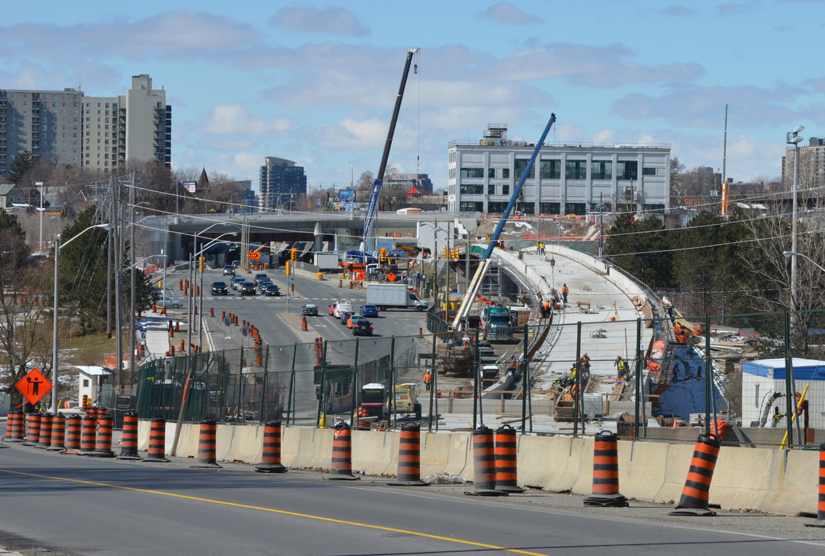
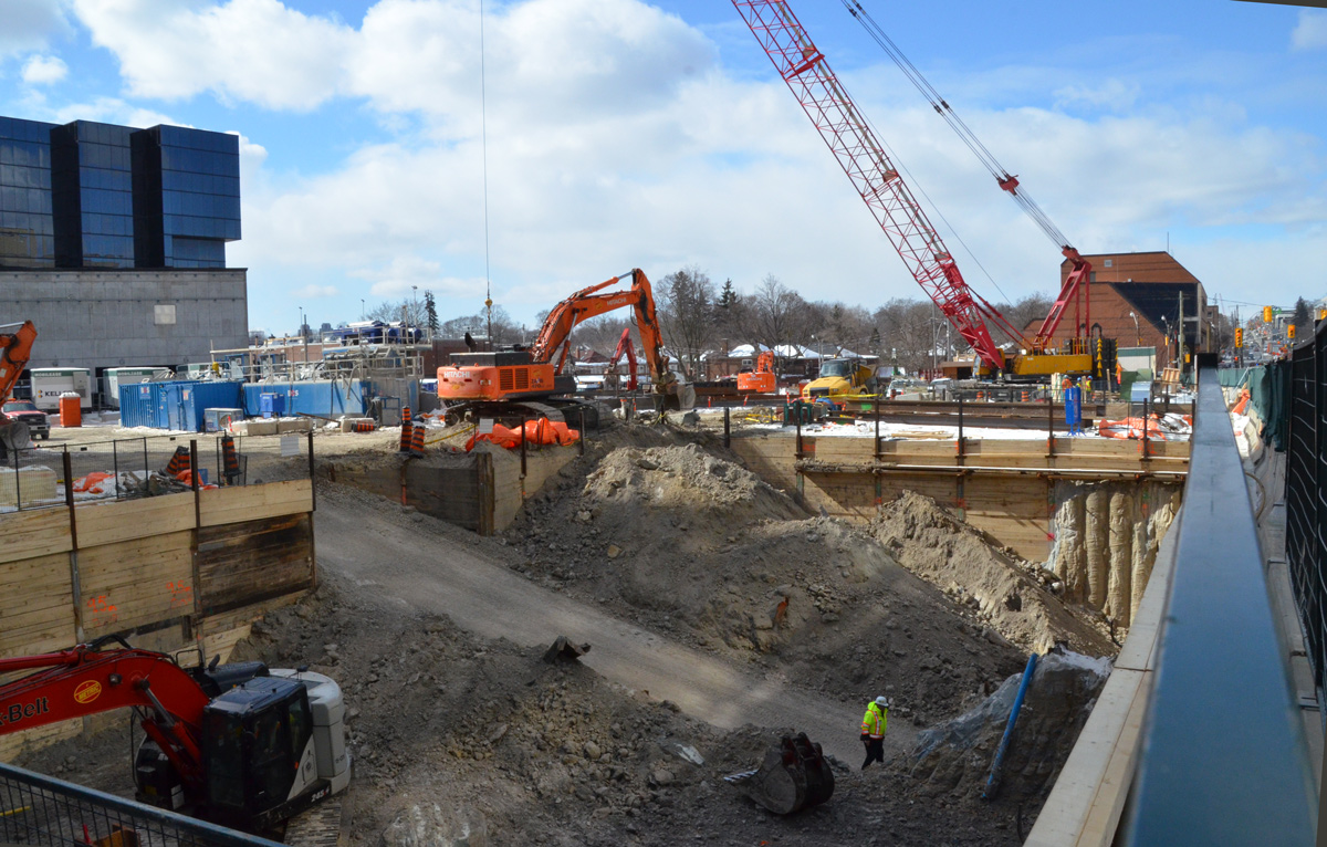
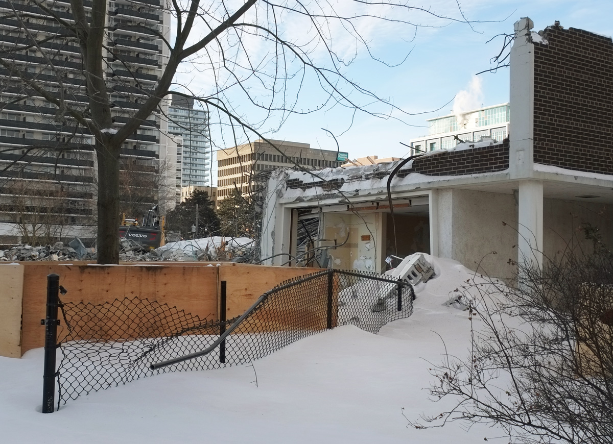
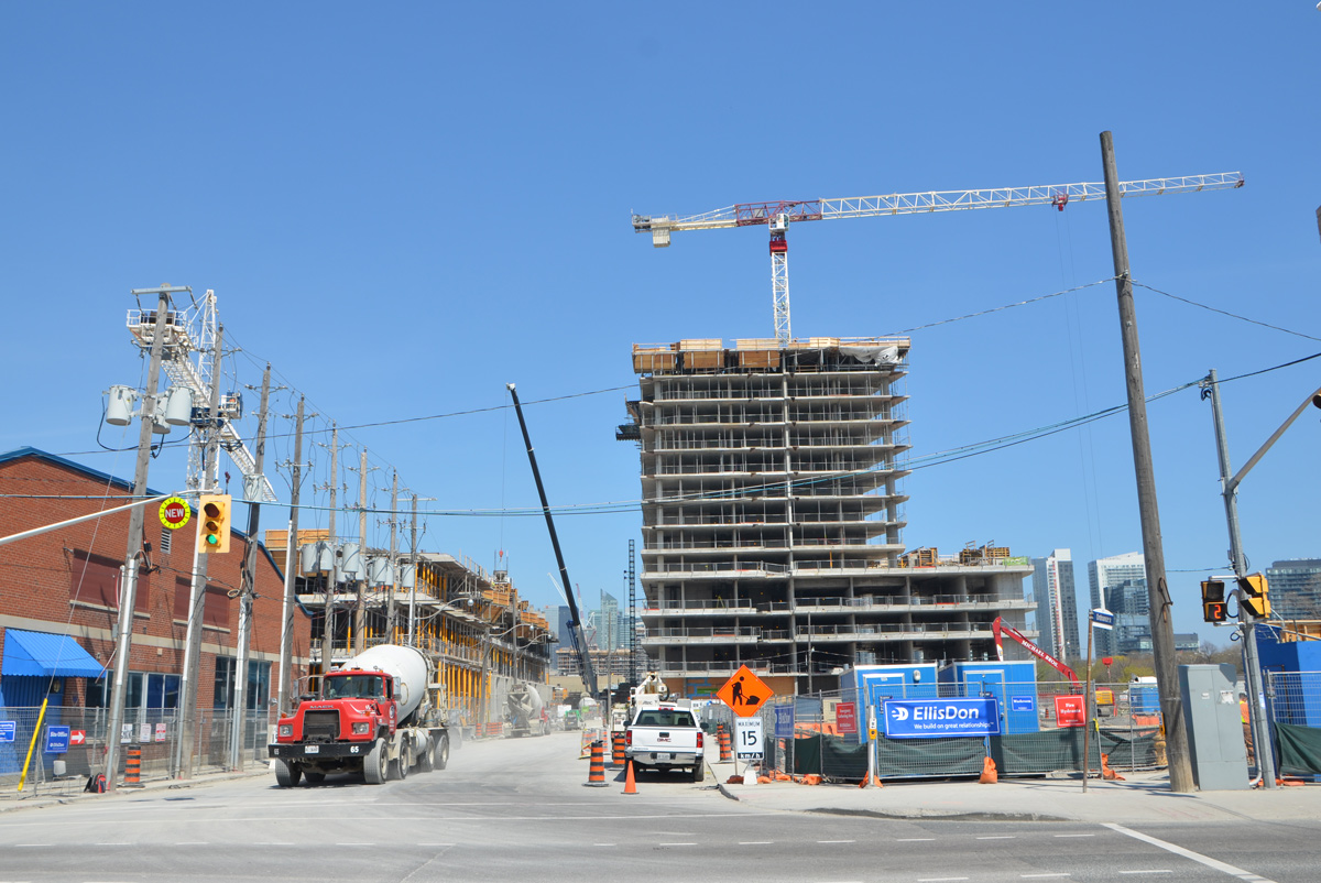
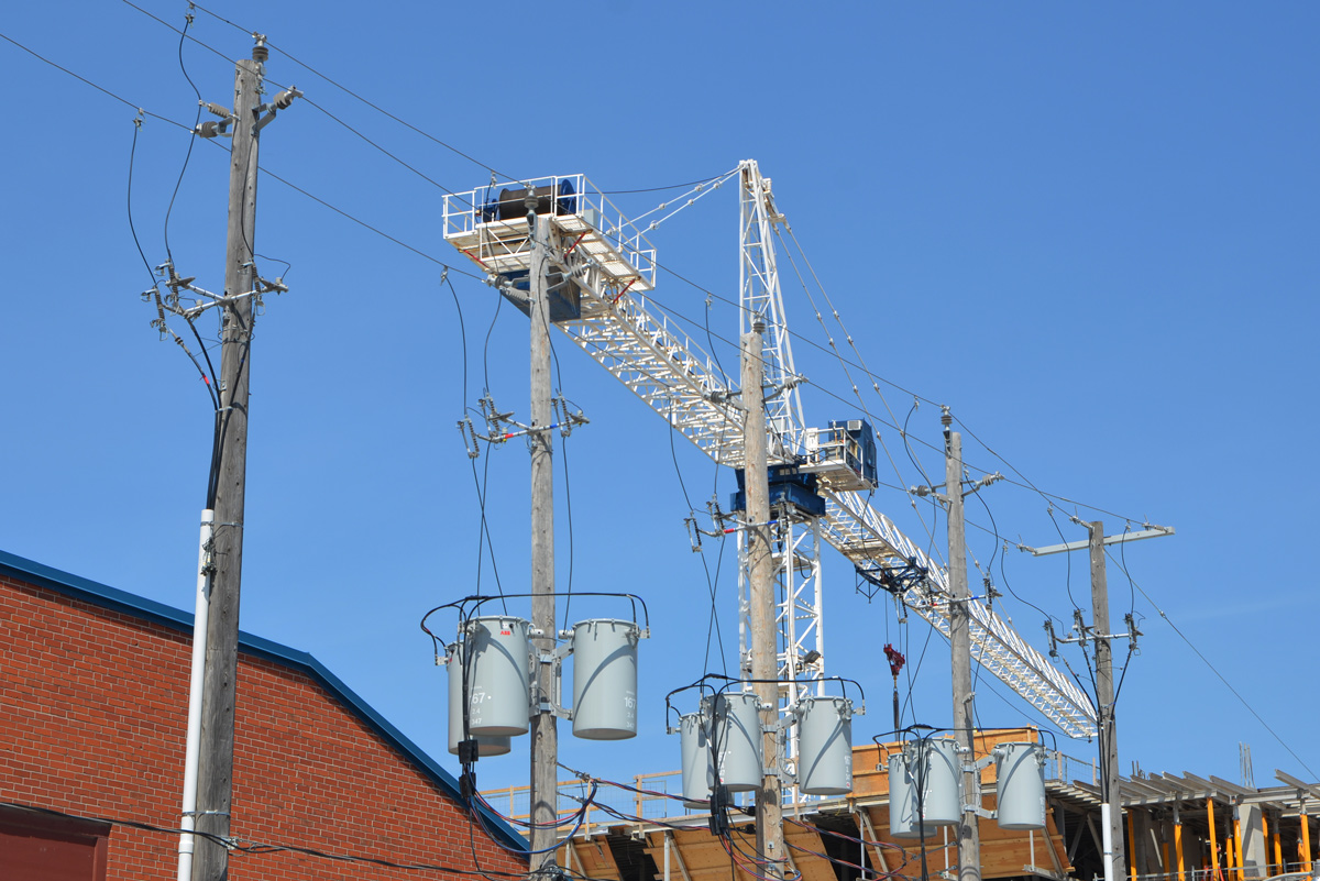
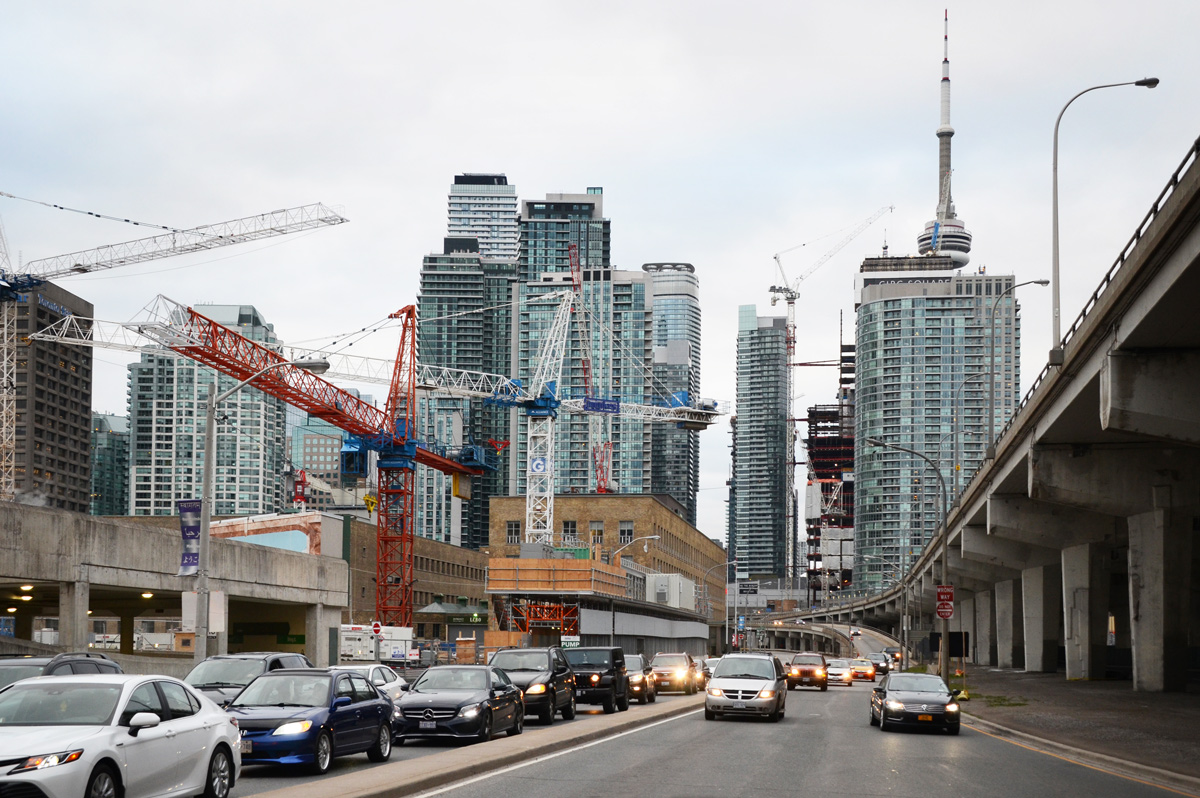
The other evening I was going to try some evening photography along the waterfront starting around Sugar Beach. As I walked down Lower Jarvis, this view caught my attention – looking west along Lakeshore Blvd.  It’s a view that has been changing very rapidly.    I counted at least seven cranes as I stood there waiting for some of the traffic to clear.

downtown Toronto, looking west towards all the tall buildings, looking along the Lakeshore with lots of traffic on it, many buildings in the foreground under construction with 7 cranes in the photo

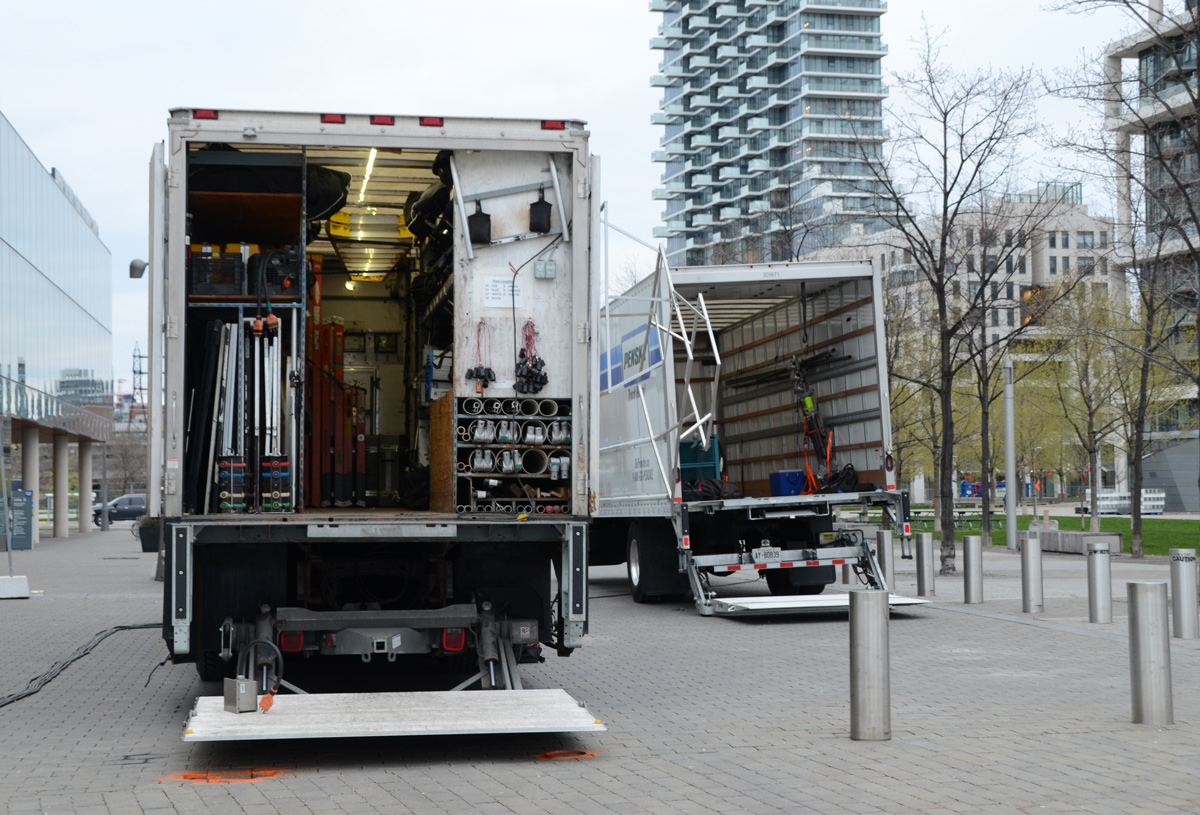
below: Sugar Beach.   Unfortunately a film crew was already here so I didn’t stick around.

a group of people standing near the waterfront at sugar beach with its pink umbrellas and white muskoka chairs

below: One of the buildings to the east of Sugar Beach is a new George Brown College building.

looking up to a second floor of a building that has a very large window, three round tables and some chairs can be seen through the window

below: Film crew trucks ready to be loaded back up

the back of two large trucks with their doors open as cables, tools and other equipment for filming is being load back into the trucks

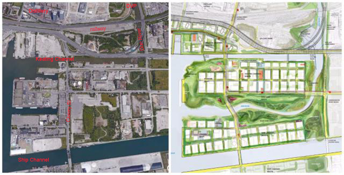
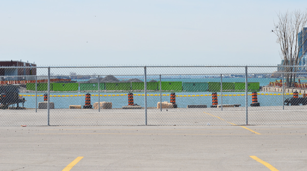
The strip of green that you see on the right side of the above photo is part of Sherbourne Common (at the foot of Lower Sherbourne Street).    From here east to Parliament is now being developed as East Bayside and is a continuation of the now completed development from Jarvis (Sugar Beach) to Sherbourne.   East Bayside is bounded by Queens Quay and Lake Ontario as well as Sherbourne and Parliament.  1800 residences are planned in this space.

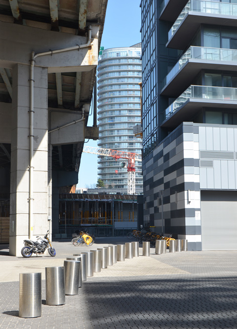
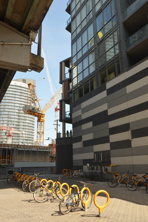
below: Some of the condos are under construction.  Same old same old; yawn.  They may look a little more interesting from a distance, but at street level they are hopelessly banal.  If you want to buy a condo here, there are only a few left in the two buildings known as Aqualina and Aquabella.   In the latter, only 3 are available, starting at a two bedroom suite for 2.8 million.  Five million dollars will get you a three bedroom penthouse with two terraces but if you want to pay an additional 1 1/2 million you get 4,000 square feet on two floors (3 bedrooms and 2 terraces as well).

new condo development by the lake

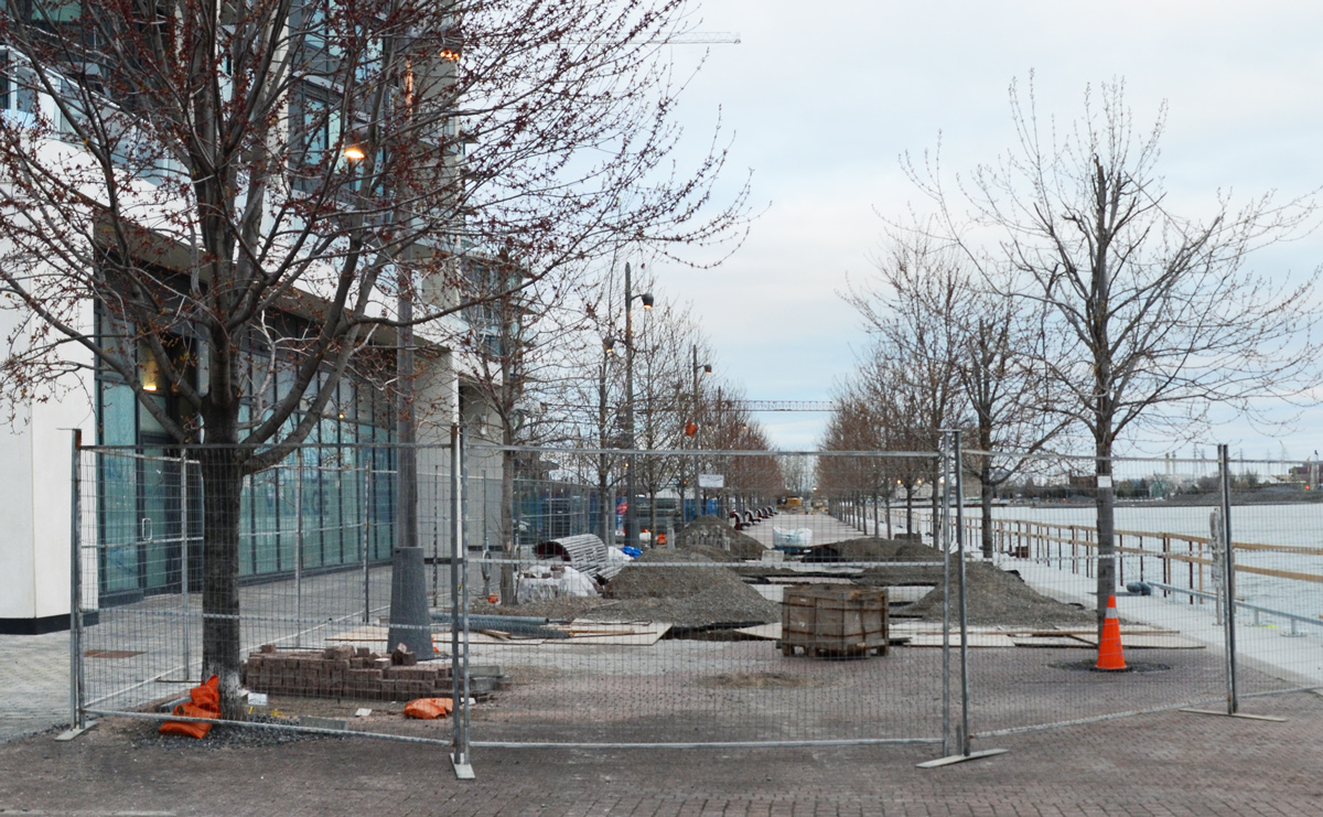
below: At least the “linear park” and waterfront path is being continued eastward along Lake Ontario.

construction of a waterfront path

orange wheel barrows at a construction site beside a lake

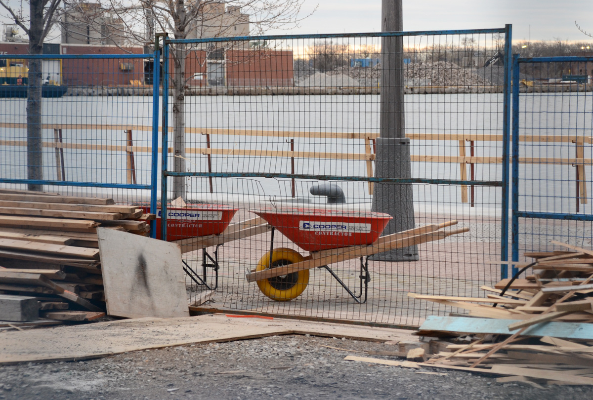
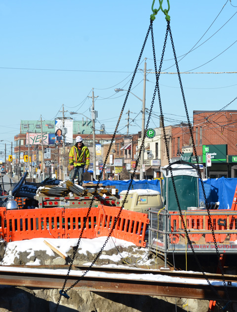
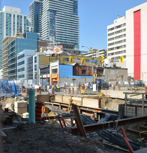
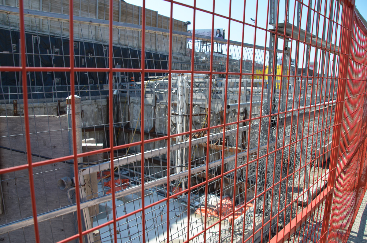
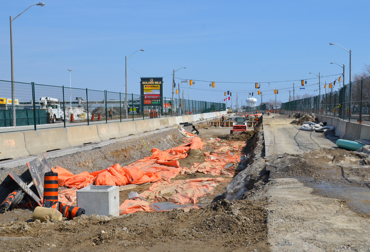
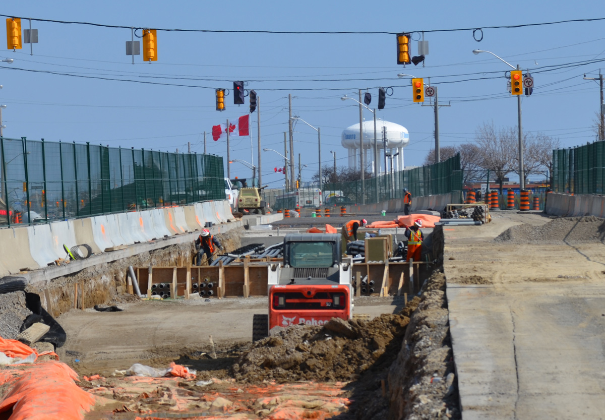
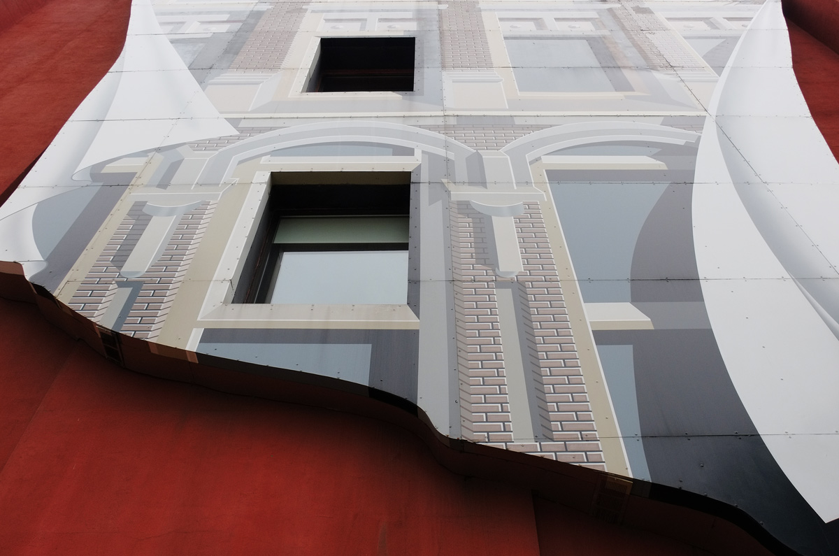
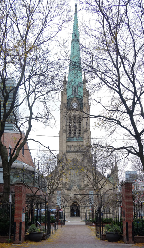
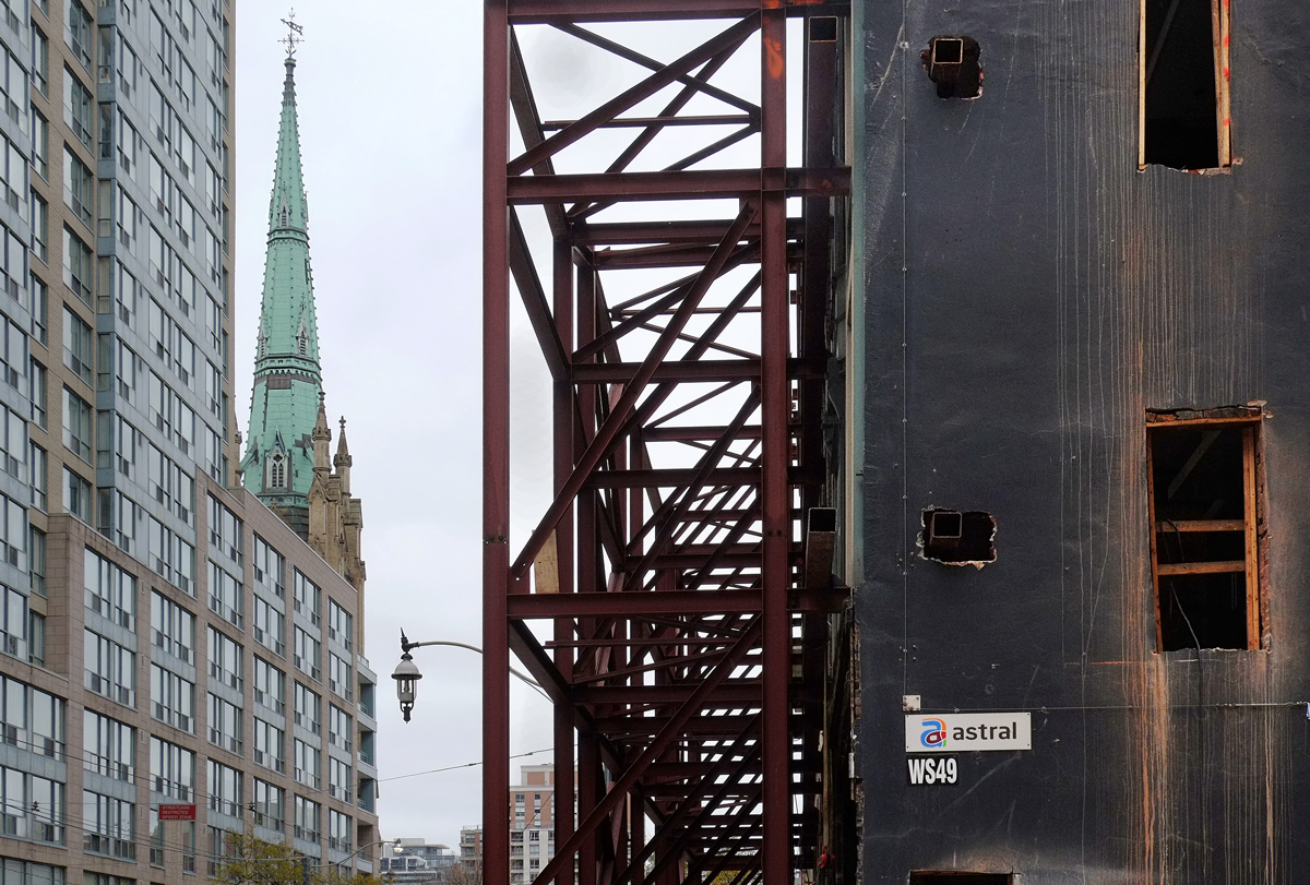
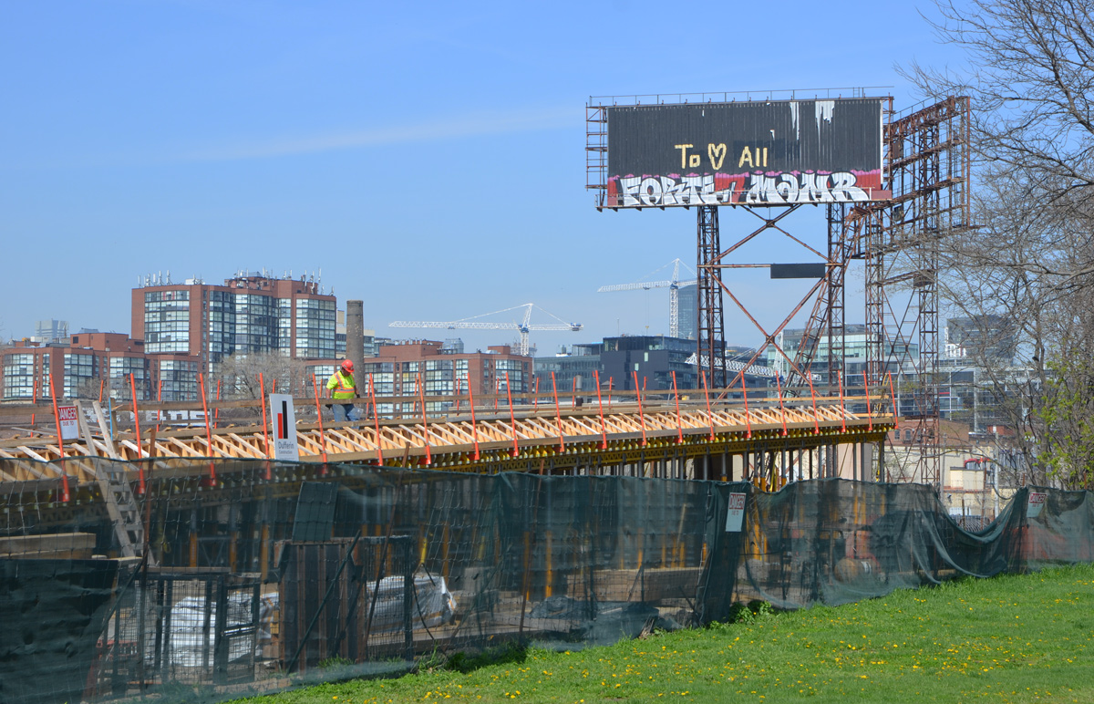
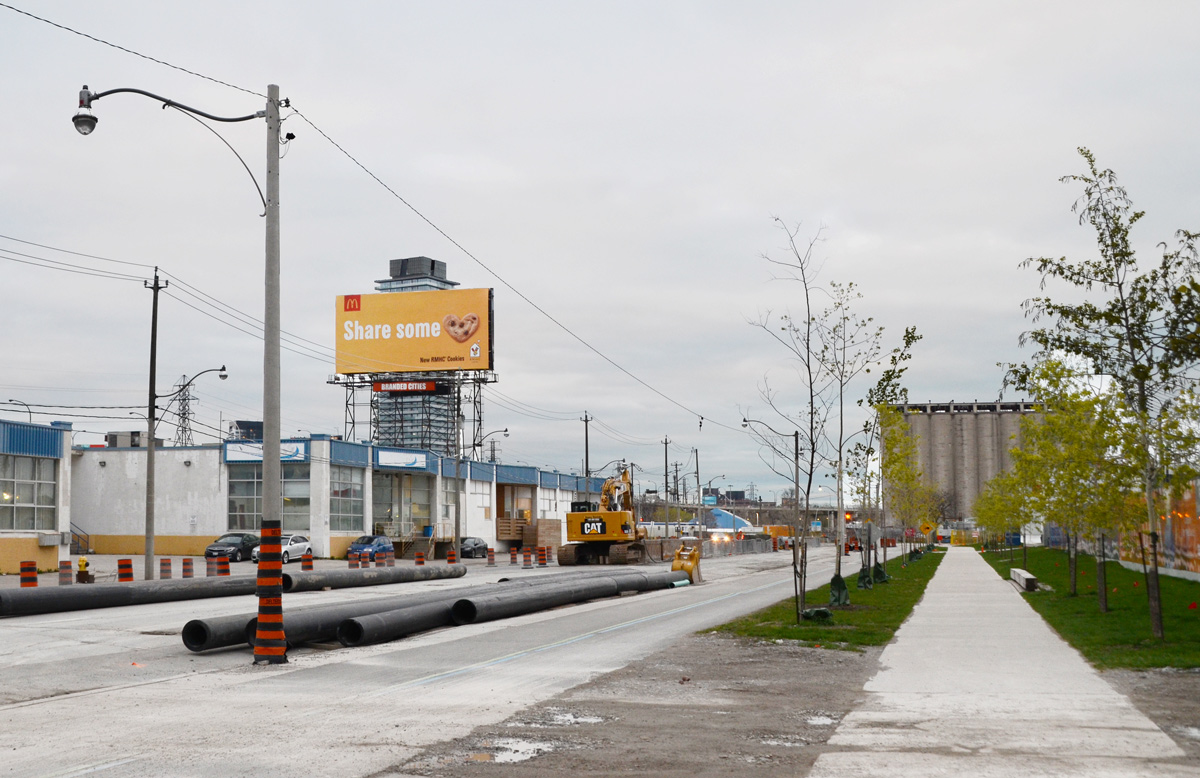
below:  Work is also underway on Queens Quay East.   As a frame of reference, the tall building behind the billboard is in the Distillery District.  Lakeshore Blvd and the Gardiner run behind the buildings with the blue trim.

billboard, construction on queens quay east

What hasn’t yet been started is construction of two office buildings that will front on Queens Quay, called T3 Bayside.  They are going to be made of wood which should be interesting.

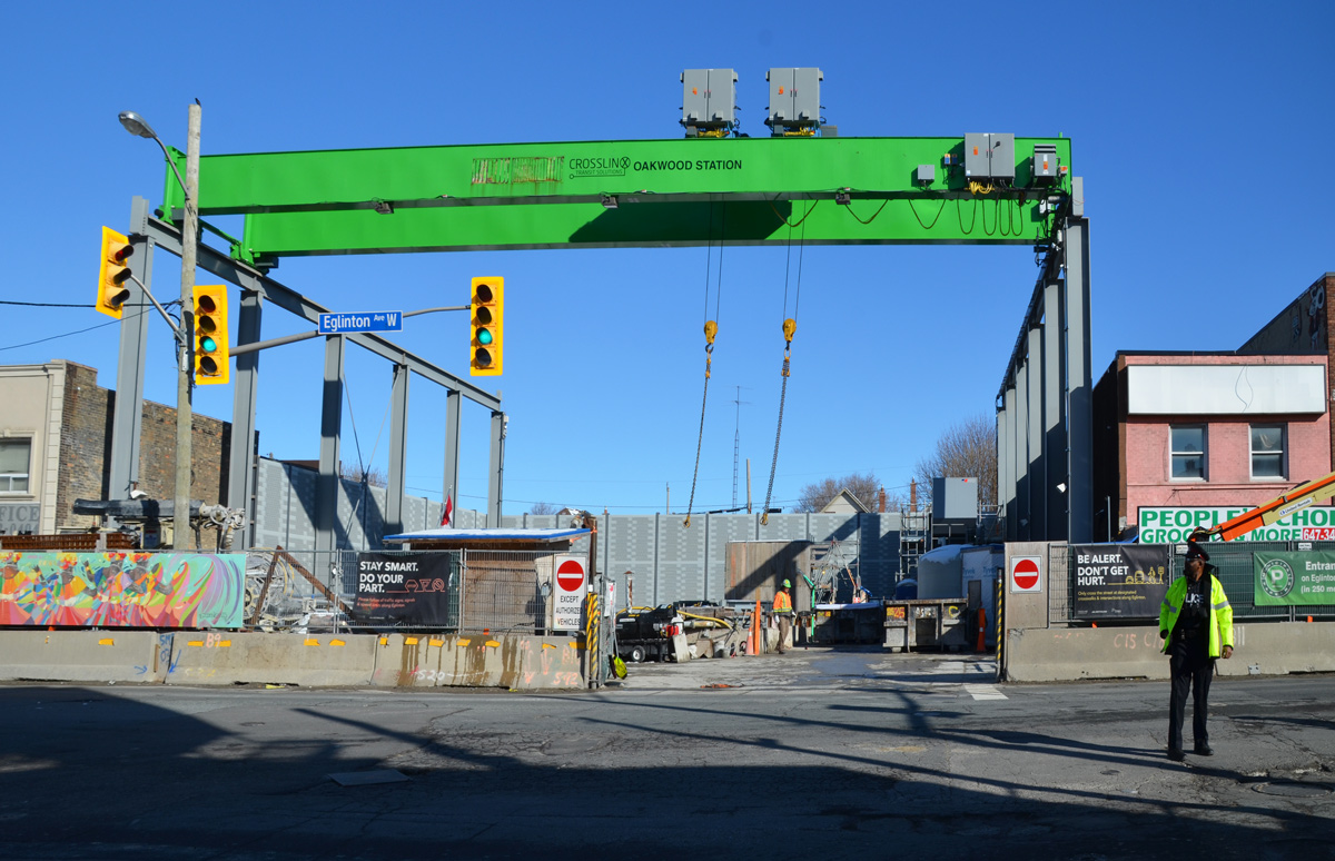
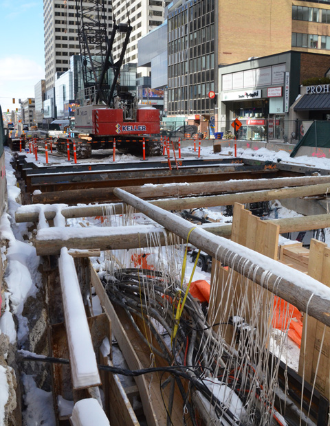
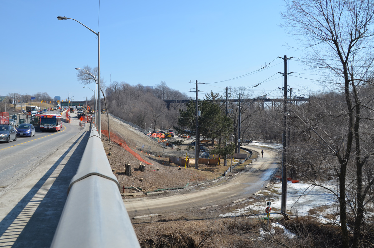
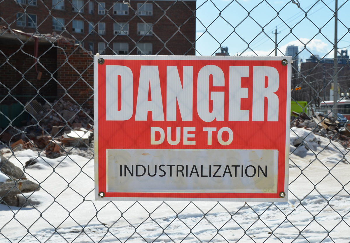
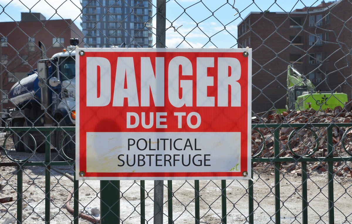
There has been a lot of talk for the past 12 to 14 years about extending streetcar service along this route.  So far a lot of planning and a lot of talk but that’s it.  An LRT right of way running along the south side of the street has been approved but the East Bayfront LRT project, (aka Waterfront LRT) has stalled because of the usual political shenanigans and financial hiccups.   A major part of the delay has been the question of how to link an East Bayfront LRT to Union station.  The present tunnel is barely sufficient for the streetcars that use it now.  Just recently (April 2019) the city released a report on how to address this issue.  I haven’t read it all yet (it’s 40 pages long) but the gist of it is that the city is considering two options – 1. rebuilding the tunnel or 2. building an automated people moving system of some sort and leave all streetcars out of the tunnel.

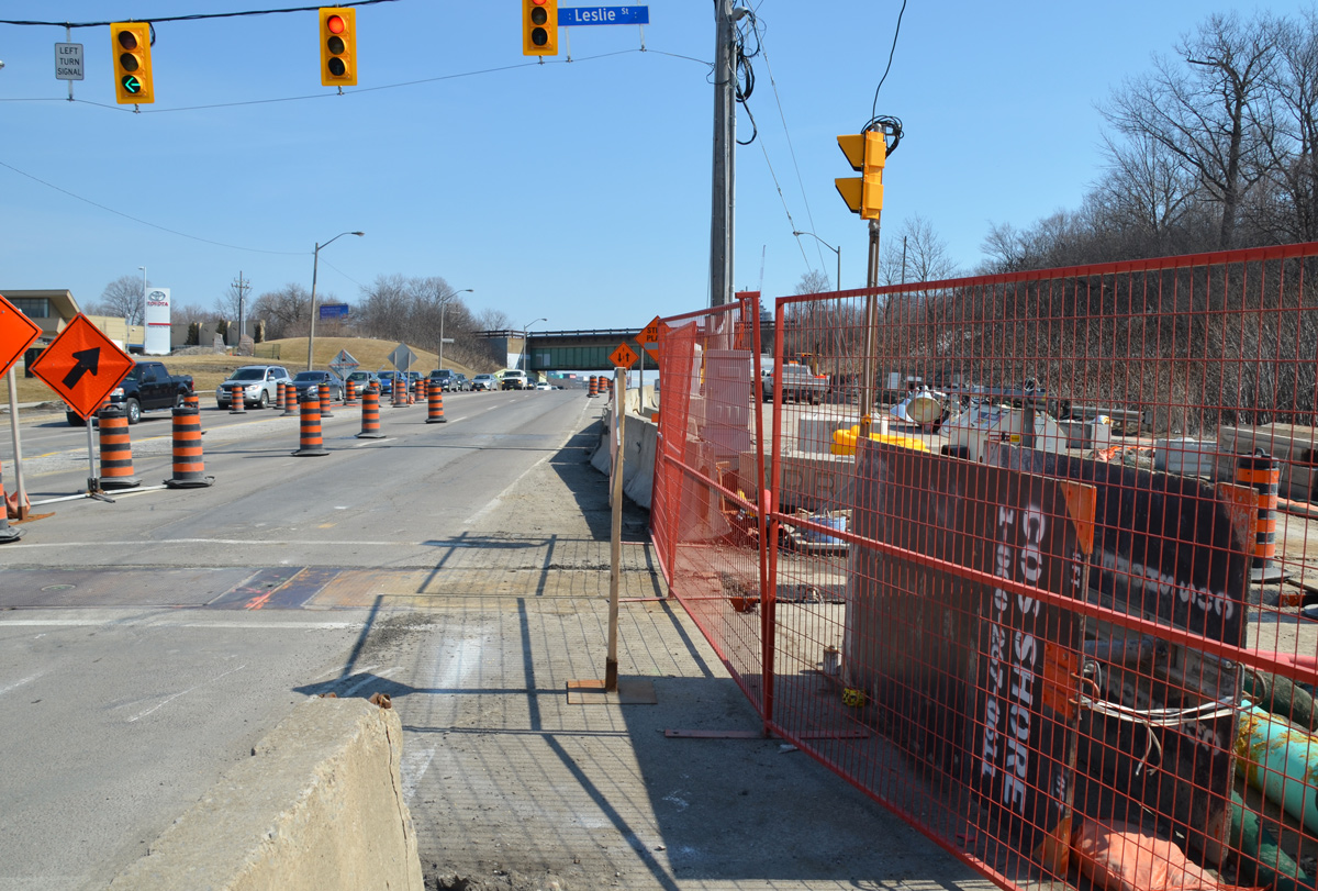
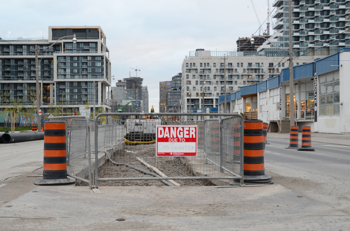
below: There is a small trench down the center of the street.

danger sign on construction zone in the middle of the street, Queens Quay, looking west along the street towards downtown toronto

Any ideas what’s being planned for the north side of Queens Quay?

two orange and black traffic contruction cones on the street in front of an old white industrial building with red door frames and a wood loading dock with yellow trim
metal framework that is holding up a large billboard

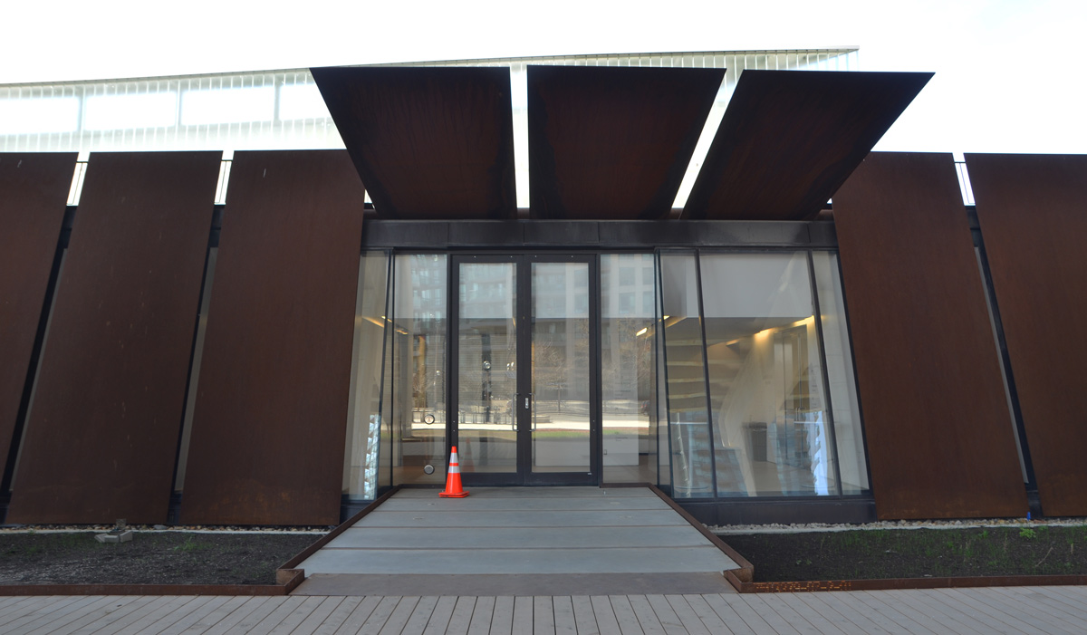
below:  Queens Quay turns towards Parliament Street.  The blue building is a Sidewalk Labs information centre.  The land that Sidewalk Labs wants to develop, Quayside, is close by – south of Lakeshore and east of Parliament.  It also includes the little strip of land between Queens Quay and Lakeshore, i.e. that answers my question above about what happens on the north side of Queens Quay.  There was some rumour (plan?) about Sidewalk Labs being involved in development of some of the Portlands but is that still on?    As to what their plans are or where they are at now, I have no idea.  That’s probably another blog post!

many orange and black cones on a stretch of road that is having work done on it

a gold coloured weather vane with a rooster on it, bright blue sky in the background

Once again, it seems that no matter where in the city you go there will be construction.  There will be the demolition of single family homes to make way for condos or at the minimum, blocks of rowhouses.   The area around Yonge and Finch is no exception.

apartment building in the background, a street of single family dweelings in the foreground, early spring so no leaves on the trees, a few cars parked in driveways

I am not sure if it serves any purpose, perhaps it’s futile, but I’d like to think that documenting what we are removing is worthwhile.   The houses on Finch Avenue East like the one in this picture are small, but the lots on which they sit are large.

small white bungalow with brown roof, on large piece of land, car in driveway

That means that a developer can demolish four houses and turn around and build 17 townhouses in the same space.    That is what is happening near Finch and Willowdale.

three small white bungalows with windows and doors boarded up, small trees overgrown around them.

Although the properties were not fenced off, all access to the houses themselves was blocked, sigh.  It looked like a local garden centre was using the backyards of a couple of the houses.

side door of a white wood house with rickety porch and steps. three trees growing besie it, door is boarded up

below: View to a new development on the other side of Finch Avenue.  This is the type of development that the area is now zoned for.  A lot of these townhouses have been built in the last few years and I suspect that eventually they will replace all of the single family homes.

view looking down a driveway, two empty houses - one on each side of the driveway. Can see across the street to new townhouse development on the other side.

single family homes and large trees on Finch Ave

single family homes and large trees on Finch Ave

Between Willowdale Avenue and Yonge Street, there were a couple of other houses that are boarded up and empty. I am not sure what the plan is for them (there was no development proposal sign posted, instead there was a sign advertising the company that is providing the financing – for what?).

small bungalow with blue door, windows boarded up, large tree in front yard, apartment building behind,

The internet can be a wonderful thing.  In case you are interested, the development is the Ava Luxury Residence and it calls for heights and densities that are vastly over what is zoned for in the area.  For example, at 9 storeys it is 37 metres tall in an area zoned for 11 metres.  The plan was first filed in 2016 but because of the size of the development, it requires a zoning by-law amendment, official plan amendment, and site plan approval to effect the proposal – all which take time.   An OMB appeal pre-hearing was scheduled to occur a few days ago, with a hearing slated for June.  MM170085 is the OMB case number if you want to dive down that rabbit hole.

small bungalow with blue door, windows boarded up, large tree in front yard, sign in front yard advertising financing

This is 50 Finch East.  As you can see, there is a taller building on the other side of Kenneth Avenue.  Kenneth was to be the dividing line – keeping the higher buildings, and denser development, closer to Yonge Street.  I’m not sure what side of the development battle you’re on, but what’s the point of having a plan if the developers (with help from the OMB) keep disregarding it?

small bungalow on a corner lot, with windows and doors boarded up, larger apartment building behind.

As I walked back to my car, I chose to walk on a side street instead of on Finch.  As I turned a corner, I happened upon a house being demolished.  Fortuitous.  Serendipity.

a yellow digger loading rubble from a house demolition into a dump truck

It doesn’t take long to reduce a house to rubble and dust.  “Another one bites the dust” springs to mind.

close up of a digger demolishing a house

And so it goes.

The Eglinton Crosstown LRT will be 19 km long once it’s finished in 2021.  The other day I posted some pictures of the construction between Yonge & Victoria Park on the eastern section.  This post covers the stretch from the Allen Expressway to Weston Road where the tracks end in the west.

below: A new way to ride. For a city on the move. Cringe worthy design.

pink billboard seen between pine trees, raised high, words on it that say A new way to ride. For a city on the move. Eglinton Crosstown arrives 2021.

below: Approaching the south end of the Allen Expressway as well as Eglinton West subway station from the east.  Eglinton West station, on the Yonge University line, is low building with a flat concrete roofline.  You can hardly see it in the photo, but it’s there.  The interior of the present station is heavy on the concrete, a legacy from the 1970’s.  As to whether or not this will be renovated, I don’t know.

workman with a slow sign upside down, on a construction site in the middle of a street, crosstown eglinton lrt

below: No room for the sidewalk so it diverts through Ben Nobleton park.

a sidewalk ends at a fence arond a construction site and pedestrians are diverted through a park to the left, signs on the fence directing traffic

below: Working under Eglinton Avenue in front of Eglinton West station.  Once the Crosstown in open, this will become Cedarvale station.

construction site, excavation and building under a road

sidewalk, many orange construction signs cluttering the sidewalk, bus stop, traffic on the street,

below: The big green crane at Oakwood station

large green overhead crane on steel runners, hanging over a construction site

below: Beside Oakwood station with all the “Open for Business” signs.  Businesses in the area are struggling.

crosswalk leading to buildings, stores beside the construction of Oakwood LRT station, concrete barriers and fence in front of most of them, Manafa Law office and Asian massage therapy centre, signs saying open for business, Eglinton Avenue West, crosstown construction

wire mesh fence in front of open pit excavation of underground LRT, steel cross beams and wood supports,

open pit excavation of underground LRT, steel cross beams and wood supports,

a workman in hard hat and yellow jacket stands on a pile of steel rods on the back of a flat bed truck with a crane lowering a steel beam into the ground in front of him

below: At Dufferin, looking north towards Central Seventh Day Adventist Church.  Fairbanks station will be at this intersection.

blue fences between sidewalk and rad at Eglinton and Dufferin, construction, church in the background,

below: Also at Dufferin, this time looking south towards St. Hilda’s towers.

red brick apartment buildings with crosstown LRT construction in front of them.

below: Photobombed!

a workman in a hard hat and carrying yellow packages walks in front of the camera on a construction site

stop sign in front of a construction site on Eglinton Ave

below: Construction of Caledonia station in front of Westside mall.  Because this station is adjacent to the Barrie corridor (GO train), plans are in the works to build a GO station here too.

three apartment buildings in the background, construction in foreground, in front of a grocery store, snow on the ground, green fence around the construction

below: A mural showing the evolution of TTC streetcars, painted by Jim Bravo in 2017, with supported from Fairbanks Village BIA, Josh Colle (city councillor), the City of Toronto., and Sherwin Williams paint.

mural of the evolution of TTC streetcars and LRT vehicles, painted by Jim Bravo in 2017, stylized but realistic looking

below: Construction in front of York Memorial Collegiate (at Keele).

Eglinton Crosstown LRT construction at Keele, in front of

below: looking east along Eglinton from Keele.

street scene, traffic and stores, construction in the middle of the street, Eglinton Avenue looking wast from Keele street

two workmen in hard hats and orange work vest look at paperwork on a construction site.

below: Working on the westernmost section of the LRT after it emerges from underground between Keele Street  and Black Creek Drive.   As you can see, the tracks are elevated and cross over Black Creek before entering the terminal station at Weston Road (Mount Dennis station).

work on the west end of the corsstown lrt, after the tracks emerge from underground, raised track for a section before final station

crane lifting wood panel from bridge, used as a form for making concrete, workmen watching,

below: The western end of the line.   The bridge is new.  I am a bit annoyed because I didn’t pursue it – I don’t know where the road goes!  It has to go somewhere because I saw at least two vehicles on it.  A quick search on google maps plus a guess equals maybe it’s an extension of Photography Drive (named that because it’s where the old Kodak factory was).

new building under construction, older white large building behind it. road in foregraound, Mt Dennis LRT station under construction

below: There is pedestrian access to the bridge, or rather, there will be access.

new concrete steps, still fenced off, up a hill with a light covering of snow to a new bridge

Then Eglinton Avenue passes under the railway tracks (the same line that the Union Pearson Express runs on) and into Mount Dennis.

construction beside a bridge, underpass is a street

below: Construction of another access to Mt Dennis station to the west of the railway tracks.

construction of Mt Dennis LRT station beside Eglinton ave and beside railway tracks

back of houses behind construction of mount dennis LRT station

below: The EMSF aka the Eglinton Maintenance and Storage Facility is almost finished.  It’s the long low grey building in the photo; it is about the size of 4 football fields.  Access is from a side street to the north of Eglinton.  This isn’t the best photo of it.  If you are interested, there is a better photo online (a ‘Toronto Now’ article) that is taken from an angle that I can’t access.   The same article describes how the Mt Dennis station will be the second largest transit hub in the city (after Union Station) as it will service GO trains, the TTC, and the Union Pearson Express.

green construction fence in front of a long low building in two shades of grey

below: mural by Adrian Hayles at the northeastern corner of Weston Road and Eglinton Avenue.

Mount Dennis Metrolinx mural by Adrian Hayles, people, a boy fishing, a person playing hockey, machinery, a turtle,

looking through blue see through fencing towards an apartment across the street, a pedestrian crossing sign in front, a danger due to excavations sign on the fence.

Back before the winter snow had melted, I was at Yonge and Eglinton and noticed that the old bus bays at Eglinton station were gone. That structure had sat empty for a couple of years but now there is a big hole where they once stood. As I looked through the pictures that I took that day, I decided that it might be interesting to explore farther east to see what was happening with the Crosstown LRT construction that has messed up the traffic through midtown for so long now.

below: Southwest corner of Yonge & Eglinton.

large hole in the ground at a construction site, diggers and a crane onsite

below: There is still a lot of construction underway on Eglinton near Yonge.

holes in the ground on construction sites on Eglinton Ave for the new crosstown LRT, shoring, wood and pipes

below: A little father east and more holes in the ground. This is the intersection of Eglinton and Mt Pleasant taken from the SE corner looking towards the NW. At least the facade of the old Imperial Bank of Canada building on the NW corner was originally going to be used as the LRT station but have those plans changed? The building was demolished but apparently the facade was taken apart brick by brick and will be re-built later.

holes in the ground on construction sites on Eglinton Ave for the new crosstown LRT

below: This is the plan for the Mt Pleasant station as seen on the Crosstown website.

artists conception of a new LRT station with a re-purposed older building

below: Looking west from Mt. Pleasant.

cain link fence and gate is open, construction crew in the middle of Eglinton Ave (at Mt Pleasant) is working with a digger, hole in the ground

below: Between Laird and Brentcliffe (east of Bayview). See those low rise brick apartment buildings? How long until they’re gone?

red and white tim hortons sign with an arrow pointing left at a long grey fence around a construction site, sidewalk, street, and low rise buildings on the right, Eglinton Ave

two 3 storey red brick apartment buildings

below: At Brentcliffe. The LRT is underground here and there is no station at this intersection. Laird, where there is a station, is only one block to the west.

Eglinton Ave east at Brentcliffe

below: From Brentcliffe, Eglinton goes downhill because of the Don River ravine system

looking east on Eglinton, towards Don Mills Road in the distance, construction in the foreground

below: Part way down the hill there is a section of concrete. At first I thought that this was where the LRT was going to come to the surface.

concrete section of road, construction

below: But then I wasn’t so sure. There is a concrete wall blocking what would be the exit. It’s difficult to get a closer look because there are two layers of fencing in the way. Nobody was working here. In addition, there is another section farther along that looks like the actual opening. Maybe this is part of the supporting infrastructure?

two fences in front of a dug out section of road, with concrete wall at one end.  One f the fences is orange, wire,

below: Still walking east along Eglinton…. Almost to the bottom of the hill at Leslie – looking east along Eglinton Avenue with E.T. Seton Park on the right and the railway bridge in the distance. Leslie Street, which ends at Eglinton, is on the very left side of the photo. There is talk that this intersection will be closed for two months this summer.

looking east along Eglinton Ave towards Leslie, on the right is the road to the park and beyond that, a railway bridge

below: I turned around and took a picture of the hill that I had just come down. Here the LRT surfaces and the tracks run down the center of the road, with lanes of traffic on both sides of the tracks. I am fairly certain that you can see the entrance to the tunnel, the east portal, near the middle of this picture. From here to Kennedy station the tracks are above ground (except for a portion of the route at Don Mills).

traffic drives west along Eglinton Ave., up the hill from Leslie, through the crosstown LRT construction

below: The sidewalk on the south side ends at Leslie street. Here, I chatted with a policeman while we waited for the light to turn green. Once he did, he escorted me across Eglinton as we had to pass through part of the construction zone. This is where I also discovered that there are no bus stops between Brentcliffe and Don Mills Road. That’s only 2 km but it feels a lot longer!

on the south side of Eglinton, where the sidewalk ends at Leslie street, looking east beyond that with construction on the right

below: A development proposal sign stands on the lawn of what used to be the Inn on the Park but what is now a Toyota dealership.

development proposal sign on the lawn of what used to be the Inn on the Park on the north east corner of Leslie and Eglinton

green netting and fencing on both sides of a narrow sidewalk running between construction and traffic.

below: The station at Don Mills and Eglinton will be called “Science Center” and it will be under the intersection.

LRT track path being constructed,

below: There will be a bus terminal on the northeast corner of Don Mills Road and Eglinton with underground access to the LRT station. This is what construction looks like on that corner at the moment.

underground sections of LRT being constructed at Don Mills and Eglinton, crane at work, metal frame over tunnel

Just east of Don Mills Road, the LRT surfaces again and remains above ground until Kennedy station. I took the bus from Don Mills Road to Victoria Park as there wasn’t as much to see in this stretch.

below: Looking east from Victoria Park Avenue.

shallow but wide hole in the ground where new LRT tracks are being laid. construction in prep for the tracks, green fencing separates construction from traffic on both sides,

shallow but wide hole in the ground where new LRT tracks are being laid. construction in prep for the tracks, green fencing separates construction from traffic on both sides, water tower in the distance

concrete utility pole with two ripped paper temporary bust stop signs, TTC, stops no longer in use

Exploring new places often leads to interesting finds.  I’m not sure if you think demolition/redevelopment sites are interesting, but I came across this one when I went to Moccasin Trail (next blog, scroll up).

An empty building.  The grey hoardings completely block the view of whatever is inside.

grey plywood fence in front of a three storey brick rental apartment building that is empty and will be torn down in a residential neighbourhood

I tried walking the perimeter, but there is no access or viewpoint.  There are actually two buildings.  Apparently one of the buildings was damaged by fire (arson) in 2008.  The buildings have been empty since 2011.

a tall tree, winter time, stands in front of a grey plywood fence in front of a three storey brick rental apartment building that is empty and will be torn down

The old sign still stands beside the fence. It is faded enough that I can’t read it, even with some manipulation in photoshop.  The building in the background is also part of the redevelopment plan.

old faded sign on grass side yard beside grey plywood fence around building about to be demolished. Across the street is another building from the 1950s or 1960s.

The year on the development proposal sign is 2013.  It also states that three buildings will replace the ones being torn down, one of 10 storeys and two of 4 storeys.  That was six years ago.   In March 2017 a plan was approved by city council for an 8 storey condo and a 4 storey rental replacement building.

Development proposal sign in front of a three storey brick apartment building.

When I saw the state of the building above, I started taking some pictures.  I thought the building was empty.  But then I heard music coming from one apartment.  Then a woman came out on to a balcony to hang up a blanket.

40 moccasin trail building, three storey apartment

Two years ago, back in March of 2017, 12 of the 34 units were occupied.   I am not sure how many people are living there now.   When it was first built, it was probably quite nice – very suburban, very Don Mills.  Now the building is in very poor condition but I’m sure that’s because the landlord is waiting to be able to demolish the building.

papered over window and old white door on apartment, overgrown saplings in front

crooked metal railings beside a concrete set of stairs, brown and white building behind.

concrete steps, side of a brick building

overgrown trees in front of an apartment

City of Toronto report on this site (May 2017)

two low rise apartment buildings, grass between them and a large tree

…and social decline, and capitalism, and a few more…..
The many dangers that we face.

red and white sign, danger due to signs, on a chainlink fence at a construction site in Regent Park, danger due to xenophobia

The demolition of older residential buildings in Regent Park continues as that area of the city is redeveloped.

6 storey brick apartment building stands empty, a fence around it as it waits for demolition

Around the demolition site, someone has hung 18 “danger due to” signs, printed with different “causes” of danger, such as industrialization.

red and white sign, danger due to signs, on a chainlink fence at a construction site in Regent Park, danger due to industrialization

It’s spelled wrong, but you know what it’s trying to say (hypocrisy).

red and white sign, danger due to signs, on a chainlink fence at a construction site in Regent Park, danger due to hypocrisy (but spelled as hipocrisy)

chainlink fence in front of the entrance of an older brick lowrise apartment building, snow on the ground, dust, dirt and garbage on the ground

Apathy

red and white sign, danger due to signs, on a chainlink fence at a construction site in Regent Park, danger due to apathy

two trees standin front of a construction site, green bin, fence around building next to be demolished in Regent Park

Over consumption

red and white sign, danger due to signs, on a chainlink fence at a construction site in Regent Park, danger due to over consumption

workmen spray water as a machine arm pulls apart a building that is in the process of being demolished - sidewalk view

a small black heart drawn on the blue walls of building now being demolished

Political subterfuge

red and white sign, danger due to signs, on a chainlink fence at a construction site in Regent Park, danger due to political subterfuge

workmen spray water as a machine arm pulls apart a building that is in the process of being demolished

Doug Ford

red and white sign, danger due to signs, on a chainlink fence at a construction site in Regent Park, danger due to Doug Ford, premier of Ontario

workmen spray water as a machine arm pulls apart a building that is in the process of being demolished

close up of dust and debris as workmen spray water as a machine arm pulls apart a building that is in the process of being demolished

GM food

red and white sign, danger due to signs, on a chainlink fence at a construction site in Regent Park, danger due to GM food (genetically modified food)

green machinery demolishes a building in Regent Park

Human infestation

red and white sign, danger due to signs, on a chainlink fence at a construction site in Regent Park, danger due to human infestation

green machinery demolishes a building in Regent Park - one room still has a white fridge in it

Mass surveillance

red and white sign, danger due to signs, on a chainlink fence at a construction site in Regent Park, danger due to mass surveillance

Misuse of signage

red and white sign, danger due to signs, on a chainlink fence at a construction site in Regent Park, danger due to misuse of signage

green machinery demolishes a building in Regent Park - 3 storeys remaining

Shrinking resources

red and white sign, danger due to signs, on a chainlink fence at a construction site in Regent Park, danger due to shrinking resources

partially demolished brick building in front of an empty building waiting to be demolished

Predatory economics

red and white sign, danger due to signs, on a chainlink fence at a construction site in Regent Park, danger due to predatory economics

Shitty pop music

red and white sign, danger due to signs, on a chainlink fence at a construction site in Regent Park, danger due to shitty pop music

Capitalism

red and white sign, danger due to signs, on a chainlink fence at a construction site in Regent Park, danger due to capitalism

Urban decay

red and white sign, danger due to signs, on a chainlink fence at a construction site in Regent Park, danger due to urban decay

Misinformation

red and white sign, danger due to signs, on a chainlink fence at a construction site in Regent Park, danger due to misinformation

reflections in a broken window

Social decline

red and white sign, danger due to signs, on a chainlink fence at a construction site in Regent Park, danger due to social decline

I walk past Davisville Junior Public School fairly often…. or should I say, I used to walk past it.

I didn’t think about it too much until I heard that it was going to be demolished – or was it going to be saved?  Maybe I should take some photos of it as apparently it has some architectural value, an early 1960’s Modernist building.   Then, back in November, a construction fence appeared around the property.   One of those metal wire temporary fences that you see all over the city.  So much for saving the building.


Photos from November:

west end of Daviville public school with it's coloured panels on the upper floor, basketball nets in front, pavement

side entrance of Davisville public school before it was demolished, modernist archtecture brick building,

back of part of Davisville public school through chainlink fence, before demolition

crooked chainlink fence posts at the corner of a schoolyard, with metal construction fence inside that, school in the background, large paved area in front of the school

The building was also home to the Metropolitan Toronto School for the Deaf as well as Spectrum Alternative School.

red roses stuck in a chainlink fence as a memorial tribute to the school that is being demolished, MTSD 1962 to 2018 where MTSD is Metropolitan Toronto School for the Deaf.

below: Notice on the fence, permit to remove 21 trees.   A new elementary school is being built on the site.  In the meantime (for 2 years), Davisville Junior Public is being relocated to Vaughan Road in what was previously the Vaughan Road Academy.  Originally, the plan was to build the new school on the property (there was a large playground) and then tear down the old (Globe & Mail Feb 2017)

city notice posted on fence, permit to remove 22 trees. Notice that 44 trees will be planted once the building on the site (new elementary school) has been demolished

below: I past by the site for the first time in a few months and discovered that most of the school is now demolished.  Only a small portion by the front entrance remains and I suspect that that won’t be around for much longer.

small part of a school remains, debris scattered on the snow, digger at work in the background, apartment building in the distance

broken fence, plywood fence, and the remains of a school that is being demolished

old front entrance of Davisville public school, lots of snow, broken walls as it is in the proces sof being demolished.

From autumn to winter, from old to new.

close up of the center of a pink flower

below: It’s a sculpture!  It’s a piece of playground equipment!  Two very large bronze hands and a red rope lattice between the hands has been installed in Berczy Park.  It was designed by Toronto artist Luis Jacob.  In the background is the “dog fountain”.

sculpture of two black hands, very large, reaching out of the ground, with red rope "cat's cradle" between them, fountain in the background, Berczy park in Toronto

below: Berczy Park from the other side. The water in the fountain has been turned off for the winter. It’s a bit too cold to hang out in the park these days but the dogs are still patiently and quietly waiting beside the fountain.

Berczy park, fountain with statues of dogs, no water because winter

below: The lower part of “Flatiron Mural” by Derek Besant, 1980 on the west wall of the Gooderham building, overlooking Berczy Park .

flatiron mural by Derek Besant on the east wall of the Gooderham Building, fake blue and white side of the building

below: On the other side of the Gooderham building, near Church Street, the old-style lamps have been decorated for the Christmas season.

Christmas decorations, pine branches and red plant pots, on a lamp post in front of the Gooderham building in Toronto, red brick flatiron type building

below: More signs that maybe Christmas is coming… eventually.  Christmas decorations are now available at most grocery stores.

part of an evergreen Christmas decoration with red and gold spray painted pieces

It’s weird to be getting into the Christmas spirit already… in mid-November when there are still a few leaves on the trees…

below: And lots of leaves on the ground.

wet yellow leaves on the ground in a small puddle, reflection of tree branches in the puddle

below: St. James Cathedral from the park (sculpture garden) across the street. Autumn, and the views are no longer blocked by greenery.

St. James Cathedral and steeple from across the street, shows whole of front of the church, in early winter so the trees in front have no leaves

below: In that sculpture garden there’s a new installation.

a white metal sculpture of a treble clef and a line of music, with yellow and red lights, in a garden, in a city, with brick buildings behind

below: “Pigro” by Tony Romano.   Pigro is Italian for “lazy”, as in lazily reclining in the park. By the looks of it, there are lights on the sculpture so it might be interesting to check this out after dark (i.e. after 4 p.m.!)

 a white metal sculpture of a treble clef and a line of music, with yellow and red lights, in a garden, in a city with a brick wall behind it

part of a white metal sculpture of a treble clef and a line of music, with yellow and red lights, in a garden, in a city with a brick wall behind it

below: Around the corner, on King Street, the omnipresent construction/renovation.

scaffolding on the front a building on King street, steeple of St. James Cathedral in the background

below: The Tom Jones restaurant still stands alone although construction has been creeping closer and closer.

Tom Jones restaurant, three storey white brick building, stand alone, parking lot on one side, street on the other, dark wood door and door frame,

below: The pale purple wall with the mural and Henry Fielding quote are also still in place although the paint is peeling badly in some spots.  (this is the east side of the Tom Jones restaurant building).

pale purple wall with mural and text, parkin lot attendent boothin front of wall as well as one parked car

below: The backs of the buildings on King Street that are being redeveloped.

below: Transitions, old, new, and in between.

back of three old brick buildings, scaffolding on the building to the right, a new glass building behind

below: And the last look at the construction, sort of… you can just see bits of the reddish scaffolding across King Street

glass and metal covering over a walkway outside between two buildings

pink and green cabbage like plant

… and vicinity

The Bentway is a new park being built under the Gardiner Expressway between Bathurst and Strachan.  I walked it almost two years ago when the park was only in the planning stages.   I thought that I’d take a look at it again the other day.  Originally, it was supposed to be ready last summer so it’s a bit behind schedule.  Surprised?

Walking south on Strachan from King, and whoa, there are changes happening here too.  Cranes everywhere.  Holes in the ground.   How many people are employed in the construction industry in Toronto?  in the GTA?

below: Looking eastward from Strachan Avenue, immediately south of King Street.

looking east from Strachan, immediately south of King, past older brick buildings to the CN Tower and city skyline

below: The view from a few metres farther south on Strachan.  The metal grid covers the railway tracks and supports the retaining walls on either side.  It also makes an interesting pattern.  These tracks turn northward – they are used by the UP Express to the airport and GO trains to places like Georgetown and Barrie.   There’s the CN Tower again – just in case you’re a CN Tower junkie like me.  I can’t resist taking pictures of it, especially when I find new angles, new foregrounds.

looing over the railway tracks to city skyline and CN Tower, construction of new building on the right

below: Immediately south of the train tracks is Ordnance Street.  Until recently it was a sleepy little dead end street of light industrials.

cement truck on street in front of construction site, cranes, fences, building about 20 storeys high

below: Ouch! Look at all those transformers on the poles.


white crane in the background, many hydro utility poles, with large grey cylindrical transformers on each of them

below: The east end of Ordnance Street is at Strachan.   It doesn’t actually end there, but continues on the west side as East Liberty Street.  This is the eastern edge of Liberty Village.

the NW corner of Strachan Ave and East Liberty Street, construction site with fence and hoardings.

Sorry, we haven’t got to the Bentway yet.  If you are a Torontonian you should now have your bearings and know at least approximately where you are.  Not far to go now.  It’s a beautiful day and we’re walking slow!

The Ordnance Street development is on a triangle of land with one side as Strachan Avenue and the other two sides as railway lines.

below: You’ll have to take my word for it that the construction on Ordnance Street is just behind the bushes on the left.   These are the tracks that run to the west and the bridge over the tracks is at Bathurst Street.  By this time, the two sets of tracks have come together as they approach Union Station.

railway tracks and CN Tower

below: One of the first views of the Bentway.  More construction.  I was standing on Strachan when I took this picture.  This is the beginnings of a new entrance to the Bentway – a large staircase down the hill from the street.  The steps are wide to allow for multiple uses – a place to gather, a place for entertainment.

construction under the elevated Gardiner Expressway, making a large set of stairs down from Strachan Ave to Grenadier Common near Fort York

below: This end of the Bentway parallels Garrison Common.  The Ordnance Street development can still be seen but there is also another structure being built on Garrison Common side of the railway tracks.

construction of an elevated ramp beside a park from a distance, with condo building going on behind it

below: A closer look.  It appears to be a ramp to a pedestrian/cycle bridge that will cross the tracks and join Ordnance Street to the Bentway, Fort York, and the streets/paths to the south.  I also really like the billboards – one with graffiti and the other is empty.

billboard beside construction of an elevated ramp beside a park

below: The new rusty entrance to the Fort York Visitors Centerentrance to Fort York visitors centre, rusted metal panels on exterior walls and as covering over doorway


below: Just beyond the visitor’s center, the Bentway is closer to completion. There was a skating rink here this past winter.

concrete path winds under the bents and pillars of the Gardiner Expressway

below: Also here is an installation by Dana Claxton called ‘Forest of Canoes’.  Colourful images of canoes on the concrete pillars.  Light-wise, they are probably best seen in the morning but that’s not when I was there.

at the Bentway, Dana Claxton's 'Forest of Canoes' art installation of pictures of canoes on the concrete supports of the Gardiner Expressway - grey canoe on black background

The Bentway follows the shoreline of Lake Ontario that existed before landfill was used to create a space for the railway lines.  Canoes were once an essential means of transport.  Now their images sit on concrete pillars that hold up the Gardiner Expressway where thousands of cars pass by every day.

at the Bentway, Dana Claxton's 'Forest of Canoes' art installation of pictures of canoes on the concrete supports of the Gardiner Expressway - blue canoe

at the Bentway, Dana Claxton's 'Forest of Canoes' art installation of pictures of canoes on the concrete supports of the Gardiner Expressway - cedar strip canoe

below: In the bottom left corner of this picture is what looks like a bluish blob.  My apologies to the artist for calling it a blob but I’ll blame it on the lack of light and therefore, the lack of detail, in the photo.  This is another art piece.  It is ‘Future Snowmachine in Kinngait (Colossus)’ by Janice Qimirpik, Moe Kelly, Embassy of Imagination, and PA System.  Embassy of Imagination is a collaboration between PA System (Patrick Thompson and Alexa Hatanaka) and youth in the Cape Dorset community of Kinngait.  This sculpture started with small playdough models of snowmobiles made by Qimirpik and Kelly.  They were then scaled into a larger than life sculpture.

at the Bentway, Dana Claxton's 'Forest of Canoes' art installation of pictures of canoes on the concrete supports of the Gardiner Expressway

The next part of the Bentway is under construction and there is still no pedestrian crossing across Fort York Blvd and is passes diagonally under the Gardiner.   There is (was?) one in the plan.

below: This sculpture is on the corner of Fort York Blvd and Grand Magazine Street.  It is ‘Fountaingrove’ by Carlo Cesta and Nestor Kruger, 2014.  It sits above the Garrison Creek Culvert that carries the now buried creek to the lake.  Like the name states, it represents water in fountains.   Of course there is a white crane hiding behind it.

part of a metal twisty sculpture, condos behind, blue sky, sun spot

below: Just west of Bathurst Street

blue surface, window relief sculpture in it, other side is artifical rock, under the Gardiner Expressway, lock stone ground,

below: Getting cosy.  Condos rise up right beside the Gardiner Expressway.  If you’ve driven across the Gardiner, you’ll know just how close some of the buildings are to the traffic.   How useful is a balcony if it’s metres away from a highway and from all those cars and trucks?  They keep being built and people keep buying them.

below: I couldn’t resist all the yellow and orange bits and pieces!

yellow circular bike rack, bikes, condos,

below: On the east side of Bathurst is the construction of a new Loblaws.  It never ends does it?

construction site that is partially covered by the Gardiner Expressway

This blog may have been a bit heavier on construction photos than you were expecting, especially since the title was about canoes. There was just so much work going on in that area that it was hard to avoid.  The next time that I walk this area it will probably be totally different… unfortunately new buildings are a lot duller to look at than construction sites so there may not be many photos!

on grey construction hoardings, a sign tat says post no bills. Someone has added 4 stencils of different Bills, Bill Murray, Bill Clinton.

Dana Claxton canoe image at Bentway, Forest of Canoes, multicoloured, bright colours,

a lot of masts from sailboats standing upright, a man walks on one of the boats as he gets it ready to go back in the water after the winter

Getting ready for spring. RCYC (Royal Canadian Yacht Club) is nearby.

There are a few changes happening down at the Port Lands.

a man in orange stands beside his bike on the side of a road, sity in the background

below: Aerial view of the present configuration of the Keating Channel, Don River, and part of the port lands beside a drawing of the planned changes.  Rerouting the Don River will create an island, Villiers Island.

two maps side by side, one is an aerial photo of the port lands and the other is a drawing of the new route of the Don River through the port lands and the planned changes to the area.

In the 1880s, the lower part of the Don south of the former Winchester St. bridge (just north of Gerrard St) was straightened and the mouth of the river was placed in a channel to create additional harbour space and industrial dock space for boats in what is known as the Port Lands.   This project was called the Don Improvement Project. The Don River now empties into the inner harbour through the Keating Channel.  Lakeshore Blvd passes over the very south end of the river and because of its height (very low), boats can not enter the Don River.   Boats may still enter the Keating Channel by going underneath a lift bridge at Cherry St.   The straightening of the Lower Don also allowed for construction of the railway line parallel to it.


below: The cars are parked on vacant land between Lakeshore Blvd and Lake Ontario/Keating Channel. Mounds of gravel have been dumped off the end of Essroc Quay and beside Keating Channel. You might also have noticed the nine green bins that have been laid across the water (very left side of the photo). They too are full of gravel. These are part of the beginning of the renovations of the port lands. The Keating Channel will remain, but the area south of it is slated to be changed. In the middle is the GFL (garbage collection) transfer station. The low reddish brown building was a recycling facility. It was the site of a fire a few months back and most of the south end sustained substantial damage.

view from higher, over Keating channel, Essroc quay and towards Centre Island, Port lands in Toronto, mounds of gravel in the water, parked cars, boats in the water, light industrical development, trees,

Access to the western portion of the port lands is via the Cherry Street bridge.

bridge with traffic lights in the background.

below:  Here it is being lifted to allow a boat to pass through the Keating Channel.   This bridge was built in 1968 and is at least the fourth bridge at this location.

lift bridge is up so a boat can pass under

below: In 1900 a wood swing bridge was built with just a single railway track that was operated by the Grand Trunk Railway.  There are still remnants of the tracks that serviced the industries located in the area.

vintage photo, black and white, 1910 of wood swing bridge in open position, some boats around, Keating Channel, Cherry Street, Toronto,

below: Two steel drawbridges were subsequently built here, one in 1912 and one in 1932. This is a circa 1915 photo of the lift bridge at Cherry Street.

photo from the Toronto Archives of the liftbridge at Cherry Street, open position, black and white photo taken about 1915, found on Wikipedia.

source: Originally from the Toronto Archives Fonds 1244, Item 1482 but found on Wikipedia

The plans for the redevelopment of this area show that the south end of Cherry Street will be moved to west of its present location – the jog in Cherry where it joins the Lakeshore for a short distance will be eliminated.

below: This is a close up shot of Essroc Quay at approximately the new location of the new Cherry Street bridge.  The Keating Channel is in the foreground.  This quay, and the water channel behind it, will be turned into wetlands and parkland.  Essroc is a landfilled pier and is publicly owned as is Cousins Quay (the one behind it with the GFL transfer station).

 a mobile crane on tractor wheels, green body, is helping dig a hole in the ground on a flat piece of land that has water on two sides. lots of orange and black construction cones around the piece of land

below: A new fence too.

behind a chain link fence, a line of green dumpster bins, laid end to end, stretch across a channel in Lake Ontario,

below: Looking across Essroc Quay to the Toronto skyline

view of Toronto skyline and CN Tower from the Port Lands, with construction for the new Cherry street realignment, and flood plain protection plan in the foreground.

There are many reasons for rerouting the Don River.   The Port Lands are no longer used by many industries, land use has changed.  As the city grows and changes, this area has become prime real estate but it is also a flood plain.  Before any development can occur, flood control measures need to be taken.    The Cherry Street Stormwater and Lakefilling project will stabilize the local shoreline, protect land from flooding, and create a new landmass to begin the re-naturalization of the Don River’s mouth.   The river would be re-routed through the middle of the Lower Don Lands between the Keating Channel and the Ship Channel. The area being filled will become part of ‘Promontory Park’, a new major green space across the harbour from Toronto’s skyline.

The project will also allow for a realignment of Cherry Street so that it no longer merges with Lakeshore for a short distance.  At the moment, the Cherry street and Lakeshore Blvd intersection is problematic, especially for pedestrians. Once upon a time there wasn’t much reason for people to walk there I guess. Now, if you are on the wrong side (the west side) of Cherry street, you get stranded at Lakeshore.

two people standing on a sidewalk as they try to figure out how to cross the street, two large billboards behind them, train tracks (elevated) behind that.

The Keating Channel isn’t exactly beautiful.  Lakeshore Blvd and the Gardiner Expressway run along the north shore of the channel.  There has been discussion & debate about the fate of these roads but so far nothing has changed.  Will they demolish this section of the elevated Gardiner?  Or won’t they? (Probably not).

raised expressway road on concrete pillars, runs above another road and beside a channel of water, CH tower and downtown Toronto in the distance

below: The very south end of the Don River at the moment.   Not much to get excited about is it?  It looks like there is work being done under the bridge?  (something’s happening there but I don’t know what).   Hopefully it will look better in a few years.

bridge over the Don River, grey, flotsam in the river,

The Ship Channel is south of the proposed changes described above.

ships docked

below: Piles of salt on the south side of Ship Channel. These arrive by ship.  The old Hearn Generating Station is in the background.

piles of salt on a dock, power generating station in the background.

small boats lined up along a dock, tugboat,

And south of it all, Cherry Beach.

woman sitting on a bench under large trees by a beach, two dogs running towards the beach, some people standing by Lake Ontario

two sikh men in turbans stand on beach, early spring, wearing jackets and long pants.

More info on the Cherry Street Stormwater and Lakefilling project