Posts Tagged ‘transit’

Welcome to Osgoode subway station.

young woman in short coat, boots, and a reddish handbag stands on the osgoode subway station platform

It’s not the busiest station on the University Line but changes are in the works.  It is going to become one of the transfer stations with the new Ontario Line.  This line will cross downtown underground with stations at: Corktown, Moss Park, Queen, Osgoode, Queen/Spadina, and King/Bathurst.

Osgoode subway platform

When the University Line was built in 1966, Osgoode station was yellow with greenish accents.

section of wall at osgoode subway station, original yellow tiles have been revealed when part of new white cladding was removed

Like other University Line station, it is nondescript and built with the minimum of fuss.

escalator from platform level at osgoode ttc subway station, yellow and green tiles on the walls

One could say the bare minimum

tunnel to an exit at Osgoode station, green tiles on walls, grey institutional flooring, overhead lights, exit sign at the end of the tunnel

One of the only extras that have been added to the station recently is direct access to the  Four Seasons Centre on the southeast corner.

stairs connecting osgoode subway station with Four Seasons centre

The other three corners of the University and Queen West intersection have stairwells on the sidewalks that connect to Osgoode station.   But…. I didn’t really mean to dwell on the station itself….

below: Canada Trust building on University Avenue
Canada Trust building on the west side of University Ave., just north of Queen, people crossing University Ave at the intersection, rainy day

I came here to document the intersection as it is now, pre-Ontario Line construction (and years of disruption!)

below: Looking north up University Avenue from Queen, east side of University (including the present subway entrance on the sidewalk – close to where the pedestrians are in the photo).

looking north up University Avenue, east side, from Queen, Osgoode law school with green grass and trees in front, surrounded by black wrought iron fence

Behind the black wrought iron fence is the former Osgoode Law School (for which the subway is named).  There is public access to the grounds and it is an oasis of green and shade in the summer time.  Green ribbons have been tied around the large trees.

trees in a park, late autumn, early winter, green ribbons are tied around the large trees

… and at least one tree has been tagged as an historic tree.

a large tree trunk with a gold ribbon and green tag on it. Tag says historic tree

Metrolinx wants to build another subway entrance here.  Apparently a third-party independent review of alternative station designs is in the process but hasn’t been completed yet.  Metrolinx decided that in the meantime they’d cut down the trees on the 5th of December (this coming week) anyhow.    If you want to see one of the ideas for the plan, there are artist’s renderings on their website:   The Ontario Line – Neighbourhood Updates – Downtown – Osgoode Station.  As usual, what is pictured now is never guaranteed to be the end product!

The Law Society of Ontario is the custodian of this greenspace and they have formally objected to Metrolinx trying to short-circuit the process.

green space in front of Osgoode Hall, trees, grass, tall buildings in the background (looking south)

Yet another location to keep an eye on!

Yesterday, Sunday of the long August weekend, I was sitting on a streetcar after walking around downtown.  I was in no rush; I was enjoying the scenery and the people watching.  The streetcar detoured off route so I didn’t end up where I expected to.  But no problem, I had my camera with me.

very front of a TTC bus at a bus stop with a streetcar turning in front of it, also reflections of turning streetcar. Some people standing on the sidewalk

These photos are glimpses of life in the city as seen through a streetcar window as it passes by.  Most of them were taken through glass…  and often the streetcar was moving…  so please don’t expect technically perfect shots!

hot summer day, people waiting for an arriving TTC streetcar on College Street, woman in a wide brim blue hat and flowery skirt, man in blue Hawaiian shirt with orange and yellow flowers

below: Northeast corner of Spadina and College streets.

northeast corner of Spadina and College streets, people crossing Spadina, low rise old brick building

below: “The Best in Town”for banana boats! cones!  sundaes! shakes!

an ice cream truck on College Street,

a person in orange t shirt and white shorts running to cross intersection of Bay and College

below: Dundas at Bay. Ryerson School of Management, Best Buy, and Canadian Tire.

intersection of Bay and Dundas, westbound traffic and bikes, some pedestrians ready to cross Bay as well.

below: Reflections on Dundas

reflections of a TTC streetcar in the window of a building on Dundas

below: Surfacing from Dundas subway station

people exiting Dundas subway station on the northwest corner of Dundas and Yonge, a couple trying to figure where they are

below: The newest mural near Dundas and Victoria.

large black and white mural on Dundas Street, white car parked in front of it. Mural features portraits of people

below: University buildings at Dundas and Church – and the rebranding of Ryerson as TMU (Toronto Metropolitan University).

corner of Dundas and Church streets, looking northwest, Ryerson University buildings, a man on a bike waiting for a green light

below: Ran out of gas, northeast corner of Dundas and Church

northeast corner of Dundas and College. Old gas station that has pumps and most of buildings removed, overhang structure still in place, taller buildings behind

below: Dundas and Mutual.  An old building put to a modern use.

corner of Dundas and Mutual, two men on bikes, older house on corner with yellowish brick and mansord roof, now a cannabis shop

below: The sign says it all. Every time I pass Filmores I am surprised to still see it standing. I thought that it was supposed to be torn down months (years?) ago.  I was also surprised to see Filmores on sites like Expedia, Hotel.com and Booking.com.  You can’t actually book one of their “straight forward rooms” on these sites, you have to call or email the hotel directly.  If you want to know more than that, you’ll have to do your own research!

front of Filmores Hotel on Dundas Ave., with sign over front entrance that says the rumours of our closing are greatly exaggerated

below: You might be able to stay at Filmores, but you can’t eat at The Love Cafe anymore.

old sign for the love cafe, bent and slightly broken above heart shaped sign, on exterior of the restaurant

below: Christmas wreaths on the doors of Dunhill Electric Co.

Dunhill electric, a very narrow storefront on Dundas

below: Dundas and Ontario Streets, Royal Oak Inn

Dundas and Ontario streets, Royal Oak Inn, Hydra Tattoo

below: Dundas and Parliament, north side

Dundas at Parliament

people sitting on a TTC bus

a young woman in black hajib and white bag walks past closed doors of a bus

Happy trails!

Open Doors was this past weekend in Toronto.  For one day only, the new maintenance facility for the Eglinton Crosstown in Mt Dennis was open to the public, the EMSF (Eglinton Maintenace and Storage Facility). Although the new trains (aka light rail vehicles) are very much like the new TTC streetcars and the new maintenance buildings resemble the Leslie Barns, here are a few glimpses of what is to come.

below: The parking lot and pedestrian access to the EMSF is off Industry Street.

bus shelter at Bertal Rd near the new facility, barbed wire fence around the building, grass and weeds around the shelter

below: Exterior of new Crosstown light rail vehicle. Six new vehicles have been delivered from Bombardier so far.  Another seventy are expected to arrive before the Crosstown opens in 2021.

inside the new maintance building, a new grey, black and white crosstown train on display, people walking past it and taking pictures

below: Interior, looking towards the front.

a few people talking at the front of new Crosstown train, from farther back in the train.

below: The AVIS facility – Automated Vehicle Inspection Station

the AVIS building at the new eglinton crosstown buildings, AVIS means, automated vehicle inspection station. It is a covering over tracks that the trains can pull into

below:  Looking into the maintenance building.

people standing outside the open door of the crosstown facility, can look inside

inside the new train maintenance building with three levels of access to the trains,

the front end of two trains parked inside, with work areas under the trains for maintenance

below: The site takes up 42 acres of land.   There are 8.5 kms of track.

streetcar tracks and overhead wires

exterior of new crosstown maintenance facility with double grey stripes, a doorway with many warning signs.

Not shown: There is also a building for Transit Operations.

The Eglinton Crosstown LRT will be 19 km long once it’s finished in 2021.  The other day I posted some pictures of the construction between Yonge & Victoria Park on the eastern section.  This post covers the stretch from the Allen Expressway to Weston Road where the tracks end in the west.

below: A new way to ride. For a city on the move. Cringe worthy design.

pink billboard seen between pine trees, raised high, words on it that say A new way to ride. For a city on the move. Eglinton Crosstown arrives 2021.

below: Approaching the south end of the Allen Expressway as well as Eglinton West subway station from the east.  Eglinton West station, on the Yonge University line, is low building with a flat concrete roofline.  You can hardly see it in the photo, but it’s there.  The interior of the present station is heavy on the concrete, a legacy from the 1970’s.  As to whether or not this will be renovated, I don’t know.

workman with a slow sign upside down, on a construction site in the middle of a street, crosstown eglinton lrt

below: No room for the sidewalk so it diverts through Ben Nobleton park.

a sidewalk ends at a fence arond a construction site and pedestrians are diverted through a park to the left, signs on the fence directing traffic

below: Working under Eglinton Avenue in front of Eglinton West station.  Once the Crosstown in open, this will become Cedarvale station.

construction site, excavation and building under a road

sidewalk, many orange construction signs cluttering the sidewalk, bus stop, traffic on the street,

below: The big green crane at Oakwood station

large green overhead crane on steel runners, hanging over a construction site

below: Beside Oakwood station with all the “Open for Business” signs.  Businesses in the area are struggling.

crosswalk leading to buildings, stores beside the construction of Oakwood LRT station, concrete barriers and fence in front of most of them, Manafa Law office and Asian massage therapy centre, signs saying open for business, Eglinton Avenue West, crosstown construction

wire mesh fence in front of open pit excavation of underground LRT, steel cross beams and wood supports,

open pit excavation of underground LRT, steel cross beams and wood supports,

a workman in hard hat and yellow jacket stands on a pile of steel rods on the back of a flat bed truck with a crane lowering a steel beam into the ground in front of him

below: At Dufferin, looking north towards Central Seventh Day Adventist Church.  Fairbanks station will be at this intersection.

blue fences between sidewalk and rad at Eglinton and Dufferin, construction, church in the background,

below: Also at Dufferin, this time looking south towards St. Hilda’s towers.

red brick apartment buildings with crosstown LRT construction in front of them.

below: Photobombed!

a workman in a hard hat and carrying yellow packages walks in front of the camera on a construction site

stop sign in front of a construction site on Eglinton Ave

below: Construction of Caledonia station in front of Westside mall.  Because this station is adjacent to the Barrie corridor (GO train), plans are in the works to build a GO station here too.

three apartment buildings in the background, construction in foreground, in front of a grocery store, snow on the ground, green fence around the construction

below: A mural showing the evolution of TTC streetcars, painted by Jim Bravo in 2017, with supported from Fairbanks Village BIA, Josh Colle (city councillor), the City of Toronto., and Sherwin Williams paint.

mural of the evolution of TTC streetcars and LRT vehicles, painted by Jim Bravo in 2017, stylized but realistic looking

below: Construction in front of York Memorial Collegiate (at Keele).

Eglinton Crosstown LRT construction at Keele, in front of

below: looking east along Eglinton from Keele.

street scene, traffic and stores, construction in the middle of the street, Eglinton Avenue looking wast from Keele street

two workmen in hard hats and orange work vest look at paperwork on a construction site.

below: Working on the westernmost section of the LRT after it emerges from underground between Keele Street  and Black Creek Drive.   As you can see, the tracks are elevated and cross over Black Creek before entering the terminal station at Weston Road (Mount Dennis station).

work on the west end of the corsstown lrt, after the tracks emerge from underground, raised track for a section before final station

crane lifting wood panel from bridge, used as a form for making concrete, workmen watching,

below: The western end of the line.   The bridge is new.  I am a bit annoyed because I didn’t pursue it – I don’t know where the road goes!  It has to go somewhere because I saw at least two vehicles on it.  A quick search on google maps plus a guess equals maybe it’s an extension of Photography Drive (named that because it’s where the old Kodak factory was).

new building under construction, older white large building behind it. road in foregraound, Mt Dennis LRT station under construction

below: There is pedestrian access to the bridge, or rather, there will be access.

new concrete steps, still fenced off, up a hill with a light covering of snow to a new bridge

Then Eglinton Avenue passes under the railway tracks (the same line that the Union Pearson Express runs on) and into Mount Dennis.

construction beside a bridge, underpass is a street

below: Construction of another access to Mt Dennis station to the west of the railway tracks.

construction of Mt Dennis LRT station beside Eglinton ave and beside railway tracks

back of houses behind construction of mount dennis LRT station

below: The EMSF aka the Eglinton Maintenance and Storage Facility is almost finished.  It’s the long low grey building in the photo; it is about the size of 4 football fields.  Access is from a side street to the north of Eglinton.  This isn’t the best photo of it.  If you are interested, there is a better photo online (a ‘Toronto Now’ article) that is taken from an angle that I can’t access.   The same article describes how the Mt Dennis station will be the second largest transit hub in the city (after Union Station) as it will service GO trains, the TTC, and the Union Pearson Express.

green construction fence in front of a long low building in two shades of grey

below: mural by Adrian Hayles at the northeastern corner of Weston Road and Eglinton Avenue.

Mount Dennis Metrolinx mural by Adrian Hayles, people, a boy fishing, a person playing hockey, machinery, a turtle,

Saturday, December 17th 2017
The day six new TTC subway stations opened.

So, of course, off we went on a subway adventure….  An exploration of the TYSSE, or in other words, the Toronto York Spadina Subway Extension.   I have presented the stations in order that I visited them, from north to south – Vaughan, Highway 407, Pioneer Village, York University, Finch West, and Donwsview Park.  It’s not every day that new subway stations come along… and these have been a long time coming!


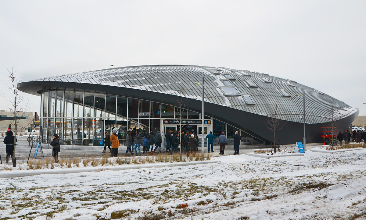
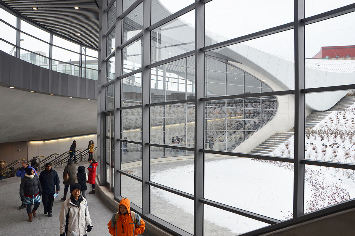
below:  The northernmost station on Line 1 is now Vaughan Metropolitan Centre.

map of line 1 of the TOronto subway system, with red "you are here" arrow at the top left hand side, for Vaughan subway station.

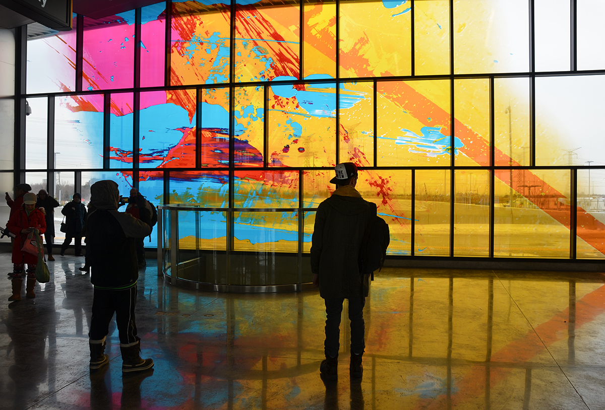
below: ‘Atmospheric Lens’ by Paul Raff Studio is the artwork that is incorporated into the roof of the station.  It features skylights and reflective panels.  The yellow is reflections from a glowing disk mounted on top of the elevator shaft – you can’t actually see the disk, just its reflection.

reflective ceiling of Vaughan subway station, with people going up the escalator towards it, taking pictures.

escalators and shiny walls of Vaughan subway station

below: Vaughan Metropolitan Centre station, from the outside

exterior view of the dome like Vaughan TTC subway station, some snow on the ground, some people standing around outside the doors.

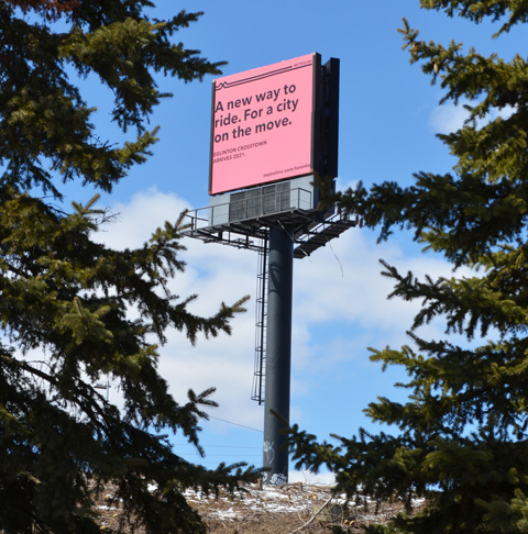
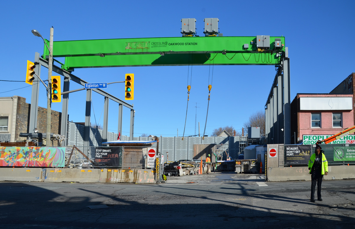
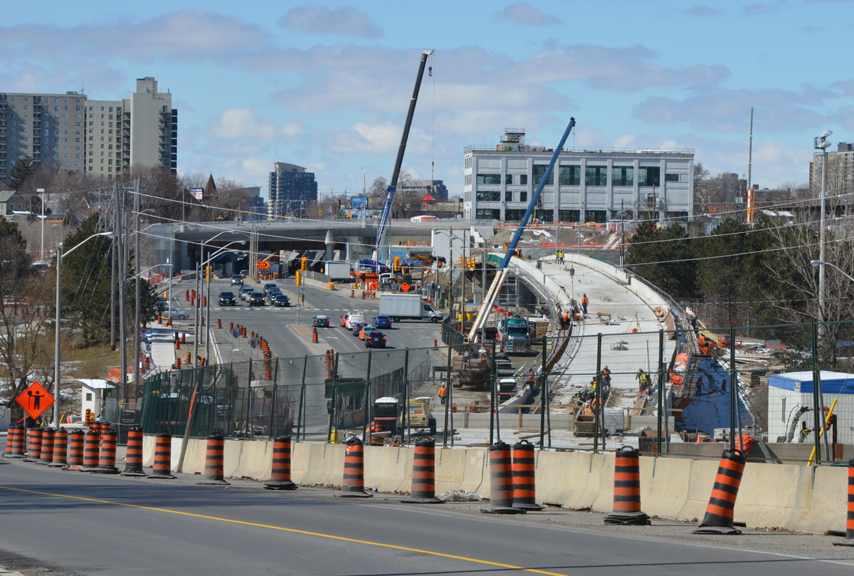
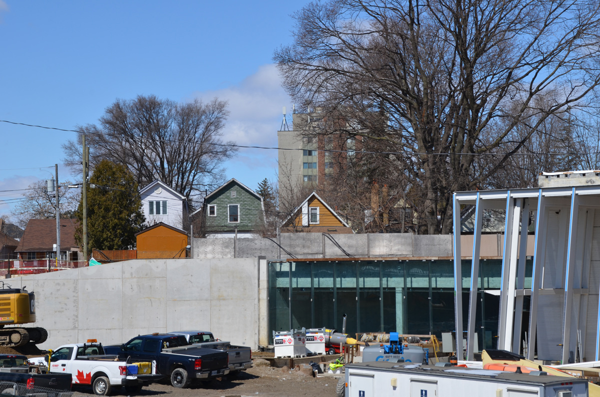
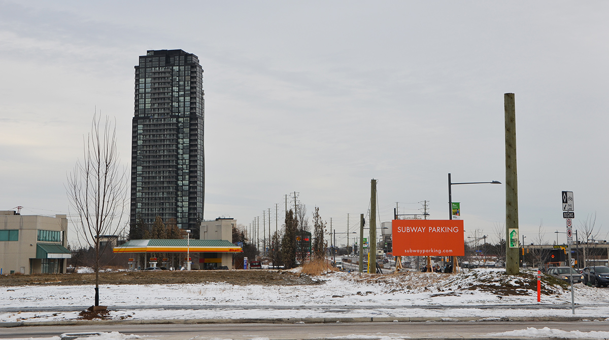
The rest of the ‘metropolitan centre’ needs a bit of work… as does the parking that this orange sign mentions.   I was surprised at how undeveloped that this part of Vaughan is.  This is the view to the east of the station.  On the west there is a development of “big box” stores some of which have just been built.  Smart Vaughan – get the subway and then build around it rather than disrupt an already built city with years of construction and the consequent traffic problems (i.e. building the Eglinton Crosstown link)

suburbia - empty field with orange sign that says Subway parking. one tall building, a gas station, a street,

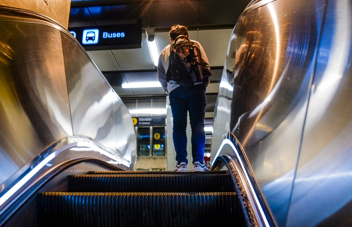
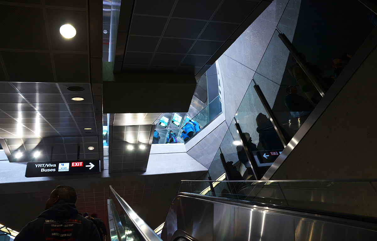
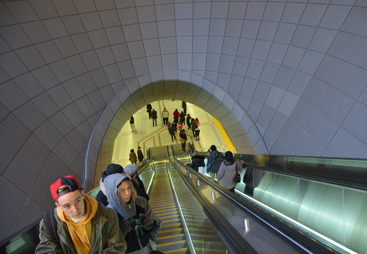
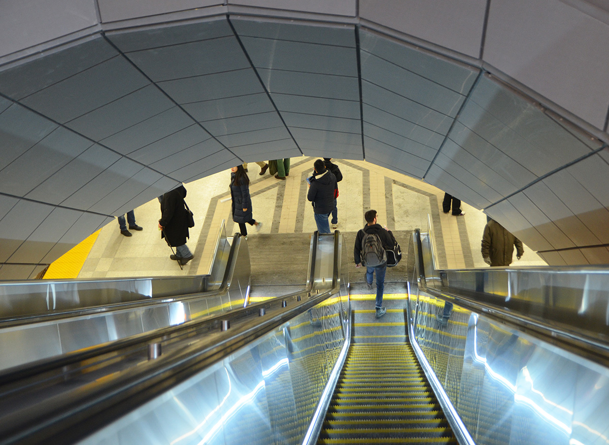
All six stations are quite deep and all six require two escalator rides to get to street level (or you can climb a lot of stairs!… stairs are not always an option though).  There are plenty of elevators.

people on a very long escalator at one of the new TTC subway stations in Toronto

below:  The walls are concrete beside the subway tracks.  Each station has its name on the wall similar to this at Highway 407 station (just south of the 407 at Jane Street).

concrete wall of the subway, with words highway 407 on the wall, at the new Highway 407 subway station TTC

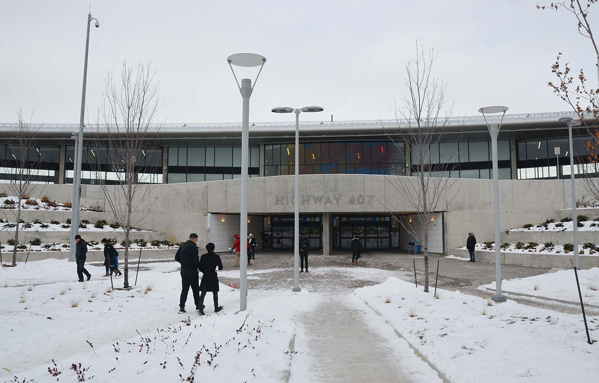
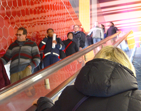
below: A large coloured glass window dominates the area at the top of the escalators (by the bus station) at Highway 407.   This artwork is by David Pearl and is one of two pieces that he did for this station.

people standing and looking at a large painted window, abstract in yellows, turquoise andpink, large window, at subway station, sunlight outside

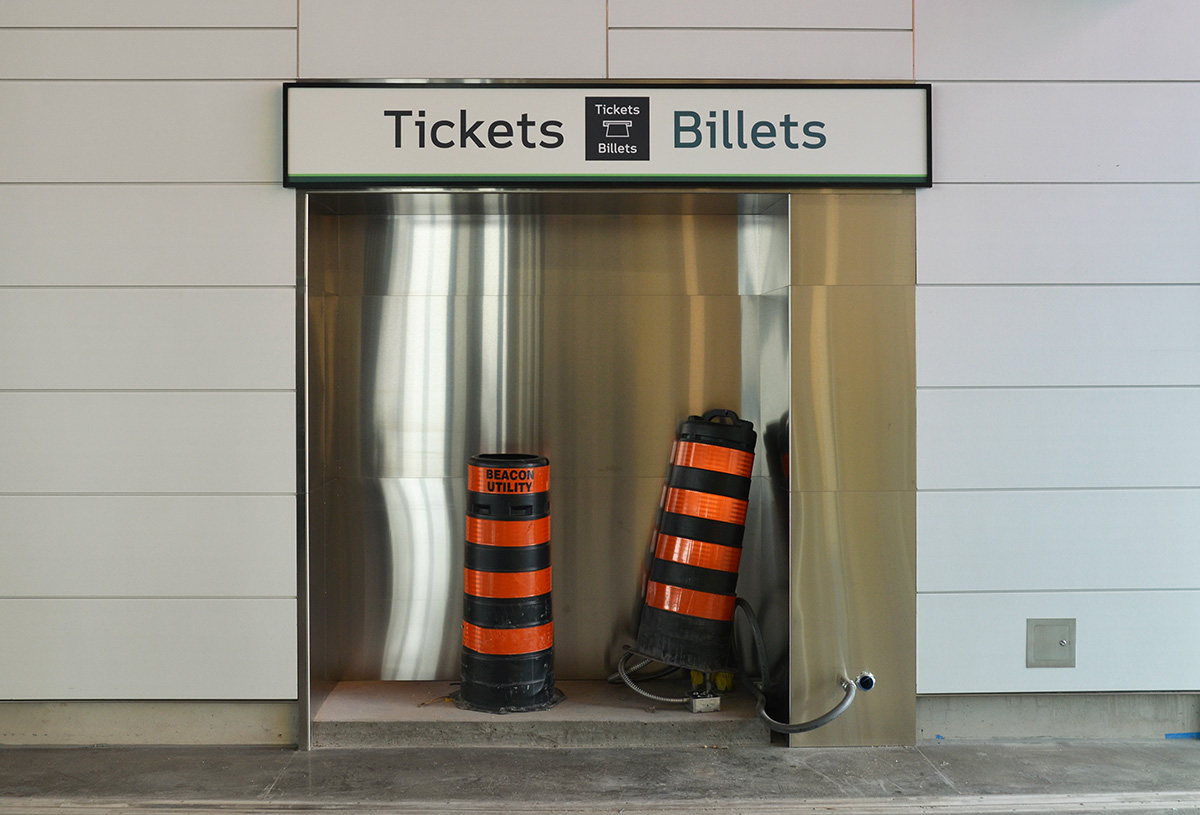
below: Highway 407 has a large GO Transit bus terminal as well.  There is still some work to be done on that part!  The worrisome part of all this is that the two stations at the end of the line are transportation hubs designed to help those commuting into Toronto.  Yes, they funnel even more people into an already overcrowded subway.  Note to the city of Vaughan – please use this as an opportunity to increase the reasons why people would commute north!

unfinished part of the subway station, indent in wall with sign tickets billets but the niche is empty except for two large black and orange striped construction cones

below:  One of the entrances to Highway 407 – the center window is the same as the coloured window above (it looks much better from inside!).  On either side are GO Transit bus terminals.  Behind me when I took the photo is a large parking lot for about 600 cars.   Functional but not necessarily pretty – it may look better from other angles but it was a cold day and it seemed like a long walk to get to the other sides).

people walking towards the entrance to HUghway 407 TYSSE station, a low concrete and glass building.

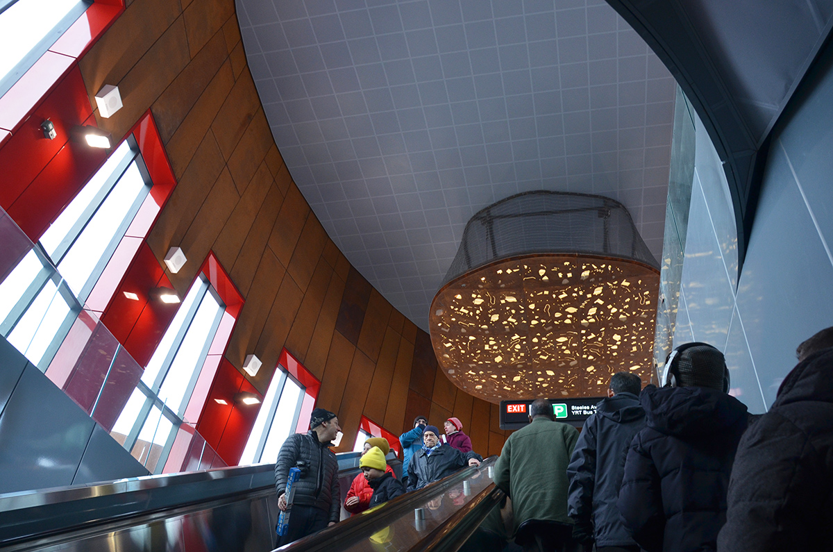
below: The new bus loop at Pioneer Village Station.  There are actually 2 bus terminals here – one for the TTC and one for YRT buses.   This station is on Steeles between Jane and Keele.   Originally this station was going to be called Steeles West – mercifully the TTC actually showed some creativity and came up with a better name.  All the ‘West’ stations drive me crazy.

exterior at new Pioneer Village TTC subway station at Steeles Ave., new bus loops with wood overhangs, still under construction

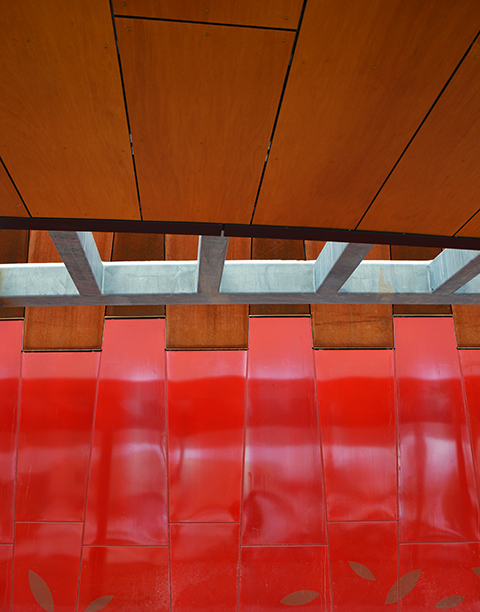
below: Coming up the escalator in the Pioneer Village station towards the large light in the ceiling.   The dominant features of the station are the large vertical windows and the red and wood cladding.   The red and wood are continued to the exterior as well.

interior of Pioneer Village subway station, top of one of the escalators, vertical windows looking outside, some red glass as accents, a large light artwork on the ceiling, people on the escalators

below:  Close up of part of the exterior.

abstract of the exterior walls of Pioneer Village subway station, red panels with wood roof and grey steel beams

below: Looking up into one of the skylights

abstract geometrics, triabngles and diamonds, reflective surfaces in a cone shaped skylight, in blacks and blues,

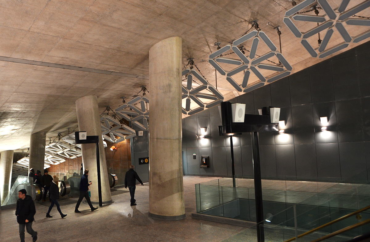
below: The main artwork at Pioneer Village station is “LightSpell” by German artists Tim and Jan Edler.   It’s an interactive installation that also helps provide light in the station.  This photo shows some of the 40 elements that make up the installation. By lighting certain sections of each element, letters of the alphabet can be formed, and in turn, words can be written.   Numbers and other special characters can also be lit.  In addition, the intensity of the light can be automatically controlled to maintain a constant light level in the station.   There are also a lot of speakers on black poles in this area but that is a mystery for another day.

art installation, LightSpell by Jan andTim Edler hangs over th escalator at Pioneer Village TTC subway station,

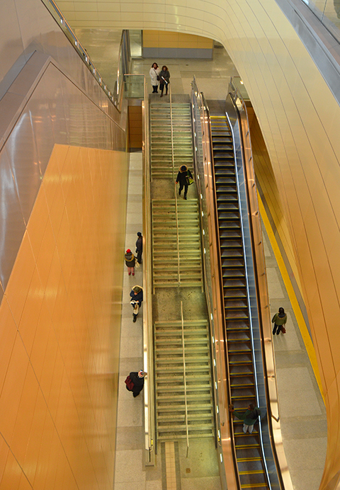
below: Inside York University station which is right on campus.  The stairs and escalators to the trains are in the center.  On both ends of the curved structure are the exits.

large round high window of concourse level of new York University subway station, snow on the ground outside, people inside

looking down the escalator at York University station,

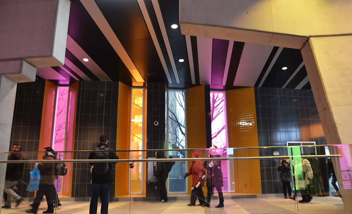
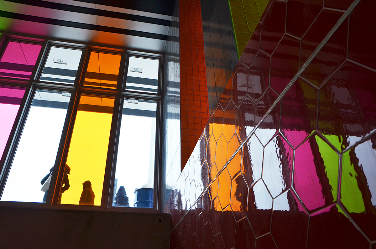
below: At Finch West station there are bright and shiny red hexagonal tiles on many of the interior walls.  (Argh, there’s that ‘west’ again)

shiny red hexagonal shaped tiles line the wall beside an escalator at the new York University subway station on TTC line 1

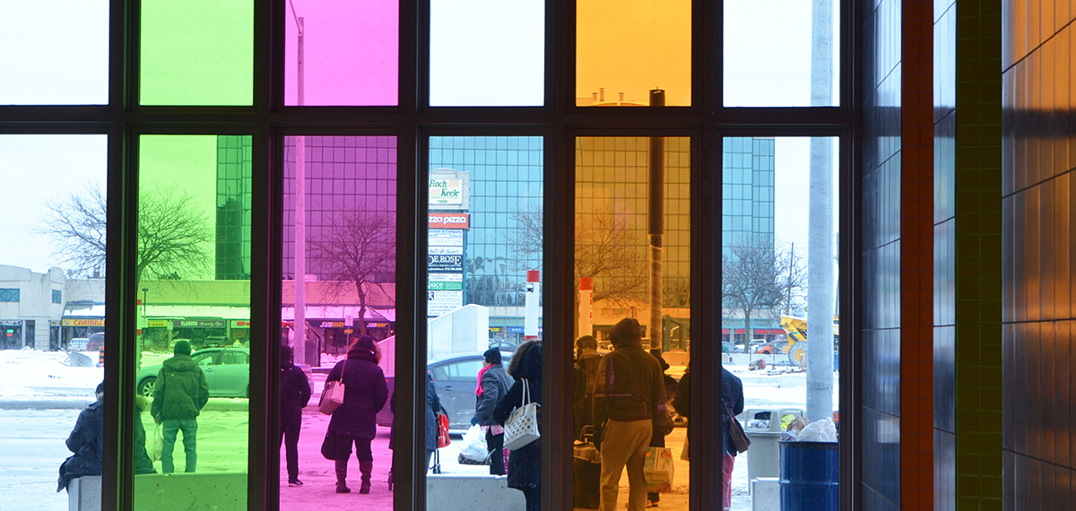
below: As you go up to street level, you are greeted by a flood of coloured light.

people on an escalator, red hexagonal tiles on the wall beside them, lots of streaks of pink and yellow light above them at the top of the escalator, Finch West subway station TTC, toronto

below: The light comes from tall sunlit windows of different colours.  Stripes of grey and white tile on the floor and ceiling add to the slightly surreal effect.

people passing through Finch West station with its tall vertical windows covered in colours, pink, blue and yellow, also with its stripes of white and dark grey tiles
Expect to see many photos taken at this station in the future!  The light and colour makes for some interesting effects.

coloured glass at Finch West station

coloured glass at Finch West station

man standing in front of coloured glass at Finch West station

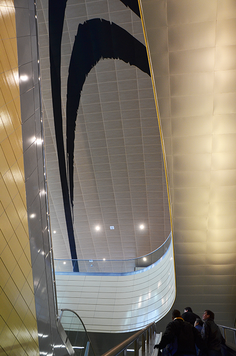
… and I have probably gotten carried away.  There’s still one more new station so let’s take a look at it – Downsview Park.

below: Looking up…

looking up over the heads of some people going up the escalator at Downsview Park subway station

below: … and looking waaaay down at Downsview Park station.

looking down two levels of the new Downsview Park subway station, long escalator and flight of stairs

below: Eventually (soon?) GO trains between Union Station and Barrie will connect with the subway here.   The subway actually runs under the GO railway tracks here.  The street level of Downsview Park station is two halves, one on each side of the GO tracks.


looking out a set of glass doors that is locked closed with a danger sign on the door.   Future GO transit exit at Donwsview Park TTC subway

below: I am going to end with this.  Part observation and part editorializing –  a sign seemingly in the middle of nowhere.  I look at this and think of old pictures I have seen of the Yonge line when it was first built.  It serviced parts of Toronto like Davisville and Summerhill that were of fairly low density but the city and/or province had the foresight to build that far north anyhow.  If you read the TTC websites about these new stations, there is a lot of talk about planning for future development and making that future development transit friendly.  A great idea.  Now, let’s apply that thinking to Scarborough…. and what do you get?  A lot of naysayers with arguments about density.  Grumble grumble oh how poor we are.   And don’t even get me started on Mike Harris and how he cancelled the Eglinton line in 1995.  Twenty two years later we’re building it at extra cost and with extra traffic disruption.  Sigh.

GO Transit and TTC subway sign in the middle of snow covered field

Is there anyone who doesn’t complain about driving in Toronto?
Does anyone have a solution that we can all agree on?
No.

Yesterday Toronto began an experiment on King Street. An experiment that CBC called a disaster on its first day.   This morning I went to check it out for myself.  It was mid-morning so there weren’t many cars.   Also, weekday drivers and Sunday drivers downtown are different.  On weekdays it’s the regulars who know the roads because they drive them all the time.   Does that make a difference? – I’m not sure.

below: At most intersections between Bathurst and Jarvis, traffic is not allowed to proceed straight through – you must turn right.  Streetcars and bicycles are the exceptions.  The traffic signals now have advanced green arrows to allow cars to turn right before the pedestrians cross the road.    Taxis are allowed to go through only between 10 p.m. and 5 a.m.   You’ll notice that the left hand land has been painted with yellow stripes, i.e. no cars here!

white arrow painted on road directing traffic to turn right

below: Two more changes have appeared. First, the streetcar stops have been moved to after the intersection instead of before. Second, small barricades block the right hand lane after the intersection. These two changes have the effect of blocking cars who try to sneak through on King Street. If there is a streetcar, you’re stuck behind it. I did see a car try to pass a streetcar (on the left) but it was unsuccessful.

streetcar stopped to let on passengers, cars behind it on the street

Many cars were disobeying the new traffic signs, some out of confusion  and some blatantly flaunting the rules.   Cars would pull into the right turn lane but then go through the light anyhow.

below: I wasn’t the only ones watching the traffic.  Global TV was at King and Jarvis while CTV were stationed at King and Church.

Global TV car and truck parked on King street, street car about to pass them

below: CBC interviews people at King & Yonge as a black GMC goes through the intersection.

CBC reporter interviewing people on the sidewalk, traffic on King sreet, a black SUV making an illegal straight through the intersection,

below: The lighter traffic makes for easier illegal left turns!

a black car makes an illegal left turn at King and Church streets

below: Taking pictures of drivers doing illegal things was like shooting fish in a barrel. There were a couple of police cars around but so far there are few consequences to doing what you want. It’s early days yet, right? Apparently starting next week, the fine for illegally going straight through the intersection will be $100 and 2 demerit points.

traffic and street cars on King Street

I have one suggestion and that is to change the traffic lights so that the only green is a right turn arrow. The streetcars would have their own light – something like the ‘white line light’ that is used at King and Sumach as well as at Eglinton and Duplex. Having an ordinary green light is almost giving mixed signals to the drivers.

below:  Hey!  Mr. Bentley watch where you’re going!

two cars waiting for a red light. a white car and a grey Bentley, pedestrians crossing the intersection in front of them.

Take care out there!

Along a short stretch of Coxwell Avenue

Upgrades to Coxwell subway station include work on the north side of Strathmore Blvd.  Two murals were created to brighten the hoardings around the construction site.  Both murals are the work of a program called ‘City on the Move – Young Artists in Transit’.  If you use Coxwell subway station you can’t help but see these murals as they are right across the street from the entrance.

below: ‘Today Reassembling Yesterday’ shows people standing within a miniature old East York.  On both sides of the mural is a replica of a Hollinger Bus line ticket.  This bus company was founded in 1921 by John Hollinger and it serviced the growing neighbourhood of East York.  By the time the TTC took it over in 1954, Hollinger had 96 employees and a fleet of 56 buses that traveled twelve routes on such streets as Woodbine, O’Connor and Coxwell.

mural in front of a construction site, the tops of two brick houses are visible behind the fence, a large green crane is working at the site

below: In this mural, five panels are covered with wallpaper of pictures of the past.  Residents, the present day, peel back the layers of the past to reveal their visions and hopes for the future.  On the left, red barns and hay stacks make way for solar panels over fields with bird filled skies.  The next panel is also inspired by agriculture – healthy corn fields and other crops under a layer with horses and stables.  The middle panel puzzles me.  I’m note sure what the pictures on the brown paper represent but birds in a tree are under it.  The fourth panel suggests accessible public transit.  Lastly, cars and trucks make way for rivers to fish in.

A mural of kids peeling away layers of wallpaper with pictures on it.

‘New Revelation, at Coxwell’

a poem by George Elliott Clarke, Poet Laureate of Toronto 2012-15
to accompany the mural at Coxwell station

As wallpaper peels to windowpanes, spy
Grass, insurgent, urging all our future
Is Spring: Sunlight sparks sweat and dream; wind drives
Machines. Thrilled, birds wing and sing so sprightly,
Everyone delights. Blossoms float perfumes.
Branches brandish emerald bouquets. Our lungs
Flood with surging airs, clean as chlorophyll,
Mint-new, mint-tangy, so song is born,
Just by breathing. Wheels become our earthly
Wings, so infant and elder, builder and
Dreamer, can flit – transit – through the city
As public millions that public millions
Uphold, so that the lame, too, can take
The air and wheel down to creek, stream, and lake.
Suddenly glittering, afresh with fish.

The TTC also owns property on the southeast corner of Coxwell and Danforth.  Back in 1915 this facility was built as the Danforth carhouse for the streetcars that ran along the Danforth.  When the Bloor Danforth subway line opened in 1966, these streetcars were retired and the carhouse was converted to handle TTC buses instead.   In 2002 the Danforth carhouse (or Coxwell Barns) was shut down.  Some of the property has been sold off but the TTC still has a presence there.

below:  Along Coxwell Avenue, south of the Danforth, there is a fence that separates TTC property from the street.  It was a typically drab TTC concrete barrier.  Recently it was painted by a group of volunteers.  The word ‘transition’ now pops out at passersby from a colourful mural designed by Sean Martindale.

Transitions written in block letters in a large geometric mural that matches the grid of the concrete that makes up the fence

close up of the letter N and part of S in the Transitions mural on a TTC fence on Coxwell ave.

Transitions written in block letters in a large geometric mural that matches the grid of the concrete that makes up the fence

If you walk a few more blocks south on Coxwell, you will come to a fence where many butterflies have stopped to rest.

two wood butterfly shapes that have been hand painted by kids and then attached to a chain link fence around a school playground.

They share a fence with a few creative owls wisely made out of recycled materials.  Tin cans, CDs, buttons, bottle tops, corks, paper clips, sunglass lenses, clothes pegs, foil plates, and bits of plastic repurposed.


four owls made of recycled goods, foil pie plates, CDs, bottle tops, there feet are wrapped around twigs and they are attached to a chainlink fence

owls made of recycled goods, foil pie plates, CDs, bottle tops, there feet are wrapped around twigs and they are attached to a chainlink fence - two corks for horns

owls made of recycled goods, foil pie plates, CDs, bottle tops, there feet are wrapped around twigs and they are attached to a chainlink fence - also blue buttons for the nose

below: A little red fairy door, home of the Earl Haig gardener.  This past summer there was a project called  Danny’s Urban Fairies.  Fairy doors that were hand crafted by local artists started appearing in stores and parks along Danforth East  (from Jones to Westlake).  Some of the fairy doors remain but many were auctioned off in November to raise money to support the non-profit East End Music Project.

A little red screen door, fairy door, at the base of a tree with two little signs. One sign says Earl Haig gardener and the other says Do not litter.

below: No bows and arrows allowed!

old sign on the exterior wall of a school that says: Playing of golf, hardball, handball, bows and arrows prohibited