Posts Tagged ‘condos’


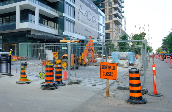
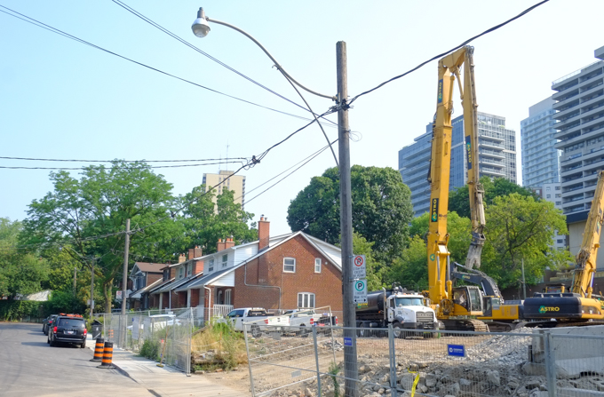
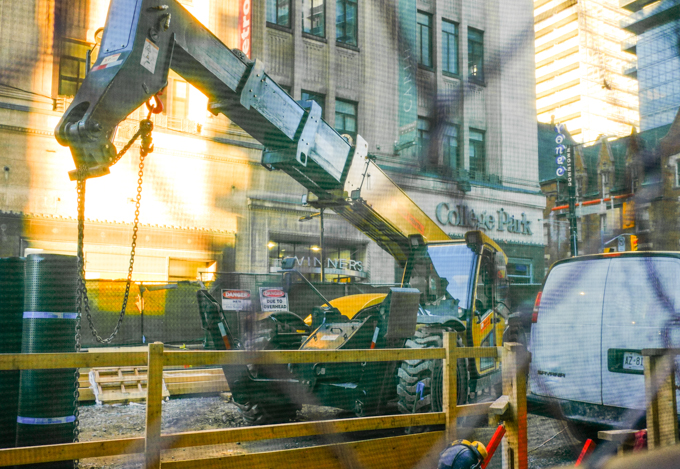
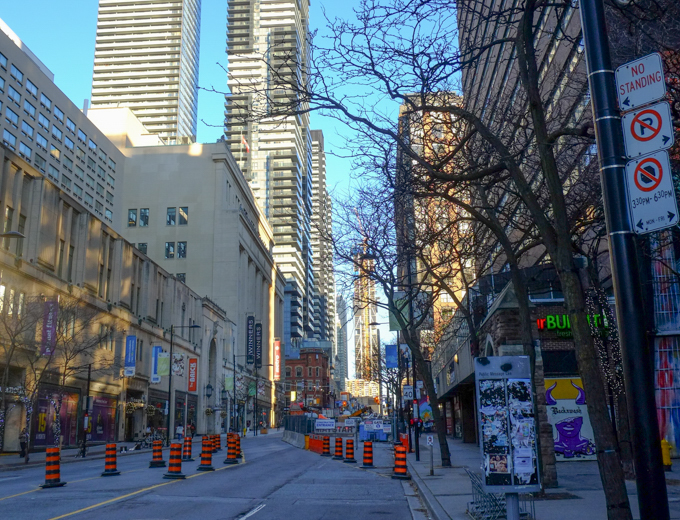
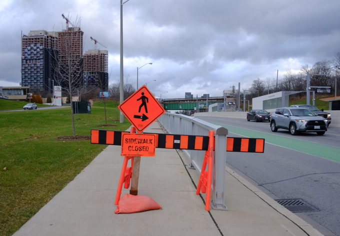
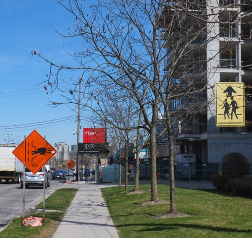
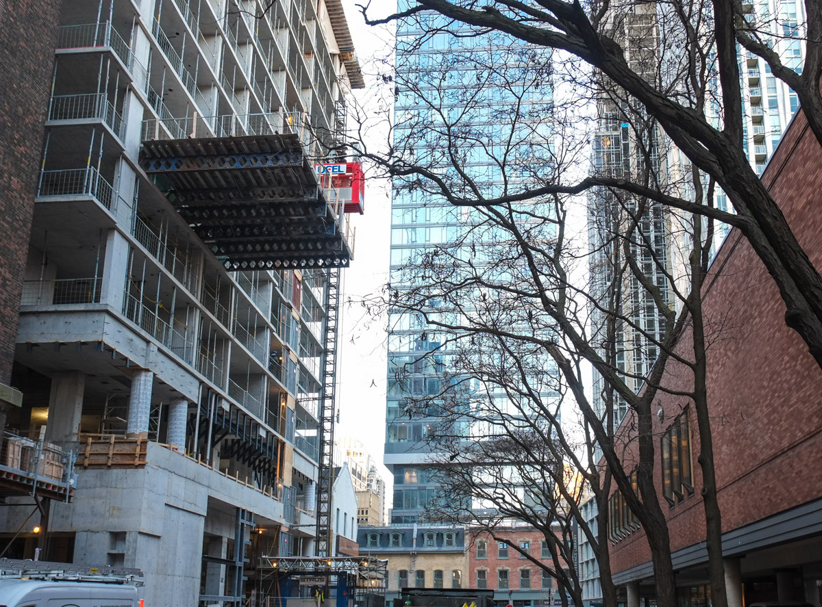
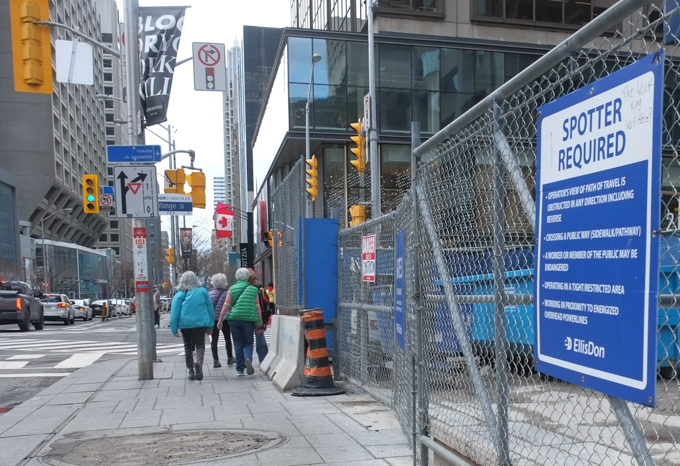
After I got off the subway at Bloor but before I got to the street, the first construction change of the day hit me in the face (luckily not literally!).  Bloor Street East is now a mess.

glass doors on Bloor street, entrance from subway to street, woman entering, blue hoardings outside because of construction on bloor street
construction on Bloor street near Yonge

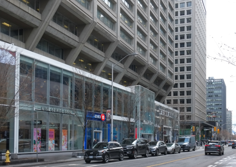
below: “The Bay” sign has been removed from the old store.   Founded in 1670 to control the fur trade in the area, the Hudson Bay Company used to lay claim to being North America’s oldest continuously operating company.  The company went bankrupt late in 2025 and all of their stores have closed including this one.  The complex (includes 34 storeys above) was opened in 1974 and was referred to as the Hudson Bay Centre.  Now it is just 2 Bloor St. East.   The next question is how does one re-purpose a large windowless space on a busy street?  (personal aside – I started by honeymoon at the Plaza II which was the original hotel in the complex.  I won’t tell you how long ago that was, but the Quebec Nordiques were in a playoff game that day).

construction site on bloor takes over sidewalk in front of royal bank, beside old Hudsons Bay Co, the Bay, concrete building

bloor street, looking east towards yonge
gray haired senior women walking west on bloor towards yonge intersection, with construction fence beside them, north side of bloor

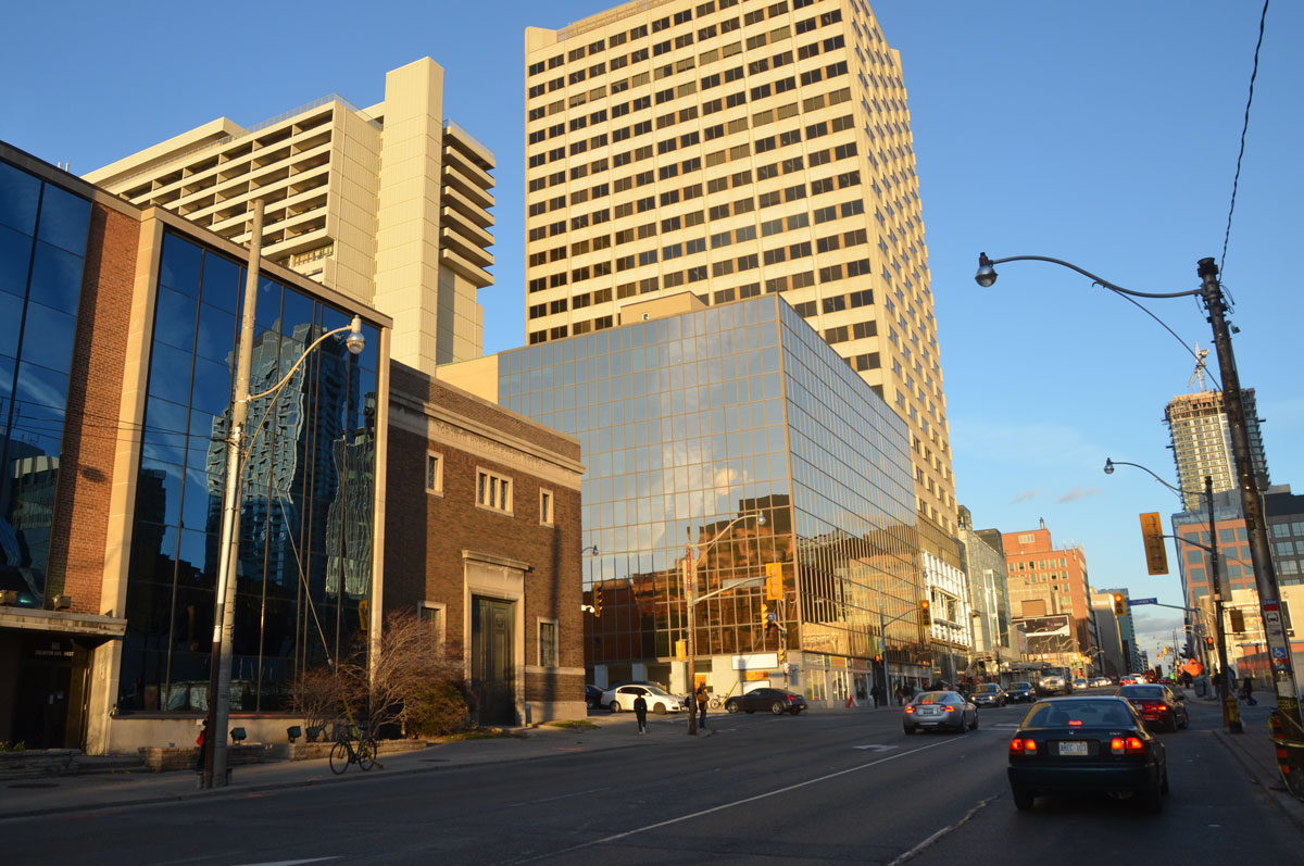
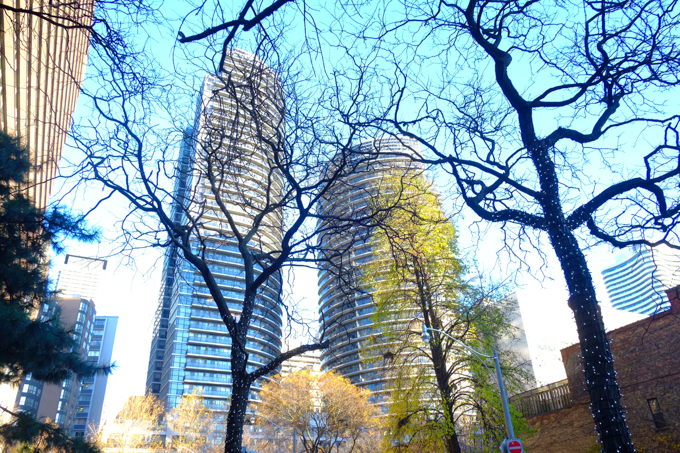
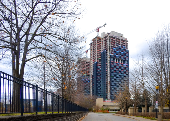
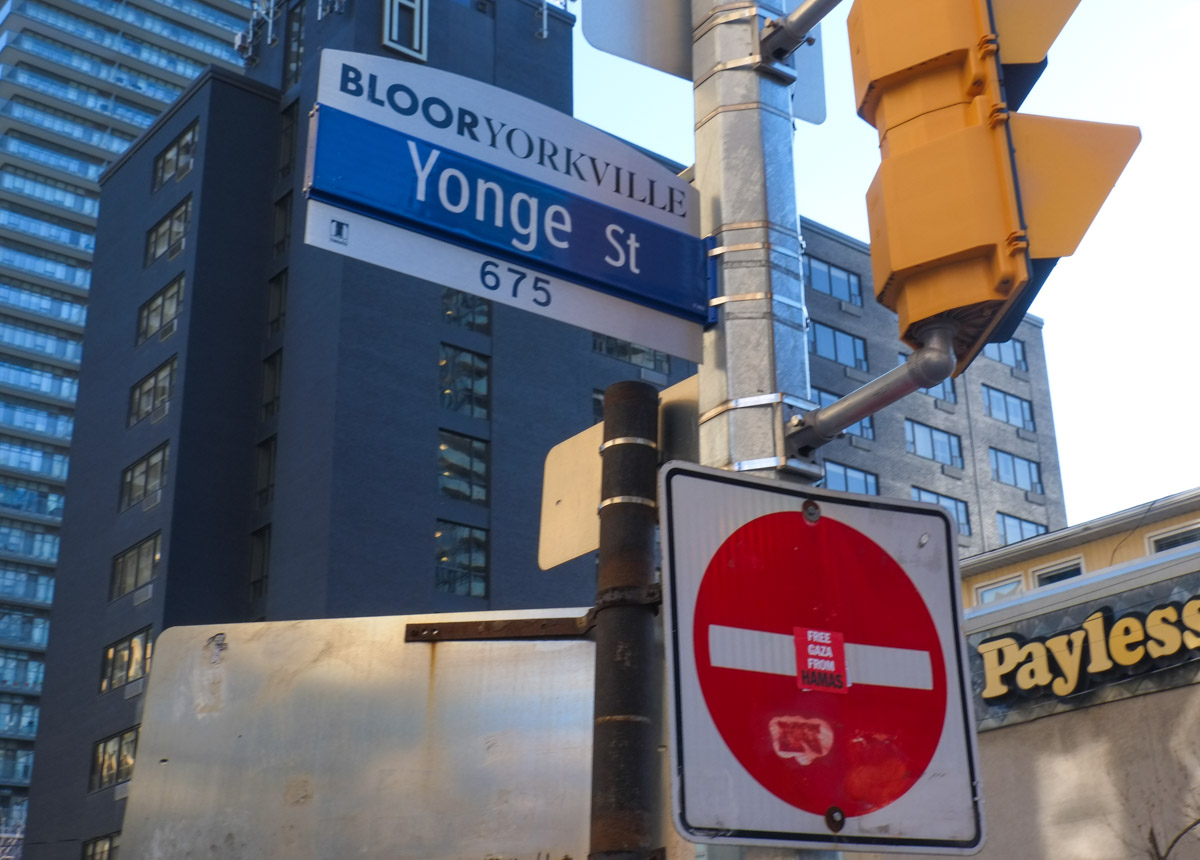
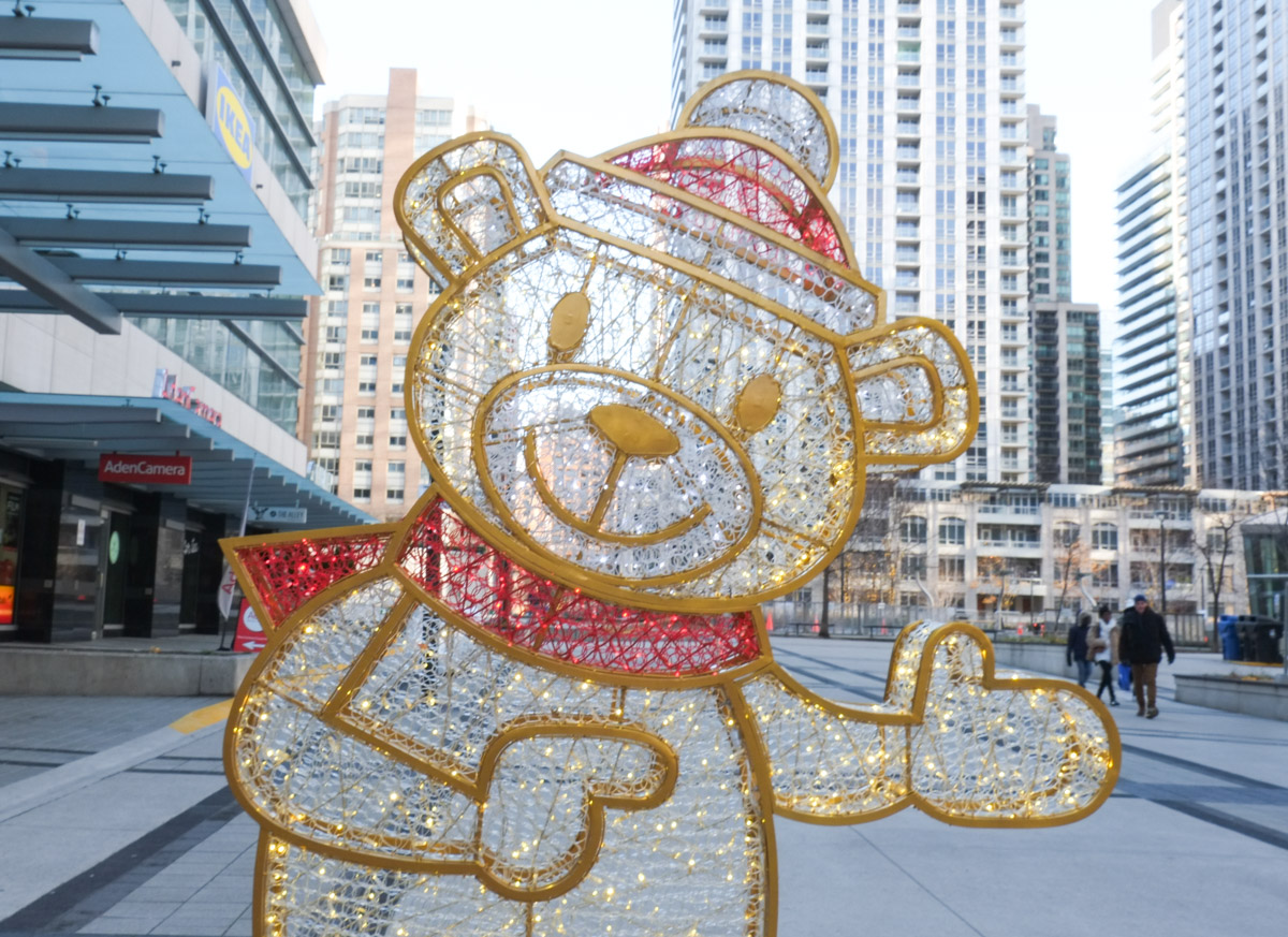
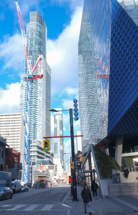
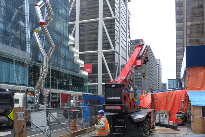
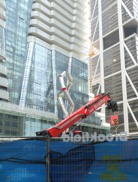
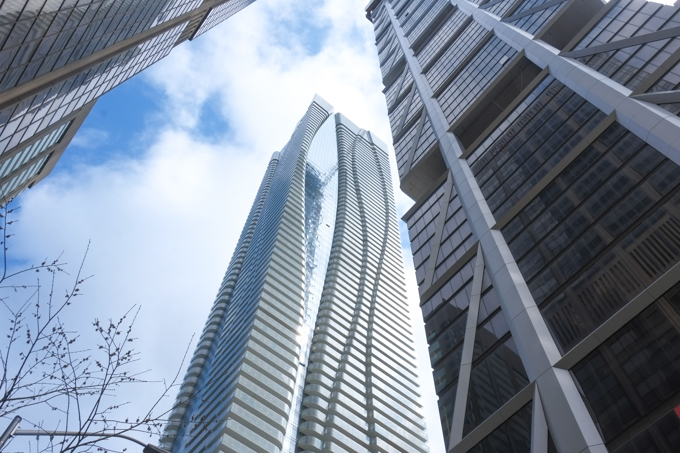
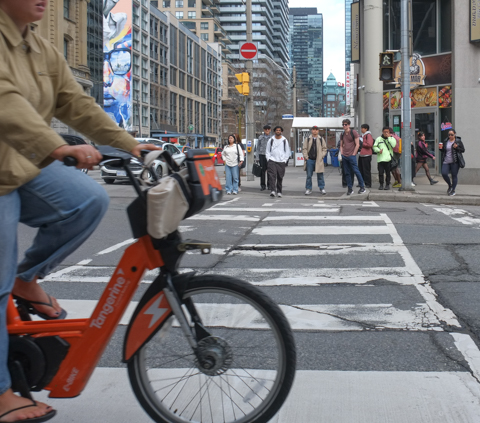
below: Upwards at Yonge & Bloor

looking skyward at yonge and bloor, stops of three glass towers

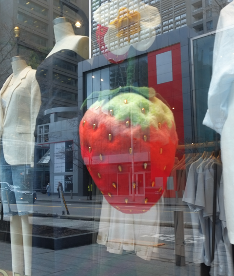
Of shorts and strawberries, and hoping for spring .  So far it’s been a cool (or rather cold) May.
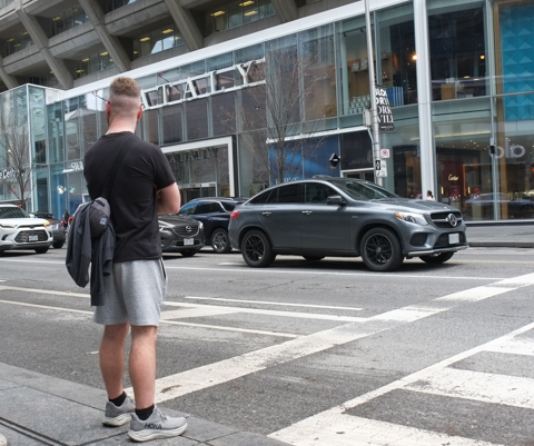
large stuffed strawberry in a store window, clothing store, summer clothes including shorts

Shorts!

man standing on sidewalk waiting to cross street, wearing black t shirt and grey shorts, dark grey car on street, across from Eataly restaurant on Bloor Street

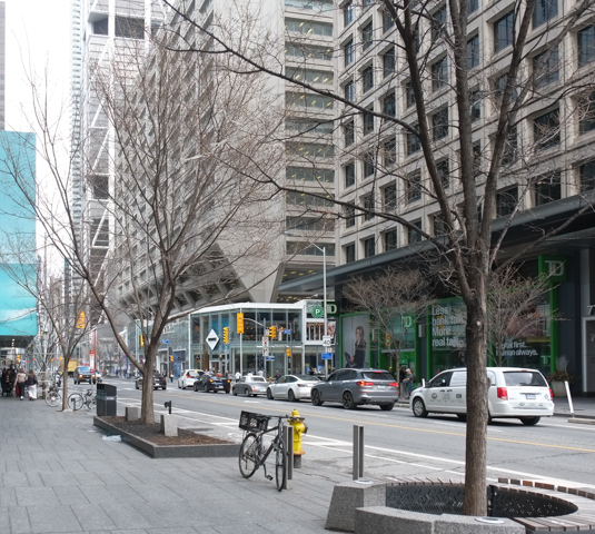
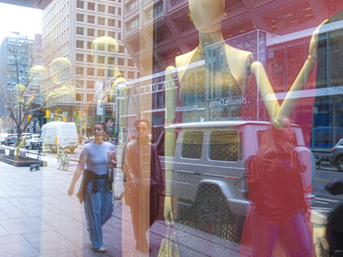
below: On the south side of Bloor is another concrete building from the 1970s, the Manulife Centre, which has undergone a transformation at street level in recent years.

manulife centre on bloor street, older concrete levels above with newer glass facades at street level

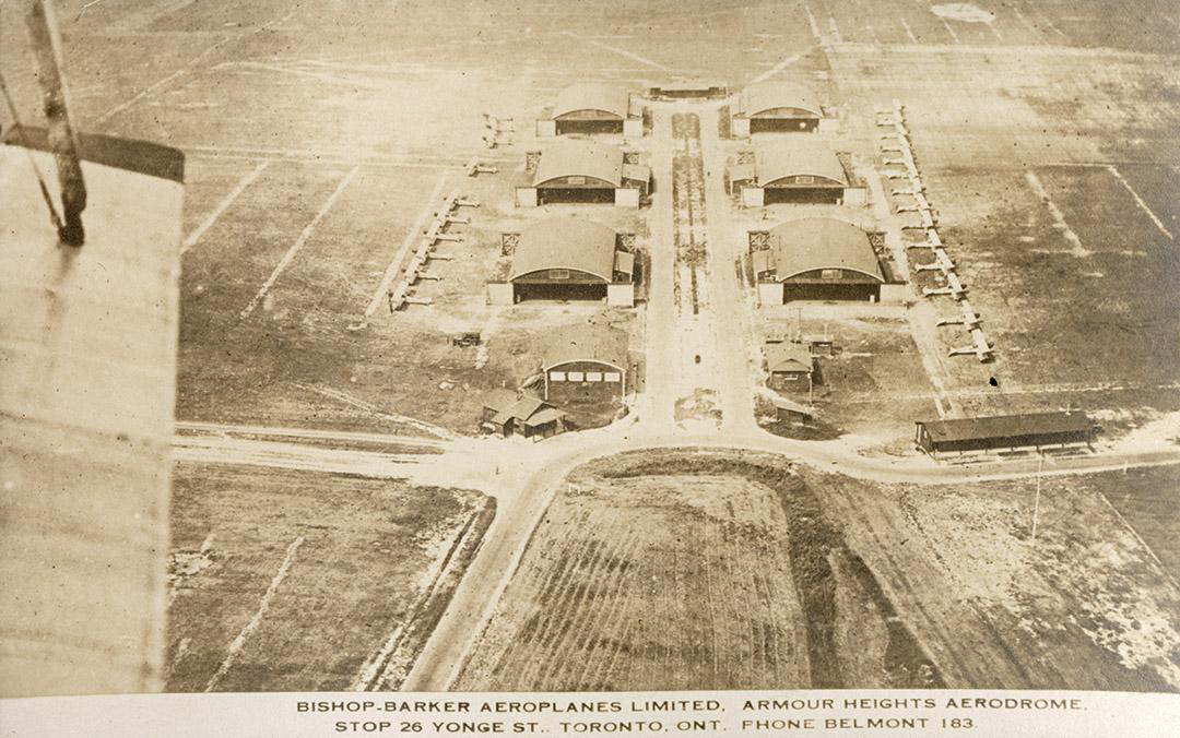
below: Found on the  City of Toronto archives website, a photo from its early days. (As another aside, after graduating from high school, I worked for a few months at a store in the basement – back in the day when Ashleys, Creeds, and Birks had stores there.  Bay Bloor Radio may be the sole survivor?)

vintage photo, faded colour, from City of Toronto Archives, manulife center at Bay and Bloor (southeast corner), concrte brutalist architecture

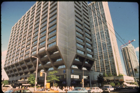
source: Fonds 200, Series 1465, File 750, Item 14

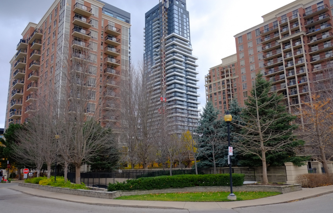
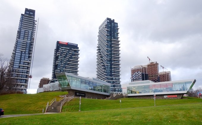
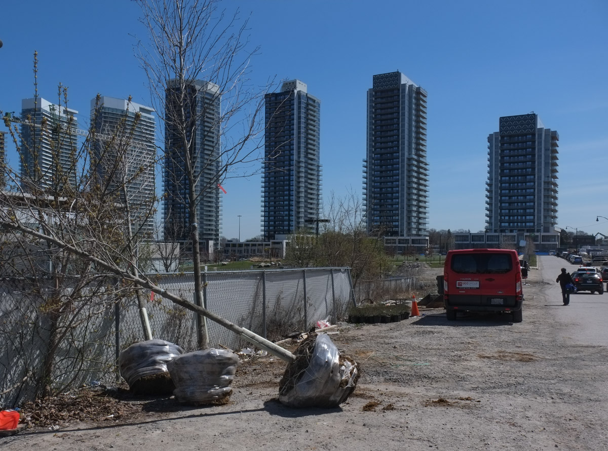
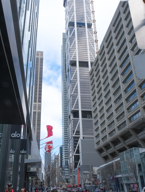
below: A contrast between the Manulife Centre and the new towers on the south side of Bloor (east and west of Yonge)…  even the upper levels of the Hudson Bay Centre can be seen in the distance.

bloor street, south side, looking east towards yonge

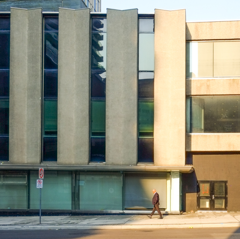
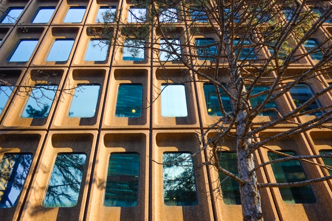
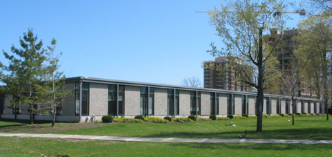
below: A little farther west on Bloor…. another concrete building with recessed windows.  Very much the style at the time!

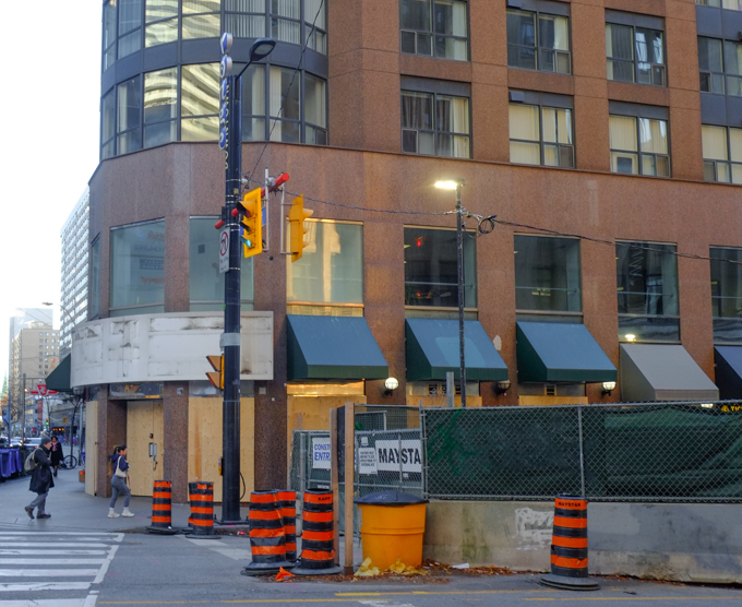
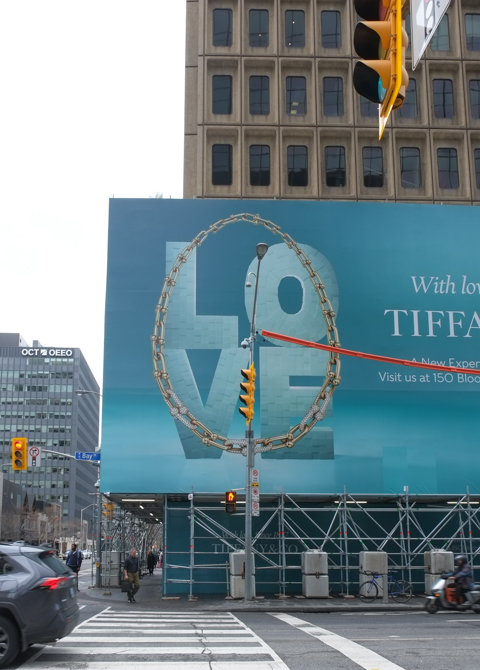
below: Northwest corner of Bay & Bloor with yet another concrete building from the 1960s and 1970s  (1200 Bay Street was built in 1966).  The last time that I walked here, the lower levels were boarded up and painted black.  Now they are hiding behind a large expanse of Tiffany Blue.  There are rumblings of an 87 storey tower being built here.  Dutch Dutch developers Kroonenberg Group and ProWinko filed a development application with the city to build such a tower back in 2020.

large blue tiffany ad with word love spelled in large capital letters, surrounded by image of a gold necklace, traffic lights in front, intersection of bay and bloor.

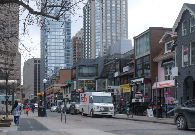
below: Looking west on Cumberland Street

Cumberland Street

view looking up to top of buildings and trees, from cumberland street, looking west

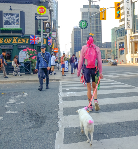
below: But there are things that don’t change – like cars getting stuck in an intersection on a red light.

Avenue Road and Bloor intersection, in front of the ROM, people crossing on green light, car stopped in intersection

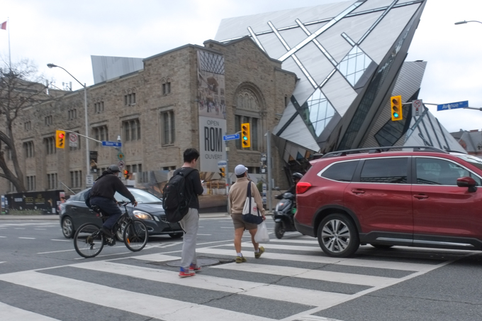
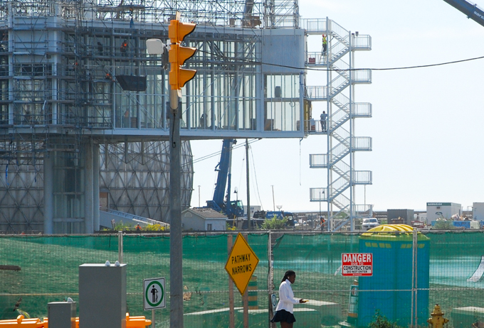
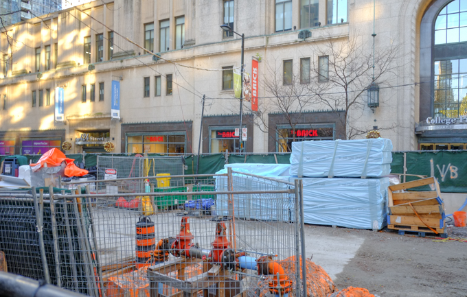
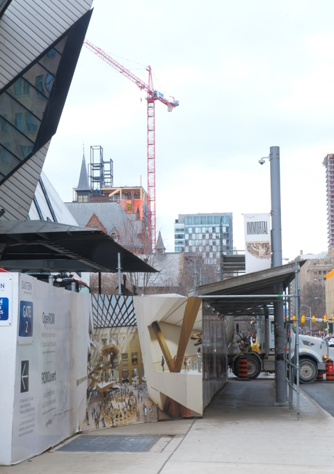
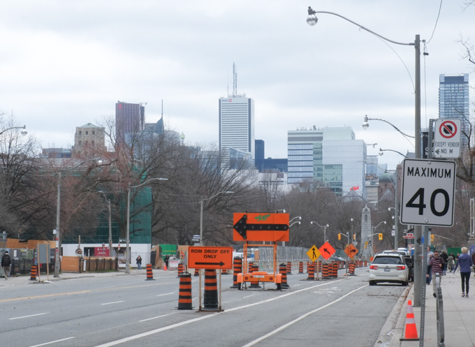
below: Never ending renovations at the Royal Ontario Museum

construction at entrance to ROM, Royal Ontario Museum,

looking south on University towwards Queens Park Circle, construction

two people outside the museum near museum subway station entrance, that has two blue porta potties sitting beside it

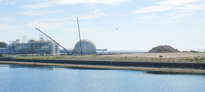
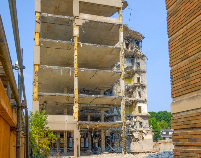
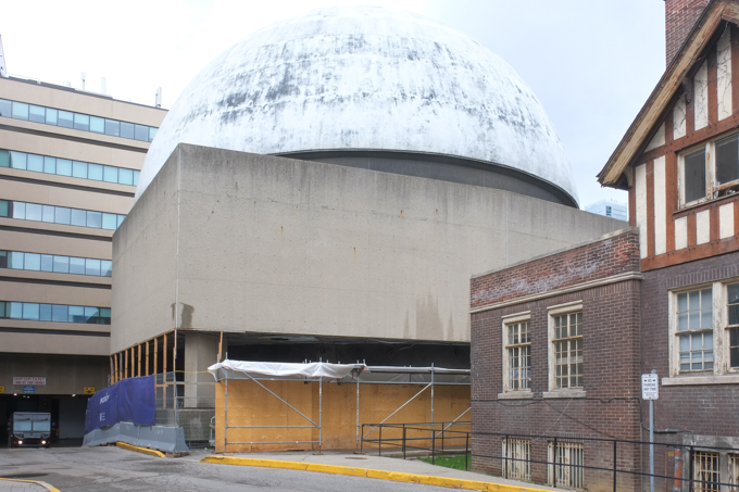
below: It has been sitting empty for years.  The McLaughlin Planetarium closed in 1995 after the provincial government cut its funding.  It wasn’t even thirty years old at the time; it opened in 1968.   It is a big cement box with a large dome on top and is not very photogenic!  It was sold to the University of Toronto back in 2009 but it is only now that redevelopment is about to occur.

The Planetarium, beside Royal Ontario Museum, empty, is being prepped for demolition, front view

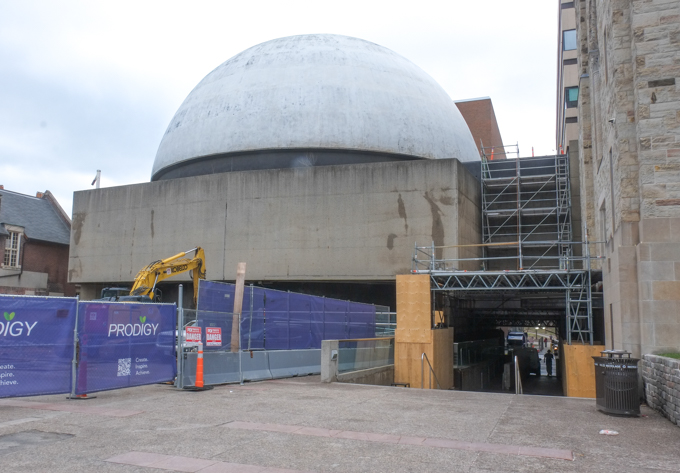
below: Backside view.   This post has been difficult to write – so many changes.  One of the reasons that I started this blog was to document the changes happening in the city.  I hadn’t expected those changes to be quite so relentless.  Never ending.  A perpetual motion machine of changes. Are we tired of winning yet?  This picture is already out of date – there are photos of the demolition popping up online now that show the dome broken open and disappearing.

The Planetarium, beside Royal Ontario Museum, empty, is being prepped for demolition, back view

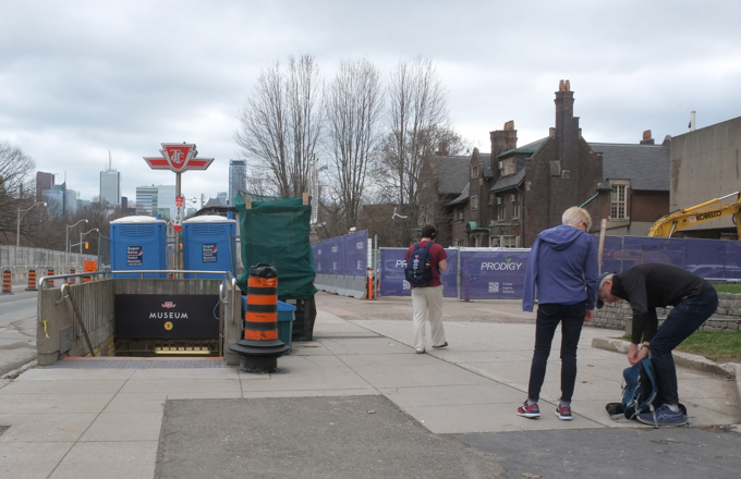
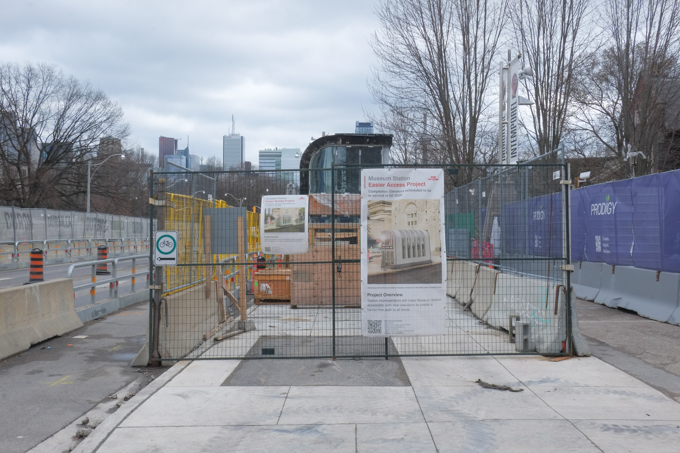
below: Museum subway station is getting a new elevator entrance from the sidewalk on University Avenue in front of where the Planetarium is/was.

museum subway station is getting a new elevator entrance, from sidewalk on university avenue

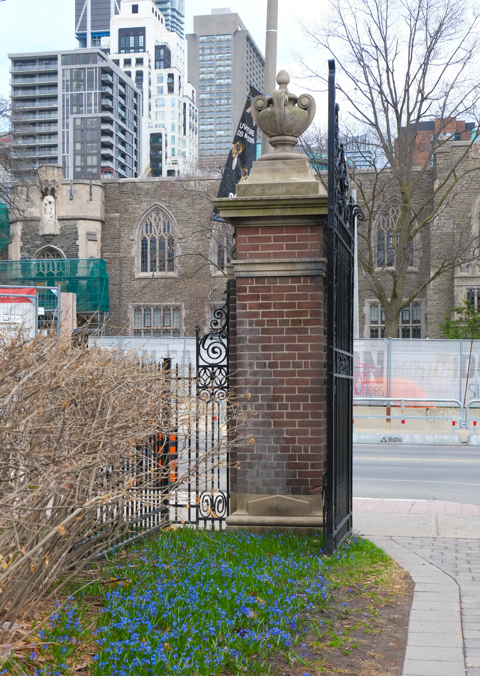
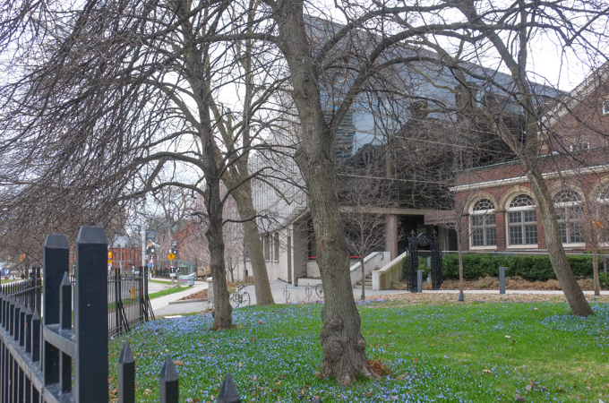
below: Little blue signs of spring dot the lawn.  Emmanuel College (U of T) is in the background.  It is affiliated with the United Church of Canada and is one of the members of the Toronto School of Theology.

purple blue spring flowers among the grass by a brick gate post,

below: Part of University of Toronto Law School.

university of toronto la school, flavelle house

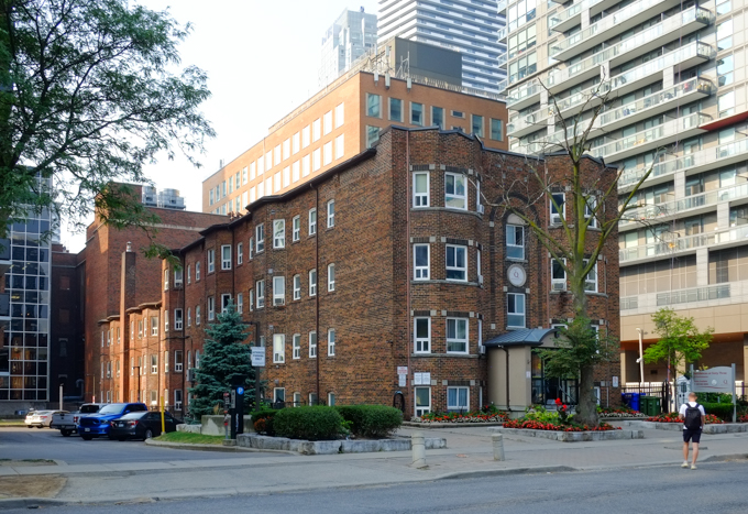
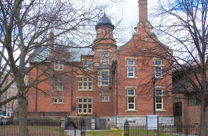
below: Annesley Hall, Victoria University, U of T,was  built in 1903 in the Queen Anne Revival style.   Annesley Hall was the first university residence built for women in Canada and is still used as such. (What?, no changes?)

side of Annesley Hall residence, Victoria University, red brick building

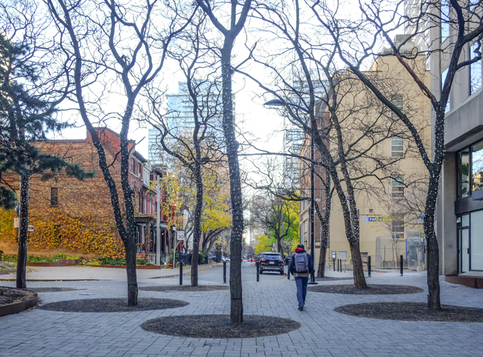
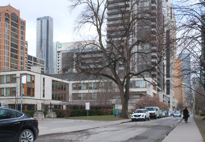
below: Charles Street West where a few original houses remain steadfast.

Charles st east with variety of architectural styles including a row of second empire homes

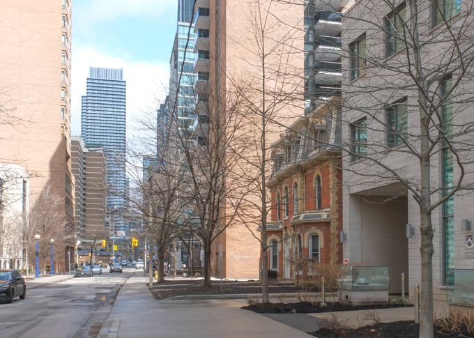
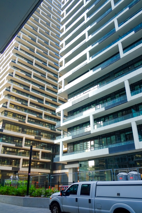
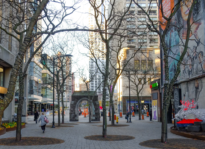
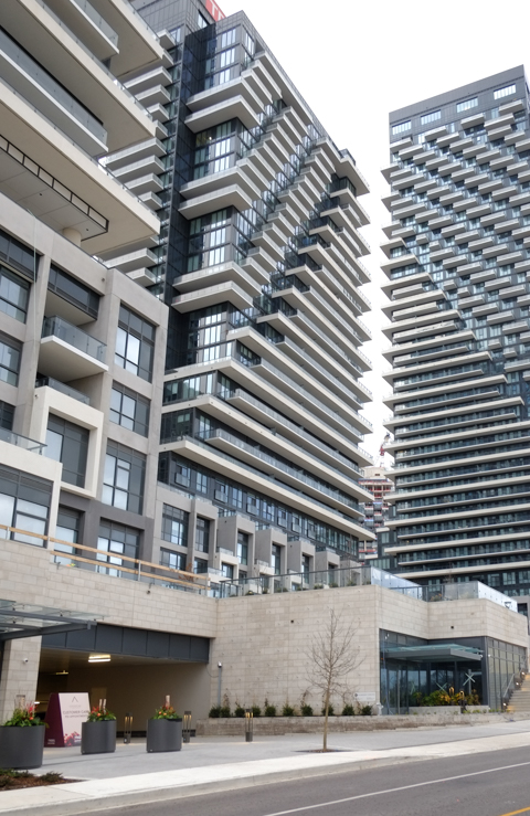
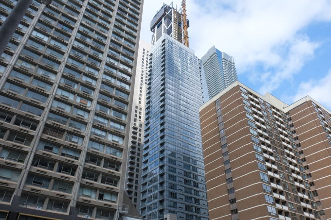
below: Still on Charles Street – but it is a perspective that is now very common around the city as everything moves upward, taller and taller.   Egos get stoked and massaged as yet another “tallest” tower gets built, only to be outdone by someone else down the line….

loking skyward, on Charles st east, to tops of highrise buildings
looking east on Charles street east

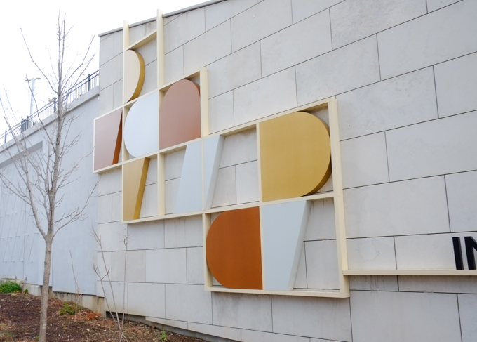
below: “La Scala”by by Canadian sculptor and architect William McElcheran.  The women are walking up the stairs, or walking around in circles…

sculpture, black metal cutout figures mounted on a cement pole, looks like a person walking around, or climbing up, the pole,

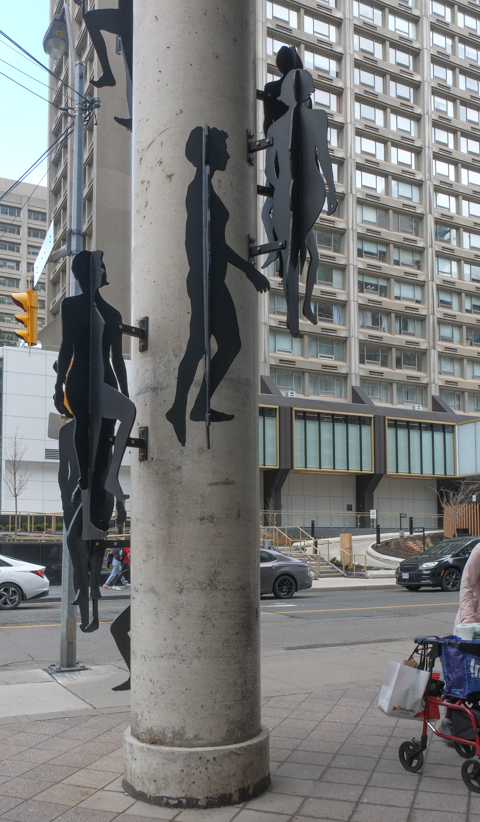
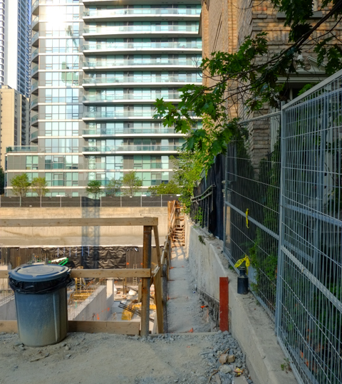
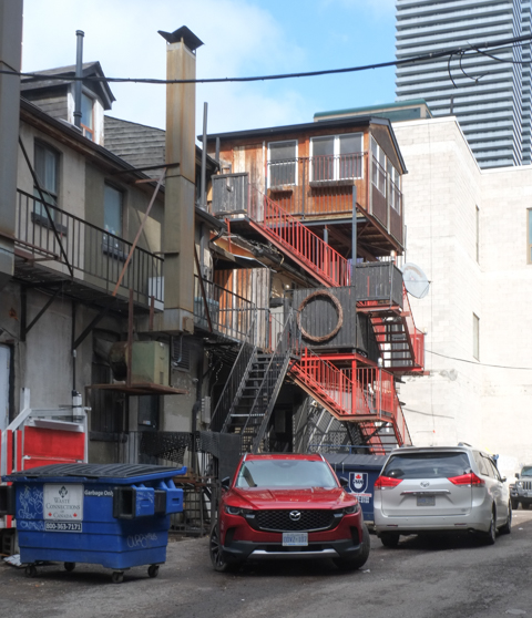
below: A peak at what is behind – lots of balconies and stairs and even an upper level addition.

back of buildings on charles street, balconies, stairs, additions, parking lot,

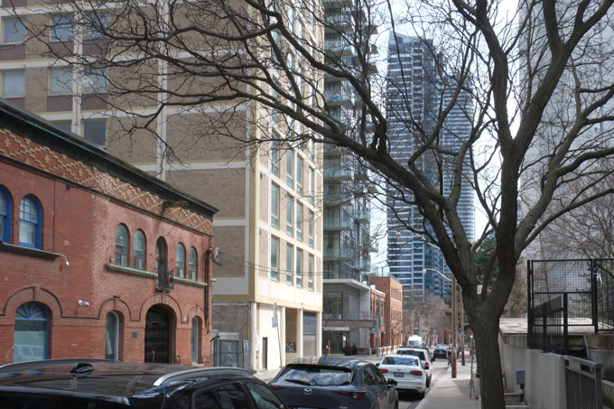
below: St. Nicholas Street runs parallel to Yonge, one street west.  It runs south from Charles Street to Wellesley.

St Nicholas Street, looking south

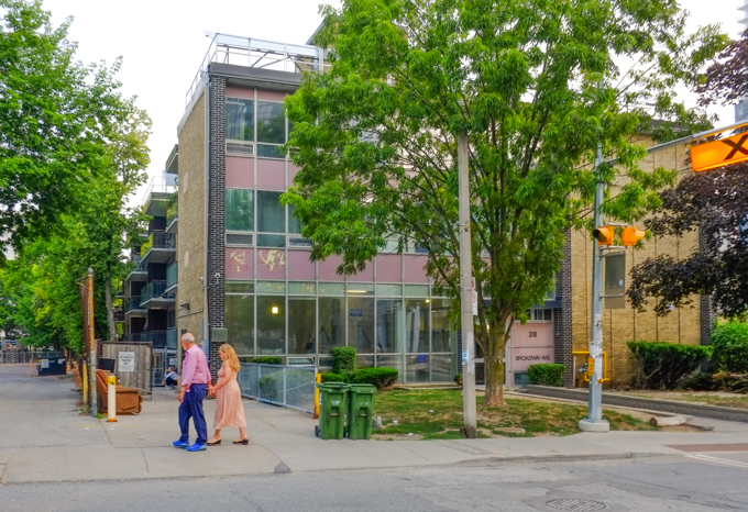
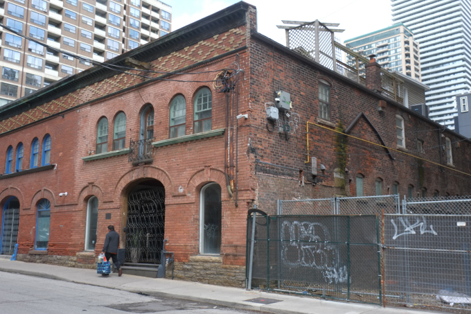
below: 81 St. Nicholas is this red brick building with the interesting contrasting brick detail across the top. It was built in 1912 and is known as the Robert Barron Stables.  In 1889 Robert Barron built a store at Yonge and Charles.  A few years later he added this building, his stables, behind the grocery store.

St. Nicholas street, looking north around number 81

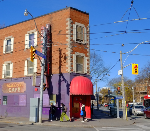
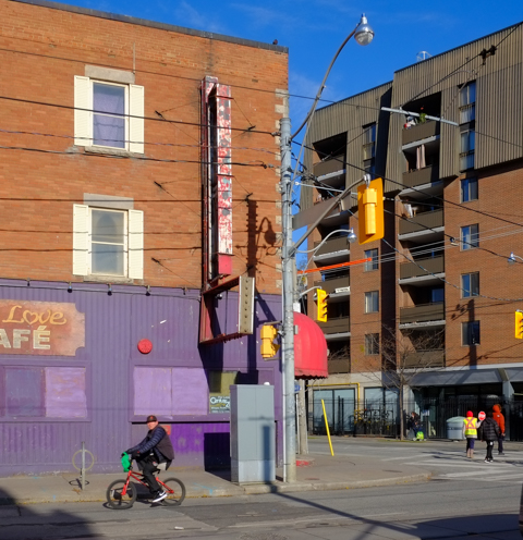
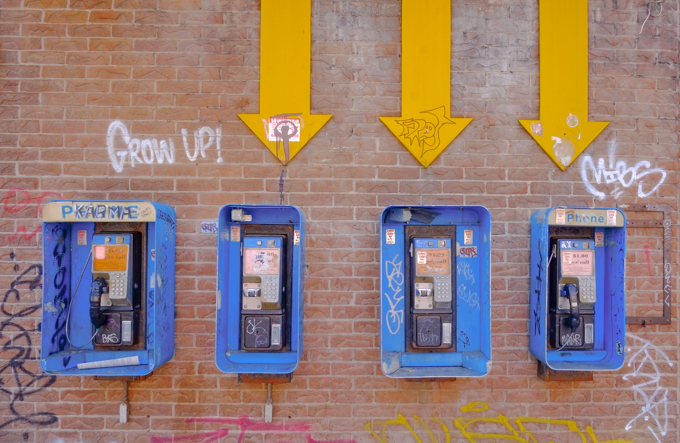
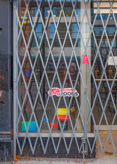
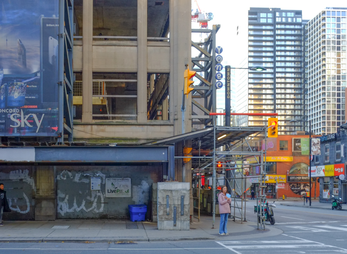
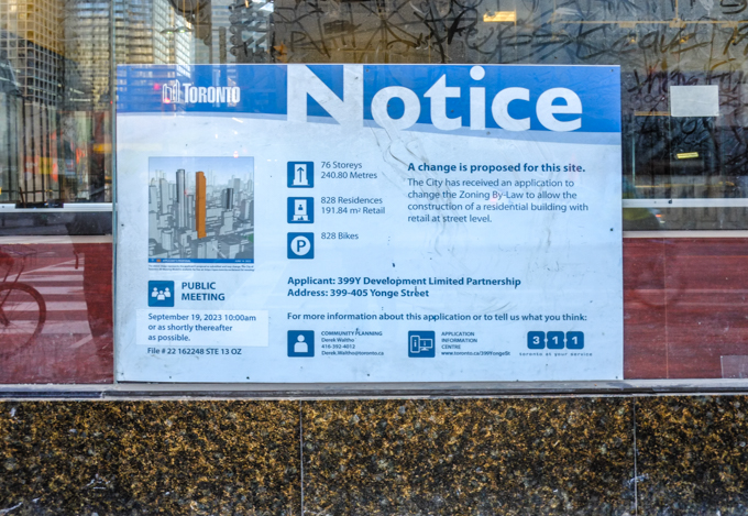
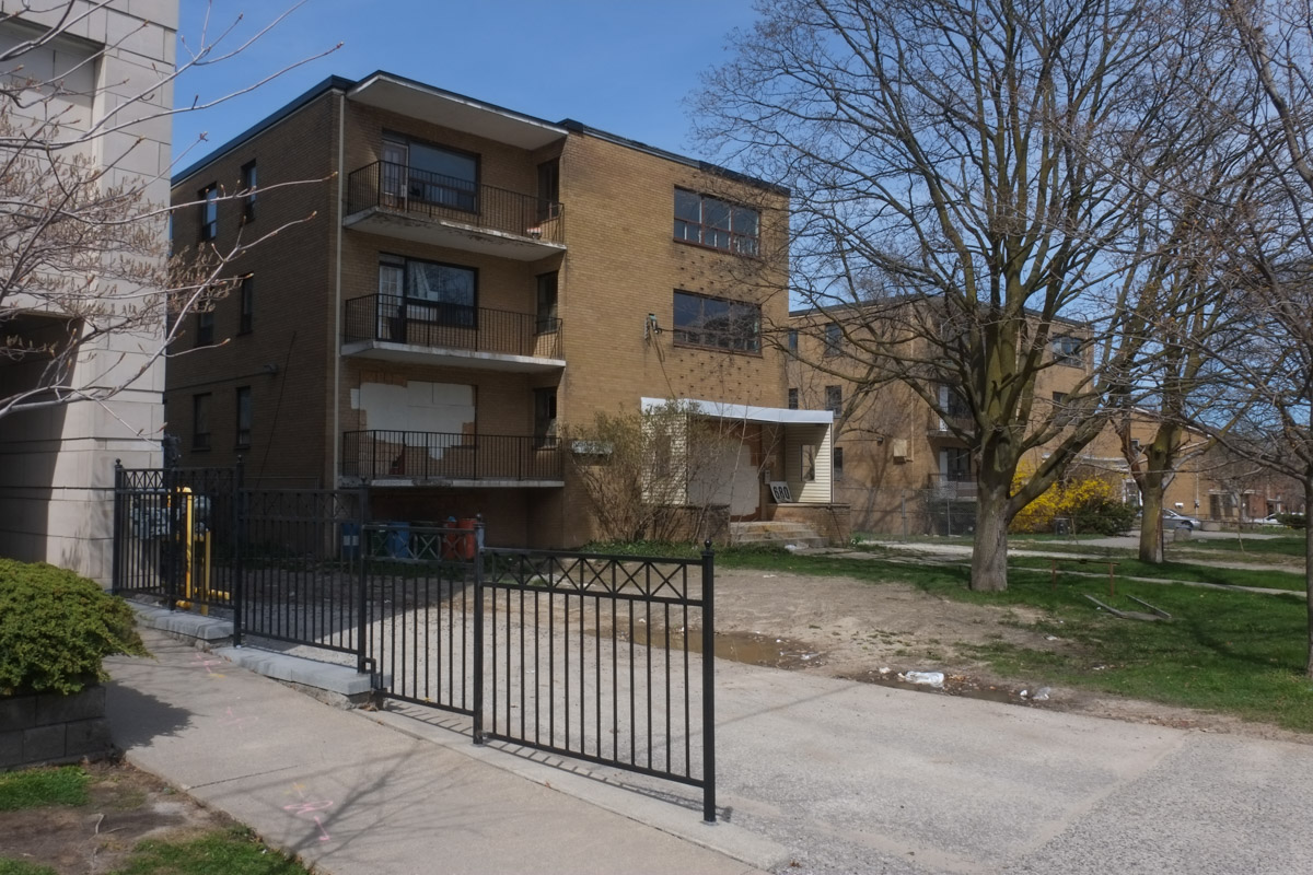
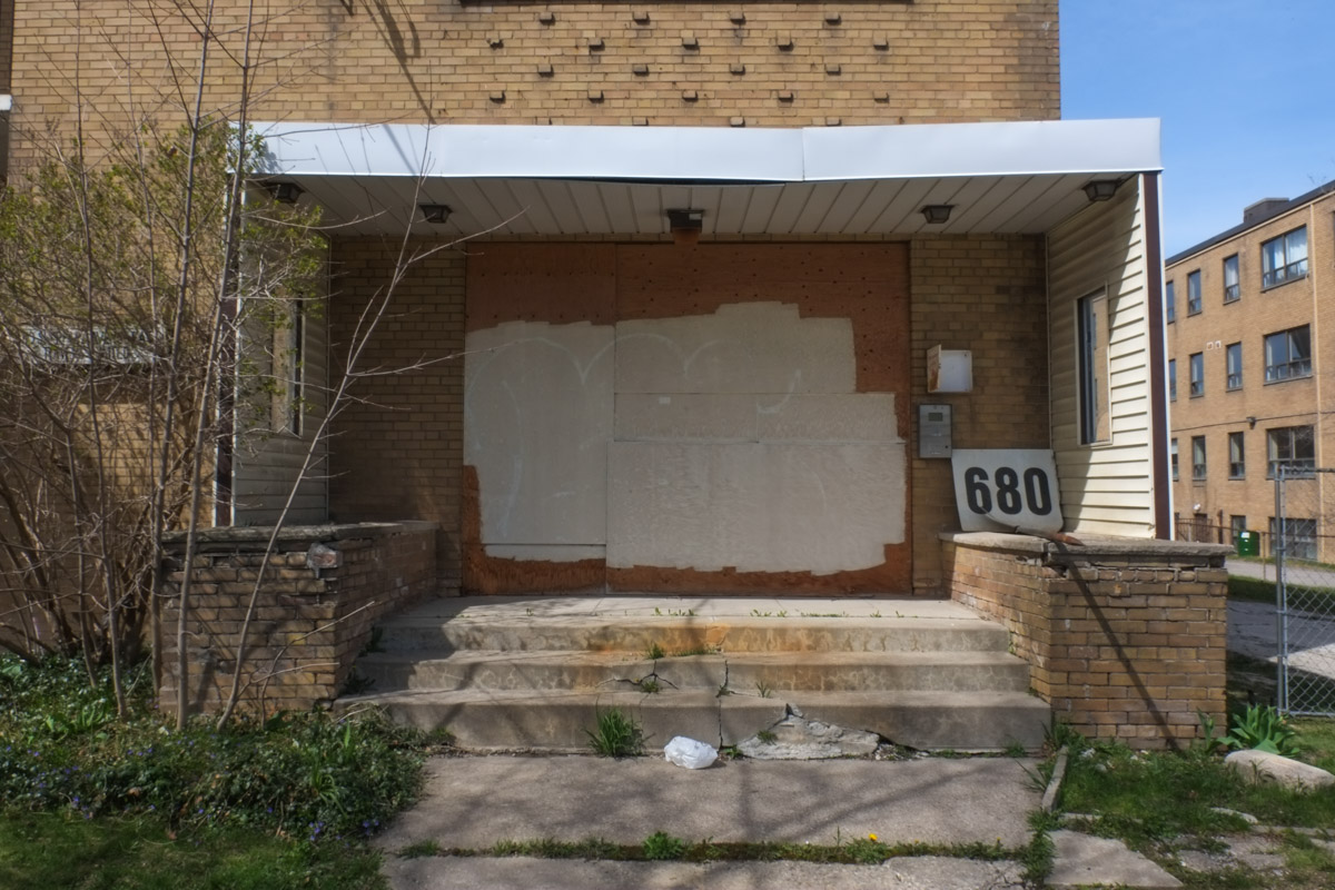
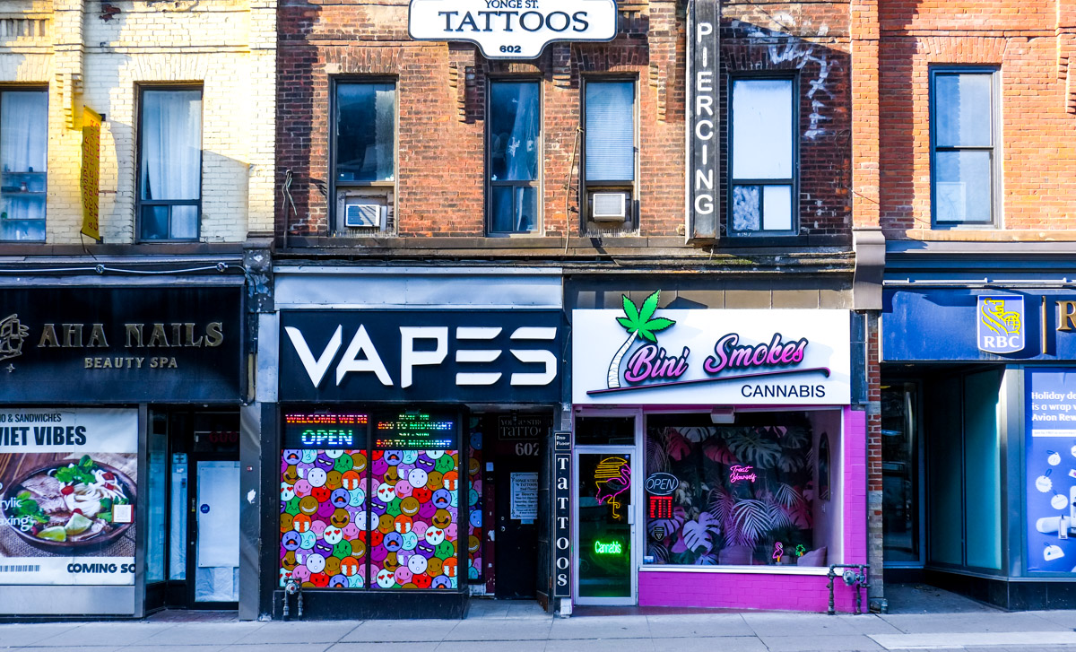
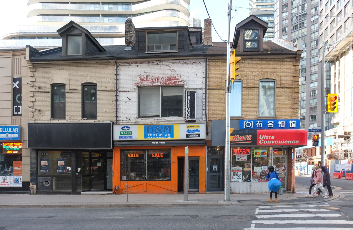
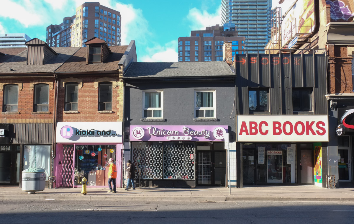
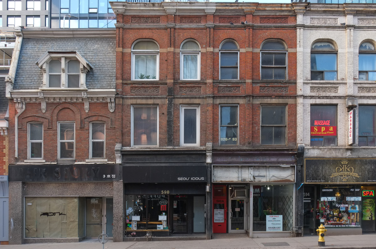
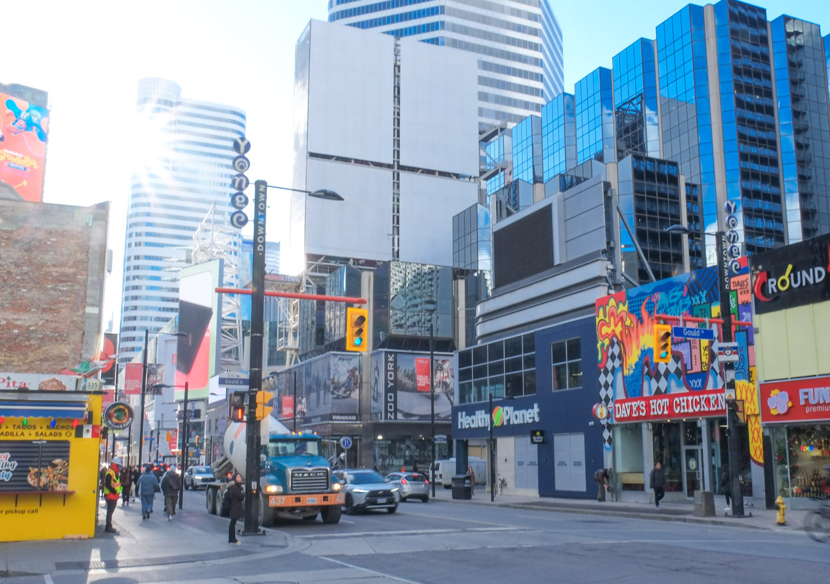
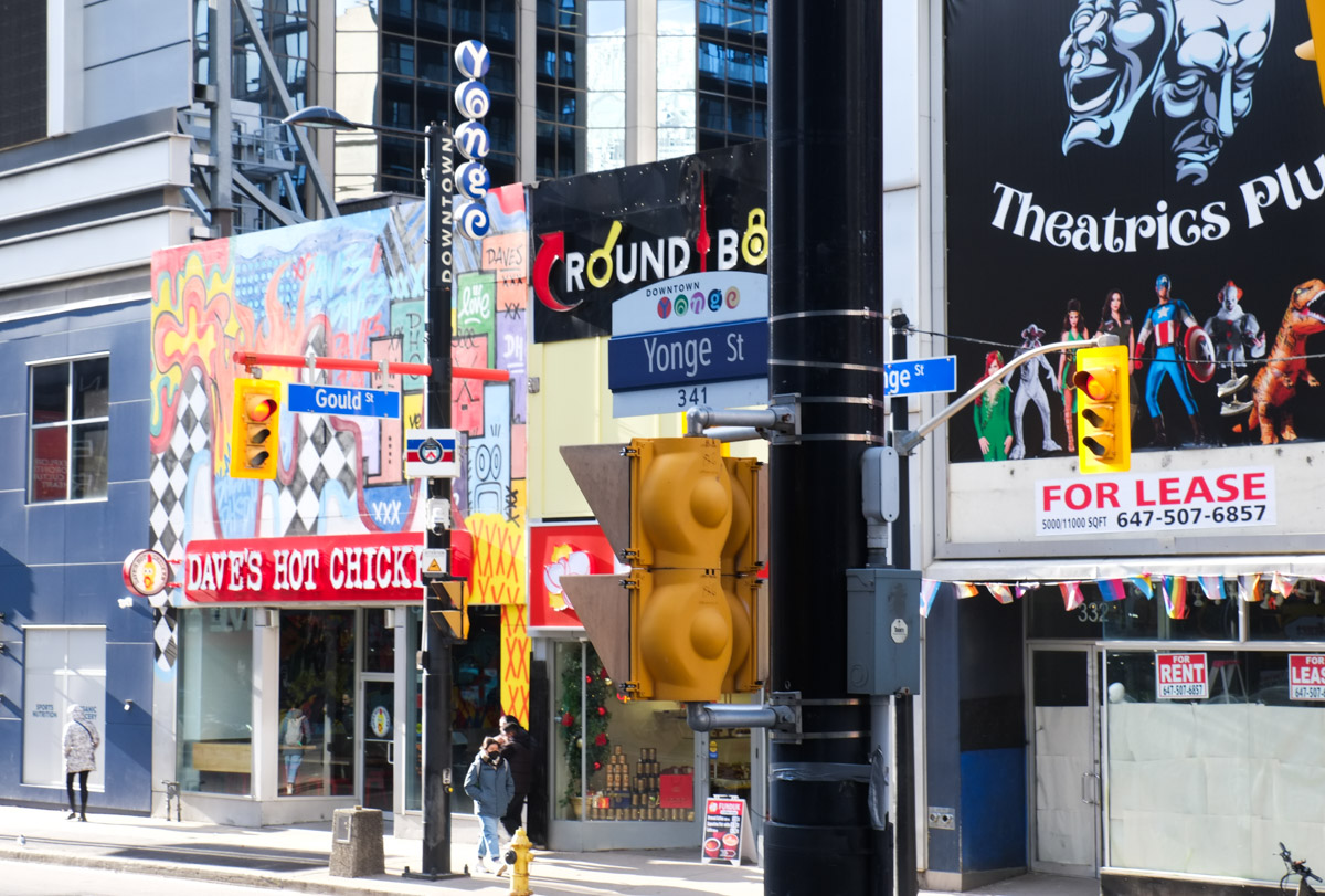
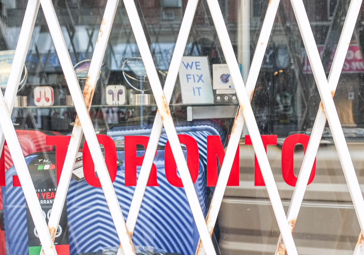
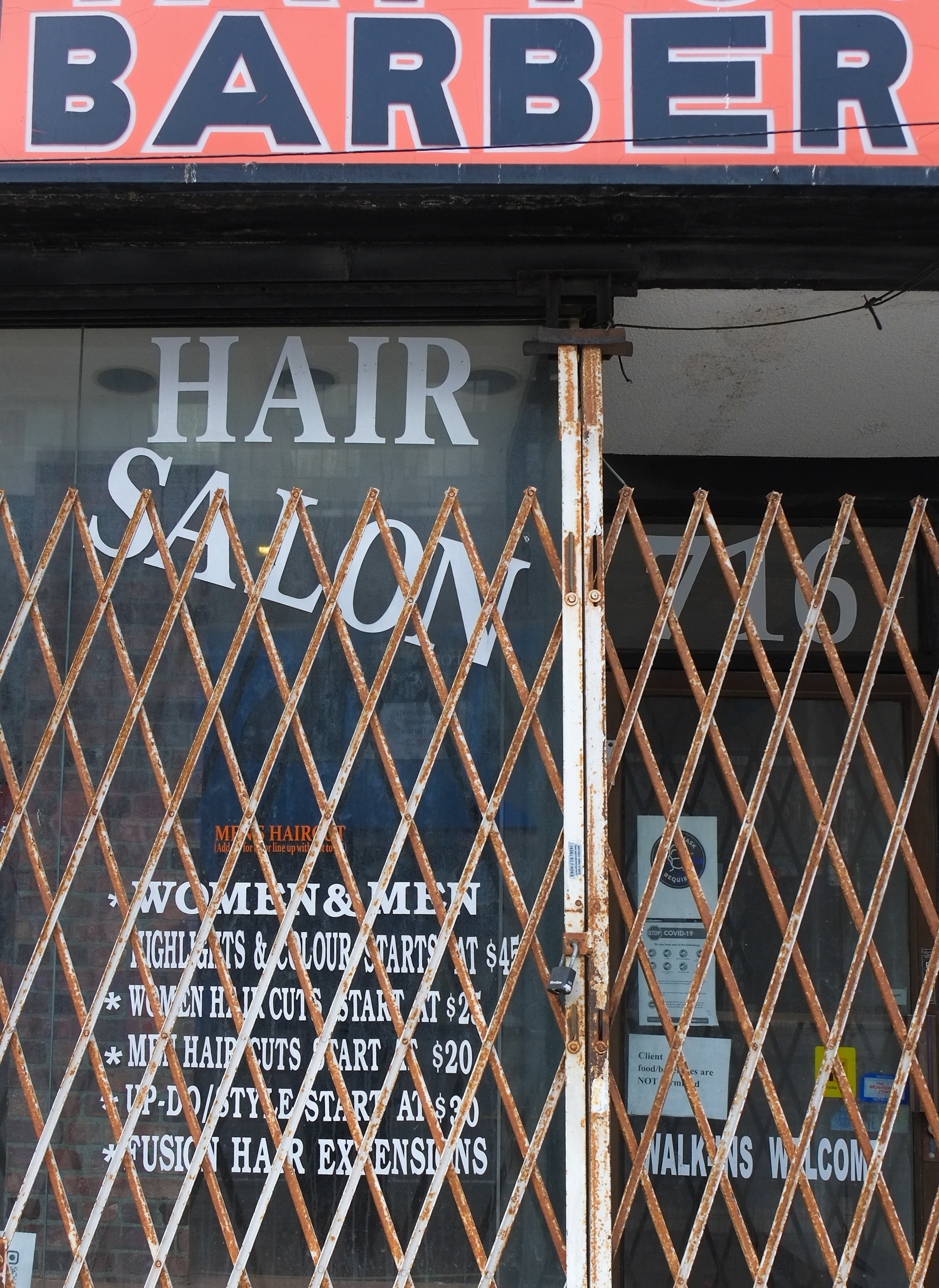
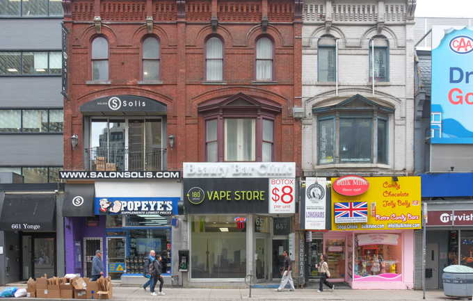
below: There are stretches of Yonge Street where there are many closed storefronts.  This usually indicates that a developer is sitting on a chunk of properties and is in the process of accumulating more… or is waiting for approval to redevelop what he already has.  Nothing moves quickly.  It’s just sad to see the emptiness and decay in the meantime.

The Diners Corner, closed Jamaican restaurant, window

doorway of hair salon, now closed, with metal gate covering the entrance

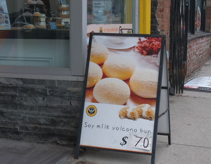
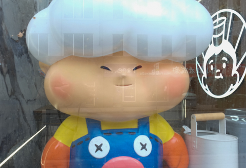
below: Filed under “learn something new everyday” is the fact that there is such a thing as soy milk volcano buns.  I assume that they are $7 each and not $70!

sign advertising soy milk volcano buns for sale, bakery, small shop, on Yonge Street

stores on Yonge Street, three storey red brick building with Popeyes and a vape shop, beside painted brick building with British candy store, jelly belly candies

in the window of a chinese bakery, lettle dumpling boy

a red mailbox on the side of a building, with graffiti, girls face, on it, yonge street scene behind

cyclist on Yonge street, through intersection, while pedestrians wait on the other side of the street for a green light

yonge street scene, blue trash bin overflowing, people walking on the sidewalk

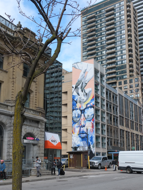
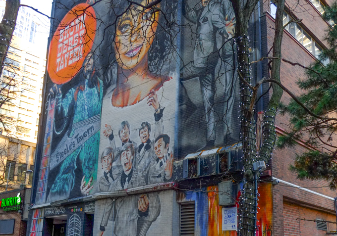
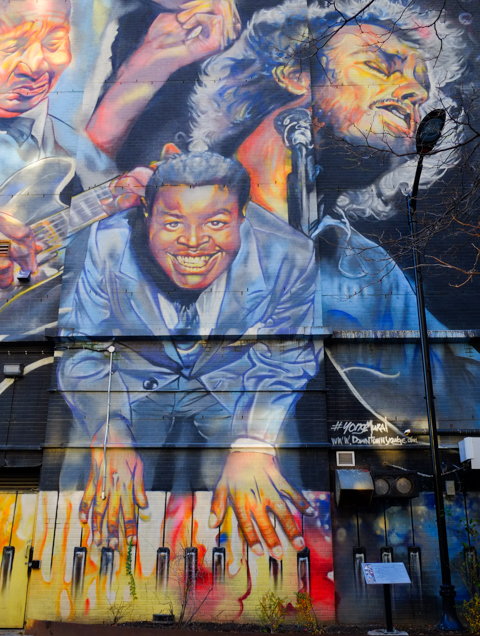
below: Charles Street East (just east of Yonge).   The large mural on the side of the apartment building is “Toronto & Stadt Frankfurt Am Main” and it was painted by Justus Becker (aka COR).   The reflection within the glasses depicts the skylines of both Toronto and Frankfurt and represents the sister city relationship between the two cities.  See that orange and white awning?  That’s a gelato place – a fabulous gelato place!… and that is where I ended my walk, almost a circle back to Yonge & Bloor.

Charles St, just east of Yonge, large mural


Liberty Village is the neighbourhood that is south of King Street, west of Strachan, and east of Dufferin. It’s southern boundary is a combination of the Gardiner Expressway and the railway tracks (CN, VIA, and GO)

a man holds a cup of coffee as he walks past a road sign with bump symbol, and a utility pole wrapped in red and white liberty village design

below: A temporary park has taken over a corner of the parking lot on Hanna.

artificial grass covering ground in new temporary park in Liberty Village, the word liberty in black on the green grass

below: The sign says Ontario Place straight ahead.

below: Dream Big

large pink mural with black letters that spell dream big

below: Allan Lamport stadium concrete

exterior side walls of Allan Lamport stadium, , concrete, peaks in roof make triangle shadows

below: Looking north from the goalposts in the stadium.

view across the field of Allan Lamport stadium, looking north to wall of condo towers

interior, seating, rows of concrete, sections 22 and 24 of Allan Lamport stadium,

triangular roofline of allan lamport stadium

lights reflected in glass windows, stadium lights on blue sky 

below: Once it was a carpet factory –  The Toronto Carpet Factory was spread over 8 brick buildings on a 4 acre site. It was built between 1899 and 1920.  The company was established by F. Barry Hayes in 1891 and was originally at Jarvis and Esplanade.  At the end of WW1, 1250 people were employed here.  The factory remained in production until 1979, although the number of carpets that were made annually was greatly reduced by the end.

part of old carpet factory, a brick building

part of old carpet factory, exterior,

part of old carpet factory, exterior

part of old carpet factory, exterior

below: Streetcars waiting at Dufferin Loop, Dufferin south of King.

TTC streetcars waiting at Dufferin loop at the bottom of Dufferin street

below: View from the bridge at the south end of Dufferin looking west along the Gardiner Expressway towards Etobicoke and Mississauga.

looking west from bridge over Gardiner Expressway towards Etobicoke and Mississauga

below: Eastern view

bridge over the Gardiner at northwest corner of CNE Grounds

a woman dressed in black walks a small white dog over a metal bridge

below: The arch marks the Dufferin Gate, the west entrance to the Exhibition Grounds.

two men walking across bridge by dufferin gate at the exhibition grounds

Part way between Dufferin and Strachan is Exhibition GO station.  The station has been designed to provide access from both sides of the tracks which in turn offers another walking route south from Liberty Village.    The area north of the tracks is a bit of a mess as the new Ontario Line will terminate at Exhibition and the completion of that project is still a few years away.

below: The pedestrian tunnel under the tracks.

interior, people walking through tunnel, lights, unfocused, fuzzy image

double decker green and white GO train at Exhibition station, wtih workman in orange work uniform waiting to get on train.

below:  Looking north under the Gardiner – Liberty Village provides that background in this image.

construction near railway tracks south of Liberty Village, near Exhibition station, under the Gardiner Expressway

workmen with digger excavator on construction site for ontario line subway

below: More Ontario Line construction as seen from Platform 4 at Exhibition station

ontario line construction site just north of Exhibition station, in liberty village

below: South end of BMO Field, looking east towards downtown and the CN Tower.

on Exhibition grounds, south end of BMO field, looking east towards CN Tower and downtown Toronto

below: BMO Field is home to both the Toronto Argonauts (CFL, football) and the Toronto FC (MLS – Major League Soccer). It has just undergone upgrades (think $$$) to make it ready to host some of the FIFA World Cup soccer/football games in mid 2026.

food building in background, as is CN Tower, entrance to construction site for renovations of BMO Field soccer
red seats that have been removed from BMO stadium, or are awaiting being added. stored outside

below: Some of the lights seen at the Exhibition – with the CN Tower in the distance.

lights and lamp posts at CNE, Exhibition, with CN Tower in the distance

below: rooftops

below:  One of the latest public art addition to the Exhibition Grounds is “Mino Bimaadiziwin”, an Anishinaabemowin phrase that translates to “Good Life”. The mural was developed in partnership with the Mississaugas of the Credit First Nation 50-meter-long artwork honors Indigenous history and culture and was unveiled in October 2024.
The installation is part of a plan to separate Exhibition Place from the Gardiner Expressway.


blue metal sculpture, behind 3 large trees, people walking past in silhouette

art installation at exhibition graounds,

below:  The McGillivray Fountain was designed by Canadian sculptor Gerald Gladstone and donated to Exhibition Place in 1968 by Gordon B. McGillivray in honor of his father, John A. McGillivray.

two women walking past fountain at the CNE

below: The Scadding cabin was originally built in 1794 by John Scadding on land that he owned east of the Don River.  He owned more than 200 acres and his property stretched from Lake Ontario to what is now the Danforth.  The next owner of the property used the cabin as an out-building.  In 1879 it was donated to the York Pioneer and Historical Society who arranged to have it moved close to its present site to celebrate the opening of the Industrial Exhibition (now the CNE).

below: The title printed on this image is “Log Cabins of the York Pioneers,Exhibition Grounds Toronto 1880.  Lithographed and printed at the Exhibition Building, Rolph, Smith & Co. Toronto”.  The cabin on the left is labelled Simcoe 1794 (i.e. the Scadding cabin) and the other is labelled York Pioneers, Lorne 1879.

old black and white photo of a drawing of two cabins, at an exhibition, in 1880

below: Shrine Peace Memorial

angel sculpture at shrine peace memorial

shrine peace memorial on exhibition grounds

below: There is a collection of twenty small sculptures representing Gods, heroes, and monsters of Greek mythology  in what is called the Garden of the Greek Gods.  They were created by Elford Bradley Cox (1914-2003) in the 1960s.

one of the greek gods sculptures at exhibition grounds

below: Hercules is the tallest of the sculptures.

one of the greek gods sculptures at exhibition grounds, back of naked man, with windmill in the background
one of the greek gods sculptures at exhibition grounds, bunch of grapes

Immediately south of the Exhibition Grounds is/was Ontario Place.  This pile of rubble is all that remains of what was on West Island – mostly the decaying amusement/theme park that hasn’t been in operation for years (death by neglect).

pile of rubble, remnants of demolition, on west island, part of Ontario Place, on Lake Ontario, as seen from the Exhibition Grounds

west island of ontario place after having been cleared of everything

below: The round Cinesphere is still there but everything west of it is gone.  Once it was the pride of Ontario – built in response to Montreal’s Expo ’67 – but slowly over the years many of its features have been altered or removed (Children’s Village, the Forum with its free concerts, and more).   Having said that, other sections have been renovated – Trillium Park on the east end for example.  I didn’t get that far on this walk but you can some of it in Ontario Place 2.0 from 2017.

what remains of ontario place

ontario place under renovation, exterior stair with workmen on it ontario place under renovation, digger working behind hoardings

graffiti on a metal railing near Lake Ontario

graffiti on a metal railing near Lake Ontario

two men stand beside street art painting at south liberty trail

…. another visit to Yonge and Eglinton

people crossing Eglinton Ave towards entrance to building on southwest corner of Yonge & Eglinton where there are images of people painted on the window

Of course, this is also the location of the Eglinton station on the mysterious Eglinton LRT.  The underground walkways between it and the Yonge – University subway line are complete, as is the entrance on the south side of Eglinton.   The latter is a large building and it will definitely help with the flow of traffic… but it sits idle.

northern new entrance to Eglinton station on LRT line, behind fence, no public access

new entrance to Eglinton station on LRT line, behind fence, no public access, on west side, with old Canada Square development behind

below: All of the old Eglinton station bus bays are long gone.

new Eglinton station Metrolinx entrance for LRT and subway, still closed to the public, with older Canada Square buildings around it

below: Canada Square, home to Canadian Tire head office for more than 50 years, was built in the 1960s and 70s.  It consists of two towers connected by a lower section – it is this middle connecting piece that has the vertical concrete slabs on the exterior. These verticals are on both the Yonge Street side (below) and this motif is repeated on the back of the building (see photo above, behind the new station entrance).   Earlier this year, Canadian Tire announced that they had renewed their lease for another 20 years and that the building was going to be redeveloped/upgraded/modernized in the near future.

a man walks down Yonge St., past vertical concrete slabs on canada square building, light and shadows

below: Northwest corner of Yonge and Eglinton

reflections in the glass on the northwest corner of yonge and Eglinton with Cineplex theatre, Winners store, Pickle barrel restaurant, and Rexall drug store, 2200 Yonge Street

people walking on the west side of Yonge, north of Eglinton

below: The Duke of York pub at Yonge and Roehampton

corner of Roehampton and Yonge, Duke of Kent pub on the corner, along with Chloes Nails, the Stag Shop

below: The old Postal Station K has been incorporated into a new condo development. The older building dates from 1936; it was built on the site of Montgomery’s Tavern (made famous in 1837 when it was the epicenter of William Lyon MacKenzie’s rebellion). It was a big square building but with Art Deco elements around the entrance. Because it was built in 1936, it actually featured (and still does) the Royal Insignia of King Edward VIII whose reign was very short-lived because he abdicated the throne only 11 months after being crowned.

old post office on Yonge street, is now the bottom part of a new condo development

below: North of Montgomery/Broadway more development.  More cranes.

looking north on Yonge street towards Montgomery, old brick and stone building on the corner, many cranes in the background

below:  About 15 years ago, North Toronto Collegiate  (NTCI) was rebuilt on Broadway.  The new school was incorporated into a condo development.  At the north entrance to the school is an artwork by Catherine Widgery’s called “Mindshadows”. It is a 20 foot high stainless steel cube on legs that is covered with numbers, letters, and words. Serene, provoke, laugh, loud, big, spirit, and up are some of the words.

entrance to North Toronto collegiate institute, with public art in front.

below:  View from Broadway of the North Toronto football field and track and some of the condos that surround it.

football field and track, par tof North Toronto Collegiate, surrounded by tall condos and apartment buildings

view west from football field and track, partof North Toronto Collegiate, many tall condos

below: Looking north from Roehampton

looking south from Broadway, football field and track, part of North Toronto Collegiate

below: At the south entrance to NTCI (on Roehampton) is another public art installation.  “What’s your name?” by Ilan Sandler (2011) contains the first names of all the NTCI students since the school opened in 1912.  Each name only appears once – but there are still 2053 different names such as Sven, Connie, Marlee, Janis, Lola, Ephraim, Bryan, and Snezana.

Part of What's your name, an art installation by Ilan Sandler, a list of over 2000 names, in concrete,

The neighbourhood that is north of Eglinton and east of Yonge has been the home of many apartment buildings for at least a few decades.  A growing number of them have been replaced by taller glass and steel condo developments, especially since the city has targeted the area for “… tall buildings and an intense concentration of office, retail, institutional and residential uses…” (quote comes from Yonge Eglinton Secondary Plan, 2018)

exterior staircase beside a building, narrow space between two older brick apartment buildings

older lowrise apartment building

below: Old style (1920s?) 4 storey walk-up apartments.  There was a time when this type of architecture was common and these apartment buildings are (were) scattered around the city.  There aren’t as many as there used to be although some, like this one, has been renovated and kept in good shape…. a testament to their good design.

4 storey brick apartment building

below: Concrete building from the 1970s at 2323 Yonge …

reflections in the windows of a 1970s concrete building, vertical windows with deeply recessed windows

below:  …   but it too has a blue and white development notice on the side of this building.  Fifty eight stories with 40 car parking spots but room for 350 bikes.

blue and white city of toronto development notice sign on yonge street

below: St. Monicas church, an A-frame structure built in 1959, is set well back from the street with a parking lot in front.

st monicas church, A frame building from 1959, and parish hall, with large parking lot in front

below: One of the many stained glass windows inside St. Monica’s church.  This image shows a window that features gold crossed keys which are a symbol associated with St. Peter.  These are the keys to the Gates of Heaven.  The church website describes this window as representing the (Catholic) Sacrament of Reconciliation (the pardoning of confessed sins).

stained glass window in St. Monicas church


below: Redesigned.   From the KPMB website, this is rendering of the proposed new St. Monica’s church.  It has been brought forward closer to the street which also allows for a new condo tower behind.  That’s the plan.

rendering of new redeveloped St. Monicas church on Broadway Ave., as proposed by KPMB, image taken from their website

below: Beside the church is St. Monica’s school.  The original brick building was built in 1916.  A few additions have been added over the years.

st Monicas school, brick building built 1917, with yellow brick addition from the 1960s

reflections of new glass and steel condos in the back window of a small white van or truck

red and black machine parked by hole at construction site

sidewalk closed in front of Akoya, new condo on Broadway, as they finish work on the front entrance and landscaping of the building

narrow walkway with wooden rail, above a large hole in the ground at a construction site

density of residences, highrise condos and apartments around Yonge and Eglinton, glass and steel towers, new developments

density of residences, highrise condos and apartments around Yonge and Eglinton, glass and steel towers, new developments

density of residences, highrise condos and apartments around Yonge and Eglinton, glass and steel towers, new developments

crane used in construction of new tall glass and steel condos, in front of other new high rise buildings near Yonge and Eglinton

below: Changes are also happening to the west of Yonge Street. For instance, this building on Eglinton between Duplex and Henning is coming down.

development notice signs beside a demolition site, partially demolished building, on henning ave,

multi level building in the process of being demolished, exterior walls all gone.

below: Old, new, and in between

Henning Ave., older single family homes with construction of new condos started beside them, crane,

below: Remnants of what used to be.

2 old sets of stairs, side by side, once lead to houses, houses now demolished, stairs now behind construction fence, diggers and other equipment in the background

demolition, debris hanging from ceiling

demolition site

yellow digger, at construction site where a building is being demolished, revealing older interior walls painted in bright colours

below: As I am sure you are aware, I have blogged about Eglinton Avenue before.  Back in 2015 (ten years ago!!) I posted this photo of Eglinton and Duplex.  Both glass buildings are now gone.  The Toronto Hydro Systems building (the short brick one) at the northwest corner of Duplex and Eglinton remains – it is the one with the coloured patches on the wall in the photo above.

looking east along Eglinton Avenue towards Yonge street with Duplex Ave in the foreground. The old Toronto Hydro-Electric building is in the picture, with a newer structure with a glass front beside it. New buildings between Duplex and Yonge on the north side of Eglinton are also in the picture.

below: Same corner, slightly different angle, taken this past week.

looking west along the north side of Eglinton, toronto hydro electric systems brick building on the corner, demolition of other buildings beside it

below: After the glass clad building on the northeast corner of Duplex and Eglinton came down, the backside of the Yonge Eglinton Center was exposed (on the right) as well as another tower (in an area that needs to be explored more!).

concrete tower


young woman with a pink ponytail, pink top, and pink backpack, walks a dog on a leash, crossing street on Yonge, dog is small and white with pink tail and pink ears.

sign that says slow, upside down and leaning against a fence, construction site in the background

below: With thanks to my mother who walked with me that day.

older woman standing in front a fence with two development notice signs

a woman holding a cup of coffee walks on sidewalk, along Eglinton, while a man sits of the steps of a building

defaced TTC bus stops sign on Eglinton, for routes 13, 32, and 61

yellowish vertical cladding, interior wilson subway station, with blue sign with arrow pointing to the left for northbound trains

Wilson subway station, on the University side of  Line 1, opened in 1978 and was the end of the line until Downsview station just to the north opened in 1996.  It is not a thing of beauty.  Concrete.   Austere from the outside.  It’s entrance from under the Allen Expressway is dark, gloomy, and depressing.

below: Northwest entrance to the station, nestled up against the Allen Expressway.

northwest entrance to wilson subway station, right next to the allen expressway

below: Walkway to southwest entrance

southwest entrance to wilson station, sidewalk through grassy area to entrance

That stretch of the subway runs down the median of the Allen Expressway.


below: Although the platform has a roof, it is open at the ends and in the winter it is cold.  There are a few of these pod-like waiting areas, circular glass structures with benches for those wanting a tiny reprieve from the wind.

on the platform of wilson subway station, circular pod-like structures made of glass, with benches, waiting areas

below: Inside the station a concrete wall sculpture by Ted Bieler entitled ‘Canyons’

very textural wall sculpture by artist ted bieler, called canyons, inside wilson subway station

two orange cones beside a phone booth against a concrete wall, interior, wilson subway station

What drew me here in the first place ….  To help brighten up the area, some of the concrete, both inside and out, has been covered with murals by Shalak Attack, Bruno Smoky, and Clandestinos,

below: An owl and a woman’s face at the two south entrances.

owl face, mural, around an entrance to Wilson subway station

clandestinos, or shalak attack, mural of a woman's face with butterflies and flowers, surrounding one of the double doors, entrance to wilson subway station

below: There is a lot of street art along Wilson Avenue but most of it is under the Allen Expressway and is not well lit. Some of it is also looking very dirty.

pillars painted with red and blue designs, under the allen expressway and beside wilson subway station

concrete pillar with street art, large brown fingers, people walking towards subway entrance

below: Pink flowers inside the station

part of a mural, inside wilson station, of bright pink flower


below: Circular “Kiss ‘n Ride” still exists.

round flat building, wilson kiss and ride, where cars can dropoff and pick up passengers

below: Exit at Wilson Heights

silhouette of man walking down hallway at wilson station, light coming through the door at the end of the passage, exit to wilson heights side of the station

below: Northeast side of the station, along with the Allen Expressway

northeast side of wilson subway station

I took most of these pictures back in the summer but I hadn’t taken the time to blog about what I had seen.  When I drove past Wilson again recently, I noticed that the parking lot on the east side (towards Wilson Heights) is now fenced off.  Now it is a snow covered vacant lot.

below: Parking lot before

bike parked outside wilson subway station

below: … and after. You can still park your bikes here, but no more cars.

vacant lot, snow covered, on the east side of wilson subway station

below: There is a City of Toronto development notice sign on the side of Wilson station.  It looks like the city may be serious about affordable housing at this site.  Apparently this has been in the works for a number of years but faced some opposition form those who wanted to keep the parking lot.   Just shy of 1500 units in six buildings are planned on the site along with community space and a public park.  The percent allotted to affordable housing varies from 35 to 48 percent, depending on the source of the information.

To the west of the station, on the north side of Wilson, is the remains of the Downsview Airport lands.

sign on chainlink fence around downsview airport that says airfield, 24 hour surveillance. it is covered with graffiti stickers,

looking through chainlink fence at old airport property, unused road with deteriorating pavement, buildings in the very distance, lots of grass and sky

below: One of the four winners of the ‘XOXO Downsview, Talking Fences’ competition of 2023, is “Aandi wenjibaayan?” which translates to “Where are you from?”  It was suggested by Lakhvir Sandhar.  The other three winners have their words displayed elsewhere on the Downsview property.

vintage photo taken from low flying airplane of bishop-barker airplane limited,

Photo credit: Toronto Public Library online digital image archive

The south side of Wilson is retail and is now Wilson Village.   It is also where you will find Billy Bishop Way named for Canadian pilot.  It is nowhere near Billy Bishop Airport (that’s WAAAAY south, on the island, or the other one in Owen Sound) but is a nod to Downsview’s history as an airfield and its role in airplane manufacturing.

William Avery Bishop was born in Owen Sound in 1894.  He was a Canadian flying ace during WW1.

toronto street sign for billy bishop way in wilson village, on wilson ave

side of home depot store, parking lot, wilson avenue

below: Looking southeast past the old metal fence that surrounds the parking on the northwest side of Wilson station.  Big box retail on the other side of Wilson, and newer midrise to highrise residential development on the other side of the Allen.

standing in parking lot on west side of wilson station, looking southeast towards allen expressway, retail big box stores on west of allen, new residential highrise on the east side

Very close to the planned “affordable housing” but on the south side of Wilson, there is already a new community being built.


There are many older single family homes to the east, in a quiet neighbourhood squeezed in between Wilson and the 401.

I even discovered an old moose hiding in the bushes!  The “Moose in the City” project goes way back to 2000 when 326 life-sized moose sculptures found homes around the city.  Each one was decorated by a local artist.   I am not sure how many still exist but it can’t be more than a fraction of the original.

Other moose: Scarborough moose near Kennedy and 401, moose at St. Clair and Bayview. Any others?

To the east, Wilson is becoming a canyon of midrise buildings, replacing the older residences, often fourplexes and sixplexes.

The development is more intensive as you get closer to the Allen and the subway line…

… on both the north and south side of Wilson

tiles, interior walls of wilson subway station, design of vertical and horizontal lines in pale yellow on rust coloured background

and other little observations along Dundas Street East – a street that has seen intensive redevelopment in the central core.  These changes are slowly moving east with the consequent mixing of old and new.

Once there were large red hearts on the sign, as well as on the building, but they have disappeared.

sign on True Love Cafe, a bright purple building

The True Love Cafe opened at the corner of Dundas East & Sherbourne back in 2004.  The outside was purple and apparently so was the inside.  Before that (since the 1950s), the space was George’s Spaghetti and Jazz Bar.

Once there were messages like, “I love you” on the walls as well as menu items written inside heart shapes, but these too are no more.

gate across entrance to true love cafe, red door, purple building, painted over window,

man on a bike cycles past true love cafe, a purple building with red awning over door

attached to side of purple building, empty frames that once held signs.

graffiti on a pole with two people with arms upraised, lone has written love, love, love, on it in black marker

below: South side of Dundas at Sherbourne.

church on southeast corner of dundas and Sherbourne, Lahore Hakka Chinese restaurant on the south west corner of same intersection

below: Also at Dundas and Sherbourne are the most famous telephone boxes in the city – or at least most photographed

exterior of front of hair salon with pictures of men and women with their hair cut

West of Sherbourne, some of the original large old brick houses still stand. Some converted to commercial uses long ago; some are still residences.

upper level of bay and gable house on Dundas East

front of old convenience store, bars over windows and gate across entrance, faded coca cola sign, green trim, magenta painted bricks,

jumble of items in a store window, metal bars over window, red coca cola boxes, potted plants, reflections of buildings across the street,

old brick houses on Dundas East

old yellow brick house behind a metal fence, green frontyard

part of lower floor of old brick building painted white

part of older white brick house, two storeys, each with one window, small part of house that juts out and is near back of yard

below: (Dundas and Pembroke) Another blue and white development notice – with another very tall condo.  Yet again, all these residences but only 6 car parking spots compared to parking for bikes; Doug Ford screams about closing bike lanes while the city actively discourages car parking.  Great for the developer as car parking costs more money to build than bike spaces.  The sign says 49 storeys, the latest Toronto paperwork on the site says 55 storeys).  The facades of the 4 heritage houses that the condo replaces will be saved.

blue and white city of toronto development notice sign on front yard of a house on dundas east

below: Nearby, another closed restaurant.

looking through window into empty and permanently closed restaurant. some reflections of buildings across the street in the window as well

below: North side of Dundas, just east of George Street.   It’s looked shabby for years but it’s still in one piece.  George’s Pizza, George’s BBQ, and  Piassa Injera and Takeout (Ethiopian).  The sign in the window of the pizza restaurant says “open” but the whole building is for sale.   No price given on the realtors’ website, but its 6000 SF with 3 retail units and 10 residential apartments.  It’s probably a candidate for demolition?

old brick houses on Dundas converted to businesses awhile back, George's Pizza, George's BBQ

below: Looking westward at Dundas and George

looking westward along dundas at george, new condos, one old second empire brick building on the southwest corner, now a King Place BBQ and curry restaurant

below:  King Place BBQ and Curry stands its ground

King Place BBQ and Curry restaurant, painted orange, in an old second empire brick building at Dundas and Dalhousie,

below: The Filmore Hotel still stands at George and Dundas East

filmore hotel at the corner of george and dundas east

dundas street looking east towards george street, old filmore hotel can just be seen behind newer condo development

below: Looking east along Dundas

dundas street east, looking eastward towards george street, new condos on both side of dundas, window reflections on the right hand side

below: Southeast corner of Dundas and Mutual

southeast corner of dundas and mutual

cyclists at the corner of dundas and mutual

below: Dundas and Mutual, northeast corner

two men talking, at the corner of Dundas and Mutual where old building is now behind scaffolding

upper storeys of older building, second empire style, mansour roof, brick, painted yellow, ground floor has addition for a store front, now cannabis store

below: Old City of Toronto Archives photo from 1978 showing the northeast corner of Dundas and Mutual back when the building was pale bluish grey and not yellow; it was home to Denys Barbecue and not a cannabis store.  The Warwick Hotel (built 1910) is long gone.

City Archives 1978 colour photo of northeast corner of Dundas and Mutual, Warwick Hotel,

below: Where the Warwick Hotel once stood is now part vacant lot and part parking lot. This concrete building (partially seen in the photo above too) was built for Sears Canada, completed in 1971.   It features cantilevered blocks to form an upside down ziggurat.   What is a ziggurat?  It is a building where each subsequent floor is smaller than the one below it with the result being a pyramidal shape.

wrought iron fence in front of a large parking lot which is front of a modernist concrete building in upside down triangle shape

below: Reflections at Dundas and Jarvis

reflections in a large window at dundas and jarvis, showing 222 Jarvis, inverted ziggurat building being renovated,

man walking along dundas at jarvis

below: Dundas and Dalhousie

looking east along dundas from dalhousie street, construction traffic cones, tall buildings,

tall condos, new development, downtown

side of an old red brick smaller building in front of a wall of new condo glass and steel with many reflections in the windows

machinery with giant drill, at a construction site

digger in vacant lot at dundas and mutual, old red brick structure with new condos in the background

old smaller red brick building on dundas, with brick taller building behind

below: Church and Dundas – closing in on Yonge Street and TMU

vacant lot at church and dundas, now a construction site

cyclist rides past construction site at Church and Dundas, looking east, with many new condos rising in the background, yellow construction machinery

new building clad with wood tones and dark blue, with orange bollards outside door

below: Birdo mural on Church Street.

birdo mural

below: A squirrel with a nut (or other edible) on the ramp to one of TMU’s buildings on Church Street.   He’s not waving goodbye, but perhaps he’s thinking “Gotta run!”

black squirrel on concrete ramp entrance to glass fronted building, a bright blue building beside it

As this has turned into the first post of January 2025…  Wishing everyone a healthy and prosperous New Year with many walking and/or photographic opportunities!  Have a good one!

…. from a walk on Kingston Road near Guildwood GO station.

orange ribbon tied to a chainlink fence that is coming apart at the top corner, strands of barbed wire on top, with empty old building and vacant lot behind

below: First sign.  Sign of distress, of times gone by.

old sign for bob johnston chevrolet dealer on kingston road, graffiti on it

Bob Johnston Chevrolet was on Kingston Road until it went out of business in 2007.  The property became a used car lot.  It backs onto the parking lot for the Guildwood GO station

below: A sign with no relevance.  A sign that says “vehicles protected by security systems” but it’s been a long time since anyone parked back there.

fence and locked gate in front of a vacant lot that used to be a parking lot, sign on fence that says vehicles protected, GO train in the background at Guildwood station

below: Other, much newer, signs have appeared on the property. They are a street art installation by Nigel Smith that appeared a few months ago.

Funnily Enough

funnily enough, graffiti street art sign on grey, billboard sized, paired with joking apart, by Nigel Smith

and Joking Apart

joking apart, graffiti street art sign on grey, billboard sized, paired with funninly enough, by Nigel Smith

And last, a sign that tells another story – a Development Notice sign that dates from 2021.  It suggests that 996 residences in 4 towers all with large podiums, will be built.  Some will be rentals. Back in 2008, the original change of zoning from commercial to mixed commercial/residential allowed for buildings up to 8 storeys.  The process limps along as the property changes owner and the height limits are appealed.

graffiti on a development notice sign on fence beside an abandoned and now derelict former car dealership, some large font lettering graffiti on the sign

The process is also slow because of the people and organizations that get a say.  Traffic studies, Urban Forestry opinions, as well as TTC and Metrolinx.  Apparently there is a Line 7, the Eglinton East LRT that will (might?) run here.  It has been proposed, accepted, and…..  don’t hold your breath.  The Eglinton LRT is 14+ years old and still not operational.   If it gets off the ground in its present plan, it will run east from Kennedy (& Eglinton) to Kingston Road, then northeast on Kingston Road to Morningside.  Finally, north to Sheppard (via UTSC) where it will loop back to join the Sheppard line.   On that cheery note, I will leave you with a few images from around the property taken on a snowy December day.

some snow, some weeds growing in the cracks, an old parking lot, with some tall light standards still standing, looking toward Kingston Road

snow covered tire left behind in an old parking lot

a tall light standard with two lights at the top has fallen over and is lying on the ground in some snow, with weeds

cracked pavement and a faded yellow wheelchair symbol in front of a derelict building waiting to be demolished, once was a car dealership

yellow graffiti scribbles on blue painted wall, abandoned building, weeds growing in front,

vines growing on derelict and empty building

peeling blue paint on old garage door, snow in front

chainlink fence with abandoned building behind

entrance to old abandoned car dealership, painted blue, over sign that said night deposit box

chainlink fence with strands of barbed wire on top, with empty old building and snowy covered vacant lot behind

large concrete barriers to block entrance to a parking lot

old light standards stand tall in a weedy snowy empty parking lot

…. A short distance but with a lot happening.

An early morning walk with a weak winter sun low in the sky.  Tall buildings that cast shadows, or reflect light.  Patterns of light and shadow.

below: Crossing Yonge from Carlton to College

people crossing intersection of college and yonge, walking westward, towards TTC streetcar that is heading east, in front of College Park, with old red brick building on the north side of college street

below: North on Yonge.  The facade above Shoppers remains.  “….has design value and technological merit as a representative of the 1950s Toronto School of ‘Picturesque Modernism’ in its expressive use of concrete seen in the cantilevered canopy and decorative piercings of the concrete screen for the above-ground parking, in the ‘egg-crate’ elevations designed to reduce solar gain, and in the predominant white aesthetic of glazed white brick and concrete surfaces.” (form City of Toronto report on heritage inclusion)

below: Rising above Yonge and College

tall new condo tower above older red brick building on northwest corner of Yonge and college

below: Looking north, up the canyon that Yonge has become.  The very tall building that is obviously under construction in the distance is at Yonge and Bloor.

looking north on Yonge, from College, towards two very tall condo developments at Yonge and Bloor, shadows because of buildings, blue sky, not much traffic

below:  Empty, boarded up and waiting its turn. Southeast corner of College & Yonge.  I have vague memories of a candy store on this corner although I think that there were a number of businesses that passed through here.

brick building with rounded edge at front, now empty, southeast corner of Yonge and College, construction at street level in front of building

below: The east half of Yonge street in front of College Park is now a construction zone.  An additional entrance on the east side of Yonge along with more elevator service between street and track levels, is being built for College subway station.  Are there any streets in the downtown area that don’t have partial closures for construction?

small construction site on yonge street, taking up space on the street, in front of College Park shops

below: Sunspots, reflected light on the side of College Park

construction equipment

below: More emptiness, more waiting.

metal grille gate covering window of a store or restaurant that is now closed, old doordash sign in the window

below: Granby and McGill are two streets that run parallel to College but don’t actually meet Yonge Street, pedestrians only here

person walking through pedestrian zone between yonge street and sheard street at the end of mcgill

below: Looking back at Yonge Street from the same spot.  When the area was pedestrianized back in the 1980s, the city purchased added the arch.  The arch came from St. Andrews United Church at Bloor and Park Road (not on this site, moved here).  The mural on the wall, right hand side …

old stone arch remains, on yonge street near Sheard and McGill streets

… is The ‘History of Music on Yonge’ mural that covers two large walls on the same building.  This is the south side of that building.   It was painted by Adrian Hayles and features music legends who played in Toronto in the 1950s and 1960s.

History of Music on Yonge mural, south side,

Brown Derby tavern and Steeles tavern part of mural

part of History of Music mural by Adrian Hayles, group of male singers in black shirts, white ties, and black stripe on white suits

On the north side of building, the mural shows Ronnie Hawkins, Glenn Gould, Dianne Brooks, Jackie Shane, Muddy Waters, Shirley Matthews, B.B. King, Gordon Lightfoot, and Oscar Peterson.

history of music on yonge mural by Adrian Hayles, north side, Massey Hall, Gordon Lightfoot, B.B. King, piano player, tall, vertical mural

part of a mural by Adrian Hayles, piano player with multicoloured keyboard

below: Behind Yonge street, between Granby and McGill (Joseph Sheard parkette)

Joseph Sheard park in Toronto, old brick house, with many tall trees, some new condos

new condo towers downtown

below: Looking north up Yonge from Granby

looking north on yonge from granby, just south of college

below: Aura

looking south on yonge by ikea store and fusettes restaurant

below: People on a corner… To the woman in the brown coat – A penny for your thoughts (Does anyone use that expression anymore?)

two women holding bright green coffee cups, talking to each other, man in background crossing the street,

below: The southeast corner of Yonge and Gerrard is still a construction site….

redevelopment of building on southeast corner of yonge and gerrard, old facade being saved

below: …. but now it is on its way up!

redevelopment of building on southeast corner of yonge and gerrard, old facade being saved

below:  On the northeast corner, also Yonge and Gerrard is an older building that is still standing… for now.  An almost obscene 76 storeys with 828 residences.  No car parking; parking for 828 bikes only.   May I recommend the elevator repair business as a career prospect for those who are looking for ideas?  Also, we could have quite the discussion about bikes and bike lanes……

blue and white city of toronto development notice sign


man talking on his phone, walks under covered scaffolding, beside hoardings with painted diagonal stripes in yellow and blue

people walking on sidewalk, approaching covered scaffolding at construction site

looking through scaffolding, to west side of yonge, older 1800s buildings with mansour roofs, H and R block, cotti coffee,

yonge street, motorbike parked outside cotti coffee

below: Looking south on Yonge from Elm

street scene, looking south on yonge from elm, towards yonge dundas square, now called sankofa square

upper levels of buildings on west side of yonge, just north of dundas, includingmcdonalds,

below: The Zanzibar Tavern glows in the morning light

view from Elm street, looking north at Yonge, zanzibar strip club glows in the morning sun, condo redevelopment on the northwest corner of yonge and elm

below: Hoardings around the construction site on the northwest corner of Yonge and Elm

artwork titled Homecomings on the hoardings at construction site, northeast corner of elm and yonge,

below: Orange! Even more construction on Yonge, this time the southwest corner of Yonge and Elm

elm street, south side, looking east, at yonge

below: No more pizzas here.

damaged exterior wall on now abandoned pizza pizza restaurant, orange and yellow ties on point, some missing

below: Looking west on Elm

person walking on sidewalk on elm street, walking west from yonge

below:  A quick stop at the Cong Caphe.  That’s an iced coconut coffee!!

bouquet of flowers on a coffee shop table along with a cinnamon bun and an iced coffee drink


… but finding many other things instead.

This is a follow-up to my last post about the Don Mills trail.  Remember that I mentioned that it came to a dead end just north of Eglinton?  I thought that surely someone somewhere in the city government would have looked into options re connecting the Don Mills trail to a street or another multi-use path.  The dead end is just east of Leslie, so off I went to check it out (and I wasn’t going to walk all the way to a dead end just to turn around again) .

Hey look!  There is a vacant lot at approximately where the trail ends.

cracked pavement with weeds growing up in them, vacant lot,

Did I wander back there?  Sadly not….. I didn’t have any lock cutters with me….  This was once a Sony Music building but it was demolished in 2016.  There was no development notice sign at the site (9 acres).

blue metal fence and gate, locked closed, vacant lot beyond the fence

below: This is the Sony Music (or CBS) building, built in 1959.  They don’t make them like this any more – so spread out and only one storey high.   Land must have been much cheaper back then!

older colour photo of sony music building on leslie street (demolished in 2016)

Photo credit: by Bob Krawczyk, found on ACO Toronto website (Architectural Conservancy Ontario)

When I was researching the Sony Music building online, I came across the Phoenix Centre.  That’s the name of the planned private club being developed at the old Wrigleys site next door to the now vacant lot.  If I had realized that when I was out walking, I would have taken more photos.  As it is, this is the best I’ve got:

southwest corner of old Wrigleys building on Leslie street, now OTT, low rise modern building

This building, built 1962, was included in North York’s Modernist Architecture, first published in 1997. In addition, The former Wrigley property has cultural heritage value as it is historically associated with the 1950s planning and development of Don Mills by E. P. Taylor and Don Mills Developments Ltd. (if interested, more info at ACO website).  The Phoenix Centre plan retains most of the office space architecture but completely remakes the factory space.

  There is also talk of a bridge (pedestrian & bikes?) over the CPR tracks to the Crosstown developments.   Makes sense to connect the Don Mills trail, Crosstown, and Leslie Street!

Part of the reason I didn’t take any photos of the old Wrigley building is that I had chose to walk south the day….  just south is a fire station as well as some condos.

on Leslie street, white building that is a fire station, parkland in beside it. to the south are condos, older red brick buildings plus newer glass and steel condos behind

And there is a well worn path that accesses the back of the properties.

large trees in foreground, dead leaves on the ground, autumn, new condos being built in the background, cranes,

This road doesn’t actually lead to those new condo towers.  The CPR railway tracks are in the way.  Those towers are part of the Crosstown development on the old IBM and Celestica property (access from both Eglinton & Don Mills)

long driveway, access road, with new condos under construction in the background

The road didn’t lead to the end of the Don Mills trail either… but it did lead to the back of a parking garage.  No dogs allowed and no trespassing.  No luck here.

path that runs behind beige concrete building (parking garage) with no trespassing sign)

I got a better view of the neighbourhood though….

highrise apartment buildings and condo towers

Black and white on a grey day.

two chairs, one black and one white, in a vacant lot, grassy, one tree,

As I walked back out the path, I noticed this sign.  I took it to mean the property behind the blue fence, not the property the path is on… probably?

no trespassing sign, metrus private property

It stopped munching and stared at me, trying to decide to sit and watch or to run away….  it scampered away before I could get any closer (I don’t pretend to take good pictures of animals but it looked so cute, all puffed up to stay warm).

a grey squirrel sitting on a fallen tree trunk, dead leaves on the ground, a nut or something edible between its two front paws

A very short walk farther south on Leslie brings us to the Inn on the Park site on the northeast corner of Leslie and Eglinton.

below: Inn on the Park as it once was (about 1969)  I have ‘borrowed’ this photo from another website – Jamie Bradburn’s Tales of Toronto.  Follow the link if you are interested in the story of the hotel – it’s an interesting read.  Did you know that in 1962 North York had a ban on cocktail lounges?

below: The site today. It’s now a Toyota/Lexus dealership and home to a few new condos.

old Inn on the Park site, northeast corner of Leslie and Eglinton, now a Toyota and Lexus dealership, also new condo development, still lots of green space in front

new condos being built at inn on the park site

artwork on exterior wall, solid colour shapes inside squares, 3 D, but mostly flat, shades of orange

But there are more changes coming….. (surprised?)…. more glass and steel towers by the looks of it.  The notice also states that parking is planned for 845 cars and 1860 bikes.  Does Doug Ford approve?

blue and white development notice on the corner of leslie and eglinton, with inn on the park site in background, auberge on the park condo development

sidewalk closed sign and barrier, on eglinton, northside, east of leslie

below: A sad sight, Sunnybrook Park LRT station all ready to go but no trains running. One of the Toronto mysteries, when will the Eglinton LRT open?

looking east at Sunnybrook Park LRT station on the Eglinton LRT line, no trains running yet but station is somplete, yellow barriers across the entrance

Standing by the LRT tracks and looking south. Wilket Creek park and the Thorncliffe trestle railway bridge can be seen.  I crossed the road because I had seen stairs down to the park….

looking south from the end of leslie street, across lanes of Eglinton to WIlket creek park and thorncliffe trestle railway bridge

A big new set of stairs!…. But. Not shown – the locked gate that blocked the entrance.   There is still no entry to Wilket Creek/Sunnybrook Park from this side of Eglinton.

long set of stairs downhill from eglinton to a large parking lot at wilket creek park.

looking south from Eglinton towards thorncliffe trestle bridge, wilket creek park, and ravine system,

It’s getting to be crowded….

cars traveling east on eglinton, approaching leslie, many waiting to turn left, new condo developments behind, crosstown, as well as inn on the park site

below: Crossing Eglinton and looking westward

traffic turning left from eglinton onto leslie, looking west on eglinton

New pedestrian and bike paths that provide access to the park from the north side of Eglinton have been built but they too are locked closed.  It’s very frustrating to see this infrastructure built and then left unusable.  The signs says construction danger but there doesn’t seem to be any construction happening…..

new stairs and bike path infrastructure built at leslie and eglinton that are closed, gates and signs

new stairs and bike path infrastructure built at leslie and eglinton that are closed, gates and signs

Just in case I have confused anyone, here is a map of the area that Google maps created.   Near the top left it even says Don Valley Bike Trailhead… which is very wrong.  No trailhead here of any kind as we’ve just learned.  Also it was the Don Mills trail not the Don Valley trail (the latter is somewhere else!)

google map screenshot of leslie and eglinton and vicinity

New benches! Wilket Creek Park is one section of the string of parks that parallel the branches of the Don River in Toronto’s ravine system. I’ll leave you with a few pictures that I took the other day while I was in the area…

new seating area with wood benches beside wilket creek park sign

lots of trees growing on hillside, autumn, dead leaves on the ground and none on the trees, park, railway trestle bridge in the background

path through woods beside a river, autumn, leaves on ground, small trees

view from under thorncliffe trestle railway bridge, metal girders,

last few yellow leaves on a tree, blowing in the wind

west don river as it flows under eglinton avenue

benches and picnic tables in a grassy park with many trees nearby, condos in the background

leaves in a puddle, reflections of tree branches in the water too

graffiti stickers on the back of a sign, one with Mexican flag,

graffiti on the sides of a small concrete pedestrian bridge

graffiti, large capital M with a bright pink heart

Bessarion subway station has always had the reputation of being one of the least used stations in Toronto.  I haven’t seen any recent numbers, but I suspect that a lot more people are now using the station.   There are a lot of development changes happening in the area so the numbers will only increase in the future.

below: South entrance to Bessarion station

entrance to bessarion ttc subway station on sheppard at bessarion, new high rise condos behind it, street scene

corner of bessarion subway station in the foreground, new community center on the right side, and construction of new condos in the background

below: A Stop sign sits in the middle of one of the entrances to the new development on Sheppard Ave East beside Bessarion subway station.  If you follow the left fork in the road, you will end up in the parking lot of the Canadian Tire store.  This store is all that is left from the original 50 acre site that was home to a Canadian Tire warehouse and distribution centre.  In 2000 Canadian Tire filed a plan to re-develop the whole site, including a new head office tower for the company.  Although the plan was approved, it never came to be.  Instead, most of the land was sold to Concord who is now in the process of redeveloping it.

new development on sheppard ave east

below: Concord has filled this community with a lot of public art including these colourful creations, “Jax” (2021) by Pierre Poussin

brightly coloured public ark in concord park place on sheppard avenue

below: A few maple leaves forming a canopy – “Maple Leaf Trellis” by Demakersvan (aka brothers Joep and Jeroen Verhoeven)

sculpture that looks like a canopy of giant maple leaves

below: Leaping Lamp by Inges Idee (a German artist collective)

leaping lamp, a large green sculpture by ingres idee of a lamp post with two very long legs as it walks over a stone wall

below: There is also a rabbit (title: “Rabbit”),  another artwork by Inges Idee.  It’s made to look like a folded ribbon of highway; it sits next to the 401 highway.

rabbit, a large sculpture by ingres idee, looks like it's made of a road all twisted into the right shape, outside new condo by the 401 highway

rabbit, a large sculpture by ingres idee, looks like it's made of a road all twisted into the right shape, outside new condo by the 401 highway

below: Birds hanging out together between Bessarion station and the new community centre.  They won’t be flying anywhere any time soon!

sculpture that looks like birds on a tree, including an owl looking out of a hole in the tree

close up of part of a sculpture with birds on a tree, showing owl looking out of hole in tree, woodpecker beside the hole

below: A small bird, a continuation of the tree full of birds, sits outside Ethennonnhawahstihnen’ Community Centre (it’s pronounced Etta-nonna wasti-nuh and it means ‘where they had a good, beautiful life”)

reflections in the window of a community centre, with small sculpture of a bird sitting outside the window

below: Real trees ready to plant.

trees with roots wrapped in burlap sitting on the ground, waiting to be planted, a row of condos newly built in the background

below: A line of towers with row houses on the lower level marks the south side. The 401 highway is behind. A new park, also Ethennonnhawahstihnen’, lies in front of the new residences.

below: Water feature in the summer, outdoor skating rink in the winter

concord development on south side of sheppard, on old canadian tire warehouse site, a curved shallow pond with a walkway around it, a small white building beside it, condos and new construction in the background

park in the center of condo development

tall glass and steel condo, one side clad in bright green

below: The view from the southeast corner of the property – the back of IKEA and the 401!

back of ikea on sheppard in north york, 401 highway,

below: At least there have been a lot of trees planted back here and some thought has been put into using the landscaping to mitigate the noise from the 401.  But the fact that thousands of cars and trucks pass her every day can never be downplayed.  I hope that the units are well sound proofed.  Having stood on balconies on other buildings that overlook a major road, I can imagine how noisy it is here too.

newly planted trees along a pathway beside the 401 highway

new condo development with a bright yellow rectangular section around a large window

the words slow down have been spray painted on a concrete barrier in front of a row of new townhouses

below: Looking southeast from Burbank

looking out of ttc bus shelter at burbank and sheppard

below: South side of Sheppard

view on sheppard, looking east near bessarion subway station

wrong way sign by driveway in front of medical building on sheppard

below: The north side of Sheppard Ave looks like this – a row of lowrise apartment buildings from the 1960s or 1970s.

lowrise apartment buildings on north side of sheppard

below: There are 2 major redevelopments proposed along here, 680-688 Sheppard and 690-720 Sheppard. Both involve condo towers.

development notice on front yard of a multiplex residential building on sheppard avenue

crumpled red and white sign says out, pole askew, between fence and tree

sign for apartment building, empty except for no vacancy and a graffiti scrawl

Just west of Bessarion station is Greenbriar Road.  There was a small community of single family homes, duplexes, and small apartment buildings back here.  Almost all of it is gone or on the way out

construction south of sheppard ave

below: A single, lonely, holdout surrounded by newer residences.

one older brick house surrounded by newer and taller residences

A 1970s brick bungalow in the foreground, new townhouses in the background

below: No sign?!

two brick duplexes, semis, or side split houses, with 5 towers of new condos behind

below: Southeast corner of Sheppard and Greenbriar  (12 storeys, 145 residences)

development notice on the frontyard of a house on corner of sheppard and greenbriar

below: There is a development notice sign on the front yard of 25 Greenbriar (23, 25, 27 and 29 to be replaced with 10 storeys, 169 residences).

orange sofa on a driveway in front of a garage between two brick buildings

large grassy backyards of two houses, one has an old swing set in the yard

below: A little farther south on Greenbriar the fences are already up (22-36 Greenbriar, 24 storeys, 351 residences).

house on Greenbriar, empty, with construction fence around it and blue and white development notice beside the fence

bessarion subway station

a woman walks eastward on sheppard near bessarion

Extra note: The northeast corner of the old Canadian Tire acreage, at 1181 Sheppard Ave East, remains undeveloped.  It is the last piece once owned by Canadian Tire.  It is adjacent to the Metrolinx rail corridor, about 100 m from the new Oriole GO station.  [ed note: Prime real estate by the sound of it!].  Two towers will probably get built here, once the heights are finalized.

This is a walk that started with the Sherlock Holmes wall behind the Toronto Reference Library that I noted in a prior post.  After a brief stop at Balzacs, we continued south on Yonge to Dundas.  With all the new development on Yonge there was a lot to see.  For the most part this is a documentation of the changes on Yonge Street and perhaps one day it will be part of “A history of” the area.

christmsd decprations, pine and pine cones, on light standard with 4 globe lights, tall condo in background

new glass towers, condos, being built behind old brick buildings on yonge street

below:  Asquith Ave, looking towards Yonge with the Toronto Reference Library on the right.   New condos rise above the old brick facades from the 1880s.

looking westward on asquith towards yonge, toronto reference library on the right

yonge street toronto street sign with upper part saying Bloor Yorkville, also red and white no entry sign with a sticker on it that says free palestine from hamas

below: Looking south on Yonge Street from just north of Bloor.  Bloor Street West now gets lost in the canyon between tall towers.  The one on the southwest corner of Bloor and Yonge is planned 91 storeys but is now between 1.2 and 1.6 billion dollars in debt.  The ONE. Now with an uncertain future.  The project was taken over by a court-appointed receiver back in October.

looking south on yonge, west side, from just north of bloor

looking up to top of condo tower being built, cranes, other tall buildings, one bloor west

looking north up yonge street towards bloor

below: Looking east on Bloor from Yonge.

bloor street, looking east, southside, from yonge,

below: What was once new is now old.

sign in an upper floor window that says always something new except the word new is worn out and parts are missing

below: The old Church of Scientology building remains empty and derelict.  It’s boarded up at street level and many of the windows are cracked.  The building has been empty since 2010.   Back in 2014/5  there was talk that the organization was going to totally renovate the interior and exterior of the building; there are renderings online of the proposed changes.  At that time they owed the city close to $100,000 in back taxes.  “This building is designed in the International Style, with a clean facade and balanced proportions ” is the beginning of a description of the property on the ACO (Architectural Conservancy Ontario) website as it apparently has a heritage designation.


old church of scientology building on yonge street, boarded up a street level, cracked glass windows,


below: Vapes, vibes, and cannabis.  A brief summary of downtown Yonge Street?

store fronts on the west side of yonge, south of bloor, Vapes, Cannabis,

below:  The northwest corner of Yonge and St. Joseph Street.  Bake Code, Sacred Seed, and Pay2Day.  Richmond Hill’s number one cake store is coming to the store on the south end.  The pictures look yummy!

old buildings from the 1800s on Yonge street, two storey, store fronts, brick, at St. Joseph street , Pay2day, Sacred Seed,


below: Southwest corner of Yonge & Wellesley

southwest corner of yonge and wellesley with old store fronts,

below: Same corner as the photo above, but from a slightly different angle to show the new curvy condo on the south side of Wellesley.

wellesley street looking west from yonge street, convenience store on southwest croner, noew curvy condo tower in glass behind it

below: More condo development.  This time on the north side Wellesley just west of Yonge.  Centre Court.

truck parked in driveway of gate 2 of centre court construction site

below: A new park on Wellesley, Lillian McGregor Park, named for Dr. Lillian McGregor (1924-2012), of Whitefish River First Nation, who was a nurse and a community leader.  She received many awards including the Order of Ontario and she was the first Indigenous woman to be awarded an honorary doctorate from the University of Toronto.

green supports on white sculpture in park

below: Artwork by Winnipeg artist, a crane by  Kenneth Lavallee in Lillian McGregor park.

sculpture of long necked goose looking down at goose egg, in park on wellesley ave in toronto

below: Spotted along the way, two shiny small pieces of graffiti – shine shoes sir.   By Rocky Zenyk.

brass puck on stone, graffiti, words cut into it

small brass plaque on a post, words engraved into it

below: But does it work?

old open style phone booth on yonge street, covered with graffiti

below: Kiokii And, Unicorn Beauty, and ABC Books.

store fronts on the west side of yonge, south of bloor, ABC books, unicorn beauty,

below: Menu in the window – potato noodles and ramen and more.

menu in the window of a chinese restaurant

below: If Chinese cuisine is not your thing, there is always tandoori chicken or palak paneer nearby.  “Come and enjoy your festive season with our specials”.

sign in window for kothur indian restaurant

below: And then for something different…. for dessert you can try ‘chilled mango sago cream with pomelo’ or ‘the bath teddy bear’, or many other different taste sensations.  I think that I need to start stopping at more of these places and actually sample some of these foods!

food pictures of items on menu in restaurant

below: Kobi Korean restaurant and Metro Cigar along with one industry that is booming along with Toronto’s construction craze, the toilet rental business!

porta pottie truck parked in front of stores on yonge street

below: At the intersection of Gloucester Street and Yonge is this new red creation, a sculpture by Albert Paley

red metal sculpture on sidewalk on yonge street
below: 33wallflower33 graffiti

33wallflower33 slap graffiti on a pole, 3 ladies in period costume, black and white,

33wallflower33 pasteup graffiti on the corner of a building, woman in long dress

signs on stores on yonge street

below: Available…. one shiny red Christmas elf costume complete with silly hat.  She doesn’t look very happy having to wear it!

young girl mannequim with long black hair, wearing a santa claus costume, or elf costume

below: A cheerful little bear welcoming you to College Park

shape of a bear in red toque and scarf, in lights, christmas decoration at college park

below: Construction, and one lane blocked, near College

looking north on yonge from college, withone lane of traffic blocked because of construction

below: Looking north on Yonge towards College Street.

looking north on yonge towards college, west side, hoardings between sidewalk and street

below:  Different architectural styles.

old three storey brick buildings on yonge street
below: .. with a closer look at some of the brick and stone details

close up view of architectural details on some brick stores on yonge street

below: More old architectural details seen on exterior walls along Yonge Street

black, top of column details on exterior wall
old round stone medallion on exterior of building

below: Southeast corner of Yonge & Gerrard, now an empty shell surrounding a hole in the ground.

southeast corner of yonge and gerrard, old building now just a frame as redevelopment of the site begins

below: Reflection of the old Charles Tavern tower, now part of a new condo development.

looking south on Yonge

below: More construction, northwest corner of Yonge & Elm where the facade of a building on Elm is being preserved.

construction site behind chainlink fence

ink and marker scrawls on coloured hoardings around construction site

below: The Zanzibar remains standing amid all the changes happening around it.

Zanzibar tavern on yonge, beside a cannabis shop

below: Reflections at Yonge and Gould (looking north)

Yonge street, tall buildings, lots of reflections,

below: Another view from Yonge and Gould, this time looking south to Dundas Street.

yonge and gould, looking south towards dundas street

below: If you look closely at the photo above, there is a store on very right that looks like the name starts with Fun.  This is Funduk, and if you look in the window, this is what you might see… Top row closest to the window is Special pomegranate with hazelnuts.  Beside it is almond paste with raspberry.  What choices!!

in a store window, rows of red rolls, turkish delight for sale,

signs and store fronts at yonge and gould,

Yonge and Gould, international food

people getting on and off a TTC streetcar on Dundas, with pictures on the side of the bus shelter in the foreground
folding metal grate over shop window, word toronto in red is written on the window

I’ll end this post with a selection of the small graffiti that I saw

below: Be a hero … or

black and white slap graffiti on a pole, be a hero, a man is holding a black umbrella over the head of another men, both men in black suits

below: Ride a broomstick … or

graffiti sticker on a black pole, woman riding a broomstick

below: Comment on Republicans …

pasteup slaps on metal box already painted

below: …. And wash it all down with an ice cream cone.

pink and blue melting ice cream, sticker on a pole, graffiti

graffiti sticker

stickers, graffiti on a pole