Posts Tagged ‘railway’

This is another “walk about” post; in fact, it is the product of two nearly identical walks a few months apart.

below: Standing at the corner of King and Spadina while TTC workmen clear the streetcar tracks of excess dirt and sand.

two young women standing on the corner of King & Spadina

below: Looking east along King Street.  The LCBO on the corner is now closed.

looking eastward along King St from Spadina, high rises, billboard, traffic, city,

below: Spadina, south of King.

construction on Spadina south of King, beside the red and white Petro Canada gas station

below: Looking through a parking lot on Wellington.

backs of buildings as seen through a parking lot on Wellington street

below: Looking south on Draper Street

looking south on Draper street to condos south of the tracks

below: The CN Tower from Draper Street

the CN tower as seen through a vacant lot on Draper street

below: Construction continues on the old Globe and Mail site south of Wellington and north of Front.

construction on the site of the old Globe and Mail building between Wellington and Front

below: A pink pig still celebrating Valentines Day.

a pink plastic pig on a porch, wearing heart shaped sunglasses and a necklace of heart shapes

below: Looking east along the tracks from Portland Street.  In November when I walked here, there were many movie trucks parked along Front Street.

looking east along the north side of the railway tracks from Portland Street towards downtown, cranes and construction site, high rises

below: The new condos on the north side of Front Street that face the railway tracks.

a line of glass and concrete condos on Front street that face the railway tracks, cars and trucks at construction site beside the tracks, below street level

pasteup graffiti on a yellow post, faces with eyes collage, by jeremy lynch

below: Crossing the Puente de Luz, Toronto’s yellow pedestrian bridge over the railway tracks.

three people crossing the puente de luz, the yellow pedestrian bridge that crosses the railway tracks

three people crossing the puente de luz, the yellow pedestrian bridge that crosses the railway tracks

looking eastward to the puente de luz bridge and the city skyline beyond, railway tracks, cranes, new buildings,

below: On the south side of the railway – the green building is the Library District condo.

fish eye lens view of side of green library condo building and the other across the street, Queens Wharf Rd

below: Bathurst Street at Fort York Blvd., with the overhang from the library which is on that corner.

overhang from the library roof, Bathurst street, south of tracks, condos, street,

below: Bathurst streetcar southbound.

TTC streetcar passes over Bathurst street bridge over the railway tracks, new condos in the background, crane

below: The grassy green mound that separates Fort York from the city…. with the city creeping up behind it.

edge of the grounds of fort york, green grass on hill, with new high risse condos in the distance

below: Orange bars across the eyes, graffiti

graffiti, three black and white photos of faces with orange streak painted through their eyes, pasteups on concrete

below: The Bentway, under the Gardiner Expressway (a previous post on the Bentway)

the bentway, the new development and park under the gardiner expressway, words on one of the concrete posts that says Welcome to the Bentway a shared space kind of place

Garrison Crossing is actually two stainless steel bridges, both over railway tracks.   Both have spans of close to 50m.  In the middle is a peninsula of land that is in the process of being developed into condos and a park.  Almost 20 years ago there was a proposal to build a bridge here – to be opened in 2012 for the anniversary of the War of 1812.  Mayor Rob Ford was opposed to it (too much money) and the plans were shelved.  A change of mayor (and some help from developers) and a change of plan again.  Construction began in 2016.  It provides a much needed link between the two sides of the railway lands.

below: Southern span – walking north from Fort York

fisheye view of first garrison crossing bridge with new condos in the middle

below: City view from the new park in the middle, train tracks (difficult to see in this picture) on two sides of the triangle.

view from Garrison Crossing, in the middle, CN Tower and Toronto downtown skyline

below: Yellow construction fences still line the edge of the path through the middle section between the bridges.

yellow construction fences line the pathway through the middle of Garrison Crossing as it is not quite finished construction

below: People crossing the northern portion of Garrison Crossing (looking south).

people walking across the Garrison Crossing bridge with high rise condos behind them

below: Looking northwest from the second span of Garrison Crossing towards Strachan Avenue and beyond.

railway tracks north of Garrison crossing looking towards Strachan Ave

below: Garrison Crossing ends at Wellington Street close to Stanley Park

park, green space, baseball diamond with lights, and a row of bright coloured houses behind

a garage door completely covered in paint, street art in red, black and yellow

street art on a garage door including a large pair of white hands

street art on two metal boxes on the sidewalk, one is a zipper opening to reveal a brick wall

below: Found – one city snowplow parking lot, between the railway tracks and Wellington Street (at the end of Walnut Ave).

parking lot for red snowplows, city property, also a dome shaped storage for sand, condos in the background

below: Immediately to the east of the snowplows is the old brick building. It has its own access road from Wellington including a bridge with three arches.   The road is overgrown and blocked by a fence.  There is no sign by the road.

cars in a parking lot with an old boarded up brick building, 2 storeys. The building has a road and 3 arched bridge leading to the upper storey

below: It took some time on google but I finally found the answer to the building above.  Here it is in 1925, the year that it was built – the Wellington Destructor.  It was used until the 1970s when burning garbage was banned; it has been a heritage building since 2005.  I found the photo online on a CBC News webpage where there a great description of the building and its history,  along with some pictures of the interior.

old black and white photo of garbage incinerator built in 1925, Toronto, large brick building

below: And that brings us back to the Bathurst Street bridge over the railway tracks on the south side of Front Street.  Did you know that it’s officially called the Sir Isaac Brock Bridge?  It spent most of its life as the Bathurst Street Bridge until 2007 when it was renamed.

traffic at the intersection of Bathurst and Front. Brown metal bridge for Bathurst over the tracks, CN Tower and new condos in the background

below: It is a steel truss bridge that was built in 1903 (one of the oldest bridges in the city).  It’s first life was a railway bridge over the Humber Bridge but in 1916 it was disassembled, moved to Bathurst, and reassembled.

brown metal bridge, Bathurst street over the railway tracks,

below: Bathurst bridge, 1919, from the west (Lake Ontario is on the right hand side).

vintage black and white photo of railway tracks and bridge over Bathurst street, 1919, from Toronto City Archives

The view from the Municipal Abbatoir Building, looking southeast. The building with the water tower on top is the Matthews Blackwell meat packing company. On the left, you can see part of the cylindrical tower belonging to Consumers Gas Company


below: Someone has given this rusty guy some eyes!  He too is watching out for interesting stories.  He’s also thankful that you made it this far!  At least he can’t roll his eyes!

two large black and white googly eyes have been glued onto a rusty piece of metal on a fence

The Eglinton Crosstown LRT will be 19 km long once it’s finished in 2021.  The other day I posted some pictures of the construction between Yonge & Victoria Park on the eastern section.  This post covers the stretch from the Allen Expressway to Weston Road where the tracks end in the west.

below: A new way to ride. For a city on the move. Cringe worthy design.

pink billboard seen between pine trees, raised high, words on it that say A new way to ride. For a city on the move. Eglinton Crosstown arrives 2021.

below: Approaching the south end of the Allen Expressway as well as Eglinton West subway station from the east.  Eglinton West station, on the Yonge University line, is low building with a flat concrete roofline.  You can hardly see it in the photo, but it’s there.  The interior of the present station is heavy on the concrete, a legacy from the 1970’s.  As to whether or not this will be renovated, I don’t know.

workman with a slow sign upside down, on a construction site in the middle of a street, crosstown eglinton lrt

below: No room for the sidewalk so it diverts through Ben Nobleton park.

a sidewalk ends at a fence arond a construction site and pedestrians are diverted through a park to the left, signs on the fence directing traffic

below: Working under Eglinton Avenue in front of Eglinton West station.  Once the Crosstown in open, this will become Cedarvale station.

construction site, excavation and building under a road

sidewalk, many orange construction signs cluttering the sidewalk, bus stop, traffic on the street,

below: The big green crane at Oakwood station

large green overhead crane on steel runners, hanging over a construction site

below: Beside Oakwood station with all the “Open for Business” signs.  Businesses in the area are struggling.

crosswalk leading to buildings, stores beside the construction of Oakwood LRT station, concrete barriers and fence in front of most of them, Manafa Law office and Asian massage therapy centre, signs saying open for business, Eglinton Avenue West, crosstown construction

wire mesh fence in front of open pit excavation of underground LRT, steel cross beams and wood supports,

open pit excavation of underground LRT, steel cross beams and wood supports,

a workman in hard hat and yellow jacket stands on a pile of steel rods on the back of a flat bed truck with a crane lowering a steel beam into the ground in front of him

below: At Dufferin, looking north towards Central Seventh Day Adventist Church.  Fairbanks station will be at this intersection.

blue fences between sidewalk and rad at Eglinton and Dufferin, construction, church in the background,

below: Also at Dufferin, this time looking south towards St. Hilda’s towers.

red brick apartment buildings with crosstown LRT construction in front of them.

below: Photobombed!

a workman in a hard hat and carrying yellow packages walks in front of the camera on a construction site

stop sign in front of a construction site on Eglinton Ave

below: Construction of Caledonia station in front of Westside mall.  Because this station is adjacent to the Barrie corridor (GO train), plans are in the works to build a GO station here too.

three apartment buildings in the background, construction in foreground, in front of a grocery store, snow on the ground, green fence around the construction

below: A mural showing the evolution of TTC streetcars, painted by Jim Bravo in 2017, with supported from Fairbanks Village BIA, Josh Colle (city councillor), the City of Toronto., and Sherwin Williams paint.

mural of the evolution of TTC streetcars and LRT vehicles, painted by Jim Bravo in 2017, stylized but realistic looking

below: Construction in front of York Memorial Collegiate (at Keele).

Eglinton Crosstown LRT construction at Keele, in front of

below: looking east along Eglinton from Keele.

street scene, traffic and stores, construction in the middle of the street, Eglinton Avenue looking wast from Keele street

two workmen in hard hats and orange work vest look at paperwork on a construction site.

below: Working on the westernmost section of the LRT after it emerges from underground between Keele Street  and Black Creek Drive.   As you can see, the tracks are elevated and cross over Black Creek before entering the terminal station at Weston Road (Mount Dennis station).

work on the west end of the corsstown lrt, after the tracks emerge from underground, raised track for a section before final station

crane lifting wood panel from bridge, used as a form for making concrete, workmen watching,

below: The western end of the line.   The bridge is new.  I am a bit annoyed because I didn’t pursue it – I don’t know where the road goes!  It has to go somewhere because I saw at least two vehicles on it.  A quick search on google maps plus a guess equals maybe it’s an extension of Photography Drive (named that because it’s where the old Kodak factory was).

new building under construction, older white large building behind it. road in foregraound, Mt Dennis LRT station under construction

below: There is pedestrian access to the bridge, or rather, there will be access.

new concrete steps, still fenced off, up a hill with a light covering of snow to a new bridge

Then Eglinton Avenue passes under the railway tracks (the same line that the Union Pearson Express runs on) and into Mount Dennis.

construction beside a bridge, underpass is a street

below: Construction of another access to Mt Dennis station to the west of the railway tracks.

construction of Mt Dennis LRT station beside Eglinton ave and beside railway tracks

back of houses behind construction of mount dennis LRT station

below: The EMSF aka the Eglinton Maintenance and Storage Facility is almost finished.  It’s the long low grey building in the photo; it is about the size of 4 football fields.  Access is from a side street to the north of Eglinton.  This isn’t the best photo of it.  If you are interested, there is a better photo online (a ‘Toronto Now’ article) that is taken from an angle that I can’t access.   The same article describes how the Mt Dennis station will be the second largest transit hub in the city (after Union Station) as it will service GO trains, the TTC, and the Union Pearson Express.

green construction fence in front of a long low building in two shades of grey

below: mural by Adrian Hayles at the northeastern corner of Weston Road and Eglinton Avenue.

Mount Dennis Metrolinx mural by Adrian Hayles, people, a boy fishing, a person playing hockey, machinery, a turtle,

street sign for Victoria Park Ave., top part says Wexford Heights

Victoria Park Avenue used to be the boundary between North York and Scarborough back before the boroughs were all amalgamated into the city. As a result, it suffered a bit from being ignored by both. I started my walk at Vic Park and Eglinton in part because I have driven this route a few times but never walked it. In addition, the arrival of the LRT here will probably have an impact on the area so I wanted to see the “before” picture.

below: A blue and white City of Toronto development notice at the NE corner of Eglinton and Victoria Park. This was once the western edge of the “Golden Mile”. In the 1950’s and 1960’s there were numerous factories including a General Motors assembly plant. Commercial developments were attracted to the area such as the Golden Mile Plaza built in 1954 (and visited by Queen Elizabeth II in 1959). This notice pertains to the plans to develop a large piece of land between Victoria Park and Pharmacy Avenues with housing, retail, and parks. The new Crosstown LRT will service the area with two stops, one at Vic Park and one at Pharmacy.

blue and white toronto development notice sign on a section of grass by a parking lot, stores in the distance

The only snow on the ground when I walked north from Eglinton were the dirty piles where snow plows had dumped the snow over the winter.

a green street sign for Eglinton Ave lies on the ground, on a pile of dirty snow, a bull dozer is in the background.

below: Looking north from Craigton which is the first street north of Eglinton. There are a lot of lowrise apartment buildings in this area.

back of a TTC bus as it stops at Victoria Park and Craigton, a woman is standing at a bus stop

three lowrise white apartment buildings in the distance, hydro wires, vacant land

below: Community garden on the hydro right of way.

community garden surrounded by orange wire fence, under hydro poles,

hydro poles, utility poles, electricity, and wires

wooden pole with street sign for Elvaston and a no truck sign, in the background, signs from stores in a strip mall

below: Sale only until Dec. 24 so hurry in…. a little late? or too early?

two people walk past a store with a sign in the window that says hurry up because sale ends Dec 28. photo taken in March

below: Commercial development took the form of strip malls when there was lots of space and density was low.

blue wire fence around an empty strip mall

old and empty Prince Cleaners (dry cleaners) in a strip mall that is empty and fenced off and waiting for redevelopment

signs for retail on a strip mall

old no apartments for rent sign outside a brick apartment building

The first settlers in the area were mostly farmers until the late 1940’s.

below: St. Judes Anglican church was built in 1848 by the Rev William Stewart Darling and the Anglican families of the Wexford area; it is the oldest surviving Anglican church in Scarborough. A more modern church was built behind it (just out of the picture) in the mid 1950’s when the population of the neighbourhood boomed. The cemetery began as a private burial plot for the Parkin family – the infant son of Patrick and Ann, Edward, was buried here in 1932.

a small white church in a cemetery, St. Juds Anglican church built in 1848

below: The intersection of Lawrence and Victoria Park. A bit forlorn.

empty parking lot at the intersection of two roads, Victoria Park Ave and Lawrence ave., truck and some other traffic, Damas middle eastern restaurant and a Shell gas station

below: Low rise, flat roofed townhouses. Most of the development on Victoria Park dates from the 1950’s and 1960’s.

1960's low rise, flat roofed townhouses in front, with red brick apartment building behind, large trees, winter, no leaves, grassy area in front

below: Some small postwar bungalows line the street, and the side streets on the Scarborough side.

a small bungalow on a side street that faces the main road, Victoria Park Ave

a few cars on the street driving past some small bungalows

below: A railway corridor passes under Victoria Park north of Lawrence.

looking from a bridge onto the train tracks below and downtown in the distance

pine tree growing in front of a brick building

two lowrise apartment buildings side by side on Victoria Park Ave., one in red brick and the other is yellow

below: A wonderful wide W shaped roofline

a wide W shaped roof line on the cover over an entrance to an apartment building

below: H is for Hockey and Hockey Sticks

a teal coloured, large H in front of an arrangement of hockey sticks, artwork on the top of a wood fence

below: No trespassing signs on the bus shelter?

empty building, with fence around it and no trespassing signs

Victoria Park continues north to beyond Steeles Avenue but I didn’t get anywhere near that far! North of Ellesmere and York Mills Road it becomes much more suburban and not as interesting. It’s more of a thoroughfare and less of a city street.

… and vicinity

The Bentway is a new park being built under the Gardiner Expressway between Bathurst and Strachan.  I walked it almost two years ago when the park was only in the planning stages.   I thought that I’d take a look at it again the other day.  Originally, it was supposed to be ready last summer so it’s a bit behind schedule.  Surprised?

Walking south on Strachan from King, and whoa, there are changes happening here too.  Cranes everywhere.  Holes in the ground.   How many people are employed in the construction industry in Toronto?  in the GTA?

below: Looking eastward from Strachan Avenue, immediately south of King Street.

looking east from Strachan, immediately south of King, past older brick buildings to the CN Tower and city skyline

below: The view from a few metres farther south on Strachan.  The metal grid covers the railway tracks and supports the retaining walls on either side.  It also makes an interesting pattern.  These tracks turn northward – they are used by the UP Express to the airport and GO trains to places like Georgetown and Barrie.   There’s the CN Tower again – just in case you’re a CN Tower junkie like me.  I can’t resist taking pictures of it, especially when I find new angles, new foregrounds.

looing over the railway tracks to city skyline and CN Tower, construction of new building on the right

below: Immediately south of the train tracks is Ordnance Street.  Until recently it was a sleepy little dead end street of light industrials.

cement truck on street in front of construction site, cranes, fences, building about 20 storeys high

below: Ouch! Look at all those transformers on the poles.


white crane in the background, many hydro utility poles, with large grey cylindrical transformers on each of them

below: The east end of Ordnance Street is at Strachan.   It doesn’t actually end there, but continues on the west side as East Liberty Street.  This is the eastern edge of Liberty Village.

the NW corner of Strachan Ave and East Liberty Street, construction site with fence and hoardings.

Sorry, we haven’t got to the Bentway yet.  If you are a Torontonian you should now have your bearings and know at least approximately where you are.  Not far to go now.  It’s a beautiful day and we’re walking slow!

The Ordnance Street development is on a triangle of land with one side as Strachan Avenue and the other two sides as railway lines.

below: You’ll have to take my word for it that the construction on Ordnance Street is just behind the bushes on the left.   These are the tracks that run to the west and the bridge over the tracks is at Bathurst Street.  By this time, the two sets of tracks have come together as they approach Union Station.

railway tracks and CN Tower

below: One of the first views of the Bentway.  More construction.  I was standing on Strachan when I took this picture.  This is the beginnings of a new entrance to the Bentway – a large staircase down the hill from the street.  The steps are wide to allow for multiple uses – a place to gather, a place for entertainment.

construction under the elevated Gardiner Expressway, making a large set of stairs down from Strachan Ave to Grenadier Common near Fort York

below: This end of the Bentway parallels Garrison Common.  The Ordnance Street development can still be seen but there is also another structure being built on Garrison Common side of the railway tracks.

construction of an elevated ramp beside a park from a distance, with condo building going on behind it

below: A closer look.  It appears to be a ramp to a pedestrian/cycle bridge that will cross the tracks and join Ordnance Street to the Bentway, Fort York, and the streets/paths to the south.  I also really like the billboards – one with graffiti and the other is empty.

billboard beside construction of an elevated ramp beside a park

below: The new rusty entrance to the Fort York Visitors Centerentrance to Fort York visitors centre, rusted metal panels on exterior walls and as covering over doorway


below: Just beyond the visitor’s center, the Bentway is closer to completion. There was a skating rink here this past winter.

concrete path winds under the bents and pillars of the Gardiner Expressway

below: Also here is an installation by Dana Claxton called ‘Forest of Canoes’.  Colourful images of canoes on the concrete pillars.  Light-wise, they are probably best seen in the morning but that’s not when I was there.

at the Bentway, Dana Claxton's 'Forest of Canoes' art installation of pictures of canoes on the concrete supports of the Gardiner Expressway - grey canoe on black background

The Bentway follows the shoreline of Lake Ontario that existed before landfill was used to create a space for the railway lines.  Canoes were once an essential means of transport.  Now their images sit on concrete pillars that hold up the Gardiner Expressway where thousands of cars pass by every day.

at the Bentway, Dana Claxton's 'Forest of Canoes' art installation of pictures of canoes on the concrete supports of the Gardiner Expressway - blue canoe

at the Bentway, Dana Claxton's 'Forest of Canoes' art installation of pictures of canoes on the concrete supports of the Gardiner Expressway - cedar strip canoe

below: In the bottom left corner of this picture is what looks like a bluish blob.  My apologies to the artist for calling it a blob but I’ll blame it on the lack of light and therefore, the lack of detail, in the photo.  This is another art piece.  It is ‘Future Snowmachine in Kinngait (Colossus)’ by Janice Qimirpik, Moe Kelly, Embassy of Imagination, and PA System.  Embassy of Imagination is a collaboration between PA System (Patrick Thompson and Alexa Hatanaka) and youth in the Cape Dorset community of Kinngait.  This sculpture started with small playdough models of snowmobiles made by Qimirpik and Kelly.  They were then scaled into a larger than life sculpture.

at the Bentway, Dana Claxton's 'Forest of Canoes' art installation of pictures of canoes on the concrete supports of the Gardiner Expressway

The next part of the Bentway is under construction and there is still no pedestrian crossing across Fort York Blvd and is passes diagonally under the Gardiner.   There is (was?) one in the plan.

below: This sculpture is on the corner of Fort York Blvd and Grand Magazine Street.  It is ‘Fountaingrove’ by Carlo Cesta and Nestor Kruger, 2014.  It sits above the Garrison Creek Culvert that carries the now buried creek to the lake.  Like the name states, it represents water in fountains.   Of course there is a white crane hiding behind it.

part of a metal twisty sculpture, condos behind, blue sky, sun spot

below: Just west of Bathurst Street

blue surface, window relief sculpture in it, other side is artifical rock, under the Gardiner Expressway, lock stone ground,

below: Getting cosy.  Condos rise up right beside the Gardiner Expressway.  If you’ve driven across the Gardiner, you’ll know just how close some of the buildings are to the traffic.   How useful is a balcony if it’s metres away from a highway and from all those cars and trucks?  They keep being built and people keep buying them.

below: I couldn’t resist all the yellow and orange bits and pieces!

yellow circular bike rack, bikes, condos,

below: On the east side of Bathurst is the construction of a new Loblaws.  It never ends does it?

construction site that is partially covered by the Gardiner Expressway

This blog may have been a bit heavier on construction photos than you were expecting, especially since the title was about canoes. There was just so much work going on in that area that it was hard to avoid.  The next time that I walk this area it will probably be totally different… unfortunately new buildings are a lot duller to look at than construction sites so there may not be many photos!

on grey construction hoardings, a sign tat says post no bills. Someone has added 4 stencils of different Bills, Bill Murray, Bill Clinton.

Dana Claxton canoe image at Bentway, Forest of Canoes, multicoloured, bright colours,

You might recognize the building below – it’s the Cherry Street interlocking tower.  Along with the Scott Street and John Street towers, they housed the the electro-mechanical interlocking for the railway tracks.  Interlocking is an apparatus that prevents conflicting movements through an arrangement of tracks, in other words, it keeps the trains separated so there are no collisions.   It was back in 1931 that the track work for Union Station was completed and the Toronto Terminals Railway interlocking system became operational. The interlocking was installed by General Railway Signal Co. of Rochester NY and it was/is controlled from the three above mentioned towers. Apparently this 1931 interlocking system has operated reliably for 86 years and today it makes it possible for 235 passenger trains travel on these tracks every weekday.


small brick building with sloped roof, sign under window that says Cherry street, beside train tracks, two tall condos in the background

The intersection of Cherry and Lakeshore isn’t pretty.  The south end of Cherry passes under the railway tracks, 8 tracks wide, just before ending at Lakeshore Blvd which is under the Gardiner Expressway at that point.

cars stopped at a red light at the south end of Cherry street where it intersects with the Lakeshore, under the Gardiner, a red convertible is the first car at the light.

below: This is the view if you’re walking east on Lakeshore.  The ‘tunnel’ is Cherry Street as it goes under the railway tracks.  The three glass condo towers are part of the Distillery District.

intersection of lakeshore blvd and cherry street from the southeast, cherry street bridge for the tracks, 3 condos of the distillery district, some traffic, billboards, concrete

below: From above –  the best way to help you visualize the intersection.   The very bottom left corner is the north end of the Cherry Street bridge.   Cherry Street and the Lakeshore come together under the Gardiner Expressway before they split again with Cherry continuing south to the Portlands and the Lakeshore curving back under the Gardiner.

view from above, railway tracks, road, waterfront, Lake Ontario,

Also, the intersection can be confusing if you’re a cyclist or a pedestrian, especially if you are coming south on Cherry Street.    It’s one stretch where the undeveloped land under the Gardiner Expressway has been neglected in part because it is also a section of the city that is in limbo – is the Gardiner going to be taken down?  or will it be moved?  or will we debate it until it’s too late to do anything?   As city redevelopment spreads east, there is more interest in this area and in the Portlands adjacent to it.

two old faded street signs one says pedestrians use west sidewalk and the other says cyclists dismount to cross roadway

below: Looking west towards the city.  The Martin Goodman Trail runs along the south side of Lakeshore before turning south at Cherry towards the Portlands.  On the other side of Lakeshore is the Lower Don River Trail that parallels the Lakeshore before turning north at the Don River.   Both trails are part of the PanAm Path.

looking west along the Gardiner Expressway and Lakeshore Rd, curve of the Gardiner as it passes over the bottom of Cherry Street, downtown skyline with CN tower, cyclists on the bike path on the south side of Lakeshore

The Panam Path was a legacy project from the 2015 Pan Am Games. The path is not completed yet but it starts at the south end of the Clairville Reservoir in the northwest part of the city. It follows the Humber River to Lake Ontario and then runs east to the Don River before heading inland a bit. Eventually it ends at the mouth of the Rouge River.  The path goes under many bridges and there is street art in quite a few of these spots.

below:  Some of the pillars and bents under the Gardiner just east of Cherry Street are the latest to be painted.  Finally some colour!

part of a colourful mural on concrete pillars under the Gardiner Expressway, cyclists in the distance, pillar with street art in the foreground

The first painting was done as part of an Art Spin event at the end of August.  Art Spin is a group that runs bicycle-led events/tours of art a few times a year.    The project is also a part of the STEPS Initiative that promotes public art in the city.

below: XYZ 2017 VAL JAM LUVS DRPN ___ DELUXO OGV  written on top of the snake before it had a tongue.

part of a colourful mural on concrete pillars under the Gardiner Expressway


Artists involved:
Daniela Rocha (muisca)
Fathima Mohiuddin (fatspatrol)
Stephanie Bellefleur (bellefleurhaus)
Meera Sethi
If I’ve left anyone out, please let me know

part of a colourful mural on concrete pillars under the Gardiner Expressway - 3 horizontal paintings on the bents,

Some of the concrete in this area is slated for refurbishment so the affected pillars have been left clear for the moment.

painted pillars under an elevated expressway, murals

below: More bird motifs, this time by @fatspatrol

lifters under the gardiner, machinery for artists to reach higher spaces, murals

below: An owl at night, stars in the sky, and purple hills, mural by Muisca.

an owl with the night sky and stars, purplish mountains, part of a colourful mural on concrete pillars under the Gardiner Expressway , a green snake with a long tongue on the vertical pillar on the right

below: A whimsical fun little purple creature with long arms.

part of a colourful mural on concrete pillars under the Gardiner Expressway - drain under the Expressway has been painted light purple and made into a head. Drainpipes are the arms

mural on bents

below: Bullets transforming into birds taking flight.

mural by Meera Sethi, shades of turquoise, bullets on the bottom but transforming into birds as they rise

part of a colourful mural on concrete pillars under the Gardiner Expressway - abstract in turquoise and other bright colours, triangles and lines and blobs

part of a colourful mural on concrete pillars under the Gardiner Expressway - pillars are light blue with birdlike and feather-like patterns at the bottom of two pillars that are close to each other

policeman on horseback as seen through two pillars under the Gardiner expressway


A walk along the Don River.

The Don Valley Brick Works (or Evergreen Brickworks) is an old clay quarry and brick factory that operated between 1889 and 1984.  Today the site consists of 16 heritage buildings and an adjacent 16-hectare public park known as Weston Family Quarry Garden that includes wetlands, hiking trails, and wildflower meadows.

below: Interior of the kiln building.  Some of the kilns have been removed to create a larger open area and year round event space.

large ceiling pipes, exhaust system for old brickworks kilns, some of the old kilns as well

below: anser faces on the exterior yellow brick wall.

yellow brick wall with two large blue anser faces on it, as well as part of the word Toronto in yellow bricks

below: The Brickworks “living map” of Toronto is looking very healthy.  It is “Watershed Consciousness” by Ferruccio Sardella and it depicts the rivers and ravines in the city.    Some of the greens are looking a little tall (like they don’t belong there? a few strays?).

a pink chair and a yellow chair sit in front of a sculpture that is a metal relief map of Toronto, green plants grow in the areas of the map that are ravines and green spaces in the city

below: Bullrushes growing in the wetland area around the pond.

narrow brown bullrushes growing amongst the reeds in the wetlands at brickworks

below:  Ideas!  I’ve been meaning to find the end of this bridge and walk at least part of it – if I do, I’ll let you know!  It’s the bridge that you see beside the Brickworks.  It was built in 1928 and is 335m long.   It is part of the Don Branch of the CPR and it ran from Leaside Junction to the downtown core until the line was closed in 2007.

two people walk across an unused railway bridge

After a short visit at the Brickworks, including a quick bite to eat at the Farmers Market, we headed south.  The first part of the walk was back along Bayview to Pottery Road since Brickworks is on the west side of the Don River and the trail is on the east side.  I didn’t take any pictures – walking along a major road that doesn’t have a sidewalk needs all of your attention.   There is a bike path that parallels Bayview on the east side but getting to it was either a long detour or a dash across the road and over a barrier.   We made the decision to stay on the west side and cross with the lights at Pottery Road.

below: Although the path is through the ravine and it runs beside the Don River, it also runs adjacent to the Don Valley Parkway.  There are only a few places on the trail where you can see the highway but there is a constant rumbling noise from the cars passing by.

cyclist on a path, riding away from the camera, fence to the left of him/her, green signs on the Don Valley Parkway to the far left. exit sign for Bayview and Bloor.

below: This is the same railway line as the bridge shown above but farther down the valley.  A very makeshift bike crossing.

two cyclists walk their bikes across loose pieces of plywood over unused railway tracks

below: Standing at the same spot as the above photo, but turned around 180 degrees… You can see how overgrown the old tracks are.

looking along an abandoned railway line, overgrown tracks, trees on either side, apartment buildings far away in the distance

below: Two different railway lines run down the Don River Valley.   The line shown here, the CN Bala subdivision line,  is very active including use by GO trains that service the Oriole, Richmond Hill, and Newmarket route.   The Bala subdivision tracks continue all the way to Sudbury.

a cyclist walks his bike over a gravel travel under a bridge that has just been renovated, another bike rider is dismounting

below: A quiet spot by the abandoned tracks.

an old rusted side of a railway trestle bridge, lots of greenery from the trees growing around it, a man is standing at one end of the bridge, unused tracks
below: There are a few spots along the trail where there was damage from the high water levels in the spring.  Most if the problems are with the banks od the river.  The trail itself is in good shape.

an orange plastic fence runs between wooden stakes, danger, marking the parts of a riverside trail that got washed away or damaged in high water in the spring

below: Kayaking on the river.

a yellow kayak with two people in it passes under an old railway bridge that has graffiti on it. Don River

below: Keeping an eye on the water level.

surveillance camera on a tall pole, aimed at rulers and markers on the far side of a river, keeping an eye on the water level

cyclists on a path through the trees, a bridge support is beside the path

a big white happy face graffiti on a bridge support

below: Does anyone know what the 6 drum shaped things are?

two boys ride bikes past the Mill Street Junction hydro station, fenced in area with danger signs,

below: Standing on the old metal bridge across the Don River at Eastern Avenue, looking south.  When the Don Valley Parkway was built, it cut through Eastern Avenue.  Eastern was rerouted, swinging north a bit before crossing over the DVP and splitting into Richmond, Adelaide, and Eastern. (depending in which direction you’re travelling).   If you stand on the bridge and look directly east, there is still a road there that dead ends at the highway.  It is now Sunlight Park Road and it is provides access to the BMW dealership that you can see as you drive past on the DVP.

metal work of the side of a bridge frames the view of a river and trees and city buildings, Don River, abandoned bridge

I couldn’t see any park in that area so I decided that if there is a Sunlight Park it’s teensy tiny.  Luckily I didn’t stop there – I did some research and discovered that Sunlight Park was actually the first baseball stadium built in Toronto.   It was built in 1886 and was first known as the Toronto Baseball Grounds – four storeys, wood, and the home of the Toronto baseball team from 1886 to 1897.   And where is Sunlight in all this?  The stadium became known as Sunlight Park after the Sunlight Soap factory that was built by the Lever Brothers in 1900/01 in the same area.   The stadium was demolished in 1913.

below: The building in the background was the Lever Brothers (the Unilever) soap factory.  There is now a sign on the building that says firstgulf.com – they are the development company that owns the site.  NOW magazine published an interesting story about the building as it looks at the moment (with lots of great pictures!).  The path through the striped underpass joins the Don River Trail to Corktown Commons.

two men walk through a park towards an underpass under a railway track, factory in the background.

 Stay safe.  Protect the plants (and the humans!)

altered sign. Instead of saying Protect the Plants it now says Protect the humans.

Just before Dupont Street ends at Dundas West, it passes under a set of railway tracks…
and of course another underpass means another mural.

It is an Art Starts project “honouring the Junction and paying homage to its industrial past rooted in the railway and celebrating its development as a diverse neighbourhood oriented community. ”  Lead artists Joshua Barndt and Jamie Bradbury along with 5 youth artists took 4 weeks to complete the mural.

mural on a concrete wall beside a sidewalk, just before the road goes under an underpass - large purple triangel, drawing of a locomotive and a couple of gears

The mural was funded by the City of Toronto’s Graffiti Transformation Program.

mural on a concrete wall beside a sidewalk, just before the road goes under an underpass, gears, plus a stylized industrial machine in black and blue

mural on a wall showing a picture of worker in a hard hat, reaching upwards, standing on a pile of bicycle wheels.

mural on the wall of an underpass, in the Junction, on Dupont, a line drawing of a railway car, with a large blue bike superimposed on top of it, a person holding a stop sign,

Cycling is used as a theme and as a way of traveling from the past to the future in the mural.

mural on the walls of an underpass, orange metal bridge, mural of cyclists riding their bikes

mural under a bridge of people riding bikes

a wall of an underpass curves as it exits the railway bridge. on the curve is the continuation of a mural that was painted on the walls of the underpass. Windmills and bikes.

mural on a curved concrete wall, beside an intersection, showing windmills with bike parked in front, and a forest with some animals in it, fox and wolf

below: The final panel in the mural, a future friendly city.

part of a mural, the word city is used to make a futuristic urban scene in blue tones. The future is friendly.

logo of two black gears side by side with the words Art Starts written across the middle of them. a small graffiti painting of a girl's head with a heart above it

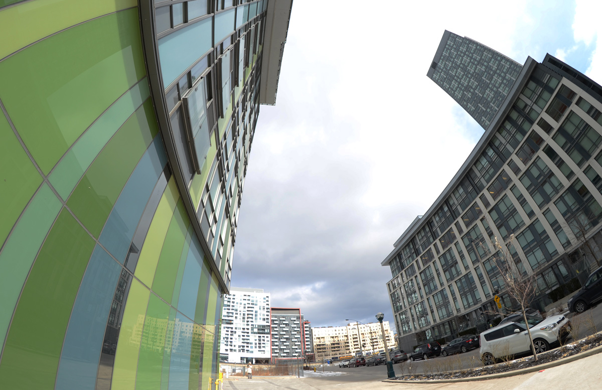
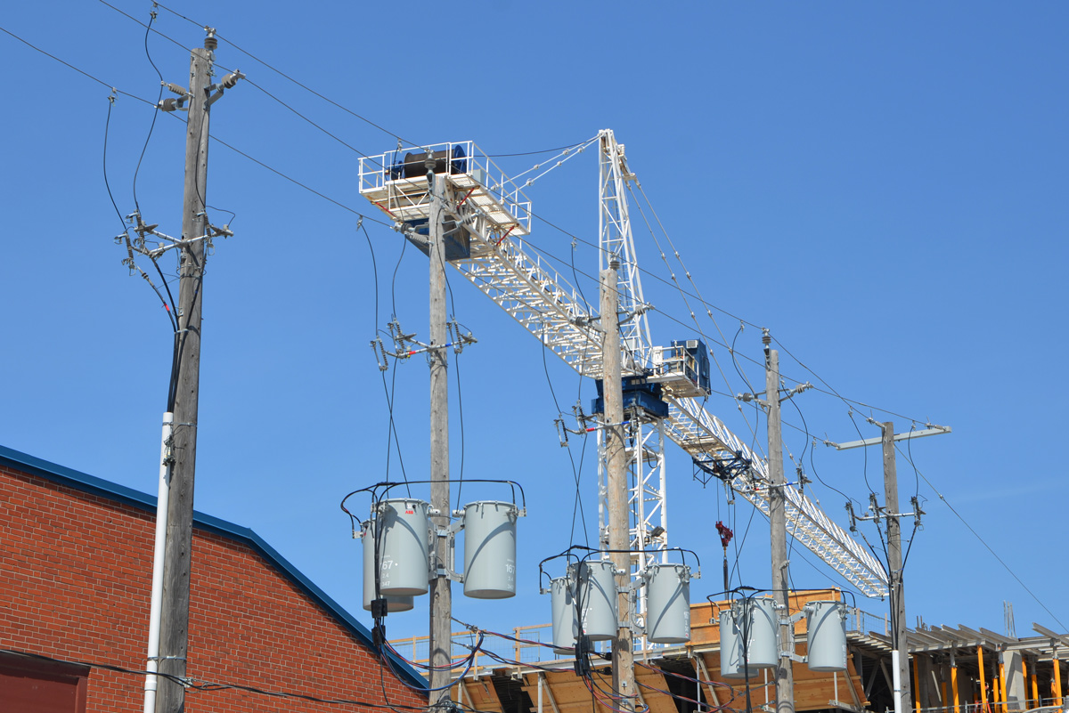
The Frederick G. Gardiner Expressway, commonly just called the Gardiner, has been in the news a lot lately.  This 18 km stretch of road between the city and the lake was completed in 1965 after years of planning and building.  At the time that it was built, Toronto’s waterfront was largely industrial and there wasn’t much objection to having a 4 to 6 lane expressway, with many sections elevated, built there.   The railway had begun the process of dividing the city from its waterfront a hundred years previously.

As the city changes and grows, more and more people live in the downtown core.  Industry has moved out and residents have moved in.  For so long the land south of the Gardiner as well as under the Gardiner was neglected, especially from a city planning point of view.  But now, the city is looking differently at that swath of land.  The far east elevated section between the Don Valley Parkway and Leslie Street was demolished in 2001 and there have been calls for the next section (Jarvis to the DVP) to be demolished as well.   There has been some controversy as to whether to demolish it or move it… and if move it, where to? I am not even sure what the plans are at the moment.   On the other hand, the western section of the elevated expressway (Strachan to Spadina) will remain standing.  Work is underway to refurbish the structure – the city doesn’t want any more stories of pieces of concrete dropping onto cars beneath!  Plans are being implemented to use the land under the Gardiner much more efficiently.  To make it work for the public.

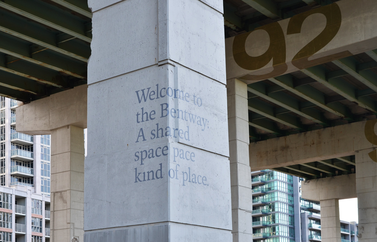
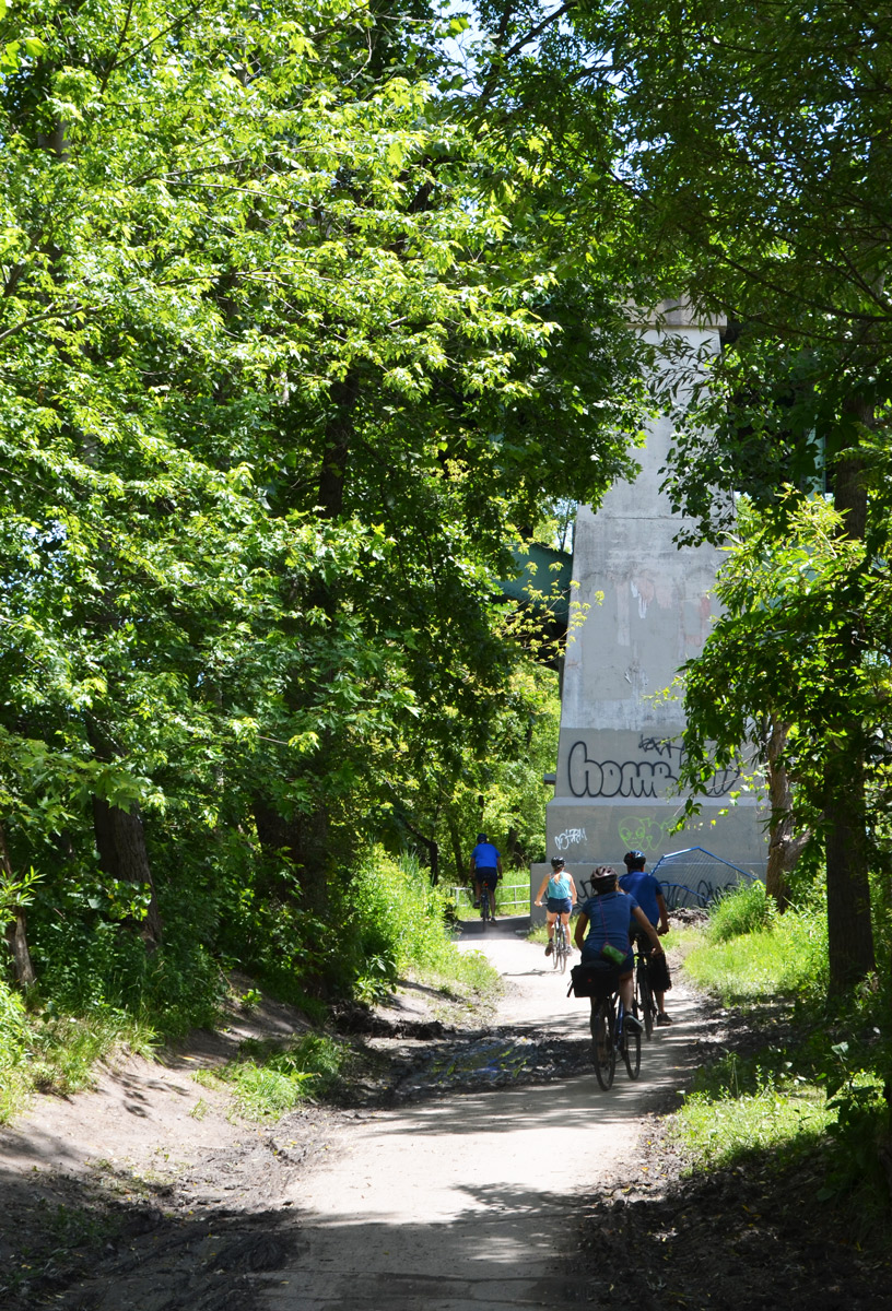
The Bentway is the name that has been given to this new park, or public space, beneath the Gardiner Expressway from Strachan 1.4 kilometres east to Spadina. The first phase is due to open Canada Day 2017 and it involves the stretch between Strachan and Bathurst.  Many of you have probably driven on the Gardiner but do any of you know what is under it now?  Let’s take a look.

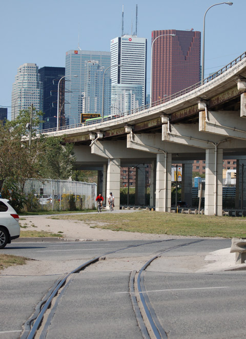
below: The Gardiner passes over Strachan Avenue which  in turn passes over the railway tracks.

bridge over a street, many orange and black construction cones down the center of the road, some pedestrians on the sidewalk

below:  On Strachan Ave looking west.   Condo development in this area has extended right to the railway line.  The Exhibition GO train station is in the distance.  You can also see the Gardiner to the left of the tracks.  Here the north side of the under part of the expressway is walled in and the enclosed space is used by Exhibition Place.  At this time there is no plan for the Bentway to extend this far; I have used this photo to provide more context as to the location of the park.

railway tracks in the center of the picture, condos on the right. On the left is the elevated Gardiner expressway, but under it is a concrete wall that makes it look more like a concrete building than a road

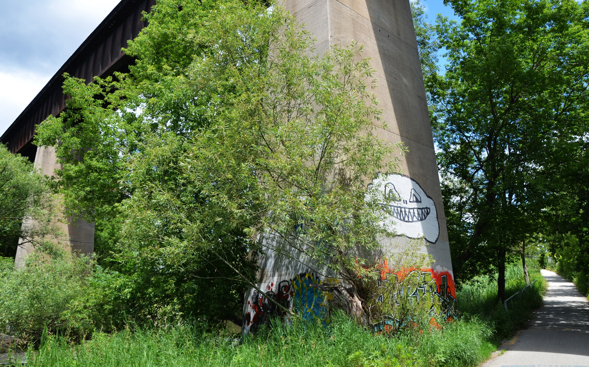
below: A closer look at the Gardiner on the west side of Strachan Avenue.  Maybe there is potential to expand the park westward? to Exhibition GO station? And by the way, those concrete structures holding up the expressway – those are called ‘bents’ and that is why the park is called what it is.

a dirt road runs alongside the Gardiner Expressway, some condos in the distance

below: This photo was taken as I stood on Garrison Common and looking towards Strachan Avenue.  This will be the western end of the new park. You can see the underside of the Gardiner as it passes over Strachan Ave which in turn is also a bridge.  This bridge once crossed the Grand Trunk Railway tracks that were built in the 1850s.  New entrances to the park are planned that incorporate the present sloped embankment of the bridge.

The elevated Gardiner Expressway passes over Strachan Ave which in turn has a bridge over what used to be a rail line. The bottom part of the bridge is covered with graffiti. The whole area is a construction site at the moment.

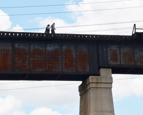
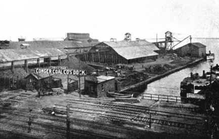
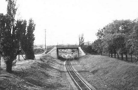
below: A quick aside:  It’s a slightly different angle, but here is a photo of the Strachan Avenue bridge from 1959, before the Gardiner was built.  I suspect that there has been upgrades made to the bridge since then.  Photo credit: R.L. Kennedy, found online (also a good source for the history of the Grand Trunk Railway in Toronto).  Garrison Common is to the right.

vintage photo from 1959, GTR tracks pass besidde Garrison Common park and under the bridge at Strachan Ave

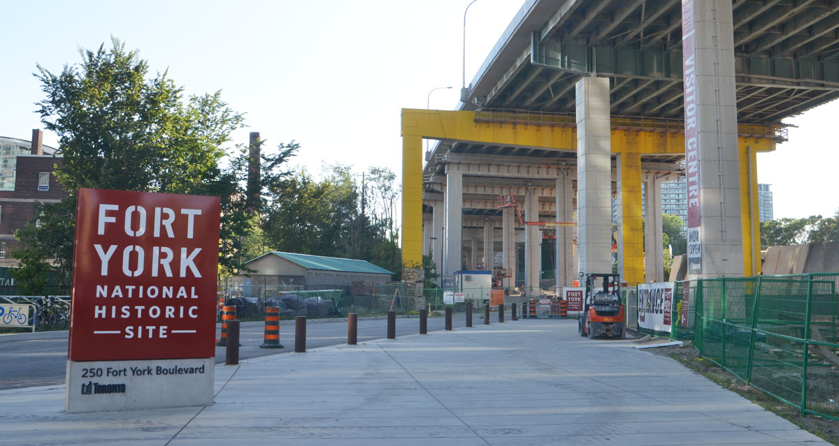
Garrison Common is the green space surrounding Fort York.  It will abut (be continuous with?) the new Bentway.  Fort York is a National Historic Site and on its 43 acre site are original buildings from the War of 1812 as well as an 1813 battle site.  Did you know that the Americans beat us here in 1813 and controlled the city of York (as Toronto was known then) for a few days?

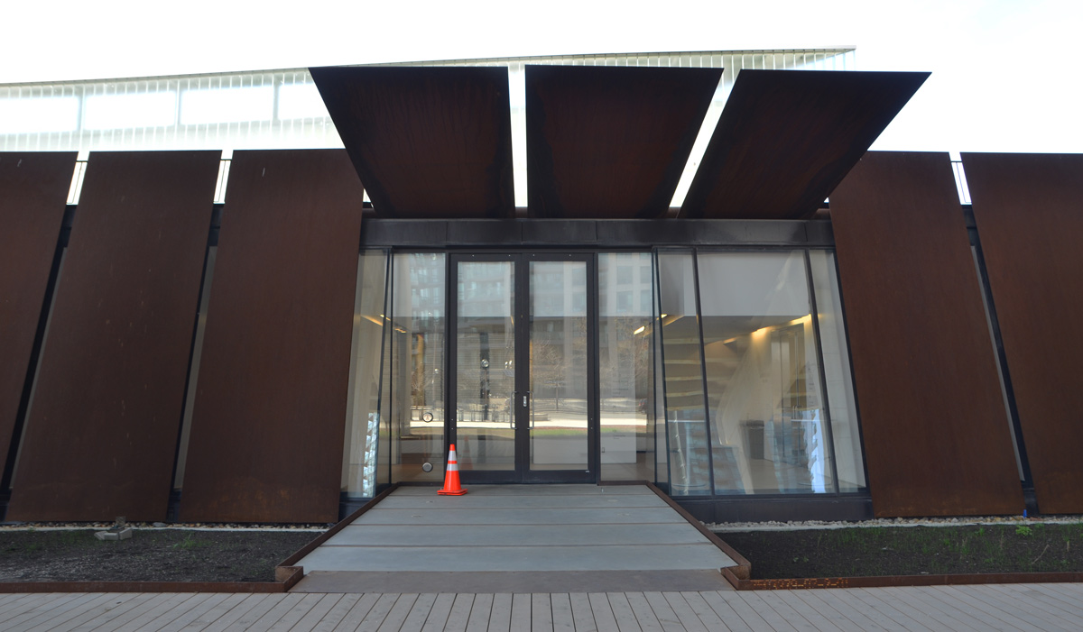
below: The new Fort York Visitors Centre is now open. There is still being work done both inside and outside, but it is open to visitors. For so long the fort was hidden away and difficult to get to; it is nice to see it receiving more attention.

entrance to Fort York, under the Gardiner, still a construction site but nearing completion

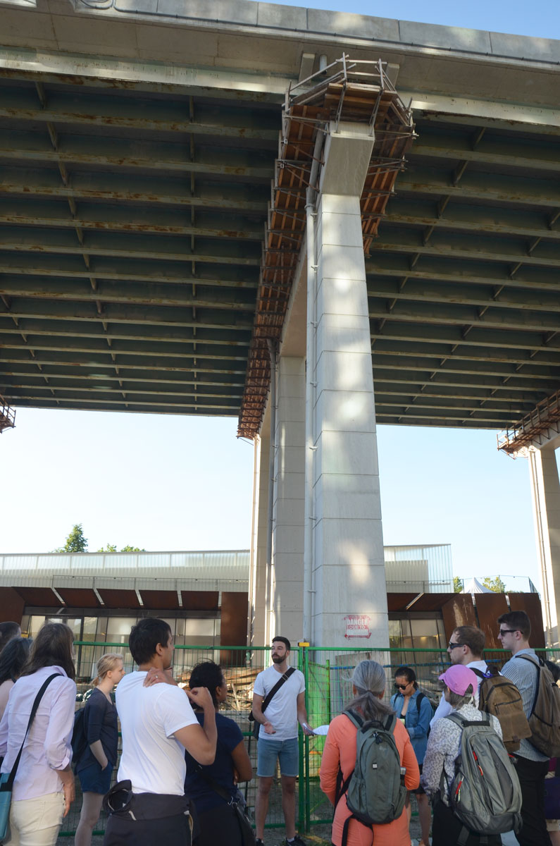
below: Jake from Park People, one of the groups helping to design the new park, stands under the Gardiner as he talks to a group of us on a tour.    Here, by Fort York, the Gardiner is the equivalent of 5 storeys from ground level, the highest it reaches as it crosses the city.

a man is standing in front of a group of people on a walking tour, he is standing under the Gardiner Expressway where it is 5 storeys above ground level.

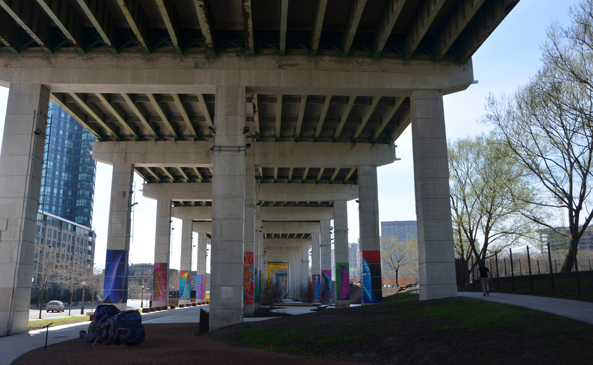
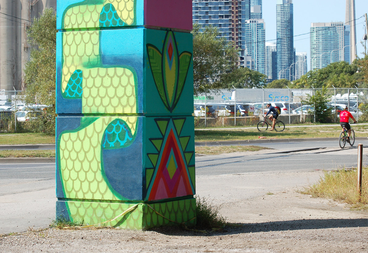
below: Standing on the grounds of Fort York.  The Bentway will be beyond the stone wall.  You can get a good idea of the spacing between the bents.  These spaces are being referred to as ‘rooms’ and there are 55 of them between Strachan and Spadina.

from the grounds of Fort York looking south to the Gardiner and the condos built beyond it. Grass field in the foreground.

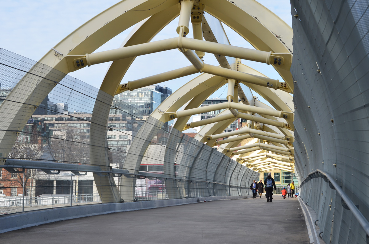
below: One obstacle is the fact that Fort York Blvd passes under the Gardiner on a diagonal.  Plans are to build a pedestrian/cycle bridge over the street.  Also in the photo, note the TTC bus – Fort York and vicinity are finally on a bus route.  Route 121 runs between the Portlands and Fort York via Union Station.

fort york blvd is in the foreground, a TTC bus and a car are on it, the Gardiner is to the right and a short condo building is in the background along with the CN tower

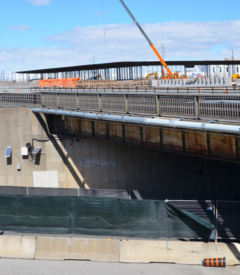
below: The section under the Gardiner Expressway between Bathurst Street and Fort York Blvd is not city owned. It is owned, and has already been developed, by the Onni Group who built the Garrison at Fort York condominiums on either side of it.  This is the eastern end of phase 1.

evening, low angle sunlight shines under the Gardiner Expressway where it has been developed with paving stones and some large rocks.

below: Northbound traffic on Bathurst passes under the Gardiner.

some traffic on Bathurst street on a rainy day, as the street passes under the Gardiner Expressway, condos on the right, construction hoardings on the left.

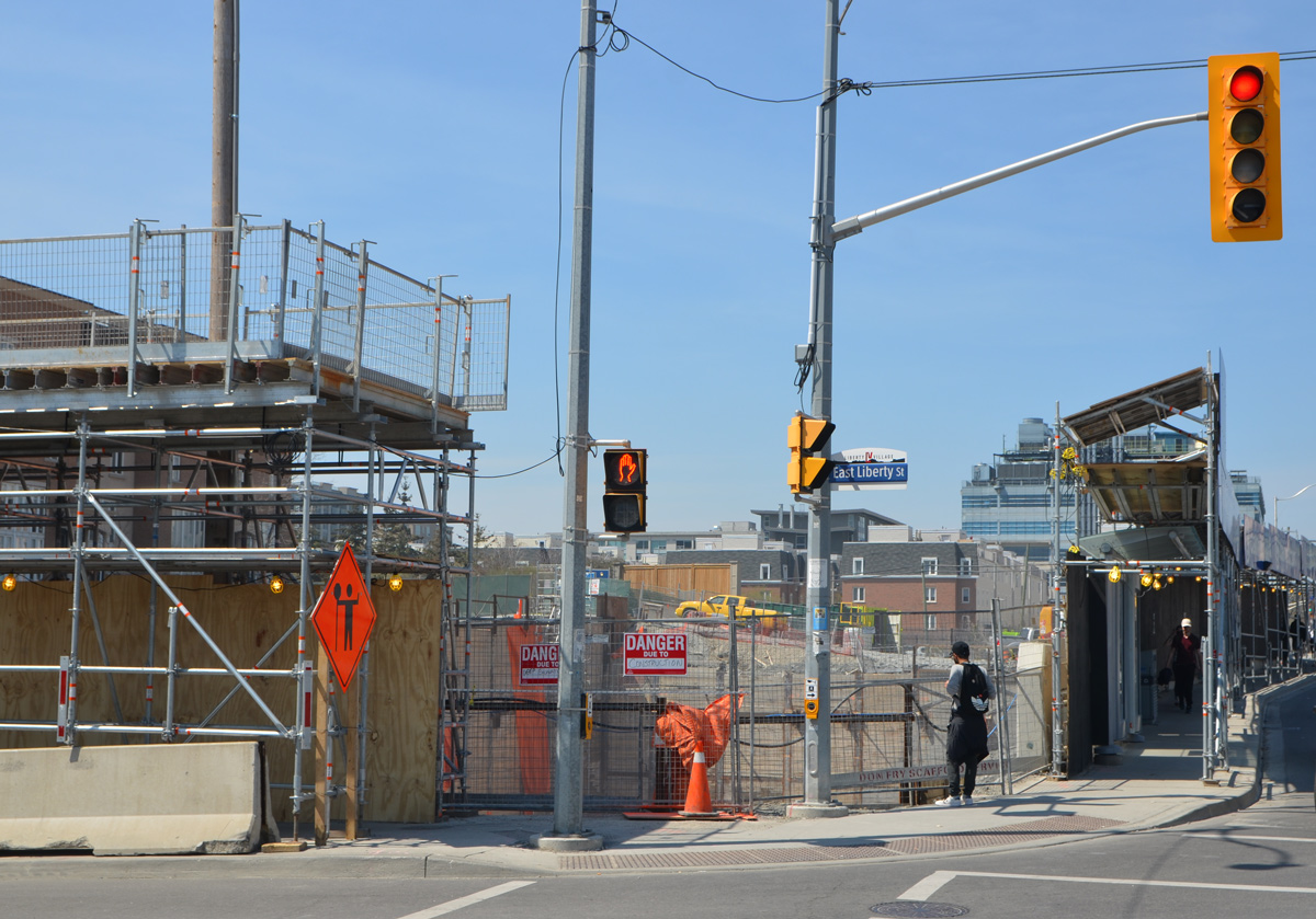
Phase 2 of the park’s development involves land between Bathurst and Spadina. This is an area that is undergoing a lot of changes at the moment, i.e. a lot of construction.

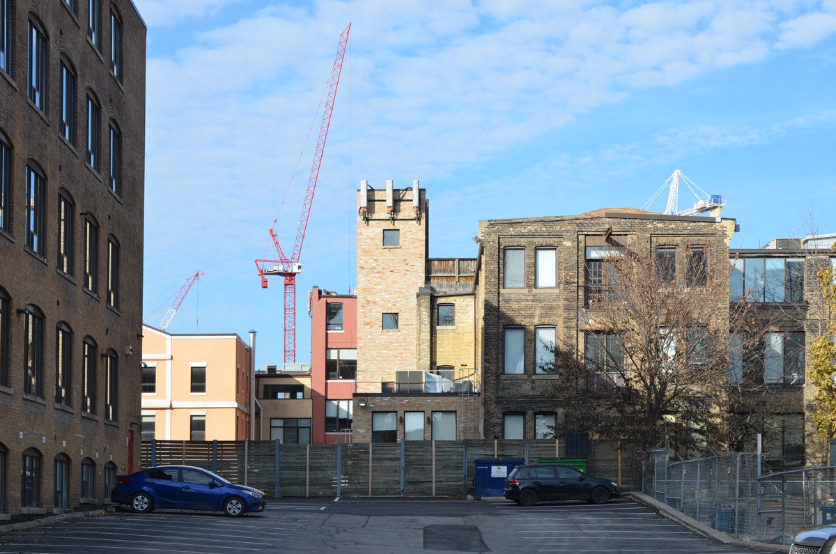
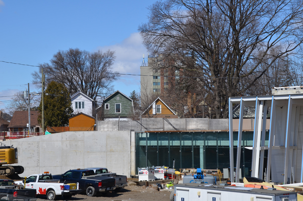
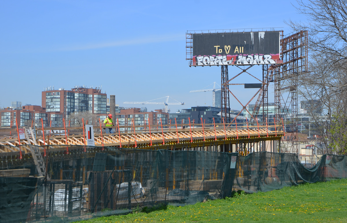
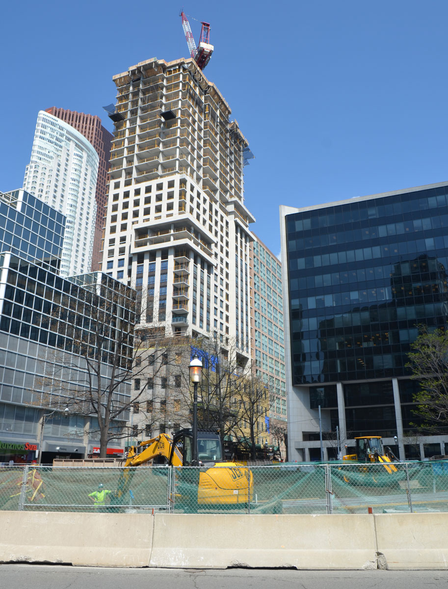
below: Immediately south of the Gardiner on the northeast corner of Bathurst and Lakeshore is a construction site.  Demolition of the old 1928 Loblaws warehouse building is now complete.  The facade of the old building was disassembled rather than demolished; after cleaning and refurbishing of the bricks, it will be rebuilt in its original location.  Two condo towers are planned for the space between Loblaws and the Gardiner.  Yes, more condo towers to face the Gardiner and add to the tunnel effect that you get when you drive on the expressway.

construction site in downtown Toronto, Gardiner Expressway runs behind the site, rubble in the foreground, a few remaining remnants of the old Loblaws building that was there, high rises in the background.

below: The development of this site is a collaboration between a number of developers.  I found a photo of one rendition (source) of what the space under the Gardiner will look like here in the future.  Public space including a cafe are part of the plans.  Check back in a couple of years to see what really happens here!

artist's rendering of what a planned development for under the Gardiner would look like, part of a larger condo and retail development.

below:  Standing on Bathurst Street, looking east along what will be Housey Street.  This is just north of where the Loblaws development (above) will be.  As you can see, you can’t walk there yet.

the elevated road, the Gardiner Expressway passes over a construction site on the right, a new street being built on the left.

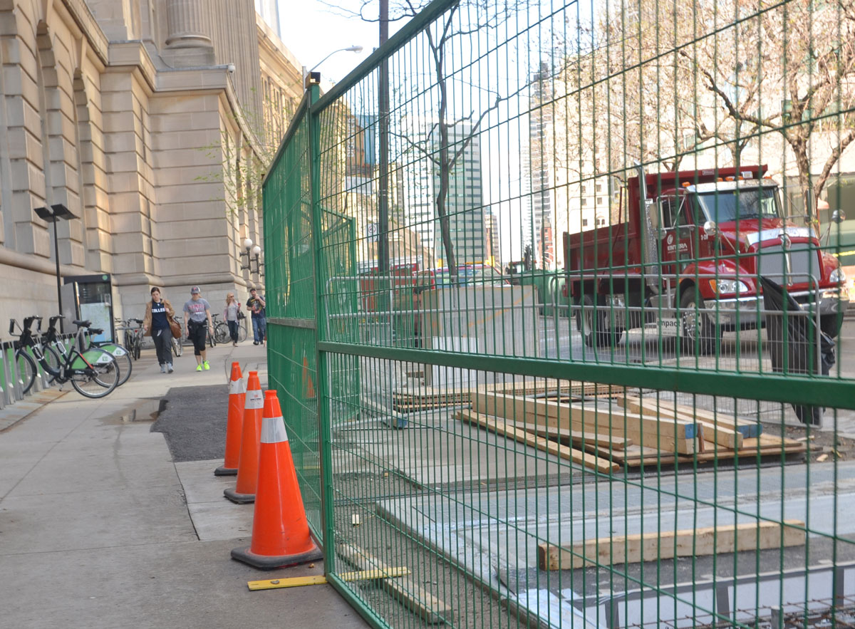
below: Southeast corner of Bathurst and Fort York Blvd.  This is the section of land just north of Housey Street.  Construction hoardings and cranes – familiar sights in this area.  It also means that taking photos of under the Gardiner here are difficult!

late afternoon, long shadows, yellowish tint to the photo, looking east from Bathurst, south of Front, north of the Gardiner, wood construction hoardings with posters on it, many orange cranes, some condos already built, a woman jogging past, cars on the street.

below: Development north of the Gardiner between Bathurst and Dan Leckie Way.

construction site under the Gardiner, cranes and condos being developed on the left, CN tower in the fog in the distance.

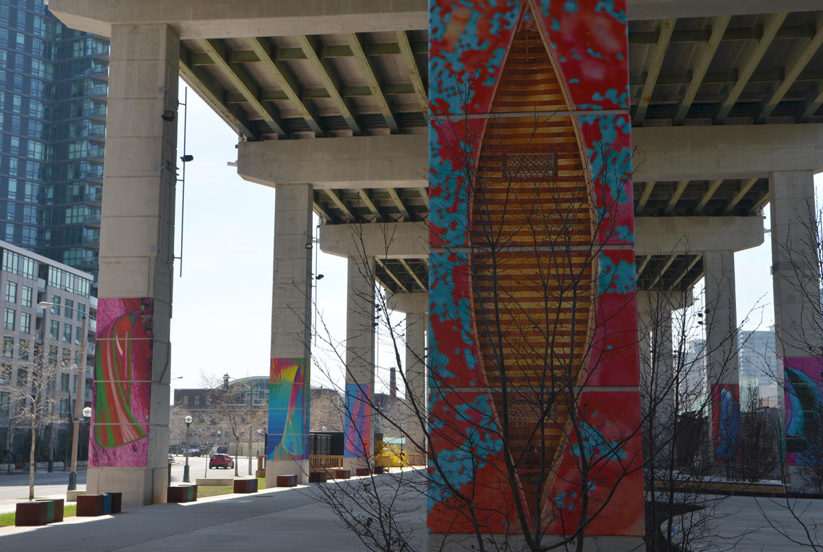
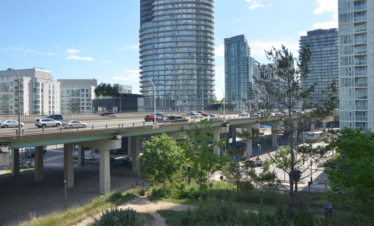
Dan Leckie Way is a north-south road that runs under the Gardiner just east of Bathurst.  It is the western boundary of Canoe Landing Park.  This park is north of the Gardiner and the Lakeshore.

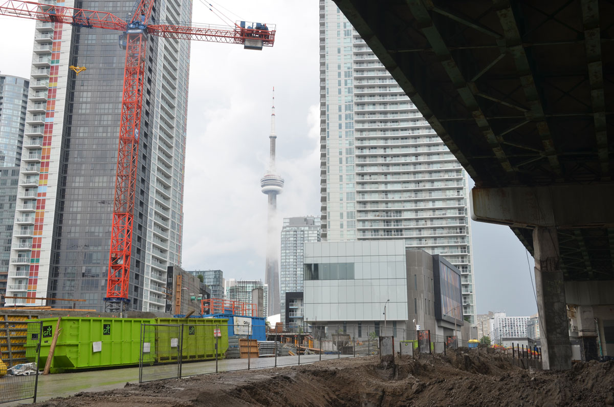
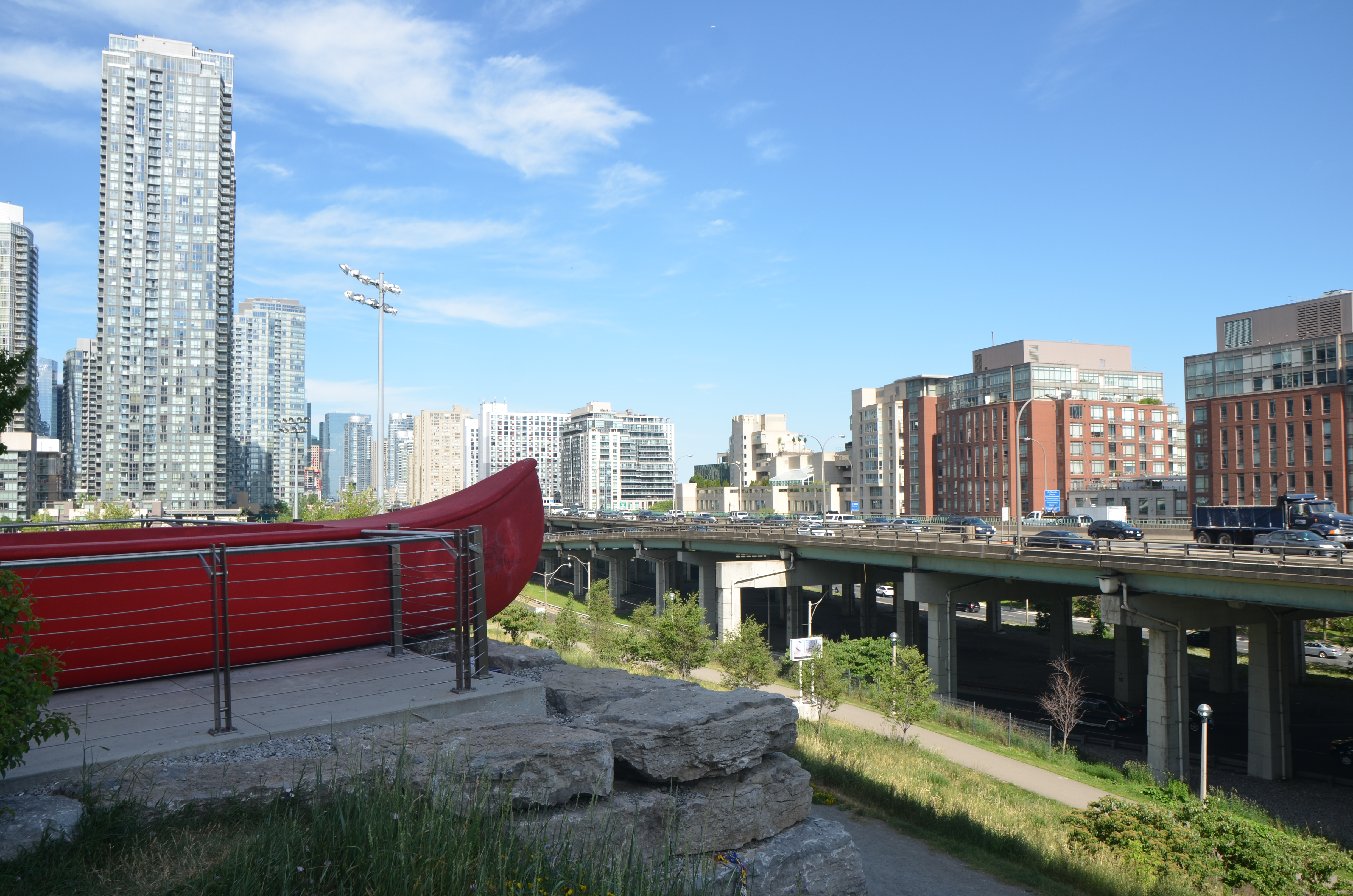
below: ‘Tom Thomson’s Canoe’, by Douglas Coupland sits at the highest point of land in the area; it’s almost at the same level as the Gardiner and is very visible as you drive by.   This park extends down the hill.

The end of a large red canoe, an artwork by Douglas Coupland called 'Tom Thomson's Canoe' sits in a park, high above the surrounding scenery. Looking southwest towards the elevated Gardiner Expressway and the condo developments south of it.

below: Looking the other way from the same vantage point. The street running under the Gardiner here is Dan Leckie Way . Up until this point the Lakeshore is south of the Gardiner.

The elevated Gardiner Expressway with traffic is in the middleground, some trees and parkland in the foreground, and condo developments in the background.

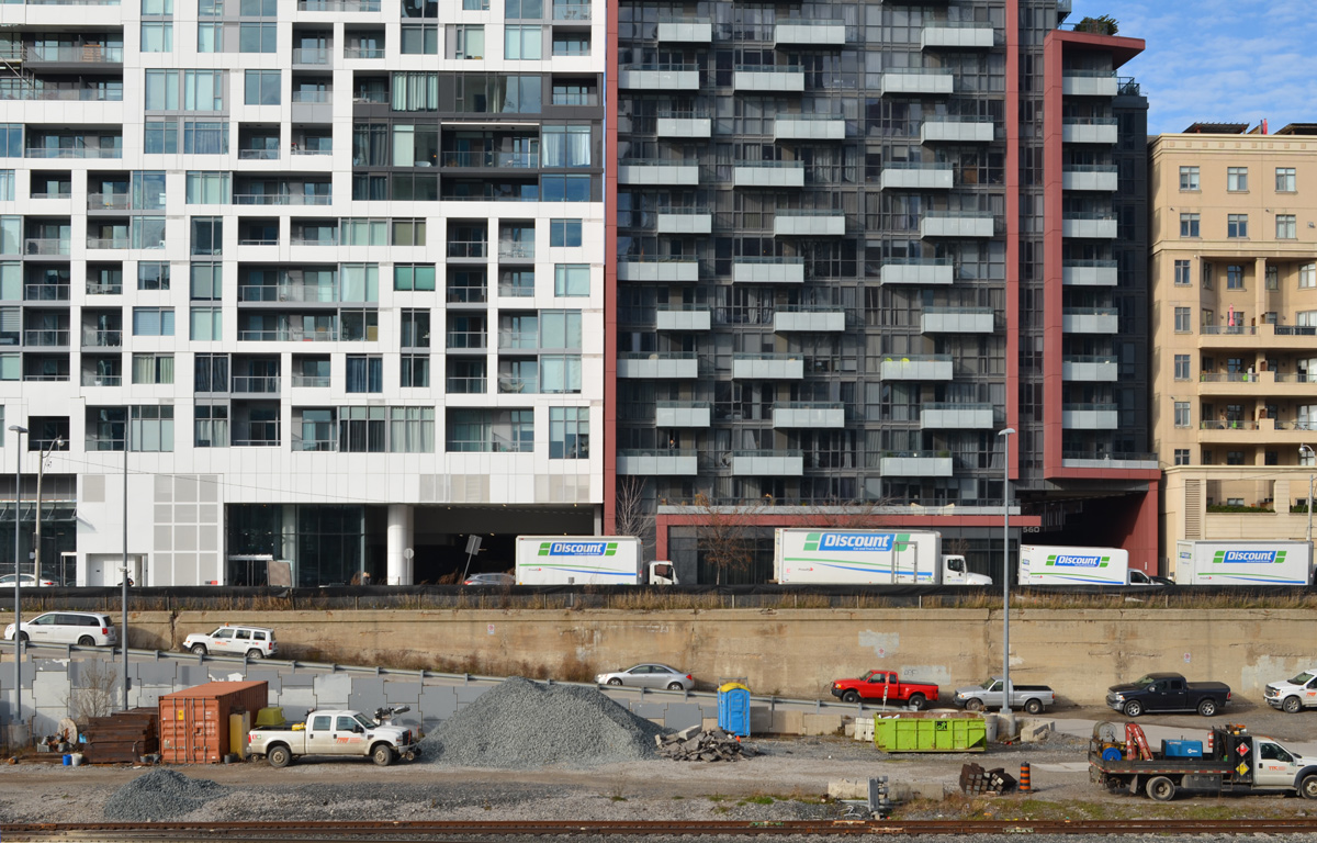
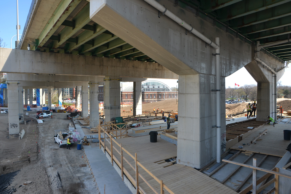
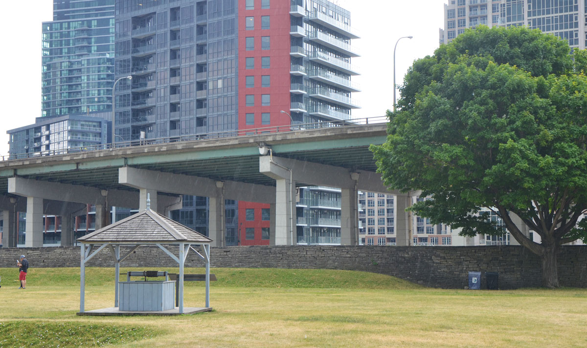
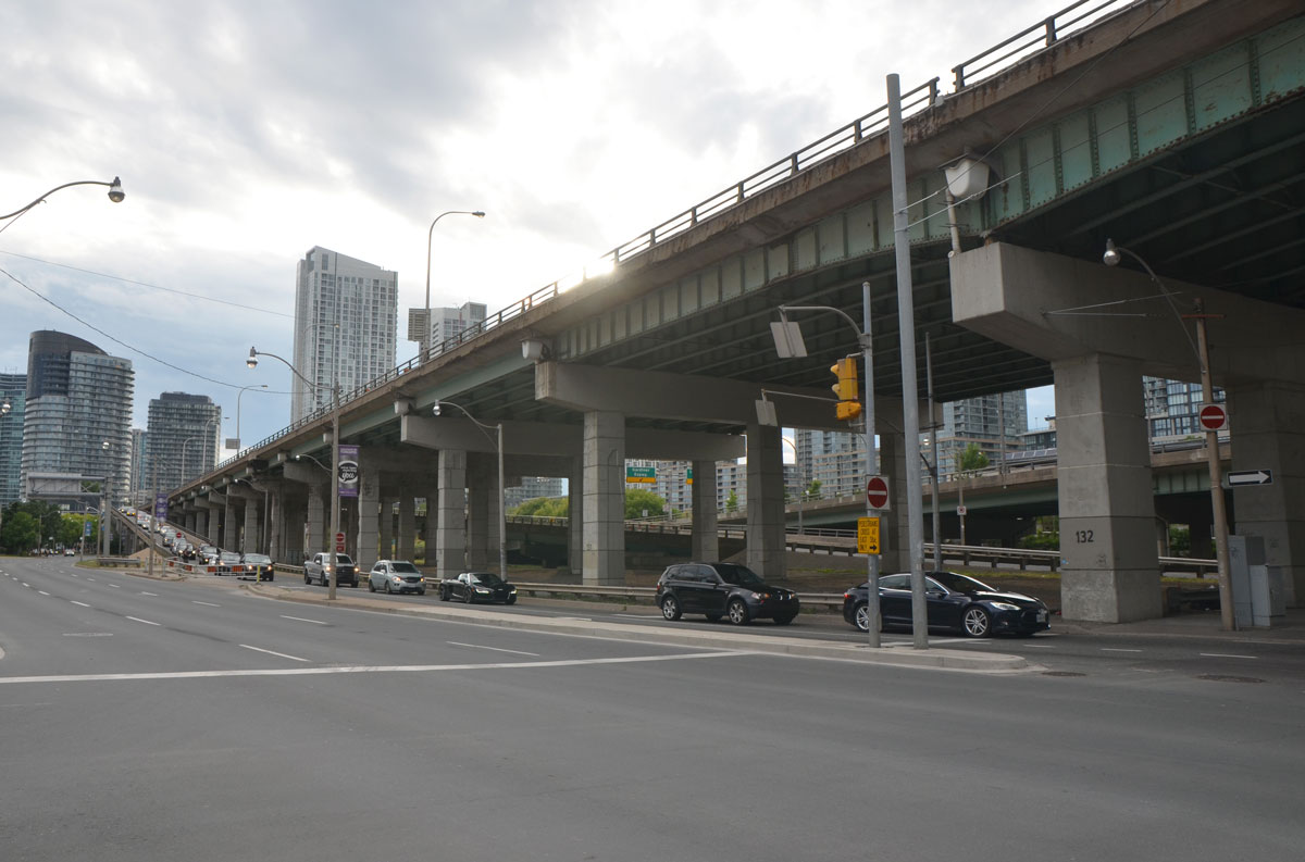
At Dan Leckie Way, the Lakeshore is still south of the Gardiner and the space under the expressway is wide open.   By Spadina, one major block east, the situation changes.   The Lakeshore splits and westbound traffic lanes go north of the Gardiner and eastbound lanes stay south.  Shortly after Spadina, the Lakeshore runs under the Gardiner and there is no room for any further development under the road.

below: Standing on Spadina, just south of the Gardiner and looking west.  Here there is a lot of road to cross for pedestrians on Spadina.  Not only has the Lakeshore split to run on either side of the Gardiner, but there are also ramps between the Gardiner and the Lakeshore.

major road with traffic under an elevated expressway in a city, long ramp from the upper level to the lower. Gardiner Expressway and Lakeshore Blvd in Toronto, at Spadina looking west

below:   Still on Spadina, and still looking west, but now under the Gardiner.  The space under the road is not as high as it was previously.  Its lower and darker and not as inviting.   It will be interesting to see what phase 2 of the Bentway development will look like in this space.  I am not sure when it will to be finished but I will keep an eye on it!

under an elevated section of the Gardiner Expressway, at Spadina.

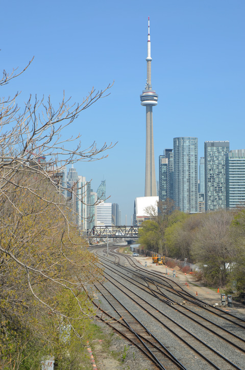
As for the eastern Gardiner, what does that look like?  Well, that’s a whole other blog post!

 Project: Under Gardiner  On this site you’ll find detailed maps and diagrams of this area as well as information about the plans for the various sections of the space.


On Friday morning, my original goal was to find ‘Residents of the Esplanade’, a CONTACT Photography Festival outdoor exhibit at David Crombie Park but it was such a beautiful morning that I didn’t stop there. I found more than just the ‘Residents’.

Forty years ago, May 1976, the site plan for The Esplanade neighbourhood was approved. Since then, it has become home to a very diverse group of people. And it is those people that this installation celebrates on the 40th anniversary of the founding of the neighbourhood.

Crombie Park runs along the south side of The Esplanade between Berkeley street and Lower Jarvis.  The installation consists of a number of small white rectangular pillars with the picture and story of person on either side.

A photo from the CONTACT photography festival, installation called 'Residents of The Esplanade' - story of Mysha from Pakistan

A photo from the CONTACT photography festival, installation called 'Residents of The Esplanade' - photo of Solomon from on top of a basketball hoop

A photo from the CONTACT photography festival, installation called 'Residents of The Esplanade' - photo of Alan working at a desk, tulips and a woman sitting in the park are in the background

People were out enjoying the morning; school kids were playing basketball at recess.

kids playing basketball on an outdoor court. The wall behind the basketball hoop has been painted with a mural of hands making a heart shape with the fingers, by Bruno Smokey and Shalak Attack.

Flowers were blooming.

close up photo of red tulips in full bloom on a sunny day

tulips in a garden in a park, orange and yellow tulips, with some greenery. Grassy area with trees behind, and people walking on a sidewalk in the background.

below: Looking towards Lower Jarvis Street and downtown Toronto.

at the corner of The Esplanade and George Street, looking west towards downtown and St. Lawrence market. Playground on the left with children playing.

below:  One street beyond Lower Jarvis is Market Street.  It dead ends at the railway tracks.  The long structure on the right is a parking garage.

looking west towards the CN Tower, with the railway tracks to the left (but they are elevated and behind maintenance buildings so you can't see the tracks). Parking structure to the right, with city buildings behind it.

below: After a small backtrack up Market Street, I went through Conger Coal Lane to Church Street.  I don’t think I have walked this way before.  The lane was named in commemoration of the Conger Coal Company whose yard and wharf was nearby.   It was one of the many companies that provided Toronto with coal back in the day when coal fueled the city.  It was started in 1870 by Mr. P.D. Conger.   In 1913, Sterling Coal company bought Conger and the name was changed to Conger Lehigh Coal Co.

a downtown Toronto lane, very clean, no graffiti, taller, newer buildings on either side of the lane. CN tower in the distance,

below: A very old photo of the Conger Coal Company dock at the foot of Church Street, back when Church street ended at Lake Ontario

historical picture of the old COnger COal Co wharf at the bottom of Church street.

below: Tucked into a corner on Church street immediately south of Front Street, is an art installation by Paul Raff called ‘Shoreline Commemorative’.  A topography of limestone forms the base of the work.  A glass ball representing the line between sky and water sits on top of a tripod that tries to evoke a land surveyor’s tripod.  The words on the wall say “For 10,000 years this was the location of Lake Ontario’s shoreline.  This brick wall stands where water and land met, with a vista horizon”

Shoreline Commemorative by Paul Raff, an art installation on Church St., south of King, that marks where the shoreline of Lake Ontario used to be. It involves words on a brick wall and a model of the shoreline of Toronto showing the different elevations of the land.

below: Continuing the lake theme, a little fish out of water, jumping over the entrance to a condo.

bas relief sculpture of a fish, square stone on a brick wall above the entrance way to a condo building.

below: From the lake theme to another common theme in the city, construction. Spring is the beginning of construction season and here Berczy Park is being upgraded. In the background a new condo is being built but as we all know condo construction ‘season’ never ends. In fact, the challenge might be to find a place in this city where there isn’t a condo being built.

workmen redoing a park, Berczy Park in Toronto, with a digger and another piece of equipment, cityscape behind with a tall condo building under construction. A red and white crane is on top.

below: I walked past the never ending Front Street construction.  Construction in front of Union station seems to be finished, but this stretch of Front Street just west of the station is still being worked on.   There have been fences here so long that I can’t remember a time when they weren’t here.

Front street constrcution, behind a greenwire fence is a rd truck and piles of construction materials. Between the fence and a stone building is the sidewalk on which some people are walking.

a shirtless man in sitting on a stool at the corner of Front and Union streets. He has four signs (behind, above, in front, and beside him) asking for spare change or for you to buy his novel that is well rated on both Amazon and Goodreads.

A man is selling Black History newspaper to another man in front of the TTC subwayentrance at Union station.


There is a railway bridge, just west of Caledonia Rd where the GO line to Aurora passes over St. Clair West.
On the north side of the underpass is a mural in black, white and grey tones.

mural in black, white, and grey about the first railway in Ontario, 1853, that was built here, and where the railway still runs as the GO line to Aurora - the words St. Clair West in large letters

The theme of the mural is “Ontario’s first railway” as this railway line has been in operation since 1853 when the Ontario, Simcoe and Huron railway was built here.

mural in black, white, and grey about the first railway in Ontario, 1853, that was built here, and where the railway still runs as the GO line to Aurora - a photo of the mural from across the street, with its three parts, the words St. Clair West on the left, the locomotive in the middle and the railway workers on the right
The first locomotive built in Canada was a steam powered engine built by the Toronto Locomotive Works, a company founded by James Good.  Named “Toronto”, it was finished in April 1853 and in mid-May 1853 it pulled a short (4 cars) train from downtown Toronto 30 miles north to Machells Corners (now Aurora).   Service on the Ontario, Simcoe and Huron line had begun!

below: “From one age to another.  The locomotive was the machine of the future.”
mural in black, white, and grey about the first railway in Ontario, 1853, that was built here, and where the railway still runs as the GO line to Aurora - a painting of an old locomotive with the words 'Ontario's First Railway' on the top of the mural and the words: "from one age to another. The locomotive was the machine of the future. " at the bottom

mural in black, white, and grey about the first railway in Ontario, 1853, that was built here, and where the railway still runs as the GO line to Aurora - three railway workers in jackets and caps

The mural was painted in September 2012 by Marcelo Pinero, Aelwynn Swanson, and Pia Ferrari from the Davenport Arts Community.

blog_mural_first_railway

There is also a mural on the south side of the underpass; it has a soccer theme.

mural on a railway bridge underpass that has a soccer theme. Flags of different countries, soccer players, words,

It too was painted by Davenport Arts Community.

part of a mural with a soccer theme with words that say Football Fever St. Clair 1982. also with pictures of football players and flags from different countries.

part of a mural with a soccer theme with words that say Football Fever St. Clair 1982. also with pictures of football players and flags from different countries.

below: Silverthorn Sunrise mural painted late in 2012 by Marcelo Pinero and Aelwynn Swanson.  It is painted on the side of Whiteside Pharmacy which is on the NE corner of St. Clair and Silverthorn.   Silverthorn was also the name of this neighbourhood prior to 1998 when it was amalgamated into the City of Toronto.

Silverthorn Sunrise mural by the Davenport Arts Community, with the word Silverthorn, a sun rising over a bridge while a new TTC streetcar passes under the bridge, the words "shop St. Clair". The mural is on the side of a red brick building, beside a pharmacy.

And last, a mural that is actually on the side of business, West York Motors, which is located on St. Clair West between Ford and Osler streets.
It was painted by Splash Murals.

mural on the side of West York motors on St. Clair West - a view of the mural from across the almost empty parking lot.

mural on the side of West York motors on St. Clair West near Osler - south end of the mural showing cars parked in front of a garagethe backs of two houses are also in the picture,

mural on the side of West York motors on St. Clair West - looking down the length of the mural including the narrow chimney on which the CN TOwer is painted.

mural on the side of West York motors on St. Clair West - the part of the mural with the words "West York since 1945" also an old convertible with its door open and top down.

mural on the side of West York motors on St. Clair West - a yellow sports car is painted on the wall near the entrance to the building

more information about the Davenport Arts Community