Archive for the ‘intersections’ Category

below: Think!  or rather Stop and think.   Above that, tbonez with The Forge Fury in another urban ninja squadron sticker.

2 stickers on a stop sign. one is a picture of a brain with the word think on it. the other is an urban ninja squadron sticker

below: There is a new public art installation nearing completion at the corner of Carlaw and Dundas.  When the project is done, the obelisk shaped sculpture by Pierre Poussin will be in the middle of a small park.  It is made of laser cut rusted metal and will feature internal LED lighting.

a new public art installation at Carlaw and Dundas with construction fence still around it, also a lot of utility poles around it, rusted metal cut with lasers in a design, sculpture is the shape of an obelisk

below: Shadows of the trees along a winding trail.

trees line a sidewalk that has had small curves added to it, shadows of these treees on the fence beside the sidewalk

below:  There really aren’t enough fairies in the world.  The ones that are supposed to clean my home haven’t shown up yet either.

a sign on a wood fence that says the poo fairy doesn't live here scoopy your ppop, aimed at dog owner

below: This looks like it was once an artwork pasted to a wall.  An eagle’s head is still visible at the very top.  Are those its feathers at the bottom by the shoes – one dark blue and one red stiletto.

a ripped picture, very large, of an eagle and a person with wings and high heeled shoes.

below: The northwest corner of Pape and Dundas.  The “This is Toronto” mural by J. Chiale is still there.

an intersection, looking northwest at Dundas and Pape where the house on the corner has a large mural by j. Chiale on the side, newer houses and apartment building in the background.

mural by J. CHiale on the side of a house

below: An old and worn sign

very old no parking sign on a chain link fence

below: A not so old sign with three lovebot stickers on it.

neighbourhood watch sign with 3 lovebot stickers on it

below: Old cars seen in an alley.  Any ideas on what model and year the brown car is?

2 old cars in an alley. one is an old brown car from the 40's, under a cloth. the other is a blue camaro

close up of a wood utilitypole with some paint splashes on it


on the side of a house, a wood panel on porch with 2 windows, 2 panels are painted blue and the last one is white

below: Santa Claus hasn’t returned to the North Pole yet!  This front yard looks quite barren

2 plastic Santa Claus figures in a front yard, no snow, in frontof a porch

below:  … compared to this one!  I am happy to report that the “doll house” still exists.   There is at least one Santa Claus in there!

a house with a front yard full of dolls and toys, on the walls, on the fence, decorations

below:  Not quite every inch (centimeter!) is covered.  Christopher Robin and Tigger, Ernie and a Picachu.  Tweety bird in a blue jacket and a white horse, Dora the Explorer is eating an apple.

some of the dolls and toys attached to the front wall of a house

below: These stickers still exist!  A Star Wars family with a dirty back window.

a star wars sticker family on the back window of a black vehicle, 2 kids, an R2D2 and a wokie

below: Usually if a couch is waiting for the garbage man it’s sitting closer to the edge of the street!

an old black vinyl couch on a sidewalk on Eastern Avenue, beside a house

below: Symmetry at the back of Bruce Junior Public School built in 1923.

back of older brick public school, Bruce Public school with pair of chimneys and rows of windows, symmetrical.

below: And then there is the asymmetry created when one side of a semi-divided house explodes upwards.

the back of a house, a semi divided house where one side is the original one storey while the other side has added two storeys and is taller than the surrounding houses, and it is narrow too

below: Leslieville has two murals.  This one covers the side of the building plus the back in pink, red, and orange stripes.   This Guidant Bikeshare mural was painted by Mediah, aka Evond Blake, in 2017.

below: Nearby at the intersection of Queen and Jones is this mural by Elicser Elliot (2016).

Leslieville mural by elicser of a man sitting under o tree in autumn

below: The Coca-Cola Coady Sweets ghost sign is still there but the convenience store under it has been replaced by a Spanish restaurant.

workmen at an intersection, white van parked, in front of building with ghost sign for Coady sweets, new Spanish restaurant on the corner

below: Queen Street East

line of stores on Queen Street East by the B & B fish and chip restaurant

Leslieville mural by iah media on the side of a building,

below: This is on the wall beside a vacant lot on Queen Street East that has been empty for years.

spray paint, large letters, wuns on a wall beside a vacant lot

Queen street east, vacant lot on the north side

below: Another vacant lot but more recently so.

looking through a chainlink fence, across a vacant lot towards Queen Street east and the brick Scotiabank building

below: An alley view, behind Queen Street East

3 storey brick building, from the back in the alley, behind Queen Street East

below: Waiting for spring?

looking through a metal gate with chainlink into a backyard with patio furniture and blue umbrella (closed)

a row of pink window boxes and red planters on a balcony of a yellowish brick apartment building

below: Dundas Street East

houses on a street with the one being an old narrow two storey house in yellowish brick

And how can we end without re-visiting the doll house?!

an old stuffed mouse with black plastic glasses, in front of a blue m & m character throwing a basketball, outside, and slightly weathered

close up of two of the dolls attached to the railing in front of house

the front steps and door to the doll house - a house covered with dollas and toys, also fake plants and flowers in pots on the stairs

This is another “walk about” post; in fact, it is the product of two nearly identical walks a few months apart.

below: Standing at the corner of King and Spadina while TTC workmen clear the streetcar tracks of excess dirt and sand.

two young women standing on the corner of King & Spadina

below: Looking east along King Street.  The LCBO on the corner is now closed.

looking eastward along King St from Spadina, high rises, billboard, traffic, city,

below: Spadina, south of King.

construction on Spadina south of King, beside the red and white Petro Canada gas station

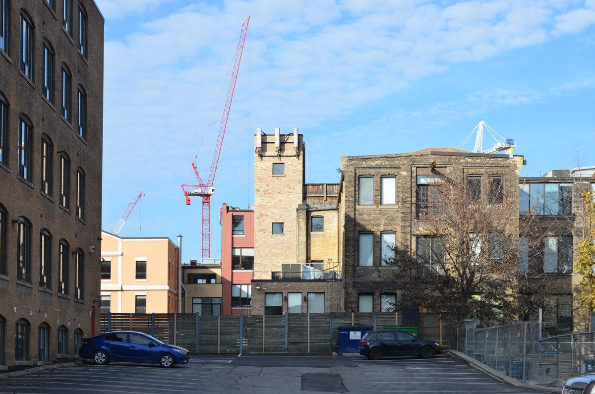
below: Looking through a parking lot on Wellington.

backs of buildings as seen through a parking lot on Wellington street

below: Looking south on Draper Street

looking south on Draper street to condos south of the tracks

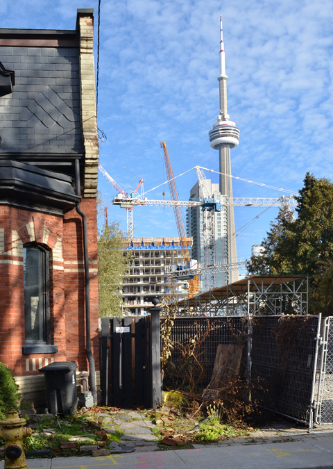
below: The CN Tower from Draper Street

the CN tower as seen through a vacant lot on Draper street

below: Construction continues on the old Globe and Mail site south of Wellington and north of Front.

construction on the site of the old Globe and Mail building between Wellington and Front

below: A pink pig still celebrating Valentines Day.

a pink plastic pig on a porch, wearing heart shaped sunglasses and a necklace of heart shapes

below: Looking east along the tracks from Portland Street.  In November when I walked here, there were many movie trucks parked along Front Street.

looking east along the north side of the railway tracks from Portland Street towards downtown, cranes and construction site, high rises

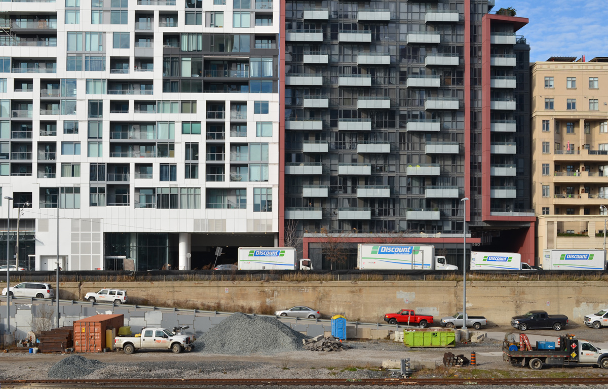
below: The new condos on the north side of Front Street that face the railway tracks.

a line of glass and concrete condos on Front street that face the railway tracks, cars and trucks at construction site beside the tracks, below street level

pasteup graffiti on a yellow post, faces with eyes collage, by jeremy lynch

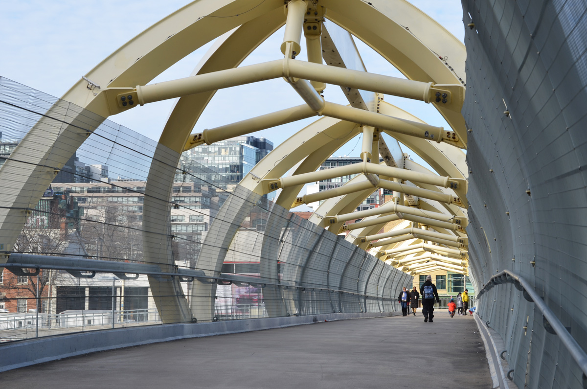
below: Crossing the Puente de Luz, Toronto’s yellow pedestrian bridge over the railway tracks.

three people crossing the puente de luz, the yellow pedestrian bridge that crosses the railway tracks

three people crossing the puente de luz, the yellow pedestrian bridge that crosses the railway tracks

looking eastward to the puente de luz bridge and the city skyline beyond, railway tracks, cranes, new buildings,

below: On the south side of the railway – the green building is the Library District condo.

fish eye lens view of side of green library condo building and the other across the street, Queens Wharf Rd

below: Bathurst Street at Fort York Blvd., with the overhang from the library which is on that corner.

overhang from the library roof, Bathurst street, south of tracks, condos, street,

below: Bathurst streetcar southbound.

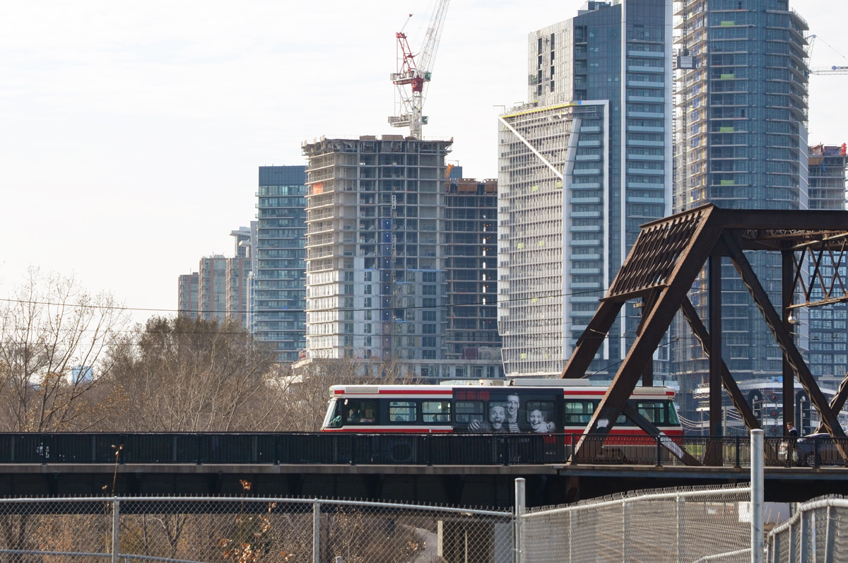
TTC streetcar passes over Bathurst street bridge over the railway tracks, new condos in the background, crane

below: The grassy green mound that separates Fort York from the city…. with the city creeping up behind it.

edge of the grounds of fort york, green grass on hill, with new high risse condos in the distance

below: Orange bars across the eyes, graffiti

graffiti, three black and white photos of faces with orange streak painted through their eyes, pasteups on concrete

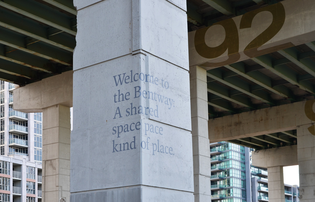
below: The Bentway, under the Gardiner Expressway (a previous post on the Bentway)

the bentway, the new development and park under the gardiner expressway, words on one of the concrete posts that says Welcome to the Bentway a shared space kind of place

Garrison Crossing is actually two stainless steel bridges, both over railway tracks.   Both have spans of close to 50m.  In the middle is a peninsula of land that is in the process of being developed into condos and a park.  Almost 20 years ago there was a proposal to build a bridge here – to be opened in 2012 for the anniversary of the War of 1812.  Mayor Rob Ford was opposed to it (too much money) and the plans were shelved.  A change of mayor (and some help from developers) and a change of plan again.  Construction began in 2016.  It provides a much needed link between the two sides of the railway lands.

below: Southern span – walking north from Fort York

fisheye view of first garrison crossing bridge with new condos in the middle

below: City view from the new park in the middle, train tracks (difficult to see in this picture) on two sides of the triangle.

view from Garrison Crossing, in the middle, CN Tower and Toronto downtown skyline

below: Yellow construction fences still line the edge of the path through the middle section between the bridges.

yellow construction fences line the pathway through the middle of Garrison Crossing as it is not quite finished construction

below: People crossing the northern portion of Garrison Crossing (looking south).

people walking across the Garrison Crossing bridge with high rise condos behind them

below: Looking northwest from the second span of Garrison Crossing towards Strachan Avenue and beyond.

railway tracks north of Garrison crossing looking towards Strachan Ave

below: Garrison Crossing ends at Wellington Street close to Stanley Park

park, green space, baseball diamond with lights, and a row of bright coloured houses behind

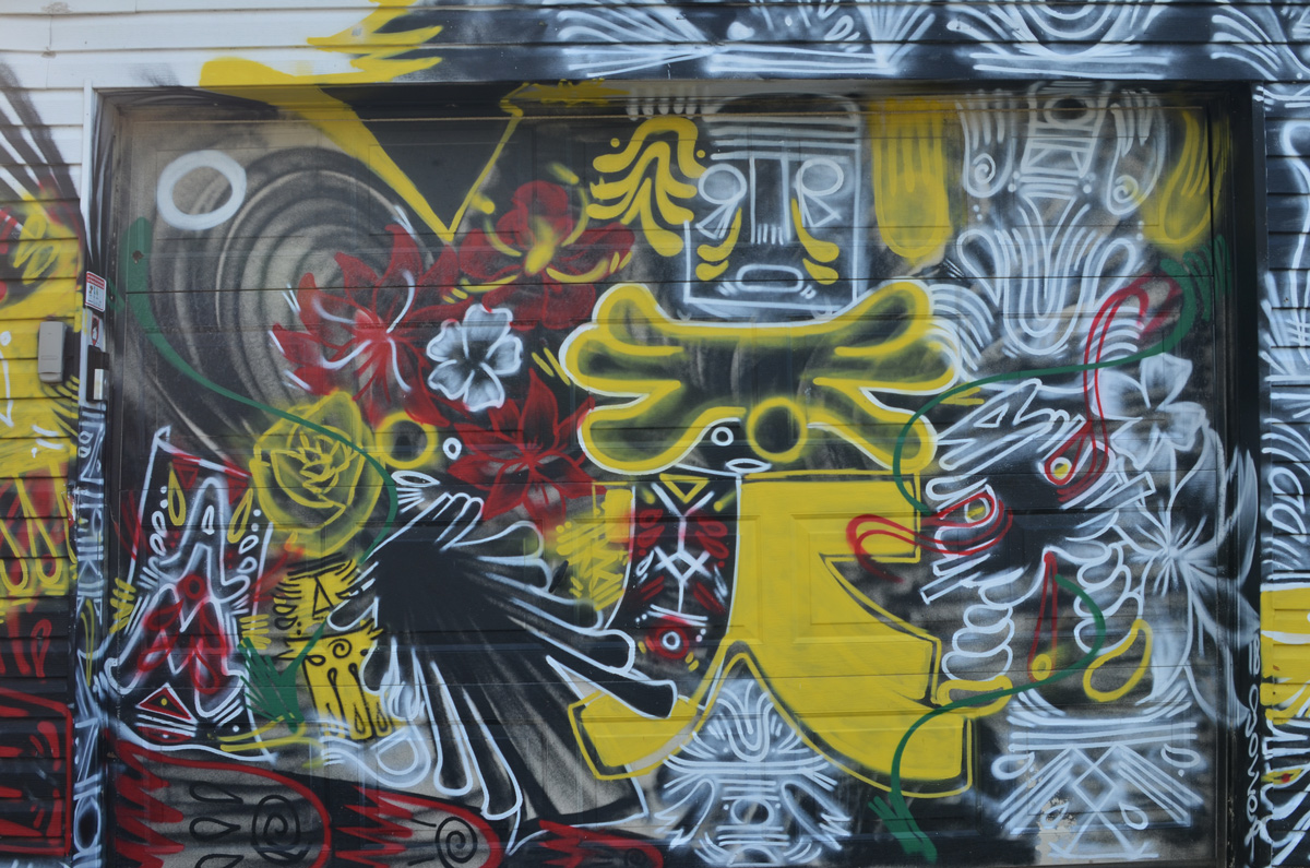
a garage door completely covered in paint, street art in red, black and yellow

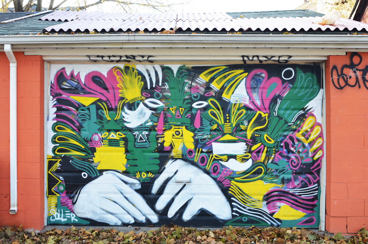
street art on a garage door including a large pair of white hands

street art on two metal boxes on the sidewalk, one is a zipper opening to reveal a brick wall

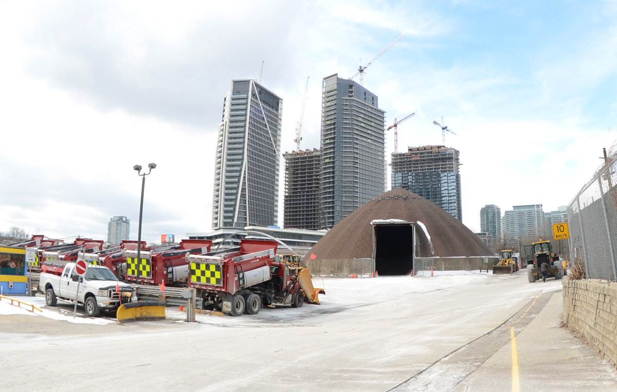
below: Found – one city snowplow parking lot, between the railway tracks and Wellington Street (at the end of Walnut Ave).

parking lot for red snowplows, city property, also a dome shaped storage for sand, condos in the background

below: Immediately to the east of the snowplows is the old brick building. It has its own access road from Wellington including a bridge with three arches.   The road is overgrown and blocked by a fence.  There is no sign by the road.

cars in a parking lot with an old boarded up brick building, 2 storeys. The building has a road and 3 arched bridge leading to the upper storey

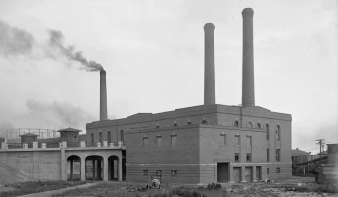
below: It took some time on google but I finally found the answer to the building above.  Here it is in 1925, the year that it was built – the Wellington Destructor.  It was used until the 1970s when burning garbage was banned; it has been a heritage building since 2005.  I found the photo online on a CBC News webpage where there a great description of the building and its history,  along with some pictures of the interior.

old black and white photo of garbage incinerator built in 1925, Toronto, large brick building

below: And that brings us back to the Bathurst Street bridge over the railway tracks on the south side of Front Street.  Did you know that it’s officially called the Sir Isaac Brock Bridge?  It spent most of its life as the Bathurst Street Bridge until 2007 when it was renamed.

traffic at the intersection of Bathurst and Front. Brown metal bridge for Bathurst over the tracks, CN Tower and new condos in the background

below: It is a steel truss bridge that was built in 1903 (one of the oldest bridges in the city).  It’s first life was a railway bridge over the Humber Bridge but in 1916 it was disassembled, moved to Bathurst, and reassembled.

brown metal bridge, Bathurst street over the railway tracks,

below: Bathurst bridge, 1919, from the west (Lake Ontario is on the right hand side).

vintage black and white photo of railway tracks and bridge over Bathurst street, 1919, from Toronto City Archives

The view from the Municipal Abbatoir Building, looking southeast. The building with the water tower on top is the Matthews Blackwell meat packing company. On the left, you can see part of the cylindrical tower belonging to Consumers Gas Company


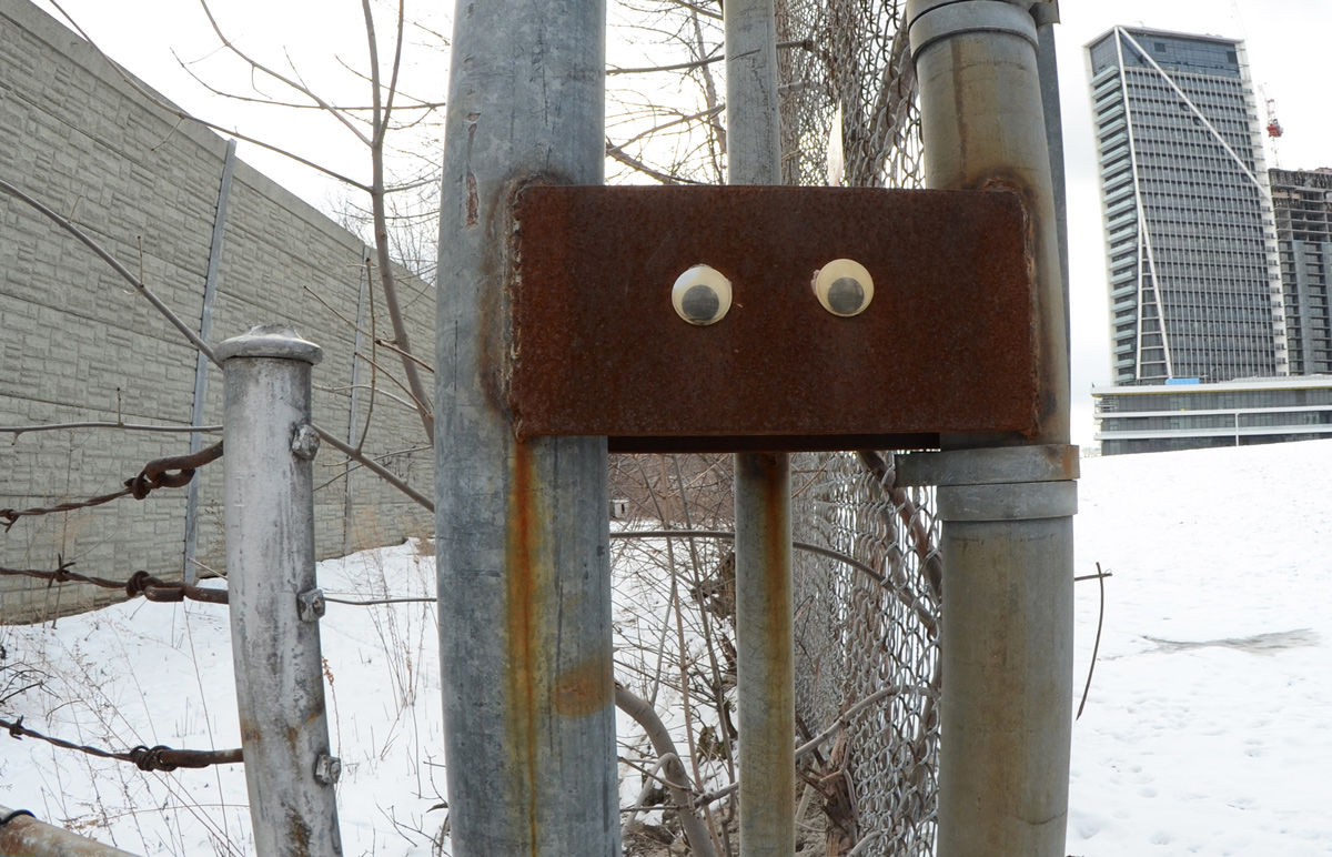
below: Someone has given this rusty guy some eyes!  He too is watching out for interesting stories.  He’s also thankful that you made it this far!  At least he can’t roll his eyes!

two large black and white googly eyes have been glued onto a rusty piece of metal on a fence

looking through blue see through fencing towards an apartment across the street, a pedestrian crossing sign in front, a danger due to excavations sign on the fence.

Back before the winter snow had melted, I was at Yonge and Eglinton and noticed that the old bus bays at Eglinton station were gone. That structure had sat empty for a couple of years but now there is a big hole where they once stood. As I looked through the pictures that I took that day, I decided that it might be interesting to explore farther east to see what was happening with the Crosstown LRT construction that has messed up the traffic through midtown for so long now.

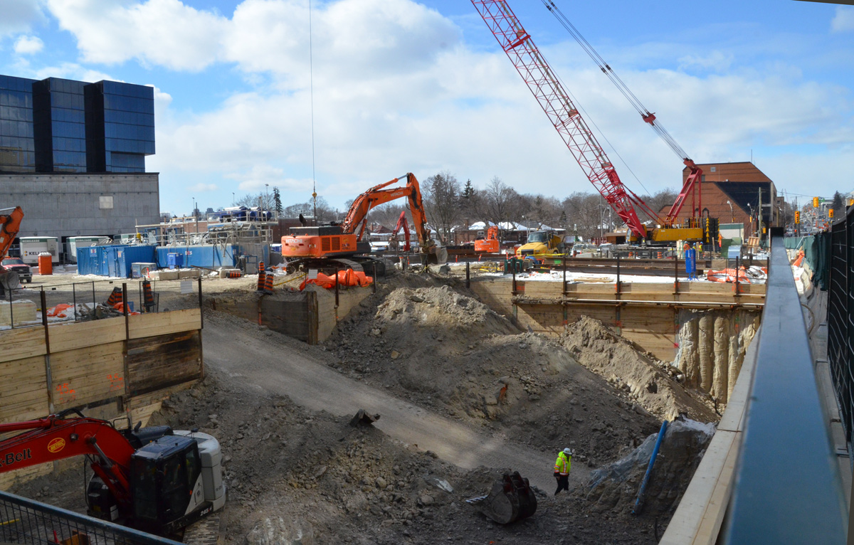
below: Southwest corner of Yonge & Eglinton.

large hole in the ground at a construction site, diggers and a crane onsite

below: There is still a lot of construction underway on Eglinton near Yonge.

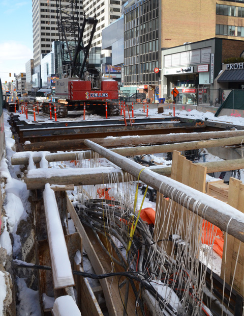
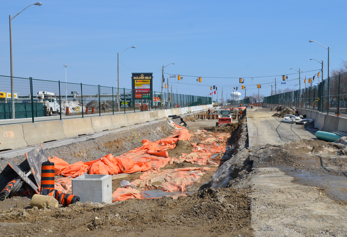
holes in the ground on construction sites on Eglinton Ave for the new crosstown LRT, shoring, wood and pipes

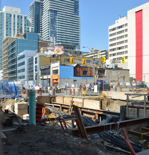
below: A little father east and more holes in the ground. This is the intersection of Eglinton and Mt Pleasant taken from the SE corner looking towards the NW. At least the facade of the old Imperial Bank of Canada building on the NW corner was originally going to be used as the LRT station but have those plans changed? The building was demolished but apparently the facade was taken apart brick by brick and will be re-built later.

holes in the ground on construction sites on Eglinton Ave for the new crosstown LRT

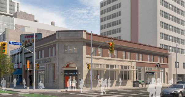
below: This is the plan for the Mt Pleasant station as seen on the Crosstown website.

artists conception of a new LRT station with a re-purposed older building

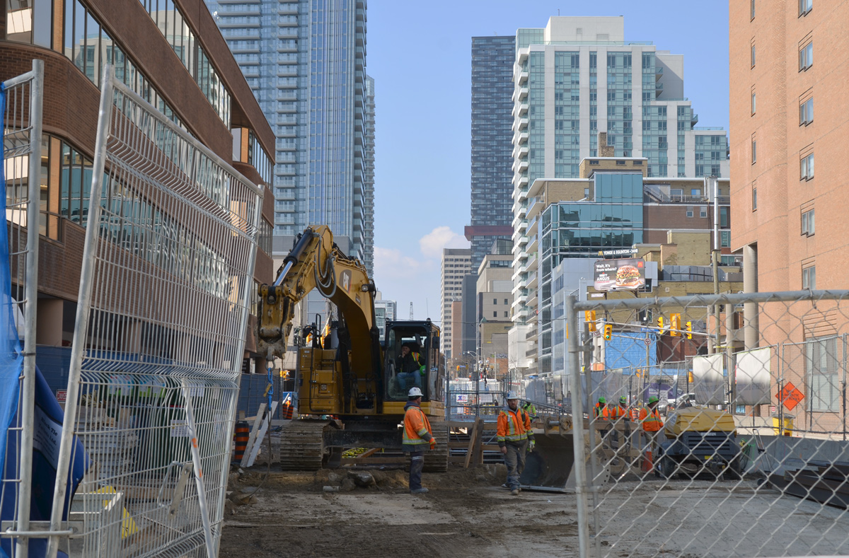
below: Looking west from Mt. Pleasant.

cain link fence and gate is open, construction crew in the middle of Eglinton Ave (at Mt Pleasant) is working with a digger, hole in the ground

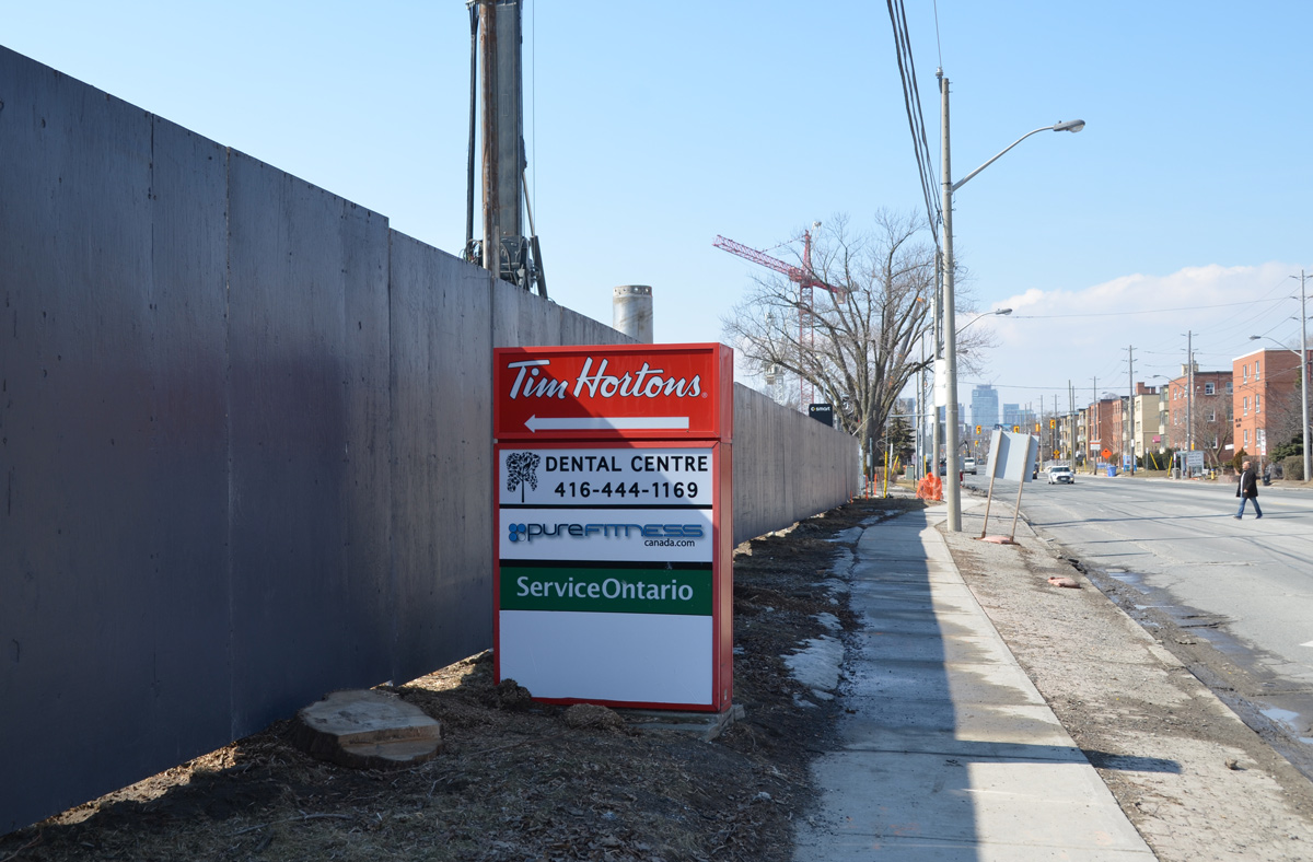
below: Between Laird and Brentcliffe (east of Bayview). See those low rise brick apartment buildings? How long until they’re gone?

red and white tim hortons sign with an arrow pointing left at a long grey fence around a construction site, sidewalk, street, and low rise buildings on the right, Eglinton Ave

two 3 storey red brick apartment buildings

below: At Brentcliffe. The LRT is underground here and there is no station at this intersection. Laird, where there is a station, is only one block to the west.

Eglinton Ave east at Brentcliffe

below: From Brentcliffe, Eglinton goes downhill because of the Don River ravine system

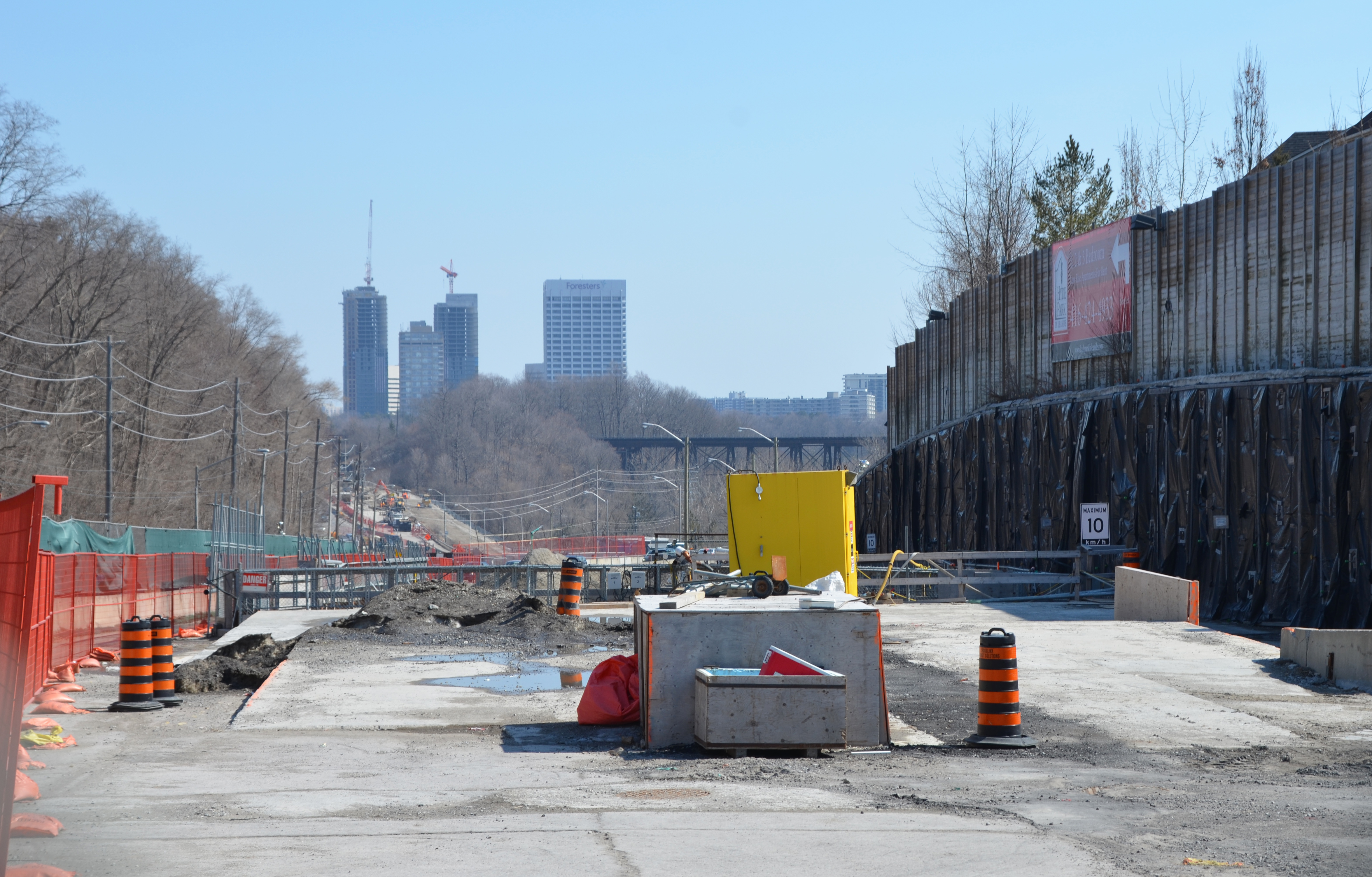
looking east on Eglinton, towards Don Mills Road in the distance, construction in the foreground

below: Part way down the hill there is a section of concrete. At first I thought that this was where the LRT was going to come to the surface.

concrete section of road, construction

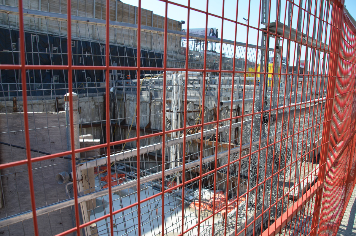
below: But then I wasn’t so sure. There is a concrete wall blocking what would be the exit. It’s difficult to get a closer look because there are two layers of fencing in the way. Nobody was working here. In addition, there is another section farther along that looks like the actual opening. Maybe this is part of the supporting infrastructure?

two fences in front of a dug out section of road, with concrete wall at one end.  One f the fences is orange, wire,

below: Still walking east along Eglinton…. Almost to the bottom of the hill at Leslie – looking east along Eglinton Avenue with E.T. Seton Park on the right and the railway bridge in the distance. Leslie Street, which ends at Eglinton, is on the very left side of the photo. There is talk that this intersection will be closed for two months this summer.

looking east along Eglinton Ave towards Leslie, on the right is the road to the park and beyond that, a railway bridge

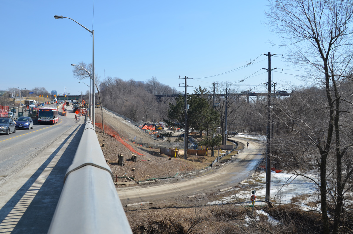
below: I turned around and took a picture of the hill that I had just come down. Here the LRT surfaces and the tracks run down the center of the road, with lanes of traffic on both sides of the tracks. I am fairly certain that you can see the entrance to the tunnel, the east portal, near the middle of this picture. From here to Kennedy station the tracks are above ground (except for a portion of the route at Don Mills).

traffic drives west along Eglinton Ave., up the hill from Leslie, through the crosstown LRT construction

below: The sidewalk on the south side ends at Leslie street. Here, I chatted with a policeman while we waited for the light to turn green. Once he did, he escorted me across Eglinton as we had to pass through part of the construction zone. This is where I also discovered that there are no bus stops between Brentcliffe and Don Mills Road. That’s only 2 km but it feels a lot longer!

on the south side of Eglinton, where the sidewalk ends at Leslie street, looking east beyond that with construction on the right

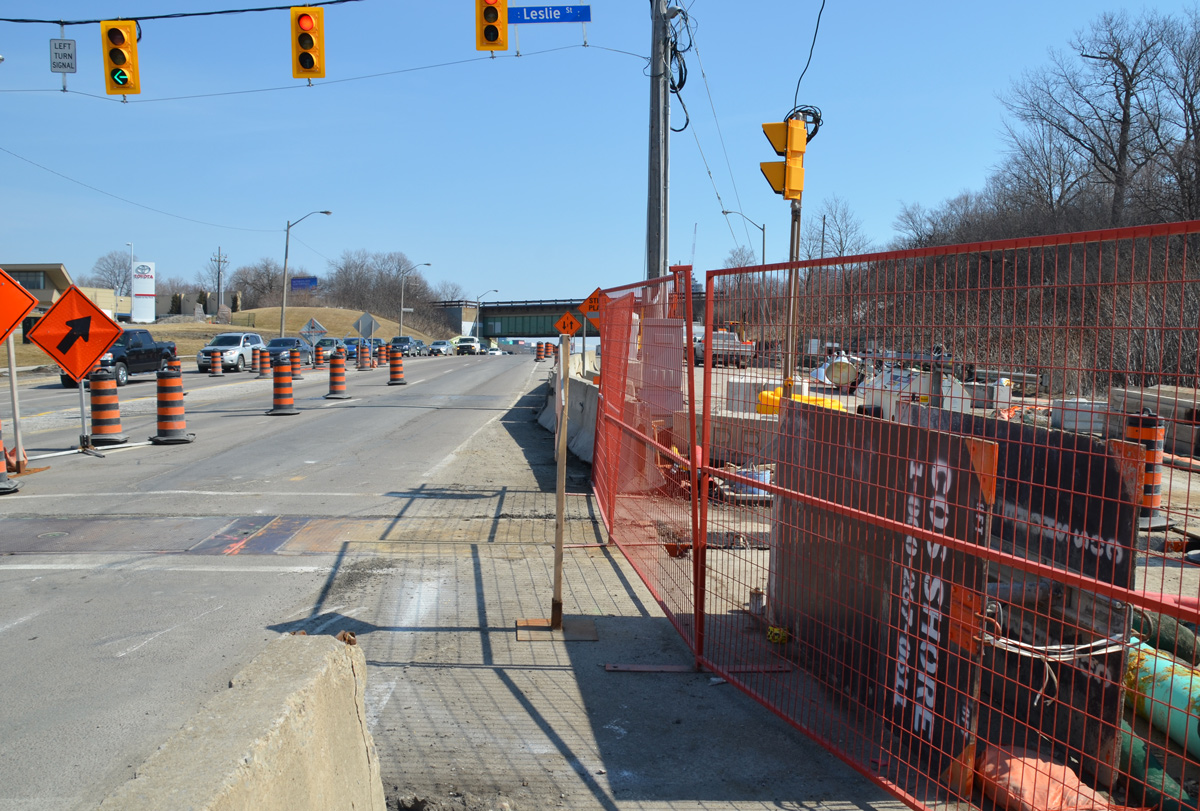
below: A development proposal sign stands on the lawn of what used to be the Inn on the Park but what is now a Toyota dealership.

development proposal sign on the lawn of what used to be the Inn on the Park on the north east corner of Leslie and Eglinton

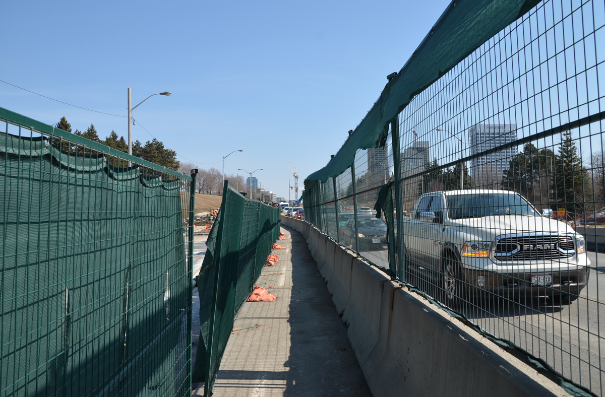
green netting and fencing on both sides of a narrow sidewalk running between construction and traffic.

below: The station at Don Mills and Eglinton will be called “Science Center” and it will be under the intersection.

LRT track path being constructed,

below: There will be a bus terminal on the northeast corner of Don Mills Road and Eglinton with underground access to the LRT station. This is what construction looks like on that corner at the moment.

underground sections of LRT being constructed at Don Mills and Eglinton, crane at work, metal frame over tunnel

Just east of Don Mills Road, the LRT surfaces again and remains above ground until Kennedy station. I took the bus from Don Mills Road to Victoria Park as there wasn’t as much to see in this stretch.

below: Looking east from Victoria Park Avenue.

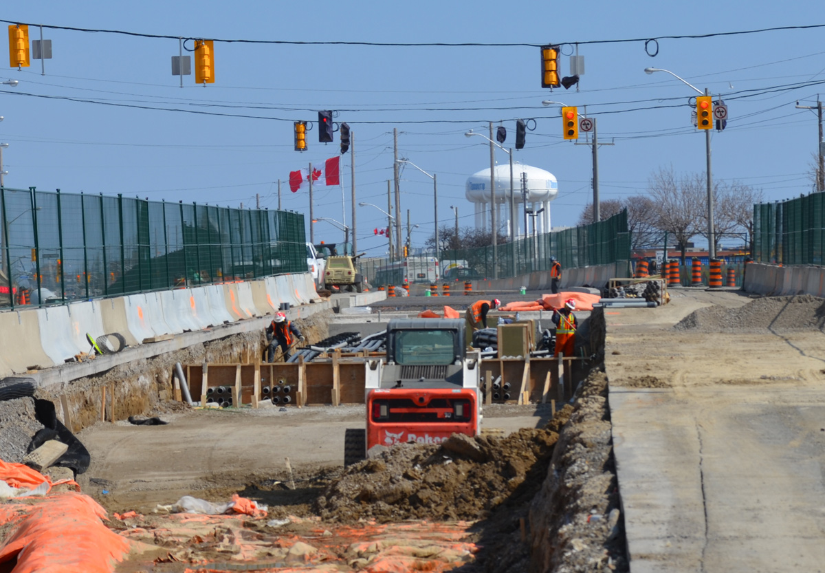
shallow but wide hole in the ground where new LRT tracks are being laid. construction in prep for the tracks, green fencing separates construction from traffic on both sides,

shallow but wide hole in the ground where new LRT tracks are being laid. construction in prep for the tracks, green fencing separates construction from traffic on both sides, water tower in the distance

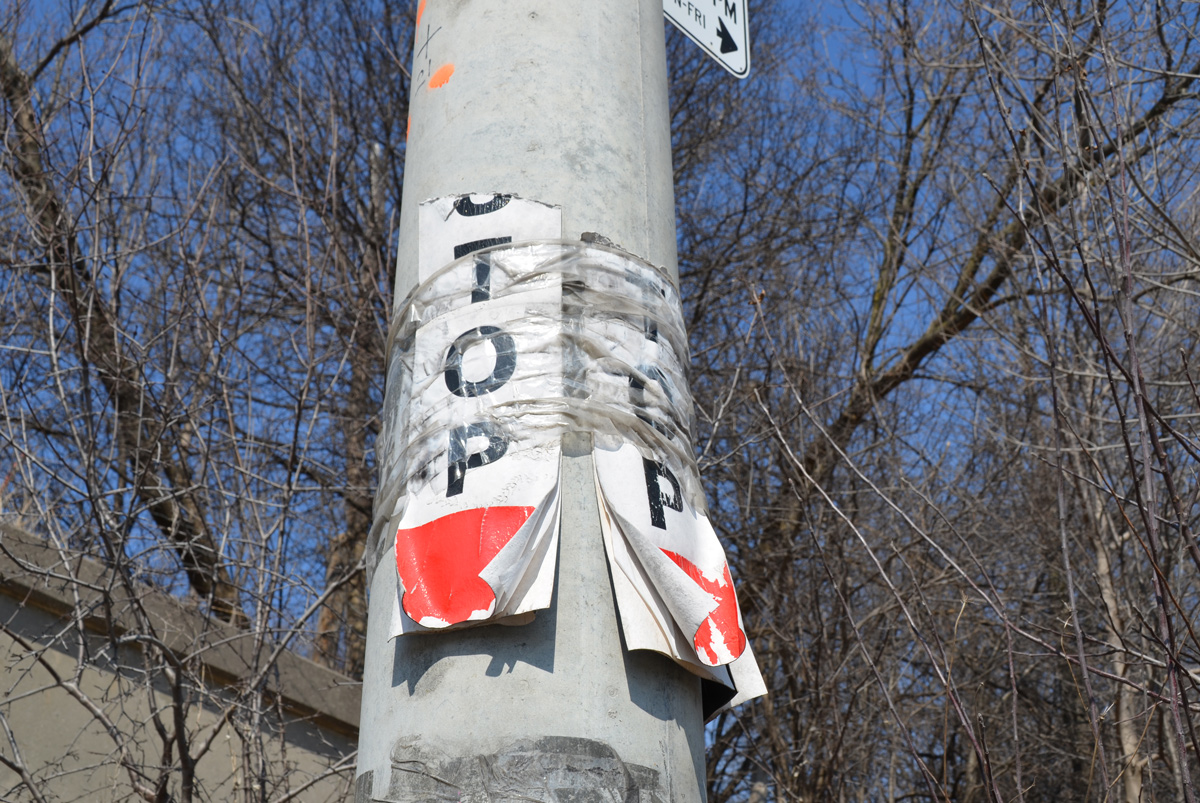
concrete utility pole with two ripped paper temporary bust stop signs, TTC, stops no longer in use

Presenting an eclectic compilation of images so

Have a seat!

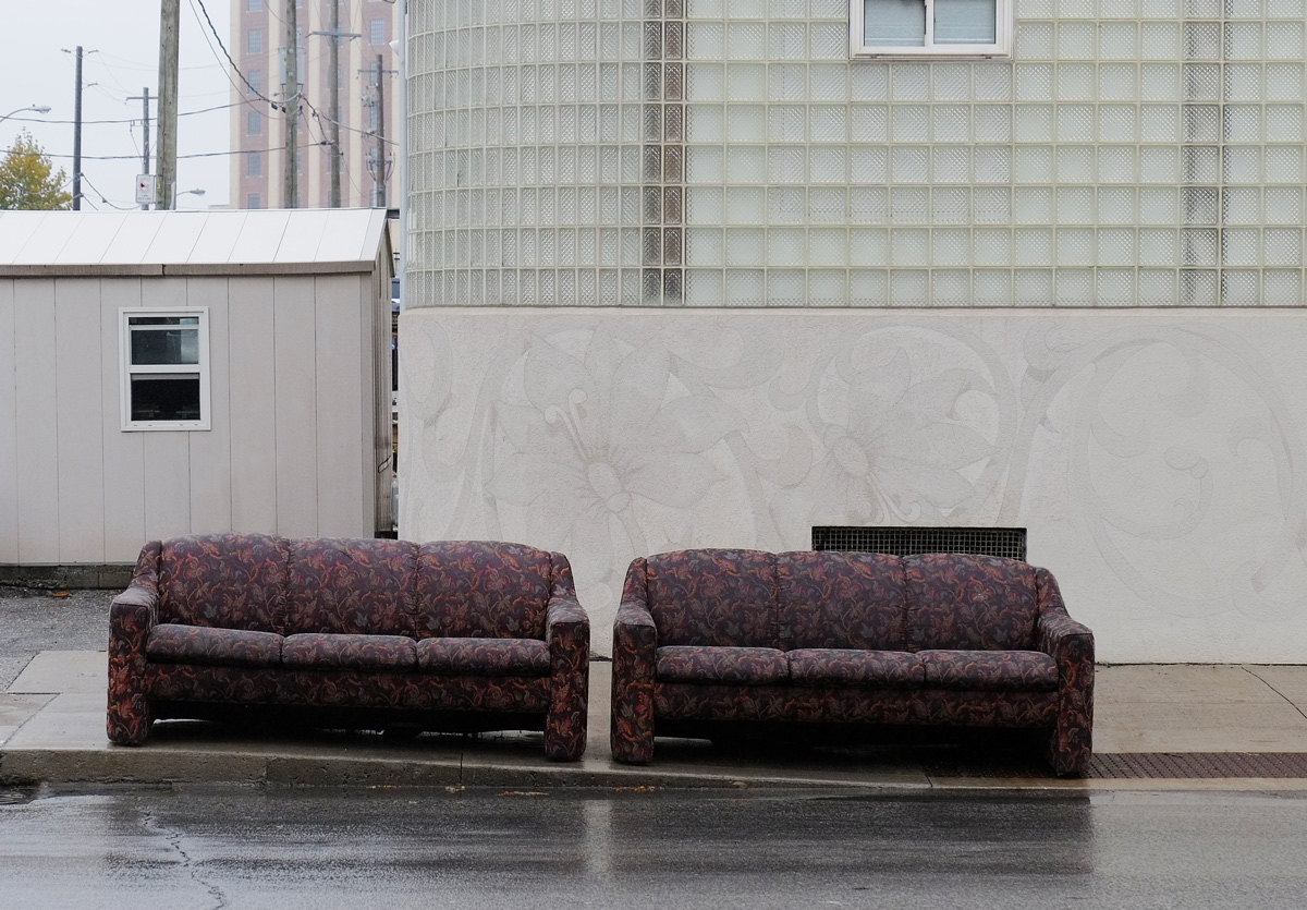
below:  But maybe not here, even if they are two comfy sofas!  Comfy but wet.

two burgundy sofas on the sidewalk

Meandering on a day early in November

while the trees were still showing their last hurrah of colour.

colourful leaves, red and yellow leaves on trees in a residential neighbourhood, Neepawa Street

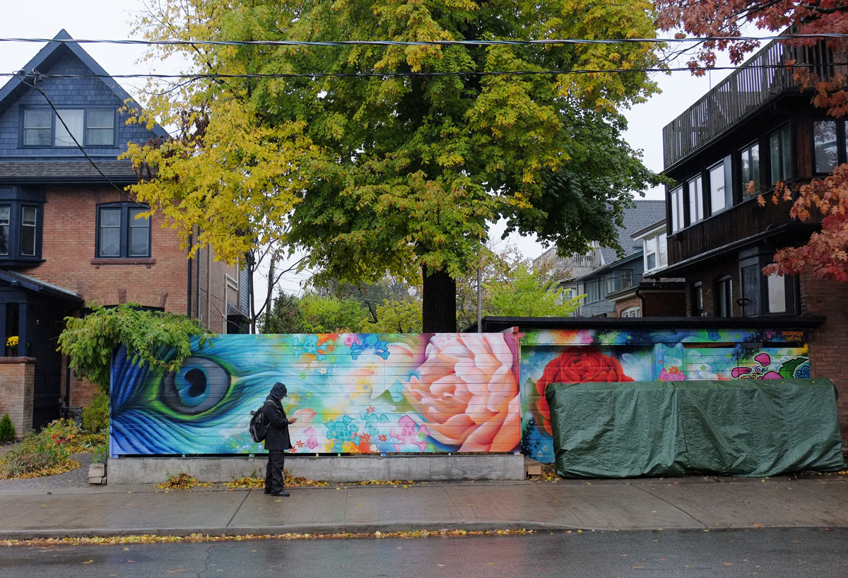
This mural is on Roncesvalles is partially obscured but is still a welcome splash of colour and vibrance.

a man walks by a mural on a fence, a peacock feather and a pink flower

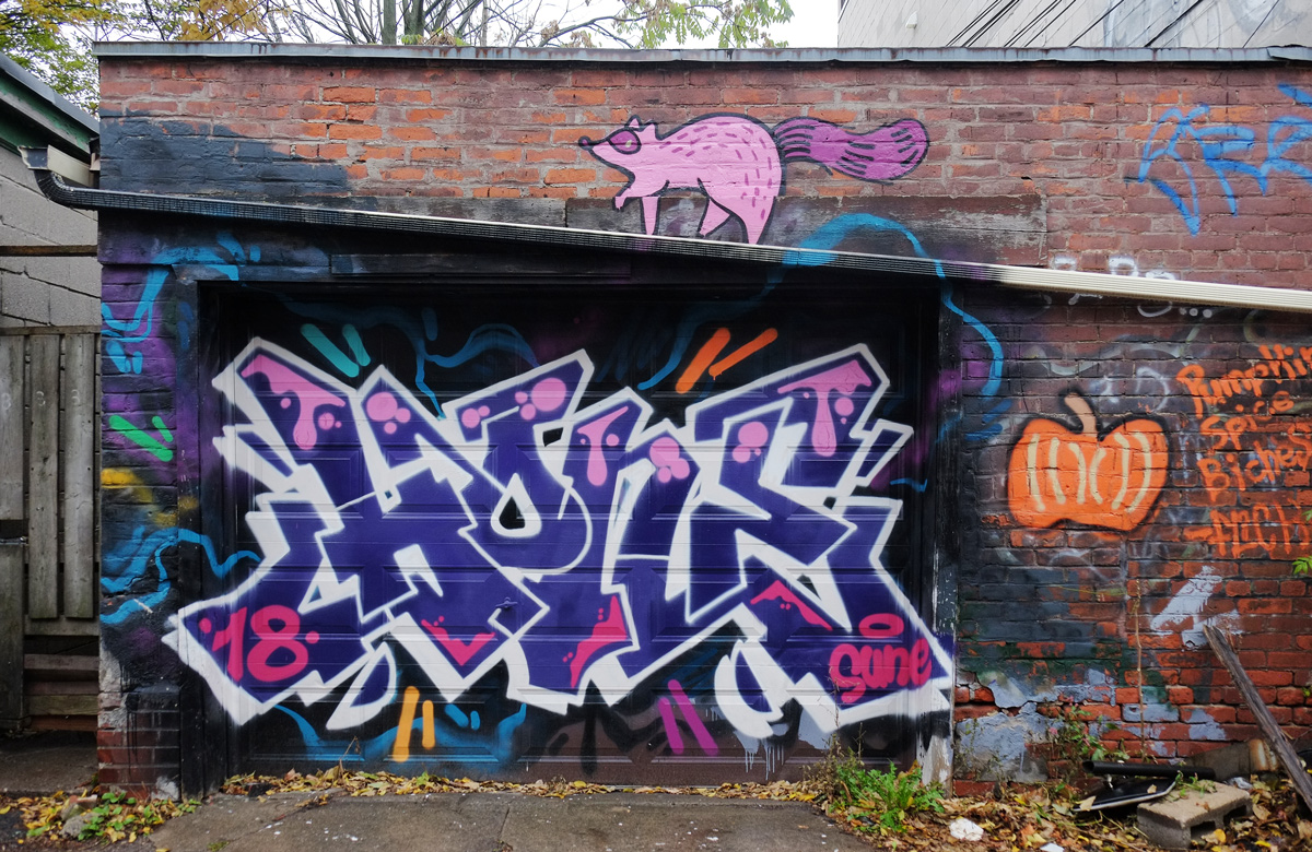
   I love the raccoons!  Pink raccoons

test graffiti on a garage in an alley, also with a pink raccoon painted above the garage door

and blue raccoons on street art that I haven’t seen before.

street art on a garage door in an alley, large heart shaped face with big eyes and red lips, also raccoons,

Crooked lines,

garage doors and fences in an alley, autumn, trees with gold and yellow leaves, as well as leaves on the ground

tight spaces,

small walkway between two light purple buildings that leads to the entrance to another residence

and old glass.  All kinds of alterations.

sign on an old house, now a commercial property, that says Alteration Fast & Best All Kinds Of

old red brick building on Dundas West, sign that says Downtown Rental

 Peeling paint on diamonds  (once red?)

paint peeling on wood, three layers of wood with upper two layers cut in diamond shapes

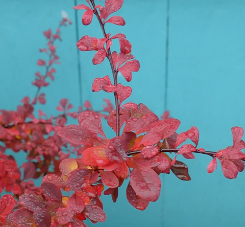
and water drops on leaves (definitely red).

red leaves of a plant, wet from the rain, in front of a bright turquoise wall

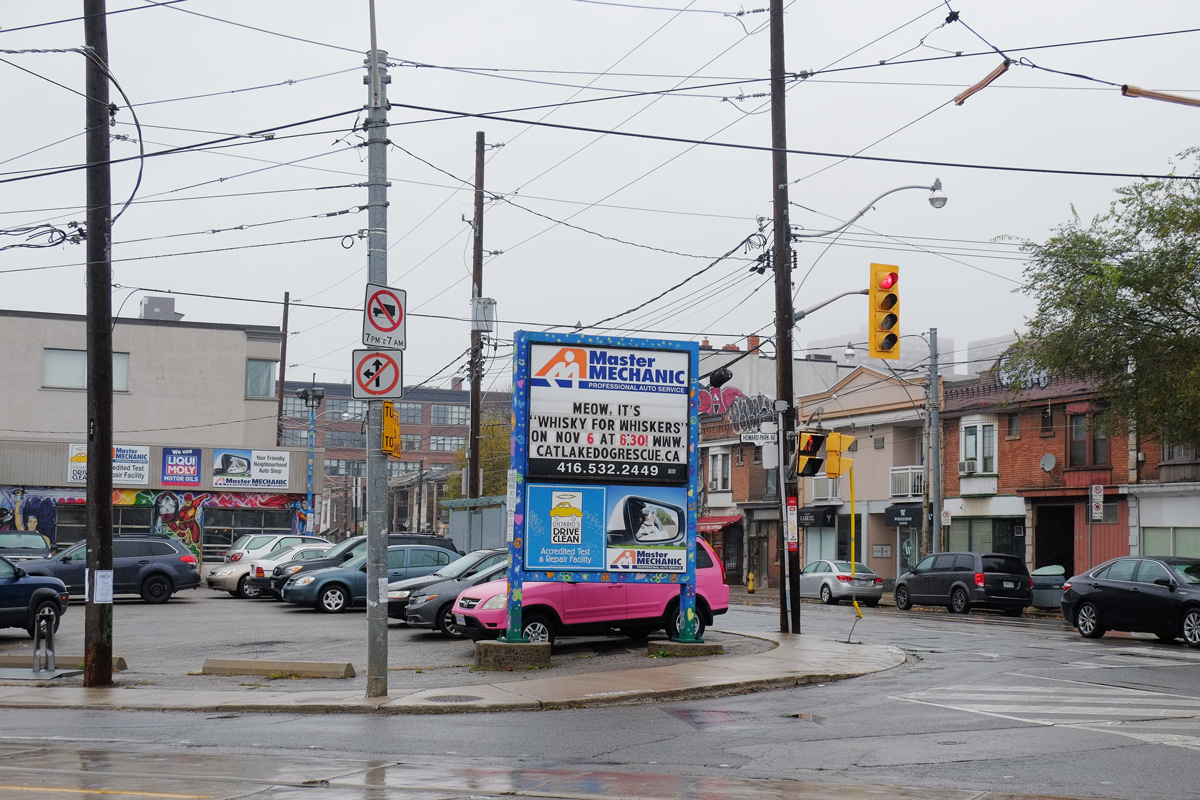
One very pink car.  Whiskey for Whiskers.

pink car in parking lot

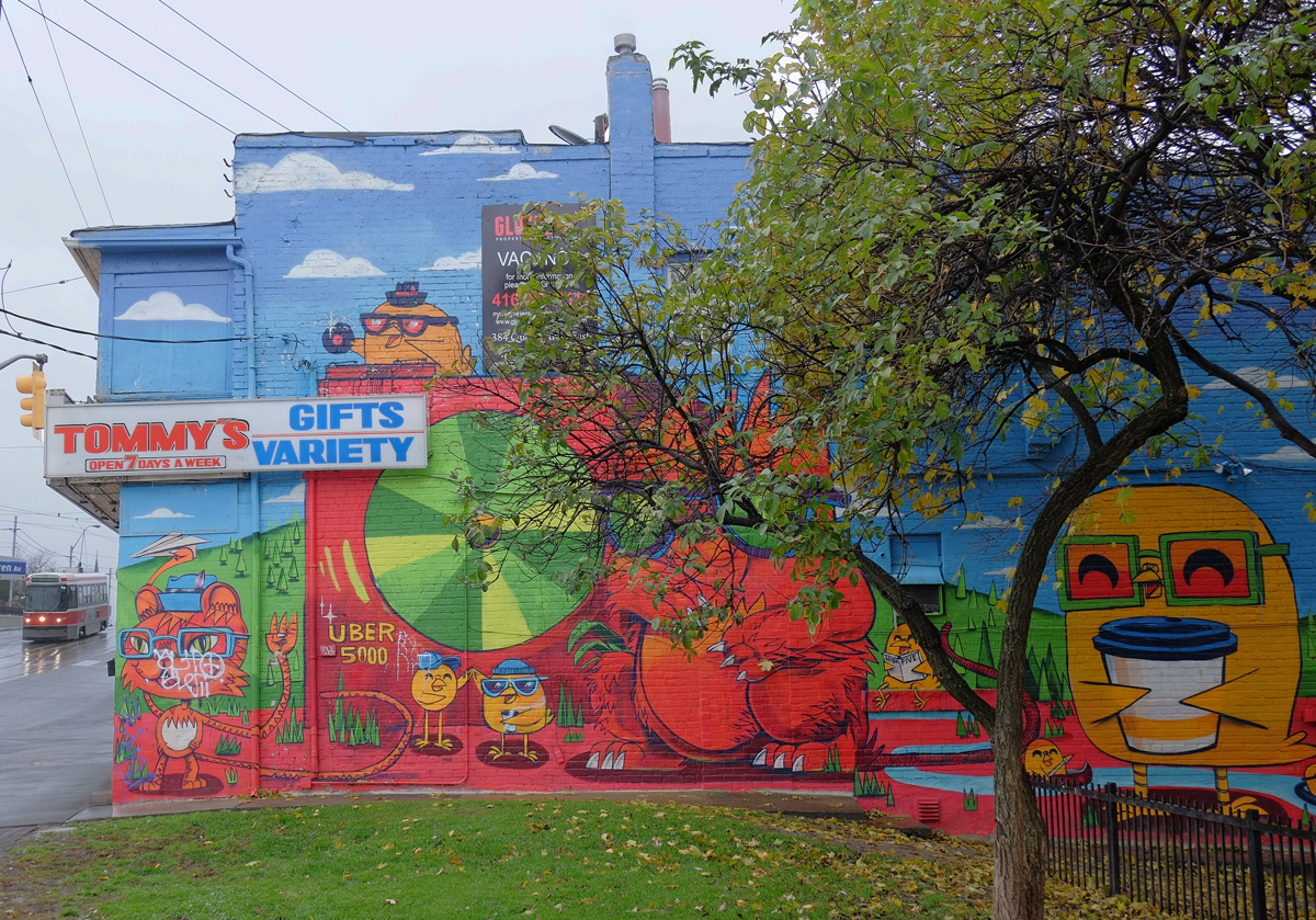
Uber 5000’s yellow birdies and friends are still on the side of Tommy’s Gift & Variety.

Uber5000 mural on the side of Tommys

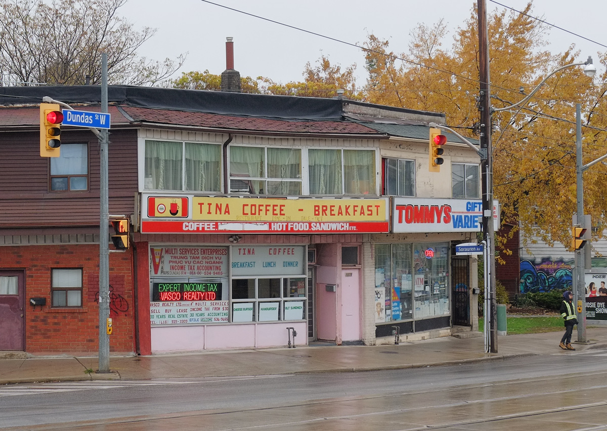
And next door you Coffee and breakfast at Tina’s while your tax returns are prepared.

restaurant and store, rainy day, wet sidewalk and street in front of it, Tina Coffee and Breakfast restaurant, and Tommys Gift & Variety, pink door between the two, two storeys, lots of windows in the storey above Tina's.

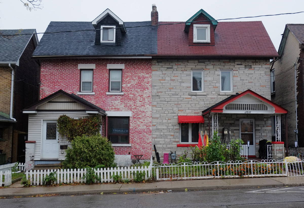
 Semi neighbours

two attached houses in the Junction, one painted red brick with dark blue roof and the other light brown with dark red roof and bright red trim, small white picket fence in front of the red house, metal fence in front of the brown house (beige actually)

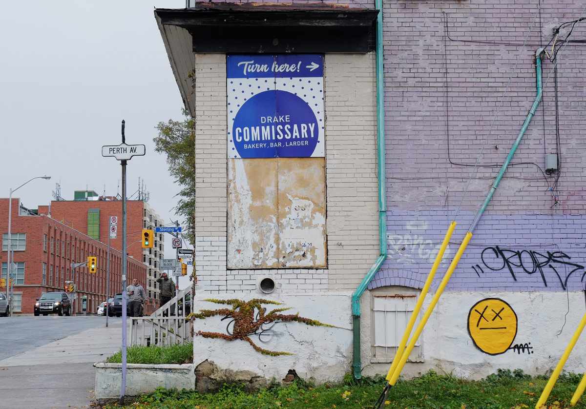
at the edges of gentrification.

building on the corner of Perth Ave and Bloor West, pale purple paint, a bright yellow happy face graffiti, a sign advertising Drake Commissary

Lights over the train tracks

looking across the train tracks to an old building with street art on the lower level, lights on metal posts over the tracks, tight mesh fence beside the railway as well

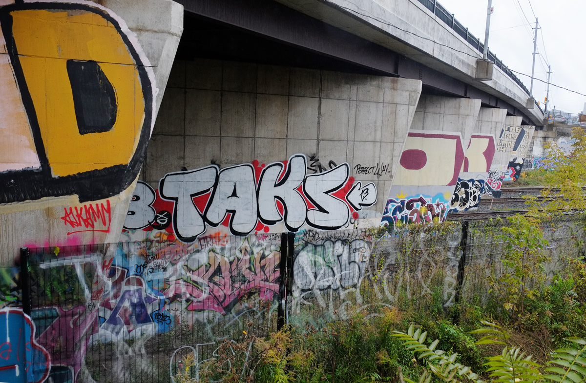
and graffiti beside.

graffiti on the concrete bridge supports, Dundas St West over the railway tracks, taken from the West Toronto Railpath

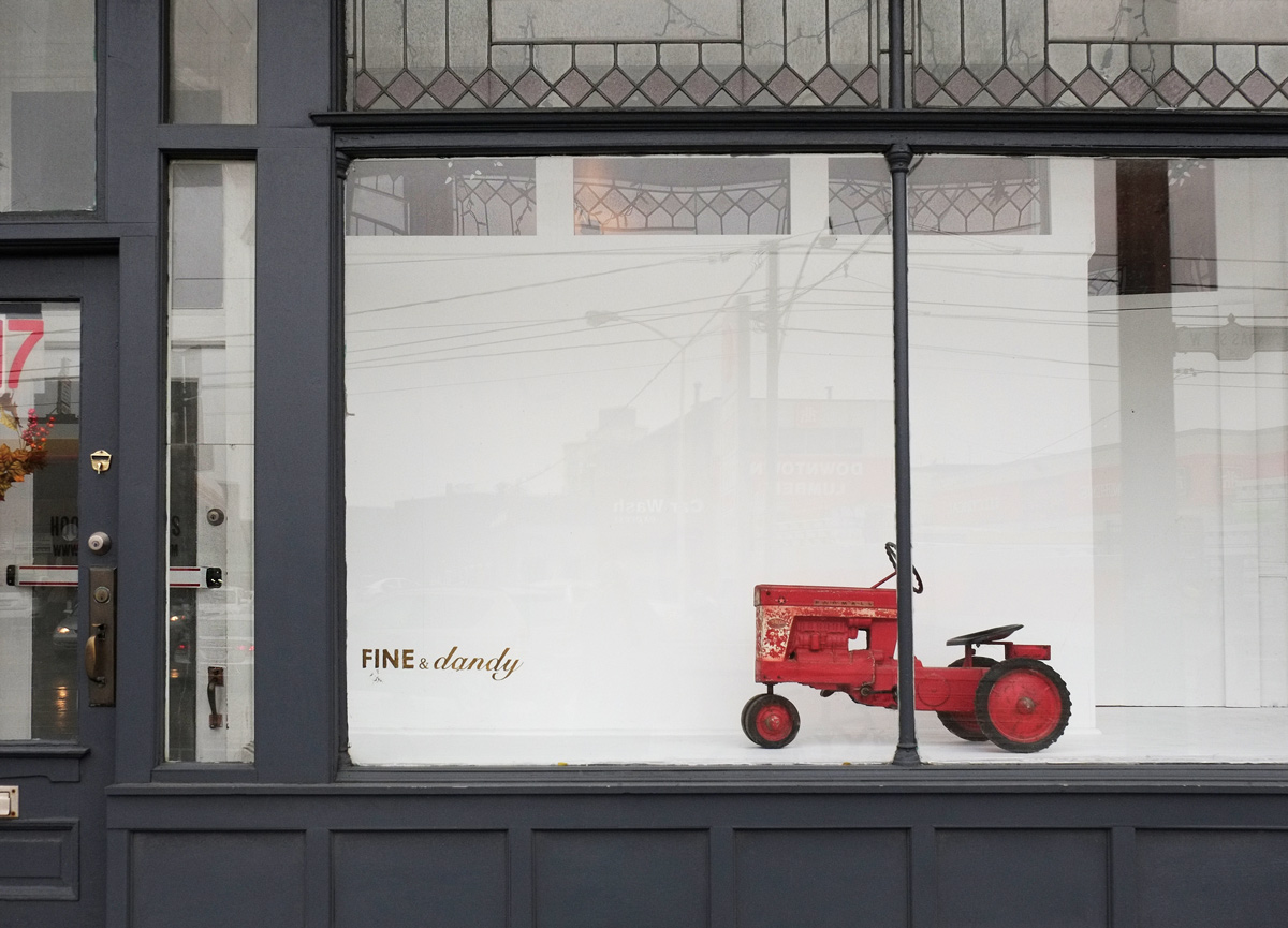
A fine and dandy tractor

a red toy tractor, old fashioned, in the window of fine and dandy on Dundas Street, white back drop behind the tractor, the building is dark grey

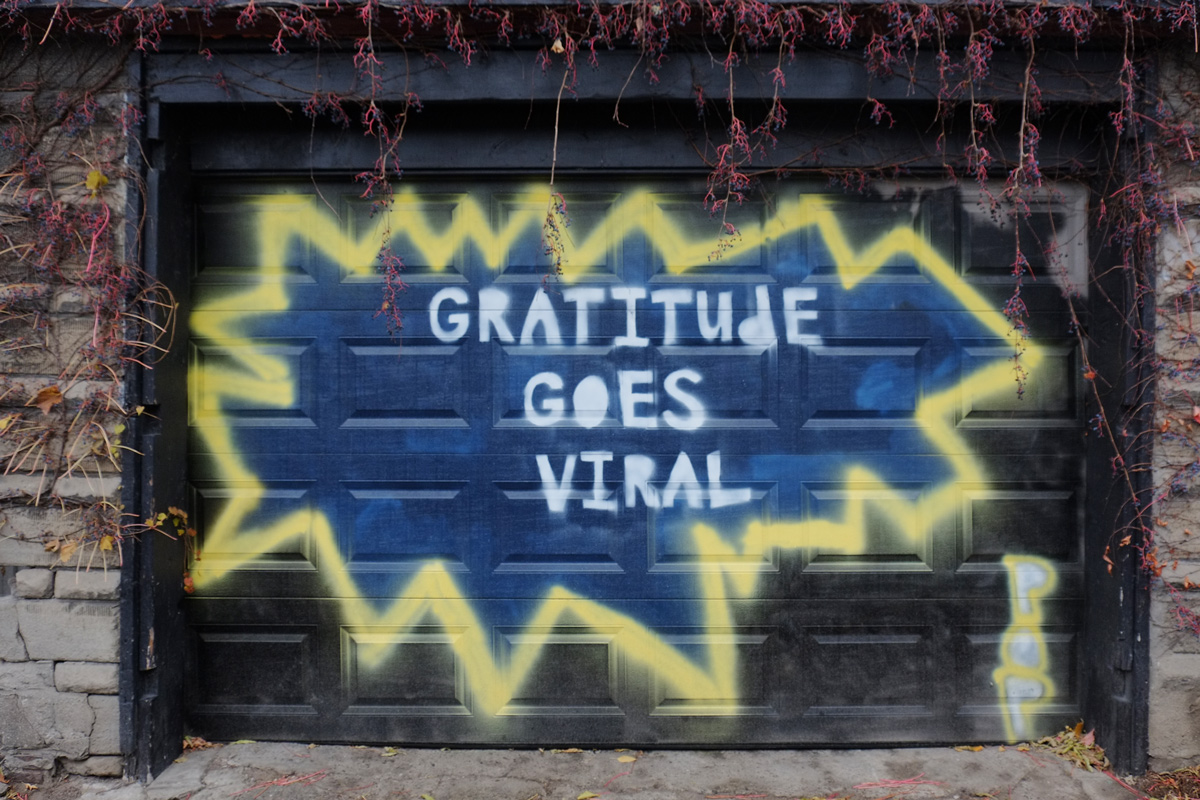
and a great idea

words painted on a garage door that say gratitude goes viral

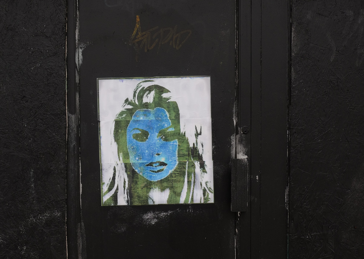
She’s gone green but she’s got the blues.

a paper paste up of woman's face in green and blue (green skin and blue hair) on a very black wall and door

and Ontario’s now orange.

row of stores on Dundas Street, one on the end has a map of Canada painted on the exterior wall, with orange background.

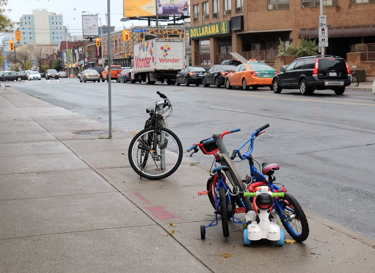
A family outing

an adult bike locked to a ring, two kids bikes and a toddlers push car locked to a second ring, on a sidewalk on Dundas West, cars and buildings in the background.

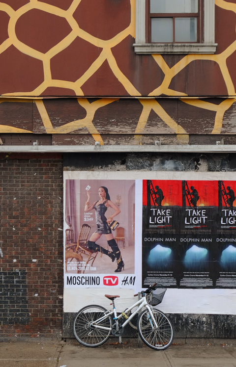
below: The building with the giraffe pattern on top, at Bloor and Dundas West, is still there.

giraffe building at Bloor and Dundas West, with traffic and pedestrians in front
giraffe pattern brown and gold wall on top and brown below, movie posters and a bike

below: The murals painted by Wallnoize are still there. They were painted in the spring of 2015 and I posted a lot of photos of them shortly after that.

people walking on a sidewalk that passes by a long mural painted by wallnoize, many small murals joined together, apartment buildings with large trees with yellow autumn leaves in the background, Bloor West,

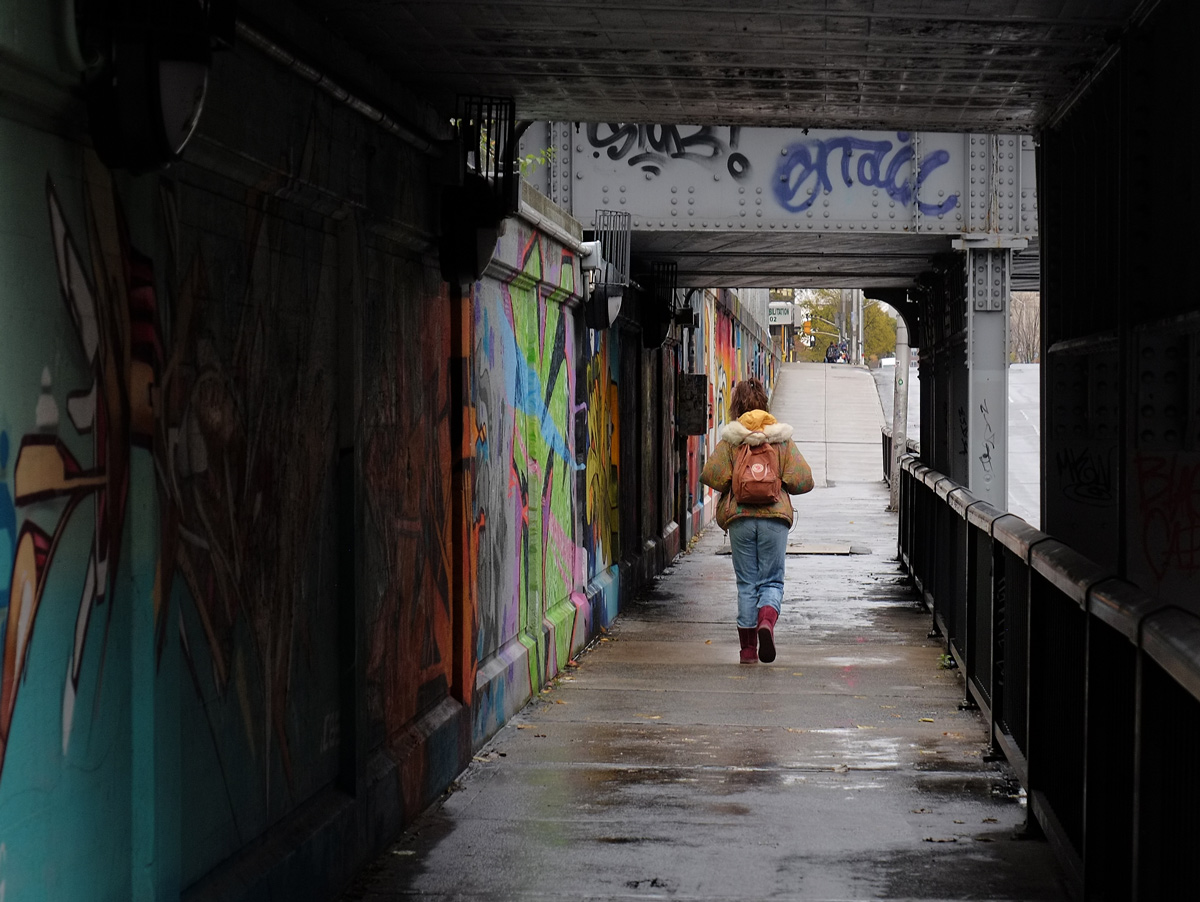
below: The murals run under the Bloor Street underpass (railway tracks overhead), on both sides of the street.

a woman walks along a wet sidewalk under a train bridge, railling on one side, street art on the wall on the other side.

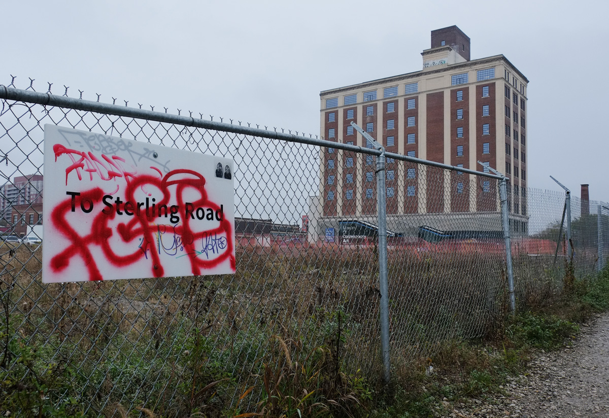
below: The new MOCA (Museum of Contemporary Art) is now open on Sterling Road. The renovations to the old Tower Automotive building aren’t totally complete; most of the area is a construction site. But the museum opened earlier this year. Access from the West Toronto Railpath is available.

chainlink fence along a path leading from West Toronto Railpath to Sterling Road, with new MOCA (Museum of Contemporary Art) in the background, what used to be the Tower Automotive Building

But hey! Why stop here?…. more about the new MOCA follows ……

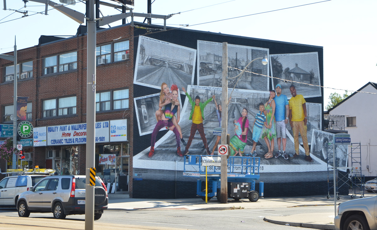
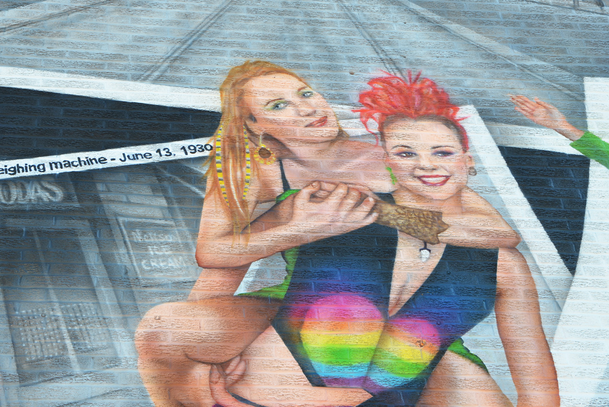
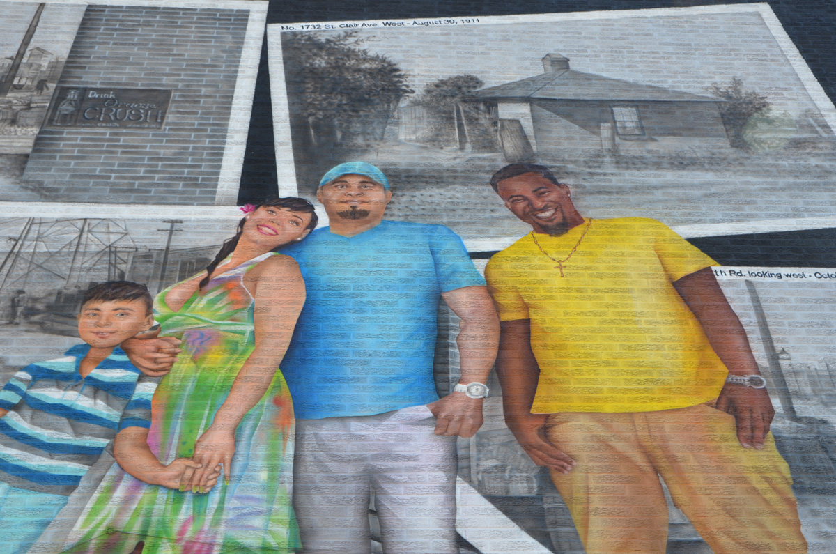
From the monochrome past to the coloured present – there’s a new mural on the corner of St. Clair West and Spring Grove painted by Christiano De Araujo.    Old black and white photos of the area and its people provide the background for a group of ten very modern and diverse people.

looking diagonally across the intersection of St. Clair West and Spring Grove Rd to a new mural that has just been finished on the side a building, painted by Christiano De Araujo.

painting of two young women, one blond and one withshort curly bright red hair, on top of painting of black and white vintage photos

painting of a black and white photo from 1930 of a woman holding a baby

below: The top photo is 1732 St. Clair West in 1911.

painting, in colour, of a group of people standing in front of paintings of some old monochrome historical pictures of the St. Clair area

below: On the top, very left corner, the black and white photo is a street scene – It’s St Clair Ave looking east from Prescott Avenue, under the railway bridge and beyond.  The bridge was built in 1931 and the photo was taken shortly after that.

new mural on the side of a 2 storey building, a series of vintage black and white photos of the area and people, with paintings of 8 modern people in colour

This is a StART (StreetARToronto) project

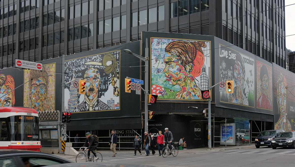
Art on construction hoardings.

below: Looking northwest at the intersection of Yonge Street and St. Clair Avenue West where seven large collages by Daniel Mazzone dominate the corner.

intersection of St. Clair and Yonge, looking northwest, construction hoardings, people crossing the street

below: On the right, James Dean.  It’s difficult to see in this photo, but there are some pink letters on either side of his face.  On the left it says “Dream as if you’ll live forever”.  On the right is says, “Live as if you will die today”.

a man stands at a bus shelter on St. Clair Ave, two large paintings on construction hoardings, by Daniel Mazzone, are behind him

below: She repeats.  This woman is at the two ends.  As far as I can tell, the only difference is the colour of the pattern in the background.   On St. Clair it’s purple while it’s red on Yonge.   Superman is on her forehead and, in fact, most of the pieces that are used in this artwork are from Superman comics.

large maural by Daniel Mazzone, on construction hoardings, a woman's face and head, created by a collage of smaller images

below: Charlie Chaplin above the bus shelter.  Many of the images used to create the face are also pictures of Charlie Chaplin.

a man sits on a bench at a bus shelter on St. Clair, with a large collage picture of Charlie Chaplin behind him, created by Daniel Mazzone

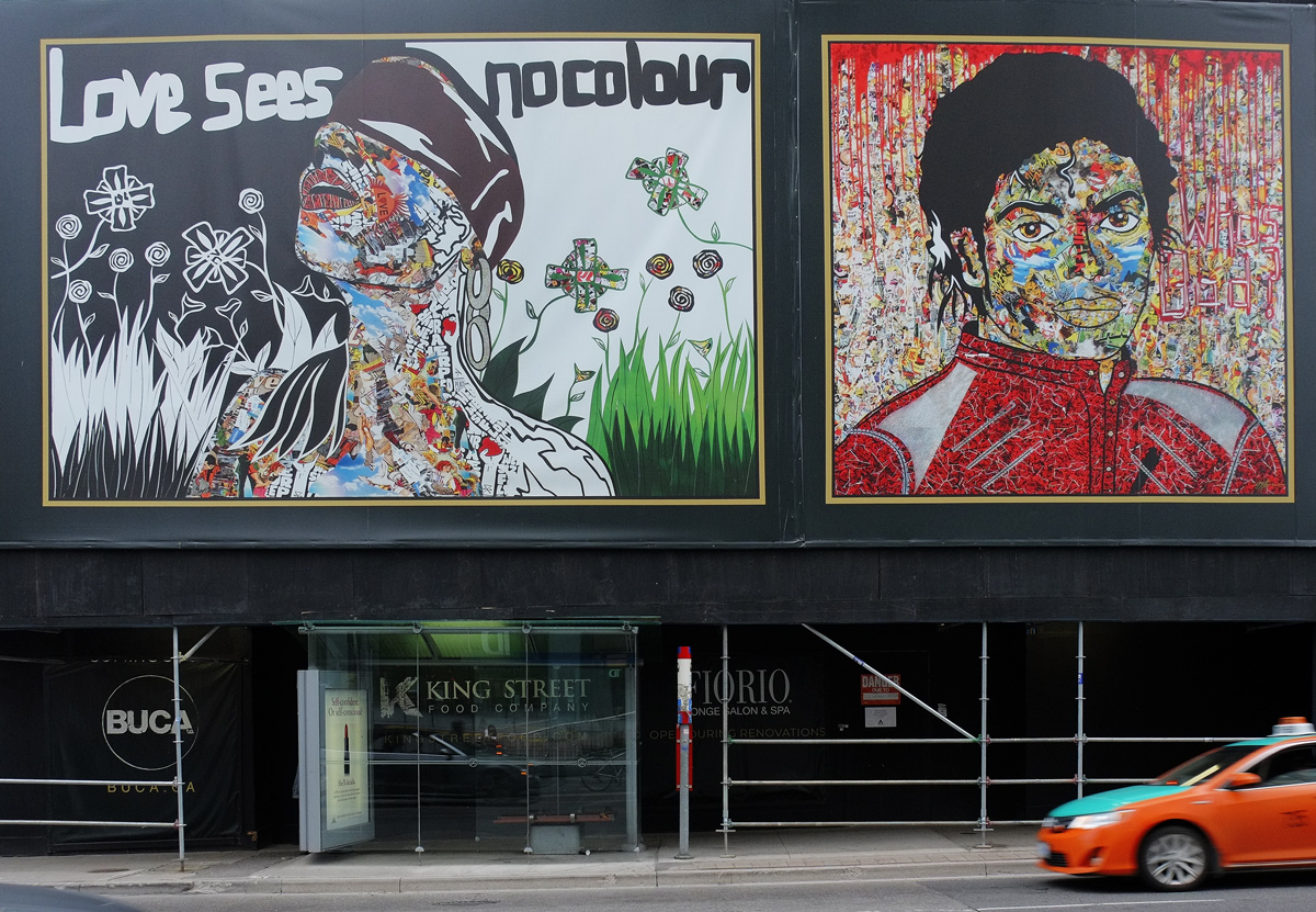
below: Love sees no colour, with Michael Jackson above Yonge Street.

two murals by Daniel Mazzone, one of which is Michael Jackson in his red Thriller jacket, and the other is a woman in a cap blowing dandelions white puffy stuff, other flowers and butterflies too along with the words Love Sees No Colours.

below: “Looking for Beauty” by Daniel Mazzone.  Does she see any?  There are a few Supermans here too, especially in her face.  “Splow” is written in green on her neck.

mural above the sidewalk, as people walk by, Yonge Street street sign, traffic,

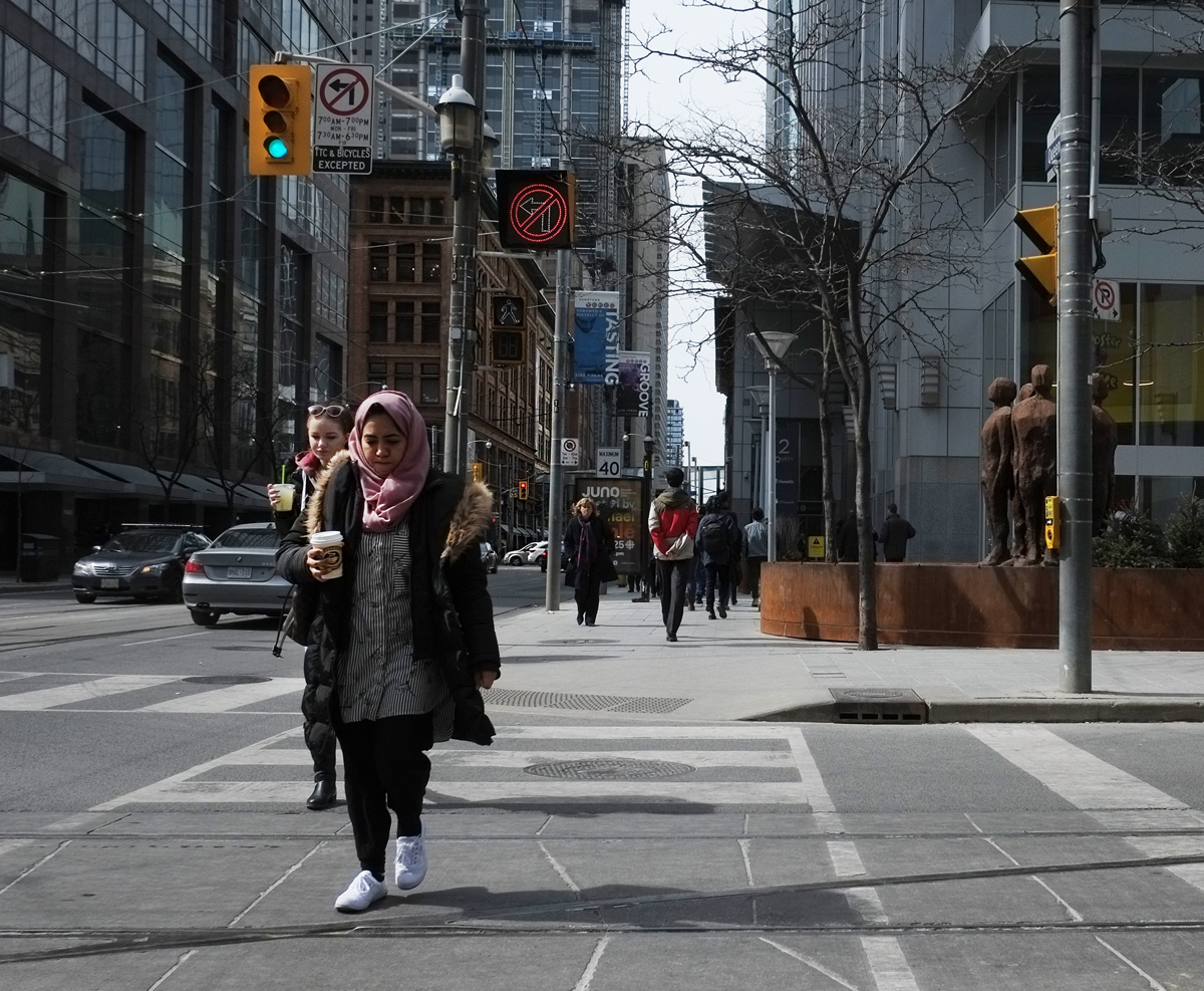
two women holding cups of coffee walk across Victoria St. on Queen Street East

Just after I wrote the previous blog post about some of the buildings on Yonge Street that are in the middle of an area being redeveloped, I walked across Queen Street East.  I noticed that there were a lot of similar three storey buildings here to those around the corner on Yonge.  Toronto must have been a booming city in the late 1800’s and early 1900’s when these stores and warehouses were built.

below: What I also noticed is how many of the storefronts are empty.   This is the northeast corner of Queen and Mutual.

the northeast corner of Queen street east and Mutual street, with an empty building on the corner.

What I don’t have is a photo of the northwest corner – it is about to be developed, or at least there is a plan to develop it, into a 29 storey glass tower.   Urban Toronto called this location, “a spot that currently feels disconnected from the rest of the City. ”  … maybe because the Moss Park neighbourhood is on the lower part of the socioeconomic spectrum?    Urban Toronto is a website that is, their words, “populated by the tastemakers, condo aficionados, buyers, builders and realtors”.   I try to stay neutral in the pro/con condo development argument but it irks me to read things like, “Redefining the urban experience” and variations thereof over and over and over again to describe mediocrity.

To be fair, this 88 Queen West project is redeveloping a parking lot.  Why is it a parking lot?  Because in the 1950’s a parking lot was more important that the buildings, including Cooke’s Presbyterian Church (1857), that originally stood there.   Perhaps we get what we deserve.


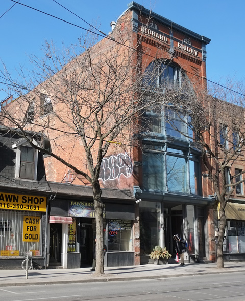
below: Richard Bigley (1853-1933) started off as a woodworker but soon switched to selling stoves. He sold the ‘Happy Thought’ line of stoves. He holds two US patents, one for a water heater and one for a sectional water heater. The building was converted into loft apartments, one loft per floor, back in the late 1990’s.

tall brick building, Richard Bigley 1876 written in white at the top (4 storeys), large glass windows in front, once an old store and warehouse, now a 3 loft apartments. 98 Queen Street East

below: Two views at the corner of Queen East and Jarvis.  You can just see the Moss Park Armoury building on the right side of this picture.  This Canadian Forces facility was built in 1960’s and it takes up a large chunk of land.  Development  rising in the north…

Queen and Jarvis intersection looking north to tall towers being built on Dundas
below: … and development rising in the west.

the intersection of Queen and Jarvis, looking northwest, with a foodora cyclist in pink in the intersection, traffic, street car, and in the distance, development on Yonge and westward, cranes, glass towers

large blue public parking sign, also a large box shaped sign on a tall pole. The sign is wearing out

below: At Ontario Street, the street sign says, Old Town Toronto.  In 1797 the city limits were moved north to Queen Street (then called Lot Street).  Ontario Street was one of the most easterly streets at that time.   And, oh yes, the city was still York.  It officially became Toronto in 1834.

toronto street sign for Ontario Street with the top part that says Old Town Toronto

below: Posters on a boarded up window – once it was a barber shop?  Posters on Queen East for events on Queen West.

posters on an empty building, exterior wall, bottom of wall has barber pole stripes painted on it.

below: A blue and white Development Notice. I still haven’t found out how many of these there are hanging around the city.  My best guess is ‘hundreds’.

blue and white city of toronto development notice sign on a chainlink fence in front of a vacant lot wehre cars and trucks are parked. For 245 to 285 Queen Street East, Bridgen Place and Richond.

At the risk of another anti-development rant, I just want to say a couple of things about the above photo.  The development here involves the closure of two public lanes, McFarrens Lane and Brigden Place.  There will be pedestrian access (public access on private land) between Queen and Richmond, between two large buildings with three towers built above them – 39, 39, and 49 storeys high.

From a City of Toronto report written in April 2016…”City Planning staff is not in support of the proposal in its current form, as the proposal not only represent over development, but also fails to recognize the existing built-form character and scale of the King-Parliament Secondary Plan Area by departing from the existing warehouse and main street typology where the site is located.”

I am not sure what the status of the project is at the moment, but the developer has a website for this project, Queen & Sherbourne, that describes it exactly as the original proposal – Three glass towers on two boring bland base buildings. It’s yet another development that looks flashy from above but is blah ick at street level.

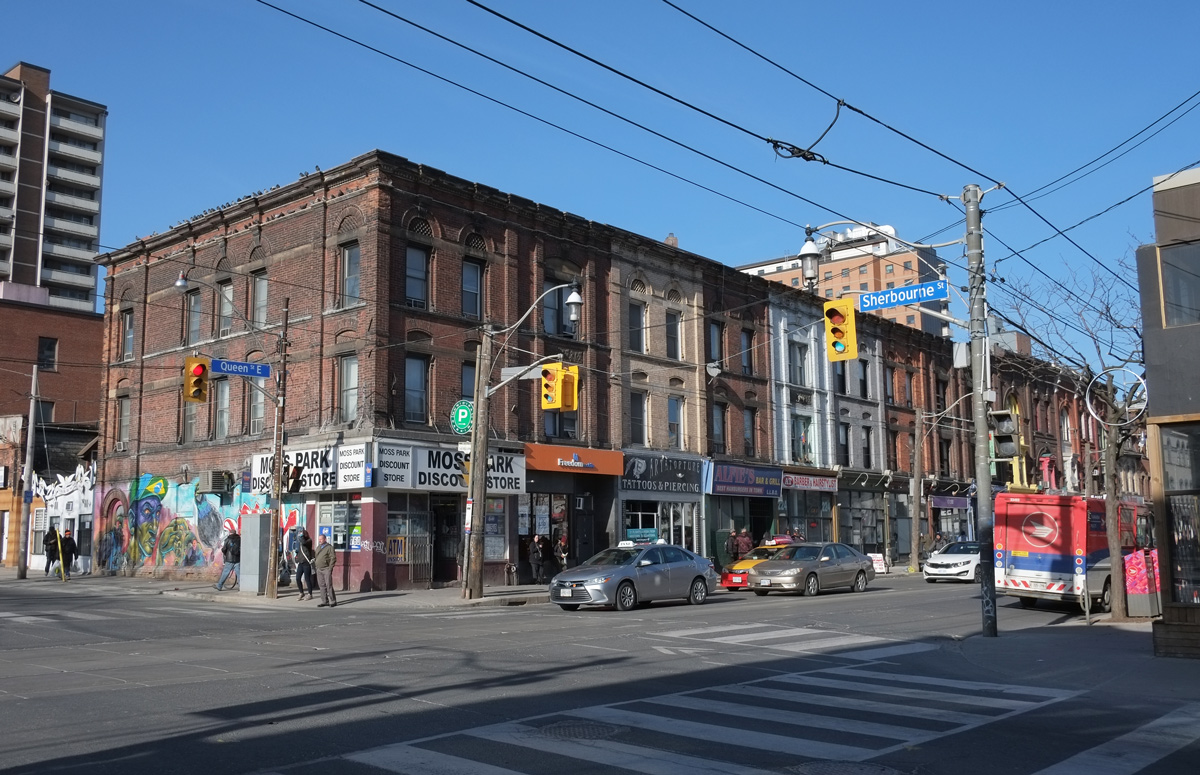
below: The northwest corner of Queen and Sherbourne

northwest corner of Queen and Sherbourne, Moss Park variety store on the corner, three storey brick Victorian buildings, cars, people,
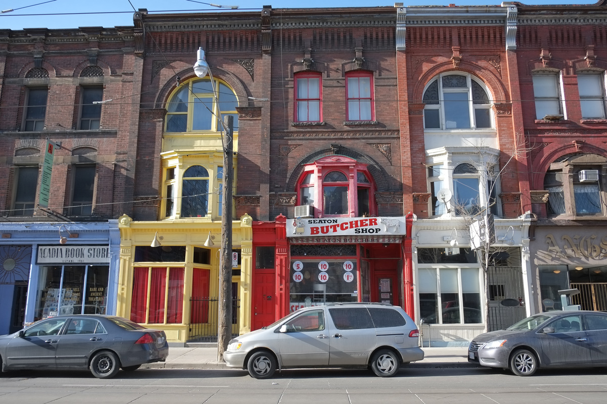
below: Bright and cheerful.

three storey victorian buildings includia Acadia Book Store, established 1931 and Seaton Butcher

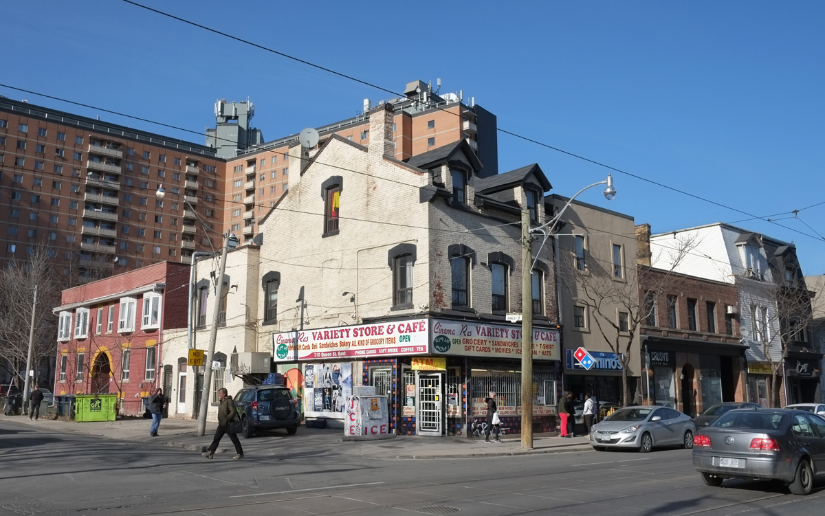
below: 310 Queen East at the corner of Queen and Berkeley.

below: Moving slightly east to the corner of Queen and Parliament (NE).  That looks like a solid old bank building on the corner.

northeast corner of queen and parliament, old brick buildings,

flat roofed old brick buildings, with oriel windows on third floor, Ray's Discount Convenience and Supermarket on the ground floor. A bus shelter on the sidewalk, people waiting for the bus, building painted rust red colour,

below: 354 and 356 Queen Street East

two narrow three storey buildings squished in between two slightly larger buildings. On the ground floor of the building on the left is Redline Coffee and Espresso while Ryans Restaurant is on the right.

below: 380, 382, and 384 Queen Street West.

two storey store fronts on queen street east, 380 Queen, 382 Queen and 384 queen.

below:  Wherever you walk there is construction.  Some of it good, some of it poor.  That’s Toronto these days.

a man walks through a covered sidewalk, past a construction site and towards a bus shelter

A morning exploring some of the art galleries at the University of Toronto.

below: Robarts Library, a large concrete building, is part of the University of Toronto and is their main humanities and social sciences library. It opened in 1973 and has been called Fort Book ever since.

intersection of Harbord and St. George streets, Robarts Library, large concrete building

I have walked past this library many times but I have never gone inside. What I didn’t know about this building is that it is also home to the Thomas Fisher Rare Book Library.  It is named after a Thomas Fisher (1792-1874), who came from Yorkshire to Upper Canada in 1821 and settled by the Humber River.  In 1973, his grandsons, Sidney and Charles Fisher, donated many books to U of T .  Since then, the library has grown to approximately 740,000 volumes including hundreds of versions of Alice in Wonderland in many different languages.  They also collect manuscripts, photographs,  and other rare materials.   You can search their holdings online.

below: The view from the 4th floor observation deck.

interior of Thomas Fisher Rare Book library, looking down from the upper level to the tables below. Shelves of books line all the walls, ceiling is open to 4 or 5 storeys up , large central light fixture

At the moment, the Thomas Fisher Library has an exhibition called “Fleeting Moments, Floating Worlds, and the Beat Generation: The Photography of Allen Ginsberg”. Ginsberg (1926-1997) is known for his poetry but he also took pictures. The Thomas Fisher library has the largest collection of Ginsberg prints in the world.

exhibit of photos by Allen Ginsberg displayed in the Thomas Fisher Rare Books Library at U of T, some black and white photos in a case, some books too, shelves of books in the background

below: Mr. Ginsberg took bathroom mirror selfies.  I wonder what he’d think of instagram?

picture of a black and white photo taken by Allen Ginsberg of himself sitting naked and cross legged in front of a bathroom mirror

Ginsberg became friends with William Burroughs and Jack Kerouac, and the trio later established themselves as the main players in the Beat Movement with their unconventional writing and wild (for the times) lifestyles.  Ginsberg’s first published work was “Howl” in 1956.  It was called “an angry, sexually explicit poem”.   The San Francisco Police Department declared it to be obscene and arrested the publisher.  The court ruled that it was not obscene.  I can see it being “ahead of its time” in 1956 but today it’s fairly tame.

The opening lines:

“I saw the best minds of my generation destroyed by madness, starving hysterical naked,

dragging themselves through the negro streets at dawn looking for an angry fix,

angelheaded hipsters burning for the ancient heavenly connection to the starry dynamo in the machinery of night,

who poverty and tatters and hollow-eyed and high sat up smoking in the supernatural darkness of

cold-water flats floating across the tops of cities contemplating jazz,”

below: Three books about The Beats.

display in a glass top case, three books by Alan Ginsberg, the one in the middle has a yellow cover and is The Beats

The Ginsberg exhibit continues until the 27th of April.

A short walk through part of the St. George campus….did I mention that it was snowing at the time?… to another art gallery on campus.

snow is falling, snow on the ground, tree in foreground, also black wrought iron fence, looking across the playing field of the U of T St. George campus to a building, tower,

below: We passed a moose standing in the snow.

a flat metal sculpture of a moose stands in a small space beside a tree, snow on the ground, snow falling from the sky. public art

The second gallery was the Art Museum at Hart House.   One of the exhibits showing there is “Figures of Sleep”.  Straight from the gallery website is this description of the exhibit: ” [it]…considers the cultural anxieties manifest in the popular and critical imagination around the collapsing biological function of sleep under economic, social and technological transformation”.  What it is is a collection of videos, photographs, and artwork depicting sleep, i.e. people sleeping by a number of different artists.  This exhibit ends on 3rd March.

below: Watching videos of people sleeping

a person watching a large video display in an art gallery

below: She’s very life like.  She’s also much smaller than life sized but even so, she was a bit creepy. “Untitled (old woman in bed)”, 2000-2002, by Ron Mueck.

very realistic and life like scupture of an old woman with grey asleep under a blanket with her head on a pillow

below: “Dream Catcher” by Rebecca Belmore, 2014 .  This wall hanging is quite large.

dream catcher by Rebecca Belmore, a large wall hanging of a person sleeping on the sidewalk, under a blanket with a picture of a lion on it.

below:  The Malcove Collection is in the same gallery.  The collection includes about 500 pieces, not all of which are on display at the moment.  Dr. Lillian Malcove (1902-1981) was born in Russia just before her parents emigrated to Canada and settling in Winnipeg.  She graduated from the University of Manitoba with an M.D. and then spent most of her adult life as a Freudian psychoanalyst in New York City.  Over her life time she amassed a collection of art that she bequeathed to U of T.

wall display cases in an art gallery, religious pieces on display, old, antiquities

below: From the Malcove collection, ‘Male Dedicant’, made of limestone, Coptic, late 4th century or early 5th century

antique stone carving (relief) of a man with curly hair, both hands raised, one hand holding a spherical object and the other hand holding a cross

below:  Detail from “The Burning Bush”, 19th century.

very old painting, religious, virgin mary and baby jesus in the center surrounded by other religous scenes


below: Last but not least, and having nothing to do with art, is this plaque on a wall near the art gallery at Hart House.  It commemorates the relationship between the Canadian and Polish Armies during WW1.  A transcription of it appears below.


plaque on an exterior brick wall commemorating the role of the Polish Army

In the early months of 1917, twenty three Polish probationary officers were trained here by the staff of the Canadian School of Infantry in Toronto.  They were the forerunners of more than 20,000 North American volunteers of Polish descent who were trained in Canada (mostly at Niagara on the Lake) to serve in the French Army, ultimately commanded by Joseph Haller.  The existence of this Polish Army in France went far to assure the presence of Poland at the Peace Conference at the end of the war and played a significant role in the reconstitution of a reunited and independent Poland after 123 years of partition. 
The Canadian Polish Congress has placed this tablet to commemorate the ardent Polish patriotism of so many Polish volunteers from the United States and Canada.   The Congress also wishes to honour the Canadian officers who trained the volunteers, including notably Lieutenant Colonel A.D. Lepan of the staff of this university and his principal subordinates, all from this university as well as Major C.R. Young, Major H.H. Madill, Major W.F. Kirk and Major F.B. Kenrick. A.D. 1990


a bike parked outside an old brick building on St. George campus of U of T, snow covered

More information about:

Allen Ginsberg exhibition

Figures of Sleep, and others, at Hart House Art Museum

Illustrations of the holdings of the Malcove Collection


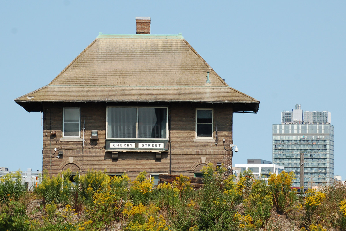
You might recognize the building below – it’s the Cherry Street interlocking tower.  Along with the Scott Street and John Street towers, they housed the the electro-mechanical interlocking for the railway tracks.  Interlocking is an apparatus that prevents conflicting movements through an arrangement of tracks, in other words, it keeps the trains separated so there are no collisions.   It was back in 1931 that the track work for Union Station was completed and the Toronto Terminals Railway interlocking system became operational. The interlocking was installed by General Railway Signal Co. of Rochester NY and it was/is controlled from the three above mentioned towers. Apparently this 1931 interlocking system has operated reliably for 86 years and today it makes it possible for 235 passenger trains travel on these tracks every weekday.


small brick building with sloped roof, sign under window that says Cherry street, beside train tracks, two tall condos in the background

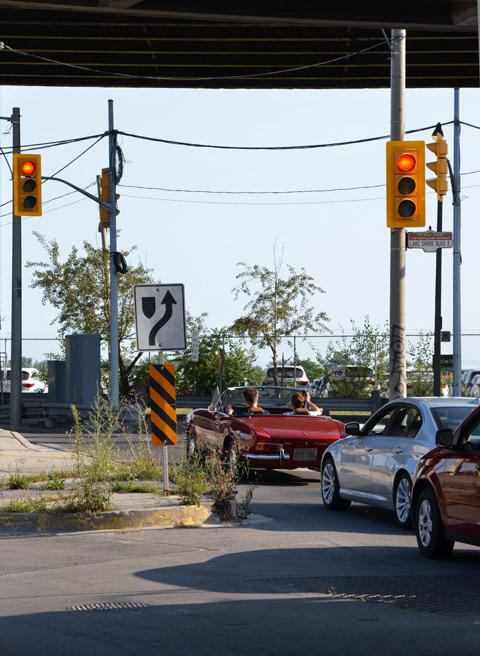
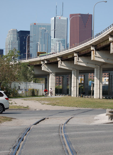
The intersection of Cherry and Lakeshore isn’t pretty.  The south end of Cherry passes under the railway tracks, 8 tracks wide, just before ending at Lakeshore Blvd which is under the Gardiner Expressway at that point.

cars stopped at a red light at the south end of Cherry street where it intersects with the Lakeshore, under the Gardiner, a red convertible is the first car at the light.

below: This is the view if you’re walking east on Lakeshore.  The ‘tunnel’ is Cherry Street as it goes under the railway tracks.  The three glass condo towers are part of the Distillery District.

intersection of lakeshore blvd and cherry street from the southeast, cherry street bridge for the tracks, 3 condos of the distillery district, some traffic, billboards, concrete

below: From above –  the best way to help you visualize the intersection.   The very bottom left corner is the north end of the Cherry Street bridge.   Cherry Street and the Lakeshore come together under the Gardiner Expressway before they split again with Cherry continuing south to the Portlands and the Lakeshore curving back under the Gardiner.

view from above, railway tracks, road, waterfront, Lake Ontario,

Also, the intersection can be confusing if you’re a cyclist or a pedestrian, especially if you are coming south on Cherry Street.    It’s one stretch where the undeveloped land under the Gardiner Expressway has been neglected in part because it is also a section of the city that is in limbo – is the Gardiner going to be taken down?  or will it be moved?  or will we debate it until it’s too late to do anything?   As city redevelopment spreads east, there is more interest in this area and in the Portlands adjacent to it.

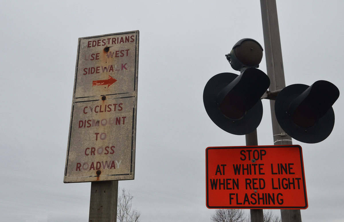
two old faded street signs one says pedestrians use west sidewalk and the other says cyclists dismount to cross roadway

below: Looking west towards the city.  The Martin Goodman Trail runs along the south side of Lakeshore before turning south at Cherry towards the Portlands.  On the other side of Lakeshore is the Lower Don River Trail that parallels the Lakeshore before turning north at the Don River.   Both trails are part of the PanAm Path.

looking west along the Gardiner Expressway and Lakeshore Rd, curve of the Gardiner as it passes over the bottom of Cherry Street, downtown skyline with CN tower, cyclists on the bike path on the south side of Lakeshore

The Panam Path was a legacy project from the 2015 Pan Am Games. The path is not completed yet but it starts at the south end of the Clairville Reservoir in the northwest part of the city. It follows the Humber River to Lake Ontario and then runs east to the Don River before heading inland a bit. Eventually it ends at the mouth of the Rouge River.  The path goes under many bridges and there is street art in quite a few of these spots.

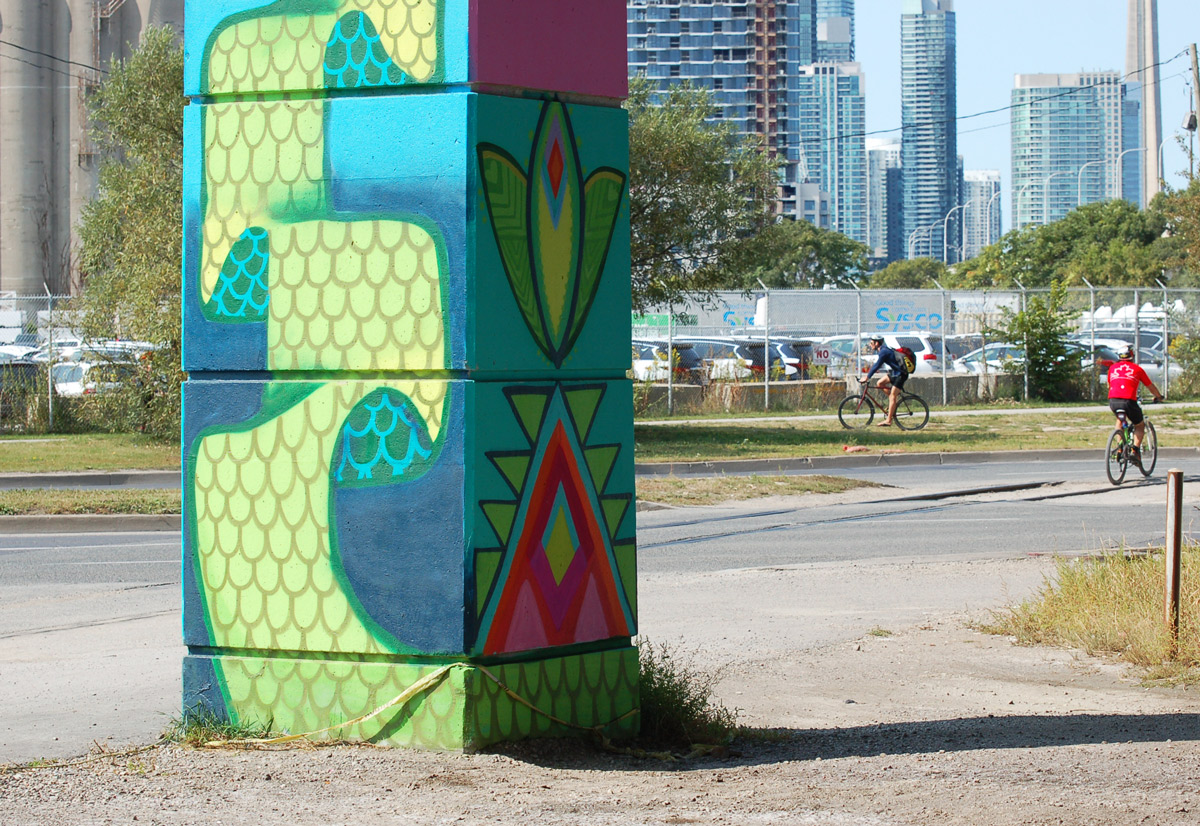
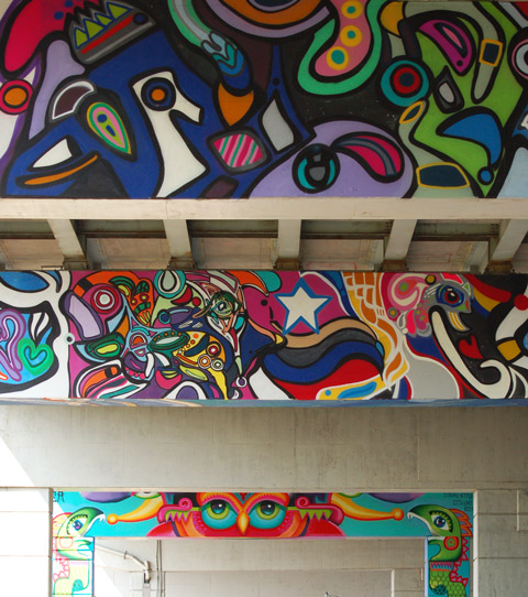
below:  Some of the pillars and bents under the Gardiner just east of Cherry Street are the latest to be painted.  Finally some colour!

part of a colourful mural on concrete pillars under the Gardiner Expressway, cyclists in the distance, pillar with street art in the foreground

The first painting was done as part of an Art Spin event at the end of August.  Art Spin is a group that runs bicycle-led events/tours of art a few times a year.    The project is also a part of the STEPS Initiative that promotes public art in the city.

below: XYZ 2017 VAL JAM LUVS DRPN ___ DELUXO OGV  written on top of the snake before it had a tongue.

part of a colourful mural on concrete pillars under the Gardiner Expressway


Artists involved:
Daniela Rocha (muisca)
Fathima Mohiuddin (fatspatrol)
Stephanie Bellefleur (bellefleurhaus)
Meera Sethi
If I’ve left anyone out, please let me know

part of a colourful mural on concrete pillars under the Gardiner Expressway - 3 horizontal paintings on the bents,

Some of the concrete in this area is slated for refurbishment so the affected pillars have been left clear for the moment.

painted pillars under an elevated expressway, murals

below: More bird motifs, this time by @fatspatrol

lifters under the gardiner, machinery for artists to reach higher spaces, murals

below: An owl at night, stars in the sky, and purple hills, mural by Muisca.

an owl with the night sky and stars, purplish mountains, part of a colourful mural on concrete pillars under the Gardiner Expressway , a green snake with a long tongue on the vertical pillar on the right

below: A whimsical fun little purple creature with long arms.

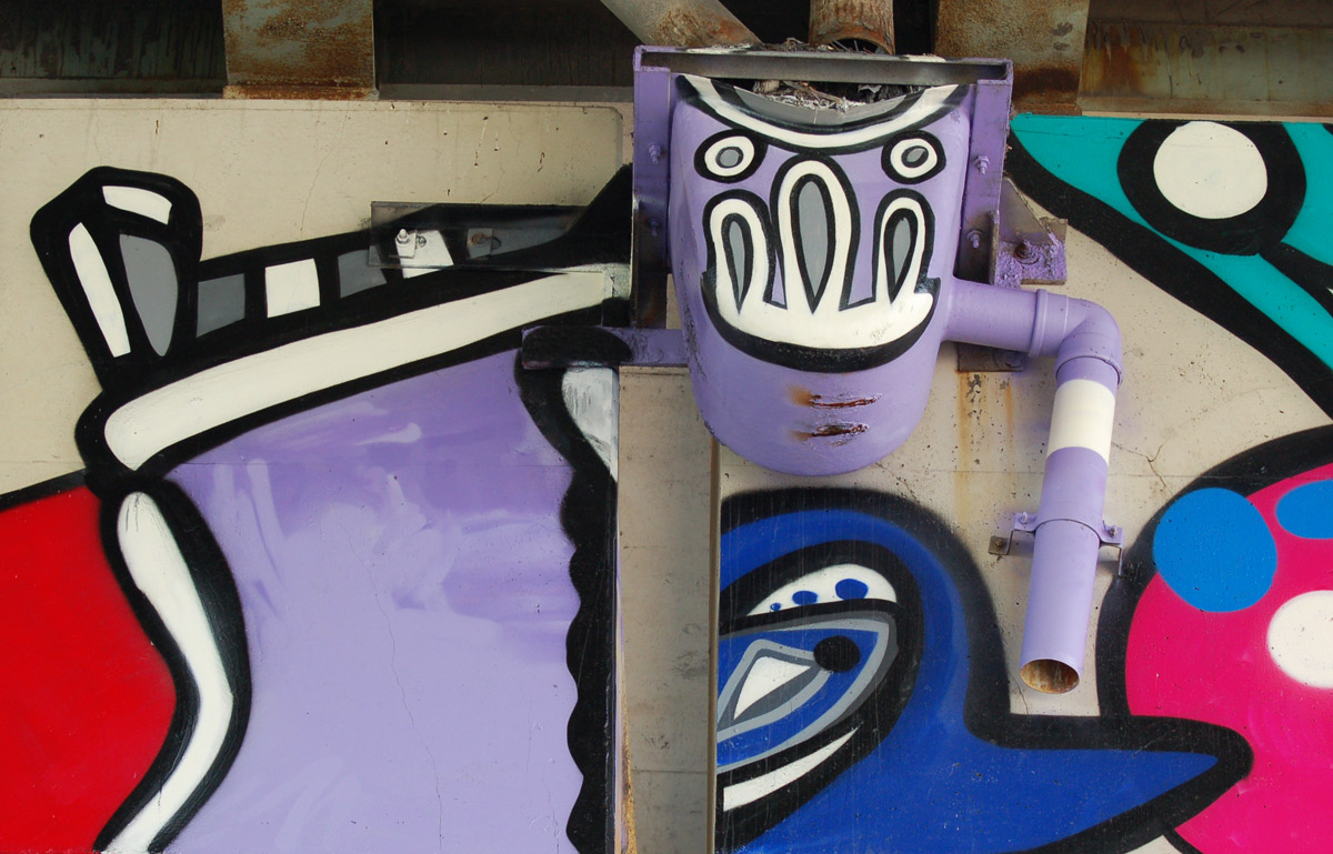
part of a colourful mural on concrete pillars under the Gardiner Expressway - drain under the Expressway has been painted light purple and made into a head. Drainpipes are the arms

mural on bents

below: Bullets transforming into birds taking flight.

mural by Meera Sethi, shades of turquoise, bullets on the bottom but transforming into birds as they rise

part of a colourful mural on concrete pillars under the Gardiner Expressway - abstract in turquoise and other bright colours, triangles and lines and blobs

part of a colourful mural on concrete pillars under the Gardiner Expressway - pillars are light blue with birdlike and feather-like patterns at the bottom of two pillars that are close to each other

policeman on horseback as seen through two pillars under the Gardiner expressway


Queen and Sherbourne – It’s a grubby corner.

below: Built in 1897 on the southwest corner and a major part of the intersection since then, is the Kormann House Hotel named for its hotel keeper in 1898, Franz J. Kormann.  The Torontoist described the building in 2008 as “Though vacant for the past few years, this old watering hole will open its doors once again as part of an upcoming condo development.”  That was 8 1/2 years ago.  It is still vacant.   The projected renovations and mid-rise condo development never got off the ground.
old brick 3 storey building on the corner of an intersection. Top part is white, bottom part is grey. Boarded up and vacant.

below: Diagonally opposite is now the Moss Park Discount Store.

building on the corner of an intersection, Moss Park Discount Store on the corner of Queen East and Sherbourne. People on the sidewalk outside the building. 3 storey brick,

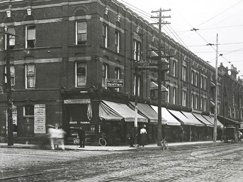
below: The same corner as above but from a slightly different angle as it looked about a hundred years ago.  Note the cobbled streets, streetcar tracks on both Queen and Sherbourne, and the lack of traffic lights.   Photo found on Lost Toronto blog

old black and white photo of the northeast corner of Queen East and Sherbourne

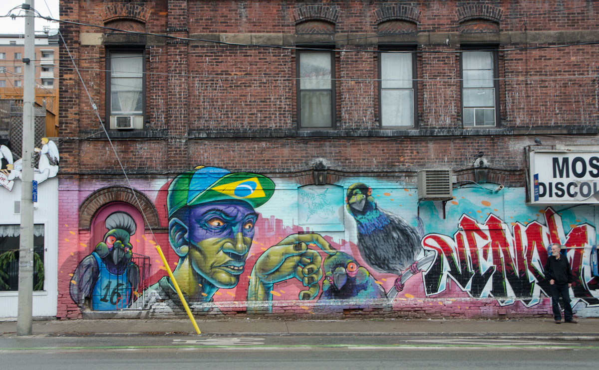
Adding a bit of colour to the intersection is the new mural on Sherbourne Street, on the side of building that houses the Moss Park Discount Store.   It features a young man in a baseball cap adorned with the Brazilian flag.  Three parrots are also in the mural.
mural on the side of a red brick building, a young man in a baseball cap and three parrots. on the exterior wall of the Moss Park Discount Store.

Close ups of parts of the mural:

part of a larger mural, a green hand is reaching out and the forefinger is rubbing the top of a parrot's head.

part of a larger mural of a parrot like bird upright, wearing a sleeveless T-shirt with the number 16 on it.

part of a large mural, a parrot head, and the signatures of the street artists who created the mural - Smoky, Cens and Vemo

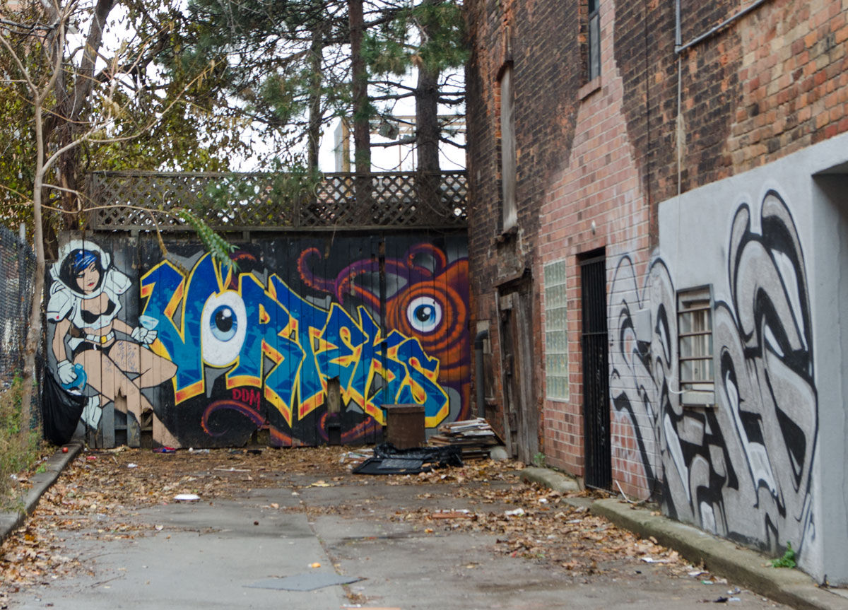
Just north of Queen, there is a small dead end alley that runs east off Sherbourne.  At the end of the alley is a mural by Vorteks….  she’s come to save someone (the world?) from an orange creature.

two murals in an alley. At the end, on a fence is a mural by vorteks, text with his signature using an eyeball for the letter O. An orange creature with an eye, most of which is behind the text, as well as a scantily clad woman who looks like a superhero.

This birdo is still looking good.  It’s just east of Sherbourne.

mural by birdo, bright green background with abstract colourful animals painted on it, tall large animals

below: On the north side of Queen Street East, looking towards Sherbourne Street from Kim’s Convenience (with the birdo mural on the wall).  I was going to write something about it ha ha having the same name as the CBC TV series “Kim’s Convenience”.  Luckily I looked it up before writing because lo and behold it is the same store!  The store was up until recently called Mimi Variety.  The new name and new signs are leftovers from filming the TV shows.   Most of the buildings in this block are heritage listed sites, especially those towards Sherbourne Street.

blog_kims_convenience_queen_east

A few more little details to end the post with:

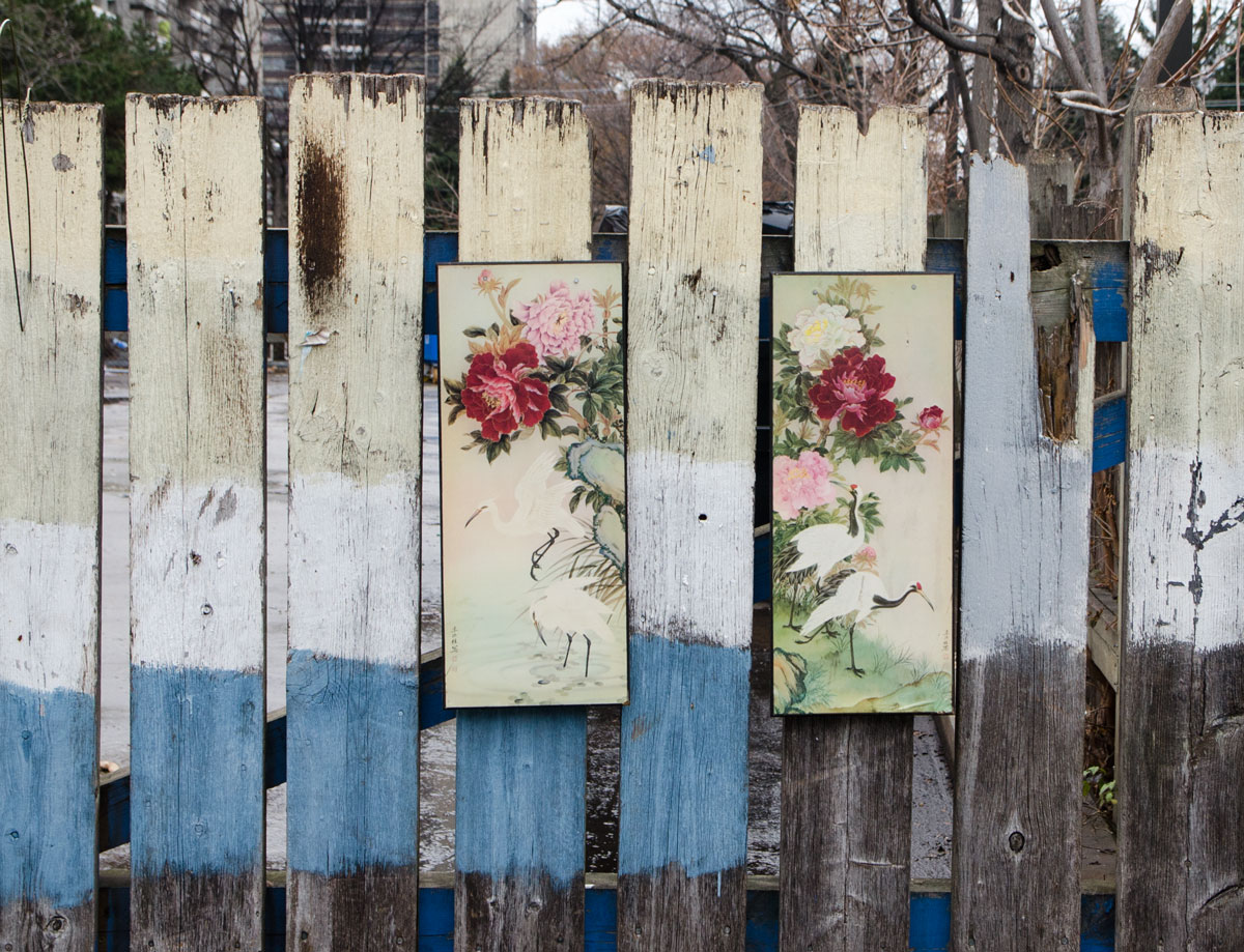
below: A triptych with the center panel missing or a diptych with a mystery middle.

a painting in three panels of a vase of pink and red flowers, on a wooded fence outside, but the middle panel is missing.

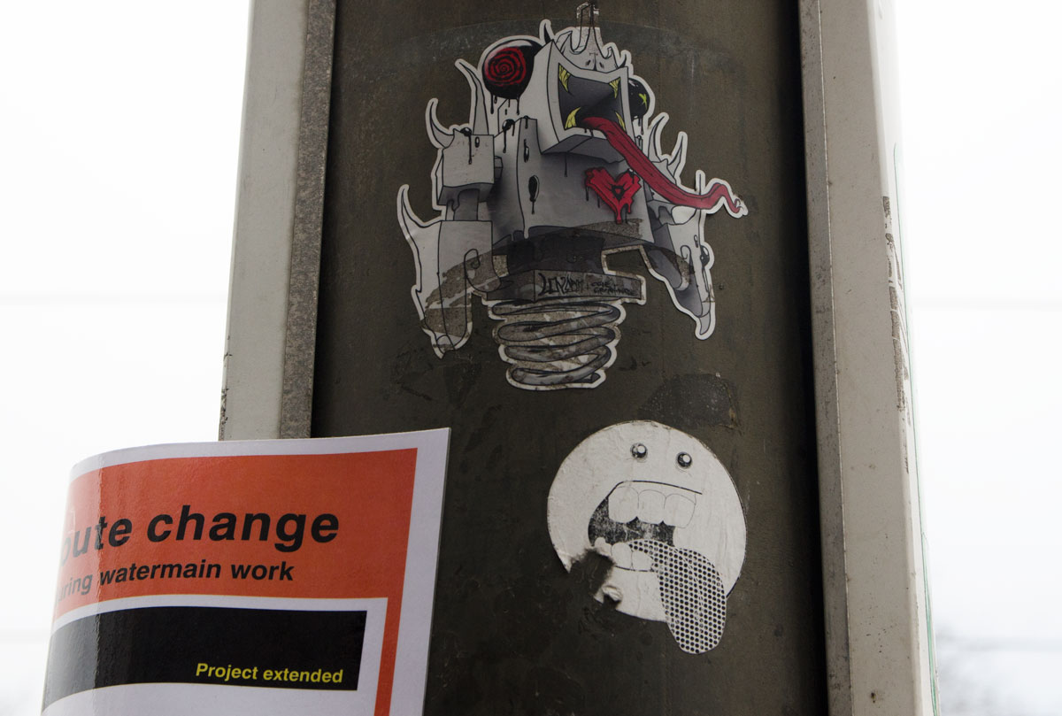
below: On a pole, a grominator lovebot hybrid with its long red tongue.  The other little guy’s tongue just can’t compare.

two stickers on a pole. The top one is a lovebot grominator joint venture hybrid character with a very long red tongue. The other is a little round faced guy with his tongue sticking out.

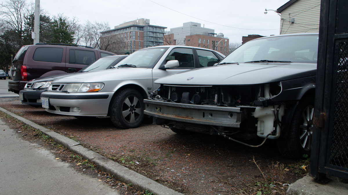
below: A dying breed, three Saabs in a row.  It’s not just old buildings that catch my eye.
Perhaps the one on the right has been cannibalized?

three saabs parked side by side. The one on the right is missing a large portion of its front bumper, headlights and other front end pieces.
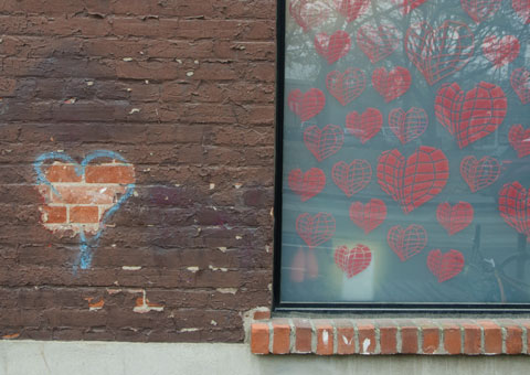
below: And last, hearts seen on a Queen St. East building.
pink hearts on a cyan coloured window beside a heart on a brick wall graffiti