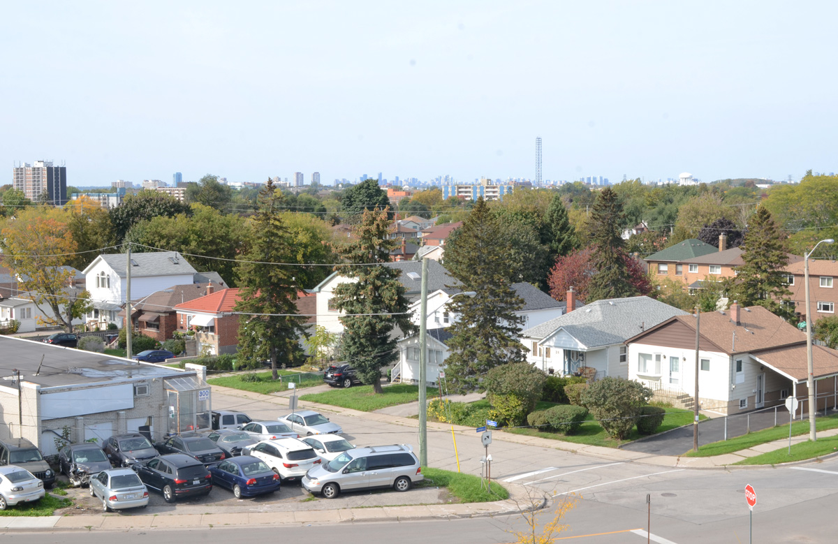
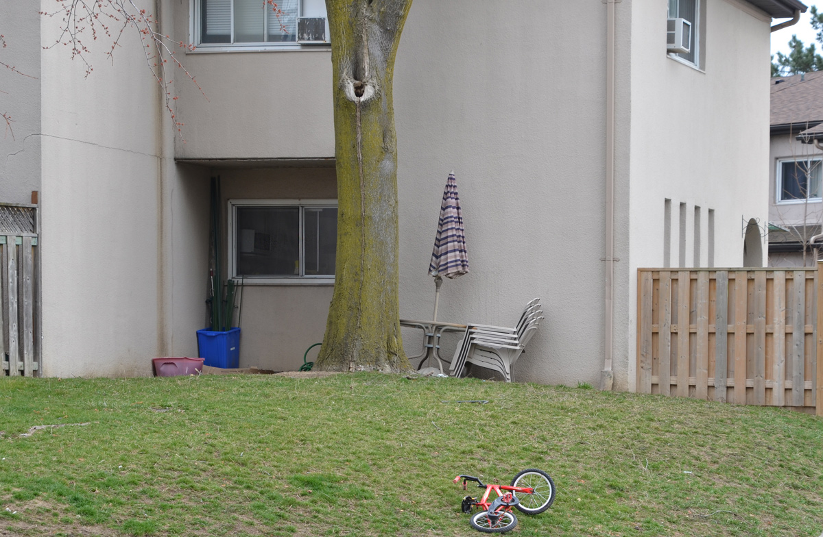
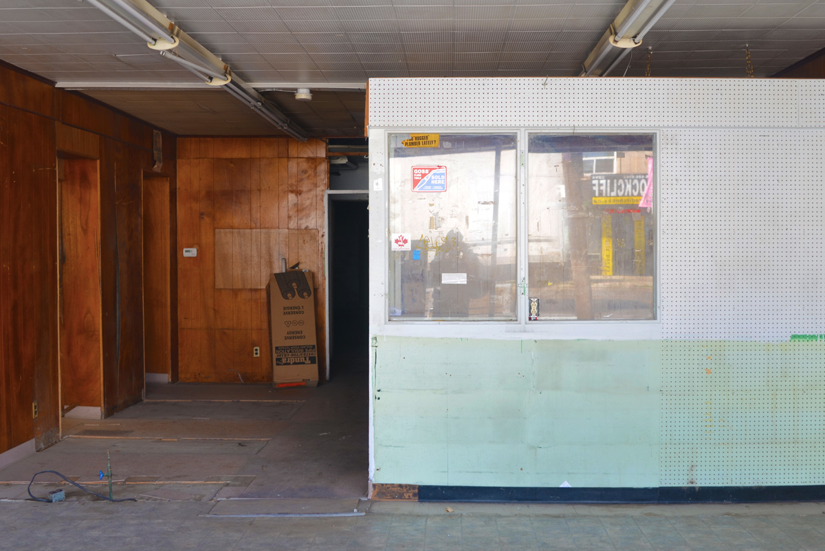
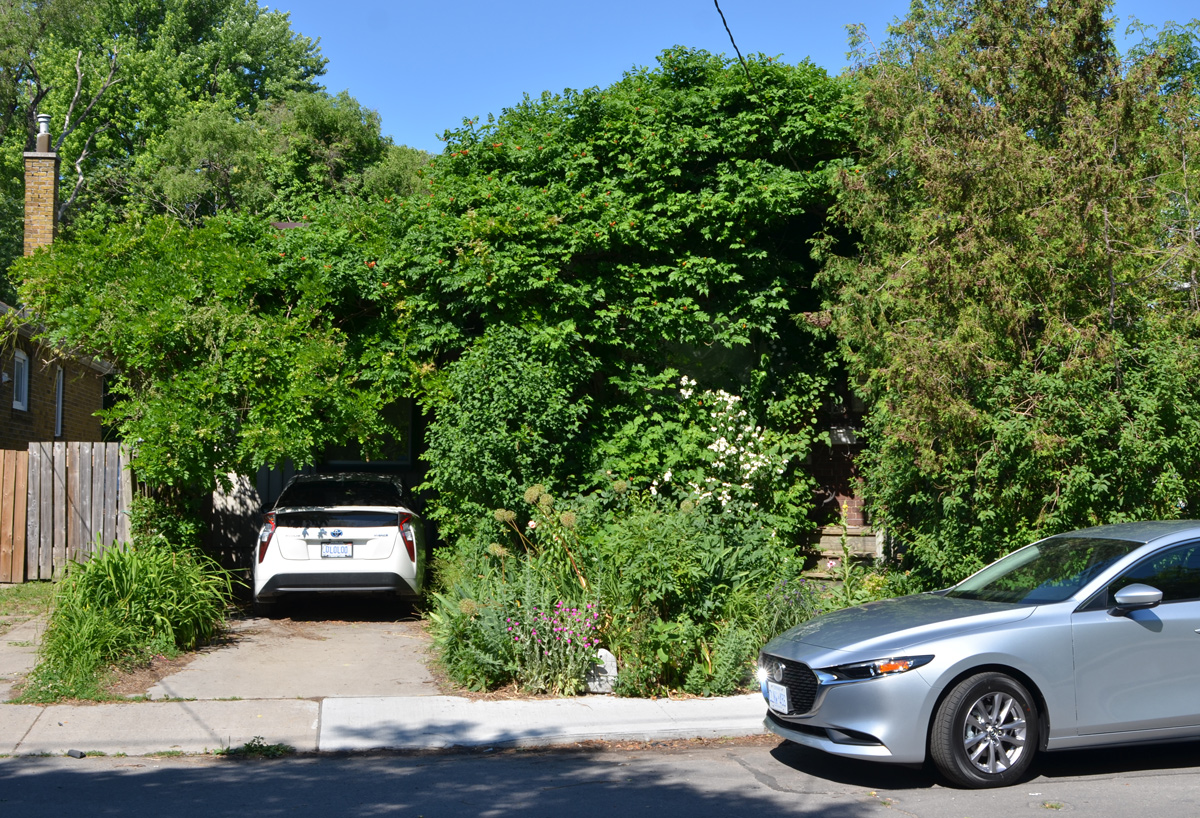
It seems like it’s been a long winter with more extended periods of colder temperatures as well as never ending snow. Last weekend was the first sign that maybe spring would arrive this year …. before the snow came back! Here are a few things that I saw on my walk last Sunday while out enjoying some warm sunshine.
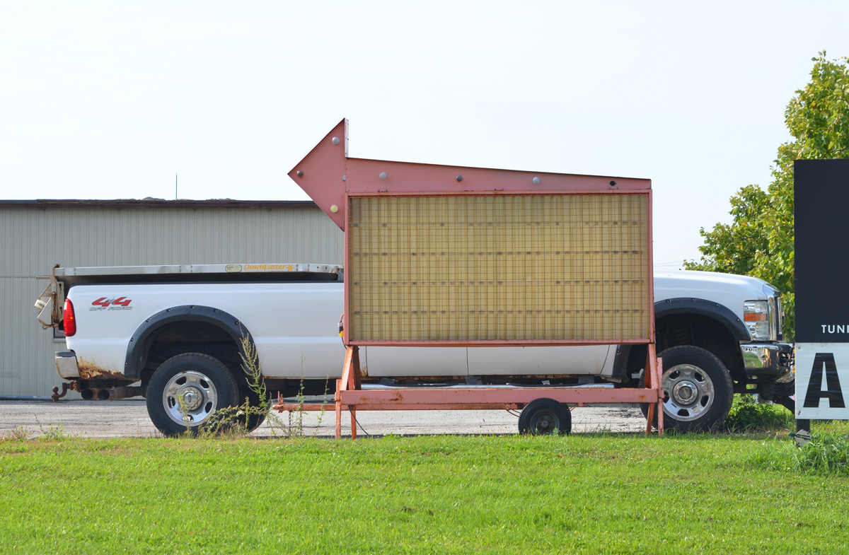
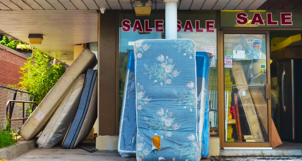
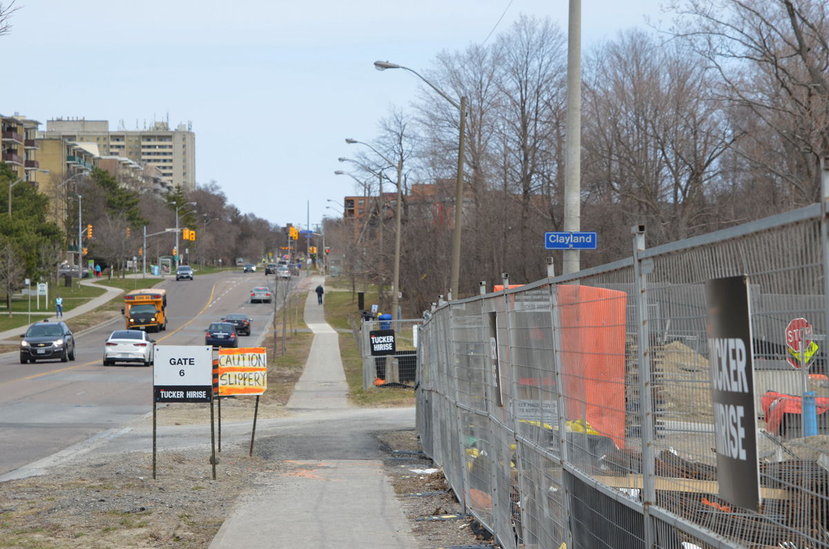
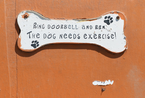
below: A sign of the times; a sign for the coming spring.
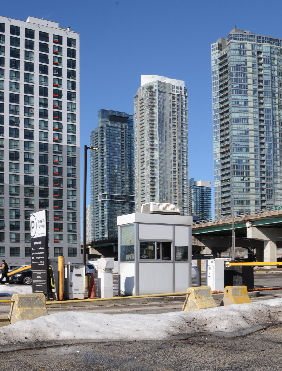
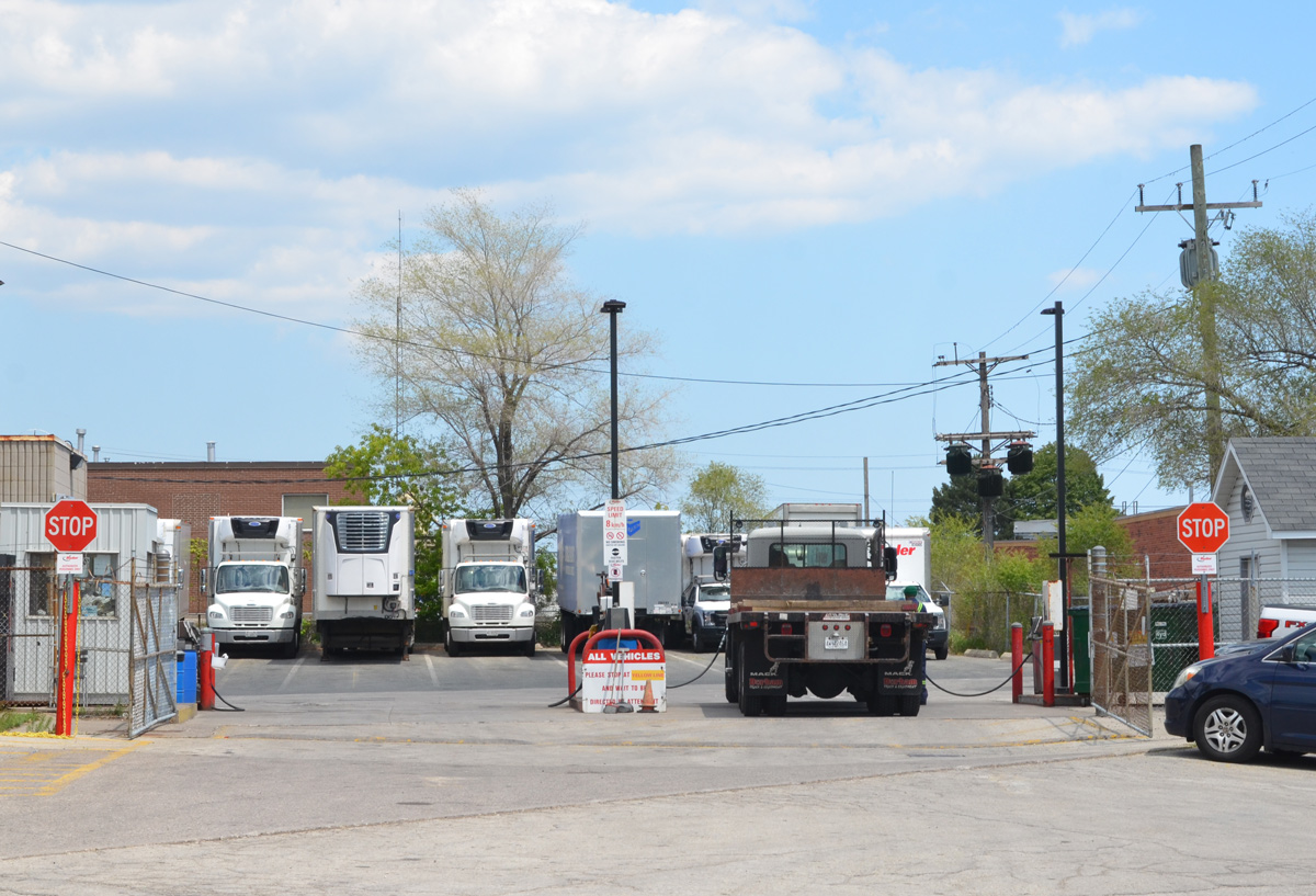
below: There is still a large parking lot on the corner of Rees and Queens Quay. It may be the last piece of undeveloped property along this part of the waterfront.
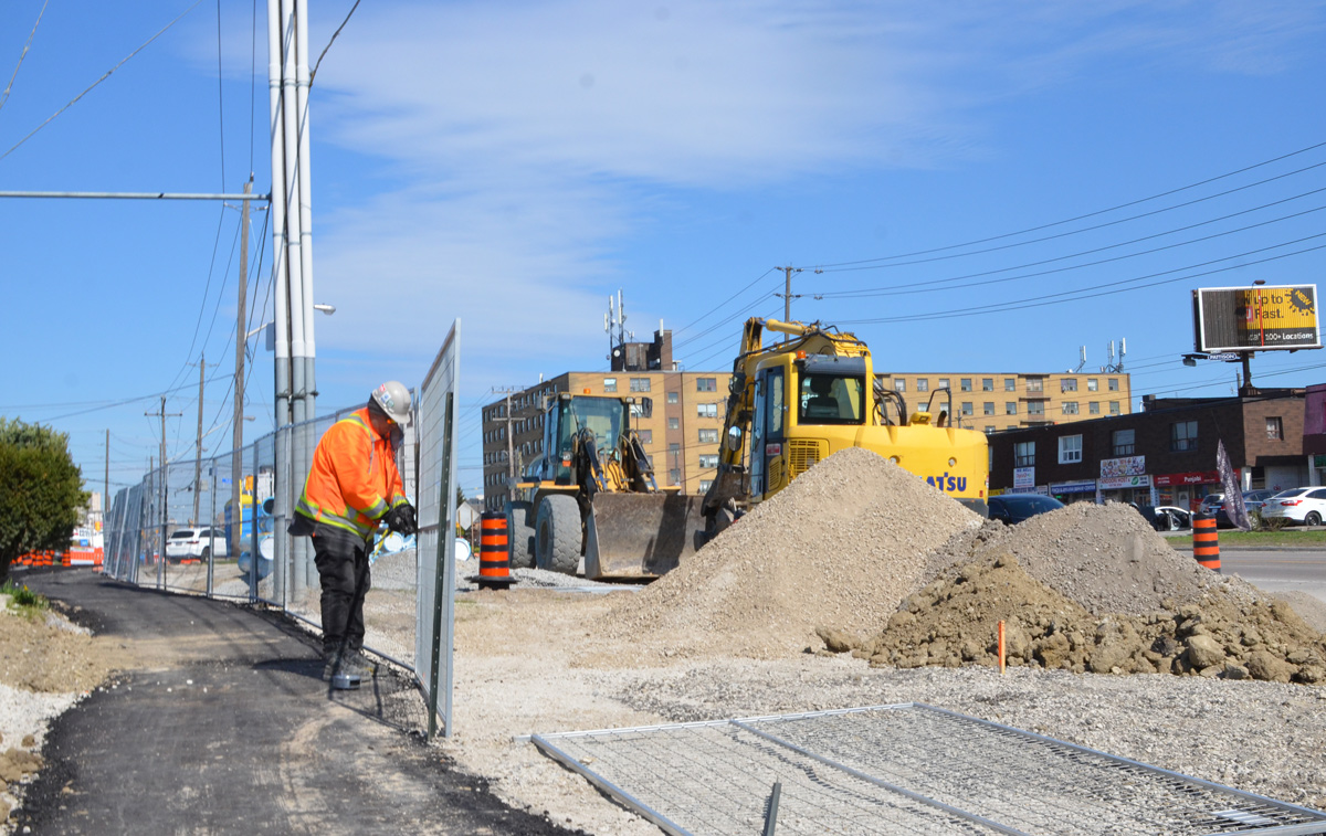
below: Clearing away the piles of snow.
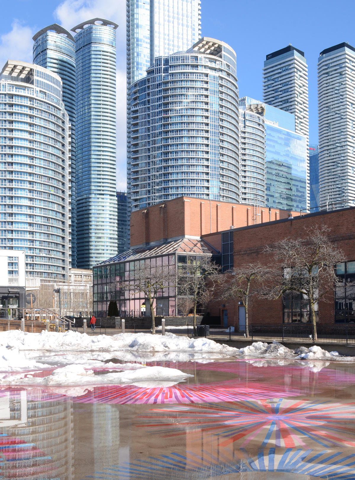
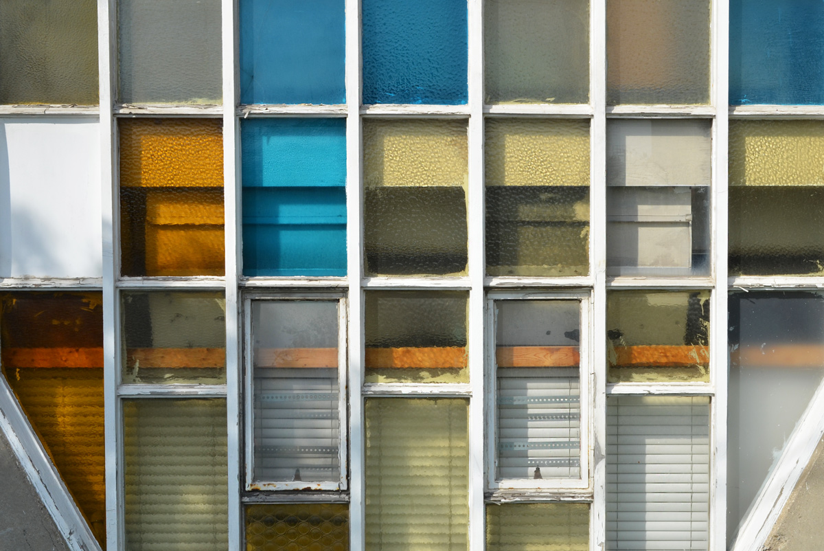
below: The skating rink beside the Power Plant is melting quickly. The designs painted on the concrete below provide a bright contrast to the towers of glass and steel nearby.
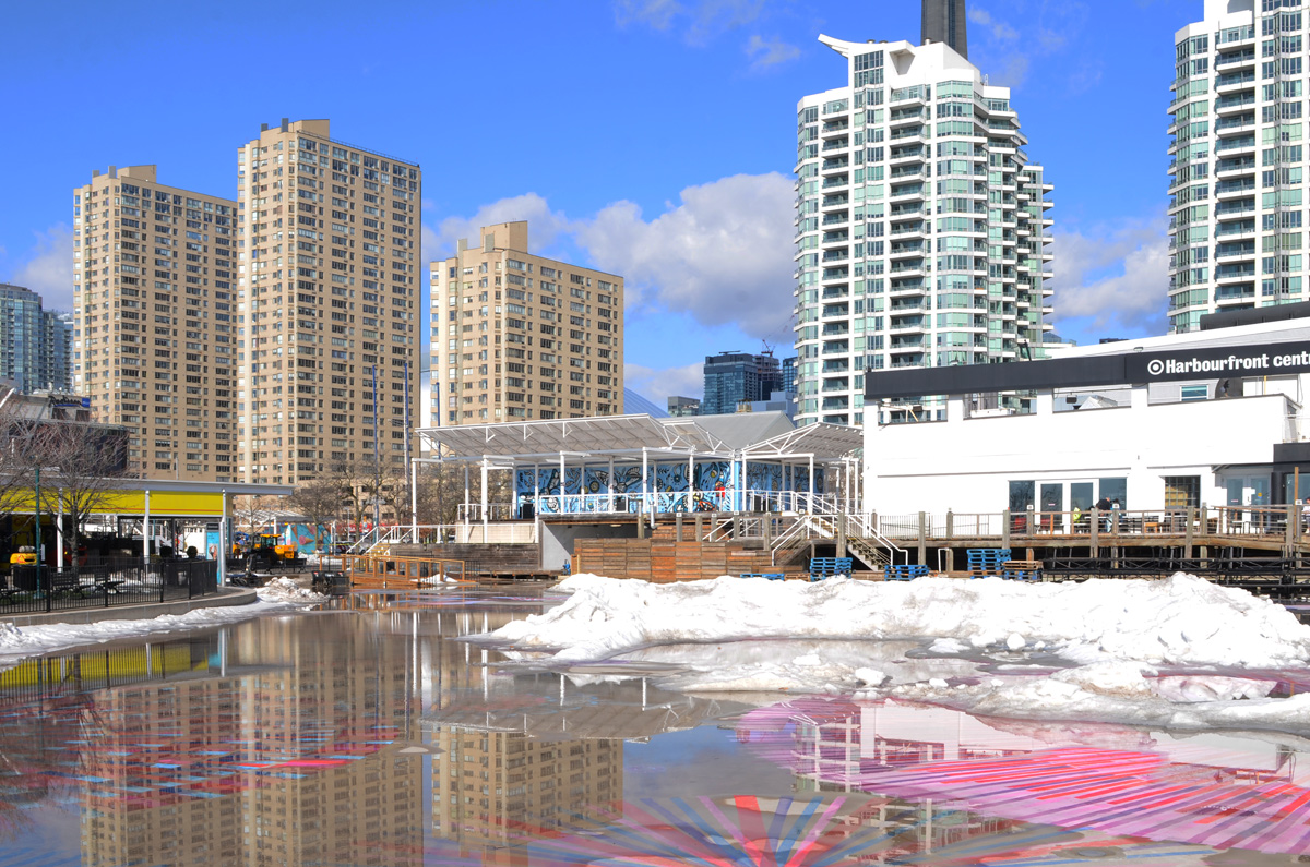
below: Same spot as above but this time looking northwest.
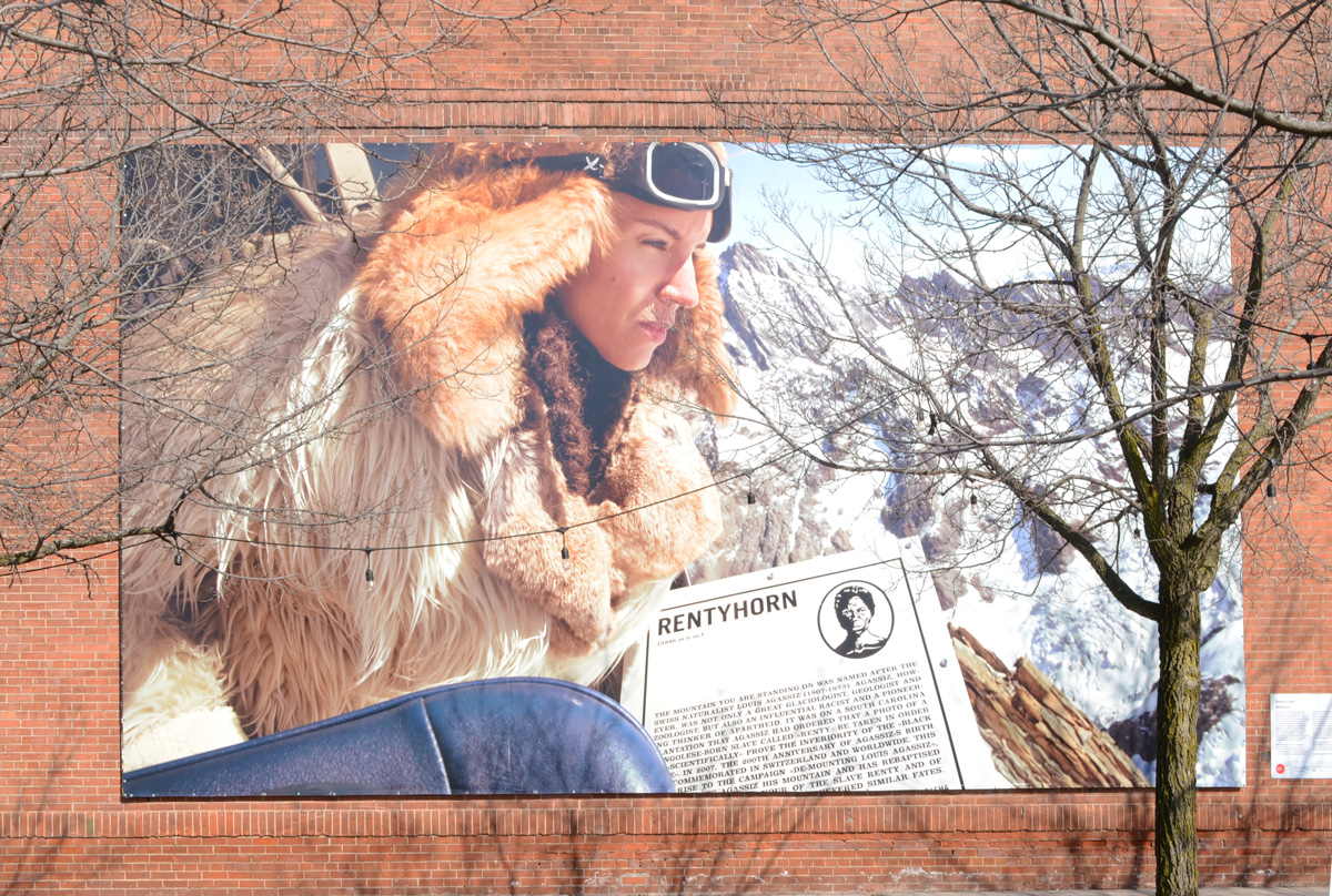
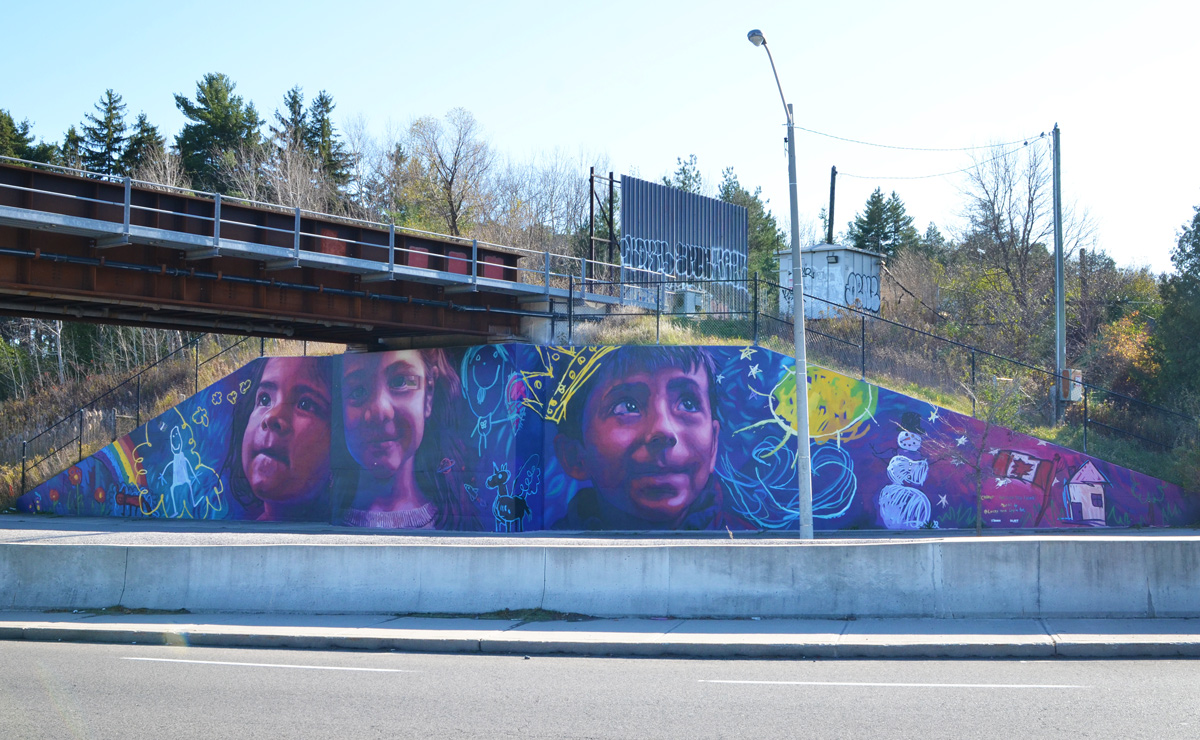
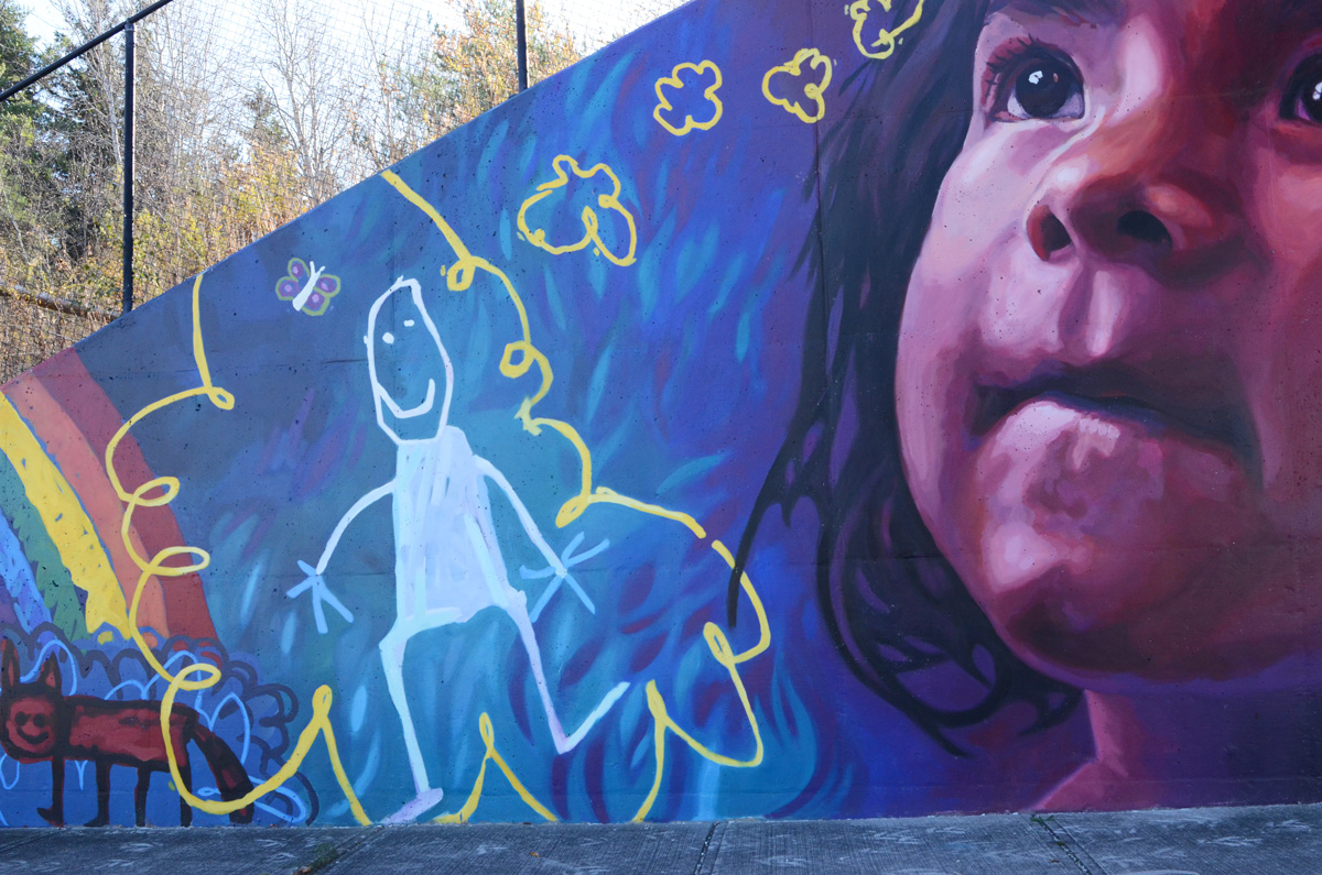
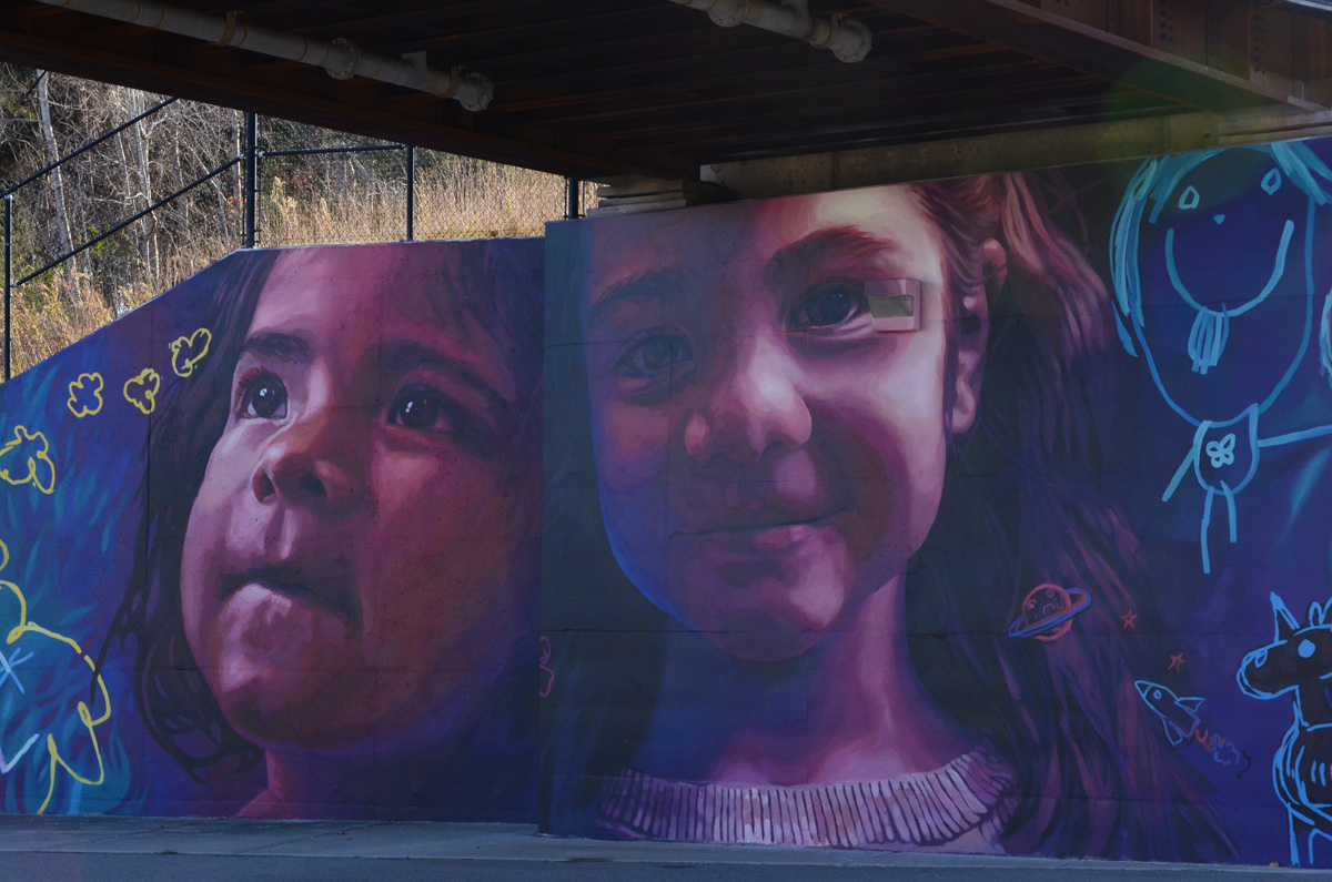
below: On the south wall of The Power Plant, a large image of the artist, Sasha Huber, on top of a Swiss mountain.
“Rentyhorn” (2008) is part of a campaign to rename Agassizhorn, a Swiss mountain peak. Louis Agassiz (1807-1873) was a Swiss glaciologist who became convinced that Blacks were an inferior species and that he could prove it. Renty was an enslaved woman who was one of a group forcibly photographed by Agassiz in his attempt to prove his theory. There is more of this story, and more of Huber’s work, on display in the gallery.
below: Reflections and distortions in the windows of The Power Plant.
below: Queens Quay
below: “Compartment Earth” in the lobby of RBC WaterPark Place building on Queens Quay. It is 16,000 pounds of stainless steel; a sculpture by American artist Roxy Paine.
below: Work continues on the park, Love Park, that replaces the old York Street exit ramp from the Gardiner Expressway.
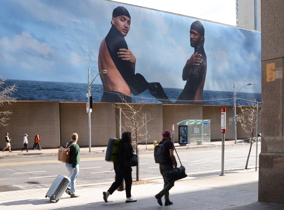
below:Esmaa Mohamoud‘s large image titled: ” The Brotherhood FUBU (For Us, By Us)” covers 37 x 144 feet (or 11 x 44 metres).
below: Looking up to the blue sky.
below: Part art, part health, this is “Visoleil” in the lobby of the new CIBC Square. A glowing circle of light to lift the spirits during the grey of a Toronto winter. I went on a Sunday and the doors were locked so I couldn’t get closer. Unfortunately, it’s probably gone by now as it was scheduled to be removed on 11th March.
below: Also at CIBC Square, “Light Stolen from the Sun” by Steve Driscoll. This new CIBC building on (by the new GO Station and across from Union Station) has been under construction for a few years now. It isn’t quite finished.
below: Looking through the front window you can catch a glimpse of this magnificent piece of backlit glass. Apparently there are twelve. This is something that I am definitely going to come back to see!
below: Street closed. Construction.
below: More construction, King and John.
below: Development notice on Crocodile Rock… yikes, 68 storeys proposed at Adelaide and Duncan.
below: Northeast corner of Adelaide and Duncan
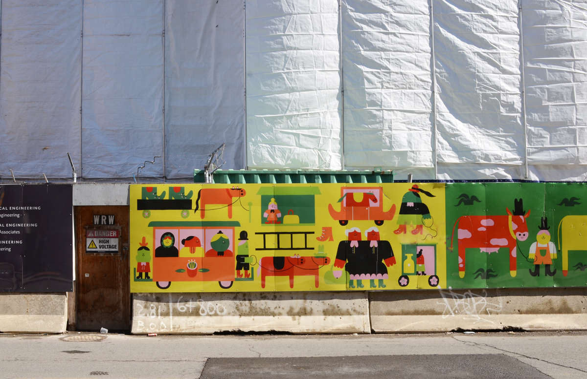
below: Hoardings on Lower Simcoe street – “A Stroll Through the City” by Camilla Teodoro
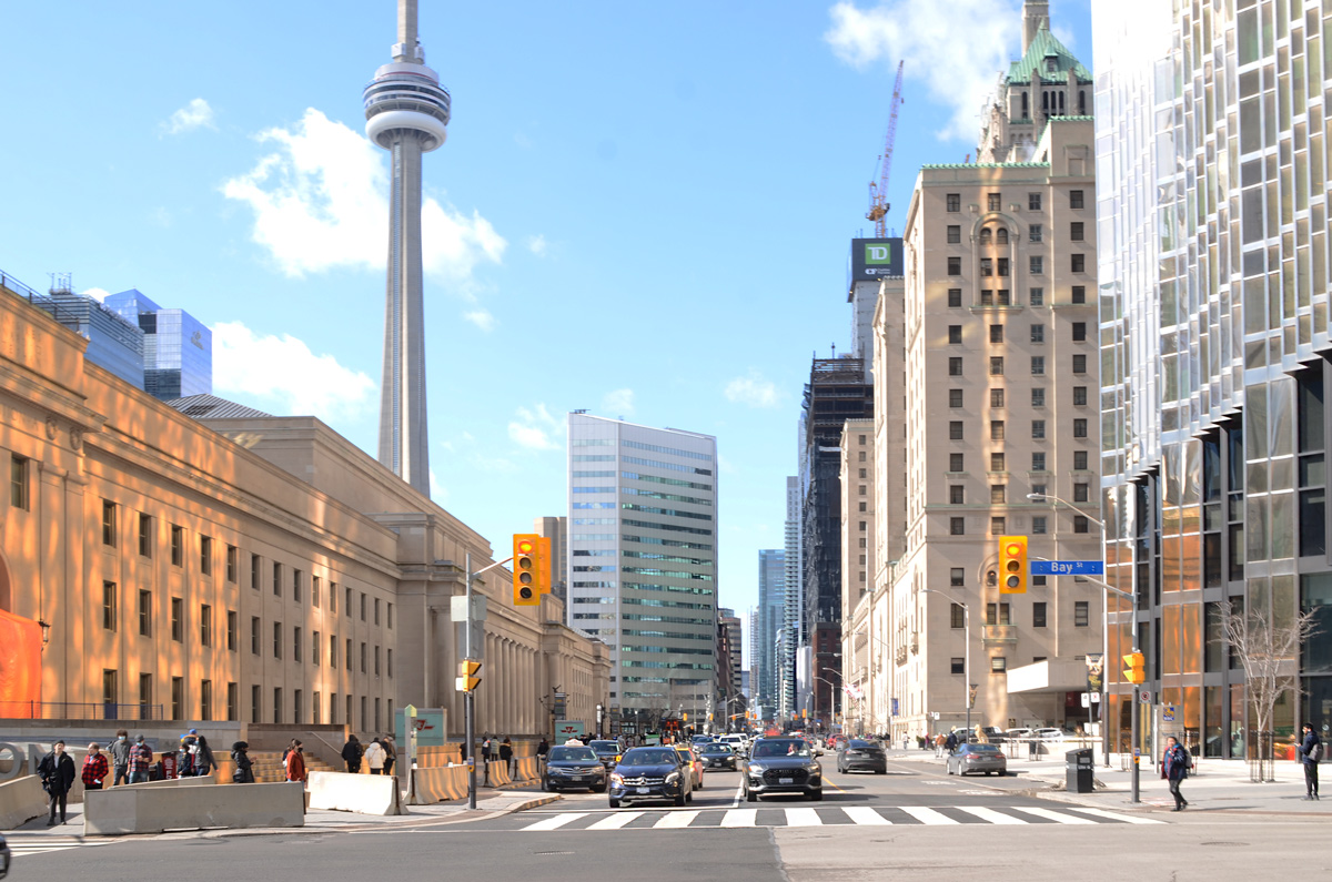
below: Looking west on Front Street from Bay with Union Station, CN Tower, Royal Bank building, and the Royal York Hotel.
below: In Simcoe Park (Front Street), there is an aluminium sculpture by British artist Anish Kapoor. It was installed in 1995.
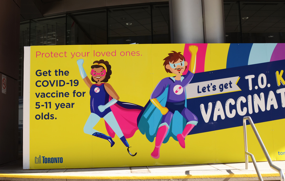
below: Outside Metro Hall, a banner promoting COVID-19 vaccination in kids.
below: Snarky graffiti – “It takes considerable knowledge just to realize the extent of your own ignorance.”
below: Signs on traffic construction cones
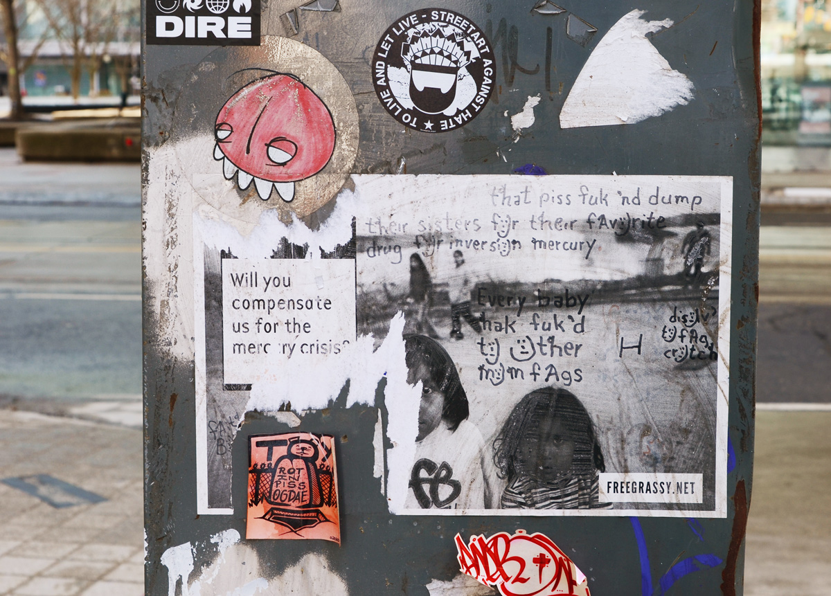
below: Protest posters and graffiti. Anti condo development & corrupt landlords. Mercury contamination of water.
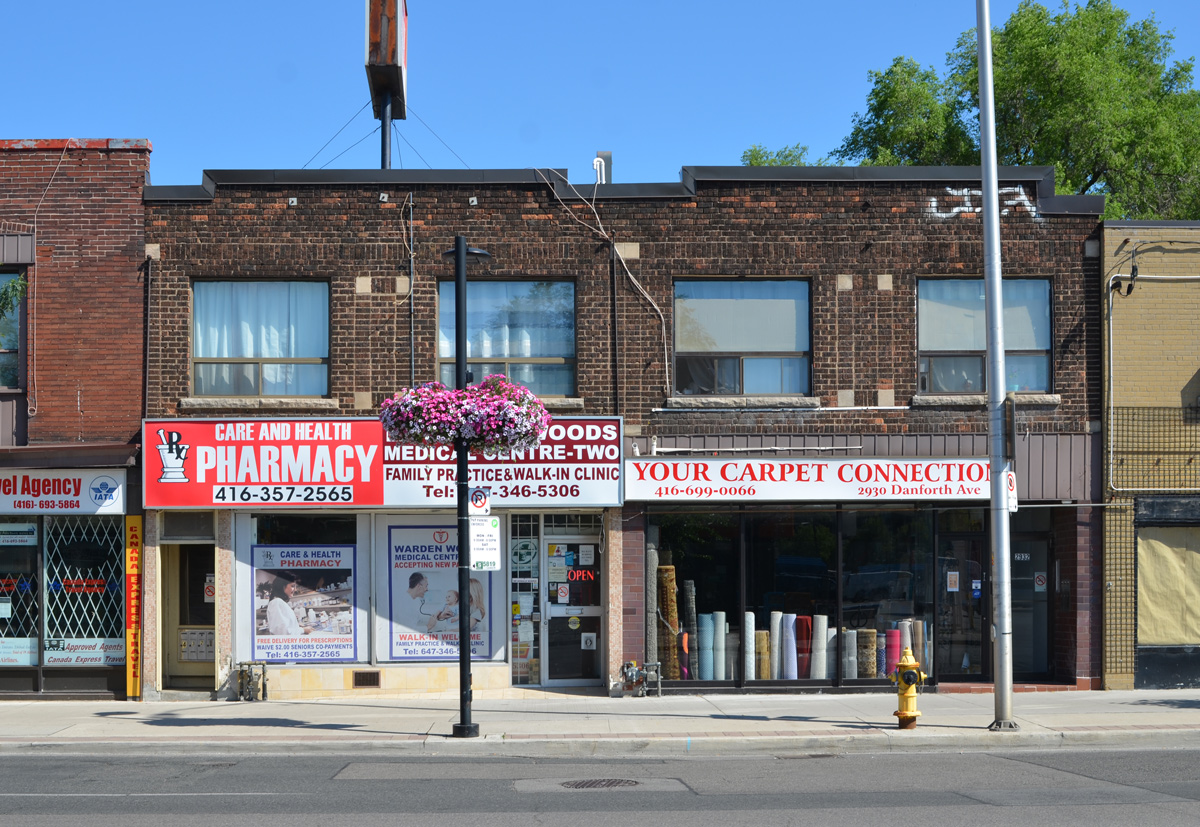
Toronto’s old industrial buildings are disappearing. So when I saw the tall brick chimneys near St. Clair and the Danforth I had to stop and take a closer look.
CLM stands for Canadian Line Materials, also known as CLM industries. It was a division of McGraw-Edison Ltd and they manufactured electrical equipment. One of their contracts was with the Canadian Government to build air raid sirens. CLM was sold in 1985 and no longer exists.
below: Back in behind, part of the parking lot has been given over to the Scarborough Community Garden.
below: In the above photo you can see the solar panels on the roof of the Scarborough Church of God that is across the street from the old CLM buildings. Construction of the church began in 1958 and it was dedicated in March 1960 as the Scarborough Junction United Church. The blue sign indicates that this is also the home of the Scarborough Grace Harvest Church (Korean).
below: Side windows on the church
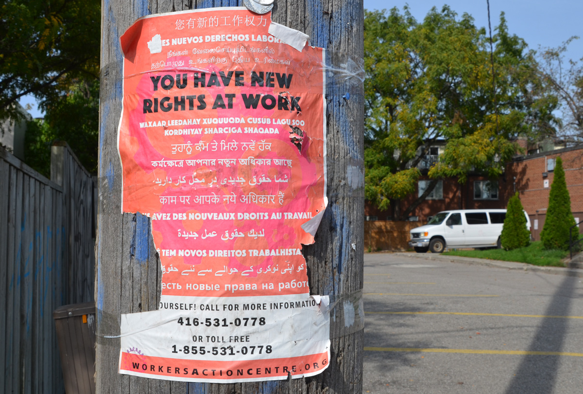
below: A reminder of how diverse Toronto is – Workers rights in many languages
below: “Known as best psychic and spiritual healer in Toronto”
below: Arsenio’s Kitchen has chicken and rice for $5.99
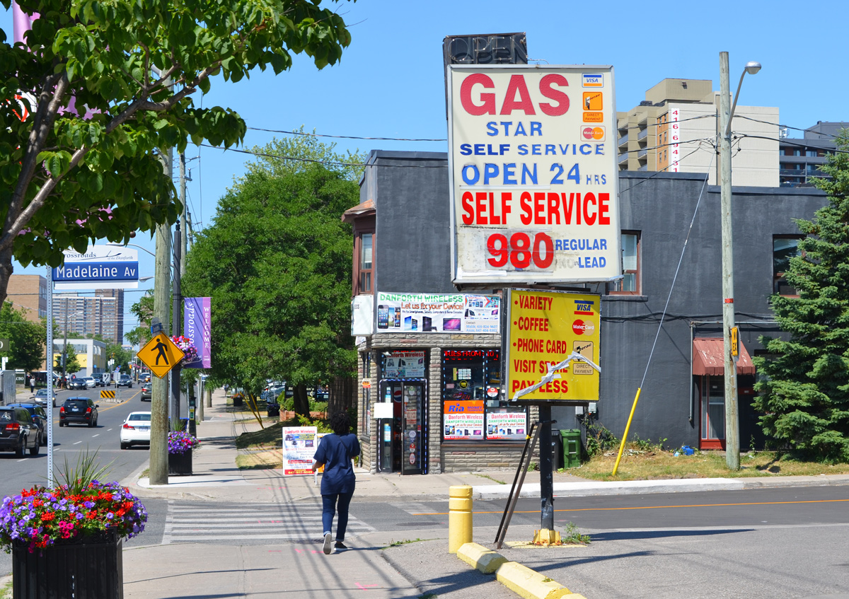
below: Fuel stop – gas for the car and a roti for you
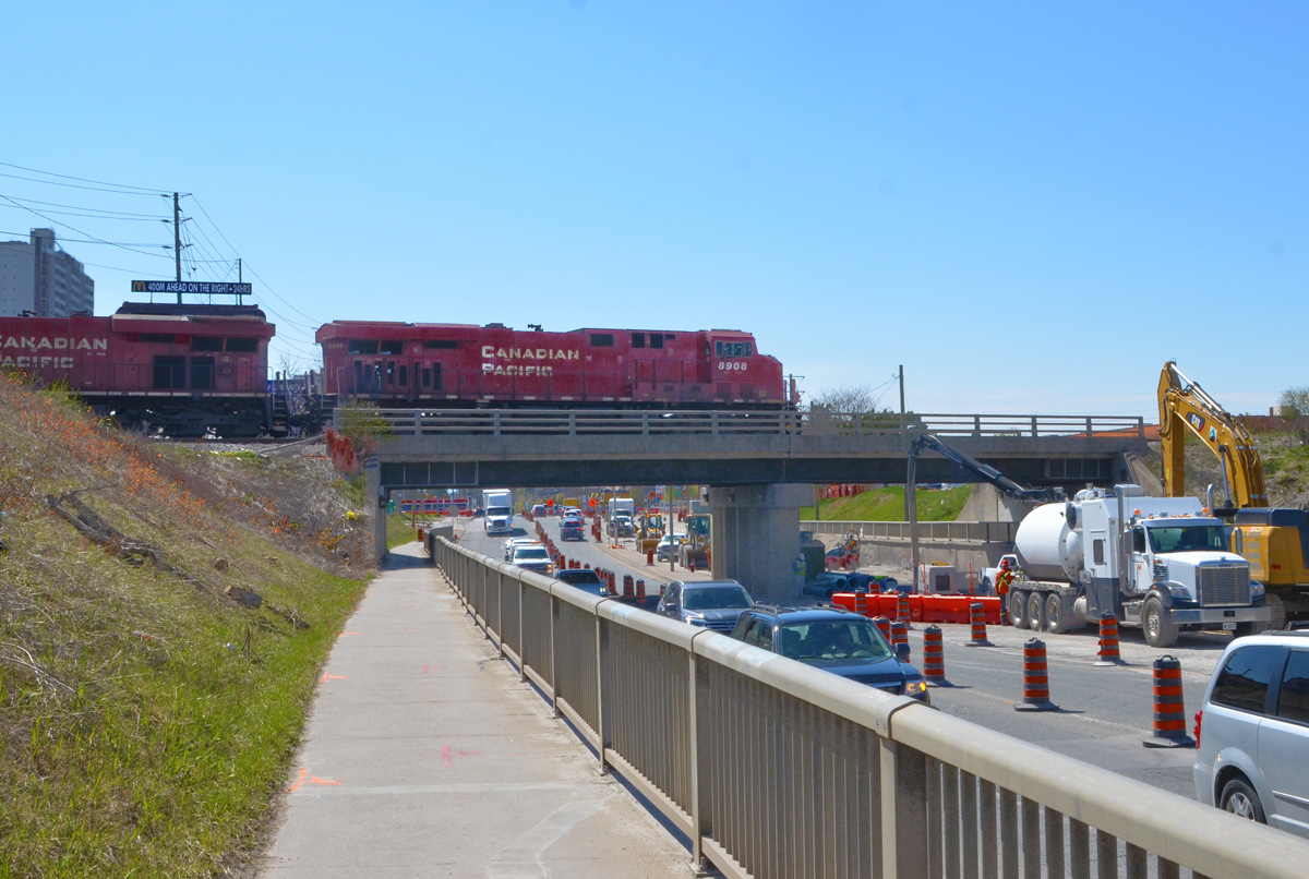
Just to the west, Kennedy Road crosses both St. Clair and Danforth and forms a small triangle. Immediately south of the Danforth, Kennedy goes over the railway tracks.
below: The view east from Kennedy, looking towards Scarborough GO station.
below: The view west from the bridge
below: A bit of country in the city.
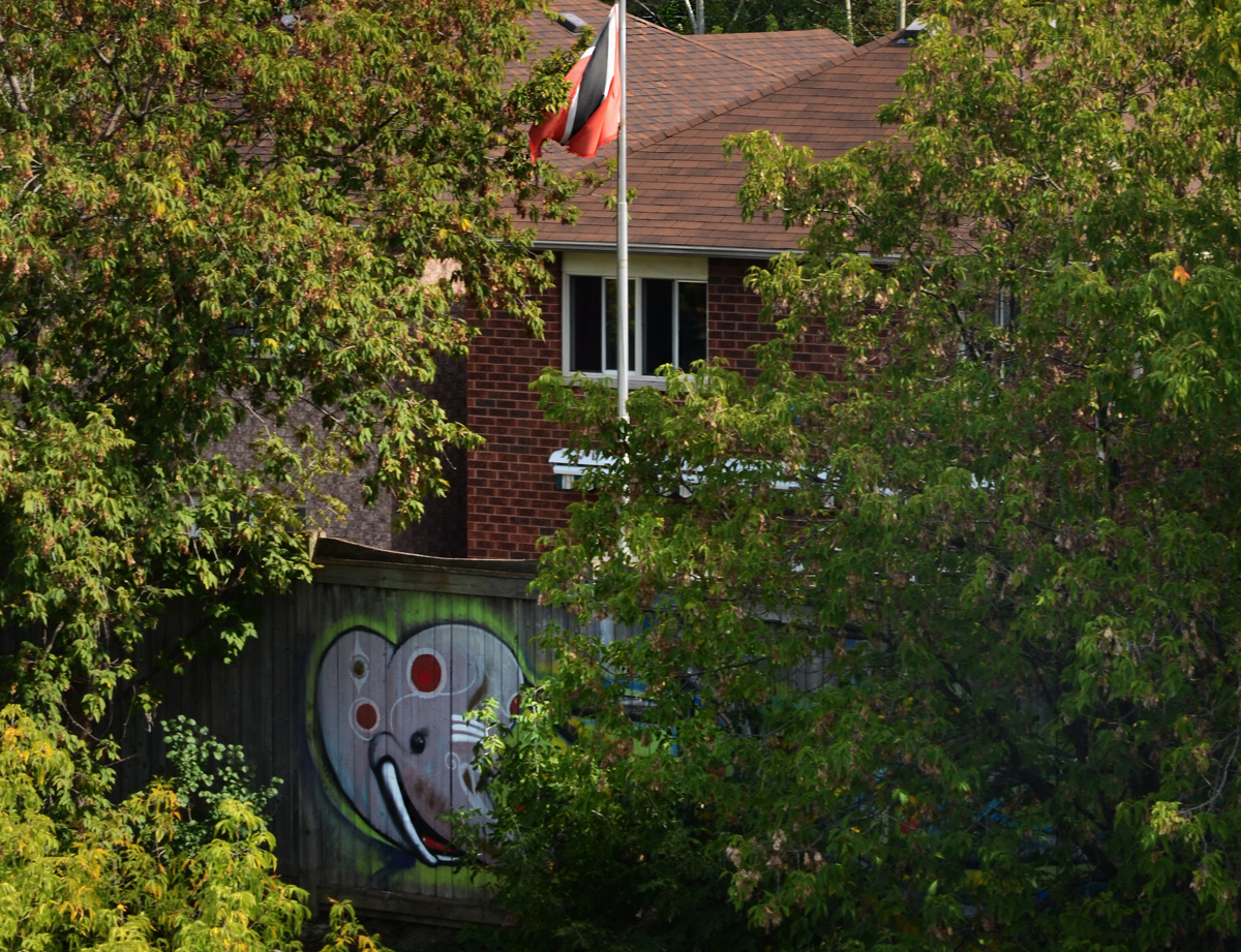
below: An elephant hiding in the bushes. Any idea of what flag that might be? Trinidad and Tobago?
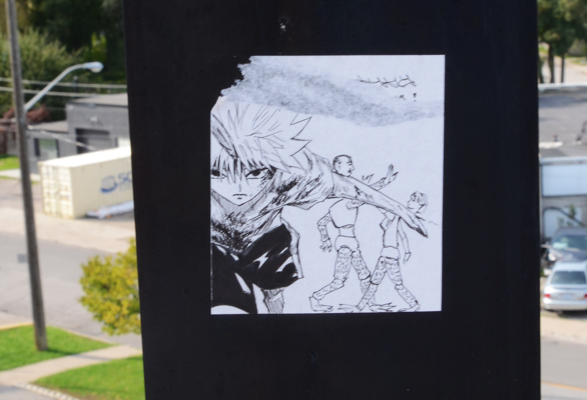
below: Anime-like on a bridge railing.
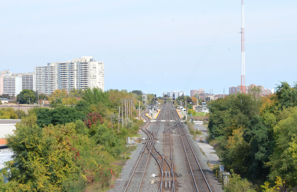
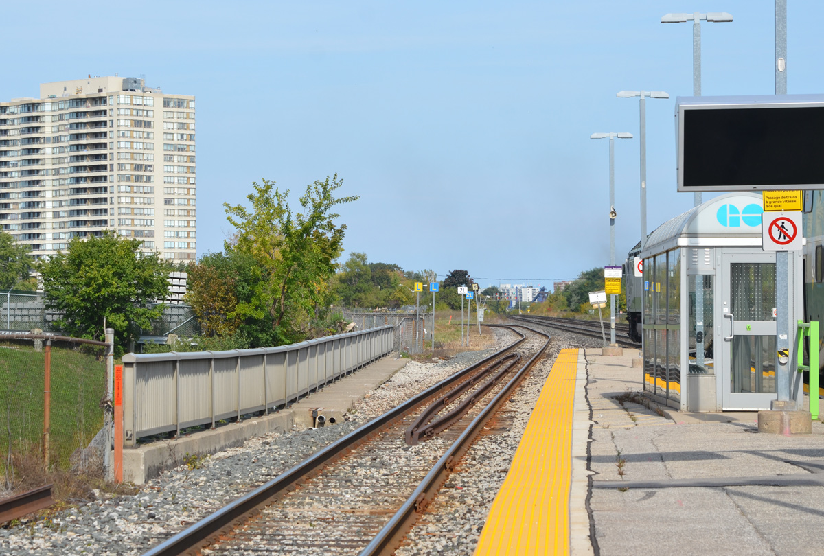
below: Standing on the platform at Scarborough GO station and looking east. Here the tracks split – the GO train line to Kennedy and Agincourt stations (and beyond) splits to the left and heads northward. The other tracks are the main CNR line as well as eastward GO line to Eglinton GO station
As I walked, it soon became apparent that there were a lot of commercial buildings now sitting empty. It’s becoming a bit repetitive but once again I found myself in an area that is about to undergo some profound changes.
below: An empty building waiting for demolition.
Scarborough Junction redevelopment plans involve a 26 acre plot of land adjacent to Scarborough GO station – what has become known as the Scarborough Junction Masterplan.
below: Drawing of the Masterplan. It covers a large chunk of the triangle created by the CNR tracks, Kennedy Road to the west, and St. Clair to the north. It will create about 6620 residential units in 17 buildings with the tallest tower being 48 storeys high. The CLM building is on this site (blocks C & G?). (image source: Urban Toronto).
below: View from the Scarborough GO station. At the moment, most of the land along the northwest side of the tracks is unused.
below: Outdoor seating arrangement
below: Truck for sale
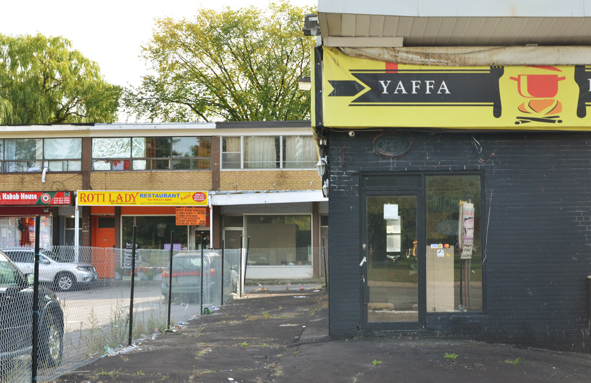
below: On the southwest corner of Kennedy and St. Clair is a small plaza from the 1960s.
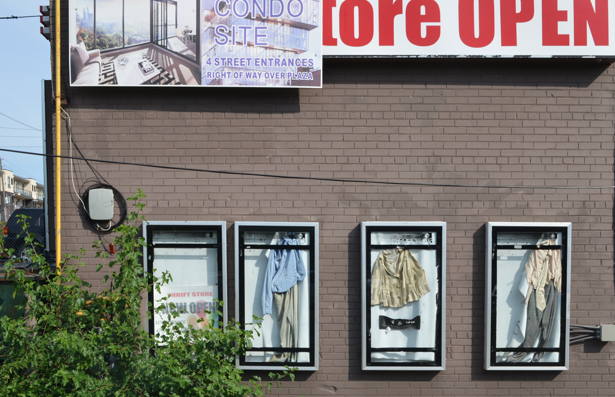
below: Another empty building behind a fence – Some clothes in cases all that remains of what was once a thrift store (and probably something else before that). There is a weathered sign suggesting a condo development but I haven’t been able to find anything about it (or I missed something).
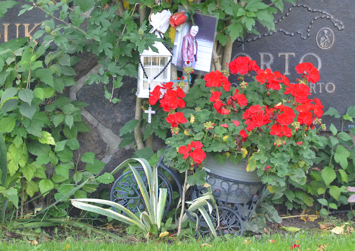
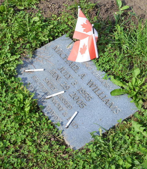
below: One corner that is in no danger of being redeveloped is the northwest corner of St. Clair and Kennedy. This is Pinehills Cemetery.
It’s heart warming to see that people care enough about those who have passed away that they find ways to celebrate that person in creative ways. Insert jokes here about how we’ll all be dead before the Maple Leafs win a Stanley Cup.
Sometimes it’s difficult to remember that Toronto includes a large number of outlying areas, not just the downtown core. Also, if you are looking for a “safe” place to walk during these Covid times, head to Kennedy Road in Scarborough. I wasn’t alone the day I walked it but people were few and far between. Out Scarborough way they aren’t as used to people wandering around with cameras so I got a few quizzical, skeptical looks. The street scene is definitely different from the central core but every street has a story to tell. Sometimes you just have to slow down and look for it.
below: What lured me into the area? I caught a glimpse of this moose and it made me want to explore more. It stands beside Kennedy Road, just south of the 401. Back in 2000 there were 326 of these sculptures scattered around the city, all were the identical moose shapes but all were painted differently. Collectively, they were “Moose in the City”.
You might have noticed that the sign also says Mike Myers Way, named for the actor who grew up in Scarborough. I am not sure if this means that all of Kennedy Road is named after him but there is a Mike Myers Drive just to the south of this (south of Lawrence).
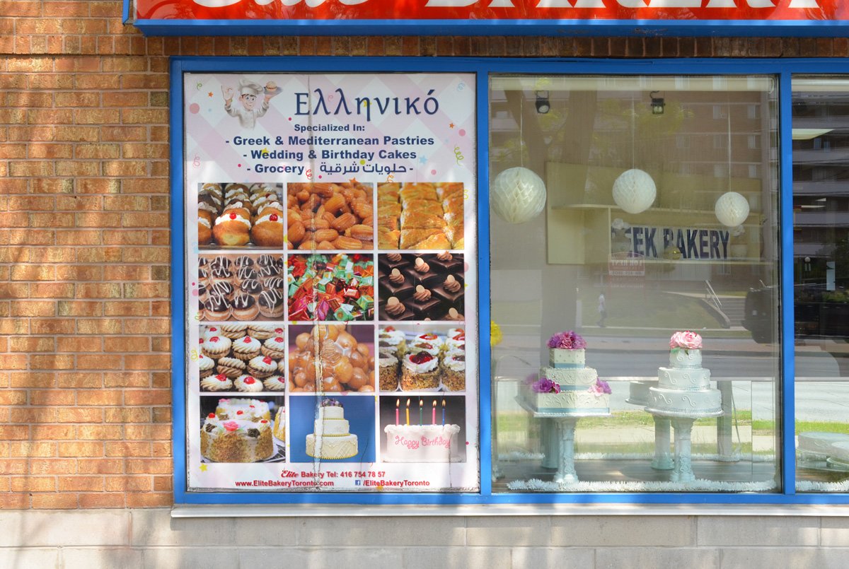
below: The sign on the Elite Bakery is trilingual – Greek, English, and another in an alphabet that I don’t recognize (Arabic?). It all looks good in any language, doesn’t it?
below: More signs of the multicultural nature of Toronto
below: Another common Toronto feature – the construction site! … with its plethora of safety rules and regulations.
below: Looking west on Eglinton at Kennedy. That is one tall utility pole!
below: Magical Aquarium Club
below: Grace Church and Grace Place Food Bank
below: Mount Zion Church, The Apostle Doctrine of God
below: Bright pink and red will make your business stand out!
below: A faded photo above the entrance to a furniture store – highlighting their wares. She seems like a very satisfied customer!
below: Or, show your product by having it on display outside (these are Covid times after all)
below: Jostling to be seen, a jumble of words and colours.
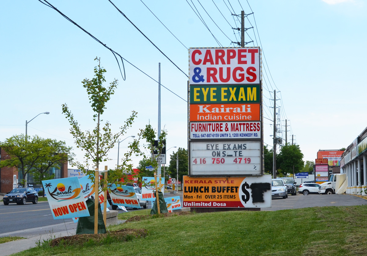
below: Eye exams on site… but the I (eye?) fell over. Carpets & Rugs, Kairali Indian cuisine – lunch buffet for an unknown price.
below: Real Kerala groceries at Motherland Foods. Mr. John’s take out.
below: The two storey brick plaza. Many of these were built around the suburban areas, back when suburbs were newer and growing quickly in the 1950s and 1960s.
below: It seems fitting that the Private Eye and Spy Shop is close to the Adult Movies store. You can also eat at Lucile’s West Indian Restaurant and Groceries or at Just Love Caribbean Restaurant.
below: Agincourt Used Cars, closed and waiting for redevelopment – into townhouse like complex with retail on the ground floor facing the street (in one proposal from December 2015 anyhow. There are 25 documents associated with this development, all available online. The latest one was March 2018. I didn’t read them.)
below: To the east, as seen from a parking lot on Kennedy Road.
below: An older housing development with direct access to Kennedy.
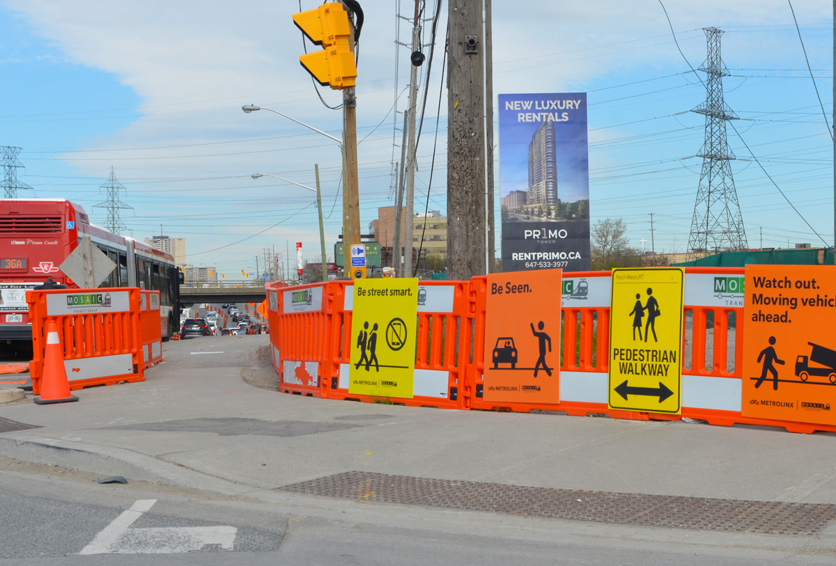
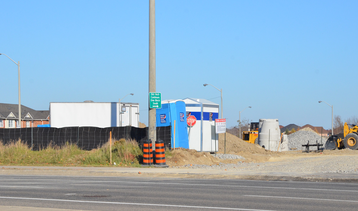
Today, the intersection of Finch and Weston Road is a mess. Metrolinx is preparing to start construction on the Finch LRT, more than 12 acres on the southeast corner is being totally rebuilt, and water mains along Finch are being upgraded. The intersection also has the misfortune to lie in a hydro corridor.
below: Looking west on Finch at Weston Road.
below: Canadian Pacific tracks cross Finch just east of Weston Road
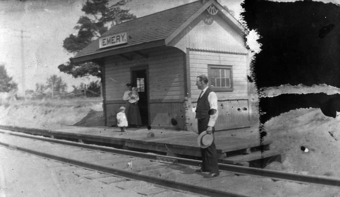
below: Emery train station just after 1900. This was a a flag station built for the Toronto Grey and Bruce Railway in 1870 (i.e. trains only stopped if you flagged them down). In the early 1880s the line was acquired by the Canadian Pacific Railroad. Photo source: Toronto Public Library
Like the rest of the GTA, development here began as a village that supported the surrounding farms. In 1796, Isaac Devins and his wife Mary Chapman were given 200 acres of land, south of what is now Finch Ave from Weston Road to Islington. Devins had worked with Governor Simcoe as a superintendent on the construction of Yonge St. Two of their grandsons opened businesses near the corner of Finch and Weston Road. – one was a blacksmith and the other a carriage maker. A brick schoolhouse came shortly after 1850 and the Methodist church followed in 1869. A post office was established in 1879… and Emery was officially a village.
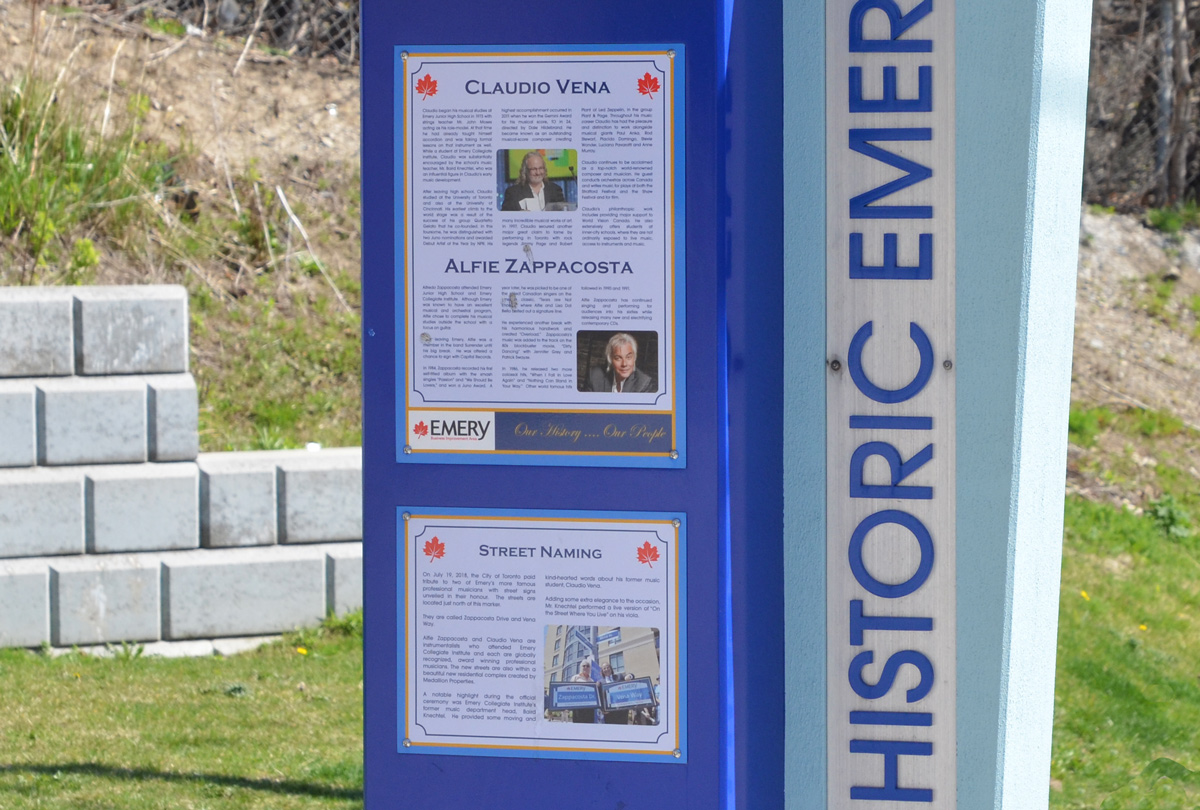
Celebrating the history of Emery are some plaques on display at a couple of bus stops on Weston Road. The one below describes two musicians with local roots, Claudio Vena and Alfie Zappacosta. Both men have streets named after them.
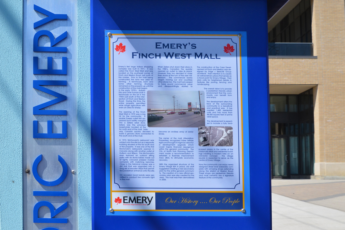
below: Finch West Mall was built in 1971 on the southeast corner of Finch and Weston Road on what had previously been farm land. Step-brothers Aubrey Ella and Orrie Truman had farmed here since 1930. …. but you can’t go shopping there any more. [transcription of the text can be found at the bottom of this post]
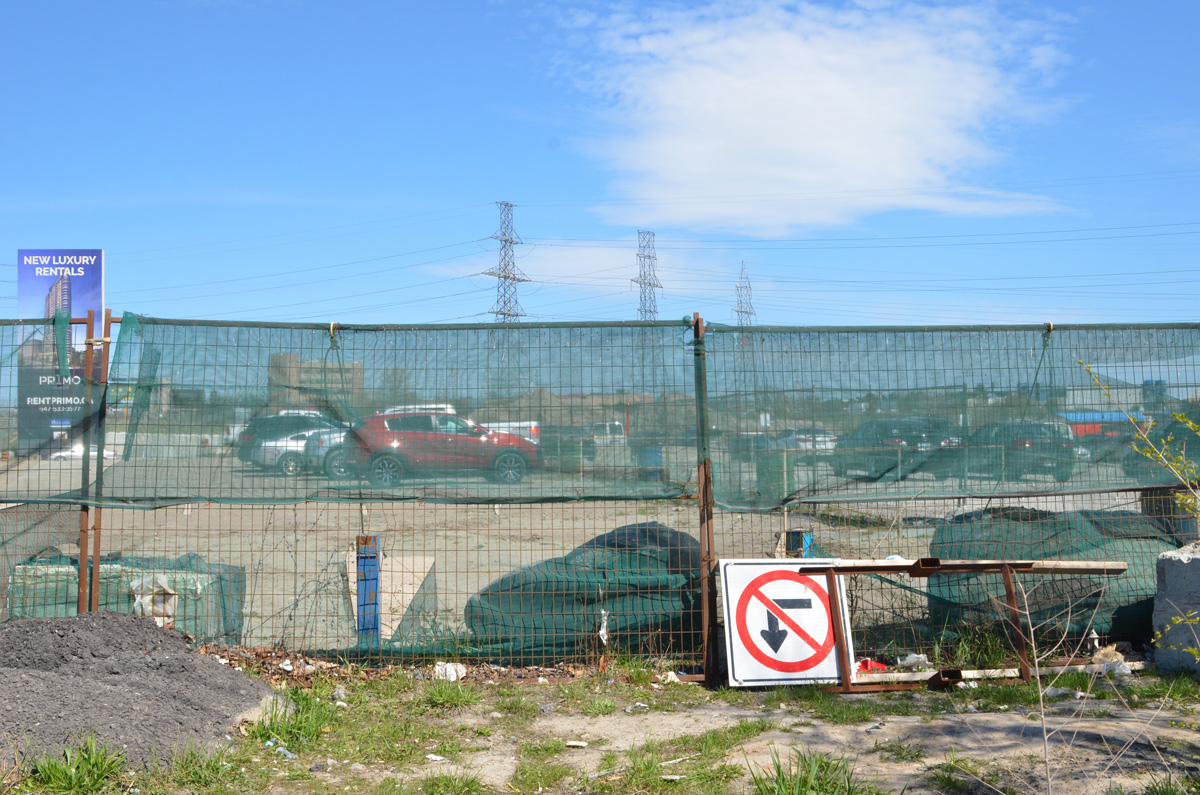
below: Development notice sign at the site of the former Finch West Mall. The proposal includes 5 towers, 2237 residences ranging from bachelors to 3 bedroom, some retail, and a park. All rentals.
below: Construction is only in the early stages so there isn’t much to see
below: Preparations for the construction of the Finch LRT are underway.
below: But not always well thought out – here sidewalk access ends but the only way to go is to cross Finch in mid-block with no help
Also like many places in Toronto, Emery has become very multicultural.
below: African Food & Groceries as well as Comida Colombiana
below: A Vietnamese restaurant and a West Indian grocery store
below: North York Sikh temple
below: Confusion?
below: More restaurants and businesses
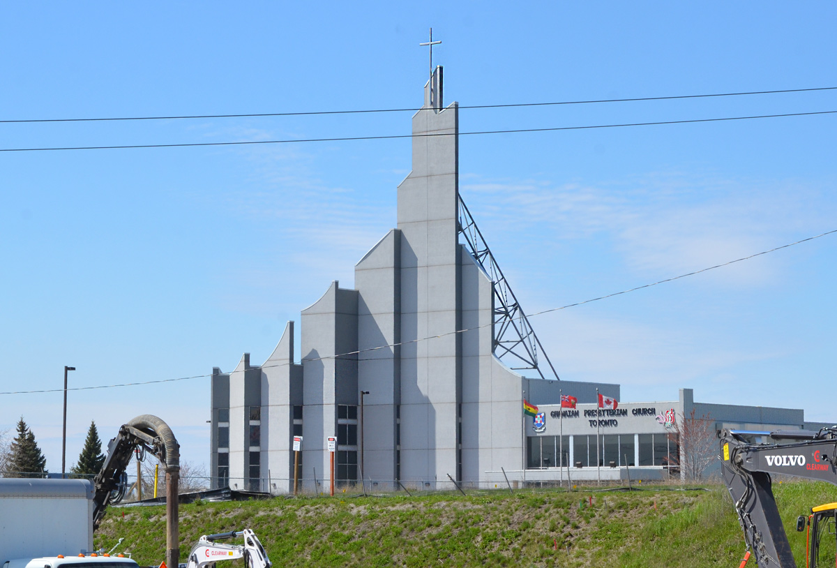
below: Ghanaian Presbyterian Church, since 1994 (as seen from Finch Ave)
below: Prayer Palace
below: Lindylou park
below: Emery Creek south of Finch
below: Finch Avenue West, looking eastward towards Weston Road
below: Slightly closer to Weston Road (from Lindyloou park looking northeast)
below: Not taken from the same spot but also Finch Avenue West, looking eastward towards Weston Road in 1958 when Finch was still a dirt road. The brick building is Emery Public School (built 1914); and it looks like it had a portable in the yard… and is that an Elmer the Safety Elephant flag? The school was demolished shortly after the picture was taken. Photo source: Toronto Public Library, photo by James Victor Salmon
below: Farther east, now past Weston Road. If you go even farther you will come to Hwy 400
below: Most of the area north of Finch is zoned for light industry including this business, the making of prefab concrete staircases. With all the condo development in the city at the moment, there must be a lot of demand for these stairs!
below: Another vacant lot
*****
Transcription of Plaque (above):
“Emery’s first large indoor shopping complex was built in 1971. It was called the Finch West Mall and was located on the southwest corner of Finch and Weston Road… Prior to the mall being constructed, the land was used for farming. A farmhouse, barn, and some other farming structures remained on the property up until the construction of the mall began in the early 1970s. Aubrey Ella and Orrie Truman built a farmhouse on the lot in the 1930s just south of the intersection of Finch and Weston Road. During this time, the entire property permitted wide range agriculture with even an arena for sheep.” “The opening of the Finch West Mall in 1972 was a big hit for the community. A sizable Towers outlet first appeared but it swiftly merged into a Zellers retail store. Zellers was the principal leaseholder located at the far north end of the mall. Safeway Canada quickly decided to build a grocery store connected to the south end of the mall.” “In 1973, McDonald’s restaurant was added onto the site but as a separate building situated at the far south of the property. It was one of the first McDonald’s restaurants opened in Canada along with another outlet at Dufferin and Wilson. This McDonald’s even featured an outdoor sitting patio with six stone tables made out of lightly coloured presses marble complete with matching benches. Close to this historical marker was a dirt trail that was upgraded into a long set of wooden steps that permitted pedestrian entrance onto the site.” “On occasions local bands were permitted to conduct live concerts right in the mall.” “When Zellers shut down their store in the 1980s, Canadian Tire quickly opened an outlet to take its place. However, they too decided to close their doors at the turn of the new millennium. The commercial banks began moving out and countless other stores too. The mall had ceased to have sound commercial value and disappointingly started to become an endless array of dollar stores.” “The owner of the mall (Medallion Properties) recognized these telltale signs and thought it might be ideal for a development upgrade which could inspire financial resurgence within the general community. The City of North York Planning Department made a recommendation to establish a Business Improvement Area (BIA) to stimulate economic recovery.” “With the organized structure of the Emery Village BIA in place, city staff suggested creating a new secondary plan for the entire general community…The mall was demolished in 2006.”
*****
One of life’s unexpected coincidences… I didn’t read the text before I took the picture so it wasn’t until a few days later that I saw the name Orrie Truman. I have Trueman ancestors in this area… was he related? Orrie Truman was Orrie Levi Richard Trueman. I don’t know where the name Orrie comes from but Levi and Richard were his grandfathers, Levi Coulter and Richard Trueman. William Mellow Trueman married Eleanor (Nellie) Coulter and Orrie is their son. William died shortly after and Nellie subsequently married Ella. Going back a generation, William Mellow Trueman is the son of Richard Trueman and Rebecca Mellow who happen to be my great great great grandparents. My great grandmother, Ina Rebecca Moore was named after Rebecca Mellow, her grandmother. Ina would have been Orrie’s first cousin. Question: What relation am I to Orrie Trueman?
below: Up beside the Don Valley Parkway and way off the beaten track this time.
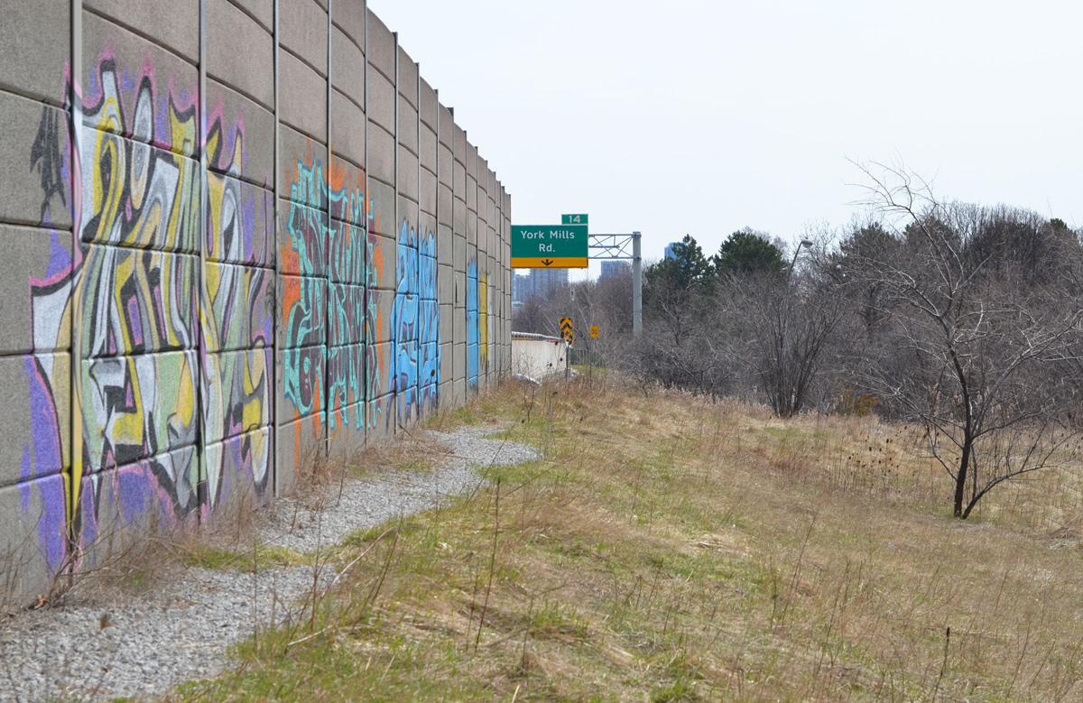
But obviously some people with spray paint know about this little green corner of North York.
below: More graffiti (text, throw ups) along the concrete barrier beside the southbound traffic
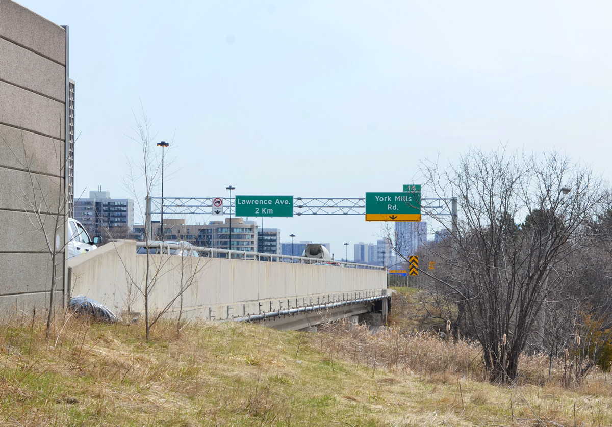
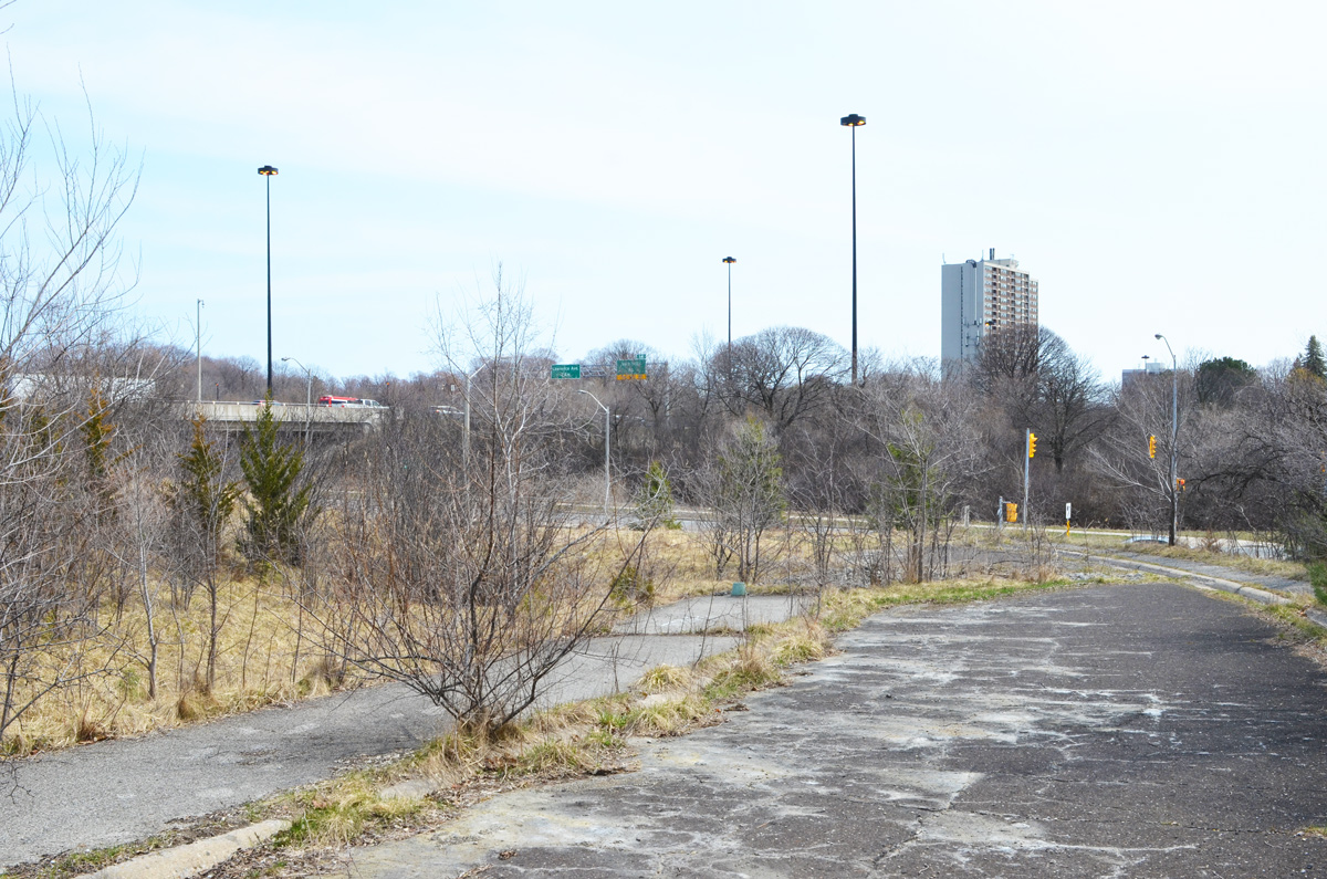
below: A dead end on an abandoned road. This is part of the remains of an onramp for the southbound Don Valley Parkway from westbound York Mills Road.
below: This ramp was closed in 2005 and replaced with the present road configuration where all the on and off ramps are on the south side of York Mills. Except for creating a mound of earth along the York Mils side, the site was left untouched. Small trees are slowly taking over as nature gains the upper hand.
below: Still no parking
below: Walking east on York Mills Road
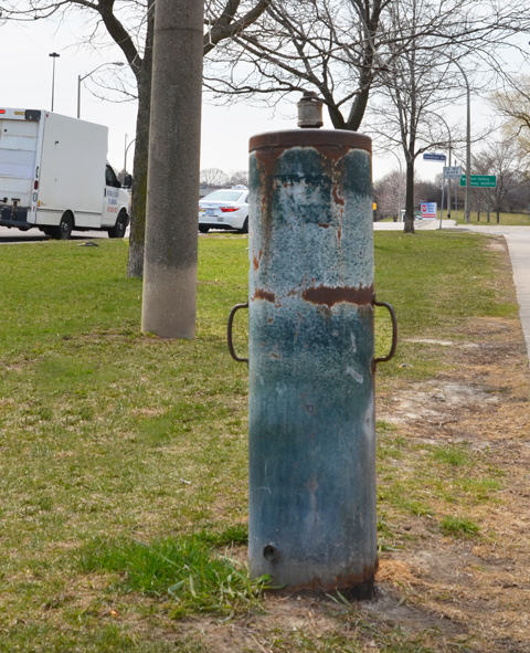
below: Any idea what this is? Something old and to do with water? At first I thought that it was sidewalk feature but now I suspect that someone ditched it here.
below: Looking eastward on York Mills Road
below: Walking through Deerlick Park
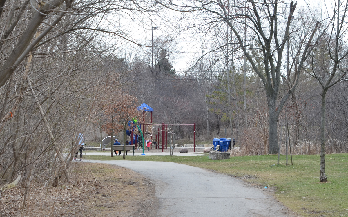
below: Playground on Deerlick Trail
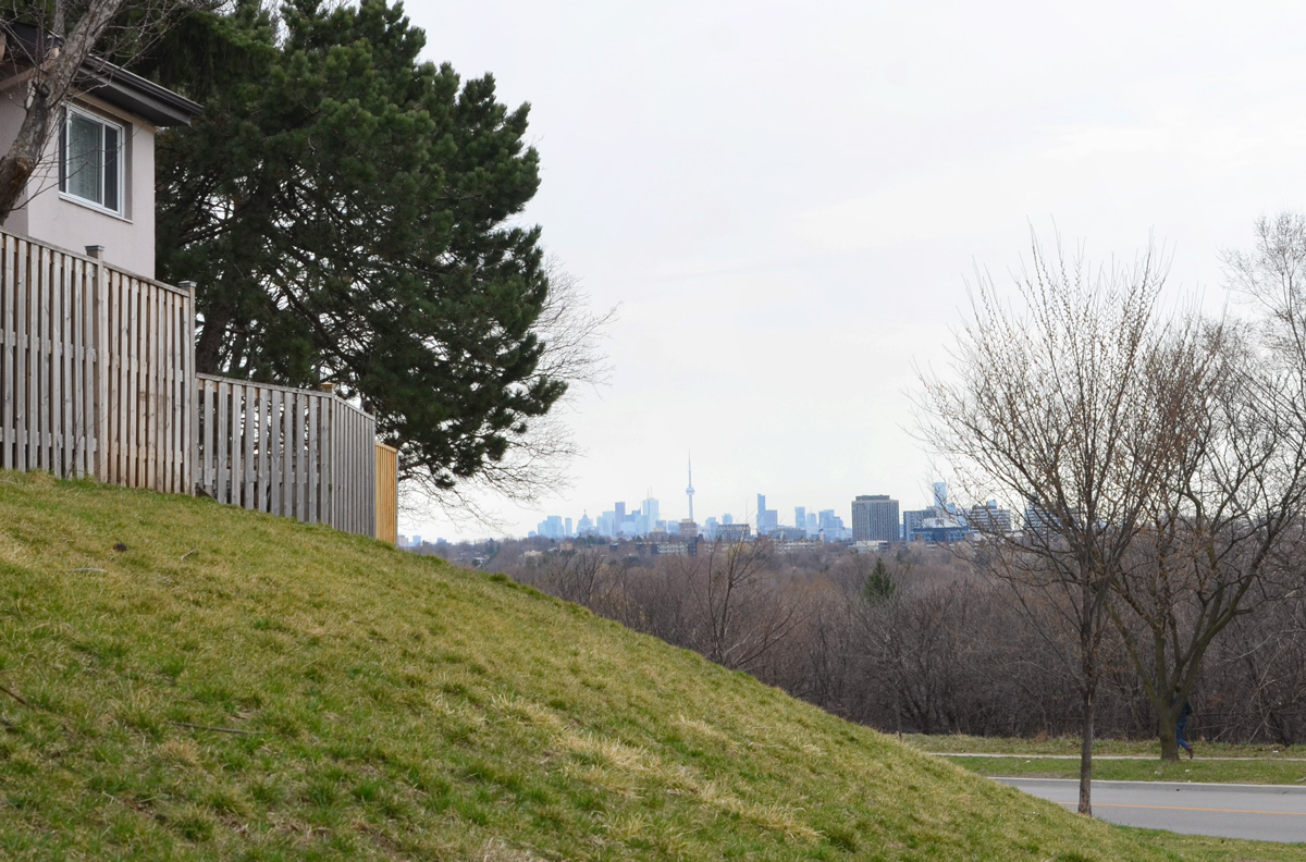
below: CN Tower and the downtown Toronto skyline in the distance
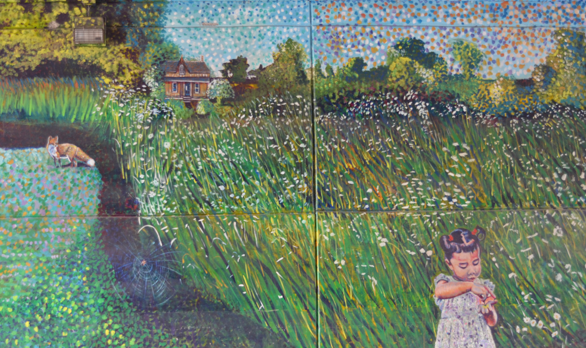
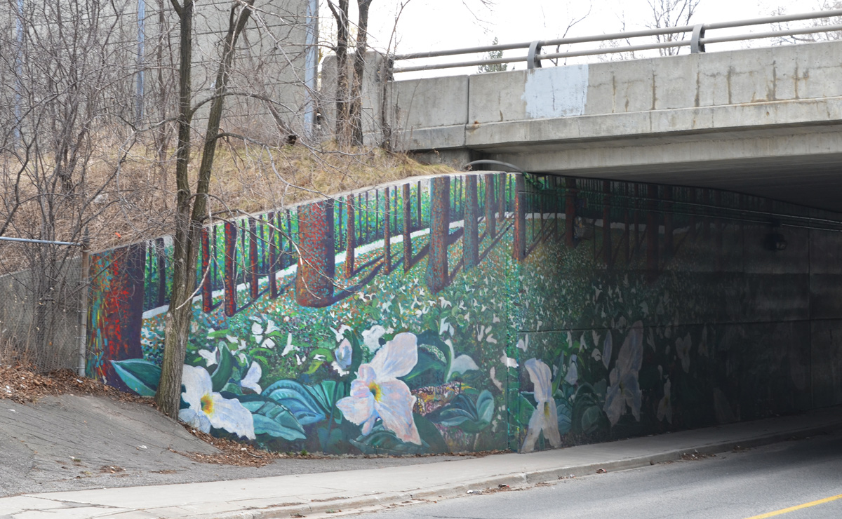
below: Trilliums under the Don Valley Parkway. Part of a mural on both sides of the underpass at Brookbanks. It was painted by Sarah J. Collard with help from Manny and Sonja Wiebe.
below: Church of Our Saviour with its large triangular stained glass window that was apparently designed by a local high school student.
From Three Valleys I tried to find a way to get back north to York Mills Road via parks and green spaces but I couldn’t do it. The next blog post was the result of a subsequent walk when I started farther north and attempted to find a path south.
A few weeks ago I read a blog post about Agincourt history in Bob Georgiou’s Scenes from a City. It reminded me that I had once tried to walk that area but I only got discouraged because of weather (grey, damp) and nostalgia. Sheppard Avenue just east of Kennedy now has this large concrete underpass (Metrolinx/GO trains) which was a shocking change from my childhood memories. My parents were living here with their parents when then met and my paternal grandparents remained in the neighbourhood until they passed. One of my great-grandfathers lived on Agincourt Drive in a house that backed onto the railway tracks.
This time round, I waited for a sunny day before I tried walking here again. For the most part, I walked Sheppard Avenue East between Kennedy and Brimley and the photos below are what I saw – what you see there these days. If you are more interested in the history of the area, then you need to be reading Bob’s blog as mentioned above.
Let’s walk!
below: The area’s Asian character is very obvious.
below: Nutriever?
below: West Highland Creek, north of Sheppard
below: Are you in the market for a used truck?
below: If not a truck, how about a car? I passed at least three used car lots.
below: The old Agincourt GO station has been demolished and a new one is being built.
below: Bell Canada (It’s a white building)
below: In a front yard on a nearby street….. I have many questions.
below: Looking east just before Midland Avenue
below: Part of the reason that Sheppard and Midland looks so empty is this vacant site on the southwest corner. There was once a Lumber King Home Centre here, then it was a flea market and used car lot, but now it’s an empty building on an otherwise vacant 4.7 acres. A plan for 80 townhouses and a park was filed back in 2015 and seems to have been winding its way through the development process ever since.
below: A quick rest at the intersection where there are actually some people. I miss interacting with the people that I see as I walk around… and I’m sure that you’ve noticed the lack of people in these blog posts.
Also, re the TTC – this is Sheppard Avenue, home of the Sheppard subway, or is it LRT now? As I was researching development at 4181 Sheppard, I discovered that Metrolinx has been applying for easements along Sheppard in preparation for anything that might be built on that street.
below: There is always something to remind us of life’s situation these days, such as this ad that was on a bus shelter. I liked the hashtag at the end, #PracticeSafe6ix
below: Knox United Church was built as a Free Presbyterian church in the 1840’s but became Knox United in 1925. This was when the Presbyterians merged with the Methodists to form the United Church of Canada. (Although not all Presbyterian churches went along with the merger).
below: Agincourt Baptist Church
below: There is a second overpass in the area. The CPR tracks pass over Sheppard between Midland and Brimley, just west of Canadian Pacific’s Toronto Yard.
below: On this overpass is a mural by elicser
below: Running parallel to the south side of the CPR line and Sheppard Avenue is a large industrial complex belonging to the International Group of Companies.
below: Toronto has 85 BIAs (Business Improvement Areas) including Sheppard East Village which includes Sheppard between Midland and Markham Road.
below: At Glen Watford and Sheppard there is a large new Seniors residence planned.
below: In the meantime, there are empty stores.
below: North Scarborough Memorial being renovated but the old gate remains.
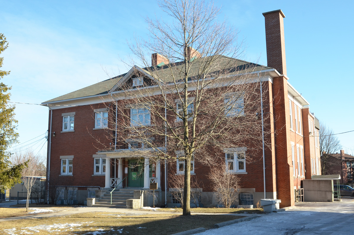
below: Agincourt Elementary School. Built in 1915 as a Continuation School, (grades 9 and 10) but used as an elementary school since Agincourt Collegiate was built in 1930.
below: (Snow)man down! You’d be tired too if you had to stand outside all winter!
below: Mystery ‘All Way Stop’ in the Walmart parking lot.
Walking from Main Street east along the Danforth, with a diversion or two to see what we can see…..
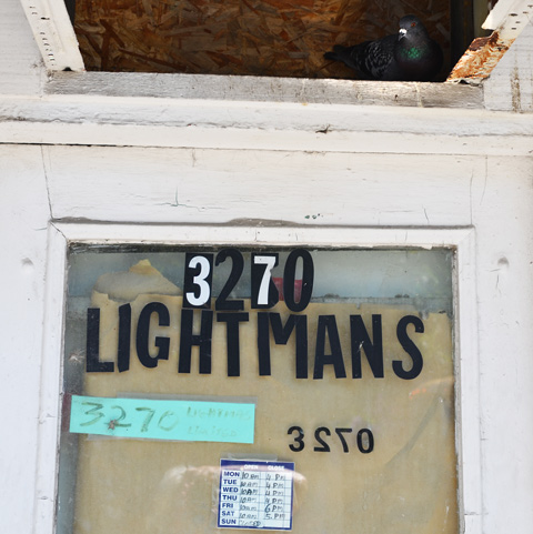
A cosy nook for a pigeon
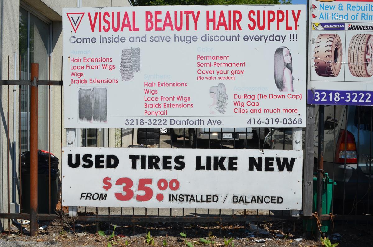
below: Come on in and choose a wig while you wait for your like new used tires to be installed!
Not all skeletons are kept in the closet.
In the category of “the unexpected”, old military vehicles.
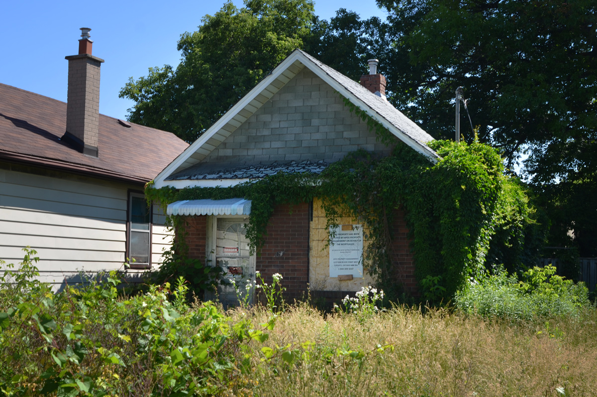
Small houses!
below: This very small house with the big front yard, and a very overgrown yard at that, sits empty and alone. “Danger do not enter” and “Private Property” signs are on the front door. If you can get as far as the front door.
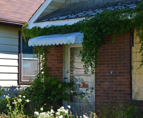
… even more overgrown and even more difficult to find the front door!
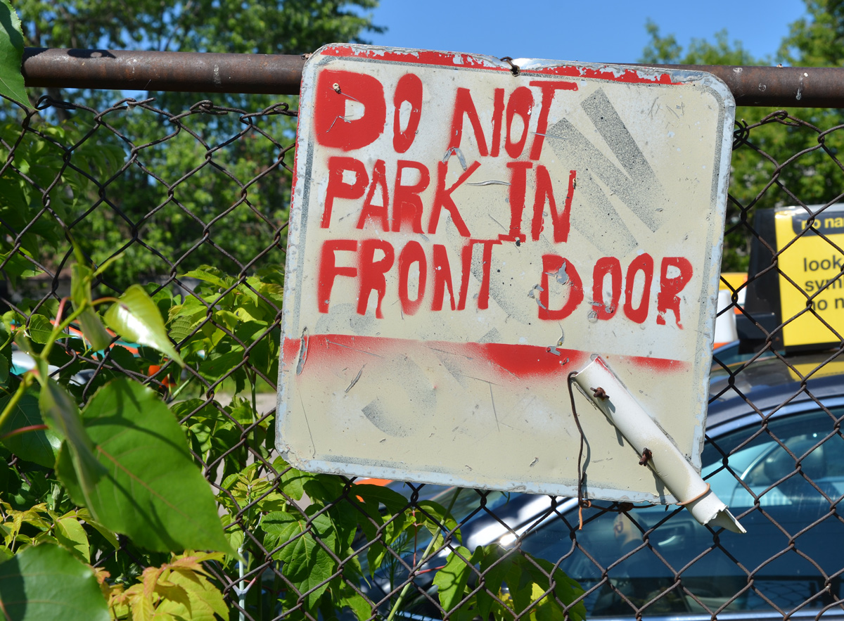
A warning sign of a different sort.
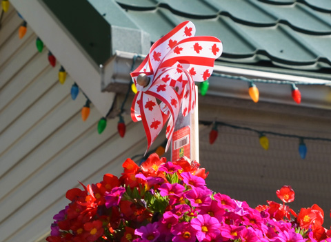
And last but not least, a patriotic splash of summer colour from July when I took these photos for the greyer days of November that we now find ourselves in.
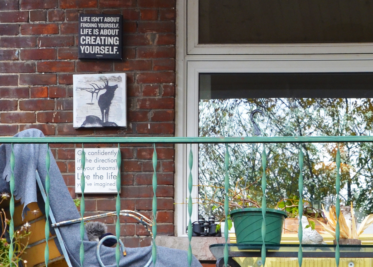
below: Go confidently in the direction of your dreams. What direction should we go today? Where will your feet take you next? Thinking interesting thoughts as we explore. “Life isn’t about finding yourself. Life is about creating yourself”. What have you created today? What should we create next?
Rather lofty words and ideas when all we’re doing is walking up Keele Street… where just looking at the stairs makes me tired.
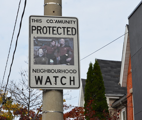
below: It was good fun to see an altered Neighbourhood Watch sign – great to know that some still exist. Five years ago (yikes!) I posted a collection of “good guys” that I had found around the city. I don’t know if Andrew Mutton, the man responsible, is still making them but I haven’t seen any new ones for a long time.
This November has started with wonderful walking weather. In fact, the whole autumn has been a delight for those of us who like to be busy outside. The colours of the trees, shrubs, and vines seem to be more vibrant this year and I don’t think that it’s wrong to say that the colours have lasted longer than usual.
below: Keele and Annette
By the time you get to Keele and Dundas you are definitely in “The Junction” named for its proximity to the junction of a number of different railway lines. In 1884 this area became the village of West Toronto Junction.
below: Looking north up Keele to Dundas. Dundas is a long street that winds its way across the city. Here in the west end, it runs north south as it crosses Bloor West. Moving north from Bloor, Dundas parallels the GO tracks for a half kilometre or so and then bends almost ninety degrees to run parallel to the Canadian Pacific railway line. The junction of these two railway lines is a short distance away (to the northeast)
below: Walking on Dundas
below: CP tracks
below: Back by the tracks
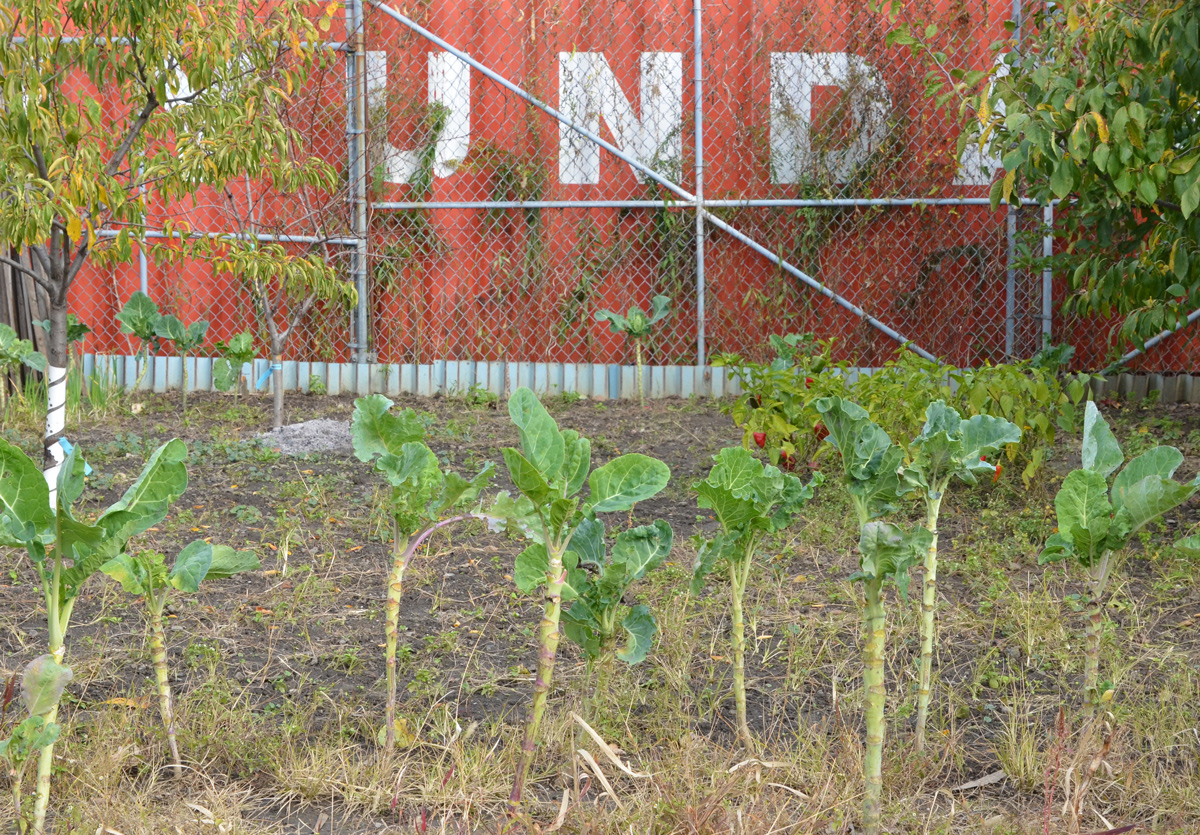
below: The remains of a vegetable garden. Are these brussell sprout plants where the sprouts part have already been removed?
From Keele, it’s a short walk east to the West Toronto Railpath which is on the east side of the GO tracks. The northern most entrance to the path is off of Cariboo Ave which is a tiny one block street north of Dupont. The southern end, although near College and Lansdowne, is actually where the GO tracks cross Dundas…. which is very confusing. If you look at it on a map, it makes a lot more sense!
below: The mural, “Strength in Numbers” is still on the underpass walls at Dupont and can be seen from the railpath. You can find more photos of it if you follow the link.
below: From the same bridge, looking east on Dupont. The twin steeples belong to the Ukrainian Orthodox Church of St. Andrew the Apostle
below: Street art on the glass wall separating the path from the railway tracks.
below: Hoardings. Paintings. In the middle is a section that has been painted with these words: “The greatness of a community is most accurately measured by the compassionate actions of its members, a heart of grace, and a soul generated by love.: C.S.K. [Coretta Scott King]
below: Black Lives Matter, Run for Ahmaud, mural by kizmet32 and Francis Pratt. Tribute to Ahmaud Arbery who was out for a run when he was murdered by two white men, Gregory McMichael and his son, Travis
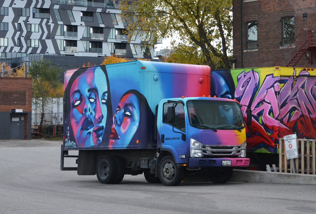
below: Kizmet street art on a Henderson Brewery truck on Sterling Ave.
below: The West Toronto Railpath crosses Bloor Street.
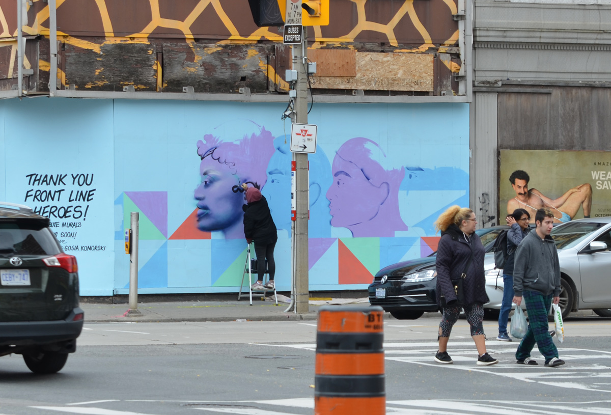
below: The giraffe building at Dundas and Bloor is still there.
below: That corner is getting a new mural, a thank you to front line workers during Covid. Borat has snuck into the photo too – but then his poster does say “Wear Mask, Save Live”. You can’t see all the words here…
below: But they are more visible here….
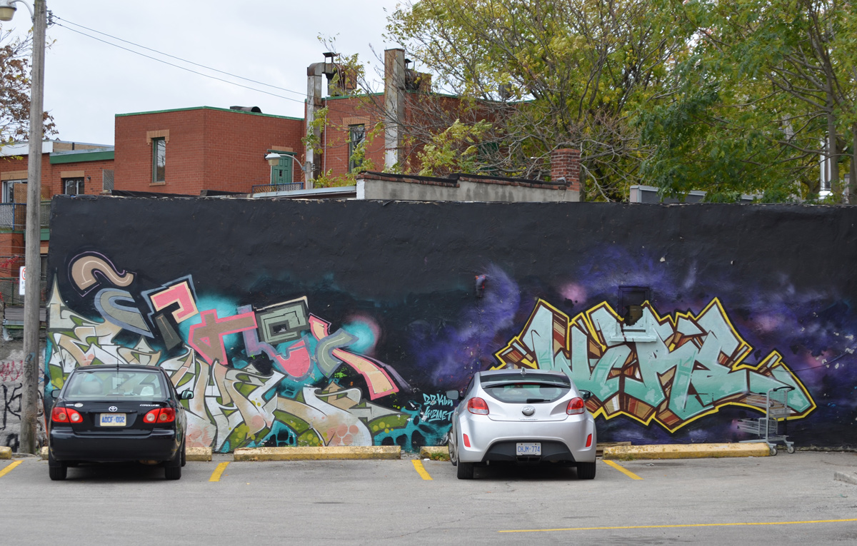
below: Street art in a parking lot. The one on the right is kizmet.
below: The building makes a wedge. On the right is the wall in the photo above.
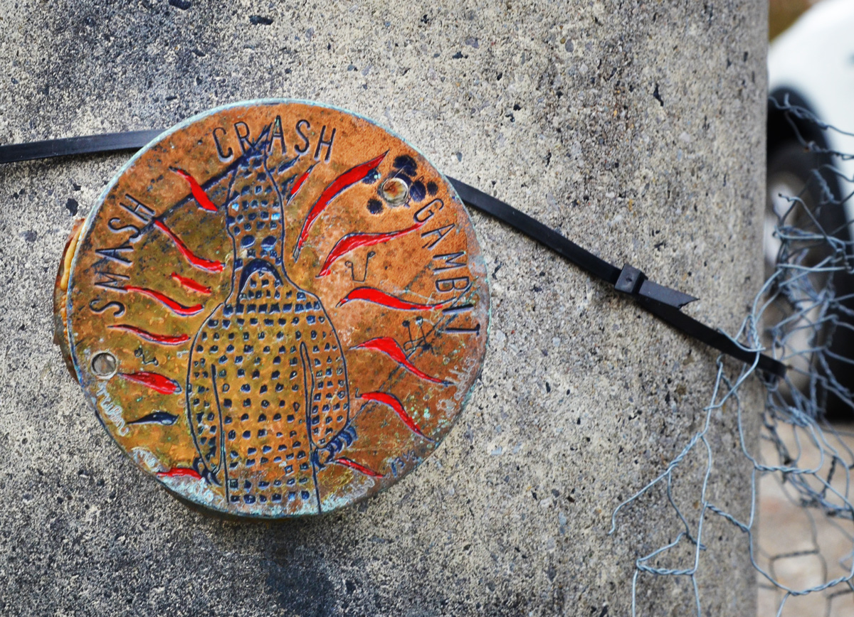
below: Smash, crash, gambit
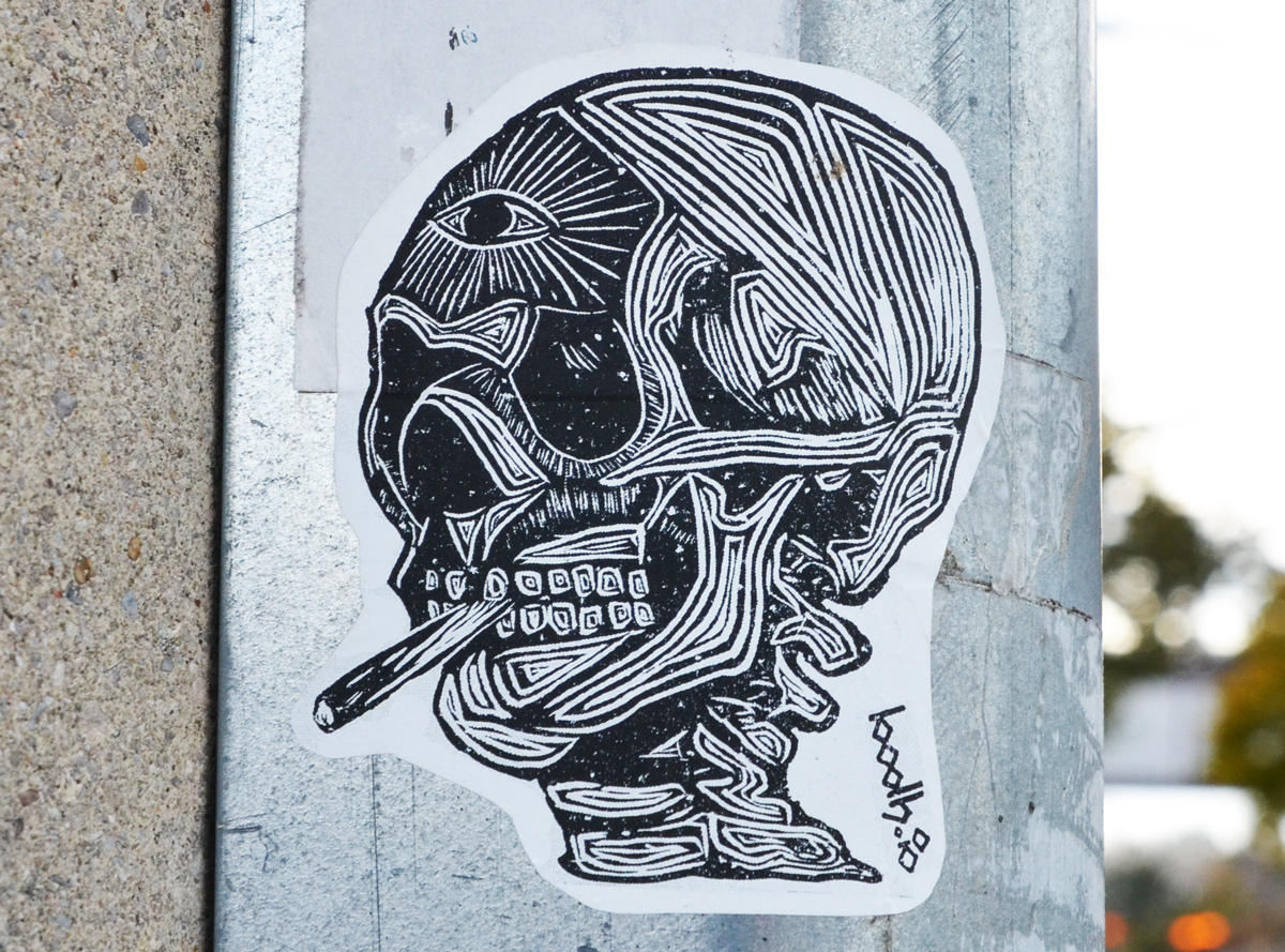
below: A skinless smoker with a third eye by bodh.io
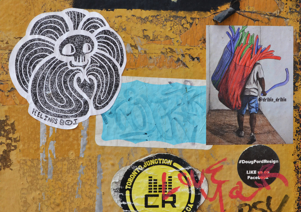
below: Drible-drible with many noodles (?) and on a more political note, someone wants Doug Ford to resign.
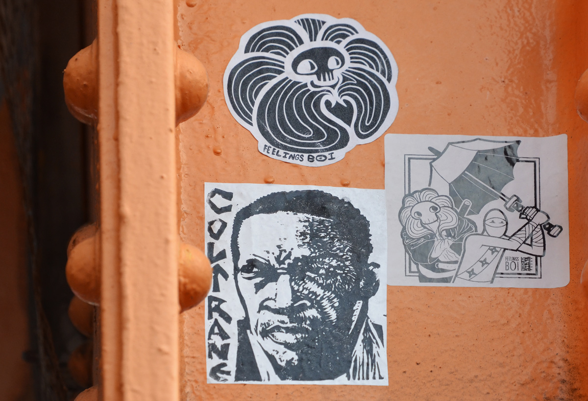
below: A trio – More feelings boi, a collaboration between him and tbonez., and a tribute to jazz musician John Coltrane.
… and that’s all for now!
There are older posts with photos from the Junction and/or the West Toronto Railpath. I’ve been walking and blogging long enough now that there is bound to be repetition! If you are interested in more pictures, you can always search all posts in this this blog for “Junction”… or for whatever you want for that matter!
I heard that there was a new mural near Finch and Morningside which of course means that I have to try and find it. In doing so, I found three murals. This is their story.
This is Morningside Heights at the far eastern side of Scarborough. The Rouge River, the border between Scarborough and Pickering, is not far away. The Toronto Zoo is also nearby.
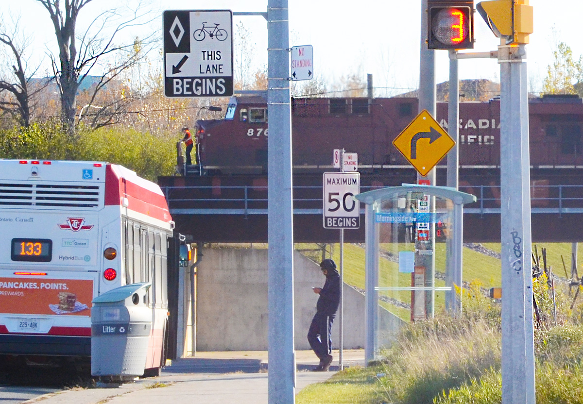
below: Bus 133, Neilson Road, waits at a stop on Finch just west of Morningside. The houses that you see in the background are on Morningside.
The Canadian Pacific railway tracks run on a diagonal at this intersection. They cross Morningside south of Finch and they also cross Finch just west of Morningside. The bridges, and underpasses, are very close to each other. In this photo, the train is on the bridge over Finch. Do people often stand outside the front of a train?
In the above picture, the wall of the underpass on the left is unpainted. The wall on the right, the one that you can’t see has a mural by Mediah.
It is called “Interoh Gale” and Mural Routes was a partner in its development last year.
below: west end
below: east end
below: Construction has begun on the southwest corner of this intersection. The site plan, approved last year, shows a Shell gas station with retail on three sides of it. Leases are available! (you’ll have to google it).
below: There is a pond with a walking trail around it almost directly across Morningside from the above construction site.
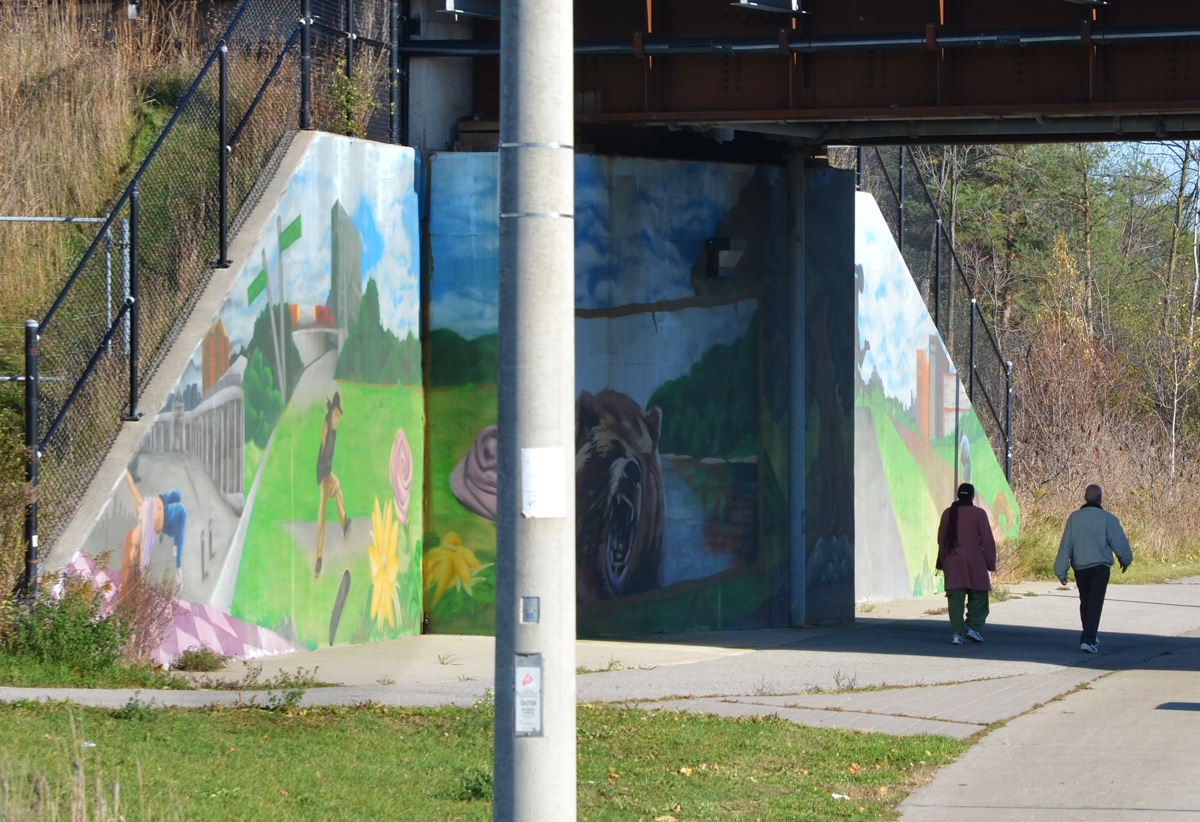
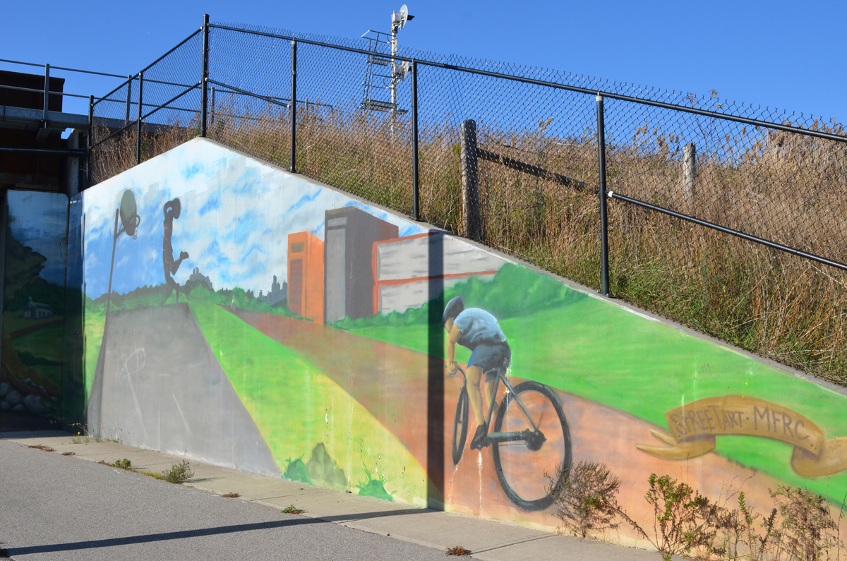
below: Two people, after being on the trail around the pond, walk south on Morningside via an underpass that has murals on both sides. This is mural on the east side. It is older than the others but it is in reasonably good shape.
below: A boy on a skate board and a girl doing what? The two green signs say Love and Malvern. I don’t know Scarborough well enough to know if the buildings in the mural represent real ones. Malvern is just to the west.
below: MFRC is Malvern Family Resource Centre and there is a picture on their website of the unveiling of this mural in September 2015.
below: This is the newest mural. It is called “Colour Outside the Lines” and it is the work of Lacey and Layla Art (aka Lacey Jane and Layla Folkmann)
below: Looking north on Morningside from Finch.
On the northwest corner of this intersection, there is a large piece of vacant land. The railway tracks run along the west side of it. I can’t find any information about it online. There isn’t the usual blue and white Notice of Development sign. The website on the billboard shows some of the houses that they have built/remodeled but there is nothing about this particular project.
Once it was fenced in by the looks of it. Not much of the black cloth remains. It looks a bit creepy, as nature undoes man’s work.
But now it’s for sale maybe? LOL. A cliff hanger ending for this post!
Most of these pictures were taken on a walk within the area bounded by Dundas East, Broadview, Queen East, and Carlaw.
below: All or nothing
below: Same same but different.
below: “We miss you” at Queen Alexandra Middle School. An older school, built in 1904/5, used to be on this site. It was named after the Queen of England at the time, the wife of King Edward VII, Queen Alexandra.
below: Also at Queen Alexandra Middle School, about 200 large black and white portraits of staff and students were on display on the exterior wall of the school. This installation is part of the global ‘Inside Out’ project. To date, Inside Out has appeared in 129 countries and has involved more than 260,000 people. In fact, they were in Toronto for Nuit Blanche back in 2015.
below: Public art at Carlaw and Dundas. I had mentioned this structure by Pierre Poussin back in March of this year. Not a lot has been done on it in the meantime except for the preparations for some sort of pattern at ground level.
below: The railway tracks cross Dundas Street just west of Carlaw. The tracks run on a NE – SW diagonal as they travel south from Gerrard.
below: Save Jimmie Simpson park poster. The Ontario Line, or the Relief Line of the subway/LRT may or may not come this way. The Relief Line was once planned as an underground line under Pape to almost Eastern before swinging west towards downtown. Someone then said why not run it above ground where the tracks already exist between Gerrard & Pape and the south end of the Don Valley Parkway at Corktown Common- and we can have a Leslieville stop. Has any decision been made? Is Toronto going to leave it all in limbo, or in the discussion/planning stage, forever and ever… and ever….
below: The north part of Jimmie Simpson Park. The park is a right angle triangle with a peak at Dundas East and a base along Queen East. The long side of the triangle is railway tracks which run behind the trees.
below: Once upon a time there was a railway station here, on Queen East at De Grassi that is. It was operational between 1896 and 1932 and demolished in 1974. In the beginning there was a level crossing here but after a number of accidents, including a collision between a freight train and a street car in 1904, the railway corridor was elevated.
below: Old black and white photo from the City of Toronto Archives, found online at “Old Time Trains”
below: Aged and peeling painting of a Canada goose that was on the railway underpass.
below: Eat the rich – and a picnic table is provided for your convenience. Don’t worry about the trains, they’re long gone. This was once a spur line and it hasn’t existed for years . You can still find small sections of track but most of it has been paved over. (near Carlaw and Dundas)
below: Looking west, towards downtown, along Dundas East. The old red brick building is on the northeast corner of Dundas and Broadview.
below: Flipped around and now looking east from Broadview in 1954. The red brick building from the above photo appears to be Dennis House and it seems that they are advertising the fact that they have televisions. On the south side of Dundas is a drug store. That building is still there but now it is a variety store whose windows are often covered with Lotto649 and LottoMax ads. In fact, the picture of the Bell telephone boxes near the beginning of this post was taken here.
photo credit: City of Toronto Archives, found online on a Blog TO page
below: This jumble of colours and lines can be found just east of Broadview and they are just visible in the background of the above picture. I love the little white door that probably leads to a basement apartment (or a secret garden in the front yard?!)
below: If you walk farther east on Dundas from Broadview you will see a collection of old two storey houses with their slate mansard roofs and dormer windows. This roof style is typical of “Second Empire” houses built in the late 1800s. I’ve always been intrigued by this group of houses but I have never been able to find out much about their history.
below: The end houses, at Boulton, have already been replaced.
below: And there are houses with similar architecture on nearby side streets.
Last but not least, a little bit of graffiti to close off this post.