Posts Tagged ‘streets’

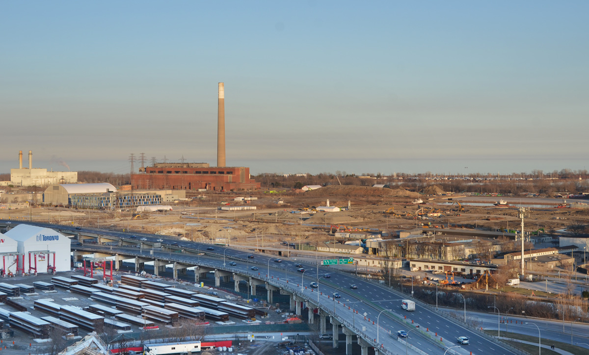
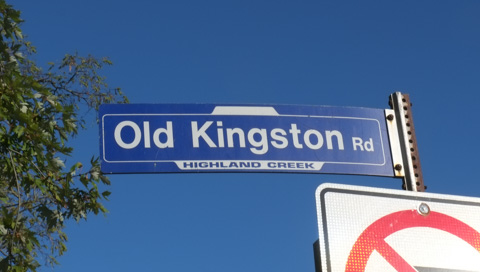
Going east to Scarborough again….   You can find Highland Creek village at the east end of Old Kingston Road while the West Hill neighbourhood is at the other end of Old Kingston Road.  This short stretch of road winds down to the Highland Creek and then back up the hill on the other side.  It was bypassed when a new wider and higher bridge was built over the river.

scarborough blue and white street sign for old kingston road, highland creek

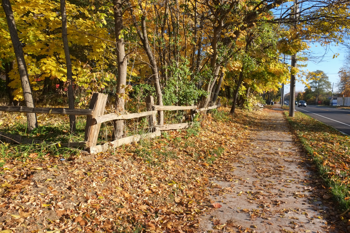
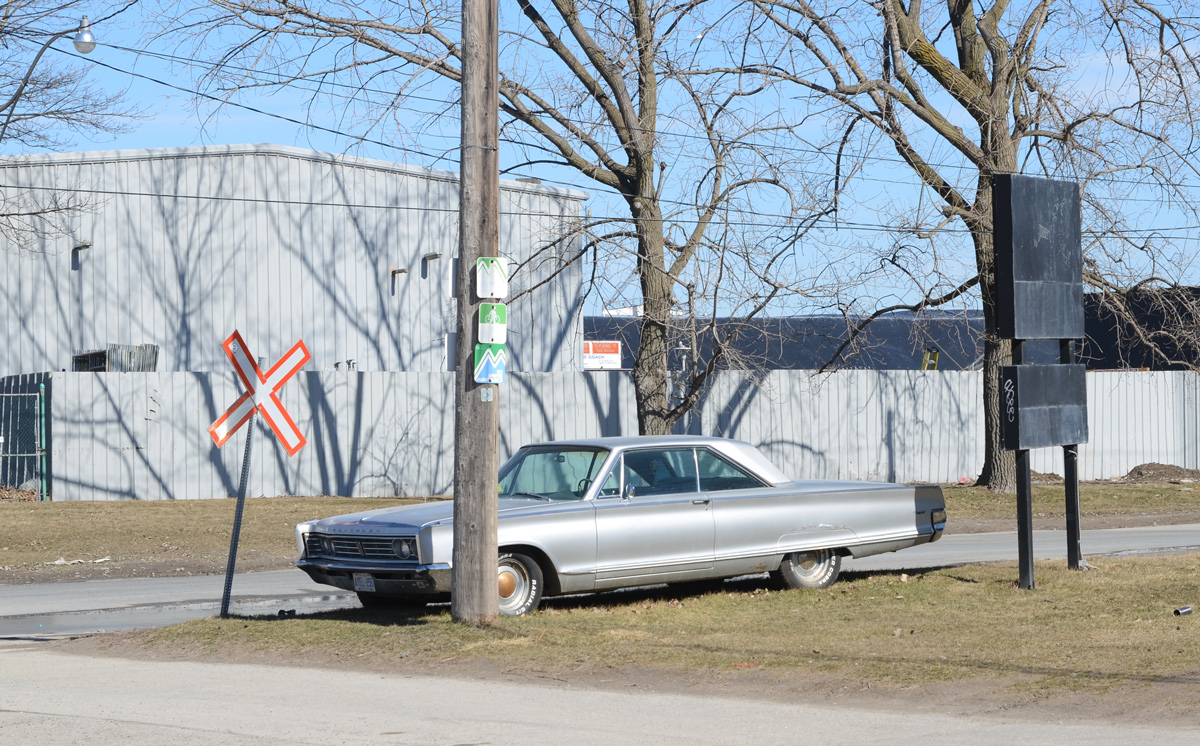
Although this area was one of the first parts of the city that was settled, there are still lots of signs of the rural nature of the area.

split cedar rail fence between autumn leaf covered sidewalk and trees

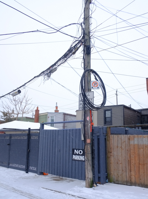
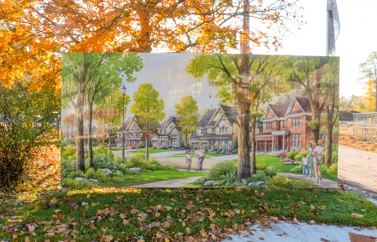
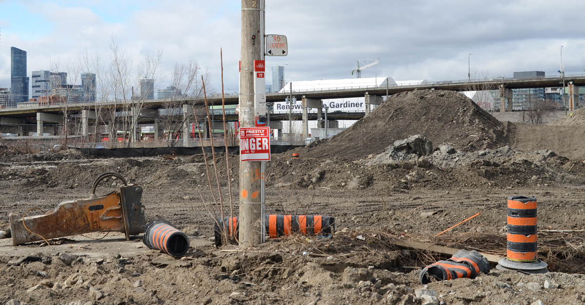
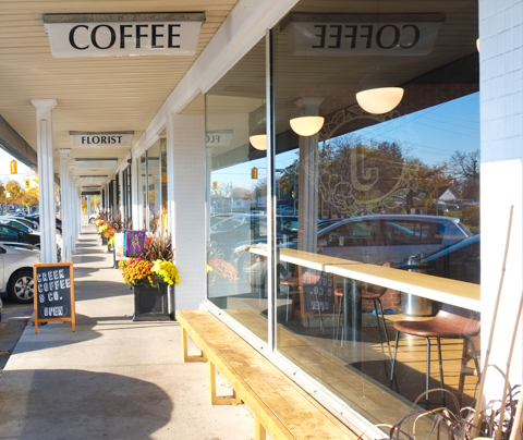
There are plenty of signs of changes too…. but there are no glass and steel highrise condos being built out here (in Highland Creek) where the developments are just as likely to be single family homes.

development imagining of housing in large picture beside a new development, large single family homes with large trees, with real trees and grass surrounding the picture

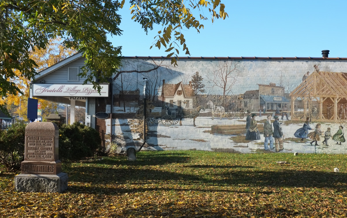
There is a mural on the side of one of the stores, it also happens to be beside the cemetery. This is Mural 8 in the Heritage Trail by Mural Routes. “Community Spirit in Early Highland Creek, Winter 1867” the building of the Wesleyan Methodist Church.   It was painted in the summer of 1994 by John Hood, Alexandra Hood, and Zeb Salmaniw.  For more information, see a previous blog post from 2017 Heritage Trail, mural 8

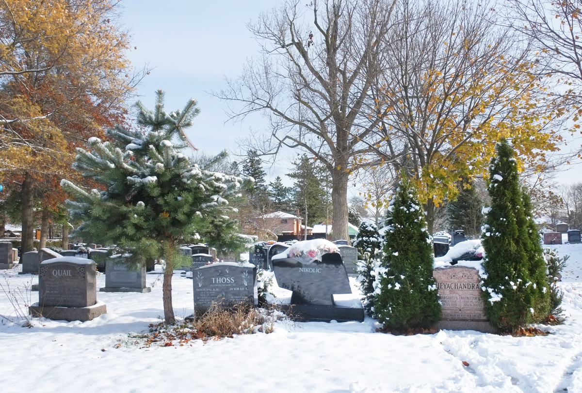
The tombstone in front of the mural is for Nelson Hawkins and his wife Susan Cornell who were married in 1877. Nelson was a farmer and he and Susan raised 6 children in the area (not all lived to adulthood).

part of a mural routes mural on the side of a building, beside a cemetery. some old tombstones, autumn scenery,

old small tombstone in a cemetery with a wall behind it, mural on wall of a woman sitting by grave stones in a cemetery

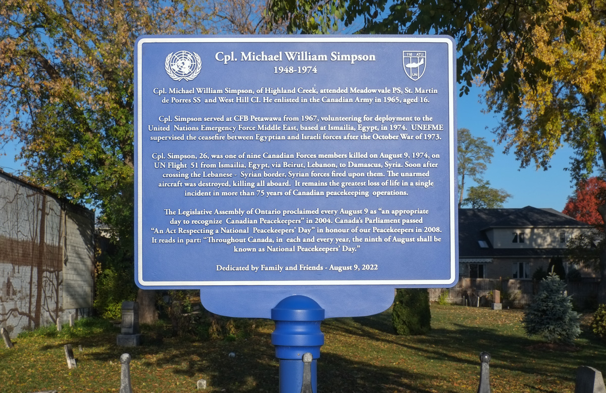
Also in the cemetery is a plaque to commemorate the life of Cpl. Michael William Simpson (1948-1974) who died in Syria while on a UN peacekeeping mission – all nine Canadians on UN Flight 51 died that day.

blue plaque in Highand Creek cemetery for cpl Michael William Simpson

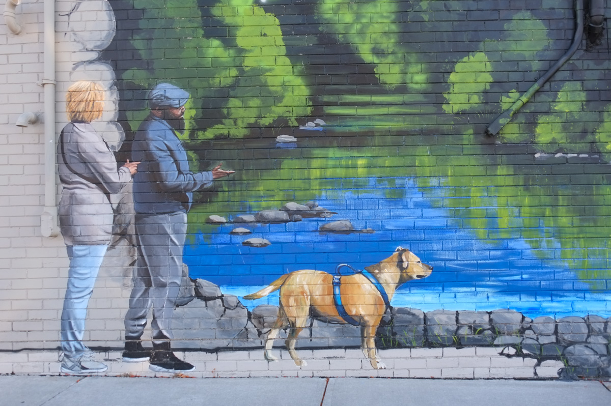
below: Deer by the creek in “Creekside” designed by Emily Harrison and painted by a group of youth and local volunteers in 2014.

vehicles parked in front of a large mural of a forest scene with deer, a creek,

The Scarborough Historical Society website tells the story of William Knowles who purchased land in Highland Creek in October 1802 and moved his family from New Jersey. …  “Knowles was a blacksmith and built the Township’s first smithy, making the nails for the first frame barn in Scarborough and planting one of the first orchards. His son, Daniel, kept the first store in Highland Creek, was a Commissioner for the straightening of Kingston Road in 1837 and was a prominent member of the Scarborough, Markham and Pickering Wharf Company which did an excellent business in shipping grain, timber and cord wood from Port Union to Oswego, New York and other Lake Ontario ports.”

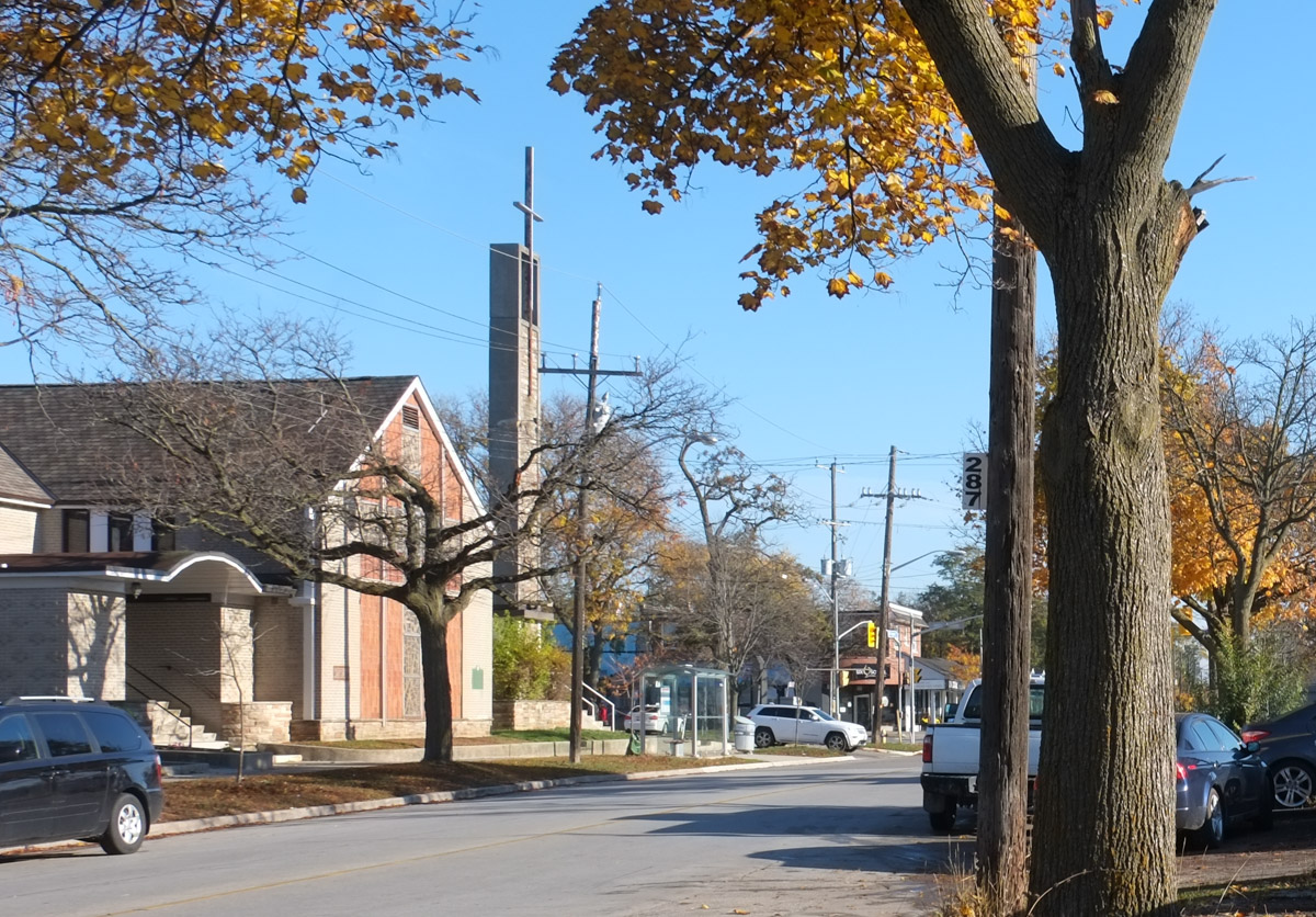
below: Shadows on the door of St. Josephs Church.   This Roman Catholic church first served the influx of Irish immigrants who started arriving at the time of potato famine in 1847.  It was the first RC community in Scarborough.

shadow of a large tree on the wall of a church, pattern of crosses in the brickwork, steps up to the door

front of St. Josephs Roman Catholic church, including steeple

The early history of these communities is dominated by families with roots in England, Scotland, and Ireland but like the rest of Toronto, it has become much more multicultural.

below: On a quiet corner in Highland Creek, Baitul Afiyat Mosque

Mosque in Highland Creek village

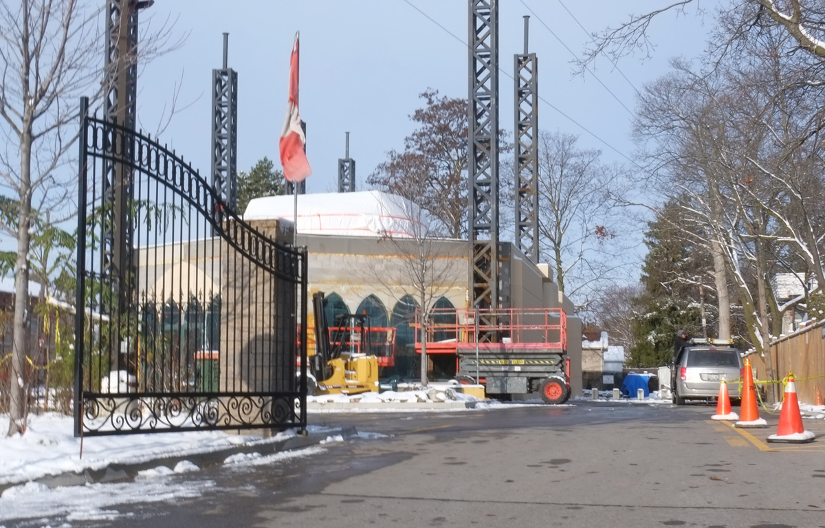
below: And another mosque under construction in West Hill

behind a black wrought iron gate, construction of a new mosque

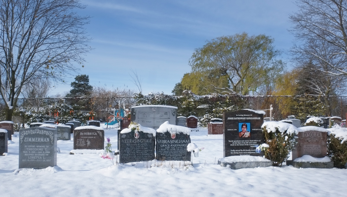
below: A short walk through St. Margarets (Anglican) cemetery reveals a more multi-cultural side of the neighbourhood.   This is just a small sample of the diversity of surnames found there.

monument stones in St. Margarets cemetery in winter, two with veerasingham surname, a zimmerman, and a de nobrega

monument stones in St. Margarets cemetery in winter with surnames quail, thoss, and nikolic

a row of old cars and trucks parked beside a road
two old red trucks

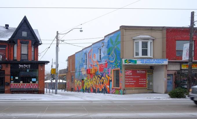
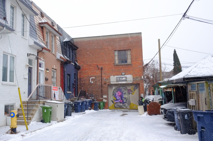
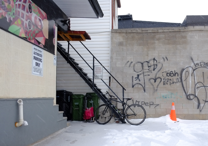
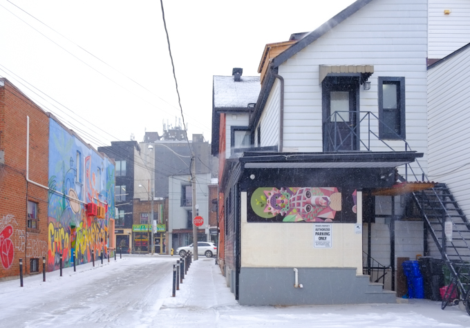
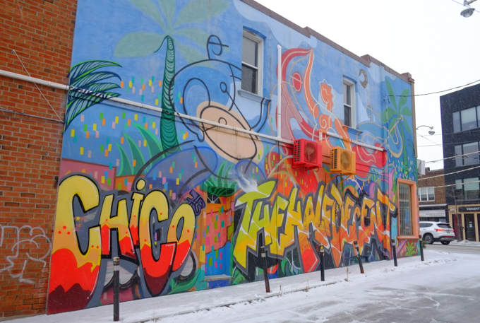
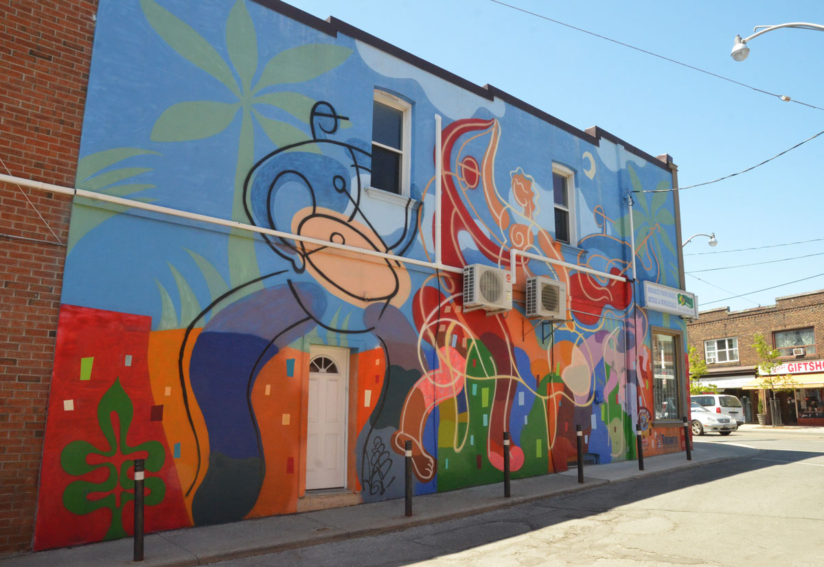
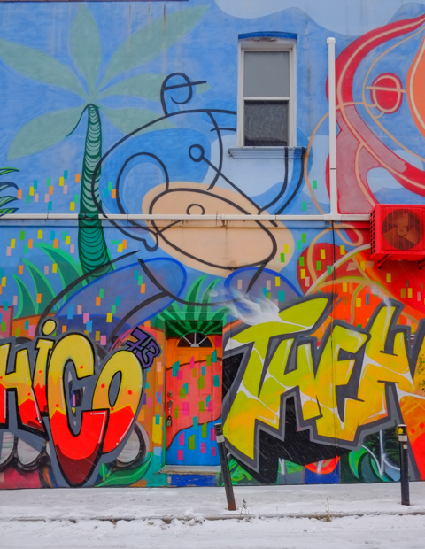
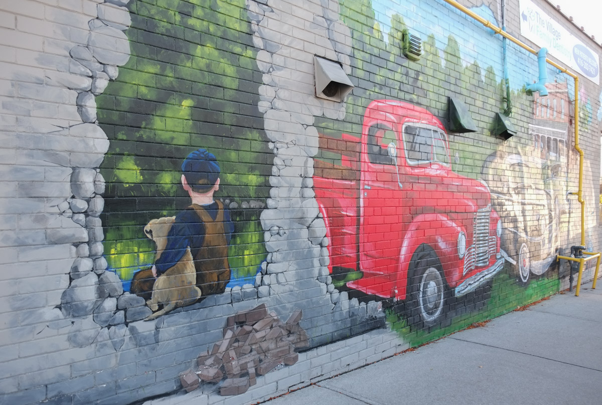
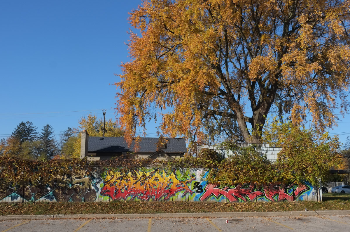
below: Another Highland Creek mural.

part of a mural, a couple walking their dog beside a creek, with trees

mural in Highland Creek, painted grey brick wall, the front of a vintage red truck has come through the wall, pile of bricks beside, a young boy in blue cap and brown overalls sits with his dog in another hole in the wall

part of a mural, a parent raccoon and a young one peer out from a hole in a stone wall

part of a mural, a young girl in blue top and blue shorts, arms upraised, like she is asking to be picked up

below: Centennial Community Scarborough consists of the southeast corner of Scarborough and includes both Port Union and Highland Creek Village neighbourhoods.

stop sign at all way stop with a toronto road sign for Ivan Road, with top part that says Centennial Community

below: This is the intersection of Kingston Road with Military Trail and Morrish Road, looking southwest towards a wide bridge over the Highland Creek.  There is an entrance to Colonel Danforth Park on the other side of Kingston Road (off the left side of the photo) but getting there is very difficult.  In the background, right side of photo, are hoardings.   Construction has begun on two 8 storey buildings, Highland Commons.

intersection of Kingston Rd., Military Trail, and Morrish Rd, large wide roads, one sign, low traffic levels, sidewalks, no people

Military Trail is a remnant of Scarborough’s first “highway built in Scarborough in 1799 by American Colonel Asa Danforth Jr.  It was a highway to connect the new town of York (i.e. Toronto) to Kingston.  The story is that the finished road was considered substandard and Danforth didn’t get fully paid.   Or maybe it was a backlash against American entrepreneurs trying to make a quick profit in Upper Canada.  Whatever the truth was, Danforth returned to the USA shortly after.

Kingston Road became Hwy 2 and was the main route to Kingston until the 401 was completed in the 1960s.

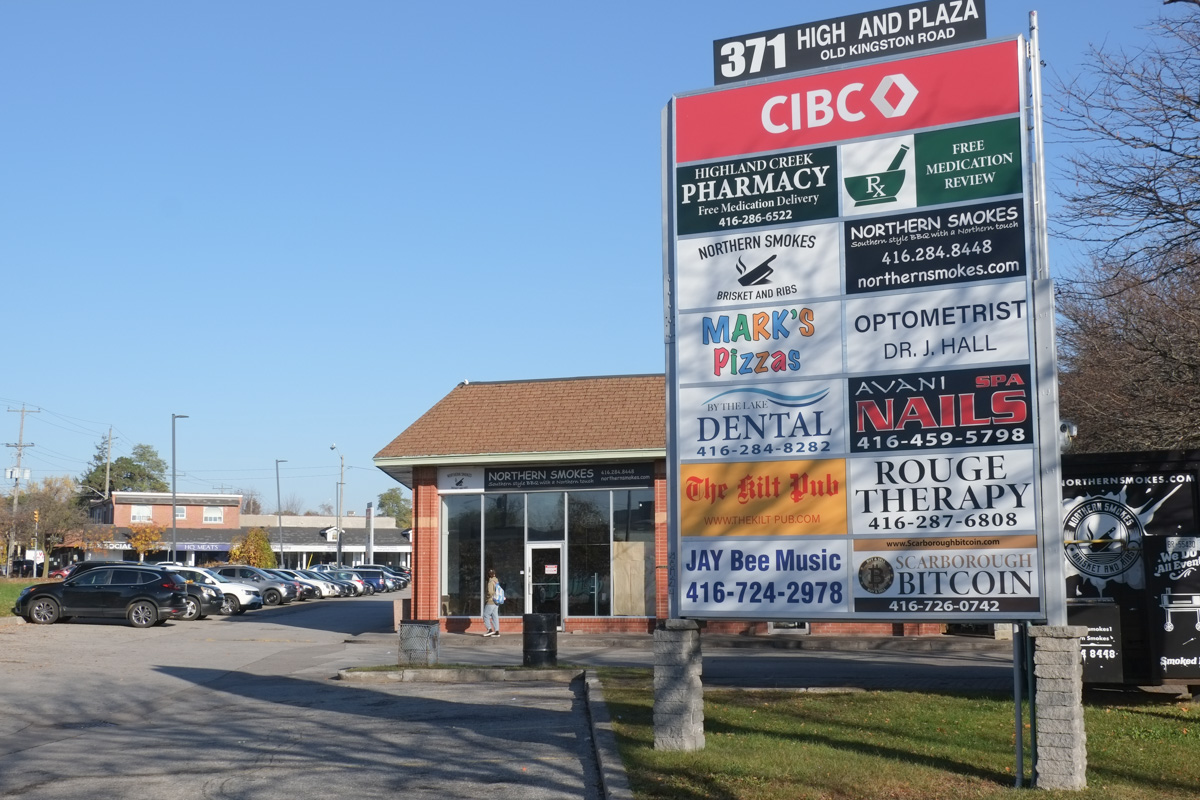
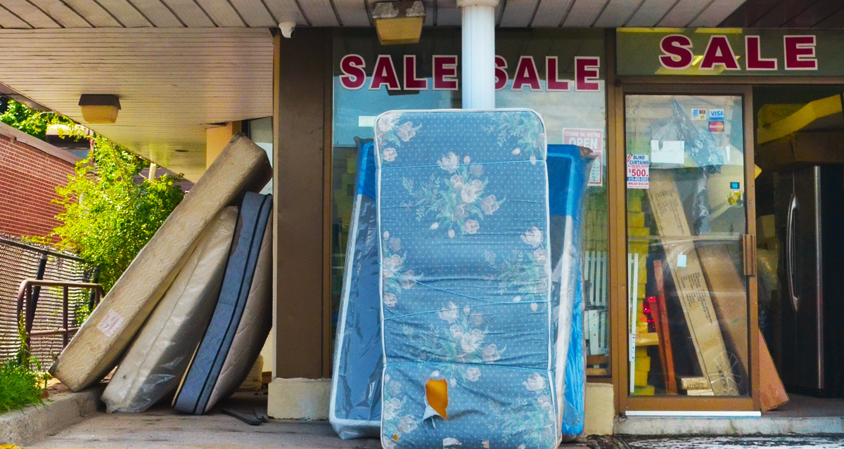
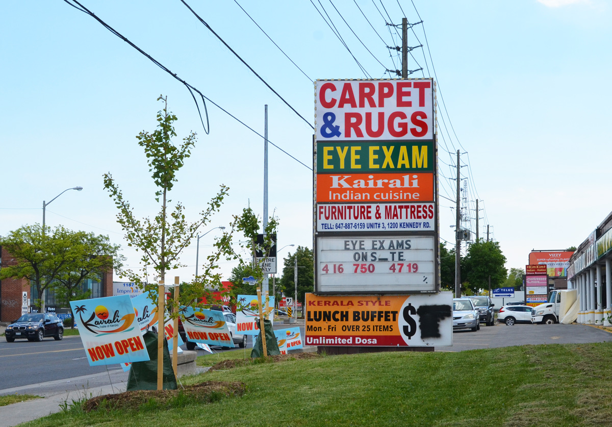
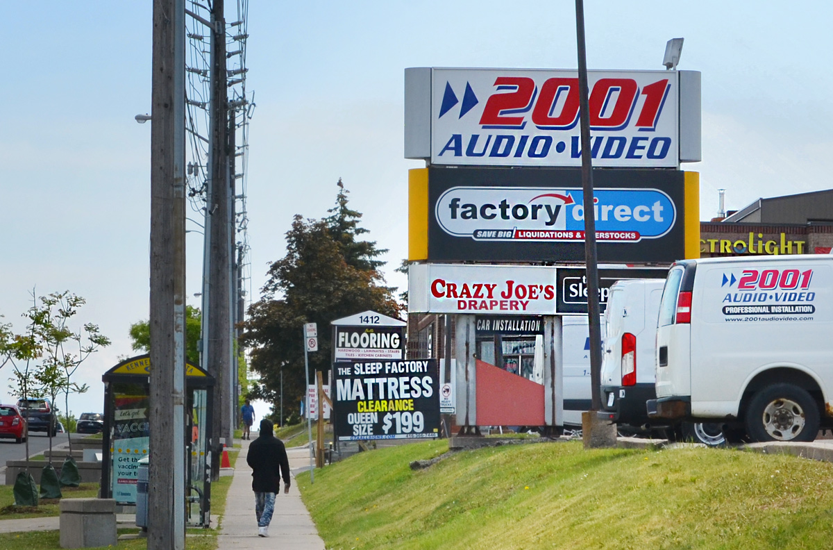
below: High And Plaza.   Strip malls or strip plazas are still plentiful.  There is talk of an Eglinton East LRT and many TTC express buses serve the area but cars still rule.

sign in a strip mall in Highland Creek, listing and advertising the businesses there such as CIBC, Scarborough Bitcoin, a pharmacy, By the Lake Dental, The Kilt Pub,

below: Proposal for a 9 storey building with 143 residential units plus retail at street level.  City infill on major routes…. and no Greenbelt is affected.
blue and white development notice in front of a strip mall on Lawrence Ave East in West Hill

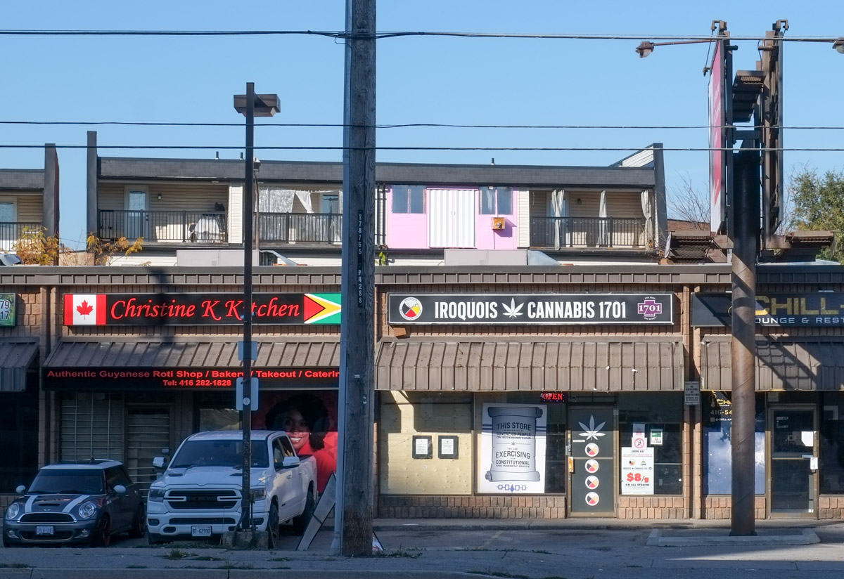
below: Sign in the window: “This store is operated by Sovereign People on Sovereign Land.  We are exercising our constitutional and inherent rights.”

iroquois cannabis store in a strip mall plaza in west hill

below: Wine and yoga! Note the poster in the window about Metrolinx LRT plans on Ellesmere (just to the north).

looking in the window of In the Spirit a yoga studio and wine lounge with the motto wellness meets wicked in joyful harmony
exterior, strip mall, outside Creek Coffee Company on a sunny day

below: Morningside Ave with its red bus lanes. Looking north towards Ellesmere

Morningside Ave., looking north, from north of Lawrence to Centennial College, and U of T Scarborough. The red lanes are for buses.

below: Another stretch of Morningside, closer to Kingston Road.  Certainly not designed with pedestrians in mind. It’s scene like this that give credence to Scarborough’s nickname Scarberia.

morningside avenue, north from kingston road, some apartment buildings and trees, 4 lanes of traffic

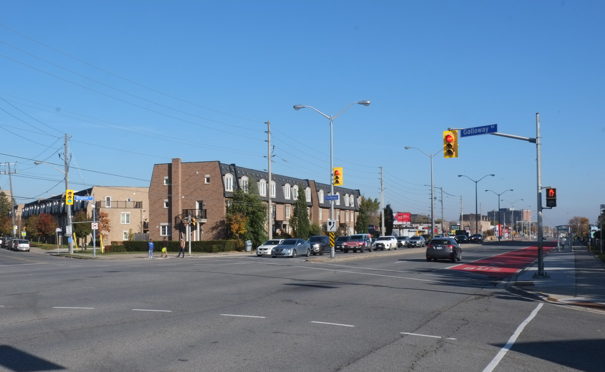
below: Looking northeast at Galloway Road and Lawrence

2 rows of townhouses at Galloway road and lawrence in West Hill, intersection of two major streets, lots of lanes of traffic

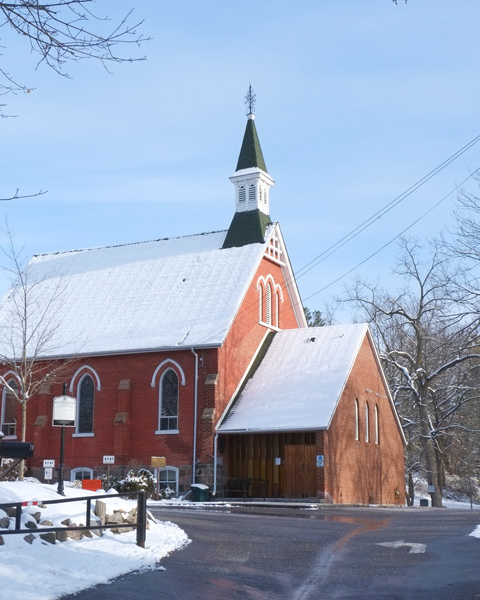
below: Melville Presbyterian Church on Old Kingston Road.  It was built in 1852.

Melville Presbyterian Church on Old Kingston Road, red brick building with black and white steeple, on a hill, winter time, snow,

below: Very few traces of old West Hill remain.  The village got its own post office in 1879 (prior to that it was part of Highland Creek).

old two storey brick house on a hill surrounded by large trees, in the snow

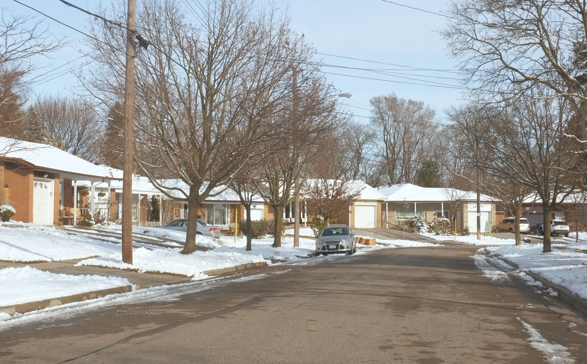
below: West Hill suburbia.  There must be thousands of houses like these 1960s bungalows in Toronto and the GTA.  This street could be in Richmond Hill, Willowdale, or Rexdale.  West Hill must have had a major growth spurt in the 1960s and 1970s.

suburban street in winter, single car garages and 1970s bungalows, some trees, one car parked on the street, driveways,

tall horizontal murals on the sides of apartment buildings at Overture Blvd, on Lawrence

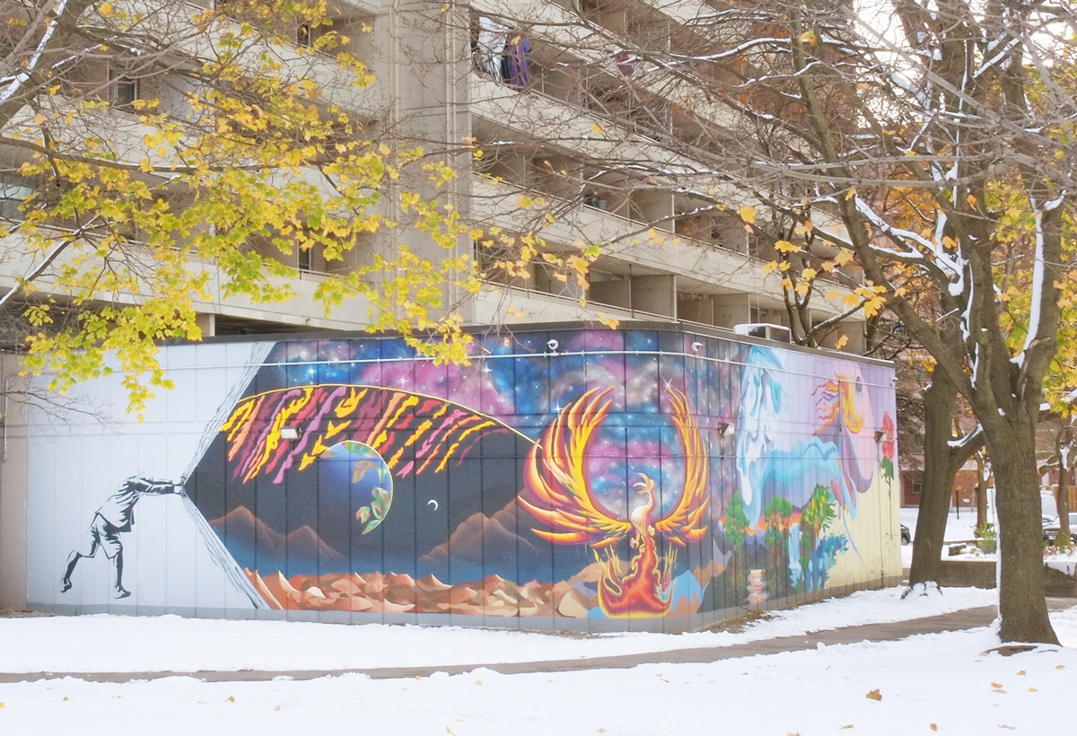
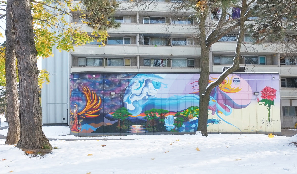
below:  On the southeast corner of Morningside and Lawrence is a mural painted in 2018 by BEHIND the Lines in collaboration with the Boys and Girls Club of East Scarborough.

mural at the corner of two walls, a person is peeling back a white curtain to reveal a planet and a phoenix with other things in the mural too, in front of an apartment building in Scarborough

mural in front of an apartment building at Morningside and Lawrence

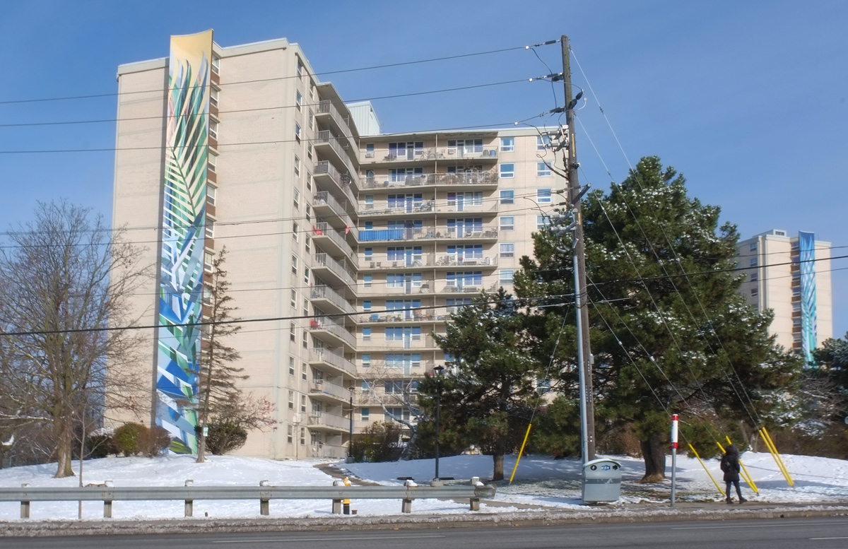
below: Northwest corner of Morningside and Lawrence

intersection of Morningside and Lawrence, northwest corner, no frills grocery store, part of Morningsde commons retail

large deciduous tree with autumn gold and orange leaves towering over a fence with a street art throw up tag on it

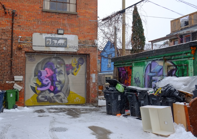
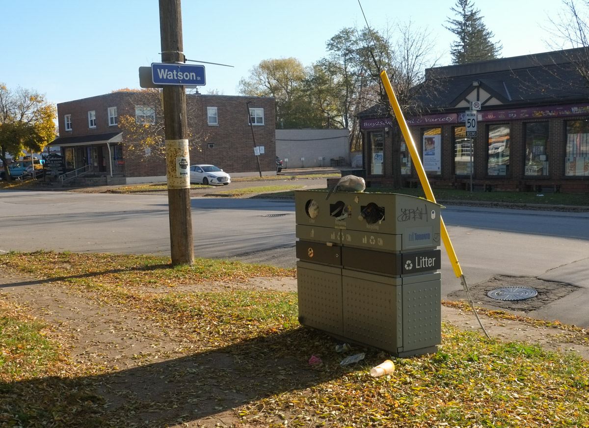
below: garbage overflowing.  In the recent municipal elections there was a lot of talk about how something as simple as garbage collection was messed up in the city.  Although it is outsourced, it has always been problematic.  Bins get broken and never repaired.  Bins get filled and never emptied.  Now when I walk around I see how much of an issue this is.

overflowing city garbage container between sidewalk and street

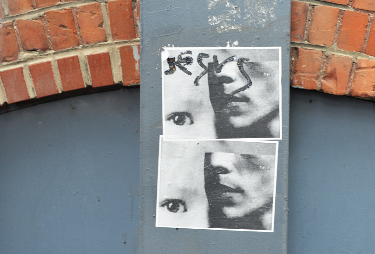
below: Mayday SOS alert for a love emergency. Whoever scrawled this message probably had a more personal reason but I will use this image as my little prayer to the city. Do better. We can be more. The potential is there if we are willing to reach for it.

on a metal pole, a small painted white heart and three letters, S O and S.

The middle of three new bridges built for the Port Lands redevelopment has just been opened to traffic.

looking north up cherry street through new yellow and white curvy bridge

The bridge may be open to traffic, but the area is still a construction zone!

Eventually Cherry Street will be realigned so that there is no jog in it at Lakeshore.    At this point in time, the south part of the realignment is closer to completion.  This is where the new bridge is.

Commissioners Street has been extended westward to join the new segment of Cherry Street.

 below: This is the east intersection of Commissioners and Cherry (looking east).  Yes, it’s a mess!  There are traffic signals even though only two of the four approaches are open.  If you are traveling south on Cherry, you have to turn right onto Commissioners.

cherry street and commissioners street intersection, canary diner restaurant, construction, port lands redevelopment

below: Same intersection, looking west.

intersection of Cherry and Commissioners street, construction, police watching over, trucks in intersection, new traffic signals

below: New part of Commissioners Street

construction along the west end of Commissioners street in the port lands, with the toronto skyline in the background

below: The west part of Commissioners ends here

dead end street, Commissioners street, west end, fence and no entry signs, traffic lights

below: If you stand in the same place as the above photo but turn to your right, this is the view that you see.  This is the new part of Cherry Street being realigned to match the section north of Lakeshore Blvd.  The new bridges over the Keating Channel are in place but there is still a lot to be done before this part of Cherry Street can be opened.

Glooking north where the new part part of Cherry Street is being built, new double bridge to go over the Keating channel as well as condos in Distillery District are in the background

below:  Looking south… It is the middle bridge that has been opened to traffic first.  It is located approximately where the T ‘n T grocery store used to be.  An interesting line of large boulders!

new Cherry Street bridge with its yellow curved lines, large rocks in the dirt in the foreground, construction still in progress

below: This is the view from the new bridge looking west.  The large white crane structure predates the construction.  The channel has always been here as it provides water/ship access to the Lafarge cement site on the south side of the waterway.  What is new is that the channel is being extended eastward to join the mouth of the Don River.

view from the Cherry Street bridge new bridge, towards Lake Ontario, Toronto skyline in the background, construction equipment in the foreground for the redevelopment of the Port Lands

below: Traveling northbound

a cement truck and a ttc bus on Cherry street on the new bridge

two cyclists pass over the new Cherry Street bridge in the bike lane

below: Looking east from the bridge.   Pinewood studios in the background on the right.

looking east from port lands yellow bridge, overlooking construction in port lands

below: Another view to the east but slightly more south.  This time Pinewood Studios is more to the left in the photo.   A pedestrian bridge is already built to span the new water channel that is under construction.

port lands redevelopment, noew pedestrian bridge over new water channel that is being created

temporary pole with pedestrian crossing light at an intersection in a construction zone, a cyclist is passing through, new port Lands bridge in the background

below: Looking north up Cherry Street towards the Distillery District.  The old, and now closed part, of the street is being torn up.  The new street and bridge are to the left in this photo.

port lands construction site, starting to tear up the old part of Cherry Street, distillery district condos in the background

port lands construction site, starting to tear up the old part of Cherry Street, distillery district condos in the background

big yellow machinery digging up the asphalt from an old road and placing it in a dump truck

a man in a red shirt walks two dogs on the sidewalk along Cherry street, towards construction and the new bridge, TTC bus in the oncoming lane of traffic

orange construction sign that says be prepared to stop, haul trucks entering and exiting, with construction, and a large dump truck beside and behind the sign

below: To the south, the lift bridge on Cherry Street is being refurbished but not replaced.  This part of Cherry Street is not being moved.

looking south at Cherry Street to lift bridge that is being refurbished

in the early morning sun, stairs in the sunlight beside a bridge, going down to the water, an old building and its reflections behind

blue and white scarborough street sign for Kennedy Road on a blue sky day, with street scene behind it ,

Sometimes it’s difficult to remember that Toronto includes a large number of outlying areas, not just the downtown core.   Also, if you are looking for a “safe” place to walk during these Covid times, head to Kennedy Road in Scarborough.  I wasn’t alone the day I walked it but people were few and far between.  Out Scarborough way they aren’t as used to people wandering around with cameras so I got a few quizzical, skeptical looks.   The street scene is definitely different from the central core but every street has a story to tell.  Sometimes you just have to slow down and look for it.

below: What lured me into the area?  I caught a glimpse of this moose and it made me want to explore more.  It stands beside Kennedy Road, just south of the 401.    Back in 2000 there were 326 of these sculptures scattered around the city, all were the identical moose shapes but all were painted differently.   Collectively, they were “Moose in the City”.

a stature of a life sized moose painted like a Canadian flag beside a large welcome to Scarborough sign, from Kennedy BIA.

You might have noticed that the sign also says Mike Myers Way, named for the actor who grew up in Scarborough.   I am not sure if this means that all of Kennedy Road is named after him but there is a Mike Myers Drive just to the south of this (south of Lawrence).

below: The sign on the Elite Bakery is trilingual – Greek, English, and another in an alphabet that I don’t recognize (Arabic?).  It all looks good in any language, doesn’t it?

sign on the outside wall of a greek bakery, words in greek, anglish, and a south asian language (or arabic). wedding cakes in the window

below: More signs of the multicultural nature of Toronto

green and white symbol of Habib bank, white lion with a sword above it

below: Another common Toronto feature – the construction site! … with its plethora of safety rules and regulations.

Coid prevention signs secured to a metal fence surrounding a construction site, a cement truck is working there

construction fence around a Tim Hortons and Petro Canada station, sign says open for takeout and drive thru

below: Looking west on Eglinton at Kennedy.   That is one tall utility pole!

looking west on Eglinton at Kennedy, north side of the street, a man standing at the corner, hydro poles, high rises in the distance, traffic.

below: Magical Aquarium Club

Magical Aquarium Club building in Scarborough

a picture of a green frog and a green reptile, large, on the outside of an aquarium shop

below: Grace Church and Grace Place Food Bank

Grace church and Grace Place food bank, design of cross in the roof shingles, cars parked in front, red brick building for the 1960s

below: Mount Zion Church, The Apostle Doctrine of God

side of a plaza with entrance for the Mount Zion Church

below: Bright pink and red will make your business stand out!

large pink and red store, contractor depot, on kennedy road,

below: A faded photo above the entrance to a furniture store – highlighting their wares.  She seems like a very satisfied customer!

faded black and white photo on the exterior of a furniture store, a woman stands alone in a dining room with table, chairs, and a hutch

below: Or, show your product by having it on display outside (these are Covid times after all)

mattresses on display outside a store, leaning against the pillars of the building

a van parked out front of a store with signs, factory outlet, warehouse sale, sign in back window of van advertising a mattress sale

below: Jostling to be seen, a jumble of words and colours.

many signs for stores and businesses, posted beside the sidewalk,

below: Eye exams on site… but the I (eye?) fell over.  Carpets & Rugs, Kairali Indian cuisine – lunch buffet for an unknown price.

signs for stores along Kennedy road

below: Real Kerala groceries at Motherland Foods.  Mr. John’s take out.

set back from the street a bit, with shrubs and a parking lot in front of it, Motherland Food, kerala groceries

below: The two storey brick plaza. Many of these were built around the suburban areas, back when suburbs were newer and growing quickly in the 1950s and 1960s.

two storey brick plaza with many stores

below: It seems fitting that the Private Eye and Spy Shop is close to the Adult Movies store.  You can also eat at Lucile’s West Indian Restaurant and Groceries or at Just Love Caribbean Restaurant.

large sign in front of plaza listing all the stores, adult movies, spa, private eye spy shop,

tall empty frame for a sign outside a closed business

below: Agincourt Used Cars, closed and waiting for redevelopment – into townhouse like complex with retail on the ground floor facing the street (in one proposal from December 2015 anyhow.  There are 25 documents associated with this development, all available online.  The latest one was March 2018.  I didn’t read them.)

yellow gate and construction fence around a vacant lot with a building in the far corner, Agincourt Used cars, closed business, graffiti on building,

below: To the east, as seen from a parking lot on Kennedy Road.

rowhouses on a side street running perpendicular to Kennedy Road, vacant lot in the foreground,

below: An older housing development with direct access to Kennedy.

rounded arch over the sidewalk leading into a residential development

semis, 18 wheelers backed into spaces at distribution center

a row of trucks parked in a parking lot

a person walks past stores with large signs in front of them, 2001 Audio and Video, Crazy Joes Drapery, Sleep Factory mattress, and a flooring store

below: Just to prove that I wasn’t totally alone!

a man in a blue jacket sits on a concrete railing while drinking from a Tim Hortons cup

a man rides his bike on the sidewalk on Kennedy Road with back to camera

Work continues on the Port Lands redevelopment with more buildings being demolished to make way for the new mouth of the Don River.

view of portlands includingLafarge silos, gas tanks, and construction

below: Cherry Street bridge

Cherry street bridge over the Keating Channel, green metal bridge

below: Don Roadway looking north.  The southern part is now closed (south of Lakeshore Blvd)

a pile of tree trunks, recently cut down, on a road that is now closed

looking north on the closed portion of the Don Roadway, lumber pile in middle of road, large metal hydro poles,

below: Villiers Street at the Don Roadway.  A couple of old buildings remain on Villiers but many structures between Villiers and the Keating Channel are now gone, especially at the east end of the channel near the present mouth of the Don River.

Villiers street at Don Roadway, two school buses parked here, Gardiner Expressway in the background

below: Commissioners Street, looking east.  Everything in that block, on the south side, has been levelled – the blue and white building is on the other side of the Don Roadway.

Commissioners street in port lands, with road closed sign

a glass bus shelter behind a construction fence

below: The west end of Commissioners street

Commissioners street in the port lands, road closed, yield sign on road yield to oncoming traffic, black and orange traffic cones, a plywood booth for security guard to sit in,

below: Commissioners Street, north side

construction, signs on a wood pole, Toronto skyline in the background

TTC bus stop for route 72 on Commissioners street but pole is now in the middle of a construction site, lots of dirt, orange and black traffic cones, Gardiner Expressway in the background

below: T’nT grocery store is now closed.  The red sign by the door advertises Chinese New Year specials.

back of a large laker boat parked beside an empty parking lot

below: The same boat, the NACC Argonaut, but from the south, from Polson Street.    NACC = Nova Algoma Cement Carriers.  She was built in Japan in 2003 and converted into a cement carrier in 2017.  The next year she entered service on the Great Lakes.

ship parked in channel, beside an empty parking lot with a small booth for attendant of parking lot

below: As you can see more clearly here, the Argonaut was actually parked beside the Lafarge facility.  T’nT is behind the Lafarge Cement round towers (building on the left).

large empty parking lot in the foregraound, largare cement facitily in the background, with a large laker docked beside it

large laker ship docked beside Lafarge cement

below: Shipping Channel

two boats parked in the shipping channel, one is the white and yellow Iroquois

boats parked in the shipping channel

shipping channel, port lands

below: There are quite a few old railway crossing signs in the Port Lands for tracks that have been torn up or long unused. I am surprised that no one has stolen them.

old car parked beside an old railway crossing sign, for a railway track that is no longer there

below: Boats of a different kind –    RCYC (Royal Canadian Yacht Club) on Cherry Street.

a line of large sail boats in storage, on land, covered with tarps, masts in the air, no sails,

below: Cherry Beach

a woman walking her dog beside a forest, on a beach

No construction affects the beach but these days, people are keeping their distance. Since taking these pictures the beach may have been closed, I’m not sure. The parking lot will be closed for sure.

cherry beach with not many people and cherry lifeguard station

below: Unwin Street, looking east towards the old Hearn Generating Station

unwin street in port lands

hearn generating station from the west side

part of Hearn generating plant, upper level with watch tower

below: Another Port Lands view from above.  North of the Gardiner is the construction site for the rebuilding of the Gardiner.  To the south is the Port Lands with the tall smokestack/chimney of the Hearn.   The white building with the two chimneys on the far left is the Portlands Energy Centre, a natural gas powered electricity generating station.

view of port lands and gardiner expressway from above including hearn generating station

below: The entry to the Portlands Energy Centre which is the property of Hydro One.

closed and locked gate with warning signs on it

a concrete road barrier with blue spray paint words that say have a good day

below: Think!  or rather Stop and think.   Above that, tbonez with The Forge Fury in another urban ninja squadron sticker.

2 stickers on a stop sign. one is a picture of a brain with the word think on it. the other is an urban ninja squadron sticker

below: There is a new public art installation nearing completion at the corner of Carlaw and Dundas.  When the project is done, the obelisk shaped sculpture by Pierre Poussin will be in the middle of a small park.  It is made of laser cut rusted metal and will feature internal LED lighting.

a new public art installation at Carlaw and Dundas with construction fence still around it, also a lot of utility poles around it, rusted metal cut with lasers in a design, sculpture is the shape of an obelisk

below: Shadows of the trees along a winding trail.

trees line a sidewalk that has had small curves added to it, shadows of these treees on the fence beside the sidewalk

below:  There really aren’t enough fairies in the world.  The ones that are supposed to clean my home haven’t shown up yet either.

a sign on a wood fence that says the poo fairy doesn't live here scoopy your ppop, aimed at dog owner

below: This looks like it was once an artwork pasted to a wall.  An eagle’s head is still visible at the very top.  Are those its feathers at the bottom by the shoes – one dark blue and one red stiletto.

a ripped picture, very large, of an eagle and a person with wings and high heeled shoes.

below: The northwest corner of Pape and Dundas.  The “This is Toronto” mural by J. Chiale is still there.

an intersection, looking northwest at Dundas and Pape where the house on the corner has a large mural by j. Chiale on the side, newer houses and apartment building in the background.

mural by J. CHiale on the side of a house

below: An old and worn sign

very old no parking sign on a chain link fence

below: A not so old sign with three lovebot stickers on it.

neighbourhood watch sign with 3 lovebot stickers on it

below: Old cars seen in an alley.  Any ideas on what model and year the brown car is?

2 old cars in an alley. one is an old brown car from the 40's, under a cloth. the other is a blue camaro

close up of a wood utilitypole with some paint splashes on it


on the side of a house, a wood panel on porch with 2 windows, 2 panels are painted blue and the last one is white

below: Santa Claus hasn’t returned to the North Pole yet!  This front yard looks quite barren

2 plastic Santa Claus figures in a front yard, no snow, in frontof a porch

below:  … compared to this one!  I am happy to report that the “doll house” still exists.   There is at least one Santa Claus in there!

a house with a front yard full of dolls and toys, on the walls, on the fence, decorations

below:  Not quite every inch (centimeter!) is covered.  Christopher Robin and Tigger, Ernie and a Picachu.  Tweety bird in a blue jacket and a white horse, Dora the Explorer is eating an apple.

some of the dolls and toys attached to the front wall of a house

below: These stickers still exist!  A Star Wars family with a dirty back window.

a star wars sticker family on the back window of a black vehicle, 2 kids, an R2D2 and a wokie

below: Usually if a couch is waiting for the garbage man it’s sitting closer to the edge of the street!

an old black vinyl couch on a sidewalk on Eastern Avenue, beside a house

below: Symmetry at the back of Bruce Junior Public School built in 1923.

back of older brick public school, Bruce Public school with pair of chimneys and rows of windows, symmetrical.

below: And then there is the asymmetry created when one side of a semi-divided house explodes upwards.

the back of a house, a semi divided house where one side is the original one storey while the other side has added two storeys and is taller than the surrounding houses, and it is narrow too

below: Leslieville has two murals.  This one covers the side of the building plus the back in pink, red, and orange stripes.   This Guidant Bikeshare mural was painted by Mediah, aka Evond Blake, in 2017.

below: Nearby at the intersection of Queen and Jones is this mural by Elicser Elliot (2016).

Leslieville mural by elicser of a man sitting under o tree in autumn

below: The Coca-Cola Coady Sweets ghost sign is still there but the convenience store under it has been replaced by a Spanish restaurant.

workmen at an intersection, white van parked, in front of building with ghost sign for Coady sweets, new Spanish restaurant on the corner

below: Queen Street East

line of stores on Queen Street East by the B & B fish and chip restaurant

Leslieville mural by iah media on the side of a building,

below: This is on the wall beside a vacant lot on Queen Street East that has been empty for years.

spray paint, large letters, wuns on a wall beside a vacant lot

Queen street east, vacant lot on the north side

below: Another vacant lot but more recently so.

looking through a chainlink fence, across a vacant lot towards Queen Street east and the brick Scotiabank building

below: An alley view, behind Queen Street East

3 storey brick building, from the back in the alley, behind Queen Street East

below: Waiting for spring?

looking through a metal gate with chainlink into a backyard with patio furniture and blue umbrella (closed)

a row of pink window boxes and red planters on a balcony of a yellowish brick apartment building

below: Dundas Street East

houses on a street with the one being an old narrow two storey house in yellowish brick

And how can we end without re-visiting the doll house?!

an old stuffed mouse with black plastic glasses, in front of a blue m & m character throwing a basketball, outside, and slightly weathered

close up of two of the dolls attached to the railing in front of house

the front steps and door to the doll house - a house covered with dollas and toys, also fake plants and flowers in pots on the stairs

Walking up Yonge Street without actually walking on Yonge Street…. with all it’s distractions and wrong turns.  We eventually get somewhere and that somewhere may actually be where we want to be!


a metal box with two paintings of women, on the left, woman is holding a red flower in her hand

below: I didn’t know that such a place existed!  It’s at Davenport and Belmont in case you feel the need….

at the corner of Davenport and Belmont is the Anti Aging Shop

below: I smiled even more when I went around the corner and encountered this sign

yellow traffic warning sign that says watch for seniors

below: Toronto layers

parking lot, with a row of backs of houses behind, with higher rise buildings in the background

below: The old stone stairs at Ramsden Park.  A bit muddy at the bottom but that never stopped me.

old stone stairs in Ramsden Park

below: Waiting for spring… or at least for some snow to melt.

a basketball hoop on a metal pole in the snow in the park

below: An after school skate.

children skating on outdoor rink at Ramsden Park

below: Old and new – exploring the lanes that run parallel to Yonge.   This is Paul Hahn Lane.

older and newer buildings in a lane in Rosedale area

below: Trespassers will be prosecuted.  If you can’t read the sign, does it still count?

old beat up green door on the back of a brick building, lane, garbage bins there, also an old faded sign that says trespassers will be prosecuted, metal stairs leading up to upper storeys

below: As you go north, Paul Hahn Lane becomes Sam Tile Lane.

small house at the corner of a street and an alley, now a cafe

below: The caterpillar isn’t where it was.  Is this an Alice’s Adventures in Wonderland reference? Actually it’s a children’s clothing store but that doesn’t stop my from quoting Lewis Carroll, or at least a short passage.  Alice’s interaction with the caterpillar is too long to include here!

an empty storefront in a red brick building, black awning in front, words on awning say Advice from a caterpillar

“In a minute or two the Caterpillar took the hookah out of its mouth and yawned once or twice, and shook itself. Then it got down off the mushroom, and crawled away in the grass, merely remarking as it went, ‘One side will make you grow taller, and the other side will make you grow shorter.’ ‘One side of what? The other side of what?’ thought Alice to herself. ‘Of the mushroom,’ said the Caterpillar, just as if she had asked it aloud; and in another moment it was out of sight.”

below: At Summerhill there is no way to parallel Yonge because of the train tracks.  A shout out to this young man who just previous to this moment stopped to ask me if I’d taken some great photos today.  I answered that it was a bit grey to get great pictures and he concurred.

a man walks under a bridge, has headphones on and is carrying dry cleaning in a plastic cover

below: Infrequently photographed (the daring architecture!) and not well known, this is Summerhill subway station.  It has no bus connections and the only major destination nearby is the large LCBO in the old CPR station a block away (i.e. not many people use this station).

Exterior view of Summerhill subway station, a low brick building with slanted front wall

below: Something old ans something new.  I was wondering if the slate tiles on the upper storey were originals when I noticed the unobtrusive addition to the white and black house.

semi divided houses

below: Looking south towards Rosedale station (view blocked by the white and blue temporary building for the construction next to the bridge).  Tall downtown buildings in  the distance.  The tallest one is at 1 Bloor East and it is partially hidden by the Hudson Bay Centre tower on the other side of Bloor Street (the squarish building) and another tower that I am not sure of.

looking down the TTC subway tracks from just north of Rosedale station, highrises of downtown in the background, trees beside the tracks, 2 subway cars, one going north and the other south

below: Another of the many “it’s a street, no it’s an alley”, passages that you find in Toronto.

house in an alley

below: The rust and metal of an alley infill house

a bright blue shiny car parked in front of a rust coloured house in an alley

below: In an area of smaller narrow houses on small lots, some creativity is required if you want to expand.

new third floor addition on a house

below: A concrete lined hole in the ground with access from the alley but also from the street?  The beginnings of a larger development?

snow covered vacant lot with a concrete hole in the foreground, basement for a new house

below: Along the way I happened upon the Toronto Lawn Tennis Club in its winter plumage.

gates and white dome of the TOronto Lawn Tennis Club

below: Foiled! I was going to walk up through and David Balfour Park but the path is blocked… so back to Yonge Street I’m afraid.

fence and gate blocking a walkway through a park, construction zone now

below: He looks about as happy as I felt at that moment… but at least my arm is still intact.

a small wooden carving of a man with a broken arm, outside in the snow

below: Once on Yonge Street I discovered that traffic is even worse than usual because of lane closures.  Water main repairs and/or replacements by the looks of it.

looking south towards downtown, Yonge street construction, water main replacement, at Rosehill

a woman walking on a sidewalk past a construction zone

construction on Yonge street

below: This is now close to St. Clair Ave and a subway station so this is where I called it quits.  The days are still short and although the temperatures aren’t too bad, a cup of coffee seemed like a great idea at that moment (see the Aroma sign in the upper right corner?  It was calling my name).

a workman holds a stop sign at an intersection while a dump truck backs up and makes a turn, construction zone on Yonge street

below: Someone doesn’t seem to mind being in traffic!

a long haired furry beige dog with its head out the front seat window of an orange car in traffic

Stay positive & enjoy the trip, you’ll get there!

Oh, by the way, the photos may not be anything special (the grey day and all that) but I still had fun with them.

A grey day. The kind of day that when it starts to rain you head to a subway station, only to have the rain stop before you get there. So you walk more. Then it rains again so you buy an umbrella and minutes later the rain stops. So you walk more.

below: Southwest corner of Yonge & Wellesley

a shoe store, a massage parlour, and a convenience store, on the southwest corner of Yonge & wellesley, old brick buildings on Yonge with newer taller condos behind

below: Northwest corner of Yonge & Wellesley

northwest corner of Yonge & wellesley, old brick buildings on Yonge with newer taller condos behind - Not Just noodles restaurant

below: Marks left behind, traces of lives once lived there.

on the side of a brick house, two storey, Victorian, the remains of marks left behind on a house that was demolished, new development going up beside it

below: Do you think that there will ever be a time when we can walk downtown without encountering construction zones?

two orange signs saying sidewalk closed, and arrows, barriers on street to form a passage for pedestrians on the street, two people walking by

below: If it’s a gaggle of geese or a parliament of owls, what’s a group of cement trucks?

five or six cement trucks parked on a side street

reflections in glass windows downtown

a sign stenciled beside a doorway that says Anything can b iced. Window beside it, with a woman sitting inside by the window

below: A new large mural by birdo at Dundas & McCaul

Dundas street, near McCaul, coffee shop and artist supply store, with a large mural by birdo above it

below: Same mural, different angle

the corner of Dundas and McCaul with a large mural by birdo looking over it

below: “Keep going” at the Children’s Healing Garden outside Sick Kids Hospital on University Avenue.

chalk writing on a low concrete wall in a small park that says keep going

below: You can do anything

chalk words on a concrete path in a park that say you can do anything

below: A large hole on University Ave

construction site, hole in the ground, a digger in the hole, one wall of the hole is a light orange colour. The Duke of Cornwall pub is on the other side of the street across from the hole

below:  There was a Dragon Festival at Nathan Phillips Square this past weekend.

arches over the pool at Nathan Phillips square with old city hall behind, and a red and gold dragon head (very large) on display for dragon festival

below: Friday was a rather quiet day at the festival, probably because of the weather.

large and colourful inflatable dragon in front of city hall, at Nathan Phillips square, for dragon festival
below: But there was lots of different food available including skewers of octopus

pieces of octopus on skewers, ready to cook

below:   There were also these fried potato spirals on sticks that are available at every festival and street function.

potato spirals, fried and on sticks, looking a pilie of them from the end

below: Hot dog vendor on Queen Street

hot dog and sausage vendor on Queen street, woman under umbrella buying something, woman working inside the booth, a man sitting behind, many signs advertising their food

view down a lane with large buildings on both sides

below: Snowmen?  This is “Born and Raised” designed by Studio How-to-See.

sculptures on sidewalk, snowmen, beside a new condo, one snowman has lost its head

below: The tallest snowman is 5 “snowballs” high, or 17 feet tall.    Oh no! The snowman in the middle has lost its head.  What would Olaf say?

tall snowman sculpture on sidewalk beside glass and steel condo, with people walking past

below:  Of course early September means TIFF.  King Street West closed and many people were walking or hanging out there trying their hand at celebrity spotting.  We are all groupies during TIFF.

two young people working in a red booth for bubly drinks, both smiling and one is giving a thumbs up

below: I wouldn’t know a famous actor or director, or anything like that, if they came up to talk to me.    My attempts to follow the crowd to get celebrity pics weren’t very successful. This is the kind of photo that I ended up with –  The eye belongs someone called Jason who is taking a selfie with a father and daughter.    I didn’t linger long on King Street.

someone is talking a selfie with a girl in a green jacket who is being held up by her father, a pro photographer is also taking their picture

below: Having King Street closed didn’t help the traffic on nearby streets.  Mind you, this is normal for Toronto especially around rush hour.  Stand at any intersection downtown and you’ll find many instances where cars block traffic when the traffic lights change.

a man walks his bike across the street, between cars who are blocking traffic, also a woman with an umbrella gets ready to start across the street too

below:  The driver knew I was there taking pictures.  It didn’t make much difference.

a woman crosses the street on a green light, traffic is jammed because a car has got stuck in the intersection on a red light

a young black woman with pink dreadlocks and a lot of rings on her fingers is on her phone as she passes by, in the background is a couple standing on the sidewalk having a conversation, the woman is holding a bouquet of flowers

below: Paste ups on Richmond Street.   I find these mesmerizing.  I love the positioning of the eye and the way that it is staring at you .

2 paper paste ups on a wall, both are the same, in grey tones, the lower part of a face with one eye beside it

below: And my last stop that day, a quiet charcoal drawing by Olexander Wlasenko at the Arbozzo Gallery at 410 Richmond Street.

a charcoal drawing of a woman by Olexander Wlasenko on the wall of an art gallery

Now, all that’s left is the pink umbrella that I bought, still unused.

506 is the number of the Carlton streetcar which runs from High Park in the west to Main Street subway station in the east.  The older cars still run on this route and one advantage of these older streetcars is that they have windows that open.  This makes it easy to take pictures while travelling; yesterday I went eastward from Yonge as far as Coxwell, sometimes on the streetcar and sometimes on foot.

below: Pointing the camera out the window, D & J Mart Convenience store at the corner of Gerrard & Sackville.

picture taken out the window of a streetcar on Gerrard, an older 2 storey brick building with retail on the lower level, two large old wood hydro poles

below: A new curvy building rises up on the corner of Carlton and Church.  The older building on the left with the R U on the top is the old Maple Leaf Gardens, now part of Ryerson University as well as a large Loblaws.

new highrise building under construction beside the old brick building that was Maple Leaf Gardens on Carlton street.

below: People, striped hoardings, and closed sidewalks.

people walking past painted hoardings in front of a construction site, painted in stripes

below: Waiting outside Jenny’s at the corner of Parliament and Gerrard where the streetcar makes another turn.

a young man stands beside a stroller outside Jenny's Convenience store on Parliament street, large red and white sign with kit kat logo on it twice - once at each end

below: Another convenience store on a corner on Gerrard.  This time there is also a construction site in the picture!  Are there more construction sites than variety stores or vice versa in this city?

from the streetcar window, a food mart on the corner and construction across the street from it.

people sitting on a TTC street car, three people, two women and a man.

below: Looking south on Broadview at Gerrard.

Broadview looking south from Gerrard with utility poles and lots of wires, people crossing the street, some traffic, the clears with the sign with a red cross on it

below:  The 506 streetcar passes through Chinatown East (the area around Broadview & Gerrard) where many of the old houses are also businesses.

older houses turned into businesses on the ground floor, two semis with Chinese businesses, one is Ly Ly beauty salon

below: The southeast corner of Broadview and Gerrard now has an A & W restaurant which seems like an intruder in an otherwise Chinese/Asian section of town.

looking at the southeast corner of Broadview and Gerrard with a large A and W restaurant on the corner. Beyond that, the other stores and restaurants are Chinese

below: At the intersection of Gerrard and Carlaw, where the railway passes over the roads, the walls have been freshly painted.  The north wall is a series of abstract shapes and colours like this.

a person in an electric wheelchair, or motorized scooter, passes by a wall that is covered with street art, traveling on the sidewalk

below: The new painting incorporates the older art that was there. In the center of the newly painted rectangles are two grey shapes, these are originals.  They are part of a 1996 installation by Dereck Revington called ‘Blue Fire’.  There is still a plaque that describes these aluminum pieces as “a constellation of five paired aluminum fragments etched with traces of a poem by Robin Blaser and suspended from the entrances to the underpass”.   Strange grey shapes (flames?) on dirty white concrete.  Regardless of what you think of the concept, the reality is that it was drab.

part of a railway overpass has been painted with street art

below: Lead artist Kirsten McCrea (also known as Hello Kirsten) and her assistants, Victoria Day & Julian Palma, have certainly brightened up the space!  The south wall is a series of frames pictures of hands holding flowers.   As seen from across the street ….

railway underpass street art, seen throughthe supporting concrete arches, paintings of hands holding flowers, framed

below: … and from close up

a dark brown hand holding a sprig of small light purple flowers

below: And lastly, the end support wall of the overpass where the flowers and the stylized shapes come together.

painting on a concrete pillar of a railway overpass, a rose with leaves, stem, and thornes, a collage of abstract shapes and

below: Store signs near Pape including the bilingual Italy Hair Design – but not in Italian!

store fronts on Gerrard including one that is painted bright green, signs over the doors including the Italy hair design store with sign in English and Chinese

below: With remnants of the past such as string of pennants faded to grey….

old three storey brick building with big bay windows on the upper two floors. Ground floor is a store or restaurant with bright red door and yellow metal bars over the windows

below: … or an old street sign still attached to the building.

side of an old brick building with stone features, an old street sign on the building Gerrard Street, now a law office with signs in the windows

below: After Greenwood, the 506 streetcar passes through Little India before it turns north on Coxwell.

food and containers on a table outside a store, with pink and green floral table cloth

below:  In the late afternoon and evening, Little India is much more lively.  Many shops sell food on the street – roasted corn on the cob (a pile is ready to cook on the green table here) as well as south Asian foods.   To the right of the corn is a bundle of sugar cane.

Mumbai Paan shop on Gerrard Street in Little India with a barbeque on the sidewalk, a bucket of corn and a pile of sugar cane

These few kilometres on a streetcar route have opened a small but fairly typical cross section of the city starting with the newer, taller, shinier center.  There’s quite a bit of multiculturalism, some history, and some colourful new art.   It’s a story that plays out all over the city in many similar yet different forms.  Familiar but unique.


below: Searching for a story? 😇

three people looking into the sun. Two are shielding their eyes with their hands, wearing sunglases, looking slightly upwards as if searching for something.


I was standing at the corner of Bay and Front, near Union Station, when the WNBR (World Naked Bike Ride) passed by.    This has been an annual event for more than 15 years now and the ride occurs in many countries around the world.  Full nudity is not mandatory, costumes and accessories are welcome, and half the fun is watching the reactions of the people on the sidewalks…. especially those who aren’t expecting to see a large group of naked people cycling past!

world naked bike ride - 3 people watching them, not sure of what to think of naked bike riders

world naked bike ride

below: I love the heart!

world naked bike ride - the behinds and backsides of a group of nude cyclists

world naked bike ride goes down Bay street, south of Front, a large group of naked people on bicycles

below: Mr. Conehead rides by

world naked bike ride - one naked man on a red bike, wearing black shoes, and wearing a conehead

below: As it turns out, this man with the suitcase is in a lot of the pictures that I took.

world naked bike ride, a man with a suitcase watches, one nude rider is carrying a Canadian flag

world naked bike ride, one cyclist is wearing Viking horns

world naked bike ride

world naked bike ride and people on the sidewalk watching them

world naked bike ride going down Bay street, crossing Front st and two large buses

If you want more information – or you want to get involved, they have a website and a facebook page.  It’s on the latter that you will find another motto, “less gas, more ass”

See you next year?

It was a beautiful day on Monday when I visited the “Winter Stations” (scroll down to next blog post), cold but sunny.   I decided to walk north on Woodbine since I haven’t done that for a while.

below: Playing with mirrors while waiting for the washroom at Woodbine Beach because there is only one women’s washroom (why is there only one?)

a mirror shaped like a porthole with a green frame, on a bright blue wall, reflection of another porthole but on an orange wall in the mirror

below: From portholes to demolition holes – I made it as far as Queen and Woodbine where there is a large hole in the ground

at the intersection of Queen and Woodbine, a hole in the ground on the north east corner and a Pizza Pizza restaurant on the south east corner

… because just north of there I discovered alleys and small streets that I don’t remember walking.  Who can resist the allure of a red door?

looking down an alley in winter, two brown tire tracks for the cars, but lots of snow. Fences, trees, and a house on a street at the end with a red front door.

below: I went to Norway

street signs on a post. a one way sign pointing left, a green and white sign that says Norway Ave continues to the right ahead

below: And I passed the North Pole

a lawn decoration in a snow covered front yard, a flat wood snowman with red and white striped hat and scarf and a sign that says north pole

below: I even walked past this No Trespassing sign.  The old cars parked the house behind caught my eye but this was as far as I ventured.

a no trespassing sign on a wire fence, snow covered driveay, two old cars parked in the backyard, beyond the fence

When there is no planned route and you’re only following your nose or sticking to the sunny side of the street, you can run into some surprises.  There were a lot of older houses – here are a few of them:

below: There are still some of these Victorian rowhouses closer to downtown but I wasn’t expecting to find any here.   As it turns out, this was part of the village/town of East Toronto.  In 1888 it was a village with about 800 residents.  It became part of the City of Toronto twenty years later (and with 4200 more people).

two semi houses with gabled roofs and covered porches, from the 1800's. snowy street scene, large trees, winter

As it turns out, one of the streets that I walked on, Lyall Avenue, is a Heritage Conservation District.  The street was surveyed in 1884 and by 1888 a few houses were built on some of the fifty yard lots.  Most of the development occurred between 1909 and 1924.  It was definitely a middle class neighbourhood.   The full report published in 2006 appears on the City of Toronto planning department website.

an upper storey oriel window with curved edges

below: This house stands alone.  A very typical older Toronto house.

a typical old Toronto two storey house with peaked roof, reddish brick, two wondows upstairs, one large window downstairs, white front door with a small roof over the door, lots of yard

below: This tidy well-kept workers cottage can only be accessed from the lane.

a workers cottage that fronts onto a snow covered lane, grey vertical wood paneling on the outside, black roof

below: A white picket fence and wicker furniture waiting for spring.

a white picket fence in the snow, wicker chairs in the yard covered with snow

large two stroey brick houses, winter, street,

All of the above houses were north of Kingston Road where the lots sizes were fairly big.  South of Kingston Road, the houses are narrower and close together. (or joined together).

the backyards and back of houses in a row, winter,

below: This square, substantial sized brick building is on Kingston Road.  Between Woodbine Avenue and Main Street, Kingston Road runs along the crest of a ridge.

large old brick house on Kingston Road, three stories,

below: Newer residential buildings on Kingston Road.

part of three new buildings

below: 1922, looking west along Kingston Road from Main street.  That’s almost 100 years ago, and there were streetcars running here even then.  No cars, just a horse and wagon.

old black and white picture from 1922 of a dirt street with a street car track, hydro poles beside the road and a house

Photo credit: City of Toronto Archives. Found online in a ‘Beach Metro’ article where you’ll find more history of the area.

The next three photos are some of the typical two storey, flat roofed, brick, all in a row, stores and businesses that were built in Toronto in the early 1900’s and later.   If I remember correctly, these were all on Kingston Road.

a storefront trimmed in bright yellow and angled at the corner, intersection of Kingston Rd and Brookside

two stores, old architecture, two storey buildings with apartments on top

Perlux cleaners, old sign painted on side of building, convenience store, mounds of snow by the sidewalk

below: A warm and colourful summer scene painting behind a chainlink fence that surrounds the playground at  Kimberley Junior Public School.

colourful painting behind a chainlink fence in a school yard, winter, snow on the ground around it, picture is of three kids in large yellow hats, playing on green grass

below: Mural at Gerrard and Main.

karate, martial arts mural on a wall

below: The last architecture picture – this building with a turret at Kingston Road.  Here Main Street becomes Southwood Drive.

commercial building with a turret at an intersection

below: Looking north on Main Street from Gerrard.  Here the streetcar turns towards Main subway station.  The bus shelter in the middle of the street is definitely old style – one of the few remaining in the city.  From here Main street is a bridge over the railway tracks.

looking north up Main street from Gerard, streetcar tracks with a bus shelter in the middle of the street. old style bus shelter, Main street then goes up, as a bridge over the train tracks. Highrise apartment building in the background.

below: From the bridge, looking southeast over Danforth GO station. Prior to 1940, this was the location of York Station as well as the Grand Trunk Railway’s main freight yard.  The yard stretched along Gerrard Street and employed several hundred people.   At that time, Gerrard Street was called Lake View Avenue (could you see Lake Ontario from there?).

view from a bridge over railway tracks, Danforth GO station below, houses beyond. covered platforms between two sets of tracks

below: York station in 1890.  It was renamed Danforth in 1922 and demolished in 1974 to make way for the GO station.  The freight yard is to the right.

york railway station in 1890. train is letting off passengers

Photo credit: Toronto Public Library. The picture was found online in an article on Danforth station that appears on the Toronto Railway Historical Association website


below: Hanging out on the Danforth

large white sign with green GO logo, Danforth station. a group of pigeons is sitting on top of the sign.


But I didn’t hang out for long.  From here to Main Street subway station is only a few steps and that was enough walking.
My writing can be almost erratic as my walking!  I hope that I didn’t lose you along the way.


wooden chair outside, against the side of a house, snow on it.