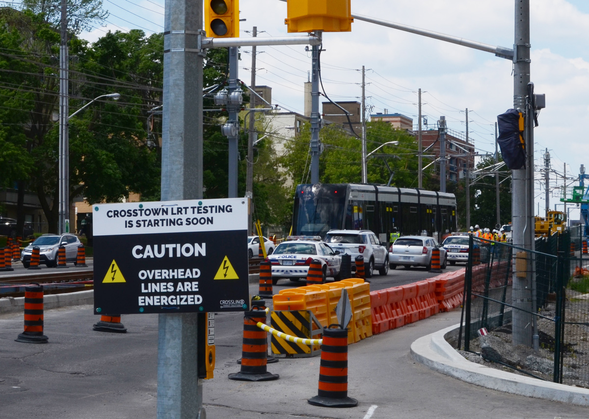
Sometimes I choose my walks randomly and sometimes I am on a mission to find something in particular. The other day, June 1st, definitely falls in the latter category. I have been following the Crosstown LRT/subway construction so when I heard that the new LRT trains were arriving for testing near Kennedy I knew that I had to see it for myself. While I was there, why not check out the area?
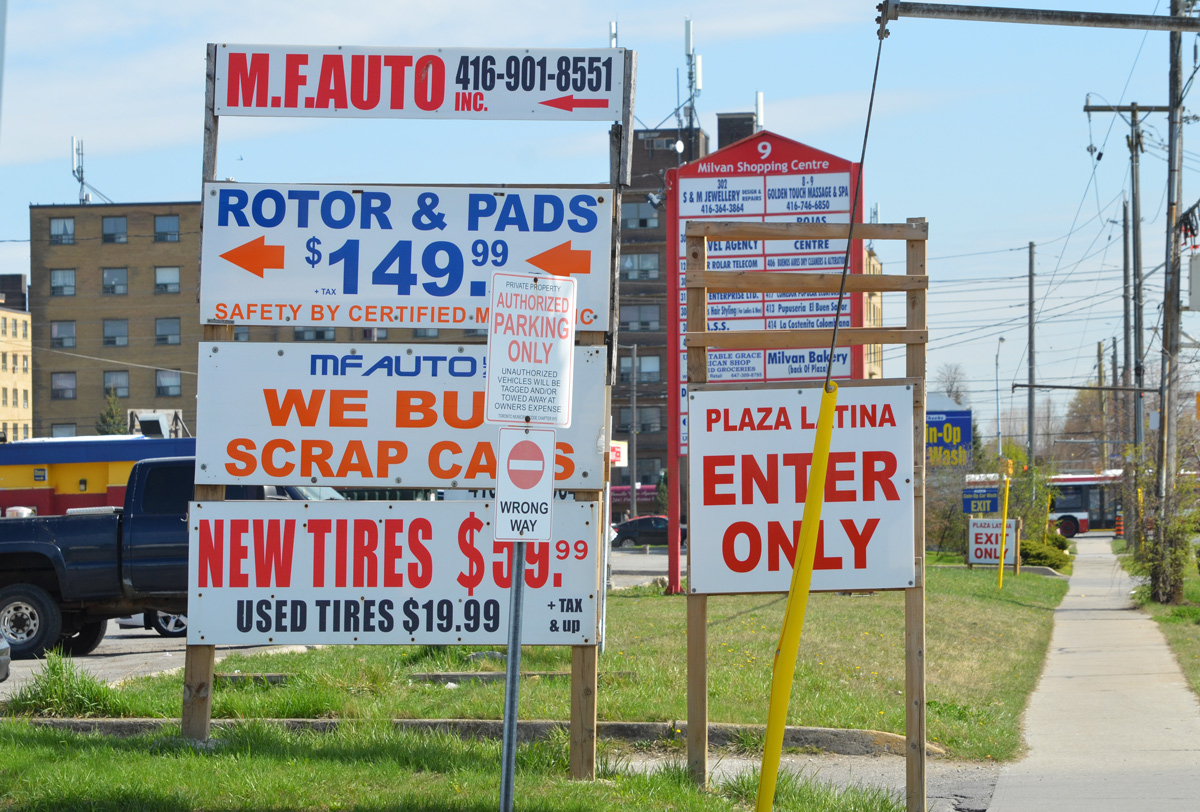
below: On Eglinton, east of Kennedy
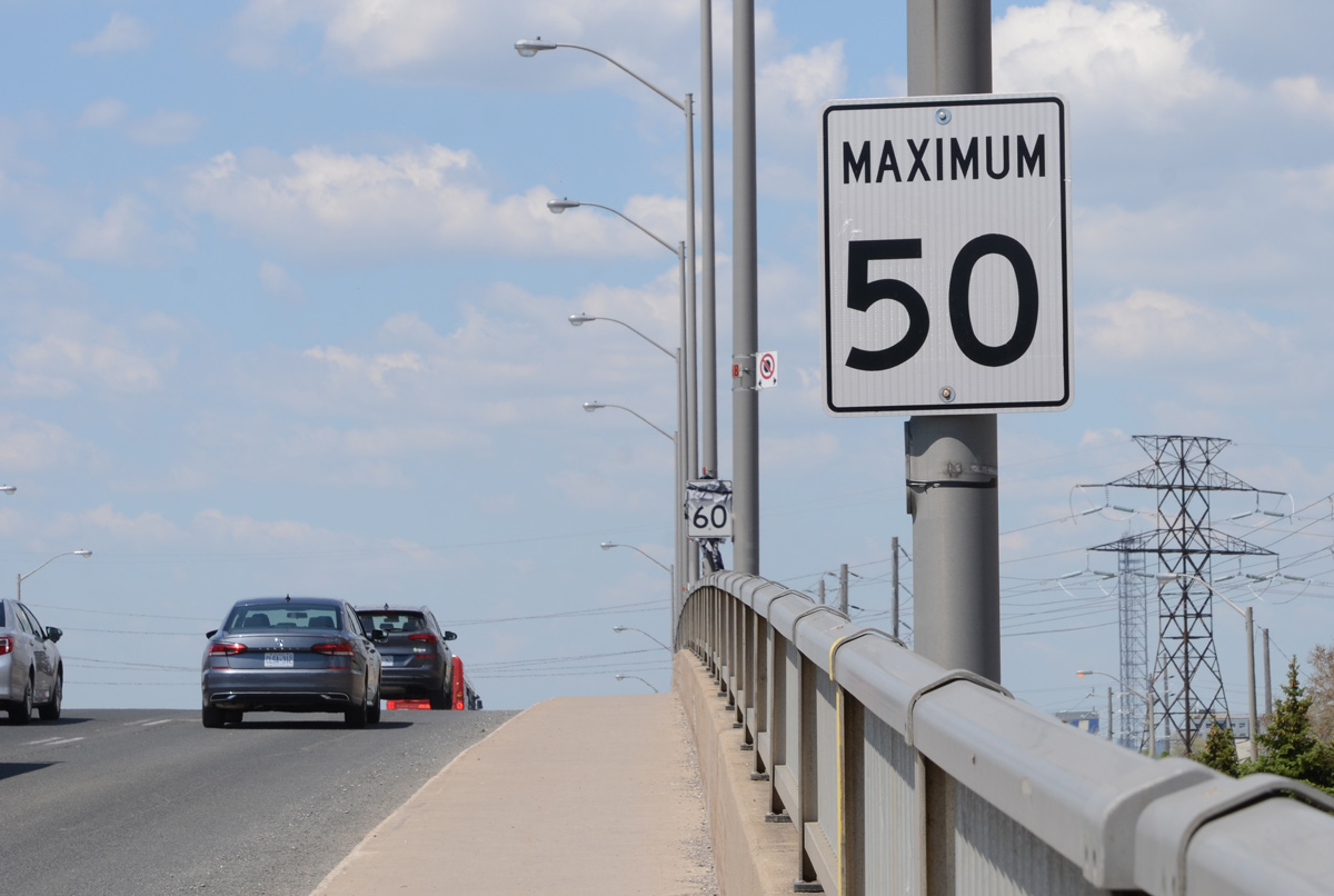
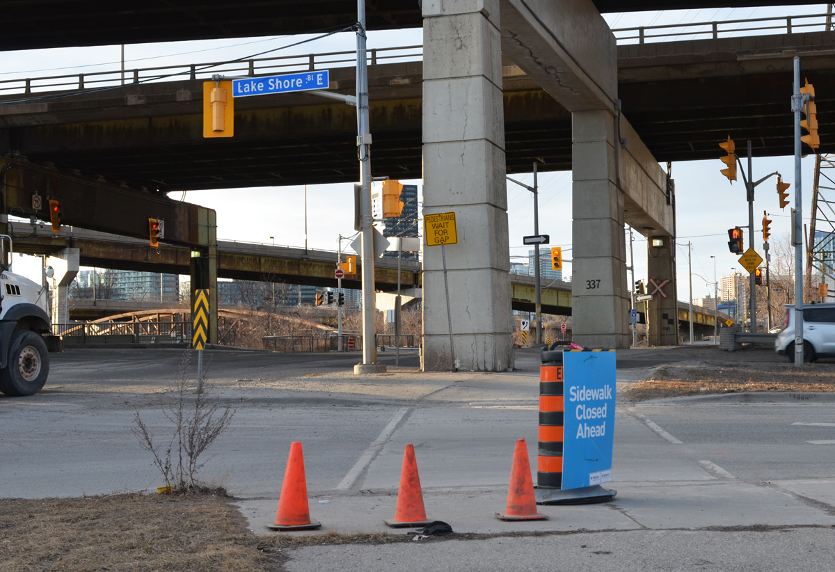
below: It’s not the most pedestrian friendly stretch of road but it’s also a bridge over railway tracks.
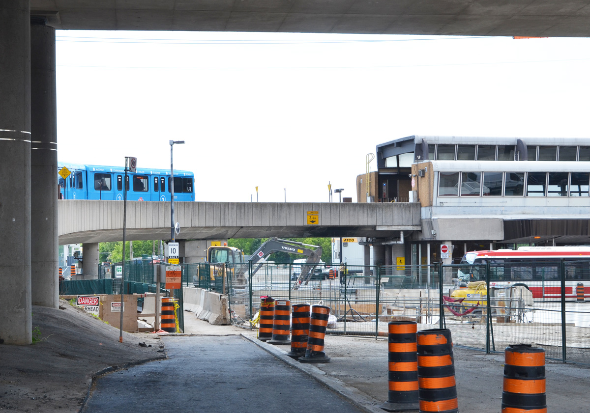
below: Kennedy station is already a GO train station. The east end of line 2 (Bloor-Danforth line) swings north as it crosses Scarborough. By Kennedy it is at Eglinton Ave and here it connects with the above ground TTC line 3 (Sheppard line). The blue train is the latter.
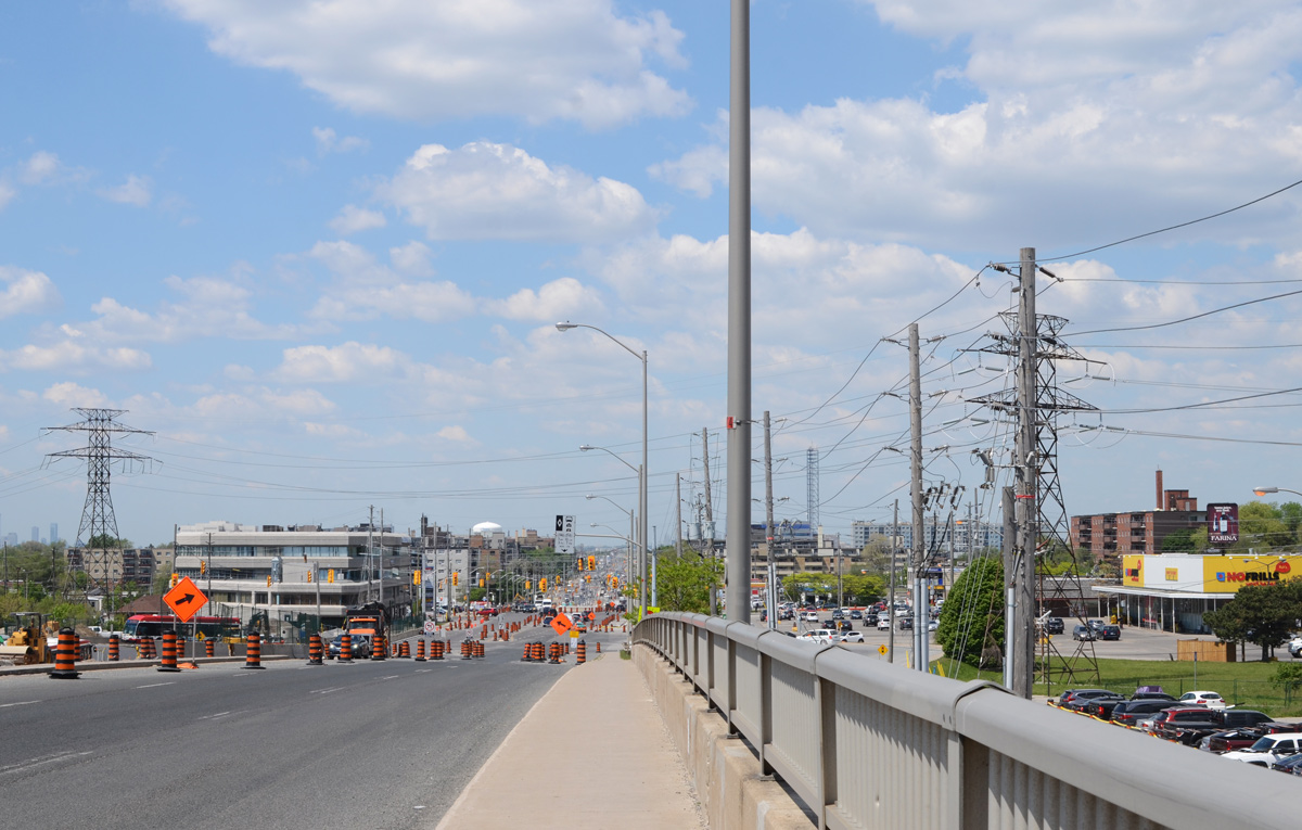
below: Looking west towards the intersection of Kennedy and Eglinton.
below: Northwest corner of Kennedy and Eglinton
below: The Crosstown LRT tracks are on the surface for
most of the Scarborough portion of its route. Just west of Kennedy station they go underground.
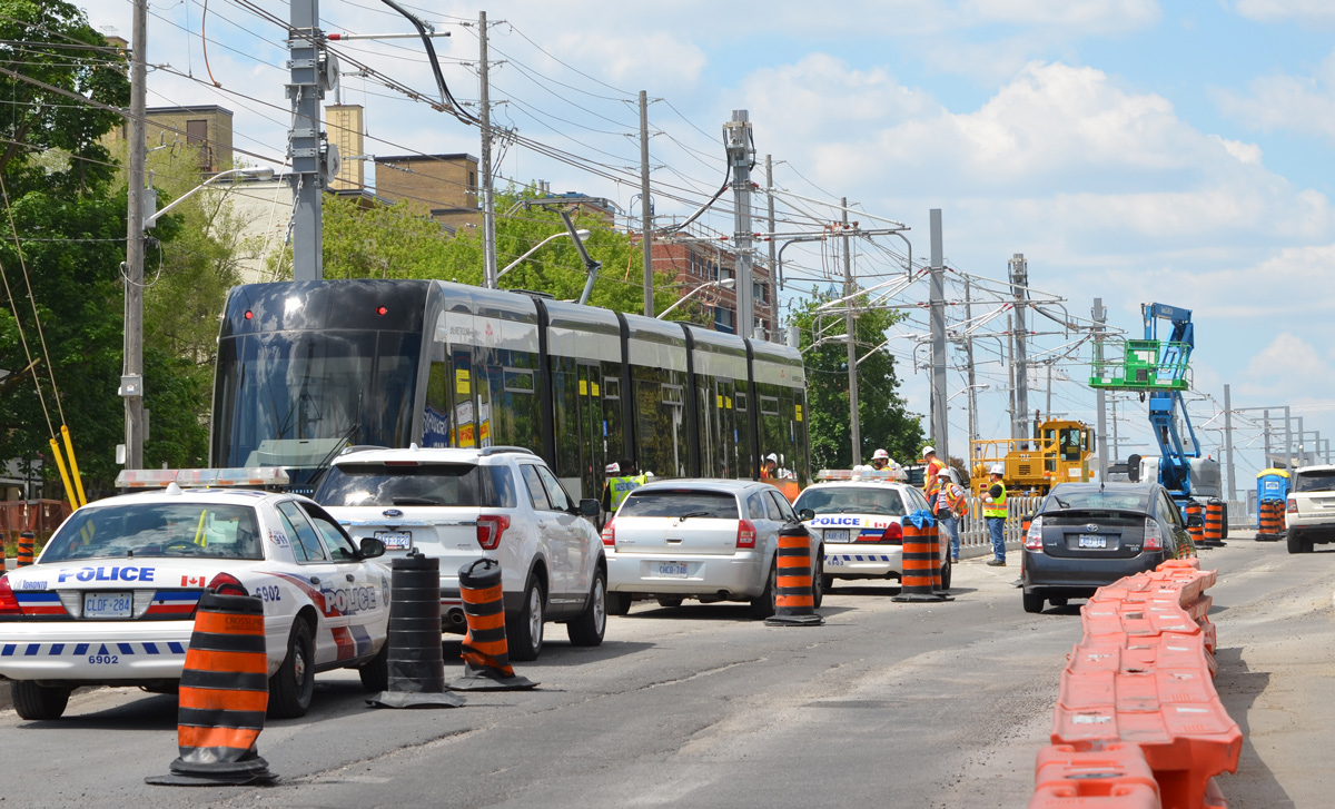
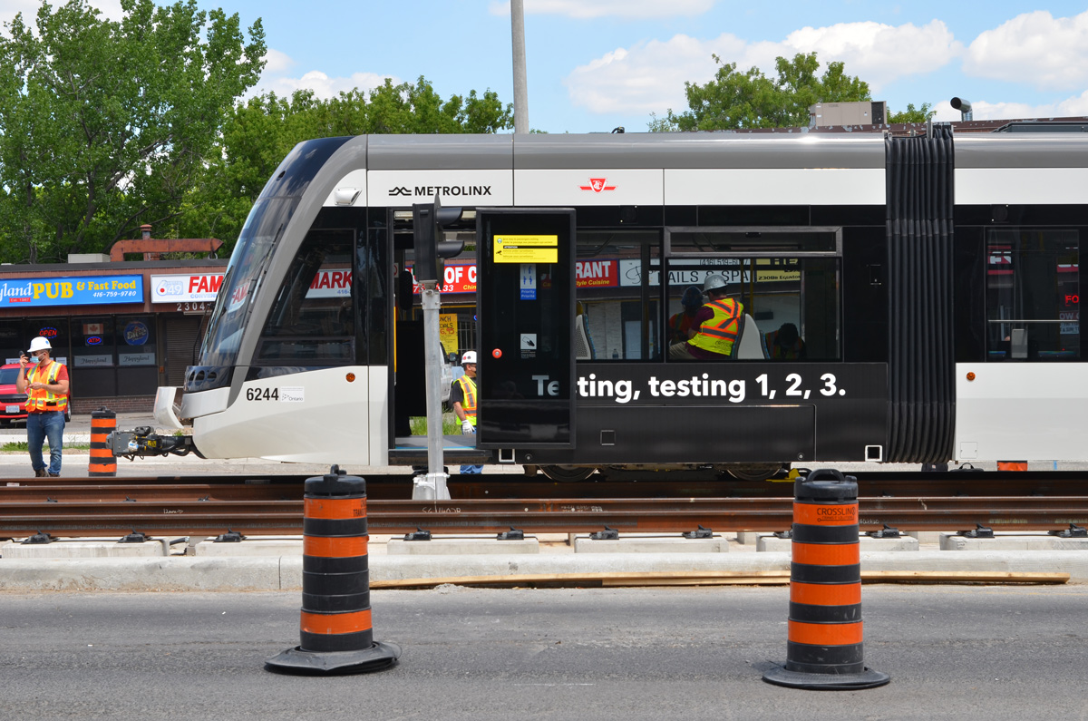
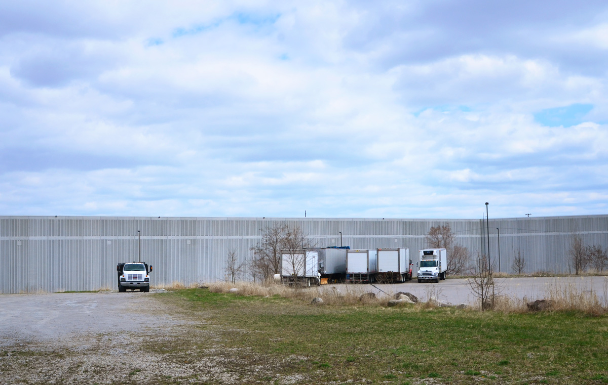
below: A new LRT train on the tracks between Ionview and Kennedy stations. It had been unloaded from a truck minutes before I arrived. At least two other trains where scheduled to arrive that day.
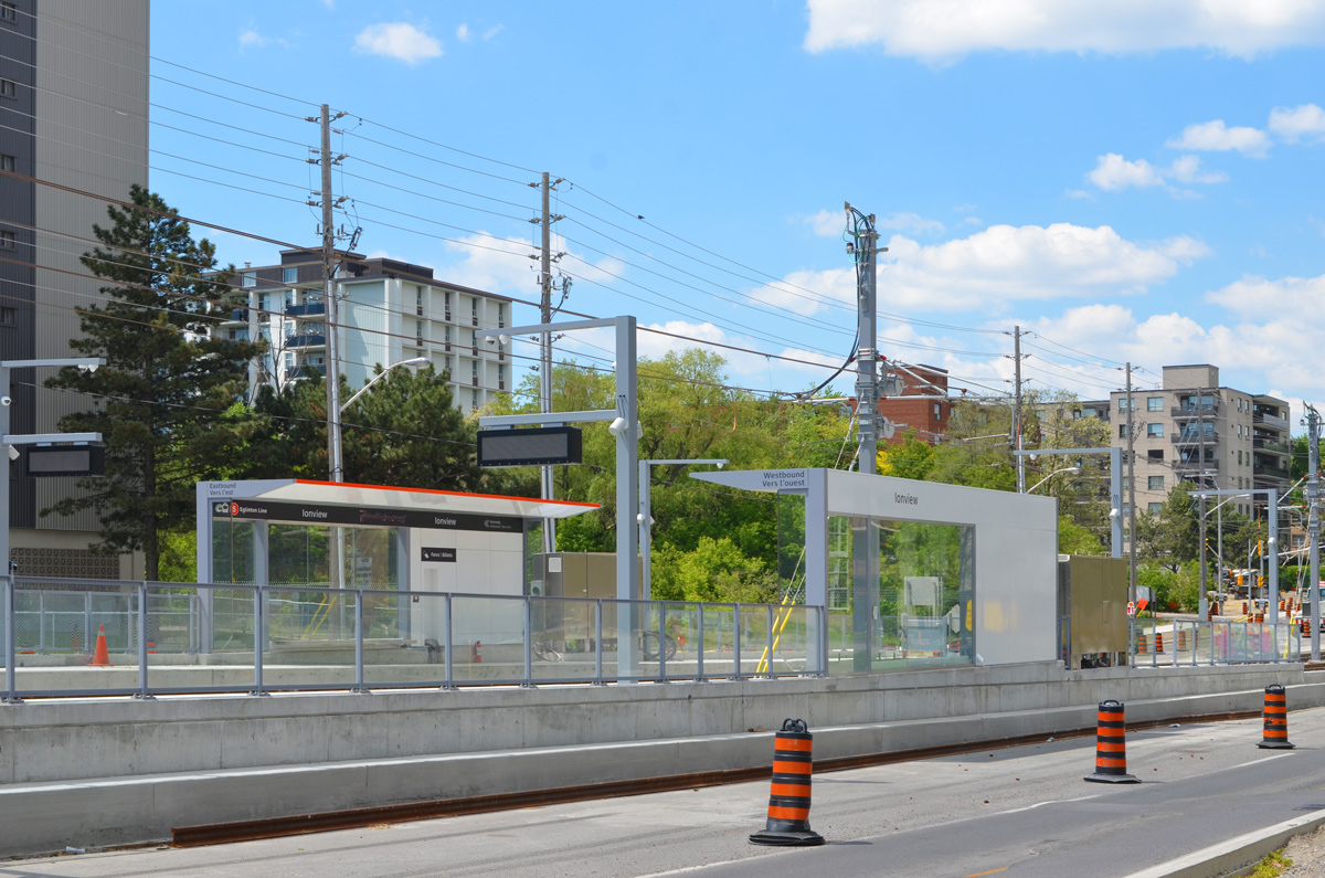
below: Ionview station
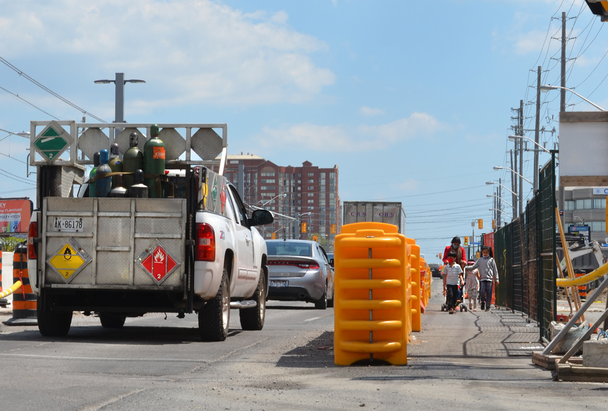
below: Traffic flow
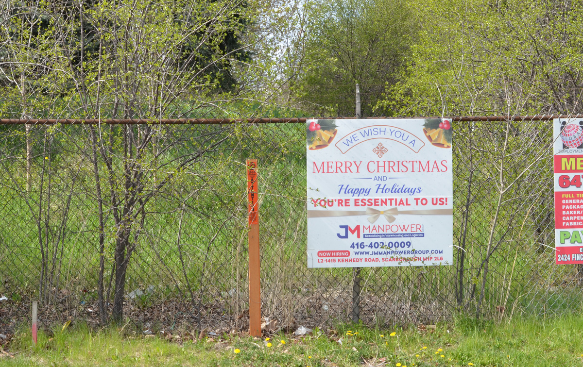
below: That’s one way to use a construction sign. Whether Mike is responsible or has been pranked is anybody’s guess
below: The new Kennedy LRT station (at the eastern end of the line) is almost complete. The LRT is scheduled to be operational “sometime in 2022”.
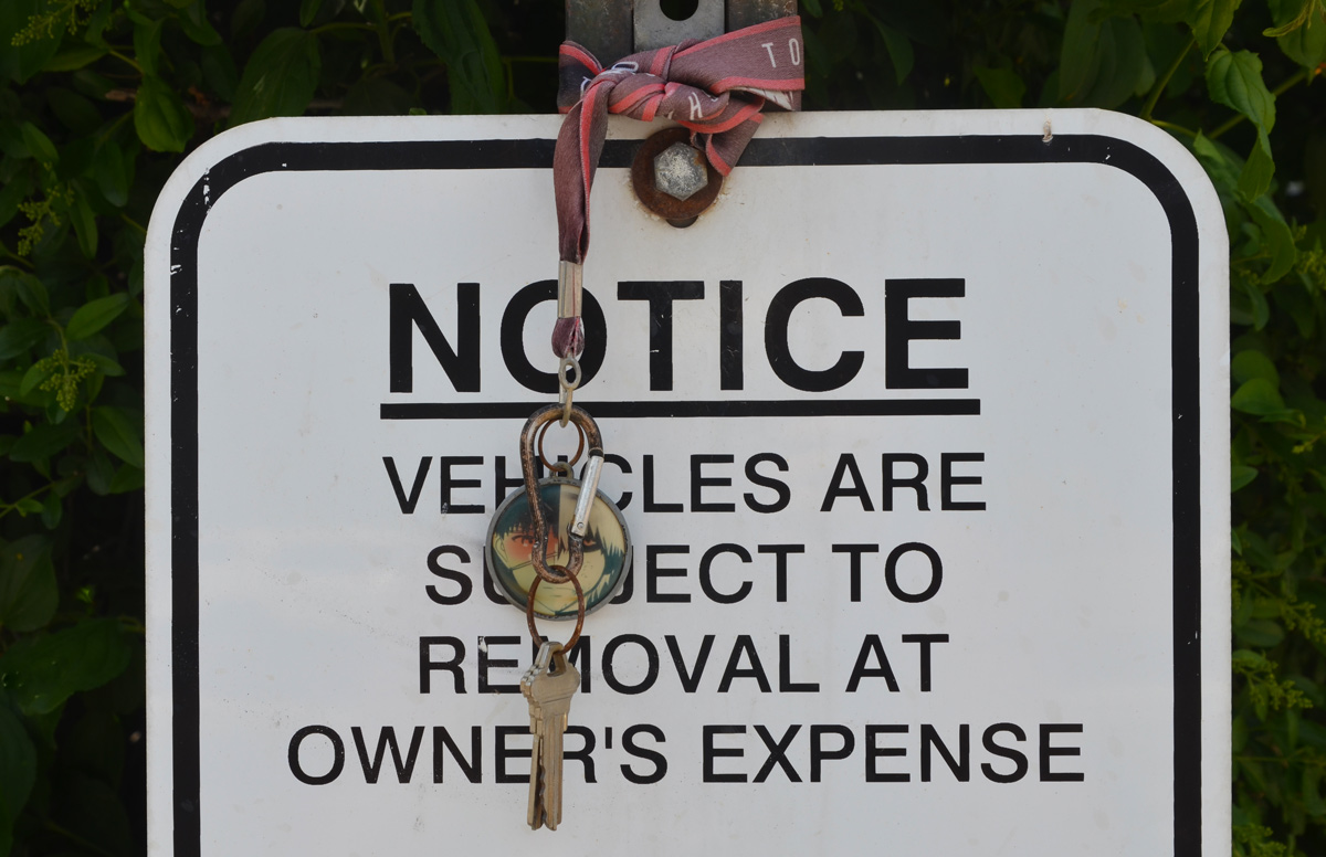
below: What people keep on their dashboards…..
below: Kiss ‘n Ride at Kennedy station
below: TTC subway train, line 3, enters Kennedy station.
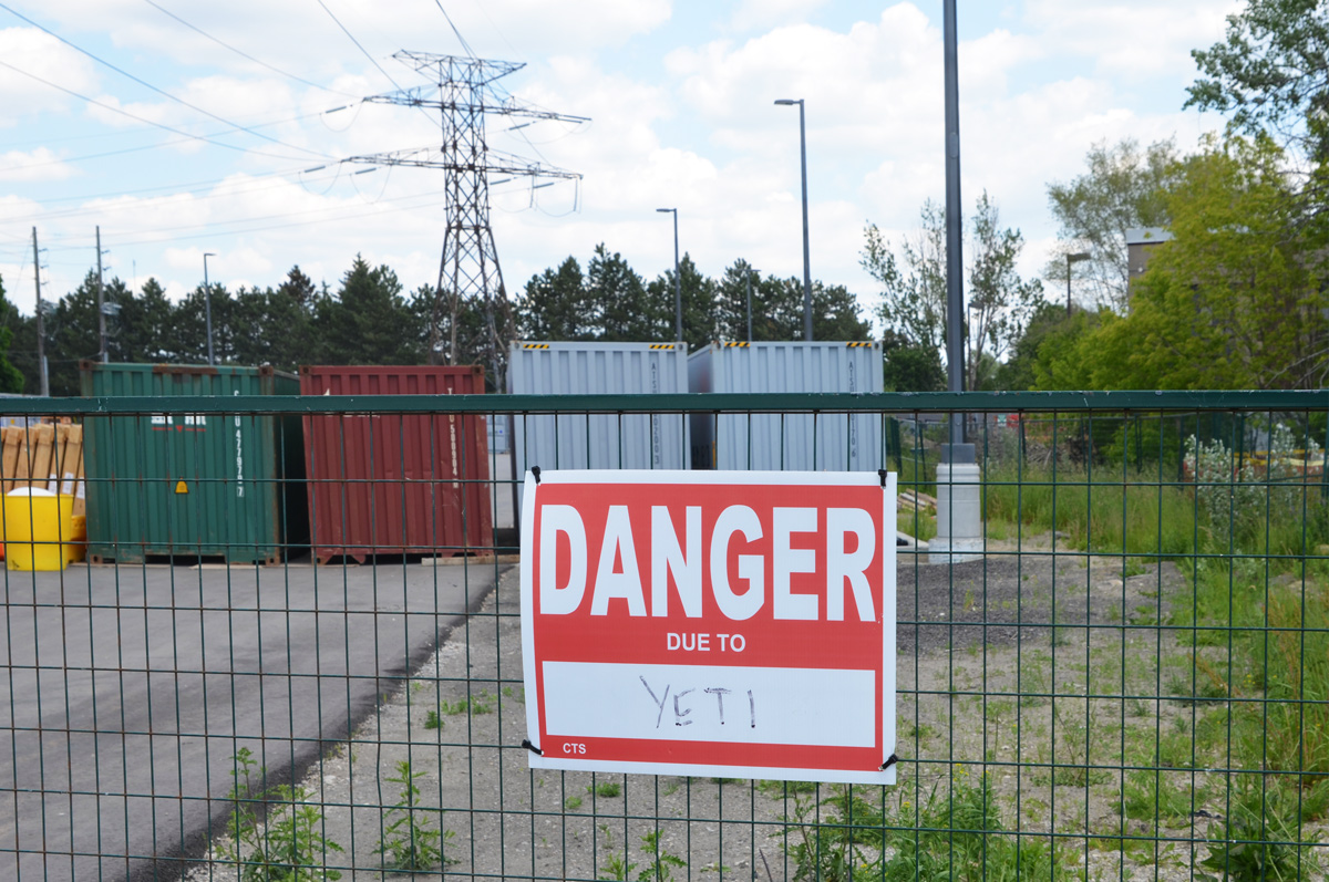
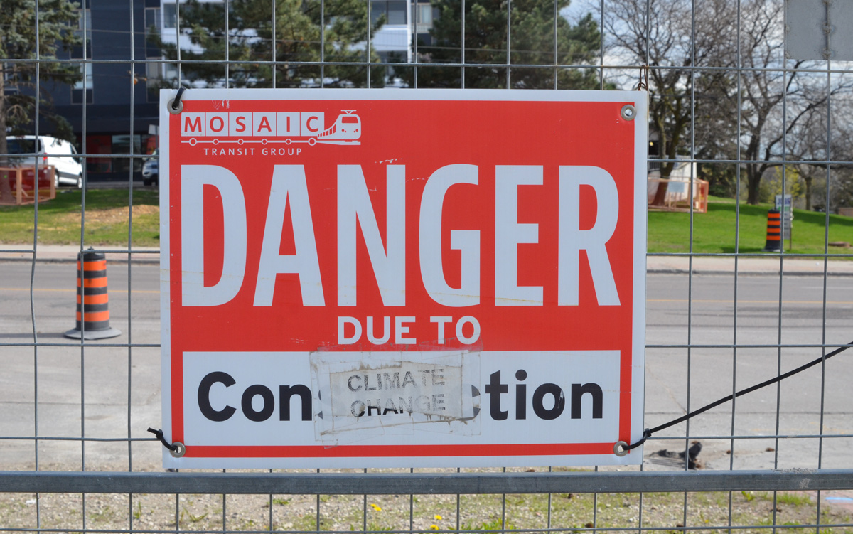
below: Danger due to yetis
below: Parking for an underground church? Or underground parking for a church?
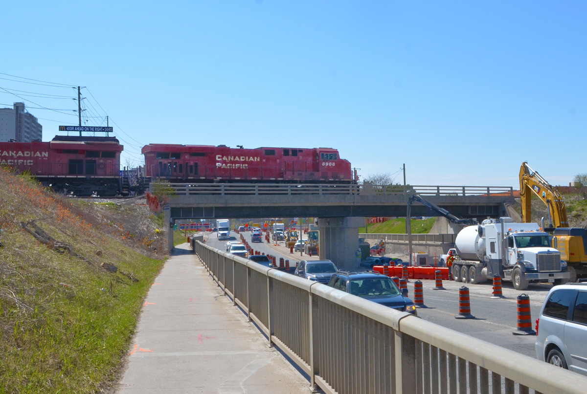
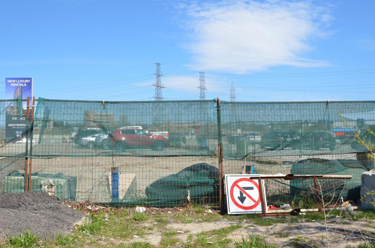
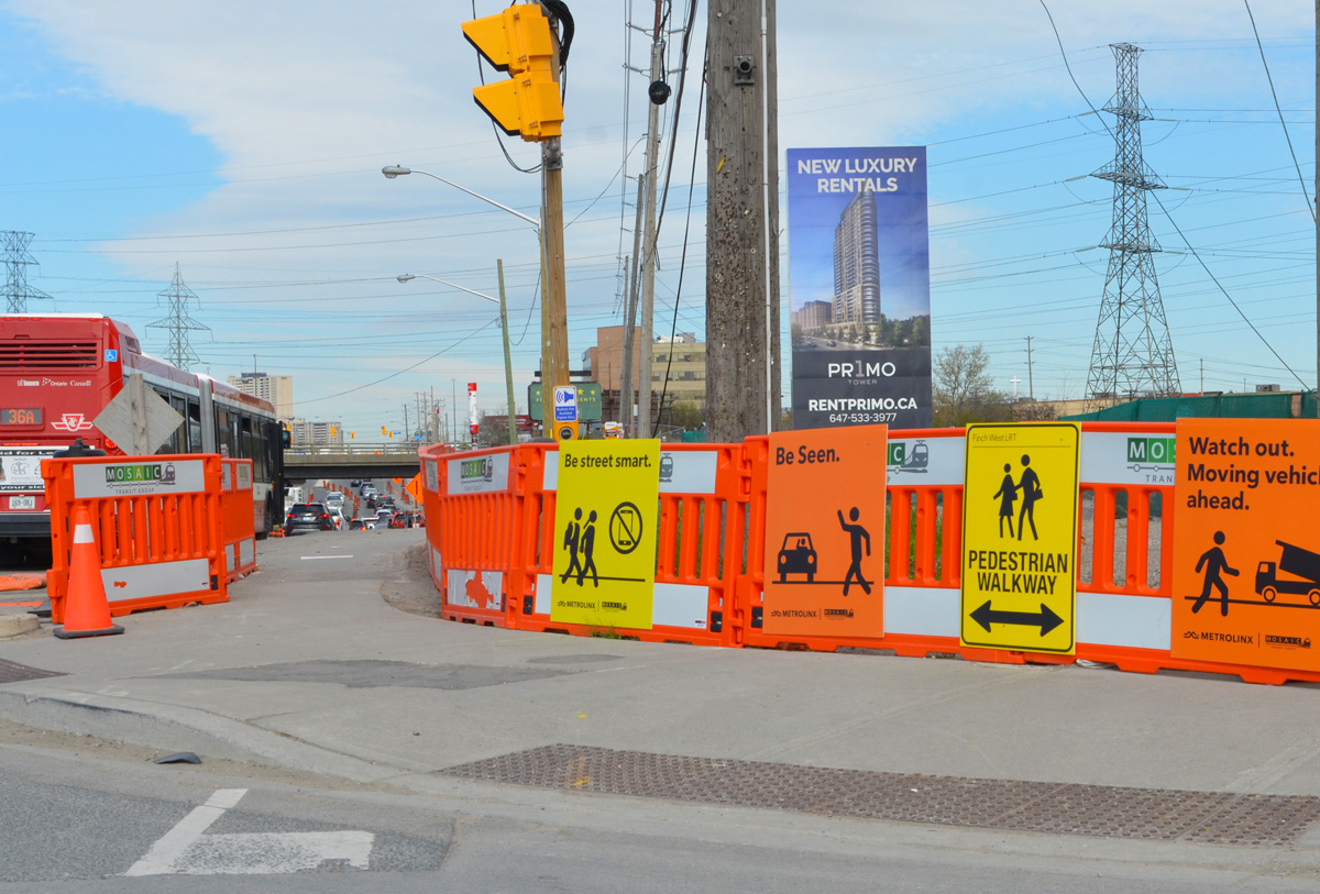
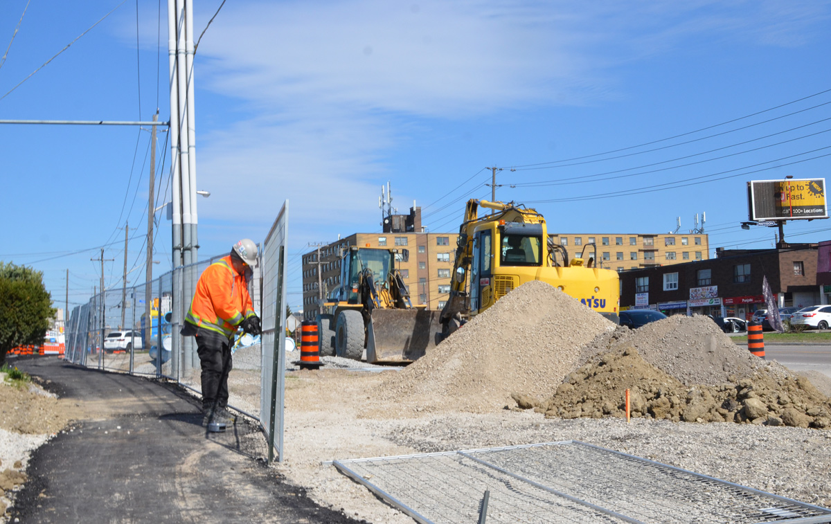
Today, the intersection of Finch and Weston Road is a mess. Metrolinx is preparing to start construction on the Finch LRT, more than 12 acres on the southeast corner is being totally rebuilt, and water mains along Finch are being upgraded. The intersection also has the misfortune to lie in a hydro corridor.
below: Looking west on Finch at Weston Road.
below: Canadian Pacific tracks cross Finch just east of Weston Road
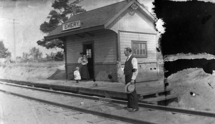
below: Emery train station just after 1900. This was a a flag station built for the Toronto Grey and Bruce Railway in 1870 (i.e. trains only stopped if you flagged them down). In the early 1880s the line was acquired by the Canadian Pacific Railroad. Photo source: Toronto Public Library
Like the rest of the GTA, development here began as a village that supported the surrounding farms. In 1796, Isaac Devins and his wife Mary Chapman were given 200 acres of land, south of what is now Finch Ave from Weston Road to Islington. Devins had worked with Governor Simcoe as a superintendent on the construction of Yonge St. Two of their grandsons opened businesses near the corner of Finch and Weston Road. – one was a blacksmith and the other a carriage maker. A brick schoolhouse came shortly after 1850 and the Methodist church followed in 1869. A post office was established in 1879… and Emery was officially a village.
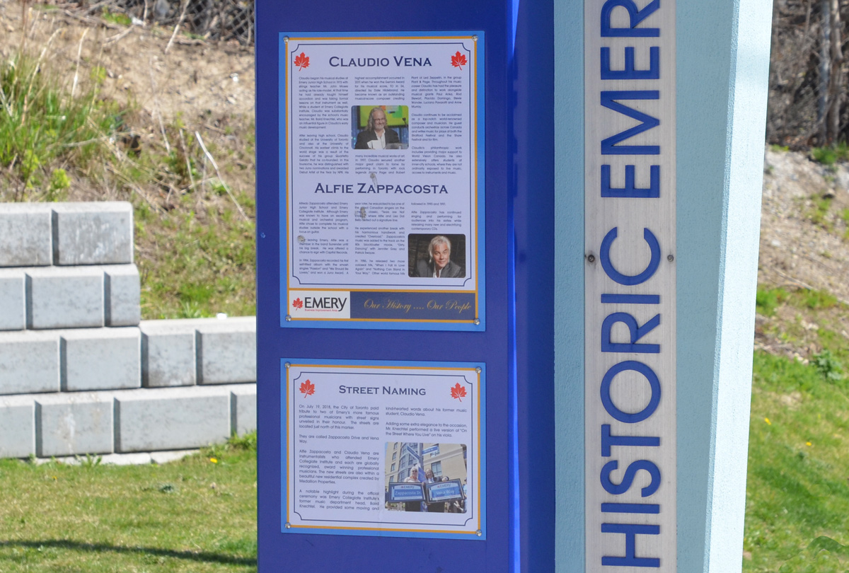
Celebrating the history of Emery are some plaques on display at a couple of bus stops on Weston Road. The one below describes two musicians with local roots, Claudio Vena and Alfie Zappacosta. Both men have streets named after them.
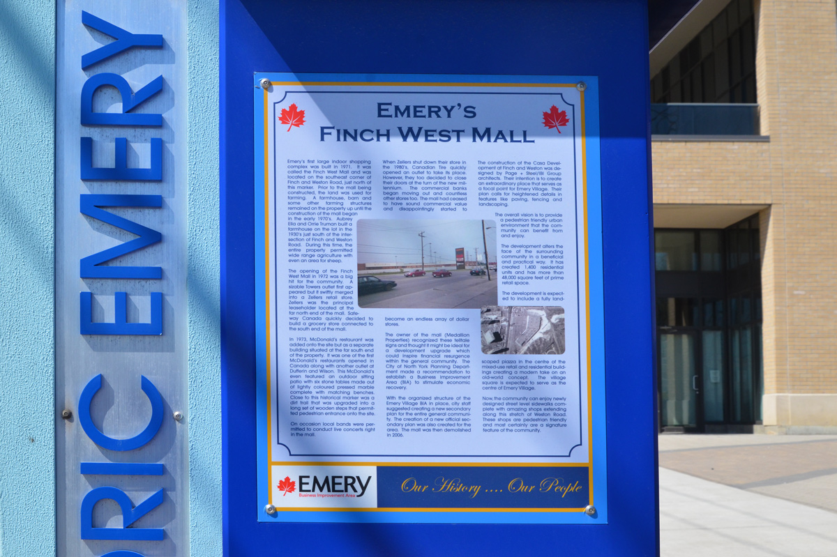
below: Finch West Mall was built in 1971 on the southeast corner of Finch and Weston Road on what had previously been farm land. Step-brothers Aubrey Ella and Orrie Truman had farmed here since 1930. …. but you can’t go shopping there any more. [transcription of the text can be found at the bottom of this post]
below: Development notice sign at the site of the former Finch West Mall. The proposal includes 5 towers, 2237 residences ranging from bachelors to 3 bedroom, some retail, and a park. All rentals.
below: Construction is only in the early stages so there isn’t much to see
below: Preparations for the construction of the Finch LRT are underway.
below: But not always well thought out – here sidewalk access ends but the only way to go is to cross Finch in mid-block with no help
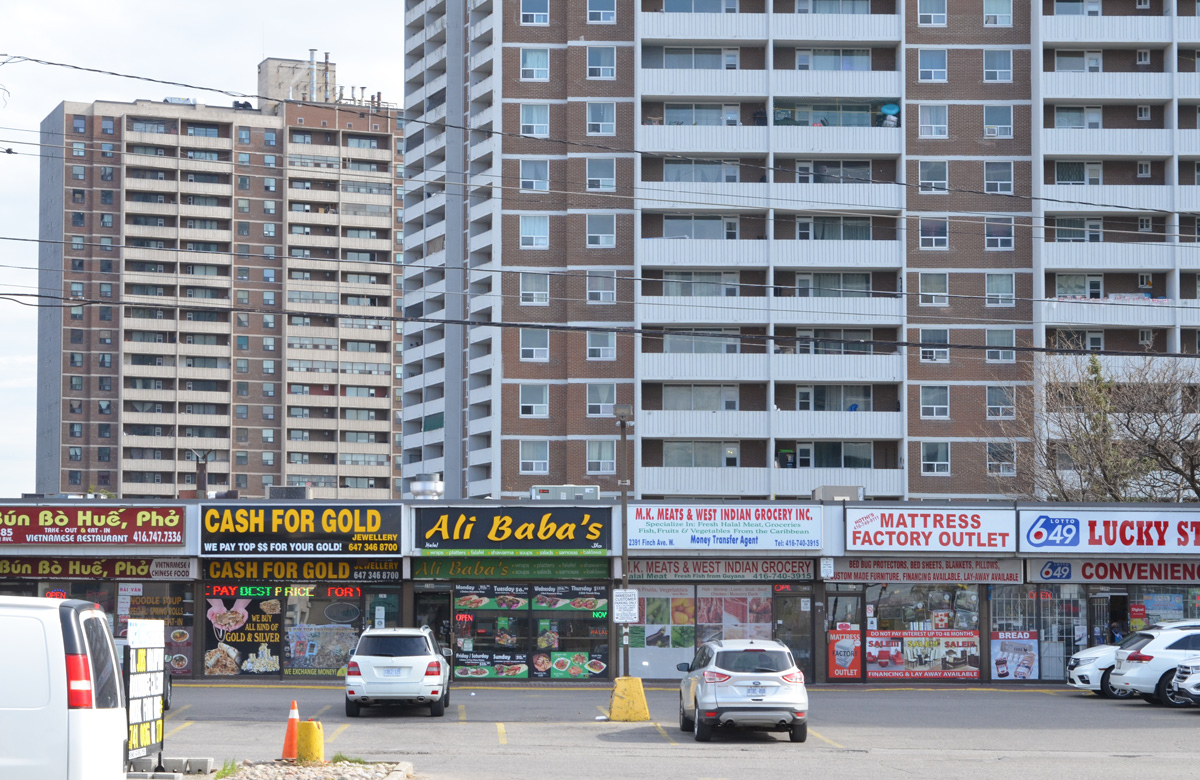
Also like many places in Toronto, Emery has become very multicultural.
below: African Food & Groceries as well as Comida Colombiana
below: A Vietnamese restaurant and a West Indian grocery store
below: North York Sikh temple
below: Confusion?
below: More restaurants and businesses
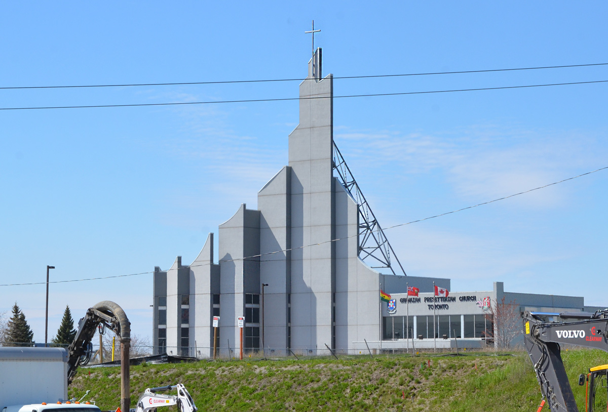
below: Ghanaian Presbyterian Church, since 1994 (as seen from Finch Ave)
below: Prayer Palace
below: Lindylou park
below: Emery Creek south of Finch
below: Finch Avenue West, looking eastward towards Weston Road
below: Slightly closer to Weston Road (from Lindyloou park looking northeast)
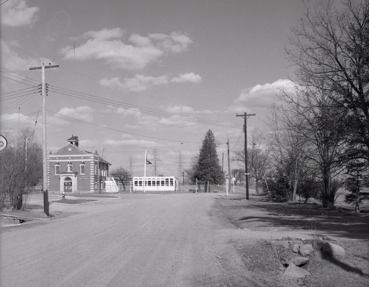
below: Not taken from the same spot but also Finch Avenue West, looking eastward towards Weston Road in 1958 when Finch was still a dirt road. The brick building is Emery Public School (built 1914); and it looks like it had a portable in the yard… and is that an Elmer the Safety Elephant flag? The school was demolished shortly after the picture was taken. Photo source: Toronto Public Library, photo by James Victor Salmon
below: Farther east, now past Weston Road. If you go even farther you will come to Hwy 400
below: Most of the area north of Finch is zoned for light industry including this business, the making of prefab concrete staircases. With all the condo development in the city at the moment, there must be a lot of demand for these stairs!
below: Another vacant lot
*****
Transcription of Plaque (above):
“Emery’s first large indoor shopping complex was built in 1971. It was called the Finch West Mall and was located on the southwest corner of Finch and Weston Road… Prior to the mall being constructed, the land was used for farming. A farmhouse, barn, and some other farming structures remained on the property up until the construction of the mall began in the early 1970s. Aubrey Ella and Orrie Truman built a farmhouse on the lot in the 1930s just south of the intersection of Finch and Weston Road. During this time, the entire property permitted wide range agriculture with even an arena for sheep.” “The opening of the Finch West Mall in 1972 was a big hit for the community. A sizable Towers outlet first appeared but it swiftly merged into a Zellers retail store. Zellers was the principal leaseholder located at the far north end of the mall. Safeway Canada quickly decided to build a grocery store connected to the south end of the mall.” “In 1973, McDonald’s restaurant was added onto the site but as a separate building situated at the far south of the property. It was one of the first McDonald’s restaurants opened in Canada along with another outlet at Dufferin and Wilson. This McDonald’s even featured an outdoor sitting patio with six stone tables made out of lightly coloured presses marble complete with matching benches. Close to this historical marker was a dirt trail that was upgraded into a long set of wooden steps that permitted pedestrian entrance onto the site.” “On occasions local bands were permitted to conduct live concerts right in the mall.” “When Zellers shut down their store in the 1980s, Canadian Tire quickly opened an outlet to take its place. However, they too decided to close their doors at the turn of the new millennium. The commercial banks began moving out and countless other stores too. The mall had ceased to have sound commercial value and disappointingly started to become an endless array of dollar stores.” “The owner of the mall (Medallion Properties) recognized these telltale signs and thought it might be ideal for a development upgrade which could inspire financial resurgence within the general community. The City of North York Planning Department made a recommendation to establish a Business Improvement Area (BIA) to stimulate economic recovery.” “With the organized structure of the Emery Village BIA in place, city staff suggested creating a new secondary plan for the entire general community…The mall was demolished in 2006.”
*****
One of life’s unexpected coincidences… I didn’t read the text before I took the picture so it wasn’t until a few days later that I saw the name Orrie Truman. I have Trueman ancestors in this area… was he related? Orrie Truman was Orrie Levi Richard Trueman. I don’t know where the name Orrie comes from but Levi and Richard were his grandfathers, Levi Coulter and Richard Trueman. William Mellow Trueman married Eleanor (Nellie) Coulter and Orrie is their son. William died shortly after and Nellie subsequently married Ella. Going back a generation, William Mellow Trueman is the son of Richard Trueman and Rebecca Mellow who happen to be my great great great grandparents. My great grandmother, Ina Rebecca Moore was named after Rebecca Mellow, her grandmother. Ina would have been Orrie’s first cousin. Question: What relation am I to Orrie Trueman?
A few weeks ago I read a blog post about Agincourt history in Bob Georgiou’s Scenes from a City. It reminded me that I had once tried to walk that area but I only got discouraged because of weather (grey, damp) and nostalgia. Sheppard Avenue just east of Kennedy now has this large concrete underpass (Metrolinx/GO trains) which was a shocking change from my childhood memories. My parents were living here with their parents when then met and my paternal grandparents remained in the neighbourhood until they passed. One of my great-grandfathers lived on Agincourt Drive in a house that backed onto the railway tracks.
This time round, I waited for a sunny day before I tried walking here again. For the most part, I walked Sheppard Avenue East between Kennedy and Brimley and the photos below are what I saw – what you see there these days. If you are more interested in the history of the area, then you need to be reading Bob’s blog as mentioned above.
Let’s walk!
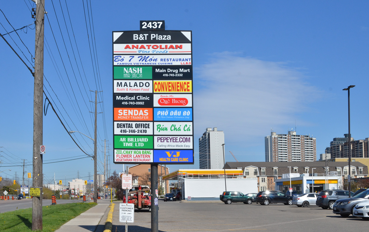
below: The area’s Asian character is very obvious.
below: Nutriever?
below: West Highland Creek, north of Sheppard
below: Are you in the market for a used truck?
below: If not a truck, how about a car? I passed at least three used car lots.
below: The old Agincourt GO station has been demolished and a new one is being built.
below: Bell Canada (It’s a white building)
below: In a front yard on a nearby street….. I have many questions.
below: Looking east just before Midland Avenue
below: Part of the reason that Sheppard and Midland looks so empty is this vacant site on the southwest corner. There was once a Lumber King Home Centre here, then it was a flea market and used car lot, but now it’s an empty building on an otherwise vacant 4.7 acres. A plan for 80 townhouses and a park was filed back in 2015 and seems to have been winding its way through the development process ever since.
below: A quick rest at the intersection where there are actually some people. I miss interacting with the people that I see as I walk around… and I’m sure that you’ve noticed the lack of people in these blog posts.
Also, re the TTC – this is Sheppard Avenue, home of the Sheppard subway, or is it LRT now? As I was researching development at 4181 Sheppard, I discovered that Metrolinx has been applying for easements along Sheppard in preparation for anything that might be built on that street.
below: There is always something to remind us of life’s situation these days, such as this ad that was on a bus shelter. I liked the hashtag at the end, #PracticeSafe6ix
below: Knox United Church was built as a Free Presbyterian church in the 1840’s but became Knox United in 1925. This was when the Presbyterians merged with the Methodists to form the United Church of Canada. (Although not all Presbyterian churches went along with the merger).
below: Agincourt Baptist Church
below: There is a second overpass in the area. The CPR tracks pass over Sheppard between Midland and Brimley, just west of Canadian Pacific’s Toronto Yard.
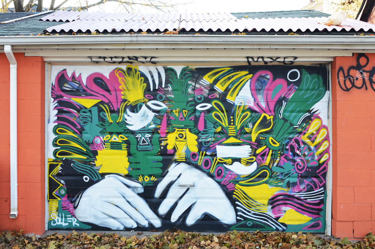
below: On this overpass is a mural by elicser
below: Running parallel to the south side of the CPR line and Sheppard Avenue is a large industrial complex belonging to the International Group of Companies.
below: Toronto has 85 BIAs (Business Improvement Areas) including Sheppard East Village which includes Sheppard between Midland and Markham Road.
below: At Glen Watford and Sheppard there is a large new Seniors residence planned.
below: In the meantime, there are empty stores.
below: North Scarborough Memorial being renovated but the old gate remains.
below: Agincourt Elementary School. Built in 1915 as a Continuation School, (grades 9 and 10) but used as an elementary school since Agincourt Collegiate was built in 1930.
below: (Snow)man down! You’d be tired too if you had to stand outside all winter!
below: Mystery ‘All Way Stop’ in the Walmart parking lot.
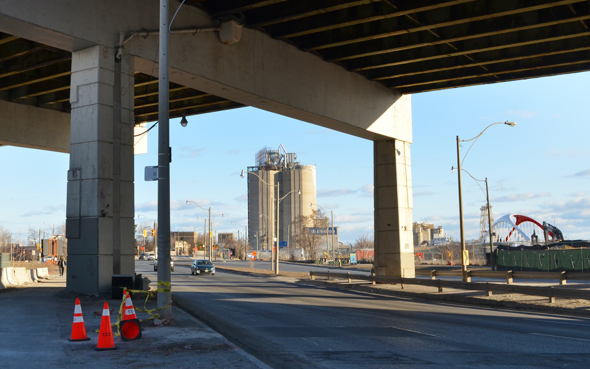
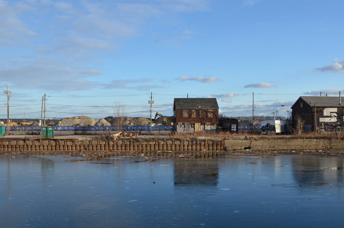
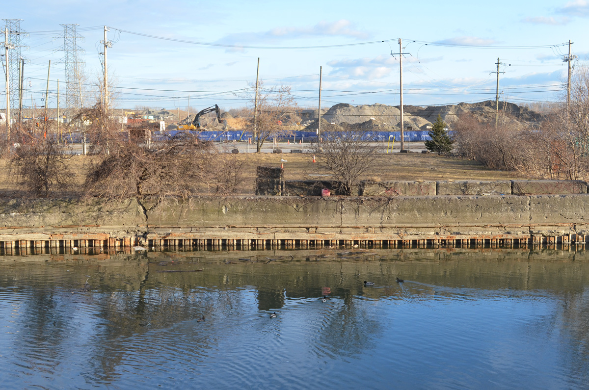
The other day, later in the afternoon, I was driving along the Lakeshore when I noticed that perfect lighting on the south side of the Keating Channel. I’ve done blog posts about the Port Lands development but I hadn’t looked at it from the other side. A quick change of plans – a parking spot nearby and a walk along the Lakeshore. This is some of what I saw that day.
below: At the bottom of Cherry Street
below: At the corner of Cherry and Lakeshore.
below: Along the Lakeshore, looking south towards Port Lands at Cherry.
below: The Gardiner curves slightly northward as it aligns with the Keating Channel. Lakeshore Blvd takes a wider turn and comes out from under the Gardiner for a few brief moments before slipping back under as both roads parallel the channel.
below: On the south side of Lakeshore, there is no sidewalk here but the grassy area is wide enough…..
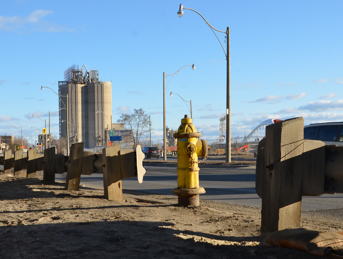
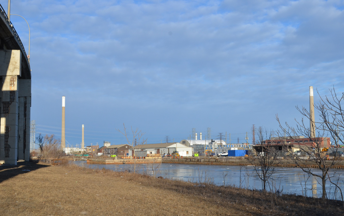
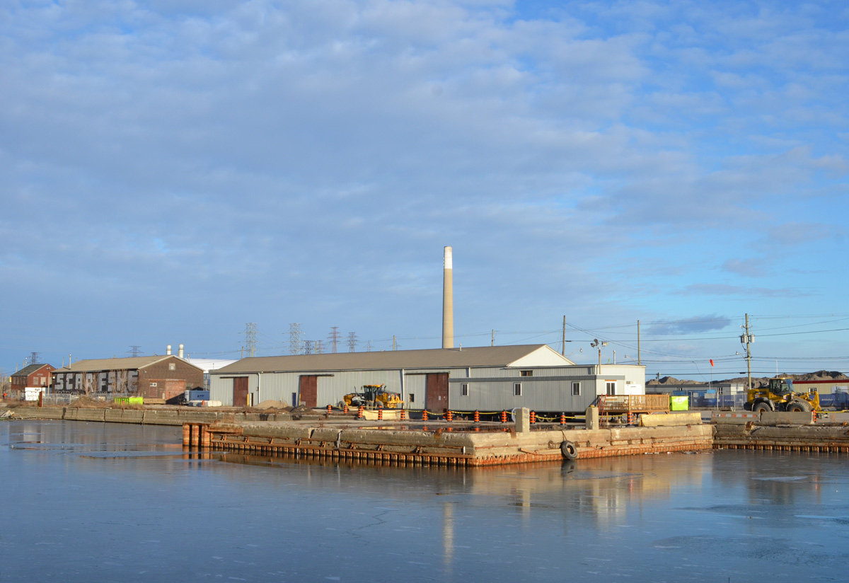
below: Walking here offers a different view of the Port Lands. The “smokestack” on the right is the old Hearn Generating station.
below: Some of the buildings that remain on Villiers Street.
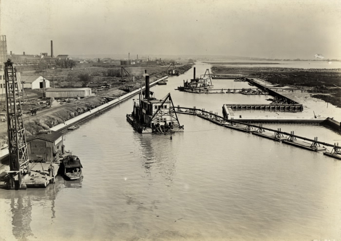
below: Panorama of Keating Channel being developed, 1916, before there was much on the Port Lands and Cherry Street was just a one lane dirt road.
below: Keating Channel, 1916
The original plan for the diversion of the Don River called for a more curved mouth of the river before it joined the Keating Channel. But the British American Oil Company who owned the land fought that idea. Instead, the 90 degree turn that still exists today was built to avoid crossing B/A property.
below: A few years after the channel was upgraded (1934)… From vacant land to a forest of BA oil tanks. There are railway tracks along the edge of the channel. From Wikipedia: “In 1908, with 8 shareholders, B/A built Canada’s third refinery on 3 acres on the eastern waterfront in Toronto. The company refined imported crude oil and its main product was kerosene; a then-useless by-product was gasoline, which was dumped into a swamp.”
Photo by Arthur Beales. Toronto Port Authority Archives, PC 1/1/10769. Found at Wikimedia Common
.
below: BA refinery with the Don River on the right, 1931. There were still storage tanks here in the 1960s when the city was building the Gardiner Expressway.
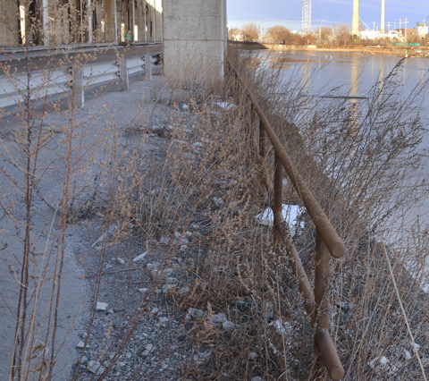
below: This rusty “fence” isn’t going to hold anyone or anything back. I had visions of tumbling into the icy channel if I went near it. I think that just looking at it made it wobble.
below: There are still places to tie up your boat
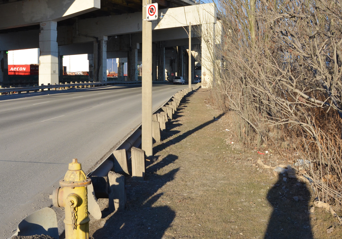
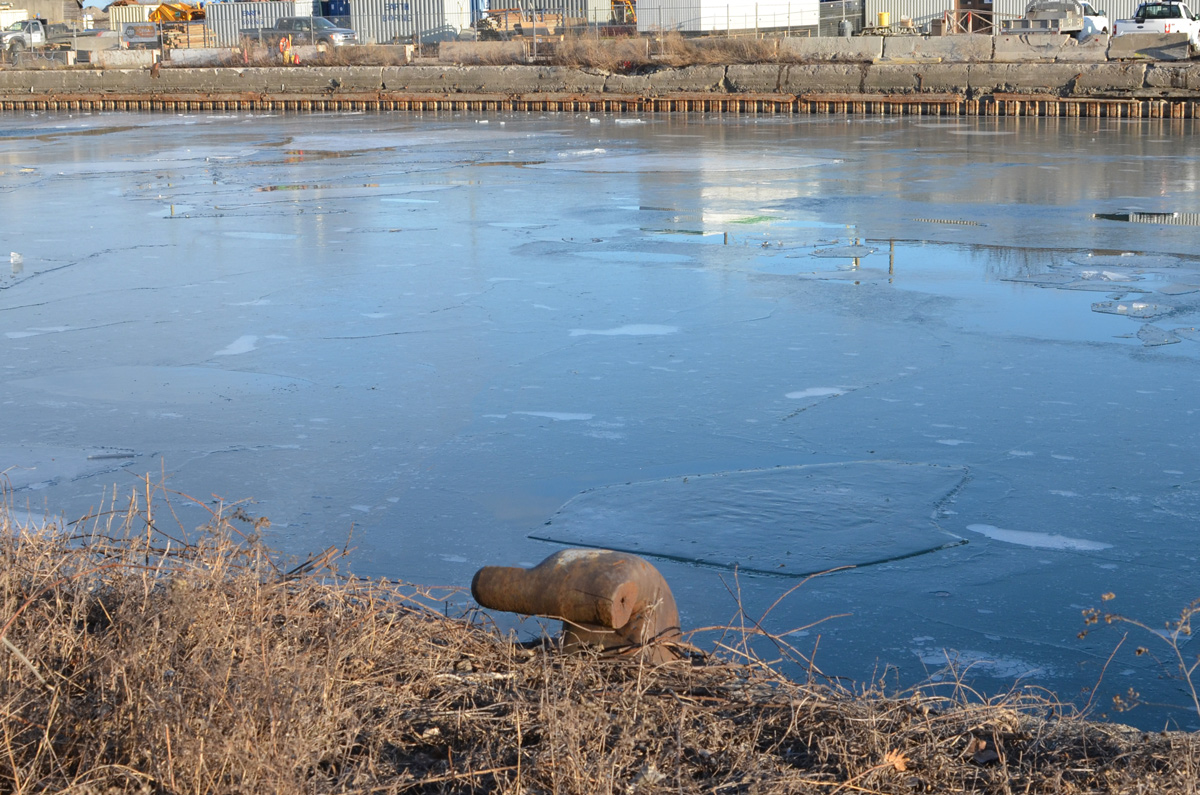
below: A big tap? It’s attached to a pipeline but is it functional? (It doesn’t look like it). There is a lot of infrastructure buried under the Lakeshore, sewer lines, water mains, electricals, etc., but this looks like a piece of history. Pleased correct me if I’m wrong! Also – if you plan to explore here, there are stretches where the only option is to walk right beside the road.
below: Likewise, the box structure is probably there to protect the rest – but what are they? Valves of some kind?
below: Looking north to Canary District and West Don Lands development. The oil tanks are long gone.
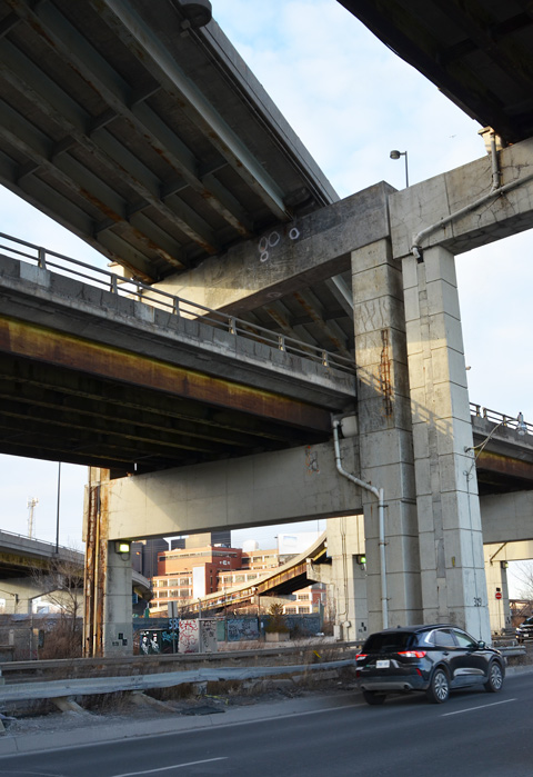
below: Looking up from Lakeshore, under both the Gardiner and the ramp from the DVP
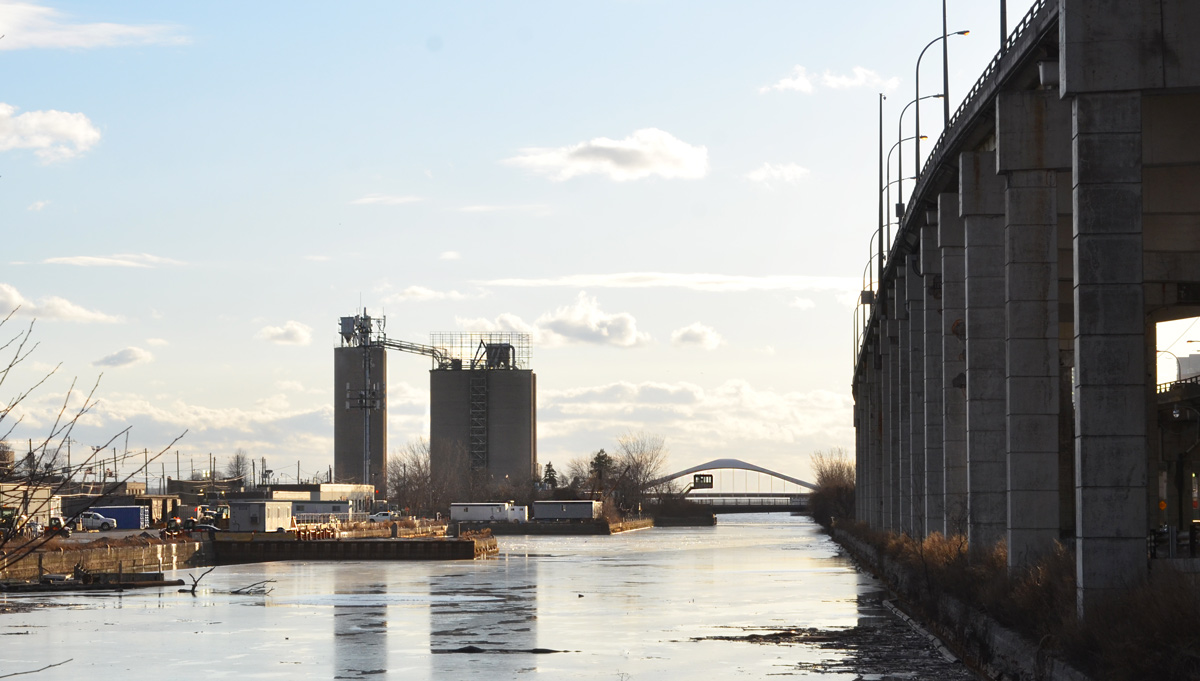
below: Looking west from Don Roadway along the Keating Channel to the new Cherry Street bridge.
below: Intersection of Lakeshore and Don Roadway.
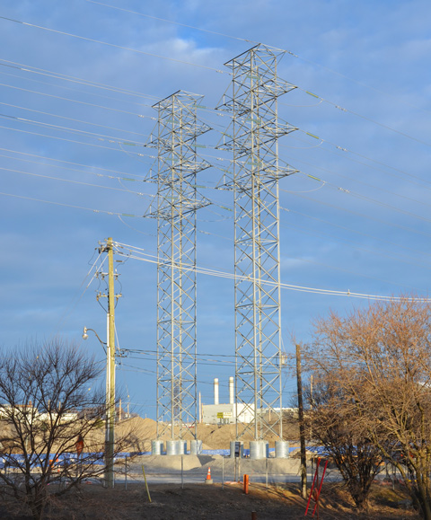
below: Two metal transmission towers standing side by side. Geometrical, straight lines, yet lace-like.
below: From the Don Roadway, northbound and homeward
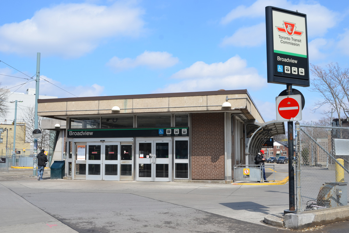
Most people are still staying home or at least close to home. You’re still not going to see many people in my photos because I am still avoiding them, still walking in quieter places. Sometimes those places happen to be streets that once upon a time (only a month ago?) were busy.
below: An empty parking lot.
below: A very quiet Broadview subway station.
below: A very tall and lanky animal on a pole. It’s missing a leg or two.
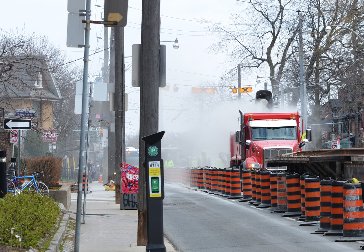
below: The TTC streetcar tracks in the middle of being replaced, on Broadview just south of Danforth.
below: More TTC construction, this time another access to Chester station is being built.
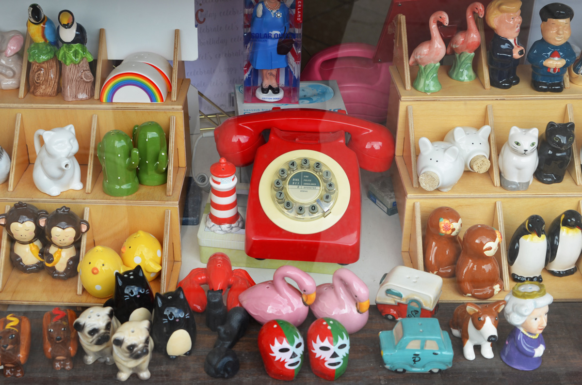
below: After a month of no shopping except for food and even no window shopping, this bright red telephone caught me eye as I walked past. Salt and pepper shakers in a store window: Flamingoes, pink swans, penguins, cats, monkeys, and little yellow chicks – cute ones and funny ones like the hot dogs, as well as political ones like Trump and his North Korean counterpart.
below: Inspired to do stuff? I think I identify more with the mug beside these days.
below: A Covid-19 message from the Danforth Music Hall – “Please take care of each other”.
below: Posters reminding people to share smiles and kindness
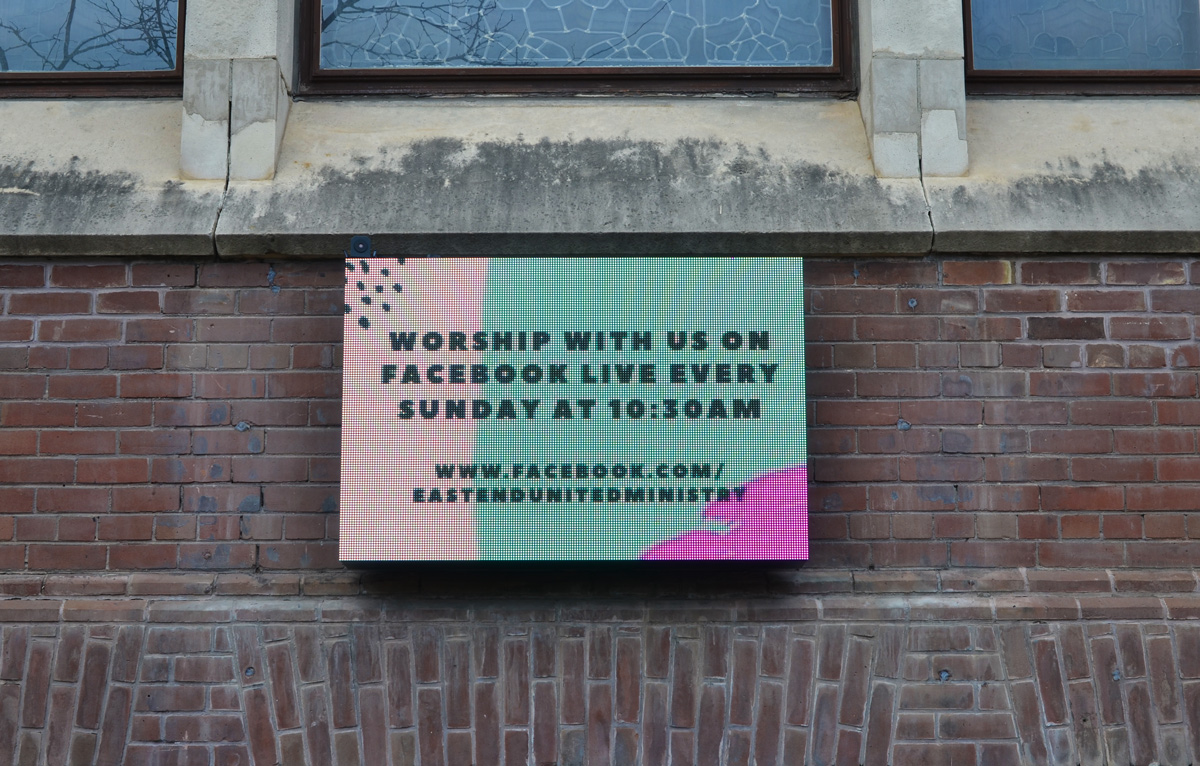
below: An electric sign outside Eastend United Church invites people to join their Sunday services on Facebook.
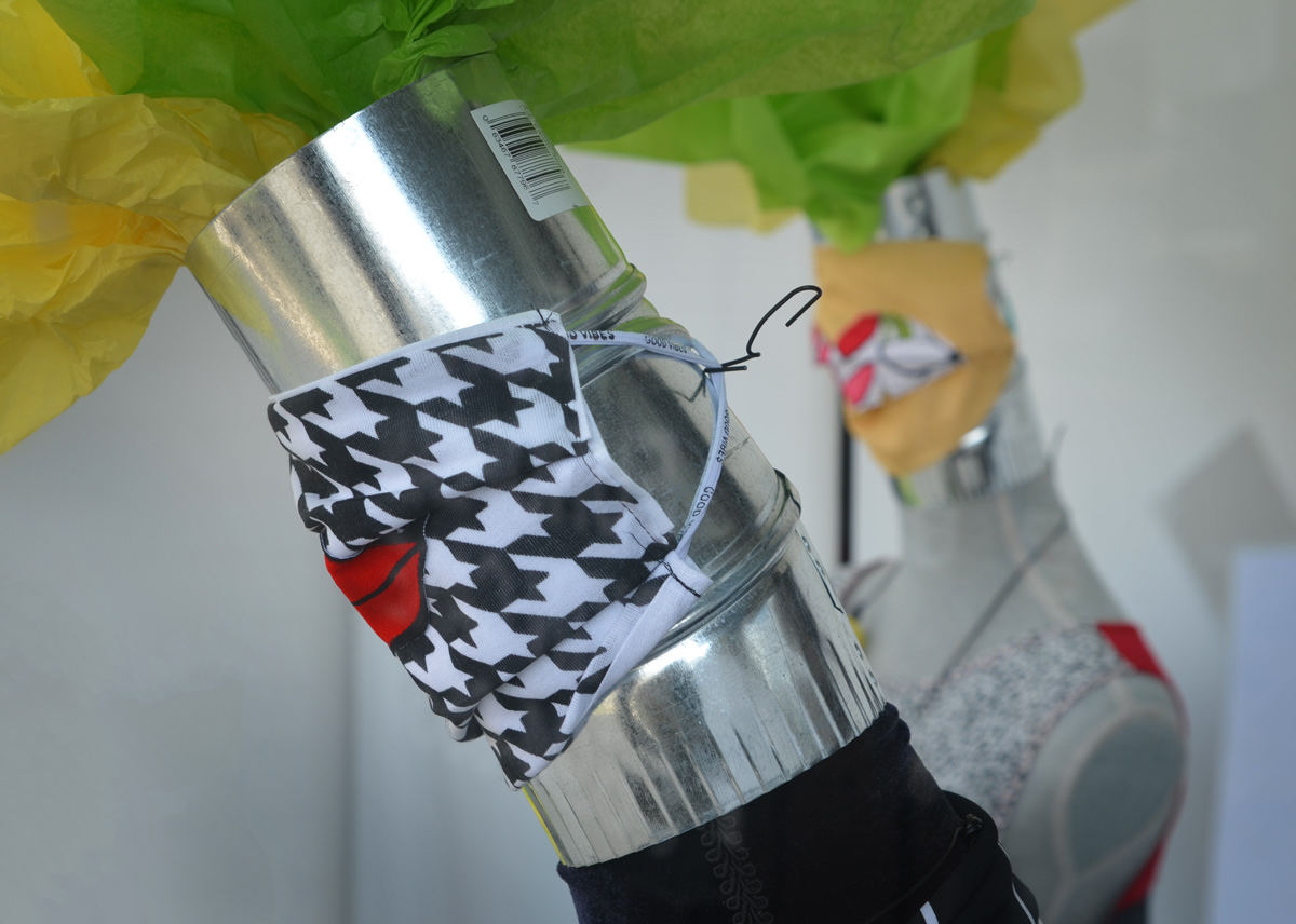
below: The mannequins had the most stylish face masks.
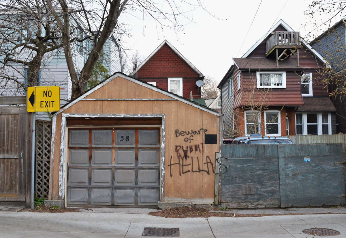
below: Beware of rabbit.
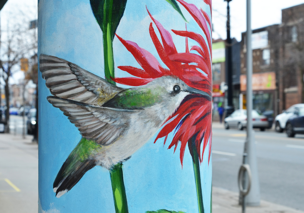
below: A hummingbird is painted on the pillar.
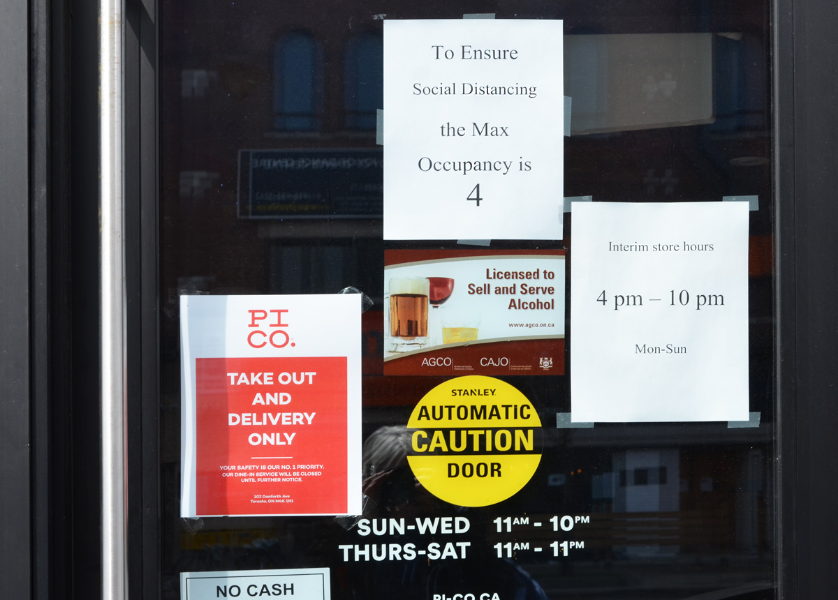
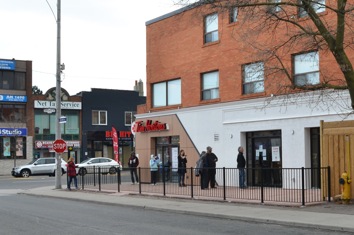
below: Takeout with distancing – a story that is repeated all over the city as restaurants try to stay afloat.
below: Social distancing leads to line ups outside Tims
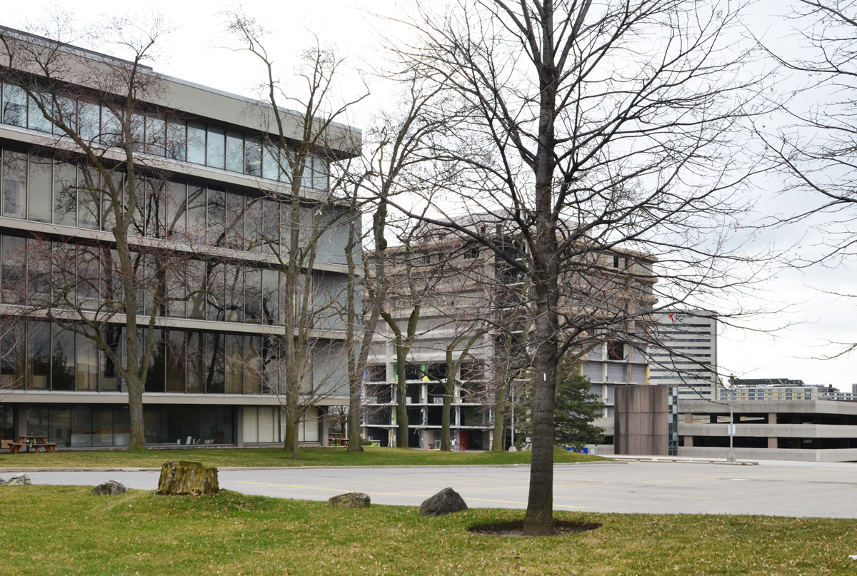
I’ve been keeping an eye on the old IBM building at the corner of Don Mills and Eglinton. It was built in 1951 as IBM’s Canadian manufacturing plant and head office.
It’s been empty for a long time but recently work has begun on the site.
The IBM complex sits on 60 acres and the whole site will be redeveloped in the coming months. The white tower in the background is also on the site, right beside the CPR tracks that mark the northern boundary.
below: A Canada goose struts near one of the entrances to the old IBM building that is being demolished.
below: Apparently the plan is to build a mix of residential and commercial buildings on the site ranging from 3 to 44 storeys. A new community centre and park are also included in the planned Crosstown Community.
In terms of construction and development, this intersection is very busy as it is also the location of the future Science Centre LRT station. It has been a mess for so long that I can’t remember how long it’s been. There are signs of progress starting to emerge from the chaos so perhaps there is hope for a 2021 opening of the Crosstown LRT.
below: The new bus bays on the northeast corner are starting to take shape.
below: More of the NE corner.
below: Looking across Eglinton towards the Mormon church and other buildings on the south east corner.
below: A sign of the times. Covid-19 dos and don’ts.
below: New tracks being laid where the LRT comes back to the surface east of Don Mills Road (looking east towards the DVP). The Science Centre station is underground even though the tracks on both the east and west side are above ground.
below: From the NE corner (black building is/was the Ontario Federation of Labour) looking south. All buildings are on the east side of Don Mills Road.
below: A sidewalk, temporary, lined with cones, along Eglinton.
There are other buildings being torn down. The building in the background is 1200 Eglinton Ave East. It was an office building with a parking structure beside it. This is the view from Wynford Drive.
The same building a few days later when I went back to check on the demolition’s progress. The parking structure is now just piles of rubble and more of the exterior walls of the other building are gone.
below: The large, almost empty, parking lot behind the Bell building on Wynford.
below: With a few exceptions, most of the buildings around Wynford are products of the 1960s and 1970s.
below: Another empty parking lot. This picture was taken on a Saturday afternoon which might explain the lack of cars but as I drive around the city I see lots of empty parking lots even during the work week. A sign of the times.
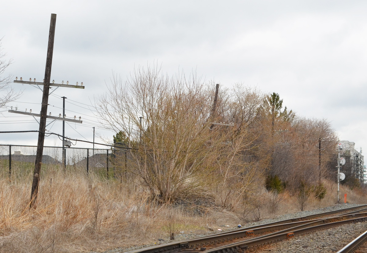
below: Looking across the Don Valley Parkway
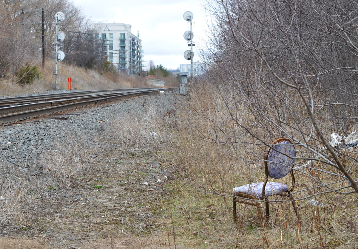
below: CPR tracks behind Wynford.
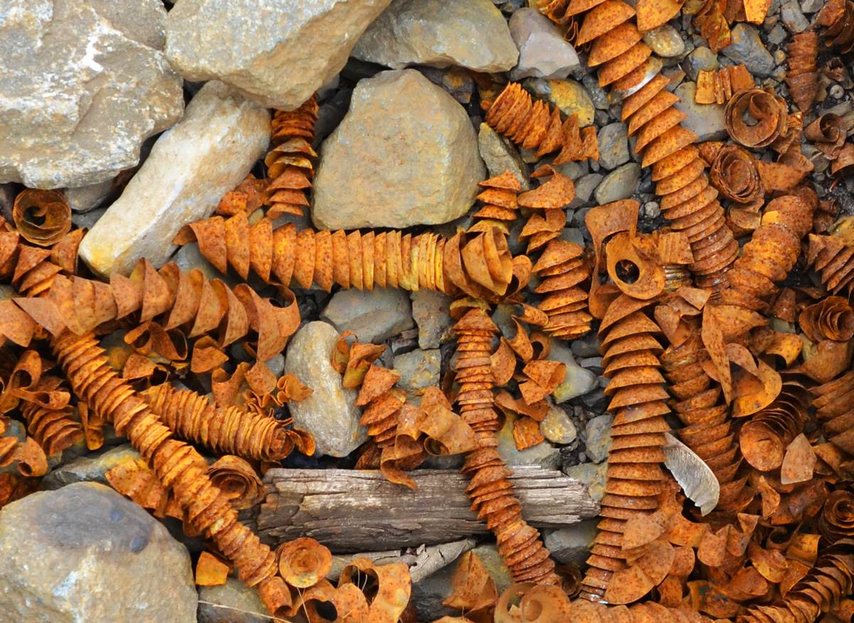
below: Rusty metal spirals, tightly wound, found amongst the gravel along the train tracks.
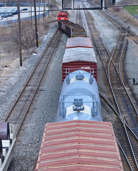
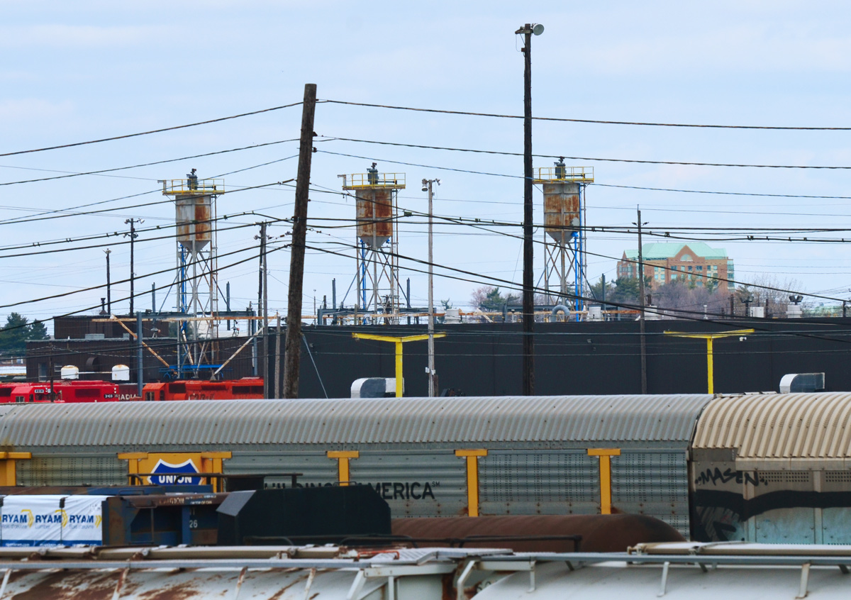
below: Looking east along the tracks just before they cross the DVP. If you follow the tracks, they lead you to the CPR marshaling yard at McCowan and Sheppard. So, that’s where I went next…. (scroll down!)
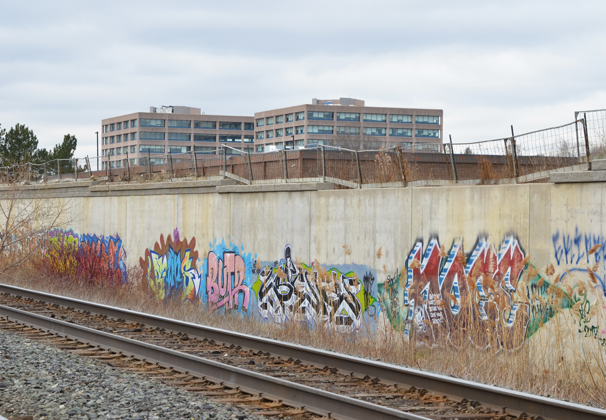
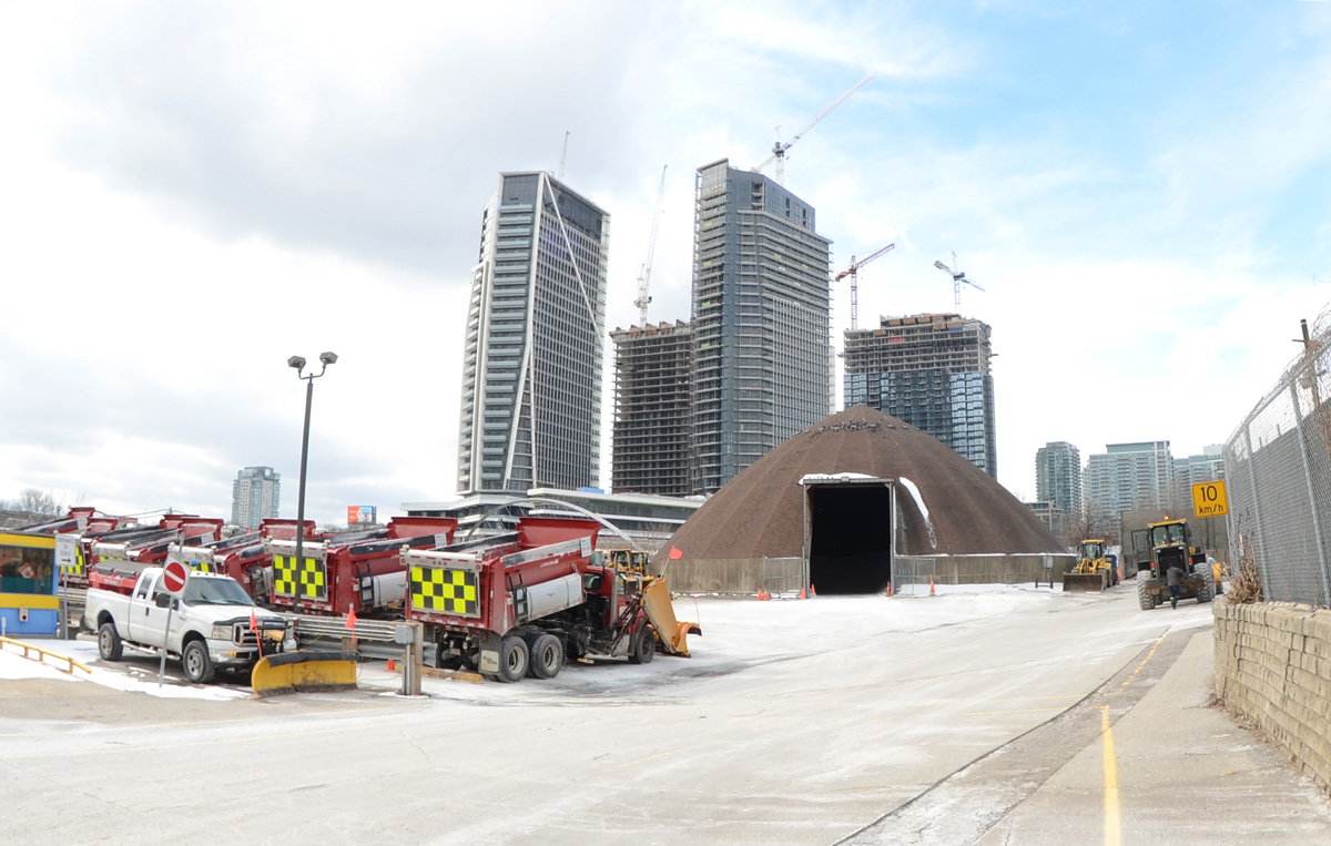
It’s easy to view railway tracks from bridges, in this case from a bridge on Finch Avenue East between Markham Road and McCowan. The is CPR Toronto Yard.
It is a marshaling yard, also known as a classification yard, which is where railway cars are separated onto one of several tracks and joined with other cars with the same destination.
Sitting on over 400 acres, CPR’s yard in Scarborough is one of the largest in Canada. There are 311 switches and about 140km of track on which freight cars are shunted between tracks. The site was opened in 1964.
…but getting to track level can be more of a challenge.
below: It sometimes involves getting lost and having a chat with a security guard or two (but not until after you have a few good wall & shadow pictures)
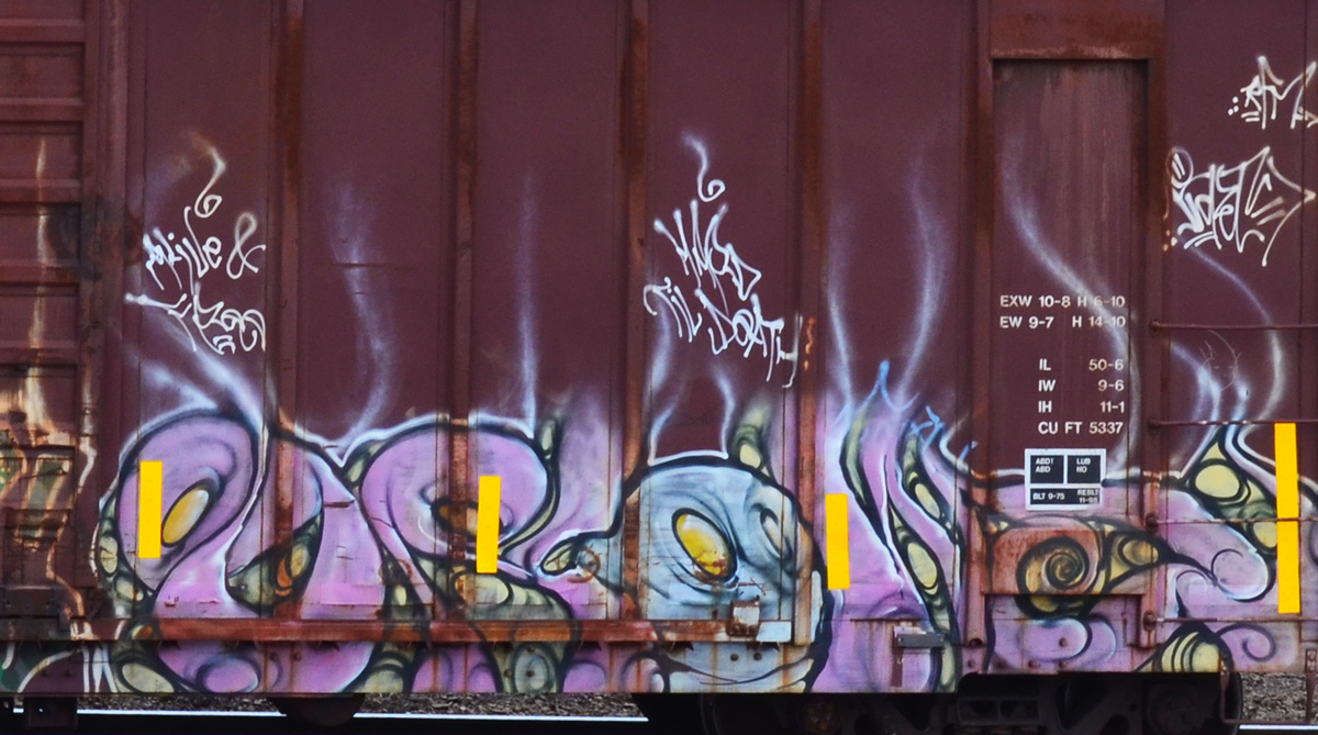
below: In other places, access is simple.
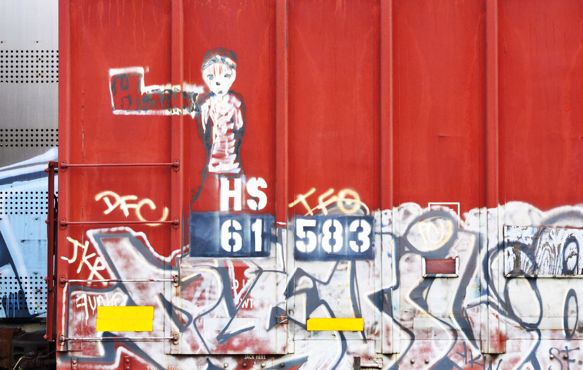
below: I’ve never thought too much about graffiti on trains until today – How many miles has this little guy traveled? Where did he come from and who painted him when? How many people have seen him as he shuttles back and forth across the country (or perhaps farther than that?)?
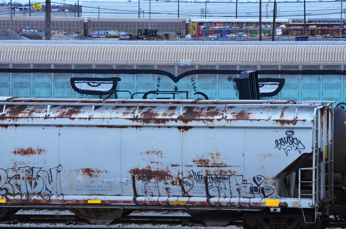
below: Looking right back at you!
below: A westbound train leaves the yard at McCowan Road.
below: Back in 1964 the community of Browns Corners was at the corner of Finch Avenue East and Markham Road(not to be confused with the other Browns Corners on Woodbine Ave and Hwy 7). There are no more traces of the community or the farms that surrounded it.
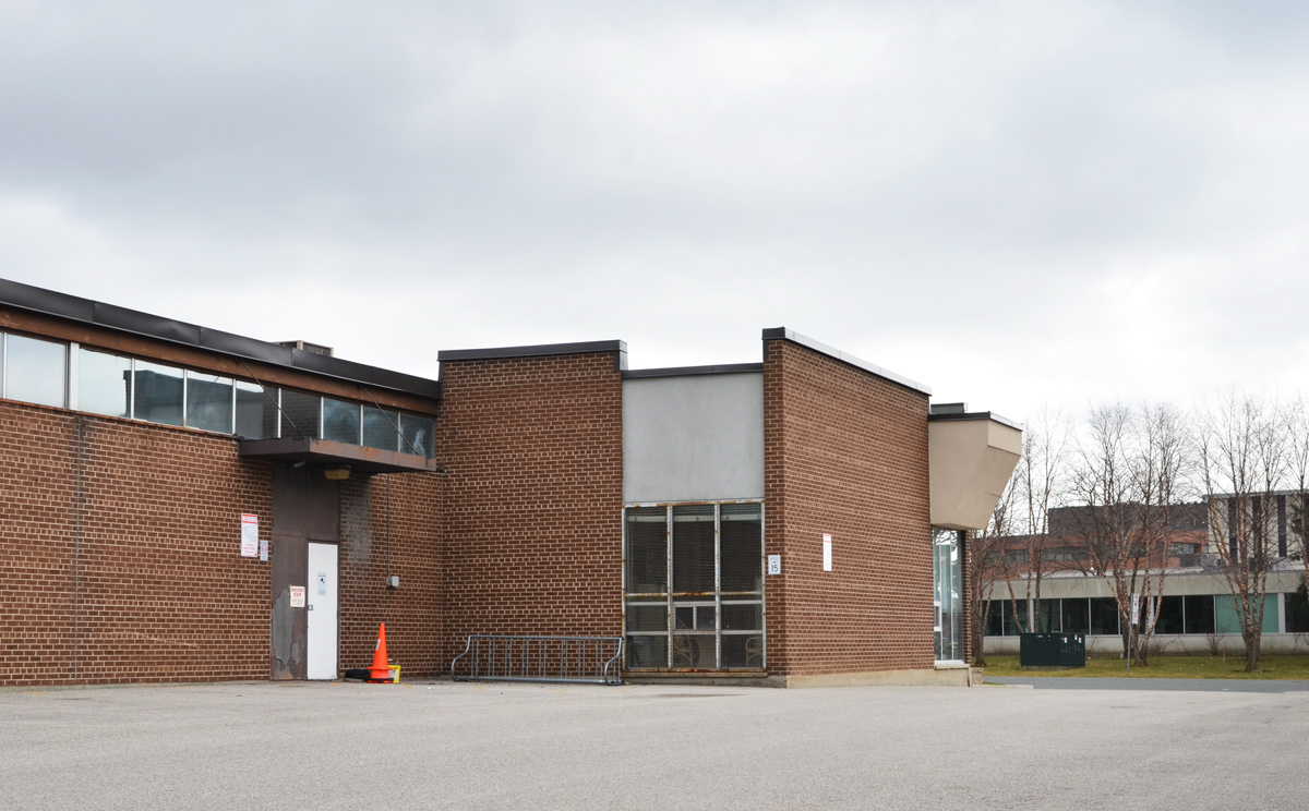
I only walked around part of the yard and I didn`t take very many pictures of the buildings that are there – seniors residence, medical clinic, a few offices, etc.
I would like to end this blog post with one building that I saw that was different.
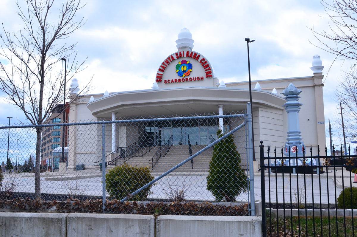
below: The Sri Sathya Sai Baba Centre is nearby. I think that I have it right – the Sathya Sai Organization is not a religion but a “universal approach to life” whose teacher and spiritual leader is Sathya Sai Baba. Each of the five petals in the flower contain a word or phrase: truth, right conduct, peace, non violence, and love.
below: There was a column-like structure near the door topped with a large lotus flower. The base was square and on each were printed words. “Offer all bitterness in the sacred Fire and emerge grand, great and Godly.”
below: “Remember the wheel of Cause and Consequence of Deed and Destiny and the Wheel of Dharma that rights them all”. I assume that the other two sides also had inscriptions but I couldn’t see them because of a fence with a locked gate.
Back on McCowan and back home… (still no TTC in my life)
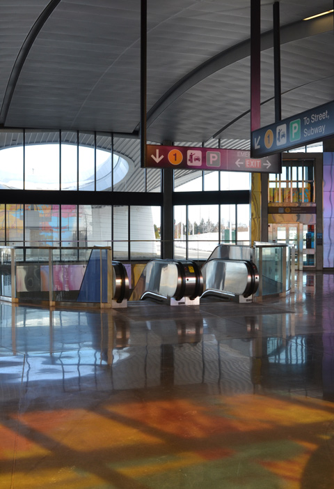
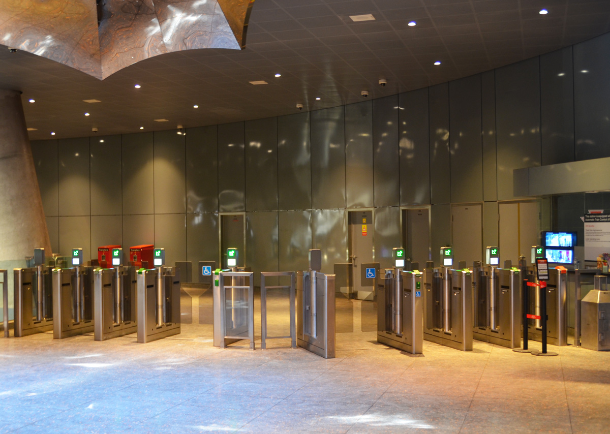
We all need some light and colour these days. So I went through old files and found these colourful pictures of the newest TTC subway stations that I took back in February, on Family Day actually. It seems like a long time ago!
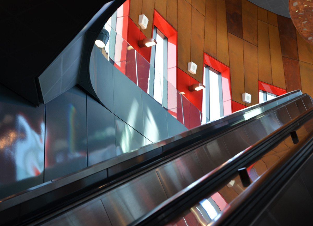
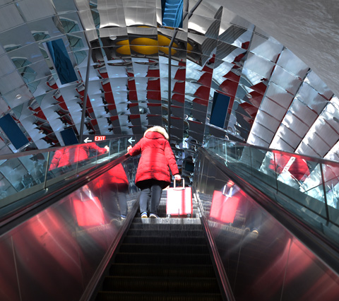
below: Escalators, Pioneer Village subway station
below: From the outside looking in, Pioneer Village station
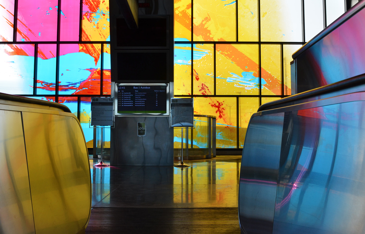
below: Hwy 407 station. Artwork by David Pearl.
below: The pinks, yellows, and blues from the coloured windows shine and bounce off surfaces
below: Little lights dance around the ceiling and upper part of the walls. This effect is caused by the artwork in the ceiling – a circular opening that you can just see in the upper left corner.
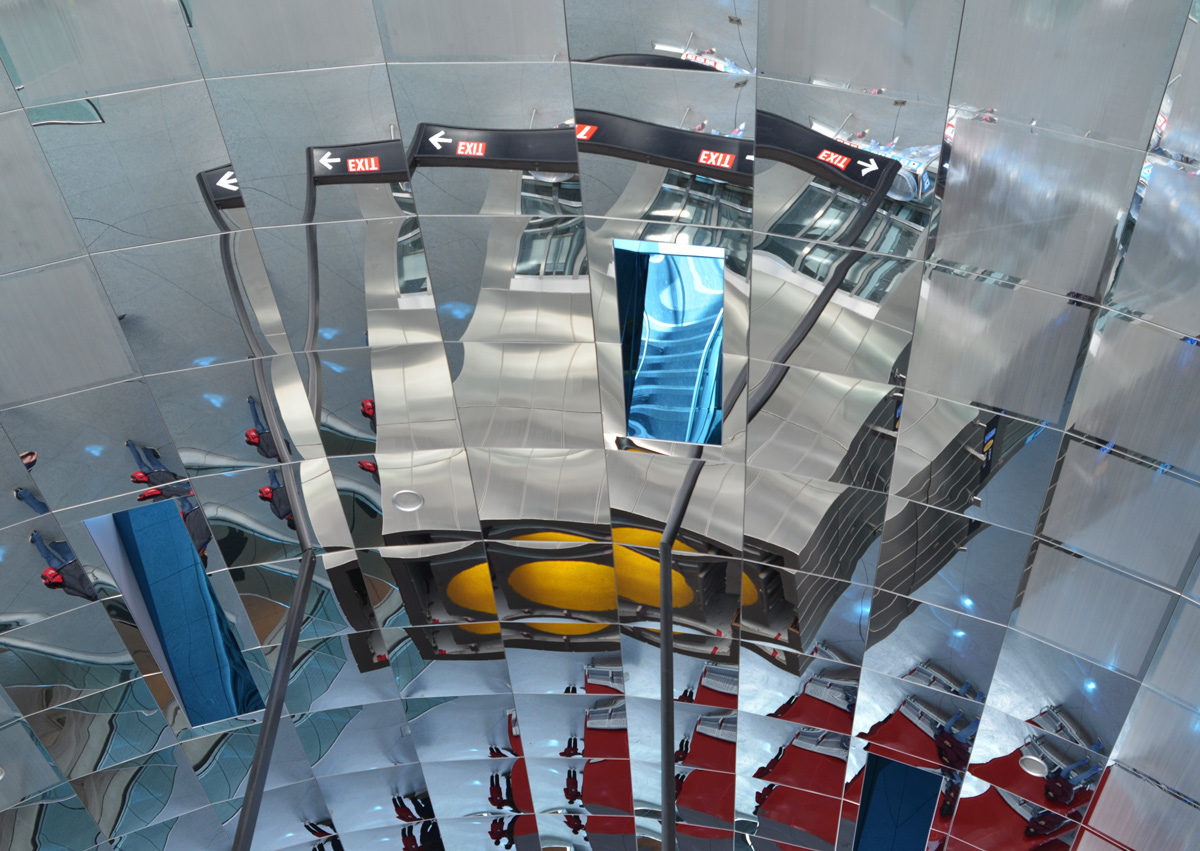
below: Looking straight up into the skylight with it’s many-sided walls that are covered with reflective material.
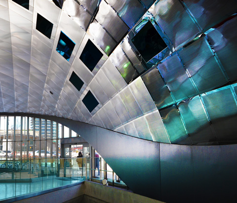
below: ‘Atmospheric Lens’ by Paul Raff Studio is the artwork that is incorporated into the roof of the station. It features skylights and reflective panels. Vaughan station.
below: Curved, reflective ceiling, Vaughan station
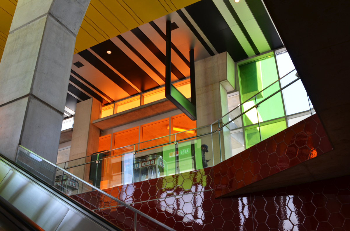
below: Finch West station with its very shiny red hexagonal wall tiles and coloured panes of glass.
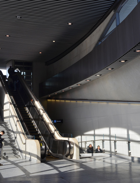
below: No colours at York University station, but lots of windows and lots of natural light.
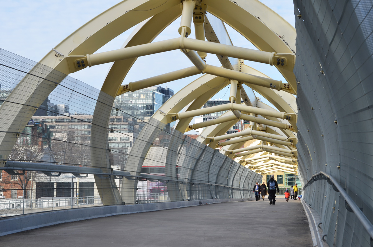
Garrison Crossing is actually two stainless steel bridges, both over railway tracks. Both have spans of close to 50m. In the middle is a peninsula of land that is in the process of being developed into condos and a park. Almost 20 years ago there was a proposal to build a bridge here – to be opened in 2012 for the anniversary of the War of 1812. Mayor Rob Ford was opposed to it (too much money) and the plans were shelved. A change of mayor (and some help from developers) and a change of plan again. Construction began in 2016. It provides a much needed link between the two sides of the railway lands.
below: Southern span – walking north from Fort York
below: City view from the new park in the middle, train tracks (difficult to see in this picture) on two sides of the triangle.
below: Yellow construction fences still line the edge of the path through the middle section between the bridges.
below: People crossing the northern portion of Garrison Crossing (looking south).
below: Looking northwest from the second span of Garrison Crossing towards Strachan Avenue and beyond.
below: Garrison Crossing ends at Wellington Street close to Stanley Park
below: Found – one city snowplow parking lot, between the railway tracks and Wellington Street (at the end of Walnut Ave).
below: Immediately to the east of the snowplows is the old brick building. It has its own access road from Wellington including a bridge with three arches. The road is overgrown and blocked by a fence. There is no sign by the road.
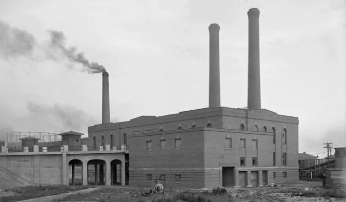
below: It took some time on google but I finally found the answer to the building above. Here it is in 1925, the year that it was built – the Wellington Destructor. It was used until the 1970s when burning garbage was banned; it has been a heritage building since 2005. I found the photo online on a CBC News webpage where there a great description of the building and its history, along with some pictures of the interior.
below: And that brings us back to the Bathurst Street bridge over the railway tracks on the south side of Front Street. Did you know that it’s officially called the Sir Isaac Brock Bridge? It spent most of its life as the Bathurst Street Bridge until 2007 when it was renamed.
below: It is a steel truss bridge that was built in 1903 (one of the oldest bridges in the city). It’s first life was a railway bridge over the Humber Bridge but in 1916 it was disassembled, moved to Bathurst, and reassembled.
below: Bathurst bridge, 1919, from the west (Lake Ontario is on the right hand side).
The view from the Municipal Abbatoir Building, looking southeast. The building with the water tower on top is the Matthews Blackwell meat packing company. On the left, you can see part of the cylindrical tower belonging to Consumers Gas Company
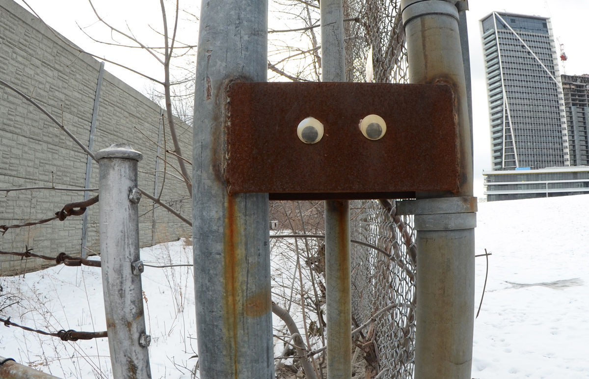
below: Someone has given this rusty guy some eyes! He too is watching out for interesting stories. He’s also thankful that you made it this far! At least he can’t roll his eyes!
Walking up Yonge Street without actually walking on Yonge Street…. with all it’s distractions and wrong turns. We eventually get somewhere and that somewhere may actually be where we want to be!
below: I didn’t know that such a place existed! It’s at Davenport and Belmont in case you feel the need….
below: I smiled even more when I went around the corner and encountered this sign
below: Toronto layers
below: The old stone stairs at Ramsden Park. A bit muddy at the bottom but that never stopped me.
below: Waiting for spring… or at least for some snow to melt.
below: An after school skate.
below: Old and new – exploring the lanes that run parallel to Yonge. This is Paul Hahn Lane.
below: Trespassers will be prosecuted. If you can’t read the sign, does it still count?
below: As you go north, Paul Hahn Lane becomes Sam Tile Lane.
below: The caterpillar isn’t where it was. Is this an Alice’s Adventures in Wonderland reference? Actually it’s a children’s clothing store but that doesn’t stop my from quoting Lewis Carroll, or at least a short passage. Alice’s interaction with the caterpillar is too long to include here!
“In a minute or two the Caterpillar took the hookah out of its mouth and yawned once or twice, and shook itself. Then it got down off the mushroom, and crawled away in the grass, merely remarking as it went, ‘One side will make you grow taller, and the other side will make you grow shorter.’ ‘One side of what? The other side of what?’ thought Alice to herself. ‘Of the mushroom,’ said the Caterpillar, just as if she had asked it aloud; and in another moment it was out of sight.”
below: At Summerhill there is no way to parallel Yonge because of the train tracks. A shout out to this young man who just previous to this moment stopped to ask me if I’d taken some great photos today. I answered that it was a bit grey to get great pictures and he concurred.
below: Infrequently photographed (the daring architecture!) and not well known, this is Summerhill subway station. It has no bus connections and the only major destination nearby is the large LCBO in the old CPR station a block away (i.e. not many people use this station).
below: Something old ans something new. I was wondering if the slate tiles on the upper storey were originals when I noticed the unobtrusive addition to the white and black house.
below: Looking south towards Rosedale station (view blocked by the white and blue temporary building for the construction next to the bridge). Tall downtown buildings in the distance. The tallest one is at 1 Bloor East and it is partially hidden by the Hudson Bay Centre tower on the other side of Bloor Street (the squarish building) and another tower that I am not sure of.
below: Another of the many “it’s a street, no it’s an alley”, passages that you find in Toronto.
below: The rust and metal of an alley infill house
below: In an area of smaller narrow houses on small lots, some creativity is required if you want to expand.
below: A concrete lined hole in the ground with access from the alley but also from the street? The beginnings of a larger development?
below: Along the way I happened upon the Toronto Lawn Tennis Club in its winter plumage.
below: Foiled! I was going to walk up through and David Balfour Park but the path is blocked… so back to Yonge Street I’m afraid.
below: He looks about as happy as I felt at that moment… but at least my arm is still intact.
below: Once on Yonge Street I discovered that traffic is even worse than usual because of lane closures. Water main repairs and/or replacements by the looks of it.
below: This is now close to St. Clair Ave and a subway station so this is where I called it quits. The days are still short and although the temperatures aren’t too bad, a cup of coffee seemed like a great idea at that moment (see the Aroma sign in the upper right corner? It was calling my name).
below: Someone doesn’t seem to mind being in traffic!
Stay positive & enjoy the trip, you’ll get there!
Oh, by the way, the photos may not be anything special (the grey day and all that) but I still had fun with them.