Archive for the ‘old buildings’ Category

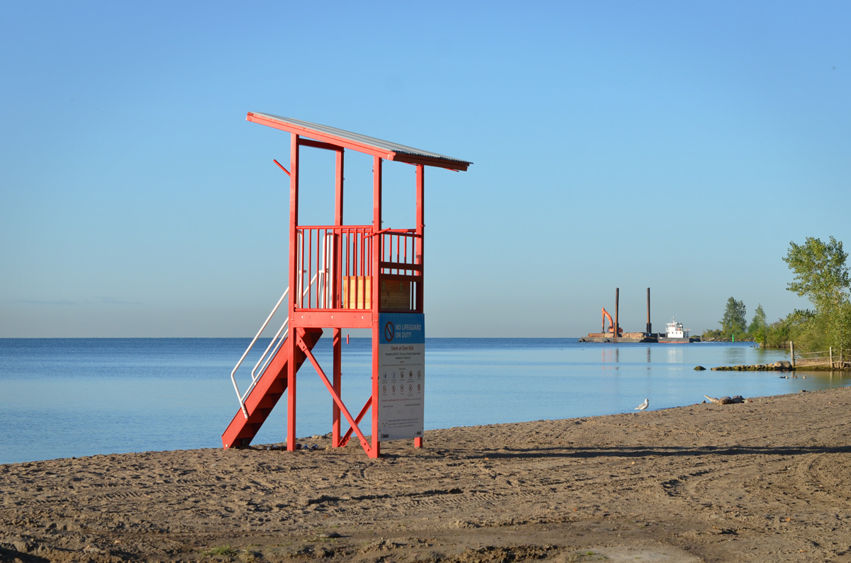
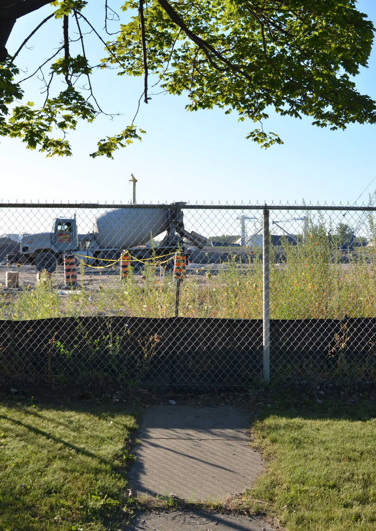
The general idea yesterday afternoon was to walk Oakwood, southbound from St. Clair.  What I didn’t expect when I left my cosy apartment was a strong cold wind,  so part of the adventure was dictated by which direction the wind was blowing and how to avoid it (if possible!).  If some of these photos look a little blurry, it’s because of the snow that was falling all afternoon.

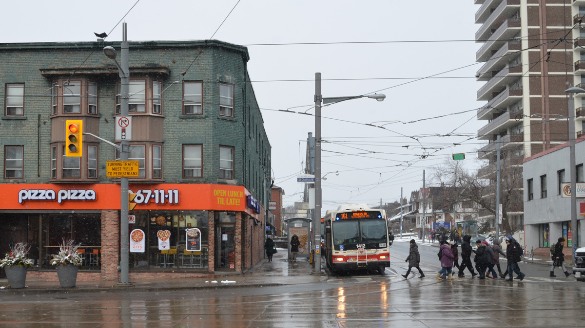
below: Pizza Pizza on the northwest corner of St. Clair and Oakwood.

NW intersection of St. Clair and Oakwood with a bus at a bus stop and a pizza pizza restaurant

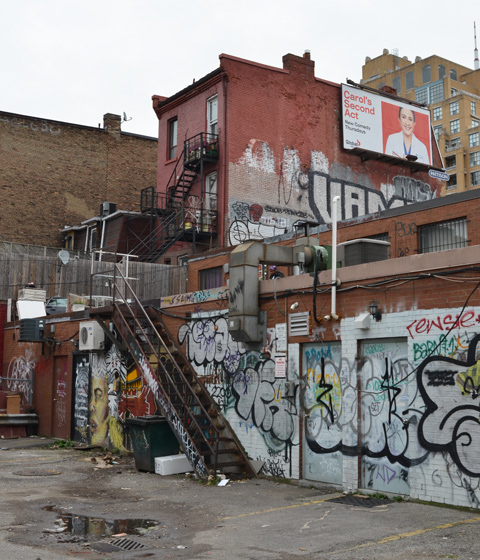
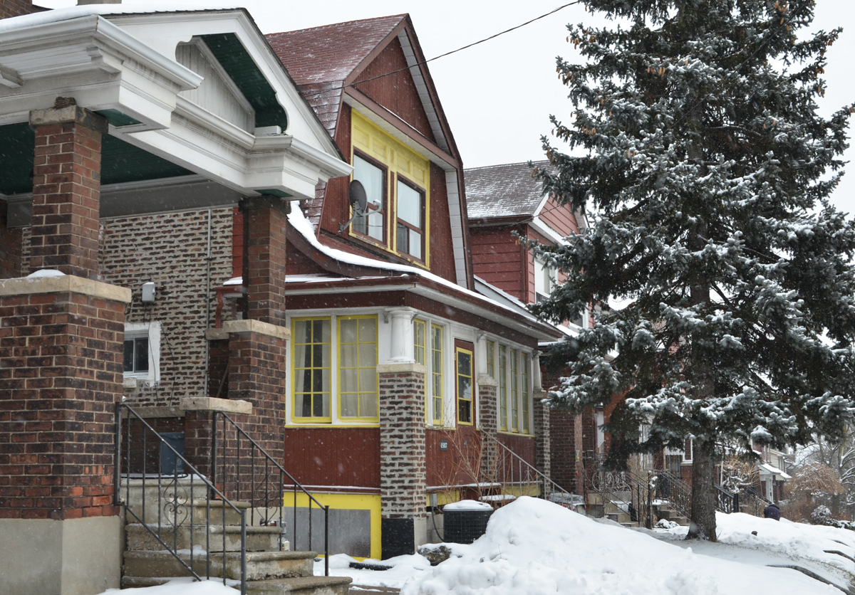
below: I hadn’t gone far when I found a lane so of course I had to follow it…  Looking back towards Oakwood Collegiate.

looking down a lane that runs parallel to St. Clair West, with Oakwood Collegiate in the background.

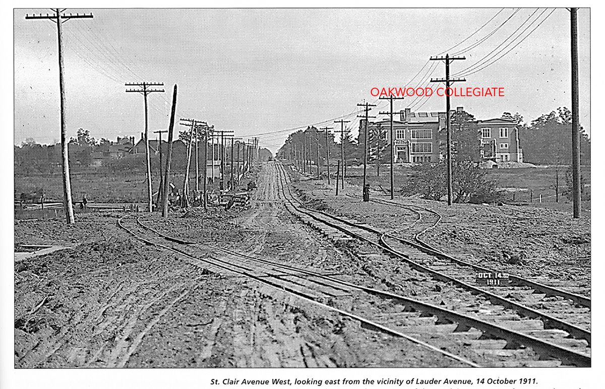
below: Old black and white photo of St. Clair Ave from 1911 just after construction of Oakwood Collegiate was complete.  Oakwood Avenue is now on the other side of the school in this photo.  It is interesting to note that St. Clair had streetcar tracks back in 1911 but was still a dirt road.  Apparently the city started building these tracks when the school was open – the St. Clair streetcar line was open in 1913.   I found this photo in Living Toronto – follow the link if you want to read more about the history of this school.

vintage black and white picture of Oakwood Collegiate from 1911 when St. Clair was a dirt road

icicles along the edges of garage roofs in the backyards of two adjacent houses, view from the alley looking over the gate

in an alley, beside an orange concrete block garage, a wooden staircase leads to an upper floor, covered with snow

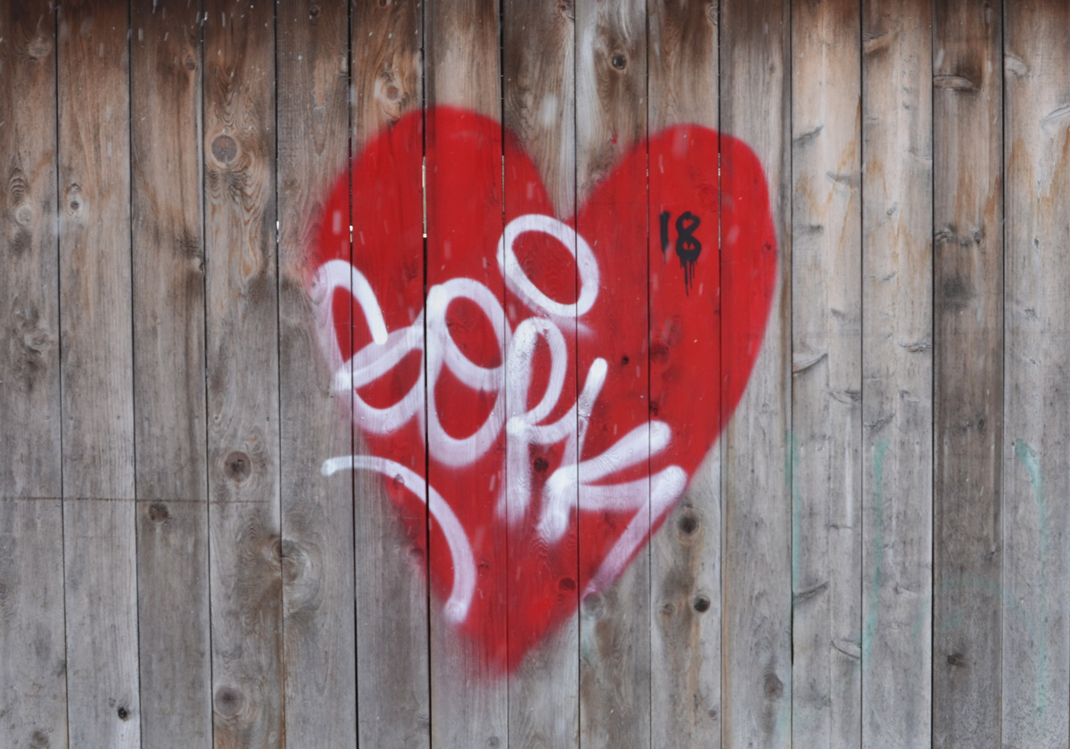
below: And that is where I spotted this man with a little red heart…

rough painting on a garage door of a man's face with a small red heart beside it

below: … and across the alley from him was this woman, also with another little red heart. It’s Valentines Day today, how sweet and how appropriate.

on a brick wall, a drawing of a woman's face with the eyes being the most prominent, a small red heart beside her face

below: The hearts just kept on coming.  I’d only walked a few minutes and already I had enough for a Valentines Day post! 🙂

graffiti, red heart on a wood fence

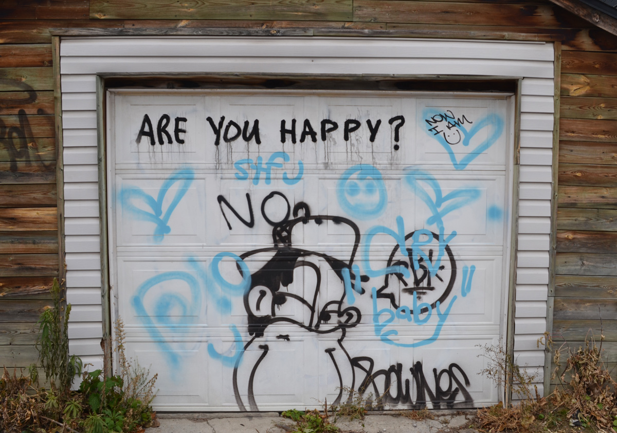
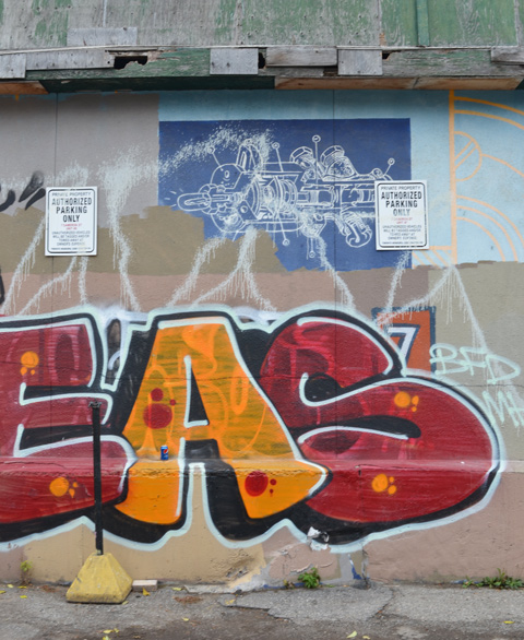
below: At the end of the lane I spotted this too…. can you see the LOVE?  It looks like it’s written in the middle of the pink and blue graffiti but it’s actually on the metal vent.

looking towards the side of a pinkish building, with graffiti higher up, over the level of the 2 storey buildings beside the pink one

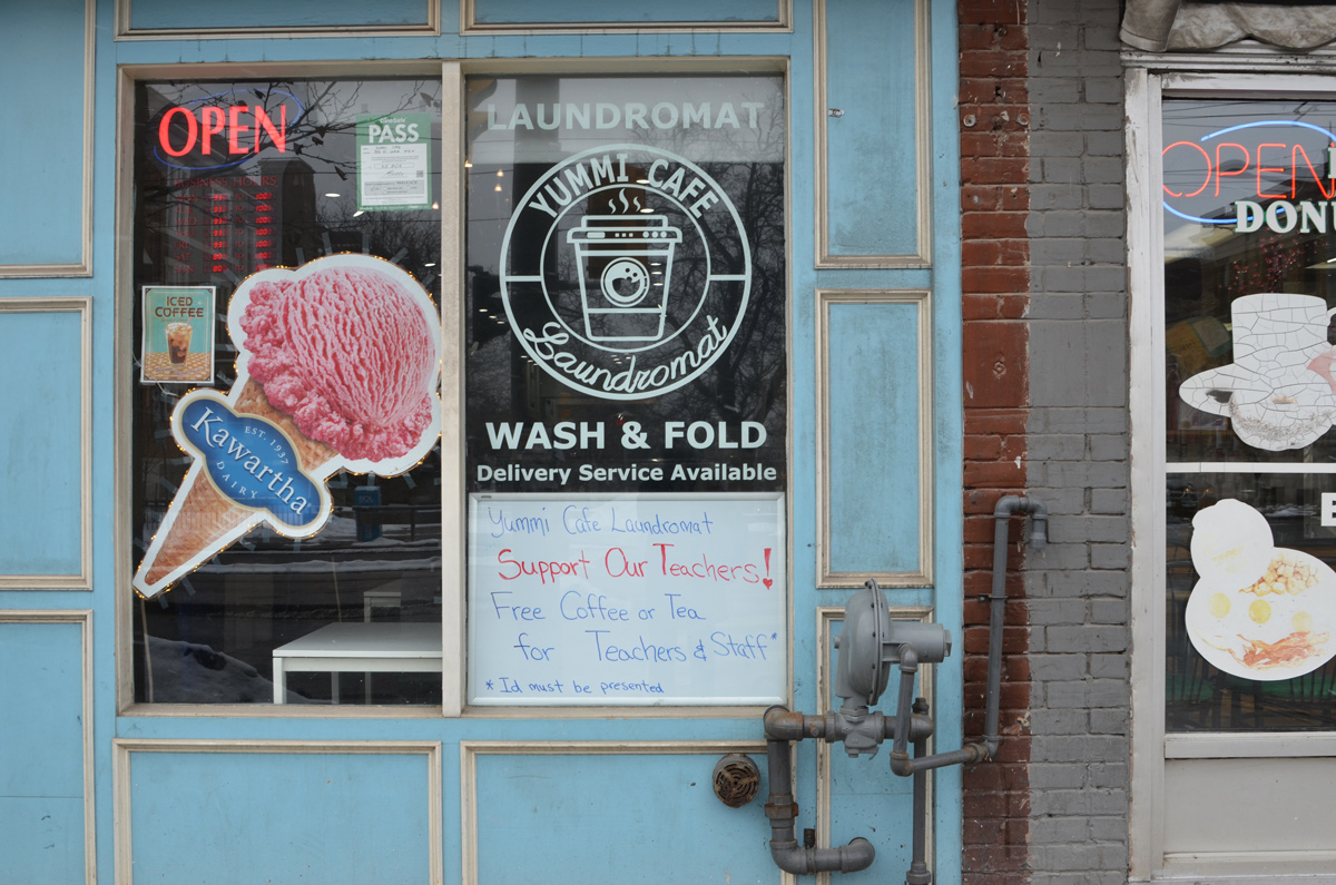
below: So much for walking down Oakwood.   I circled back to St. Clair West where I saw the Yummi Cafe & Laundromat with it’s hand written sign in the window.  Support Our Teachers!  These are trying days for education in Ontario as the teachers lock horns with Doug Ford and his Conservatives who speak first and think later.

storefront, yummi cafe and laundromat, picture of pink ice cream cone as an ad for Kawartha Dairy, also a sign that says support your teachers, offering them free coffee

a bike with a flat front tire is locked to a street sign pole on the sidewalk on St. Clair west

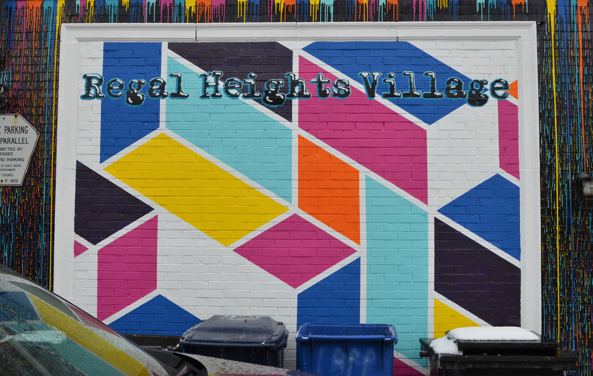
below: This is middle section of the Royal Heights village mural painted by Murals by Marg in 2019.  It is on the side of 1006 St. CLair West (at Appleton Ave).

middle part of the Regal Heights mural, geometric shapes in bright colours

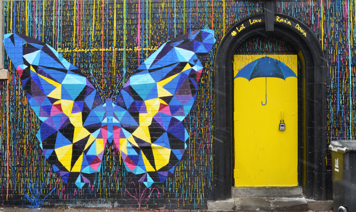
below: To the right is a small butterfly, child height.  Choose to be kind.

a butterfly in a colourful mural with the wods choose to be kind written above it

below: The left side has a larger butterfly as well as a bright yellow door with a blue umbrella.  Let love rain down!

a multi coloured butterfly, mostly blue and yellow, made of geometric shapes, in a mural beside a yellow door with a blue umbrella painted on it

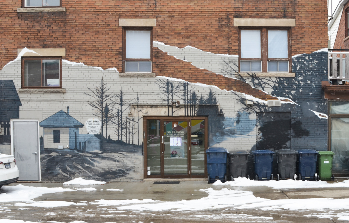
below: Right across the street (on the northeast corner of Appleton & St. Clair) is this mural.  I haven’t been able to find out who the artist was.

mural in blues and greys on the side of a brown brick building, an outdoor winter scene

TTC streetcar stop on St. Clair West, stores, traffic lights, and poeple waiting to cross the road

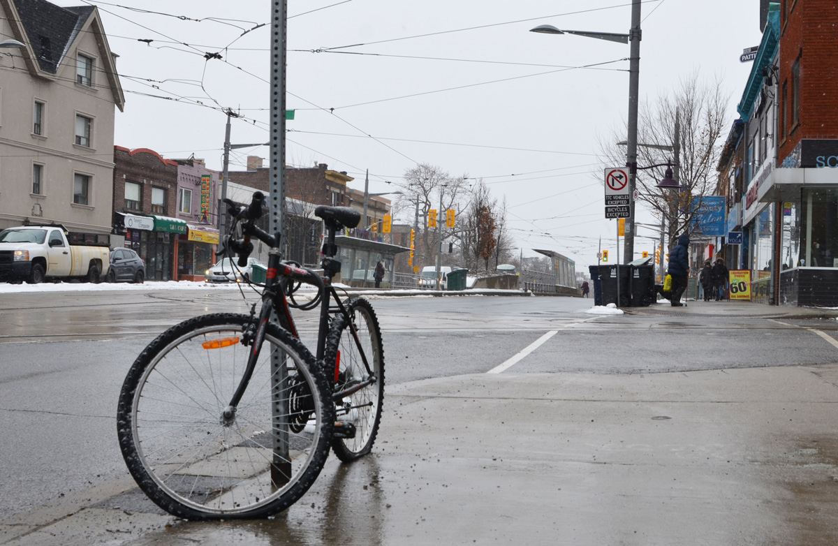
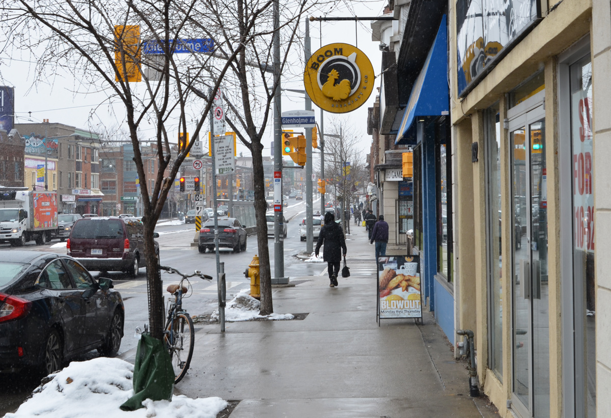
below: Looking west on St. Clair as you approach Glenholme.

looking west on St. Clair approaching Glenholme, people on sidewalk, traffic lights, Boom restaurant, other store fronts
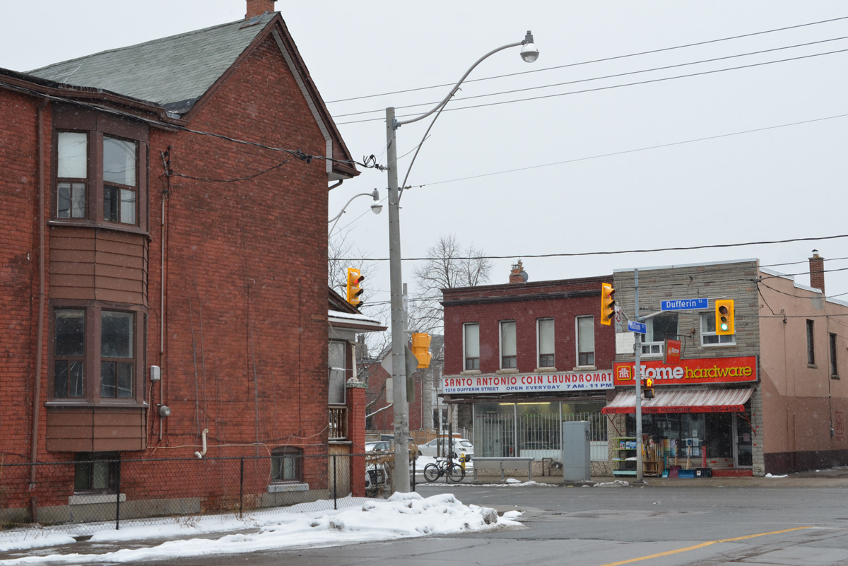
below: A coin laundry as well as Glenholme Variety on the southwest corner of St. Clair and Glenholme.

southwest corner of Glenholme and St. Clair with large 3 storey brick building housing GLenholme Variery store and a laundromat.

below: In front of 98 Glenholme is this little sculpture, an old fashioned sewing machine on a pole.  It marks the home of Marcello Tarantino Sartoria (tailor).

little metal sculpture of a sewing machine on a pole with a bit of green above it

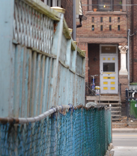
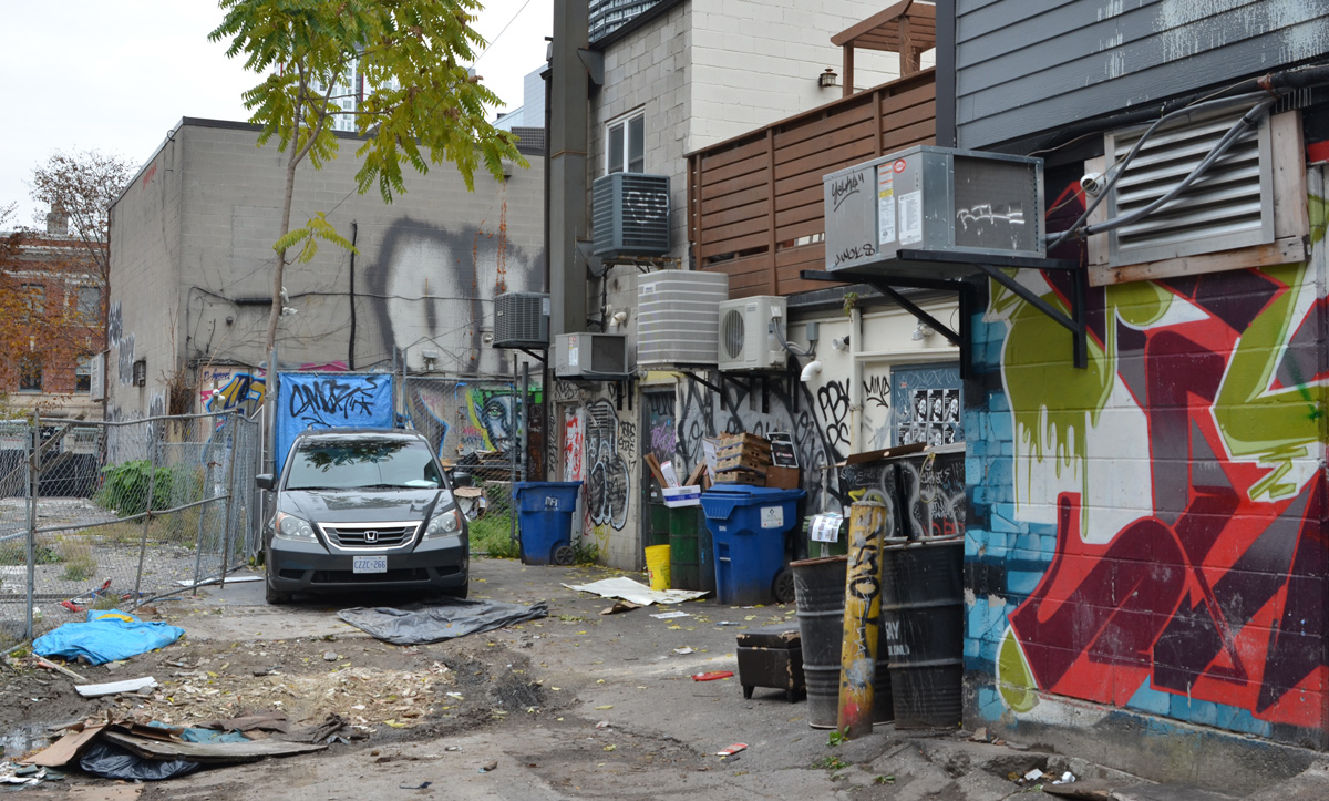
below: Another alley – the wind back here is not so bad!

old green Chevrolet delivry van parked in a snowy alley, also part of a mural with hearts on it, alley scene

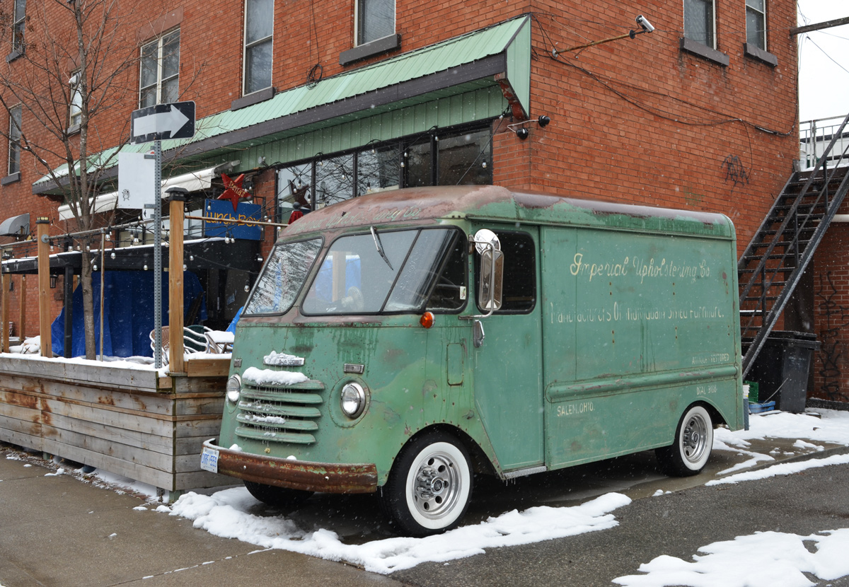
below: An old green Chevrolet delivery van with Imperial Upholstering Co written across the side and above the front window in faded letters. Also fading is the text: Manufacturers of Individual Style(?) Furniture

old green Chevrolet delivery van with Imperial Upholsteriing Co written in faded cursive writing on the side

laneway scene, snow, car, poles, trees, garages, part of a mural with hearts on it

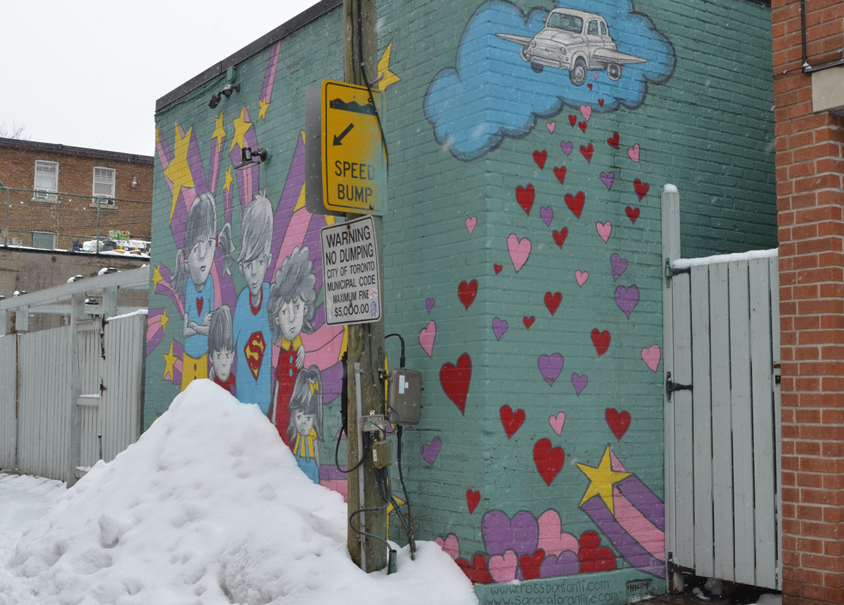
Mural by Ross Bonfanti and Sandra Tarantino with hearts, stars, a flying car and superhero kids.

mural by Bonfanti and Tarantino of superhero kids and los of pink and red hearts, a yellow star and a car with wings flying in a blue cloud

superhero kids mural

The alley ended at Dufferin and that is where I headed south.

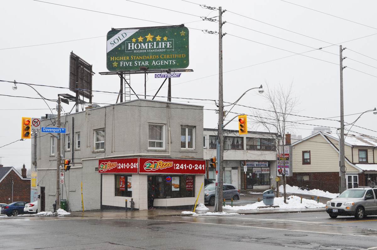
below: The southwest corner of Dufferin and Davenport

south west corner of Dufferin and Davenport, pizza restaurant with large billboard on the roof

below: A black and white photo from 1912 of the construction of Dufferin Street at Davenport.  This photo is originally from the City of Toronto archives but I found it online in an article on the history of Dufferin Street in blogTO.

1912 black and white photo of construction of Dufferin, cobblestones or bricks, at Davenport

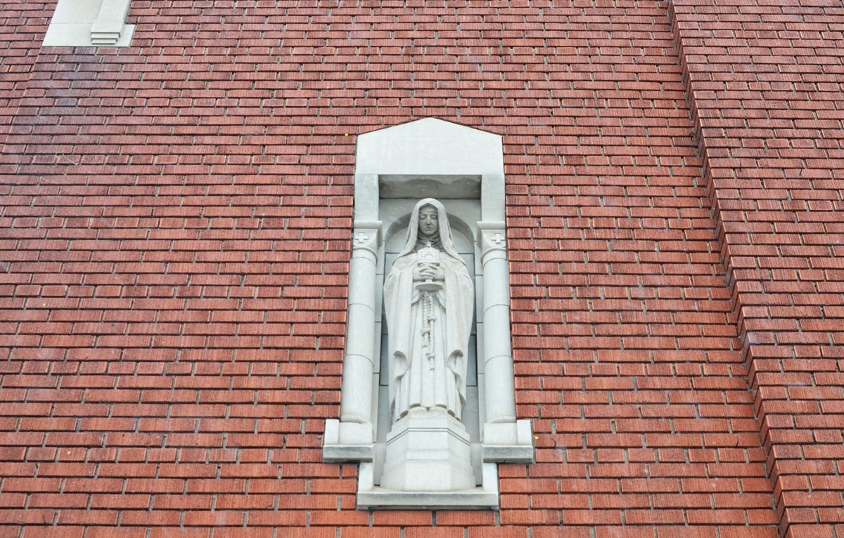
below: Mary looks down upon us, from a niche in the wall of St. Mary of the Angels church.

a small grey statue of Mary in a grey niche on the exterior of a brick church, St Mary of the Angels

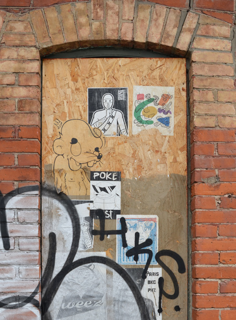
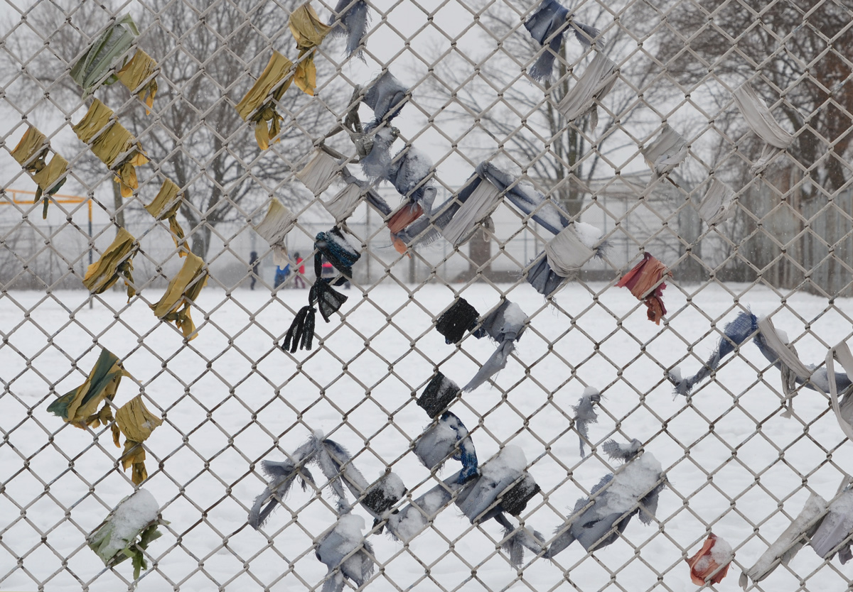
below: Remnants of an art project left to weather on a fence around a schoolyard.

remnants of fabric or paper that has been wrapped around parts of a chainlink fence at a school yard

below: A smiling happy mural on the side of a dental office on Dufferin Street painted by spudbomb (2017)

long mural by spud bomb of a woman smiling, holding a red apple with a bite out of it in one hand and a globe in the other hand. She is wearing a red and purple striped close fitting outfit over her arms and head. On the side of a dental office. The word smile is written many times in different fonts

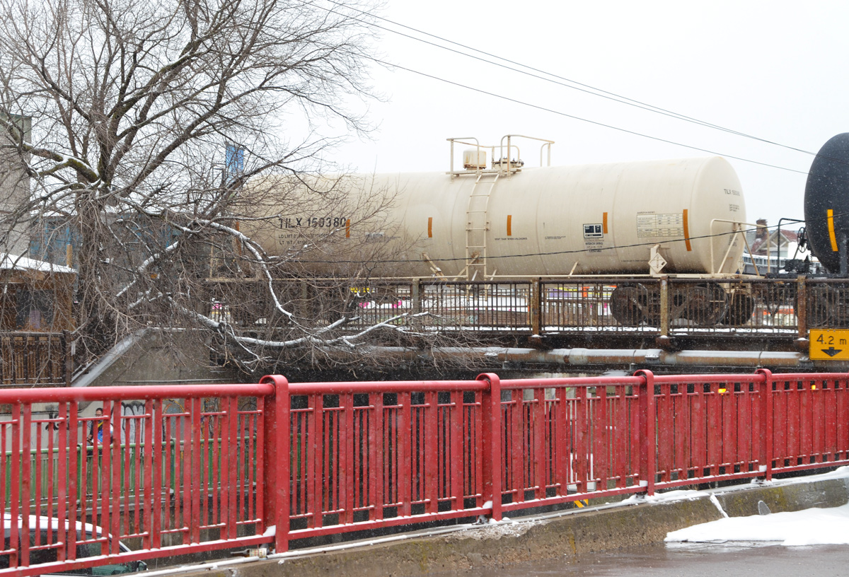
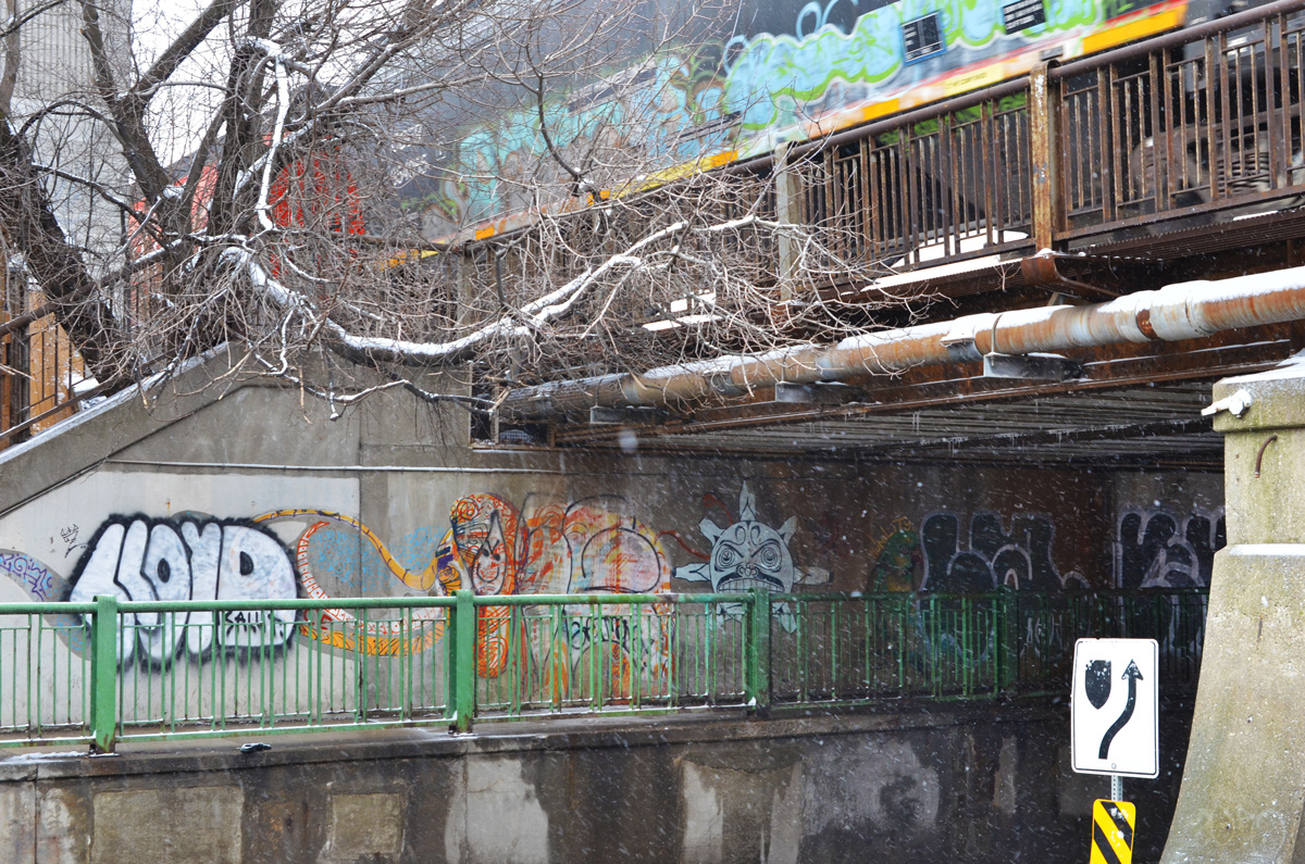
below: Just north of Dupont Street, the CPR tracks cross Dufferin.

a red railing separates a parking lot from a hill, in the background a white tanker railway car is passing over a bridge

train with grafiti on the side of the car passes over a bridge over Dufferin Street and there is graffiti on the walls of the underpass

graffiti on the side of a building by a small hill and some trees. The hill is part of the embannkment for the railway tracks

below: This strange pillar (artwork?) is on the southwest corner of Dufferin and Dupont.  It used to be the marker/sign for the stores in the Galleria plaza on that corner.  Everything there is under renovation at the moment so instead of tearing down the sign, it was converted into this.   Hence, “Love me till I’m me again”.

a sign that says Love me till I'm me again in red neon, on a column that has been spray painted in different colours, a neon red heart outline at the top, in a parking lot with cars passing by

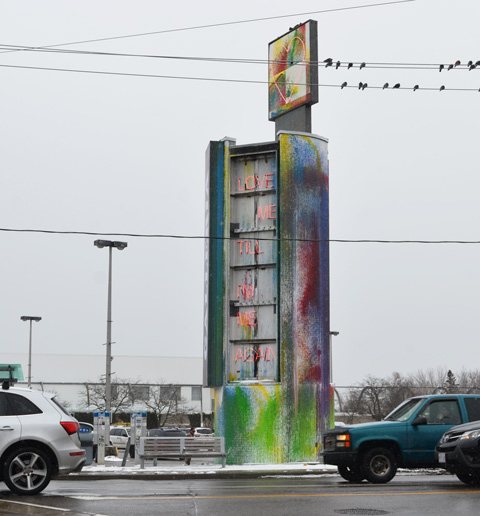
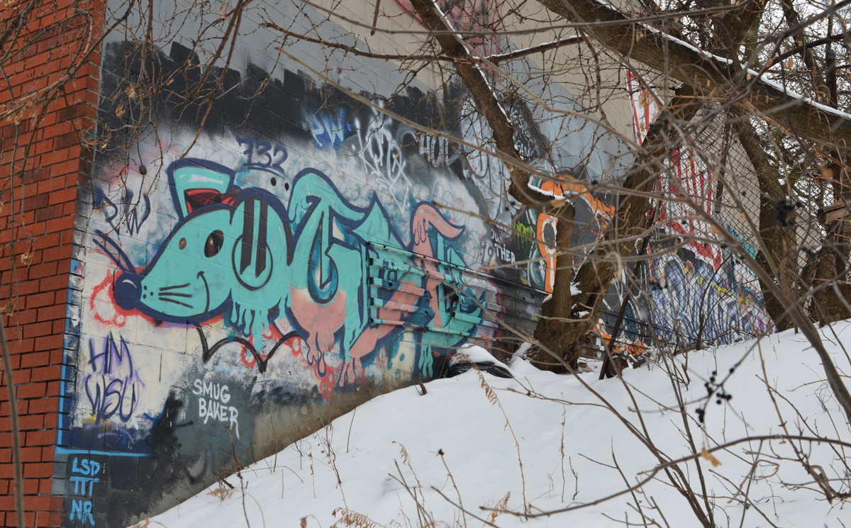
below: From a different angle – the neighbourhood wins no beauty contest.

looking west on Dupont at Dufferin, old Galleria sign, parking lot, traffic lights, plaza

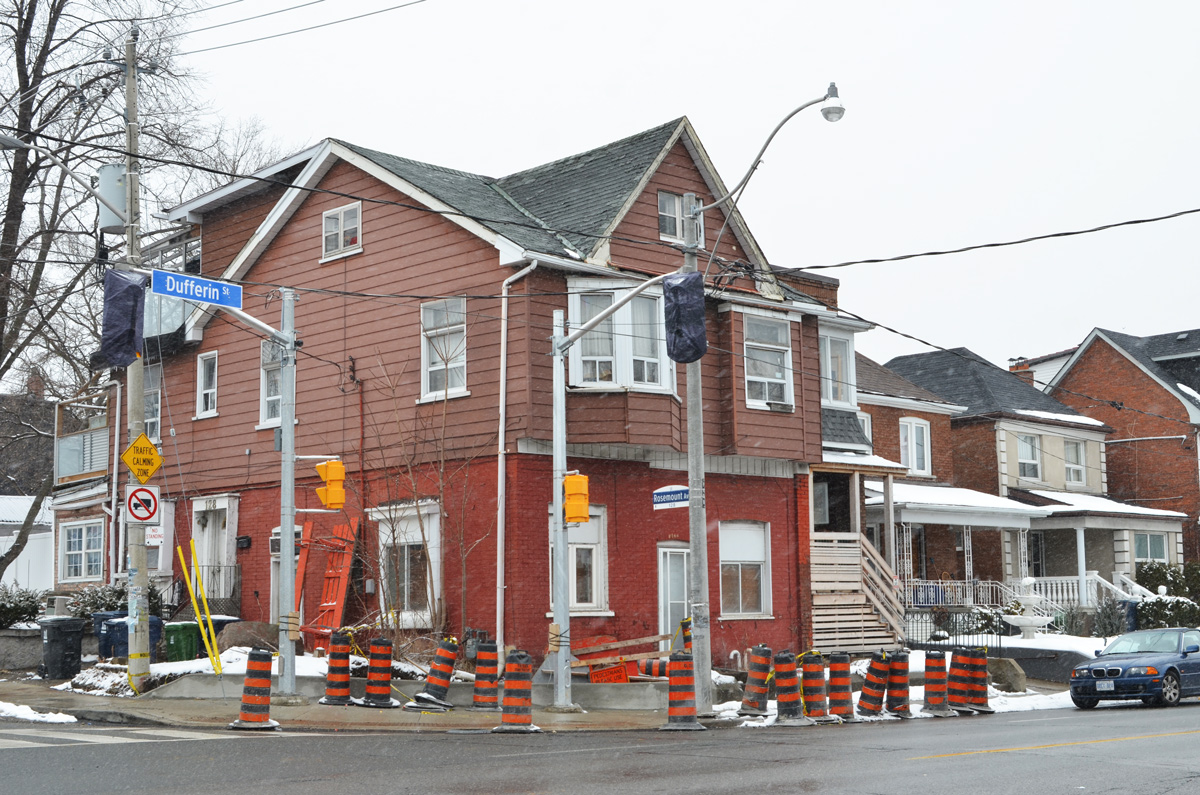
below: The architecture on Dufferin, both houses and stores, is a mishmash of styles (or non-styles!) that have evolved over the years.   The next few photos try to give you an idea of the variety.  First, at Dufferin & Rosemount

large house on the north west corner of Dufferin and Rosemount. Brick on the bottom, brown siding on the top, construction cones on the sidewalk around it

below: Dufferin & Hallam

house and stores on Dufferin street, including the San Antonio Coin laundromat and a Home hardware

chainlink fence with dead vines on it, snow, around the front of a brick house with broken railing on the porch

two storey barn style house, brick, with large pine tree in front yard

below: Dufferin & Auburn

intersection of dufferin and auburn streets, lowrise row houses with porch

side of a brick multi family residence, windows, white door, with a small white porch over the door, broke chair beside the door

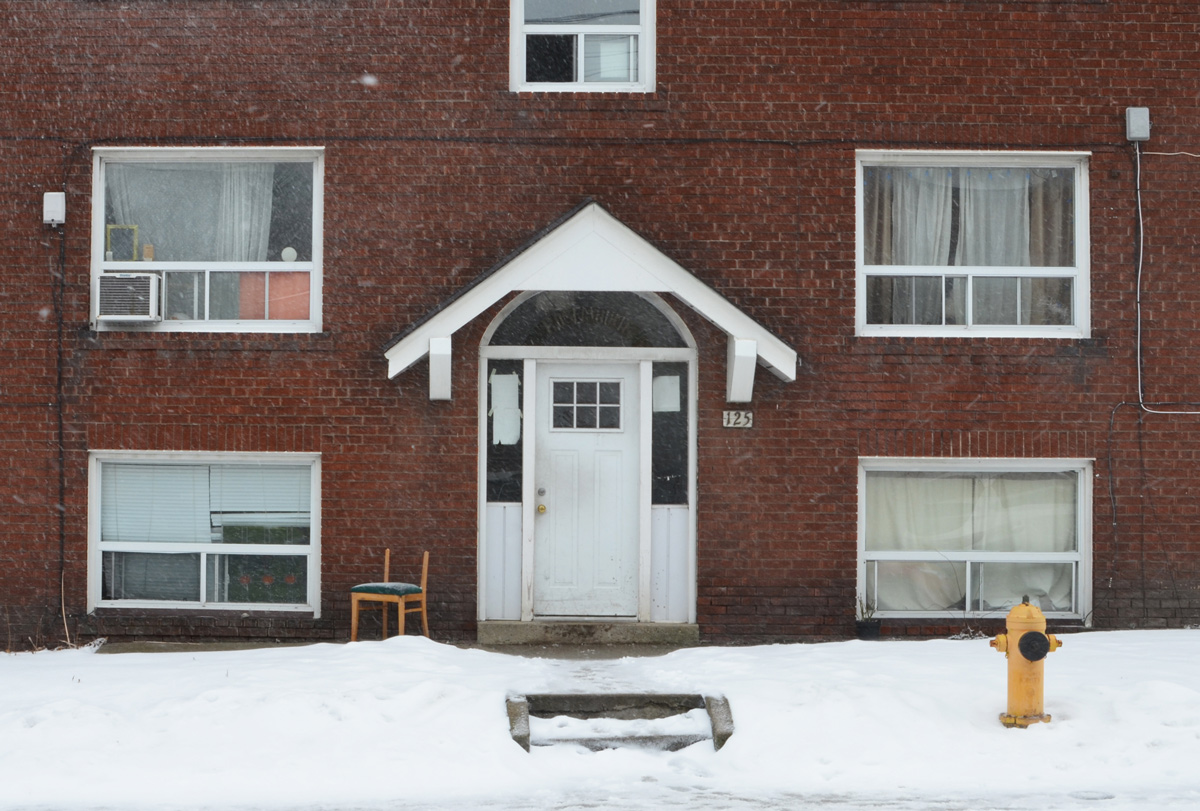
below: Standing alone at 1432

old house number 1432 Dufferin with a new fence

below: 1452A and its neighbours

three houses on Dufferin, the one on the left is 1452A

a 2 storey semi divided house on Dufferin, upper level has a balcony with with a green and white railing, winter, snow on the ground

two storey semi divided house beside Dufferin Bloor auto shop, bus stop in front,

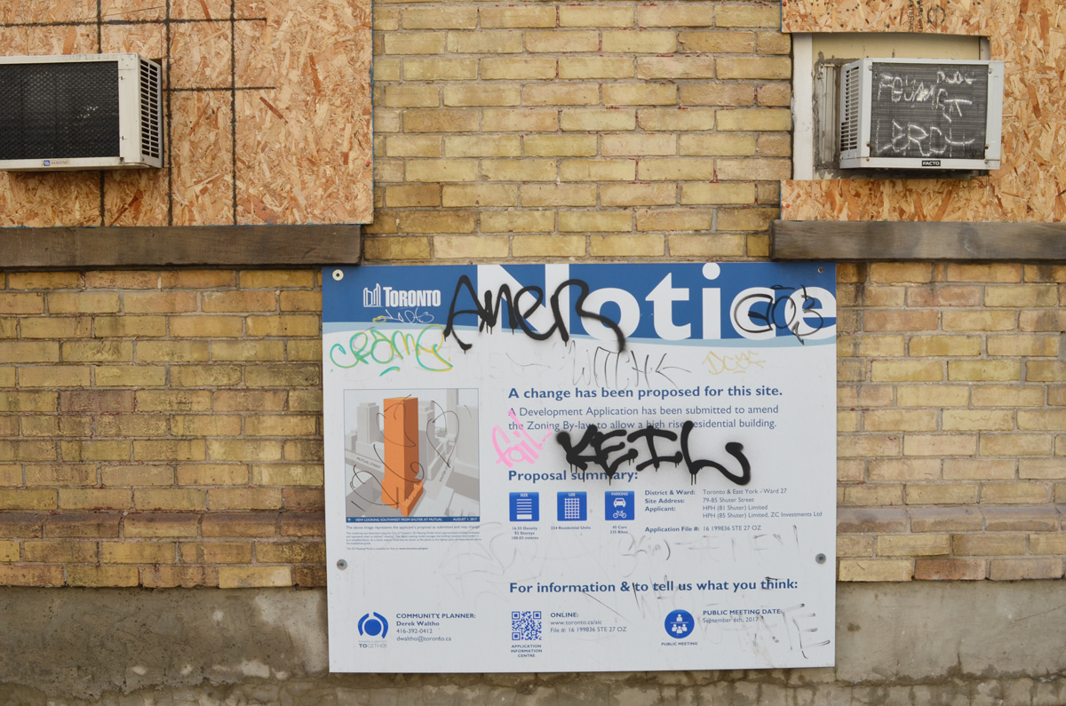
below: An ominous sign – a boarded up house on Dufferin Street.  Is change far behind?  Just in case, I like to document what’s there because in this city, you turn around and everything’s different.  And you think to yourself, “What used to be there?”  But you can’t remember because that is how our memories work and isn’t that disconcerting?

a large tree grows in front of a brick house that has been boarded up

I like the camera part but I’m willing to prove the “no fun” part wrong.  The other day I went meandering with a friend.  We started near Christie station (at a coffee shop of course) with no particular destination in mind.  Generally south was the consensus… and with a pinch of playfulness (forget that no fun nonsense!) and a dash of distraction that’s more or less what we did.

sticker on a yellow pole, camera with legs and arms, also a sticker below it that says no fun

below: As you may know, Bloor Street east of Christie is Koreatown with lots of Korean restauants and tea shops.

below: … including cheese tea.  This seems to be a new trend, or at least new to me!  Apparently it is black or green tea with a foamy topping made from cream cheese, sugar, and whipping cream (or variations thereof).  Next time I may indulge.

below: “Imagine your Korea” mural on the side of P.A.T. Central, a large Korean store.

below: A fire breathing dragon and many scared people trying to run away. It’s a pity about the garbage though.

large mural on the side of abuilding, a large green dragon is breathing fire and scaring people out of their homes and stores and into the streets,

below: By Bathurst street the Korean restaurants have disappeared.  Once upon a time (it seems so long ago!) Honest Ed’s dominated the SW corner of Bloor and Bathurst.  Now there is just hole there, and a very big hole at that.

below: This picture is just a small part of “Utopic Isles, Neon Nights, a Flowery Future”, which consists of three panels of images by grade 11 and 12 visual arts students from Central Tech high school.  They are part of the hoardings around the construction site here.

picture on construction hoardings on Bloor St near Bathurst, an owl in a tree, a cat sitting below the tree, trees are weird shapes

below: Another section of hoardings feature collages of old pictures of Honest Eds – a project by Jessica Thalmann called “To Dwell is to Leave Traces”

hoardings on Bloor Street near Bathurst, a series of collages featuring old pictures of Honest Eds and the area, in many colours, by Jessica Thalmann

below: To try gluing pictures on hoardings is also to leave traces!  Its’ another “no fun” find.   All rather cool until you learn that no fun is a branding thingy.  Stickers as promos for businesses are now very common, posters like this on, not so much.

two posters that were glued to construction hoardings but that have been largely torn off

below: Construction makes room for the two buildings on Bathurst that refused to sell to the developers.  You can still see the ghost sign on one of the buildings – baby carriages repaired

below: Looking west from Bathurst Street across the big hole to the backs of the houses on Markham Street that are empty and boarded up.  Some of them will be retained in the new development.

below: A concrete lovebot hides in the corner.  He’s missing an arm and has three bricks instead of a leg.

an old concrete lovebot with an arm and a leg missing. on two bricks instead of the leg, in a pile of leaves, beside a rust coloured wall

below: Near lovebot is another ghost sign – Coca Cola, sold everywhere (Bathurst Street)

large ghost sign on a brick wall, coca cola sold everywhere, Bathurst Street

below: This frog has four points on his crown and lips made of plaster.   Looks like he’s found a home on top of the garbage pin.

below: ‘Keep hustlin!”  Don’t linger and watch out for cars.  I was going to make some comment about Toronto becoming increasingly dangerous for pedestrians but I decided that I needed some documentation to back me up.  I learned the acronym KSI (killed or seriously injured).  Toronto has the research on the KSI stats for 2005-2018 as part of their Vision Zero plan and the results are “mixed”, i.e. the trend isn’t upwards.  In fact, I don’t think there is a trend of any sort.

below: [Can we stand two social issues in a row?  LOL.]  What I didn’t realize was there was a “worldwide “Nobody Pays” call to action on November 29 for fare evasions” (source).  Chile in the poster is a reference to Chilean high school students protesting transit fare increases with a series of mass evasions starting on the 7th of October.    I don’t recommend burning your Presto card just yet.

below: The very small print at the bottom of the poster gives references to two documents (from 2012 and 2014) that outline the funding of the TTC and where the money comes from.

below: Well it is December after all…..

Christmas decorations in a store window, little tree ornaments of Santa, one with him holding onto a little parachute and one with him on a bike

below: Well it is December after all…..

a sticker of a black faceless man in grey suit, black tie, and black gloves, with arms raised with two hands in peace symbol, words that say destruction, despair, death

blue outline simple drawing of a persons head and shoulders

looking down a path between houses, green chainlink fence with sagging wood fence immediately behind it

below: Conversation on a garage door.

a garage door with the words, are you happy?

a car parked in a backyard of a house that has been gutted and is now being rebuilt

empty backyard of an older two storey building, with brick buildings on either side of it, seen from the laneway

an old car is parked under a tree and beside a house with graffiti on it

below: Sometimes Mother Nature endures.  There was no stopping this tree and it seems to have thrived even with the metal of the fence embedded in it.

a tree has grown up around a chainlink fence so the fence is embedded in the tree

below: The omnipotent metal fence strikes again.  This time flamingos in love and an Al Runt mural are in danger.

chain link construction fence in front of a mural of dancing pink flamingoes

below: Continuation of the mural by Al Runt around the corner of the building

part of a mural by al runt on a wall and on a metal fence

below: This mural has suffered a different fate, that of the creeping billboard posters.  As much fun as “procaffeinating” is fun to read about, I’ve seen more than enough of them around the city.  I’m not sure that it was someone’s sense of humour that resulted in Holt Renfrew posters being displayed beside those for  Pathways to Education that play on poverty and lack of education.

poster put up on a wall covering a mural that was there

below: But….  [one day I will do a post where only the words in the photos do the talking.  There are some great stories out there]

below: I especially like this one, Just Keep Going.

below: A white horse in an alley

splotch of white spray paint on a rusty part of a garage in a laneway looks a bit like a horse

below: As well as two little astronauts.

green garage door with a white square, on the square are two black stencils of an astronaut

below: Blood and bandages barber shop. Wonderful name!

blood and bandages barber shop from the outside, lights in window, bike parked outside

When you walk across College Street in this area you can’t help but notice that you’re in Little Italy.

below: As we walked westward along College Street, we saw three of these blue areas painted on the NW corners (of Roxton, Ossington & Dovercourt)

part of a lower storey of a building, as well as part of the sidewalk directly in front of it, are painted bright light blue

These are the Blue Room, by Stanislav Jurkovic and they were supported by the College Promenade BIA.   From the website: “Similar to a 3 dimensional ‘green screen’ in film production, the space becomes stage and canvas.”  It has also won a Toronto Urban Design Award.   Some photos that people have taken of these spaces can be seen on instagram by searching on #blueroomcollege (although the same photos are fed to the Blue Room website that I linked to in the first sentence).

two people waiting in a TTC bus shelter, part of a lower storey of a building, as well as part of the sidewlk directly in front ot it, are painted bright light blue

below:  In the entrance way to a store that sells a lot of things including DVD’s in Little Italy.  The 4 moschettieri – the 4 muskateers! A film from 1962 with Georges Riviere as d’Artagnan (the wonder of Google!).  At the bottom of the photo is the name Salvatore Samperi; I am not sure which film it is for but Samperi  (1943-2009) was an Italian film director & writer.   I find it intriguing that these old posters are still on this wall, torn and discoloured as they are.

wall in a doorway with old posters for Italian movies, some on top of others

below: Same store.  Italian movies on DVD’s for sale.  ‘Maruzzella’ (in English, ‘The Mermaid of Naples’) came out in 1956.  If you are an aficionado of old Italian movies, be quick, as I think this store is having a going out of business sale.

old Italian movies on DVD for sale in a store window

I’ll leave you with an image that I found online, a full copy of the poster that is partially covered up above – for the R rated film Malicious/Malizia in 1973. (photo source)  That’s 40+ years ago.  You see, when you start wandering you start finding all kinds of strange and fascinating things – no fun? indeed not.

copy of an old film poster for the Italian film malizia from the 1970s


November came in with a gust of grey and dampness.  So when the sun breaks through for a while it’s time to grab a coat and a camera and get walking even if it wasn’t you planned to do that day.

below: The cube house at the bottom of Sumach Street is still with us. It was for sale early in 2017.  At that time, March 2017, BlogTO published an article about this building that starts with this description: “Based on Dutch architect Piet Blom’s complex of Cubic Houses in Rotterdam, the UniTri structure dates back to 1996”.  It was sold in May 2018 for almost three million dollars.

1 Sumach Street, a building made of three green cubes on point on a white pedestal, 3 apartments.

below: No idea is original.  Seen under Richmond/Adelaide Streets.

a painting on a concrete pillar of an overpass, words, No idea is original there's nothing new under the sun, it's never what you do but how you do it.

below: This guy holding his hands in front of him and wearing a red wizard cap still adorns the corner of the Magic Building on Sumach.  He’s just one of a number of wizards you’ll find there.

a painting of a man with hands folded in front, and wizard cap on, on the exterior corner of a building

below: This was the scene of a large fire back in April 2018.  Three buildings were damaged with the one in the middle being beyond repair. It is now gone.  It’s been a long, slow recovery.

an empty bus shelter on Queen East, behind it is a vacant lot where a building had been destroyed by fire, to the left is a green building with bottom floor window boarded up and a sold sign on it. To the right is an old brick building

below: Another building gone.  This one by choice.

a new three storyhouse on the corner, a vacant lot beside it with blue covering as a new home is being built, other houses down the street after that

below: Colourful porch details.

a front porch painted in red and the steps in red and white stripes, wrought iron railing has parts painted white

below: A photo to document this part of Queen Street East because whether it’s in 2 years or 20, there will be changes.

Queen Stree East at Trefann, looking west along the north side of Queen, two story brick storefronts with apartments above, old brick buildings

variet and convenience store painted bright yellow, white metal grill covers window, lots of signs in and around the window in red letters

Amedae spice market store painted yellow with red trim on doors and windows, a large tree grows in front of the store.

a white BMW vehicle with no front licence plate parked in front of a small old building covered with signs that say we fix computers, cell phones and wireless solutions, etc

refelctions of autumnleaves and other buildings in a corner window of a rug store

two men walk past on the sidewalk

architectural details on old buildings on Queen Street East

Seaton Butcher shop exterioe, old brick building, red trim, Queen Street East

below:  A row of old brick houses at 79 through 85 Shuter Street where a fire has recently destroyed some of the the upper levels and roofs.


row of old brick houses at 79 through to 85 Shuter Street where a fire has recently partially destroyed the upper levels and roofs

below: The buildings are empty and boarded up.  This is the southeast corner of Shuter & Mutual.

row of old brick houses at 79 through to 85 Shuter Street where a fire has recently partially destroyed the upper levels and roofs

below: There is a development proposal notice on the buildings. The proposed plan saves the old houses and shows a tall glass building built behind and above them.

development proposal sign on side of yellowish brown brick building that is empty and boarded up.

below: That’s a big drill!

a large drill bit on the end of a piece of construction equipment that's parked in a vacant lot beside a beige building

below: Shuter Street at Church.

looking west on Shuter street at Church, St. Mikes hospital, construction at the NE corner of Shuter & Church, mural by parking lot

below: Looking north on Church Street towards the new buildings that are part of Ryerson University’s expansion.

looking north up Church Street from Shuter towards Ryerson University

below: Steeple, St. Michaels Cathedral

steeple of St. Michaels cathedral

below: Looking west on Dundas towards Victoria Street and Yonge Dundas Square. The cylinder structure is part of the CityTV building.  The outer layer is wire mesh.


looking west on Dundas Street towards Victoria Street, large cylinder structure above the street at City News building, TTC streetcar turn with walkway above it, billboards of Yonge Dundas square behind it

graffiti covered door with turquoise painted words that say street life sweet life

There is an alley that runs behind the north side of Queen Street West, just west of Spadina.

mural and graffiti on a wall in an alley

The next few photos are of street art that isn’t new (and it may appear in earlier blog posts). There are usually cars parked here and today most of the parking spots were empty.

older mural on the back of a building in an alley

close up view of older mural on the back of a building in an alley

below: An older elicser mural

older mural by elicser of two men, one head is much larger than the one behind it

below: Uber5000 painting (and his iconic yellow bird) – the man, the bird, and the surveillance cameras.

an old uber5000 painting on a wall of a man in black baseball cap and glasses with a little yellow birdie on his shoulder, a no parking sign on top of man's hands

graffiti and paint covering on old window on graffiti covered wall in a lane

backs of stores on Queen West, covered with graffiti, a ladder to upper floor, brick buildings

below: This house has been empty for a long time. The doors and windows are now covered with plywood, providing a canvas for some graffiti and a surface for a few paste-ups.

an old brick two storey semi detached house with green mansard roof is boarded up and empty

below: Urban ninja squadron is on the phone.  Tacim Collective (from Milan Italy) is also represented here as is Paris BKC (Brass Knuckles Crew), and sketchrat.

paper paste ups on plywood covering a window

paper paste ups on plywood covering a door

below: There used to be a collection of these “blueprint” pieces (maybe four of them?).  This is the last remaining one.

blue and white blueprint graffiti with large red and yellow text scrawl below it, on a wall in an alley

walls in alley covered with graffiti

below: The lane ends in a mess at a chainlink fence that surrounds a vacant lot on Spadina.

messy alley with car parked, trash bins, barrels, graffiti, air conditioners, back walls,

below: Hidden away just beyond the fence is a face by Phillip Saunders.

behind a chain link fence, viewed from a laneway, a face street art painting by Phillip Saunders

Work on the Port Land redevelopment continues.  The area is changing fast enough that I thought another visit would be a good idea.

below: Cherry Lifeguard Station, calm and peaceful in the early morning.  On a weekday in September all is quiet here.

cherry lifeguard station, with dock in front, very calm and still water, reflections of the building in the water, early morning,

below: A new red lifeguard chair sits on a freshly raked beach.  In the distance, a tug pushes a barge out of the harbour and onto Lake Ontario.

red lifeguard station on cherry beach in the morning

below: A family of Canada geese rest on the embankment of the Keating Channel. The white concrete supports of the Gardiner Expressway are reflected in the water.

white concrete supports of the elevated Gardiner Expressway are reflected in the water of the Keating Channel while a family of Canada Geese sit on the bank

below: Looking west along the Keating Channel. The Don River empties to the bottom right, just out of the picture. At the moment, the Keating Channel is the only route to Lake Ontario but this is about to change.

looking west along the Keating Channel, trees on the left, Gardiner Expressway on the right

below: The Cherry Street bridge, a lift bridge, was broken in the open position for about a month at the end of the summer.  It was fixed in time for Labour Day weekend so it is down now (can it go back up?  It will soon be demolished so maybe that doesn’t matter)

view from above, Cherry street bridge in open position, port lands, cement silos, Lake Ontario, construction

below:  From above, the Keating Channel is in the foreground and it is here that construction on a new Cherry Street bridge is just beginning.  This is west of the present bridge because Cherry Street is going to be straightened as it passes under the Gardiner.      There is another small channel behind the Keating Channel but it ends at the T&T store… for now.    Cherry Beach and Lake Ontario are in the background.

Port Lands from above, Keating Channel, beginning of construction of a new bridge at Cherry street,

below: Reflections of the T&T sign.  Soon this store will be gone.  The path of one of the new waterways for the Don River goes right through the middle of their property to join with the channel that is already there (picture above).

reflections of the green T and T supermarket sign in a car window

below: Villiers Street, looking west from the Don Roadway.   The new path of the Don River is going to make an island of this part of the Port Lands as it runs parallel to, and immediately west of, the Don Roadway.

railway crossing sign on Villiers Street in the PortLands, some remnants of train track still there bu no trains

below: Villiers Street is actually two streets running parallel, both of which have two-way traffic.  This is left over from the days when the railway ran down the middle of the street.

green road sign that says Traffic operates two way on both branches of Villiers street

below: Remaining fragments of railway track can be found all over the Port Lands. This is Villiers Street at the Don Roadway. The Gardiner Expressway is in the background.

street with remnants of railway tracks on it

below: Old gas pump on Villiers.

rusty old gas pump

below: The northwest corner of Commissioners and the Don Roadway. The green mound is the beginnings of the flood protection work there. Flood protection means work on the re-routing of the mouth of the Don River.

the north west corner of Don Roadway and Commissioners Street

below: Looking west on Commissioners Street from east of the Don Roadway (at the traffic lights).  This is one of several large hydro structures that run from the Portlands Energy Centre (a natural gas burning electrical plant).   Hydro infrastructure changes are part of the Port Lands redevelopment.

a very tall metal hydro pole and structure above the street, Commissioners Street, Port Lands

below: Work on the south side of Commissioners.

cranes, workers, construction site

Soon Commissioners Street will be closed between the Don Roadway and Cherry Street.  All of the buildings there will be demolished.  At the moment, most of them are empty.

below:  Old abandoned buildings on Commissioners

old buildings on Villiers Street, with CN Tower in the background

part of an empty and abandoned building, two storeys, old windows, the number 130 written in large white numbers

side of an old abandoned building, top part is rusted pale green metal, bottom is painted dark grey

below: United Rentals on Commissioners Street, now empty. Soon gone.

empty United Rentals building in the Port Lands

below: Chained and locked.

a rusty chain and a padlock keep a gate closed

old brick building

construction on flood control measures in the Port Lands

below: North side of Commissioners, east of the Don Roadway. You can see the Gardiner Expressway and the old Lever Brothers factory.

a plant grows up agains a chain link fence, pile of dirt and industrial buildings behind the fence

a red and white danger due to sign that someone has written radioactive signs on so sign says danger due to radioactive signs

below: South end of the Don Roadway.

very south end of Don Roadway, south of Commissioners street, dead end, dirt road, no trespassing construction site entry

below: Looking west towards downtown from the Don Roadway

view of Toronto skyline and CN tower from Don Roadway

fence with signs, danger due to sign, plus sign that says Port Lands Flood Protection

below:  Back in July the demolition of the GFL (Green For life) buildings was well underway.

the last part of GFL (Green For life) structure to be torn down in the Port Lands, cement truck, dirt road, vacant land

below: This is the GFL recycling transfer station during the demolition process.  At the same time, the shoreline was being reconfigured and “naturalized”.  The trees in the water in the foreground have since died but this is part of the plan – they are to become part of a new fish and wildlife habitat.

west end of portlands early on in the redevelopment process, partially demolished building, barge in water creating new land, reconfiguring the shoreline

below: Access to the northwestern part of the Port Lands has been very limited.  Cherry Street and the T&T parking lot are as far as you can go … if you obey all the signs.    (photo from July)

black and orange cones line the route of entry to cement making facility in the Port lands

below: September

CN Tower and Toronto skyline from Cherry street, T and T market parking lot

below: The sea gulls have the parking lot to themselves, between Lafarge and the lake at the west end of the Port Lands.  There are no plans (that I can find) to remove or relocate Lafarge.

lots of sea gulls sitting on a parking lot behind Lafarge cement silos in the Port Lands

below: If you stand looking at the view above, and then turn around, you get the image below. Polson Pier view of the Toronto skyline.

view of Toronto skyline across Toronto Harbour from Polson Pier

a path leads to a fence, construction site behind the fence, including a cement truck

torn and shredded black fabric caught on a barbed wire fence

below: Map of the area.  As you can see, I have only covered a small part of the Port Lands.  There is so much more to explore!

map of the Port lands area

506 is the number of the Carlton streetcar which runs from High Park in the west to Main Street subway station in the east.  The older cars still run on this route and one advantage of these older streetcars is that they have windows that open.  This makes it easy to take pictures while travelling; yesterday I went eastward from Yonge as far as Coxwell, sometimes on the streetcar and sometimes on foot.

below: Pointing the camera out the window, D & J Mart Convenience store at the corner of Gerrard & Sackville.

picture taken out the window of a streetcar on Gerrard, an older 2 storey brick building with retail on the lower level, two large old wood hydro poles

below: A new curvy building rises up on the corner of Carlton and Church.  The older building on the left with the R U on the top is the old Maple Leaf Gardens, now part of Ryerson University as well as a large Loblaws.

new highrise building under construction beside the old brick building that was Maple Leaf Gardens on Carlton street.

below: People, striped hoardings, and closed sidewalks.

people walking past painted hoardings in front of a construction site, painted in stripes

below: Waiting outside Jenny’s at the corner of Parliament and Gerrard where the streetcar makes another turn.

a young man stands beside a stroller outside Jenny's Convenience store on Parliament street, large red and white sign with kit kat logo on it twice - once at each end

below: Another convenience store on a corner on Gerrard.  This time there is also a construction site in the picture!  Are there more construction sites than variety stores or vice versa in this city?

from the streetcar window, a food mart on the corner and construction across the street from it.

people sitting on a TTC street car, three people, two women and a man.

below: Looking south on Broadview at Gerrard.

Broadview looking south from Gerrard with utility poles and lots of wires, people crossing the street, some traffic, the clears with the sign with a red cross on it

below:  The 506 streetcar passes through Chinatown East (the area around Broadview & Gerrard) where many of the old houses are also businesses.

older houses turned into businesses on the ground floor, two semis with Chinese businesses, one is Ly Ly beauty salon

below: The southeast corner of Broadview and Gerrard now has an A & W restaurant which seems like an intruder in an otherwise Chinese/Asian section of town.

looking at the southeast corner of Broadview and Gerrard with a large A and W restaurant on the corner. Beyond that, the other stores and restaurants are Chinese

below: At the intersection of Gerrard and Carlaw, where the railway passes over the roads, the walls have been freshly painted.  The north wall is a series of abstract shapes and colours like this.

a person in an electric wheelchair, or motorized scooter, passes by a wall that is covered with street art, traveling on the sidewalk

below: The new painting incorporates the older art that was there. In the center of the newly painted rectangles are two grey shapes, these are originals.  They are part of a 1996 installation by Dereck Revington called ‘Blue Fire’.  There is still a plaque that describes these aluminum pieces as “a constellation of five paired aluminum fragments etched with traces of a poem by Robin Blaser and suspended from the entrances to the underpass”.   Strange grey shapes (flames?) on dirty white concrete.  Regardless of what you think of the concept, the reality is that it was drab.

part of a railway overpass has been painted with street art

below: Lead artist Kirsten McCrea (also known as Hello Kirsten) and her assistants, Victoria Day & Julian Palma, have certainly brightened up the space!  The south wall is a series of frames pictures of hands holding flowers.   As seen from across the street ….

railway underpass street art, seen throughthe supporting concrete arches, paintings of hands holding flowers, framed

below: … and from close up

a dark brown hand holding a sprig of small light purple flowers

below: And lastly, the end support wall of the overpass where the flowers and the stylized shapes come together.

painting on a concrete pillar of a railway overpass, a rose with leaves, stem, and thornes, a collage of abstract shapes and

below: Store signs near Pape including the bilingual Italy Hair Design – but not in Italian!

store fronts on Gerrard including one that is painted bright green, signs over the doors including the Italy hair design store with sign in English and Chinese

below: With remnants of the past such as string of pennants faded to grey….

old three storey brick building with big bay windows on the upper two floors. Ground floor is a store or restaurant with bright red door and yellow metal bars over the windows

below: … or an old street sign still attached to the building.

side of an old brick building with stone features, an old street sign on the building Gerrard Street, now a law office with signs in the windows

below: After Greenwood, the 506 streetcar passes through Little India before it turns north on Coxwell.

food and containers on a table outside a store, with pink and green floral table cloth

below:  In the late afternoon and evening, Little India is much more lively.  Many shops sell food on the street – roasted corn on the cob (a pile is ready to cook on the green table here) as well as south Asian foods.   To the right of the corn is a bundle of sugar cane.

Mumbai Paan shop on Gerrard Street in Little India with a barbeque on the sidewalk, a bucket of corn and a pile of sugar cane

These few kilometres on a streetcar route have opened a small but fairly typical cross section of the city starting with the newer, taller, shinier center.  There’s quite a bit of multiculturalism, some history, and some colourful new art.   It’s a story that plays out all over the city in many similar yet different forms.  Familiar but unique.


below: Searching for a story? 😇

three people looking into the sun. Two are shielding their eyes with their hands, wearing sunglases, looking slightly upwards as if searching for something.


Something new or something different.
And for sure, something’s changed.

below: Too cool for school. Dundas Square.

a young boy in sunglasses stands on one foot in front of a water fountain at Dundas square

sitting by the water at Dundas square, a mother and two kids, an older man in a hat is nearby

a man stands in dundas square, with a rolling suitcase in one hand

two men sit beside a store window with female mannequins in summer clothes, another man is walking past

below: The north east corner of Victoria and Lombard (looking north on Victoria).

downtown buildings

below: This building is on the north west corner of Victoria and Richmond.  It is the Confederation Life building, constructed in 1892.   According to Wikipedia, afire gutted the top floor of the building and destroyed the roof in June 1981 but the rest of the structure remained intact.

the top corner of an old red brick building with a green roof, with a new glass building behind it

below: A 1912 picture of the Confederation Life Building.  Photo source

vintage photo from 1912 postcard of the confederation life building at the corner of Victoria and Richmond streets. built 1892, large red brick building with ornate roofline

three buildings joined together, one red brick, one beige stucco and one a purplish brown. A small tree grows in front of them. Four windows.

below: Fran’s restaurant at the corner of Victoria and Shuter – a Toronto institution.

scaffolding around the building with an orange Frans sign on it - Frans restaurant at Shuter and Victoria streets

below: And just a bit farther north on Victoria is the Senator which is even older than Fran’s.  That’s a lot of food!

large mural on the side of the Senator restaurant, a man in glasses holds a steaming cup of coffee with plates of food in front of him, by his shoulder, bacon and eggs with toast as well as a plate with a sandwich and a side of salad. A third plate has a piece of chocolate cake

below: Signs on Victoria Street including a marvelous old Green P Parking sign.

signs, senator restaurant, public parking, and an old green _ parking sign

below: Protest poster with a message for Prime Minister Trudeau.  Will you compensate us for the mercury crisis?

large black and white poster on an empty building with plywood covering doors and windows.

below: Breaking my habit of not photographing people sleeping on the streets – it was the large green frog pillow that made me chuckle and reach for my camera.

a person is sleeping on their back on the sidewalk. Their head is on a large green frog pillow

below: And speaking of frogs, a group of them have appeared at College Park.   A group of frogs is called an army… but if these are actually toads then a group of toads is a knot.   Hmm…. frogs prefer water while toads live on land.  There are also differences in their eggs, tongues and teeth but the most noticeable difference is in their eyes.  Frogs have round eyes that bulge out.  Toads eyes are more oval and don’t bulge.  Conclusion – these are frogs searching for water.

two bronze sculptures of frogs in a park

Bronze sculpture of a large frog with a water pond (no water in it) behind it

below: Looking north on Yonge street towards Alexander.  The very tall building is at Yonge & Bloor.

looking north on yonge street towards alexander and bloor. tall buildings, old buildings, cranes, traffic

below: More Yonge Street.  Another juxtaposition of old and new; the opportunities for this kind of image are becoming commonplace.  Also,  I could probably take pictures on Yonge every day and still miss some of the changes.

a variety of ages of buildings on Yonge street from those built in the 1800s to modern glass buildings.

below: Plaid, paw prints, and pink

people at an intersection, a woman in a red and black plaid jacket and pink shoes

below: One is happier than the others.

a man and a young girl look out the window of a TTC streetcar with a poster on the side advertising Aladdin movie

below: Dundas Street, just west of University Ave., looking towards Simcoe and St. Patrick streets.

a cyclist with an otange shirt sits on his bike while looking at his phone. He's stopped behind an orange and black striped construction cone on the side of a street

below: North side of Dundas street, just west of Bay.

downton buildings with a construction zone

below: Who doesn’t like bacon?  I prefer mine a bit crispier.

a woman is dressed in a bacon costume and standing on the sidewalk on Dundas Street giving out flyers

a couple crosses a street by a streetcar, an Asian man and a woman in a teal head scarf

“Days go running and hiding
The weeks are going slippy and sliding
Years leave quicker every time they come”
from “When We Were Young” by Passenger


The other evening I was going to try some evening photography along the waterfront starting around Sugar Beach. As I walked down Lower Jarvis, this view caught my attention – looking west along Lakeshore Blvd.  It’s a view that has been changing very rapidly.    I counted at least seven cranes as I stood there waiting for some of the traffic to clear.

downtown Toronto, looking west towards all the tall buildings, looking along the Lakeshore with lots of traffic on it, many buildings in the foreground under construction with 7 cranes in the photo

below: Sugar Beach.   Unfortunately a film crew was already here so I didn’t stick around.

a group of people standing near the waterfront at sugar beach with its pink umbrellas and white muskoka chairs

below: One of the buildings to the east of Sugar Beach is a new George Brown College building.

looking up to a second floor of a building that has a very large window, three round tables and some chairs can be seen through the window

below: Film crew trucks ready to be loaded back up

the back of two large trucks with their doors open as cables, tools and other equipment for filming is being load back into the trucks

The strip of green that you see on the right side of the above photo is part of Sherbourne Common (at the foot of Lower Sherbourne Street).    From here east to Parliament is now being developed as East Bayside and is a continuation of the now completed development from Jarvis (Sugar Beach) to Sherbourne.   East Bayside is bounded by Queens Quay and Lake Ontario as well as Sherbourne and Parliament.  1800 residences are planned in this space.

below: Some of the condos are under construction.  Same old same old; yawn.  They may look a little more interesting from a distance, but at street level they are hopelessly banal.  If you want to buy a condo here, there are only a few left in the two buildings known as Aqualina and Aquabella.   In the latter, only 3 are available, starting at a two bedroom suite for 2.8 million.  Five million dollars will get you a three bedroom penthouse with two terraces but if you want to pay an additional 1 1/2 million you get 4,000 square feet on two floors (3 bedrooms and 2 terraces as well).

new condo development by the lake

below: At least the “linear park” and waterfront path is being continued eastward along Lake Ontario.

construction of a waterfront path

orange wheel barrows at a construction site beside a lake

below:  Work is also underway on Queens Quay East.   As a frame of reference, the tall building behind the billboard is in the Distillery District.  Lakeshore Blvd and the Gardiner run behind the buildings with the blue trim.

billboard, construction on queens quay east

What hasn’t yet been started is construction of two office buildings that will front on Queens Quay, called T3 Bayside.  They are going to be made of wood which should be interesting.

There has been a lot of talk for the past 12 to 14 years about extending streetcar service along this route.  So far a lot of planning and a lot of talk but that’s it.  An LRT right of way running along the south side of the street has been approved but the East Bayfront LRT project, (aka Waterfront LRT) has stalled because of the usual political shenanigans and financial hiccups.   A major part of the delay has been the question of how to link an East Bayfront LRT to Union station.  The present tunnel is barely sufficient for the streetcars that use it now.  Just recently (April 2019) the city released a report on how to address this issue.  I haven’t read it all yet (it’s 40 pages long) but the gist of it is that the city is considering two options – 1. rebuilding the tunnel or 2. building an automated people moving system of some sort and leave all streetcars out of the tunnel.

below: There is a small trench down the center of the street.

danger sign on construction zone in the middle of the street, Queens Quay, looking west along the street towards downtown toronto

Any ideas what’s being planned for the north side of Queens Quay?

two orange and black traffic contruction cones on the street in front of an old white industrial building with red door frames and a wood loading dock with yellow trim
metal framework that is holding up a large billboard

below:  Queens Quay turns towards Parliament Street.  The blue building is a Sidewalk Labs information centre.  The land that Sidewalk Labs wants to develop, Quayside, is close by – south of Lakeshore and east of Parliament.  It also includes the little strip of land between Queens Quay and Lakeshore, i.e. that answers my question above about what happens on the north side of Queens Quay.  There was some rumour (plan?) about Sidewalk Labs being involved in development of some of the Portlands but is that still on?    As to what their plans are or where they are at now, I have no idea.  That’s probably another blog post!

many orange and black cones on a stretch of road that is having work done on it

The other day I heard rumours of a subway protest – i.e. a protest over the potential uploading of the responsibility for the TTC from the city to the province.   On the 27th of March there was a “day of action” at 40 subway stations during the morning rush, starting at 7:30 a.m.

below: Walking toward Eglinton subway station with the sun shining from behind me. Golden glass.

condo development, crane, single houses in the foreground, near Yonge & Eglinton

I couldn’t find anyone at Eglinton station (was I too early?) but there were 4 people handing out leaflets inside Bloor station.  I also saw this guy with an OPSEU flag by Wellesley station.

a man holds an OPSEU (a union) flag outside Wellesleysubway station as he stands with a woman while someone is taking their picture.

So much for the idea of a blog post about this day of action.  But it was a beautiful morning so I enjoyed the walk down Yonge street.  I don’t often walk here that early and I was surprised how quiet it was.  The light was also interesting.

Yonge Street

below: A mix of old and new architecture, looking south towards the old St. Charles tavern clock tower that is being incorporated into a new development.

looking south on Yonge street on a sunny morning, sun is shining on the St. Charles tavern clock tower, tall buildings behind it

below: Near Yonge & Bloor.  Preservation of an old building… and very big crane.

old brick three storey building stands alone by a construction site as new development goes on around it. large crane in the background

two fire trucks parked on a street of high rise and midsized apartment buildings

below: Looking north from Dundas under a watchful eye.

people cross Yonge street on the north side of Dundas, a big picture of an eye is on a billboard looking down over the street

looking up at relief sculpture and column on an old building that says erected 1905, a new condo tower is behind it

reflections in the large window of a building, people, bikes, and old city hall

below: Looking north from Queen Street.  The Eaton Centre is on the left in the foreground.  Play the game of ‘name that building’ or ‘I remember when’.

looking up (north) on Yonge street,

a blurry streetcar as it stops at a stop where two people are waiting

people crossing the street in front of a streetcar that is waiting for a red light. At thewest side of intersection of Queen and University

people waiting for a streetcar on Queen at Bay, standing outside a TD bank that has a video screen with a very large woman on it.

below: This was the largest group of “protesters” that I saw.  It was more of an information session than a protest, and there’s nothing wrong with that.

people handing out leaflets and brochures at Osgoode station, on the sidewalk outside the station exit. University Ave

below: People headed to work as I started home.

inside Osgoode subway station, at platform level, one subway is just closing its doors getting ready to leave, people are headed up the stairs.


Exploring new places often leads to interesting finds.  I’m not sure if you think demolition/redevelopment sites are interesting, but I came across this one when I went to Moccasin Trail (next blog, scroll up).

An empty building.  The grey hoardings completely block the view of whatever is inside.

grey plywood fence in front of a three storey brick rental apartment building that is empty and will be torn down in a residential neighbourhood

I tried walking the perimeter, but there is no access or viewpoint.  There are actually two buildings.  Apparently one of the buildings was damaged by fire (arson) in 2008.  The buildings have been empty since 2011.

a tall tree, winter time, stands in front of a grey plywood fence in front of a three storey brick rental apartment building that is empty and will be torn down

The old sign still stands beside the fence. It is faded enough that I can’t read it, even with some manipulation in photoshop.  The building in the background is also part of the redevelopment plan.

old faded sign on grass side yard beside grey plywood fence around building about to be demolished. Across the street is another building from the 1950s or 1960s.

The year on the development proposal sign is 2013.  It also states that three buildings will replace the ones being torn down, one of 10 storeys and two of 4 storeys.  That was six years ago.   In March 2017 a plan was approved by city council for an 8 storey condo and a 4 storey rental replacement building.

Development proposal sign in front of a three storey brick apartment building.

When I saw the state of the building above, I started taking some pictures.  I thought the building was empty.  But then I heard music coming from one apartment.  Then a woman came out on to a balcony to hang up a blanket.

40 moccasin trail building, three storey apartment

Two years ago, back in March of 2017, 12 of the 34 units were occupied.   I am not sure how many people are living there now.   When it was first built, it was probably quite nice – very suburban, very Don Mills.  Now the building is in very poor condition but I’m sure that’s because the landlord is waiting to be able to demolish the building.

papered over window and old white door on apartment, overgrown saplings in front

crooked metal railings beside a concrete set of stairs, brown and white building behind.

concrete steps, side of a brick building

overgrown trees in front of an apartment

City of Toronto report on this site (May 2017)

two low rise apartment buildings, grass between them and a large tree