Posts Tagged ‘development’

It’s easy to view railway tracks from bridges, in this case from a bridge on Finch Avenue East between Markham Road and McCowan.  The is CPR Toronto Yard.

seen from a bridge, two bright red CPR train engines on tracks, beside the watch tower

It is a marshaling yard, also known as a classification yard, which is where railway cars are separated onto one of several tracks and joined with other cars with the same destination.

boxcars and tankers waiting on tracks at the CPR yard

Sitting on over 400 acres, CPR’s yard in Scarborough is one of the largest in Canada.  There are 311 switches and about 140km of track on which freight cars are shunted between tracks.   The site was opened in 1964.

across the tracks, lots of red CPR engines, with skyline behind

seen from a bridge, a train passes below, engine, flatbed cars, a tanker, and a boxcar

…but getting to track level can be more of a challenge.

below: It sometimes involves getting lost and having a chat with a security guard or two (but not until after you have a few good wall & shadow pictures)

a security guard walks down a road between two white metal buildings

below:  In other places, access is simple.

a small dead pine tree in front of a large puddle in a parking lot, a line of red boxcars behind it

a man in a safety vest stands beside two boxcars, one yellow and the other orange,

three tanks on towers above train cars at CPR yard

below: I’ve never thought too much about graffiti on trains until today – How many miles has this little guy traveled?  Where did he come from and who painted him when?  How many people have seen him as he shuttles back and forth across the country (or perhaps farther than that?)?

the graffiti on the side of a red boxcar

below: Looking right back at you!

graffiti on the side of a train car - painted pale blue with two big eyes that seem to be looking at the viewer

reddich colour boxcar with pink and blue blobs, graffiti

below: A westbound train leaves the yard at McCowan Road.

two bright red CPR engines at the front of a train, black tanker cars behind, as it crosses over the bridge at the entrance to the CPR railway yard

below: Back in 1964 the community of Browns Corners was at the corner of Finch Avenue East and Markham Road(not to be confused with the other Browns Corners on Woodbine Ave and Hwy 7).   There are no more traces of the community or the farms that surrounded it.

trucks parked beside a long low grey building, in the distance. in front is a vacant lot

I only walked around part of the yard and I didn`t take very many pictures of the buildings that are there – seniors residence, medical clinic, a few offices, etc.

pattison billboard beside a street, on a vacant piece of land
a bus shelter on the side of a street, with vacant land behind and a large billboard advertising a radio station

the backs of trucks parked by a vacant lot

I would like to end this blog post with one building that I saw that was different.

below: The Sri Sathya Sai Baba Centre is nearby.  I think that I have it right – the Sathya Sai Organization is not a religion but a “universal approach to life” whose teacher and spiritual leader is Sathya Sai Baba.   Each of the five petals in the flower contain a word or phrase: truth, right conduct, peace, non violence, and love.


Sri Sathya Sai Baba centre

below: There was a column-like structure near the door topped with a large lotus flower.  The base was square and on each were printed words.  “Offer all bitterness in the sacred Fire and emerge grand, great and Godly.”

part of the base of a column with words that say offer all bitterness in the sacred fire and emerge grand, great and godly

below: “Remember the wheel of Cause and Consequence of Deed and Destiny and the Wheel of Dharma that rights them all”.  I assume that the other two sides also had inscriptions but I couldn’t see them because of a fence with a locked gate.

part of the base of a column with words that say remember the wheel of cause and consequence of deed and destiny and the wheel of dharma that rights them all

Back on McCowan and back home… (still no TTC in my life)

a row of cars for sale, seen from the back

Another blog post constructed from the wanderings around a neighbourhood.

below: A bronze plaque erected by the East York Historical Society is mounted on the stone fence of the Taylor Cemetery which is adjacent to Don Mills United Church.    The plaque mentions the Methodist Church – the Methodists became part of the United Church in 1925.

bronze plaque on a stone wall, Taylor cemetery, erected by the East York historical society gives rough outline of the history of the Taylor family here

The Taylor Cemetery – John Taylor (1773-1868), his wife Margaret Hawthorne and seven children emigrated from Uttoxeter Staffordshire in 1821. In 1839, three sons, John, Thomas, and George, purchased this land from Samuel Sinclair (1767-1852) except for a portion Sinclair gave to the Primitive Methodist Connexion in 1851. The Taylors gave the Connexion a brick church in 1859. The family operated three paper mills and a brick mill in the Don Valley, where they had considerable landholdings and were responsible for much of the development of East York in the nineteenth century.

.

below: The present church building dates from 1950 when a smaller building was demolished.  This church was registered in 1819 and has been on this site since 1839 (as mentioned above, originally Methodist).

brick Don Mills United Church with bright red doors

below: Close by is Holy Cross Roman Catholic Church.  Established in 1928, it was the first Catholic parish in the Township of East York.  This church, built in 1948, is the second one on the site.     

Holy Cross Church

below: Bethany Baptist Church has been on the corner of Pape and Cosburn since 1920.  Obviously this building is not that old!  This is the addition, built in 1958, to the older church that you can just see on the right side of the picture.

brick building with stained glass in blue and green in the center section, sign on front says Bethany Baptist Church

below: A metal sculpture of a soldier mounted on the wall of The Royal Canadian Legion, hall #10, a memorial to the Soliders of Suicide – those soldiers who have taken their own lives, usually as the result of PTSD.

a metal statue of a soldier, at rest, mounted on a brick wall, as memorial to soldiers who committed suicide

below: The southeast corner of Pape and O’Connor still sits empty. There used to be a gas station here and that probably meant contaminated soil that had to be dealt with.   The development proposal sign dates from 2014  and was for a 2 storey commercial building.  I am not sure why the delay or what the status of the proposal is.

vacant lot on the corner of O'Connor and Pape, with fence around it, development proposal sign from 2014, overgrown,

below: Donlands Convenience with its rounded corner is similar to a few others in the city.

Donlands convenience store, a 2 storey brick building on the corner of an intersection, with a rounded wall

stores on Donlands Ave as well as a studio with a large blue store front

two people waiting on the corner for a green light

below: Do not block the entrance. …. or are the apples for the teachers?

4 bushel baskets of apples in a doorway of the Korjus Mathematics Tutorial Services

below: A sample of some of the restaurants in the area.  There are also quite a few Greek restaurants as the Danforth (and the original Greektown) is just to the south.

3 restaurants on a street, an Indian Paan and snack plce, an Africa Indian restaurant called Simba, and a fish and chip restaurant

independent gas station and service center at Floyd street

a man fills a car tank with gas at an independent gas station, sign says price of a litre of gas is 99.9 cents

below: Golden Pizza Restaurant in an old brick building with a square facade at the roofline.

the golden pizza restaurant on Broadview, old 2 storey brick building with square roofline facade

below: Another square roofline, Logan Convenience

Logan convenience store, 2 storey red brick building, on a corner, with no other building next to it

Like most parts of the city, the houses are of various architectural styles.

houses Torrens

Whether I am correct or not, I don’t know but I have always associated East York with small post-war bungalows.

a well kept yellow brick post war bungalow with a grey roof and a partial white and green metal awning over the front steps that lead to a small porch

white bungalow with Christmas wreath on brown wood front door and a santa claus decoration on the front steps, a yellow fire hydrant by the sidewalk

A few are being “renovated”

construction of a new 2 storey house in between two square bungalows

below: What was surprising to me was how many multi-family buildings there are in the area –  Both lowrise…

front entrance, exterior, of a yellow brick lowrise apartment building from the 1960s or 1970s

4 storey apartment building, brick, on a corner

and apartment buildings

4 high rise apartment buildings in East York. winter time, trees with no leaves, blue sky,

curved white concrete cover over entrance of apartment building, that is brown brick with white balconies

two brick houses in front of a tall apartment building

lamp and lampost in front of a blank beige wall of an apartment building, with another highrise in the background.

below: I am beginning to think that there should be at least one old car picture in every blog post! I certainly encounter enough of them! Today’s car – a yellow Oldsmobile (from the 1970’s?).  Sounds like a challenge doesn’t it?!

an old yellow Oldsmobile car, with historic licence plate, parked in a driveway in front of an old white garage

I like the camera part but I’m willing to prove the “no fun” part wrong.  The other day I went meandering with a friend.  We started near Christie station (at a coffee shop of course) with no particular destination in mind.  Generally south was the consensus… and with a pinch of playfulness (forget that no fun nonsense!) and a dash of distraction that’s more or less what we did.

sticker on a yellow pole, camera with legs and arms, also a sticker below it that says no fun

below: As you may know, Bloor Street east of Christie is Koreatown with lots of Korean restauants and tea shops.

below: … including cheese tea.  This seems to be a new trend, or at least new to me!  Apparently it is black or green tea with a foamy topping made from cream cheese, sugar, and whipping cream (or variations thereof).  Next time I may indulge.

below: “Imagine your Korea” mural on the side of P.A.T. Central, a large Korean store.

below: A fire breathing dragon and many scared people trying to run away. It’s a pity about the garbage though.

large mural on the side of abuilding, a large green dragon is breathing fire and scaring people out of their homes and stores and into the streets,

below: By Bathurst street the Korean restaurants have disappeared.  Once upon a time (it seems so long ago!) Honest Ed’s dominated the SW corner of Bloor and Bathurst.  Now there is just hole there, and a very big hole at that.

below: This picture is just a small part of “Utopic Isles, Neon Nights, a Flowery Future”, which consists of three panels of images by grade 11 and 12 visual arts students from Central Tech high school.  They are part of the hoardings around the construction site here.

picture on construction hoardings on Bloor St near Bathurst, an owl in a tree, a cat sitting below the tree, trees are weird shapes

below: Another section of hoardings feature collages of old pictures of Honest Eds – a project by Jessica Thalmann called “To Dwell is to Leave Traces”

hoardings on Bloor Street near Bathurst, a series of collages featuring old pictures of Honest Eds and the area, in many colours, by Jessica Thalmann

below: To try gluing pictures on hoardings is also to leave traces!  Its’ another “no fun” find.   All rather cool until you learn that no fun is a branding thingy.  Stickers as promos for businesses are now very common, posters like this on, not so much.

two posters that were glued to construction hoardings but that have been largely torn off

below: Construction makes room for the two buildings on Bathurst that refused to sell to the developers.  You can still see the ghost sign on one of the buildings – baby carriages repaired

below: Looking west from Bathurst Street across the big hole to the backs of the houses on Markham Street that are empty and boarded up.  Some of them will be retained in the new development.

below: A concrete lovebot hides in the corner.  He’s missing an arm and has three bricks instead of a leg.

an old concrete lovebot with an arm and a leg missing. on two bricks instead of the leg, in a pile of leaves, beside a rust coloured wall

below: Near lovebot is another ghost sign – Coca Cola, sold everywhere (Bathurst Street)

large ghost sign on a brick wall, coca cola sold everywhere, Bathurst Street

below: This frog has four points on his crown and lips made of plaster.   Looks like he’s found a home on top of the garbage pin.

below: ‘Keep hustlin!”  Don’t linger and watch out for cars.  I was going to make some comment about Toronto becoming increasingly dangerous for pedestrians but I decided that I needed some documentation to back me up.  I learned the acronym KSI (killed or seriously injured).  Toronto has the research on the KSI stats for 2005-2018 as part of their Vision Zero plan and the results are “mixed”, i.e. the trend isn’t upwards.  In fact, I don’t think there is a trend of any sort.

below: [Can we stand two social issues in a row?  LOL.]  What I didn’t realize was there was a “worldwide “Nobody Pays” call to action on November 29 for fare evasions” (source).  Chile in the poster is a reference to Chilean high school students protesting transit fare increases with a series of mass evasions starting on the 7th of October.    I don’t recommend burning your Presto card just yet.

below: The very small print at the bottom of the poster gives references to two documents (from 2012 and 2014) that outline the funding of the TTC and where the money comes from.

below: Well it is December after all…..

Christmas decorations in a store window, little tree ornaments of Santa, one with him holding onto a little parachute and one with him on a bike

below: Well it is December after all…..

a sticker of a black faceless man in grey suit, black tie, and black gloves, with arms raised with two hands in peace symbol, words that say destruction, despair, death

blue outline simple drawing of a persons head and shoulders

looking down a path between houses, green chainlink fence with sagging wood fence immediately behind it

below: Conversation on a garage door.

a garage door with the words, are you happy?

a car parked in a backyard of a house that has been gutted and is now being rebuilt

empty backyard of an older two storey building, with brick buildings on either side of it, seen from the laneway

an old car is parked under a tree and beside a house with graffiti on it

below: Sometimes Mother Nature endures.  There was no stopping this tree and it seems to have thrived even with the metal of the fence embedded in it.

a tree has grown up around a chainlink fence so the fence is embedded in the tree

below: The omnipotent metal fence strikes again.  This time flamingos in love and an Al Runt mural are in danger.

chain link construction fence in front of a mural of dancing pink flamingoes

below: Continuation of the mural by Al Runt around the corner of the building

part of a mural by al runt on a wall and on a metal fence

below: This mural has suffered a different fate, that of the creeping billboard posters.  As much fun as “procaffeinating” is fun to read about, I’ve seen more than enough of them around the city.  I’m not sure that it was someone’s sense of humour that resulted in Holt Renfrew posters being displayed beside those for  Pathways to Education that play on poverty and lack of education.

poster put up on a wall covering a mural that was there

below: But….  [one day I will do a post where only the words in the photos do the talking.  There are some great stories out there]

below: I especially like this one, Just Keep Going.

below: A white horse in an alley

splotch of white spray paint on a rusty part of a garage in a laneway looks a bit like a horse

below: As well as two little astronauts.

green garage door with a white square, on the square are two black stencils of an astronaut

below: Blood and bandages barber shop. Wonderful name!

blood and bandages barber shop from the outside, lights in window, bike parked outside

When you walk across College Street in this area you can’t help but notice that you’re in Little Italy.

below: As we walked westward along College Street, we saw three of these blue areas painted on the NW corners (of Roxton, Ossington & Dovercourt)

part of a lower storey of a building, as well as part of the sidewalk directly in front of it, are painted bright light blue

These are the Blue Room, by Stanislav Jurkovic and they were supported by the College Promenade BIA.   From the website: “Similar to a 3 dimensional ‘green screen’ in film production, the space becomes stage and canvas.”  It has also won a Toronto Urban Design Award.   Some photos that people have taken of these spaces can be seen on instagram by searching on #blueroomcollege (although the same photos are fed to the Blue Room website that I linked to in the first sentence).

two people waiting in a TTC bus shelter, part of a lower storey of a building, as well as part of the sidewlk directly in front ot it, are painted bright light blue

below:  In the entrance way to a store that sells a lot of things including DVD’s in Little Italy.  The 4 moschettieri – the 4 muskateers! A film from 1962 with Georges Riviere as d’Artagnan (the wonder of Google!).  At the bottom of the photo is the name Salvatore Samperi; I am not sure which film it is for but Samperi  (1943-2009) was an Italian film director & writer.   I find it intriguing that these old posters are still on this wall, torn and discoloured as they are.

wall in a doorway with old posters for Italian movies, some on top of others

below: Same store.  Italian movies on DVD’s for sale.  ‘Maruzzella’ (in English, ‘The Mermaid of Naples’) came out in 1956.  If you are an aficionado of old Italian movies, be quick, as I think this store is having a going out of business sale.

old Italian movies on DVD for sale in a store window

I’ll leave you with an image that I found online, a full copy of the poster that is partially covered up above – for the R rated film Malicious/Malizia in 1973. (photo source)  That’s 40+ years ago.  You see, when you start wandering you start finding all kinds of strange and fascinating things – no fun? indeed not.

copy of an old film poster for the Italian film malizia from the 1970s


November came in with a gust of grey and dampness.  So when the sun breaks through for a while it’s time to grab a coat and a camera and get walking even if it wasn’t you planned to do that day.

below: The cube house at the bottom of Sumach Street is still with us. It was for sale early in 2017.  At that time, March 2017, BlogTO published an article about this building that starts with this description: “Based on Dutch architect Piet Blom’s complex of Cubic Houses in Rotterdam, the UniTri structure dates back to 1996”.  It was sold in May 2018 for almost three million dollars.

1 Sumach Street, a building made of three green cubes on point on a white pedestal, 3 apartments.

below: No idea is original.  Seen under Richmond/Adelaide Streets.

a painting on a concrete pillar of an overpass, words, No idea is original there's nothing new under the sun, it's never what you do but how you do it.

below: This guy holding his hands in front of him and wearing a red wizard cap still adorns the corner of the Magic Building on Sumach.  He’s just one of a number of wizards you’ll find there.

a painting of a man with hands folded in front, and wizard cap on, on the exterior corner of a building

below: This was the scene of a large fire back in April 2018.  Three buildings were damaged with the one in the middle being beyond repair. It is now gone.  It’s been a long, slow recovery.

an empty bus shelter on Queen East, behind it is a vacant lot where a building had been destroyed by fire, to the left is a green building with bottom floor window boarded up and a sold sign on it. To the right is an old brick building

below: Another building gone.  This one by choice.

a new three storyhouse on the corner, a vacant lot beside it with blue covering as a new home is being built, other houses down the street after that

below: Colourful porch details.

a front porch painted in red and the steps in red and white stripes, wrought iron railing has parts painted white

below: A photo to document this part of Queen Street East because whether it’s in 2 years or 20, there will be changes.

Queen Stree East at Trefann, looking west along the north side of Queen, two story brick storefronts with apartments above, old brick buildings

variet and convenience store painted bright yellow, white metal grill covers window, lots of signs in and around the window in red letters

Amedae spice market store painted yellow with red trim on doors and windows, a large tree grows in front of the store.

a white BMW vehicle with no front licence plate parked in front of a small old building covered with signs that say we fix computers, cell phones and wireless solutions, etc

refelctions of autumnleaves and other buildings in a corner window of a rug store

two men walk past on the sidewalk

architectural details on old buildings on Queen Street East

Seaton Butcher shop exterioe, old brick building, red trim, Queen Street East

below:  A row of old brick houses at 79 through 85 Shuter Street where a fire has recently destroyed some of the the upper levels and roofs.


row of old brick houses at 79 through to 85 Shuter Street where a fire has recently partially destroyed the upper levels and roofs

below: The buildings are empty and boarded up.  This is the southeast corner of Shuter & Mutual.

row of old brick houses at 79 through to 85 Shuter Street where a fire has recently partially destroyed the upper levels and roofs

below: There is a development proposal notice on the buildings. The proposed plan saves the old houses and shows a tall glass building built behind and above them.

development proposal sign on side of yellowish brown brick building that is empty and boarded up.

below: That’s a big drill!

a large drill bit on the end of a piece of construction equipment that's parked in a vacant lot beside a beige building

below: Shuter Street at Church.

looking west on Shuter street at Church, St. Mikes hospital, construction at the NE corner of Shuter & Church, mural by parking lot

below: Looking north on Church Street towards the new buildings that are part of Ryerson University’s expansion.

looking north up Church Street from Shuter towards Ryerson University

below: Steeple, St. Michaels Cathedral

steeple of St. Michaels cathedral

below: Looking west on Dundas towards Victoria Street and Yonge Dundas Square. The cylinder structure is part of the CityTV building.  The outer layer is wire mesh.


looking west on Dundas Street towards Victoria Street, large cylinder structure above the street at City News building, TTC streetcar turn with walkway above it, billboards of Yonge Dundas square behind it

The other evening I was going to try some evening photography along the waterfront starting around Sugar Beach. As I walked down Lower Jarvis, this view caught my attention – looking west along Lakeshore Blvd.  It’s a view that has been changing very rapidly.    I counted at least seven cranes as I stood there waiting for some of the traffic to clear.

downtown Toronto, looking west towards all the tall buildings, looking along the Lakeshore with lots of traffic on it, many buildings in the foreground under construction with 7 cranes in the photo

below: Sugar Beach.   Unfortunately a film crew was already here so I didn’t stick around.

a group of people standing near the waterfront at sugar beach with its pink umbrellas and white muskoka chairs

below: One of the buildings to the east of Sugar Beach is a new George Brown College building.

looking up to a second floor of a building that has a very large window, three round tables and some chairs can be seen through the window

below: Film crew trucks ready to be loaded back up

the back of two large trucks with their doors open as cables, tools and other equipment for filming is being load back into the trucks

The strip of green that you see on the right side of the above photo is part of Sherbourne Common (at the foot of Lower Sherbourne Street).    From here east to Parliament is now being developed as East Bayside and is a continuation of the now completed development from Jarvis (Sugar Beach) to Sherbourne.   East Bayside is bounded by Queens Quay and Lake Ontario as well as Sherbourne and Parliament.  1800 residences are planned in this space.

below: Some of the condos are under construction.  Same old same old; yawn.  They may look a little more interesting from a distance, but at street level they are hopelessly banal.  If you want to buy a condo here, there are only a few left in the two buildings known as Aqualina and Aquabella.   In the latter, only 3 are available, starting at a two bedroom suite for 2.8 million.  Five million dollars will get you a three bedroom penthouse with two terraces but if you want to pay an additional 1 1/2 million you get 4,000 square feet on two floors (3 bedrooms and 2 terraces as well).

new condo development by the lake

below: At least the “linear park” and waterfront path is being continued eastward along Lake Ontario.

construction of a waterfront path

orange wheel barrows at a construction site beside a lake

below:  Work is also underway on Queens Quay East.   As a frame of reference, the tall building behind the billboard is in the Distillery District.  Lakeshore Blvd and the Gardiner run behind the buildings with the blue trim.

billboard, construction on queens quay east

What hasn’t yet been started is construction of two office buildings that will front on Queens Quay, called T3 Bayside.  They are going to be made of wood which should be interesting.

There has been a lot of talk for the past 12 to 14 years about extending streetcar service along this route.  So far a lot of planning and a lot of talk but that’s it.  An LRT right of way running along the south side of the street has been approved but the East Bayfront LRT project, (aka Waterfront LRT) has stalled because of the usual political shenanigans and financial hiccups.   A major part of the delay has been the question of how to link an East Bayfront LRT to Union station.  The present tunnel is barely sufficient for the streetcars that use it now.  Just recently (April 2019) the city released a report on how to address this issue.  I haven’t read it all yet (it’s 40 pages long) but the gist of it is that the city is considering two options – 1. rebuilding the tunnel or 2. building an automated people moving system of some sort and leave all streetcars out of the tunnel.

below: There is a small trench down the center of the street.

danger sign on construction zone in the middle of the street, Queens Quay, looking west along the street towards downtown toronto

Any ideas what’s being planned for the north side of Queens Quay?

two orange and black traffic contruction cones on the street in front of an old white industrial building with red door frames and a wood loading dock with yellow trim
metal framework that is holding up a large billboard

below:  Queens Quay turns towards Parliament Street.  The blue building is a Sidewalk Labs information centre.  The land that Sidewalk Labs wants to develop, Quayside, is close by – south of Lakeshore and east of Parliament.  It also includes the little strip of land between Queens Quay and Lakeshore, i.e. that answers my question above about what happens on the north side of Queens Quay.  There was some rumour (plan?) about Sidewalk Labs being involved in development of some of the Portlands but is that still on?    As to what their plans are or where they are at now, I have no idea.  That’s probably another blog post!

many orange and black cones on a stretch of road that is having work done on it

a gold coloured weather vane with a rooster on it, bright blue sky in the background

Once again, it seems that no matter where in the city you go there will be construction.  There will be the demolition of single family homes to make way for condos or at the minimum, blocks of rowhouses.   The area around Yonge and Finch is no exception.

apartment building in the background, a street of single family dweelings in the foreground, early spring so no leaves on the trees, a few cars parked in driveways

I am not sure if it serves any purpose, perhaps it’s futile, but I’d like to think that documenting what we are removing is worthwhile.   The houses on Finch Avenue East like the one in this picture are small, but the lots on which they sit are large.

small white bungalow with brown roof, on large piece of land, car in driveway

That means that a developer can demolish four houses and turn around and build 17 townhouses in the same space.    That is what is happening near Finch and Willowdale.

three small white bungalows with windows and doors boarded up, small trees overgrown around them.

Although the properties were not fenced off, all access to the houses themselves was blocked, sigh.  It looked like a local garden centre was using the backyards of a couple of the houses.

side door of a white wood house with rickety porch and steps. three trees growing besie it, door is boarded up

below: View to a new development on the other side of Finch Avenue.  This is the type of development that the area is now zoned for.  A lot of these townhouses have been built in the last few years and I suspect that eventually they will replace all of the single family homes.

view looking down a driveway, two empty houses - one on each side of the driveway. Can see across the street to new townhouse development on the other side.

single family homes and large trees on Finch Ave

single family homes and large trees on Finch Ave

Between Willowdale Avenue and Yonge Street, there were a couple of other houses that are boarded up and empty. I am not sure what the plan is for them (there was no development proposal sign posted, instead there was a sign advertising the company that is providing the financing – for what?).

small bungalow with blue door, windows boarded up, large tree in front yard, apartment building behind,

The internet can be a wonderful thing.  In case you are interested, the development is the Ava Luxury Residence and it calls for heights and densities that are vastly over what is zoned for in the area.  For example, at 9 storeys it is 37 metres tall in an area zoned for 11 metres.  The plan was first filed in 2016 but because of the size of the development, it requires a zoning by-law amendment, official plan amendment, and site plan approval to effect the proposal – all which take time.   An OMB appeal pre-hearing was scheduled to occur a few days ago, with a hearing slated for June.  MM170085 is the OMB case number if you want to dive down that rabbit hole.

small bungalow with blue door, windows boarded up, large tree in front yard, sign in front yard advertising financing

This is 50 Finch East.  As you can see, there is a taller building on the other side of Kenneth Avenue.  Kenneth was to be the dividing line – keeping the higher buildings, and denser development, closer to Yonge Street.  I’m not sure what side of the development battle you’re on, but what’s the point of having a plan if the developers (with help from the OMB) keep disregarding it?

small bungalow on a corner lot, with windows and doors boarded up, larger apartment building behind.

As I walked back to my car, I chose to walk on a side street instead of on Finch.  As I turned a corner, I happened upon a house being demolished.  Fortuitous.  Serendipity.

a yellow digger loading rubble from a house demolition into a dump truck

It doesn’t take long to reduce a house to rubble and dust.  “Another one bites the dust” springs to mind.

close up of a digger demolishing a house

And so it goes.

looking through blue see through fencing towards an apartment across the street, a pedestrian crossing sign in front, a danger due to excavations sign on the fence.

Back before the winter snow had melted, I was at Yonge and Eglinton and noticed that the old bus bays at Eglinton station were gone. That structure had sat empty for a couple of years but now there is a big hole where they once stood. As I looked through the pictures that I took that day, I decided that it might be interesting to explore farther east to see what was happening with the Crosstown LRT construction that has messed up the traffic through midtown for so long now.

below: Southwest corner of Yonge & Eglinton.

large hole in the ground at a construction site, diggers and a crane onsite

below: There is still a lot of construction underway on Eglinton near Yonge.

holes in the ground on construction sites on Eglinton Ave for the new crosstown LRT, shoring, wood and pipes

below: A little father east and more holes in the ground. This is the intersection of Eglinton and Mt Pleasant taken from the SE corner looking towards the NW. At least the facade of the old Imperial Bank of Canada building on the NW corner was originally going to be used as the LRT station but have those plans changed? The building was demolished but apparently the facade was taken apart brick by brick and will be re-built later.

holes in the ground on construction sites on Eglinton Ave for the new crosstown LRT

below: This is the plan for the Mt Pleasant station as seen on the Crosstown website.

artists conception of a new LRT station with a re-purposed older building

below: Looking west from Mt. Pleasant.

cain link fence and gate is open, construction crew in the middle of Eglinton Ave (at Mt Pleasant) is working with a digger, hole in the ground

below: Between Laird and Brentcliffe (east of Bayview). See those low rise brick apartment buildings? How long until they’re gone?

red and white tim hortons sign with an arrow pointing left at a long grey fence around a construction site, sidewalk, street, and low rise buildings on the right, Eglinton Ave

two 3 storey red brick apartment buildings

below: At Brentcliffe. The LRT is underground here and there is no station at this intersection. Laird, where there is a station, is only one block to the west.

Eglinton Ave east at Brentcliffe

below: From Brentcliffe, Eglinton goes downhill because of the Don River ravine system

looking east on Eglinton, towards Don Mills Road in the distance, construction in the foreground

below: Part way down the hill there is a section of concrete. At first I thought that this was where the LRT was going to come to the surface.

concrete section of road, construction

below: But then I wasn’t so sure. There is a concrete wall blocking what would be the exit. It’s difficult to get a closer look because there are two layers of fencing in the way. Nobody was working here. In addition, there is another section farther along that looks like the actual opening. Maybe this is part of the supporting infrastructure?

two fences in front of a dug out section of road, with concrete wall at one end.  One f the fences is orange, wire,

below: Still walking east along Eglinton…. Almost to the bottom of the hill at Leslie – looking east along Eglinton Avenue with E.T. Seton Park on the right and the railway bridge in the distance. Leslie Street, which ends at Eglinton, is on the very left side of the photo. There is talk that this intersection will be closed for two months this summer.

looking east along Eglinton Ave towards Leslie, on the right is the road to the park and beyond that, a railway bridge

below: I turned around and took a picture of the hill that I had just come down. Here the LRT surfaces and the tracks run down the center of the road, with lanes of traffic on both sides of the tracks. I am fairly certain that you can see the entrance to the tunnel, the east portal, near the middle of this picture. From here to Kennedy station the tracks are above ground (except for a portion of the route at Don Mills).

traffic drives west along Eglinton Ave., up the hill from Leslie, through the crosstown LRT construction

below: The sidewalk on the south side ends at Leslie street. Here, I chatted with a policeman while we waited for the light to turn green. Once he did, he escorted me across Eglinton as we had to pass through part of the construction zone. This is where I also discovered that there are no bus stops between Brentcliffe and Don Mills Road. That’s only 2 km but it feels a lot longer!

on the south side of Eglinton, where the sidewalk ends at Leslie street, looking east beyond that with construction on the right

below: A development proposal sign stands on the lawn of what used to be the Inn on the Park but what is now a Toyota dealership.

development proposal sign on the lawn of what used to be the Inn on the Park on the north east corner of Leslie and Eglinton

green netting and fencing on both sides of a narrow sidewalk running between construction and traffic.

below: The station at Don Mills and Eglinton will be called “Science Center” and it will be under the intersection.

LRT track path being constructed,

below: There will be a bus terminal on the northeast corner of Don Mills Road and Eglinton with underground access to the LRT station. This is what construction looks like on that corner at the moment.

underground sections of LRT being constructed at Don Mills and Eglinton, crane at work, metal frame over tunnel

Just east of Don Mills Road, the LRT surfaces again and remains above ground until Kennedy station. I took the bus from Don Mills Road to Victoria Park as there wasn’t as much to see in this stretch.

below: Looking east from Victoria Park Avenue.

shallow but wide hole in the ground where new LRT tracks are being laid. construction in prep for the tracks, green fencing separates construction from traffic on both sides,

shallow but wide hole in the ground where new LRT tracks are being laid. construction in prep for the tracks, green fencing separates construction from traffic on both sides, water tower in the distance

concrete utility pole with two ripped paper temporary bust stop signs, TTC, stops no longer in use

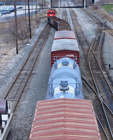
This is another “come along with me as I walk” blog.  Let me share some of the sights from Thursday’s walk which started at Ossington subway station and sort of followed Davenport south to Queen Street with a few diversions down alleys and side streets.

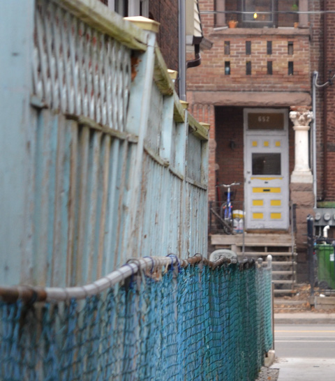
below: Ooops!  Dead end alleys too.  That’s one way to keep people out!

chainlink and barbed wire fence acorss the backyard of a house

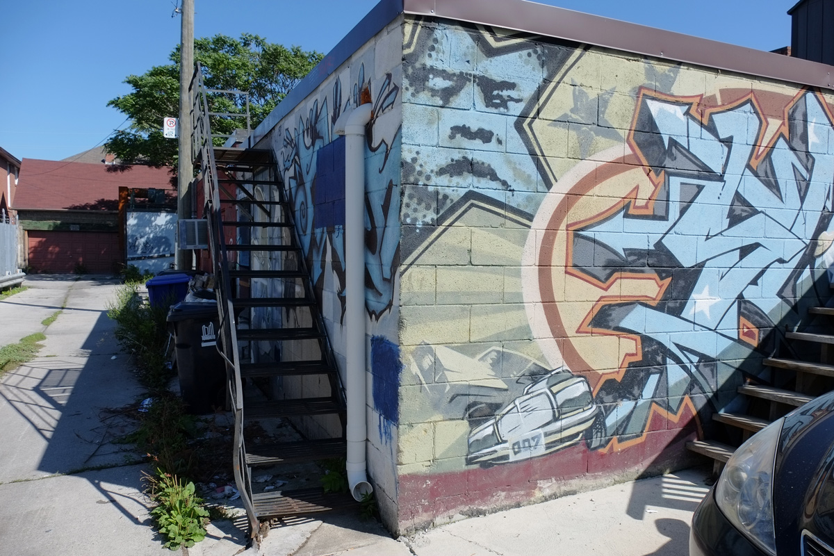
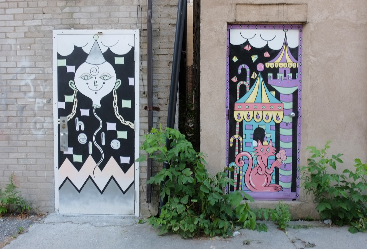
below: A starry man (star face?) watches 007 below.   Street art in an alley.

street art in an alley - corner of a concrete block building, metal staircase as well, blue star with a man's face inside it, a racing car near the bottom with licence plate 007

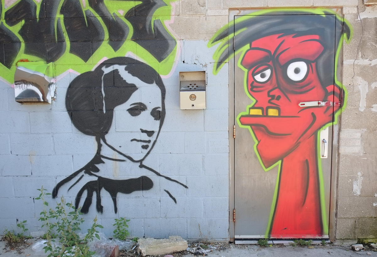
below: More painting, this time Princess Leia and a strange red man with a latch in his ear.

street art in an alley - red man's head, with protruding lower jaw and two large yellow teeth, white eyes, on a door, black and white picture of Star Wars Princess Leia on the wall beside

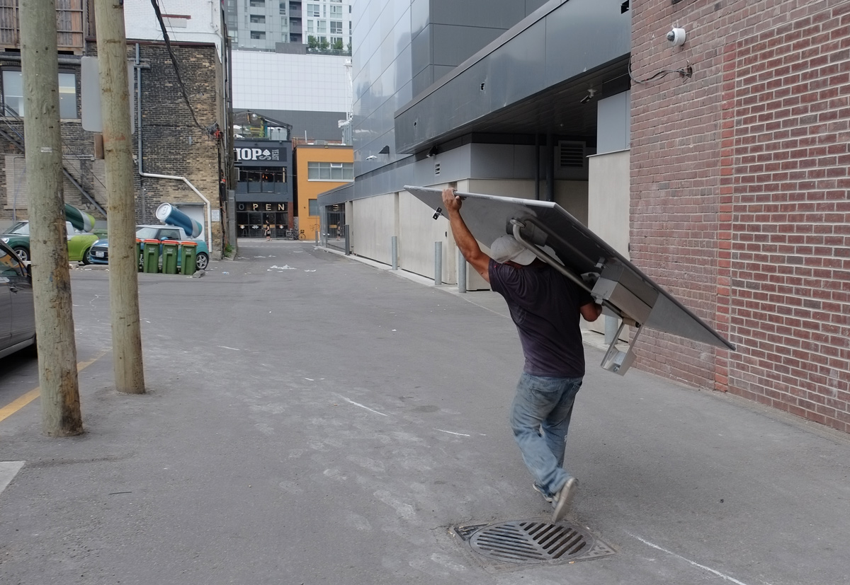
below: If he’s aiming for the garbage bin, he’s missed.

street art in an alley - word radar on grey metal door, with screaming face below, on the wall beside is a moon shpaed figure, with arm out and seems to be holding something in its fingers but nothing there, garbage bins (real) below

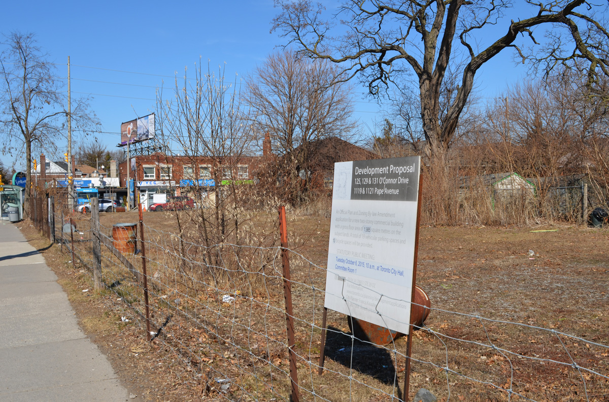
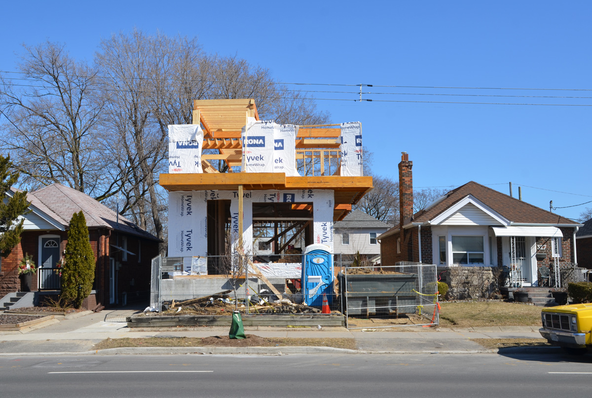
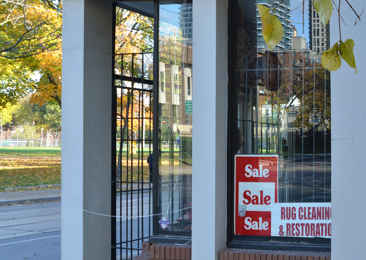
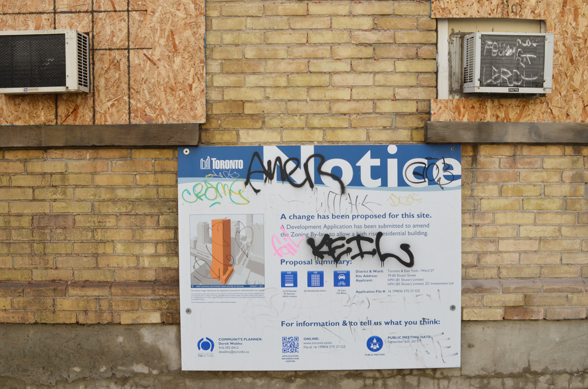
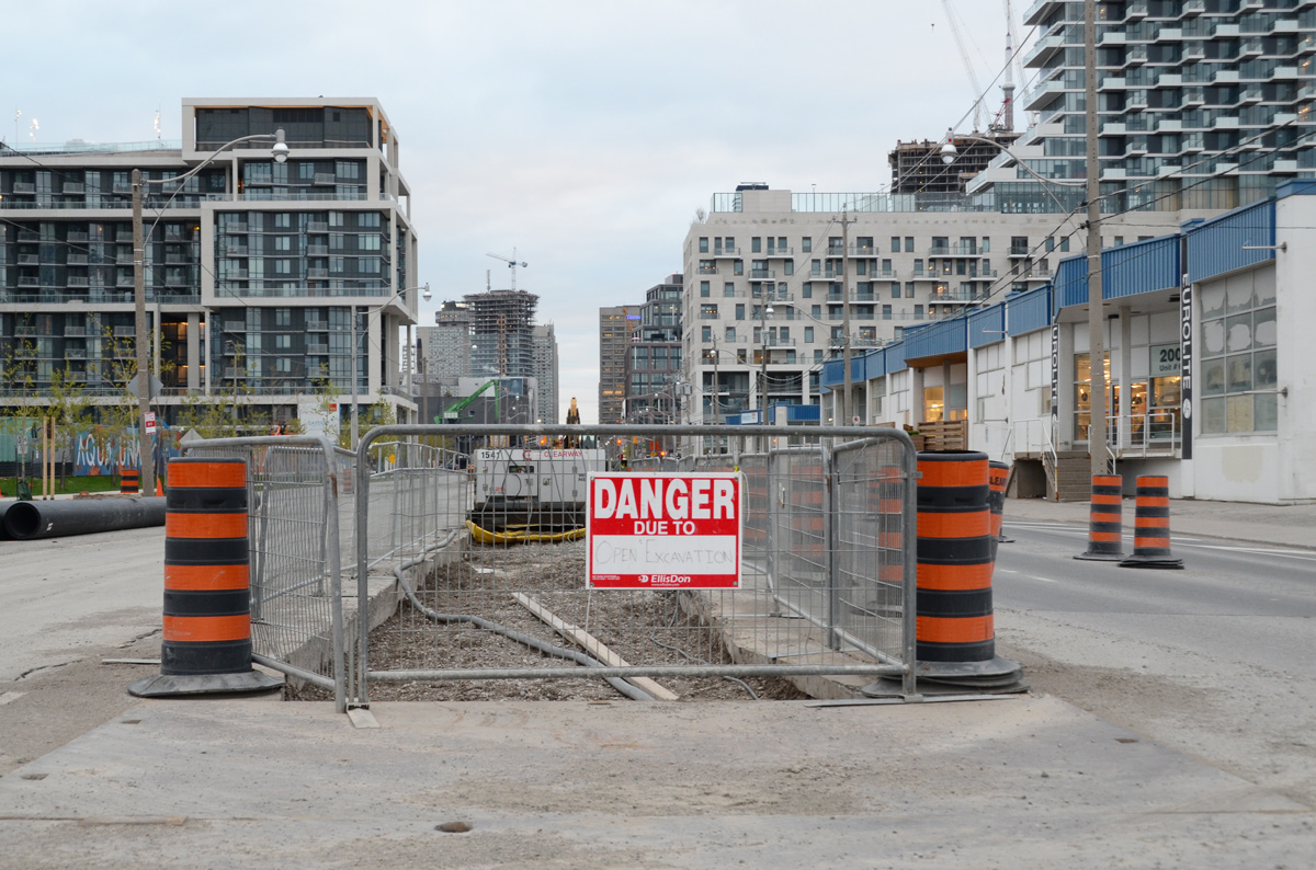
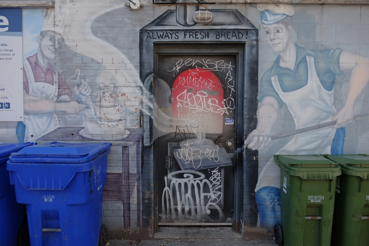
below: ‘Always fresh bread!’ according to the mural on Nova Era bakery… but maybe you see the edge of the blue and white city of Toronto development notice sign peeking into the picture….

an old and fading mural on the side of an old bakery, showing two bakers, male, baking bread, with chef's hats and white aprons on

below:  … because a 12 storey condo may be moving in.  Retail is planned for the lower level but it may the same old same old glass and steel development with excessively high ceilings on the ground floor and zero street appeal.  Please prove me wrong!

blue and white city of toronto development notice sign on the side of a building, under a window, beside a mural of a baker in chefs hat and white apron icing a three layer wedding cake

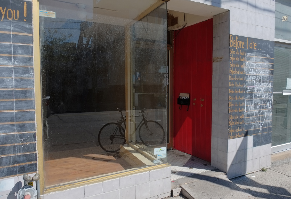
below: Across the street, is this empty storefront.  Two intriguing blackboards remain – the one on the left says Thank You! and leaves you lines to fill in with things you are thankful for.  On the right, a “Before I Die” board.   What are you thankful for? What would you like to do before you die?  The business once here didn’t die, they just moved around the corner to Bloor Street.

empty store front with a bike parked inside, a red wall beside the door way, dirty glass in front, reflections in the glass

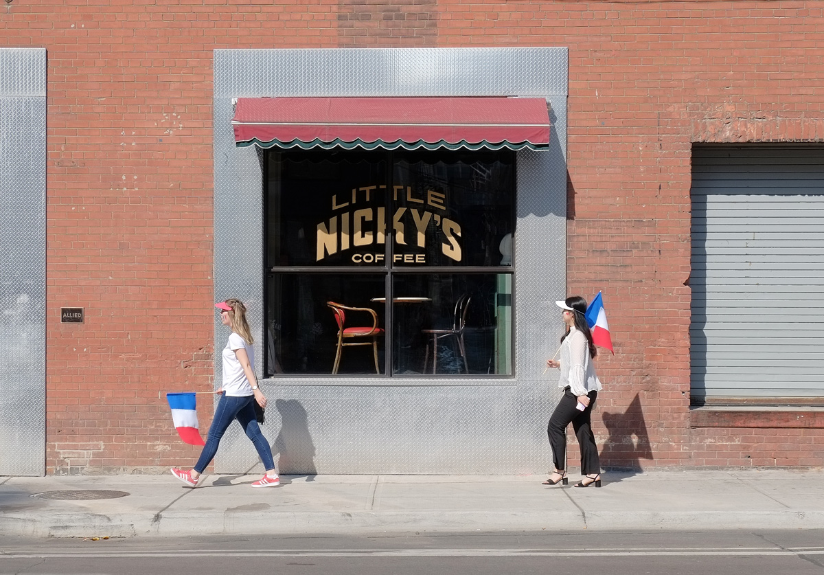
below: A bit of local ‘colour’ complete with ‘colourful’ language.

the back of a cyclist stopped at the side of a street by a bus stop, and traffic light, a woman stands on the sidewalk with a large puffy pink scarf around her neck and a lot of belongings with her

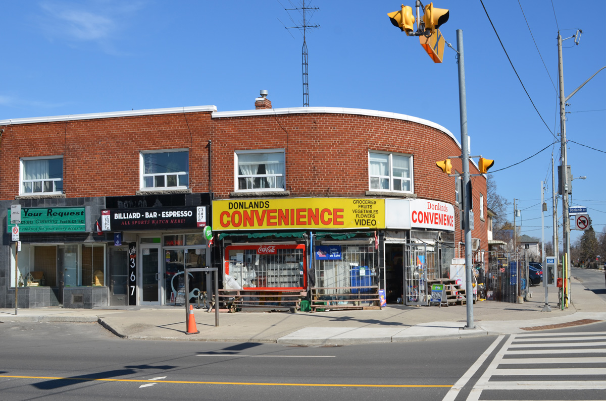
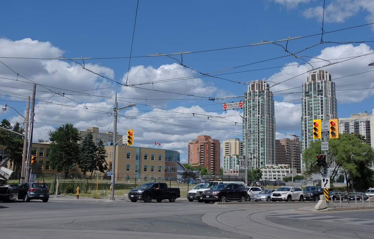
below: This building is on the northeast corner of Bloor and Dovercourt.

old square brick building on the north east corner of Dovercourt and Bloor, apartments on top and stores on ground level

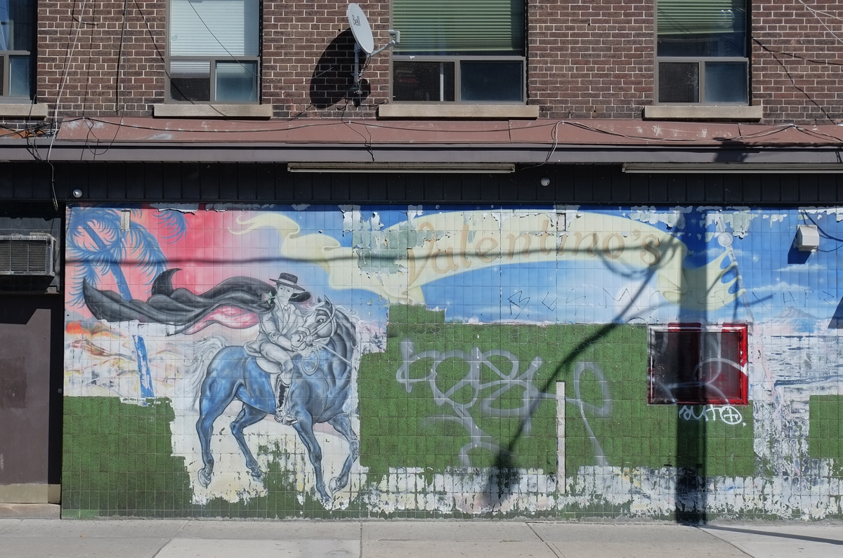
below: I haven’t been able to find out anything about Valentinos but I quite like the debonair rider with a rose between his teeth.

old faded mural of a man on horseback, with hat and cape, the word Valentinos is written near the top, most of the mural has been painted over and is now just green

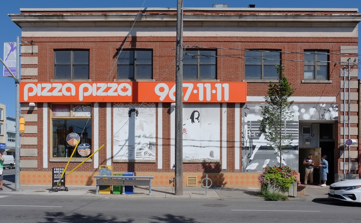
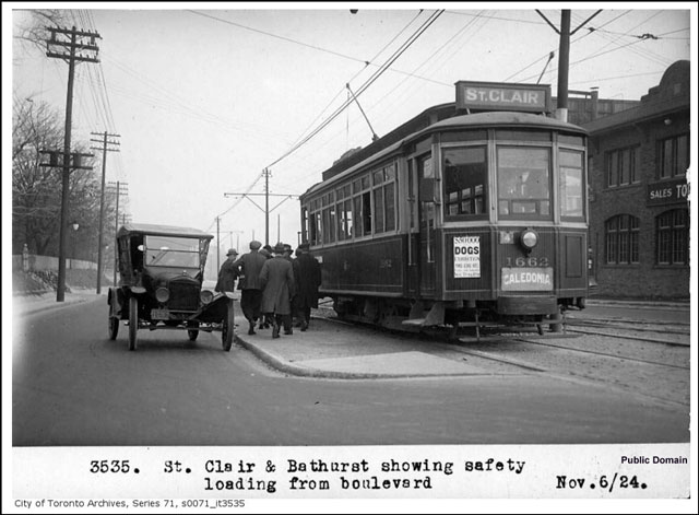
below: Vintage photo of the Bloor and Dovercourt intersection.  No cars!

vintage coloured postcard of the intersection of Bloor and Dovercourt in Toronto, hydro poles, brick buildings, streetcar, woman crossing road, no cars

below: The red and white building in the postcard above is on the southeast corner of the intersection. It is now home to a Pizza Pizza. Most of it’s large windows have been covered over with large pictures.  The streetcar tracks on Bloor are long gone and Davies butcher shop is now a Starbucks.

below: I walked past St. Michael Archangel Serbian Eastern Orthodox Church (on Delaware Ave) and a Portuguese Presbyterian Church (on Dovercourt).  Then I came across the Centennial Methodist Church.  It was built in 1906 and converted into residences in 2010.

front of Centennial Methodist church on Dovercourt, now apartments, red brick building with large round top windows

historical plaque for centennial methodist church on dovercourt road

CENTENNIAL METHODIST CHURCH, 1906, This Neo-Gothic inspired church replaced an earlier Centennial Methodist Church built on this site in 1891. Notable design elements include decorative stone trim, three central Tudor-arch windows, and flanking square towers topped with pyramidal steeples. It was renamed Centennial United Church in , after the creation of the United Church of Canada. In 1986, the Nisei congregation of the Toronto Japanese Church joined Centennial United to form Centennial Japanese Church. A residential redevelopment was completed in 2010.


below: A little farther south on Dovercourt I passed this for sale sign.   I stopped and took a photo of it because of the words in pink: “Laneway suite potential”.  Of course I had to check the lane to see if anyone had built suites back there.   Suites, according to the city of Toronto, are rooms built over garages and not stand alone residences.

for sale sign on the grass in front of a house

below: It is a neat and tidy lane but so far with no suites

Bill Cameron Lane

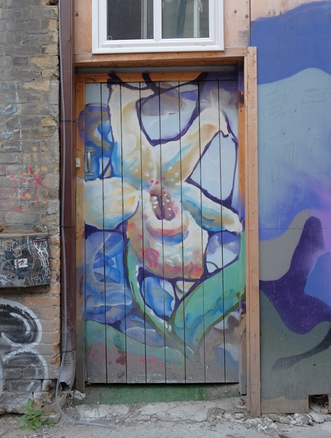
below: But I did see this mural there.

garage door covered with a mural of a boy walking in a birch forest in the snow with his dog following him

below: I also noticed that the backyards on both sides of the alley were very deep, wonderfully deep actually, especially for a city house.  You could probably sever it in two quite easily.

backyard, view from an alley

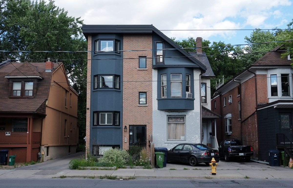
below: In fact, something like that has happened a bit farther south where someone took one house, renovated it, and added three more residences with additional access from the alley behind.   I notice that there are 4 water meters here as well as a gate that possibly provides access to the houses behind.

part of a modernized and renovated house with new houses built behind it

In case you’re curious, the four houses are all for sale.  The house in front is a semi and the asking price is $2,400,000.  For that you get 2992 square feet and 4 bedrooms.  The others are slightly smaller and slightly less expensive.

below: A rare large vacant lot

the side of a house on the other side of a large vacant lot

below: Norbregas Variety and Grocery.

Norbregas variety and grocery store, the ground floor of a house on a corner in a residential area, Dovercourt

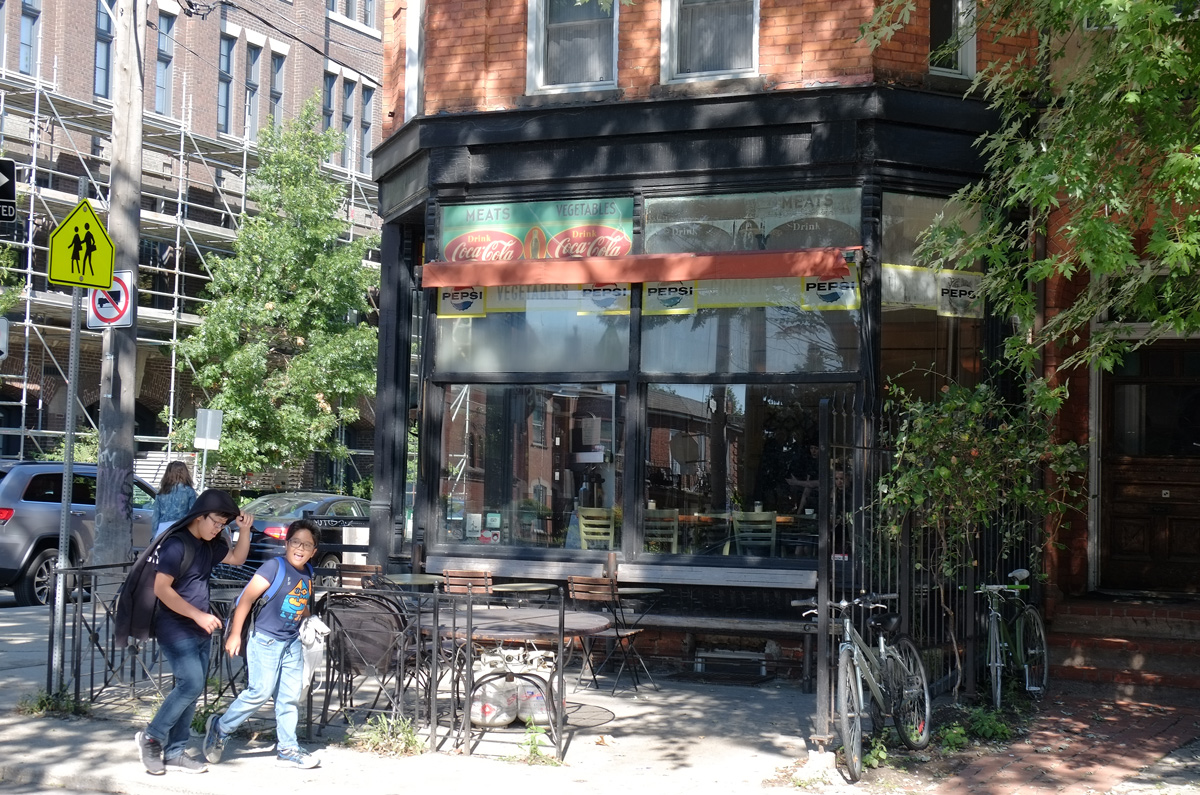
below: And nearby, a cafe with both Coca-Cola and Pepsi signs

a deli, cafe, with old coca cola, coke, signs as well as pepsi signs. chairs and tables out front, large windows, two boys wakling past, on a corner in a residential area, old house

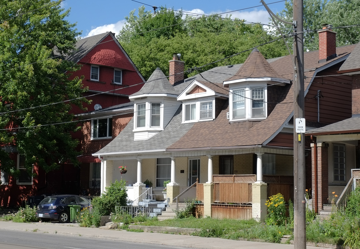
below: The streets around Dovercourt are all very nice with lots of large solid old houses and tall trees – in this case, a chestnut tree.

chestnut tree and large old houses on a street

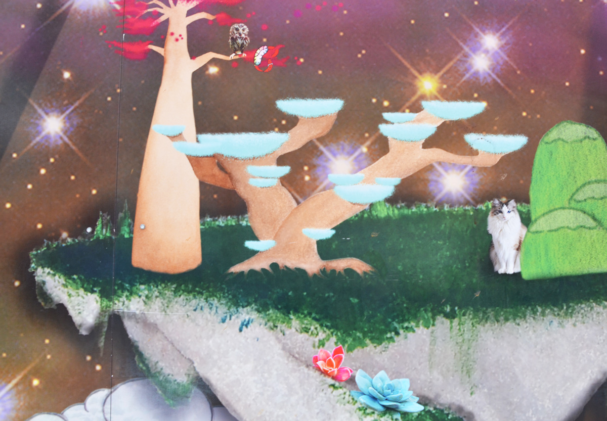
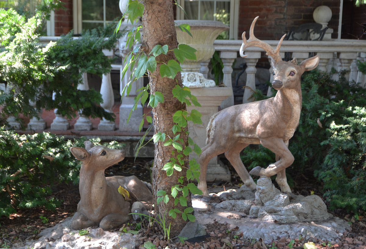
below: I even spotted some wildlife!

two statues of small deer in the front yard of a house, one is lying down and looking at the other who is standing nearby, both are in the shade of a large tree

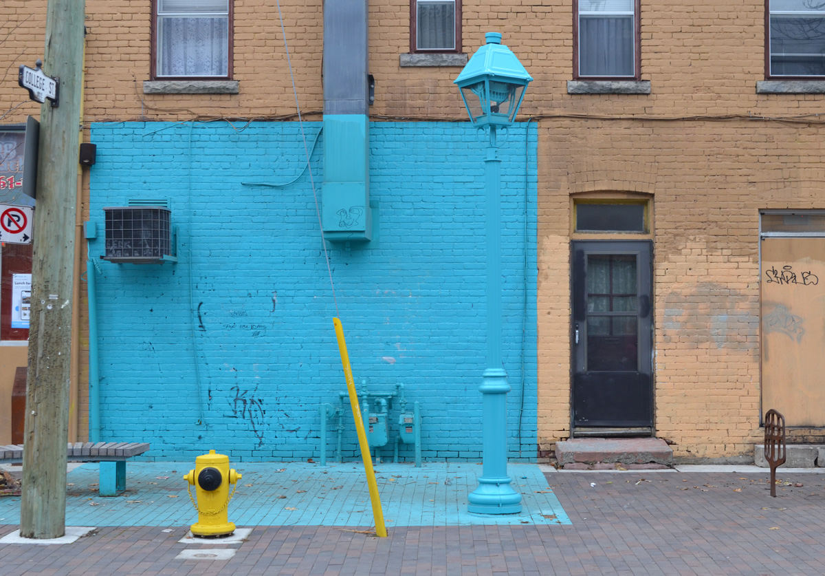
below: Northeast corner of College & Dovercourt

three storey red brick building on corner of college and dovercourt, northeast corner, stores on the lower leve, traffic lights, utility poles and streetcar wires

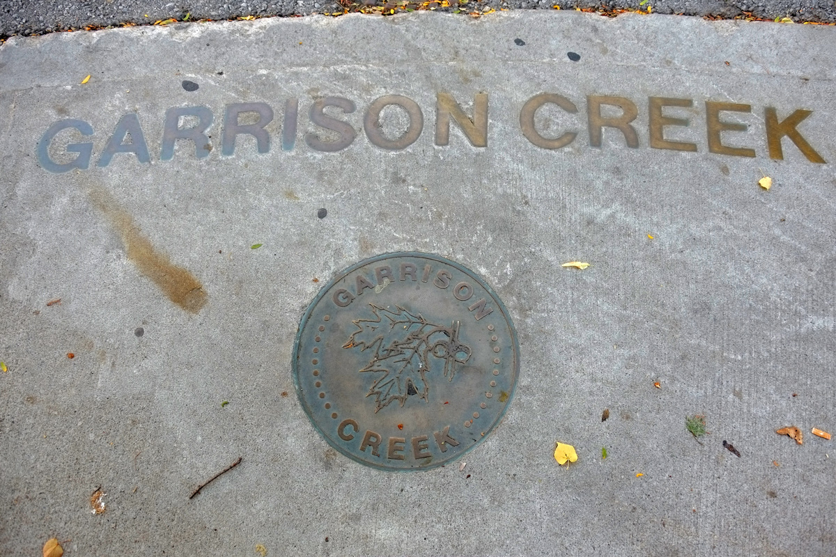
below: Letters embedded in the sidewalk where one of the branches of the Garrison Creek passes underground, just south of College Street.  The creek was buried more than a century ago.  In the early days, the creek was treated more like an open sewer than a river.  As the city developed, the stream was diverted into underground sewers (1880’s) and streets were built above it.   By 1920, almost a century ago, the stream was entirely diverted into the sewer system.

brass letters embedded in the sidewalk that say Garrison Creek, also a round metal medallion with the same words

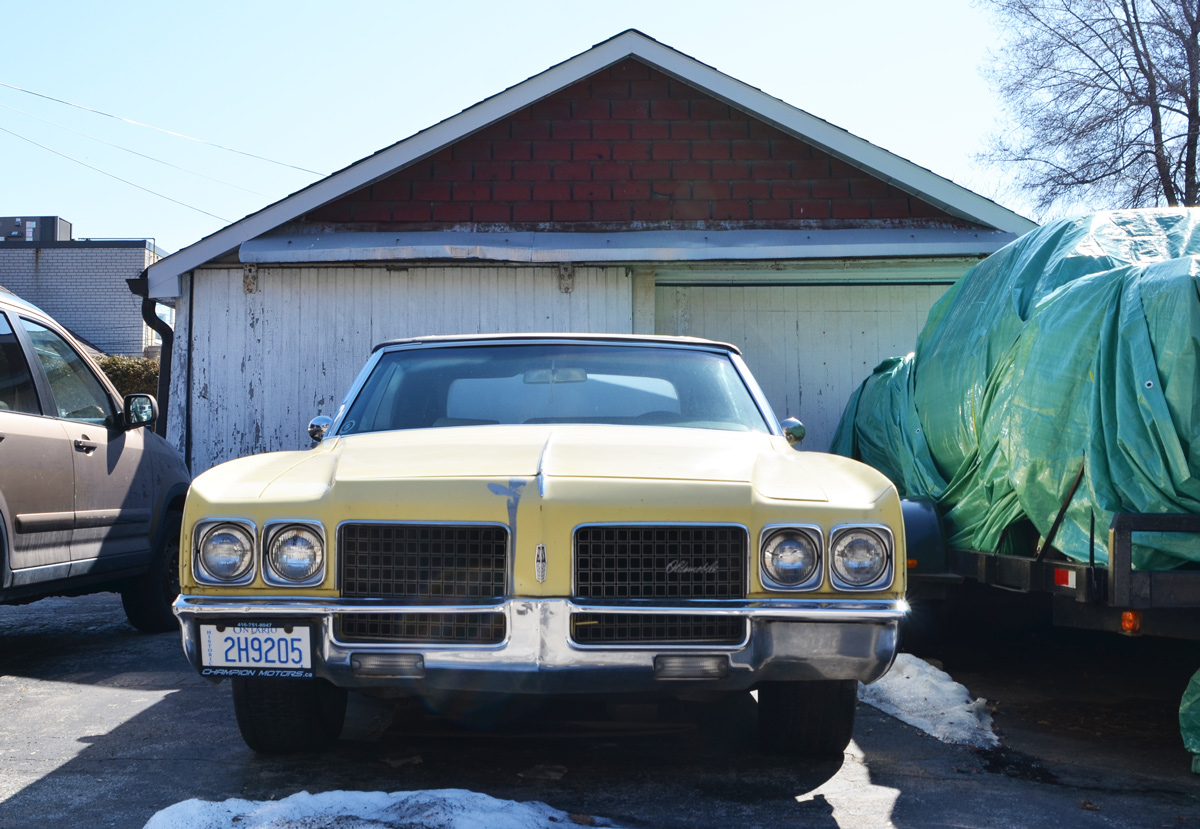
below: The age of this car seemed to fit well with the buildings around it.

man stands beside on older car in a parking lot surrounded by old brick buildings

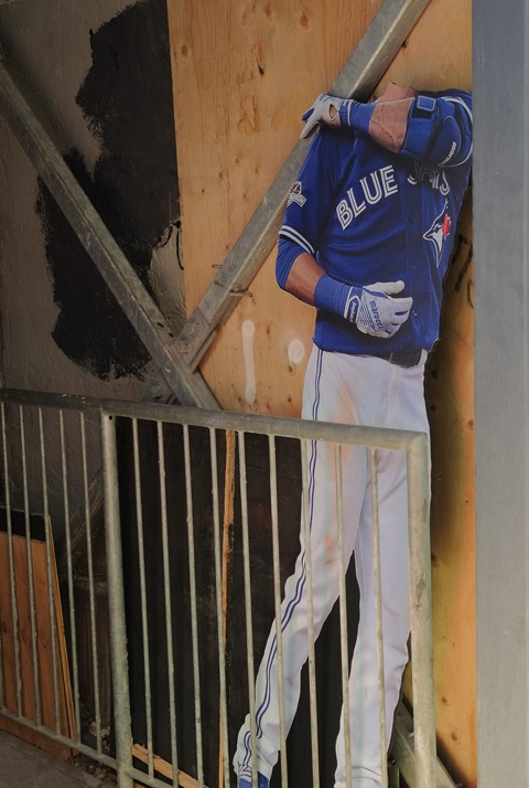
below: Some of Dr. Spock still remains.  He hasn’t been beamed up  yet.

once a mural of Dr Spock, now tagged over although Spock's head is still visible

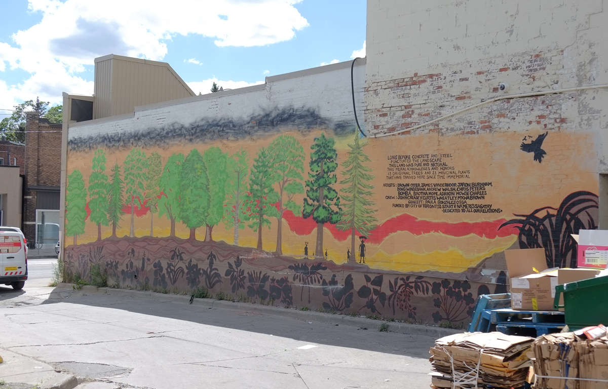
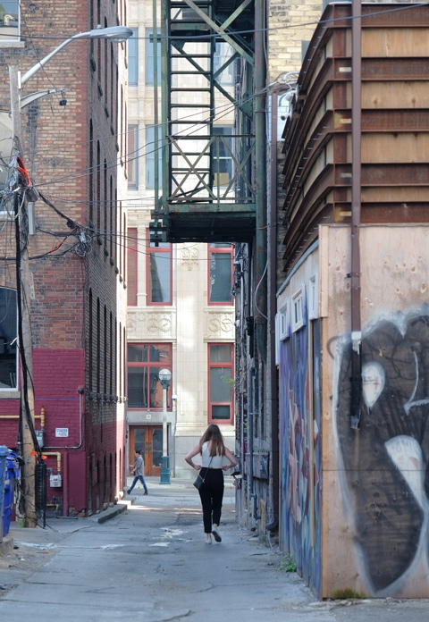
below: Part of a mural by elicser in a lane behind Dundas West

elicser painting of a man in a brown toque

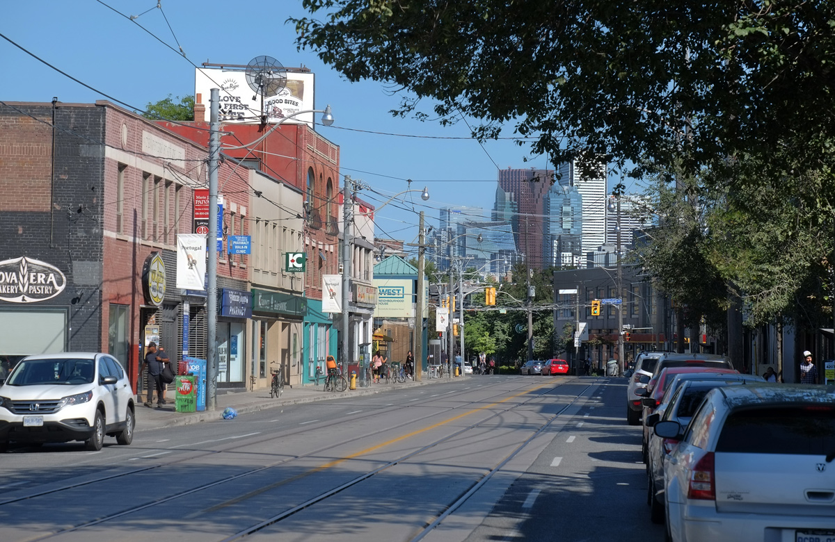
below: Looking east along Dundas, from Dovercourt

view along Dundas to the east, and downtown Toronto, from Dovercourt Rd

below: A larger than life Pink Panther painted by Matt Gondek.  This is on the northeast corner of Dundas and Dovercourt, close to Skey Lane where his other murals are (see recent blog post on Skey Lane)

mural of pink panther sitting in a chair, large

below: She can still be found near Queen and Dovercourt (painted by Jarus)

mural by jarus in an alley, a woman looking over her shoulder

Just before Queen Street West there is an art galley called the David Kaye Gallery.

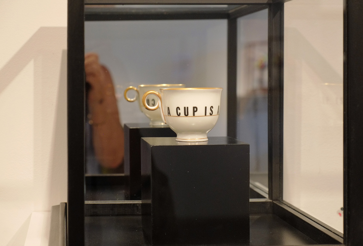
below: It may be difficult to see, but this cup is displayed in a glass case mounted on the wall. The back part of the cube is a mirror. For $12,500 it can be yours (but my arm is not included!).

a white tea cup on a black block inside a glass cube with a mirror at the back. on the cup, in black letters, are the words a cup is a cup

below: Both this piece, and the cup above, are part of “Camp Fires: The Queer Baroque of Léopold L. Foulem” and are on display until the 23rd of September.

artwork by Leopold Foulem, a porcelain piece with gold figures on the sides like handles

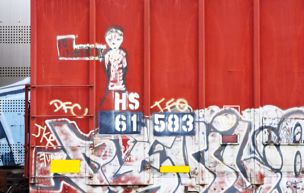
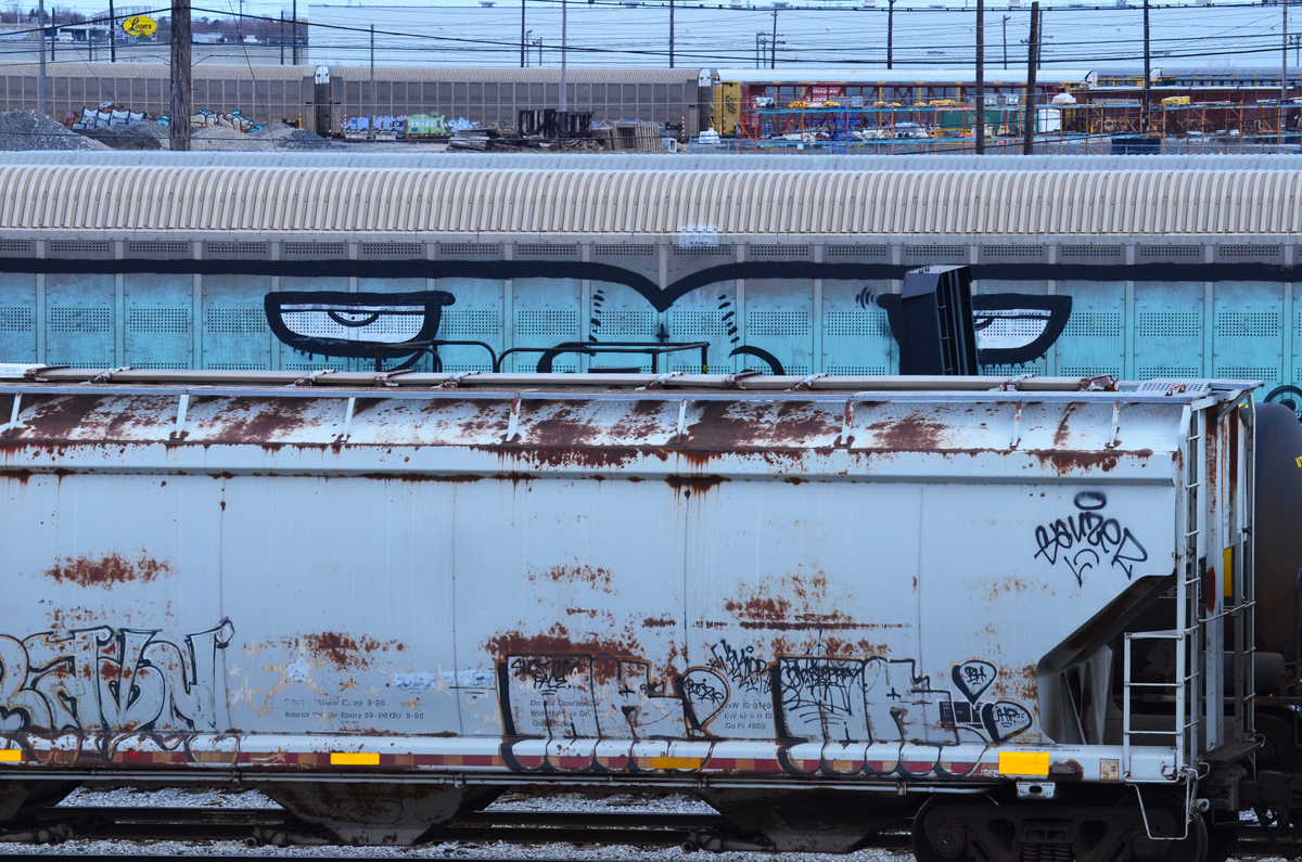
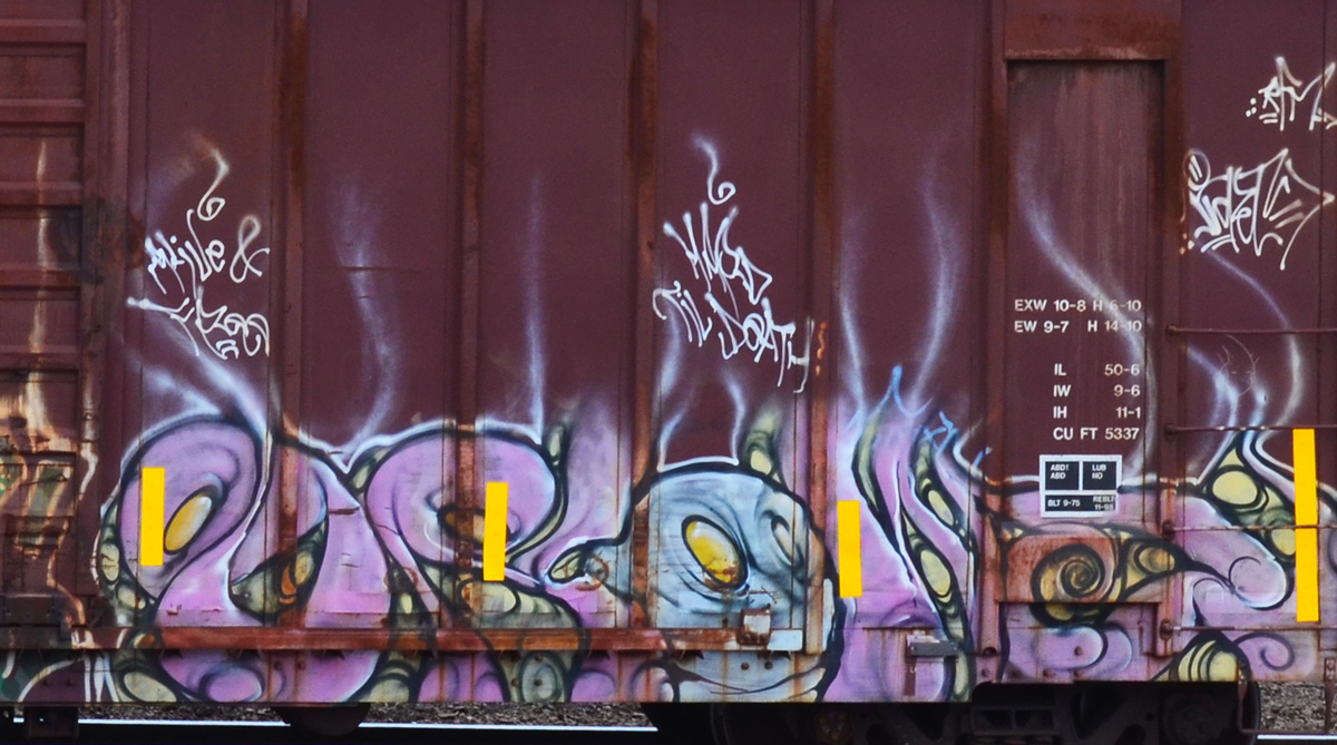
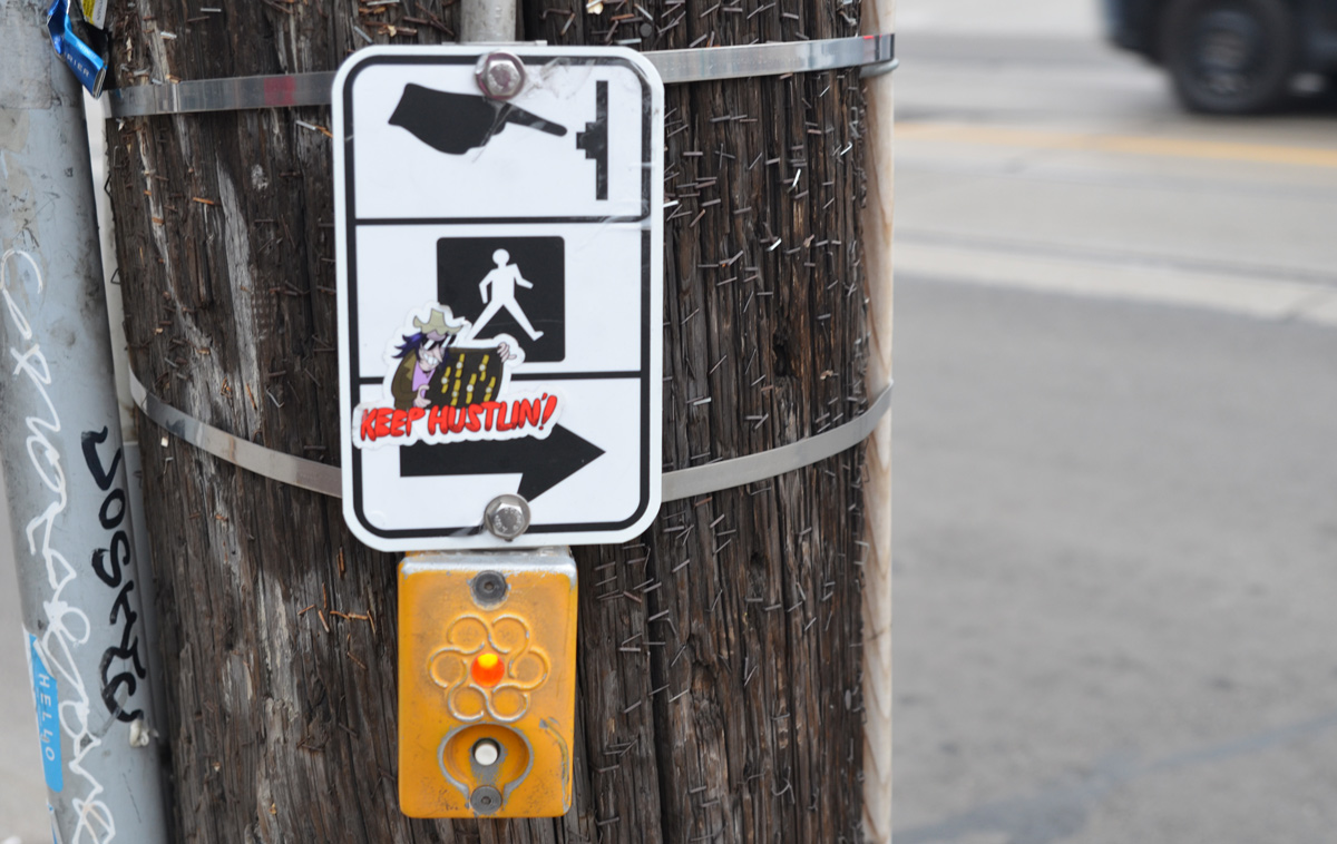
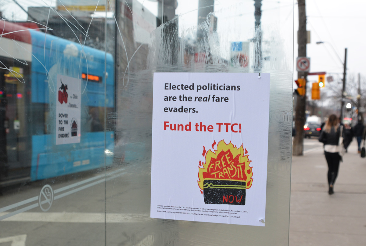
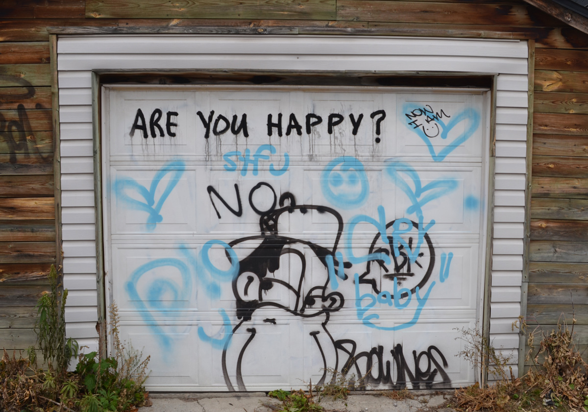
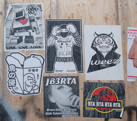
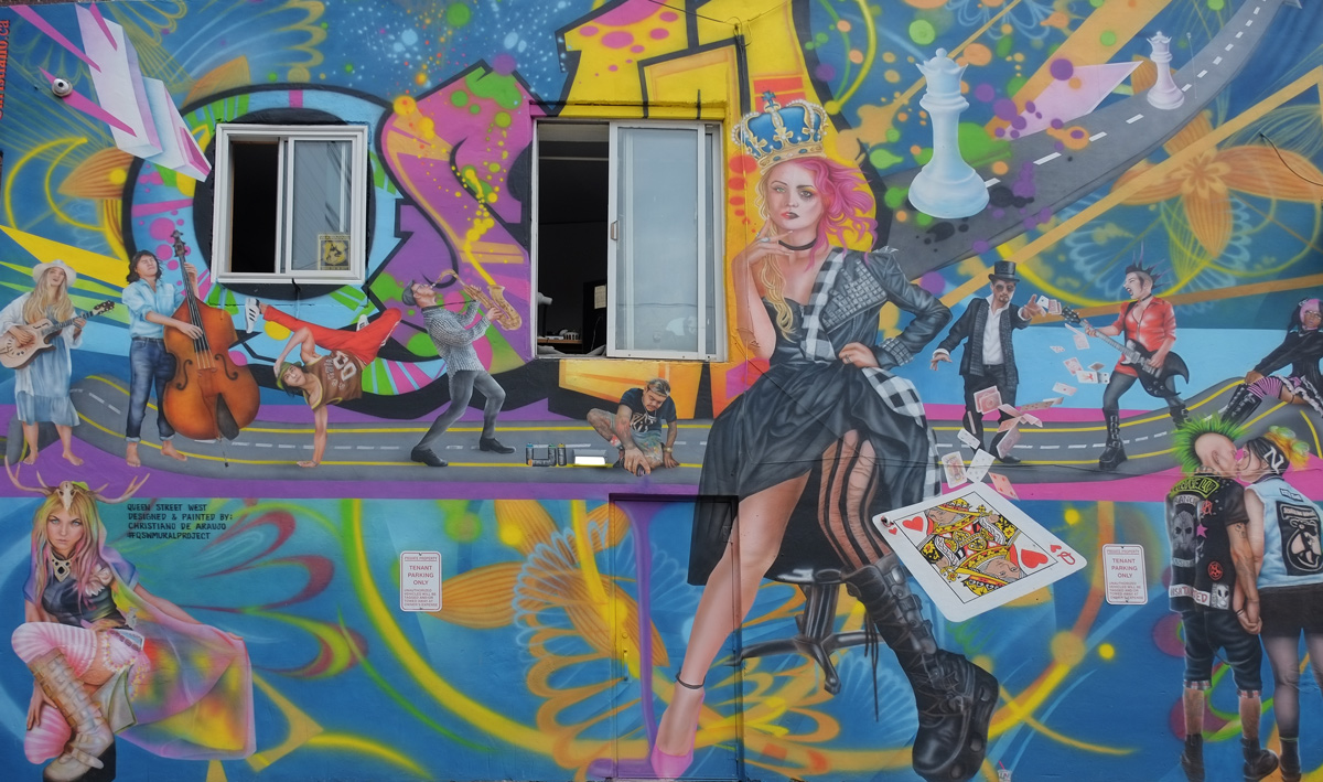
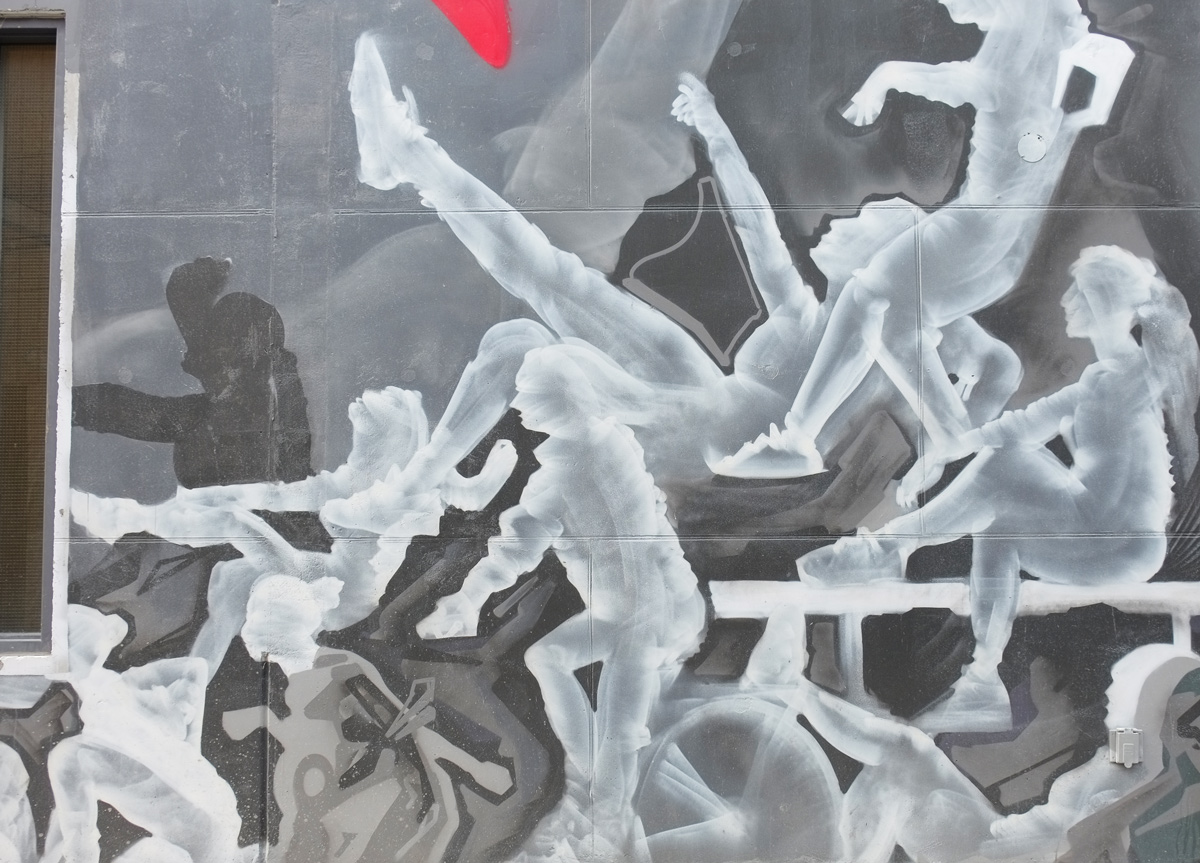
I am going to end this blog post with a few pictures of some of the graffiti that I saw:

below: Red hearts on a yellow door.

a door painted yellow with three large red hearts on it

below: No more need for parliaments

a beige garage door with the words no more need for parliaments written on it

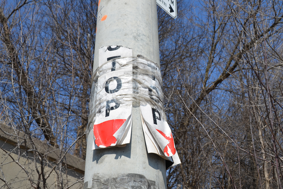
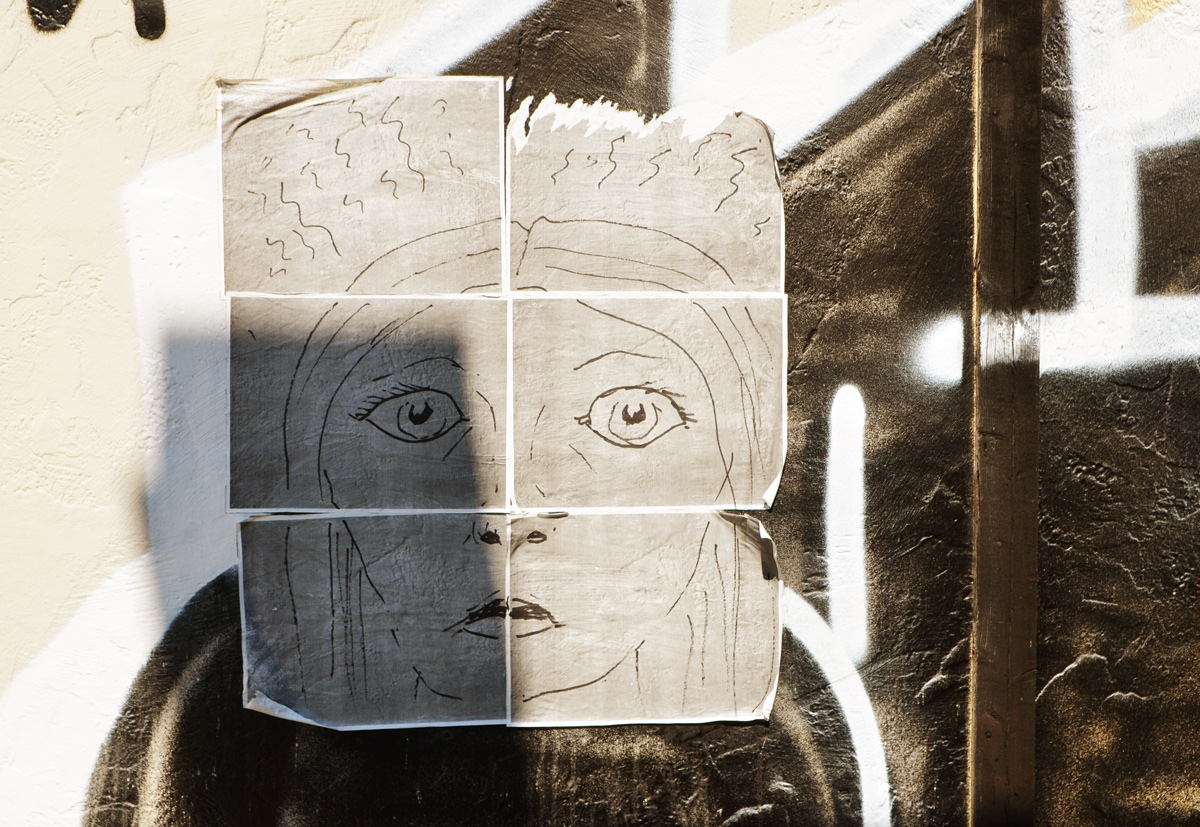
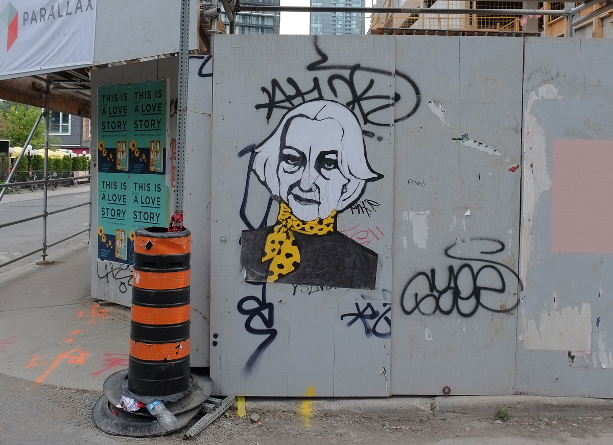
below: She’s a bit frayed at the edges and coming apart at the seams.

a hand drawn picture of a face, on paper, pasted on a fence

There is no theme to this blog post.  It’s just a description of some of the things that I saw as I walked down Bathurst Street the other day after taking the 512 streetcar to St. Clair West station.   In a lot of ways its like other busy Toronto streets, some houses, a few corner stores, and an alley or two along the way.   A little bit of architecture and a little bit of history round out the story.

At St. Clair West and Bathurst, the northeast corner remains vacant. About four or five years ago there was a gas station and car wash on this corner.  St. Clair West subway station is just to the east, just beyond the trees on the right hand side.

northeast corner of Bathurst and St. Clair West, vacant lot, St. Michaels College in the background as well as a couple of highrise condos.

below: I went looking for an old photo of this corner and this is what I found.  It’s from 1924.  If the streetcar’s destination is Caledonia, then it is going westward.  In 1924, St. Clair was the northern edge of the city and very little development had occurred here.  It is interesting to note that the streetcar tracks came first, then the development.   In addition, I’d love to be able to read the sign about dogs but the resolution of the photo is not good enough.  An ad?  A sign saying no dogs allowed?  Or something else?

vintage black and white photo from 1924 of a streetcar on the St. Clair line stopped at Bathurst to pick up passengers.

below: Of course, no vacant lot remains that way for long.   At the moment, three 30 storey towers joined with a 6 or 7 storey podium has been proposed for the site but it is still in the re-zoning and planning stages.  The light brown building to the left is St. Michael’s College School (boys school).

blue and white city of Toronto development notice sign on a small hill, by some trees, in front of a vacant lot. Highrises in the background

below: New development on the southeast corner of this intersection is almost complete. People have moved into the units above while the finishing touches are put on the lower retail floors. Developments like this are all over the city. Developments that look great (maybe?) on paper but are lackluster and banal at street level.

street level of a new glass and steel building, empty retail space available for lease, just finishing being built

below: As I walked south on Bathurst, this mural caught my eye.

mural in a laneway, painting of many trees with red and yellow sky, dark brown earth, and a few small black figures, some words beside it

Words written beside the mural:
“Long before concrete and steel
Punctuated the landscape
The land was pure and natural
This mural acknowledges and honors 13 trees and 21 medicinal plants that have thrived here since time immemorial.”

The mural was funded by Toronto’s Start program (street art) and Na’Ma’Res Sagatay, a residence for indigenous men that is nearby.

close up of mural, large trees with wavy red and yellow sky, small black figures standing under the trees

I will admit that the main reason that I was walking in this area is because I wanted to check out the new public artwork that I’ve read about at Bathurst and Vaughan.  It is “Three Points Where Two Lines Meet” by Christian Giroux and Daniel Young and apparently there is some controversy about it.

below: For those who don’t know that intersection, it is V-shaped.  This photo shows the approach to  the intersection from the north, on Vaughan.  I took this photo because my first reaction to the scene was “Ugly.  Ugly is what Toronto does”.  From this angle the sculpture gets lost in the visual noise.

sidewalk, lined by tall hydro utility poles, wood, road, some buildings, approaching the intersection of Bathurst and Vaughan

Cities have rules and regulations for public art. It needs to be weatherproof and graffiti-proof.  It can’t block the view of drivers and pedestrians.  No sharp edges or structures that people might hurt themselves on – note the two black poles are to prevent people from hitting their heads.

A woman walks past Three Points Where Two Lines meet

From Giroux & Young’s website:  “Taking its form from the orphaned triangular site on which it sits, this artwork produces a new urban room by combining a multicoloured truss structure, the triangular plot of wild grasses it encloses, and an encircling sidewalk thats acts as a podium and plinth. Located between the converging energies of uptown and downtown, the structure densifies an intersection already clotted with utilities and challenges established forms of urbanism and spatial representation in Toronto.”  Think of that what you will.  While you’re thinking, you can check the website for more photos and information.

Three Points Where Tao Lines meet, a public art sculpture in bright colours, metal grid like construction cranes, by Daniel Young and Christian Giroux at the intersection of Bathurst and Vaughan.

below: An interesting (unique?) roofline on what turns out to be The Occult Shop.  I made one mistake – I neglected to cross the street to go inside and find out just what one can buy here.

brick building with a large rounded roofline, the bulding is a semi, one half has doors and windows covered with white from the inside, the other is the occult shop

below: These people can still be seen in the space above the doorway at 1358 Bathurst.

the space above a doorway at number 1358 Bathurst is painted with pictures of people (head and shoulders) in shades of brown

Continuing south on Bathurst, as you go downhill towards Davenport Road, there is a retaining wall beside the sidewalk on the west side.  This wall was painted back in October 2013.  The city paid $23,000 to two Brooklyn NY street artists (Patrick McNeil and Patrick Miller, together known as Faile) who designed the mural and in turn paid other artists to paint it.

The mural is quite long and I only have a few pictures of bits and pieces of it.

mural, large blue and white owl, with words in large letters that say no change my heart

mural, large painting of a blond boy sleeping, head on pillow, head and shoulders only

mural, by faile, orange car, woman driver, the word vanity written on the side of the car

below: Apparently Davenport Road is considered to be one of Toronto’s oldest roads.  It follows the base of a ridge and provided a route between the Humber River in the west and the Don River in the east.

toronto historical society plaque for Davenport Road, 1995, description of the history of Davenport Road

below: There is a park on the northwest corner of Bathurst and Davenport, The Tollkeeper’s Park.  The old house, the Tollkeeper’s Cottage, is now a museum run by The Community History Project.  It is open on Saturday afternoons (and some Sundays during the summer)

The Tollkeeper's Park, sign, green space, trees, and an old small wood frame house, now a museum,

below: And across the road is Tollkeeper’s Lane.  There are chairs everywhere in this city not usually as comfy looking as these.

two comfy chairs in an alley withtheir backs agains a grey garage door

below: An old Comet parked in the alley

a yellowish beige Comet car, old, parked behind a house in a lane

below: Tomatoes and other vegetables growing in a front yard.

small front yard packed full of vegetable plants looking very green and healthy

below: A hand, part of an Elicser mural.  This mural, which is on both sides of the railway underpass just north of Dupont, is still there.  Photos can be seen in a blog post from Nov 2014 (Yikes!  Have I been blogging that long?!).

part of a mural, a blue hand horizontal on a wall with some weeds growing in front of it

There are a few remnants of a more industrial past in the area near the railway tracks.

a window consisting of 18 panes of glass, 6 across and 3 down, some have texture and some are clear. the clear ones are reflecting the blue sky and clouds.

old wood door, once painted green but the paint is peeling

below: Another door –  I doubt that it’s open now, or that it ever will be again.

back door of an empty house, window boarded over, door with board nailed across it, open sign in the window, also a sign that says beware of dog

below: These windows, and the house too, probably won’t be here much longer either.

green trim around roof and windows of an old house

below: A very standard row of semi-divided houses; a common sight.  Hundreds (thousands?) of these were built around the city.

a semi divided house on bathurst street, two storey, bay windows on upper floor, porches, stairs to front door

below: And a not so usual semi.

a semi divided house on bathurst street where one side has been rebuilt into a taller square structure

below: A touch of art deco.

two doors side by side with art deco motifs, on a low rise brick building

below: Slight larger houses, with turrets even!  (or is there another name for this architectural element?)

a semi divided house on bathurst street both with small turrets above upper floor bay windows

below: This is part of Coopers Hawk Lane which is just south of Dupont.

buildings and garages in a lane, Coopers Hawk Lane, garage doors have street art on them.

painting of a wooden box with papers in it, pictures of people on the papers

below: In another nearby alley …. a pink cat eating ice cream

two doors in an alley, painted, one in colours, the other in black and white

below: And a gate with a frame, and the laundry beyond.

a chainlink fence and gate in a back yard, laundry hanging out to dry in the yard, brick houses, some green grass

red octagonal stop sign with a sticker on it that says take a breath


July is still hot and still humid.  Not complaining though – it’s just part of my excuse as to why I haven’t posted much recently.  Yesterday morning I managed to get myself out the door around 7:30 so I could walk comfortably – without drowning in sweat.

below: Getting ready to walk.

looking out the window of a Starbucks, backwards writing on the window, a dog tied to a tree, a bike,

I followed the morning light but still trying to stay away from places that are too familiar.   The following pictures are in no particular order.

below: With hands on hips, in an alley near Queen & John.

a woman walks down an alley, away from the camera, metal fire escape staircase is above her, brick buildings beside her

below: Vincent Van Gogh has taken up a position on Dundas Street across from the AGO.  This 8′ x 8′ sculpture sits in front of the Mayberry Fine Art gallery.  It is the work of Saskatchewan artist Joe Fafard who recently had an exhibit at that gallery. Fafard has other works in the city – he is the artist that produced “The Pasture” which is the seven life-sized bronze cows outside TD Centre.  I don’t have a photo of the cows for this blog post, but if you don’t know the piece (or want to see it again), here is a link to an article about them.

large square blue and yellow artwork that looks like the face of Vincent Van Gogh in front of a building with pillars and front steps. A young woman is walking by

below: A large flower in an alley doorway.

painting of a large flower on a door in an alley

below: Beside the flower is a black and blue butterfly.

spray paint street art mural of a blue and black butterfly

below: A heart bursting with colour on Cayley Lane.

garage and garage door painted in mural with a red heart in the center, surrounded by pink, purple and blue triangles

below: Black face, white face. What emoji face are these?

graffiti on wall and on wood pole, both are faces with mouth and two round eyes

below: Harriet Boulton Smith is the ceremonial name for the section of John Street between Queen Street West and Stephanie Street.  Harriet Smith was the last owner of “The Grange” and Grange Park.  When she died in 1910, she left her home and seven acres of land to the Art Museum of Toronto (AMT).  The site is now the home of the Art Gallery of Ontario.  She also bequeathed the family art collection to the AMT.    This section of John Street was once the driveway to the Grange.

Toronto street sign for John Street, also called Harriet Boulton Smith Way

below: He lost his head in the lane.

a headless cardboard cut out of a Toronto Blue Jay baseball player, in a doorway, in a lane.

below: Taking the bathroom stall with him.  The toilet paper holder is empty though.

a man carries a metal divider from a bathroom, with toilet paper roll holder still attached, carrying it on his shoulder

below: One of my favorite windows.  Sunday was the day of the French vs Croatia soccer/football World Cup game and there was a group of France supporters gathering on Peter Street to watch the game.  Apparently the party after the game, celebrating France’s victory, spilled out onto the street afterwards but unfortunately I missed it.

the window of Nickys coffee shop, on red brick wall, with two women walking past, both are carrying French flags

below: Old rusty metal barrels and butterflies.

a tree grows behind old rusty metal barrels and a wall painted blue with little butterflies painted on it.

below: The ice cream “mane” is still there.  I frequently walk down an alley and wonder if I’ve ever been this way before… and then I spot an old friend and recognize where I am.  That was the case when I spotted the ice cream guy (mane?  why mane?).  I think he dates from 2014.

street art painting in a laneway of a man in white uniform and hat, holding popsicle in one hand and ice cream cone in the other, words say ice cream mane

below: Same alley as the ice cream man, perhaps the same vintage originally?  The white swirls and the ‘love’ came after I think.

old street art, paint fading, of a blue man's face, and the word love

below: 24 hour public parking on the large sign, private parking on the small pink one but no one’s parking there anyhow.

parking lot, white wall behind, parking lot attendant booth covered in signs, 24 hour public parking, private parking,

below: Pasteups on plywood hoardings.  A love love love lovebot and a blessed urban ninja squadron amongst others.

paste ups on plywood hoardings,

below: Reflections

reflections of City TV building in a puddle

below: Large mural behind Queen Street West (south side) featuring queens of different sorts – cards, chess and people at the minimum.  “Queen Street West” designed and painted by Christiano De Araujo near the end of 2017.

large mural on the side of a building in an alley, theme is Queen Street west, queen of hearts heart, musicians,

below: Looking south on Soho Street towards Queen.  On the right is the new Mountain Equipment Coop store under construction.

looking down street towards Queen Street West

below: Street art in the greenery

street art in an alley

below: Lines. Electrical lines.  Horizontal lines of the stairs.  Vertical lines of the buildings.

metal staircase on upper level, street lights, electrical wires,

below: The next two photos are of a large mural on the back of a new building.  The first picture shows the figures on the right hand side of the mural.  Figures in action.

below: The Umbra building is clad with vertical lines made from a material that takes on different colours depending on the light.

building, umbra store, vertical lines on exterior of a material that changes colour depending on the light

below: Who is she?

below: Bent metal bracket

bent metal bracket on a white (painted) wood utility pool

Today, Monday, the sky looks stormy.  Perhaps a good thunderstorm will take away the humidity.  Whatever the weather, I’ll be back soon!