There is no theme to this blog post. It’s just a description of some of the things that I saw as I walked down Bathurst Street the other day after taking the 512 streetcar to St. Clair West station. In a lot of ways its like other busy Toronto streets, some houses, a few corner stores, and an alley or two along the way. A little bit of architecture and a little bit of history round out the story.
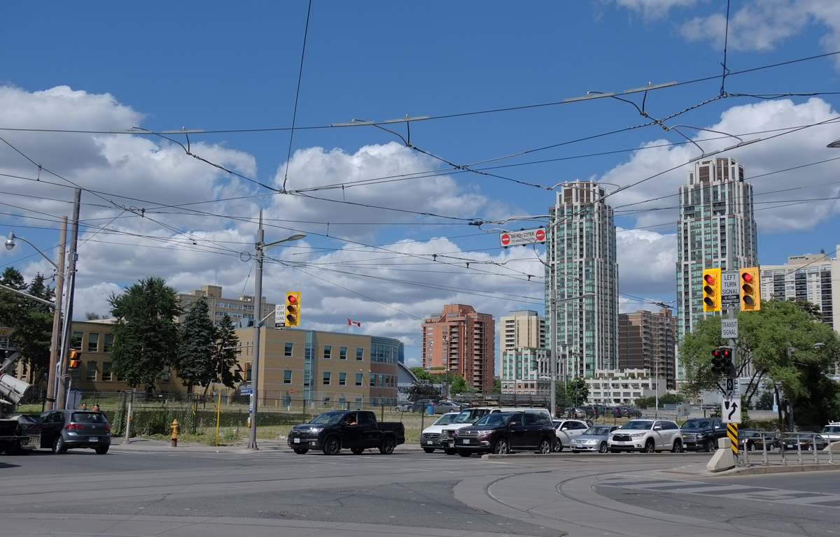
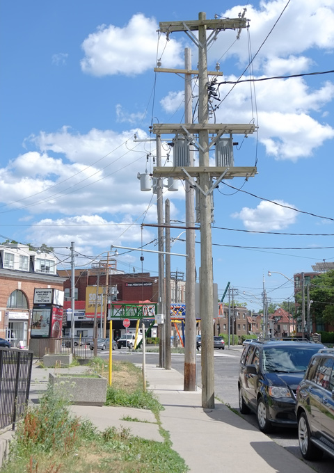
At St. Clair West and Bathurst, the northeast corner remains vacant. About four or five years ago there was a gas station and car wash on this corner. St. Clair West subway station is just to the east, just beyond the trees on the right hand side.
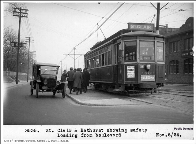
below: I went looking for an old photo of this corner and this is what I found. It’s from 1924. If the streetcar’s destination is Caledonia, then it is going westward. In 1924, St. Clair was the northern edge of the city and very little development had occurred here. It is interesting to note that the streetcar tracks came first, then the development. In addition, I’d love to be able to read the sign about dogs but the resolution of the photo is not good enough. An ad? A sign saying no dogs allowed? Or something else?
below: Of course, no vacant lot remains that way for long. At the moment, three 30 storey towers joined with a 6 or 7 storey podium has been proposed for the site but it is still in the re-zoning and planning stages. The light brown building to the left is St. Michael’s College School (boys school).

below: New development on the southeast corner of this intersection is almost complete. People have moved into the units above while the finishing touches are put on the lower retail floors. Developments like this are all over the city. Developments that look great (maybe?) on paper but are lackluster and banal at street level.

below: As I walked south on Bathurst, this mural caught my eye.
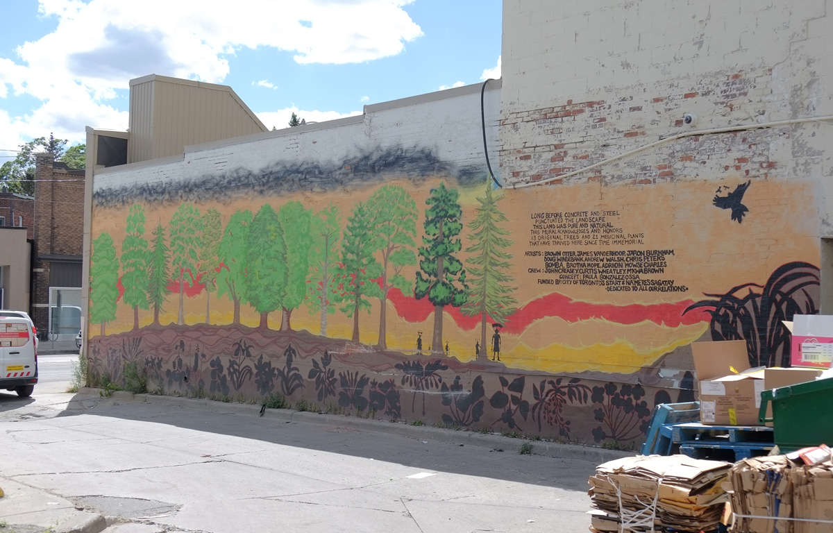
Words written beside the mural:
“Long before concrete and steel
Punctuated the landscape
The land was pure and natural
This mural acknowledges and honors 13 trees and 21 medicinal plants that have thrived here since time immemorial.”
The mural was funded by Toronto’s Start program (street art) and Na’Ma’Res Sagatay, a residence for indigenous men that is nearby.

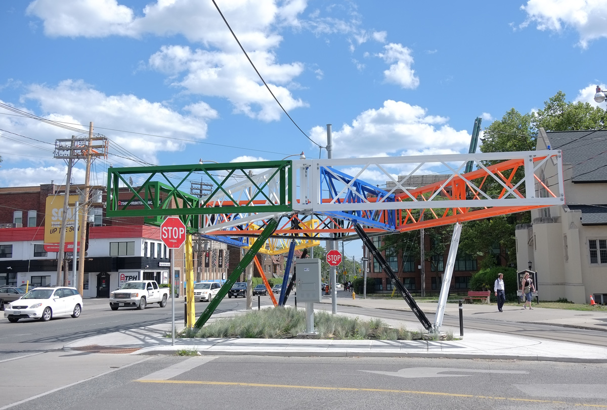
I will admit that the main reason that I was walking in this area is because I wanted to check out the new public artwork that I’ve read about at Bathurst and Vaughan. It is “Three Points Where Two Lines Meet” by Christian Giroux and Daniel Young and apparently there is some controversy about it.
below: For those who don’t know that intersection, it is V-shaped. This photo shows the approach to the intersection from the north, on Vaughan. I took this photo because my first reaction to the scene was “Ugly. Ugly is what Toronto does”. From this angle the sculpture gets lost in the visual noise.
Cities have rules and regulations for public art. It needs to be weatherproof and graffiti-proof. It can’t block the view of drivers and pedestrians. No sharp edges or structures that people might hurt themselves on – note the two black poles are to prevent people from hitting their heads.

From Giroux & Young’s website: “Taking its form from the orphaned triangular site on which it sits, this artwork produces a new urban room by combining a multicoloured truss structure, the triangular plot of wild grasses it encloses, and an encircling sidewalk thats acts as a podium and plinth. Located between the converging energies of uptown and downtown, the structure densifies an intersection already clotted with utilities and challenges established forms of urbanism and spatial representation in Toronto.” Think of that what you will. While you’re thinking, you can check the website for more photos and information.
below: An interesting (unique?) roofline on what turns out to be The Occult Shop. I made one mistake – I neglected to cross the street to go inside and find out just what one can buy here.

below: These people can still be seen in the space above the doorway at 1358 Bathurst.

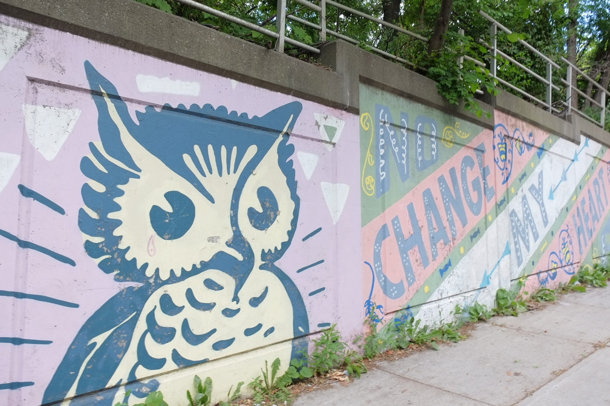
Continuing south on Bathurst, as you go downhill towards Davenport Road, there is a retaining wall beside the sidewalk on the west side. This wall was painted back in October 2013. The city paid $23,000 to two Brooklyn NY street artists (Patrick McNeil and Patrick Miller, together known as Faile) who designed the mural and in turn paid other artists to paint it.
The mural is quite long and I only have a few pictures of bits and pieces of it.


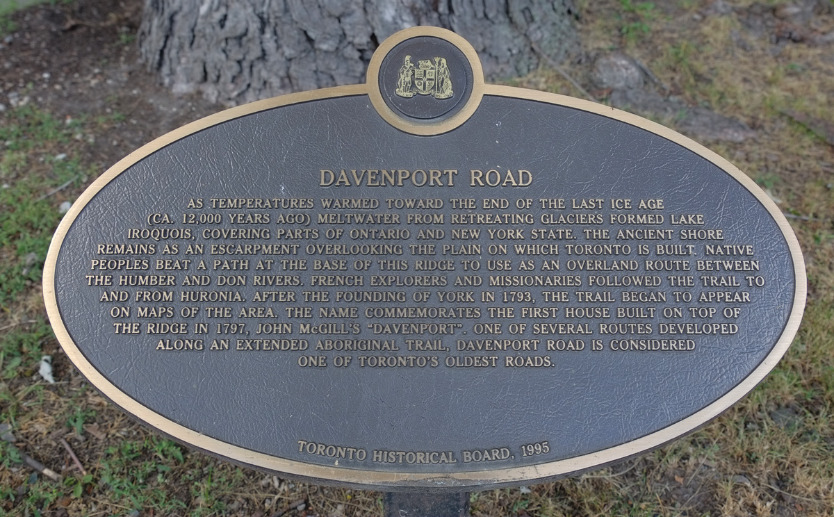
below: Apparently Davenport Road is considered to be one of Toronto’s oldest roads. It follows the base of a ridge and provided a route between the Humber River in the west and the Don River in the east.
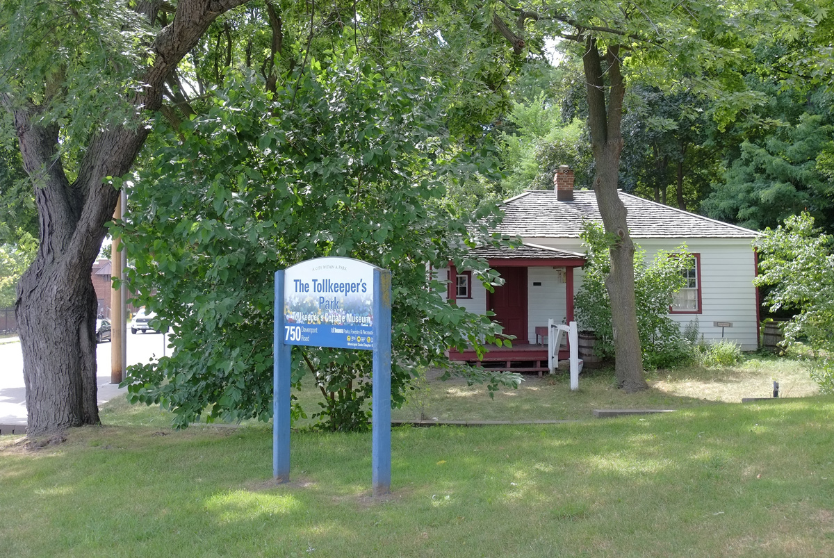
below: There is a park on the northwest corner of Bathurst and Davenport, The Tollkeeper’s Park. The old house, the Tollkeeper’s Cottage, is now a museum run by The Community History Project. It is open on Saturday afternoons (and some Sundays during the summer)
below: And across the road is Tollkeeper’s Lane. There are chairs everywhere in this city not usually as comfy looking as these.

below: An old Comet parked in the alley

below: Tomatoes and other vegetables growing in a front yard.

below: A hand, part of an Elicser mural. This mural, which is on both sides of the railway underpass just north of Dupont, is still there. Photos can be seen in a blog post from Nov 2014 (Yikes! Have I been blogging that long?!).

There are a few remnants of a more industrial past in the area near the railway tracks.


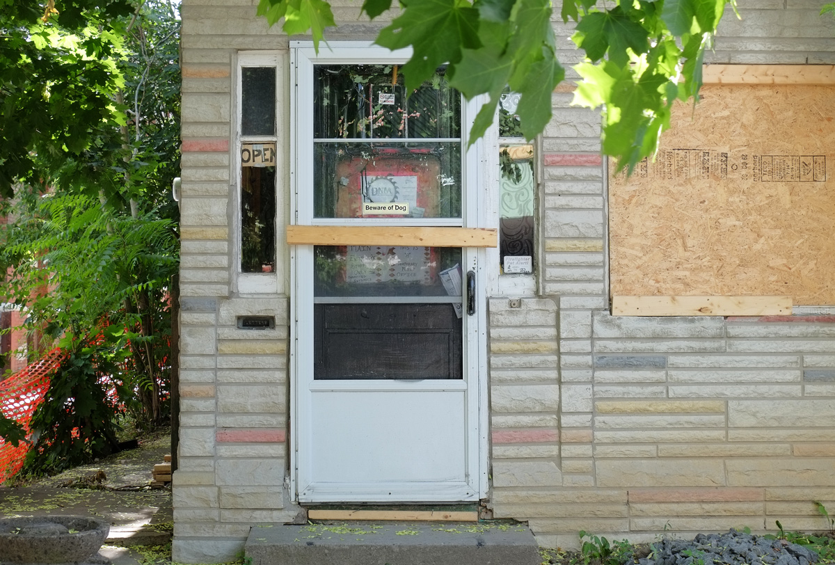
below: Another door – I doubt that it’s open now, or that it ever will be again.
below: These windows, and the house too, probably won’t be here much longer either.

below: A very standard row of semi-divided houses; a common sight. Hundreds (thousands?) of these were built around the city.

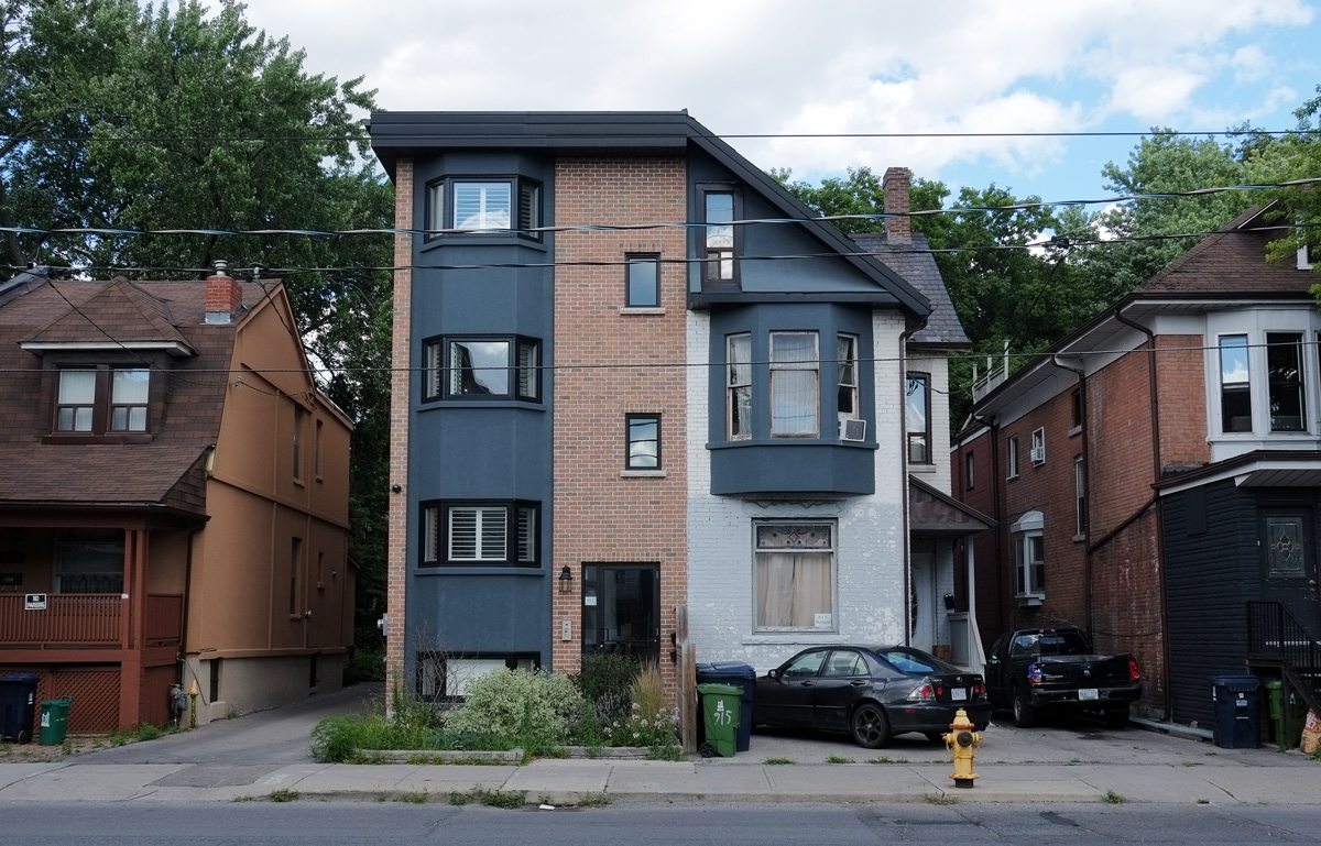
below: And a not so usual semi.
below: A touch of art deco.

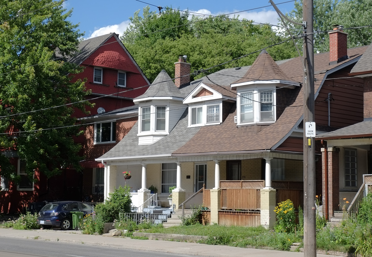
below: Slight larger houses, with turrets even! (or is there another name for this architectural element?)
below: This is part of Coopers Hawk Lane which is just south of Dupont.


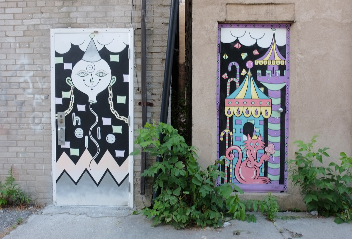
below: In another nearby alley …. a pink cat eating ice cream
below: And a gate with a frame, and the laundry beyond.