Archive for the ‘public art’ Category

If you go looking for Henry Moore at the corner of Dundas and McCaul, you will be disappointed.

green construction fence around a small part of the sidewalk at the corner of Dundas and McCaul, equipment inside, one small gingko tree, building says Art Gallery of Ontario

Instead, you have to walk around the corner.

yellow pedestrian crossing sign that has been altered to look like 2 art students, one with a cardboard tube and the other with a portfolio case

After residing at the corner of Dundas and McCaul since 1974,  Henry Moore’s sculpture “Large Two Forms” was moved to the newly renovated Grange Park on the 3rd of June.   Grange Park is behind the Art Gallery of Ontario as well as OCADU (Ontario College of Art and Design University).

 the Henry Moore sculpture, Large Two Forms, in Grange Park behind the Art Gallery of Ontario , a couple on a bench beside it

The new setting suits the sculpture.  There is more room for people to interact with the sculpture and the park makes a more picturesque background for those who like to take photos.

 the Henry Moore sculpture in Grange Park behind the Art Gallery of Ontario - Large Two Forms, with the blue wall of the AGO in the background

a girl in orange shorts and purple shoes stands on top of the Henry Moore sculpture in Grange Park behind the Art Gallery of Ontario

I’d be interested in knowing if the AGO has any plans for the now empty corner at Dundas and McCaul.  Was the construction pictured above just to remove the platform that the sculpture used to be on?  Or is there more to it than that?

Also, I don’t mean to spoil your fun, but how long will it be until a “do not climb” sign appears in Grange Park?   I’m not advocating for one – I just know how the city acts on things like this.   Part of me says, “Quick, get your selfie from on top of the sculpture while you can!”

A little extra that I discovered this morning.   As I wrote this blog post I kept thinking about “Down By the Henry Moore”, a song from my past.   All I could recall was the title.   I found a great version of it on youtube –  the song was written and sung by Murray McLauchlan and was released in 1974.   The Henry Moore referred to in the song is the one in front of City Hall but the video on youtube has some fabulous old picture of Toronto!  Many thanks to john allore who made the video and uploaded it to youtube.  I really enjoyed seeing the old images, down memory lane and all that.   If you are interested, this is the link;  it will open youtube in a new page.  You may have to suffer through a few seconds of ads and you have my apologies for that.

Sometimes when you search for one thing you find another.

The other day I posted pictures of the Cliffside murals in Scarborough.  When researching, them I discovered that there are other murals in Scarborough thanks to Mural Routes.  Of course, I had to go exploring!

Murals are often in parking lots or in alleys.  Last weekend I found one in a cemetery.   “Building the Addition to the Wesley Methodist Chapel, Highland Creek, Winter 1867” is on the side of a building that abuts the Wesleyan Methodist cemetery on the east end of Old Kingston Road.

below: Most of the mural.  Design and artwork by John Hood , assisted by Alexandra Hood and Zeb Salmaniw, 1994.  There is a small portion of the mural missing in this picture.  On the right is a panel that tells the story of the mural.

mural, winter scene, from about 1867, adding an addition, wood frame, onto a church, old house and store in the background. cemetery around the church, trees.

This is what the words say:

The following is an extract from the ‘The Christian Guardian’, a Methodist newspaper:
Your numerous readers will be glad to hear of the success of the Wesleyan Methodist Church at the Highland Creek, on the Scarboro’ Circuit. The above church was found to be entirely too small for the accommodation of its increasing congregation. The friends therefore decided to put an addition to the church 18 feet by 24 feet. It was re-opened and dedicated to God by divine service last Sabbath…” Wm. Tredway, Scarboro Dec 20, 1867
This mural depicts this event as it may have appeared from the northeast corner of this cemetery, looking southwest, across Old Kingston Road in mid November of 1867.

below: The William Tredway mentioned on the mural opened his first general store   at the corner of Eglinton Ave & Kingston Rd.  In 1865 he sold it and started over with a store on Old Kingston Road at Morrish Road.   It is this second store that is shown in the mural.  Tredway sold that store in 1878 to devote himself to politics as well as a career as a Justice of the Peace.

part of a mural, historic scene, old store with name W. Tedway above the door, people in period costumes, circa 1867. winter scene

part of a mural, horse drawn wagon, one man sitting at the front of the wagon, another man standing at the rear loading the wagon with lumber

men up on the roof of a new addition on a building, constructing roof joists, winter scene, old fashioned

below: The bronze plaque near the entrance to the cemetery.

bronze plaque on a stone wall in the Wesleyan cemetery on Old Kingston Road, Highland Creek, Scarborough

“This Highland Creek burying ground dates back to the reign of George III prior to 1800. On this site stood Wesleyan Methodist Church 1865-1891 merged with Bible Christian Methodist Church 1863-1891 which became Centennial Methodist in 1891 and later Centennial United Church 1925, plaque erected 1967, Centennial of Canada’s Confederation by Centennial United Church of Canada and Wesleyan Cemetery Board. “

The cemetery consists of a 1/2 acre plot.  Back in 1834 it was part of 500 acres that was acquired by Jordan and Melinda Post in trade for their 15 acres at King & Yonge.   Some of the stones predate 1834 and as mentioned on the plaque, there was a burying ground here before 1800.  The oldest stone might be that for William Pearce, son of John and Susan who died 18 Aug 1813 at age 11 years & 5 months.   Local legend says it became a burial ground when a passenger on a passing stage coach died there.

a real tombstone, surname Littlejohns, in a cemetery, with a mural in the background showing a woman kneeling by a grave in the winter, small amount of snow, no leaves on the trees

Jordan Post (1767-1845) and his wife Melinda (nee Woodruff, abt 1780-1838) were both born in Connecticut but were married in York (Toronto) in 1804.  Jordan was a watch maker and when he arrived in York in 1802 he was the first watch maker in the town.   He had other businesses as well but he probably made most of his money speculating in land.  In 1834 he moved to Scarborough township, to the location of this cemetery, where he built a sawmill.  Both Jordan and Melinda are buried here along with an unknown number of others, including other Posts and Woodruffs.   There are stones for 76 people including Ann (d. 1903) and Edward Littlejohns (d. 1887) pictured above.

below: An interesting juxtaposition – The real monument on the left is for Edith, infant daughter of Henry and Eleanor Lanktree, died 26 Sept 1872 at age 16 months.   The bottom part of other stone also mentions Henry and Eleanor Lanktree but I can’t read the inscription on the top part.

two real but old and weathered tombstones in a cemetery, with a mural of trees in winter around a cemetery where a woman sits by a grave

The church is no longer there.  It once stood next to the location of the mural with the cemetery around it.  Today the cemetery is maintained by the community.

Cliffside is an area around Kingston Road in the west  side of the city and the ‘cliff’ in the name refers to the Scarborough Bluffs.    The murals in this post are all on Kingston Road just west of Midland Ave.    They are the result of work of Mural Routes, an organization “dedicated to the creation, development and promotion of public wall art” since 1990.

below: ‘Spooners Garage’ by Phillip Woolf, 1992.   Art Spooner’s garage in Cliffside was built in 1926 (and rebuilt in 1947).   The mural has two parts, each showing a different time period.  They face each other.

mural of gas station, Spooners Garage, from the 1920s or 1930s

mural of gas station, Spooners Garage, from the 1920s or 1930s

below:  … and the later version

part of a mural showing a gas station from the 1940s or 1950s

part of a mural showing a gas station from the 1940s or 1950s

below: ‘H.M. Schooner, Onondaga c. 1793’ by Jeff Jackson 1992.  The Onondaga was built near Kingston in 1790 and it served with the Provincial Marine until 1797.  It was the ship in which John Graves Simcoe and his wife Elizabeth sailed across Lake Ontario to York (now Toronto) to establish the capital of Upper Canada.

painted mural of a schooner from the 1790s sailing on Lake Ontario

below: ‘Let’s Take a Walk on the Wildside’ by B.C. Johnson, 2016.   Canadian plants and animals cover all four sides of Ikki Sushi – herons, bears, moose, beaver, and fox among the pine trees. Creeks, swamp, and waterfalls can also be seen.  More of Johnson’s work can be seen at Sandown Lane Cliffside blog post

Ikki Sushi restaurant covered with a mural with scenes of Canadian flora and fauna,

back of restaurant with open door. Ikki Sushi restaurant covered with a mural with scenes of Canadian flora and fauna, inside of door is painted too

below: ‘Cliffside Golf Course’ by Dan Sawatzky, 1991.   Founded by George McCordick in 1931, the Cliffside Golfcourse was south of Kingston Road and overlooked Lake Ontario.    It closed in 1950.  The mural is faded and partially obscured by two trees.

two trees obscure a faded mural

below: The words on the mural tell the story of the golf course.

mural of two men golfing. One is swinging a golf club and the other has a golf bag slung over his shoulderh

red vintage car in a mural

mural, woman from the 1930's standing behind a vintage car and holding a set of golf clubs

The last two murals have appeared in a previous blog post that I wrote once upon a time when I didn’t know how many Scarborough murals there were.  Even now I’ve hardly scratched the surface.

below:  ‘The Half Way House’ by John Hood, 1990.  The mural is at the corner of Midland Avenue & Kingston Road which is where the inn and stage coach stop was located.   The  building was moved to Black Creek Pioneer Village in 1965.

mural depicting the Half Way House, an old inn that used to be at the corner of Kingston Road and Midland. Two men are sitting on the stairs in front of the mural

below: ‘The Bluffs as Viewed by Elizabeth Simcoe c. 1793’ by Risto Turunen, 1992.   The story is that Elizabeth Simcoe was so impressed by the view of the cliffs she persuaded her husband, John Graves Simcoe, to name the area after Scarborough England where there are similar cliffs.

Three cars are parked in front of a large mural of the Scarborough Bluffs, there is a small row boat on Lake Ontario in front of the cliffs.

There are more murals on old Kingston Road both to the east and west of these, but that will be a story for another day.

also see: Heritage Trail Mural 8 – Old Kingston Road 

Identity.  What springs to mind when you hear the word identity?  And how does that relate to art?

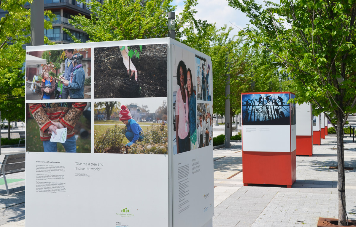
Let’s now take those general questions and narrow it down to the work of three artists, or photographers to be more precise: Suzy Lake, Lori Blondeau, and Shelley Niro.  I haven’t chosen those women randomly; I’m writing about them because their work is on view if you go to the Ryerson Image Centre.  Suzy Lake’s photos are on display in the main gallery inside while Lori Blondeau and Shelley Niro’s are showing outside.  The latter two were installed as part of the CONTACT Photography Festival.

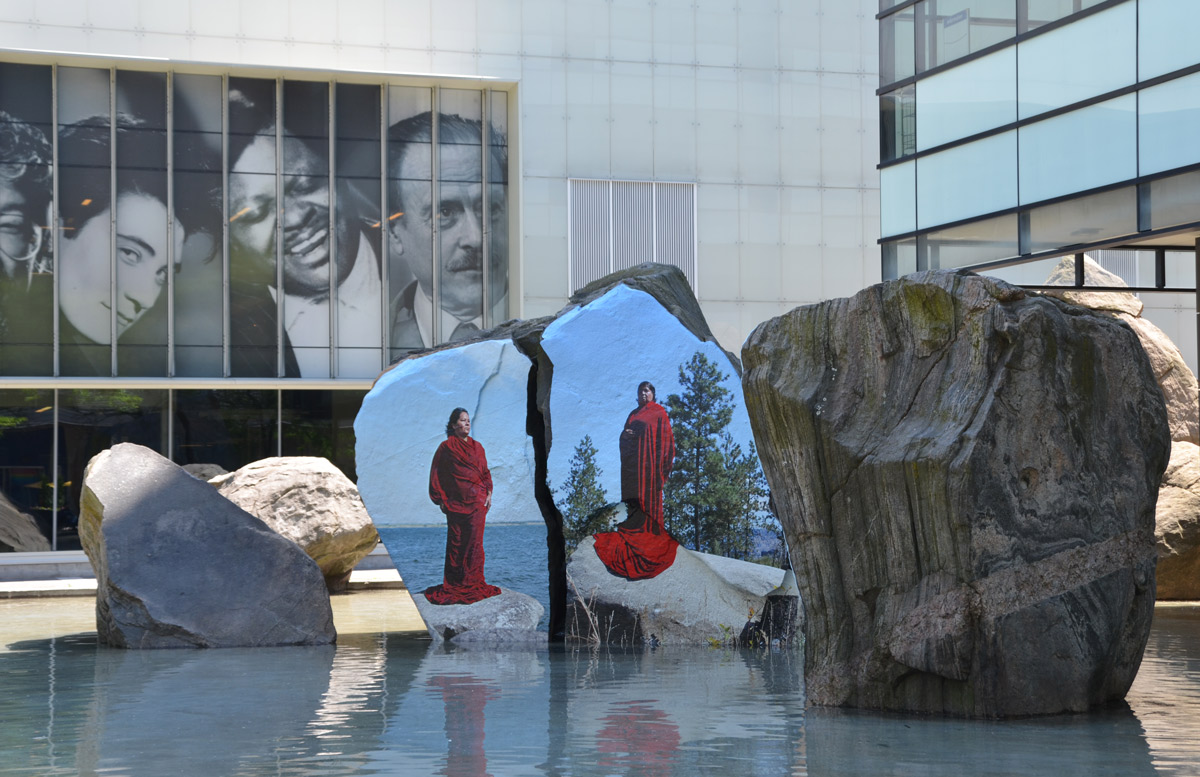
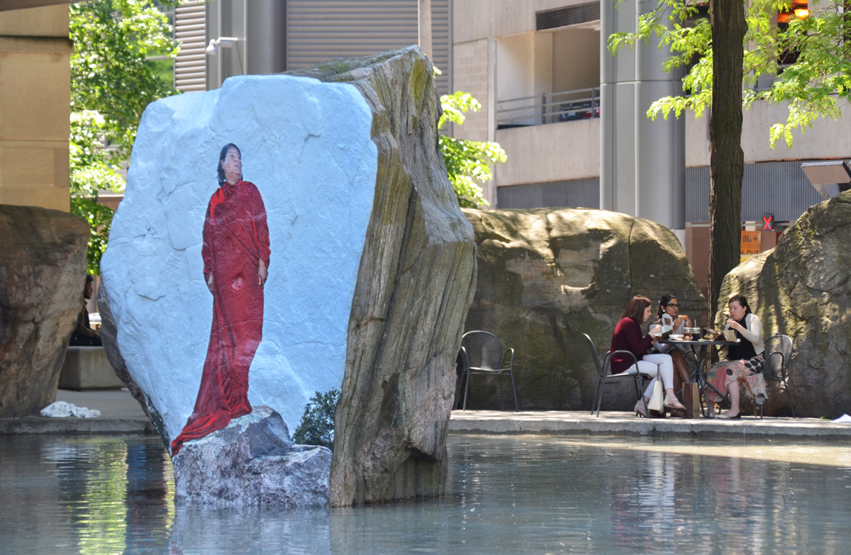
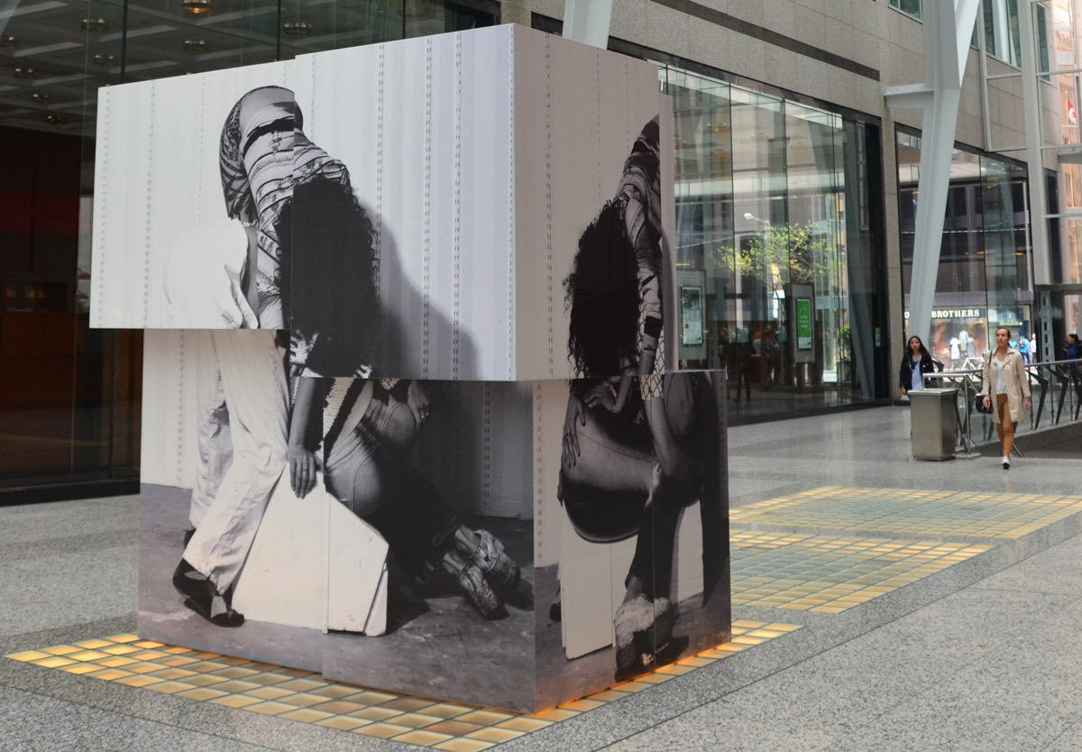
below:  Three large images of the Lori Blondeau draped in red while standing on a rock adorn three of the large boulders in Devonian Square.   They are part of her “Asiniy Iskwew” work.  The title is Cree and translates to “Rock Woman”.    In this work, the rocks on which she stands refer back to Mistaseni which was a large sacred boulder that once marked a gathering place.   The Saskatchewan government dynamited it in the 1960’s to make room for a man made lake.

photograph or painting of a woman in red standing on a rock, directly onto the surface of a large rock in a shallow pool of water outside Ryerson Image Center, three large black and white photographs of people's heads are above and behind the artwork

The words on the wall say that Blondeau questions (“interrogates”) how the definitions of Indigenous identity are influenced by popular media and culture, not just in this exhibit but in the rest of her art as well.   Her point here is that pictures of strong woman run counter to how popular culture portrays Indigenous women.

photograph or painting of a woman in red standing on a rock, directly onto the surface of a large rock in a shallow pool of water

My questions – What and/or who shapes your identity?  That question can mean “Your” as in you the individual and it can mean “Your” as in some collective group that you belong to.     How does identity evolve?  Can it be changed?

How does history affect your identity?  As one who has done a lot of genealogy research I understand the importance of history to some people.  I have traced my Canadian ancestors – I know where they’re buried and I know where they lived.   For me that is a comfort.  But I also know that if you want to kill a conversation just bring up the subject of genealogy.  Not everyone is interested.

Back to photography and history –

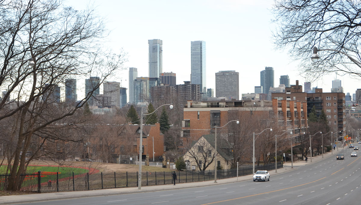
A second indigenous woman artist is Shelley Niro whose work is titled “Battlefield of my Ancestors”.  It consists of 6 photographs that were taken in upstate New York and in southwestern Ontario.  The pictures are in the garden with the statue of Egerton Ryerson (1803 – 1880), the man who Ryerson University is named after.   He was many things including a Methodist minister, a founder of Victoria College (part of the University of Toronto), a Chief Superintendent of Education for Upper Canada, and the person who wrote a report/study on Native education (1847) that became the model for the residential schools thirty years later.

below: Ryerson standing in the greenery with a picture on either side of him.  On the left is a picture of a plaque in New York state that says: “Site of Indian village Gar-Non-De-Yo destroyed during Sullivan campaign Sept 21, 1779”.  On the right is a black and white picture of the Mohawk River in New York state.

statue of Egerton Ryerson in a small garden with shrubs and small trees. Two large photographs also in the picture, one on each side of the statue

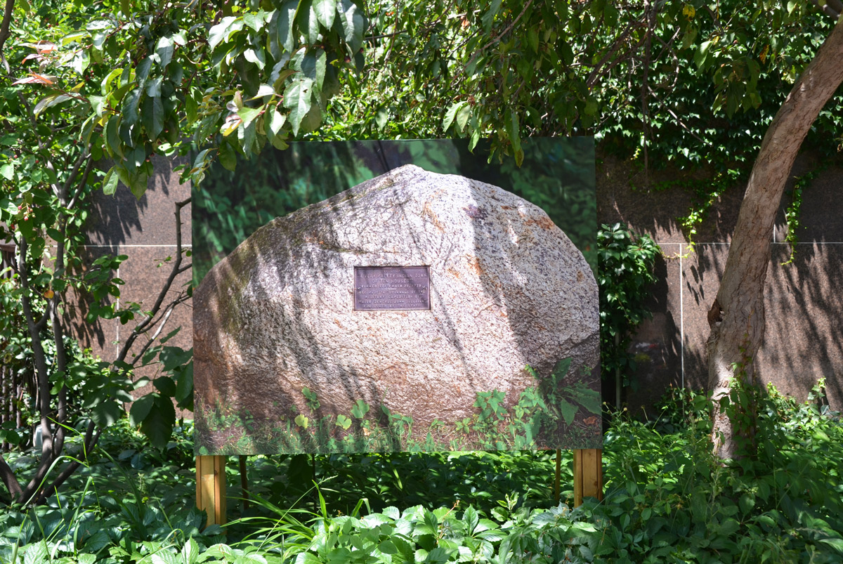
below:  Photo taken of a rock at Cayuga Lake.

photo of a small plaque on a rock exhibited amongst shrubs and greenery outside

The plaque says:
Site of “A very pretty Indian town of ten houses” burned September 21, 1779. See page 76 “Journals of the military expedition of Major General John Sullivan” published by the state

Back a few lines I called Niro an “indigenous woman artist”.   I don’t know if she’d be comfortable with that.  Maybe yes, maybe no.   I used those words because they help to understand her work in the context of this blog.   Should I then use the description “white woman artist” to talk about the third person, Suzy Lake?

Lake’s photography career began in the 1970’s and for the first two decades was primarily concerned with female identity.  In almost all her photos, she is the subject.  The 1970’s were the days of  Women’s Lib and the rise of “Feminism” – the quest for political reforms on issues such as reproductive rights, domestic violence, maternity leave, and equal pay.  It was also a time of increased questioning of cultural norms with regard to women’s roles.  In many ways it resembled the increase of awareness of indigenous identity, rights, and problems that we see today.

large black and white photograph in a gallery, two men on top of a large frame are controlling the movements of a human puppet

 large photo in a gallery of a women dressed just in a long slip, sweeping up debris from the floor. Debris is bits and chunks of plaster that have been removed from the wall

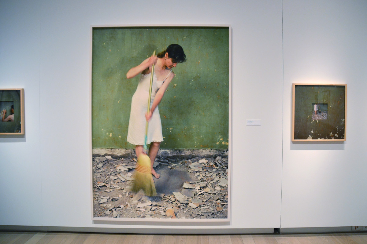
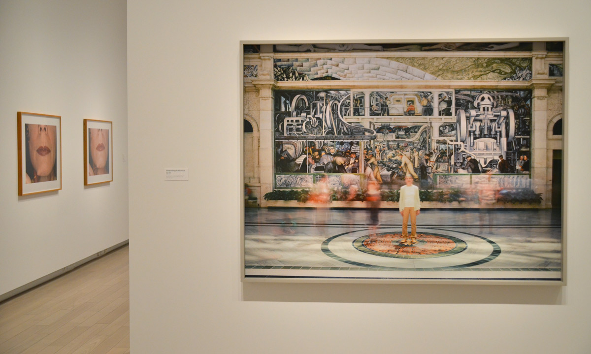
below: Her most recent work involves pictures of her standing in an environment of some sort.  The photo is a one hour exposure and the end result is an image where only she and inanimate objects are present and in focus.  Here is “Extended Breathing in the Rivera Frescos” 2013-2014.   The painting behind her is one in a series by Mexican artist Diego Rivera at the Detroit Institute of the Arts.

three suzy lake photos, one of her in front of a mural and two are close ups of her face

colour photo of close up of a woman's face, just mouth, bottom part of nose and some cheek. She is wearing bright red lipstick

‘Making Peace’ is a traveling exhibit that is being shown in Toronto at the moment.  It was produced by the International Peace Bureau (IPB) and was first shown in in 2010 as a celebration of the 100th anniversary of the 1910 Nobel Peace Prize that was awarded to IPB.  It’s purpose is to promote peace as well as educate and inform.

It can be seen until the end of June on Front Street East in the Canary District (by Corktown Commons, east of the Distillery District).    In Toronto, the exhibit involves short four-sided pillars that line the sidewalk and each side of every pillar has a photo with a description or a quote from a famous person.  There is also a temporary gallery in an indoor space ‘loaned’ to the exhibit by one of the developers in the Canary District.

below: A painting in progress by Ford Medina showing Nelson Mandela in five colours.  These colours carry over into the outdoor exhibit and each colour represents the five main elements that IPB considers necessary for peace:
1. disarmament and nonviolence (purple)
2. conflict prevention and resolution (red)
3. economic and social justice (orange)
4. human rights, law and democracy (blue)
5. environment and sustainable development (green)

indoor temporary gallery for the Making Peace exhibit, a painter is in the midst of creating a large painting of five copies of a picture of Nelson Mandela, each copy is in a different colour, purple, red, orange, blue and green,

below: The display extends into Corktown Commons.  Here the pillars are green as this is the section for the fifth element named above, the environment.

outdoor exhibit, Corktown Commons, short pillars with 4 sides, each side has a picture and a description, the background colour is green which represents the environment and sustainability.

below:  Photo by Ribeiro Antonio.  The words that accompany this photo are: ” On 25 September 2015, the 193 countries of the UN agreed to an historic plan of action, entitled ‘Transforming our world: the 2030 Agenda for Sustainable Development’.  This plan contains 17 goals with 169 targets covering a broad range of sustainable development issues.  These include ending poverty and hunger, improving health education, making cities more sustainable, combating climate change, and protecting oceans and forests.”  If you are interested in this, there is more information on the UN website.

a photo of a person dressed in a large blue and green Planet Earth costume, holding the hand of a young boy as the walk on a beach towards the water

below: Blue is for human rights, law, and democracy and here you have an old black and white photograph of Sylvia Pankhurst (1882-1960), a British campaigner, apparently taken when she was in Australia speaking out on behalf of woman’s rights as part of the Suffragette movement.  The Suffragettes (or Women’s Social and Political Union or WSPU) was founded by a small group of women in 1903, including Sylvia, but during WW1 Sylvia was expelled from the WSPU because of her pacifist views and anti-war actions.  Her sister Adela shared similar views – she immigrated to Australia where campaigned against the First World War.

a vintage black and white photo that is part of an exhibit, outdoors, called Making Peace

below: Two photos.  The one on the right, of the woman holding the flower in front of the armed soldiers, was taken at a Peace March against the Vietnam War in Washington DC in 1967.  The photo on the left was taken in 2001 and is the back of a Kamajor fighter in Sierra Leone.  They played a role in the civil war that occurred in that country between 1991 and 2002.

2 sides, taken from the corner, of a box like structure, with black and white photographs on the two sides, one of the back of a man with a rifle across his shoulders and a backpack that says Lets go to school. The other photo is a woman standing up to a line of soldiers with bayonets.

below: A couple of the red pillars on Front Street with the blue sculpture, “The Water Guardians ” behind them.   The images on the closest pillar are of inside the Holocaust Memorial in Jerusalem as well as UN peacekeepers in Bosnia.

an outdoor art exhibit on peace, two of the structures used for mounting pictures on, with the blue sculpture on Front Street, Canaray District, in between the two boxes.

below: Closer to home, this pillar celebrates the work of the Toronto Parks and Trees Foundation.   Working with the city as well as with community groups, businesses, and individuals, they help to increase  Toronto’s tree cover.

a set of four photos about planting trees on the side of a square pillar, one of many pillars that are arranged in a line on the sidewalk.

“Earth provides enough to satisfy every man’s need, but not every man’s greed.”  Gandhi

below: Homeless migrant worker, China

picture of a woman sleeping underneath a picture of a woman lying on a bed, shown outdoors so there are some tree leaves in the picture

The exhibit continues until mid-September.

The water levels in Lake Ontario are higher than normal this spring – some beaches are under water and a large percent of the Toronto Islands are flooded.  In front of the Power Plant Art Gallery the water level is even with with the concrete walkway… but not high enough to deter people from enjoying the waterfront this past weekend.

a young couple sits by the waterfront, on a stone bench. He has his arm around her. There is yellow caution tape behind them because the water level in Lake Ontario is high.

It seems appropriate that the artwork on the exterior wall (facing the lake) of the Power Plant features an image of water – white crested waves on a large lake.  The piece is “Bound, Hupfield 2017” by Maria Hupfield; it is 19 feet high and 31 feet wide.   The central image is a seascape painted by the artist’s mother, Peggy Miller, many years ago.  It is being wrapped (unwrapped?) with grey felt-like material.
Is it a treasured artwork that is being readied for storage?
Is it a painful memory that is being covered up to be forgotten?
Is it a family heirloom that is being brought out for someone to admire?

a large art installation on the south exterior wall of the Power Plant contemporary art gallery, with a small tree in front of it.

a girl sits on the rail between the walkway on the waterfront and the water while she reaches a hand out towards a duck. Her mother and younger sister watch.

a mother crouches down beside a young child who is wearing a helmet and is on a scooter, the mother is waving at the Kajama as it docks, the Kajama is a boat with sails that gives tourists rides on Lake Ontario

If you are interested in more information about Maria Hupfield, check the CONTACT website.

“Objects contain meanings beyond their materiality, meanings that we bring to them or receive from them. Objects are the result of an action, entail a trace of a human gesture, and trigger reactions and memories. They have the potential to be read collectively or personally. In her artistic practice, Maria Hupfield reveals the interrelational potential triggered by objects between humans or cultural environments.”

I was away for most of the month of May so I missed a lot of the annual Contact Photography Festival.  In the few days that I had to catch up, I visited a few of the exhibits.  One of these was ‘Nous ne somme pas des heros’ (We are not heroes) by Valerie Blass at the Allen Lambert Galleria in Brookfield Place.

two large cubes constructed from pieces of photos of different people in different positions sit in the middle of Brookfield Place, under the glass arched roof.

Blass arranged people in sculpture-like poses and then photographed them from different angles.  The photographs were then cut into sections, glued on blocks,  and then the ‘sculptures’ were re-assembled.

a large stack of blocks with black and white photos of people on them by Valerie Blass.

The subjects of the sculptures are anonymous.  Their “bodies fold inward, their differences intertwine and merge into single entities” (source).

photographs of the back of a person with another person sitting on his shoulders, upper person is leaning forward with head down, the blocks on which the photos are printed are in the walkway at Brookfield Place

bottom part of photos by Valerie Blass on a block at Brookfield Place as part of Scotiabank Contact photography festival, feet. Also the feet of people walking past.

I was out earlier this evening, venturing out to a gallery opening on Avenue Road near Dupont.  It wasn’t meant to be a photo taking adventure but it was a sunny evening and rather than wait for a bus on Avenue Road, I started to walk.   It didn’t take long before the camera came out (yes, I usually have it with me!).  Have I walked here before?

a yellow traffic sign in front of a store window. Window is lit and has two female mannequins in it. Sign says Turning traffic must yield to pedestrians.

On Avenue Road just south of St. Clair West there are quite a few older apartment buildings and most are in good shape.

below: It’s nice to see that this building is being renovated.

old 6 storey brick apartment building that is undergoing renovations, bottom few storeys are covered in scaffolding.

below: Most of the apartment buildings in the area are mid to low rise.   If I remember correctly, the building on the right is the tallest  (and newest?)

three midrise apartment buildings.

side of an apartment building with a decorative panel running up the center.

below: You don’t see brickwork or stone details like these on newer buildings.

detail of the brick and stone work on an older apartment building. There are three stone women lying under each oriel window, diamond patterns in the brick on the exterior as well

below: Looking southeast, generally towards downtown, as you come down the hill on Avenue Road.  The bright green and red on the left is the De Lasalle College playing field.

view of downtown Toronto skyline from Avenue Road, just south of St. Clair.

below: Mural along the side of the lead up to the railway bridge.
The signature is Leventhal ’96

mural painted along the side of a wall that is part of the embankment for a railway bridge Mural is a country scene, grass and fields, a farm in the distance and a couple of trees.

below: Under the railway tracks.   I thought that the blue tiles were a nice feature – are there other tiles like this under any other Toronto bridges?

under a railway bridge, steel girders above, street passes under, across the street the lower part of the wall is blue tile, a man on a bicycle is passing by

two women walk past a brick house with green wood features, porch, windows, garage door.

below: The turret (steeple?) of De Lasalle College

De Lasalle Callege building, an old brick house with a turret , trees, lawn,

below: One of the entrances to the Mayfair Apartments.

decorative entranceway for the Mayfair apartment building. Woood doors, carved stone above and beside the door

below: Another of the entrances (there was at least one more).  The stonework is similar but the old light fixtures are still in place.  In the picture above, you can see the holes  where the lights once were.

entrance to the mayfair apartments. 396 Avenue Road, stone work and old light fixtures

below: Old wood door on Avenue Road.

old wood door with mailbox and number 280

below:  The first signs of a republic… I had heard about the Republic of Rathnelly  but I didn’t know anything about it, including its location.    Back in 1967  the residents of the officially seceded from the rest of Canada, originally as a form of protest against the proposed Spadina Expressway that would have physically divided the community.    The founders named their republic after Rathnelly Avenue which runs parallel to Avenue, one street to the west.   Rathnelly Avenue was named after William McMaster’s birthplace of Rathnelly, Ireland.  (McMaster Avenue is there too).  William McMaster (1811-1887) was a founding president of the Canadian Bank of Commerce between 1867 and 1887.  He was also a senator.   The special street signs were designed in 2012.

Toronto street sign that says Poplar Plains Cr and also says Republic of Rathnelly

below: A painted sign on the side of The Avenue Diner (at Davenport Road).  It was closed when I walked by so I’ve made a note to myself to go back and see if the interior has changed much since 1944.

old faded mural painted on wood on the exterior side wall of the Avenue Diner. shows people sitting at a lunch counter with an employee behind

below: Across the street from The Avenue Diner is the Havana Coffee Bar. The old building still has a ghost ‘Tamblyn’ sign on it.  To me, Tamblyns was a drug store but was it something else prior to that?  I can’t read the smaller word below ‘Tamblyn’ on the building.  …. A quick check and the answer is ‘no’ – Gordon Tamblyn opened his first pharmacy in 1904 and by the time he died in 1933, he had a chain of about 60 stores.

old building with ghost sign on the upper storey, Tamblyns, bottom part now a dry cleaners and the Havana bar and grill.  A bus shelter is beside the building and some people are waiting for a bus.

…and then I found myself in Yorkville but that’s a whole different story!

a very large fake diamond ring, single stone, sculpture size, about 3 feet in diameter, stands in front of an old fashioned clock in front of some stores

traffic signs at an intersection, at Lakeshore Blvd East, two one way signs pointing in the opposite directions, an elevated expressway also in the picture

“There’s more than one way” describes the above picture quite nicely but it’s probably a stretch to say that it’s  relevant to this blog post at all.   Not that that’s ever stopped me!  The other day I stood at this intersection (Lakeshore and Sherbourne I think) trying to decide which way to go.  I went straight ahead because that’s what the traffic signal told me to do.  I obeyed.  “When in doubt, go with the green light”, is one of my ‘rules’ when I’m walking.

below: The artistry of hydro towers and wires framed by the Lakeshore and the Gardiner.

a view between the Gardiner and Lakeshore with the roads framing the top and bottom of the picture. Hydro towers and wires are the main part of the image

below: Shattered glass

shattered glass still in place

below: Part of “Site Specific” by Scott Eunson & Marianne Lovink, on Sumach Street at Eastern Ave.

rusted metal cut out, part of a public art installation, cut outs look like houses, polished steel cutouts below the rusty ones.

below: The view inside the streetcar.  A new 514 Cherry car was wrapped in a light blue ad.
I have no idea what it was advertising.

looking into the window of a streetcar, people sitting,

below: There are a number of this “eye” balls in the playground part of Sherbourne Common.

a large white sphere with a black circle in the middle, on a metal pole. Background is out of focus

below: Changing the billboard.  The image is printed on a large piece of vinyl (plastic? something similar?) and held to the frame by ropes.   Or at least that’s what it looked like.  It was quite a distance up so it was difficult to see exactly what they were doing.

two men are changing the ad on a very large billboard. One man is below and the other is above and he is passing a long rope to man below.

below:  Graffiti.  Two words.  In yellow.

in yellow paint, graffiti, words fuck trump written on a metal box on a sidewalk

below: Chairs.   Blue chairs.  Three blue chairs plus one reflection.

three old blue plastic chairs with metal rusty legs sit on the concrete porch of a commercial building. Windows behind them. one of the chairs is reflected in the window

below: A drab door on a drab wall.

drab double glass doors on a drab light brown brick building with a sign that says public parking with arrows pointing to the door, The sign is above the door.

below:  An entrance to a different parking lot.

looking through a parking garage to a lighted entrance with people carrying bags and returning to their cars

below: Numbers on the concrete.

close up of the side of a concrete structure on a ramp of an expressway, there are two number sequences there. In stencil it says R42-78 and in stickers, AJ48

below: More numbers.  Another code that I can’t crack.

black and orange construction cone site beside a kerb on which numbers have been spray painted in orange

below: Stonework details on an old bank building.

architectural details on an old bank building, a fancy column top (ionic?), some carvings in the stone work.

below: Another old building – now that the north building of the St. Lawrence market has been demolished, the rear of the St. Lawrence Hall has been exposed.  It’s quite a pretty building.

the rear of the old St. Lawrence Hall building, with a bright blue wood hoarding fence in front of it. a woman is walking past

below: Interior, St. Lawrence market

the interior of the St. Lawrence market, looking towards the north entrance, with the large arched window over the doorway

below: And when you’re in front of the St. Lawrence market, isn’t it obligatory to take a picture of the Gooderham building?   A Toronto iconic view.

the Gooderham building, built in the flatiron style, with glass towers behind it, downtown Toronto

below: Another icon, the CN Tower, as seen through the Distillery District from Cherry Street.
That’s a fabulous orange door!

Cherry street entrance to the distrillery district, looking west towwards the CN tower, brick road, overhead lights, bright orange door in the background,

below: Postage stamp art at 234 Adelaide East by Joanne Tod and Jon Reed.  The whole installation includes 12 images including a 1930 painting by Lawren Harris (2nd on the left) which was issued in 1967.   To the right of it is a stamp honouring the Alouette 2 research satellite.  In between those stamps is Queen Elizabeth, a fixture on Canadian stamps for so many years.   The old post office which was built in 1834 is nearby.

public art in front of a condo building that is a ribbon made of metal, flat, etched with a series of vintage Canadian postage stamps images

below: Walls.  Shored up walls of the construction hole in front of a wall of glass.

a blue crane inside a hole that is a construction site for a new condo, with many glass tower condos in the background.

below: Last, symmetrical? steps in the buildings.

a building under construction in front of another building


May all your lights be green!

Right now, the section of Sheppard Avenue East between Yonge and Leslie streets is a mix of old, middle aged and new – a hodge podge of sizes, styles and uses.   It’s neither ugly nor pretty.  It’s not sure if it’s city or  suburban.

below: The intersection of Bayview and Sheppard from the southwest.

main road with traffic, coming to an intersection, with a tall building in the background

You’ll probably never hear anyone say, “Hey, let’s go for a walk along Sheppard”.  So why was I there?   I’ve driven along this stretch many times but I have never walked it.  Have I been missing something?

below: A short distance west of Bayview is the modern brick St. Elizabeth of Hungary Roman Catholic Church, or ÁrpádHázi Szt. Erzsébet Római Katolikus Templom according to their sign.  Sunday mass is in Hungarian.   If you are driving past on Sheppard Ave, it’s easy to miss the simple steeple and cross that marks this building as a church.

steeple of St. Elizabeth of HUngary RC church, modern brick building with simple cross on the top

below: A large mosaic adorns one of the exterior walls.

mosaic on the exterior brick wall of St. Elizabeth of Hungary RC Church showing St. Elizabeth and two people kneeling beside her.

below: A small shrine is in front of the church.

small picture of Mary and baby Jesus in bright colours, on a small shrine in front of a church

below: The south entrance to Bayview subway station.  There are no escalators at this entrance  – instead, there is an elevator and a LOT of stairs.

south entrance to Bayview subway station with tall residential buildings behind and a construction site beside

below: The artwork at Bayview station is by Panya Clark Espinal, titled ‘From Here Right Now’.  Half an apple lies on the platform.

art on a subway platform, a line drawing of a very large apple that has been cut in half, on the wall and floor of the station

below: A salt or pepper shaker on the wall.  I’ve only shown two of the images in the series.  There are 24 in total and they are scattered throughout the  station.

art on a subway platform wall, a salt or pepper shaker in black on white tiles

below: There is a small park behind the south entrance to Bayview subway station, Kenaston Garden Parkette where I saw this tree in bud.   The first signs of spring are always wonderful to see.   Today it’s -12C outside so I hope the tree is okay.

pussy willow buds on a tree

below: This little park was designed by Wilk Associates Landscape Architecture and it incorporates a large number of rocks including a glacial boulder found on the site.   A bronze sculpture of a tree clinging to a rock  by Reinhard Reitzenstein is one of the features of the park.

small sculpture in a park of a sapling on a rock with its roots growing over the surface of the rock

below: If you stand in the park and look east,  you can’t miss the construction.

small sculpture in a park of a sapling on a rock with its roots growing over the surface of the rock - crane and construction site in the background

a convex mirror beside a black and yellow caution sign, condos are reflected in the mirror

the front and side of a large truck is in the foreground, right side, with a construction site beyond

Construction is everywhere on Sheppard Avenue.

below: All of the houses on Cusack Court are now gone.  Only the ‘No Exit’ sign remains.

a construction site where the houses on a a whole street have been demolished. The no exit sign for the street still remains., the site is behind a chainlink fence

a banner of the Canadian flag has fallen over and is lying on the ground behind a chainlink fence

below: The single family homes on the south side of Sheppard are slowly being demolished to make way for condo developments.  At the corner of Sheppard Ave East and Greenbriar  the proposed development of 184 residential units is the subject of an OMB prehearing on the 8 May 2017  (case number PL161113).

a boarded up house, split level, built in the 1950s, is in the foreground, condos and apartment buildings are behind it

below: Five houses are empty and waiting to be demolished to make way for two buildings, 11 and 6 storeys, mixed use (i.e. retail at street level) and incorporating a few townhouses.  In other words, the same old same old.

a boarded up house, split level, built in the 1950s, is in the foreground, condos and apartment buildings are behind it

below:  I said “same old same old” above because these types of buildings are popping up all over  many major roads that are outside the downtown core.  I suspect that Sheppard Avenue will be lined with structures like this one that’s already been built on the north side of Sheppard.

across the street is a 10 storey residential building, cars on the street, small trees in the foreground

Many people make the argument that there isn’t the density to support a subway along Sheppard.  I am of the opinion that if they’re not wrong now, they soon will be.   Development and public transit are dependent on each other, a symbiotic relationship if you will.   If you are affected by the construction along Eglinton for the new Crosstown line, you might agree that waiting for density only increases the problems and inconvenience (and cost?) of building new subway lines.   Also, have you seen photos of what the area around Davisville or Finch (and others) stations looked like when the subway opened there?   What is the required density?  Why do we want to funnel even more people towards the overcrowded Yonge line anyhow?   Is there an end to the questions we can ask?

And that’s another reason for my walk here…. to make note of the construction that is occurring whether we agree with it or not and to document some of  the changes.

below:  Two low rise apartment buildings.

two three storey brick apartment buildings with balconie in the front, taken from across the street

below: Once upon a time there were a lot of these little houses along Sheppard (even more so on the west side of Yonge Street).  At least one of these is still used as a family home but most are now offices or businesses.

a few small brick houses on the south side of Sheppard Ave

below: The north entrance to Bessarion station

looking across the street to the small north entrance to Bessarion subway station, with a small two storey plaza beside it

below: Looking east from Bessarion.  You can see as far as the condos on Don Mills Road.

looking west from Bessarion subway station towards Leslie Street and beyond,

   There is a reason that you haven’t seen many people in these pictures and it’s not because I waited for people to get out of the way.   Sheppard Avenue is a “major arterial road” under Toronto’s road classification system and traffic movement is its major function.  20,000+ cars are expected to use it every day.

I don’t like to say it, but why would you be walking along Sheppard anyhow?

below: Bayview Village parking lot at the NE corner of Bayview and Sheppard.

parking lot of a mall, Bayview village with surrounding buildings in the background.

As you might know, scroll down to the next blog post to see some pictures of Bessarion station!