Archive for the ‘locations’ Category

Wilket Creek forms one of the many ravines in the city. The northern part has been buried; it surfaces just south of York Mills Road and flows south until it joins the West Don just north of Eglinton. Edwards Gardens is part of the park system along the creek and that is where I met a friend the other day.  It was her part of town and she was my guide for the day.  The magnolia trees were at peak bloom and the fragrance of their blossoms filled the air.

below: Magnolia

A white magnolia in full bloom in front of a house with chimney

below: Three magnolia buds ready to open up.
Three magenta magnolia buds ready to open up, grey fuzzy bottom part of the bud included

below: Other trees and shrubs were also laden with blossoms
Pink blossoms on a tree, spring

A man takes a picture of his wife and daughter in front of a tree full of pink blossoms at Edwards Gardens

below: Volunteers working in the Teaching Garden, preparing the beds for planting.
A woman with grey hair and a blue baseball cap is hoeing weeds out of a garden, orange yellow wheelbarrow beside her, Edwards Garden

below: Some of the different types of trees that grow here – three different bark colours.
Three different kinds of trees, with 3 different coloured trunks, including a birch tree

below: A willow tree by Wilket Creek
large tree on a grassy field beside a creek lined with rocks, early spring, willow leaves are just beginning to show, a pale green colour

below: Dawn Redwood tree (aka Metasequoia tree)
large dawn redwood tree, also called metasequoia, no leaves, very early spring

below: Parts of the gardens were closed for repairs to the banks of the creek and the path alongside it.
construction machinery on a path beside Wilket Creek, Edwards Gardens

Walking the ravine north from Edwards Gardens is impossible – unfortunately, that stretch of the ravine  is not open to the public.  A gap in the system. We rejoined the creek at Windfields Park.

Windfields Park

paved path, curves as it goes downhill, bench at the bottom of the hill, grass beside the path, trees on both sides, Windfields Park

A person in a red jacket sits on a fallen log in a forest beside a teepee shape structure made from tree branches, leaves are just beginning to open, late April

below: A rock stuck in a hard place, where rocks usually aren’t found.
A large granite boulder entangled in the roots of tree that has fallen over

below: Yellow wildflowers, Lesser Celandine which is apparently an invasive species.
A large patch of low yellow flowers and greenery in front of a tree that has fallen down, tree trunks in the background

below: A tennis ball in the wild.

orange tennis ball stuck in the V of a tree, between two branches, in a forest

below: Two birch trees, probably Silver Birch because of the brown bark of the younger tree that will soon shed to reveal the white bark below.

Two birch trees in a forest, one is younger and has just started shedding it's brownish bark, the other is older and had white bark

below: Yellow trout lily. The flashy red parts hang downwards so they are hidden close to the forest floor. The flowers are difficult to spot but the mottled green and brown leaves give them away.
wildflower on the ground in forest, a yellow trout lily
below: Bloodroot flowers
wildflower on forest floor, white bloodroot flower and leaves

With thanks to Iskuhi for walking with me and teaching me the names of some trees and wildflowers. … and for some playing with sunlight and shadows (because that’s what photographers do!).

A person holding a bloodroot plant in one hand and a camera phone in the other, trying to get a picture showing texture of veins in the leaf

street art mural on the side of a building beside a car wash.  Car wash has bright turquoise wall with lots of garbage bins lined up along side it.

below: “88 Keys of Light”, a collaboration between Edward Platero and Kristyn Watterworth
upright painted piano sits on the sidewalk, five guitars on top if it

below: Southeast corner, Queen St East and Woodbine Ave

southeast corner of Woodbine and Queen St East, three storey brick building with stores on ground level, people waiting at traffic light,

from across the street, mural of a woman on a sofa reading a book, mural, covers window of an empty store, a woman in a red coat is walking past, the store to the right is for lease, the store to the left is a variety store with a blue and yellow sign,

small white house with blue trim and a yellow awning over the front door, white fence around the front yard, empty lot beside it with white tarp covering chainlink fence around the yard

below: A cheerful dalmatian stands outside Firehall 227

fire hydrant in front of a fire station 227 painted like a dalmation dog, white with black spots, a red hat with number 227 on its head, and a big smile on its face

below: Mural, “Greetings from the Beach” by Elise Goodhoofd

mural, Greetings from the Beaches by Elise Goodhoofd

a person sits on a bench in front of the Sunrise Grill on Queen East

below: A Lovebot sticker

pink lovebot sticker, with a blue heart, on the back of a stop sign, historic woodbine beach street sign for Queen Street East as well

below: Don’t tell her that her head is empty.

in a store window, florist, planter in the shape of a woman's head, also metal round trays of succulents

below: Another Starbucks gone.

empty storefront, with ghost Starbucks coffee sign across the front

below: faded to yellow

in a store window, fake licence plates with Canadian flags that have faded to yellow and white

below: Another Luminosity installation, “Headlights”, by Collective Memory aka Robert McKaye and Stoyan Barakov

Luminosity public art installation of 6 mannequins with lampshades for heads

below: About an hour later….

Luminosity art installation of mannequins with lampshades for heads.  night time, so dark outside, lights turned on inside shades

below: Mural by John Kuna painted in 2019. It replaced an earlier mural (2007, by Rudolf Stussi) that had deteriorated.

mural on Queen Street East, side of Foodland grocery store, scenes from the beach - a couple dancing by an outdoor pavillion, an Asian family having a picnic in the park, young adults playing beach volleyball, Leuty lighthouse, fireworks in the distance, by John Kuna and Mural Routes

below: Part of a mural, Scarborough Amusement Park, by Daniel Seagrave, 2008

Mural on a wall beside Subway fast food restaurant, a tree in front of the mural, old fashioned beach activities with people in period bathing costumes, red row boat, boardwalk, boat with orange sails
a lime green vw microbus parked in a driveway

below: Above the entrance to an empty store.
old sign above a store doorway, the word Mara with a woman in a blue dress lying across the last 3 letters, holding a big orange and red flower

below: One of many hearts shining in the windows.

blue LED lights in the shape of a heart in the window of a shoe store on Queen Street East

below: Looking in other windows too.

store window with a yellow LED light heart, a white head and shoulders mannequin with closed eyes and wearing a black covid mask with white maple leafs on it.

store window, wonder woman items, a large purple platform shoe,

looking in the window of a toy store

clothing store window with women's tops and blouses in orange hanging from a bar, a green and orange scarf around the neck of the orange knit top in front

looking in the window of a laundromat with no people in it, but with open sign

window of an art gallery at number 888, an abstract painting in the window predominantly red

looking diagonally across the street at a corner store, Convenience Plus as it gets dark outside

below: “Share the Love”, Thelia Sanders Shelton

Luminosity installation person holding a large red heart, in front of a TTC streetcar

Luminosity installation person holding a large red heart, with R C Harris filtration plant in the background

below: Part of “Beacon Silo” by Chris Foster
strips of mirrors forming a cylinder that rotates as coloured lights shine on it.

below: Same installation but from across the street
Under an umbrella shape - a series of mirrors making a cylinder that rotates, lights shining on it from the sides so the shapes of lights being reflected changes as the cylinder moves

a couple walk down the sidewalk, late evening as it gets dark

a string of yellow LED lights looped over branches of a large tree beside a row of stores, evening

below: “Out from under the Shadows”, by Bryan Faubert.  Light passes through cutouts in the metal plate to make shadow pictures on the wall.

below: Firehall 227 with it’s clock tower

Evening lights, exterior of Firehall number 227 at Queen East and Woodbine, clock tower shows 8:20,

below: Open doors, Firehall 227

night, exterior of firehall 227, open door showing interior and pepsi vending machine, bench on sidewalk,

back of a small house at night, gate open, light on in back room, tree by sidewalk,

below: Up beside the Don Valley Parkway and way off the beaten track this time.

up on a hill, level with a DVP overpass over York Mills Road, concrete barrier at side of parkway, signs for exit ramp to York Mills, also sign saying Lawrence Ave in 2 km,

But obviously some people with spray paint know about this little green corner of North York.

graffiti on a concrete wall beside the Don Valley Parkway just north of York Mills Road

below: More graffiti (text, throw ups) along the concrete barrier beside the southbound traffic

text graffiti on the concrete wall along west side of DVP, apartment building in the background,

below: A dead end on an abandoned road. This is part of the remains of an onramp for the southbound Don Valley Parkway from westbound York Mills Road.

text graffiti on a concrete wall, beside green space and the dead end of an abandoned onramp for the Don Valley Parkway, red brick apartment building, small trees,

below: This ramp was closed in 2005 and replaced with the present road configuration where all the on and off ramps are on the south side of York Mills.  Except for creating a mound of earth along the York Mils side, the site was left untouched.  Small trees are slowly taking over as nature gains the upper hand.

abandoned road starting to be overgrown with cracked asphalt, behind some houses, lots of trees with no leaves (early spring)

below: Still no parking

abandoned ramp to DVP,

Looking south along remains of an abandoned on ramp for the DVP at York Mills Road, later winter,

below:  Walking east on York Mills Road

A path crosses a large lawn in front of two apartment buildings

looking slightly uphill at a tree with a slight lean to the right in front of a tall yellowish grey apartment building

below: Any idea what this is? Something old and to do with water? At first I thought that it was sidewalk feature but now I suspect that someone ditched it here.

Small cylindrical metal object standing upright on the grass beside a sidewalk, rusty and old

below: Looking eastward on York Mills Road

Looking east along York Mills Road, just east of the Don Valley Parkway, some condo construction on the right, traffic, school bus, low rise apartments on the left

red and orange spray paint markings on a sidewalk by a construction site

below: Walking through Deerlick Park

View from a park towards a construction site with first few floors of a new condo built.  Taller apartment buildings in the background

fence around  a pile of dirt, construction site, with orange objects, apartment building in the background

below: Playground on Deerlick Trail

path leading to a playground

An orange kids bike lies on the grass outside a townhouse.  Patio chairs are stacked up by the house along with round table and folded umbrella

below: CN Tower and the downtown Toronto skyline in the distance

Looking beyond a fence and some houses to see the CN Tower and Toronto downtown skyline in the distance

Part of a mural, outdoors summer rural scene with house in the distance, a fox by a creek and a girl in the foreground in a flowered dress and her hair in two pigtails, surrounded by a field of long grass and flowers

below: Trilliums under the Don Valley Parkway. Part of a mural on both sides of the underpass at Brookbanks. It was painted by Sarah J. Collard with help from Manny and Sonja Wiebe.

end of a mural on walls of an underpass, under the DVP.  A field of white trilliums with tree trunks on the background.

Woman walking on sidewalk, walking past a mural by Start and City of Toronto, on DVP underpass concrete walls

part of a mural, a man cycling on a path, a sea gull lands behind him., path goes past field of flowers

3 valleys auto garage and full service gas station, a low one storey building with 4 bays for car repair

below: Church of Our Saviour with its large triangular stained glass window that was apparently designed by a local high school student.

Front view of Our Saviour Church, Anglican, with its A shaped roof line.  Large triangular stained glass window

Construction site in residential area, house is mostly demolished, just footprint remains, fence around site, orange digger, backs of houses in next street, a tall apartment building in the background

blue dump truck backed into a construction site where a house has been demolished

split level semi divided house with cars parked in the driveway, a large tree in front of the one on the right, apartment building behind

From Three Valleys I tried to find a way to get back north to York Mills Road via parks and green spaces but I couldn’t do it. The next blog post was the result of a subsequent walk when I started farther north and attempted to find a path south.

below: No Eiffel Tower here!

blue and white toronto street sign for Paris Court, on a wood utility pole

tile pattern beside a glass door

As you probably know, Toronto is full of creeks, ravines, and trails. Most of the creeks are tributaries of the Humber, Don, or Rouge River. This week’s adventure was along the Don River starting at the south end of the Betty Sutherland Trail. The north part of this trail begins at Leslie and Sheppard, just behind North York General Hospital (where parking is difficult).  Even though early April is still brown and grey, there is always something to see.

below: Don River

Don River in early spring

below: Pussy willows – One of the first signs of spring

pussy willows in spring

below: As I walked along the trail, I encountered this guy. He started getting agitated as I got close to the the river, but there was a photo that I was after…..

a male mallard duck standing on the bank of a creek with back to photographer but turning head to look behind

below: I had spotted colours through the browns and greys of the trees… graffiti covered ruins on the other side of the river.

colorful graffiti on an old stone structure whose roof has collapsed, as seen from across a creek, with trees in the way, no leaves because April, too early in the spring

Of course I found my way across the river to explore them in more detail!

below: When I went looking online for information about this structure, I came across a blog post in Scenes from a City from 2013. It’s hard to see, but some of the graffiti remains unchanged 8 years later.

below: And right behind me I discovered a tunnel entrance built into the hillside

below: It was very dark inside so the quality of these photos is questionable, but I thought that the old rusty control boxes looked fascinating. How long have they been here?

The Betty Sutherland trail ends at Duncan Mill Road. I was trying to get as far south as possible, so rather than go up to street level, I went under Duncan Mill Road where my map showed that there was more green space.

below: Wishes were written on pieces of paper, folded, and tied to a tree with pink yarn.

pieces of white paper tied to small branches of a small tree with pink yarn

below: The tangled roots of a dead tree lie beside the Don River just south of Duncan Mill Road.

a large piece of driftwood from the roots of a large tree in the foreground with a river, trees, and an apartment building in the background

below: Blue and yellow rocks

many small stones painted blue and some painted yellow, on the ground, with weeds starting to grow up among them

below: It wouldn’t be a walk without a (or several!) used mask lying around but this one is cuter than most.

a pink covid mask lies on the ground, on top of dead leaves.  The mask has a picture of a peach on it.

below: Oh Oh

below: Bracket, or shelf, fungi on a dead tree trunk

below: Playing fields alongside Moatfield

Green space, playing field, beside a road with office buildings on it

below: Looking east towards Graydon Hall

playing field with soccer goal, apartment buildings of Graydon Hall in the background.

below: Now we are off the beaten track. That’s Don Mills Road with some graffiti on a pillar that beckons me forward. A few trees have been planted here but maintenance may be sporadic.

below: under the bridge
close up of a discarded can of spray paint lying on the ground.  Graffiti under a bridge is in the background but out of focus.

under a bridge over the Don River with graffiti on the concrete, metal girders overhead, water in the river

below: There was no problem getting under the bridge, but around the corner was an unexpected surprise – This appears to be the end of the line. Yes, it was green space but my map didn’t warn me that it was private! I didn’t have golf clubs with me so I wasn’t sure if I could sneak or bluff my way through – plus my car was behind me so it wasn’t worth the trouble to try.

sign saying private property no trespassing at the edge of a golf course, Donalda Golf course

blog_betty_sutherland_trail

“Betty Sutherland served thirteen years as an elected representative on North York Council until her retirement from politics in 1985. From 1979 to 1985, Mrs. Sutherland was a member of Metropolitan Toronto Council and the Metropolitan Toronto and Region Conservation Authority. Devoted to the improvement of recreational opportunities for citizens and visitors, Mrs. Sutherland was Chairman of Metropolitan Toronto Parks, Recreation, and Property Committee from 1982 to 1985 and a member of the Authority’s Don Valley Advisory Board from 1981 to 1984. The naming of this trail is a symbol of the significant contribution she made to Metropolitan Toronto’s regional parks.

old factory buildings in Liberty Village, with a connecting bridge between them that is over the street

Arty things around Liberty Village


small alley with a building on the right side with panels at street level that are decorated with murals

closer up view of murals in an alley

Back in May 2020, 14 benches in public places throughout Liberty Village were designed/decorated by different artists.

below: ‘Gathering’ by Patrick Li

a black metal bench with cut outs in red, of L and V shapes on the back piece
below: “Home of Innovation” by Jieun June Kim

a bench in Liberty Village with the back piece decorated in houses in primary coloursbelow: Red pigeons in front of a new condo – by Los Angeles-based artist Nathan Mabry.  If you step back and look at it from the right angle, the large red parts look like a pigeon as well.

Red metal sculpture in front of a new condo development in Liberty Village, with red metal pigeons on top of the shapes

below: ‘Perpetual Motion’ by Francisco Gazitua

a large white metal sculpture in a park in Liberty village

below: “In Memory of Omi and Opa” by Thelia Shelton

A black metal bench between the sidewalk and street, the back of the bench has yellow figures all holding hands

below: “Love Conquers Our Differences” designed by Christiano De Araujo and produced by David Ogilvie Engineering

an apartment building across the street, a bench on the sidewalk in the foreground.  The bench is red with a picture on the back of a man and woman yelling at each other and a red heart in the middle

street in Liberty Village, one utility pole is painted in turquoise with red triangles and the word Love written in cursive

metal bicycle rack with a large paste up of urban ninja squadron t bonez wearing white briefs and nothing else, also no head

below: Brightly carpeted stairs behind one of the old brick buildings typical of Liberty Village

a bright pink and orange carpet on the stairs leading to the second storey behind an old brick building in Liberty Village

below: mural by Jarus

mural of a woman sitting drinking coffee except the top part of her head and face are missing

below: One smart mural.

large mural that is the word genius

billboards and graffiti

turquoise metal box with liberty village words on a street

below: Grominator watches the dancers

grominator graffiti on a metal box beside sidewalk, a cherry picker lift machine parked beside it, under an overhang that says loading dock.  Mural of black people dancing on the wall behind the lifter.

black and red metal bench in front of a two storey beige brick wall with a large number 60 painted in black on it

below: It’s not easy these days but “smile, enjoy now”.

black and white picture of a woman in a white hat and white fluffy scarf on hoardings with blotches of yellow and blue, also blue writing that says smile enjoy now

you can have it all written in red on reflective hoardings

below: “Can” by Michelle Cieloszczyk, 2017

large sculpture of a crushed metal can, grey, beside a pile of snow on a pedestrian walkway in Liberty Village

decorative birdhouse with red roof with a string of lights and a fake cardinal or two

two yellow metal bumpers at the end of the railway tracks, left over from a real railway line, ends in park by a fence along another, real, train tracks, graffiti on the walls beyond the tracks, houses beyond that

Time for coffee!

blog_closed_seated_outside

exterior of Coffee Shop Loiue with sign in window above door that says this is a coffee shop

exterior view of a window that had clear plastic on it.  plastic is ripping and peeling

A few weeks ago I read a blog post about Agincourt history in Bob Georgiou’s Scenes from a City.   It reminded me that I had once tried to walk that area but I only got discouraged because of weather (grey, damp) and nostalgia.  Sheppard Avenue just east of Kennedy now has this large concrete underpass (Metrolinx/GO trains) which was a shocking change from my childhood memories.  My parents were living here with their parents when then met and my paternal grandparents remained in the neighbourhood until they passed.  One of my great-grandfathers lived on Agincourt Drive in a house that backed onto the railway tracks.

sheppard avenue east just east of kennedy road, with GO train bridge overpass, all concrete, with access road to Go station on the left

This time round, I waited for a sunny day before I tried walking here again.   For the most part, I walked Sheppard Avenue East between Kennedy and Brimley and the photos below are what I saw – what you see there these days.  If you are more interested in the history of the area, then you need to be reading Bob’s blog as mentioned above.

Let’s walk!

a man with a red backpack walks along the sidewalk in front of some small businesses, a condo building in the background

below: The area’s Asian character is very obvious.

Asian store front windows

below: Nutriever?

nutriever label in an ad in a store window, canada flag on the label too

below: West Highland Creek, north of Sheppard

waterway with concrete sides, graffiti on the walls, some water,

pink and white text graffiti on a canal wall

below: Are you in the market for a used truck?

looking across the street to a used truck lot, tall condos in the background

below: If not a truck, how about a car? I passed at least three used car lots.

honest used car sales at the corner of Reidmont and Sheppard

a grey apartment building in the background, a house as auto sales, cars parked in front, used car lot,

Top ten auto, used car sales, white trailer, yellow and black checkered flags

below: The old Agincourt GO station has been demolished and a new one is being built.

2 fences, one on either side of a pedestrian pathway through a construction area at Agincourt GO station

signs on construction fence at Agincourt GO station showing picture of new station

side of a house, orange construction fence, ELlis Don sign, metal railling

below: Bell Canada (It’s a white building)

white Bell Canada building in Scarborough with big round vents on the side

below: In a front yard on a nearby street….. I have many questions.

a small tree, some metal rungs, a bike tied up near top of tree, grey sculpture on the ground

below: Looking east just before Midland Avenue

intersection of Midland and Sheppard East, on Sheppard, looking east,

below: Part of the reason that Sheppard and Midland looks so empty is this vacant site on the southwest corner.  There was once a Lumber King Home Centre here, then it was a flea market and used car lot, but now it’s an empty building on an otherwise vacant 4.7 acres.   A plan for 80 townhouses and a park was filed back in 2015 and seems to have been winding its way through the development process ever since.

chainlink fence around an empty and abandoned store with yellow and white front, large vacant parking lot in front, a security sign is upside down on the fence

old weathered framing around a sign, now empty, in front of a vacant lot

chainlink fence with rusty mailboxes, a lot of garbage has blown up against the fence

below: A quick rest at the intersection where there are actually some people.   I miss interacting with the people that I see as I walk around… and I’m sure that you’ve noticed the lack of people in these blog posts.

corner of Midland and Sheppard East, a Midland bus is northbound, bus shelter with 2 people across the street

 Also, re the TTC – this is Sheppard Avenue, home of the Sheppard subway, or is it LRT now?  As I was researching development at 4181 Sheppard, I discovered that Metrolinx has been applying for easements along Sheppard in preparation for anything that might be built on that street.

two women getting on a Sheppard TTC bus at Midland

below: There is always something to remind us of life’s situation these days, such as this ad that was on a bus shelter.  I liked the hashtag at the end, #PracticeSafe6ix

poster in a bus shelter, Covid-19, how it isn't over yet, practice safe six

below: Knox United Church was built as a Free Presbyterian church in the 1840’s but became Knox United in 1925.   This was when the Presbyterians merged with the Methodists to form the United Church of Canada. (Although not all Presbyterian churches went along with the merger).

side of red brick church with cemetery between church and road, smell steeple, Knox United church

below: Agincourt Baptist Church

blog_agincourt_baptist_church

below: There is a second overpass in the area.   The CPR tracks pass over Sheppard between Midland and Brimley, just west of Canadian Pacific’s Toronto Yard.

looking along Sheppard East from the railway underpass

below: On this overpass is a mural by elicser

mural by elicser on the concrete wall of a C P R overpass in Scarborough

part of an elicser mural, a woman with a red rose in her hair sits on a man's shoulders, a woman in a pink dress is also in the picture

below: Running parallel to the south side of the CPR line and Sheppard Avenue is a large industrial complex belonging to the International Group of Companies.

steel tanks, rail line, industrial area

industrial site with metal tanks, a storefront with Chinese signs in front and to one side

advertising signs along a fence, spa for 15 dollars, a Chinese furniture store, a pink poodle picture

signs along Sheppard Ave East
Chinese halal buffet restaurant with bright red sign,
a small skinny flower store on Sheppard

below: Toronto has 85 BIAs (Business Improvement Areas) including Sheppard East Village which includes Sheppard between Midland and Markham Road.

street signs and banners on utility poles, Sheppard East Village, Fulham Street, Brimley Road,

below: At Glen Watford and Sheppard there is a large new Seniors residence planned.

sign advertising live music and dancing in front of a strip mall that is about to be redeveloped

below: In the meantime, there are empty stores.

Dragon centre, Chinese market, now closed and empty, empty parking lot and two small dead cedar trees

below: North Scarborough Memorial being renovated but the old gate remains.

old gate in front of North Scarborough Memorial centre, now renamed, indoor swimming pool

below: Agincourt Elementary School.  Built in 1915 as a Continuation School, (grades 9 and 10) but used as an elementary school since Agincourt Collegiate was built in 1930.

Agincourt Public school, two storey square brick building built in the early 1900s as a high school

large trees in front of a red brick school, Agincourt Collegiate

residential street in Agincourt, brick houses, Ross Avenue street sign

a house in a residential neighbourhood being renovated

below: (Snow)man down! You’d be tired too if you had to stand outside all winter!

below: Mystery ‘All Way Stop’ in the Walmart parking lot.

a stop sign is leaning against the back of a billboard so that no one can see it from the road

The other day, later in the afternoon, I was driving along the Lakeshore when I noticed that perfect lighting on the south side of the Keating Channel.  I’ve done blog posts about the Port Lands development but I hadn’t looked at it from the other side.  A quick change of plans – a parking spot nearby and a walk along the Lakeshore.  This is some of what I saw that day.

below: At the bottom of Cherry Street

Cherry street railway building

below: At the corner of Cherry and Lakeshore.

old concrete silos as seen from Lakeshire and Cherrt, with Gardiner Expressway above

below: Along the Lakeshore, looking south towards Port Lands at Cherry.

yellow fire hydrant in front, guard rails along the side of Lakeshore Blvd, with Lafarge silos in the background

below: The Gardiner curves slightly northward as it aligns with the Keating Channel.  Lakeshore Blvd takes a wider turn and comes out from under the Gardiner for a few brief moments before slipping back under as both roads parallel the channel.

Gardiner Expressway curves to the left

below:  On the south side of Lakeshore, there is no sidewalk here but the grassy area is wide enough…..

shadow on the grass beside the Lakeshore

below:  Walking here offers a different view of the Port Lands.  The “smokestack” on the right is the old Hearn Generating station.

Keating Channel, looking east

below: Some of the buildings that remain on Villiers Street.

looking across the Keating Channel to a low rise building, square dock juts into the channel

old buildings still remaing on Villies Street as seen from across the Keating Channel

below: Panorama of Keating Channel being developed, 1916, before there was much on the Port Lands and  Cherry Street was just a one lane dirt road.

panorama - 1914 picture of building of Keating channel to divery mouth of Don River to Lake Ontario, black and white vintage photo, also Port Lands before they were developed

below: Keating Channel, 1916

1914 picture of building of Keating channel to divery mouth of Don River to Lake Ontario, black and white vintage photo
The original plan for the diversion of the Don River called for a more curved mouth of the river before it joined the Keating Channel.  But the British American Oil Company who owned the land fought that idea.  Instead, the 90 degree turn that still exists today was built to avoid crossing B/A property.

below: A few years after the channel was upgraded (1934)…  From vacant land to a forest of BA oil tanks. There are railway tracks along the edge of the channel.  From Wikipedia: “In 1908, with 8 shareholders, B/A built Canada’s third refinery on 3 acres on the eastern waterfront in Toronto. The company refined imported crude oil and its main product was kerosene; a then-useless by-product was gasoline, which was dumped into a swamp.”

photo of Keating Street

Photo by Arthur Beales. Toronto Port Authority Archives, PC 1/1/10769. Found at Wikimedia Common

.

below: BA refinery with the Don River on the right, 1931.  There were still storage tanks here in the 1960s when the city was building the Gardiner Expressway.

1931 photograph, vintage, black and white, of British American oil refinery just north of the Keating Channel and just west of the Don River,

Photo source: Library and Archives Canada, online

.

below: This rusty “fence” isn’t going to hold anyone or anything back.  I had visions of tumbling into the icy channel if I went near it.  I think that just looking at it made it wobble.

old rusty metal barrier between the Keating Channel and the road, with some weeds and gravel

below: There are still places to tie up your boat

a large metal piece beside keating channel, for tying off boats who want to park there,

below: A big tap? It’s attached to a pipeline but is it functional?  (It doesn’t look like it).  There is a lot of infrastructure buried under the Lakeshore, sewer lines, water mains, electricals, etc., but this looks like a piece of history.  Pleased correct me if I’m wrong!  Also – if you plan to explore here, there are stretches where the only option is to walk right beside the road.

old rusty large valve for a pipeline, beside Lakeshore Blvd,

below: Likewise, the box structure is probably there to protect the rest – but what are they?  Valves of some kind?

old metal pieces of hardware, pipes and valves?, rusty, beside the Keating channel

lone building onthe other side of the water, surrounded by construction at ground level.  boarded up, two storey building

construction in the background, blue digger, vacant land, and the Keating channel in the foreground, ducks in the water

below: Looking north to Canary District and West Don Lands development.  The oil tanks are long gone.

Canary district development from the Lakeshore, looking north,

below: Looking up from Lakeshore, under both the Gardiner and the ramp from the DVP

view from the Lakeshore looking up to the Gardiner Expressway and the underside of the ramp from the Don Valley Parkway to the Gardiner, 3 levels of concrete pillars and roadway.

below: Looking west from Don Roadway along the Keating Channel to the new Cherry Street bridge.

view from the Don Roadway back to the new Cherry Street bridge, looking west, with the Gardiner to the right, Keating channel with thin layer of ice on it, docks and a few buildings on the Port Lands side of the channel

below: Intersection of Lakeshore and Don Roadway.

at the intersection of Don Roadway and Lakeshore Blvd, traffic cones and a blue sign that says sidewalk closed ahead

below: Two metal transmission towers standing side by side.  Geometrical, straight lines, yet lace-like.

two tall metal hydro poles with lots of blue sky, power plant in the distance, and looking very small

below: From the Don Roadway, northbound and homeward

street art on the concrete bents holding up the ramp from D V P to Gardiner Expressway, walking path beside, with a man walking his dog,

close up of part of electrical station equipment, with water tower in the background with word Ponds written on it

chain link fence with a design woven into it with different colours, artwork, shrubbery with no leaves (winter time), billboard on an expressway in the background

 Yonge, Eglinton, Avenue, Chaplin.

Some habits die hard and some rules aren’t meant to be broken including the unwritten rule that a photowalk begins at a coffee shop.  Was it the best. coffee. ever.?  I’m not sure.  It was good; it would have been even better if I’d been able to drink it inside!  Also good is the fact that there are independent coffee shops that are still open and I hope that they survive (and thrive?) until the summer.

sign on sidewalk advertising a coffee shop that says best coffee ever also mulled wine

below: Long north up Yonge Street from Lola (L O L A Lola), towards Eglinton.  Back to Midtown.

looking northup Yonge Street, from Lola Rd., towards Eglinton Avenue

below: Yonge and Manor Road, looking northeast.  One of the remaining Midtown buildings that date from the original development about 100 years ago.   In 2016/2017 a massive list of buildings in this area was put forward as considerations for “Main Street Block” heritage designation including this one at 2075 Yonge at the corner of Manor Road East.   In the resulting report, mention is made of “the three-storey scale, the glazed commercial storefronts with apartments in the upper floors, and the elaborate Tudor Revival styling typical of those dating to the interwar era in North Toronto.”  I haven’t done any more research to determine if any of these buildings were actually added to the heritage register.

at the corner of YOnge and Manor Road, looking north east

below: Northwest corner of Yonge and Eglinton.  Still mired in Crosstown construction.

intersection of Yonge and Eglinton

below: Walking west on Eglinton through a maze of cones and detours.

Eglinton Ave west sidewalk through Crosstown construction, lots of orange and black cones, pedestrian detour signs

below: Looking back towards Yonge and Eglinton.

Eglinton Ave west sidewalk through Crosstown construction, barriers on both sides, narrow, tall buildings at Yonge and Eglinton in the background

below: Consulting.

behind that metal bars of a construction barrier, workmen are consulting a paper

below: Part of the pedestrian detour on the north side of Eglinton takes you through Eglinton Park. This photo is from May 2020 so you can’t see the ice and snow that was there a few days ago!

Pedestrian detour for crosstown subway and l r t construction, orange sign with arrow pointing right, leading pedestrians through the park

below: View of the city, looking east towards Yonge Street from Eglinton Park (May 2020)

view of city skyline from Eglinton Park - looking east towards Yonge & Eglinton. Tennis courts in the foreground

below: Decorated hoardings at Eglinton Park.

green plywood hoardings around Crosstown construction, with artwork on them, painted designs on wood

below:  Rendered drawing of the future Avenue Road Crosstown station.

picture on green hoardings, an image of what Avenue Road subway station is going to look like when its finished

below: Avenue Road Crosstown station as it is now.

metal support beams for construction of new Avenue Road subway station, Crosstown
below: What it looked like in early May last year. Not much change is there?  I was disappointed to see how Eglinton Avenue looks just the same as it has for years.  At the surface it appears that there has been no progress. I’d love to be able to see what was/is happening down below as I know that the work didn’t stop for Covid.

Photo from May 2020, construction of Avenue Road subway station

red octagonal stop sign that now says stop racism

below: No running, no diving. Sigh. Although it makes sense that there’s no diving in the shallow end, it’s just another reminder that this has been a year of “no”.

outdoor waterslide at an outdoor pool closed for the winter, sign that says no running, no diving

below: One of the many architectural styles on Avenue Road

square residence on Avenue Road, two storey, duplex or fourplex, snow,

three older houses on Avenue Road, winter time

below: Chaplin Crescent views

houses in winter, large tree, with tall condos in the background.

below: And back to Yonge Street –  For lease, a former Starbucks at Yonge and Davisville.  This is one of 25 locations in Toronto that closed at the beginning of February and one of the approximately 300 closed across Canada.   This was always a busy place but maybe it was dependent on commuter traffic as it is by the Davisville subway station.  The list of 25 closed Starbucks’ is heavy on mall locations and those on the heavy commuter routes.


Starbucks, now closed, in an older building at Yonge and Davisville, for lease sign iin the window

The building started its life in 1894 as J.J. Davis’ general store and post office built on land owned by John Davis ­— the same Davis that gave the name to the tiny community of Davisville.  When I was researching the building, I found the following three photos.  First, J.J. Davis Store, ca 1900.  Home of the Davisville Post Office 1894-1913.

J.J. Davis Store, about 1900

below: The same corner, 1951.  Note the old bus on Davisville (and all the people waiting to get on it!).   The Chaplin Groceteria is now the Fresh Buy Market but the building is almost exactly the same 50+ years later.  The hydro lines have been buried since 1951.

photo of the northeast corner of Yonge and Davisville, back when there was a flower shop on the corner

below: I have been trying to reconcile the information that I found online:

  1.  The J.J. Davis Store was built in 1894,
  2. The first post office was in Davis’s store,
  3. John Davis died in 1891.

Then I found the photo below.  It was taken in 1981 and is of a building, Host Rent a Car, at the corner of Yonge & Imperial (one block north of Yonge & Davisville).   The library notes: “In the 1870s, this was the site of T. G. Crown’s Grocery, Flour and Feed Store and the first Post Office in Davisville.” Davisville Village Walk, North Toronto Historical Society, 1984, p. 5.    Therefore, two stores (that still exist) and two “first” post offices … and a mix-up somewhere.

  I like the fact the T.G. Crown’s store was on Imperial street!

old black and white picture, 1981, of host rent a car shop at Imperial and Yonge, in Toronto, old two storey house

The above three black and white photos are online, from the Toronto Public Library

seating and snow outside the backdoor of a white house with a green roof

With many thanks to Karen for accompanying me.  Sorry, no photo – totally forgot…. We’ll have to make good on our vow to walk again!

I first started walking the streets with a camera sometime in 2011.   At that time Instagram was still a baby; the photo sharing platform of choice at the time was flickr.  Flickr still exists but there are many more choices now.  Back in the day there was a Toronto flickr group that had meetups once a month.  The meetup, there’s another concept that has exploded with the internet.  There are now meetup groups for any photography genre that tickles your fancy.  Ten years ago, you met through flickr and that is how I found Toronto Photo Walks. They walk (or walked pre-COVID) on alternate Saturdays, rain or shine, somewhere in the city.   My first walk with them was February 2012, almost exactly 9 years ago.   If you check their website, you”ll see that COVID-19 has played havoc with their group and there haven’t been any walks for a year now.  I miss my phellow photogs so the other day I walked with one and this is where we ended up.


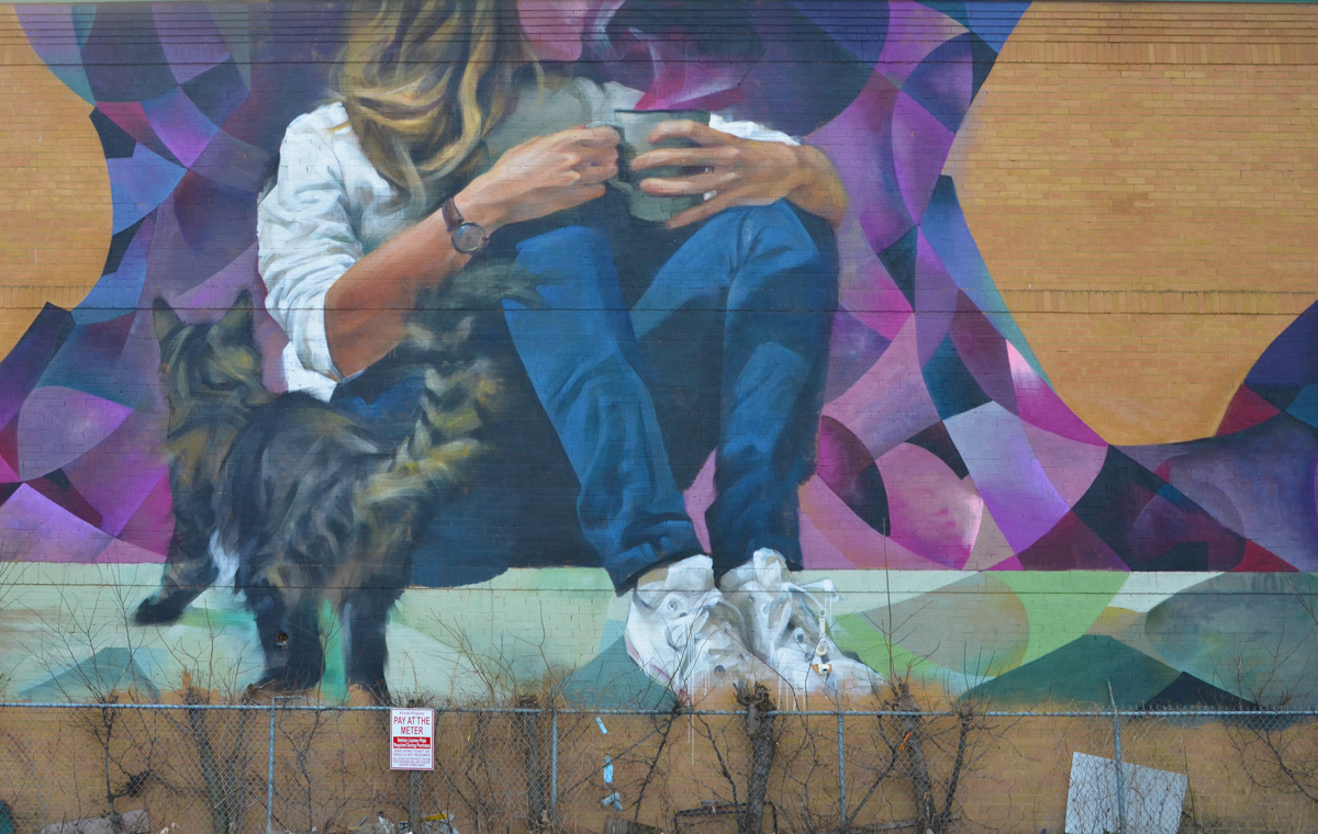
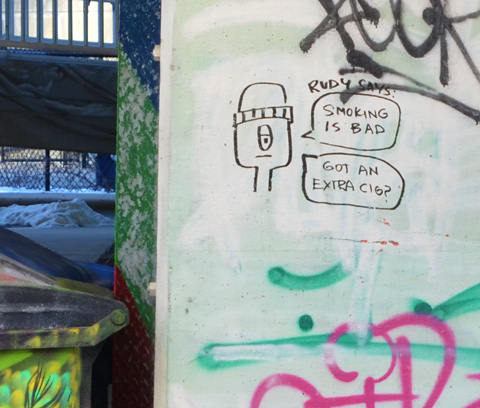
below: If you’ve been in the Distillery District this winter (or any of the past few winters), you might recognize this cheerful fellow.

tall fake snowman with a red and white striped scarf, in the distillery district

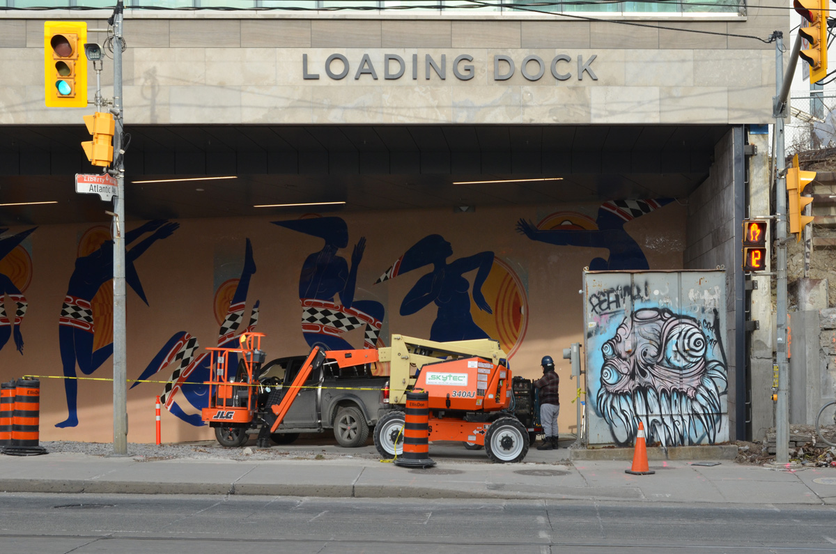
below: At Mill and Trinity, the omnipresent blue and white Notice sign.  Apparently a developer has applied to build a 31 storey building (on top of the existing old brick structure) with 392 hotel rooms.  I wonder if they are happy that they didn’t just finish this a year ago?  Ontario hotel occupancy rate hit a low of 15.3% in April 2020 and had barely started to recover when the second lockdown hit.  As an aside – if you like stats, you’ll like the Ministry of Tourism, Culture, and Sport research pages!

blue and white city of toronto development notice in front of old brick building in distillery district

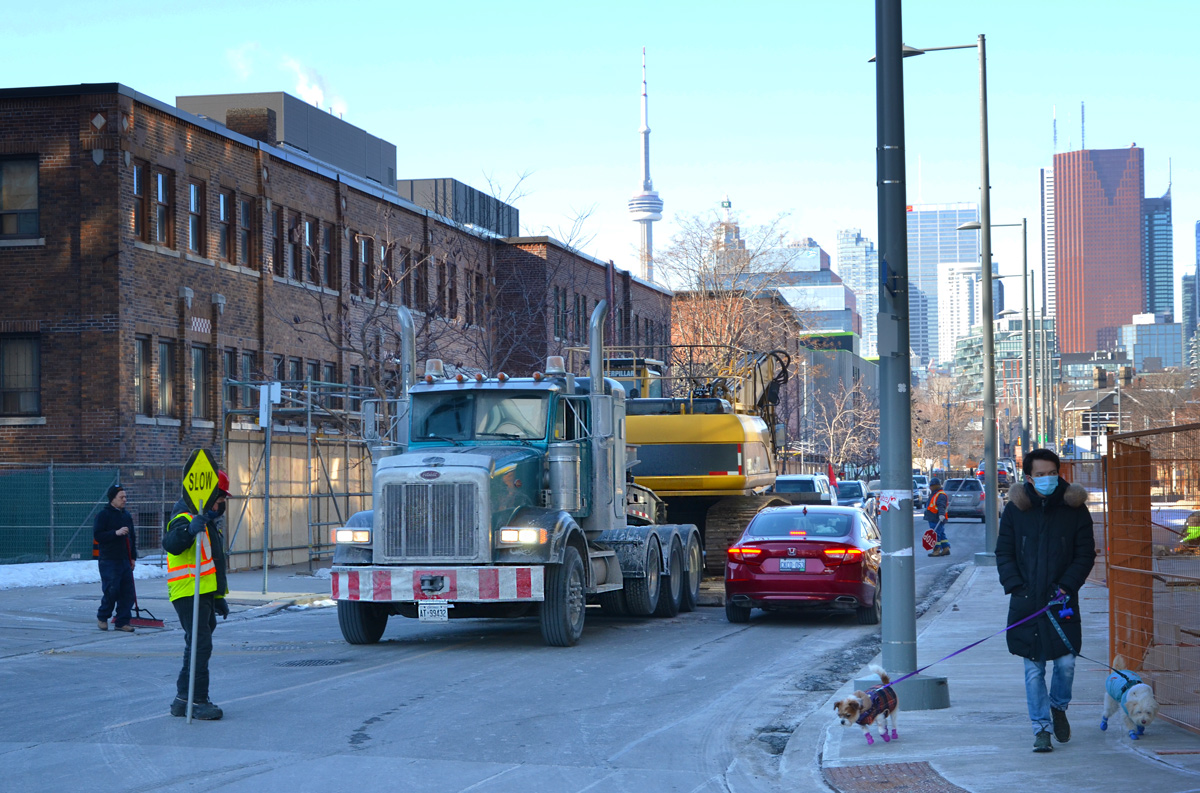
below: One industry that is booming is the film business.  Often you can see movie trucks at the corner of Mill and Cherry.  This land is owned by the province and is awaiting an affordable housing development of some sort.

movie film crew trucks on the corner of Cherry and Mill streets

two people buying coffee and muffins from a food truck in a lot with many other white trucks

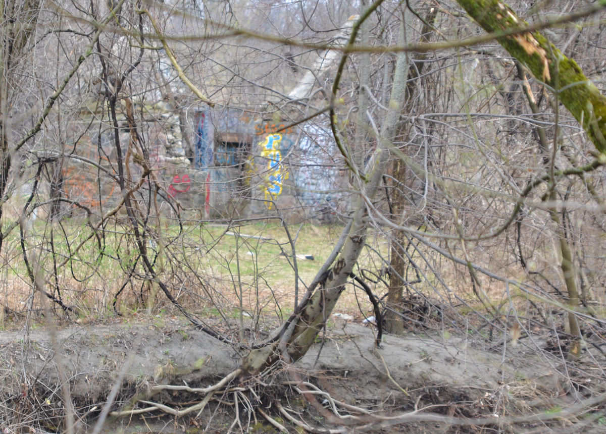
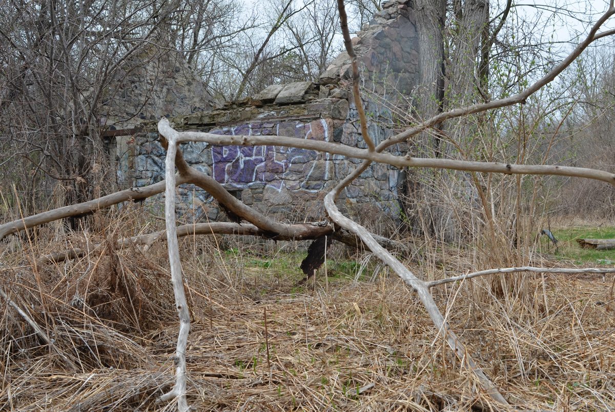
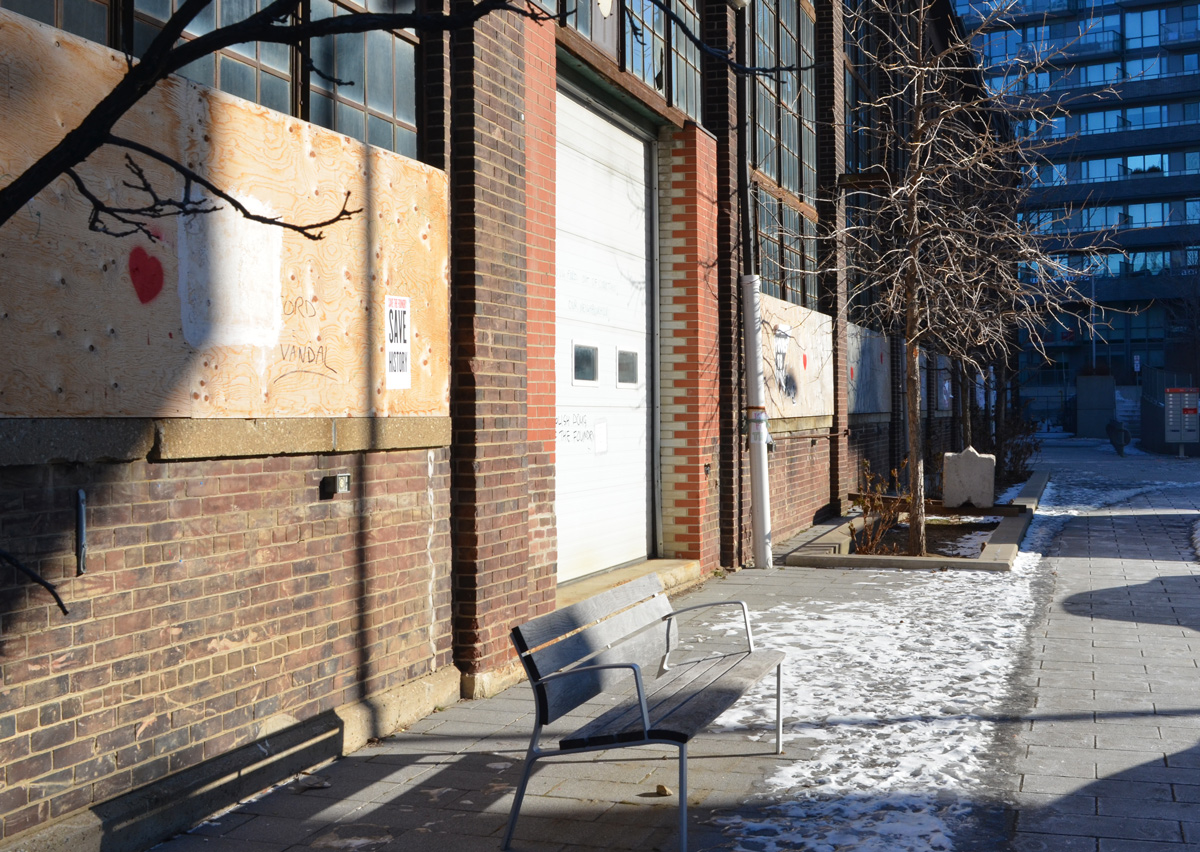
below: The old Foundry site, actually a group of heritage buildings at the former Dominion Wheel and Foundries Company on Eastern Avenue that are more than 100 years old.

glass windows of the old foundry building

The problem?  It sits on provincially owned land.  The province can pull stunts like changing the zoning without city approval (or knowledge).  It can turn one foundry building into 3 towers of max 141m high  (30 storeys is approx. 100m so 141 m is TALL!).  One of them has to be rental apartments but can’t have parking – there’s to be a commercial parking structure instead.  Hey let’s build affordable housing by making them pay for parking!  Here is the government website with the proof – Ontario Regulation 595/20

bench on sidewalk in front of old foundry building

Fast forward to late January.  Demolition of the foundry begins with no warning to the neighbourhood.  There is a rezoning order but no actual plans drawn up or developer named.  As far we know, the province still owns the land but refuses to say exactly the plan is because, well, probably because there is no plan or because the province is selling out to a developer.  Name your poison.   The province just says “affordable housing” and we’re supposed to go oooh and ahhh.

old foundry building behind hoardings, new condo in the background

Just around the corner (on Mill Street) three towers of 761 rental units are being built at the moment (no photo, it’s all behind hoardings so far).

machinery in front of old foundry building that demolition was started on, and then stopped

below: Heritage Toronto plaque, 2012, Dominion Wheel & Foundries Ltd., Manufacturing Complex

plaque at former Dominion Wheel and Foundries Company on Eastern Avenue

These four buildings were once part of a larger Dominion Wheel & Foundries Ltd. complex. By 1913, the company had constructed its first building, 169 Eastern Ave. on this site. As a manufacturer of railway equipment, rolling stock, and foundry and machinery supplies, Dominion Wheel & Foundries expanded with the growth of the nearby railway companies. By the 1940s, the buildings stretched from this location to Cherry Street, replacing two former residential streets. The firm’s remaining warehouse (#169)m foundry building (#153, built 1951), office building (#171, built 1930), and machine shop (#185, built about 1935) are now among the few remaining reminders of the extensive impact the railway industry had on this area.

.

Anyhow, lots of protest, lots of noise.  Demolition was halted.  An Ontario Divisional Court justice temporarily stopped the province from demolishing the heritage buildings.

4 hand drawn posters protesting the demolition of the old foundry building

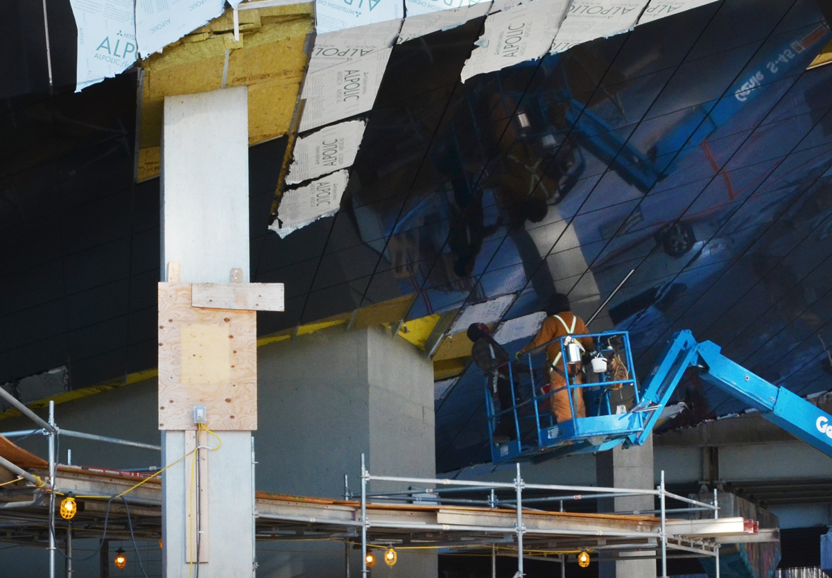
below: Just behind the Foundry, an almost completed condo.

new condo in Canary district almost finished construction,

below: Workers remove the protective layer from the mirror-like panels on the underside of the overhang (see yellow area near the bottom of the condo in the above photo).  This feature parallels the mirrors on the “ceiling” of Underpass Park which is close by.

workmen working on a lift, working on mirrored exterior overhanging roof on a new condo

flat bed truck carrying machinery, and little red car on street, man holding slow stop sign by construction site , man on sidewalk walking two small dogs

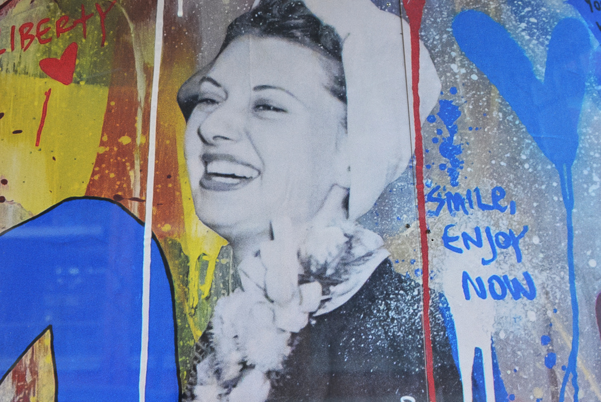
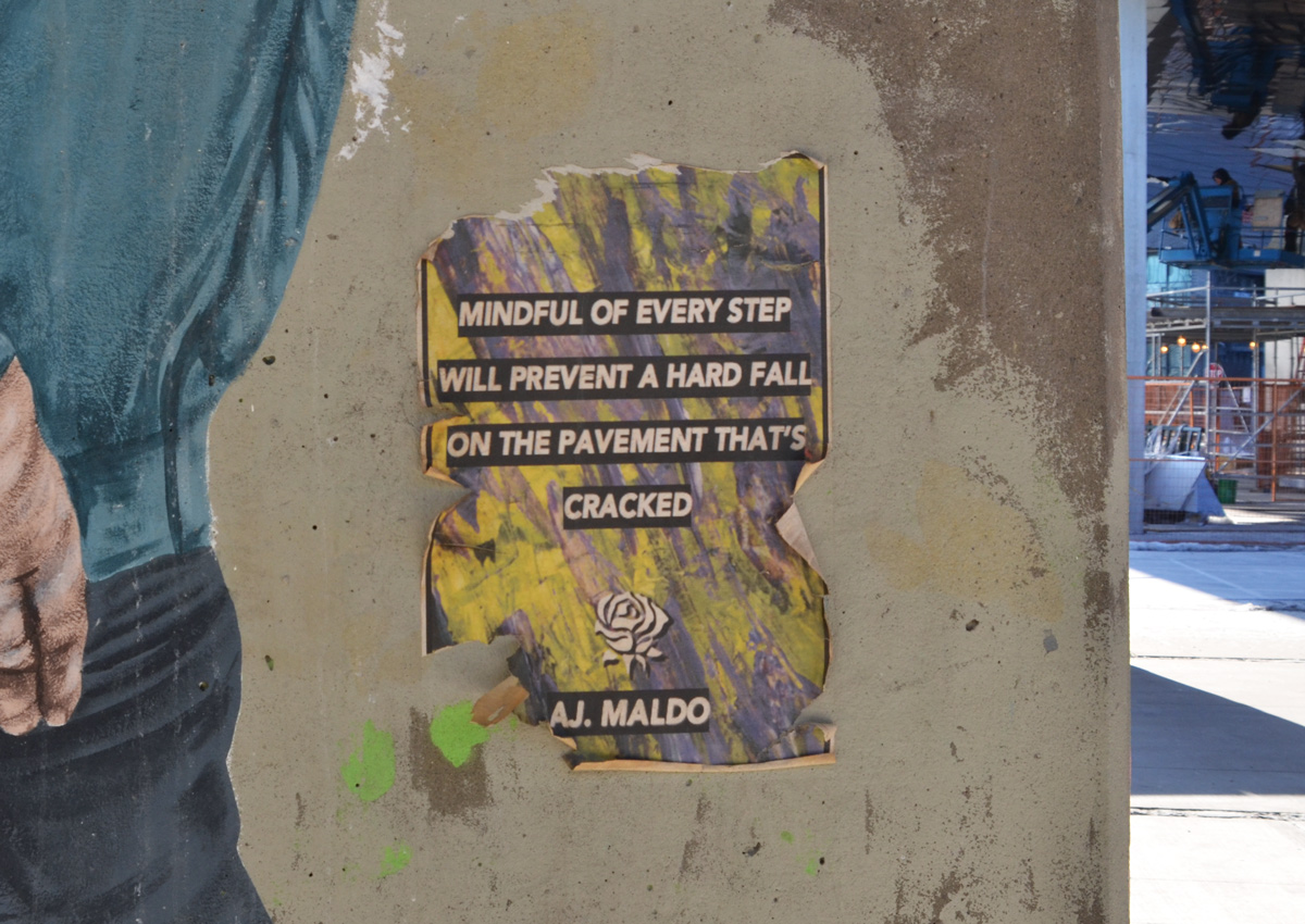
below: Poster paste up graffiti at Underpass Park (you can see the new condo I mentioned above in the upper right corner).  Good advice whether you take it literally or as a metaphor.

poster graffiti on a piller in Underpass Park, poetry on it

black marker scrawl graffiti on a concrete post, drawing of man's face and head with words about smoking

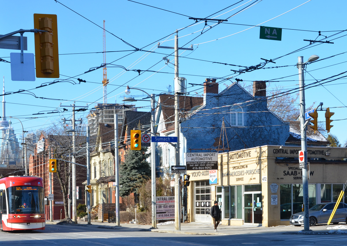
below: Looking northwest at the corner of King and Sumach

corner of kIng and Sumach, looking northwest, Central Auto mechanic on the corner

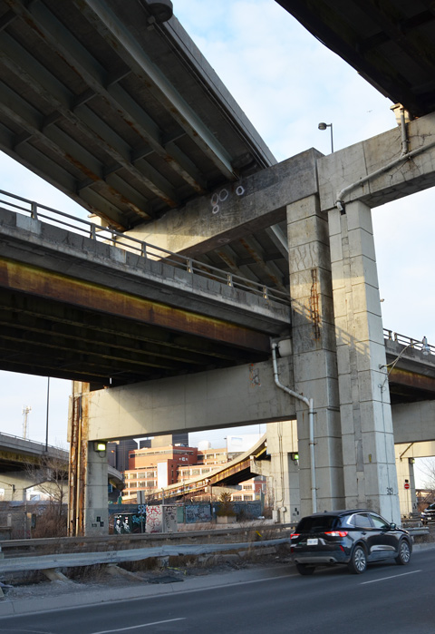
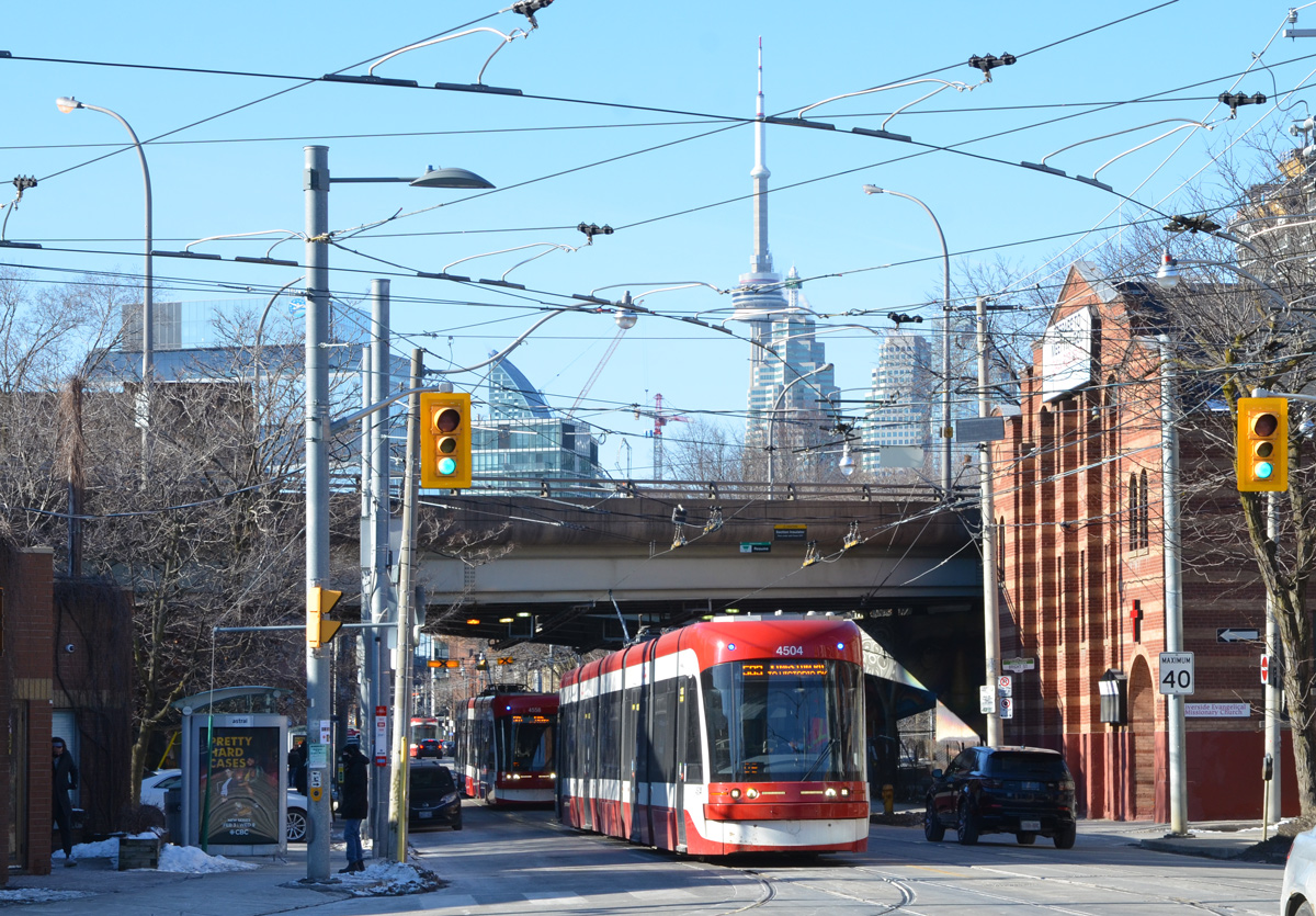
below: A few metres further west along King.  Traffic passes under Richmond and Adelaide streets.

TTC streetcar on King as it goes under the Richmond Street overpass from the Don Valley Parkway

below:  Looking northwest from Sackville Park.
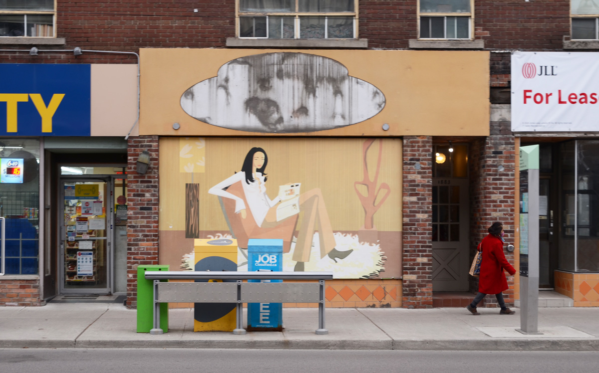
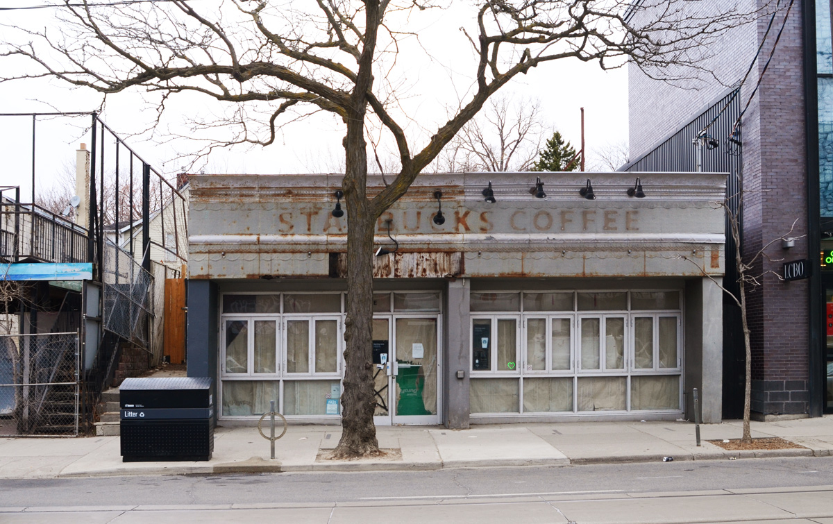
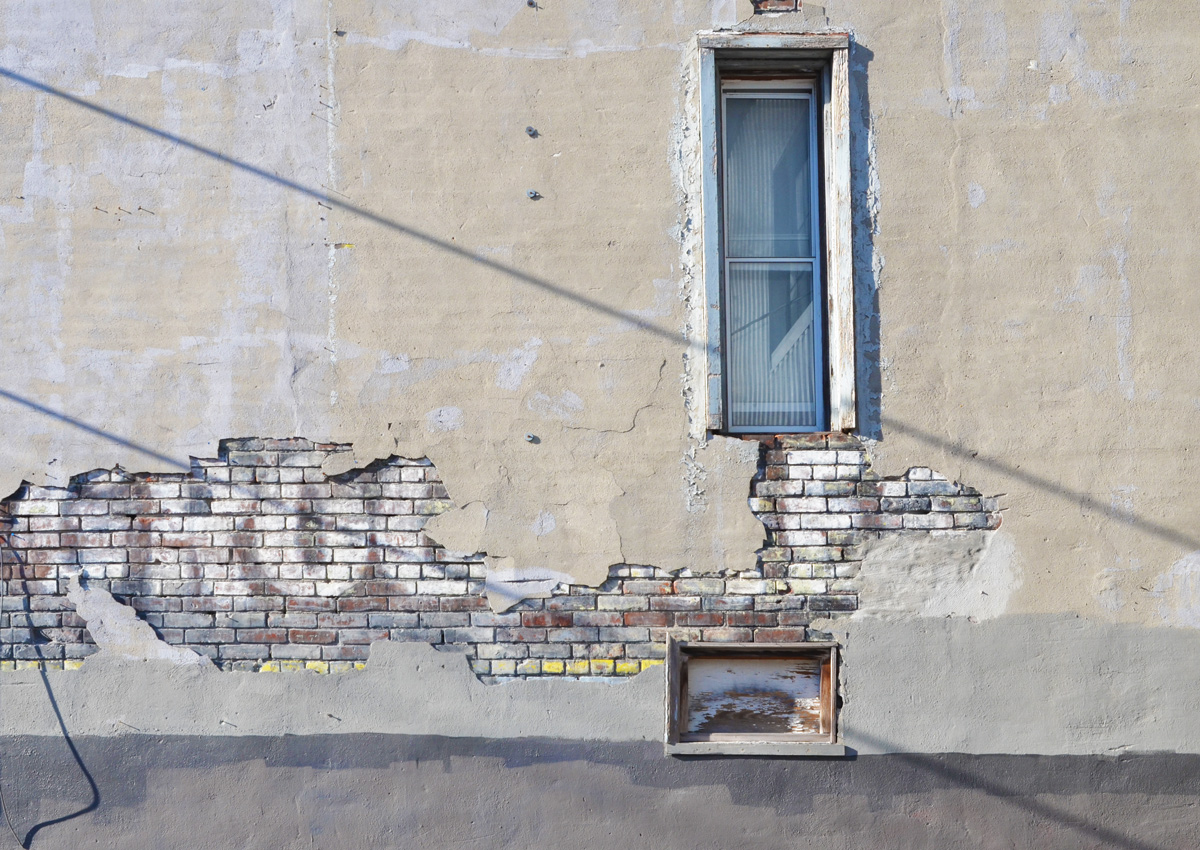
looking west through Sackville Park, to city buildings behind, snow on ground

below: ghost sign

ghost sign that says groceries, under a cracking layer of concrete, on a wall with a couple of windows

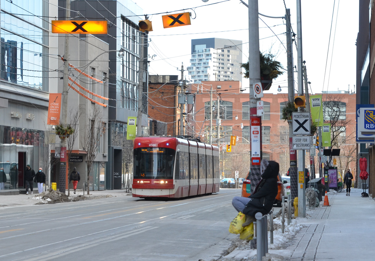
below: Waiting for the streetcar.

King street 504 TTC streetcar, person sitting onrailing and waiting for streetcar

man making a delivery , a box, on a bike, KIng street,

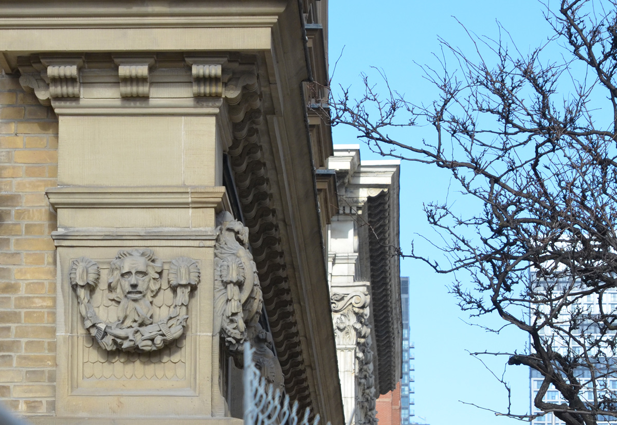
below: Architectural detail on a corner of St. Lawrence Hall.   That’s quite the expression on the poor fellow’s face.  The harrowed look of someone who has spent too much time in lockdown?

small relief sculpture high on a wall of the St. Lawrence Hall

below: In contrast, this guy looks like he’s having a great time!

a small dog is looking out the open window of a black car

Did you ever think that we’d still be mired in this pandemic a year later?

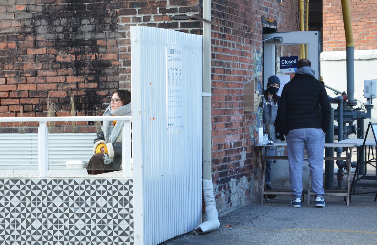
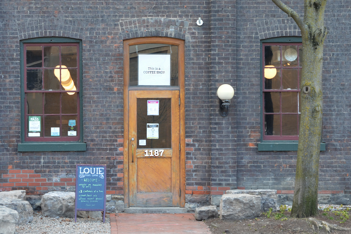
below: A reminder that this pandemic has been hard on a lot of businesses –  sign on a window, “Dear Customers”

sign in a restaurant window

Dear customers, We have decided to close this weekend to re-assess for the future…

.

below: Lining up to buy groceries, masked and keeping distanced.

people lined up waiting to get into No Frill grocery store, keeping the 2 metres apart

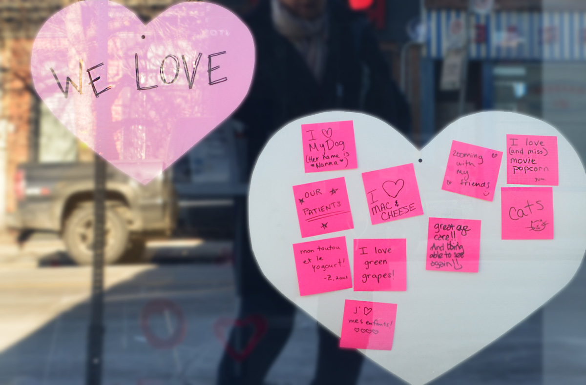
On a storefront window, something positive: hearts for the things we love – “my dog”, “mac & cheese”, “movie popcorn”, etc.

pink post it notes with words, beside big pink heart, in the window of a store, notes all say what people love

below: Pam Lostracco artwork on hoardings.

painted hoardings of a couple sitting on a bench, a child on a bike, some Canada geese, by Pam , around a construction site

workmen by the entrance to a construction site, with concrete mixer backed into the site

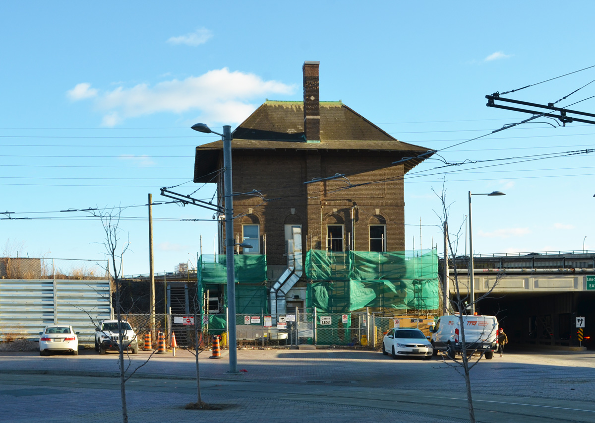
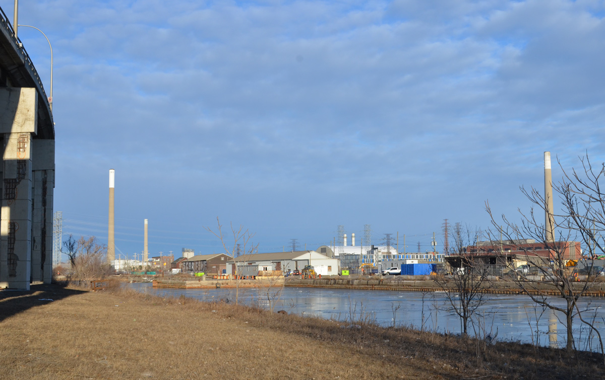
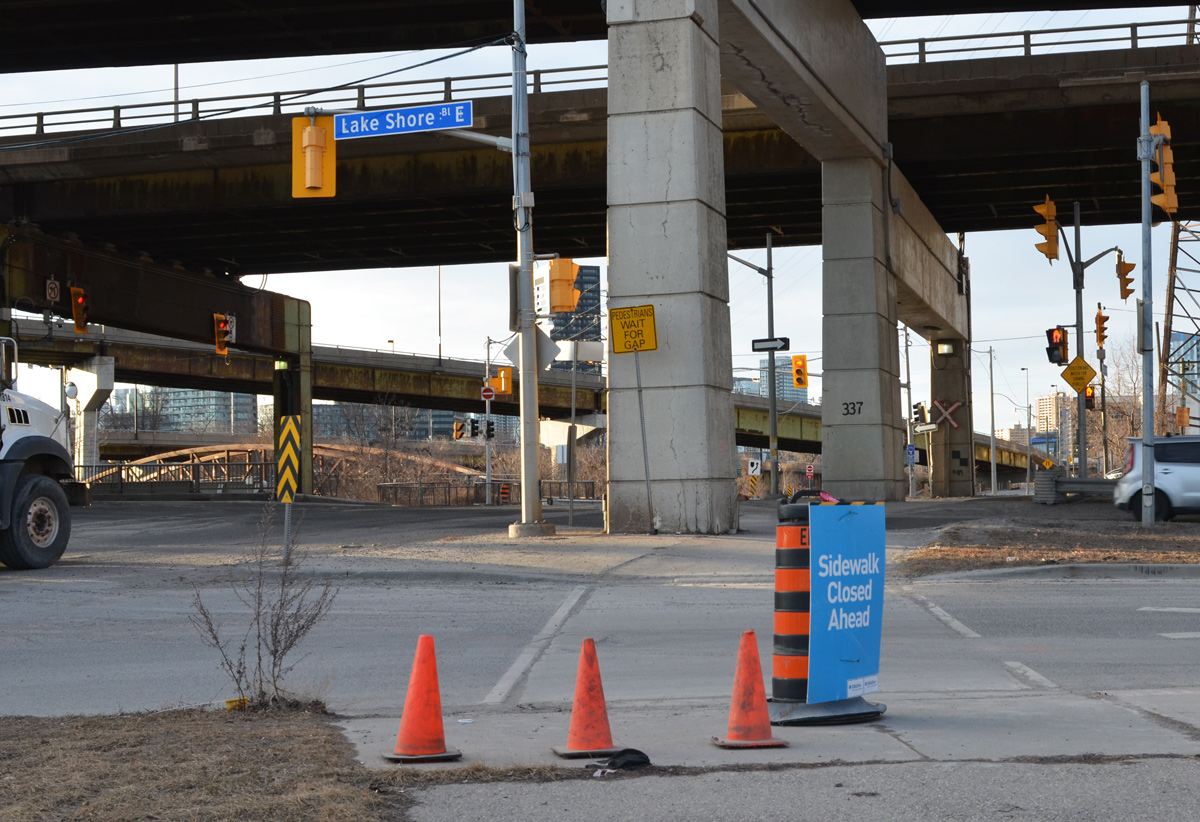
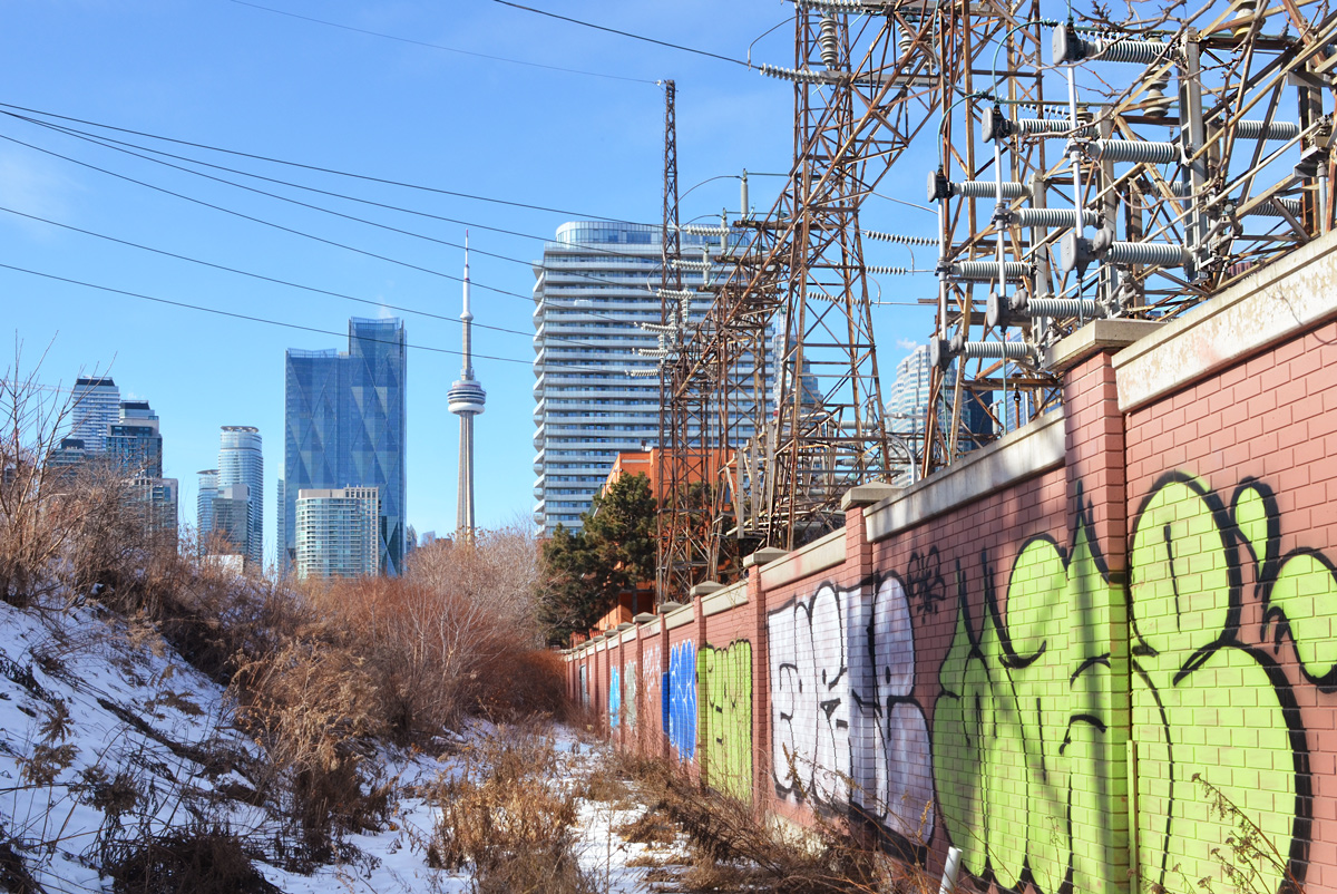
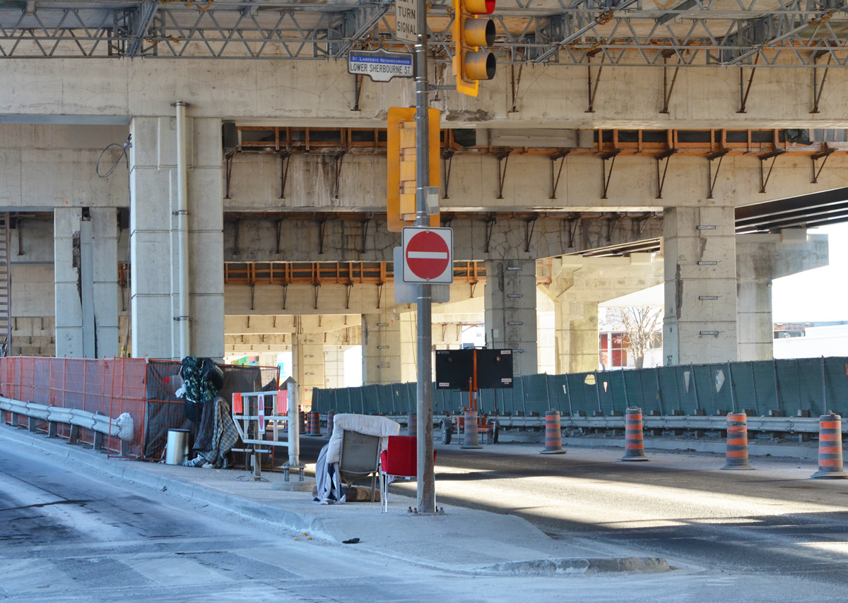
below: View of the CN Tower from Lower Sherbourne, just north of Lakeshore/Gardiner and immediately south of Hydro One’s Esplanade Transformer Station.  Unfortunately, that is not a public path; it is behind a locked gate.

graffiti on the wall around the hydro substation, lots electrical stuff, with CN Tower and downtown buildings in the background

below: Chairs in the median.

two chairs in the median on the Lakeshore, under the Gardiner at Lower Sherbourne

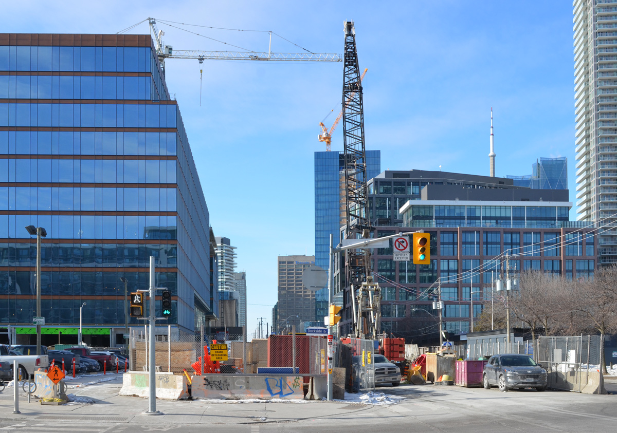
below: Queens Quay at Lower Sherbourne, looking west towards downtown.

looking west on Queens Quay from Lower Sherbourne, construction,

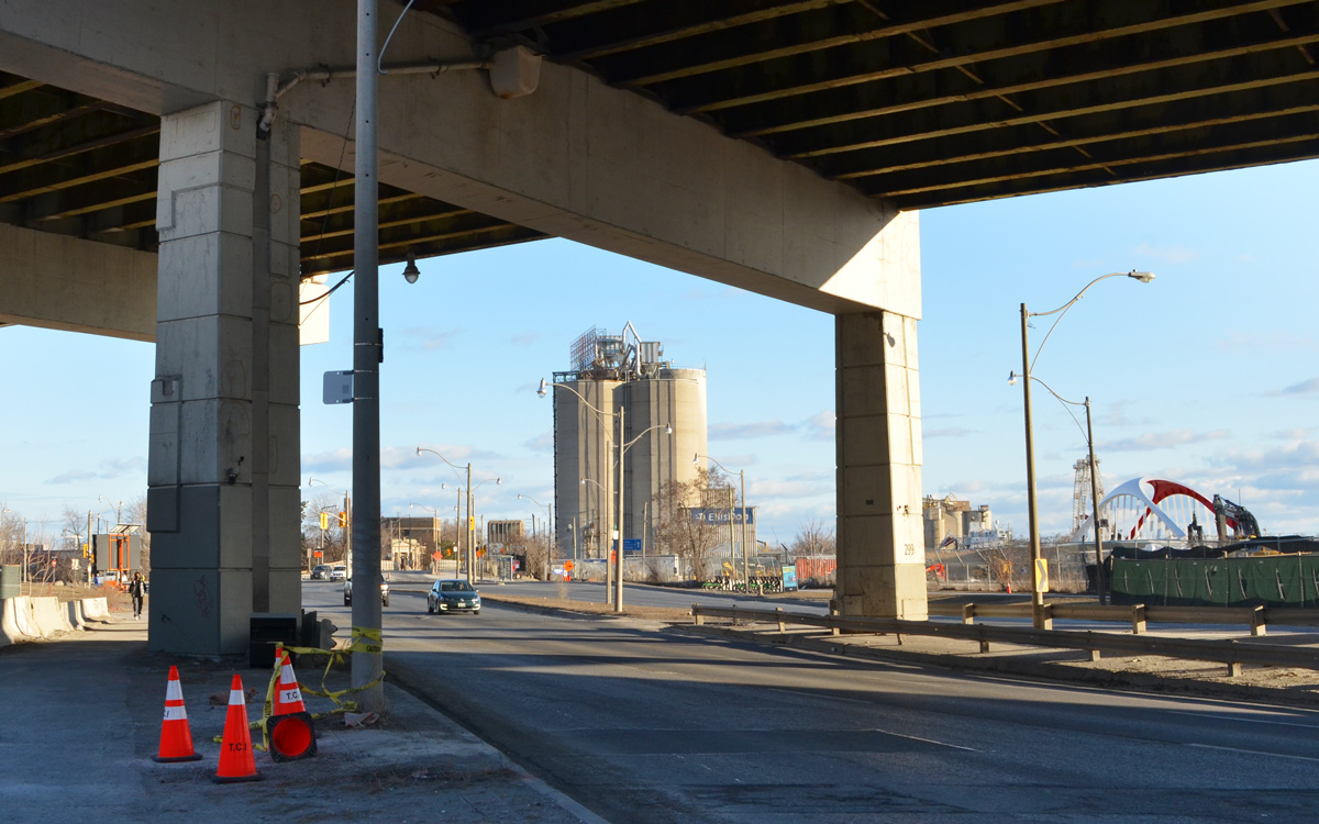
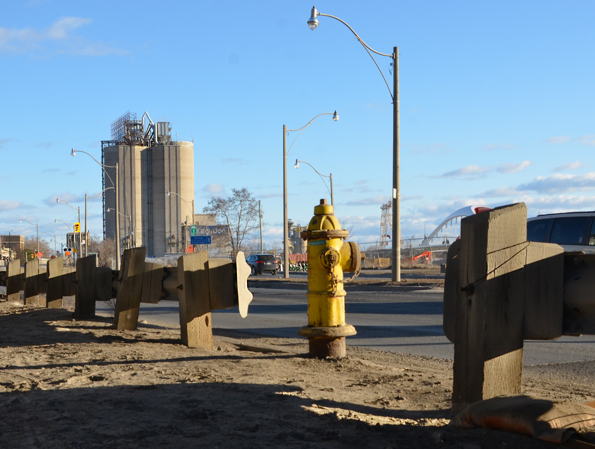
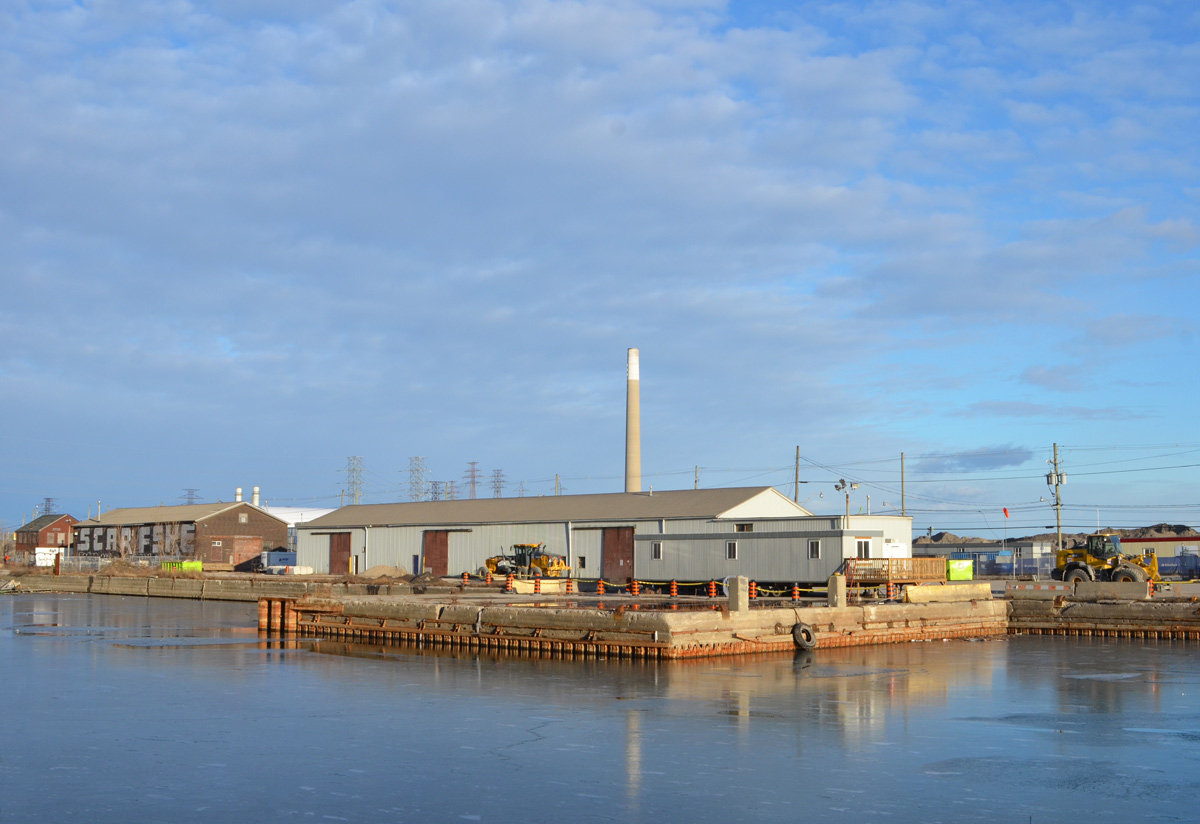
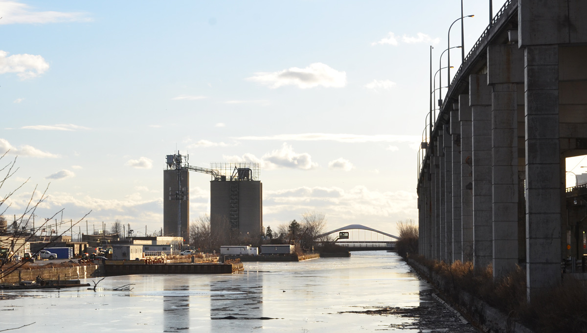
below: Queens Quay at Lower Sherbourne, looking east towards the old Victory Soya Mills Silos.  They were built for Canadian Breweries’ soya bean processing plant in 1944.  Ten years later the site was sold to Proctor and Gamble who renamed them the Victory Soya Mills Silos.   One last change of ownership occurred in 1980 when Central Soya Mills purchased them.   They have been empty since 1991.  Other buildings on the site have been demolished but the silos remain, now a heritage building but surrounded by a large vacant lot.

looking east on Queens Quay from Lower Sherbourne with old concrete silos in the distance, lots of orange and black traffic cones in the middle of the street in the foreground

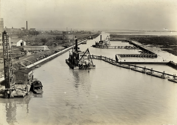
below: The mill with its three silos before it closed in the early 1990s.  The silo that still stands is the one in the back, not the two closest to the water.   In this picture, you are looking southeast; the Port Lands are in the background and the Cherry Street bridge is on the left at the very edge.  There isn’t much traffic on the Gardiner Expressway!
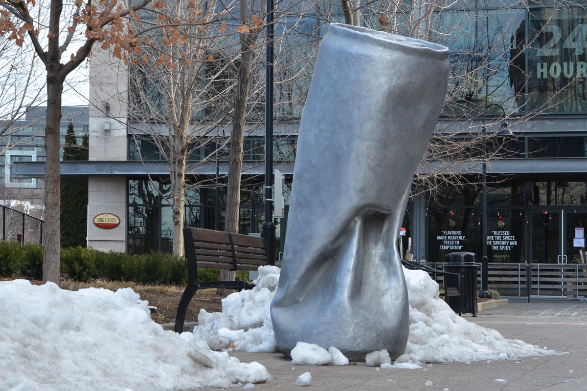
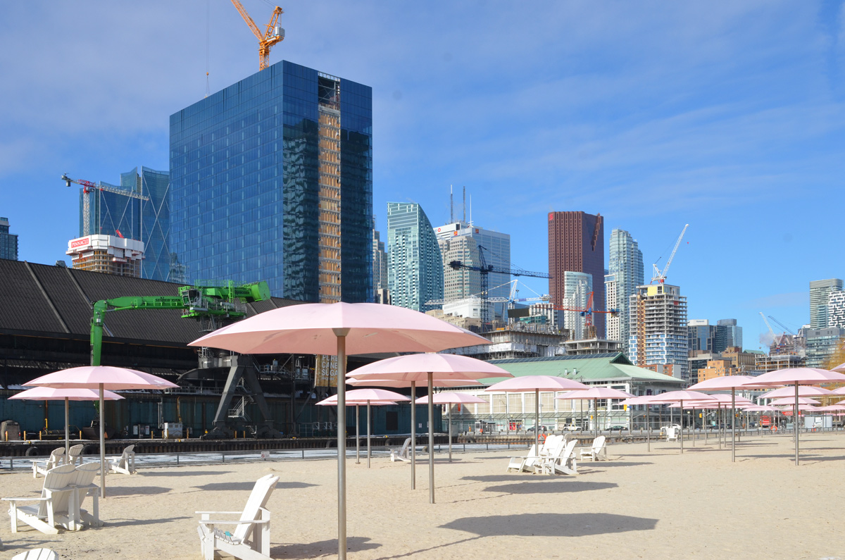
old colour photograph of Victory Soya Mills with Port Lands behind

below: Sugar Beach

sugar beach with pink umbrellas, looking northwest to the city, new glass highrise beside redpath sugar

black and white sticker graffiti on a pole

sticker graffiti on a pole

My thanks to Vicki for walking with me that day.  We’ve walked many miles together in the past but I don’t think that we’ve ever walked alone (maybe?)

reflections in a window downtown

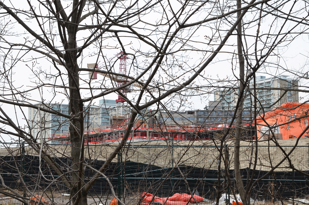
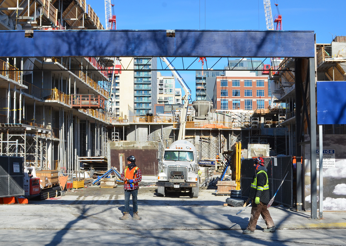
below: As an aside, after walking with Vicki, I looped back around to my car.  This construction site is on Adelaide where the brick facade of the old building is being preserved.   More to explore another day!

construction site, Adelaide street, new condo building, but with retention of the old facade

poster on the outside of a store, blue wall, picture of a tree and words that say Love your hood, Birchcliff village

Birch Cliff, where one of the predominant themes is birch trees.

mural of birch tree trunks

Such as this mural on the side of the public school.

Birch cliff public school, a two storey red brick building, with a large mural of birch trees on one exterior wall

The other theme in this stretch of Kingston Road seems to be the blue and white Toronto notice of development signs and the consequent empty buildings.

Lenmore Court, an older brick apartment complex, with a blue and white Toronto notice of development sign on it

banner, density has to make sense, protest agains Atlree developers and their plan to redevelop Lenmore Court

two posters on a wood utility pole, protesting redevelopments in the neighbourhood

small mural of birch trees beside Scarborough bluffs, on outside wall beside a window with a protest sign in it. Poretesting redevelopment of parts of Kingston Road with buildings that are too big, too tall, too wide

three empty storefronts at 1557, 1559 Kingston Road, two storey buildings in shades of grey

three old two storey brick storefronts, one is Cheers restaurant painted bright red, the other is Barbers by Nature

beside a new condo building, older smaller buildings on Kingston Road, Lakeview Tavern,

looking across the street to Majestic Auto service and Fallingbrook garage, two businesses that share a building

side entrance and car door of Fallingbrook garage, mechanic, service entrance, now with a development notice sign on it

The old….

three storey red brick apartment buildings with large trees in front, one apartment has red curtains

… and the new. This is the only building that is close to being finished.   If the drawings on the development signs are to be believed, there will be several more in the neighbourhood just like it in a couple of years time.

six or 7 storey new condo development in birch cliff

below: Kingston Road is quite close to Lake Ontario. At this point the only thing between the road and the water is the grounds and golf course of The Toronto Hunt Club, a private members only club.

trees, in winter time, with snow on the ground, with Lake Ontario in the distance, Scarboruogh Hunt Club grounds

below: On the side of Legion 13 on Kingston Road is this large mural.  Painted in memory of Max Silverstein, by John Hood with help from Alexandra Hood and Asif Khan, 1991. Restored in 2010 by Blinc Studios.  It’s also part of the Heritage Trail murals, a Mural Routes project.

large mural on the side of Legion 13 building on Kingston Road, parade of soldiers

Plaque beside the mural says: “Scarborough Rifle Company marching to the Niagara Frontier, June 1, 1866. In 1862 the Scarborough Rifle Company was organized with headquarters in a school at Eglinton Avenue near Markham Road. It was the first of several militia companies formed in York County. The company was rushed to the Niagara frontier three times in 1865 and 1866 to defend Canada against the Fenians. The Scarborough Rifle Company later became No. 1 Company in the 12th Battalion of Infantry, the forerunner of Queen’s York Rangers.”

.

below: A smaller mural on the right hand side of the above one features portraits of two men, Captain Norris and Lieutenant Taber, soldiers in the Fenian Raids of 1866.

mural on side of Legion 13 building, two portraits in oval frames, Norris and Taber, Fenian Raids history

below: Another Heritage Trail  mural – “Mitchells General Store” by Phil Irish, 1998.  Mitchells store was one of the first businesses established in the Birch Cliff area.  The same store is mentioned in another Scarborough history mural just a bit north on Warden Avenue (see Scarborough Bells)

a mural on the side of a building, inside an old fashioned store with a man behind the counter and a woman shopper

yellow metal bucket hanging from a tree with evergreens and a red ribbon, also three gold christmas balls hanging with the bucket

below: An elaborate home for the birds with a tiny outpost below.

a large white bird house with a red windmill on it, behind a wrought iron fence, and a for rent sign on the fence

below: Ready for social distancing when you’re feeling down in the dumps.

an old beige arm chair, with snow it, outside beside industrial garbage bins

Molson Canadian flag outside a bar, also muskoka chairs and a carved wood bear, a Canadian flag too.

below: Buster’s ready to play

carved wooden bear, Buster, with Canada flag hockey shirt on, holding a hockey stick,

below: This guy needs a beer

posters and signs on the door of a bar

below: Looking in a window – framed pictures, old records, a trunk and a tripod.

looking in the window of a junk vintage store, framed pictures on the wall, a shelf of old records, a trunk, and other stuff

windows and entrance of Sharons Variety store on Kingston Road

below: A Beckers store, you don’t have to be that old to remember Beckers do you?  The original Beckers Milk Company was founded in 1957; they had five convenience stores that were open 7 days a week, 14 hours a day.  By 2006 when the company was sold to Alimentation Couche-Tard, there were 500 stores.  Most were converted to Macs convenience stores stores.  In 2013 the Beckers label was brought back and apparently there are now 45 Beckers stores.

row of two storey brick storefronts including a Beckers store with a birch tree mural on it

an old gas station that is now a used car dealership, with many cars parked outside in the snow

cars parked outside in the snow at a used car lot

below: St. Nicholas Anglican church, opened 1917.

St Nicholas church, red brick, no steeple, but a pointed roof

old two story brown brick building on Kingston Road

red wall, exterior of Fashion Sushi

below: An idea for a future walk!

Warden street sign, with traffic signals, also a sign pointing south to the Waterfront Trail