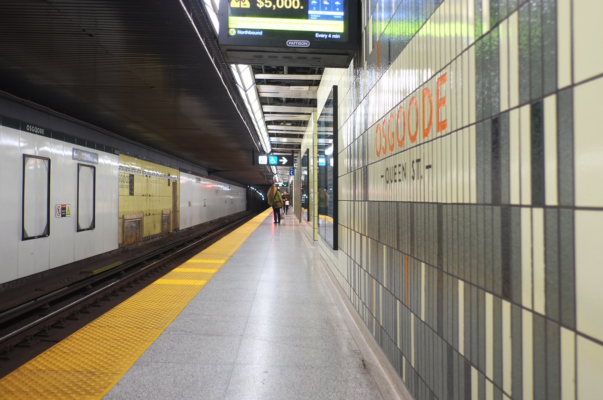
It’s not the busiest station on the University Line but changes are in the works. It is going to become one of the transfer stations with the new Ontario Line. This line will cross downtown underground with stations at: Corktown, Moss Park, Queen, Osgoode, Queen/Spadina, and King/Bathurst.
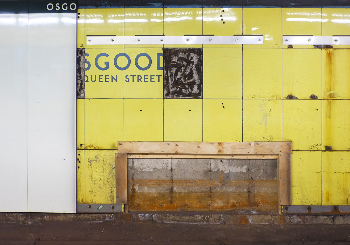
When the University Line was built in 1966, Osgoode station was yellow with greenish accents.
Like other University Line station, it is nondescript and built with the minimum of fuss.
One could say the bare minimum
One of the only extras that have been added to the station recently is direct access to the Four Seasons Centre on the southeast corner.
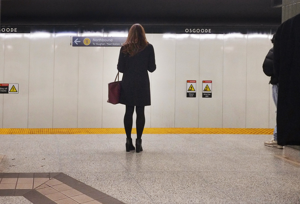
The other three corners of the University and Queen West intersection have stairwells on the sidewalks that connect to Osgoode station. But…. I didn’t really mean to dwell on the station itself….
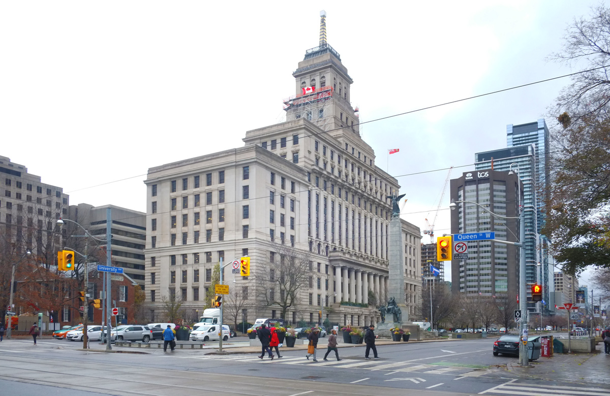
below: Canada Trust building on University Avenue
I came here to document the intersection as it is now, pre-Ontario Line construction (and years of disruption!)
below: Looking north up University Avenue from Queen, east side of University (including the present subway entrance on the sidewalk – close to where the pedestrians are in the photo).
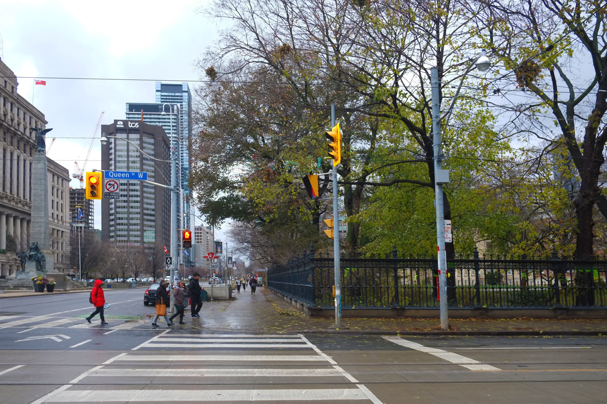
Behind the black wrought iron fence is the former Osgoode Law School (for which the subway is named). There is public access to the grounds and it is an oasis of green and shade in the summer time. Green ribbons have been tied around the large trees.
… and at least one tree has been tagged as an historic tree.
Metrolinx wants to build another subway entrance here. Apparently a third-party independent review of alternative station designs is in the process but hasn’t been completed yet. Metrolinx decided that in the meantime they’d cut down the trees on the 5th of December (this coming week) anyhow. If you want to see one of the ideas for the plan, there are artist’s renderings on their website: The Ontario Line – Neighbourhood Updates – Downtown – Osgoode Station. As usual, what is pictured now is never guaranteed to be the end product!
The Law Society of Ontario is the custodian of this greenspace and they have formally objected to Metrolinx trying to short-circuit the process.
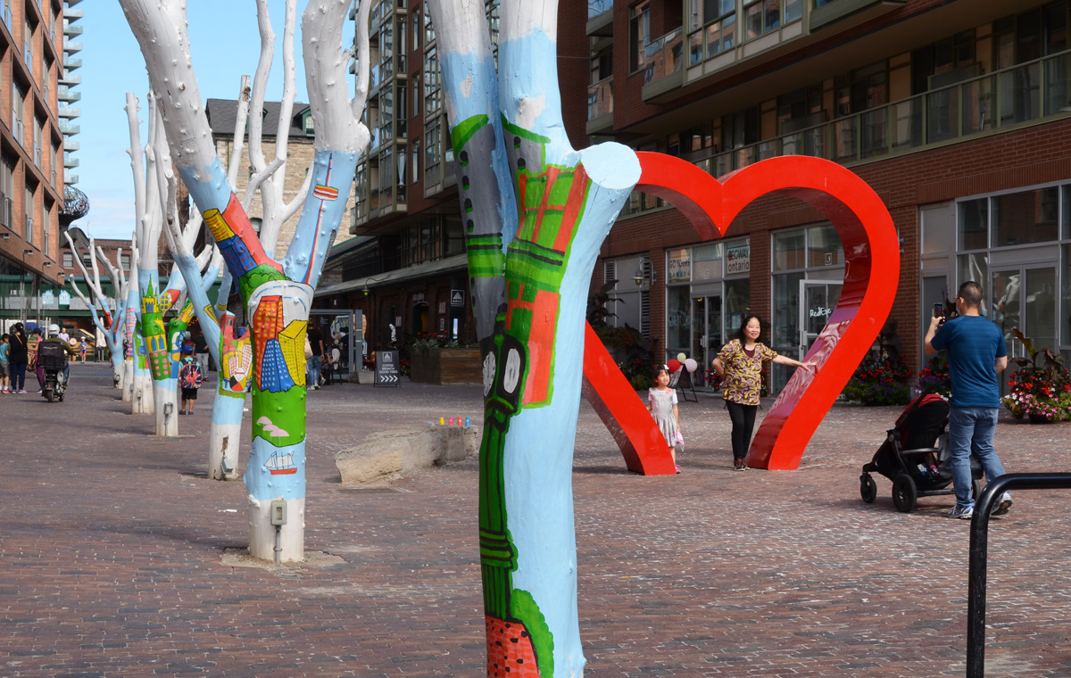
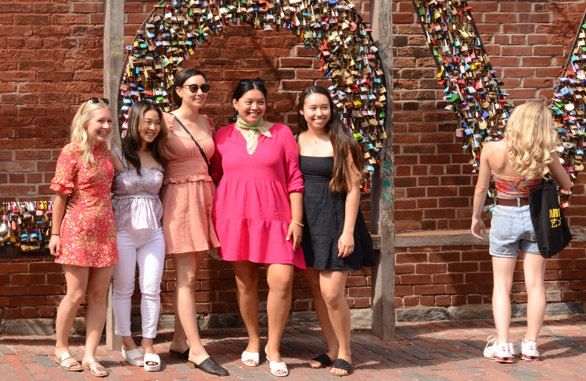
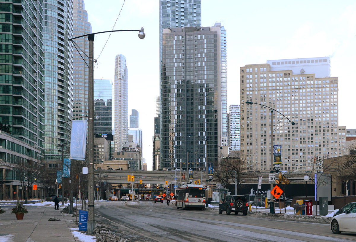
Another day, another walk through the city starting at the Distillery District and heading west towards the waterfront and downtown Toronto.
below: Posing under the heart, Distillery District.
below: Posing with the LOVE locks.
below: Flowered Dress Madonna” by Ann Agee, 2021 as seen in the Corkin Gallery in the Distillery District.
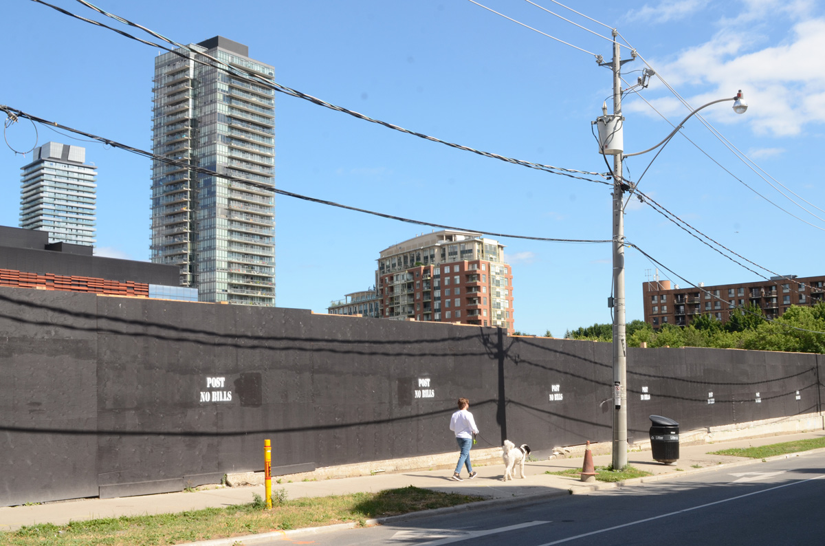
below: Looking east on Front Street from Berkeley. Police Division is the old brick building. Both sides of Front are lined with black hoardings as redevelopment of those sites started recently.
below: Berkeley St., south of Front
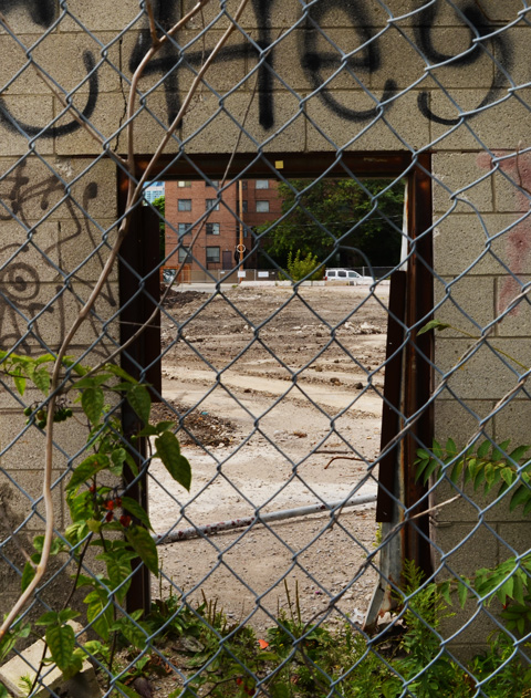
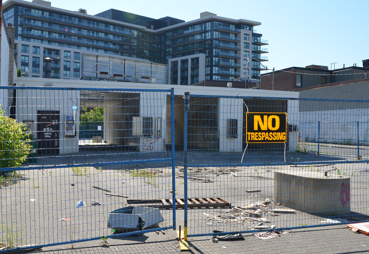
below: Another hole in the wall; another vacant lot waiting for redevelopment on Parliament Street. More tall buildings coming to the Distillery District.
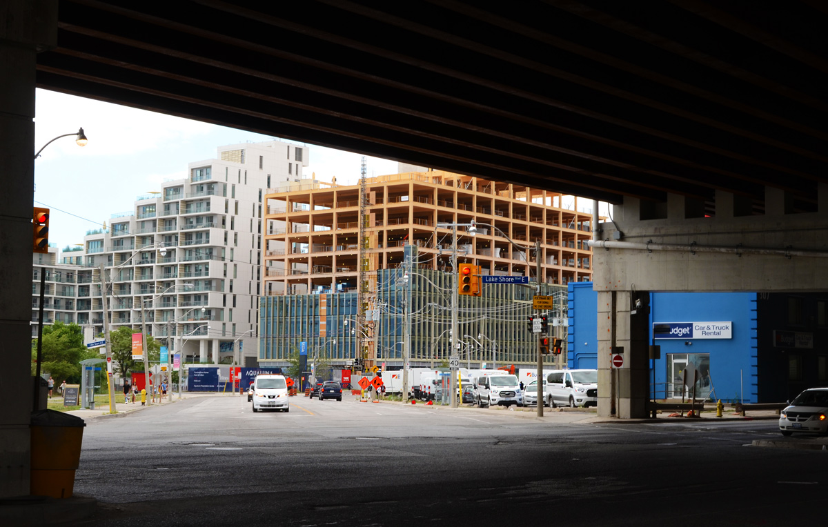
below: Looking south from the end of Parliament Street and across Lakeshore Blvd to the start of Queens Quay East. Many changes here!
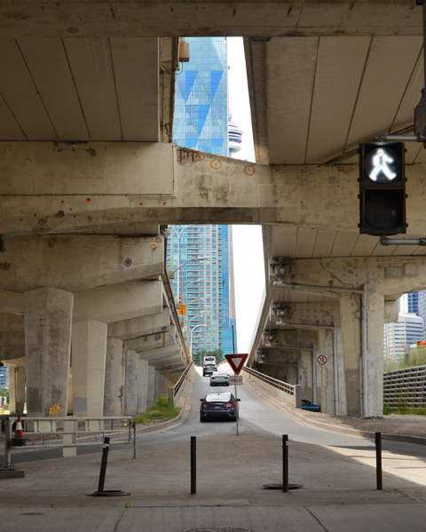
below: The CN Tower peaks through the gap created by one of the onramps for the Gardiner Expressway.
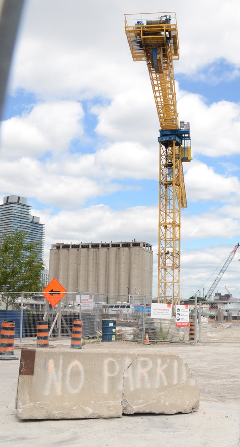
below: No Parkin’, Victory Soya Mills in the background
below: Looking east towards the Port Lands redevelopment. The new Cherry Street bridge is in the background.
below: From the same spot on the waterfront as the above picture, but looking in the other direction.
below: Queens Quay East
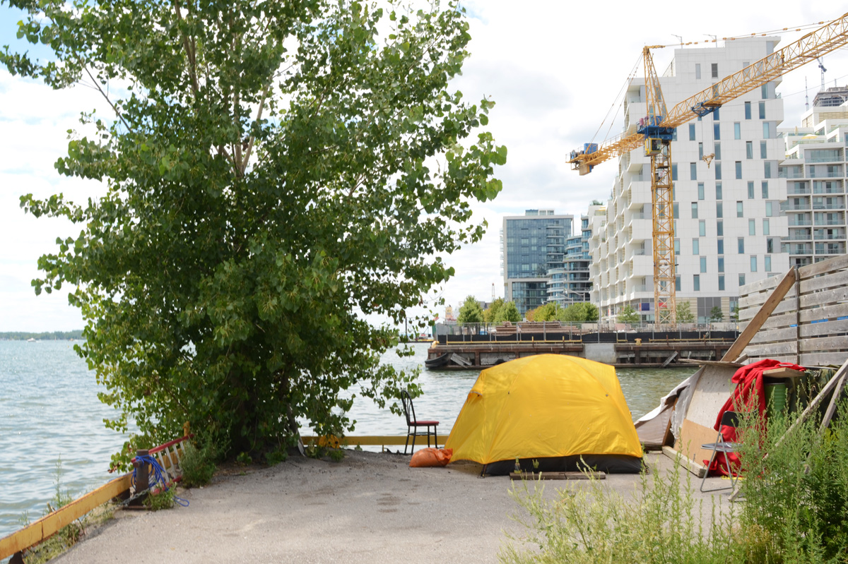
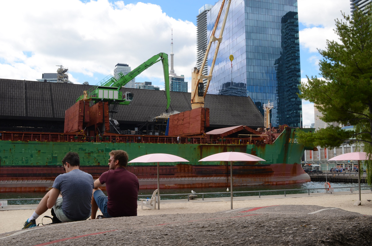
below: Relaxing by the lake.
below: Sugar Beach, spectator section, in the shade.
below: On the rocks, Sugar Beach
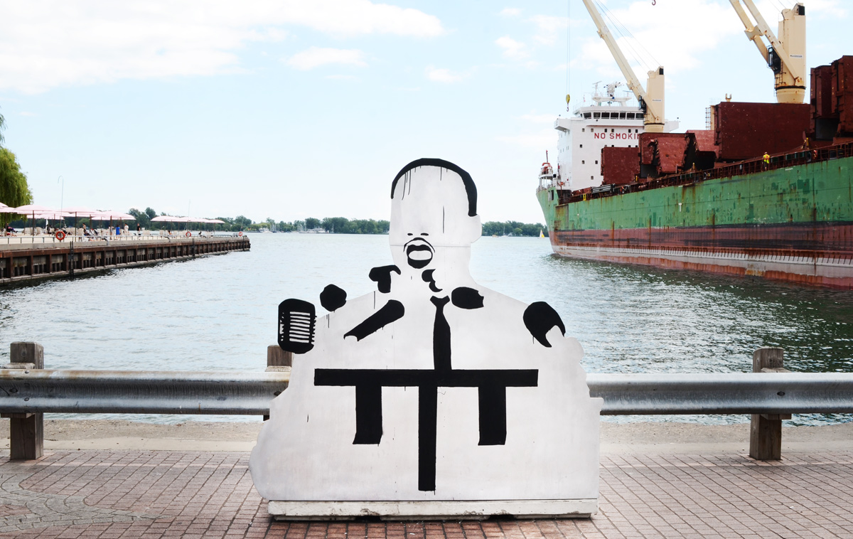
below: I am not sure who this is or why he’s on the waterfront. He’s made of wood – someone constructed him and left him here.
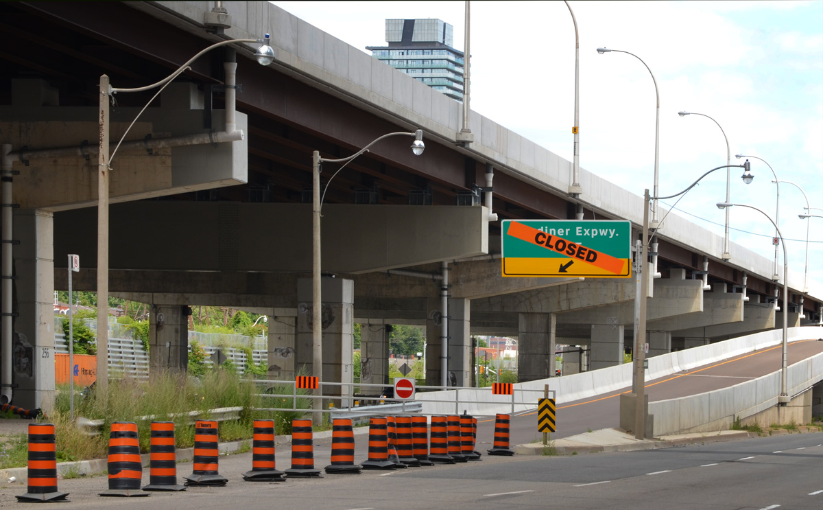
below: Closed – ramp to the the eastbound Gardiner at Lower Jarvis.
below: Lower Jarvis
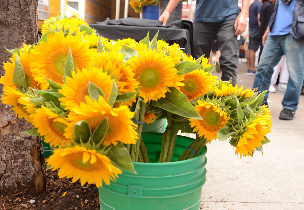
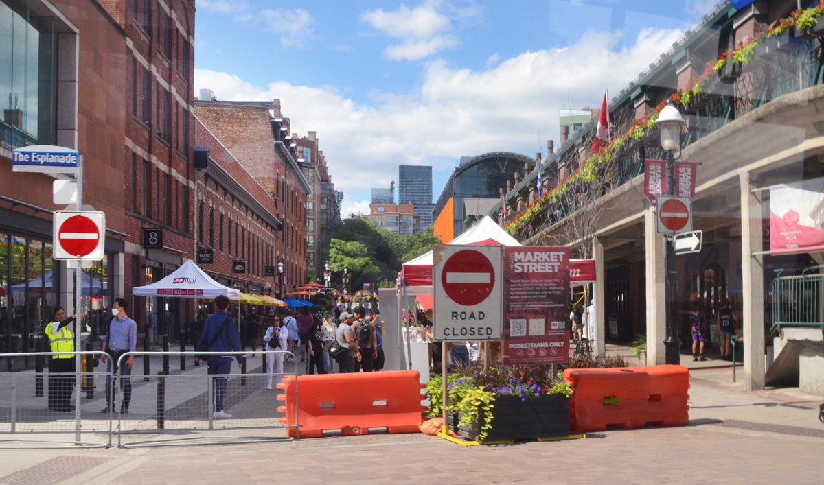
below: A bucket full of bright and cheerful sunflowers on the sidewalk by St. Lawrence Market.
below: Market Street closed to traffic at Esplanade.
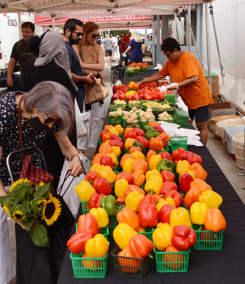
below: Marvelous peppers and other veggies for sale at St. Lawrence Market
below: Someone’s looking a little distraught. Remember how your parents used to say that if you frowned too much, or you made too many weird faces, your face would freeze in that position? That is what this poor fellow reminded me of. “Frozen” in time on the side of St. Lawrence Hall.
below: In a window. The title of the painting is “Alone” so perhaps she is alone in the city albeit surrounded by flowers. Unfortunately, they are yellow and blue flowers so I suspect that there is Ukrainian symbolism at play here and that ‘alone’ has a much deeper significance.
below: Leader Lane ends at Wellington.
below: Mama elephant and her two little ones are still walking through the courtyard behind Commerce Court. They haven’t reached the pool yet (but at least there’s water in the pool now).
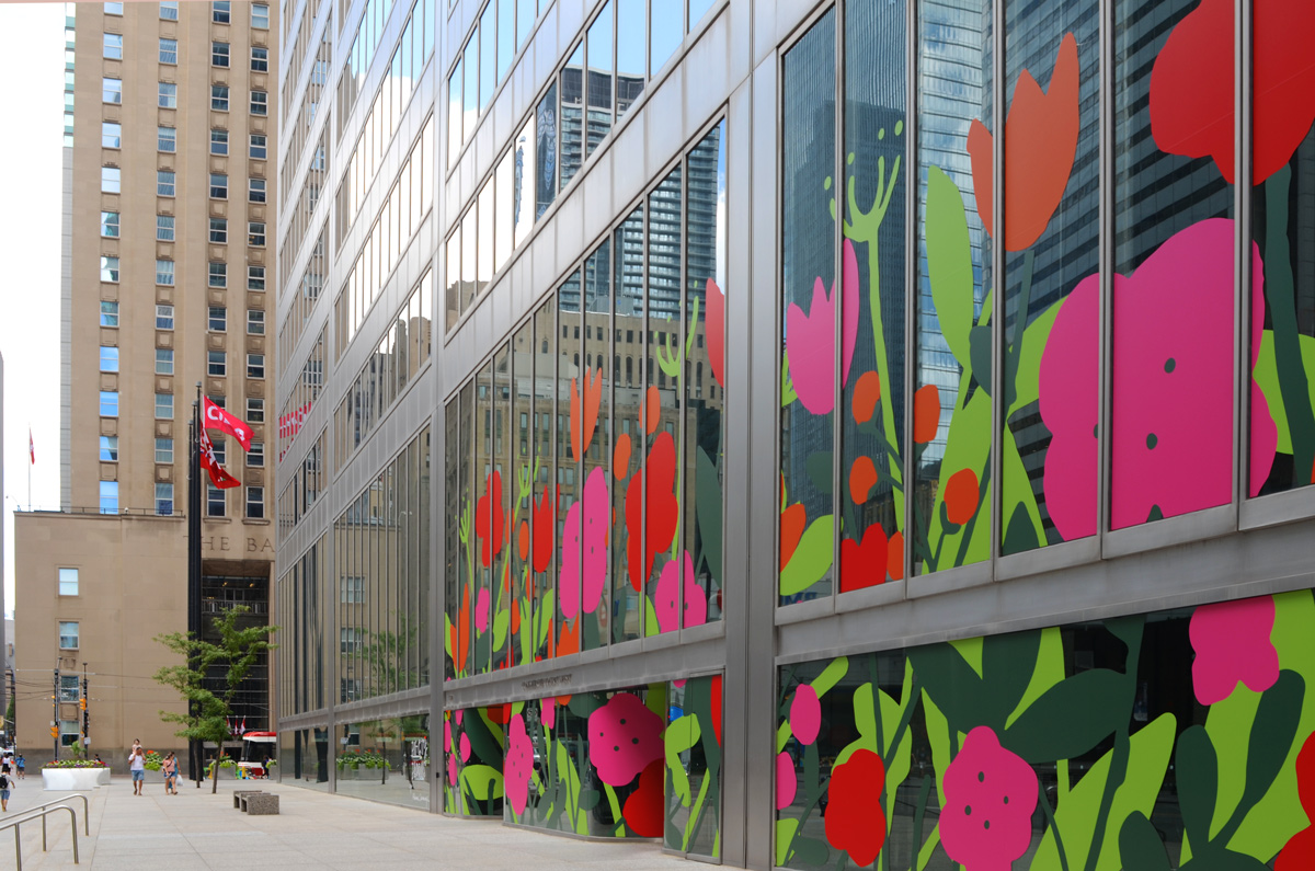
below: This is one of the five Big City Blooms murals found around the city (west side of Commerce Court). The big bold and cheerful flowers in reds and pinks are the work of Alanna Cavanagh.
below: Same Commerce Court building as the above picture but from a slightly different angle.
below: Melinda Street
below: Narrow city alley views, framing the gorgeous stone and brick work on the older building with its arched windows.
below: There appears to be a forest path in the middle of Brookfield Place. It is actually a photograph that is part of an exhibit called, “Take Your Seat With the Group of Seven, Nature the Inspires Us”. (now gone from Brookfield Place).
below: In this exhibit, locations used by the Group of Seven in their paintings were revisited. Photos were taken using a red director’s chair, placing the chair in the artist’s position. In this set of images, two small paintings from Coldwell Harbour are paired with a large photo of present day Coldwell Harbour – the chair is small but you should be able to see it on the rocky outcropping. The harbour is on Lake Superior near the town of Marathon.
Once it was the hinterland but now it feels like the city just goes on and on and on….
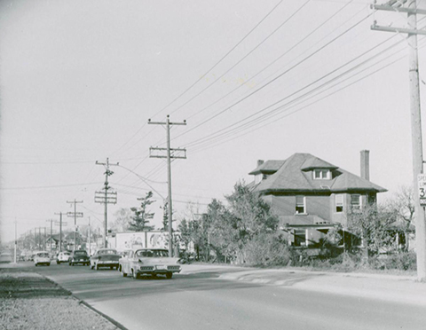
below: In 1955 this was the view looking south on Yonge from just north of Cummer/Drewry. This was the center of the community of Newtonbrook, named after the Newton Brook Wesleyan Church founded in 1857. A general store and post office were opened here in 1863 on the northeast corner of Yonge & Drewry (possibly the buildings on the right side of this photo).
photo credit: James Victor Salmon, found on Toronto Public Library website (public domain).
below: It’s not taken from exactly the same viewpoint (traffic!) but this is what you see looking south on Yonge Street now.
below: Looking north up Yonge Street from just south of Cummer/Drewry. The large house is on the southeast corner of Cummer and Yonge.
photo credit: Tim Chirnside, found on Toronto Public Library website (public domain)
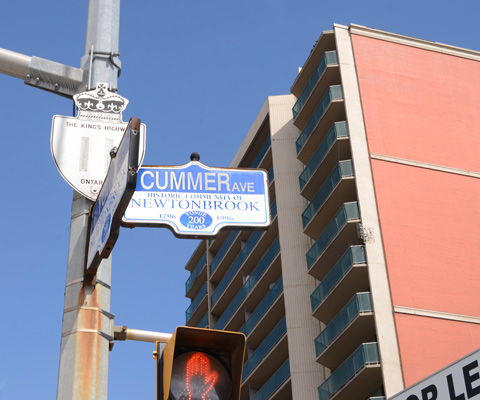
below: The intersection of Yonge and Cummer (to the east) and Drewry (to the west) today. The large house in the black and white photo above would be on the far right of this picture.
below: Yonge Street is also Provincial Highway 11.
below: It is a major transportation/transit route.
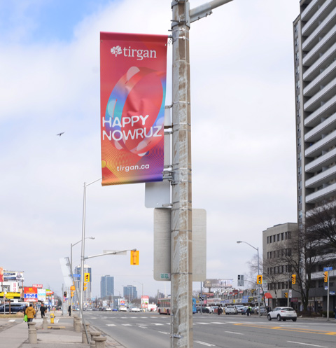
below: Happy Nowruz! or in other words, Happy New Year! It is the Iranian New Year; the beginning of spring; a new day! The banners were by sponsored by Tirgan, an organization that “promotes cross-cultural dialogue between Iranian-Canadians and the global community at large.”
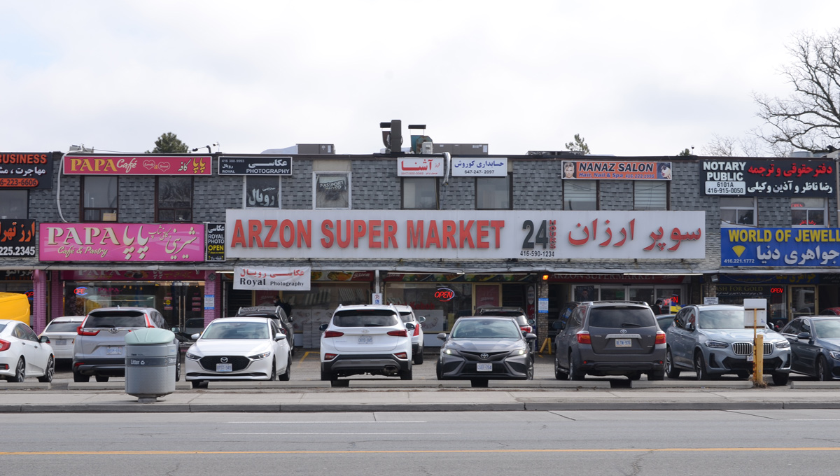
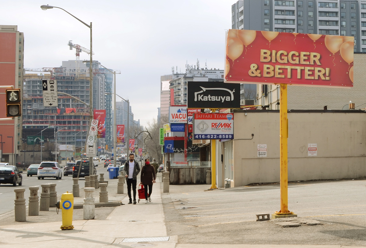
below: There are many other cultures that are well represented in this part of the city.
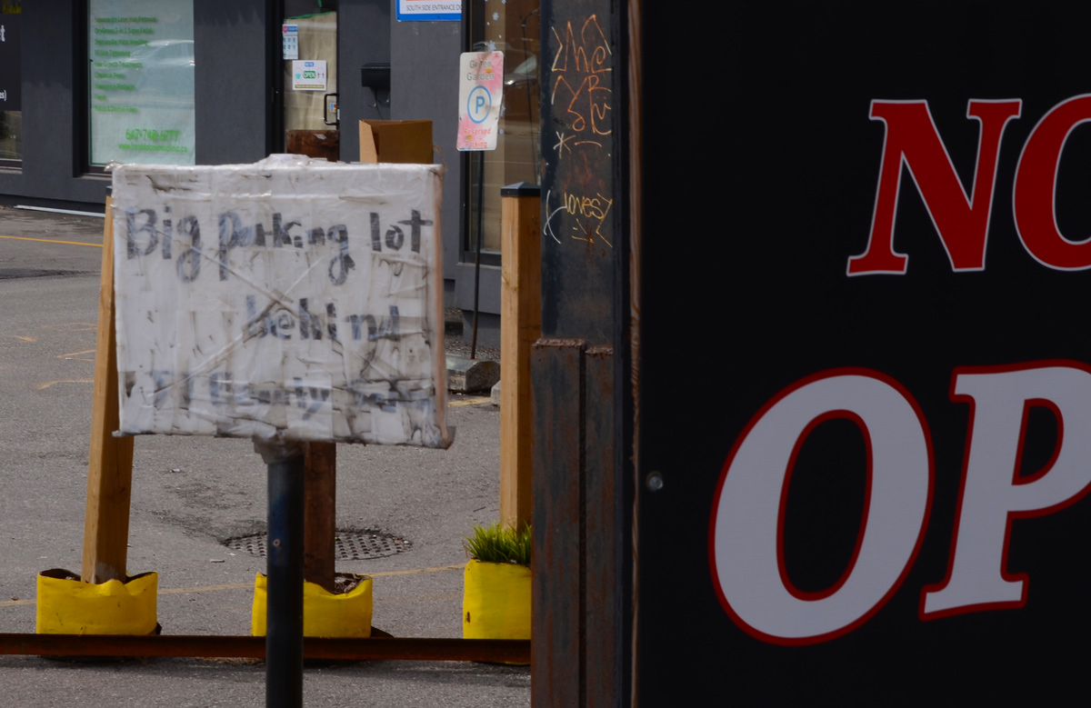
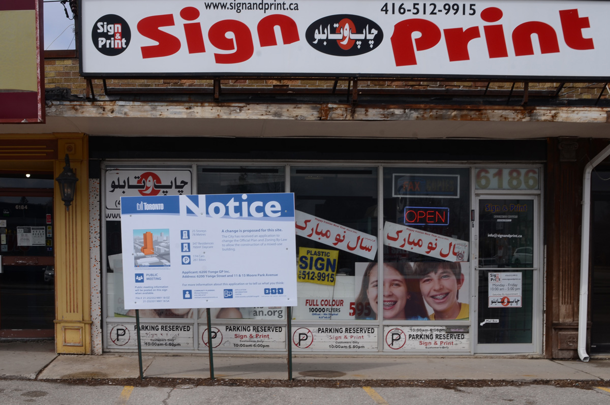
below: Like so many parts of Toronto, there is a lot of redevelopment taking place. Blue and white development notice signs are everywhere.
below: To be (possibly) replaced by 25 storeys, 347 residences and a daycare.
below: Seoul Plaza with it’s Korean BBQ restaurant and other businesses (not all Korean) – also with a development notice sign in front. I’m not sure of the size of the development but it looks like your average 20ish storeys on podium condo.
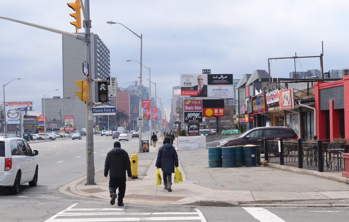
below: Looking south from Moore Park Ave
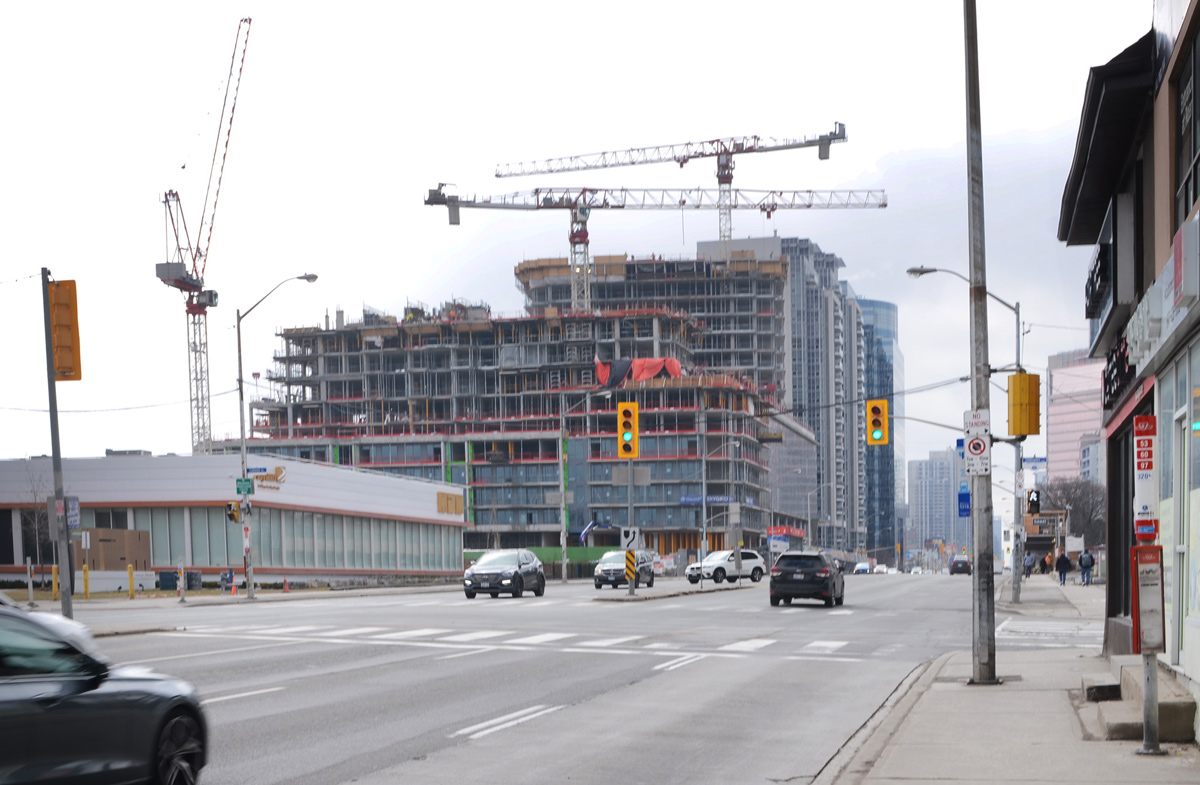
below: Looking north to the intersection of Yonge and Steeles. Steeles Ave has been the northern boundary of the City of Toronto since 1953. All of the tall buildings in this picture are north of Steeles and are in Thornhill (York Region).
below: Pro Ukraine stencil graffiti.
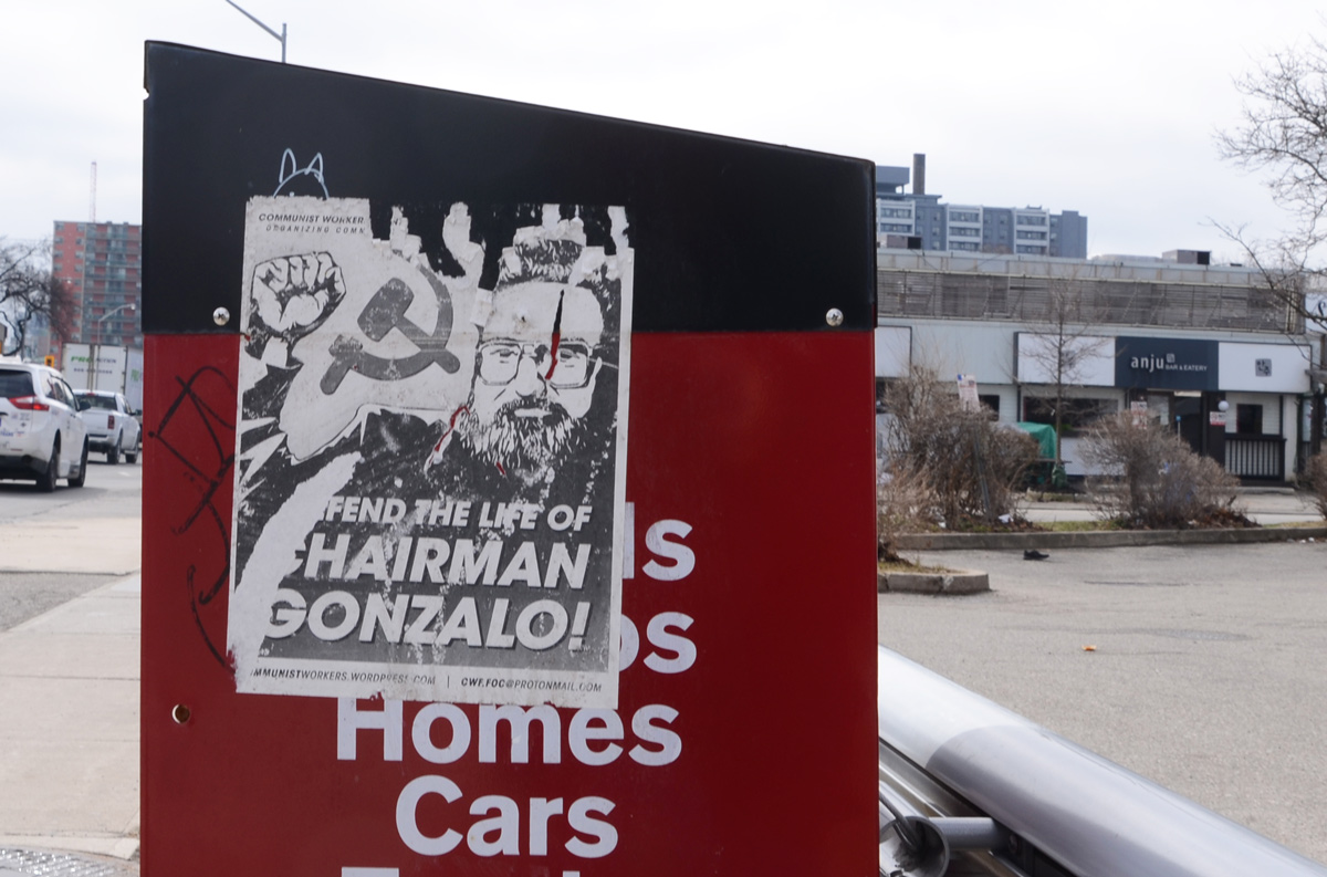
below: I’m not sure what the spring will do but someone has been putting up a lot of posters for the Communist Party.
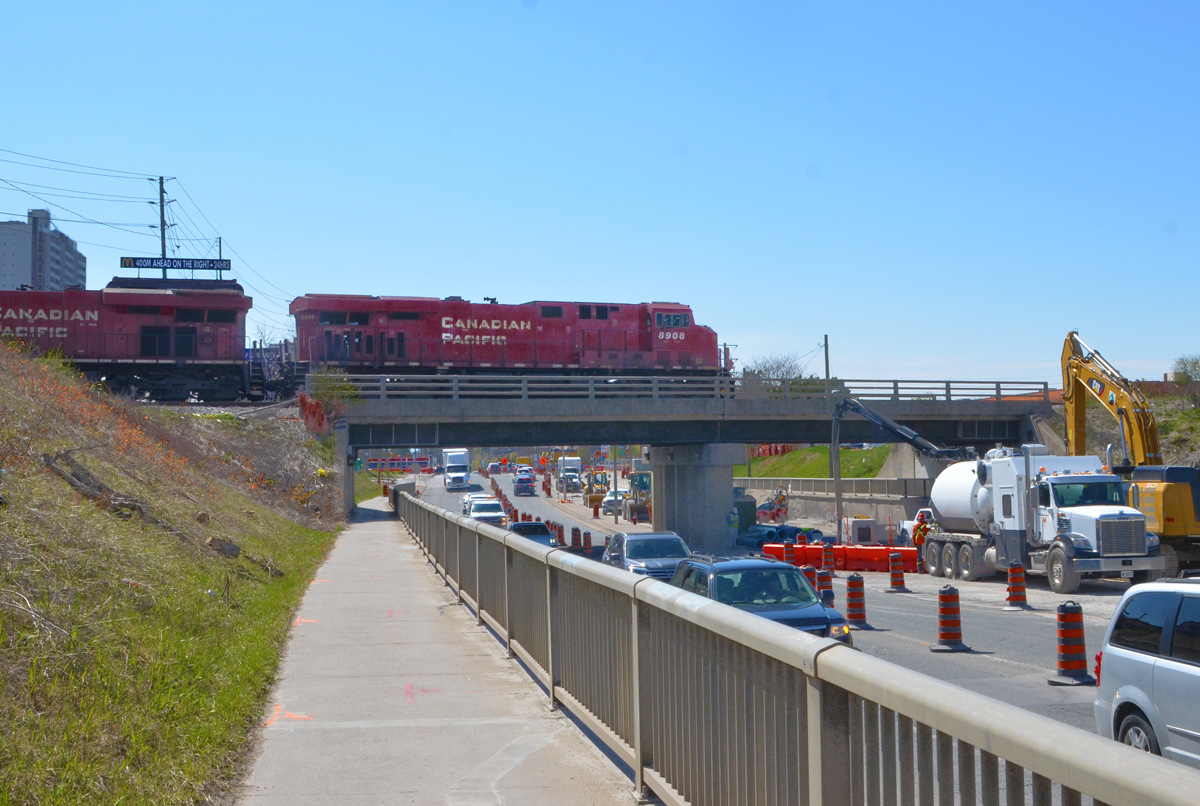
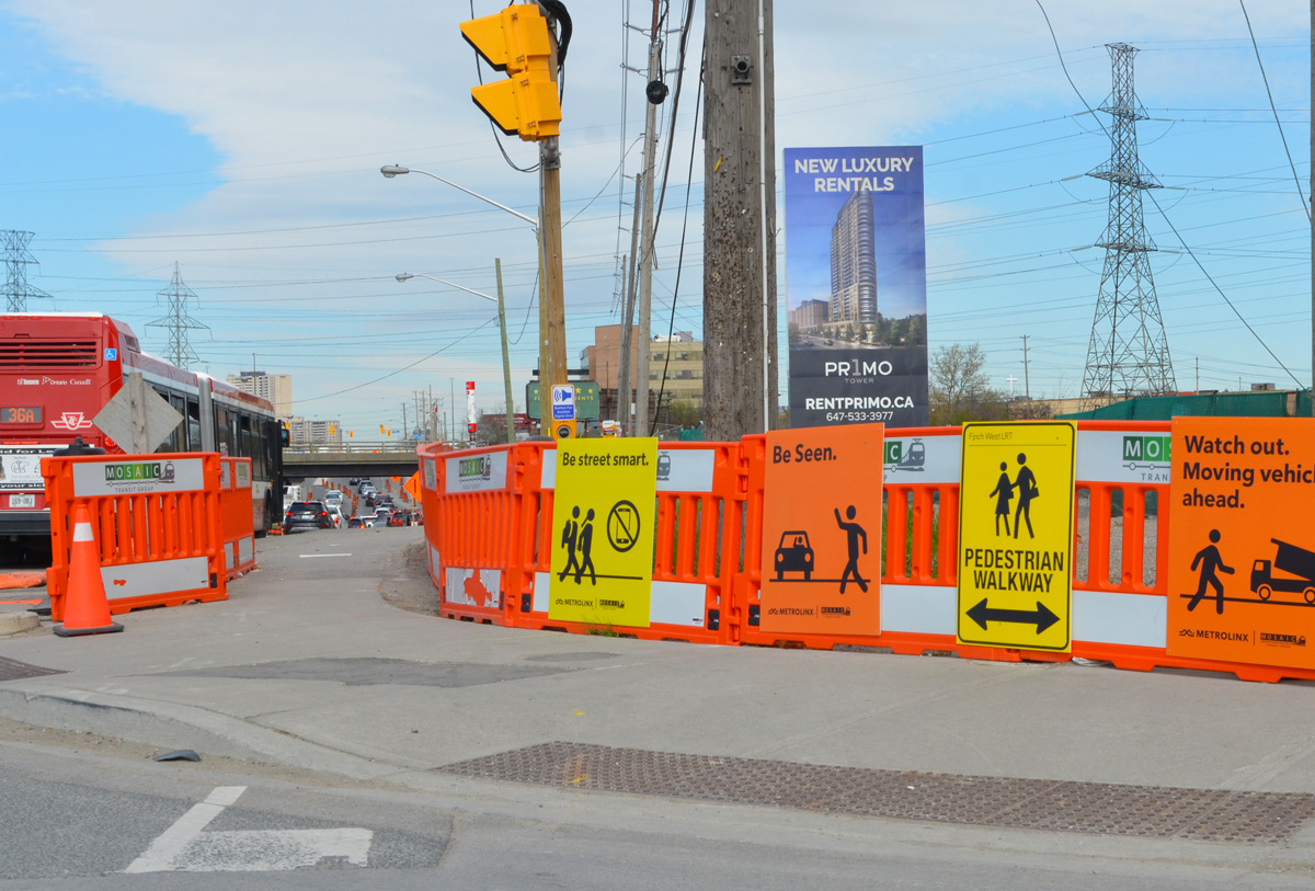
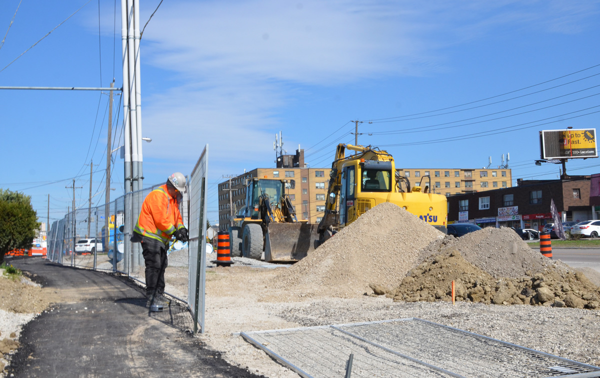
Today, the intersection of Finch and Weston Road is a mess. Metrolinx is preparing to start construction on the Finch LRT, more than 12 acres on the southeast corner is being totally rebuilt, and water mains along Finch are being upgraded. The intersection also has the misfortune to lie in a hydro corridor.
below: Looking west on Finch at Weston Road.
below: Canadian Pacific tracks cross Finch just east of Weston Road
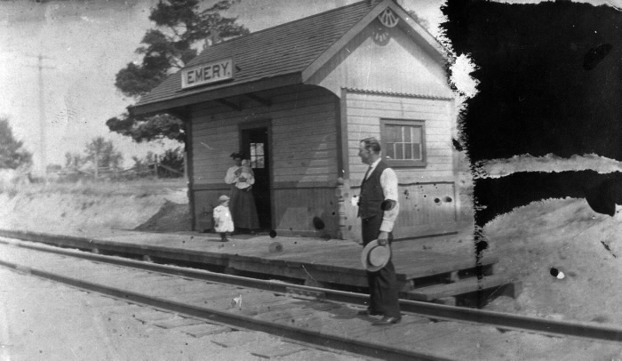
below: Emery train station just after 1900. This was a a flag station built for the Toronto Grey and Bruce Railway in 1870 (i.e. trains only stopped if you flagged them down). In the early 1880s the line was acquired by the Canadian Pacific Railroad. Photo source: Toronto Public Library
Like the rest of the GTA, development here began as a village that supported the surrounding farms. In 1796, Isaac Devins and his wife Mary Chapman were given 200 acres of land, south of what is now Finch Ave from Weston Road to Islington. Devins had worked with Governor Simcoe as a superintendent on the construction of Yonge St. Two of their grandsons opened businesses near the corner of Finch and Weston Road. – one was a blacksmith and the other a carriage maker. A brick schoolhouse came shortly after 1850 and the Methodist church followed in 1869. A post office was established in 1879… and Emery was officially a village.
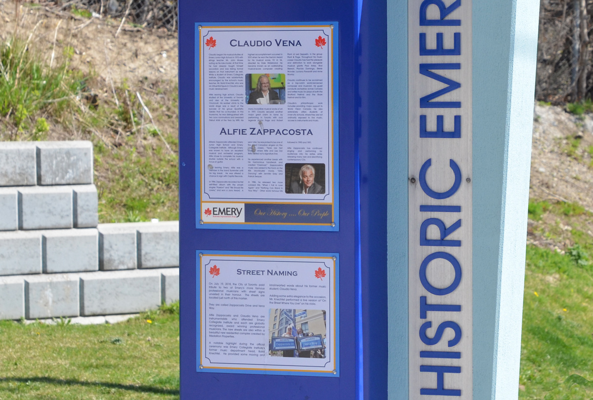
Celebrating the history of Emery are some plaques on display at a couple of bus stops on Weston Road. The one below describes two musicians with local roots, Claudio Vena and Alfie Zappacosta. Both men have streets named after them.
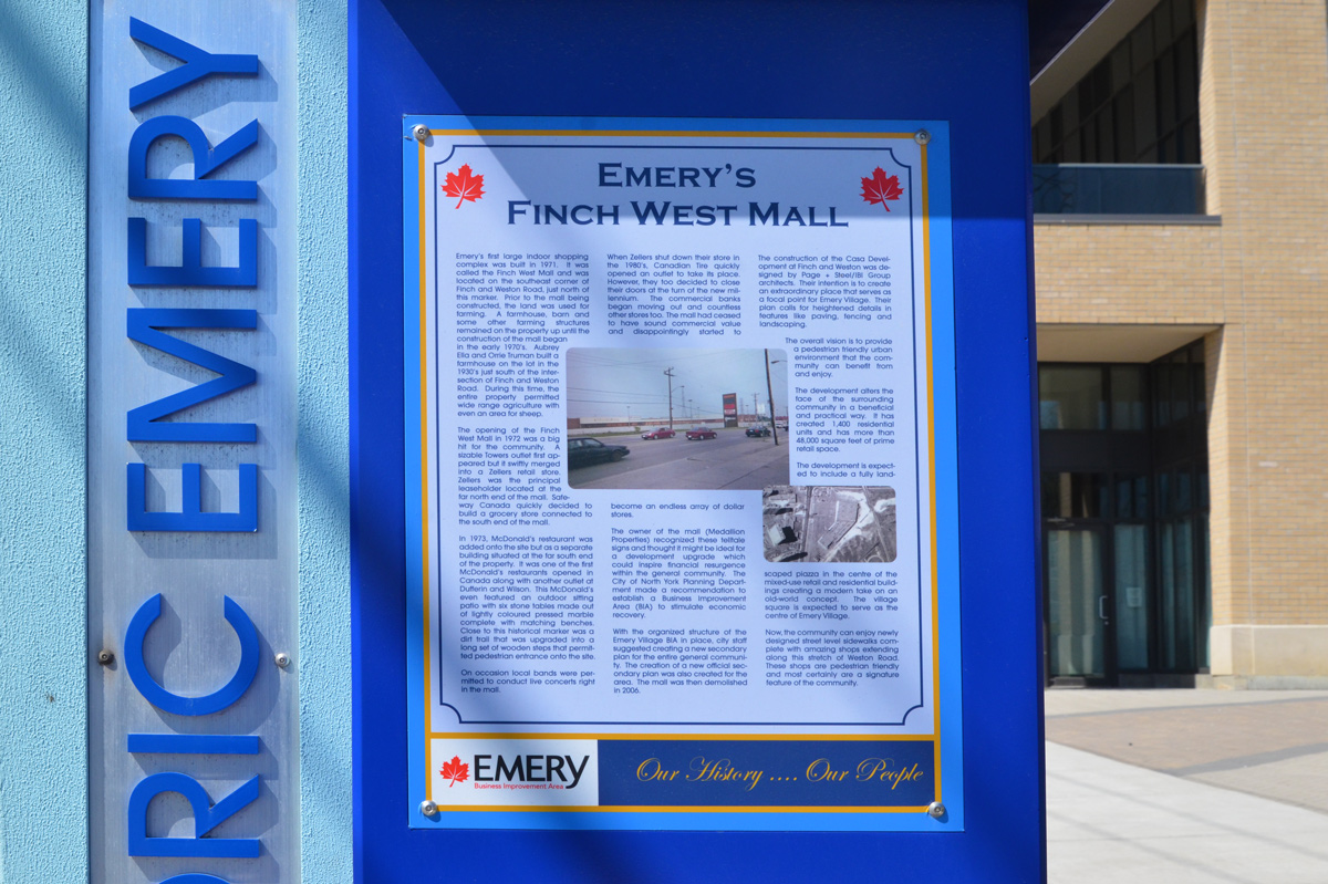
below: Finch West Mall was built in 1971 on the southeast corner of Finch and Weston Road on what had previously been farm land. Step-brothers Aubrey Ella and Orrie Truman had farmed here since 1930. …. but you can’t go shopping there any more. [transcription of the text can be found at the bottom of this post]
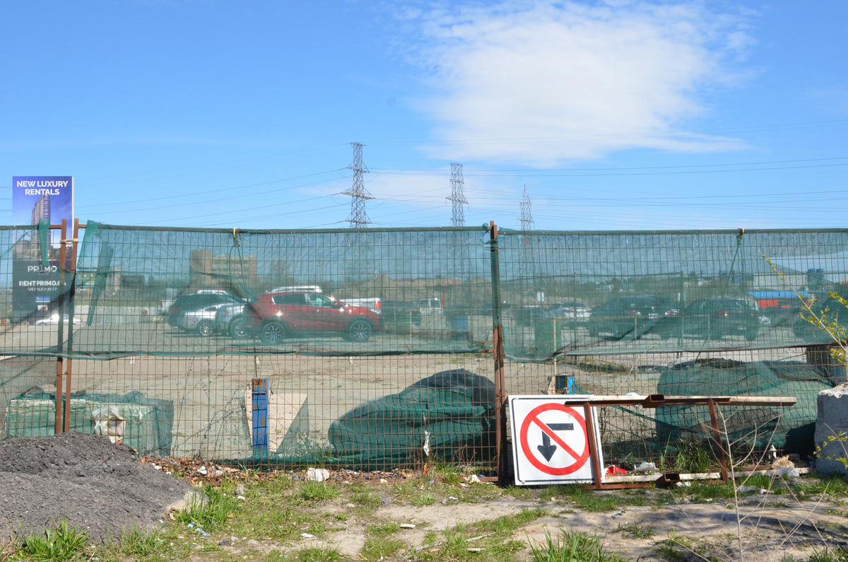
below: Development notice sign at the site of the former Finch West Mall. The proposal includes 5 towers, 2237 residences ranging from bachelors to 3 bedroom, some retail, and a park. All rentals.
below: Construction is only in the early stages so there isn’t much to see
below: Preparations for the construction of the Finch LRT are underway.
below: But not always well thought out – here sidewalk access ends but the only way to go is to cross Finch in mid-block with no help
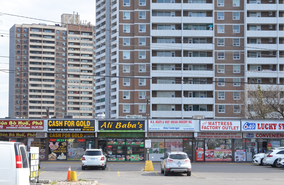
Also like many places in Toronto, Emery has become very multicultural.
below: African Food & Groceries as well as Comida Colombiana
below: A Vietnamese restaurant and a West Indian grocery store
below: North York Sikh temple
below: Confusion?
below: More restaurants and businesses
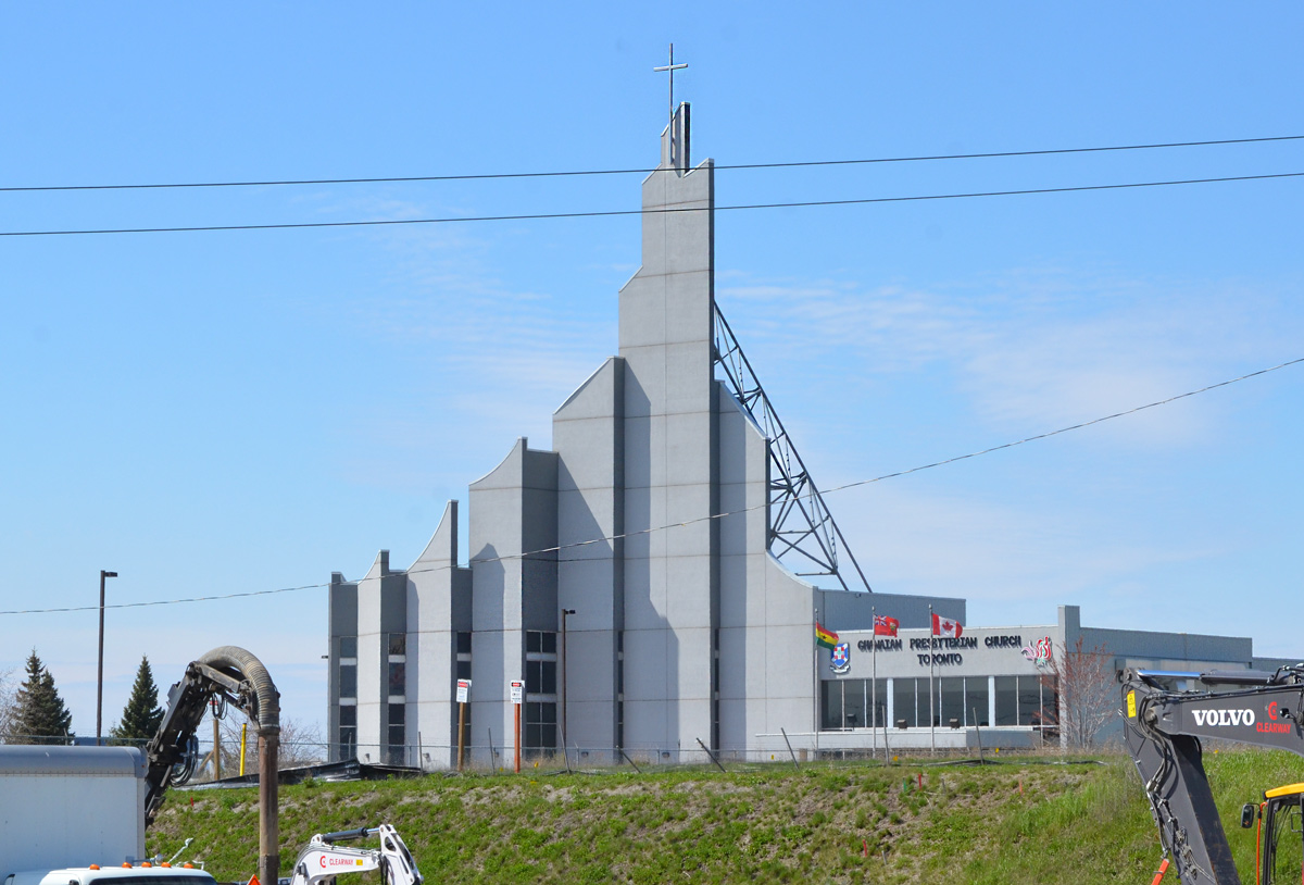
below: Ghanaian Presbyterian Church, since 1994 (as seen from Finch Ave)
below: Prayer Palace
below: Lindylou park
below: Emery Creek south of Finch
below: Finch Avenue West, looking eastward towards Weston Road
below: Slightly closer to Weston Road (from Lindyloou park looking northeast)
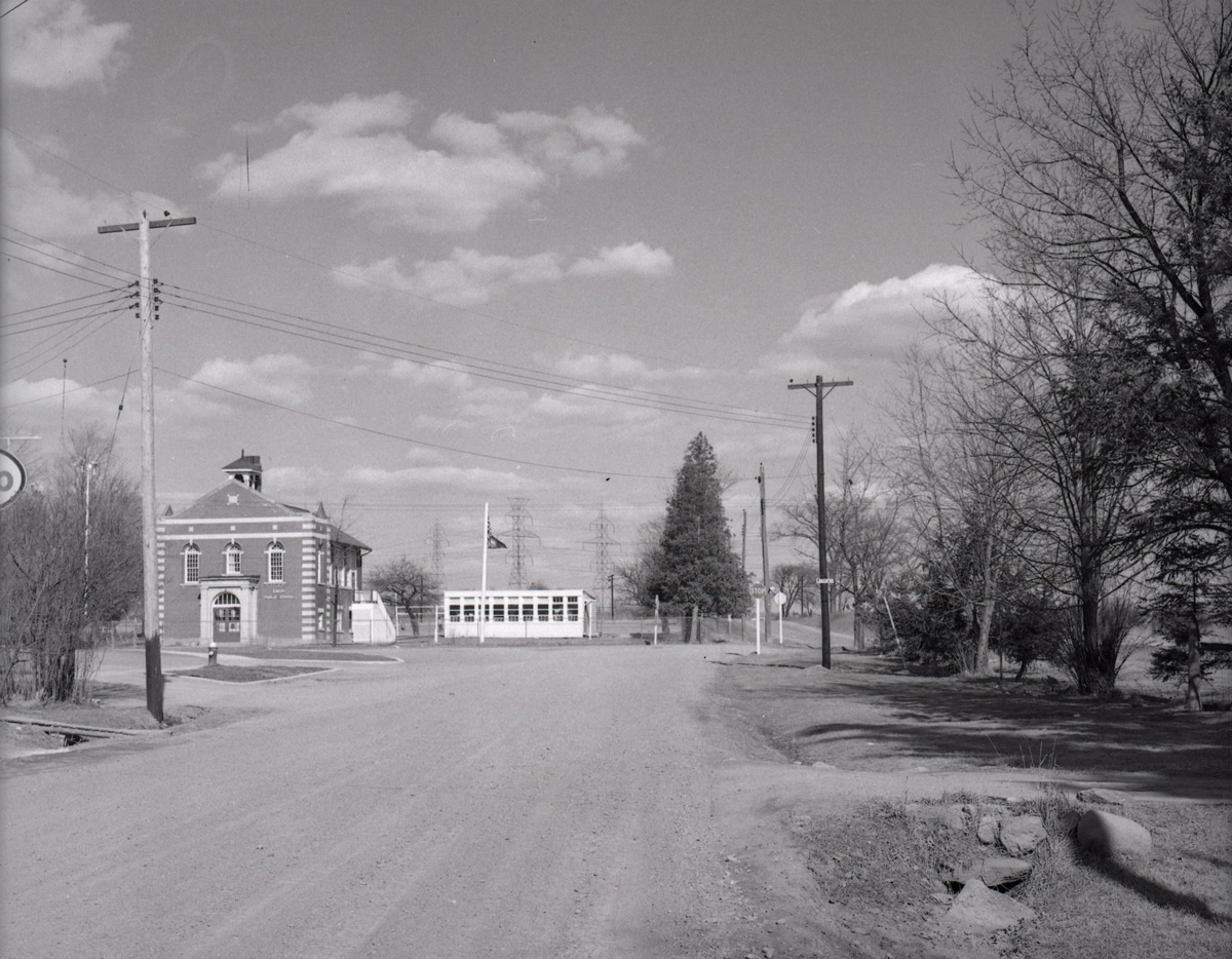
below: Not taken from the same spot but also Finch Avenue West, looking eastward towards Weston Road in 1958 when Finch was still a dirt road. The brick building is Emery Public School (built 1914); and it looks like it had a portable in the yard… and is that an Elmer the Safety Elephant flag? The school was demolished shortly after the picture was taken. Photo source: Toronto Public Library, photo by James Victor Salmon
below: Farther east, now past Weston Road. If you go even farther you will come to Hwy 400
below: Most of the area north of Finch is zoned for light industry including this business, the making of prefab concrete staircases. With all the condo development in the city at the moment, there must be a lot of demand for these stairs!
below: Another vacant lot
*****
Transcription of Plaque (above):
“Emery’s first large indoor shopping complex was built in 1971. It was called the Finch West Mall and was located on the southwest corner of Finch and Weston Road… Prior to the mall being constructed, the land was used for farming. A farmhouse, barn, and some other farming structures remained on the property up until the construction of the mall began in the early 1970s. Aubrey Ella and Orrie Truman built a farmhouse on the lot in the 1930s just south of the intersection of Finch and Weston Road. During this time, the entire property permitted wide range agriculture with even an arena for sheep.” “The opening of the Finch West Mall in 1972 was a big hit for the community. A sizable Towers outlet first appeared but it swiftly merged into a Zellers retail store. Zellers was the principal leaseholder located at the far north end of the mall. Safeway Canada quickly decided to build a grocery store connected to the south end of the mall.” “In 1973, McDonald’s restaurant was added onto the site but as a separate building situated at the far south of the property. It was one of the first McDonald’s restaurants opened in Canada along with another outlet at Dufferin and Wilson. This McDonald’s even featured an outdoor sitting patio with six stone tables made out of lightly coloured presses marble complete with matching benches. Close to this historical marker was a dirt trail that was upgraded into a long set of wooden steps that permitted pedestrian entrance onto the site.” “On occasions local bands were permitted to conduct live concerts right in the mall.” “When Zellers shut down their store in the 1980s, Canadian Tire quickly opened an outlet to take its place. However, they too decided to close their doors at the turn of the new millennium. The commercial banks began moving out and countless other stores too. The mall had ceased to have sound commercial value and disappointingly started to become an endless array of dollar stores.” “The owner of the mall (Medallion Properties) recognized these telltale signs and thought it might be ideal for a development upgrade which could inspire financial resurgence within the general community. The City of North York Planning Department made a recommendation to establish a Business Improvement Area (BIA) to stimulate economic recovery.” “With the organized structure of the Emery Village BIA in place, city staff suggested creating a new secondary plan for the entire general community…The mall was demolished in 2006.”
*****
One of life’s unexpected coincidences… I didn’t read the text before I took the picture so it wasn’t until a few days later that I saw the name Orrie Truman. I have Trueman ancestors in this area… was he related? Orrie Truman was Orrie Levi Richard Trueman. I don’t know where the name Orrie comes from but Levi and Richard were his grandfathers, Levi Coulter and Richard Trueman. William Mellow Trueman married Eleanor (Nellie) Coulter and Orrie is their son. William died shortly after and Nellie subsequently married Ella. Going back a generation, William Mellow Trueman is the son of Richard Trueman and Rebecca Mellow who happen to be my great great great grandparents. My great grandmother, Ina Rebecca Moore was named after Rebecca Mellow, her grandmother. Ina would have been Orrie’s first cousin. Question: What relation am I to Orrie Trueman?
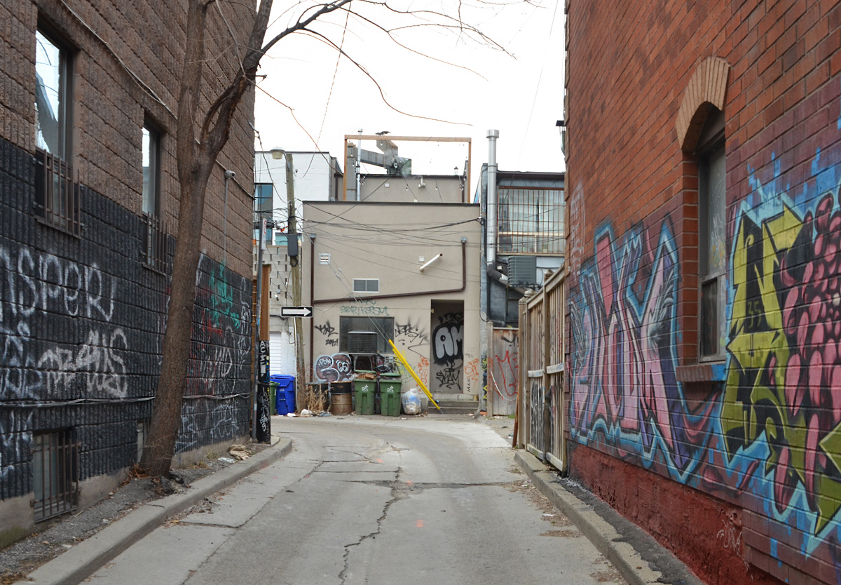
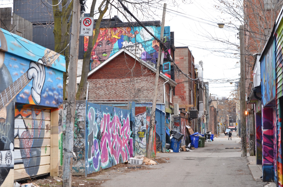
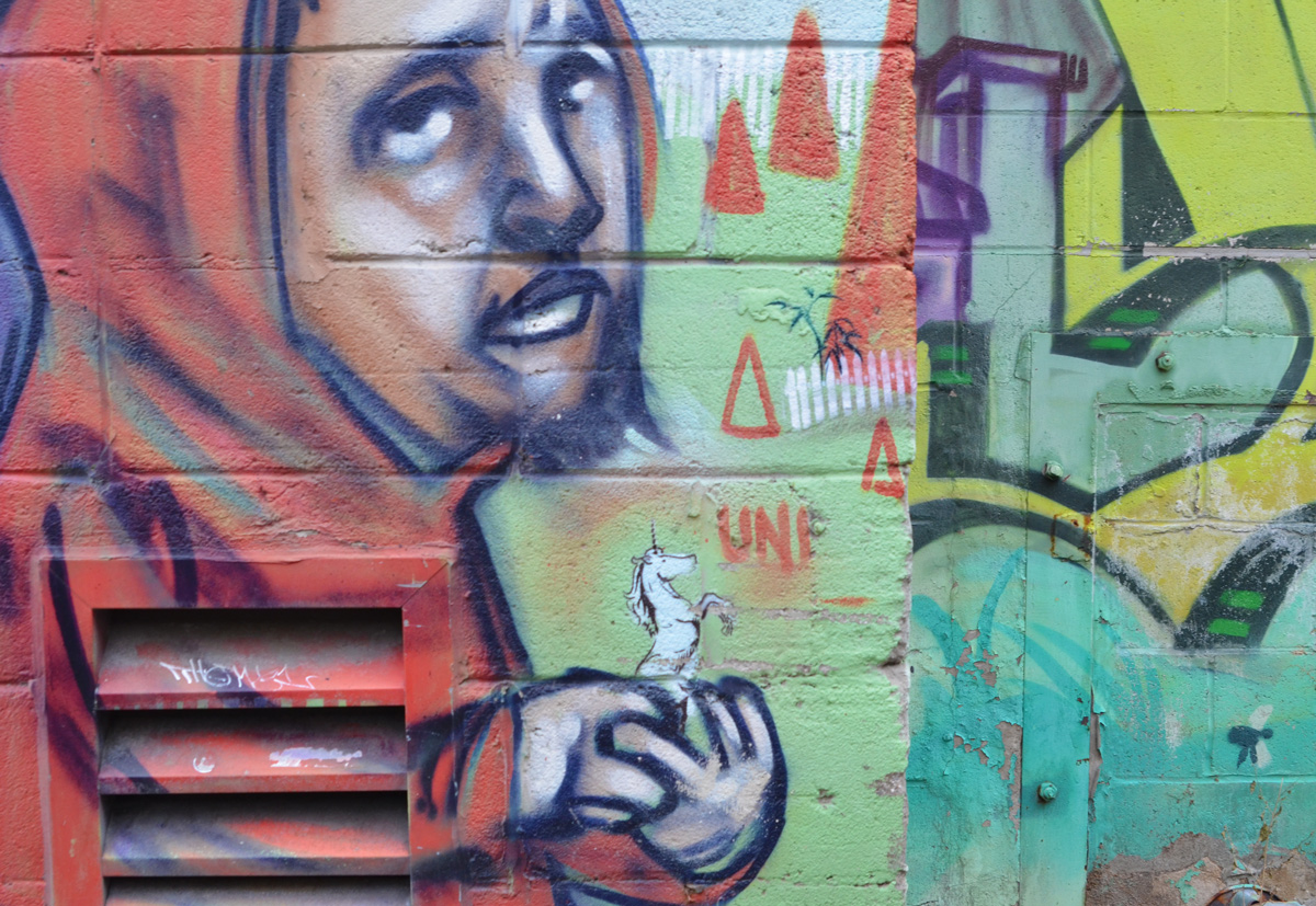
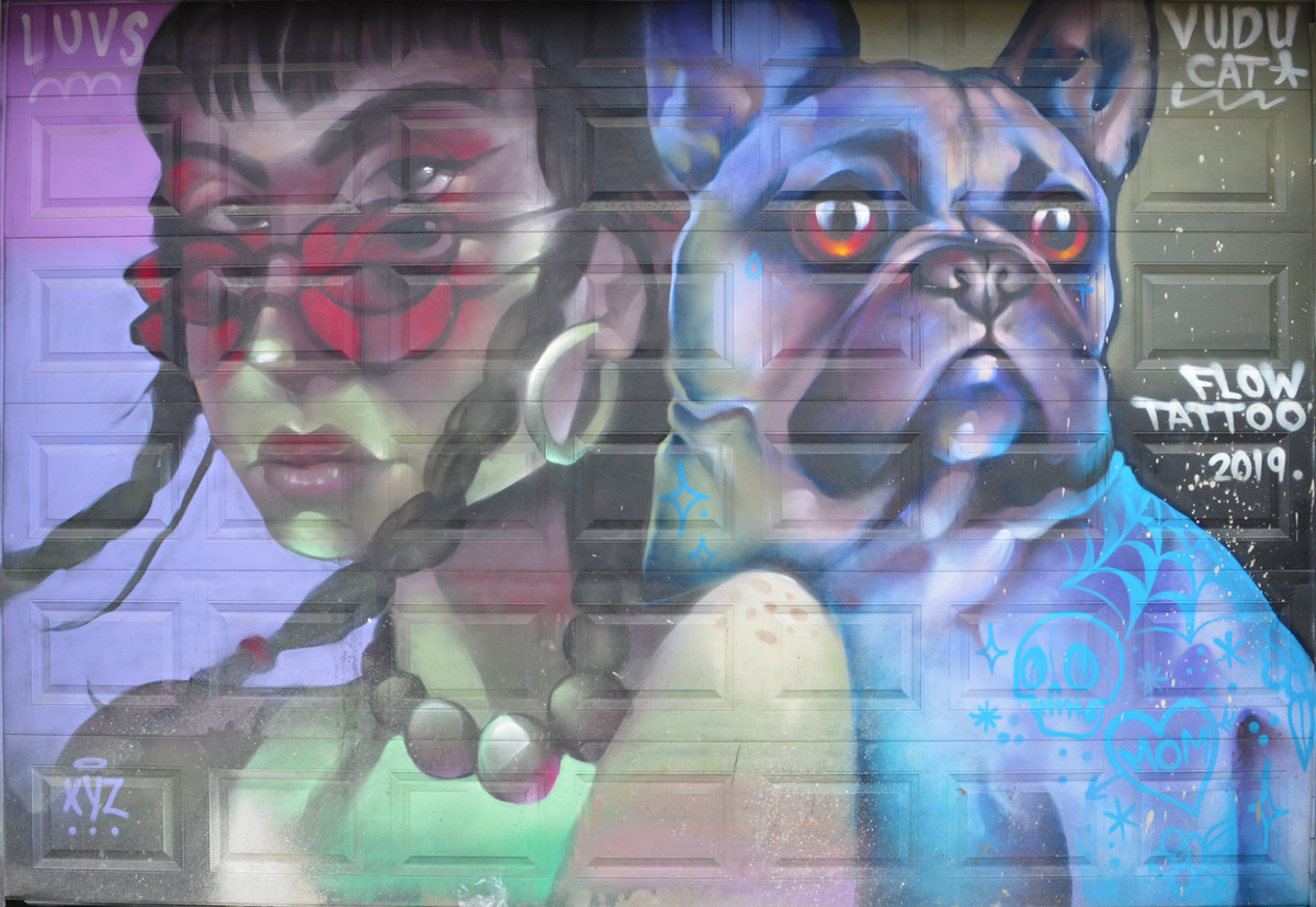
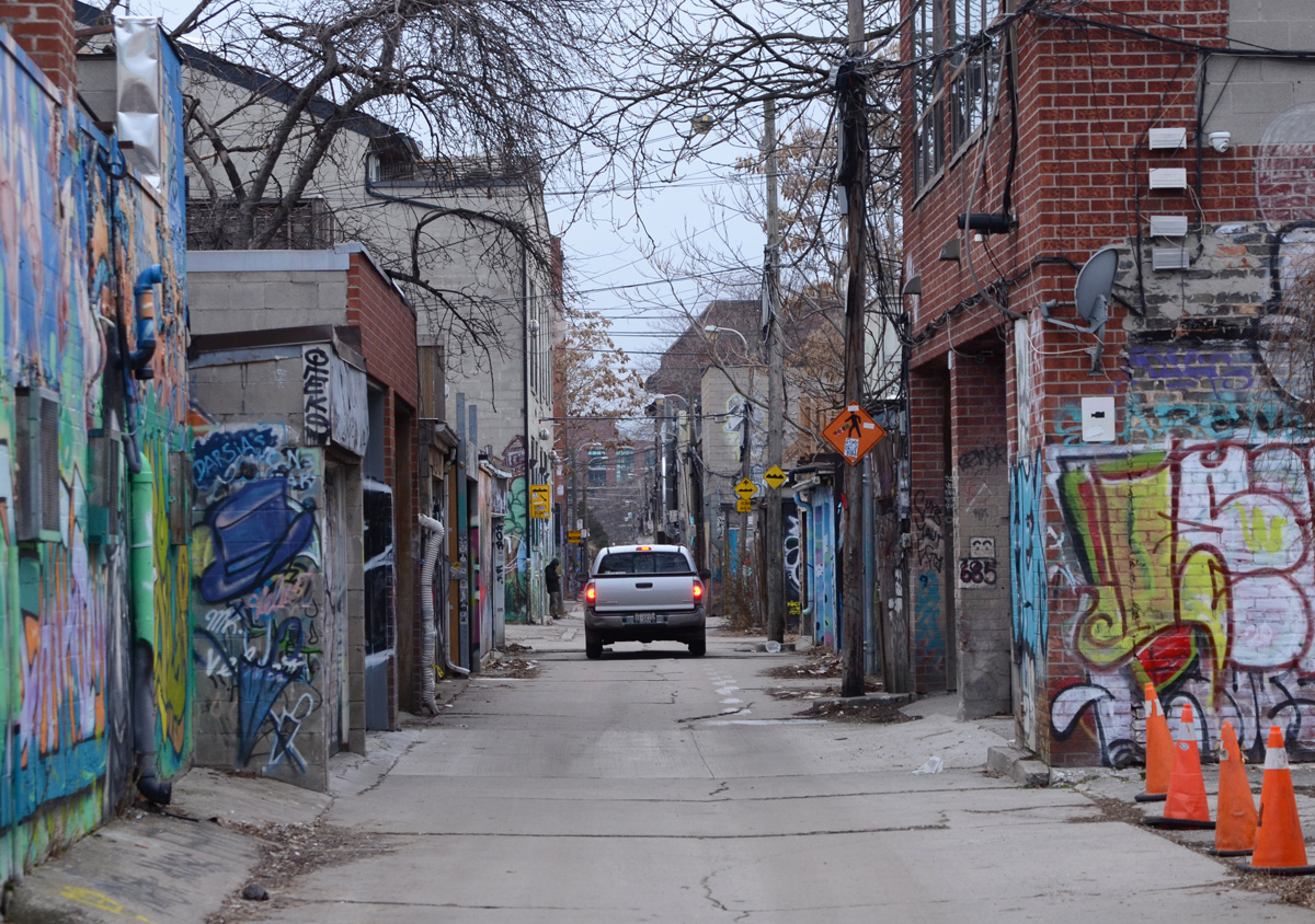
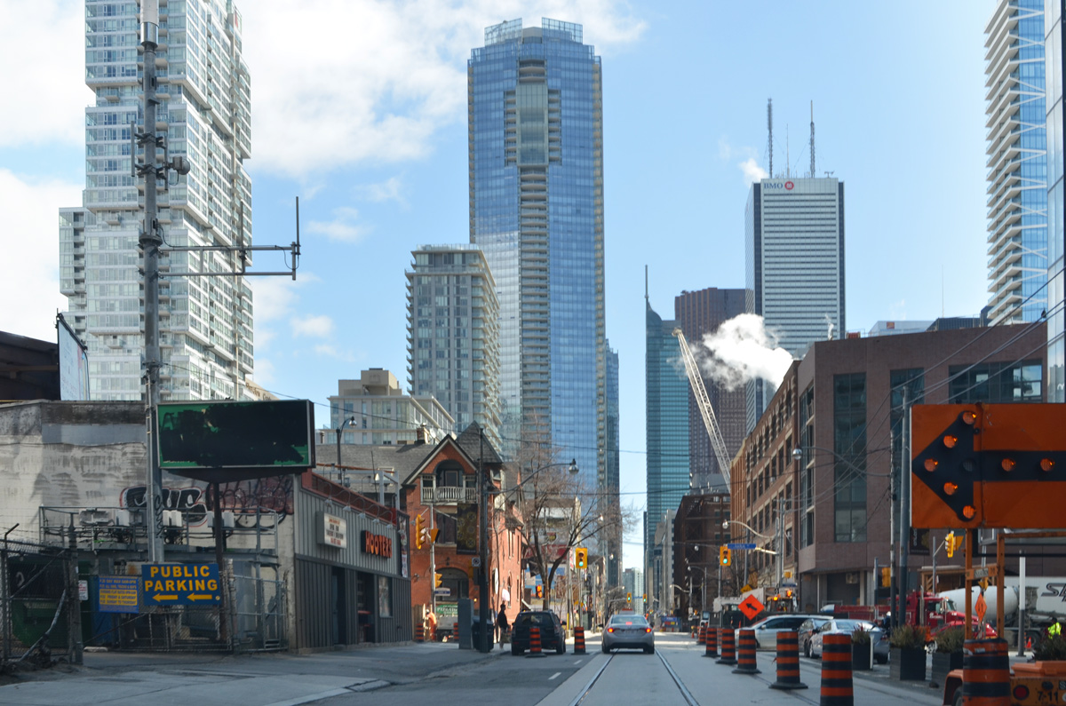
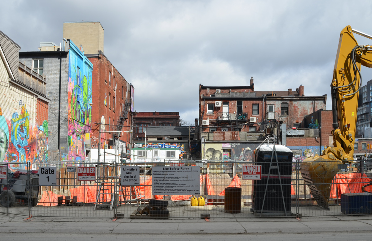
Most people who visit Graffiti Alley don’t realize that there is another section of street art to the west. Technically, Graffiti Alley is the lane behind the south side of Queen Street West between Spadina and Augusta. The next section of the alley, from Augusta to Portland, is Rush Lane. Unfortunately there is a large Loblaws/Winners that blocks the lane on the west side of Portland.
To access the next couple of blocks of laneway, you have to detour down to Richmond Street and turn right. Public Lane is a few steps away from Richmond & Portland.
below: Public Lane turns to the left, regardless of what the arrow says.
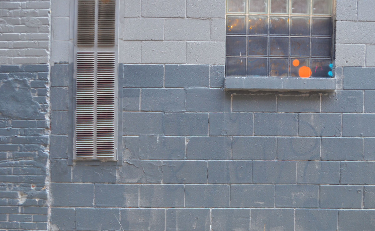
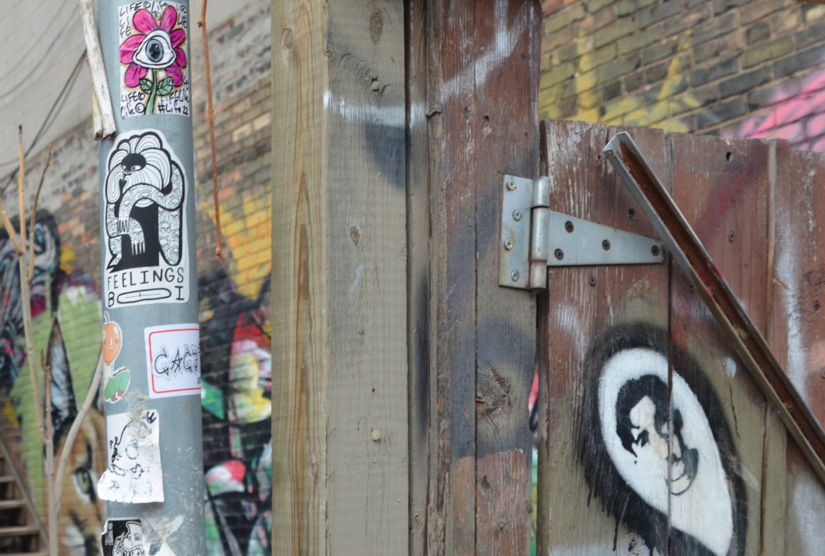
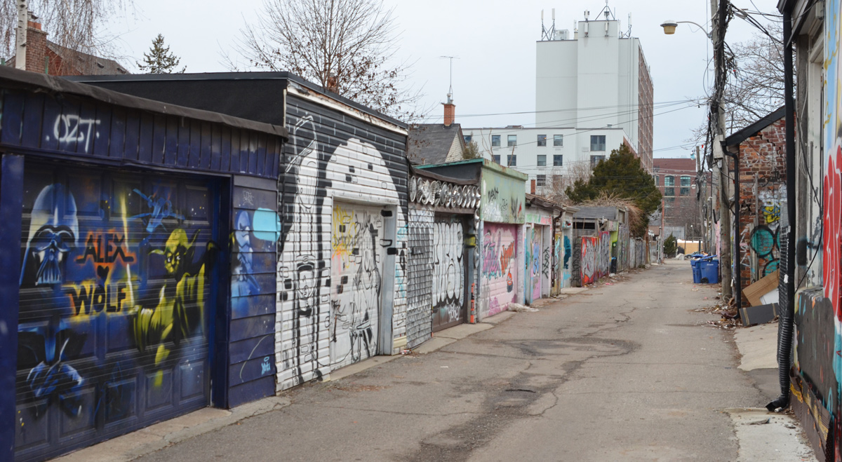
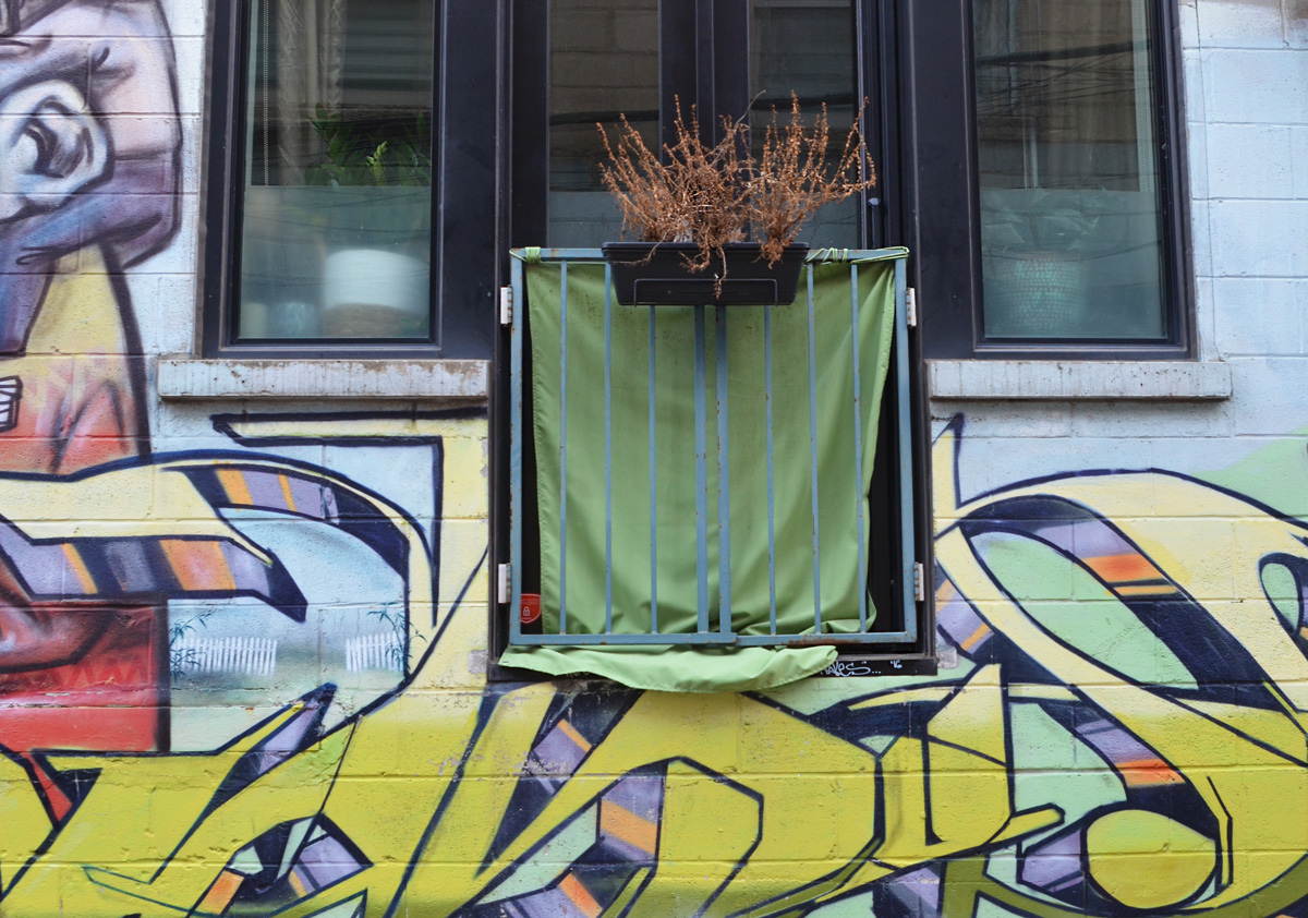
below: Between here and Bathurst Street, a lot of street art has disappeared as redevelopment of Richmond has progressed. The large black building on the right has its garage entrance from the lane so watch for cars when you’re back there.
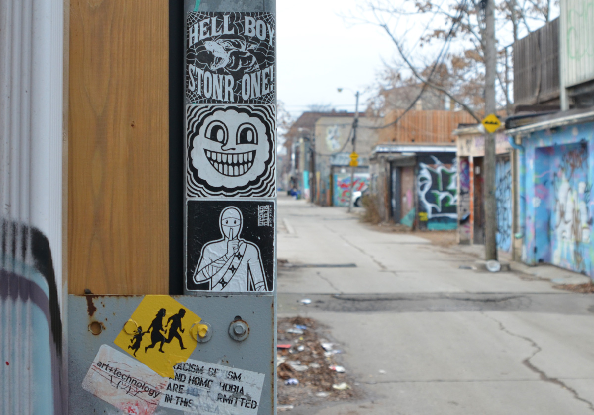
below: A few circles of colour on a grey wall, a reminder that there was once street art here.
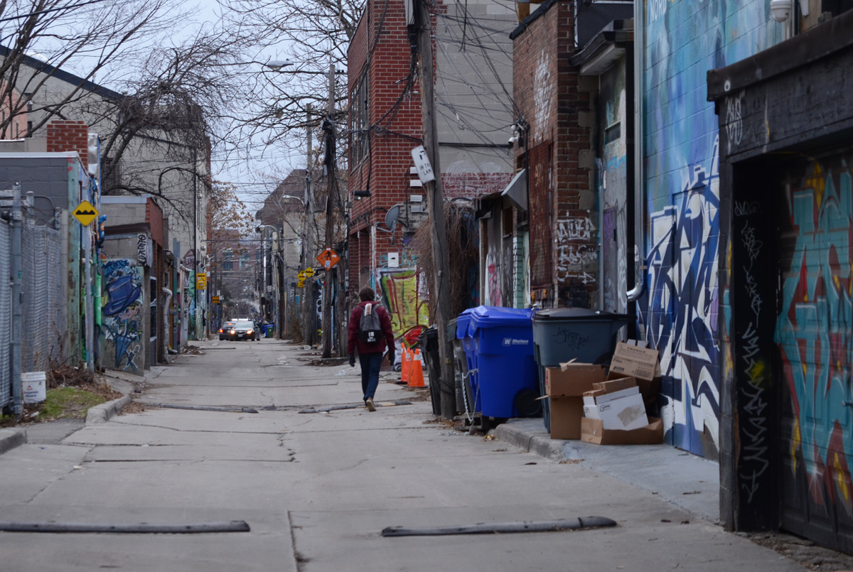
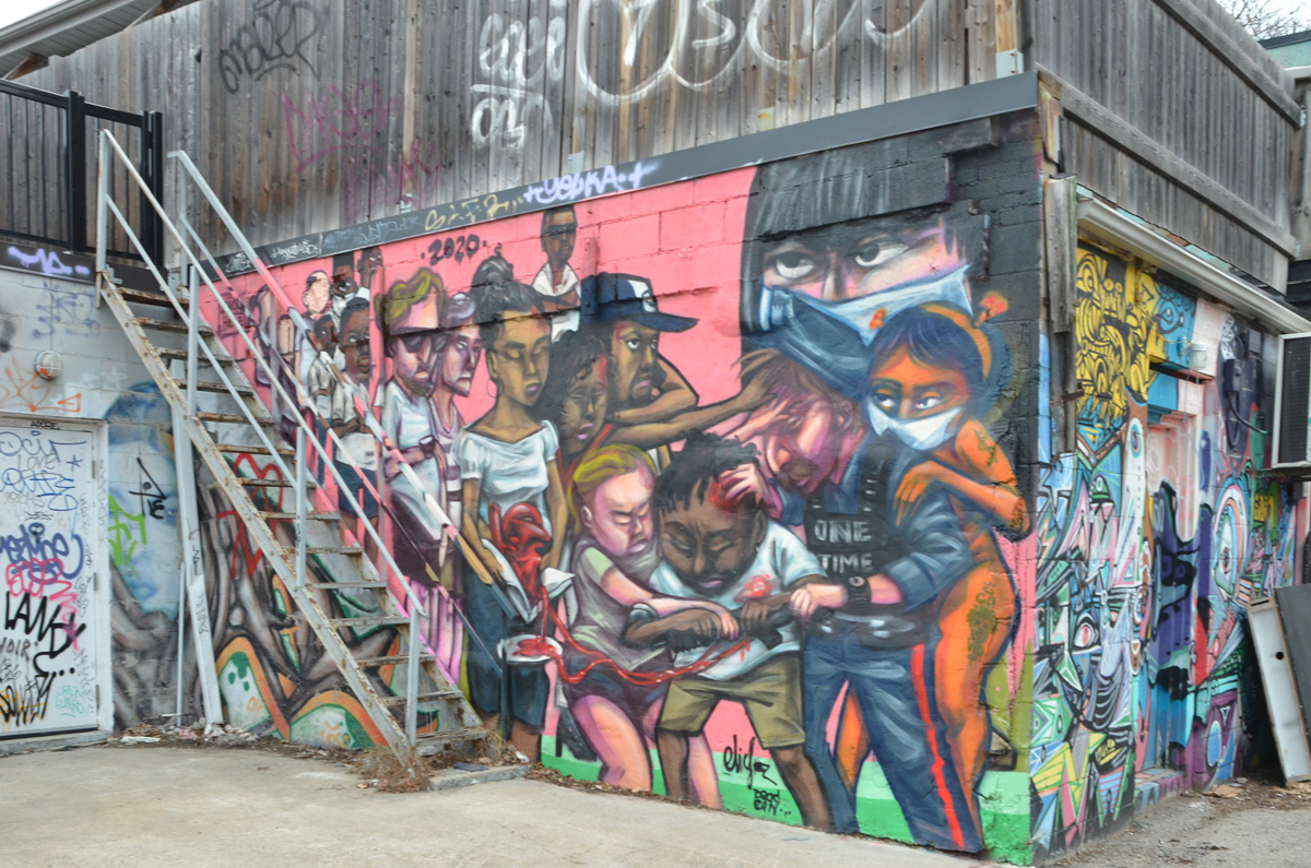
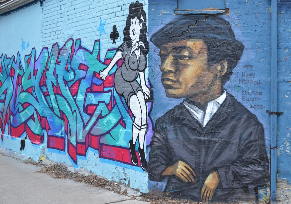
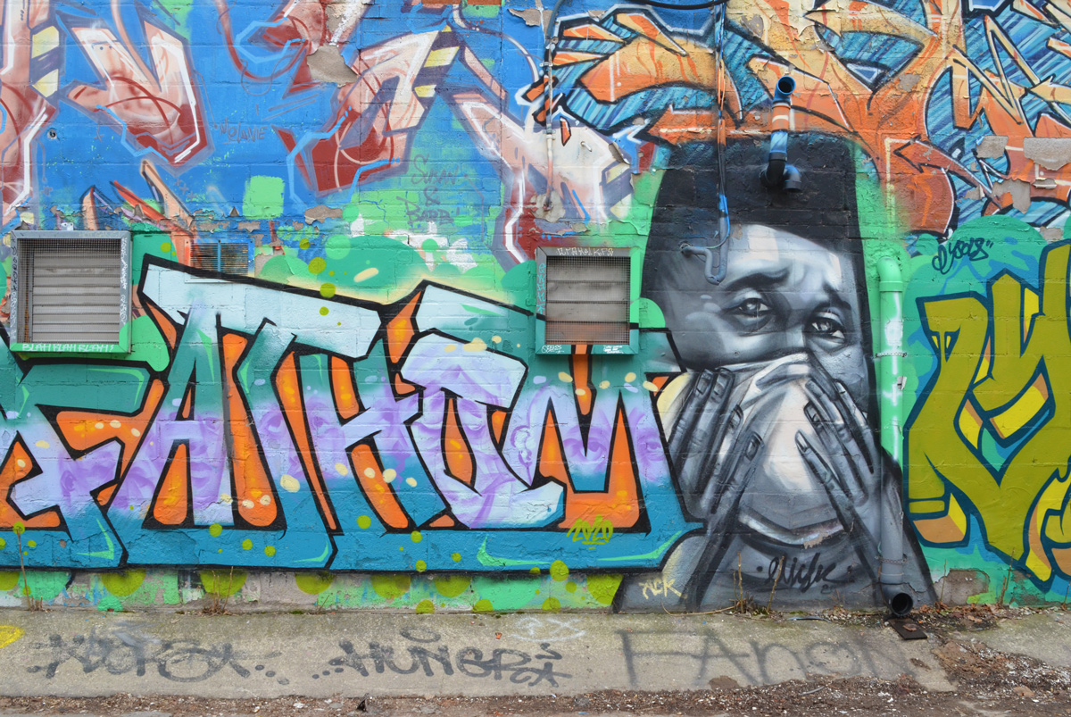
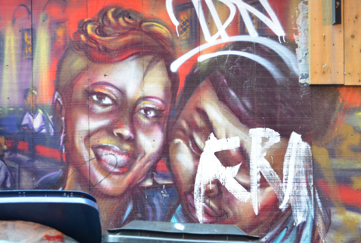
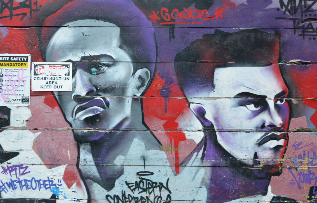
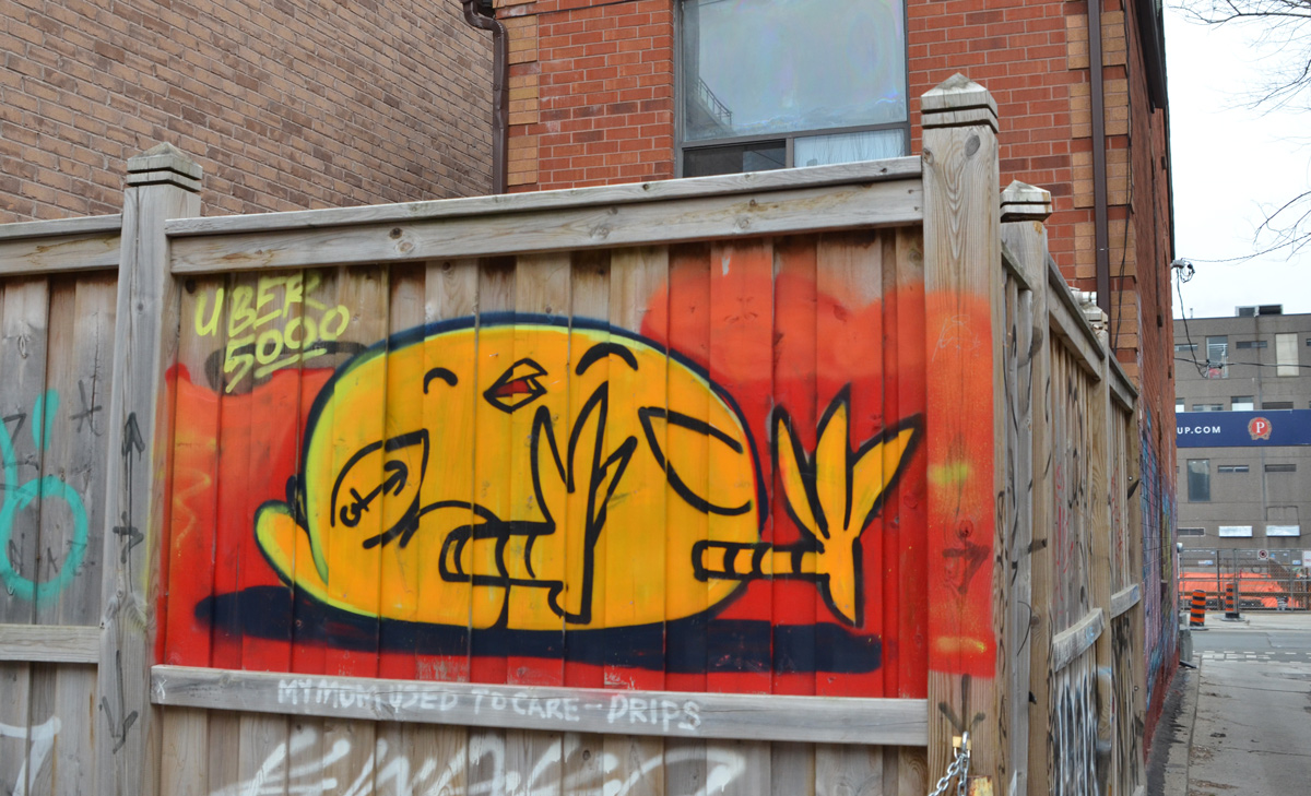
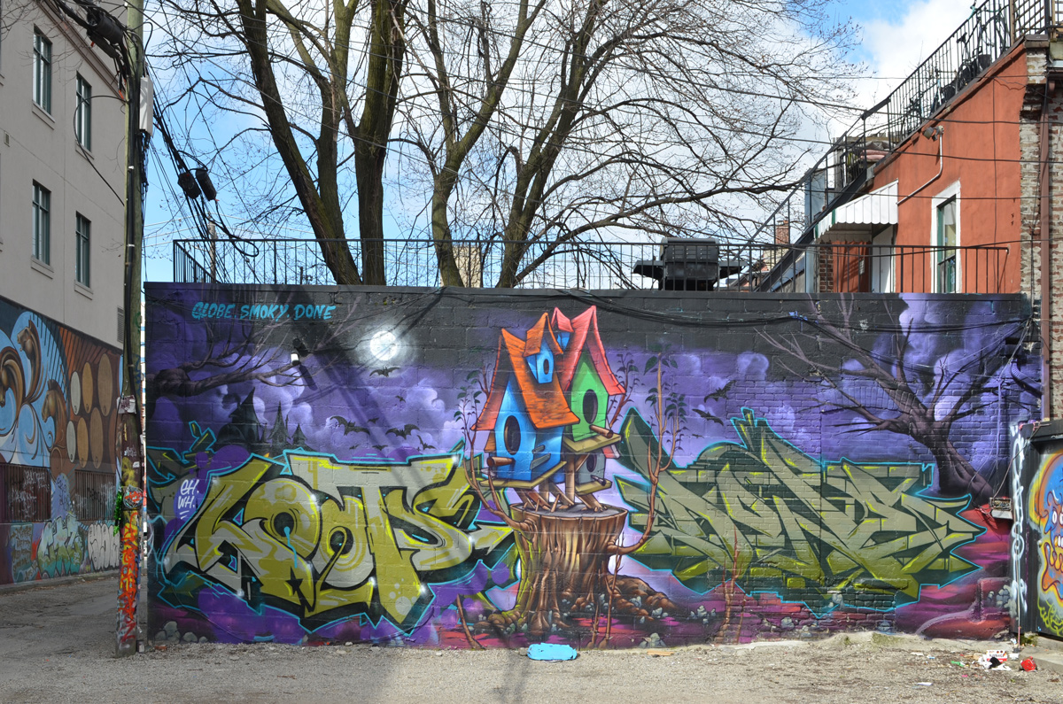
below: Beyond Bathurst there is a long stretch of laneway. A lot of the paintings here are older and some may have already appeared in this blog.
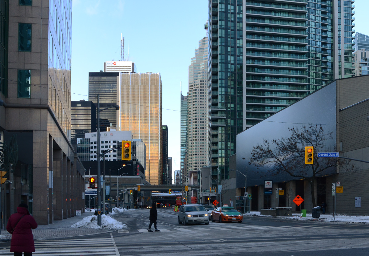
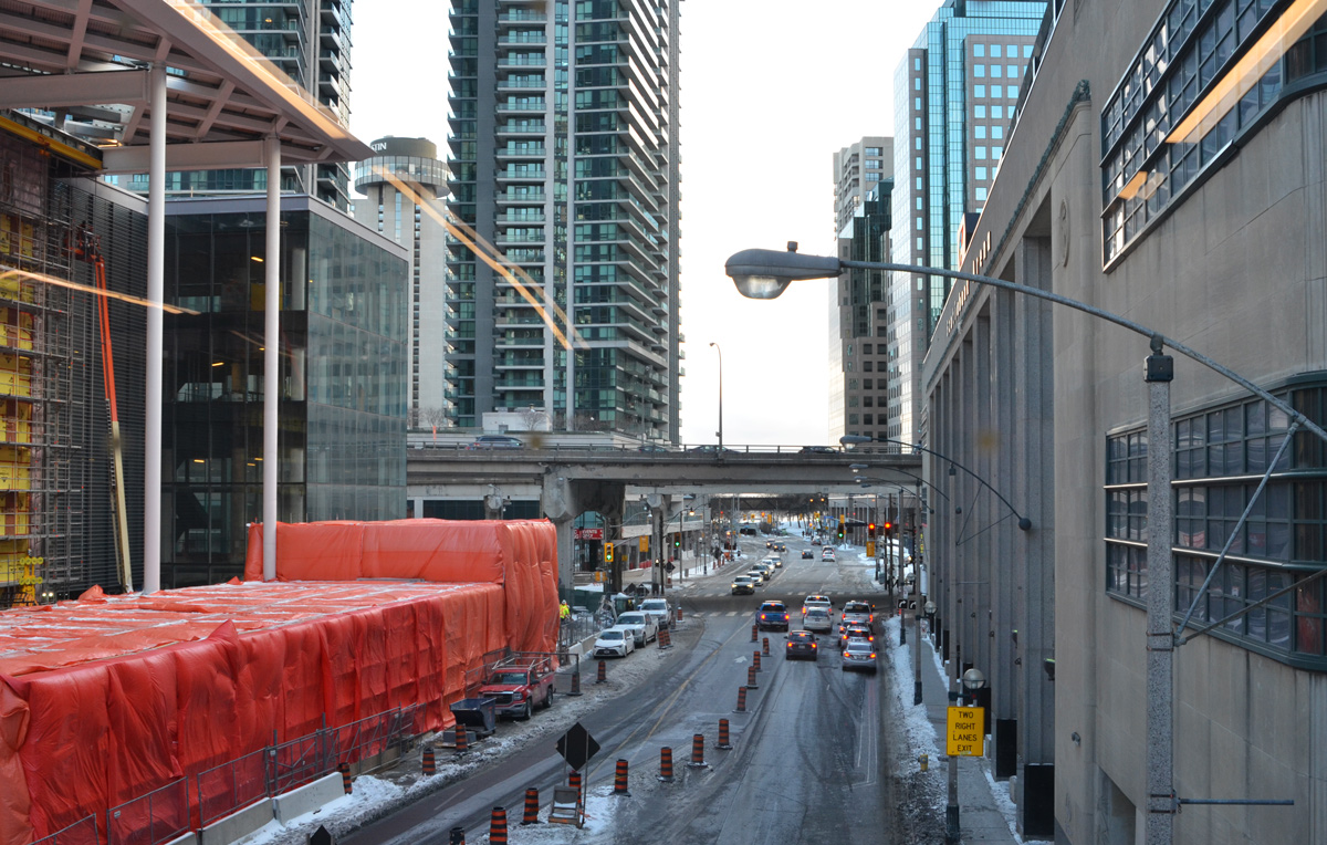
A cold and frosty afternoon walk westward along a windy Queens Quay to Harbourfront with a detour to Union Station to warm up. It was below zero, but only single digits so it can’t be that bad, right?
below: New construction, Lower Jarvis at Queens Quay East, beside Sugar Beach
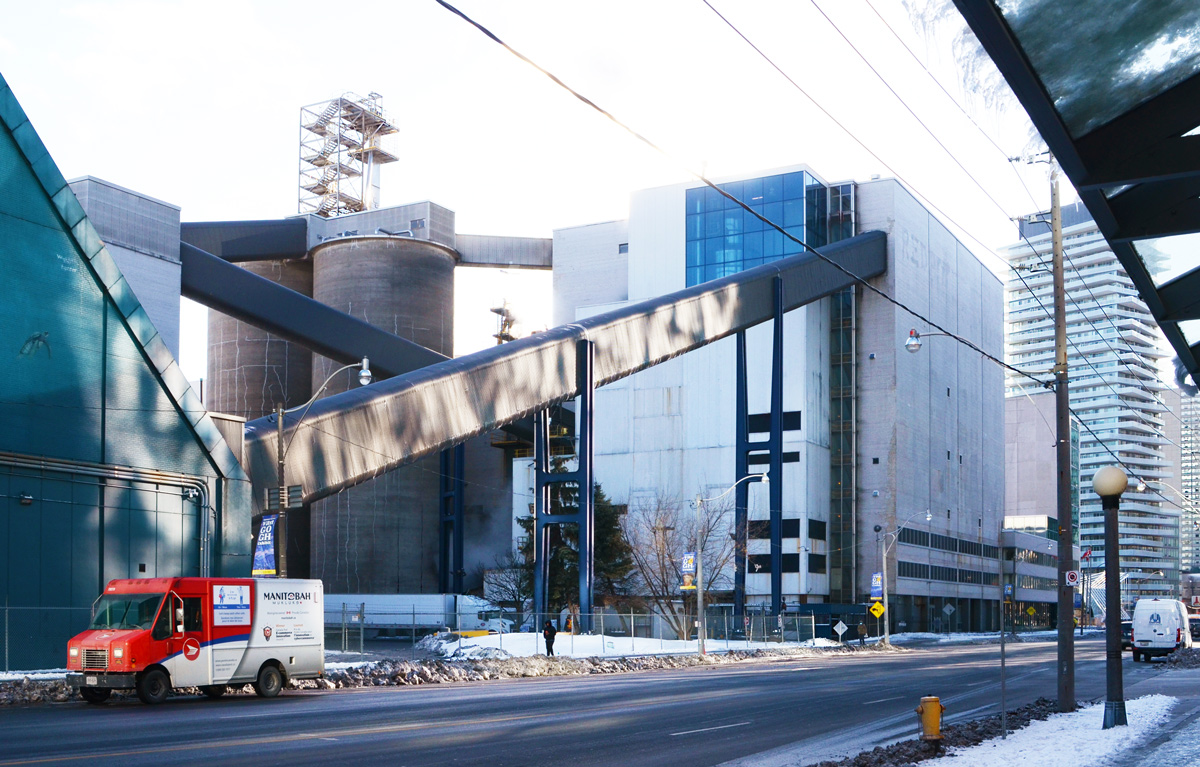
below: Redpath Sugar on Queens Quay East
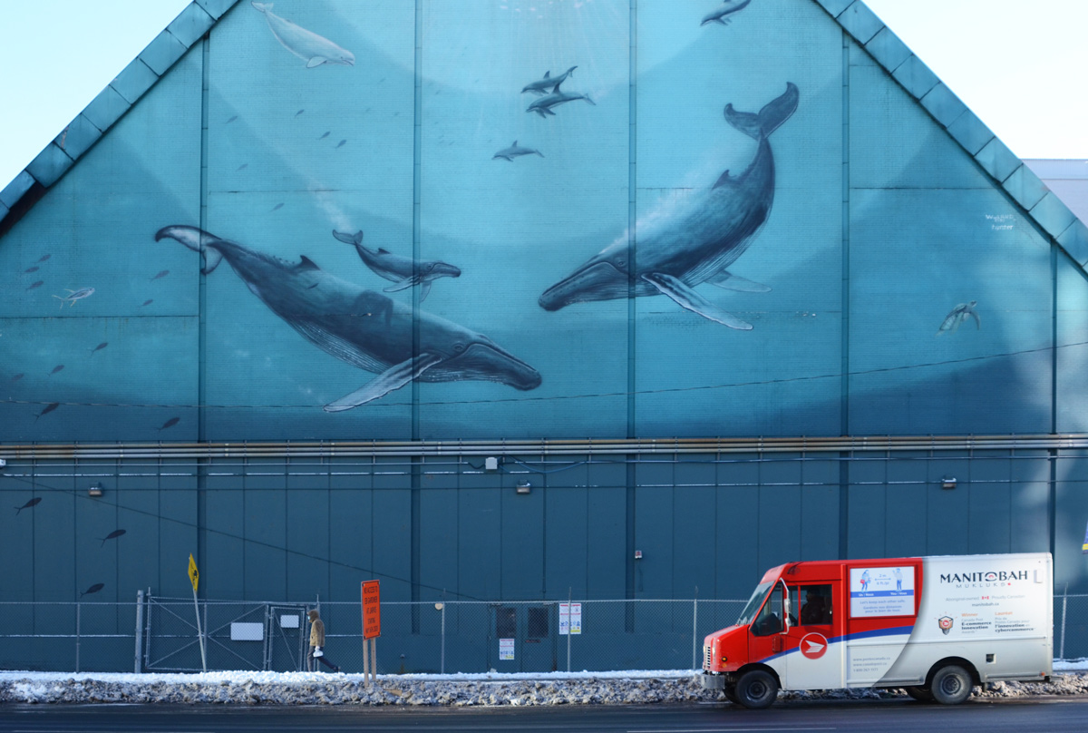
below: “Whaling Wall”, 1997, on the side of Redpath Sugar, one in a series of 100 murals painted by Robert Wyland that feature whales and other seal life.
below: Looking north up Yonge Street from Queens Quay
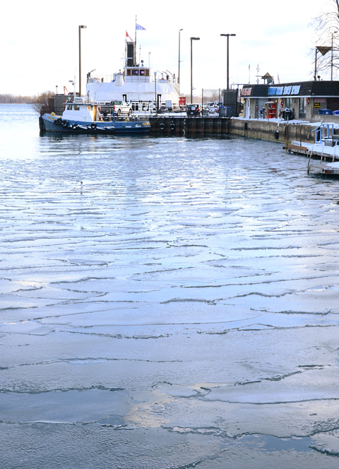
below: Ice just beginning to form on the water. Although it’s almost February, Lake Ontario remains unfrozen – at least up until last Thursday when this picture was taken. That was also the coldest day of the winter that we’ve had so far. A lot more of the harbour, and lake, should be frozen now!
below: Looking north up Bay Street from Queens Quay
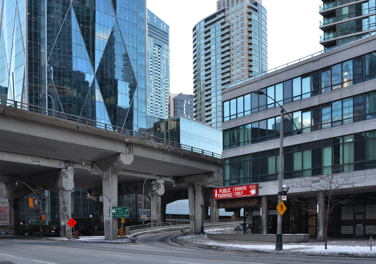
below: Lakeshore & Gardiner at Bay Street.
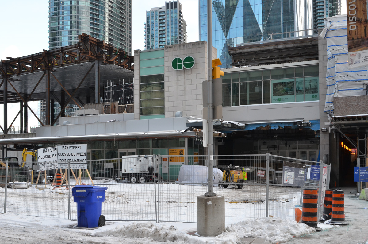
below: There’s a new walkway over Bay Street that joins Union Station and the GO bus terminal.
below: Looking south from the new walkway. On the right is the old postal sorting station, then Air Canada Centre, and now totally rebranded as the Scotiabank Arena.
below: It also offers new views into windows!
below: Towards the new GO Terminal. When I wandered through it was just me and two security guards.
below: The first of these that I have seen, inside the new GO bus terminal.
below: The old GO Terminal
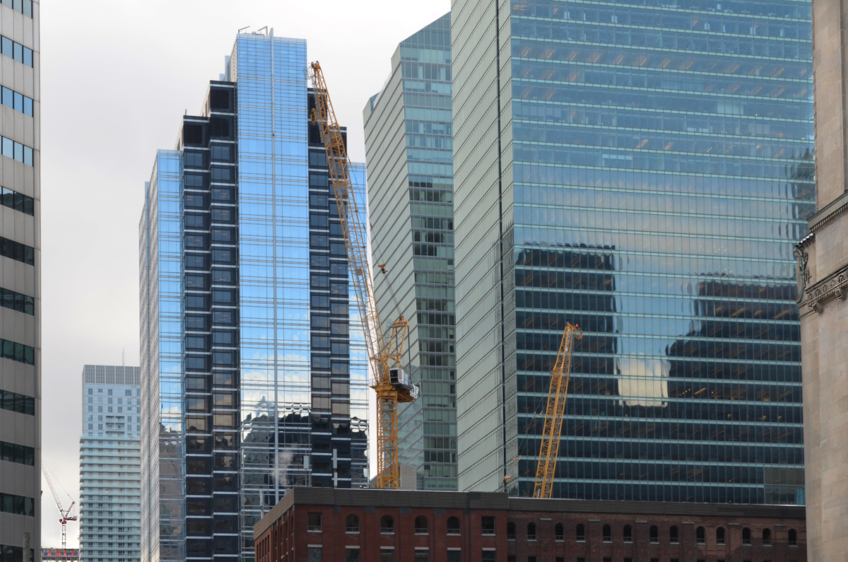
below: It was very quiet in front of Union Station, especially subdued for late on a weekday afternoon.
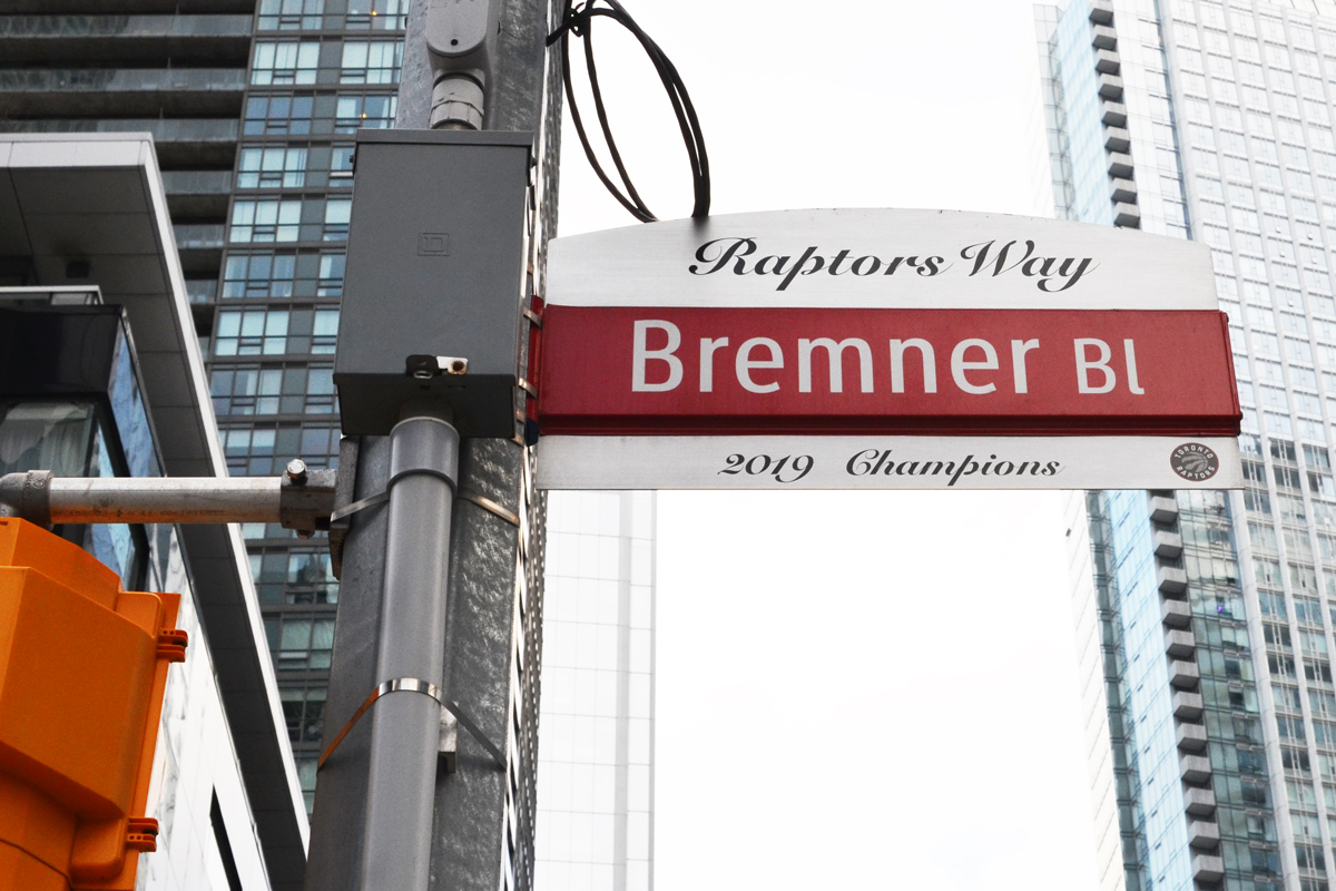
below: Remembering the 2019 Raptors team.
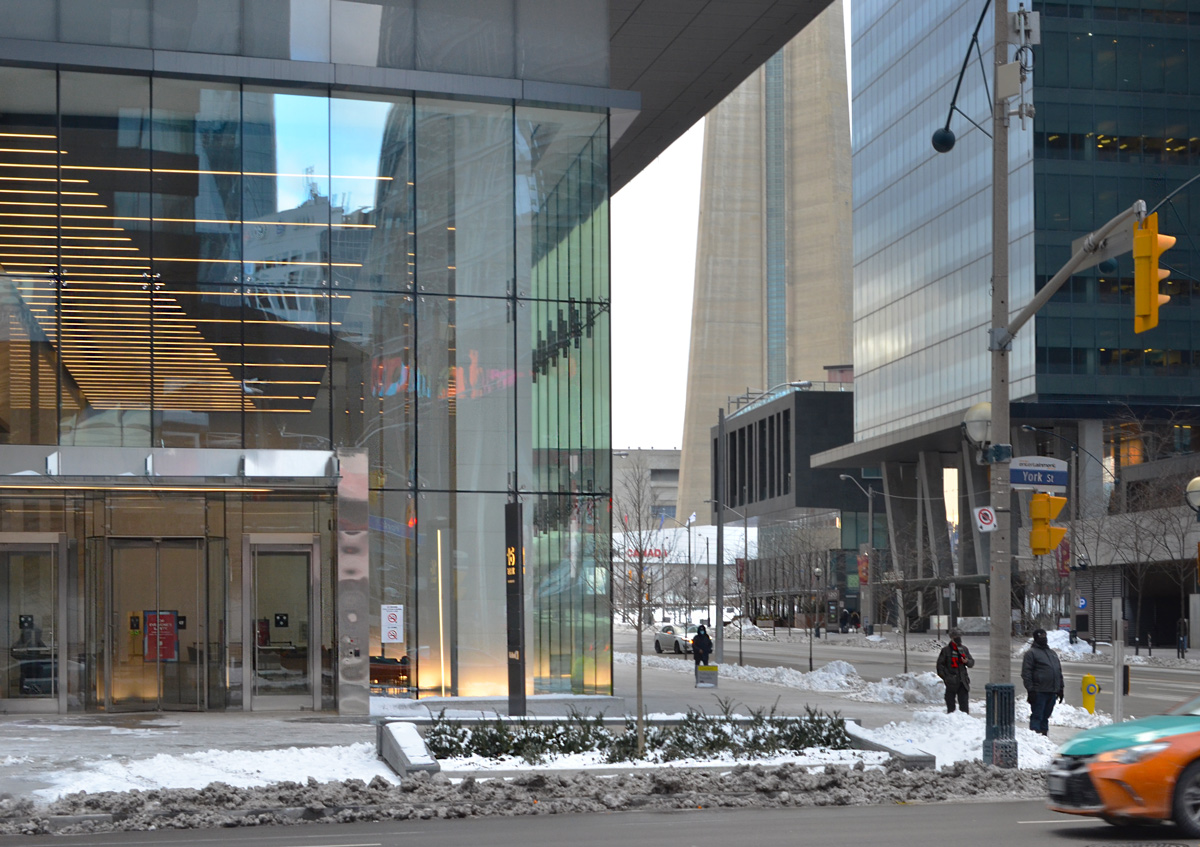
below: York Street at Bremner, with the base of the CN Tower peaking through.
below: Looking into the lobby of a new building at 10 York Street, designed by Brad Golden & Co.
below: “Iceberg” in Canada Square, with the CN Tower in the background. This sculpture, that you can walk through, also has sound and lights. The latter would probably be better seen a little later in the day!
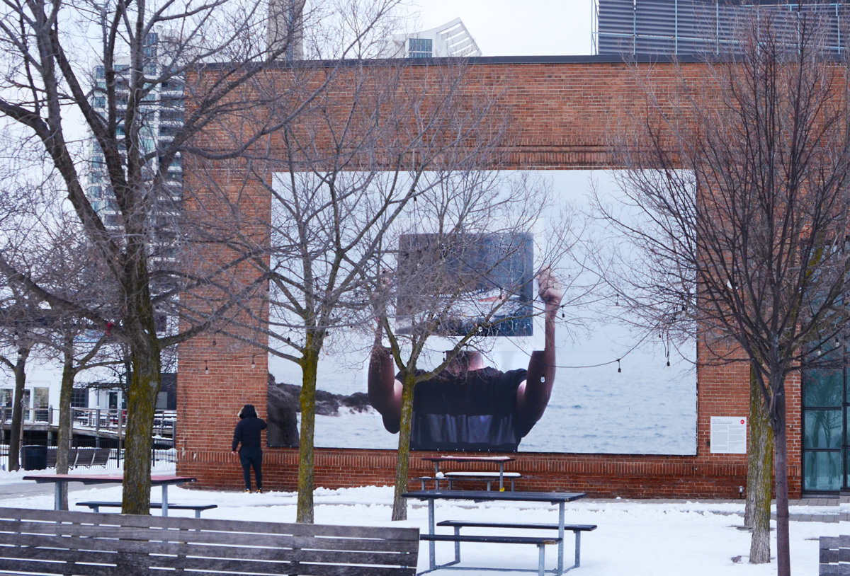
below: Dewit L. Petros, “Untitled (Overlapping and intertwined territories that fall from view III)”, on the south wall of the Power Plant Contemporary Art Gallery. This was part of the 2020 Contact Photography Festival.
below: “Sonic Runway” a light-art installation on the waterfront created by Warren Trezevant and Rob Jensen.
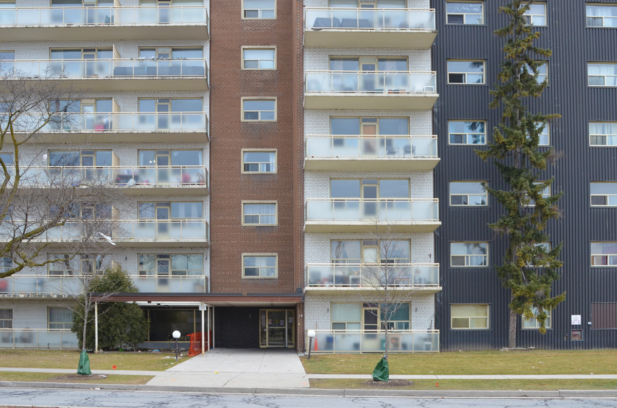
This post grew out of the last walk that I took with my mother. It fit the criteria of being close to her house, had a route where we didn’t double back, and was somewhere that neither of us had walked recently. Our route was The Donway, the circular road that encompasses the intersection of Don Mills Road & Lawrence Ave. We drive through it or past it frequently but as you know, the world looks different when you get out of your car.
Developed between 1952 and 1965, the suburb of Don Mills was very much a “planned community”. The history of its development is online so I am not going to dwell on that aspect. I was more interested in what it looks like now – what changes are happening there? What looks just like it did 60 years ago?
We started at the library. [As an aside, this where I had my first job. I was 15; I hated it; I lasted two months. My apologies to all librarians. ]
below: Don Mills Library. In 1956 the land was purchased at Lawrence and Donway West for a new library. It was opened in 1961 and renovated in 1994. A few years later it was added to the inventory of North York’s Modernist Architecture. You can download the brochure that lists, with pictures, the more than 200 buildings on this inventory from an ERA Architects website(but be patient!)
below: The old and the new.
below: A new playground in front of construction where the Don Mills Arena once stood.
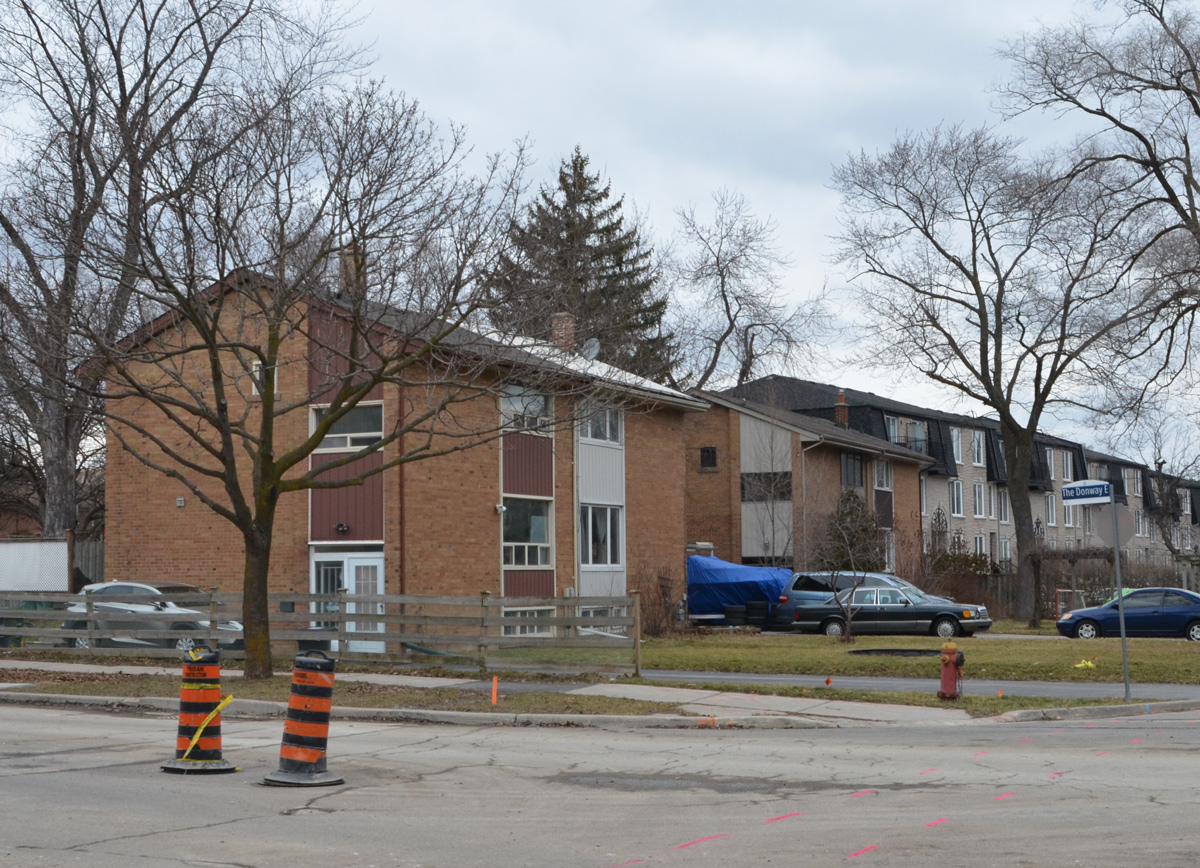
The original Don Mills plan called for higher density inside the Donway Circle with lower density & single family homes outside the circle. These condos are withing the circle, adjacent to the “Shops at Don Mills”.
below: The old post office (postal station) building is gone too.
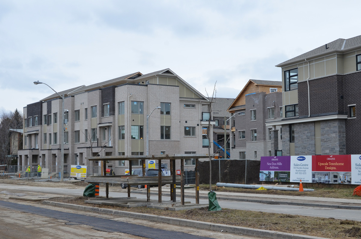
These new townhouses sit outside the north east quadrant of the circle.
I don’t think that anyone is going to claim that the original architecture in the area was “pretty” but these grey things are unsightly if not stupendously ugly.
below: Each of the quadrants of The Donway has a church. In the NE is Donway Baptist Church (also in the inventory of NY Modernist Architeture). The new townhouses seem to dwarf the church.
below: Don Mills Covenant United Church in the NW portion of The Donway.
below: The front of Don Mills Secondary school where many small trees have been planted. There’s at least one apple tree and one cherry tree .
below: This style of bungalow must have been very popular as tens of thousands of them were built, not just in Toronto, but in other towns and cities as well.
below: The car port, another Don Mills feature that helped make housing affordable at the time.
below: A family of raccoons has found a home in Don Mills too!
My apologies if the greyness of the photos makes you think that Don Mills is a grey kind of place. Blame the weather – there hasn’t been a lot of sun this January.
The south end of Dawes Road dead ends at the railway tracks just south of the Danforth. On this block there is an old abandoned car wash at 18 Dawes.
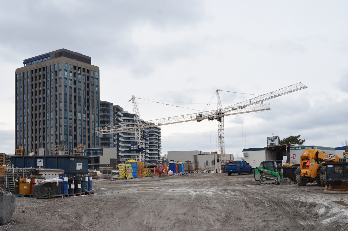
As it turns out, this sleepy little section of Dawes might be about to burst. Being within walking distance of both Main subway station and the Danforth GO line makes it a wonderful location. Three development proposals are being considered here. First, two towers, 26 and 33 storeys with a shared 5 storey podium are planned for 10 and 30 Dawes (includes this car wash location).
below: 12 Dawes Road might be the only original building remaining.
Across the street is 9 Dawes where two towers (24 and 30 storeys) with a shared podium have been proposed – with the usual bland nondescript street level nonsense.
To the south is 6 Dawes. Here there might be three towers – 40, 46, and 49 storeys. This development will also include a new community center as well as an entrance to the Danforth GO station. It runs along the north side of the railway tracks from Dawes to Main.
That’s a total of 7 towers between 24 and 49 storeys in a small space at the end of Dawes Road. The drawings for each proposal do not include the other developers’ towers so it’s difficult to picture the end result. Crowded, yes. Manageable? Who knows.
Both of these developments are in the planning stage (started in 2019) and both require zoning by-law amendments. Development can be very slow and changes often occur.
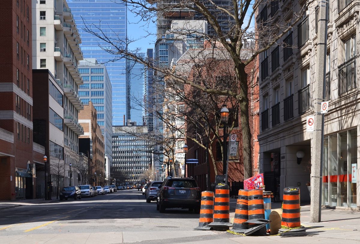
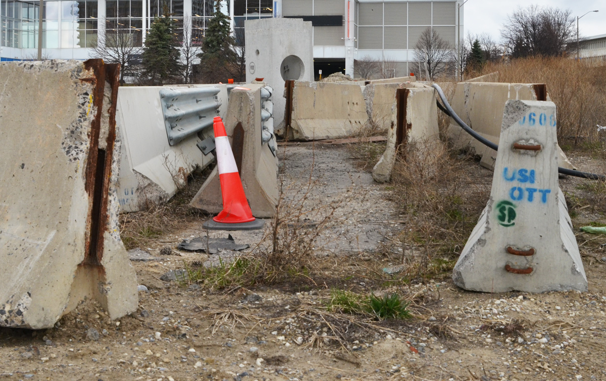
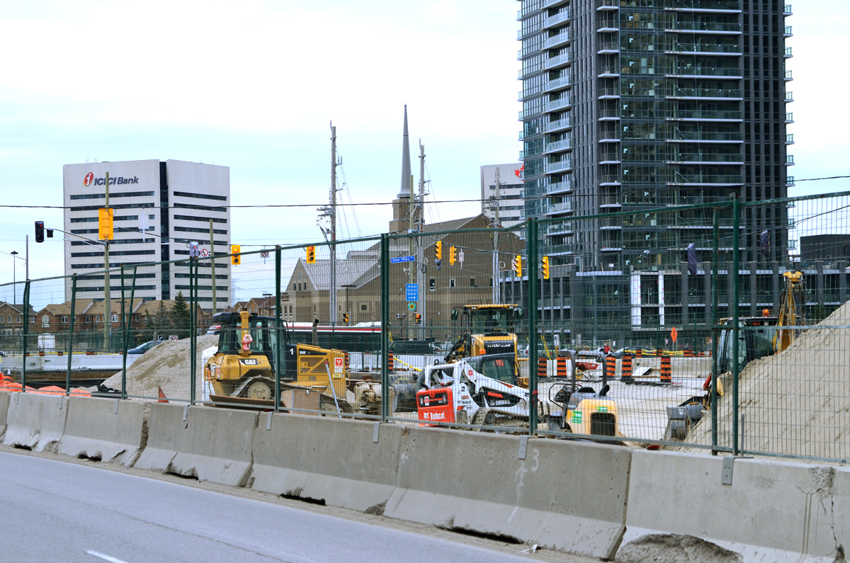
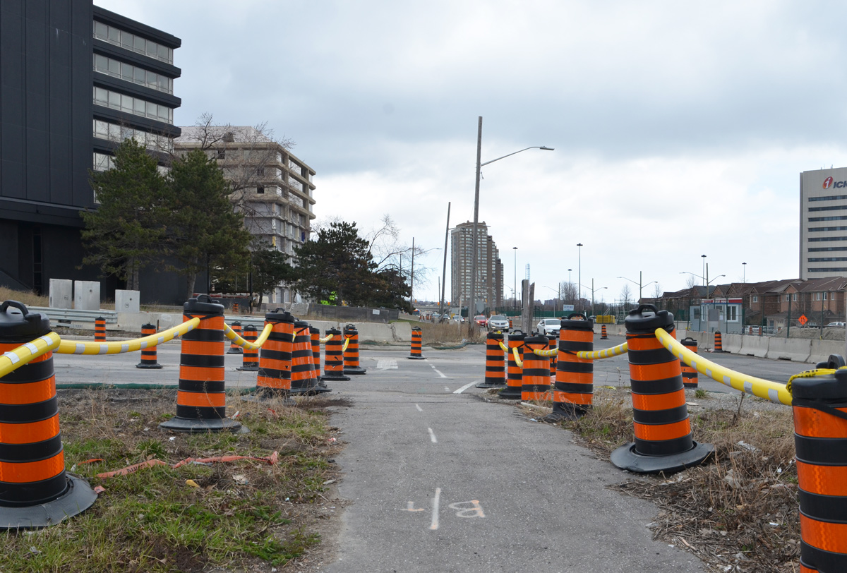
There’s a video on the internet of a kangaroo hopping down the street in deserted downtown Adelaide Australia and there are photos of other animals that have taken to roaming urban streets now that many people are staying at home. I thought of these things as I drove downtown today. Not because I saw animals. Not because the streets were quiet and empty. No, instead I wanted to compare these animal sightings to the proliferation of orange and black traffic cones as well as dump trucks and other machinery. It seems like the city has taken this time to block more lanes for construction than usual – I may be imagining things but I doubt it.
below: Driving east on Adelaide
below: Demolition on Jarvis
below: Maud Street
below: Lombard Street
below: I think that they are looking at me but how can I be sure?
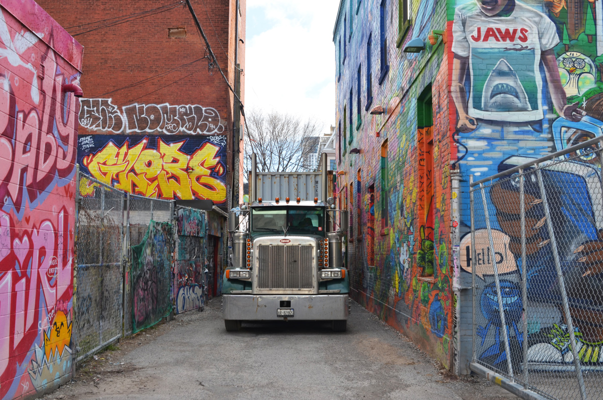
My destination this morning was Graffiti Alley. There were no tourists there today but there were trucks blocking the alley. More construction nonsense.
below: In fact there were two trucks
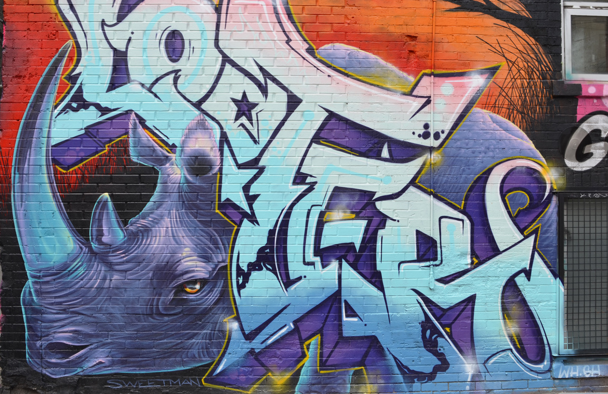
below: A new Nick Sweetman mural – a purple rhinoceros
below: This mural is not new but it is the first time that I have seen it with no cars parked beside it.
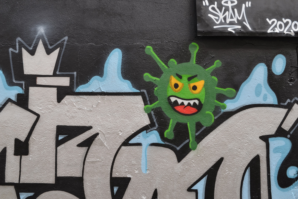
below: Graffiti Alley now tests positive for the novel coronavirus, the green variety.
below: KFC sits empty. That’s not a coronavirus victim – it was empty before we all started staying home.
below: A message from 525 and 523, Stay Safe! (actually it’s from T-bonez).
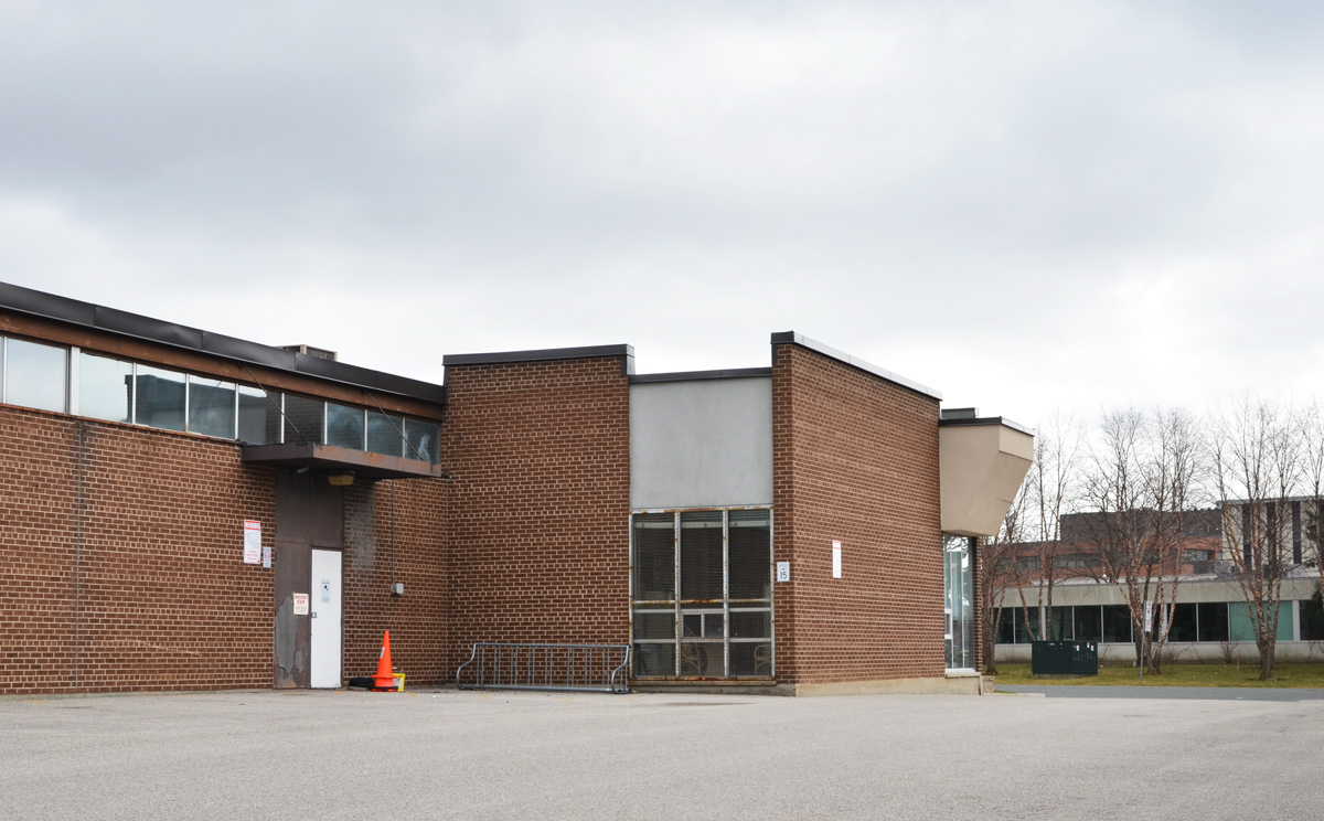
I’ve been keeping an eye on the old IBM building at the corner of Don Mills and Eglinton. It was built in 1951 as IBM’s Canadian manufacturing plant and head office.
It’s been empty for a long time but recently work has begun on the site.
The IBM complex sits on 60 acres and the whole site will be redeveloped in the coming months. The white tower in the background is also on the site, right beside the CPR tracks that mark the northern boundary.
below: A Canada goose struts near one of the entrances to the old IBM building that is being demolished.
below: Apparently the plan is to build a mix of residential and commercial buildings on the site ranging from 3 to 44 storeys. A new community centre and park are also included in the planned Crosstown Community.
In terms of construction and development, this intersection is very busy as it is also the location of the future Science Centre LRT station. It has been a mess for so long that I can’t remember how long it’s been. There are signs of progress starting to emerge from the chaos so perhaps there is hope for a 2021 opening of the Crosstown LRT.
below: The new bus bays on the northeast corner are starting to take shape.
below: More of the NE corner.
below: Looking across Eglinton towards the Mormon church and other buildings on the south east corner.
below: A sign of the times. Covid-19 dos and don’ts.
below: New tracks being laid where the LRT comes back to the surface east of Don Mills Road (looking east towards the DVP). The Science Centre station is underground even though the tracks on both the east and west side are above ground.
below: From the NE corner (black building is/was the Ontario Federation of Labour) looking south. All buildings are on the east side of Don Mills Road.
below: A sidewalk, temporary, lined with cones, along Eglinton.
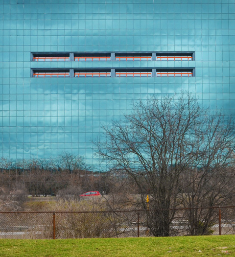
There are other buildings being torn down. The building in the background is 1200 Eglinton Ave East. It was an office building with a parking structure beside it. This is the view from Wynford Drive.
The same building a few days later when I went back to check on the demolition’s progress. The parking structure is now just piles of rubble and more of the exterior walls of the other building are gone.
below: The large, almost empty, parking lot behind the Bell building on Wynford.
below: With a few exceptions, most of the buildings around Wynford are products of the 1960s and 1970s.
below: Another empty parking lot. This picture was taken on a Saturday afternoon which might explain the lack of cars but as I drive around the city I see lots of empty parking lots even during the work week. A sign of the times.
below: Looking across the Don Valley Parkway
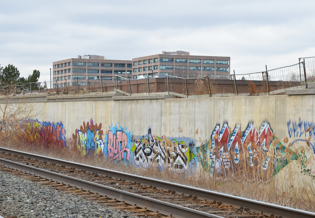
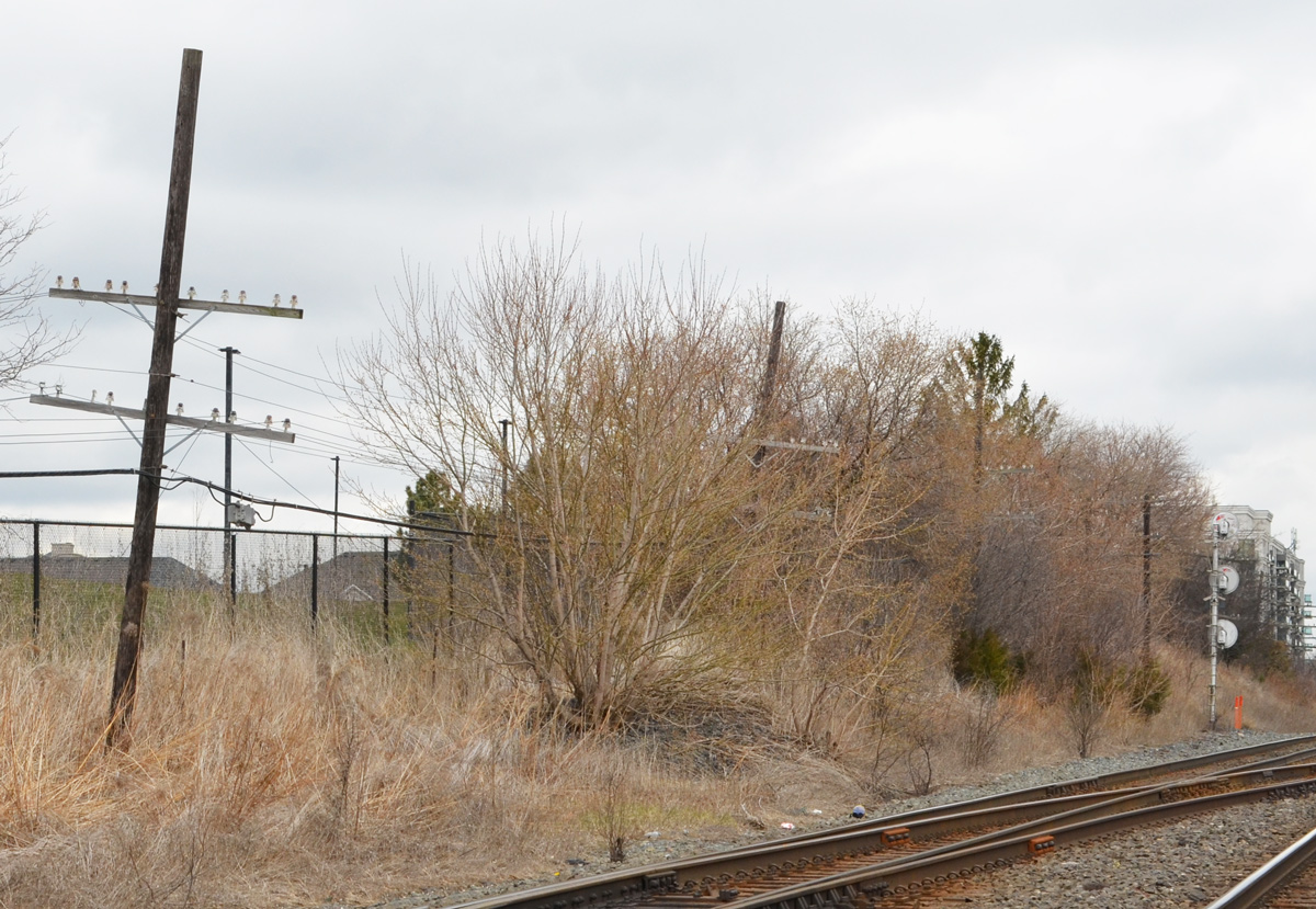
below: CPR tracks behind Wynford.
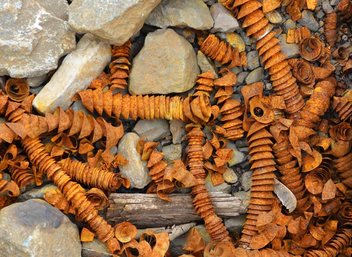
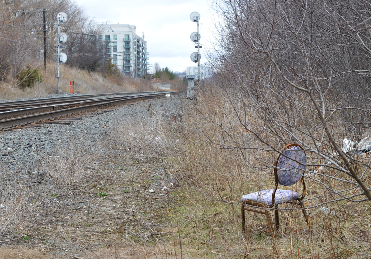
below: Rusty metal spirals, tightly wound, found amongst the gravel along the train tracks.
below: Looking east along the tracks just before they cross the DVP. If you follow the tracks, they lead you to the CPR marshaling yard at McCowan and Sheppard. So, that’s where I went next…. (scroll down!)