Posts Tagged ‘development’

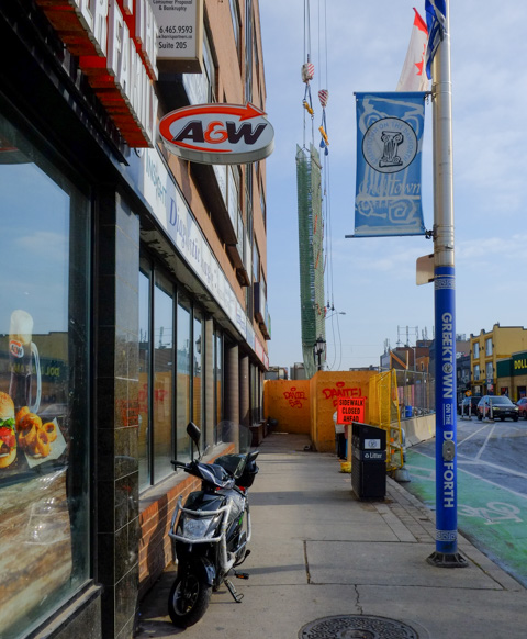
…. another visit to Yonge and Eglinton

people crossing Eglinton Ave towards entrance to building on southwest corner of Yonge & Eglinton where there are images of people painted on the window

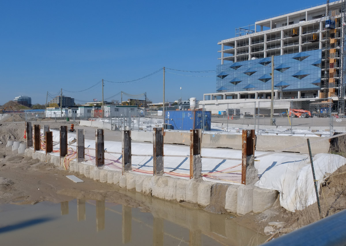
Of course, this is also the location of the Eglinton station on the mysterious Eglinton LRT.  The underground walkways between it and the Yonge – University subway line are complete, as is the entrance on the south side of Eglinton.   The latter is a large building and it will definitely help with the flow of traffic… but it sits idle.

northern new entrance to Eglinton station on LRT line, behind fence, no public access

new entrance to Eglinton station on LRT line, behind fence, no public access, on west side, with old Canada Square development behind

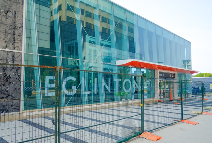
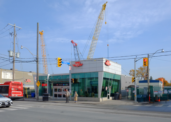
below: All of the old Eglinton station bus bays are long gone.

new Eglinton station Metrolinx entrance for LRT and subway, still closed to the public, with older Canada Square buildings around it

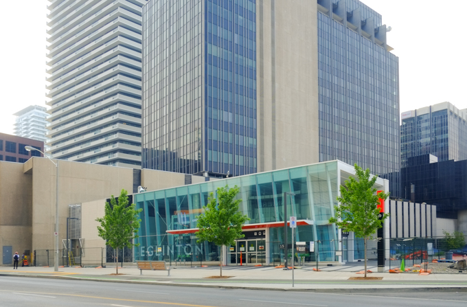
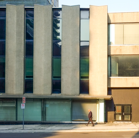
below: Canada Square, home to Canadian Tire head office for more than 50 years, was built in the 1960s and 70s.  It consists of two towers connected by a lower section – it is this middle connecting piece that has the vertical concrete slabs on the exterior. These verticals are on both the Yonge Street side (below) and this motif is repeated on the back of the building (see photo above, behind the new station entrance).   Earlier this year, Canadian Tire announced that they had renewed their lease for another 20 years and that the building was going to be redeveloped/upgraded/modernized in the near future.

a man walks down Yonge St., past vertical concrete slabs on canada square building, light and shadows

below: Northwest corner of Yonge and Eglinton

reflections in the glass on the northwest corner of yonge and Eglinton with Cineplex theatre, Winners store, Pickle barrel restaurant, and Rexall drug store, 2200 Yonge Street

people walking on the west side of Yonge, north of Eglinton

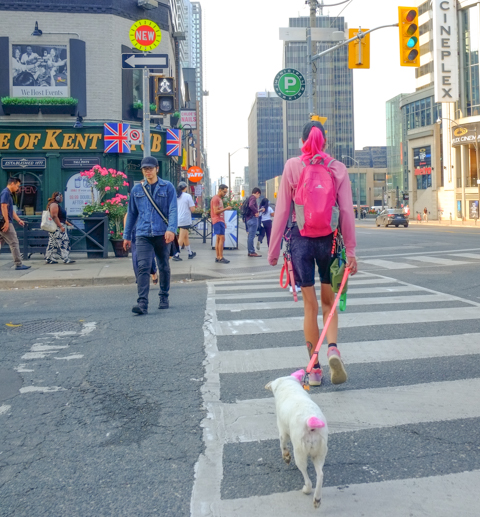
below: The Duke of York pub at Yonge and Roehampton

corner of Roehampton and Yonge, Duke of Kent pub on the corner, along with Chloes Nails, the Stag Shop

below: The old Postal Station K has been incorporated into a new condo development. The older building dates from 1936; it was built on the site of Montgomery’s Tavern (made famous in 1837 when it was the epicenter of William Lyon MacKenzie’s rebellion). It was a big square building but with Art Deco elements around the entrance. Because it was built in 1936, it actually featured (and still does) the Royal Insignia of King Edward VIII whose reign was very short-lived because he abdicated the throne only 11 months after being crowned.

old post office on Yonge street, is now the bottom part of a new condo development

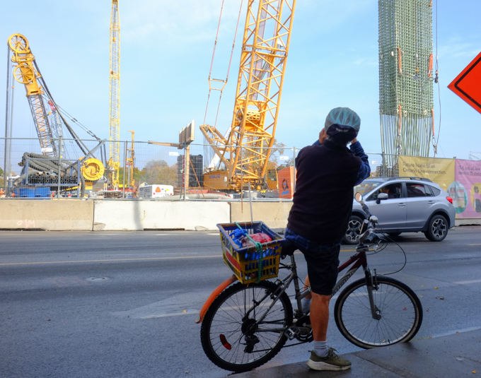
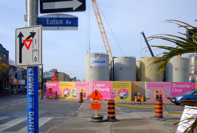
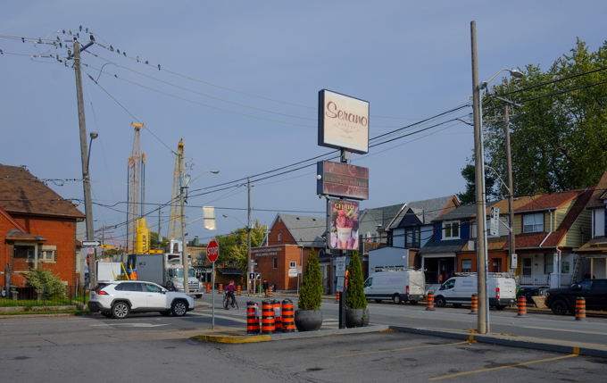
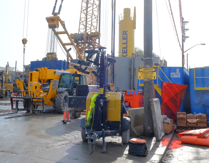
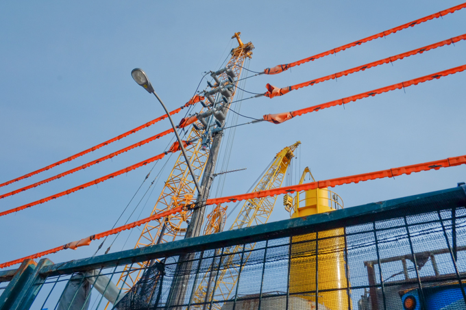
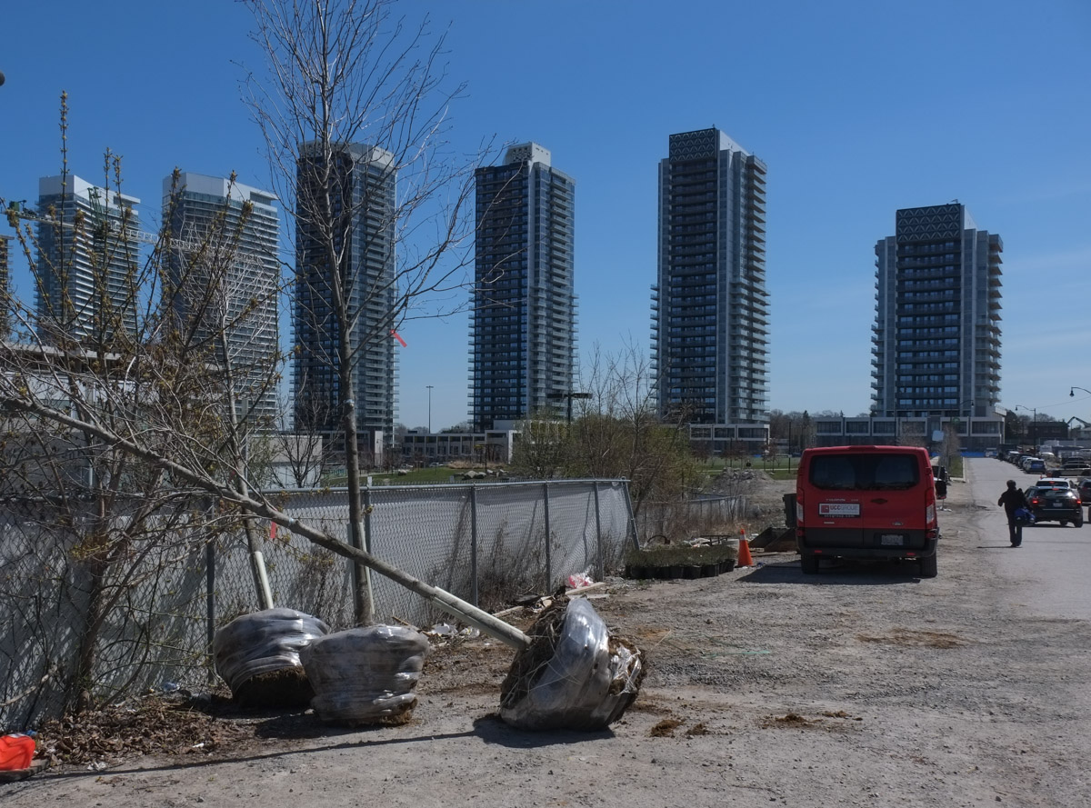
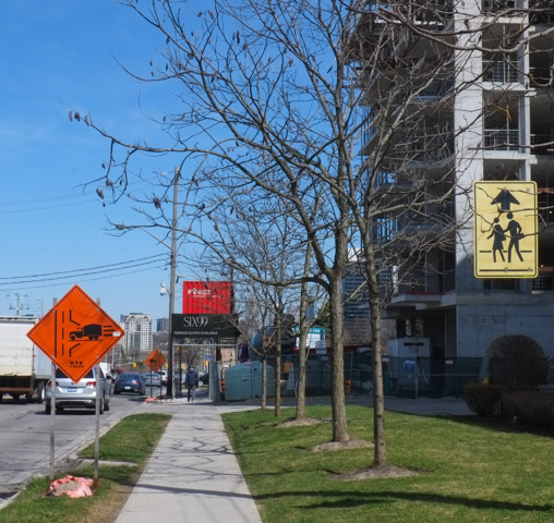
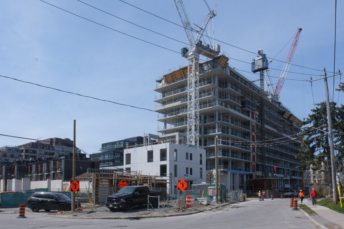
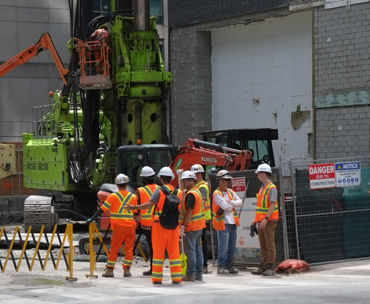
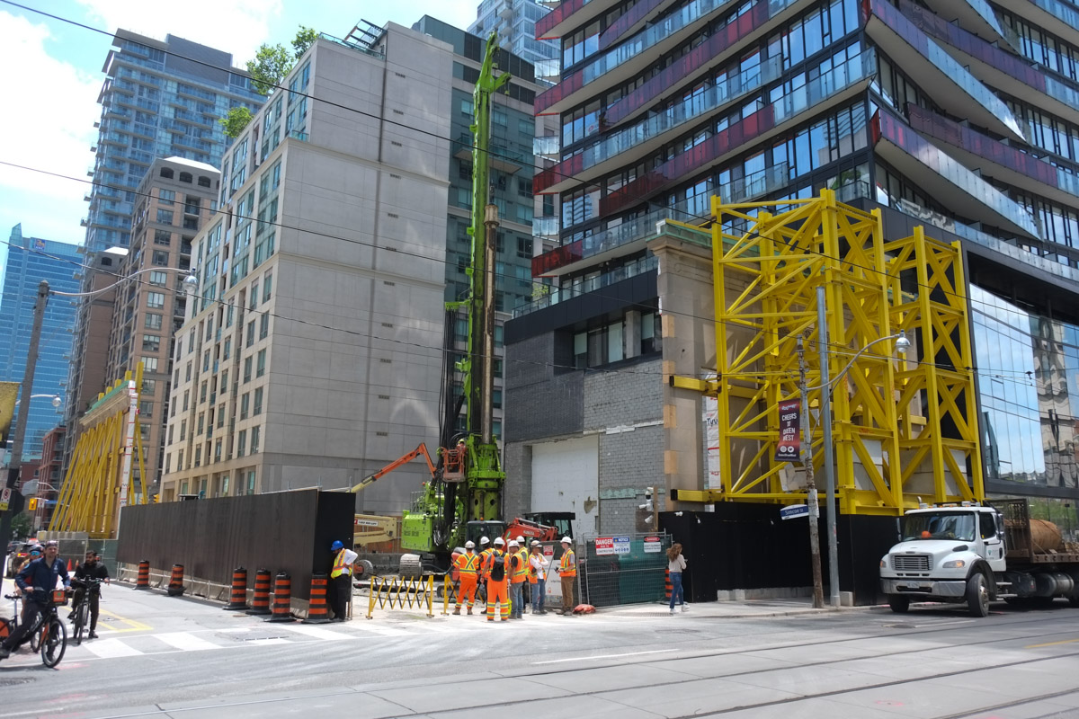
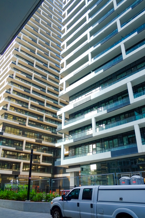
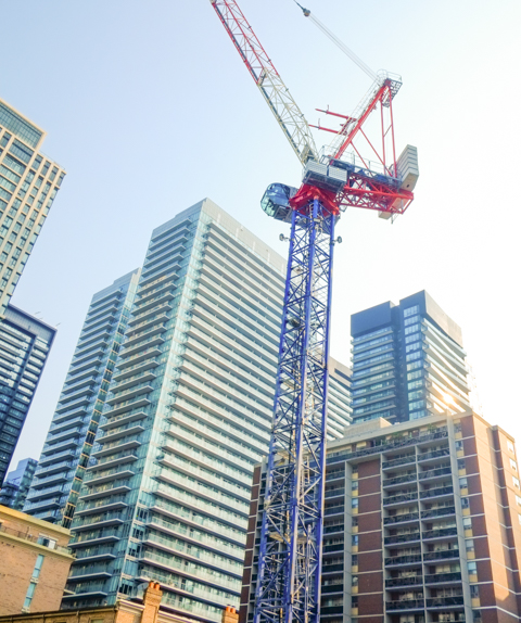
below: North of Montgomery/Broadway more development.  More cranes.

looking north on Yonge street towards Montgomery, old brick and stone building on the corner, many cranes in the background

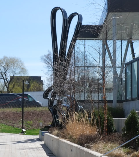
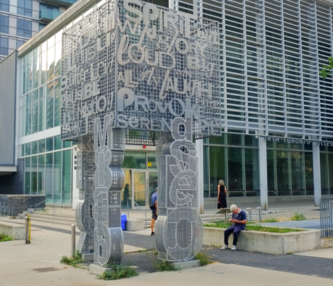
below:  About 15 years ago, North Toronto Collegiate  (NTCI) was rebuilt on Broadway.  The new school was incorporated into a condo development.  At the north entrance to the school is an artwork by Catherine Widgery’s called “Mindshadows”. It is a 20 foot high stainless steel cube on legs that is covered with numbers, letters, and words. Serene, provoke, laugh, loud, big, spirit, and up are some of the words.

entrance to North Toronto collegiate institute, with public art in front.

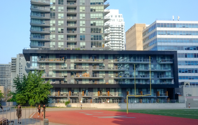
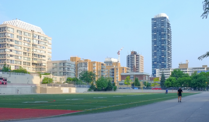
below:  View from Broadway of the North Toronto football field and track and some of the condos that surround it.

football field and track, par tof North Toronto Collegiate, surrounded by tall condos and apartment buildings

view west from football field and track, partof North Toronto Collegiate, many tall condos

below: Looking north from Roehampton

looking south from Broadway, football field and track, part of North Toronto Collegiate

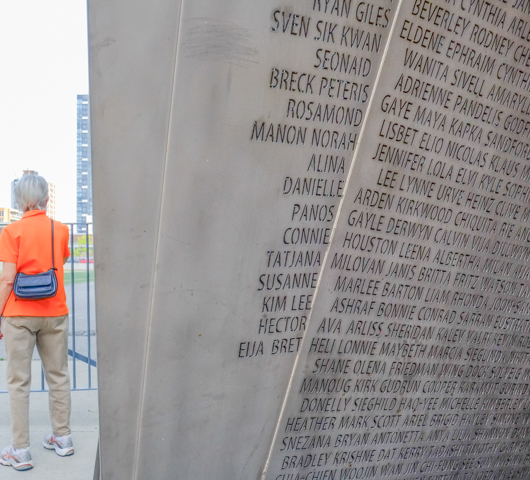
below: At the south entrance to NTCI (on Roehampton) is another public art installation.  “What’s your name?” by Ilan Sandler (2011) contains the first names of all the NTCI students since the school opened in 1912.  Each name only appears once – but there are still 2053 different names such as Sven, Connie, Marlee, Janis, Lola, Ephraim, Bryan, and Snezana.

Part of What's your name, an art installation by Ilan Sandler, a list of over 2000 names, in concrete,

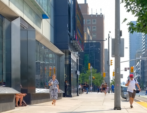
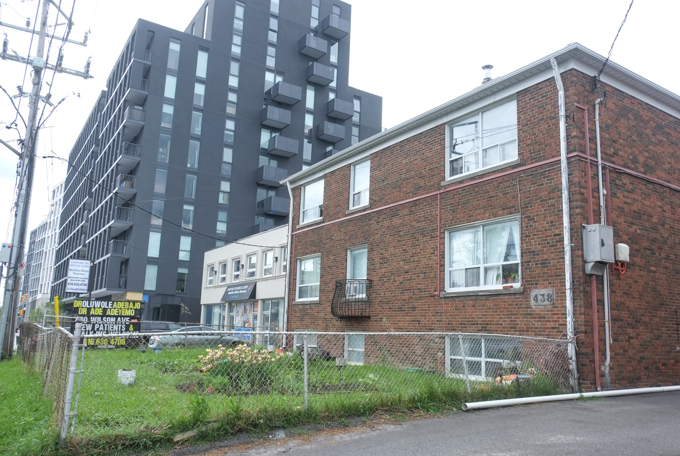
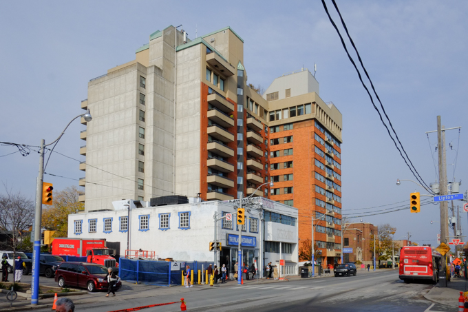
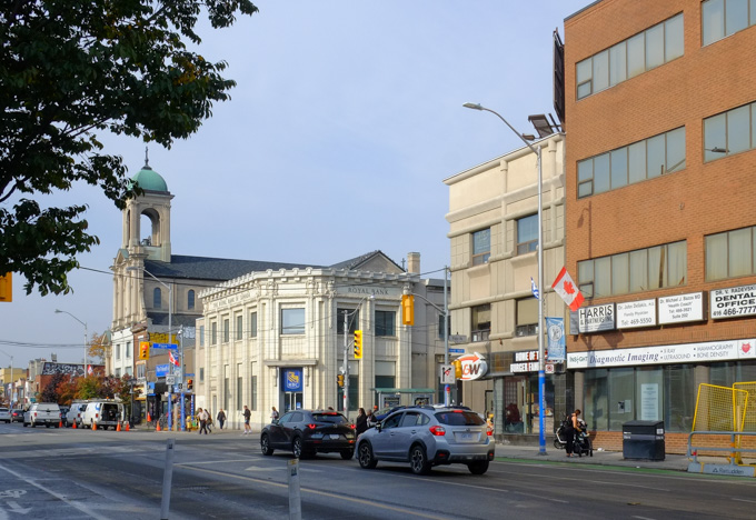
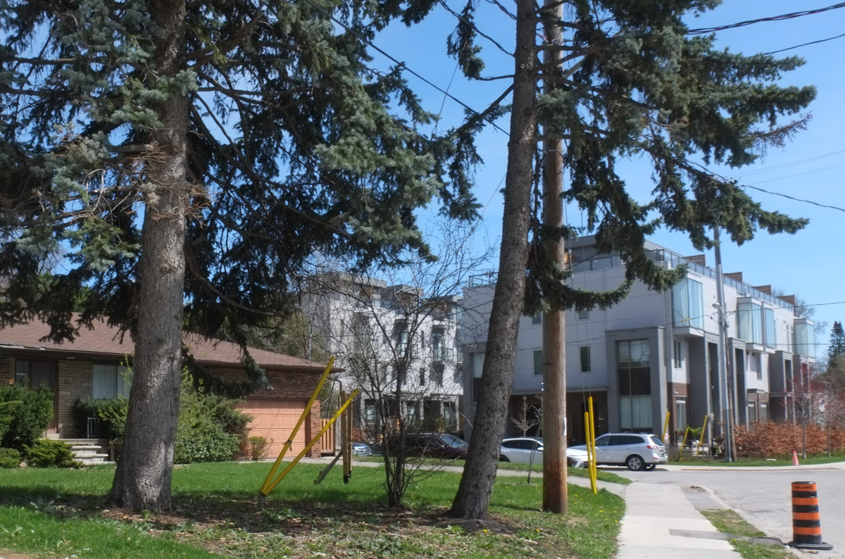
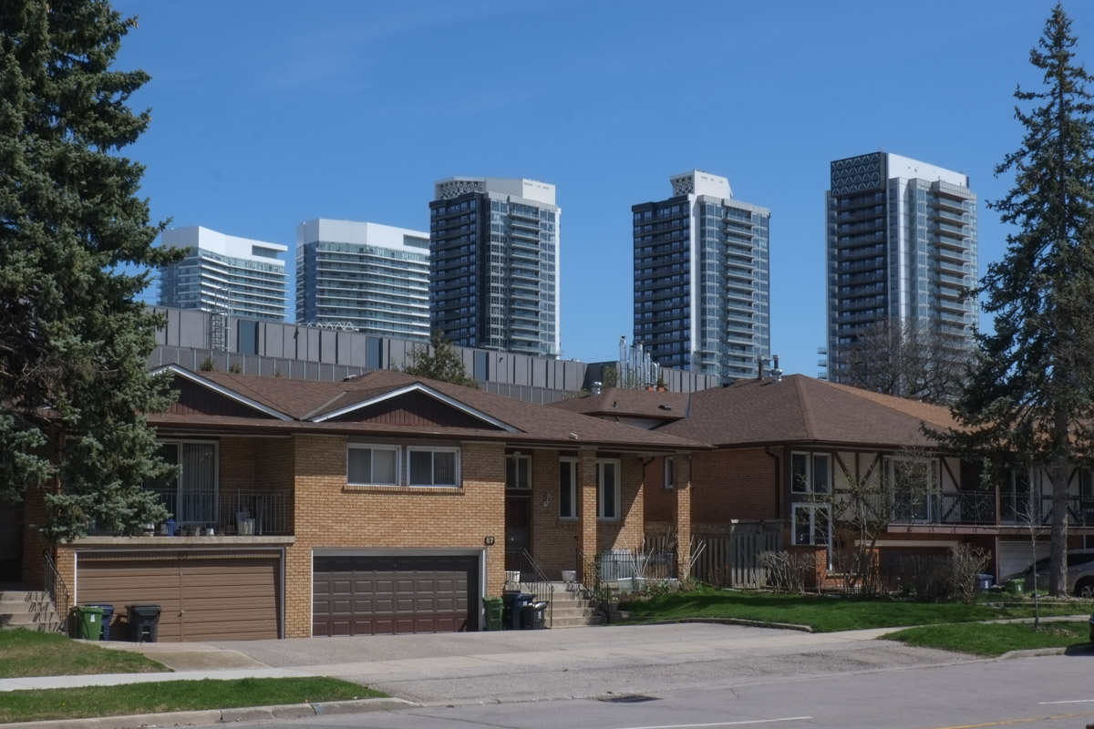
The neighbourhood that is north of Eglinton and east of Yonge has been the home of many apartment buildings for at least a few decades.  A growing number of them have been replaced by taller glass and steel condo developments, especially since the city has targeted the area for “… tall buildings and an intense concentration of office, retail, institutional and residential uses…” (quote comes from Yonge Eglinton Secondary Plan, 2018)

exterior staircase beside a building, narrow space between two older brick apartment buildings

older lowrise apartment building

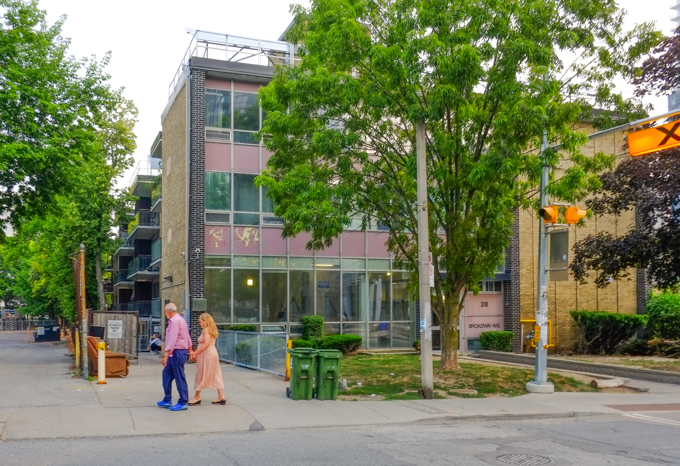
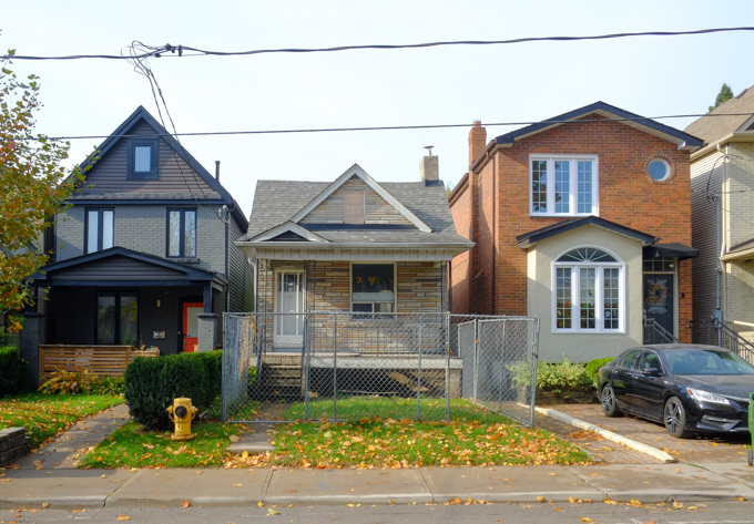
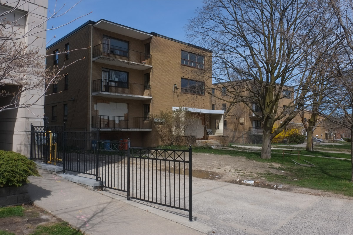
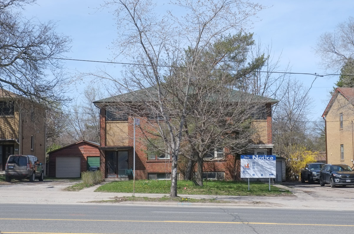
below: Old style (1920s?) 4 storey walk-up apartments.  There was a time when this type of architecture was common and these apartment buildings are (were) scattered around the city.  There aren’t as many as there used to be although some, like this one, has been renovated and kept in good shape…. a testament to their good design.

4 storey brick apartment building

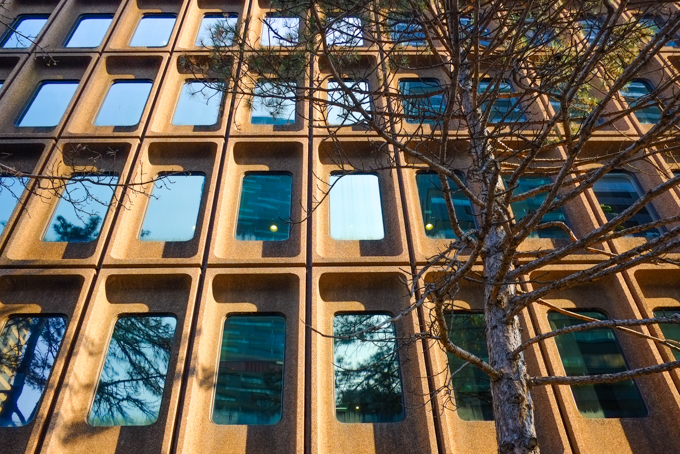
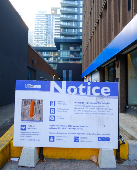
below: Concrete building from the 1970s at 2323 Yonge …

reflections in the windows of a 1970s concrete building, vertical windows with deeply recessed windows

below:  …   but it too has a blue and white development notice on the side of this building.  Fifty eight stories with 40 car parking spots but room for 350 bikes.

blue and white city of toronto development notice sign on yonge street

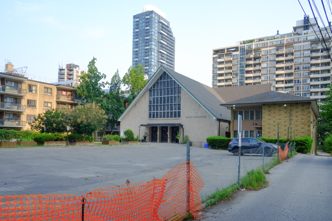
below: St. Monicas church, an A-frame structure built in 1959, is set well back from the street with a parking lot in front.

st monicas church, A frame building from 1959, and parish hall, with large parking lot in front

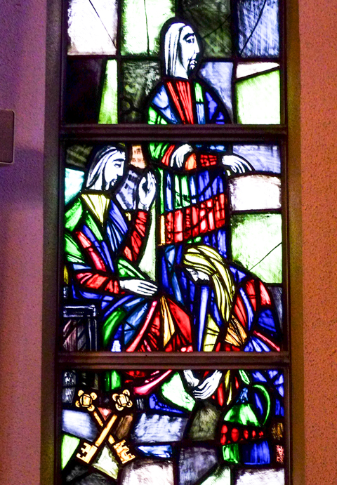
below: One of the many stained glass windows inside St. Monica’s church.  This image shows a window that features gold crossed keys which are a symbol associated with St. Peter.  These are the keys to the Gates of Heaven.  The church website describes this window as representing the (Catholic) Sacrament of Reconciliation (the pardoning of confessed sins).

stained glass window in St. Monicas church


below: Redesigned.   From the KPMB website, this is rendering of the proposed new St. Monica’s church.  It has been brought forward closer to the street which also allows for a new condo tower behind.  That’s the plan.

rendering of new redeveloped St. Monicas church on Broadway Ave., as proposed by KPMB, image taken from their website

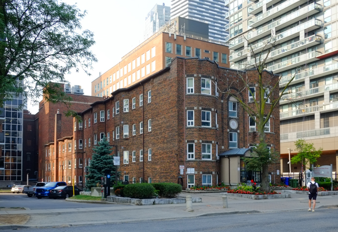
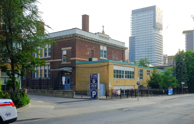
below: Beside the church is St. Monica’s school.  The original brick building was built in 1916.  A few additions have been added over the years.

st Monicas school, brick building built 1917, with yellow brick addition from the 1960s

reflections of new glass and steel condos in the back window of a small white van or truck

red and black machine parked by hole at construction site

sidewalk closed in front of Akoya, new condo on Broadway, as they finish work on the front entrance and landscaping of the building

narrow walkway with wooden rail, above a large hole in the ground at a construction site

density of residences, highrise condos and apartments around Yonge and Eglinton, glass and steel towers, new developments

density of residences, highrise condos and apartments around Yonge and Eglinton, glass and steel towers, new developments

density of residences, highrise condos and apartments around Yonge and Eglinton, glass and steel towers, new developments

crane used in construction of new tall glass and steel condos, in front of other new high rise buildings near Yonge and Eglinton

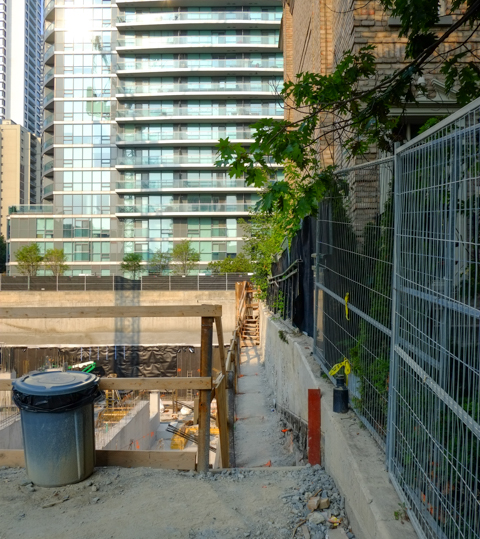
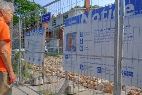
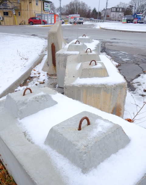
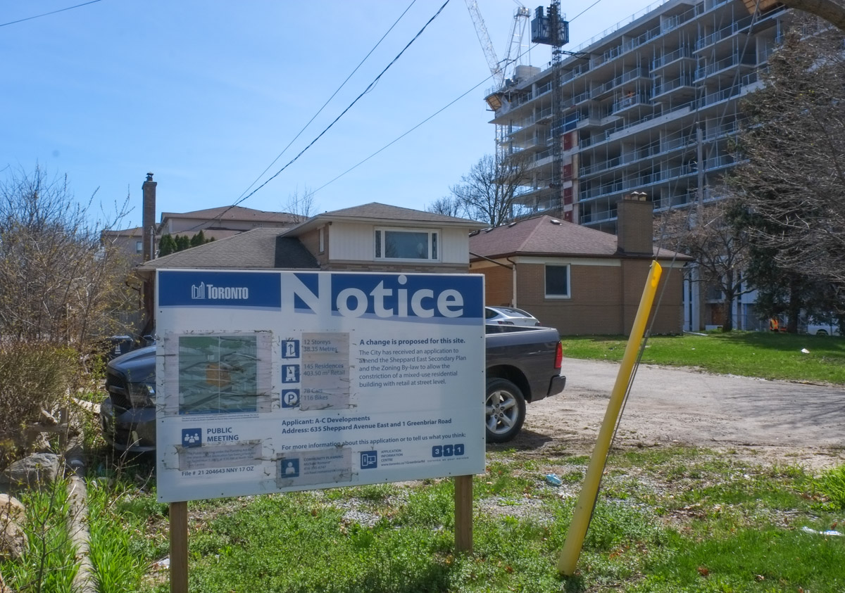
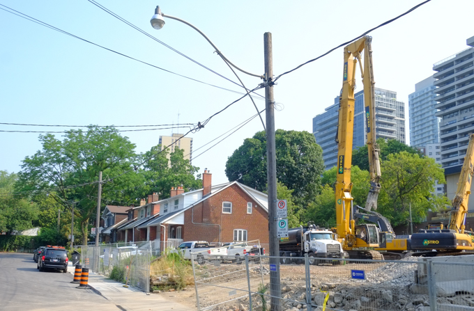
below: Changes are also happening to the west of Yonge Street. For instance, this building on Eglinton between Duplex and Henning is coming down.

development notice signs beside a demolition site, partially demolished building, on henning ave,

multi level building in the process of being demolished, exterior walls all gone.

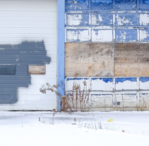
below: Old, new, and in between

Henning Ave., older single family homes with construction of new condos started beside them, crane,

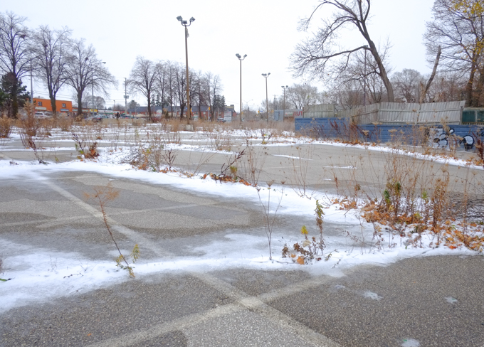
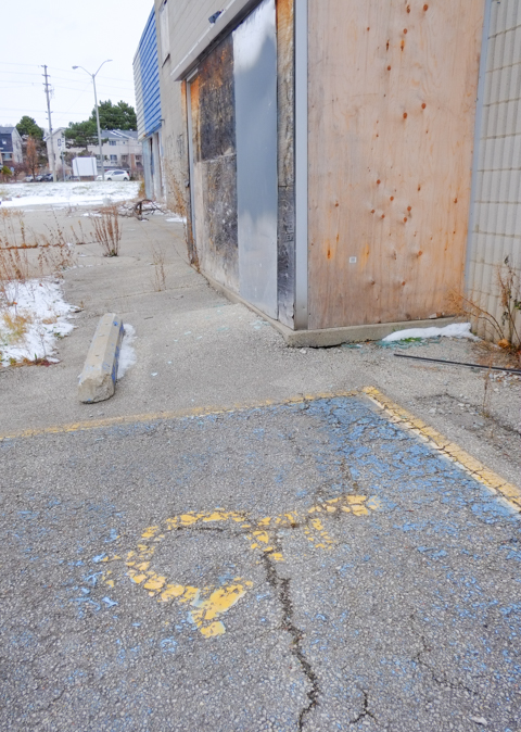
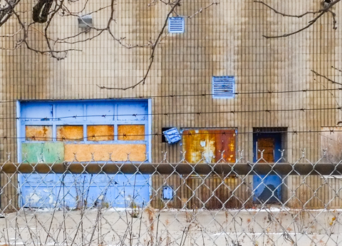
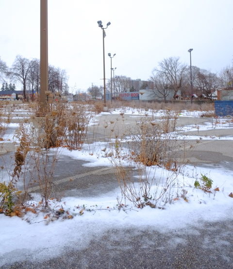
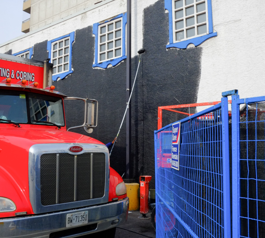
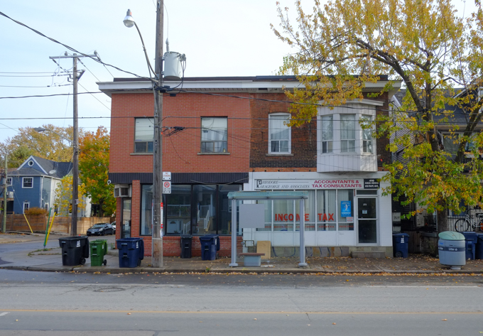
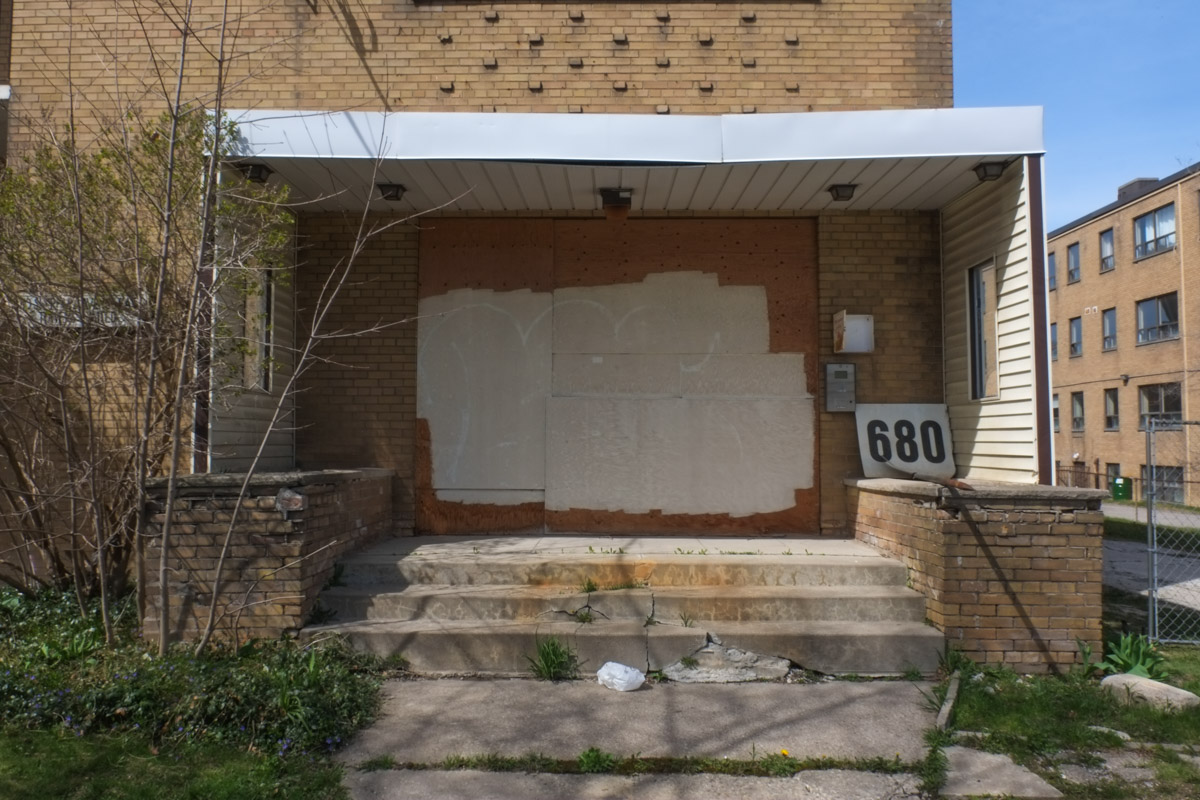
below: Remnants of what used to be.

2 old sets of stairs, side by side, once lead to houses, houses now demolished, stairs now behind construction fence, diggers and other equipment in the background

demolition, debris hanging from ceiling

demolition site

yellow digger, at construction site where a building is being demolished, revealing older interior walls painted in bright colours

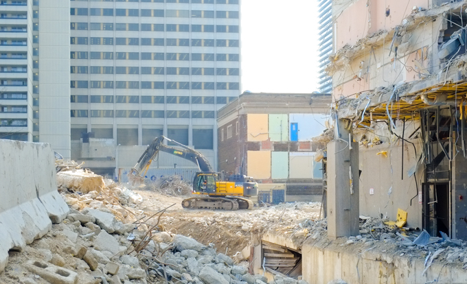
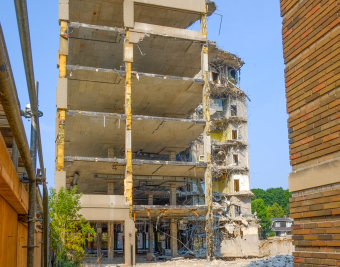
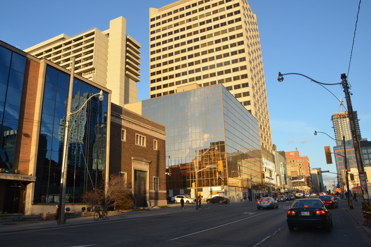
below: As I am sure you are aware, I have blogged about Eglinton Avenue before.  Back in 2015 (ten years ago!!) I posted this photo of Eglinton and Duplex.  Both glass buildings are now gone.  The Toronto Hydro Systems building (the short brick one) at the northwest corner of Duplex and Eglinton remains – it is the one with the coloured patches on the wall in the photo above.

looking east along Eglinton Avenue towards Yonge street with Duplex Ave in the foreground. The old Toronto Hydro-Electric building is in the picture, with a newer structure with a glass front beside it. New buildings between Duplex and Yonge on the north side of Eglinton are also in the picture.

below: Same corner, slightly different angle, taken this past week.

looking west along the north side of Eglinton, toronto hydro electric systems brick building on the corner, demolition of other buildings beside it

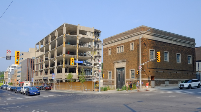
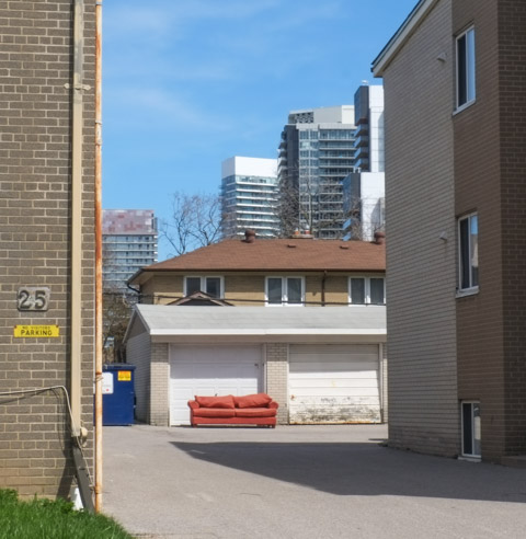
below: After the glass clad building on the northeast corner of Duplex and Eglinton came down, the backside of the Yonge Eglinton Center was exposed (on the right) as well as another tower (in an area that needs to be explored more!).

concrete tower


young woman with a pink ponytail, pink top, and pink backpack, walks a dog on a leash, crossing street on Yonge, dog is small and white with pink tail and pink ears.

sign that says slow, upside down and leaning against a fence, construction site in the background

below: With thanks to my mother who walked with me that day.

older woman standing in front a fence with two development notice signs

a woman holding a cup of coffee walks on sidewalk, along Eglinton, while a man sits of the steps of a building

defaced TTC bus stops sign on Eglinton, for routes 13, 32, and 61

yellowish vertical cladding, interior wilson subway station, with blue sign with arrow pointing to the left for northbound trains

Wilson subway station, on the University side of  Line 1, opened in 1978 and was the end of the line until Downsview station just to the north opened in 1996.  It is not a thing of beauty.  Concrete.   Austere from the outside.  It’s entrance from under the Allen Expressway is dark, gloomy, and depressing.

below: Northwest entrance to the station, nestled up against the Allen Expressway.

northwest entrance to wilson subway station, right next to the allen expressway

below: Walkway to southwest entrance

southwest entrance to wilson station, sidewalk through grassy area to entrance

That stretch of the subway runs down the median of the Allen Expressway.


below: Although the platform has a roof, it is open at the ends and in the winter it is cold.  There are a few of these pod-like waiting areas, circular glass structures with benches for those wanting a tiny reprieve from the wind.

on the platform of wilson subway station, circular pod-like structures made of glass, with benches, waiting areas

below: Inside the station a concrete wall sculpture by Ted Bieler entitled ‘Canyons’

very textural wall sculpture by artist ted bieler, called canyons, inside wilson subway station

two orange cones beside a phone booth against a concrete wall, interior, wilson subway station

What drew me here in the first place ….  To help brighten up the area, some of the concrete, both inside and out, has been covered with murals by Shalak Attack, Bruno Smoky, and Clandestinos,

below: An owl and a woman’s face at the two south entrances.

owl face, mural, around an entrance to Wilson subway station

clandestinos, or shalak attack, mural of a woman's face with butterflies and flowers, surrounding one of the double doors, entrance to wilson subway station

below: There is a lot of street art along Wilson Avenue but most of it is under the Allen Expressway and is not well lit. Some of it is also looking very dirty.

pillars painted with red and blue designs, under the allen expressway and beside wilson subway station

concrete pillar with street art, large brown fingers, people walking towards subway entrance

below: Pink flowers inside the station

part of a mural, inside wilson station, of bright pink flower


below: Circular “Kiss ‘n Ride” still exists.

round flat building, wilson kiss and ride, where cars can dropoff and pick up passengers

below: Exit at Wilson Heights

silhouette of man walking down hallway at wilson station, light coming through the door at the end of the passage, exit to wilson heights side of the station

below: Northeast side of the station, along with the Allen Expressway

northeast side of wilson subway station

I took most of these pictures back in the summer but I hadn’t taken the time to blog about what I had seen.  When I drove past Wilson again recently, I noticed that the parking lot on the east side (towards Wilson Heights) is now fenced off.  Now it is a snow covered vacant lot.

below: Parking lot before

bike parked outside wilson subway station

below: … and after. You can still park your bikes here, but no more cars.

vacant lot, snow covered, on the east side of wilson subway station

below: There is a City of Toronto development notice sign on the side of Wilson station.  It looks like the city may be serious about affordable housing at this site.  Apparently this has been in the works for a number of years but faced some opposition form those who wanted to keep the parking lot.   Just shy of 1500 units in six buildings are planned on the site along with community space and a public park.  The percent allotted to affordable housing varies from 35 to 48 percent, depending on the source of the information.

To the west of the station, on the north side of Wilson, is the remains of the Downsview Airport lands.

sign on chainlink fence around downsview airport that says airfield, 24 hour surveillance. it is covered with graffiti stickers,

looking through chainlink fence at old airport property, unused road with deteriorating pavement, buildings in the very distance, lots of grass and sky

below: One of the four winners of the ‘XOXO Downsview, Talking Fences’ competition of 2023, is “Aandi wenjibaayan?” which translates to “Where are you from?”  It was suggested by Lakhvir Sandhar.  The other three winners have their words displayed elsewhere on the Downsview property.

vintage photo taken from low flying airplane of bishop-barker airplane limited,

Photo credit: Toronto Public Library online digital image archive

The south side of Wilson is retail and is now Wilson Village.   It is also where you will find Billy Bishop Way named for Canadian pilot.  It is nowhere near Billy Bishop Airport (that’s WAAAAY south, on the island, or the other one in Owen Sound) but is a nod to Downsview’s history as an airfield and its role in airplane manufacturing.

William Avery Bishop was born in Owen Sound in 1894.  He was a Canadian flying ace during WW1.

toronto street sign for billy bishop way in wilson village, on wilson ave

side of home depot store, parking lot, wilson avenue

below: Looking southeast past the old metal fence that surrounds the parking on the northwest side of Wilson station.  Big box retail on the other side of Wilson, and newer midrise to highrise residential development on the other side of the Allen.

standing in parking lot on west side of wilson station, looking southeast towards allen expressway, retail big box stores on west of allen, new residential highrise on the east side

Very close to the planned “affordable housing” but on the south side of Wilson, there is already a new community being built.


There are many older single family homes to the east, in a quiet neighbourhood squeezed in between Wilson and the 401.

I even discovered an old moose hiding in the bushes!  The “Moose in the City” project goes way back to 2000 when 326 life-sized moose sculptures found homes around the city.  Each one was decorated by a local artist.   I am not sure how many still exist but it can’t be more than a fraction of the original.

Other moose: Scarborough moose near Kennedy and 401, moose at St. Clair and Bayview. Any others?

To the east, Wilson is becoming a canyon of midrise buildings, replacing the older residences, often fourplexes and sixplexes.

The development is more intensive as you get closer to the Allen and the subway line…

… on both the north and south side of Wilson

tiles, interior walls of wilson subway station, design of vertical and horizontal lines in pale yellow on rust coloured background

…. from a walk on Kingston Road near Guildwood GO station.

orange ribbon tied to a chainlink fence that is coming apart at the top corner, strands of barbed wire on top, with empty old building and vacant lot behind

below: First sign.  Sign of distress, of times gone by.

old sign for bob johnston chevrolet dealer on kingston road, graffiti on it

Bob Johnston Chevrolet was on Kingston Road until it went out of business in 2007.  The property became a used car lot.  It backs onto the parking lot for the Guildwood GO station

below: A sign with no relevance.  A sign that says “vehicles protected by security systems” but it’s been a long time since anyone parked back there.

fence and locked gate in front of a vacant lot that used to be a parking lot, sign on fence that says vehicles protected, GO train in the background at Guildwood station

below: Other, much newer, signs have appeared on the property. They are a street art installation by Nigel Smith that appeared a few months ago.

Funnily Enough

funnily enough, graffiti street art sign on grey, billboard sized, paired with joking apart, by Nigel Smith

and Joking Apart

joking apart, graffiti street art sign on grey, billboard sized, paired with funninly enough, by Nigel Smith

And last, a sign that tells another story – a Development Notice sign that dates from 2021.  It suggests that 996 residences in 4 towers all with large podiums, will be built.  Some will be rentals. Back in 2008, the original change of zoning from commercial to mixed commercial/residential allowed for buildings up to 8 storeys.  The process limps along as the property changes owner and the height limits are appealed.

graffiti on a development notice sign on fence beside an abandoned and now derelict former car dealership, some large font lettering graffiti on the sign

The process is also slow because of the people and organizations that get a say.  Traffic studies, Urban Forestry opinions, as well as TTC and Metrolinx.  Apparently there is a Line 7, the Eglinton East LRT that will (might?) run here.  It has been proposed, accepted, and…..  don’t hold your breath.  The Eglinton LRT is 14+ years old and still not operational.   If it gets off the ground in its present plan, it will run east from Kennedy (& Eglinton) to Kingston Road, then northeast on Kingston Road to Morningside.  Finally, north to Sheppard (via UTSC) where it will loop back to join the Sheppard line.   On that cheery note, I will leave you with a few images from around the property taken on a snowy December day.

some snow, some weeds growing in the cracks, an old parking lot, with some tall light standards still standing, looking toward Kingston Road

snow covered tire left behind in an old parking lot

a tall light standard with two lights at the top has fallen over and is lying on the ground in some snow, with weeds

cracked pavement and a faded yellow wheelchair symbol in front of a derelict building waiting to be demolished, once was a car dealership

yellow graffiti scribbles on blue painted wall, abandoned building, weeds growing in front,

vines growing on derelict and empty building

peeling blue paint on old garage door, snow in front

chainlink fence with abandoned building behind

entrance to old abandoned car dealership, painted blue, over sign that said night deposit box

chainlink fence with strands of barbed wire on top, with empty old building and snowy covered vacant lot behind

large concrete barriers to block entrance to a parking lot

old light standards stand tall in a weedy snowy empty parking lot

Have a seat!   It’s a rather warm autumn this year, isn’t it?

a pale orange, faded, fabric covered armchair sits by the curb on a sidewalk in front of a house, fallen autumn leaves on the ground

below: A Hallowe’en spider caught in a rather thick web. It doesn’t have much to do with Pape subway station although you might feel inclined to put “scary” and “TTC” together.

big black fake spider on white, on a red shrub, front yard

Anyhow back to the main story…. Pape station is where the existing Bloor-Danforth line is going to meet the new Ontario line.

below: Do you remember when Pape station was being renovated? Now the site is a mess again.

pape subway station entrance on pape avenue, with cranes around it, for construction of Ontario Line

Pape station is a short block north of the Greektown section of Danforth.

orange and black traffic cones, and orange construction mesh fencing, outside pape subway station, for ontario line construction

below: Looking south on Pape towards Danforth

looking south on Pape from beside Pape TTC subway station

below: Across the street from the subway station

buildings on Pape across from the TTC subway station

below: See that bright white building in the picture above?  I bet that it’s not white anymore.

truck with red cab is parked beside a white building that is being painted black, person with a paint roller on a very long pole

below: My idea was to walk around the whole site. …

sidewalk in front of A & W, motorcycle parked there, sidewalk ends with orange fence because of construction, utility pole by sidewalk is wrapped in blue with Greektown Danforth written on it, also a blue and white Greektown banner on pole as well as Canadian flag

below: Looking back at the Danforth and Pape intersection, north side.  The white stone Royal Bank building stands on the northwest corner.  Behind it, the steeple and little green dome of Holy Parish church points upward.

Danforth at Pape, north side of the street, bank building on northwest corner, and A & W on the northeast corner

below: Ontario Line construction along the Danforth, northside.  Metrolinx seems to have a lot of property here.

ontario line construction on the danforth near pape

below: Any idea what this is?  What is happening here?

large yellow crane holds up an very large item, ontario line construction

below: I wasn’t the only one taking pictures!

a man on a bicycle has stopped to take a picture of the construction at pape station, on the danforth

below: Eaton Avenue runs parallel to Pape, just to the east.

Eaton Ave at Danforth, looking west, Ontario Line subway construction site

below: Northeast corner of Danforth and Eaton

northeast corner of danforth and eaton avenue, 3 storey brick building, Papa Johns pizza on ground floor, Mr. Pide restaurant (now closed), Black Pot lounge, an empty storefront and an Asian (Korean?) restaurant.

below: Eaton Ave entrance to Pape station lined with plywood hoardings.  This station isn’t that old – the update was completed in 2013.  I think that it is being retained but it is hard to tell from the Metrolinx website.  A brand new entrance is planned for the Danforth as well (and may be very large and very grand, not quite to scale with the present neighbourhood?).

Eaton Ave entrance to Pape subway station, lined by construction hoardings, plywood, Ontario Line subway construction site

below: Houses on Eaton Ave with Metrolinx construction behind them.

single family houses on Eaton Ave with construction cranes behind them, Ontario Line,

2 large orange storage tanks, wires, crane, ontario line construction site

2 large orange storage tanks, wires, crane, ontario line construction site , orange flags on overhead wires

This area has been serviced by the Bloor Danforth line since 1966.  In general, most of the residences are single family houses, often as some form of row housing.  Smaller houses with small yards seems the norm… i.e. a fairly typical East York neighbourhood.

three single family houses on eaton avenue

Muriel Avenue and Selkirk Street, residential neighbourhood near Pape subway station, single family homes and row houses

Exploring on Pape…..

below: Working on Pape, fixing a porch (or just watching)

reconstruction of a front porch

below: Addis Kidan Church, Greek Gospel Church..

Addis Kidan church on Pape Ave., red brick building with small white cross on roof

below: Tzatziki cafe with the painting above the entrance – interior restaurant scene

Tzatziki restaurant cafe on Pape, with painting above entrance

small commercial building on Pape with a TTC bus shelter in front of it

below: Mixed use – once a line of single family homes, now some are businesses.

a line of two storey family houses on Pape Ave., one is now an upholstery business

two storey duplex

Seranos bakery and food store, sign and parking lot,

below: There is also another construction site at Sammon

machinery in a construction site

wires covered with orange plastic, on a pole above a construction site

below: Looking north on Pape Ave from MacPhail.   There is another station under construction at Cosburn, a few more blocks north but that’s for another day. (Updated 22 June 2025 – there is now an Ontario Line – North Pape blog post)

looking northward on Pape

white arrow pointing right and orange pedestrian sign pointing left

I’ll end instead the way I began – with a little bit of Halloween to distract you from the constant noise of construction.

frontyard halloween decorations, zombie on swing with grey teddy bear on her lap

halloween decorations, outdoors, looks like yellow skull and arm bones are rising out of the lawn

Bessarion subway station has always had the reputation of being one of the least used stations in Toronto.  I haven’t seen any recent numbers, but I suspect that a lot more people are now using the station.   There are a lot of development changes happening in the area so the numbers will only increase in the future.

below: South entrance to Bessarion station

entrance to bessarion ttc subway station on sheppard at bessarion, new high rise condos behind it, street scene

corner of bessarion subway station in the foreground, new community center on the right side, and construction of new condos in the background

below: A Stop sign sits in the middle of one of the entrances to the new development on Sheppard Ave East beside Bessarion subway station.  If you follow the left fork in the road, you will end up in the parking lot of the Canadian Tire store.  This store is all that is left from the original 50 acre site that was home to a Canadian Tire warehouse and distribution centre.  In 2000 Canadian Tire filed a plan to re-develop the whole site, including a new head office tower for the company.  Although the plan was approved, it never came to be.  Instead, most of the land was sold to Concord who is now in the process of redeveloping it.

new development on sheppard ave east

below: Concord has filled this community with a lot of public art including these colourful creations, “Jax” (2021) by Pierre Poussin

brightly coloured public ark in concord park place on sheppard avenue

below: A few maple leaves forming a canopy – “Maple Leaf Trellis” by Demakersvan (aka brothers Joep and Jeroen Verhoeven)

sculpture that looks like a canopy of giant maple leaves

below: Leaping Lamp by Inges Idee (a German artist collective)

leaping lamp, a large green sculpture by ingres idee of a lamp post with two very long legs as it walks over a stone wall

below: There is also a rabbit (title: “Rabbit”),  another artwork by Inges Idee.  It’s made to look like a folded ribbon of highway; it sits next to the 401 highway.

rabbit, a large sculpture by ingres idee, looks like it's made of a road all twisted into the right shape, outside new condo by the 401 highway

rabbit, a large sculpture by ingres idee, looks like it's made of a road all twisted into the right shape, outside new condo by the 401 highway

below: Birds hanging out together between Bessarion station and the new community centre.  They won’t be flying anywhere any time soon!

sculpture that looks like birds on a tree, including an owl looking out of a hole in the tree

close up of part of a sculpture with birds on a tree, showing owl looking out of hole in tree, woodpecker beside the hole

below: A small bird, a continuation of the tree full of birds, sits outside Ethennonnhawahstihnen’ Community Centre (it’s pronounced Etta-nonna wasti-nuh and it means ‘where they had a good, beautiful life”)

reflections in the window of a community centre, with small sculpture of a bird sitting outside the window

below: Real trees ready to plant.

trees with roots wrapped in burlap sitting on the ground, waiting to be planted, a row of condos newly built in the background

below: A line of towers with row houses on the lower level marks the south side. The 401 highway is behind. A new park, also Ethennonnhawahstihnen’, lies in front of the new residences.

below: Water feature in the summer, outdoor skating rink in the winter

concord development on south side of sheppard, on old canadian tire warehouse site, a curved shallow pond with a walkway around it, a small white building beside it, condos and new construction in the background

park in the center of condo development

tall glass and steel condo, one side clad in bright green

below: The view from the southeast corner of the property – the back of IKEA and the 401!

back of ikea on sheppard in north york, 401 highway,

below: At least there have been a lot of trees planted back here and some thought has been put into using the landscaping to mitigate the noise from the 401.  But the fact that thousands of cars and trucks pass her every day can never be downplayed.  I hope that the units are well sound proofed.  Having stood on balconies on other buildings that overlook a major road, I can imagine how noisy it is here too.

newly planted trees along a pathway beside the 401 highway

new condo development with a bright yellow rectangular section around a large window

the words slow down have been spray painted on a concrete barrier in front of a row of new townhouses

below: Looking southeast from Burbank

looking out of ttc bus shelter at burbank and sheppard

below: South side of Sheppard

view on sheppard, looking east near bessarion subway station

wrong way sign by driveway in front of medical building on sheppard

below: The north side of Sheppard Ave looks like this – a row of lowrise apartment buildings from the 1960s or 1970s.

lowrise apartment buildings on north side of sheppard

below: There are 2 major redevelopments proposed along here, 680-688 Sheppard and 690-720 Sheppard. Both involve condo towers.

development notice on front yard of a multiplex residential building on sheppard avenue

crumpled red and white sign says out, pole askew, between fence and tree

sign for apartment building, empty except for no vacancy and a graffiti scrawl

Just west of Bessarion station is Greenbriar Road.  There was a small community of single family homes, duplexes, and small apartment buildings back here.  Almost all of it is gone or on the way out

construction south of sheppard ave

below: A single, lonely, holdout surrounded by newer residences.

one older brick house surrounded by newer and taller residences

A 1970s brick bungalow in the foreground, new townhouses in the background

below: No sign?!

two brick duplexes, semis, or side split houses, with 5 towers of new condos behind

below: Southeast corner of Sheppard and Greenbriar  (12 storeys, 145 residences)

development notice on the frontyard of a house on corner of sheppard and greenbriar

below: There is a development notice sign on the front yard of 25 Greenbriar (23, 25, 27 and 29 to be replaced with 10 storeys, 169 residences).

orange sofa on a driveway in front of a garage between two brick buildings

large grassy backyards of two houses, one has an old swing set in the yard

below: A little farther south on Greenbriar the fences are already up (22-36 Greenbriar, 24 storeys, 351 residences).

house on Greenbriar, empty, with construction fence around it and blue and white development notice beside the fence

bessarion subway station

a woman walks eastward on sheppard near bessarion

Extra note: The northeast corner of the old Canadian Tire acreage, at 1181 Sheppard Ave East, remains undeveloped.  It is the last piece once owned by Canadian Tire.  It is adjacent to the Metrolinx rail corridor, about 100 m from the new Oriole GO station.  [ed note: Prime real estate by the sound of it!].  Two towers will probably get built here, once the heights are finalized.

Also could be called, “Of bricks and stones and a lot of glass.”

I was recently telling a relative that one of the best ways to explore Toronto, especially downtown,  is just to get off at a subway station or streetcar stop and start walking.  There is always something to see.   This walk is the result of taking my own advice and just getting off at Queen station and seeing where my feet took me.   First stop was the Eaton Centre where Michael Snow’s birds still fly.  “Flightstop”.

interior of eaton centre shopping mall, south end by queen street exit, escalators and stairs, glass ceiling

below: Interior, Eaton Centre where all the benches have been removed.  Sadistic?  Gone are the days when you could take pictures of the men sitting outside Victorias Secret.

inter eaton centre shopping mall, people walking, others on walkway above,

interior of eaton centre shopping mall, large dream catcher shaped decoration hanging from the ceiling, with gold, silver, and white, ribbons, people on stairs beside it

below: As I walk around the city, I see more and more of this – the glass wall.   This view is south on James Street as I walk between the Eaton Centre and Old City Hall.

looking south on James street with old city hall on the right and eaton centre on the left, looking towards queen street with lots of glass towers in the background

below: Approaching City Hall and Nathan Phillips Square from the east you now encounter a conundrum.  Did people hit their heads on the low ramps?  Or were people camping out here?  A poor, and I hope temporary, solution.

barricades under a ramp with two signs saying this way, with red arrows, pointing opposite directions from each other

below:  A few images from “The Red Chair Sessions”, photography by Nadya Kwandibens  A series of 9 large photos is on display in the ground floor windows of City Hall (viewed from outside).  On the right, Sage Paul, designer and artist, originally from English River; on the left, Mushkegowuk Iskwew from Peetabeck (Fort Albany Ontario).

red chair photography at toronto city hall

below: Portrait of Ogimaa Kwe Bnes (aka Chief Lady Bird, her Spirit name) from Mnjikaning and Aura from Onyota’a:ka, posing under a mural that the two of them painted at Underpass Park.

red chair photography at toronto city hall

below: The backside of Sir Winston Churchill as he walks away from City Hall – something to think about?  The new court house is in the background.

man standing beside backside of statue of winston churchill

below: New court house from the corner of Chestnut and Armoury.

new court house, tall glass and steel building

below: Reflections in the glass of the new court house

very blue sky with white puffy clouds, reflected in windows of new court house on armoury

below:  Across Chestnut from the court house is an old hotel that is now part of U of T.  Its older brick and concrete facade contrasts with the glass and steel of the newer building.

grey brick and concrete wall

below: More concrete, the back of City Hall (completed 1965).  This is not a view that is typically shown but I find it fascinating that there are no windows at all on the outer sides.  As it turns out the back walls are made from 18 inches of reinforced concrete that allow for cantilevered floors which in turn make it possible to have an inner structure with few structural elements.

back side of toronto city hall, curved buildings, concrete

below: Also on Centre Ave is the Textile Museum. At the moment one of their exhibits is about quilts, “The Secret Codes: African Nova Scotian Quilts.  Some of the quilts are older ones like this pair by Susan Lawrence (1931-2008) which is a variation of “square in square” pattern.

two quilts by Nova Scotia resident Susan Lawrence, hanging in the textile museum

below: Other quilts are more contemporary such as these three by Myla Borden from New Glasgow NS

three quilts by Myla Borden on exhibit at textile museum, black line applique of daily scenes

quilt by Myla Borden on exhibit at textile museum, black line applique of daily scenes

I first read about these quilts on a blog, junkboattravels.blogspot.com  She has a more thorough description of the exhibit along with some pictures. I will add a few more of my photos at the bottom of this post, but if you are interested in seeing others, I recommend checking out the link above (and then scroll down a bit).

below: Looking north on Centre Ave to Dundas and beyond.  The facade of the old brick building on the northwest corner is being saved. It was built in 1928 as an extension to McLean Hunter which was on University Ave. This Beaux-Arts style building has five storeys of offices and four storeys for a printing plant.

looking north on centre avenue towards dundas

below: A closer look at the facade.

dundas and centre, northwest corner, facade of old brick building is being saved during redevelopment

below: Also Centre and Dundas, but the eastside of Centre, a colourful spot… and a trendy way to liven the street appeal of a parking garage.

east side of Centre and Dundas inersection with colourful abstract geometric mural on the corner of a parking garage, and turquoise upper level of Hong Shing restaurant

below: “The world is a little bitter. I want to give you a little sweet.” written on the inside.  Tiles in a marvelous tessellation by the front door.

looking in the window of a restaurant or coffee shop, with tiles in grey black and white pattern by the front door

below: Reflections in the glass at the northwest corner of University and Dundas.

glass building with lots of reflections, northwest corner of dundas and university

below: Crossing University Ave. while looking west on Dundas.  There’s a curvy new building underway.

looking west along dundas from university

below: The old court house, or Toronto Courthouse, which was built in 1966 is on University Ave just north of Osgoode Hall.  It is a 20th Century Modern building clad in Queenston limestone, a stone that you can also see on many other Toronto civic buildings such as the ROM and the .  It is quarried in Queenston, near Niagara Falls, and at one point was the largest quarry operation in Ontario.  You’d easily mistake it for concrete.

old court house building, or Toronto Courthouse, 361 University Ave., 8 storeys, clad with Queenston limestone, Canadian flag flying beside.

below: Cannons and yellow umbrellas

two cannons behind a black wrought iron fence by a patio with yellow umbrellas

below: Behind the yellow umbrellas

below: A narrow passageway between buildings.

two people at the end of a narrow lane that has a tall black wall on the left. 4 lamp posts along the wall

below: Old City Hall clock tower

a woman on her phone walks north on university ave past the canada life building where a man is sitting on the steps

below: The CN Tower sneaks into the photo.  At Osgoode, Metrolinx has taken over part of University Avenue for construction of the Ontario Line across Queen Street.

a man walks south on university, past the entrance to osgoode subway station on the northwest corner of university and queen west

below: Even Campbell House is behind scaffolding.

below: Just another Toronto street corner.

workmen in orange safety clothing standing around and talking or watching others work, construction site at Queen and Simcoe

below: Another facade saved. This one is at Queen and Simcoe where a bank once stood.

construction on Queen West and Simcoe

below: The wide open mouth of the green monster reaches upward as it tries to grasp the red balcony between its jaws.

below: This is the bank in question, The Canadian Bank of Commerce, built in 1930 just after the beginning of the Depression.  The photo was taken in 1931.  Take a close look at the other buildings in the picture, the stores to the right.   The structure with the Coleman Oil Burners billboard is gone but take a  look at the next couple photos which are of this stretch of Queen West today.

old black and white photo of bank of commerce on southwest corner of queen and simcoe, black and white, taken 1931

Queen street west, new condo with red glass on balconies, older stores like Adrenaline Tattoo, a Barbershop, Hollywood Hi, south side of the street

below: Queen West struggles to maintain its character.  The store in the middle is definitely in sad shape.  It looks like it would collapse if the others weren’t there to support it.

three stores on Queen West

two stores on Queen West

three stores on Queen West

below: There’s a little white “ceremonial” street sign, just below the blue and white Queen St. West sign, that let’s you know that this stretch of road was also named Moses Znaimer Way.  Znaimer had a long career in the entertainment industry in Toronto including co-founding CITY-TV, MuchMusic, and more.  In Toronto, a ceremonial street name is secondary to the legal name.  I am not sure how many there are in the city and I haven’t gone down that rabbit hole to find out.  Interesting idea though.

two people crossing the street by Queen West, with stores in the background, Civello, Stag Shop and another

below: Queen and McCaul, looking west

below: Gelber Brothers ghost sign on Richmond Street.

below: The CN Tower… again!  and Hooters (do they still exist?)

below: Murals in a parking lot.  Both were painted by Alex Bacon.

below:  Blue marine life, sharks circling.  An ominous hook.  This one of many Pangea Seed Foundation sponsored murals in the city.  Some of the others appear in a much earlier blog post, “love letters in paint” (2016).  Pangea Seed’s original mission was to use science, art and creativity to “inspire positive change around pressing ocean environmental issues”. This campaign has now branched out to increase awareness of the issues involving out fresh water lakes and rivers as well.

mural, blues, aquatic, marine animals, sharks swimming in the water

below: Restaurants on John Street.

restaurants in old brick houses on John street, with tall glass and steel condos rising above them

below: A vacant building longing to be another restaurant. In the meantime it’s been painted black… and as I type those words I am reminded of the Rolling Stones song, “Paint it Black”.  The song is a bit depressing and negative but then again, so is a blackened building.

older three storey building with mansour roof and upper gable windows, painted black, vacant, ad posters on it

The last stanza is “I wanna see it painted Painted black
Black as night
Black as coal
I wanna see the sun Blotted out from the sky
I wanna see it painted, painted,
painted Painted black, yeah

below: “We See You” shout out to the doctors, nurses, and other healthcare professionals that worked throughout Covid.  “Thank you”.  Painted by Elicser Elliott.

mural by elicser elliott on the side of a Tim Hortons, small lane, with text that says we see you. it's a thank you mural to the healthcare professionals that worked throughout covid

below: Variety on Adelaide.  Bricks and stone and a lot of glass.

older brick building, with sign Variety on Adelaide, in front of newer glass and steel condos

below: Looking east along Adelaide (a one way street with bike lanes and newly rebuilt streetcar tracks).

looking east along adelaide from john

below: Looking down the middle of the glass and metal sculpture in Grasett Park.  If you were to step back a bit, the sculpture takes on the shape of sails of a ship.

glass and metal sculpture in a park that looks like sails on a ship

below: Looking through the netting/glass, same sculpture as above.  The park is named after Dr. George Robert Grasett, a medical doctor (1814-1847).  The park stands on the site of the Emigrant Hospital built in 1847 to treat “ship fever” (typhoid) and other sicknesses in the Irish immigrants who started arriving in greater numbers that year.  Many died on the journey and many more were sick when they arrived.  Dr. Grasett was appointed as Medical Superintendent of the hospital but he died of typhoid fever about a month afterwards.   His name, as well as the names of the other doctors, nurses, and orderlies, (and one priest) are engraved on the benches in the park.

looking through etched glass on a sculpture to street scene on other side of adelaide street

below: Designs in the pavement – etched into the granite is an 1842 map of Toronto.

pavement designs in a small park, grasett park, dedicated to robert grasett and irish immigrants of the 1840s

below: Widmer Street, where a row of old houses has been preserved, but are dwarfed by the developments around them.

below: King Street, looking east from John Street.

barriers on King Street that were initially part of King street pilot for streetcars but infrastructure never made permanent, King street looking east from JOhn

below: It’s always there!  The CN Tower again.

below: Southeast corner of King and John.  Another glass wall.

below: Another row of preserved brick facades.  This time on King West.

preserved row of brick buildings on king street, with glass and steel condo rising above and behind

below: Rising above the Royal Alex Theatre

top part of Royal Alexandra Theatre building on King Street, with new glass condo towering above it

a couple standing on sidewalk and talking, a red and white crane in a construction site rises behind them, condo building in the background

below: This is “The Poet, The Fever Hospital” (1992) by Bernie Miller in David Pecaut Square

Bernie Miller sculpture in David Pecaut Square, title of The Poet, The Fever Hospital

below: Nearby is a new sculpture by Gillie and Marc and it has a very long title: “He was on a Wild Ride to a Safer Place with Rabbitwoman and a Dogman” (not the Dogman from the childrens books!). There is an empty seat at the back of the bike and it’s waiting for you to join them on their wild ride!

sculpture in david pecaut square, a four seater bicycle with a large rhino in the front seat, then a dog and then a rabbit. the back seat is empty for photo ops, this is by Gillie and Mac and is called He was on a wild ride to a safer place
Rabbitwoman and Dogman from a Gillie and Mac sculpture

black door at number 122, with white words painted on door that say who taught you to love

black and white slap graffiti on a metal box on sidewalk

This post has grown. It’s longer than I had envisioned it when I started putting ideas together a few days ago. I am not sure whether to thank you or to congratulate you for getting this far! Maybe both. Anyhow, I hope that you’ve seen a few new things, or interesting bits, as you’ve scrolled through this post.  Perhaps the pictures have brought back some memories?  In the meantime…..


As promised earlier, more quilts to end the post.

quilt in a museum


quilt in textile museum, the cotton pickers

quilt in a museum with a poem on it as well as black and white photos

“Sing poets of this beauty
Sing choirs of this inviolate pride
Make these moments precious to history
Let these scenes live in every eye”

This is a walk that started with the Sherlock Holmes wall behind the Toronto Reference Library that I noted in a prior post.  After a brief stop at Balzacs, we continued south on Yonge to Dundas.  With all the new development on Yonge there was a lot to see.  For the most part this is a documentation of the changes on Yonge Street and perhaps one day it will be part of “A history of” the area.

christmsd decprations, pine and pine cones, on light standard with 4 globe lights, tall condo in background

new glass towers, condos, being built behind old brick buildings on yonge street

below:  Asquith Ave, looking towards Yonge with the Toronto Reference Library on the right.   New condos rise above the old brick facades from the 1880s.

looking westward on asquith towards yonge, toronto reference library on the right

yonge street toronto street sign with upper part saying Bloor Yorkville, also red and white no entry sign with a sticker on it that says free palestine from hamas

below: Looking south on Yonge Street from just north of Bloor.  Bloor Street West now gets lost in the canyon between tall towers.  The one on the southwest corner of Bloor and Yonge is planned 91 storeys but is now between 1.2 and 1.6 billion dollars in debt.  The ONE. Now with an uncertain future.  The project was taken over by a court-appointed receiver back in October.

looking south on yonge, west side, from just north of bloor

looking up to top of condo tower being built, cranes, other tall buildings, one bloor west

looking north up yonge street towards bloor

below: Looking east on Bloor from Yonge.

bloor street, looking east, southside, from yonge,

below: What was once new is now old.

sign in an upper floor window that says always something new except the word new is worn out and parts are missing

below: The old Church of Scientology building remains empty and derelict.  It’s boarded up at street level and many of the windows are cracked.  The building has been empty since 2010.   Back in 2014/5  there was talk that the organization was going to totally renovate the interior and exterior of the building; there are renderings online of the proposed changes.  At that time they owed the city close to $100,000 in back taxes.  “This building is designed in the International Style, with a clean facade and balanced proportions ” is the beginning of a description of the property on the ACO (Architectural Conservancy Ontario) website as it apparently has a heritage designation.


old church of scientology building on yonge street, boarded up a street level, cracked glass windows,


below: Vapes, vibes, and cannabis.  A brief summary of downtown Yonge Street?

store fronts on the west side of yonge, south of bloor, Vapes, Cannabis,

below:  The northwest corner of Yonge and St. Joseph Street.  Bake Code, Sacred Seed, and Pay2Day.  Richmond Hill’s number one cake store is coming to the store on the south end.  The pictures look yummy!

old buildings from the 1800s on Yonge street, two storey, store fronts, brick, at St. Joseph street , Pay2day, Sacred Seed,


below: Southwest corner of Yonge & Wellesley

southwest corner of yonge and wellesley with old store fronts,

below: Same corner as the photo above, but from a slightly different angle to show the new curvy condo on the south side of Wellesley.

wellesley street looking west from yonge street, convenience store on southwest croner, noew curvy condo tower in glass behind it

below: More condo development.  This time on the north side Wellesley just west of Yonge.  Centre Court.

truck parked in driveway of gate 2 of centre court construction site

below: A new park on Wellesley, Lillian McGregor Park, named for Dr. Lillian McGregor (1924-2012), of Whitefish River First Nation, who was a nurse and a community leader.  She received many awards including the Order of Ontario and she was the first Indigenous woman to be awarded an honorary doctorate from the University of Toronto.

green supports on white sculpture in park

below: Artwork by Winnipeg artist, a crane by  Kenneth Lavallee in Lillian McGregor park.

sculpture of long necked goose looking down at goose egg, in park on wellesley ave in toronto

below: Spotted along the way, two shiny small pieces of graffiti – shine shoes sir.   By Rocky Zenyk.

brass puck on stone, graffiti, words cut into it

small brass plaque on a post, words engraved into it

below: But does it work?

old open style phone booth on yonge street, covered with graffiti

below: Kiokii And, Unicorn Beauty, and ABC Books.

store fronts on the west side of yonge, south of bloor, ABC books, unicorn beauty,

below: Menu in the window – potato noodles and ramen and more.

menu in the window of a chinese restaurant

below: If Chinese cuisine is not your thing, there is always tandoori chicken or palak paneer nearby.  “Come and enjoy your festive season with our specials”.

sign in window for kothur indian restaurant

below: And then for something different…. for dessert you can try ‘chilled mango sago cream with pomelo’ or ‘the bath teddy bear’, or many other different taste sensations.  I think that I need to start stopping at more of these places and actually sample some of these foods!

food pictures of items on menu in restaurant

below: Kobi Korean restaurant and Metro Cigar along with one industry that is booming along with Toronto’s construction craze, the toilet rental business!

porta pottie truck parked in front of stores on yonge street

below: At the intersection of Gloucester Street and Yonge is this new red creation, a sculpture by Albert Paley

red metal sculpture on sidewalk on yonge street
below: 33wallflower33 graffiti

33wallflower33 slap graffiti on a pole, 3 ladies in period costume, black and white,

33wallflower33 pasteup graffiti on the corner of a building, woman in long dress

signs on stores on yonge street

below: Available…. one shiny red Christmas elf costume complete with silly hat.  She doesn’t look very happy having to wear it!

young girl mannequim with long black hair, wearing a santa claus costume, or elf costume

below: A cheerful little bear welcoming you to College Park

shape of a bear in red toque and scarf, in lights, christmas decoration at college park

below: Construction, and one lane blocked, near College

looking north on yonge from college, withone lane of traffic blocked because of construction

below: Looking north on Yonge towards College Street.

looking north on yonge towards college, west side, hoardings between sidewalk and street

below:  Different architectural styles.

old three storey brick buildings on yonge street
below: .. with a closer look at some of the brick and stone details

close up view of architectural details on some brick stores on yonge street

below: More old architectural details seen on exterior walls along Yonge Street

black, top of column details on exterior wall
old round stone medallion on exterior of building

below: Southeast corner of Yonge & Gerrard, now an empty shell surrounding a hole in the ground.

southeast corner of yonge and gerrard, old building now just a frame as redevelopment of the site begins

below: Reflection of the old Charles Tavern tower, now part of a new condo development.

looking south on Yonge

below: More construction, northwest corner of Yonge & Elm where the facade of a building on Elm is being preserved.

construction site behind chainlink fence

ink and marker scrawls on coloured hoardings around construction site

below: The Zanzibar remains standing amid all the changes happening around it.

Zanzibar tavern on yonge, beside a cannabis shop

below: Reflections at Yonge and Gould (looking north)

Yonge street, tall buildings, lots of reflections,

below: Another view from Yonge and Gould, this time looking south to Dundas Street.

yonge and gould, looking south towards dundas street

below: If you look closely at the photo above, there is a store on very right that looks like the name starts with Fun.  This is Funduk, and if you look in the window, this is what you might see… Top row closest to the window is Special pomegranate with hazelnuts.  Beside it is almond paste with raspberry.  What choices!!

in a store window, rows of red rolls, turkish delight for sale,

signs and store fronts at yonge and gould,

Yonge and Gould, international food

people getting on and off a TTC streetcar on Dundas, with pictures on the side of the bus shelter in the foreground
folding metal grate over shop window, word toronto in red is written on the window

I’ll end this post with a selection of the small graffiti that I saw

below: Be a hero … or

black and white slap graffiti on a pole, be a hero, a man is holding a black umbrella over the head of another men, both men in black suits

below: Ride a broomstick … or

graffiti sticker on a black pole, woman riding a broomstick

below: Comment on Republicans …

pasteup slaps on metal box already painted

below: …. And wash it all down with an ice cream cone.

pink and blue melting ice cream, sticker on a pole, graffiti

graffiti sticker

stickers, graffiti on a pole

My previous post was about wandering around the Distillery District which by the way is 20 years old now.  Back in 2003 it was surrounded by a part of the city that seemed to have been forgotten.    In 2015 the PanAm games were held in Toronto.  Athletes Village, i.e. housing for the athletes competing in the games was built new in what was now being called the West Don Lands.  After the games, this housing was converted to “746 market-priced condos, 41 market-priced town homes, 250 affordable-rent apartments, 257 student dormitory units for George Brown College, office and retail units, and a YMCA recreation centre.” (Wikipedia)   Development in the area continues on all sides of the Distillery.

below: Southside view of the new development on Mill Street (east of Cherry).

new condo development on Mill street, corktown,

below: Northeast corner of Mill and Cherry. Part of this complex is a new Anishnawbe health centre.

northeast corner of Cherry and Mill, new development, Anishnawabhe medical center, other buildings,

below: Eastbound on Eastern Avenue at Trinity Street

eastern ave eastbound approaching trinity street, construction signs, building being built, cranes, traffic,

below: Fire hydrant in a field of chicory, vacant lot surrounded by a fence.

yellow fire hydrant in the weeds and wild flowers at vacant lot downtown, highrises in the background

below: Down and out.   Grounded.  Election signs left over from the recent by-election for mayor.

signs on the ground, election signs for mayor by election

below: A large section of land at Parliament and Front that will become the site of Corktown station on the new Ontario Line is surrounded by hoardings.  From here the line goes northwest to a new Moss Park station at Queen & Sherbourne –  or it goes southeast to the existing railway tracks by the Lakeshore where it surfaces before a new station, East Harbour, at the foot of Broadview ( south of Eastern).

pink signs on hoardings around construction site for Ontario Line

men on a red lift, construction site

below: Nicholson Lane

looking down Nicholson Lane,

below: There is a new mural on the St. Lawrence Community Recreation Centre painted by Darwin Peters from Pikangikum First Nation..

exterior of St. Lawrence Community Centre, painted with new mural, first nations theme

below: On the Esplanade

man on sidewalk, walking past park,

below: Photography exhibit along the Esplanade, “Mashkiki” by Morningstar Quill about life in Pikangikum First Nation.   This photo shows a group of young women making ribbon skirts.

black and white painting of a group of young women sewing, sewing machine, table, in a park, part of Mashkiki project

below:  The exhibit was produced with the support of Jamii, a non-profit arts organization.

colour photo of people in two canoes, paddling on a lake, on display in a park,

below: For those hot summer days when we’re all looking for a bit of relief!

sidewalk metal box that has been painted to look like a box that dispenses or sells ice

below: Post more Bills

graffiti on a TTC bus stop pole, that says post more bills, with a rough drawing of a person

a young woman walks her dog

below: Working on the new north market building, St. Lawrence Market.

workmen on the roof of the new North tower of St. Lawrence market

below: Looking westward from Front and George streets.

view of Toronto skyline from Front and Jarvis

people at intersection of Front and Jarvis, waiting for light,

below: Lower Sherbourne

northeast corner of lower sherbourne and front streets, construction site

below: McVeighs Irish pub in an old building that is now surrounded by new developments, Richmond and Church.

mcveighs irish pub in an old building at Richmond and church, now surrounded by new development

two workmen sit beside mcveighs pub, on the small patio,

below: The steeple of St James Cathedral peaks through the gap.

The green weathered copper roof of St. James Cathedral steeple can be seen in the gap between two newer low rise buildings, one of which has a platform of window cleaners on it

below: This is “Afrophilia”, an installation at the Toronto Sculpture Garden by Frantz Brent-Harris, a Jamaican artist now based in Toronto.

In the sculpture garden on King St., a line of red heads on poles, title of installation is Afrophilia.

below: A closer look at two of the heads.

two of the red heads in Afrophilia, a sculpture installation in outdoor space

below: Crossing King Street.

on King Street, decorated curbs at streetcar stops, pedestrians crossing King St., a TTC streetcar

below: Queen Street East

street scene, Queen St. East downtown Toronto, construction, Canadian flags ,pedestrians, tall buildings,

below: The present state of the northeast corner of Queen and Church (60 Queen St. East).  Before becoming a placeholder for yet another condo development, it was a Shawarma’s King restaurant. That old yellow building may be living out its final days – since 2018 a very tall (54 to 57 storeys) building has been proposed for this site.   The original proposal had the usual blah glass and steel at street level as shown on the condo website (queenchurch.com) but in November 2020 the existing building (and a couple of nearby buildings on Church St) was added to Toronto’s Heritage Register.

large yellow building with a turret at the corner of Queen and Sherbourne streets, now with large glass and steel condo buildings behind it.

condo development at Queen and church streets in Toronto


below: Queen Street is now closed at Church Street for work on the new Ontario Line subway.  Rumour says that it will be closed 4 (5?) years.  Yes, years.  The subway will run under Queen Street and connect to the Yonge line at Queen and the University line at Osgoode.

two workmen at blocked Queen Street at church, Ontario Line metrolinx construction

below: Peering over the fence?

sculpture of men in circle with backs together, at Church and Queen, now beside fence and hoardings for Queen street closure

below: Looking west along Queen Street towards Yonge (behind the hoardings).

Queen Street closure, looking towards Yonge street

below: Trying to look west along Queen at Yonge.

Looking west on Queen from Yonge, construction site, Queen street closure, glass tunnel over the street, road closed signs,

below: The glass roof of the Eaton Centre is also being renovated and updated.  Scaffolding now dominates the upper level of the mall.

scaffolding and large adverts inside the eaton centre

below: More Queen Street closed…  the closure runs as far west as Bay Street and Old City Hall.

old city hall, Queen Street, with construction fence in front, for road work, and subway work

below: Feeding the pigeons at Nathan Phillips square.

woman sitting on grass and feeding pigeons while she smokes a cigarette

below: Group shot!  A school group visiting City Hall.

large school group getting photo taken by Toronto sign at Nathan Phillips, 3D sign, group shot,

below: Constructing a rainbow heart

man wth green hair delivering flowers to be made into a heart shaped decoration, by water at Nathan Phillips square

below: …. which became an attraction before it was finished

a man taking a picture of his wife standing beside a partially finished heart made of rainbow coloured flowers, nathan phillips square,

below: Empty planters.  Ugliness on Queen Street, right in front of Nathan Phillips Square and City Hall.  Neglectful.  Toronto can build it but Toronto can’t maintain it.

large, low, concrete planters along Queen street, with dirt in them but no flowers or plants,

below: Mayor Gao for mayor!  I don’t think that this was a serious candidate?!  But then again, there were 101 people on the ballot in that by-election so maybe he was…..

hand written sign posted in front of city hall


Ontario Science centre from the south

Rumours swirling that is…. because the Ontario Science Centre has been in the news lately.  Doug Ford (and the Provincial PC’s) have said that they are going to move it from its Don Mills and Eglinton location to Ontario Place down by the Exhibition Grounds.  What then becomes of the Science Centre LRT station?  It hasn’t even opened yet and its already obsolete?  And needs a new name?  …..that’s assuming that the Eglinton Crosstown LRT ever gets done.  But hush, no one is talking about that, that’s a secret……

below: Behind fences, the new Science Centre LRT station and transit hub remains unfinished.  It is a very quiet construction site.  Not a soul to be seen.

metal construction fence in front of the science centre lrt station that is being built at Don Mills and Eglinton,

One of the arguments for moving the Science Centre is to open up the land for housing.  Let’s ring some bells and say ‘housing’.   Who can oppose housing, right?

below: This is southeast corner of Don Mills and Eglinton where a development notice stands.  Apparently two towers are planned for this location – 26 and 48 storeys high. (The Science Centre is on the west side of Don Mills Road).

In fact, on the east side of Don Mills Road, south of Eglinton (i.e. across the street from the Science Centre), there are two other properties with development notice signs.

brick townhouse row with a blue and white development notice in front, Don Mills Road, St. Dennis Drive

Four new towers, as infill, have been proposed for these sites.

brick highrise apartment building on Don Mills Road with development notice sign in front of it

AND

What is now the upper parking lot for the Science Centre is already on the books as new housing.  This is at the southwest corner of Don Mills and Eglinton.   The sign may have been flattened but that doesn’t make the plan disappear!

blue and white development notice sign lying on the ground in the shade under some trees, trash around it

below: Blocked sidewalk on the south side of Eglinton, upper parking lot is on the left side in the picture

orange signs on sidewalk saying sidewalk closed ahead

below: View looking south from the upper parking lot towards the Science Centre

view from upper parking lot of science centre which is empty, past line of tall evergreens, to lower parking lot and buildings

green exit sign with an arrow pointing to the right on which someone has written there's no, sign now says there's no exit

AND (Yes, there’s more)

There is a 60 acre development on the northwest corner of Don Mills and Eglinton (the old IBM/Celestica site) that is in the midst of being transformed into the Crosstown neighbourhood.

new construction at Aspenridge crosstown development

below:  This is a picture that I found (and have blatantly swiped from) on an Urban Toronto web page – It shows the development and infill at Flemingdon Park  among the existing structures. The planned buildings are slightly transparent – perhaps 14 of them?? (and that doesn’t include all of Crosstown)  The Science Centre is bottom centre.

image taken from urban toronto site showing development at Don Mills an Eglinton

So which developer whispered sweet nothings in Doug Ford’s ear?

Who thought that moving the Science Centre was a good idea?

Who owns the land now? Did you know that 81 acres of the land that the Science Centre is on is owned by the TRCA?  That’s the Toronto Regional Conservation Authority.  The rest of the land (a tiny sliver along Eglinton & Don Mills) is owned by the city of Toronto.  TRCA  and the City of Toronto jointly leased the property to the Ontario Science Centre for a 99-year term, expiring on June 30, 2064.

The TRCA owns the land because of the terrain – steep slopes, ravines, and waterways – i.e. not land suitable for housing.  Doug Ford’s announcement came as a surprise to the TRCA – but does that surprise anyone?

below: Another image that I found online that describes the area better than any words that I could write.  This is a map of the area showing who owns what.  Source: TRCA website

map of Don Mills and Eglinton showing ownership of the land by TRCA and city of toronto

BUT

What else is happening here?

The new subway/LRT line, the Ontario Line, Doug Ford’s favorite line, is also being built here.  It is the transit line that runs south from the Science Centre to close to the lakeshore before turning west through downtown (Queen Street closed for 4 years for construction!!) and ending at Ontario Place.

Work has already started in the ravine south of the Science Centre where there will be stops for both Flemingdon Park and Thorncliffe Park.  The whole north section of the Ontario Line will be elevated.  Between the Science Centre and Flemingdon stations it will run above the street and sidewalk (Don Mills Rd).  At some point between Flemingdon and Thorncliffe Park there will have to be a bridge over the West Don River.

pink sign on construction fence in park that is for Ontario line, transit construction

signs around a construction site, ravine erosion mitigation work, as well as drilling for new subway line

below: Where the Science Centre meets the West Don Trail

two men walk across the grass where the West Don Trail meets the Science Centre south entrance, spring, green grass, some buds on trees

Some other photos from the area

science centre exterior

view from entrance of science centre, curved outdoor stairs, apartment building in background

below: The Science Centre has interesting trash bins on its grounds.  Maybe they could teach the city a thing or two?

trash bin, metal, with colourful picture on the side

Ontario Science Centre banner on a pole on Don Mills Road with traffic and larger buildings in the background

below: West side of Don Mills Road

west side of Don Mills Road at Eglinton, new glass covered building on north side is partially completed, new science centre station entrance behind metal fence on south side

below: The southwest entrance to the Science Centre station from another angle

new entrance to Science Centre LRT station at Eglinton and Don Mills

below: Looking west on Eglinton towards Don Mills

looking east on Eglinton Ave towards Don Mills Road and new science centre station on the south side

below: Walking home after school

a small group of boys walking along the grass beside Eglinton Ave on the east side of Don Mills

It was four years ago that demolition of the old IBM buildings began.  On the surface it doesn’t look like much is happening.

fence, dirt, and weeds in front of crosstown redevelopment

construction site, steel girders slightly rusted upright into the ground, some water puddles, sand and dirt, start of a new street

construction site

Crosstown neighbourhood construction site

people waiting for traffic light to turn green at corner of Don Mills and Eglinton, two young women and an Asian woman with a black and white umbrella

Out of Service.  Nothing happening here.

sign that says out of service

Sorry, but I have a few more questions and comments about this thing I encountered at Don Mills & Eglinton ….

What is this?  A phallic rock in a concrete circle …. or Doug Ford giving the city the finger?  To those who design and build public art (if that’s what it is)…. that concrete circle is just a large garbage can.  It will collect trash.  It will fill with rain water.  It will be an unsightly mess.  It’s too low for a bench and it blocks the sidewalk.  There’s no sign and no explanation.  I can’t find anything about it online either.

a rock pillar stands upright, in the center of a concrete circle

below: Pink faced, orange leopard spotted blast of colour…. A mural by Christina Mazzulla.

mural of a woman dressed like a pink and orange cat, large, covers side of garage

Settlement in what is now Parkdale began before 1850.  In 1879 it was incorporated as a village and ten years later it became part of the city of Toronto.

below: Mural by Jim Bravo and Lula Lumaj from 2015, celebrating the history of Sunnyside Park.  In the early years, part of the attraction of living in Parkdale was its proximity to Lake Ontario and such features as Sunnyside Beach and Sunnyside Amusement Park.

Jim Bravo mural in Parkdale, beach scene, celebrating 100 years, Sunnyside Beach

close up of part of Jim Bravo mural in Parkdale, beach scene, celebrating 100 years, Sunnyside Beach

sign for Lees convenience store, milk jug shape in white with red letters that say open 7 days a week

below: Christmas wreath on the globe outside Parkdale Library.  This is the World Peace Monument, a globe surrounding a fountain.  It was designed by Peter Dykhuis and fabricated in copper and bronze by Heather & Little in 2005.  The metal sculpture has aged well but as we should all know by now, the city does not do water features well (i.e. I’ve never seen a fountain there; have you?)

sculpture outside Parkdale Library, a metal globe, with a Christmas wreath on it

In July 2022, City council adopted the Parkdale Main Street Historic District Plan.   It covers Queen Street  from Dufferin west to Jameson/Macdonell including this block of three buildings.  It hopes to preserve many of the two and three storey brick buildings that line Queen Street and in turn, the character of the area.

old brick buildings on Queen St West in Parkdale including home hardware store

below: Map of proposed Parkdale Main Street HDP. This map was found on a City website where you can also find other information about the project if you want.

below: Southeast corner of Queen and Dunn


old brick building at the corner of Dunn and Queen, with newer highrise behind

below: A happy black and white bear to greet you

painted doorway on Queen West, a black and white bear, smiling, sitting

below: And a cow in a tea cup

street scene, Parkdale, including Rustic Cosmos cafe and its sign showing a cow in a black tophat sitting in a tea cup

sign outside store, kodak image check system, best image, digital 1hour photo

sign beside a store window that says support your local farmers, with a picture of an old fashioned truck

below: Looking south on Lansdowne.  Note the car blocking the bus stop.

Lansdowne looking south to Queen, yellow building, Tiny Cafe, on the right, people getting on a TTC bus on the left side

below: Someone’s happy this morning

a store front with white metal bars, yellow door, and a large cutout of a white drink cup with domed top and a happy face on the side

below: Looking south on Noble towards Queen

vacant lot behind brick building on the northwest corner of Noble and Queen West

below: Northeast corner of Brock and Queen

large three storey brick building on the northeast corner of Brock Ave and Queen Street West, stores at street level, traffic lights at the intersection

coloured flags flying over Queen Street West

brick building storefronts on Queen West, Hanoi Restaurant, Vietnamese, beside Hamza Mosque

below: “No Justice No Development” in the window of this former store.

large square house on corner with large window, covered in white but with pink letters on window that say no justice

below: Row houses. Each house shares a gable, or a peak, with one beside.  Gables were very common in Toronto architecture, especially in the Victorian era, but in those houses each had its own gable.   As people have decorated their houses, the resulting mix of colours, materials, and textures forms its own picture. This is not unique to this street – there are many other places in Toronto where homes with shared gables (both semis and rows) have been renovated such that the two halves look very different.

line of row houses on Noble Street, all two storey, all with gables,

below: Bay and gable houses

bay and gable houses in Parkdale, some with added porch and balcony,

below: Parkdale has always had a mix of many different building styles, both commercial and residential. The Tsampa Tibetan restaurant has an octagonal turret.

Tsampa Tibetan restaurant with a turret on its roof, on the corner of Queen Street West, a pedestrian walking past

below: From rows of two storey houses to walls of glass and steel (on the other side of Dufferin, and the other side of the railway corridor).

Noble Street street scene, back of a red brick building, fence for railway corridor, and high rises on the other side of the tracks in the background.

below: Until a few years ago, this was Designer Fabrics store.  The block of buildings was built in 1881 by J.C. Mussen, a Parkdale businessman.  It was originally six storefronts.   In 2020 there was a plan to build a nine storey condo on this site.

empty building at 1360 Queen West, old brick building, retail at ground level with papered over windows,

below: Like the building beside it, this grey building at 1354-356 Queen West may be demolished to make way for a condo development.  There has been a long line of retail businesses in this space, from John Wanless’s hardware store in 1881 to Designer Fabrics (1950s to 2018).  For more information about the building, see the website of Architectural Conservancy Ontario.

looking across Queen Street West, small tree and bus shelter on the south side, older buildings on the north side including a two storey brick building with front windows papered over

small tree in front of a parkdale mural

alley with old garages behind Queen Street West, trees, winter scene but no snow

below: One person’s trash is another person’s treasure…. I had to double check just to make sure that it wasn’t real!

overflowing household trash bin with a fake arm in it, look very real

garage in alley behind Queen West, painted in shades of green with a tag throw up piece on one wall

below: The bottom right section of a black and white mural by Jimmy Chiale.

part of a mural that is black and white stylized abstract shapes

fence in an alley, part chainlink, with old wood, and old metal leaning against it

below: “Danger – Restricted Area” says the sign

orange car parked in a short alley or driveway, by a pole with a sign that says danger restricted area, backs of buildings, muddy

stencil graffiti on a reddish brown brick wall, yellow paintbrush with top in flames, with words above that say you just read this

graffiti stickers on utility pole, one is an urban ninja squadron t bonez character

sticker graffiti on a pole, all text, says very clever statement that makes you question your miserable life

below: Nothing changes

large metal door or shutters covering storefront window painted orange with words nothing changes, large graffiti tag covering the lower part

below:Another demolition – this one is on Noble, immediately north of Queen Street West.  An 8 storey condo has been proposed for this site.

danger due to demolition sign on a fence at a construction site. partially demolished building on the site along with muddy land

view of part of a demolition site, concrete half wall with decorated top, looks like carved dancing people

below: Another building, another blue and white sign, another condo. As it turns out, this is immediately behind 1354-13656 Queen West (that grey building a few images above) which means that the 9 storey condo here will front on three streets: Queen St, Brock Ave, and Abbs St..

blue and white city of toronto development notice sign on a wood fence

below: The struggle against colonialism continues

below: After a while there are just too many of these.  It can get a bit disheartening.  This sign sits in front of 1488 Queen Street West which is already empty and looking derelict at street level.  The snails pace of development doesn’t help – neglected properties are a liability.  They look horrid and contribute nothing to the neighbourhood.

blue and white development notice sign for 1488 queen west, with graffiti land back written on it

below: Scan for nonsense

paper on a wood utility pole, scan for nonsense, graffiti

With thanks to @designwallah for helping to identify the artists of some of the murals in this post.