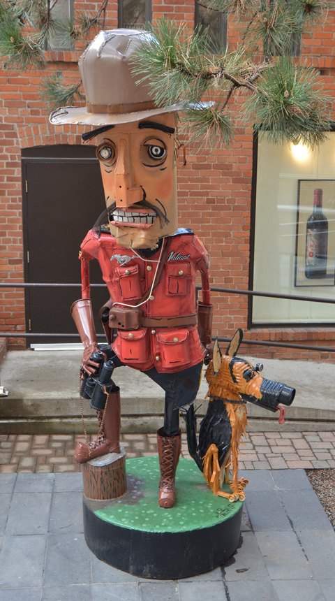
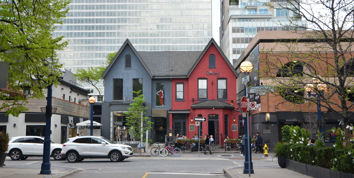
The rain let up long enough for the Dyke March to parade across Bloor and down Yonge without everyone getting wet. Lots of colour and sparkle was on display along with lots of enthusiasm and fun! This year’s theme was Resist as seen on this crocheted banner.
signs of the bygone times
Posted: May 25, 2018 in history, locationsTags: dials, factory, faded, Harbour East, Lakeshore, Lever Brothers, old, peeling, Ponds, redevelopment, rusty, signs, soap, Unilever
From Lever Brothers soap factory to Unilever to East Harbour development… In the 1890’s, Lever Brothers of Britain built a soap factory at the foot of the Don River. Lever Brothers eventually became part of Unilever, an Anglo-Dutch conglomerate. In 2002 Unilever sold the Toronto factory, but not the land, to Pensler Capital Corp of New Jersey. From the National Post: ” Mr. Pensler renamed the company “Korex.” He froze workers’ wages. They lost their Unilever pensions. In 2008, Mr. Pensler offered a contract which workers said stripped seniority and benefits. About 160 workers walked out; in August, 2009, Korex Don Valley declared bankruptcy.”
The development company, First Gulf Corp., bought the 14-hectare site from Unilever Canada back in 2012. Although there are plans to redevelop the site, nothing has happened yet.
below: The sign says “Drivers, do not exceed 10 psi when unloading T.P.P. hexahydrate.
The building is mostly empty. You can rent space inside if you have about $10,000/day to spend. The grounds are kept fairly clean but the signs of neglect and age are everywhere. There are other interesting bits and pieces left over from the site’s industrial past, but I have chosen to literally focus on the signs today.
below: No more phoning to get into the warehouse.
below: Some signs have left very few traces.
below: It’s not easy to read, but the sign in the foreground is a warning about speed bumps.
back to Bulwer Street
Posted: May 22, 2018 in graffiti and street art, locationsTags: David Suzuki, Elicser, horus, Indigo, Kevin Ledo, love letters to the Great Lakes, murals, sightone, stikman, street art, Toronto Hydro, vandel
Almost two years ago I wrote about the murals and street art on Bulwer street. Somethings have changed and some of the murals have disappeared. For instance, the area bounded by Bulwer, Soho and Queen streets is now a construction site instead of a parking lot. I walked here yesterday, a holiday Monday, and discovered that there were no parked cars blocking views of the street art. I also discovered a tour group stopping to talk about something on the street but I was too far away to hear what they were talking about (something about bricks on the buildings?)
below: An unobstructed view of the David Suzuki and Atlantic salmon mural by Kevin Ledo, painted in 2016 as part of the “Love Letters to the Great Lakes” mural project.
below: The mural, a collaboration between Elicser and Indigo, hasn’t fared as well. As you can see, the bottom portion has sadly been tagged over.
below: Part of a mural by horus.
below: A 2017 creation by sightone, breakin’ atoms, a memorial to Vandel.
below: A collection of items attached to the schoolyard fence. Metal pans and a shoe form?
below: The CN Tower, a metal staircase, and some graffiti. The back building looks very old, especially the windows.
below: Another bit of “old” is this Toronto Hydro building with its very high fence and gate. Is it still in use?
One last little bit – this stikman is still here – weathered but still standing. Once upon a time he was covered with a circuit board design but that layer has peeled away. Aging but ageless.
ravines & greenery, long weekend edition
Posted: May 21, 2018 in graffiti and street art, natureTags: blossoms, blue jay, buds, bushes, chair, cherry tree, chipmunk, crab apple, creek, fallen trees, fly, fungi, Japanese maple, leaves, monuments, Mt. Pleasant cemetery, prunus serrulata, shrubs, street art, trees, under rbidge, water, Yellow Creek
Happy Victoria Day!
Happy 2 4 long weekend.
More correctly, I hope that you had a good weekend!
This blog post is the result of a walk through Mt. Pleasant cemetery, down the ravine behind Yonge Street that goes under St. Clair East and the Summerhill railway bridge. After crossing Mt. Pleasant Road, take the right at the fork in the path to go uphill on Milkman Lane. This brings you out of the ravine close to Glen Road. Follow Glen Road south to Sherbourne subway station.
below: Lots of shades of red, green, and yellow in the cemetery.
I will dedicate this post to the man that I met on the path near the St. Clair bridge. He had many questions about the path and where it went. He was in awe that such a place existed in the city and was so excited to find it. He couldn’t linger though because he was on a break from work.
below: Blossoms on an Arnolds crab apple tree, Malus X Arnoldiana (the tree had a label, cemetery)
below: Dense clusters of fragile pink and white petals on a Japanese Flowering Cherry Prunus Serrulata.
below: The chains of humankind? Or something creepier? Please don’t put anything like this on my tombstone regardless of what they symbolism might be!
below: It was very quiet and surprisingly green on the path. I had procrastinated about walking in the ravines because I didn’t think that spring was far enough along. Surprise! Spring has sprung very quickly – the leaves have been popping out all over the place. May is a fantastic month – everything comes alive so quickly.
below: Walking on Park Drive, under Glen Road, following the Yellow Creek.
below: It looks like a throne under the bridge!
below: Yellow Creek, near St. Clair.
below: Wildlife!
below: Fungi growing out of a rotting log on the forest floor.
below: Mushrooms of a more colourful variety
below: Under St. Clair.
below: I didn’t see any real ones that day. You can spot this one close to Sherbourne subway station.
Bring on summer!
a Yorkville meander with Captain Canuck, Batman and a mountie or two
Posted: May 16, 2018 in galleries, locationsTags: Adrian Dingle, Alter Ego, Amyn Nasser, batman, bear, Brendan Meadows, Captain Canuck, Christopher Woodcock, church, city, City Obscure, clock, firehall, flag, Heliconian Hall, hoardings, ice fishing, Ipseity, Liss Gallery, Lomas Gallery, mannequins, mountie, music scene, Nelvana of the North, Nelvana of the Northern Lights, new york, park, Patrick Amiot, photographer, photography, photos, plaque, posters, sculpture, spring, Toronto Reference Library, tower, tpl, trees, urban
It’s still May and the CONTACT Photography Festival is still on so I am still trying to see as much as possible. Yesterday afternoon I went wandering in Yorkville where there is lots to see and do besides a couple of CONTACT exhibits.
below: Captain Canuck. I started with the TD Gallery at the Toronto Reference Library. It wasn’t that long ago that I was there (April I think) but the exhibit has changed. It is now ‘Alter Ego: Comics and Canadian Identity’. Isn’t Captain Canuck the most famous Canadian superhero? He first appeared in 1975.
below: Not so well known – The cover of the book ‘Nelvana of the Northern Lights’ by Adrian Dingle (1911-1974). Nelvana was Canada’s first female superhero; she first appeared in 1941, a few months before (American) Wonder Woman. Nelvana’s superpowers included turning invisible and traveling at the speed of light along a ray of the Northern Lights. According to Wikipedia, she “visited lost kingdoms under the ice, journeyed to other dimensions, and fought against the Axis Powers during World War II, eventually taking on the secret identity of secret agent Alana North. Her last adventure was published in 1947.
below: This structure was built in 1876 as a Carpenter Gothic Revival Style church – the Olivet Congregational Church. It has been the home of the Heliconian Club since 1923. This women only club was formed in 1909 and is still active today supporting women in the arts. There is a photo exhibit on there at the moment but viewing is by appointment only (it is a club not a gallery after all).
below: For CONTACT, the Lomas Gallery on Yorkville Ave is featuring a few large photos of cityscapes that are full of tall buildings. The one behind the red couch is ‘NoMad New York’ by Christopher Woodcock.
below: On the wall beside is ‘[a]DCLXI’ by Amyn Nasser.
below: It’s not a sculpture or a statue, but this red faced mannequin caught my eye. Maybe next time he’ll remember his sunscreen.
below: The clock tower of the Yorkville firehall. One side seems to missing its clock face.
below: Brendan Meadows’ black and white portraits hang on the walls of the Liss Gallery in an exhibit titled ‘Ipseity’. These were printed as silver gelatin selenium-toned lith prints by Bob Carnie from negatives made from digital images. The images were also manipulated with the Sabatier effect (solarization); this results in an image that is wholly or partially reversed in tone. Dark areas appear light or light areas appear dark.
below: Posters on hoardings add a little life at street level to the construction sites in the area. This set features businesses and sites in the area including the ROM.
below: Some colourful art deco style posters.
below: Prepared for anything! With a yellow duckie, handcuffs and binoculars, Batman and his Robin hand puppet prepare to take on the forces of evil! These are sculptures by Patrick Amiot.
below: Part of the Miraim Schiell gallery is devoted to Amiot’s work.
below: This large RCMP mountie and his dog stand behind the gallery.
below: Enjoying the wonderful spring afternoon on Cumberland.
below: Oh.. that second mountie that I alluded to in the title of this post – he was on the wall at the Alter Ego exhibit. This one. Just don’t call him Dudley Do-Right.
below: This is either ironic or sad. The first few lines of text say “In the the 1960s and 1970s, Yorkville village was the heart of Canada’s bohemian, counterculture community”. As I took this picture a new Bentley with dealer plates drove past. I looked around and the ‘counterculture’ of 40 to 50 years ago has been replaced by designer boutiques, high end stores, fine art galleries, and restaurants with linen napkins. Not a lot of music happening here. Full transcription is below.
“In the the 1960s and 1970s, Yorkville village was the heart of Canada’s bohemian, counterculture community. More than 40 clubs and coffee houses nightly featured folksingers-songwriters, including Ian & Sylvia, Gordon Lightfoot, Joni Mitchell, and Neil Young, who performed some of their first compositions in these smoky venues.
Yorkville’s first coffee house, Club 71, was opened by Werner Graeber in 1959. By 1964, Yorkville had become a nurturing environment not only for folk music, but also for pop, blues, and later, psychedelic rock. Hippies and teenagers flocked to these unlicensed venues, which offered an alternative to Yonge Street bars.
Yorkville was also home to three sound-recording studios, taping major acts such as The Guess Who, Lighthouse, and Ann Murray. With its vital role in fostering a wealth of talent, the Yorkville scene inspired a generation of songwriters and led to the rise of a new Canadian sound.”
spring, across the water
Posted: May 15, 2018 in locations, nature, old buildings, waterfrontTags: abandoned, baby geese, blossoms, boats, breakwater, cameras, catkins, Centre Island, cherry trees, ferry, flowers, geese, houses, Lake Ontario, nature, path, people, pictures, pier, red alder, reflections, sailboats, sakura, spring, Toronto Islands, trees, Ward's Island, water, willow trees
A trip to Toronto Islands on a sunny spring day.
Photos and stories – an eclectic mix of history and nature that resulted from wandering around the eastern portion of the islands.
below: From the ferry, looking toward the glass and steel of the city.
Toronto Islands is a collection of at least 12 small islands. In the early years the island archipelago was really a peninsula of sandbars and ponds; it was connected to the mainland by a narrow strip of sandy shoreline. This landform was created over centuries by the action of waves, winds and lake currents – washing away portions of the Scarborough Bluffs and depositing this material to the west in a five-mile-long hooked shape. This process of natural “landscaping” continued until the spring of 1858, when a particularly powerful hurricane created a channel four to five feet deep through the peninsula. By June of that year, the Eastern Gap was a waterway, and the Toronto Islands came into being.
below: On the ferry between the city and Centre Island.
The first buildings on the islands were the Blockhouse Bay garrison built in the 1794 by the British at Gibraltar Point – it included a blockhouse and storage structures. A second blockhouse and a guard house were built soon after, only to be destroyed by the Americans in the Battle of York in April 1813. The lighthouse at Gibraltar Point built in 1809 still stands (sorry, no photo).
In 1833 Michael O’Connor built a hotel on one the islands. He used a horse-drawn boat to ferry customers across from the mainland to his hotel. At that time, there was still access by road but it was a toll road. In 1836 it cost sixpence for every four-wheeled carriage drawn by two horses. Smaller ‘vehicles’ paid less. In 1858 the hotel (now Quinns Hotel) was destroyed during the same hurricane that turned the peninsula into an island. The hotels were destroyed but the islands remained popular. With no road access, ferries were needed and many people ran private ferry services until they were bought out or amalgamated into the Toronto Ferry Company in 1892. It was privately owned until 1926 when it was purchased by the City of Toronto for $337,500.
Many houses and businesses, (hotels, restaurants, bowling alley, laundry, theatre etc) were established over the years from Hanlon’s Point in the west to Wards Island in the east. Today, residences are only in the eastern section of Wards Island and on Algonquin Island.
The Ward’s Island community began in the 1880s as a settlement of tents. Up until then, that eastern end of the islands was mostly wetlands. The first summer colony on Ward’s in 1899 consisted of just eight tenants, each of whom had paid a fee of $10 rent for the season. The number of tents grew each year. In 1913, the city felt it necessary to organize the community into streets. The evolution from tents to cottage structures progressed in stages with the building of floors, the addition of kitchens and then porches, resulting in the creation of the homes.
In 1953 the municipal government changed their policy toward the Toronto Islands landscape and its residents. Businesses were removed and the systematic demolition and burning of homes began. More of the islands became parkland. There are 262 houses on Wards and Algonquin Islands today, down from about 630 residences on all the islands. The last of the Lakeshore houses was removed in 1968 but traces of them still remain.
below: The pier on the Lake Ontario side.
below: Sandbags along the shore. Last spring there was a lot of flooding here and the island was closed to visitors – sort of. Ferries didn’t run and the park facilities were closed. The islands are very flat and low so it doesn’t take much extra water to flood.
below: There is a small amusement park, Centreville, on Centre Island.
below: Island transport that can be rented if you don’t want to walk.
below: Boats moored QCYC (Queen City Yacht Club), one of the three yacht clubs on the islands.
below: Sakura trees in bloom. The trees were donated by the Sakura Project. The aim of this project was to strengthen Japanese Canadian relations by planting cherry trees in visible locations across Ontario. Between 2000 and 2012, 3,082 trees were planted at 58 locations. The trees on Centre Island were planted in 2011.
below: Catkins from a red alder tree. They almost look like raspberries packed tight together.
below: An early family of Canada geese.
below: The pier at the eastern end of Wards Island is bad need of repair. To the right is the entry into the Eastern Channel (or Eastern Gap).
below: Looking over to Algonquin Island. Once upon a time this island was just a sandbar.
and back to the mainland.
paddling the Bentway
Posted: May 11, 2018 in construction, galleries, locationsTags: art, canoes, Carlo Cesta, construction, CONTACT, Dana Claxton, development, Embassy of Imagination, Forest of Canoes, fort york, Fountaingrove, images, Janice Qimirpik, Moe Kelly, Nestor Kruger, Ordnance Street, PA system, park, pictures, public space, railway, sculpture, snowmobile, Strachan Ave., tracks
… and vicinity
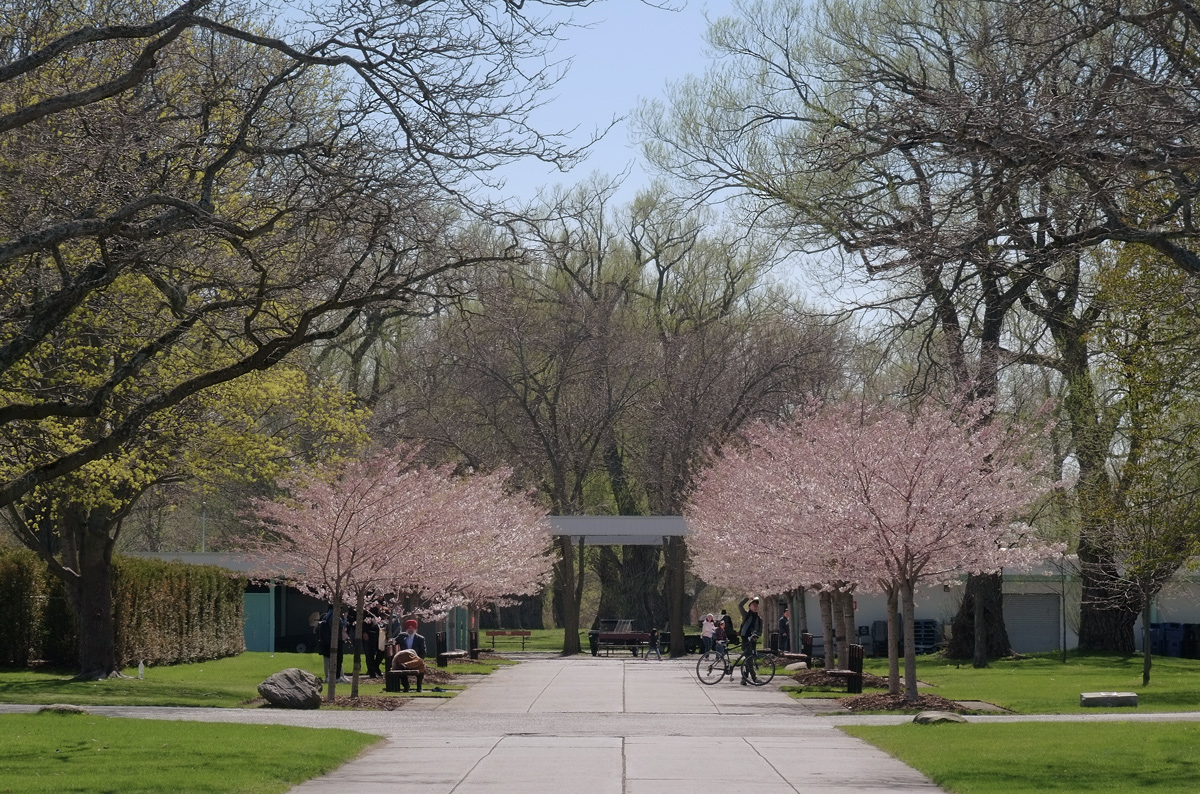
The Bentway is a new park being built under the Gardiner Expressway between Bathurst and Strachan. I walked it almost two years ago when the park was only in the planning stages. I thought that I’d take a look at it again the other day. Originally, it was supposed to be ready last summer so it’s a bit behind schedule. Surprised?
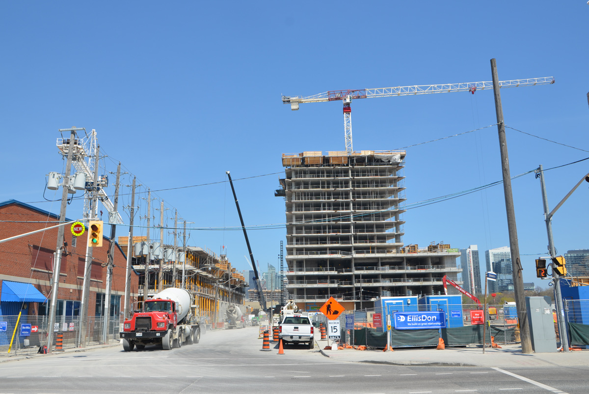
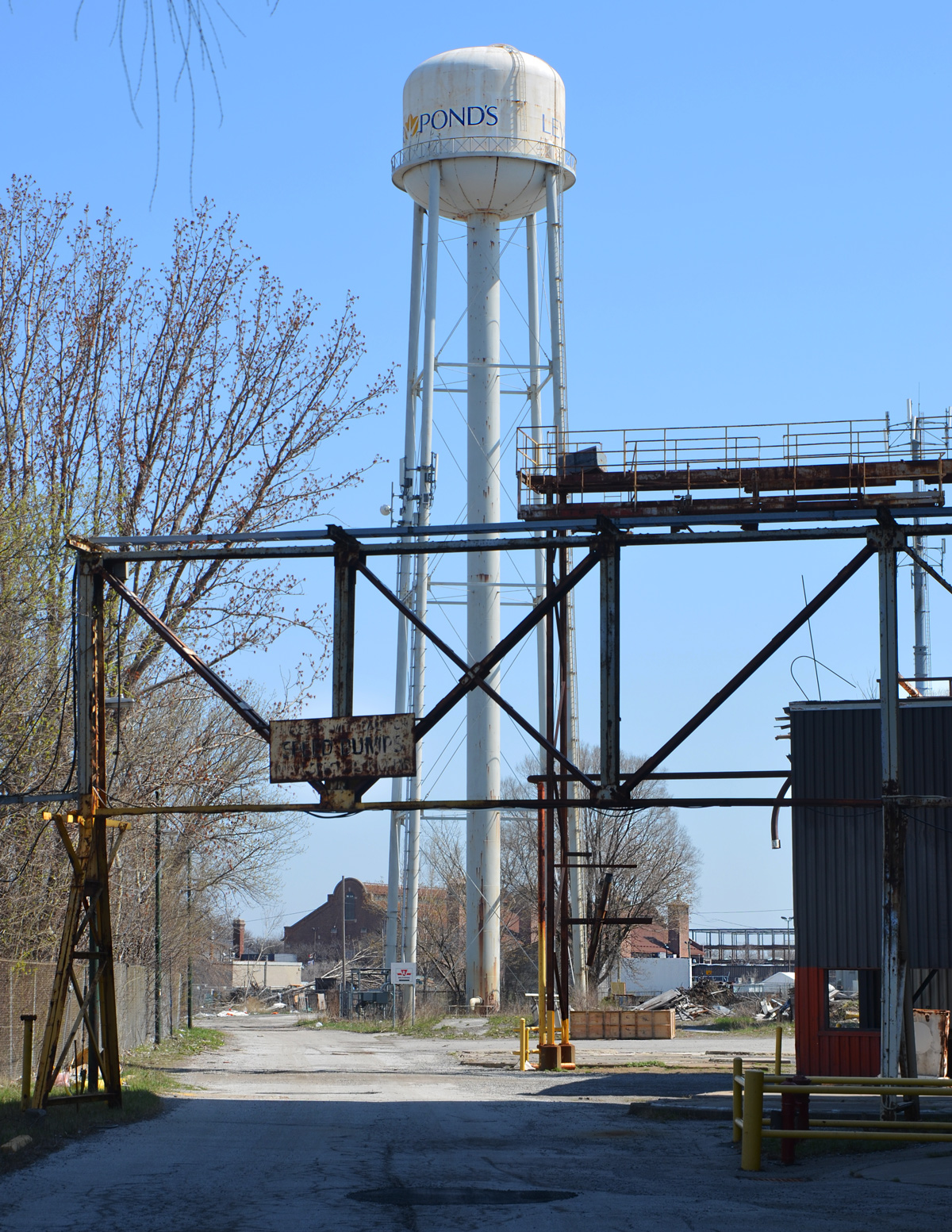
Walking south on Strachan from King, and whoa, there are changes happening here too. Cranes everywhere. Holes in the ground. How many people are employed in the construction industry in Toronto? in the GTA?
below: Looking eastward from Strachan Avenue, immediately south of King Street.
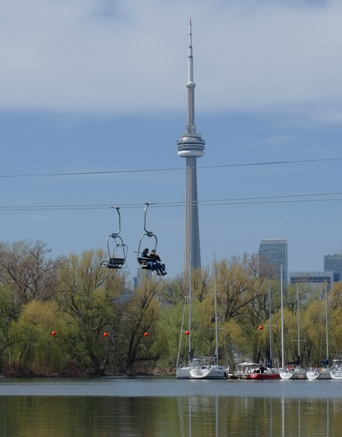
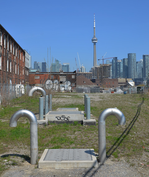
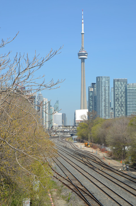
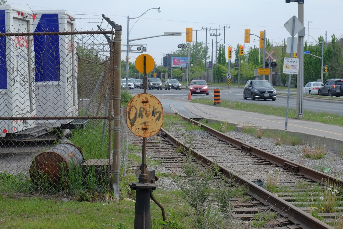
below: The view from a few metres farther south on Strachan. The metal grid covers the railway tracks and supports the retaining walls on either side. It also makes an interesting pattern. These tracks turn northward – they are used by the UP Express to the airport and GO trains to places like Georgetown and Barrie. There’s the CN Tower again – just in case you’re a CN Tower junkie like me. I can’t resist taking pictures of it, especially when I find new angles, new foregrounds.
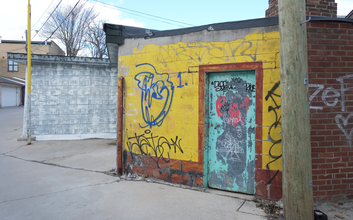
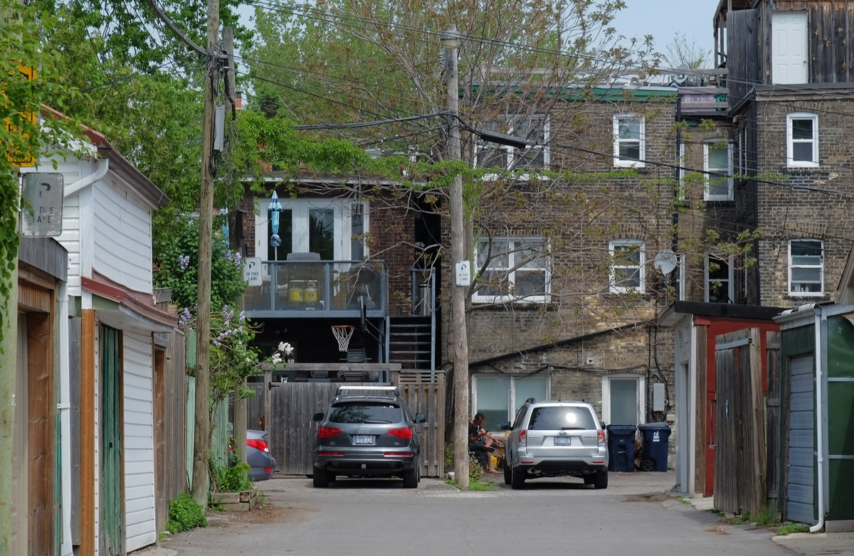
below: Immediately south of the train tracks is Ordnance Street. Until recently it was a sleepy little dead end street of light industrials.
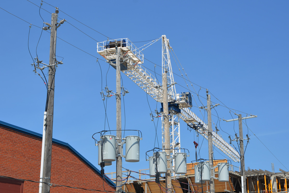
below: Ouch! Look at all those transformers on the poles.
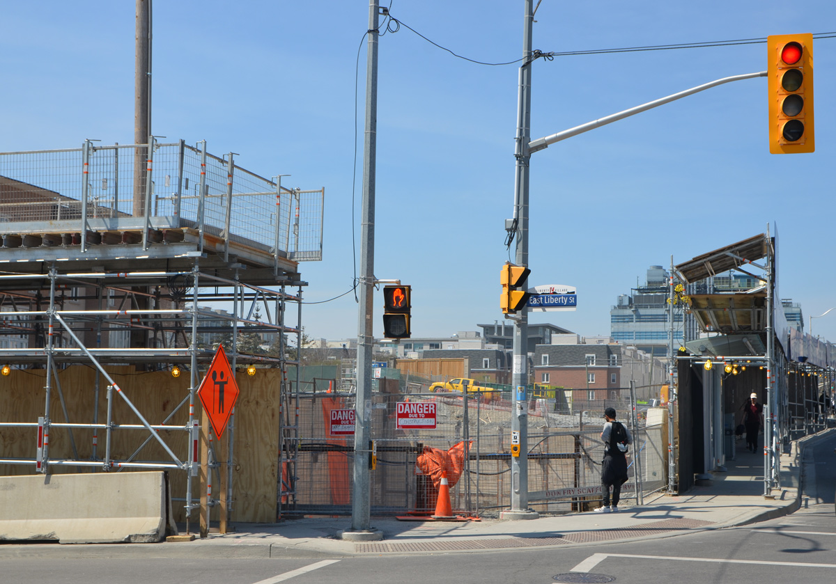
below: The east end of Ordnance Street is at Strachan. It doesn’t actually end there, but continues on the west side as East Liberty Street. This is the eastern edge of Liberty Village.
Sorry, we haven’t got to the Bentway yet. If you are a Torontonian you should now have your bearings and know at least approximately where you are. Not far to go now. It’s a beautiful day and we’re walking slow!
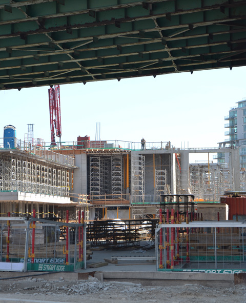
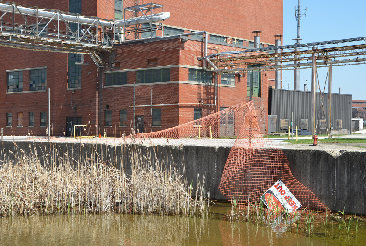
The Ordnance Street development is on a triangle of land with one side as Strachan Avenue and the other two sides as railway lines.
below: You’ll have to take my word for it that the construction on Ordnance Street is just behind the bushes on the left. These are the tracks that run to the west and the bridge over the tracks is at Bathurst Street. By this time, the two sets of tracks have come together as they approach Union Station.
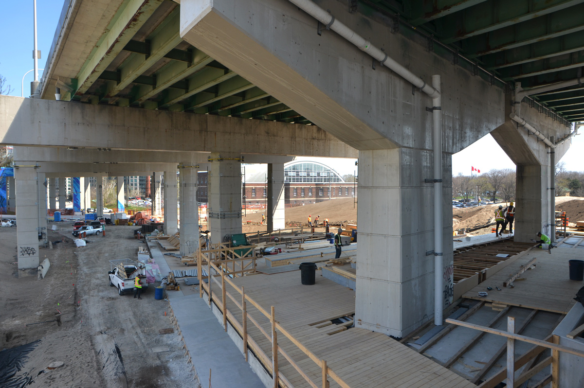
below: One of the first views of the Bentway. More construction. I was standing on Strachan when I took this picture. This is the beginnings of a new entrance to the Bentway – a large staircase down the hill from the street. The steps are wide to allow for multiple uses – a place to gather, a place for entertainment.
below: This end of the Bentway parallels Garrison Common. The Ordnance Street development can still be seen but there is also another structure being built on Garrison Common side of the railway tracks.
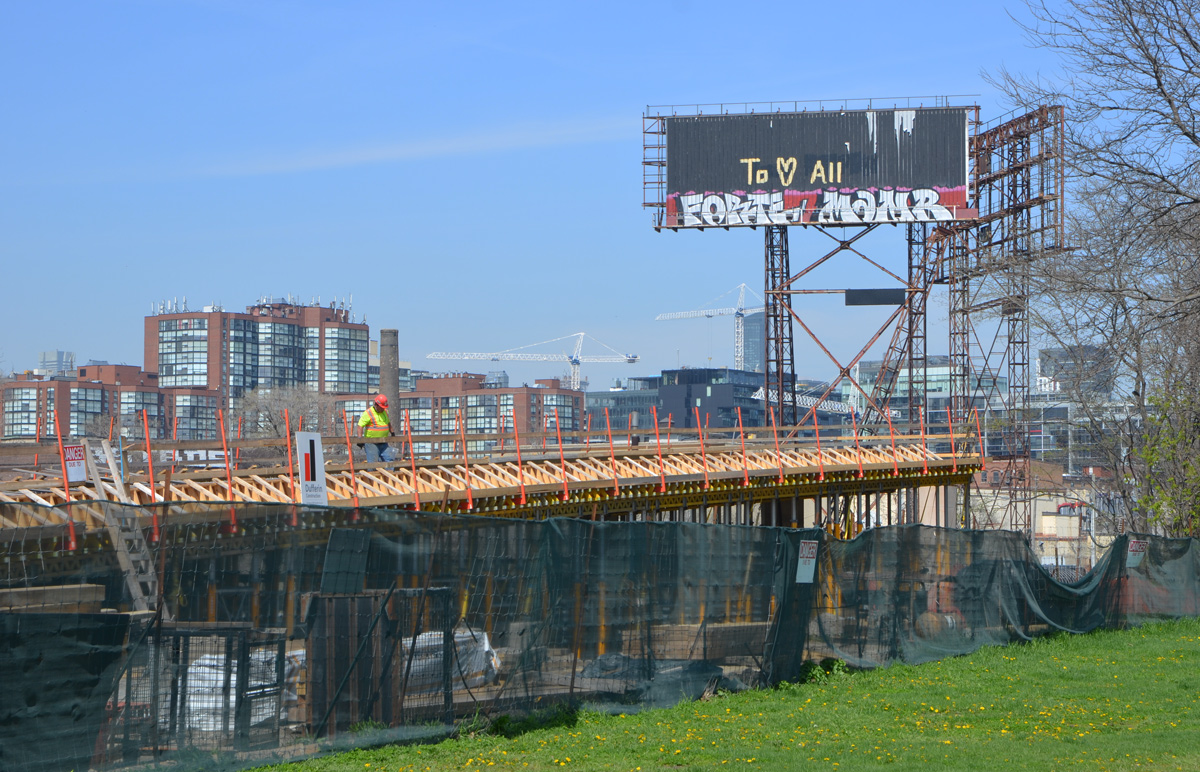
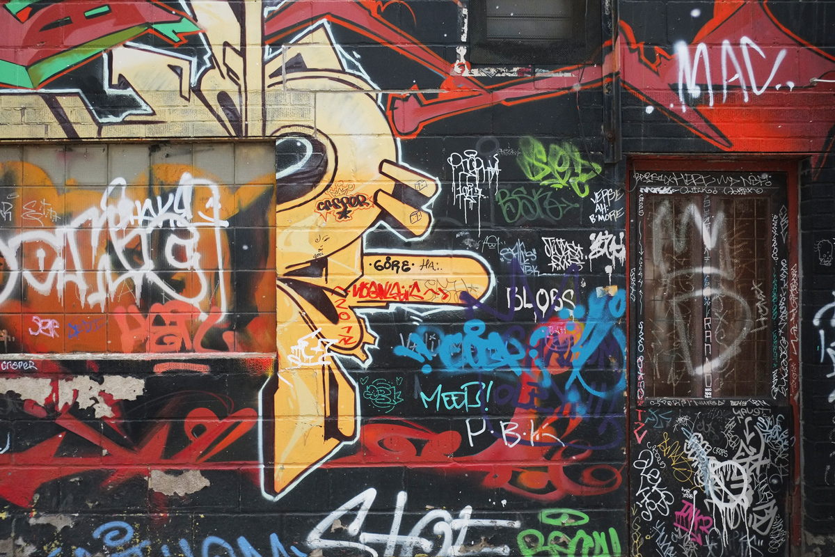
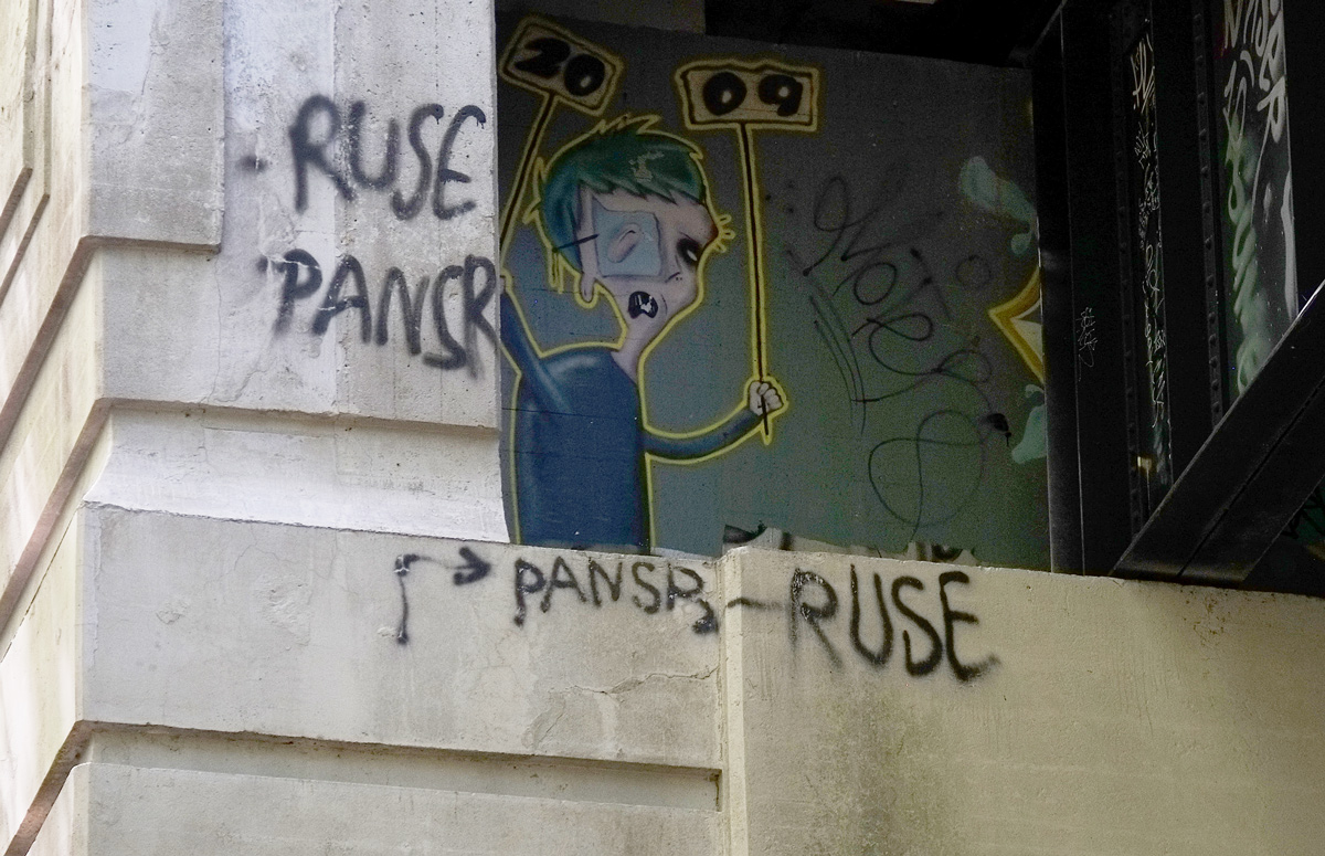
below: A closer look. It appears to be a ramp to a pedestrian/cycle bridge that will cross the tracks and join Ordnance Street to the Bentway, Fort York, and the streets/paths to the south. I also really like the billboards – one with graffiti and the other is empty.
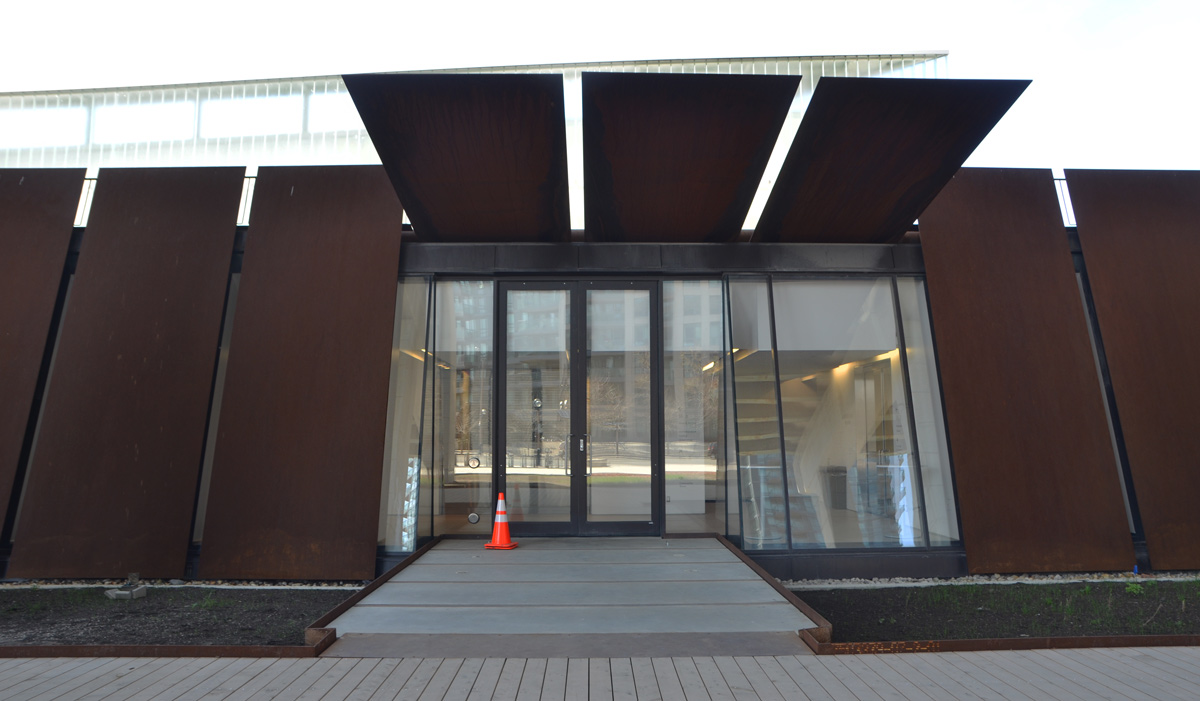
below: The new rusty entrance to the Fort York Visitors Center
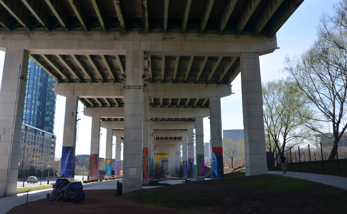
below: Just beyond the visitor’s center, the Bentway is closer to completion. There was a skating rink here this past winter.
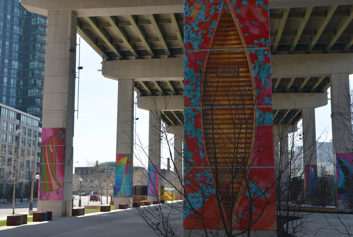
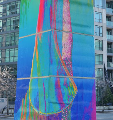
below: Also here is an installation by Dana Claxton called ‘Forest of Canoes’. Colourful images of canoes on the concrete pillars. Light-wise, they are probably best seen in the morning but that’s not when I was there.
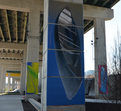
The Bentway follows the shoreline of Lake Ontario that existed before landfill was used to create a space for the railway lines. Canoes were once an essential means of transport. Now their images sit on concrete pillars that hold up the Gardiner Expressway where thousands of cars pass by every day.
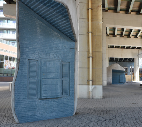
below: In the bottom left corner of this picture is what looks like a bluish blob. My apologies to the artist for calling it a blob but I’ll blame it on the lack of light and therefore, the lack of detail, in the photo. This is another art piece. It is ‘Future Snowmachine in Kinngait (Colossus)’ by Janice Qimirpik, Moe Kelly, Embassy of Imagination, and PA System. Embassy of Imagination is a collaboration between PA System (Patrick Thompson and Alexa Hatanaka) and youth in the Cape Dorset community of Kinngait. This sculpture started with small playdough models of snowmobiles made by Qimirpik and Kelly. They were then scaled into a larger than life sculpture.
The next part of the Bentway is under construction and there is still no pedestrian crossing across Fort York Blvd and is passes diagonally under the Gardiner. There is (was?) one in the plan.
below: This sculpture is on the corner of Fort York Blvd and Grand Magazine Street. It is ‘Fountaingrove’ by Carlo Cesta and Nestor Kruger, 2014. It sits above the Garrison Creek Culvert that carries the now buried creek to the lake. Like the name states, it represents water in fountains. Of course there is a white crane hiding behind it.
below: Just west of Bathurst Street
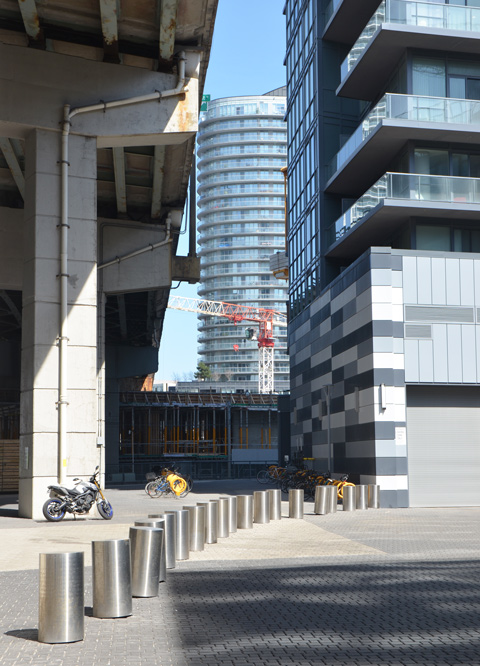
below: Getting cosy. Condos rise up right beside the Gardiner Expressway. If you’ve driven across the Gardiner, you’ll know just how close some of the buildings are to the traffic. How useful is a balcony if it’s metres away from a highway and from all those cars and trucks? They keep being built and people keep buying them.
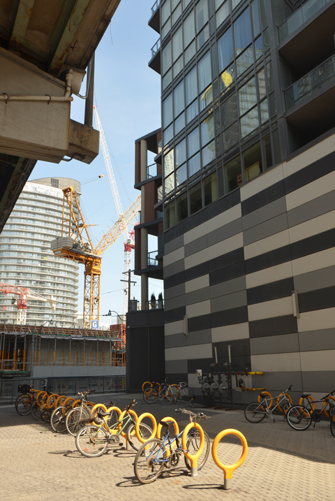
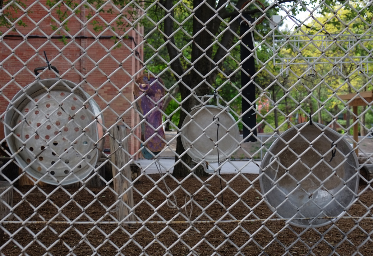
below: I couldn’t resist all the yellow and orange bits and pieces!
below: On the east side of Bathurst is the construction of a new Loblaws. It never ends does it?
This blog may have been a bit heavier on construction photos than you were expecting, especially since the title was about canoes. There was just so much work going on in that area that it was hard to avoid. The next time that I walk this area it will probably be totally different… unfortunately new buildings are a lot duller to look at than construction sites so there may not be many photos!


![on a gallery wall, Lomas Gallery, a large photo, [a]DCLXI by Amyn Nasser of a wall of glass skyscrapers with lots of windows, on the wall beside is another photo in which Nasser's photo is reflected.](https://mcfcrandall.blog/wp-content/uploads/2018/05/blog_photo_reflected_another_photo.jpg?w=614&h=437)


