Two pieces of street art side by side in a laneway. Eyes looking outward, watching you as you pass by.

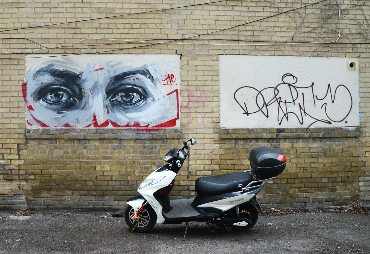
Two pieces of street art side by side in a laneway. Eyes looking outward, watching you as you pass by.
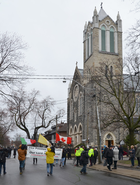
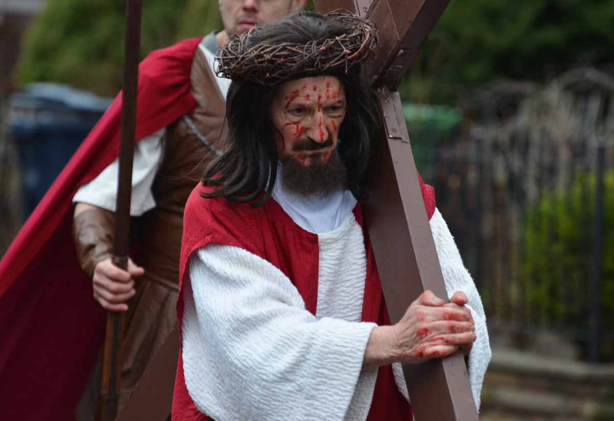
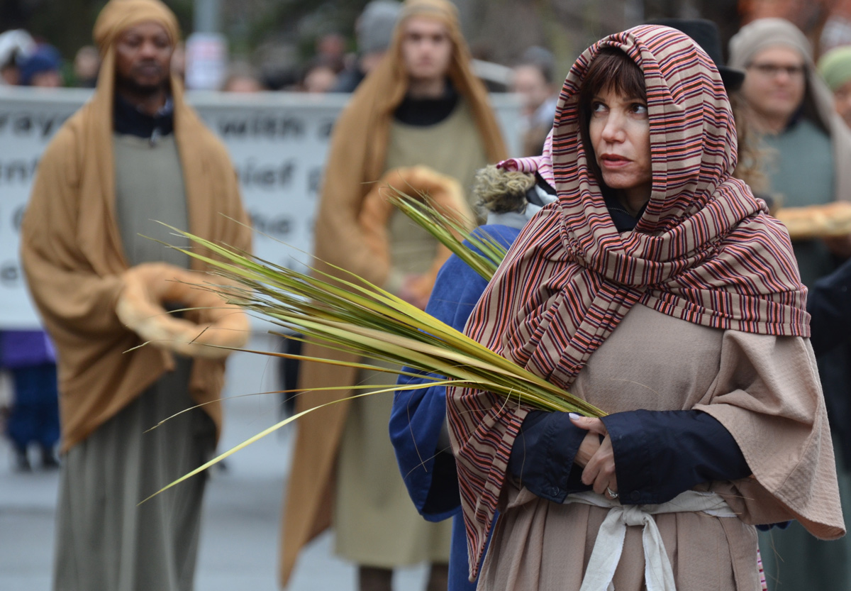
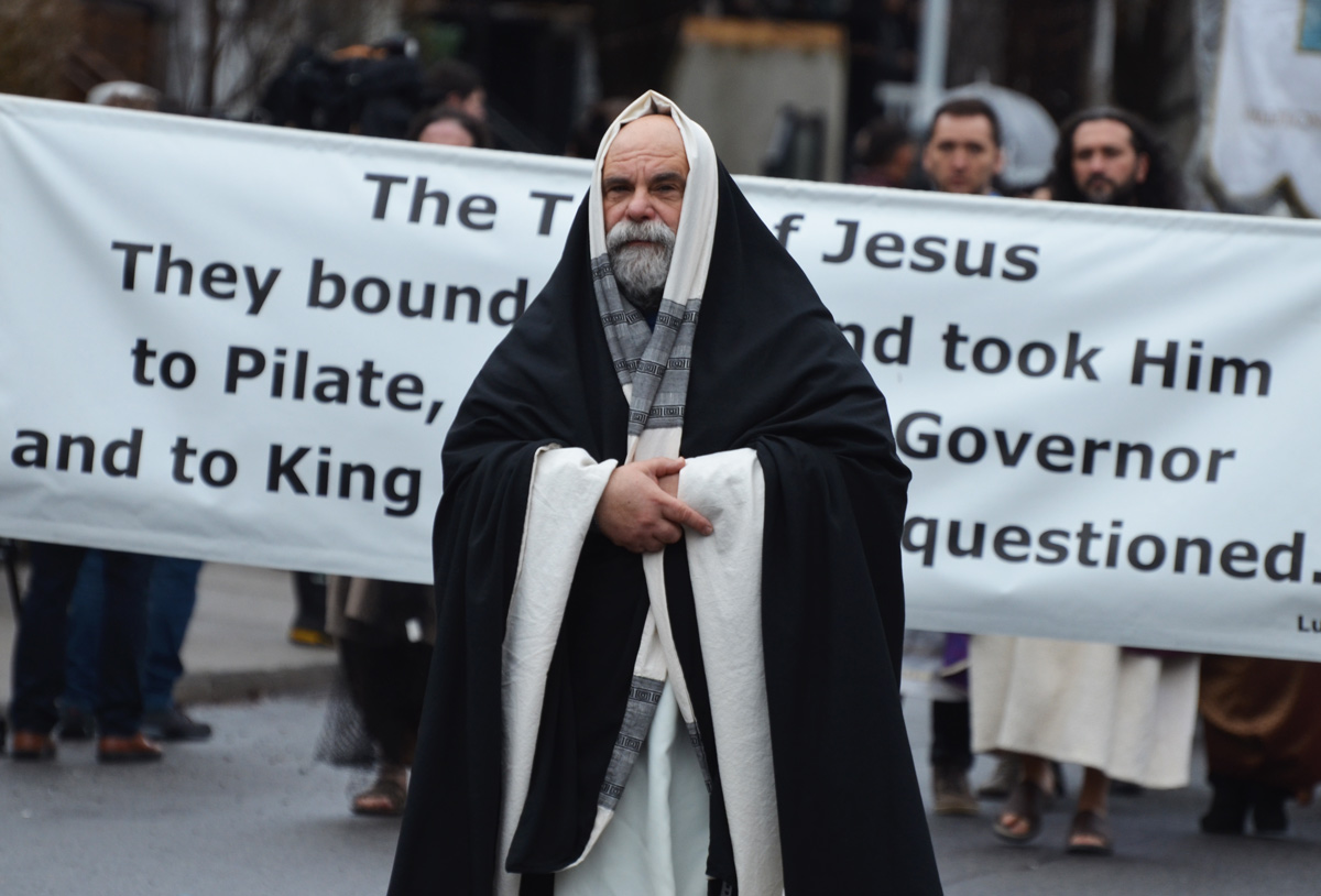
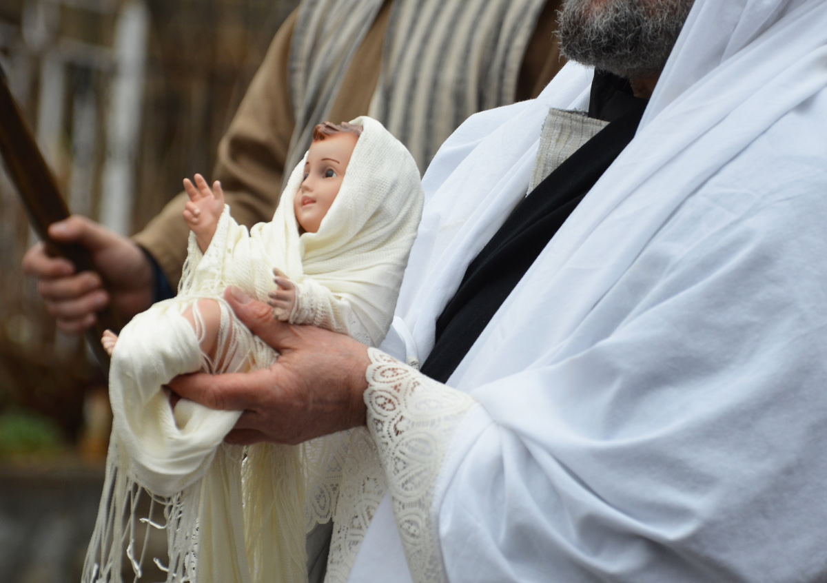
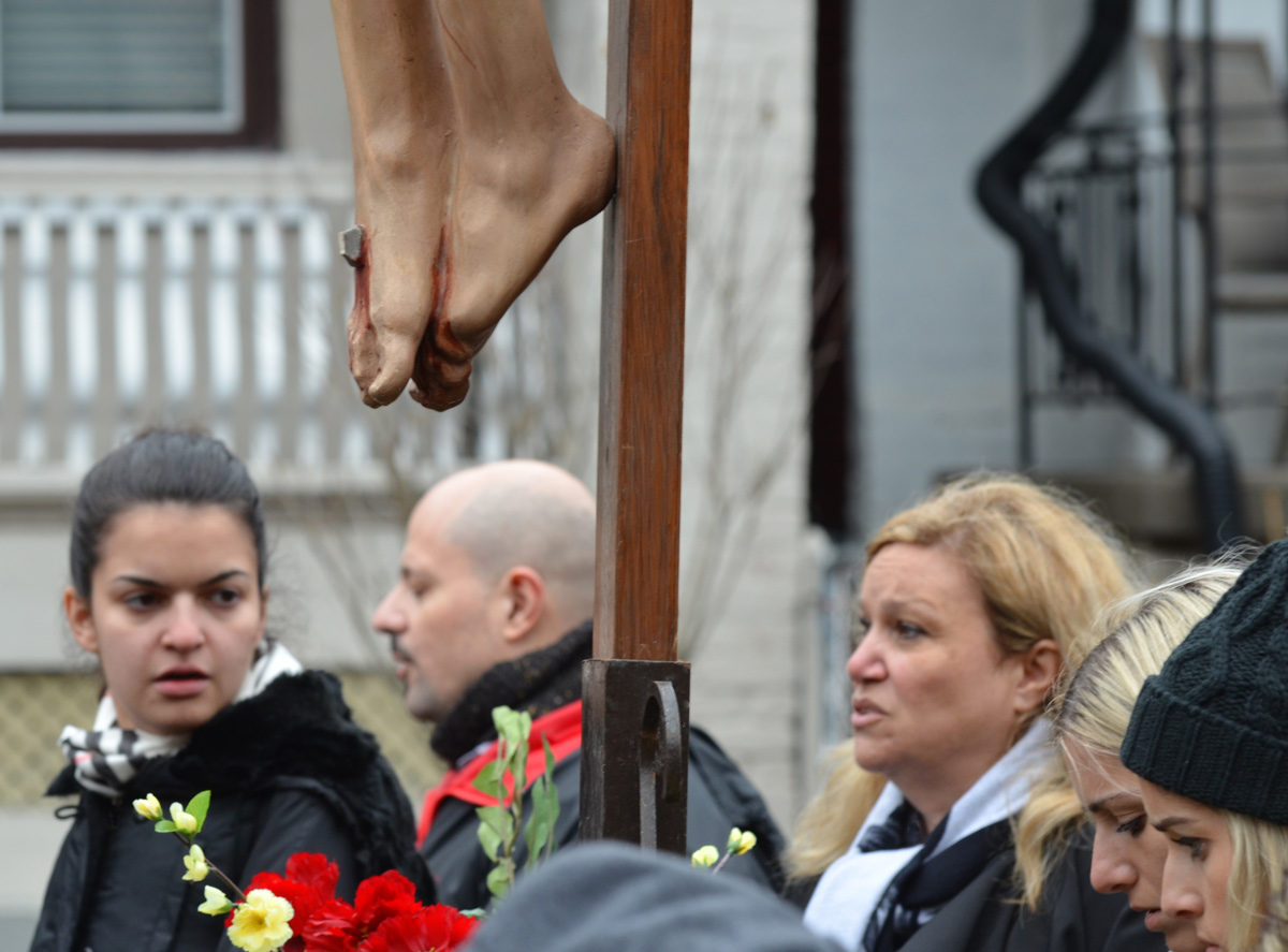
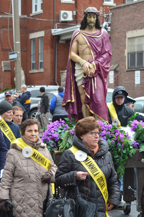
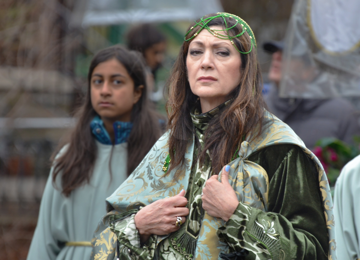
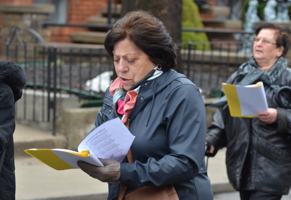
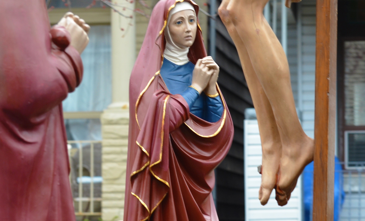
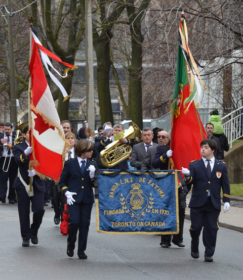
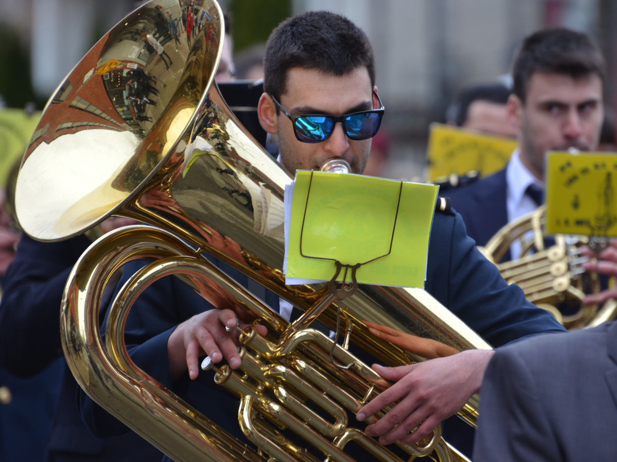
‘The Passion of Christ’ procession starting from St. Francis Assisi Roman Catholic Church at Mansfield Avenue and Grace Street in Little Italy. This tells the story of the events leading up to the Crucifixion of Christ on Good Friday.


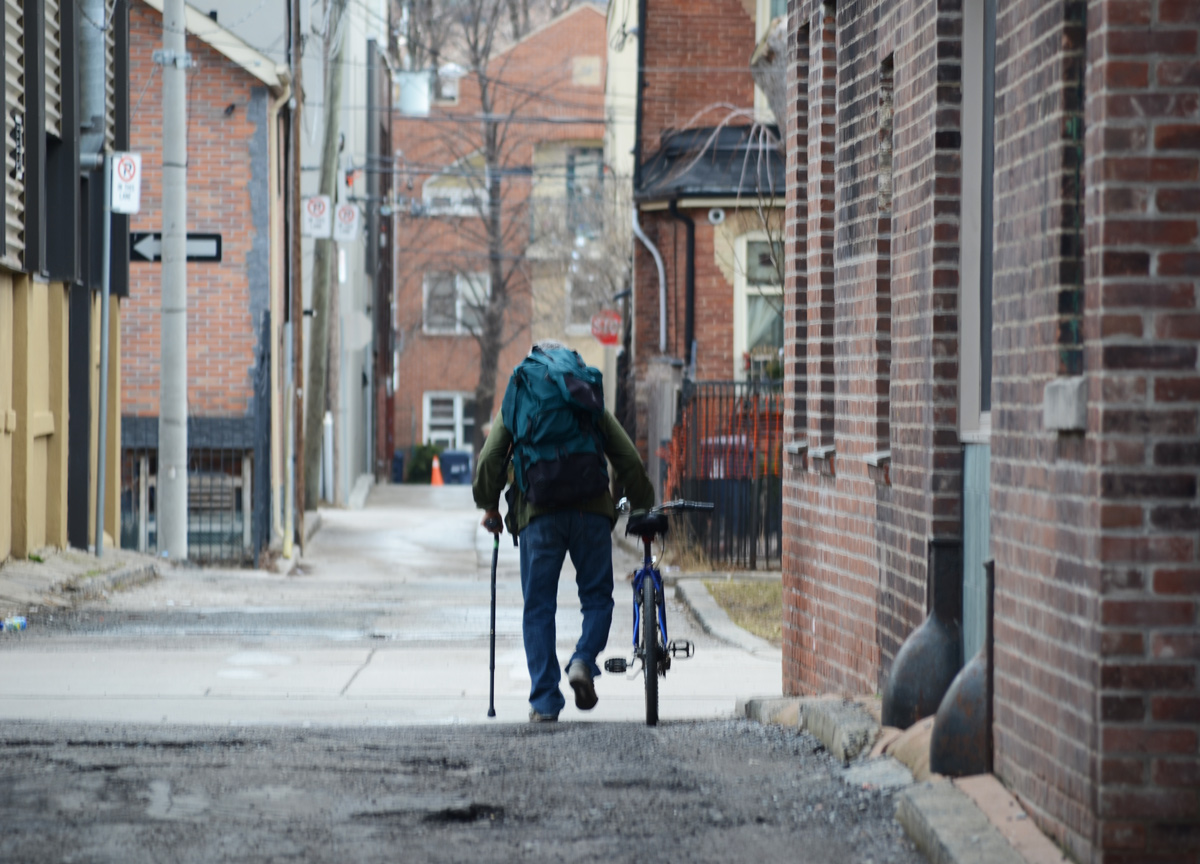
This blog post is a result of a walk from last week, from Dundas and Jarvis to Jones and Gerrard – from downtown into Leslieville/Riverdale on a beautiful day for a walk. As usual, I strayed onto a few alleys along the way. The pictures below may or may not be in sequential order but it doesn’t matter, does it?
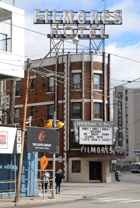
below: Although many of the buildings around it have been demolished, Filmores Hotel remains. I’m not sure if that’s a comment on the ownership of the building, or its use.
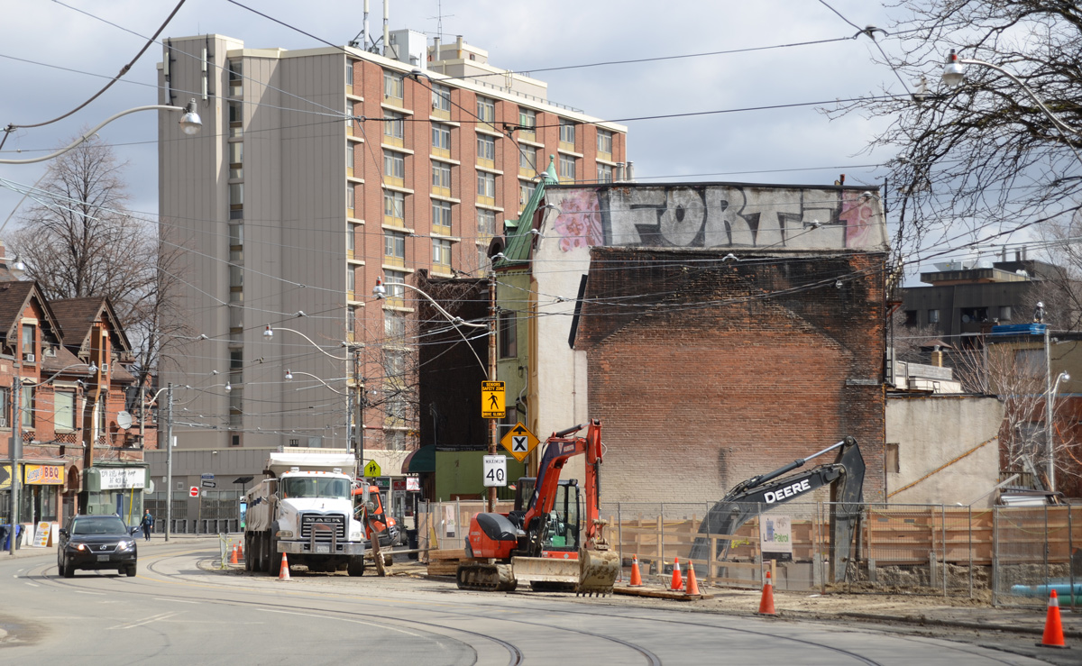
Once upon a time, e.g. in 1916, Dundas Street only existed westward from Ossington. There was no Dundas Street downtown or in the eastern part of the city. After WW1, a collection of smaller streets were widened and joined together to form Dundas Street as far as Broadview. That is why there are these curves in the street between George and Sherbourne.
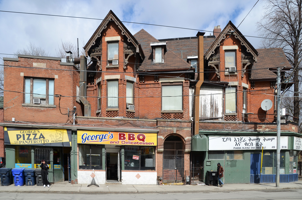
below: Maybe it was once someone’s large house? Now it’s looking a little run down but it’s still home to George’s Pizza and George’s BBQ. The one on the corner is Piassa Injera and Takeout which is Ethiopian.
below: Looking back towards downtown and the wall of glass and steel that has been erected.

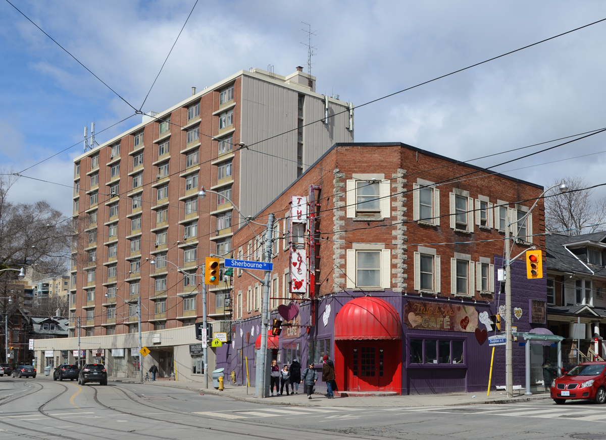
below: The True Love Cafe at the corner of Sherbourne and Dundas. It’s had a fresh coat of paint and the hearts on the exterior wall have been fixed up. Only the sign needs a little TLC.
below: The redevelopment of Regent Park continues.

below: New buildings in Regent Park.
![]()
below: I stopped for a drink at Daniels Spectrum where I came across an interesting exhibit…. A sample of some of the photographs on display at Daniels Spectrum. They are part of a project, #ShootForPeace, by Yasin Osman. Each features youth from Regent Park with the theme of the exhibit being family and how family can be defined.

below: One of the stained glass windows from St. Bartholomews church, in memory of Sister Theresa, 1891-1988. I’ve walked past this church many times but this was the first time that I went inside. It is a small, quiet church with some nice stained glass.

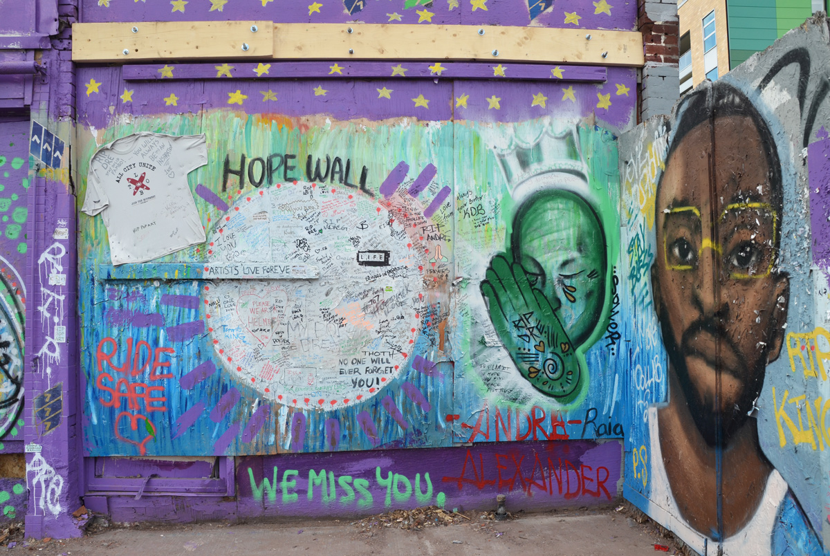
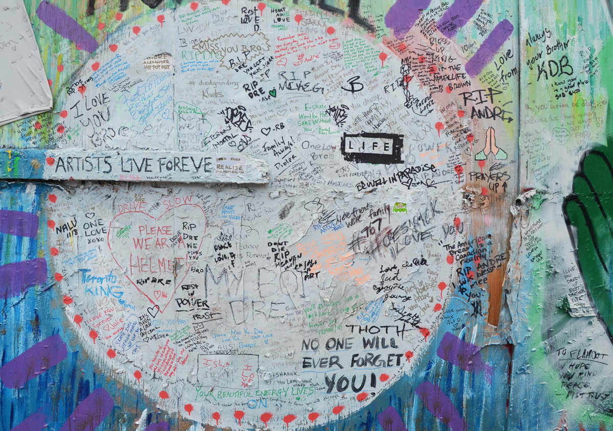
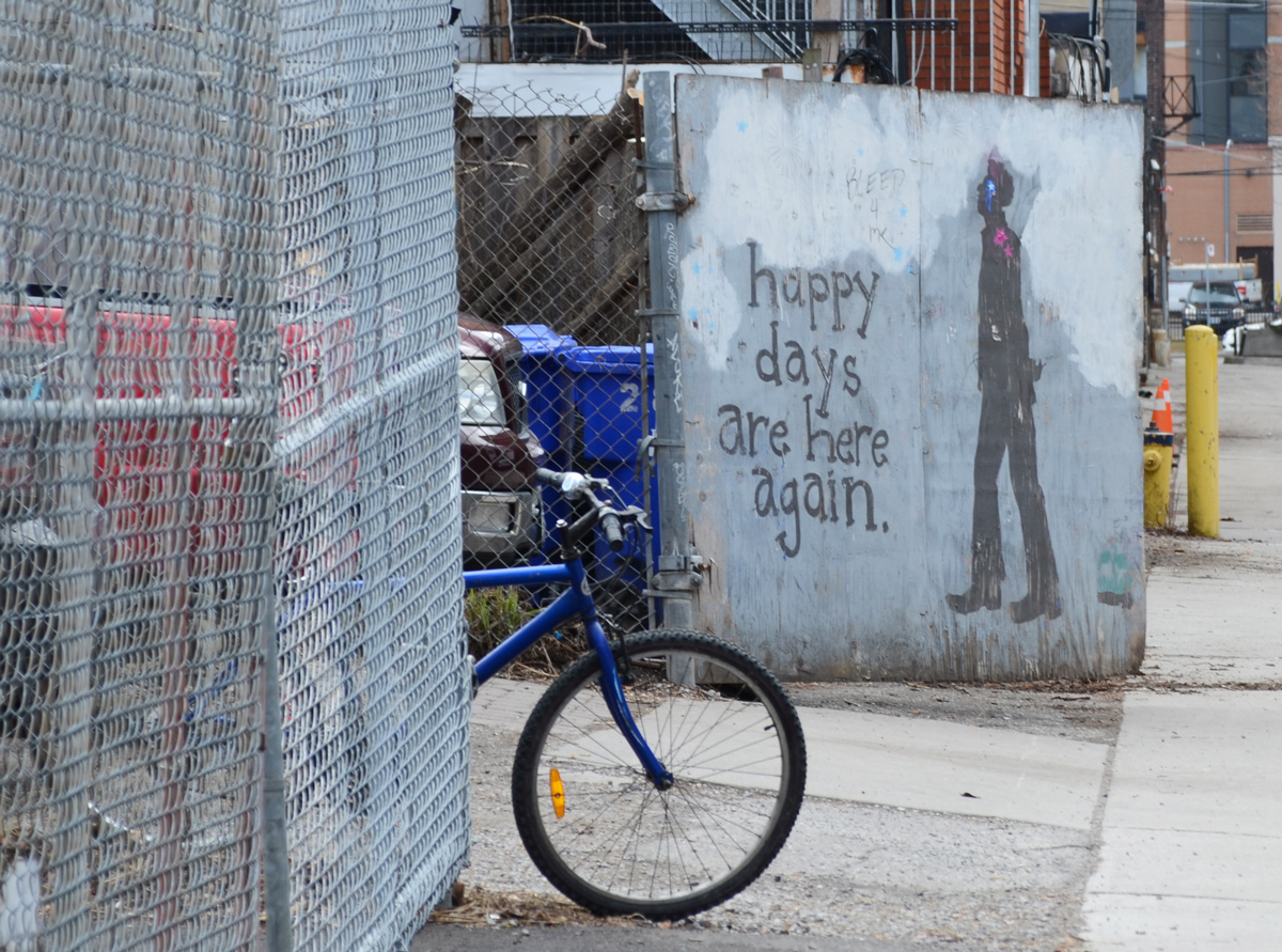
below: Graffiti on a wall.

below: Walking her dog on the Don River trail.

below: Looking north towards the Gerrard Street bridge.

below: Looking south along the Bayview Extension to the new development in the East Don Lands.
below: Just east of the DVP a truck was offloading new cars including this black Rolls Royce.

below: Same car, looking east towards Dons Milk store

below: Waiting for summer
In the early 1950s, the City of Toronto began a new road project to extend Dundas eastwards from Broadview to Kingston Road to serve as a new four-lane traffic arterial, intended as an alternative to Gerrard and Queen. Nine streets were widened to form the new Dundas street and in some cases, alleyways were used to connect these streets, and this is clearly visible as garages and backyards continue to front on to Dundas near Jones Avenue.


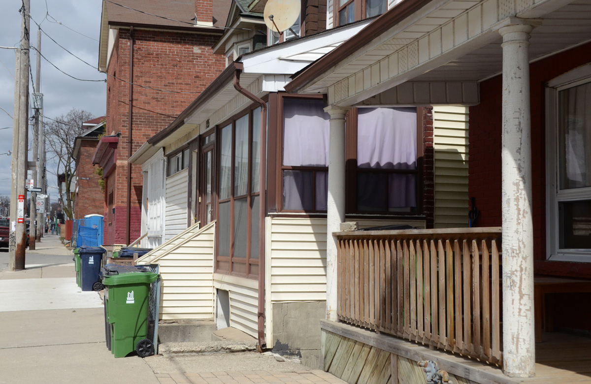
Dundas Street is a major thoroughfare in the city – there aren’t many family homes that front onto it. Jones, other hand, is a residential street. The houses are an eclectic mix, most of which are fairly modest – or less.
below: Flat roofs on small, narrow rowhouses with tiny front yards.

below: Half white and half yellow.

below: Once upon a time, Toronto street signs were these blue and white metal signs that were attached to the buildings on the corners. They are hard to read from the street! Beginning in the 1950’s they were replaced with the signs that we are more accustomed to seeing. There are still quite a few of these old ones spread out around the city in older neighbourhoods. It is rare to find a house with two signs.

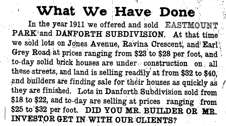
below: An ad for W.N. McEachern & Sons Ltd. that appeared in the Toronto Star on 26 April 1912 (online source). They developed a few areas in the east part of Toronto including Eastmount Park which was between Danforth and Gerrard on the east side of Jones.

below: Near the corner of Jones and Gerrard, surprise, surprise, a hole in the ground.

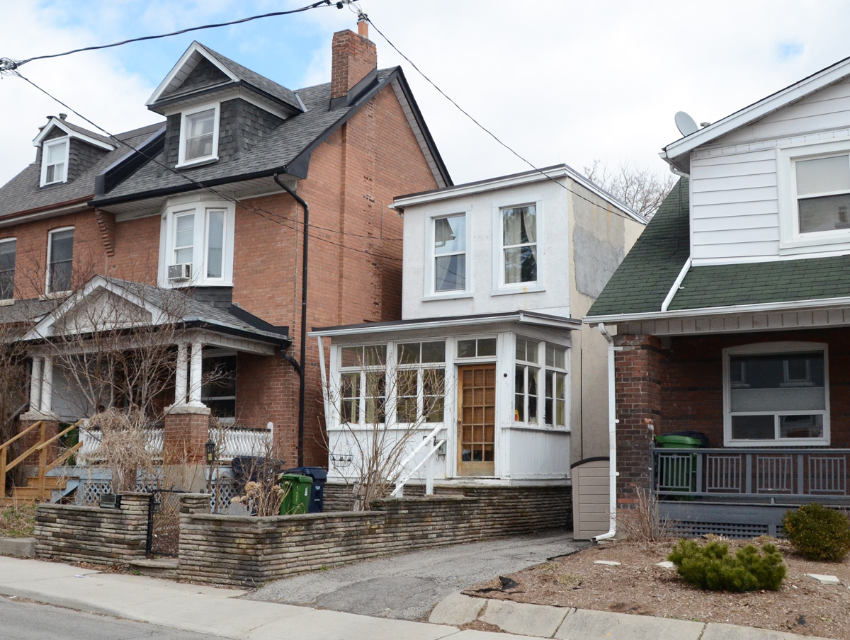
below: Before I end this post, one last cute little white house tucked in between two larger brick residences.
Safe walking everyone!
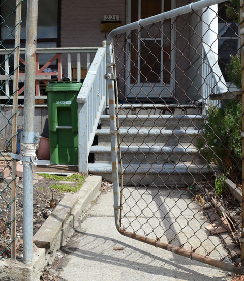
below: Sometimes I love fences!


Once again, it seems that no matter where in the city you go there will be construction. There will be the demolition of single family homes to make way for condos or at the minimum, blocks of rowhouses. The area around Yonge and Finch is no exception.

I am not sure if it serves any purpose, perhaps it’s futile, but I’d like to think that documenting what we are removing is worthwhile. The houses on Finch Avenue East like the one in this picture are small, but the lots on which they sit are large.

That means that a developer can demolish four houses and turn around and build 17 townhouses in the same space. That is what is happening near Finch and Willowdale.

Although the properties were not fenced off, all access to the houses themselves was blocked, sigh. It looked like a local garden centre was using the backyards of a couple of the houses.

below: View to a new development on the other side of Finch Avenue. This is the type of development that the area is now zoned for. A lot of these townhouses have been built in the last few years and I suspect that eventually they will replace all of the single family homes.


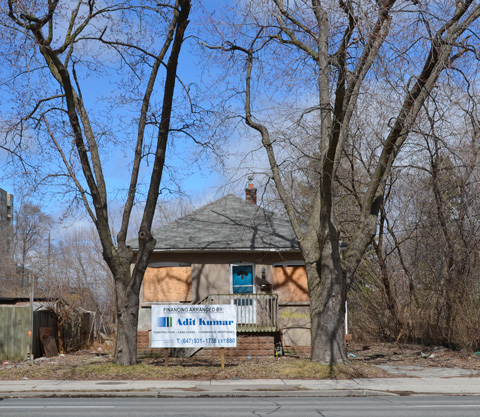
Between Willowdale Avenue and Yonge Street, there were a couple of other houses that are boarded up and empty. I am not sure what the plan is for them (there was no development proposal sign posted, instead there was a sign advertising the company that is providing the financing – for what?).

The internet can be a wonderful thing. In case you are interested, the development is the Ava Luxury Residence and it calls for heights and densities that are vastly over what is zoned for in the area. For example, at 9 storeys it is 37 metres tall in an area zoned for 11 metres. The plan was first filed in 2016 but because of the size of the development, it requires a zoning by-law amendment, official plan amendment, and site plan approval to effect the proposal – all which take time. An OMB appeal pre-hearing was scheduled to occur a few days ago, with a hearing slated for June. MM170085 is the OMB case number if you want to dive down that rabbit hole.
This is 50 Finch East. As you can see, there is a taller building on the other side of Kenneth Avenue. Kenneth was to be the dividing line – keeping the higher buildings, and denser development, closer to Yonge Street. I’m not sure what side of the development battle you’re on, but what’s the point of having a plan if the developers (with help from the OMB) keep disregarding it?

As I walked back to my car, I chose to walk on a side street instead of on Finch. As I turned a corner, I happened upon a house being demolished. Fortuitous. Serendipity.

It doesn’t take long to reduce a house to rubble and dust. “Another one bites the dust” springs to mind.

And so it goes.
As winter passes into spring
A walk around Edwards Gardens in early spring
below: A red cardinal in a tree

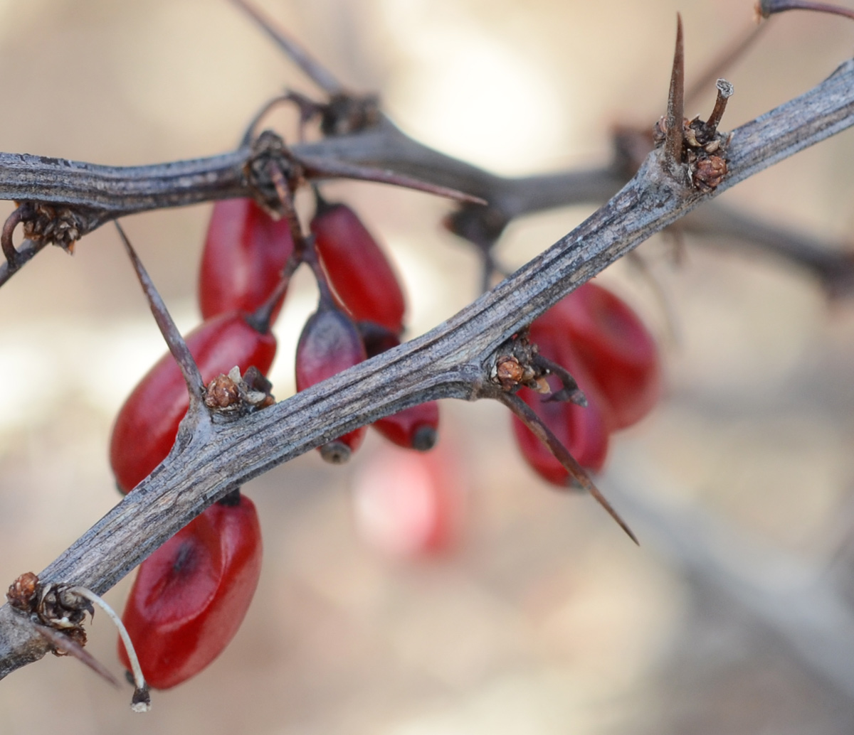
below: Red berries that have wintered on their thorny branches.
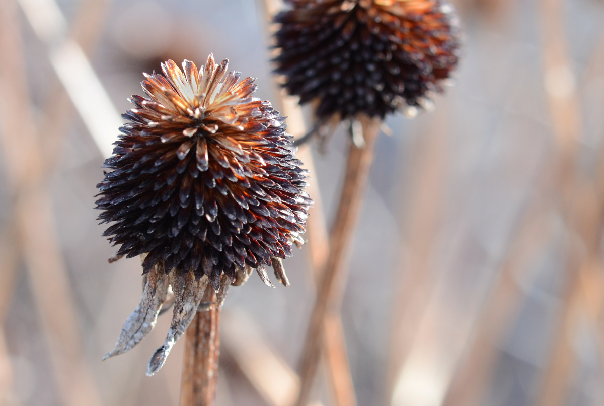
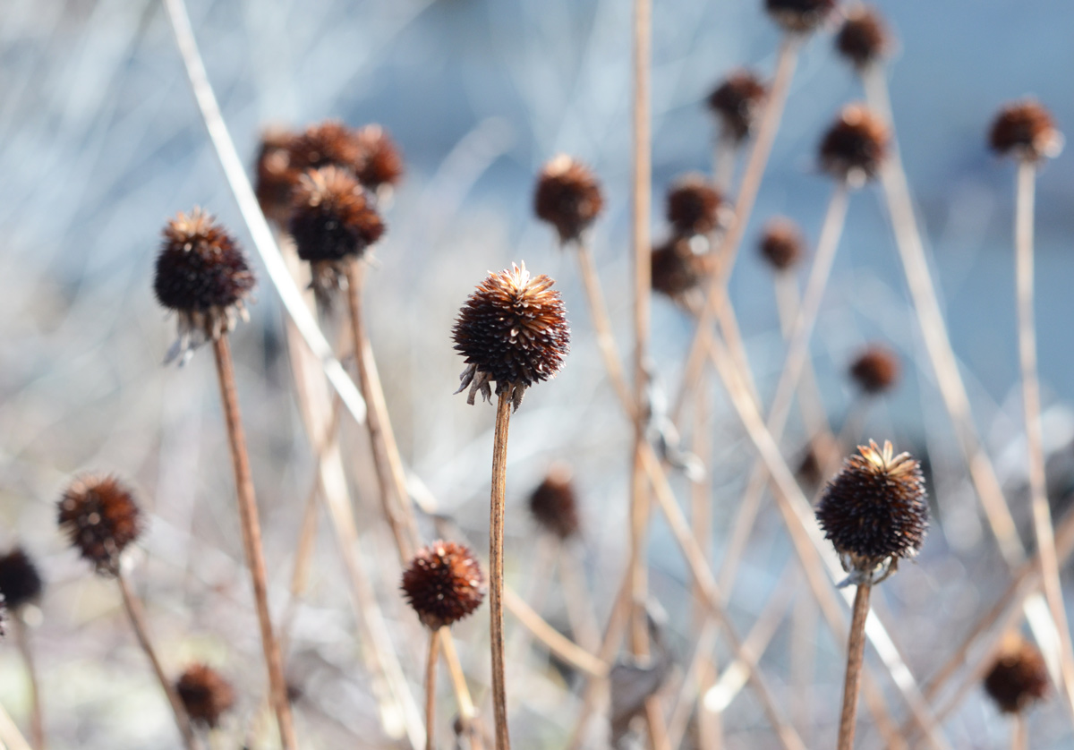
below: The remains of coneflowers on their sturdy stems.
below: Pussy willows just emerging

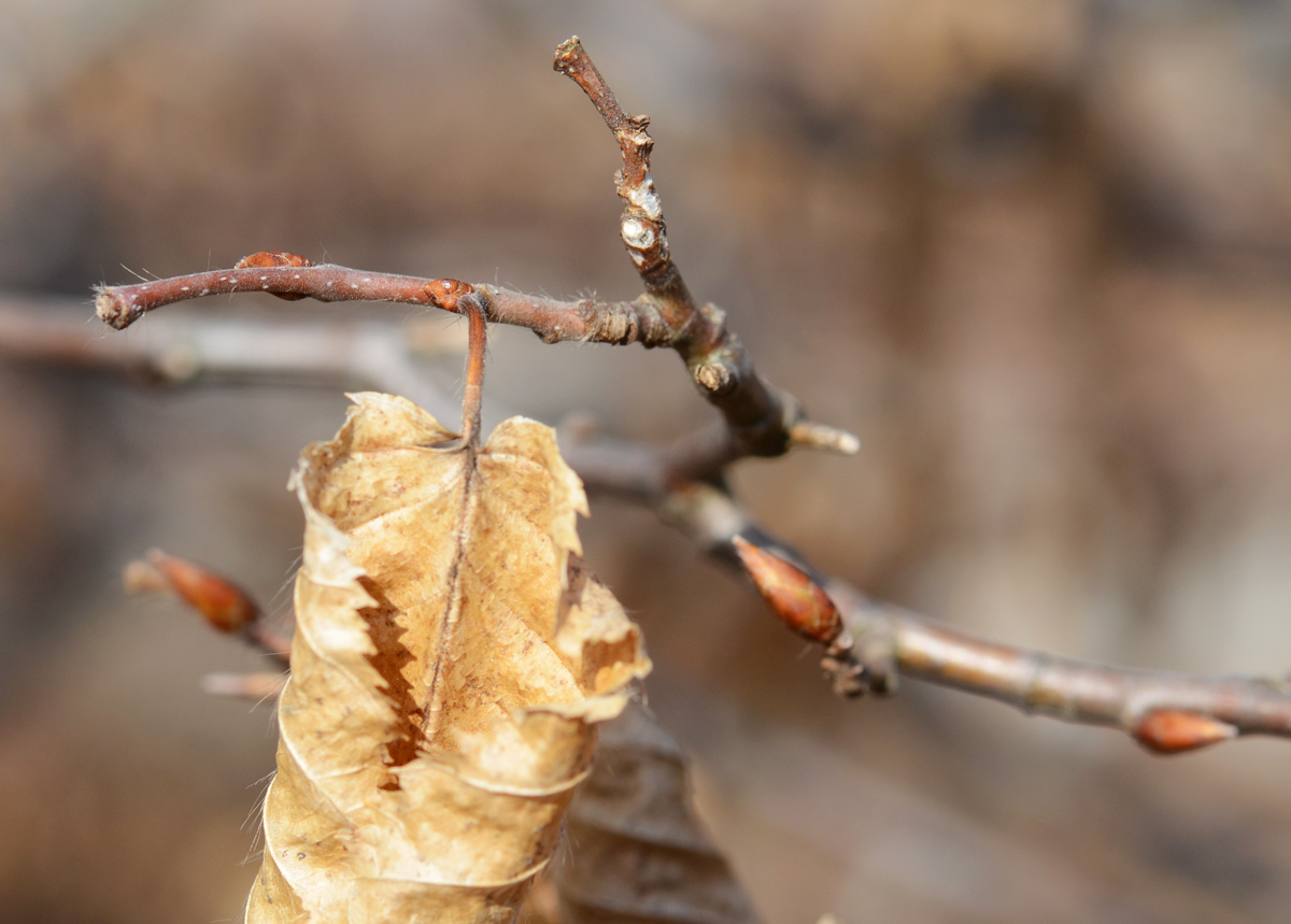
below: On a small twig, both an old leaf and new buds.
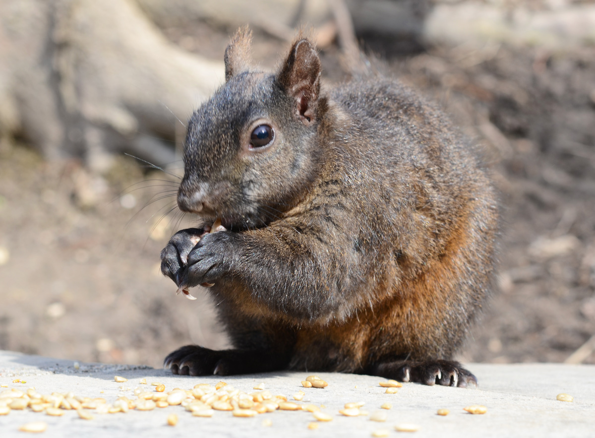
below: A squirrel enjoying the seeds that someone has left for it. w
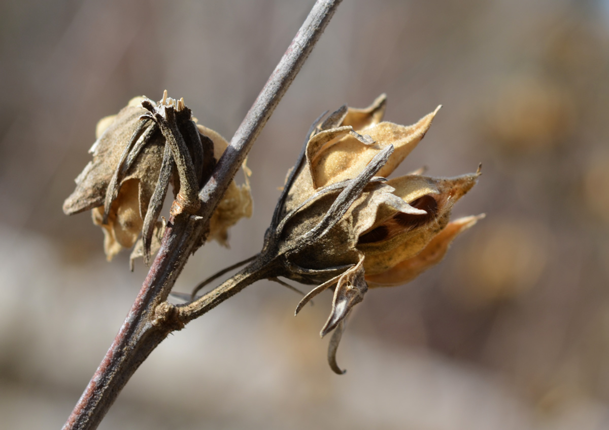
below: Dead and dried, seed pods that opened long ago.
below: New fuzzy magnolia buds

below: A sparrow with its back to the camera

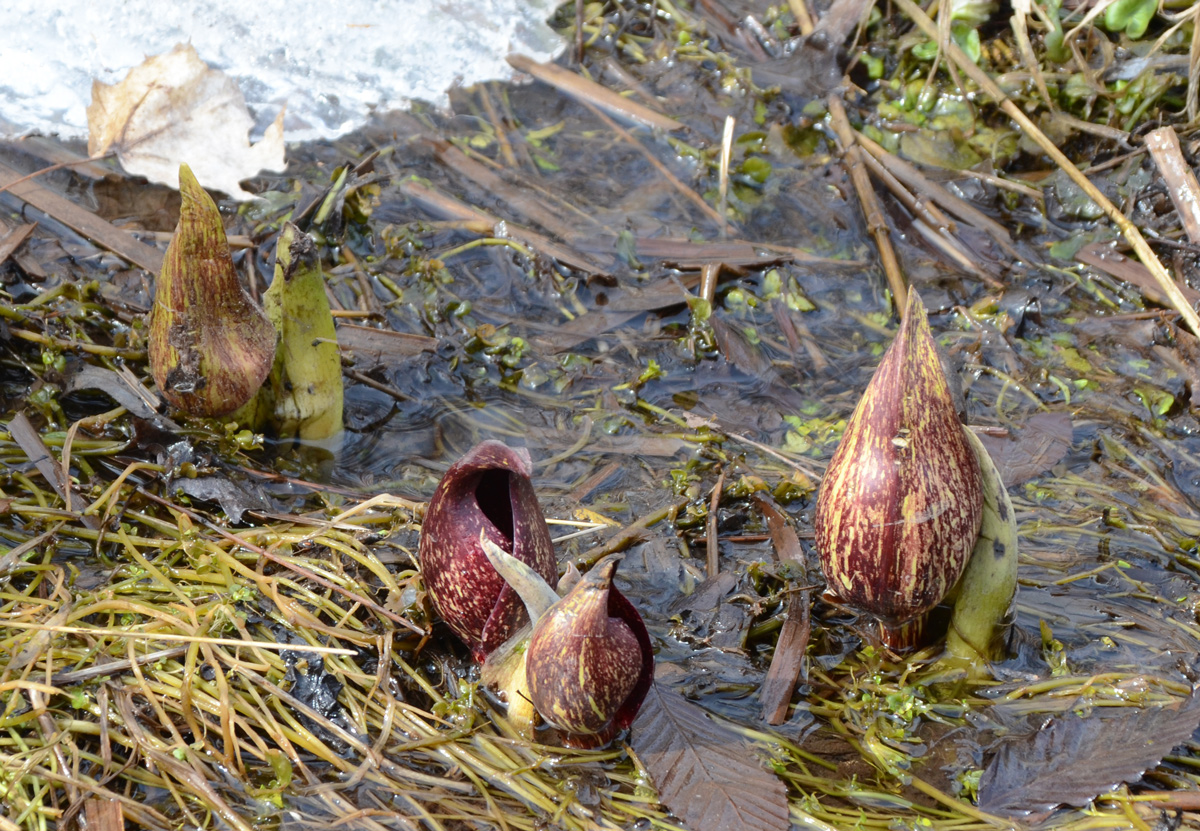
below: These strange looking growths are the beginnings of skunk cabbage plants.
below: The pale yellow of the willow trees as their leaves begin to bud.

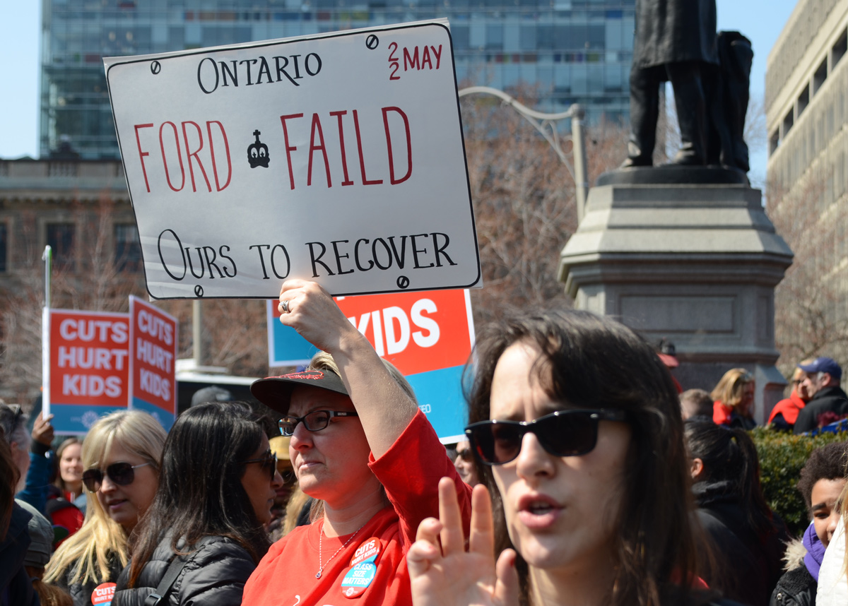
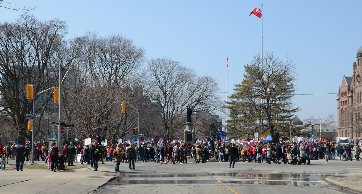
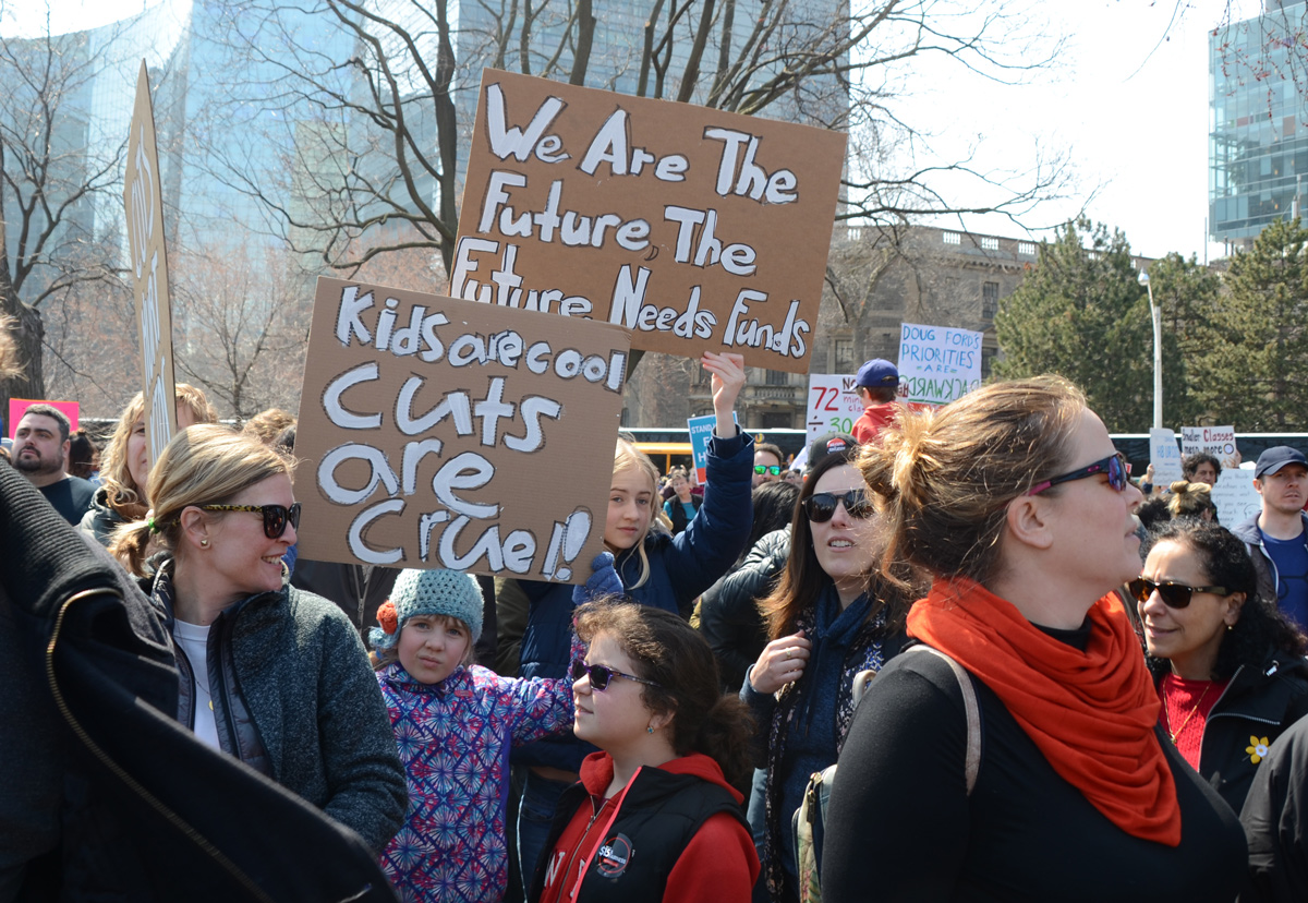
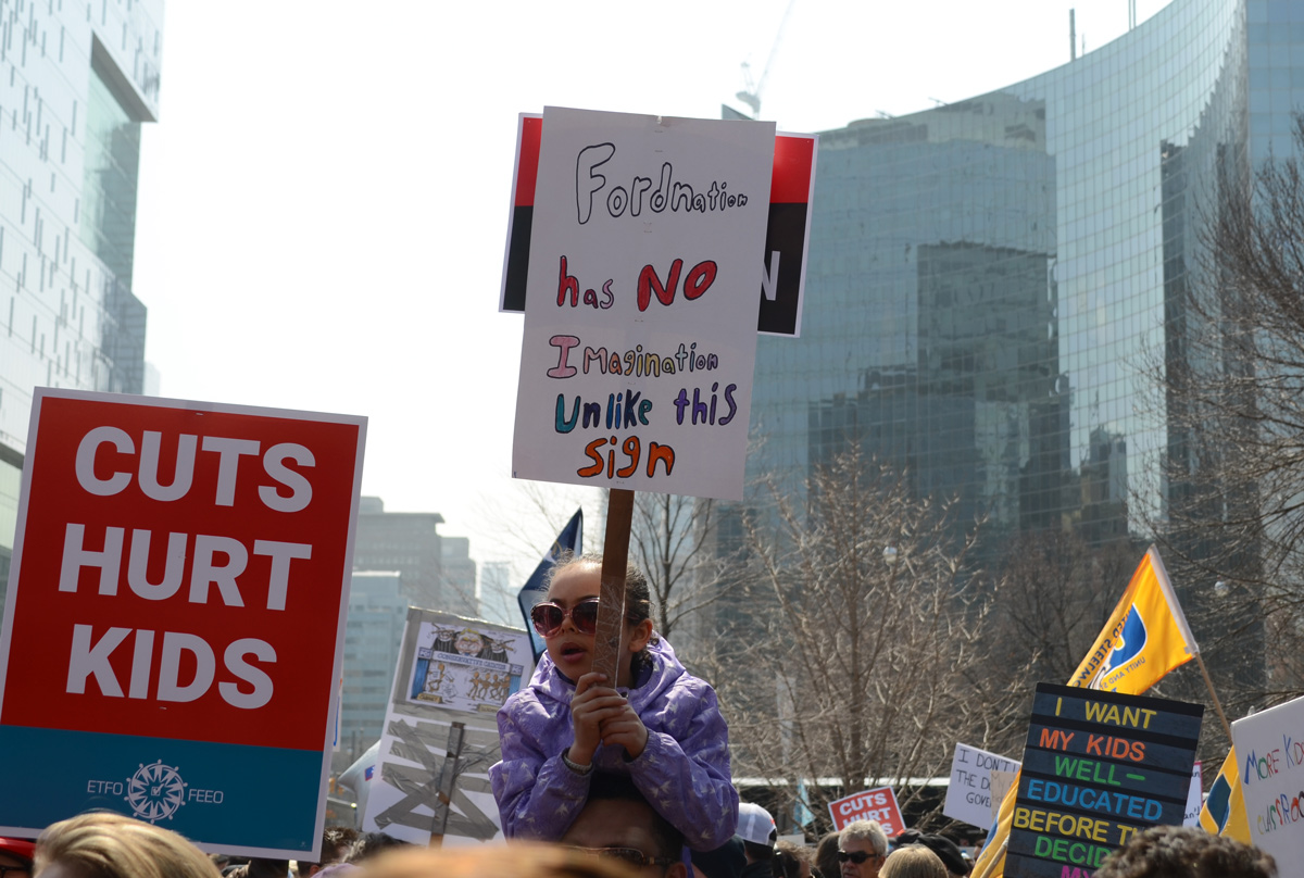
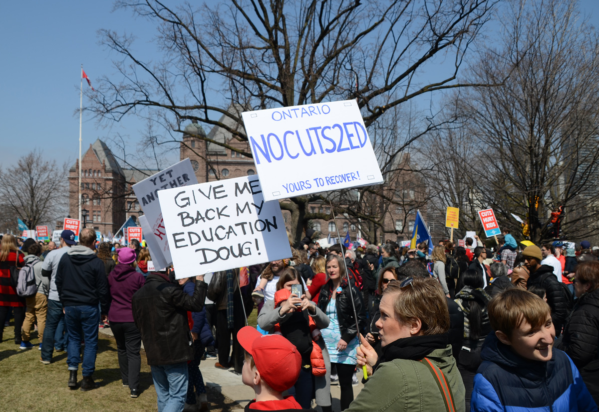
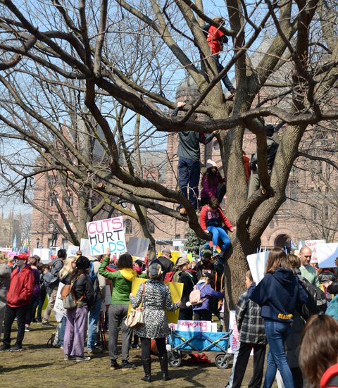
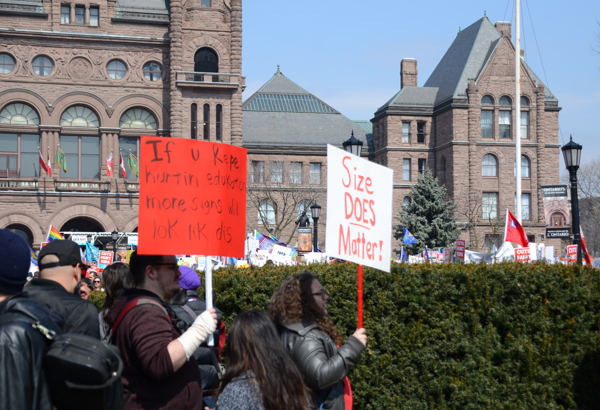
Yesterday there was a large protest in front of Queens Park. Thousands of people from around the province gathered to demonstrate against Doug Ford and his Conservative party proposed cuts to education funding. It was so crowded that you couldn’t move through the center of the park in front of the parliament buildings. So many people were arriving by TTC that there were line-ups just to get out of Queens Park station. Buses, some say 170 arrived from out of town, were parked on both sides of Queens Park Circle. In the beginning, the road was open but police soon closed it along with some of the other streets in the area. Here are some of the people and the signs they carried:
below: Time to use our outside voices. There were lots of families with kids there.

below: Ford Faild. Ours to recover. There were a number of signs that played on the licence plate motif as one of the things that Ford wants to change is the motto on the plates.
below: Queens Park from the east.
below: The protest was organized by 4 unions. Many people carried pre-printed signs but there was an abundance of hand made signs in the crowd as well.

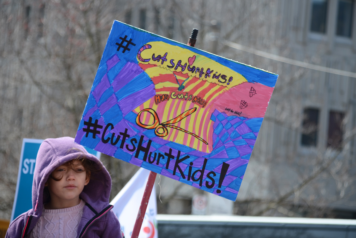
below: From Kitchener, a “Cuts Hurt Kids” sign.

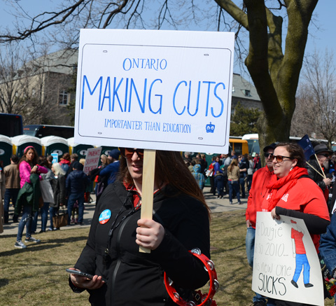
below: Another licence plate: “Importanter than education”.
below: Drug Ford is a villain in big letters

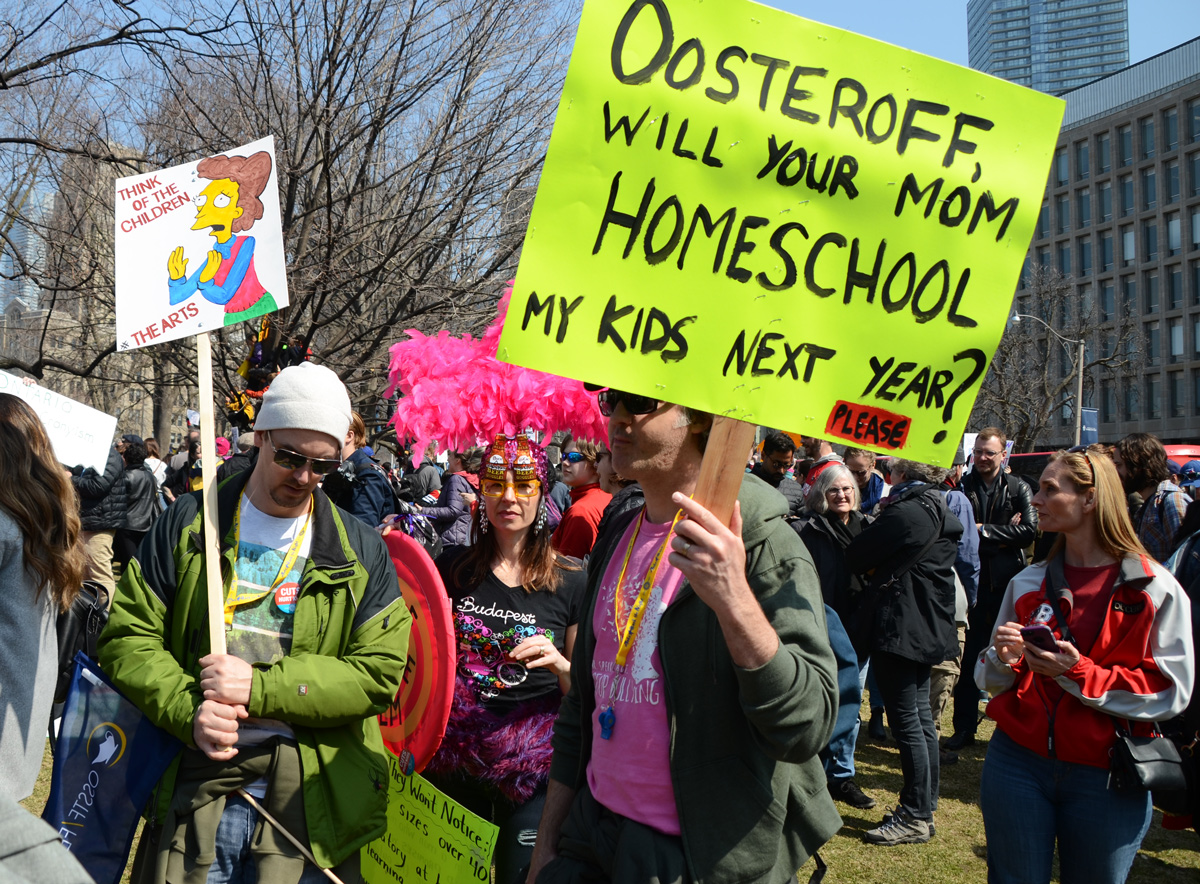
below: Oosteroff’s mom would be very busy.
below: Queens Park Circle, south end. Buses letting passengers/protesters off.

below: Job losses aren’t saved by retirements, they’re stolen from the young work force.

below: Think before it’s illegal. Tax cuts for the rich or cuts to education?

below: Those who can teach, those who can’t become premier of Ontario.

below: Art matters.

below: I’ve seen better cabinets at IKEA


below: Communication means talking and listening.

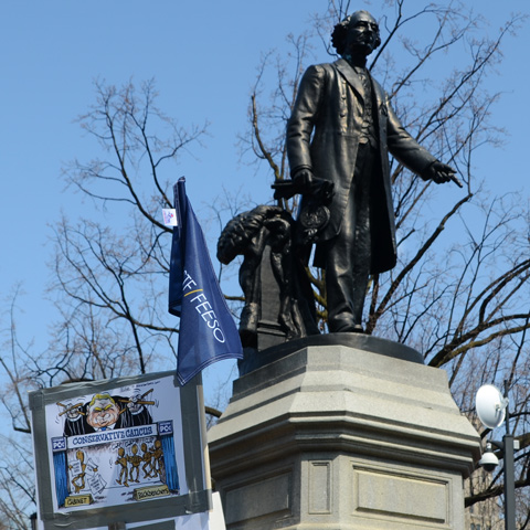
below: The statue of Sir John A. Macdonald stands beside a sign that depicts the Conservative caucus as Doug Ford’s puppets. Ford pulls the strings and they all dance along.
below: Kids are cool, cuts are cruel. We are the future, the future needs funds.
below: #cutshurtkids in colour
below: A great visual for DoFo flushing our education.

below: A math question? How many one dollar beers is education worth?

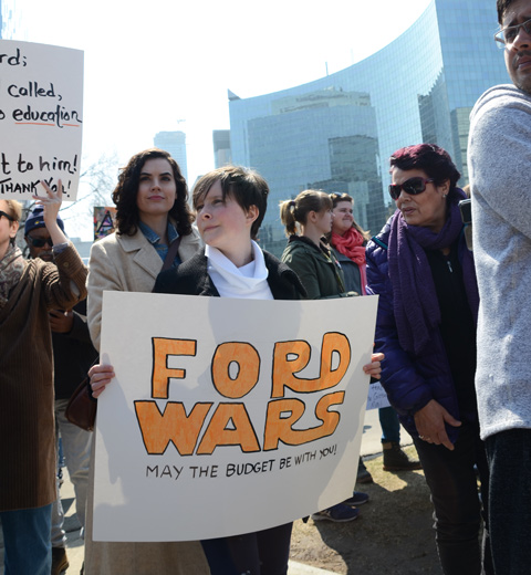
below: Ford Wars, may the budget be with you
below: Fordnation has no imagination – unlike this sign.
below: Give me back my education Doug! and another Yours to Recover.
below: Climbing trees for a better view
below: Another attempt at a crowd shot.

below: Size does matter and a lovely spelling mess.

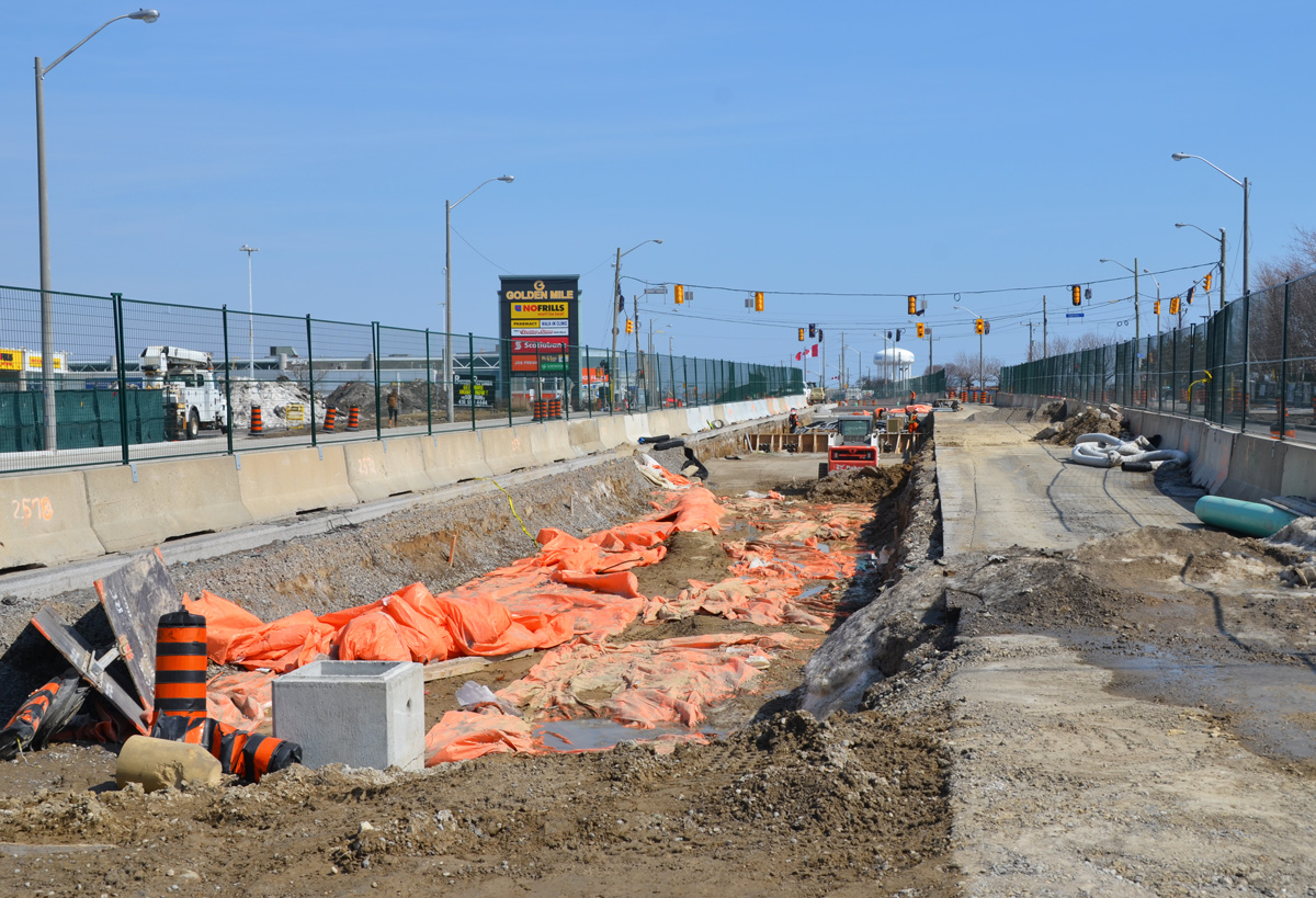
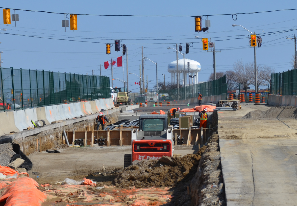
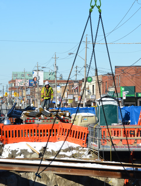
The Eglinton Crosstown LRT will be 19 km long once it’s finished in 2021. The other day I posted some pictures of the construction between Yonge & Victoria Park on the eastern section. This post covers the stretch from the Allen Expressway to Weston Road where the tracks end in the west.
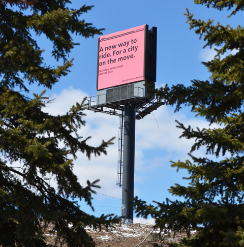
below: A new way to ride. For a city on the move. Cringe worthy design.
below: Approaching the south end of the Allen Expressway as well as Eglinton West subway station from the east. Eglinton West station, on the Yonge University line, is low building with a flat concrete roofline. You can hardly see it in the photo, but it’s there. The interior of the present station is heavy on the concrete, a legacy from the 1970’s. As to whether or not this will be renovated, I don’t know.

below: No room for the sidewalk so it diverts through Ben Nobleton park.

below: Working under Eglinton Avenue in front of Eglinton West station. Once the Crosstown in open, this will become Cedarvale station.


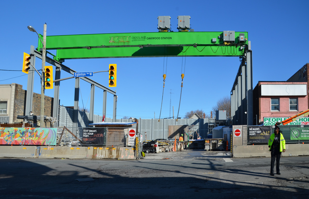
below: The big green crane at Oakwood station
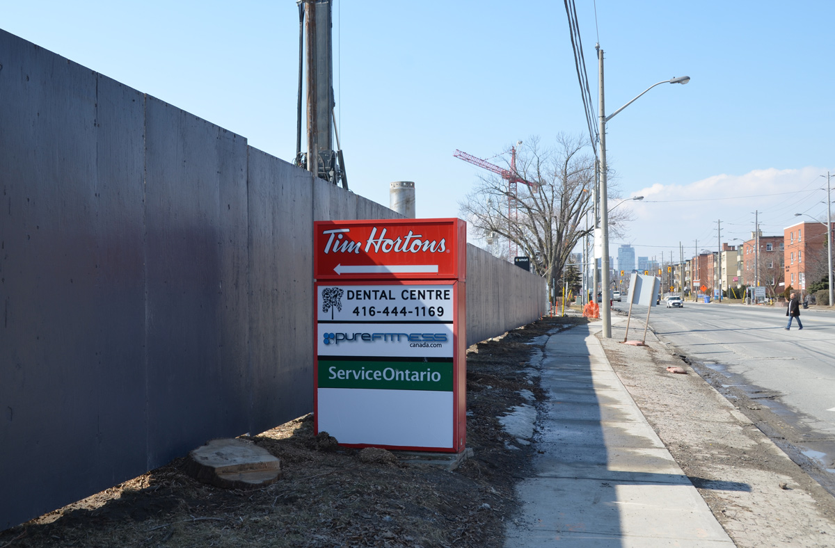
below: Beside Oakwood station with all the “Open for Business” signs. Businesses in the area are struggling.


below: At Dufferin, looking north towards Central Seventh Day Adventist Church. Fairbanks station will be at this intersection.

below: Also at Dufferin, this time looking south towards St. Hilda’s towers.

below: Photobombed!


below: Construction of Caledonia station in front of Westside mall. Because this station is adjacent to the Barrie corridor (GO train), plans are in the works to build a GO station here too.

below: A mural showing the evolution of TTC streetcars, painted by Jim Bravo in 2017, with supported from Fairbanks Village BIA, Josh Colle (city councillor), the City of Toronto., and Sherwin Williams paint.

below: Construction in front of York Memorial Collegiate (at Keele).

below: looking east along Eglinton from Keele.


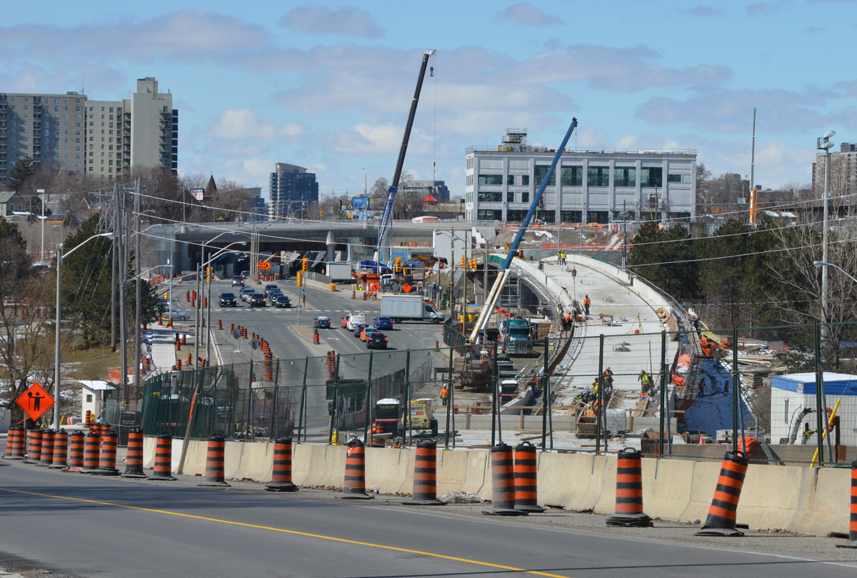
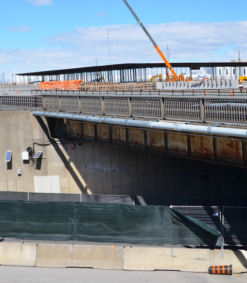
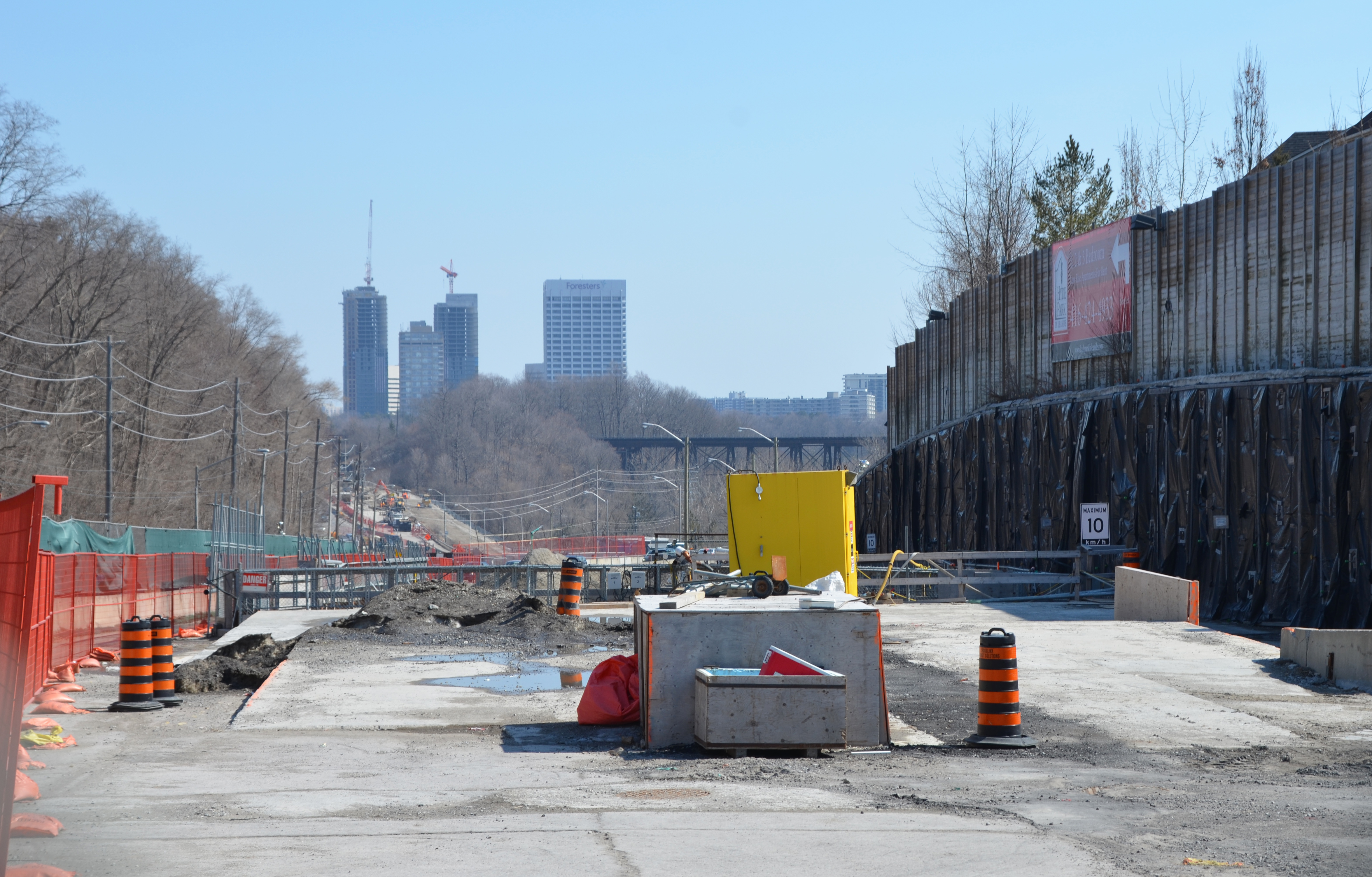
below: Working on the westernmost section of the LRT after it emerges from underground between Keele Street and Black Creek Drive. As you can see, the tracks are elevated and cross over Black Creek before entering the terminal station at Weston Road (Mount Dennis station).

below: The western end of the line. The bridge is new. I am a bit annoyed because I didn’t pursue it – I don’t know where the road goes! It has to go somewhere because I saw at least two vehicles on it. A quick search on google maps plus a guess equals maybe it’s an extension of Photography Drive (named that because it’s where the old Kodak factory was).

below: There is pedestrian access to the bridge, or rather, there will be access.

Then Eglinton Avenue passes under the railway tracks (the same line that the Union Pearson Express runs on) and into Mount Dennis.
below: Construction of another access to Mt Dennis station to the west of the railway tracks.

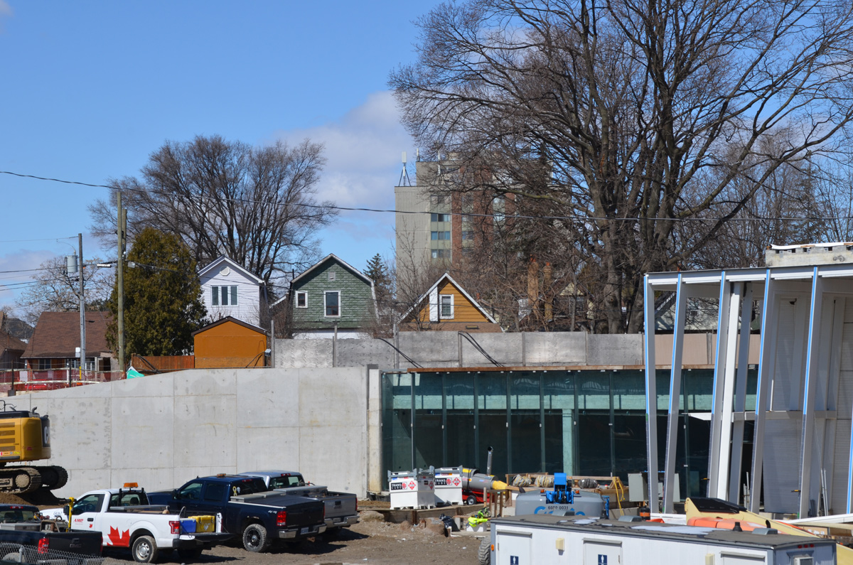
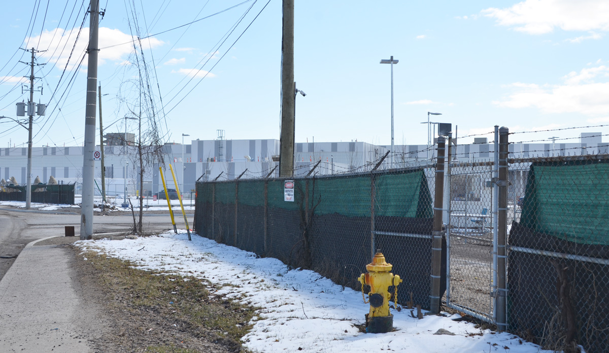
below: The EMSF aka the Eglinton Maintenance and Storage Facility is almost finished. It’s the long low grey building in the photo; it is about the size of 4 football fields. Access is from a side street to the north of Eglinton. This isn’t the best photo of it. If you are interested, there is a better photo online (a ‘Toronto Now’ article) that is taken from an angle that I can’t access. The same article describes how the Mt Dennis station will be the second largest transit hub in the city (after Union Station) as it will service GO trains, the TTC, and the Union Pearson Express.
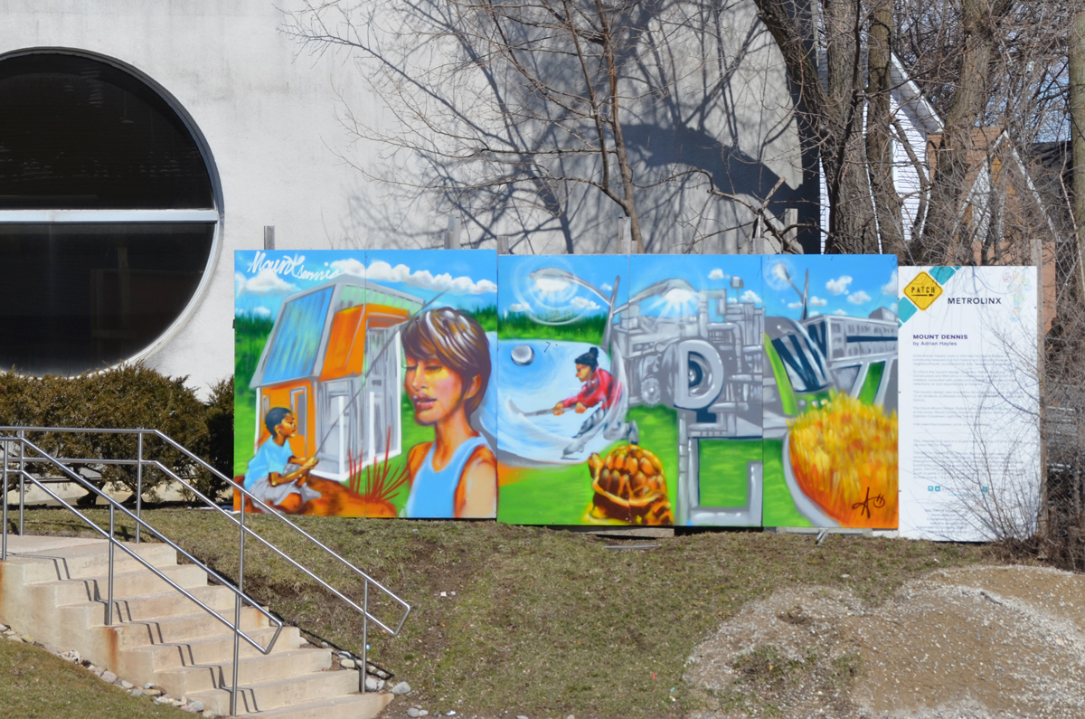
below: mural by Adrian Hayles at the northeastern corner of Weston Road and Eglinton Avenue.
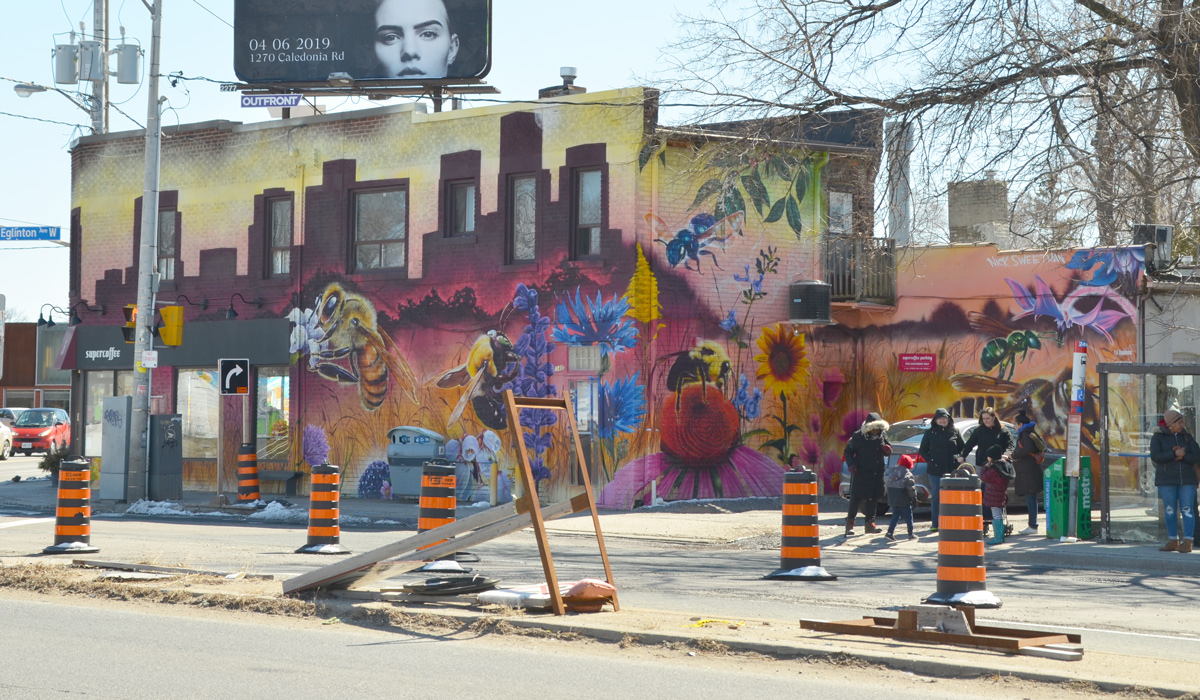
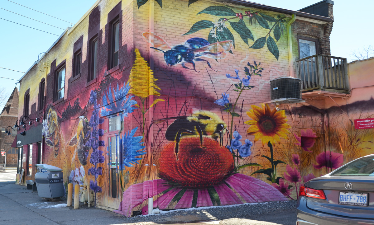
On the southwest corner of Weston Road and Eglinton Avenue West, on the side of Supercoffee, is another large, colourful Nick Sweetman pollinators mural. It features 6 different types of bees commonly found in Toronto.
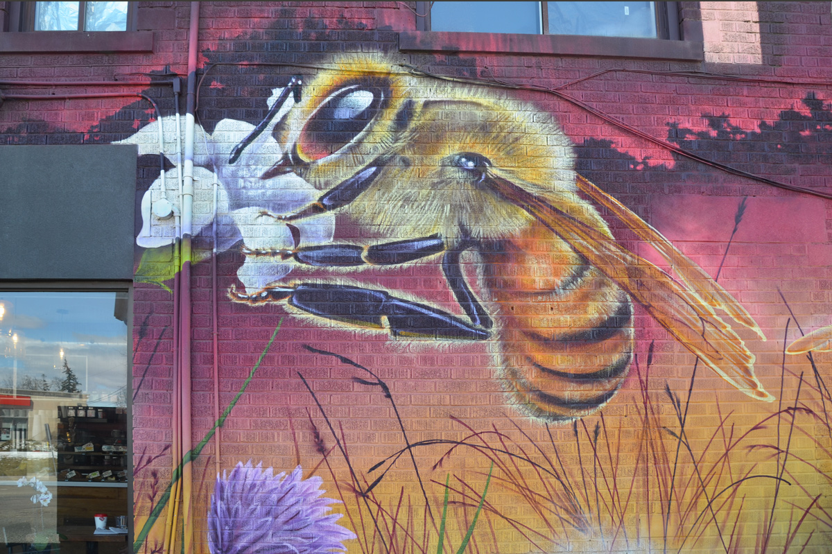
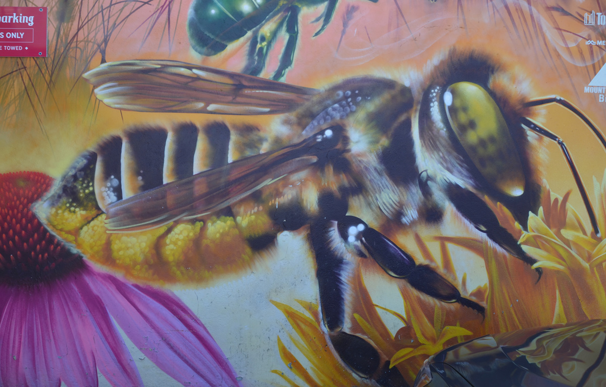
below: Honey bee (apis mellifera)
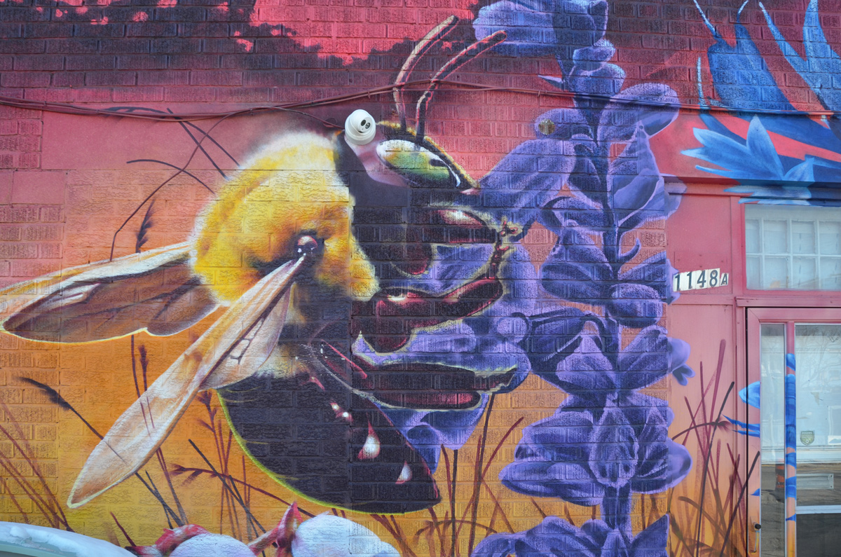
below: Bumble bee (bombus affinis)

below: Mason bee (osmia conjuncta)
below: Carpenter bee (xylocopa virginica)
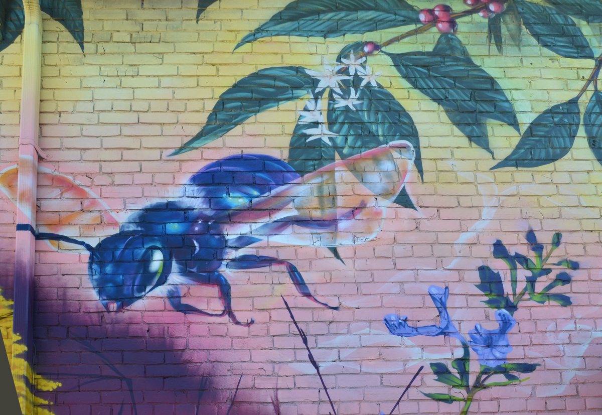
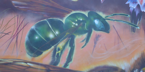
below: Green Sweat bee (augochloropsis metallica)
below: Leafcutter bee (megachile latimanus)
The mural was commissioned by the Mount Dennis BIA with help from the City of Toronto’s Mural Street Art Program as well as Metrolinx.
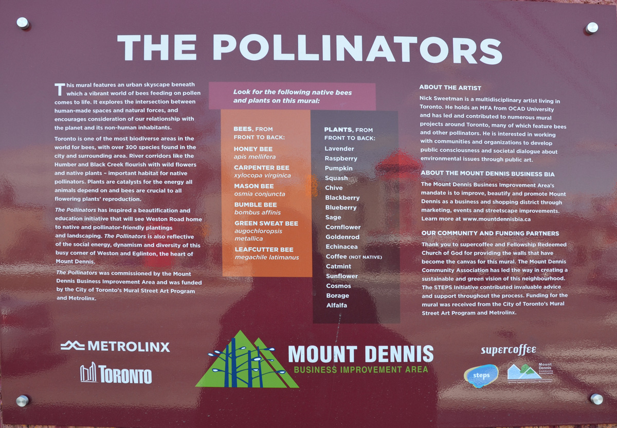
“This mural features an urban skyscape beneath which a vibrant world of bees feeding on pollen comes to life. It explores the intersection between human-made spaces and natural forces, and encourages consideration of our relationship with the planet and its non-human inhabitants. Toronto is one of the most biodiverse area in the world for bees, with over 300 species found in the city and surrounding area. River corridors like the Humber River and Black Creek flourish with wild flowers and native plants – important habitat for native pollinators. Plants are catalysts for the energy all animals depend on and bees are crucial to all flowering plants’ reproduction. “

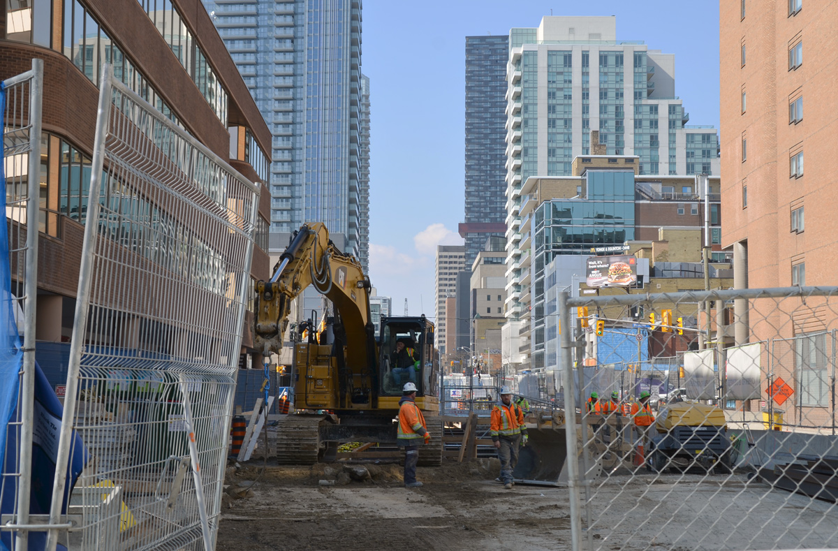
Back before the winter snow had melted, I was at Yonge and Eglinton and noticed that the old bus bays at Eglinton station were gone. That structure had sat empty for a couple of years but now there is a big hole where they once stood. As I looked through the pictures that I took that day, I decided that it might be interesting to explore farther east to see what was happening with the Crosstown LRT construction that has messed up the traffic through midtown for so long now.
below: Southwest corner of Yonge & Eglinton.
below: There is still a lot of construction underway on Eglinton near Yonge.
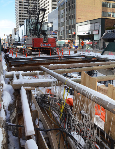
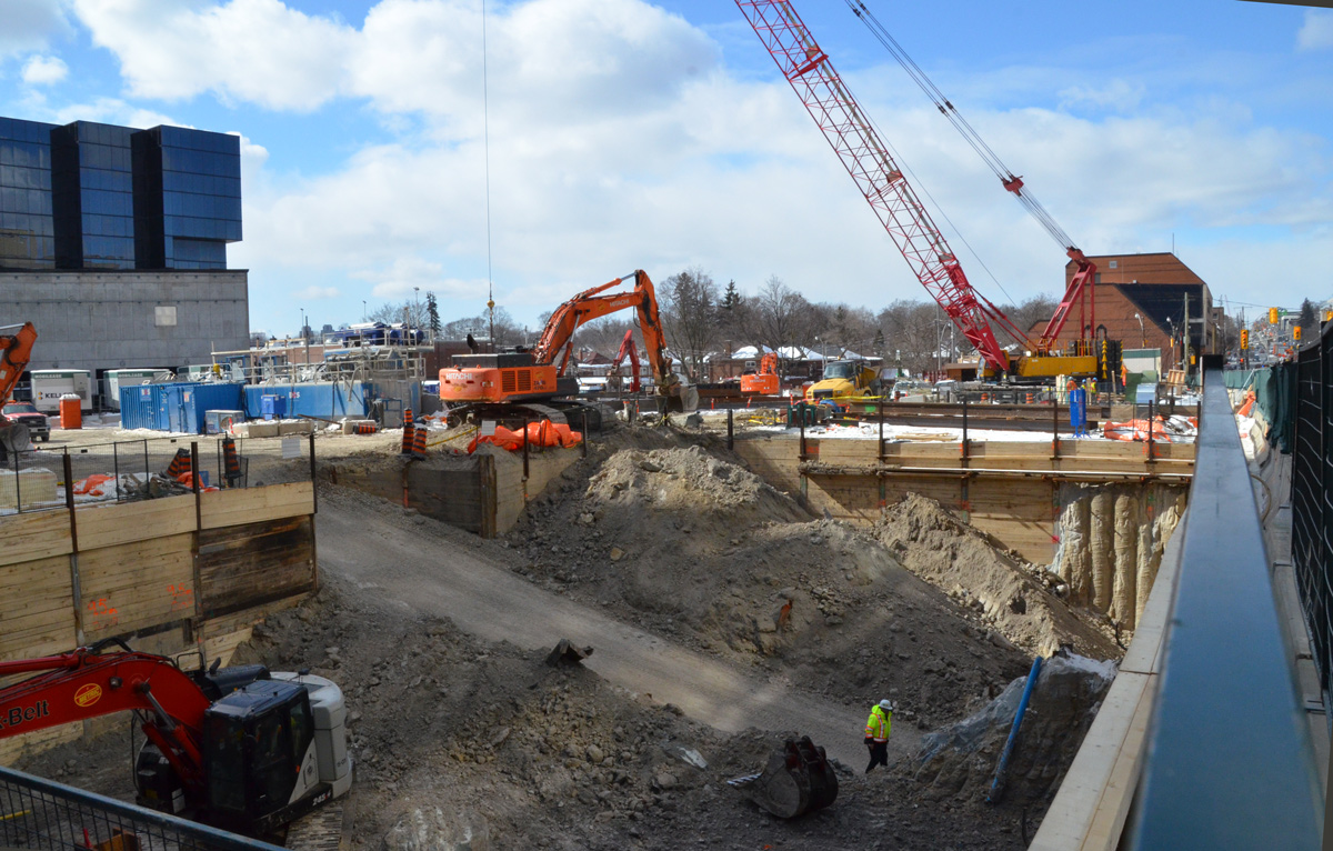
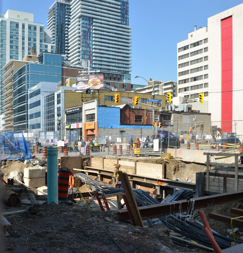
below: A little father east and more holes in the ground. This is the intersection of Eglinton and Mt Pleasant taken from the SE corner looking towards the NW. At least the facade of the old Imperial Bank of Canada building on the NW corner was originally going to be used as the LRT station but have those plans changed? The building was demolished but apparently the facade was taken apart brick by brick and will be re-built later.
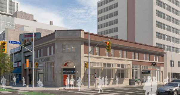
below: This is the plan for the Mt Pleasant station as seen on the Crosstown website.
below: Looking west from Mt. Pleasant.
below: Between Laird and Brentcliffe (east of Bayview). See those low rise brick apartment buildings? How long until they’re gone?

below: At Brentcliffe. The LRT is underground here and there is no station at this intersection. Laird, where there is a station, is only one block to the west.

below: From Brentcliffe, Eglinton goes downhill because of the Don River ravine system
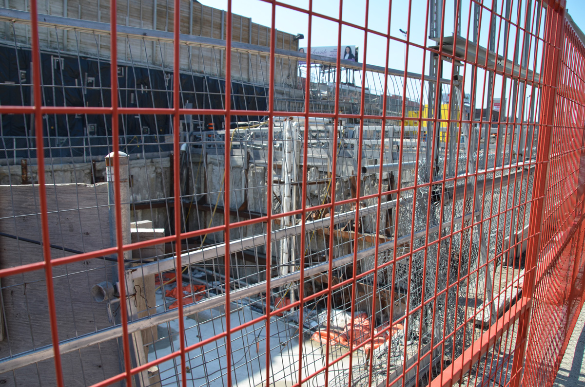
below: Part way down the hill there is a section of concrete. At first I thought that this was where the LRT was going to come to the surface.

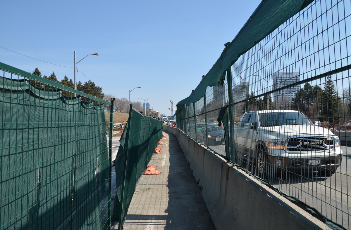
below: But then I wasn’t so sure. There is a concrete wall blocking what would be the exit. It’s difficult to get a closer look because there are two layers of fencing in the way. Nobody was working here. In addition, there is another section farther along that looks like the actual opening. Maybe this is part of the supporting infrastructure?
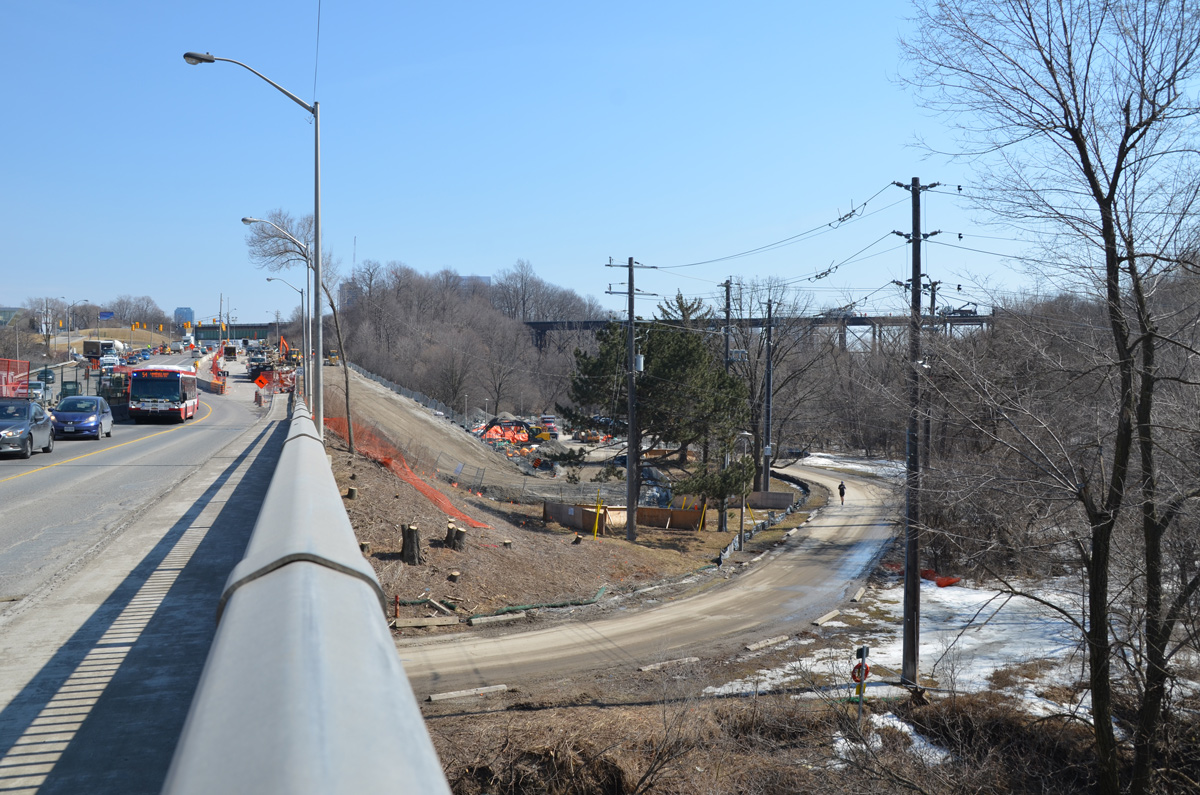
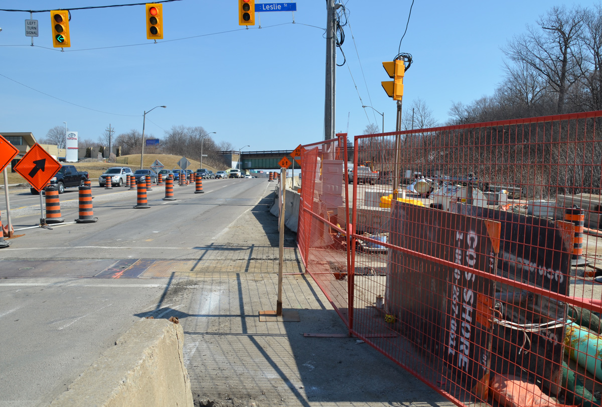
below: Still walking east along Eglinton…. Almost to the bottom of the hill at Leslie – looking east along Eglinton Avenue with E.T. Seton Park on the right and the railway bridge in the distance. Leslie Street, which ends at Eglinton, is on the very left side of the photo. There is talk that this intersection will be closed for two months this summer.
below: I turned around and took a picture of the hill that I had just come down. Here the LRT surfaces and the tracks run down the center of the road, with lanes of traffic on both sides of the tracks. I am fairly certain that you can see the entrance to the tunnel, the east portal, near the middle of this picture. From here to Kennedy station the tracks are above ground (except for a portion of the route at Don Mills).

below: The sidewalk on the south side ends at Leslie street. Here, I chatted with a policeman while we waited for the light to turn green. Once he did, he escorted me across Eglinton as we had to pass through part of the construction zone. This is where I also discovered that there are no bus stops between Brentcliffe and Don Mills Road. That’s only 2 km but it feels a lot longer!
below: A development proposal sign stands on the lawn of what used to be the Inn on the Park but what is now a Toyota dealership.

below: The station at Don Mills and Eglinton will be called “Science Center” and it will be under the intersection.

below: There will be a bus terminal on the northeast corner of Don Mills Road and Eglinton with underground access to the LRT station. This is what construction looks like on that corner at the moment.

Just east of Don Mills Road, the LRT surfaces again and remains above ground until Kennedy station. I took the bus from Don Mills Road to Victoria Park as there wasn’t as much to see in this stretch.
below: Looking east from Victoria Park Avenue.