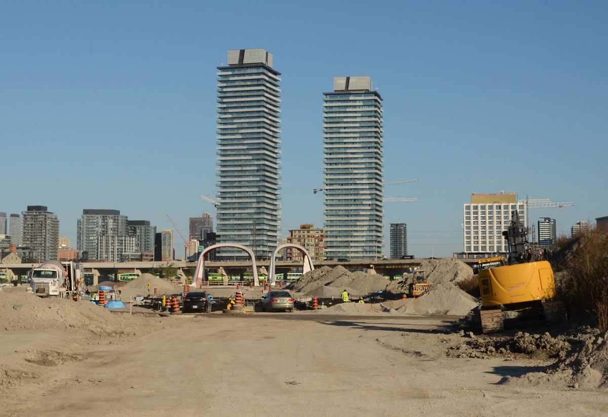


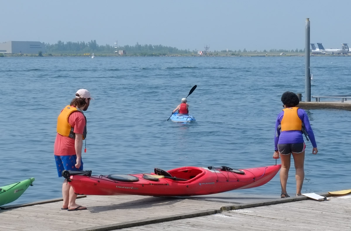


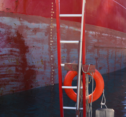
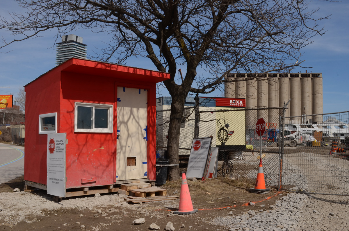
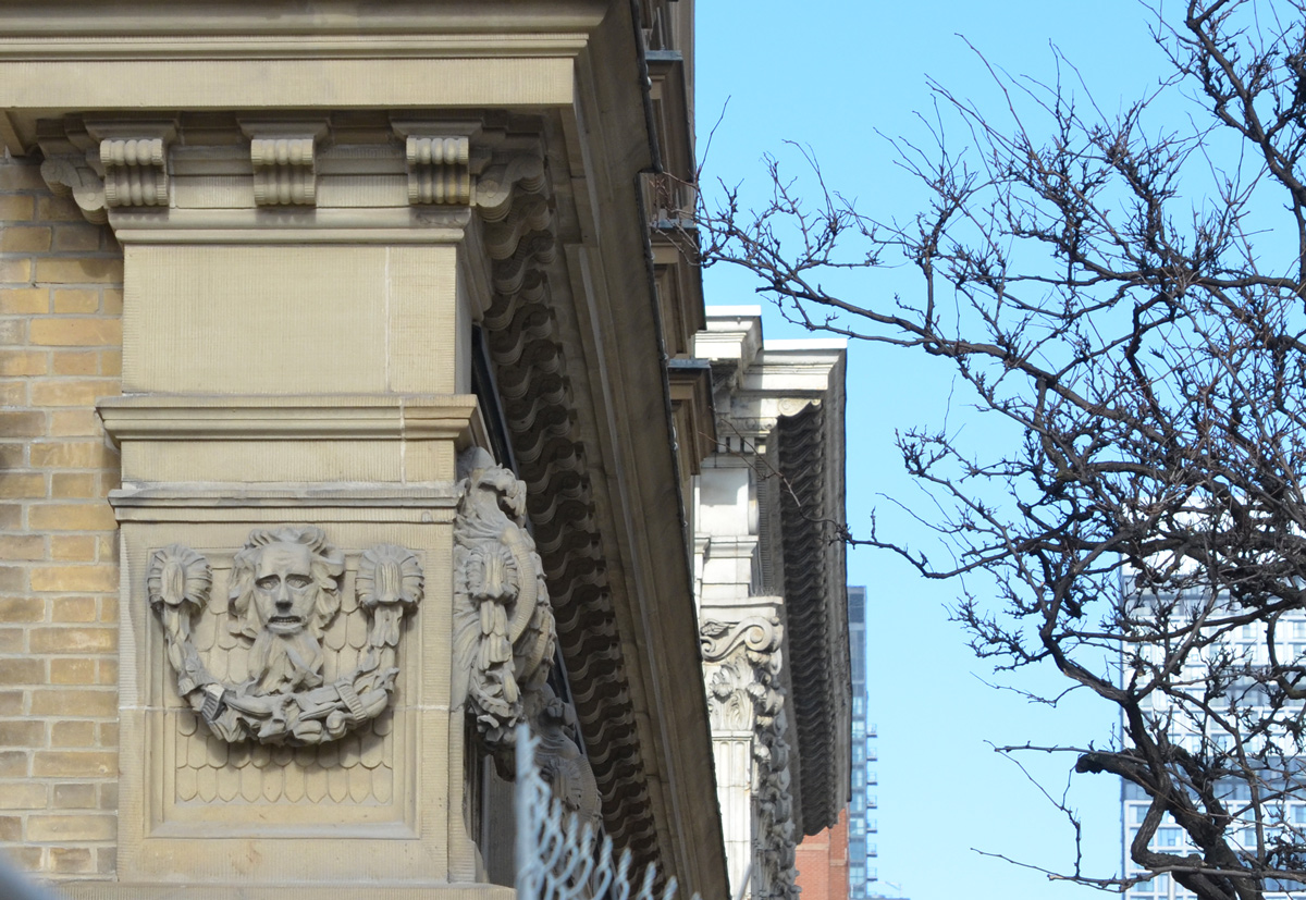
Part of Port Lands redevelopment.
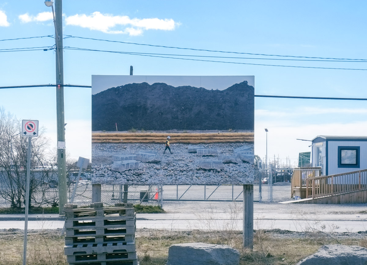
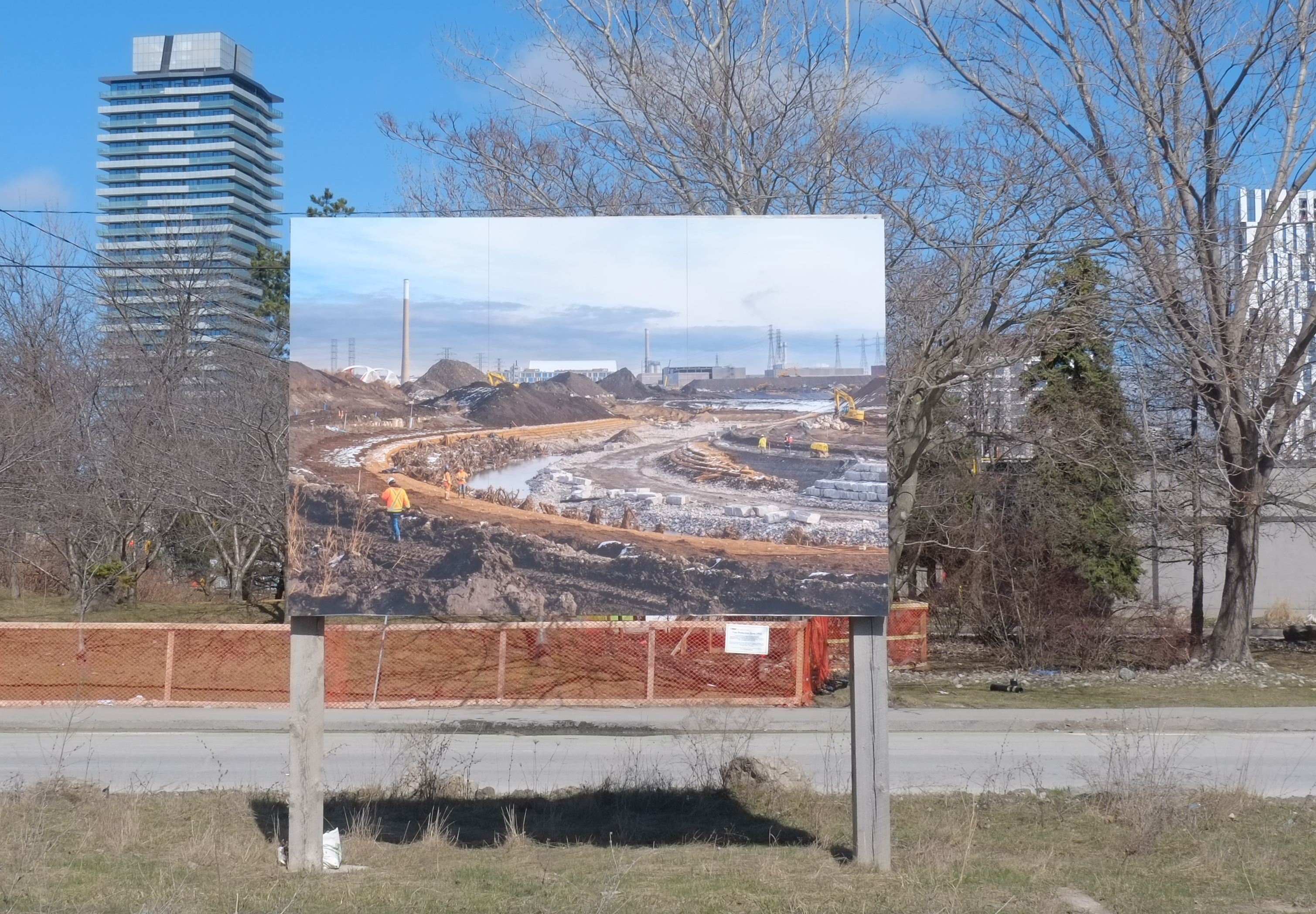
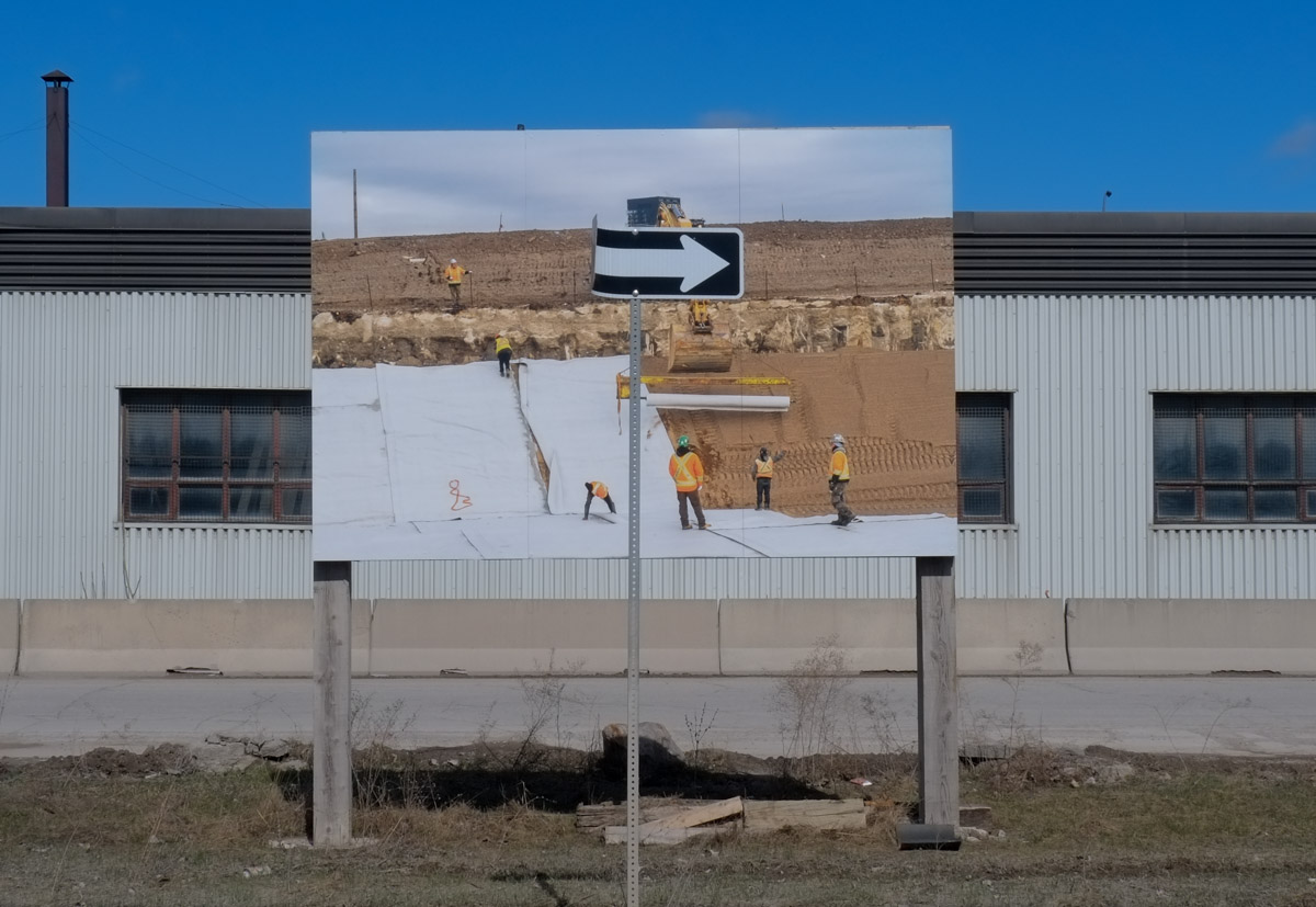
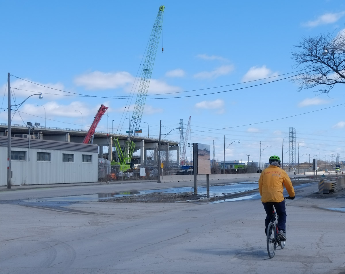
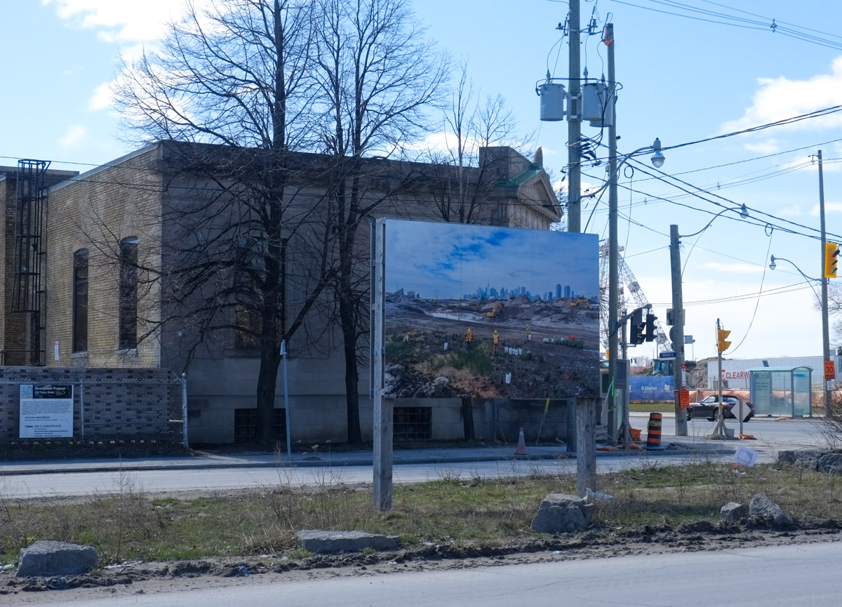
Almost a year ago, a number of photos of the Port Lands work were installed along Villiers Street, “How to Build a River”. This is at least the second exhibit by Vid Ingelevics and Ryan Walker in this location. The prior set of images can be seen in a post from 2020, “the new Cherry Street bridge“. It was part of the Contact Photography Festival for 2022. I realize that it is now 2023 but I had forgotten about this exhibit until last week when I was walking in the area.
Here are some of the photos along with a few other details seen on Villiers Street.
below: “Sand and Charcoal”
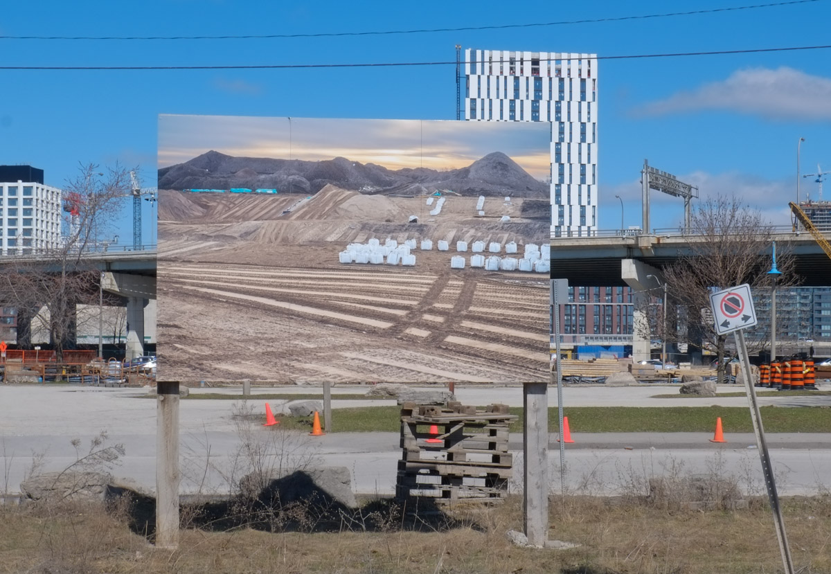

below: “Stratified River Ingredients”

below: Meander
below: Eastward on Villiers Street

below: Crib Wall 3

below: “Layering Membrane”
below: “Transplanting #1”

below: “Transplanting #2”

You might not be able to see these images any more. It is now May 2023 and there is another Contact Photography Festival that has just begun. Ingelevics and Walker have a newer exhibit planned which was scheduled to be installed for the 1st of May. Chances are this newer exhibit will stick around for a while too!
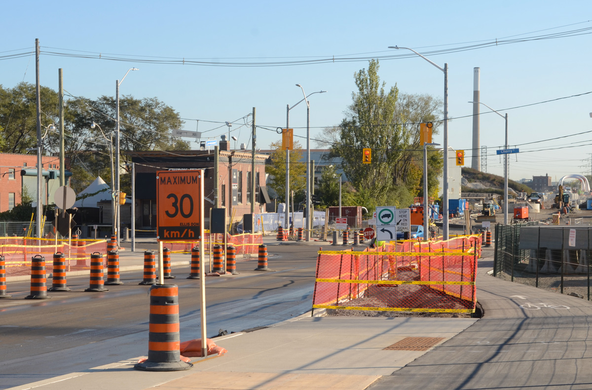
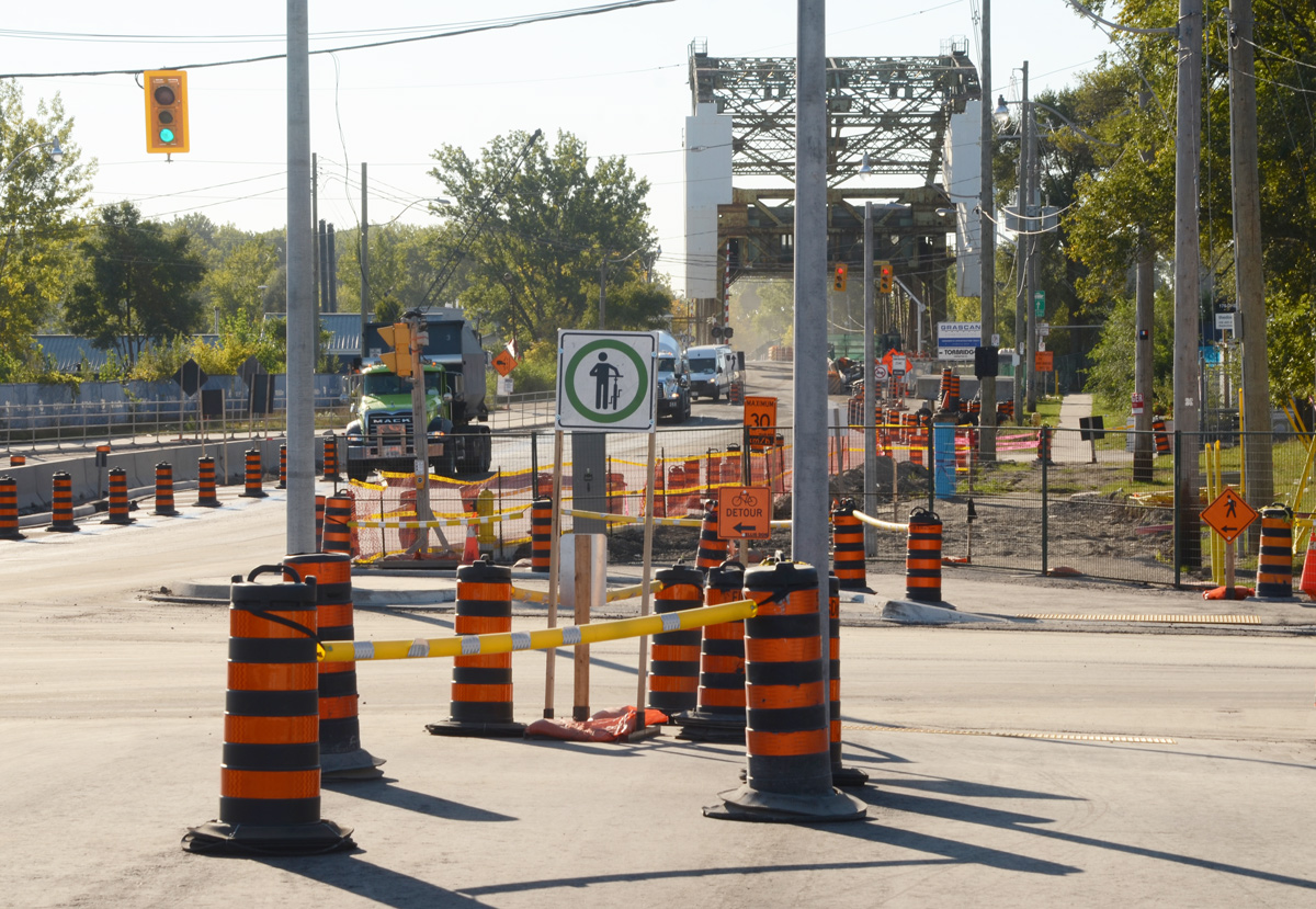
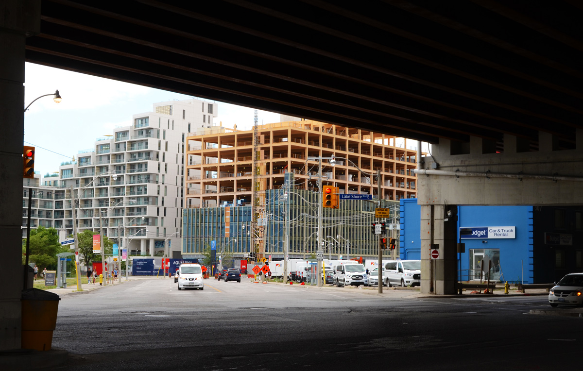
The middle of three new bridges built for the Port Lands redevelopment has just been opened to traffic.

The bridge may be open to traffic, but the area is still a construction zone!
Eventually Cherry Street will be realigned so that there is no jog in it at Lakeshore. At this point in time, the south part of the realignment is closer to completion. This is where the new bridge is.
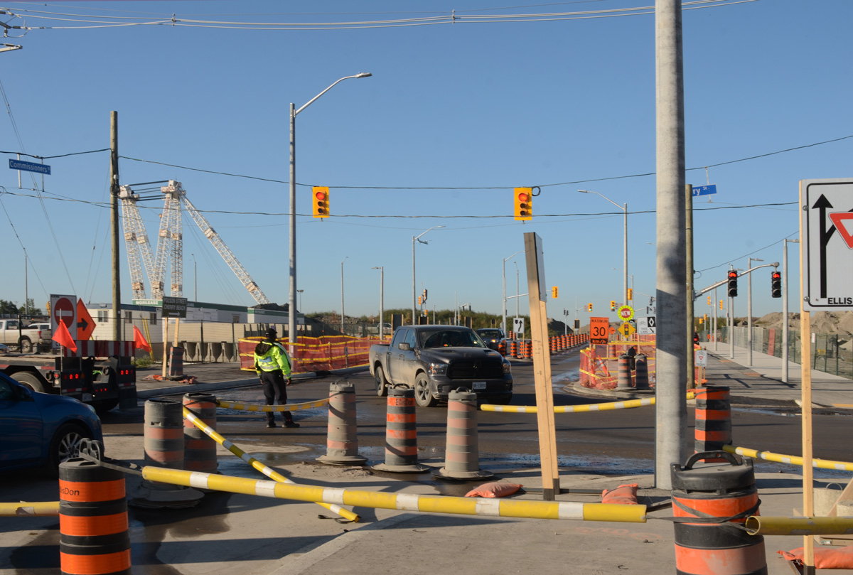
Commissioners Street has been extended westward to join the new segment of Cherry Street.
below: This is the east intersection of Commissioners and Cherry (looking east). Yes, it’s a mess! There are traffic signals even though only two of the four approaches are open. If you are traveling south on Cherry, you have to turn right onto Commissioners.
below: Same intersection, looking west.
below: New part of Commissioners Street

below: The west part of Commissioners ends here

below: If you stand in the same place as the above photo but turn to your right, this is the view that you see. This is the new part of Cherry Street being realigned to match the section north of Lakeshore Blvd. The new bridges over the Keating Channel are in place but there is still a lot to be done before this part of Cherry Street can be opened.
below: Looking south… It is the middle bridge that has been opened to traffic first. It is located approximately where the T ‘n T grocery store used to be. An interesting line of large boulders!

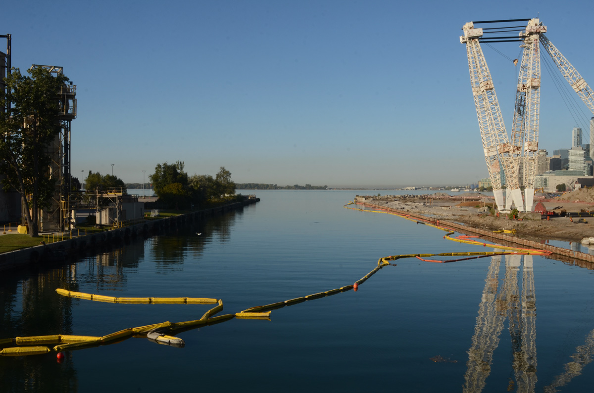
below: This is the view from the new bridge looking west. The large white crane structure predates the construction. The channel has always been here as it provides water/ship access to the Lafarge cement site on the south side of the waterway. What is new is that the channel is being extended eastward to join the mouth of the Don River.


below: Traveling northbound


below: Looking east from the bridge. Pinewood studios in the background on the right.
below: Another view to the east but slightly more south. This time Pinewood Studios is more to the left in the photo. A pedestrian bridge is already built to span the new water channel that is under construction.

below: Looking north up Cherry Street towards the Distillery District. The old, and now closed part, of the street is being torn up. The new street and bridge are to the left in this photo.


below: To the south, the lift bridge on Cherry Street is being refurbished but not replaced. This part of Cherry Street is not being moved.

Another day, another walk through the city starting at the Distillery District and heading west towards the waterfront and downtown Toronto.
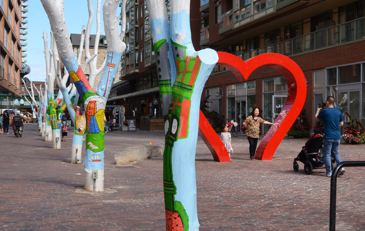
below: Posing under the heart, Distillery District.
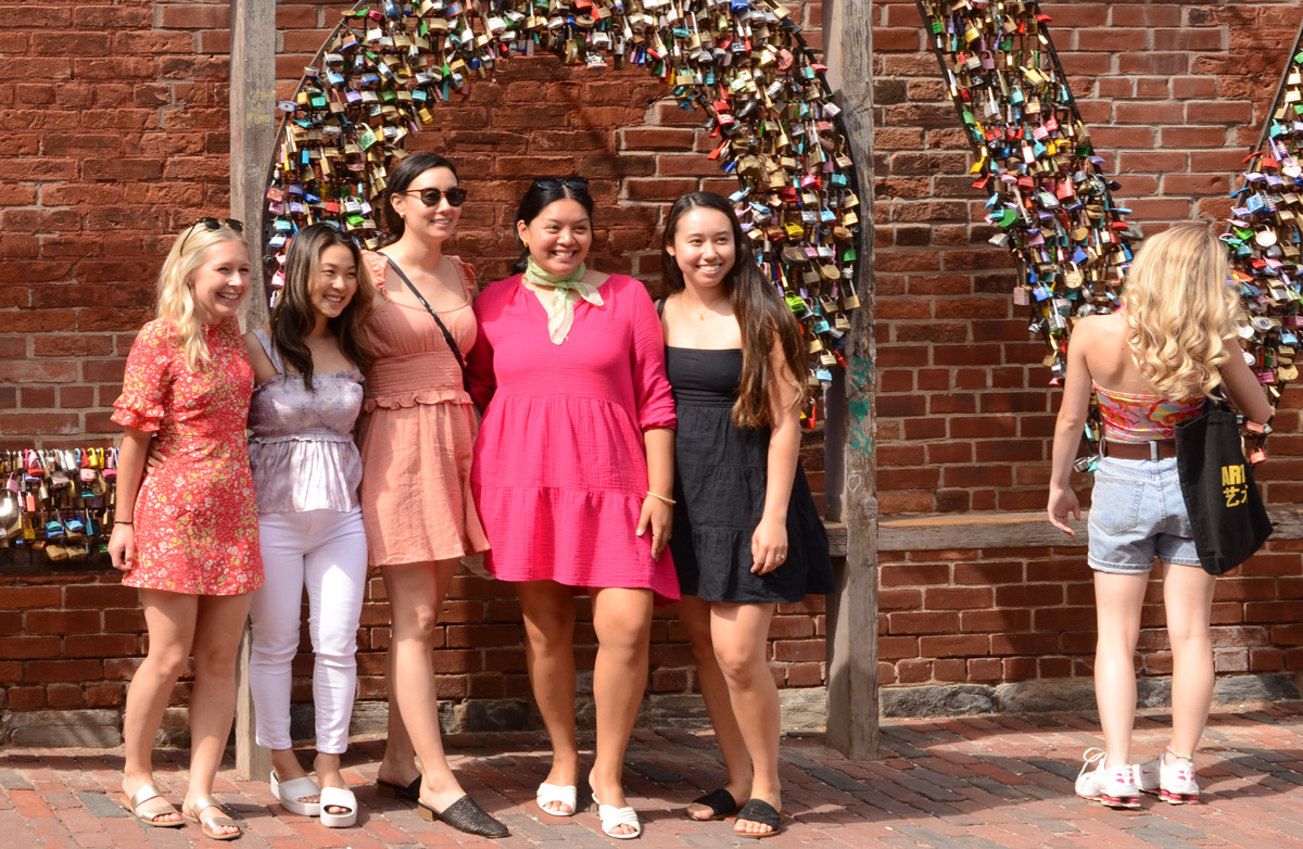
below: Posing with the LOVE locks.
below: Flowered Dress Madonna” by Ann Agee, 2021 as seen in the Corkin Gallery in the Distillery District.

below: Looking east on Front Street from Berkeley. Police Division is the old brick building. Both sides of Front are lined with black hoardings as redevelopment of those sites started recently.

below: Berkeley St., south of Front
below: Another hole in the wall; another vacant lot waiting for redevelopment on Parliament Street. More tall buildings coming to the Distillery District.
below: Looking south from the end of Parliament Street and across Lakeshore Blvd to the start of Queens Quay East. Many changes here!
below: The CN Tower peaks through the gap created by one of the onramps for the Gardiner Expressway.
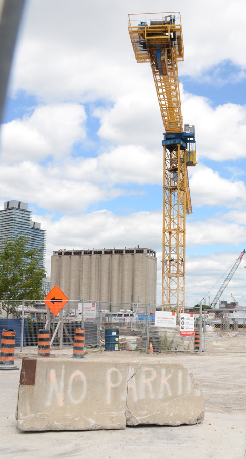
below: No Parkin’, Victory Soya Mills in the background


below: Looking east towards the Port Lands redevelopment. The new Cherry Street bridge is in the background.

below: From the same spot on the waterfront as the above picture, but looking in the other direction.
below: Queens Quay East

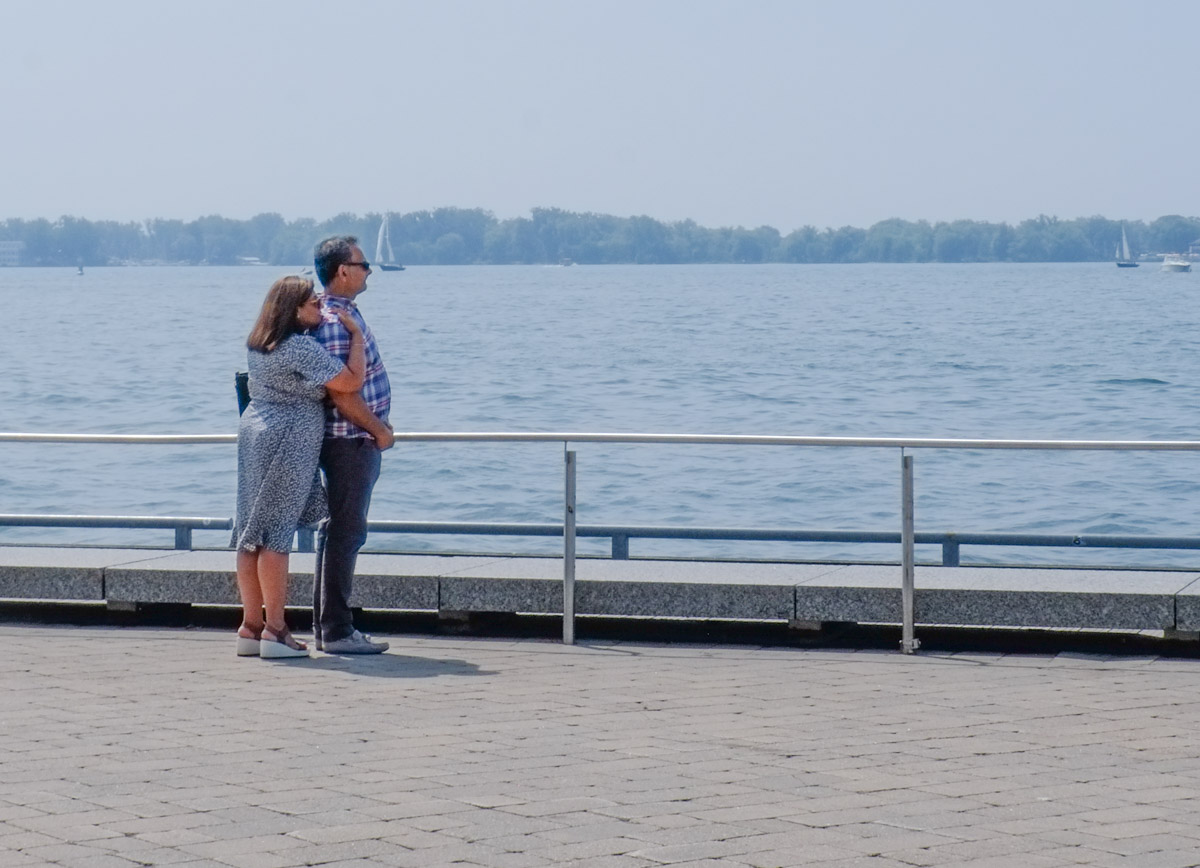
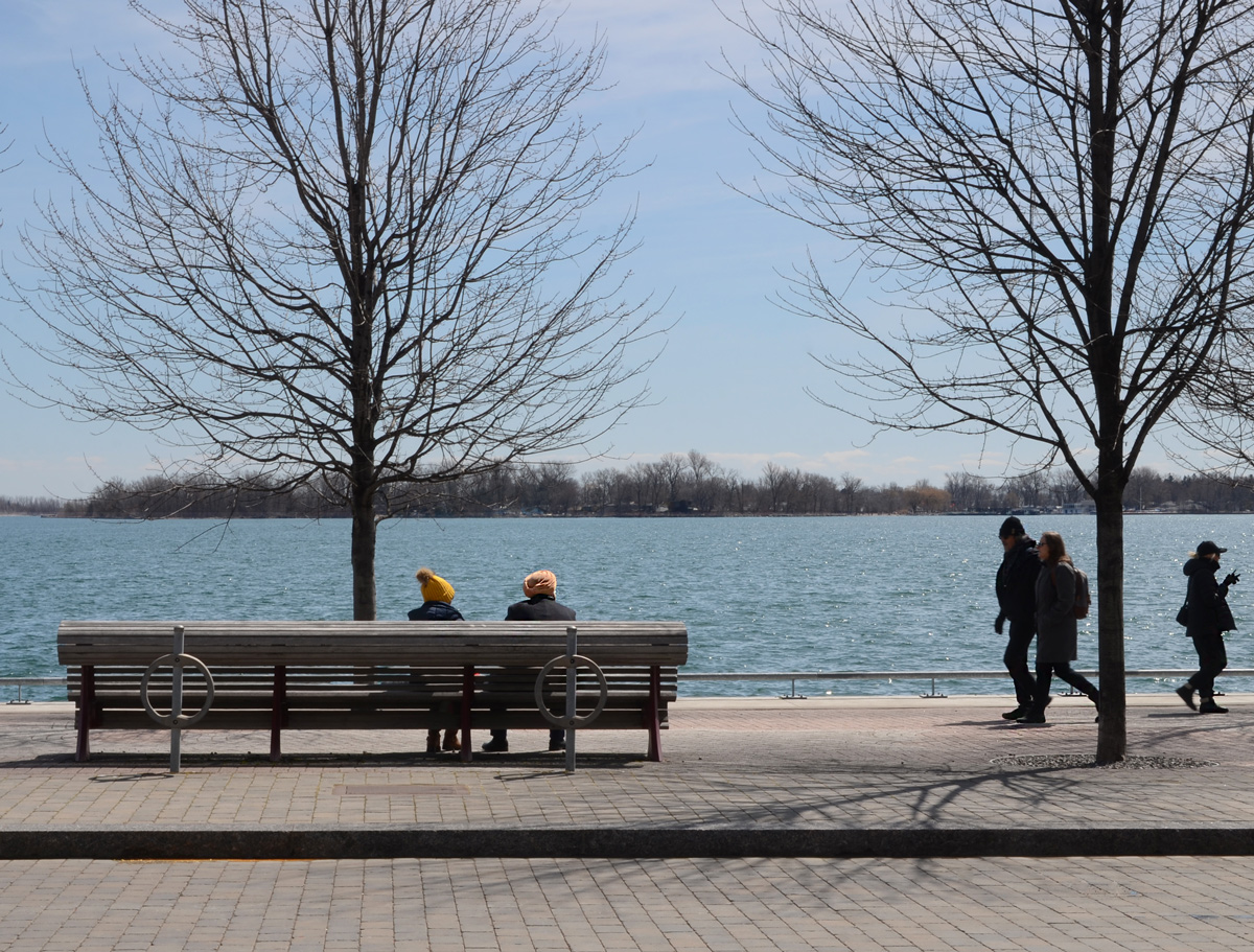
below: Relaxing by the lake.
below: Sugar Beach, spectator section, in the shade.


below: On the rocks, Sugar Beach
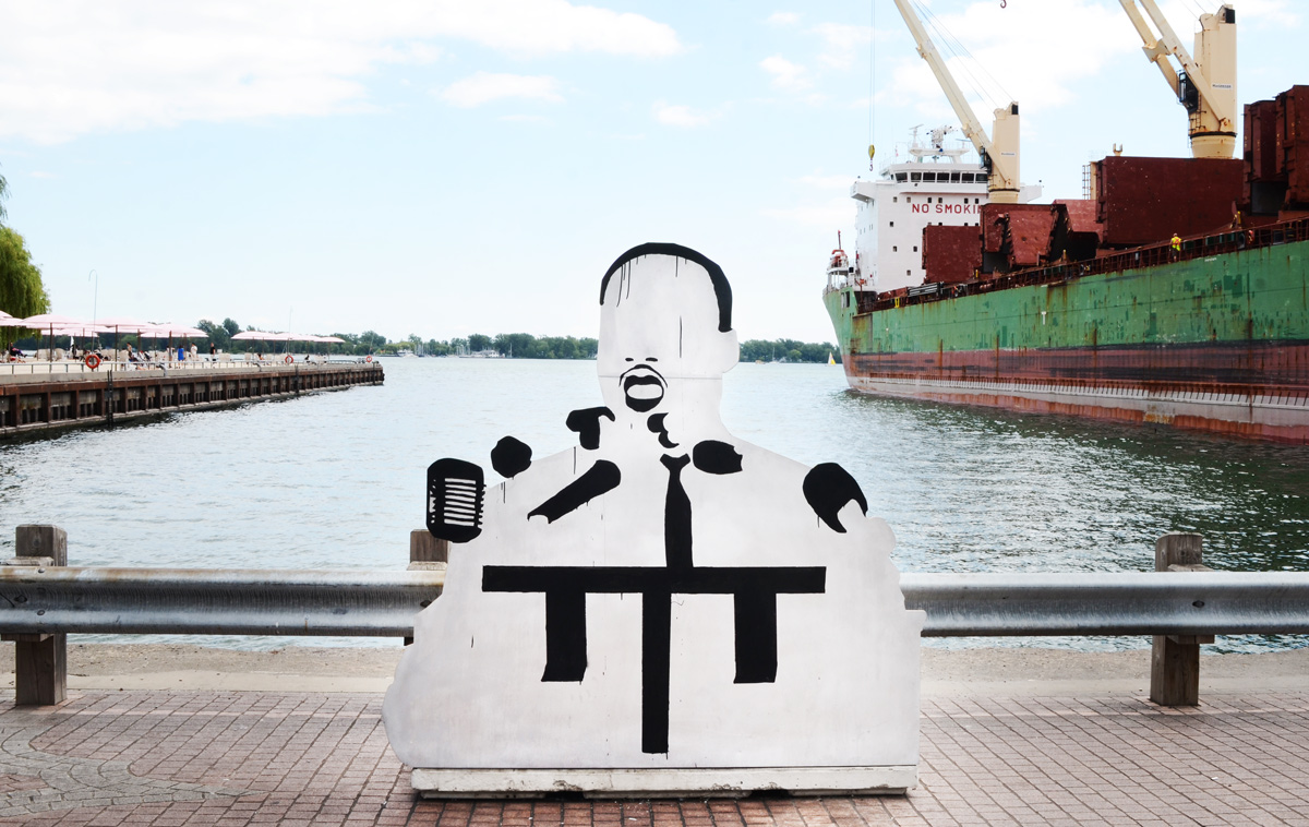
below: I am not sure who this is or why he’s on the waterfront. He’s made of wood – someone constructed him and left him here.
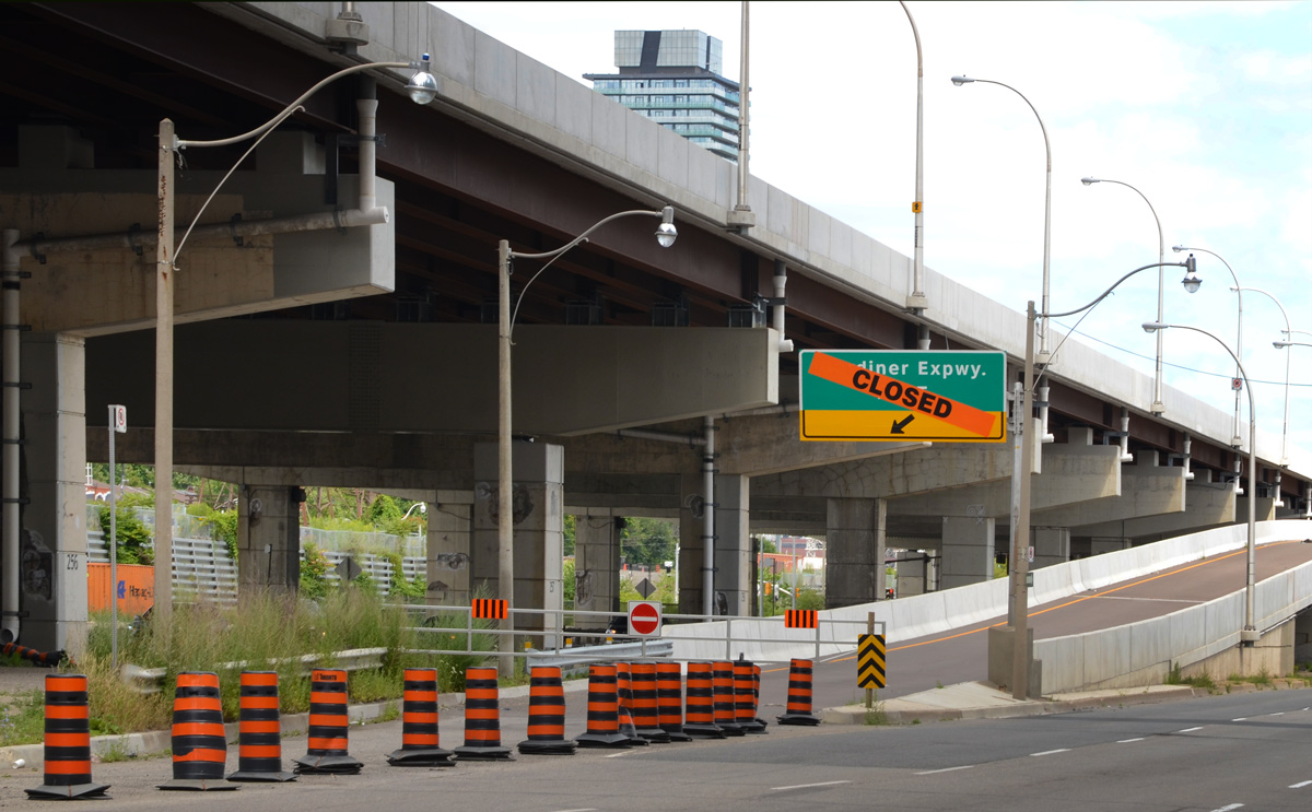
below: Closed – ramp to the the eastbound Gardiner at Lower Jarvis.
below: Lower Jarvis

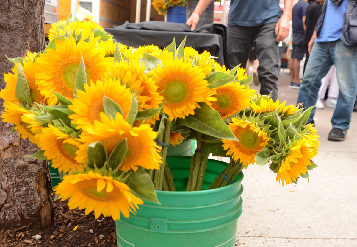
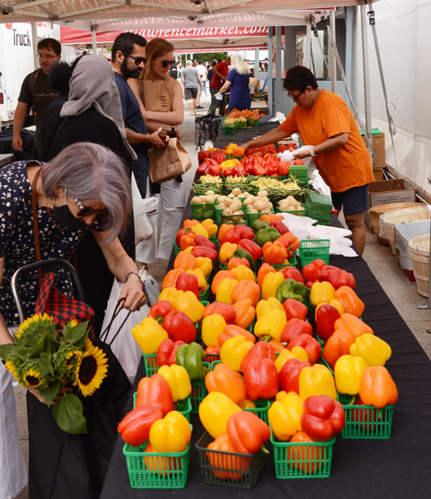
below: A bucket full of bright and cheerful sunflowers on the sidewalk by St. Lawrence Market.
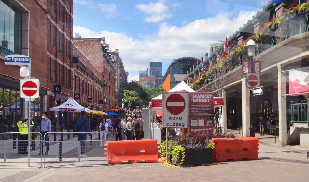
below: Market Street closed to traffic at Esplanade.
below: Marvelous peppers and other veggies for sale at St. Lawrence Market
below: Someone’s looking a little distraught. Remember how your parents used to say that if you frowned too much, or you made too many weird faces, your face would freeze in that position? That is what this poor fellow reminded me of. “Frozen” in time on the side of St. Lawrence Hall.

below: In a window. The title of the painting is “Alone” so perhaps she is alone in the city albeit surrounded by flowers. Unfortunately, they are yellow and blue flowers so I suspect that there is Ukrainian symbolism at play here and that ‘alone’ has a much deeper significance.

below: Leader Lane ends at Wellington.

below: Mama elephant and her two little ones are still walking through the courtyard behind Commerce Court. They haven’t reached the pool yet (but at least there’s water in the pool now).

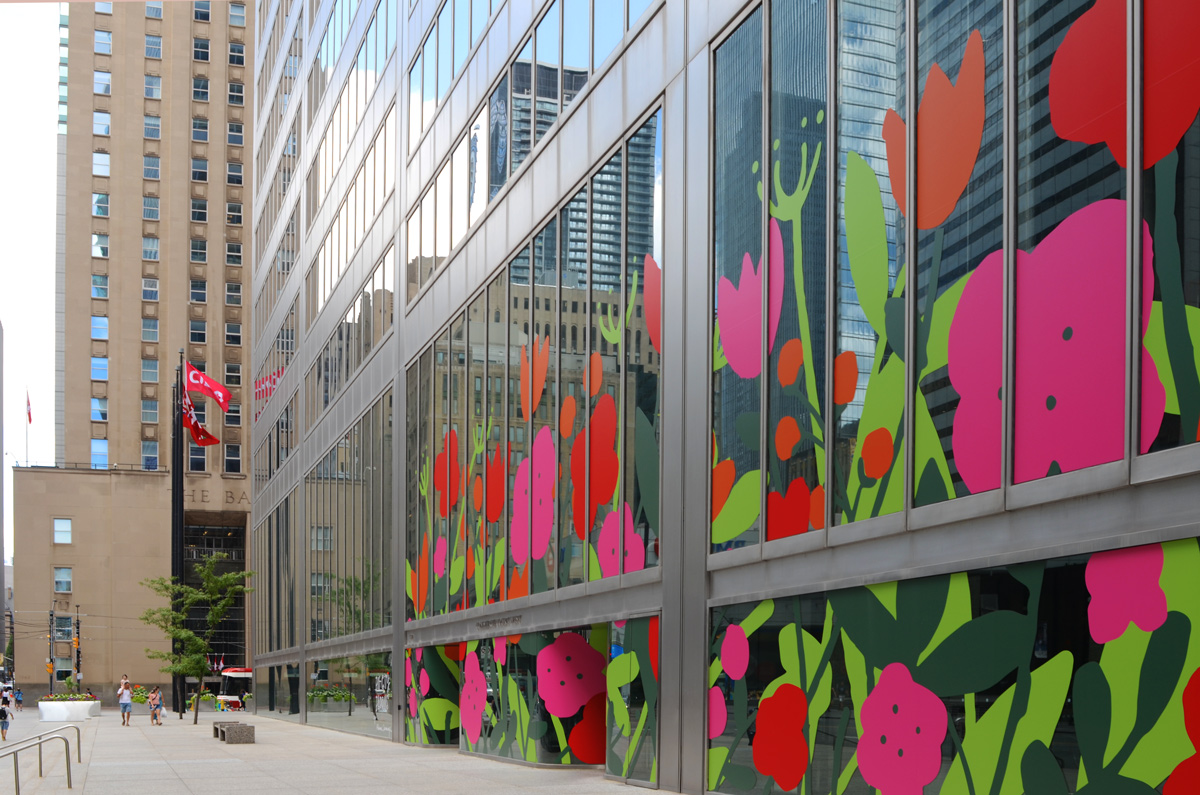
below: This is one of the five Big City Blooms murals found around the city (west side of Commerce Court). The big bold and cheerful flowers in reds and pinks are the work of Alanna Cavanagh.
below: Same Commerce Court building as the above picture but from a slightly different angle.

below: Melinda Street
below: Narrow city alley views, framing the gorgeous stone and brick work on the older building with its arched windows.

below: There appears to be a forest path in the middle of Brookfield Place. It is actually a photograph that is part of an exhibit called, “Take Your Seat With the Group of Seven, Nature the Inspires Us”. (now gone from Brookfield Place).

below: In this exhibit, locations used by the Group of Seven in their paintings were revisited. Photos were taken using a red director’s chair, placing the chair in the artist’s position. In this set of images, two small paintings from Coldwell Harbour are paired with a large photo of present day Coldwell Harbour – the chair is small but you should be able to see it on the rocky outcropping. The harbour is on Lake Superior near the town of Marathon.

***
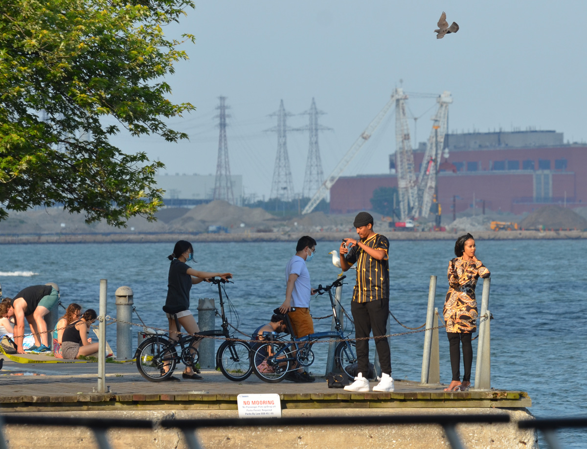
Let’s follow the fish! 🐟 It’s pointed east along Queen’s Quay and by coincidence that the direction I’m headed too… 😃

The seagull is not amused.


below: Harbour Square Park with “Sundial Folly” at the water’s edge. This art installation is the work of John Fung and Paul Figueiredo. It has recently been cleaned up. The sphere is hollow and there is a walkway that runs through it. An opening at the south side (water side) acts as a sundial.
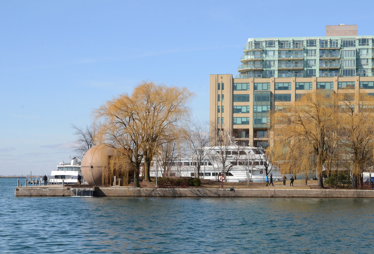
below: Looking east from Harbour Square towards the Westin Hotel tower and the park by the ferry docks.

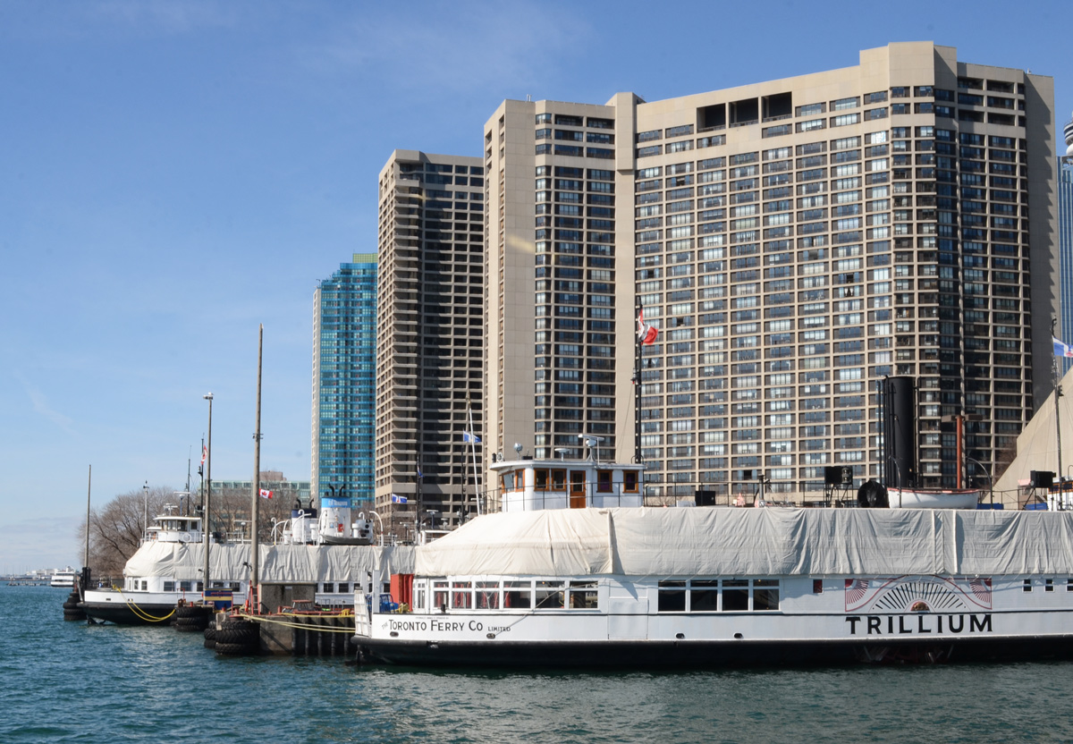
below: Tour boats and ferries still under wraps for the winter months.
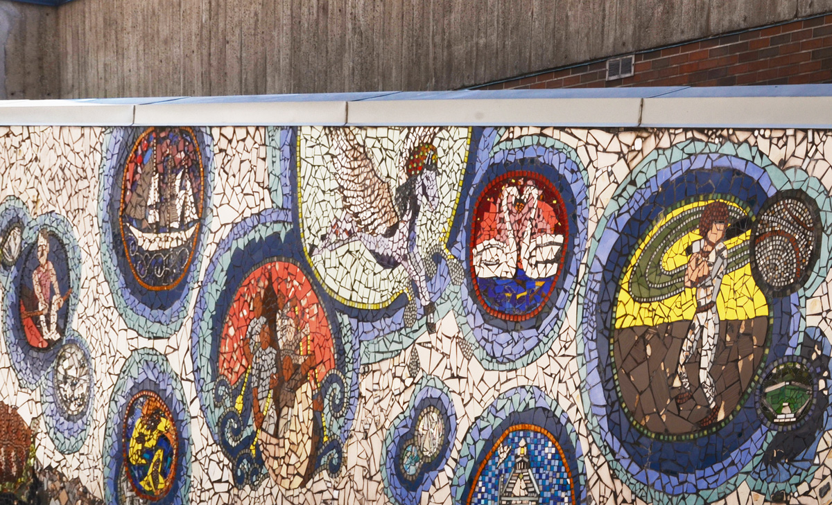
below: “Shore Stories” a mosaic located by the Jack Layton Ferry Terminal. It was made in 2012 by youth from the community under the guidance of AFCY (Arts for Children and Youth, an organization that may or may not still exist).
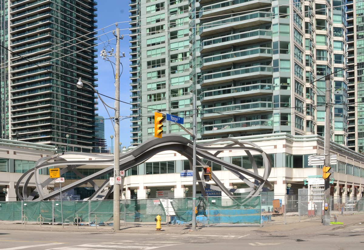
below: The “egg beaters” at 1 Yonge Street are now behind a fence. The installation is actually called “Between the Eyes”, and is by Richard Deacon.
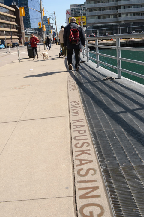
below: It’s 830km to Kapuskasing and even farther to Cochrane, just keep following Yonge Street northwards.


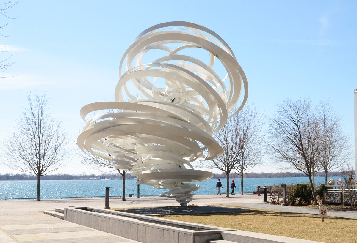
below: “A Series of Whirlpool Field Manoeuvres for Pier 27”. by Alice Aycock
below: The walkway along the waterfront comes to an end where a very high concrete wall separates Redpath Sugar from the public space.
below: Que Rock murals, water theme, “Water Clans (Nbii Dodem)” four panels at Redpath Sugar.


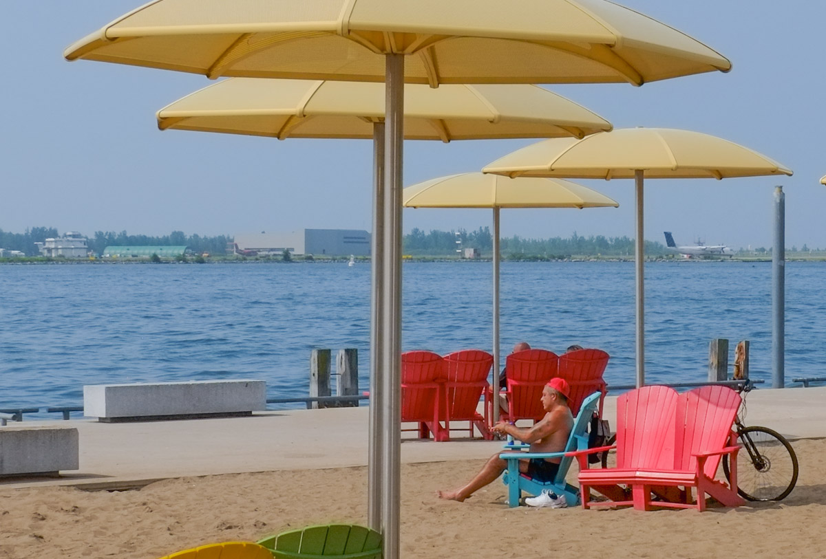
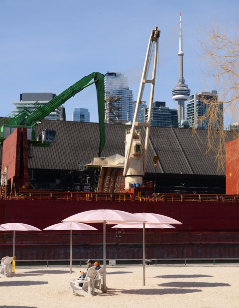
below: Pink umbrellas and sugar filled ships, at Sugar Beach.
below: Queens Quay East at Dockside

below: Sherbourne Commons


below: New construction on Queens Quay East where many parts are being made of wood. A new park, Aitkens Place Park lies between the new building and the waterfront.

below: Vacant lot on the corner of Queens Quay East and Small Street.


below: At the foot of Parliament Street.
below: Anser eyes
below: Sweet and salty at the Distillery

From late February through to the end of March is Winter Stations on Woodbine Beach along Toronto’s waterfront.
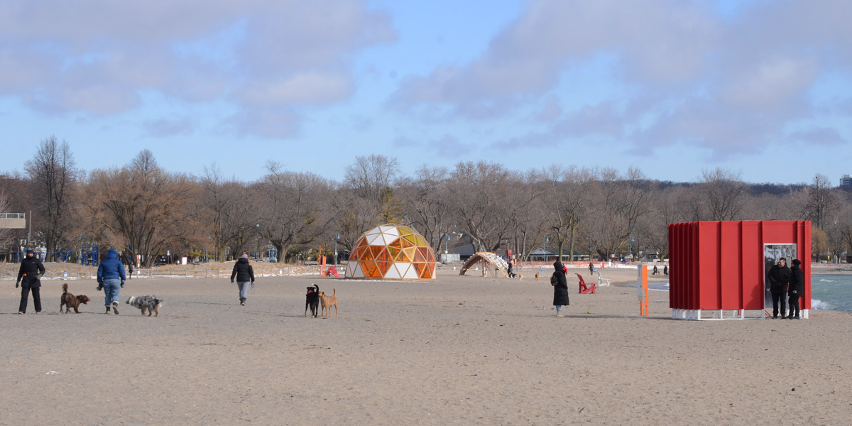
below: “The Hive” by Canadians, Kathleen Dogantzis & Will Cuthbert


below: Designed by a team from Daniels Faculty of Architecture, U of T, “Introspection”.
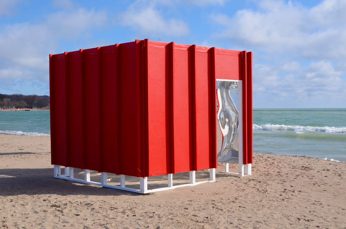
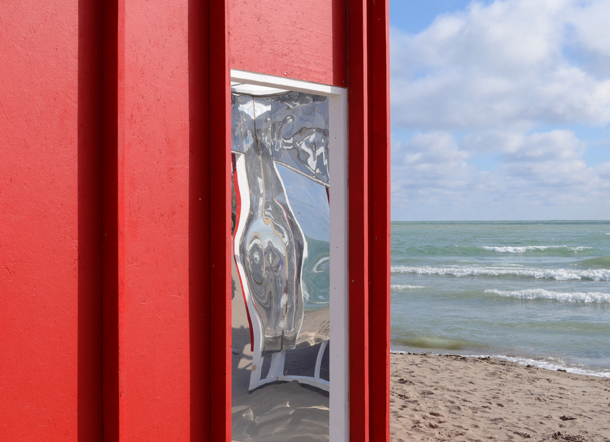

below: Designed by a Turkish pair, Cemre Önertürk and Ege Çakır is “Enter-Face”.

below: The structure on the left has circular openings on one side and a translucent panel on the other (lakeside) – you can through but the resulting view is slightly distorted. On the taller structure, there is a reflective material.


below: “S’winter Station” was designed by a team from Ryerson University’s Department of Architectural Science. The circular openings on the surface panels were made from beach towels, an object more associated with summer than with winter.


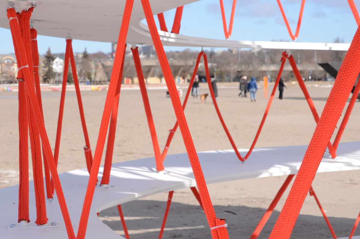
below: “One Canada” by a team from School of Environmental Design and Rural Development at the University of Guelph. The “One” in the title is for the combining of Indigenous and Non-Indigenous together as one. Seven rings representing wisdom, love, respect, bravery, honesty, humility, and truth. Orange (for National Day of Truth and Reconciliation) ropes weave the rings together in a pattern echoing those used to make drums.


below: Simcoe Wave Deck


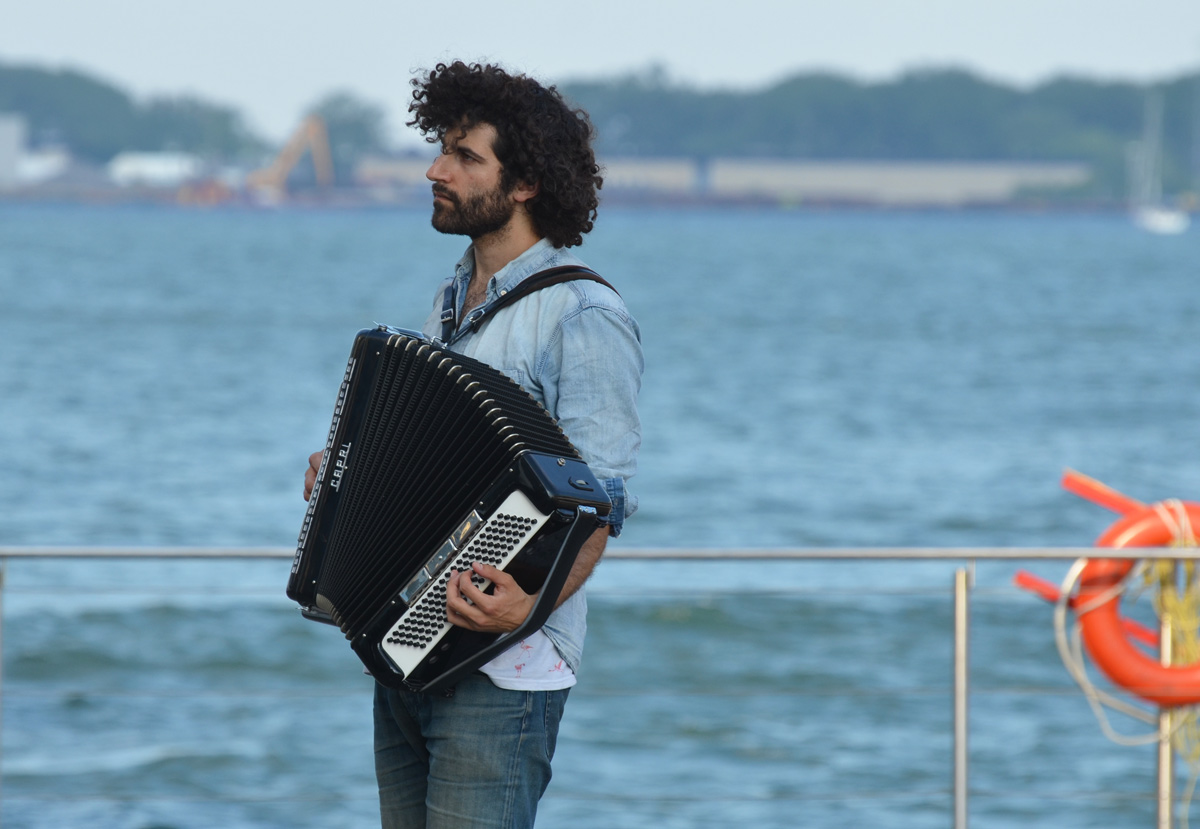
below: Joseph Landau, accordion player
below: Queens Quay traffic – take care! Cyclists (and pedestrians) don’t always see or obey their traffic signals!


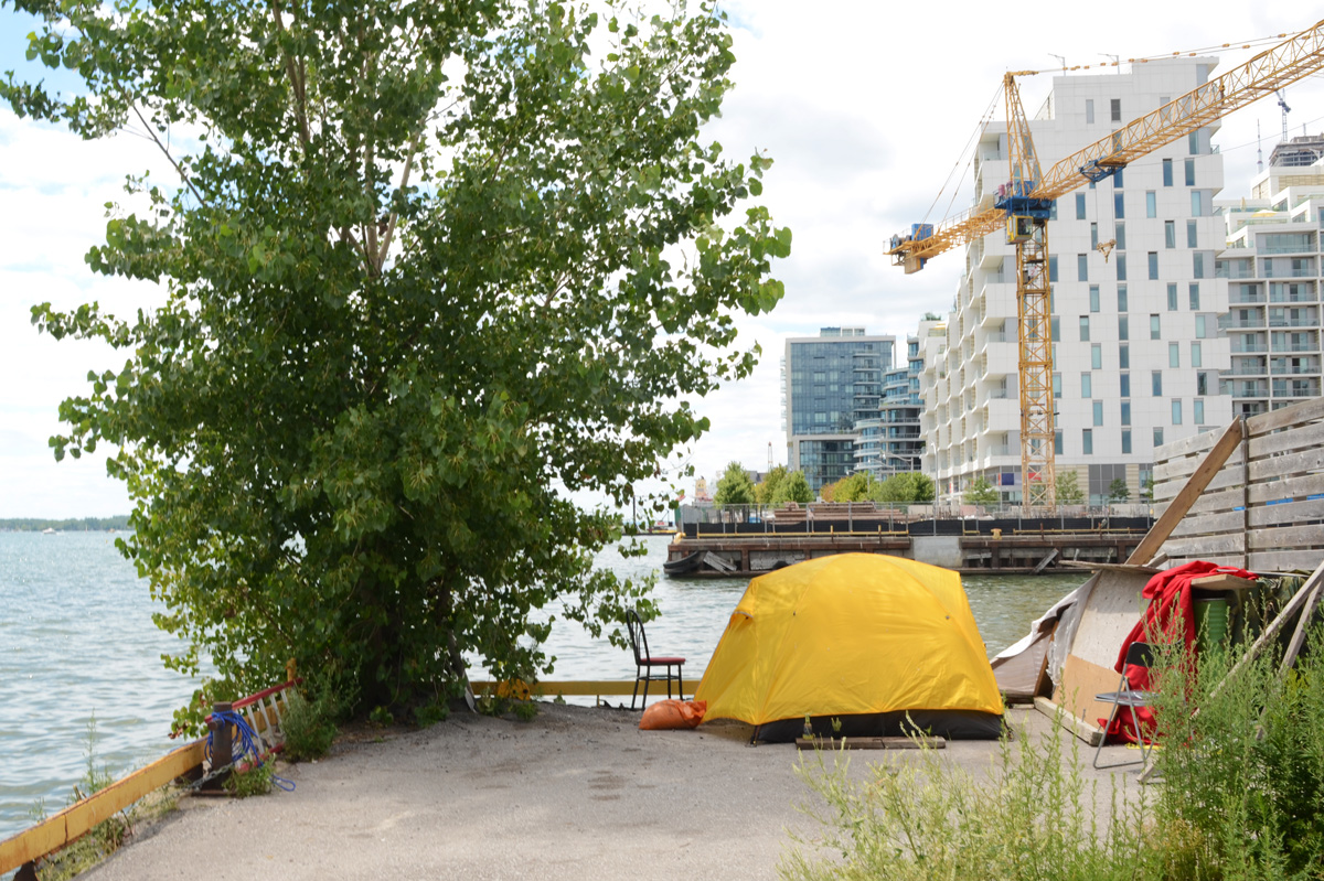
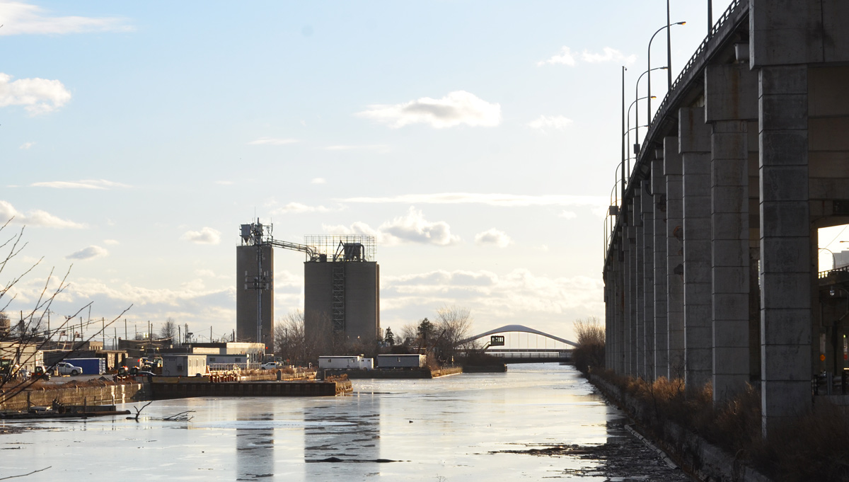
The other day, later in the afternoon, I was driving along the Lakeshore when I noticed that perfect lighting on the south side of the Keating Channel. I’ve done blog posts about the Port Lands development but I hadn’t looked at it from the other side. A quick change of plans – a parking spot nearby and a walk along the Lakeshore. This is some of what I saw that day.
below: At the bottom of Cherry Street
below: At the corner of Cherry and Lakeshore.
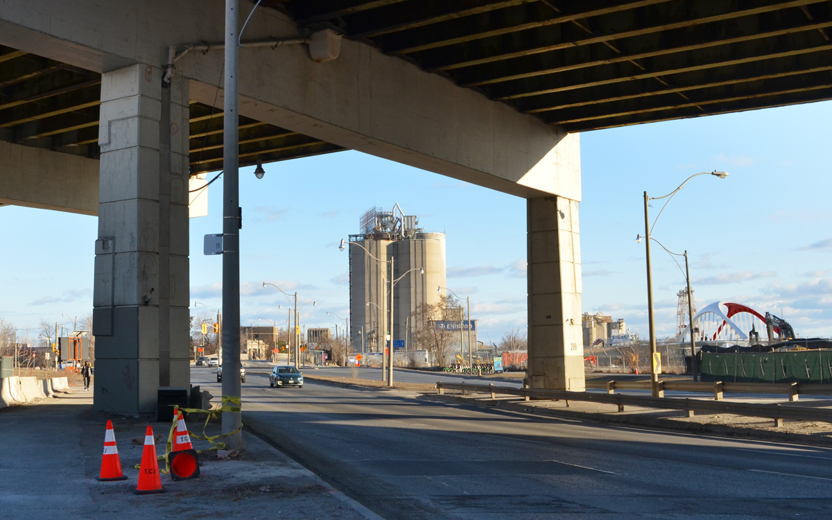
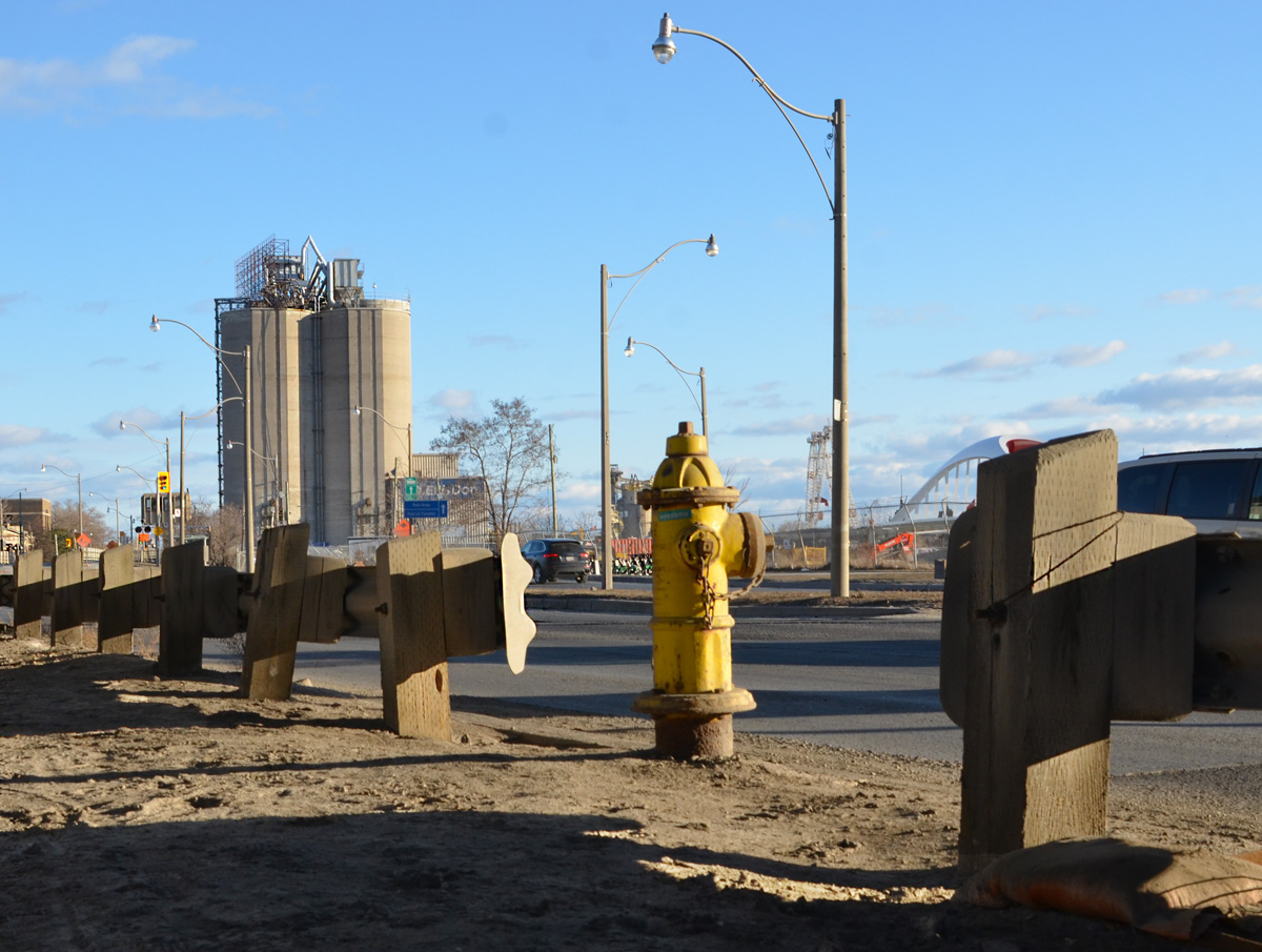
below: Along the Lakeshore, looking south towards Port Lands at Cherry.
below: The Gardiner curves slightly northward as it aligns with the Keating Channel. Lakeshore Blvd takes a wider turn and comes out from under the Gardiner for a few brief moments before slipping back under as both roads parallel the channel.

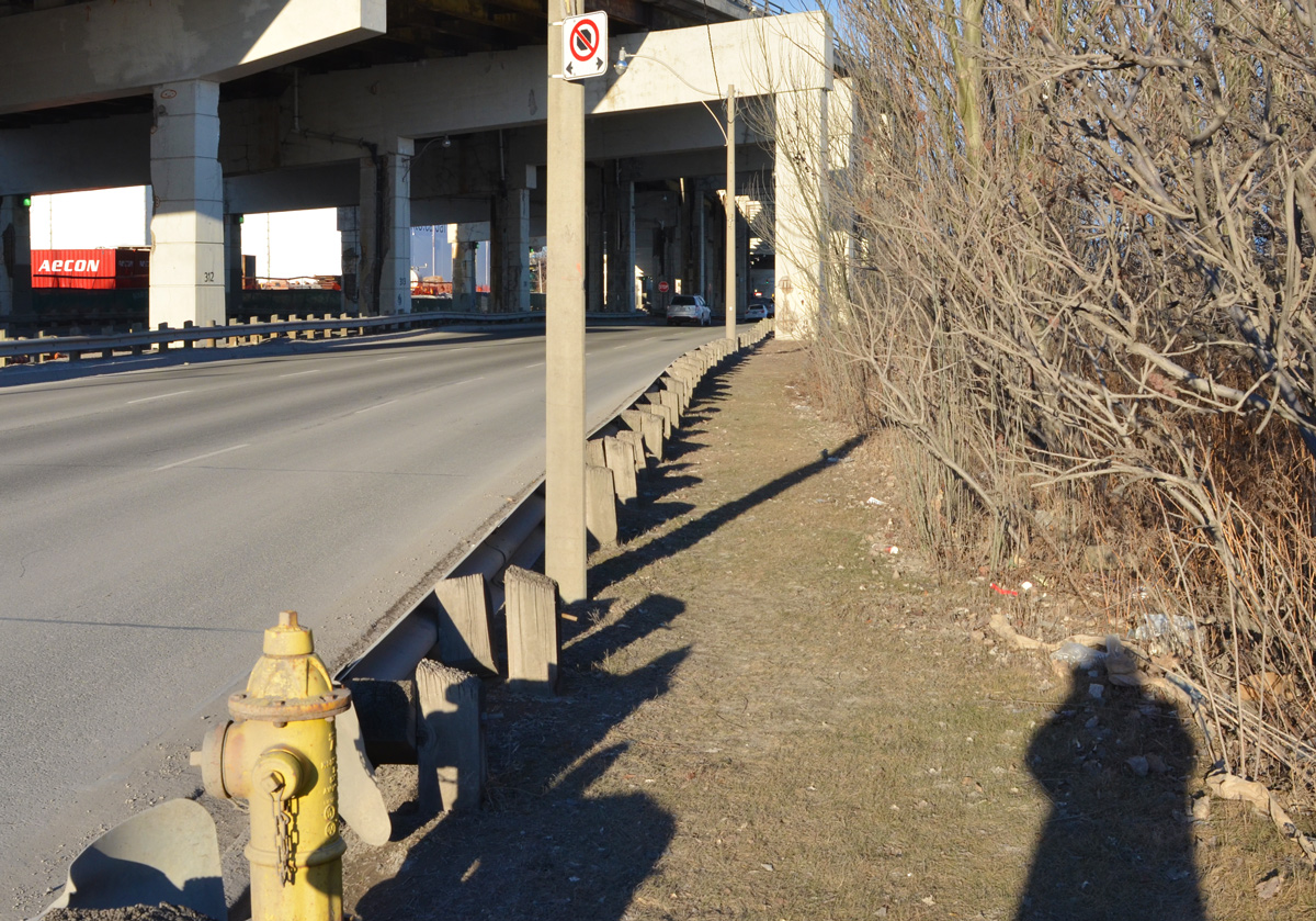
below: On the south side of Lakeshore, there is no sidewalk here but the grassy area is wide enough…..
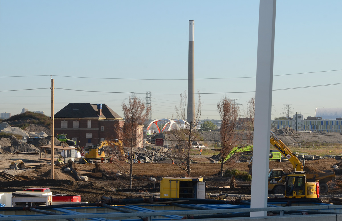
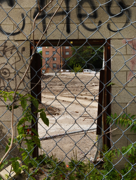
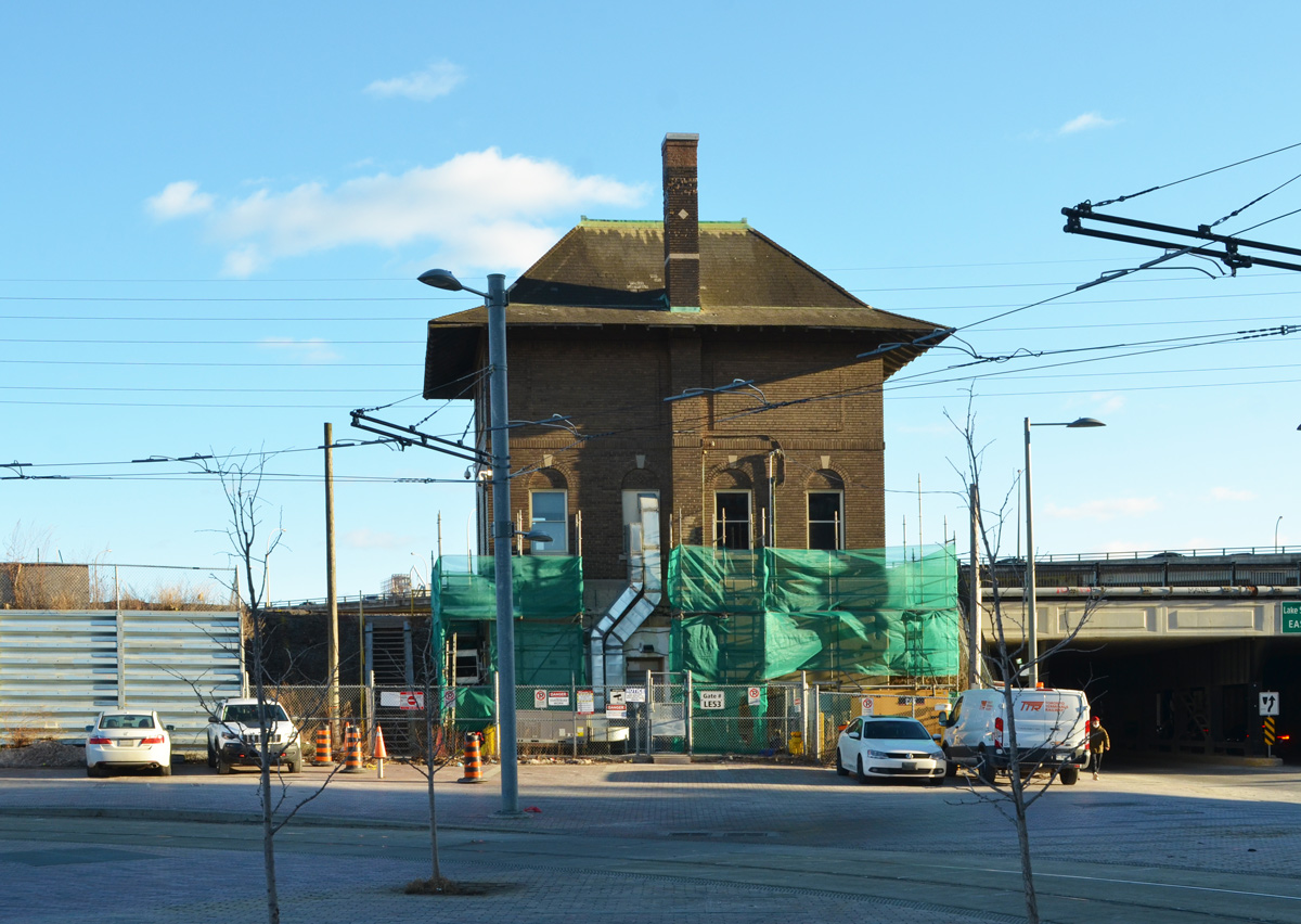
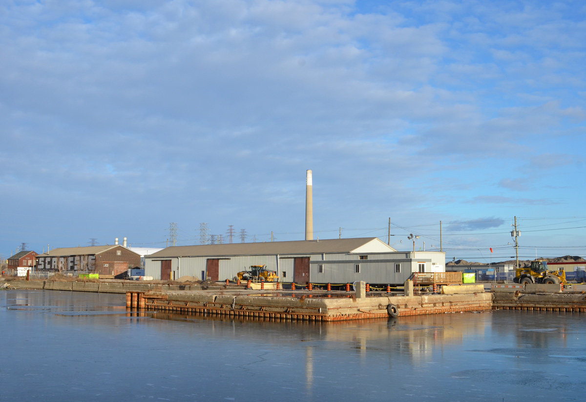
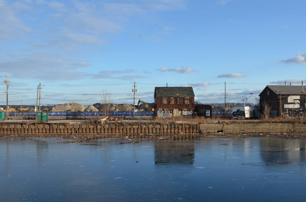
below: Walking here offers a different view of the Port Lands. The “smokestack” on the right is the old Hearn Generating station.
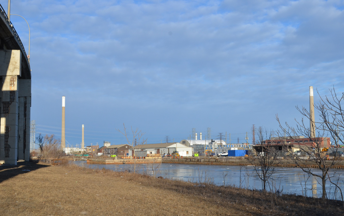
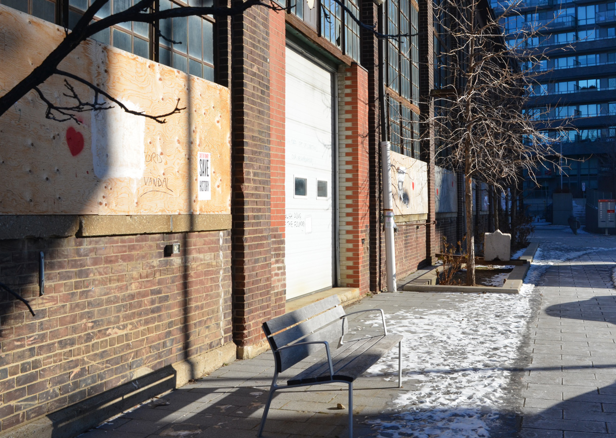
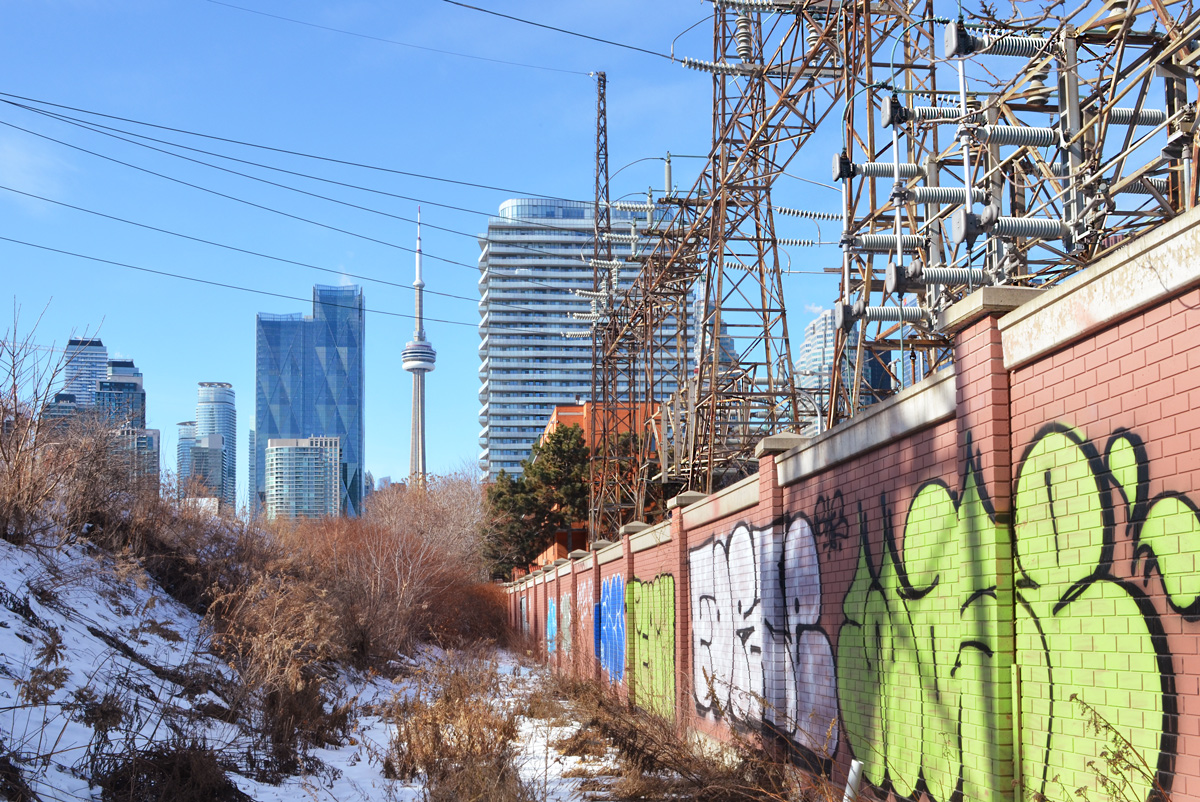
below: Some of the buildings that remain on Villiers Street.

below: Panorama of Keating Channel being developed, 1916, before there was much on the Port Lands and Cherry Street was just a one lane dirt road.

below: Keating Channel, 1916
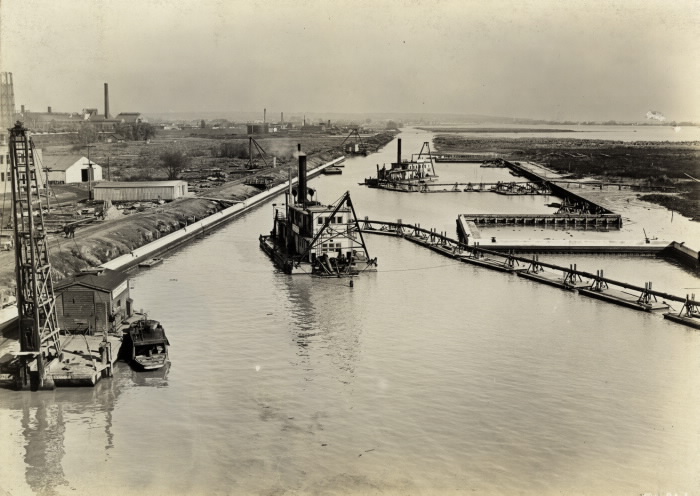
The original plan for the diversion of the Don River called for a more curved mouth of the river before it joined the Keating Channel. But the British American Oil Company who owned the land fought that idea. Instead, the 90 degree turn that still exists today was built to avoid crossing B/A property.
below: A few years after the channel was upgraded (1934)… From vacant land to a forest of BA oil tanks. There are railway tracks along the edge of the channel. From Wikipedia: “In 1908, with 8 shareholders, B/A built Canada’s third refinery on 3 acres on the eastern waterfront in Toronto. The company refined imported crude oil and its main product was kerosene; a then-useless by-product was gasoline, which was dumped into a swamp.”

Photo by Arthur Beales. Toronto Port Authority Archives, PC 1/1/10769. Found at Wikimedia Common
.
below: BA refinery with the Don River on the right, 1931. There were still storage tanks here in the 1960s when the city was building the Gardiner Expressway.

Photo source: Library and Archives Canada, online
.
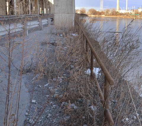
below: This rusty “fence” isn’t going to hold anyone or anything back. I had visions of tumbling into the icy channel if I went near it. I think that just looking at it made it wobble.
below: There are still places to tie up your boat
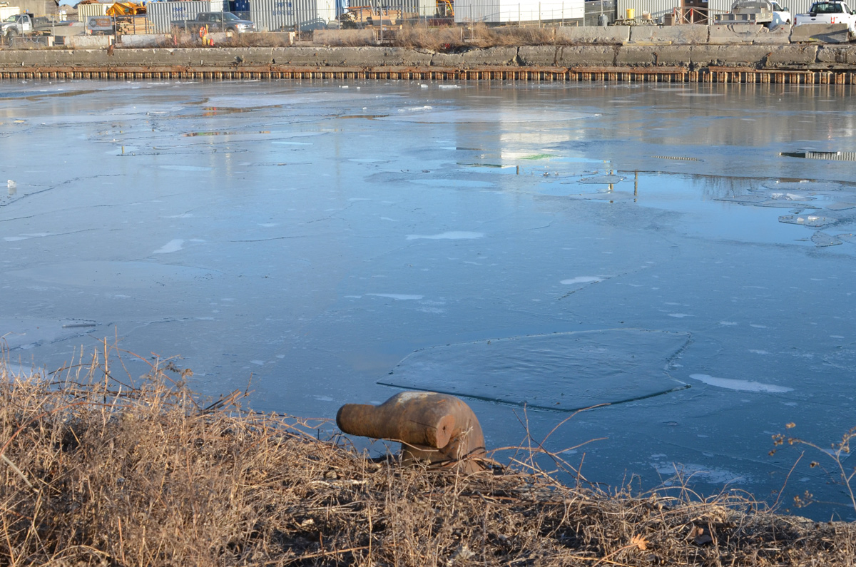
below: A big tap? It’s attached to a pipeline but is it functional? (It doesn’t look like it). There is a lot of infrastructure buried under the Lakeshore, sewer lines, water mains, electricals, etc., but this looks like a piece of history. Pleased correct me if I’m wrong! Also – if you plan to explore here, there are stretches where the only option is to walk right beside the road.

below: Likewise, the box structure is probably there to protect the rest – but what are they? Valves of some kind?

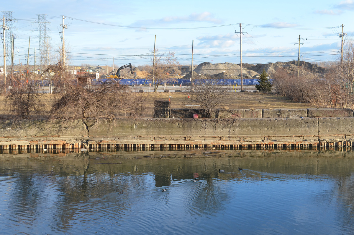
below: Looking north to Canary District and West Don Lands development. The oil tanks are long gone.

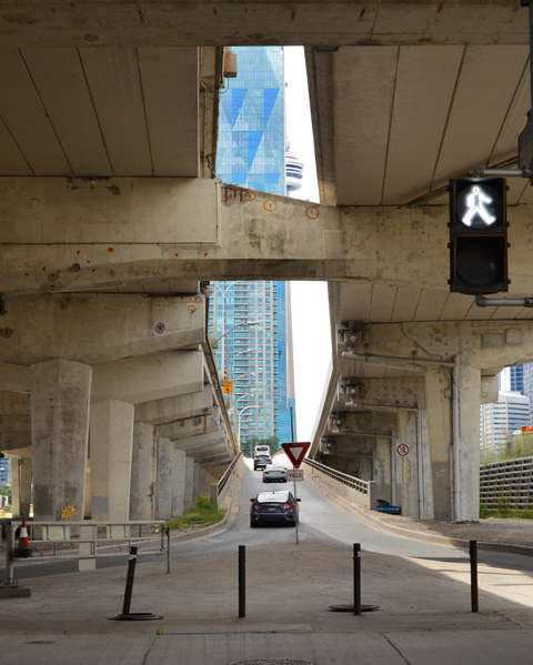
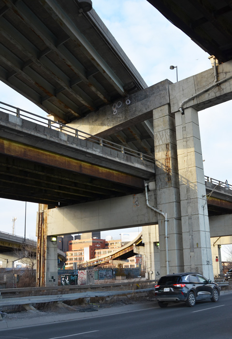
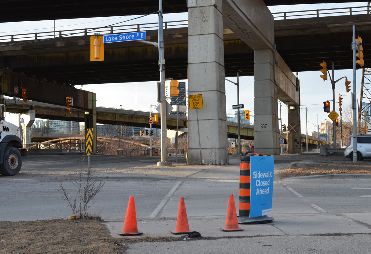
below: Looking up from Lakeshore, under both the Gardiner and the ramp from the DVP
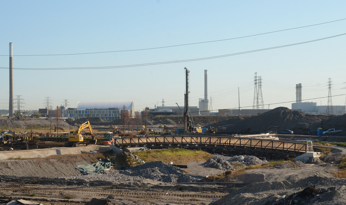
below: Looking west from Don Roadway along the Keating Channel to the new Cherry Street bridge.
below: Intersection of Lakeshore and Don Roadway.
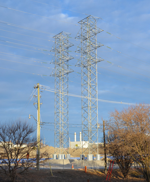
below: Two metal transmission towers standing side by side. Geometrical, straight lines, yet lace-like.
below: From the Don Roadway, northbound and homeward


I first started walking the streets with a camera sometime in 2011. At that time Instagram was still a baby; the photo sharing platform of choice at the time was flickr. Flickr still exists but there are many more choices now. Back in the day there was a Toronto flickr group that had meetups once a month. The meetup, there’s another concept that has exploded with the internet. There are now meetup groups for any photography genre that tickles your fancy. Ten years ago, you met through flickr and that is how I found Toronto Photo Walks. They walk (or walked pre-COVID) on alternate Saturdays, rain or shine, somewhere in the city. My first walk with them was February 2012, almost exactly 9 years ago. If you check their website, you”ll see that COVID-19 has played havoc with their group and there haven’t been any walks for a year now. I miss my phellow photogs so the other day I walked with one and this is where we ended up.
below: If you’ve been in the Distillery District this winter (or any of the past few winters), you might recognize this cheerful fellow.

below: At Mill and Trinity, the omnipresent blue and white Notice sign. Apparently a developer has applied to build a 31 storey building (on top of the existing old brick structure) with 392 hotel rooms. I wonder if they are happy that they didn’t just finish this a year ago? Ontario hotel occupancy rate hit a low of 15.3% in April 2020 and had barely started to recover when the second lockdown hit. As an aside – if you like stats, you’ll like the Ministry of Tourism, Culture, and Sport research pages!

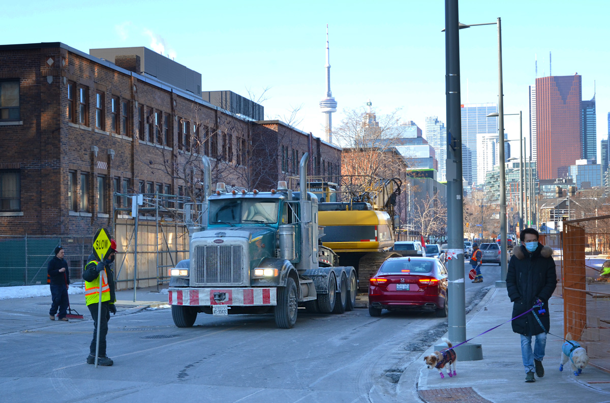
below: One industry that is booming is the film business. Often you can see movie trucks at the corner of Mill and Cherry. This land is owned by the province and is awaiting an affordable housing development of some sort.


below: The old Foundry site, actually a group of heritage buildings at the former Dominion Wheel and Foundries Company on Eastern Avenue that are more than 100 years old.

The problem? It sits on provincially owned land. The province can pull stunts like changing the zoning without city approval (or knowledge). It can turn one foundry building into 3 towers of max 141m high (30 storeys is approx. 100m so 141 m is TALL!). One of them has to be rental apartments but can’t have parking – there’s to be a commercial parking structure instead. Hey let’s build affordable housing by making them pay for parking! Here is the government website with the proof – Ontario Regulation 595/20
Fast forward to late January. Demolition of the foundry begins with no warning to the neighbourhood. There is a rezoning order but no actual plans drawn up or developer named. As far we know, the province still owns the land but refuses to say exactly the plan is because, well, probably because there is no plan or because the province is selling out to a developer. Name your poison. The province just says “affordable housing” and we’re supposed to go oooh and ahhh.

Just around the corner (on Mill Street) three towers of 761 rental units are being built at the moment (no photo, it’s all behind hoardings so far).

below: Heritage Toronto plaque, 2012, Dominion Wheel & Foundries Ltd., Manufacturing Complex

These four buildings were once part of a larger Dominion Wheel & Foundries Ltd. complex. By 1913, the company had constructed its first building, 169 Eastern Ave. on this site. As a manufacturer of railway equipment, rolling stock, and foundry and machinery supplies, Dominion Wheel & Foundries expanded with the growth of the nearby railway companies. By the 1940s, the buildings stretched from this location to Cherry Street, replacing two former residential streets. The firm’s remaining warehouse (#169)m foundry building (#153, built 1951), office building (#171, built 1930), and machine shop (#185, built about 1935) are now among the few remaining reminders of the extensive impact the railway industry had on this area.
.
Anyhow, lots of protest, lots of noise. Demolition was halted. An Ontario Divisional Court justice temporarily stopped the province from demolishing the heritage buildings.

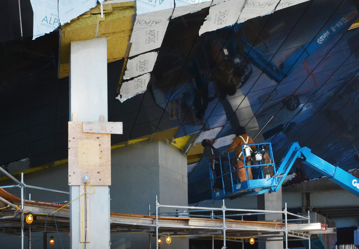
below: Just behind the Foundry, an almost completed condo.

below: Workers remove the protective layer from the mirror-like panels on the underside of the overhang (see yellow area near the bottom of the condo in the above photo). This feature parallels the mirrors on the “ceiling” of Underpass Park which is close by.
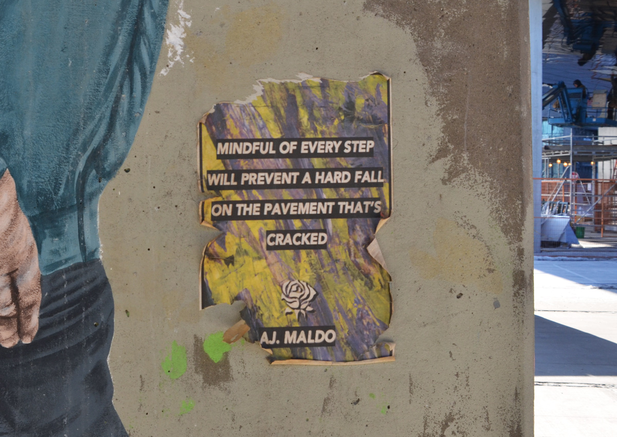
below: Poster paste up graffiti at Underpass Park (you can see the new condo I mentioned above in the upper right corner). Good advice whether you take it literally or as a metaphor.

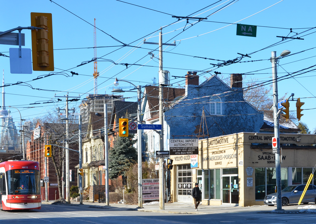
below: Looking northwest at the corner of King and Sumach
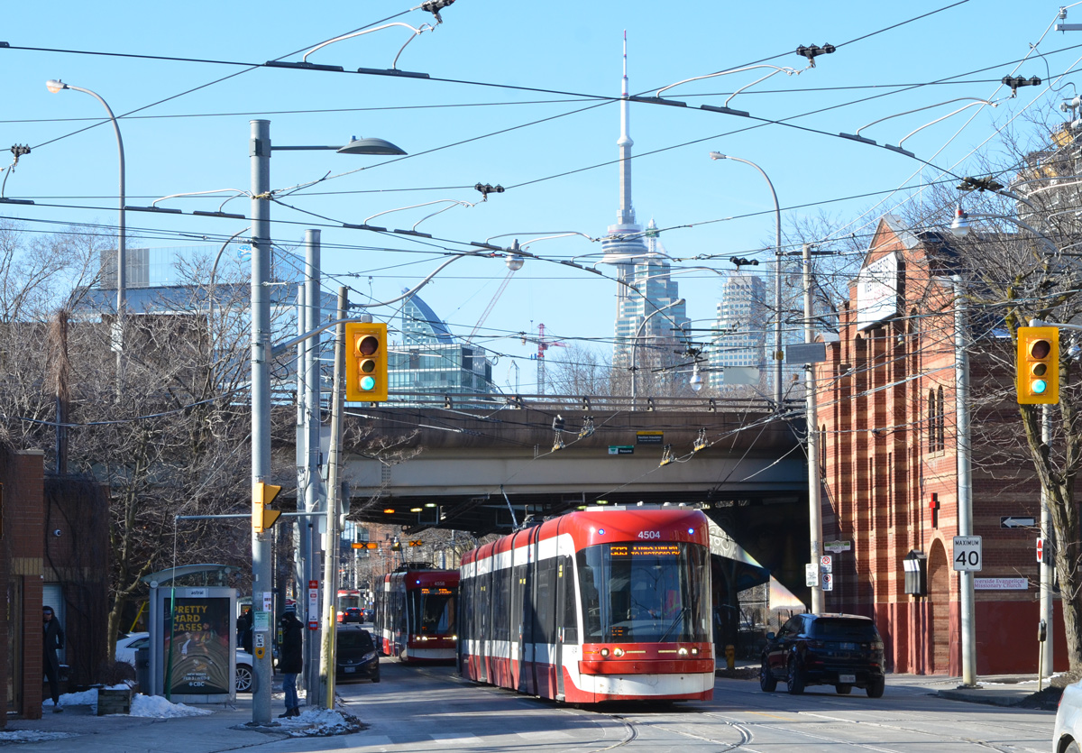
below: A few metres further west along King. Traffic passes under Richmond and Adelaide streets.
below: Looking northwest from Sackville Park.

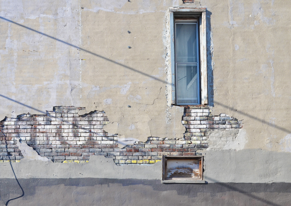
below: ghost sign
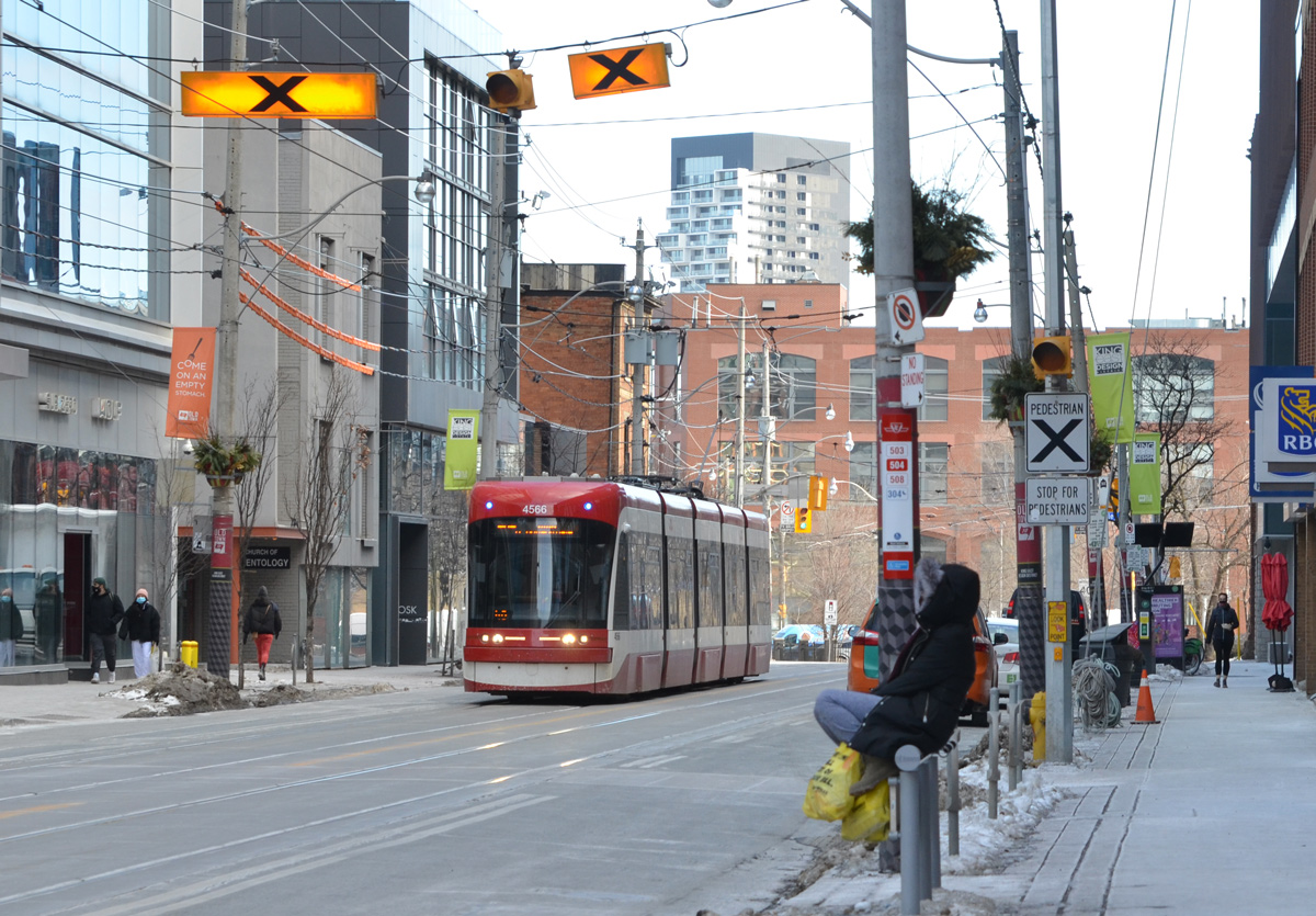
below: Waiting for the streetcar.

below: Architectural detail on a corner of St. Lawrence Hall. That’s quite the expression on the poor fellow’s face. The harrowed look of someone who has spent too much time in lockdown?
below: In contrast, this guy looks like he’s having a great time!
Did you ever think that we’d still be mired in this pandemic a year later?
below: A reminder that this pandemic has been hard on a lot of businesses – sign on a window, “Dear Customers”

Dear customers, We have decided to close this weekend to re-assess for the future…
.
below: Lining up to buy groceries, masked and keeping distanced.

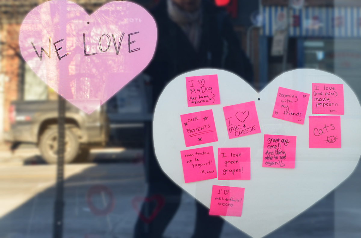
On a storefront window, something positive: hearts for the things we love – “my dog”, “mac & cheese”, “movie popcorn”, etc.
below: Pam Lostracco artwork on hoardings.

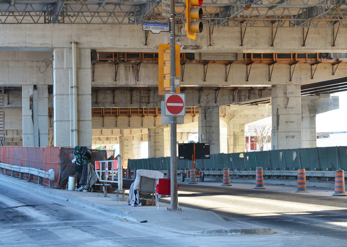
below: View of the CN Tower from Lower Sherbourne, just north of Lakeshore/Gardiner and immediately south of Hydro One’s Esplanade Transformer Station. Unfortunately, that is not a public path; it is behind a locked gate.
below: Chairs in the median.
below: Queens Quay at Lower Sherbourne, looking west towards downtown.
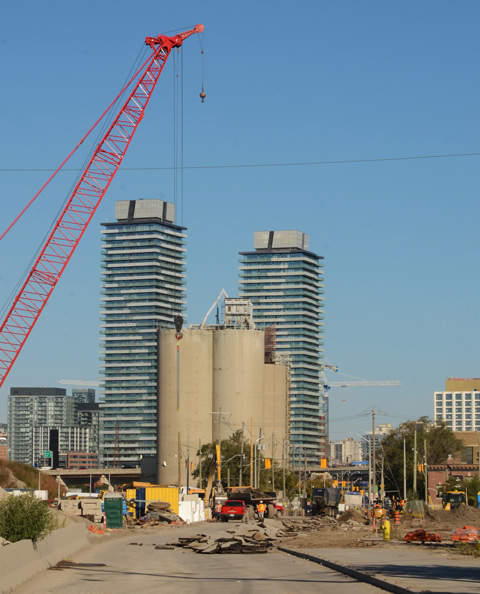
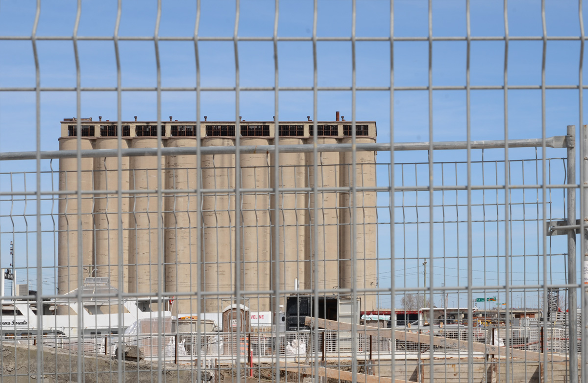
below: Queens Quay at Lower Sherbourne, looking east towards the old Victory Soya Mills Silos. They were built for Canadian Breweries’ soya bean processing plant in 1944. Ten years later the site was sold to Proctor and Gamble who renamed them the Victory Soya Mills Silos. One last change of ownership occurred in 1980 when Central Soya Mills purchased them. They have been empty since 1991. Other buildings on the site have been demolished but the silos remain, now a heritage building but surrounded by a large vacant lot.

below: The mill with its three silos before it closed in the early 1990s. The silo that still stands is the one in the back, not the two closest to the water. In this picture, you are looking southeast; the Port Lands are in the background and the Cherry Street bridge is on the left at the very edge. There isn’t much traffic on the Gardiner Expressway!

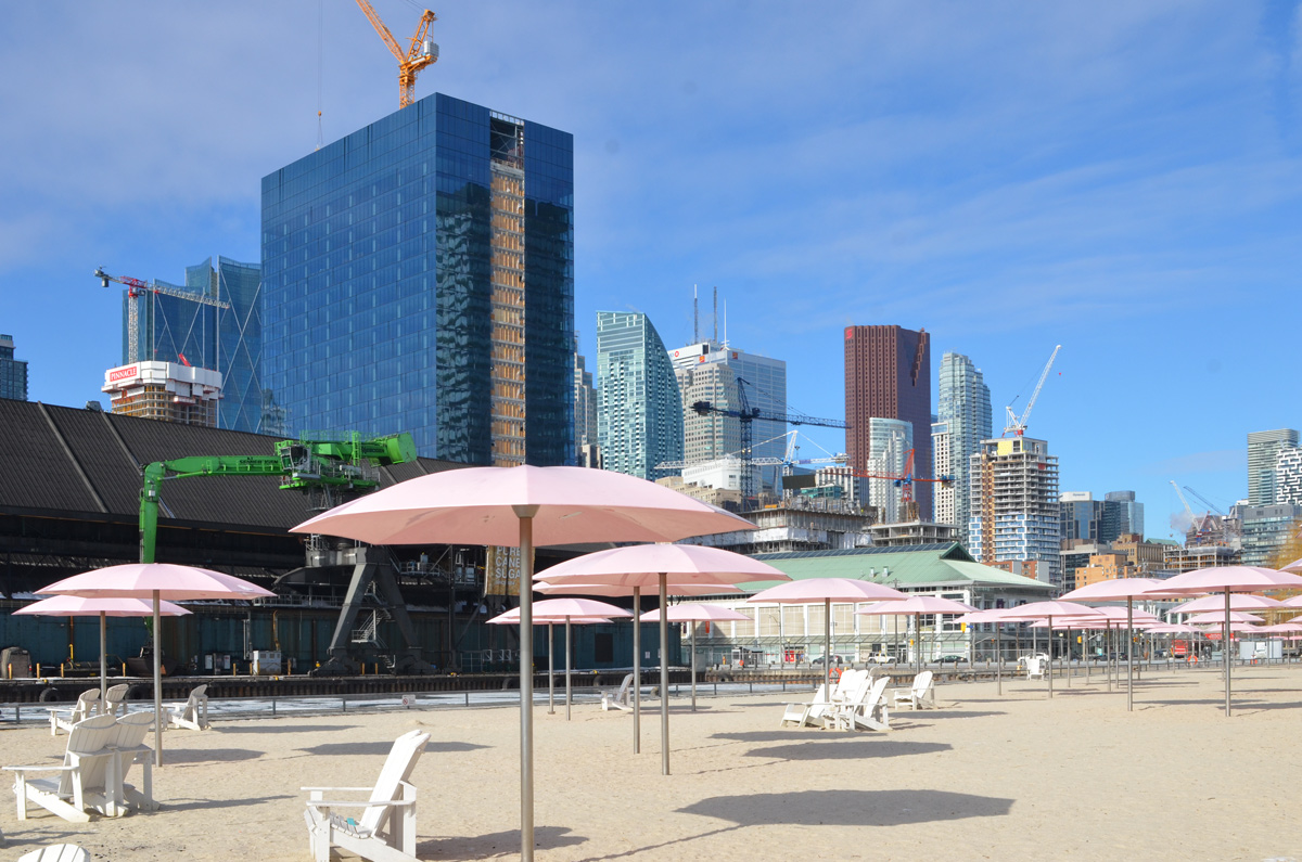
below: Sugar Beach


My thanks to Vicki for walking with me that day. We’ve walked many miles together in the past but I don’t think that we’ve ever walked alone (maybe?)

below: As an aside, after walking with Vicki, I looped back around to my car. This construction site is on Adelaide where the brick facade of the old building is being preserved. More to explore another day!

A mild January turned into a frigid February but that shouldn’t slow us down should it? So I bundled up and drove to Mimico to meet a friend – what? we haven’t seen each other for over a year? 2020 has taken its toll. At least it’s easier wearing masks in cold weather!

below: Two murals by Jim Bravo. On the right, “Down Creek Way” 2012. On the left, “Morning Ice Harvest” 2014. Both are part of the Lakeshore Arts Project

below: A watery mural with a large duck bottom as it paddles by on the side of Birds and Beans Coffee Shop. Another Lakeshore Arts Project; it was designed by Alexa Hatanaka and Patrick Thompson and painted with the help of a crew of youth & community members coordinated by Paula McDines.

below: Mural on the side of Calibreze Pizza on Lakeshore Blvd.


The northern boundary is the Gardiner Expressway. Here, stairs from the street running parallel to the Gardiner up to Royal York Road before it becomes a bridge over the expressway.

below: Signs on the outside

below: … and old photos on the inside. Jimmys Coffee, Royal York Road. Hanging out inside was verboten but a few minutes of warmth was appreciated.


below: Who can resist a unicorn poop cookie?

below: Signs of Covid. Prior to the most recent lockdown there was talk about “big box stores” being allowed to stay open while smaller businesses had to close. At the moment, even “big box stores” are closed.

below: Bag full of work.

below: Moooooove me…. I’m tired of getting splattered with slush when cars get too close!


below: A cold and wet seat.


below: Just out of the picture, and making a lot of noise, was the same dog that’s in this picture.

![]()
below: Tibetan prayer flags adorn the fence. Each colour represents an element; white symbolizes air, red is fire., green is water, yellow is earth, and blue is wind. They also represent directions – North, South, East, West and Center. As the flags flutter in the wind, they emit positive spiritual vibrations enabling the wind to carry away the prayers and wishes. As the prayers drift away, the colours fade.


below: Mimico is home to a large GO facility, the Willowbrook Rail Maintenance Facility. It didn’t look too inviting! It might be worth some research so that on a warmer, sunnier day we could go exploring.

below: It’s difficult to see, but the door on the left has a “women” sign on it. His and hers.

What had started as a sunny morning, turned into a grey low-light so we headed to the lake to see if we could find more sun, or at least better light.
below: Part of Humber College Lakeshore Campus. These buildings were built in the late 1880s as “cottages”, part of the Mimico Asylum (later known as the Lakeshore Psychiatric Hospital). Almost a hundred years later the site was shut down. At that time, there were 280 patients, down from a peak of 1,390 in 1950.

below: The site was leased to Humber in 1991 and since then these four buildings have been completely renovated to suit Humber’s needs.

below: Humber College is surrounded on three sides by Colonel Sam Smith park and one of the features of the park is an outdoor skating loop. This year, online registration is needed for a time slot at all rinks – unless you’re lucky enough to arrive when others have cancelled or have been unable to show up. (As an aside – they have a washroom for weary walkers in need!)


Another feature of the park are the waterfront trails along the shores of Lake Ontario.

below: Comfy sofa at the ready?


We never did find more light that morning. But if you’re in the mood for hot chocolate bombs or other sweet goodies we might have found the place for you!

below: As I was driving home after the walk, I came across this scene: