Posts Tagged ‘construction’

There are so many new buildings in Toronto!  One of them is the new CIBC building at 81 Bay Street which is immediately south of the railway tracks and across the street from Union Station.  It is also adjacent to the new GO Bus station.

below: If you take the elevator to the 4th floor of the new CIBC building,  you can access the new park.   This is the view that greets you. The park extends over the railway tracks – a great use of space!

elevated park over railway tracks that is part of cibc square development,

below:Looking east from the park (on a foggy morning, and with a spot of dirt on the glass fence).   The trees on the right mark the spot where a strip of land separates the railway tracks from the Gardiner Expressway/Lakeshore combination.  Between Yonge and Parliament there are no buildings adjacent to the tracks on the south side.    That tall splotchy looking building is the Sugar Wharf Condos which, as the name suggests, are close to the Redpath Sugar property.

eastward view from cibc park, over railway tracks, tall buildings on either side of the tracks,

below: Looking north across the roof over the railway tracks.  The gold building is another bank building, RBC (Royal Bank of Canada).  On the right, the building that looks like there are diamond shapes in the glass, is a second CIBC tower but on the north side of the railway tracks.

below: Construction continues on the north side.  It too will have a park that extends over the tracks.  The two parks should merge into one once construction is completed.

construction site, park above the railway tracks at part 2 of cibc square, on the north side of the tracks, gold coloured r b c building also in the photo

man working at construction site, park above the railway tracks at part 2 of cibc square, on the north side of the tracks, gold coloured r b c building also in the photo as is Royal York Hotel

CIBC square, park

CIBC square, park, in November

below: Westward

looking west from cibc square, red leaved plants in foreground, CN Tower in background

below: In the center of the park is a large shiny metal leafless tree.   This is “New Amalgam” by Roxy Paine (2022).   It is 72 feet high.

public art, tall tree made of metal, cibc square

public art, tall tree made of metal, cibc square, cn tower in the background

below: Looking over the covered tracks at Union Station and all the ventilation system components on the roof.

looking west from CIBC square, long railway tracks, past covered tracks at Union Station with ventilation systems on the roof, CN Tower,

looking west from CIBC square, long railway tracks, past covered tracks at Union Station, CN Tower, with construction on south side of railway tracks

below: A closer look at the nearby construction at track level (and lower).

union station infrastructure construction

There are also stairs on the exterior of the CIBC building that lead to the elevated park.

looking into a few levels of cibc building, through large windows, from exterior stairs

Bay street side of CIBC office building, west side, lower three levels with tall white pillars

below: Looking south on Bay Street where Scotiabank arena takes up most of the street scene.  That’s the Gardiner Expressway as it crosses Bay.

looking south on Bay street rom CIBC building, Scotiabank arena takes up most of the street scene,

below: Through the window to the interior of CIBC  where Steve Driscoll’s artwork shines brightly.

interior of cibc building on bay street as seen through large window from exterior stairs, glass artwork, little round tables with a couple of people seated at them

below: “A light stolen from the sun” is a collection of 12 digital prints on laminated glass.   they can also be viewed from the 4th floor but access is controlled.   Also, camera use will get you a nice chat with a security guy.  The usual, phones are allowed but even little cameras are a no no.

Steve Driscoll artwork, red and blue, trees, tall, vertical works on glass

below: An outpouring of red poppies is the stunning centerpiece in this Remembrance Day tribute (created by Fresh Floral Creations).

an arrangement of red poppies for Remembrance day in the lobby of an office building,

two women on exterior stairs by CIBC sqaure, downtown toronto

With thanks to Nancy and Merle who went exploring with me that day.

Have a seat!   It’s a rather warm autumn this year, isn’t it?

a pale orange, faded, fabric covered armchair sits by the curb on a sidewalk in front of a house, fallen autumn leaves on the ground

below: A Hallowe’en spider caught in a rather thick web. It doesn’t have much to do with Pape subway station although you might feel inclined to put “scary” and “TTC” together.

big black fake spider on white, on a red shrub, front yard

Anyhow back to the main story…. Pape station is where the existing Bloor-Danforth line is going to meet the new Ontario line.

below: Do you remember when Pape station was being renovated? Now the site is a mess again.

pape subway station entrance on pape avenue, with cranes around it, for construction of Ontario Line

Pape station is a short block north of the Greektown section of Danforth.

orange and black traffic cones, and orange construction mesh fencing, outside pape subway station, for ontario line construction

below: Looking south on Pape towards Danforth

looking south on Pape from beside Pape TTC subway station

below: Across the street from the subway station

buildings on Pape across from the TTC subway station

below: See that bright white building in the picture above?  I bet that it’s not white anymore.

truck with red cab is parked beside a white building that is being painted black, person with a paint roller on a very long pole

below: My idea was to walk around the whole site. …

sidewalk in front of A & W, motorcycle parked there, sidewalk ends with orange fence because of construction, utility pole by sidewalk is wrapped in blue with Greektown Danforth written on it, also a blue and white Greektown banner on pole as well as Canadian flag

below: Looking back at the Danforth and Pape intersection, north side.  The white stone Royal Bank building stands on the northwest corner.  Behind it, the steeple and little green dome of Holy Parish church points upward.

Danforth at Pape, north side of the street, bank building on northwest corner, and A & W on the northeast corner

below: Ontario Line construction along the Danforth, northside.  Metrolinx seems to have a lot of property here.

ontario line construction on the danforth near pape

below: Any idea what this is?  What is happening here?

large yellow crane holds up an very large item, ontario line construction

below: I wasn’t the only one taking pictures!

a man on a bicycle has stopped to take a picture of the construction at pape station, on the danforth

below: Eaton Avenue runs parallel to Pape, just to the east.

Eaton Ave at Danforth, looking west, Ontario Line subway construction site

below: Northeast corner of Danforth and Eaton

northeast corner of danforth and eaton avenue, 3 storey brick building, Papa Johns pizza on ground floor, Mr. Pide restaurant (now closed), Black Pot lounge, an empty storefront and an Asian (Korean?) restaurant.

below: Eaton Ave entrance to Pape station lined with plywood hoardings.  This station isn’t that old – the update was completed in 2013.  I think that it is being retained but it is hard to tell from the Metrolinx website.  A brand new entrance is planned for the Danforth as well (and may be very large and very grand, not quite to scale with the present neighbourhood?).

Eaton Ave entrance to Pape subway station, lined by construction hoardings, plywood, Ontario Line subway construction site

below: Houses on Eaton Ave with Metrolinx construction behind them.

single family houses on Eaton Ave with construction cranes behind them, Ontario Line,

2 large orange storage tanks, wires, crane, ontario line construction site

2 large orange storage tanks, wires, crane, ontario line construction site , orange flags on overhead wires

This area has been serviced by the Bloor Danforth line since 1966.  In general, most of the residences are single family houses, often as some form of row housing.  Smaller houses with small yards seems the norm… i.e. a fairly typical East York neighbourhood.

three single family houses on eaton avenue

Muriel Avenue and Selkirk Street, residential neighbourhood near Pape subway station, single family homes and row houses

Exploring on Pape…..

below: Working on Pape, fixing a porch (or just watching)

reconstruction of a front porch

below: Addis Kidan Church, Greek Gospel Church..

Addis Kidan church on Pape Ave., red brick building with small white cross on roof

below: Tzatziki cafe with the painting above the entrance – interior restaurant scene

Tzatziki restaurant cafe on Pape, with painting above entrance

small commercial building on Pape with a TTC bus shelter in front of it

below: Mixed use – once a line of single family homes, now some are businesses.

a line of two storey family houses on Pape Ave., one is now an upholstery business

two storey duplex

Seranos bakery and food store, sign and parking lot,

below: There is also another construction site at Sammon

machinery in a construction site

wires covered with orange plastic, on a pole above a construction site

below: Looking north on Pape Ave from MacPhail.   There is another station under construction at Cosburn, a few more blocks north but that’s for another day. (Updated 22 June 2025 – there is now an Ontario Line – North Pape blog post)

looking northward on Pape

white arrow pointing right and orange pedestrian sign pointing left

I’ll end instead the way I began – with a little bit of Halloween to distract you from the constant noise of construction.

frontyard halloween decorations, zombie on swing with grey teddy bear on her lap

halloween decorations, outdoors, looks like yellow skull and arm bones are rising out of the lawn

On a warmer than usual late October morning….

hear comes the sun poster in a store window on bloor west

… when the early morning sun played with the autumn leaves in Christie Pits park

trees in autumn foliage, reds, golds, and oranges, in christie pits park

painting on a cement box in christie pits park, black bird head, with text, land back to natives is justice

a man walks by a fruit and vegetable store on bloor street

Of course, late October means Halloween with pumpkins and other spooky things.

display of small pumpkins, outside in sun, at a market, orange with green bumpy bits

below: This guy hasn’t had his coffee yet!

halloween decoration in front of coffee shop, inflatable orange pumpkin with scary face, also two green arms,

As I started putting together this post, I learned that Doug Ford wants to tear up Toronto bike lanes starting with those on Bloor, Yonge, and University Ave   He has named them in his latest wannabe Toronto mayor action, namely Bill 212, Reducing Gridlock, Saving You Time Act, 2024.

stickers and notes on door of bike shop

Ford claims that bike lanes add to the congestion on our streets (and makes his commute to work difficult).  You will note the traffic chaos here this morning! The vans on the far side are (legally) parked.  I suspect that Ford once sat in a traffic jam on Bloor and noticed that cyclists were moving faster than he was.

a female cyclist rides a bike in a bike lane on bloor street, one car is driving past, some other cars are parked across the street

man in plaid shirt riding a bike in bike lane

But I don’t want to get bogged down with politics and the antics of politicians, so I will leave you with a few scenes for Bloor West (approximately) between Christie and Lansdowne.  There is some Halloween, some stores, some construction, some people, some architecture, some of the usual stuff!  Maybe even a few things that will take your mind off politics!

below: Bloorcourt

bloorcourt sidewalk art, heart shapes around the letters, in front of a convenience store, painted by Victor

bloorcourt banner on a utility pole at dovercourt and bloor, with crane in the background, for construction on the northwest corner of that intersection

below: A little bit of history…. small tiles in the doorway of number876

floor, exterior, outside of doorway of store on bloor west, covered with small multi coloured tiles, plus green tiles making the number 876

below: Banjara parking lot payphone with its own Heritage Plaque thanks to the Toronto Sign Reimagination Unit, aka Jode Roberts.

empty small telephone booth with a plaque on top

In the summer of 2015, a coin-operated telephone was installed here, replacing three long-standing Bell payphones.  This payphone served hundreds of residents, offering a vital communication link.  To make a call, users had to insert metal coins through a slot.  However, the phone mysteriously disappeared sometime in the past year. 
The coin-operated payphone was patented by American inventor William Gray in 1891.  Its use peaked around 2005, with nearly half of Canadians reporting regular use and over 150,000 payphones across the country.  By 2015, more than two-thirds of these payphones had been removed. As of 2021, only a few hundred functioning payphones remained in Toronto.   This plaque commemorates the payphones in this parking lot and their gradual disappearance from the urban landscape. 
Heritage Plaque courtesy of the Toronto Sign Reimagination Unit, 2024


a woman sitting on a bench, outside, beside a small store, leaning on grey fence with sign on it saying pizza, as well as an arrow pointing right

looking in a store window, mannequin hand in front of a design on a t shirt that is a raccoon popping its head out of a garbage can, trash panda

chairs stacked in corner of patio, outside, some leaves have fallen on the chairs

below: Bloor and Brock

Pizza Pizza on the southwest corner of Bloor and Brock, also stores on the north side of Bloor,

bloor west, north side, at brock, blue collar bakery, bar neon, old laundromat, man walking past on sidewalk,

below: Part of a mural by Jimmy Chiale

part of a mural by Jimmy chiale, many shapes and colours, abstract, mostly blues, some faces,

man standing outside a door of a store

jumble of signs outside of a store

window of a business on bloor street, massage, neck and shoulder etc., red words on the glass that are starting to peel off, plant in window,

bloody no trespassing banner, as halloween decoration, in a store window display, with reflections of the street

hoardings beside construction site, along with scaffolding and protection that covers the sidewalk

below: Amazing!  He’s a cumin being! Good things!

decorations in a window display, store, paper hearts in different colours, each with one or two words like amazing, good things, , also note saying he's a cumin being.

below: Angel Mary

white statue of angel mary, praying, in a store selling beauty and hair products

below: Very large Italian flag by Vito Vesia Upholstery

large italian flag hanging against exterior wall of a building

envelope sticking out of the top of a rusty mailbox that is mounted on a blue metal gate

below: By Dufferin station

people waiting outside subway station, both women on phones, one standing beside a large suitcase

below: Bloor & Lansdowne

looking west along bloor at Lansdowne, front of TTC bus, people waiting to cross street, discount store on the northwest corner,

below: Scrawl on a TTC bus stop pole.  At first I thought that it was a biblical reference, but when I checked, I found that Daniel 5:5 is “Immediately the fingers of a human hand appeared and wrote on the plaster of the wall of the king’s palace, opposite the lampstand. And the king saw the hand as it wrote”.  I doubt that has anything to do with gullible Christian hippies, right?

graffiti writing on TTC bus stop pole that says Daniel 5.5 gullible Christian hippie

big orange cartoon face, with white cap, mural on a garage in an alley
an alley in bloorcourt, murals on garage, staircases, brick buildngs,

close up of a painting on exterior of garage in an alley, blue star with a man's face in it, front end of car with licence plate 007

mural of lighthouse on a red brick wall, bottom part has been tagged over with a lot of yellow paint

below: “Remember to Love! Go call your mom, say I love you and thanks!”

sticker graffiti on a Canada Post mailbox

graffiti stickers on the back of street signs

With thanks to Bill, Jeff, Paul, and Barry who walked with me that morning – and a shout out to the woman who said, “That’s so cute” when she learned that we were walking together.  Cute?

pedestrians crossing street, man on bicycle waiting for green light, bus stop pole, lowrise brick apartment in background

walking on sidewalk, west on bloor,

The best laid plans….

Tucked away on a dead end suburban street is a little park with a monument in it.  A monument to a couple, Henry Mulholland and Jane Armstrong.

stone pillar about 6 feet high, with plaque, memorial for Henry Mulholland

Dedicated to the memory of Henry Mulholland and his wife Jane Armstrong. Pioneers of this district who emigrated from Ulster in 1806 and took out the original grant of four hundred acres from the crown. He fought in the War of 1812 and later returned to Ireland to induce further emigration. While returning was drowned in the wreck of the Lady of the Lake in the Straits of Belle Isle in 1833. Erected by the eight branches of their descendents, 1937.

The ‘Lady of the Lake’ sailed from Belfast on 8 April 1833.  She was bound for Quebec with 233 passengers aboard – mostly immigrants. On the morning of 11th May, off the coast of Newfoundland, the ship struck an iceberg.  Only a few people survived.

Jane was not with her husband on that trip, instead she was at home with her 10 surviving children, the youngest of whom, Henry Jr. was born in 1829.  Two more children later died of smallpox.

Jane and Henry were married in Co. Monaghan Ireland in 1806 so they must have emigrated as newlyweds.  Their first child, Mary Ann, was born in 1807.

The 400 acres that the couple were granted were Lots 14 and 15, Con 3 in East York (south of what is now Sheppard and east of what is now Leslie).  They built a log house on an island in the East Don River.   Fast forward a number of years, after a number of changes of ownership and many changes in the neighbourhood, Henry and Jane’s great grandson, George Stewart Henry bought the farmhouse and property at Lot 14 Con 3 (for $14,500) to bring it back into the family.

The name George S. Henry may be more familiar to some of you.  There is a high school named after him, and a whole neighbourhood, Henry Farms.

The reason that I found the Mulholland cairn?  It is located close to one of the entrances to the Betty Sutherland Trail, just north of the 401 highway.  A few years ago I walked the south end of this trail (you can read about it here: Paths to ruin and a course, 2021).  Now I wanted to walk the northern section as well.

below: An ominous sign, construction on the trail!

signs at the beginning of the Betty Sutherland Trail

below: It wasn’t long before the trail ended.  There were six signs to warn us.  The end was at the 401 highway.

Rather than retracing our steps, we went down to the river’s edge.

The East Don River flows under the 401

We headed back north instead of south. …Over a piece of the path that had washed out in the August flooding.

below: stag horn sumac

below: pear tree

below: swamp bush sumac

below: North York General Hospital in the background.

below: The East Don River flows diagonally under the Leslie Sheppard intersection.  The black and white highrise in the distance is farther north up Leslie Street.

below: Looking west along Sheppard towards railway bridge

below: Seen just outside of Leslie subway station (at Sheppard).  We didn’t see any wildlife, just a lot of traffic.

Apples on the sidewalk, north side of Sheppard…. Seems to suggest that once upon a time someone lived here and planted apples.

below: Looking east

below: Teasels

below: Chinese Crab Apple tree

Now on the East Don Trail (north of Sheppard) where there is more construction.  Also, a large number of new trees have been planted.

below: Strange artwork outside Canadian Tire, just west of Leslie

Getting back to “Best laid plans”…..   You may have noticed that these aren’t the most recent pictures (wrong season!)….  This post was written back in early September and I thought that I had uploaded it.  Ooops.  Forgot.

In downtown Toronto there is a large waterfall mural painted on a brick wall  – because of the bricks, the painting looks a bit more like water pouring over a dam.  Still nice; still nature.

mural by b c johnson, a waterfall

Another waterfall – a longer drop of water, this time on a door.  All the murals here were painted by B. C. Johnson.  There are five or six of them on different buildings, some waterfalls, and some landscapes.

in cottage lane, a mural of a waterfall, with greenery beside it, electrical boxes on the green, with wires, and graffiti on the boxes ,

below: Here a  heron stands on a fallen tree beside the water.  A birch trees is also on the shore.  A waterfall is on the other side of the lake.

mural in cottage lane by b c johnson, a heron stands on a fallen log on a rock on shoreline, birch tree nearby, water, and a waterfall in the background

below: This building is overgrown with ivy which adds a nice touch to the scene. The door becomes a very thick tree trunk perched on a rock above the water.

on a wall by a black door, overgrown with ivy, door looks like tree trunk, also mural in cottage lane by b c johnson, a heron stands on a fallen log on a rock on shoreline, birch tree nearby, water, and a waterfall in the background

below: Surprisingly, there is no puddle at the bottom of the steps (insert big smiling emoji here).

porch at back of building, in alley, on building with lots of ivy growing on it, mural of a waterfall

porch at back of building, in alley, on building with lots of ivy growing on it, with another building across the alley with murals of waterfalls and landscapes

below: A real tree once grew here.  I don’t think that it was a beaver that cut it down.

old hollow tree trunk in lane, in front of a landscape mural and wall overgrown with ivy

boarded up window or door, exterior view, from cottage lane, now covered with part of a mural of a landscape by b c johnson

below: Where do you find Cottage Lane?  South of Bloor, west of Yonge, then follow the signs… and the road less traveled.

St. Marys street, restaurants and signs, canadian flag, street sign of cottage lane

I was not sure why it was named Cottage Lane since, to me, there isn’t much that is cottage-y here.  The answer – there are 10 rowhouses on St. Nicholas Street that were built in 1883 and although the architectural style is ‘bay and gable’, they are referred to as the cottages of St. Nicholas Street.  As you may have guesses, St. Nicholas Street backs onto this lane.

below: Looking north towards Bloor.   Buildings that face Yonge Street are on the right and those on St. Nicholas Street are on the left.

cottage lane, looking north towards bloor and new condos, back of buildings,

back of buildings in cottage lane, balconies, green trash bins, tall condos in the background,

cottage lane

purple bike with white seat cover, parked in an alley beside a small sumac tree and an old window with metal bars on it

back of buildings in cottage lane, balconies, exterior stairs, pink wall, green trash bins, car parked, brick buildings,

back of store, commercial building, alley view, door, heating and air conditioning vents, graffiti on wall, blue trash bins

graffiti on a red brick wall, a bright white ghost with red eyes and smiling mouth, yellow pipes and white plastic exhaust pipes from building

exterior brick wall, painted bright red, with many black wires in a bundle crossing it,, white graffiti happy face, other blue graffiti text lil

graffiti on red brick wall, respect dollar sign, free dollars, 2014

square street sign covered with graffiti ticker, all o them are black with gold lettering

Back in 2021, I posted some pictures from Sandown Lane (Cliffside, near Midland and Kingston Road) where there are many more paintings by B. C. Johnson.

Were you an Edmonton Oilers fan?  Did you jump on that bandwagon?  On the night of the 7th game of the Stanley Cup playoffs were you glued to the TV?  Or are you wondering what I’m talking about?!

I usually watch hockey games now and again, especially during the playoffs but I found that watching the Edmonton-Florida series was just too stressful.  Instead, these long June evenings are great for walking!  A little bit of Yonge Street, Uptown Yonge, was my stomping grounds the evening of the last game.

banner for uptown yonge on a hydro pole, stores and new condo in the background, says eat up. street sign for st. Clements avenue as well

A few scenes from Yonge between Eglinton and Sherwood, in no particular order…

evening, coffee shop on Yonge street, also poke bar,

below: Old and new. I like the way the evening light catches the architectural details along the rooflines.

roofline, old brick buildings with architectural details in front of a newer high rise residential building

below: Playing peek-a-boo.  The new pushes from behind.

stores on Yonge street, prism hair salon, vape studio, goa hair salon,


below: Seating!

late evening, getting dark outside, looking at store front, cobbler's corner shoe repair,

ceiling art, white and green cubes with lights inside

round exterior wall of part of rio can yonge eglinton centre, short glass tower,

metal grille gate covers glass doors of now empty and closed store on yonge street

below: Northwest corner of Yonge and Eglinton, Yonge- Eglinton Centre with its updated glass facade.

yonge eglinton centre entrance

When the Yonge Eglinton Centre was built in 1968, Eglinton was the last station on the TTC subway line.  The Y-E Centre was a large development, and was the tallest building in the neighbourhood.   There was a shopping centre, a cinema, an office tower, two tall residential towers, most of which still remain.   Eglinton is no longer a gateway to suburbia; it is Midtown.  The Y-E Centre is just another tall building in a sea of them.

side of concrete building from the 1970s, Yonge Eglinton centre

tall concrete building

below: The new entrance to the Eglinton LRT (unopened of course)  with the Canadian Tire headquarters behind.  Southwest corner of Yonge and Eglinton.

southwest corner of Yonge and Eglinton, new entrance to Eglinton LRT (unopened), Canadian Tire head quarters building, 1970s concrete, new condo behind

Lament for the Eglinton LRT.  Metal fences and torn cloth.  In tatters and disarray.   Still not opened.

front glass of eglinton LRT station, behind metal construction fence and torn green cloth

stores on yonge street

sidewalk tunnel under scaffolding to protect from adjacent construction site

restaurant window, night time, sidewalk

Maybe one day I will be able to walk somewhere in this city and not run into another hole in the ground.  Note the usual – facades being saved, single houses that stubbornly remain.

construction hole in the ground

gravel roadway down into construction hole in the ground

Bus stop all tied up in knots.

TTC bus stop on yonge street behind orange and black cones and yellow caution tape

mural on the side of bmo bank on yonge, flowers, male face, female face, child face, dog, and lot lots of flowers

white car parked in front of a mural with flowers with many petals, and a woman's face

artwork on glass above subway entrance at canada square, corner of yonge and eglinton, a woman is carrying a potted plant, a man in green shirt with tattooed arm is looking at her

three plants in flower pots on a shelf in a room with a blue light, on the left is an orchid,

below: With some paparazzi stalker vibes I’m afraid.

… Back home in time for most of the third period…. Sad to see Edmonton lose, but why is there hockey this late in June?

Bessarion subway station has always had the reputation of being one of the least used stations in Toronto.  I haven’t seen any recent numbers, but I suspect that a lot more people are now using the station.   There are a lot of development changes happening in the area so the numbers will only increase in the future.

below: South entrance to Bessarion station

entrance to bessarion ttc subway station on sheppard at bessarion, new high rise condos behind it, street scene

corner of bessarion subway station in the foreground, new community center on the right side, and construction of new condos in the background

below: A Stop sign sits in the middle of one of the entrances to the new development on Sheppard Ave East beside Bessarion subway station.  If you follow the left fork in the road, you will end up in the parking lot of the Canadian Tire store.  This store is all that is left from the original 50 acre site that was home to a Canadian Tire warehouse and distribution centre.  In 2000 Canadian Tire filed a plan to re-develop the whole site, including a new head office tower for the company.  Although the plan was approved, it never came to be.  Instead, most of the land was sold to Concord who is now in the process of redeveloping it.

new development on sheppard ave east

below: Concord has filled this community with a lot of public art including these colourful creations, “Jax” (2021) by Pierre Poussin

brightly coloured public ark in concord park place on sheppard avenue

below: A few maple leaves forming a canopy – “Maple Leaf Trellis” by Demakersvan (aka brothers Joep and Jeroen Verhoeven)

sculpture that looks like a canopy of giant maple leaves

below: Leaping Lamp by Inges Idee (a German artist collective)

leaping lamp, a large green sculpture by ingres idee of a lamp post with two very long legs as it walks over a stone wall

below: There is also a rabbit (title: “Rabbit”),  another artwork by Inges Idee.  It’s made to look like a folded ribbon of highway; it sits next to the 401 highway.

rabbit, a large sculpture by ingres idee, looks like it's made of a road all twisted into the right shape, outside new condo by the 401 highway

rabbit, a large sculpture by ingres idee, looks like it's made of a road all twisted into the right shape, outside new condo by the 401 highway

below: Birds hanging out together between Bessarion station and the new community centre.  They won’t be flying anywhere any time soon!

sculpture that looks like birds on a tree, including an owl looking out of a hole in the tree

close up of part of a sculpture with birds on a tree, showing owl looking out of hole in tree, woodpecker beside the hole

below: A small bird, a continuation of the tree full of birds, sits outside Ethennonnhawahstihnen’ Community Centre (it’s pronounced Etta-nonna wasti-nuh and it means ‘where they had a good, beautiful life”)

reflections in the window of a community centre, with small sculpture of a bird sitting outside the window

below: Real trees ready to plant.

trees with roots wrapped in burlap sitting on the ground, waiting to be planted, a row of condos newly built in the background

below: A line of towers with row houses on the lower level marks the south side. The 401 highway is behind. A new park, also Ethennonnhawahstihnen’, lies in front of the new residences.

below: Water feature in the summer, outdoor skating rink in the winter

concord development on south side of sheppard, on old canadian tire warehouse site, a curved shallow pond with a walkway around it, a small white building beside it, condos and new construction in the background

park in the center of condo development

tall glass and steel condo, one side clad in bright green

below: The view from the southeast corner of the property – the back of IKEA and the 401!

back of ikea on sheppard in north york, 401 highway,

below: At least there have been a lot of trees planted back here and some thought has been put into using the landscaping to mitigate the noise from the 401.  But the fact that thousands of cars and trucks pass her every day can never be downplayed.  I hope that the units are well sound proofed.  Having stood on balconies on other buildings that overlook a major road, I can imagine how noisy it is here too.

newly planted trees along a pathway beside the 401 highway

new condo development with a bright yellow rectangular section around a large window

the words slow down have been spray painted on a concrete barrier in front of a row of new townhouses

below: Looking southeast from Burbank

looking out of ttc bus shelter at burbank and sheppard

below: South side of Sheppard

view on sheppard, looking east near bessarion subway station

wrong way sign by driveway in front of medical building on sheppard

below: The north side of Sheppard Ave looks like this – a row of lowrise apartment buildings from the 1960s or 1970s.

lowrise apartment buildings on north side of sheppard

below: There are 2 major redevelopments proposed along here, 680-688 Sheppard and 690-720 Sheppard. Both involve condo towers.

development notice on front yard of a multiplex residential building on sheppard avenue

crumpled red and white sign says out, pole askew, between fence and tree

sign for apartment building, empty except for no vacancy and a graffiti scrawl

Just west of Bessarion station is Greenbriar Road.  There was a small community of single family homes, duplexes, and small apartment buildings back here.  Almost all of it is gone or on the way out

construction south of sheppard ave

below: A single, lonely, holdout surrounded by newer residences.

one older brick house surrounded by newer and taller residences

A 1970s brick bungalow in the foreground, new townhouses in the background

below: No sign?!

two brick duplexes, semis, or side split houses, with 5 towers of new condos behind

below: Southeast corner of Sheppard and Greenbriar  (12 storeys, 145 residences)

development notice on the frontyard of a house on corner of sheppard and greenbriar

below: There is a development notice sign on the front yard of 25 Greenbriar (23, 25, 27 and 29 to be replaced with 10 storeys, 169 residences).

orange sofa on a driveway in front of a garage between two brick buildings

large grassy backyards of two houses, one has an old swing set in the yard

below: A little farther south on Greenbriar the fences are already up (22-36 Greenbriar, 24 storeys, 351 residences).

house on Greenbriar, empty, with construction fence around it and blue and white development notice beside the fence

bessarion subway station

a woman walks eastward on sheppard near bessarion

Extra note: The northeast corner of the old Canadian Tire acreage, at 1181 Sheppard Ave East, remains undeveloped.  It is the last piece once owned by Canadian Tire.  It is adjacent to the Metrolinx rail corridor, about 100 m from the new Oriole GO station.  [ed note: Prime real estate by the sound of it!].  Two towers will probably get built here, once the heights are finalized.

view of cn tower from port of toronto, with buoys, on land, in front, as well as a parking lot

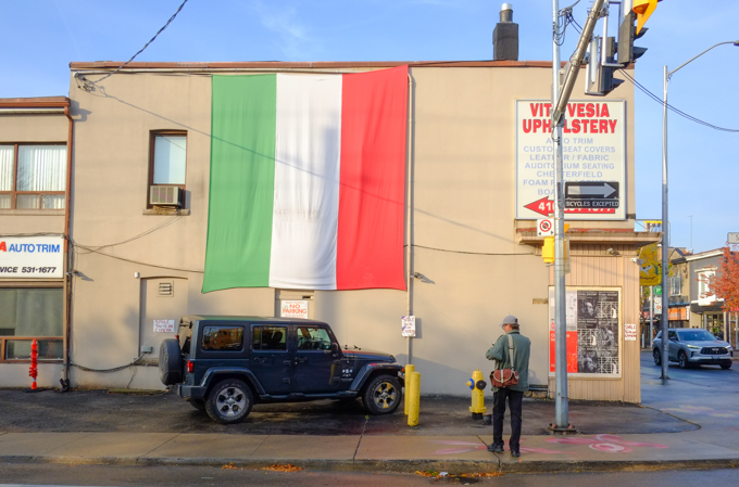
Welcome back! Bienvenuti!  A colourful sign to welcome you and visitors to Toronto.  I’m not sure how many visitors get to see this banner!

sign saying welcome to toronto in many different languages

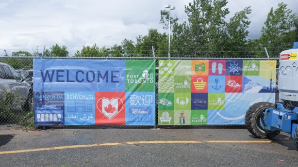
The Port of Toronto has almost become an obscure corner of the city.  It’s certainly not where most tourists arrive in the city!  Nor is it a place where residents venture.

welcome sign in different languages, puddle in front, large green and orange buoys, on land, reflections in the puddle

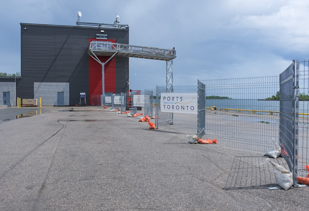
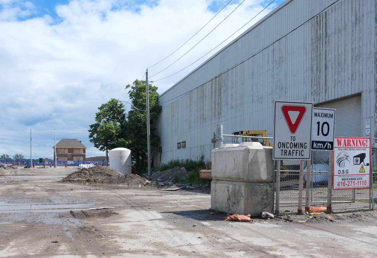
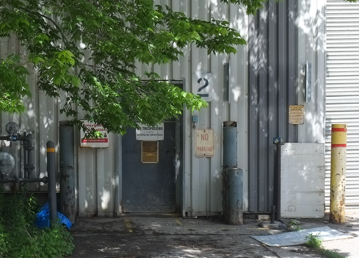
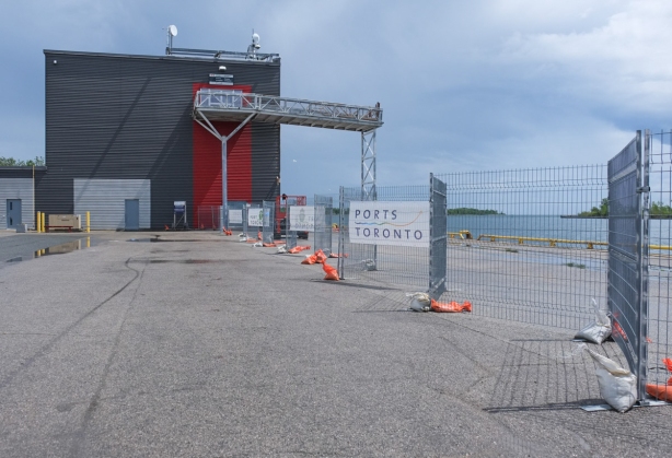
below: Once there was a ferry between Toronto and Rochester that docked here but it didn’t last long.  Now there are a few cruise ships that stop here.  The building would be almost deserted if Netflix hadn’t taken over some of the space.

building on pier, beside waterfront, with chainlink temporary fence, sign says Toronto Port or Port of Toronto

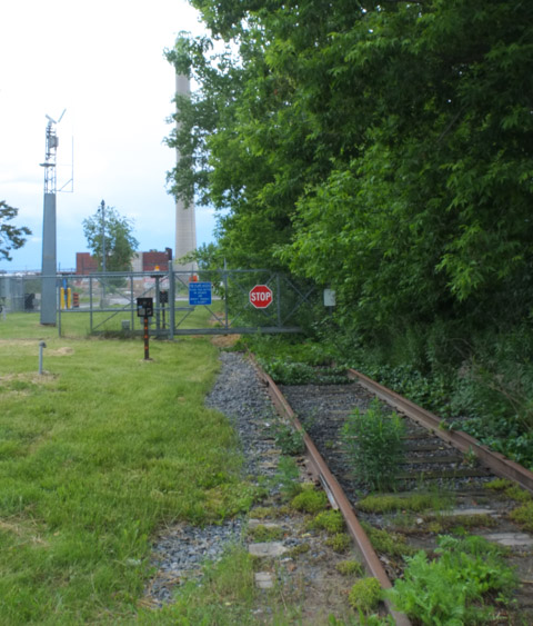
below:  The fragments of railway track are reminders of the industrial past.

metal fence across old railway tracks on a pier, beside waterfront, Lake Ontario, Port of Toronto

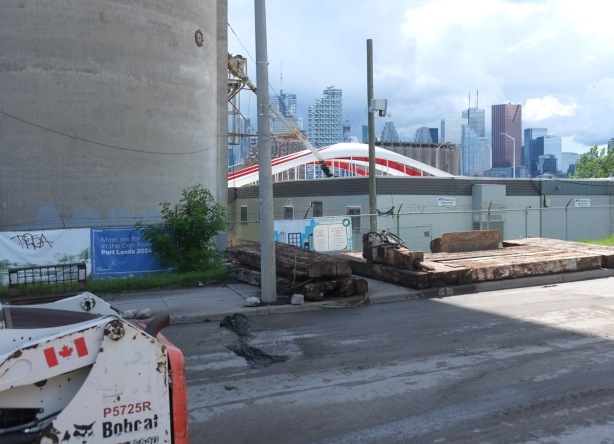
below: There are bits of track scattered all over the Port Lands

fence across old railway tracks with industrial site beyond

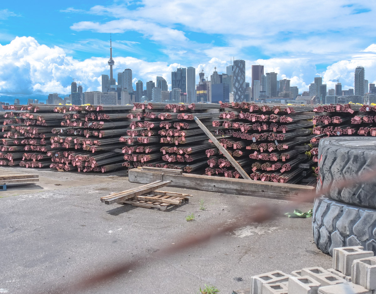
below: The Port is much quieter but there is still activity.  These long metal bars that are neatly stacked on shore were probably recently offloaded.

stacks of 40 foot long rebar on the waterfront, port of toronto, recently unloaded from a boat
view through chainlink fence on pier, a yacht is exiting the harbour, toronto skyline in the background

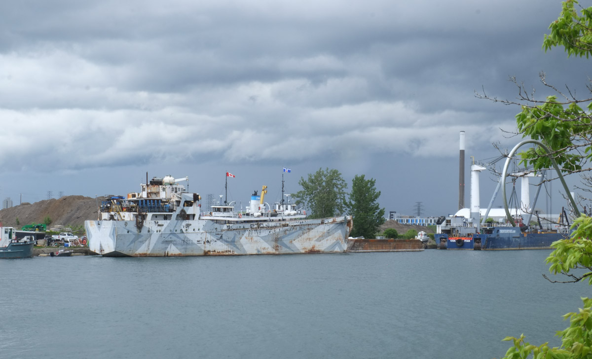
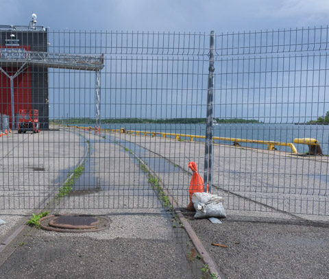
below: Boats in the Ship Channel.  The redevelopment plan for the Port Lands has always included the retention of the Ship Channel.  The sand and salt for Toronto’s roads is delivered here.

ships in the Shipping Channel

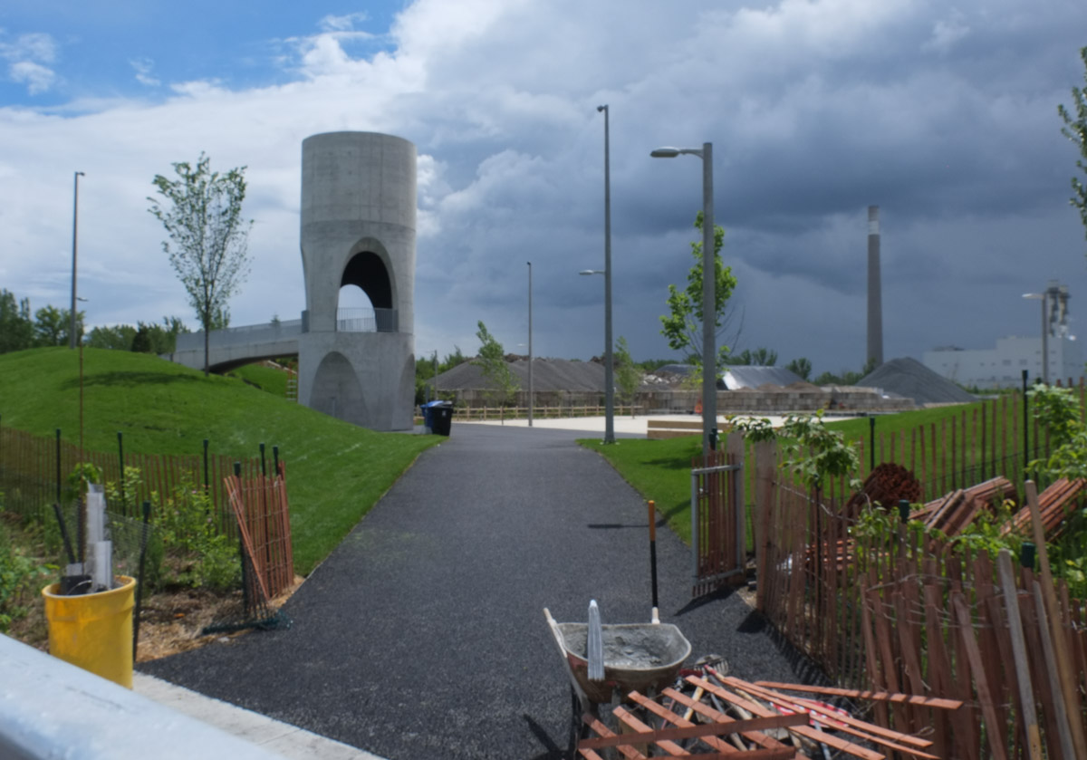
below:  At the east end of the Ship Channel, a new park is being developed – Leslie Lookout Park.   The concrete cylindrical structure is a lookout tower so there will be views over a man-made beach (that appears white in the photo).  The beach is larger in real life than it looks like in the photo.

new park being developed

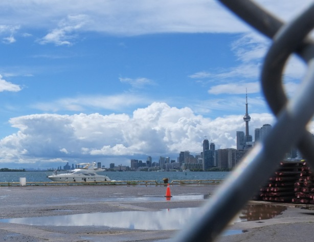
below: Can you see the little sliver of blue water?  That is the Ship Channel.

behind chainlink fence, new park being developed, on shipping channel so water is just visible in the photo

below: Looking south on Munitions Street

munitions street, port lands, construction, all gone but old fire hall and white building film studio

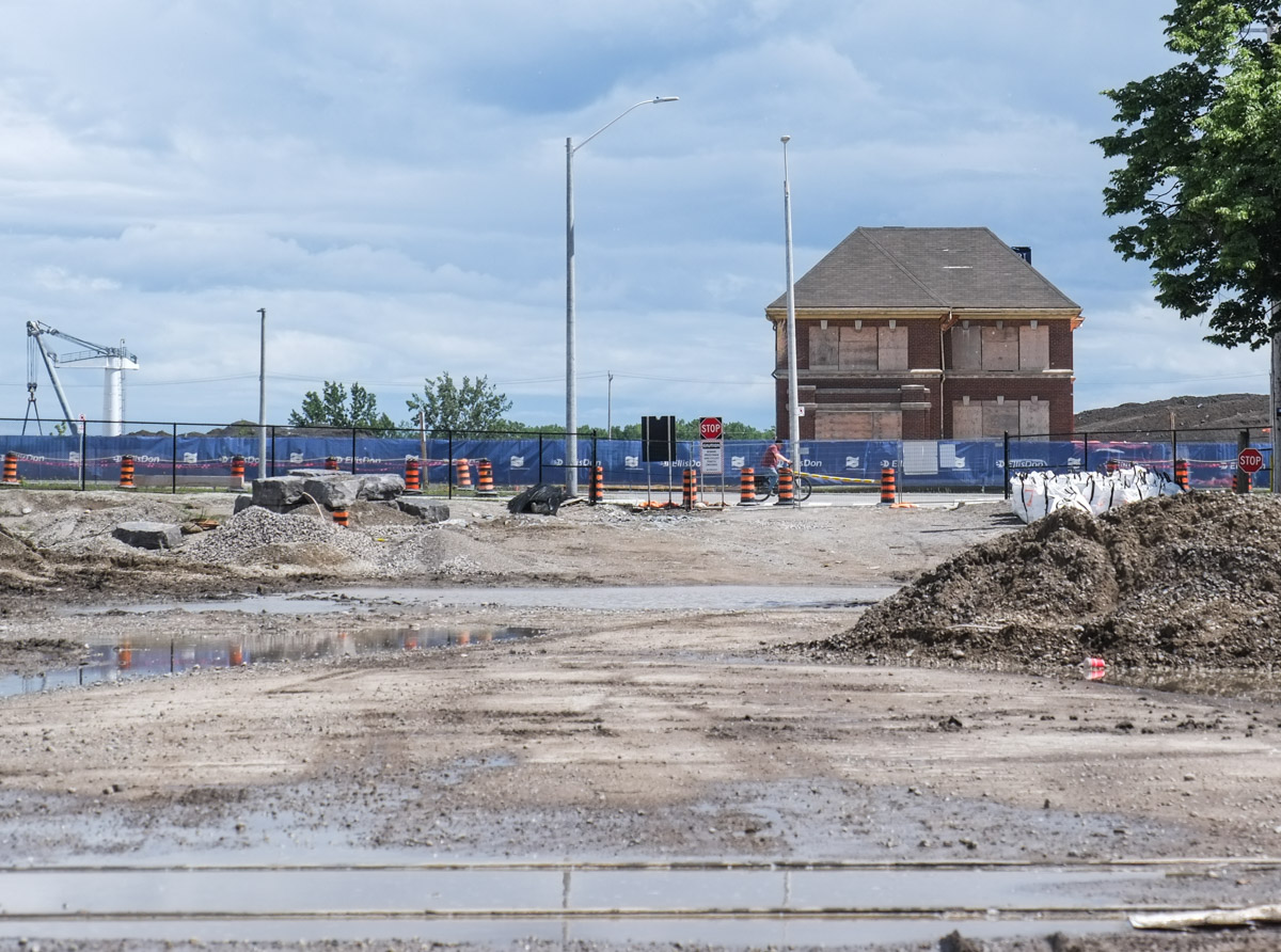
below: Toronto Firehall, Station 30, built in 1928 still stands.  It is a heritage building and if the plans are followed, it will be repurposed.

munitions street, port lands, construction, all gone but old fire hall

entrance to old metal clad building, tree in front, no trespassing sign on door, no parking sign beside door

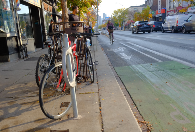
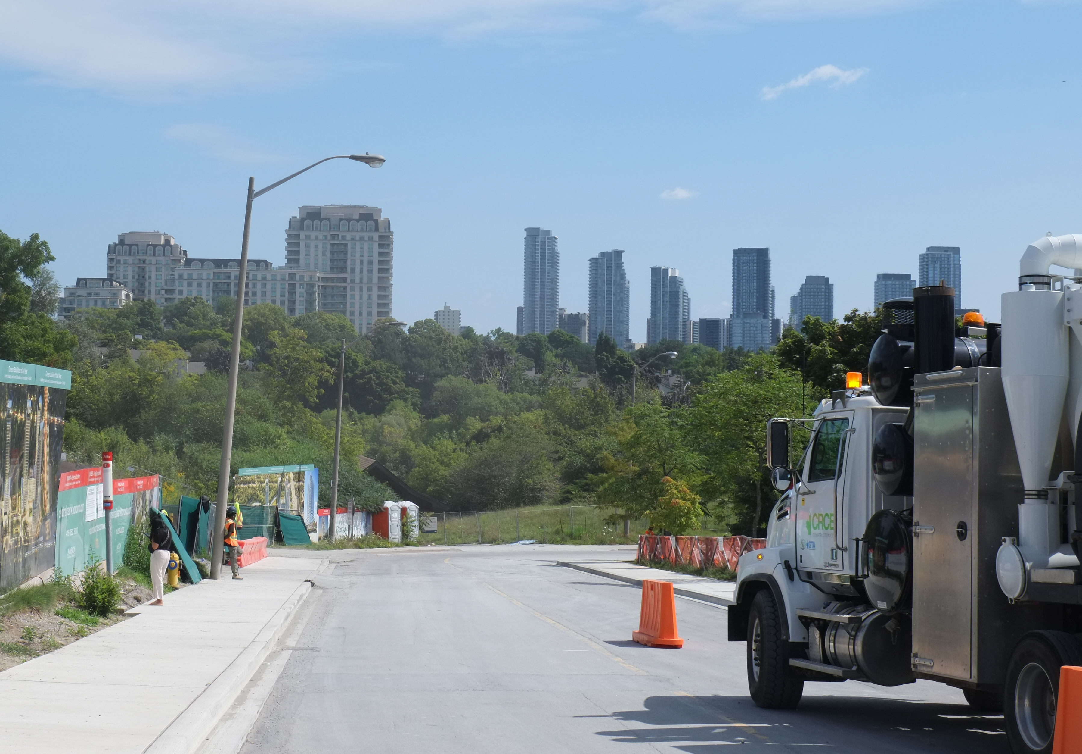
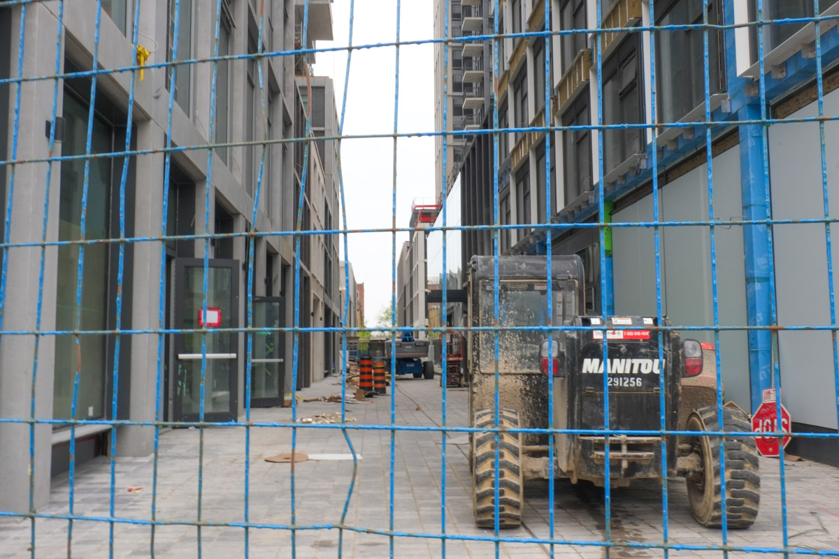
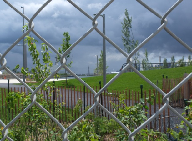
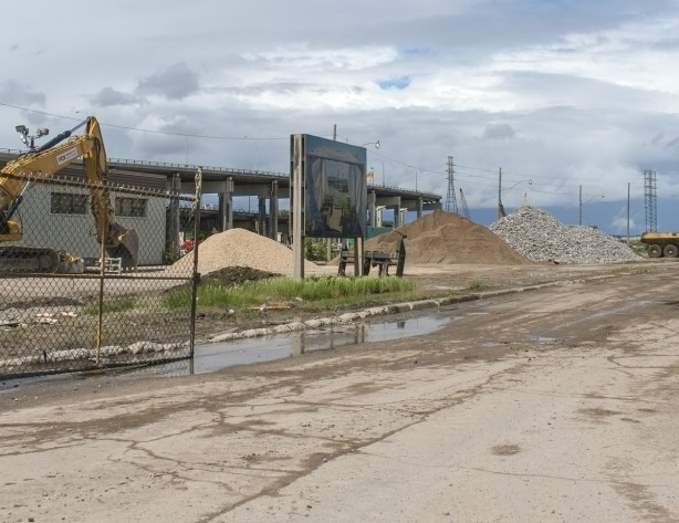
below: The redevelopment of the Port Lands has involved a lot of infrastructure changes.  Roads have been changed, rivers have been diverted, bike lanes and better sidewalks have been created.  At times it has been confusing to navigate through.

traffic signs, signals, and new construction in Port lands

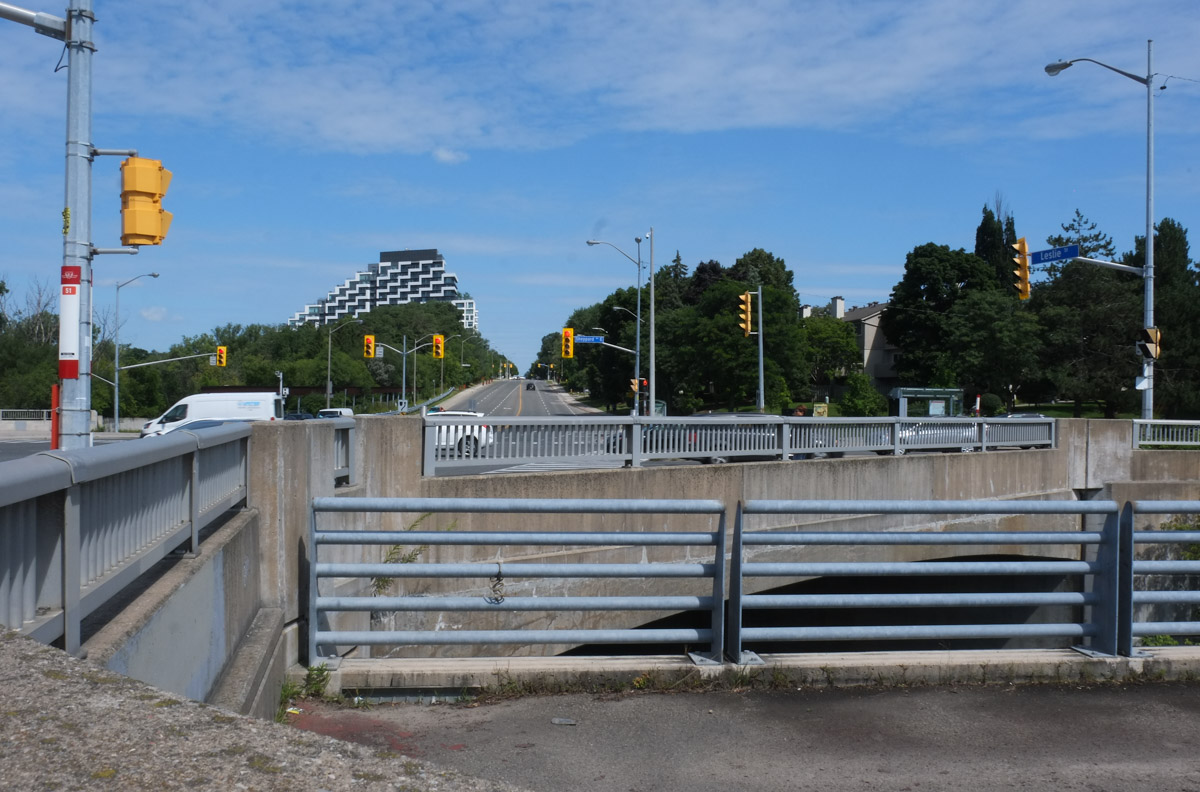
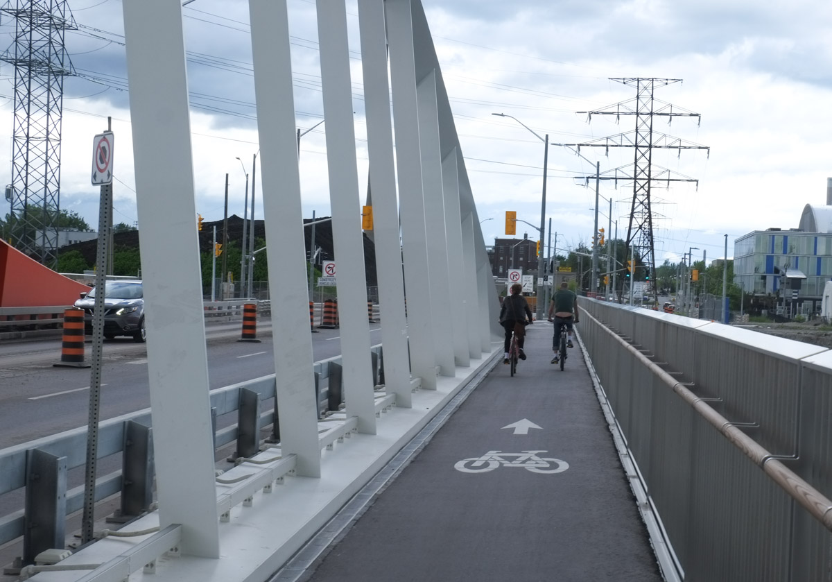
below: The new Commissioners Street bridge is in, and there is water running under it.  There is now a river on land that was once industrial.   On the north side of the bridge there is a bike lane and a wide sidewalk.

red and white curvy bridge, commissioners street bridge, dark clouds in the sky,

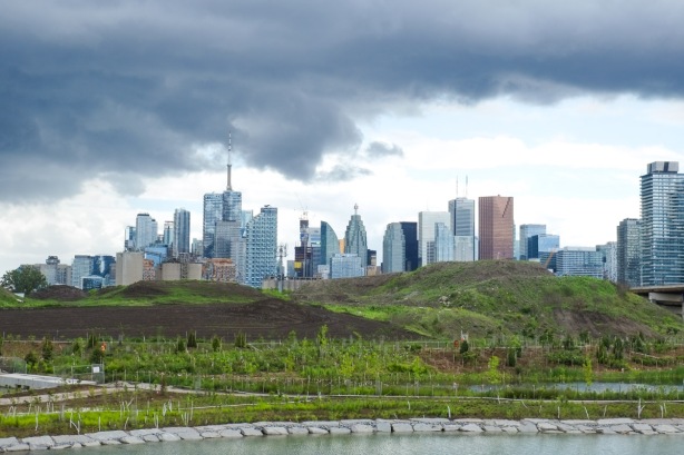
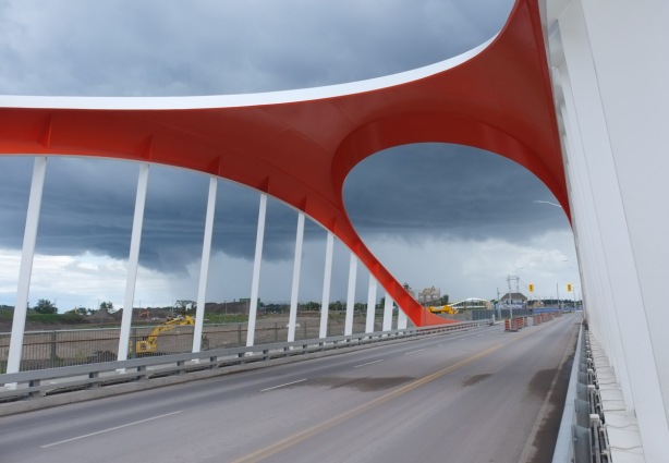
below: The bridge offers new vistas of the city.  Many new trees have been planted.

view northwest from commissioners street bridge, over river and park with many newly planted trees, to downtown toronto skyline

view north from commissioners street bridge, towards Gardiner Expressway, and Lakeshore

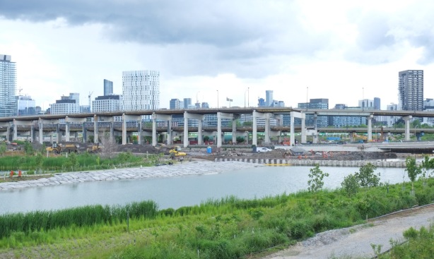
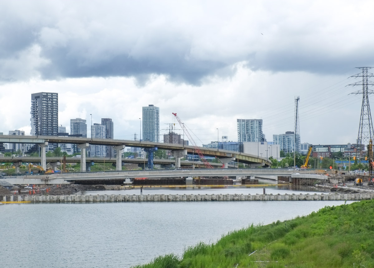
below: Lakeshore Blvd crosses the Don River on a very low bridge (like before) while the ramps between the Gardiner and the DVP curve above it.

view north and slightly east from commissioners street bridge, ramp from Gardiner to DVP with Lakeshore crossing river
below: Just be careful because there is no sidewalk on the south side (why not?? for the sake of saving money on 4 extra feet??)

cyclists crossing commissioners street bridge
commissioners street bridge, mostly sky with lots of clouds

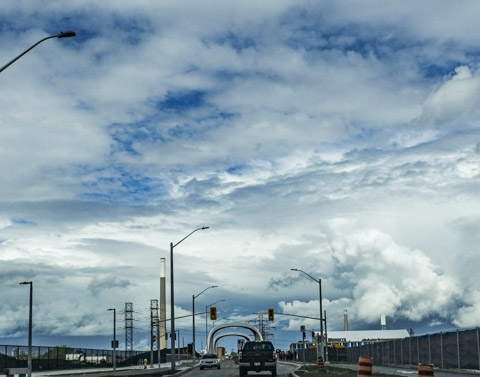
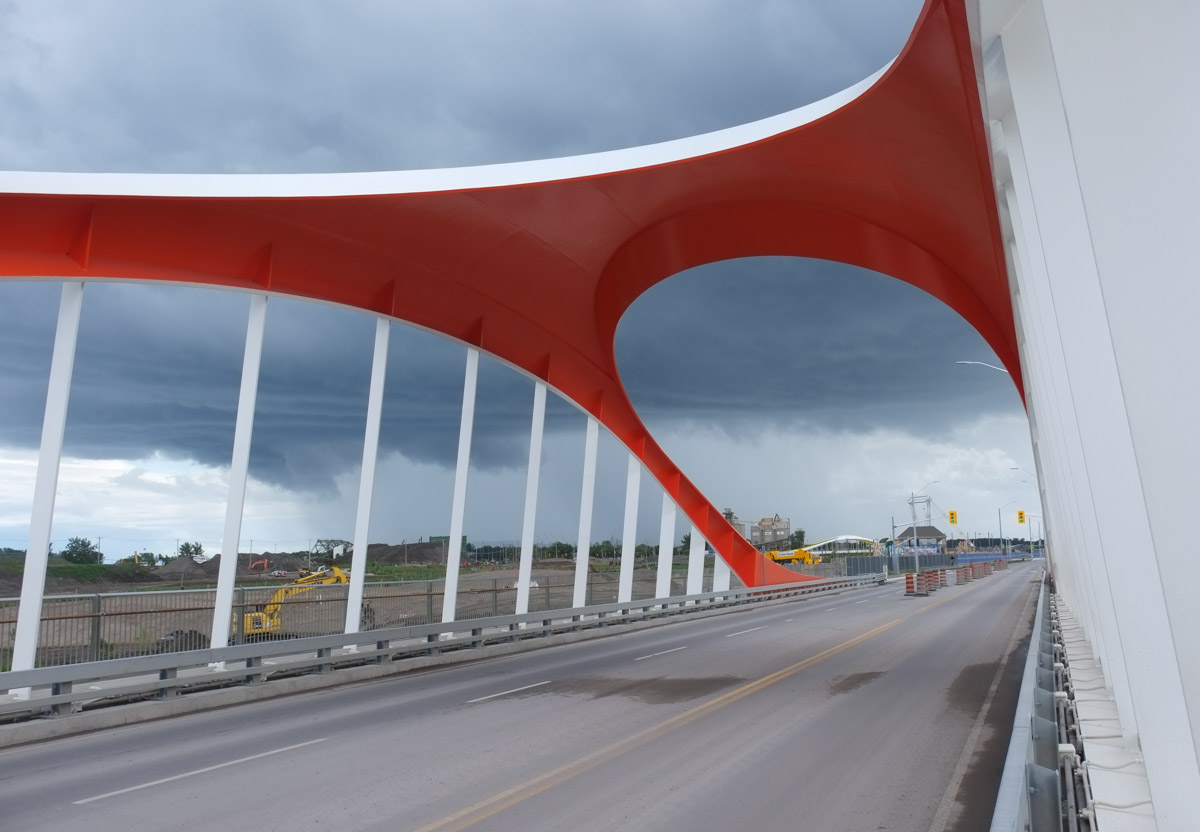
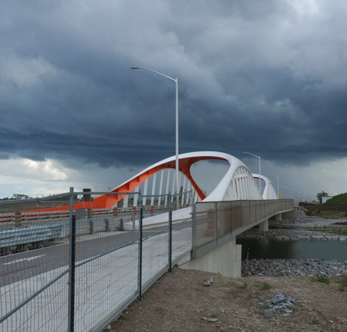
below: The same sleek curvy design seen in the previous bridges is repeated here.

red and white curves of the commissioners street bridge

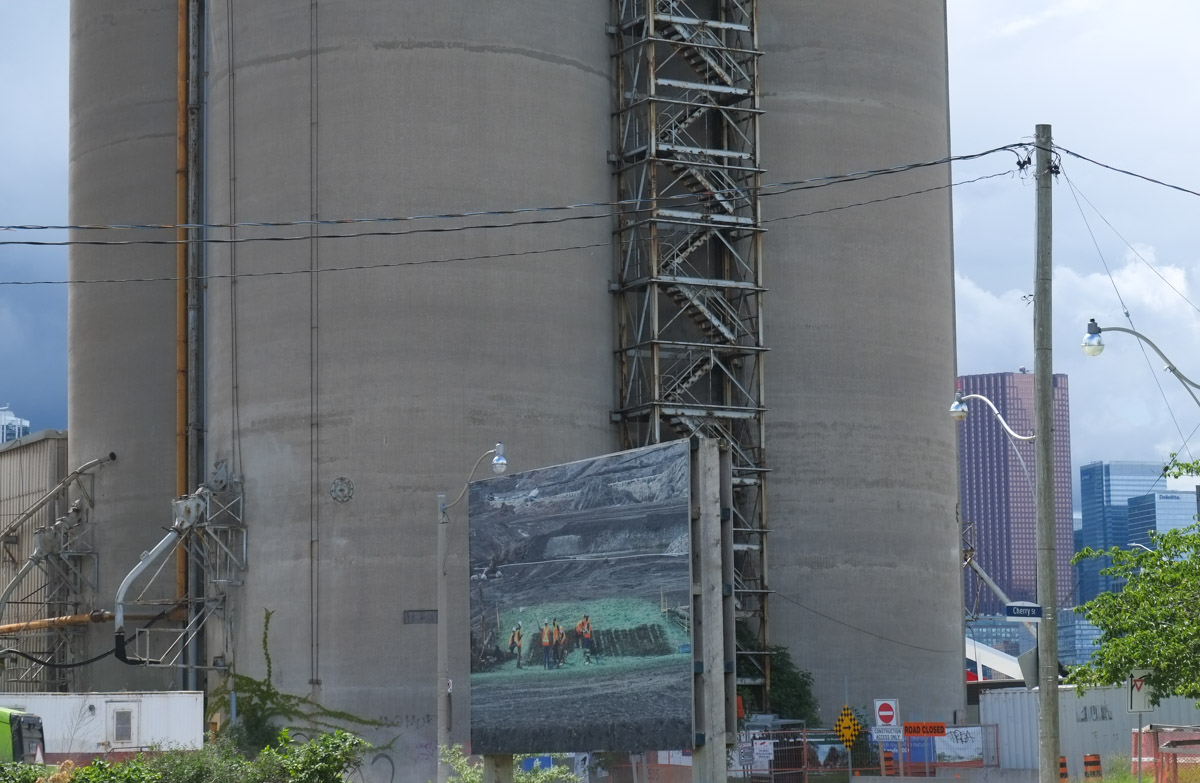
below: Another series of photographs of the work being done here, by Vid Ingelevics and Ryan Walker

large photograph on a billboard in front of large concrete silos, port lands,
below: One photograph is mounted on the roll-up door of one of the ESSROC cement plant silos

large photograph mounted on door of garage on concrete silo

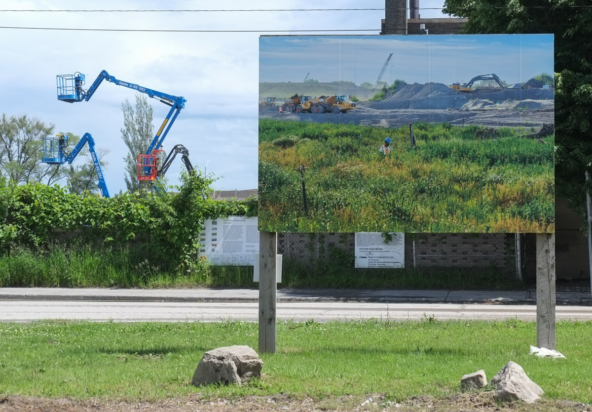
below: Like the previous series of images, most of the photographs are displayed down the center of what remains of Villiers Street,  on top of the remains of the old railway line.

large photo image on display beside street, in front of building with cranes beside it

below: One more photograph on what remains of Villiers Street – and in the background, what remains of the eastern end of the Gardiner Expressway.

construction in port lands, villiers street torn up, photograph on display in center, gardiner expressway in the background

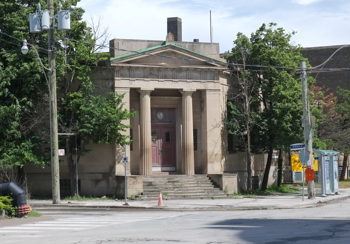
below: Southeast corner of Villiers and Cherry

old bank building with columns, stone, on southeast corner of villiers and cherry

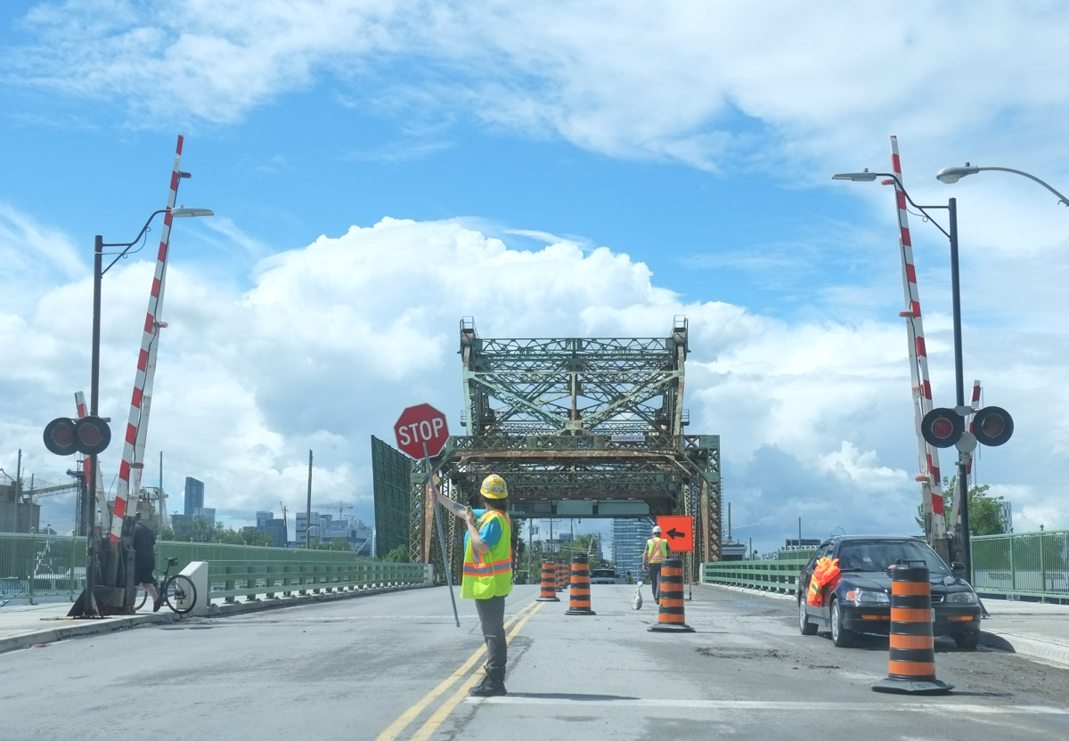
below: One original bridge remains, the one with the long name – Cherry Street Strauss Trunnion Bascule Bridge.

cherry street straus trunnion bascule bridge, with person holding stop sign, construction on the bridge

lifeguarding station at cherry beach, old white wood building, with look out tower and flag pole,

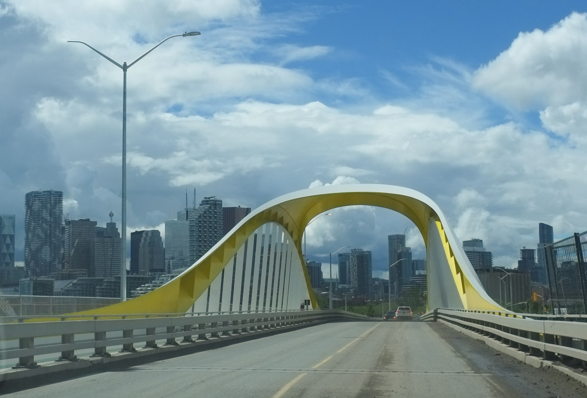
below: The first of the new bridges that was actually operational is the south Cherry Street bridge, the yellow one.

yellow and white cherry street bridge

below: The second new bridge on Cherry Street is now in use.  For months we’ve been able to take pictures of the side of it as we stood on the old Cherry Street bridge. (see The New Cherry Street Bridge from Nov 2020).  Maybe one day in the future there will be a streetcar on the east part of the bridge.    As you can see, the rain came and we bailed.  Better pictures of the bridge will have to wait for a future post!

new cherry street bridge from the south, double bridge, one side for cars, bike, and pedestrians. The other side is for transit but so far there is no transit here

below: The old Cherry Street bridge is gone and the road has been rerouted. The old jog in Cherry at Lakeshore is gone.

rubble and digger removing old cherry street bridge, distillery district condos in the background

rubble and digger removing old cherry street bridge, distillery district condos in the background

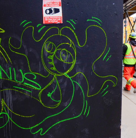
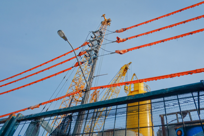
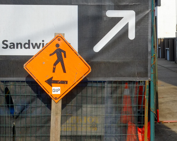
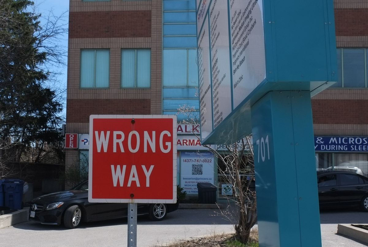
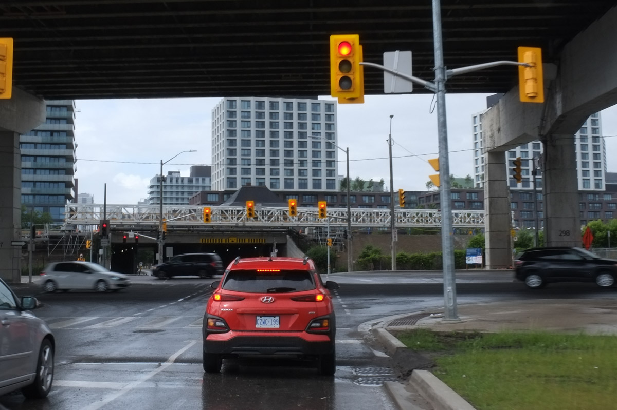
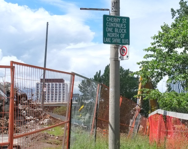
below: Misdirection.

green and white sign that says cherry street continues one block north of Lakeshore

below: Trying to see the new bridge from the site of the old bridge but there seems to be a construction site in the way.

new cherry street bridge, red, and white, seen from site of old bridge

below: Continuing north on the now straight Cherry Street.  Any ideas what that white structure is ahead?  It runs parallel to the railway line at track level and crosses Cherry Street just south of the railway underpass.

a red car waits at a red light on Cherry at Lakeshore. The Gardiner Expressway passes overhead. Distillery District and Corktown are straight ahead

We now exit the Port Lands and finish today’s explorations…. with the exception of one quick note…. I noticed that the old Canary Diner on Cherry is now painted a reddish orange colour.  It looks like it is being renovated.   A story for another day!

TTC streetcar, route 504, in front of repainted canary diner on cherry street, old three storey brick building

toronto skyline in the background, with boats docked on piers, rubber dinghy in foreground

hydro transmission towers with the cn tower in the background

below: Medallion embedded in the sidewalk outside Bathurst subway station entrance showing the way –   South to Bloor and west to Bathurst is first on list for today. … Or maybe round and round in circles?

brass circular medallion embedded in the sidewalk in front of Bathurst subway station, four points of the compass with labels, E to subway, S to Bloor, W to Bathurst and N to Dupont

below:  Looking south on Bathurst towards Bloor.  The southwest corner of Bloor and Bathurst is now a solid block of condos.

looking south on Bathurst towards Bloor, west side of the street

below: Same collection of buildings but from a slightly different angle.  Giant concrete pillars in front of ground level glass wall.  Argh.  Unoriginal Toronto architecture.

southwest corner of Bloor and Bathurst, tall glass and steel condo buildings

below:  Working at heights.  It looks like road access from Bathurst towards Markham Street. More concrete pillars!

below:  Alternative Thinking and its neighbour directly to the south remained the holdouts and are now completely surrounded by new development.

two older structures now surrounded by new condo buildings, older ones were three storey brick stores with apartments above from the 1880s. Alternative Thinking store

below: Around the corner on Bloor near Markham. The sidewalk in this stretch has been widened with benches and planters added.

bloor street, sidewalk in front of new condos, blue construction fence still up, new benches and planters on the sidewalk
below: Honest Eds is long gone.

behind blue construction fence, machinery, two tall condo being built with laneway between them

below:  Work continues on the re-making of Markham Street.

workmen on construction site on Markham street

below:  Ed’s Mercantile Store & Studio.  Vintage and Handmade Goods – it’s not exactly Honest Ed’s but it was at least worth a smile and a chuckle (and a photo!)

Ed's Mercantile store window on Bloor, vintage and old stuff,

below: Stop.  Stop building.

stop sign at Palmeston Blvd, with the word building scratched into it, stop building

below: From Palmerston, the new condos rise up behind.

roofline of older houses on Palmerston with new condos in the background

large red brick old house on Palmerston with large new condo in the background

below: Spring!  Lilacs in abundance in front of an old brick house with fabulous balcony space.

older brick house, 3 storeys, with 2 balconies and a porch, all with white wood railings, large pink lilac in front, with yellow tulips and greenery in front garden

below: One block south of Bloor is Lennox

Lennox street scene, trees, old red brick building, condos behind

 chairs, one on either side of a brown door, red brick building

below:  There is a lane that runs north from Lennox that ends behind the stores on Bloor.   The old buildings are dwarfed by the newer condos.

looking down an alley, with backs of old buildings on Bloor immediately adjacent to tall new condo

below: Same alley, new infill housing

infill housing in a laneway, two storey house with mostly windows on upper level

below: This isn’t the exact view from that lovely infill house, but it’s close.

wall with street art, construction site on the other side of the wall

below: Still in the alley trying to get a good view of what’s happening on the site…   Some of the old houses on Markham have been kept (or at least their facades).

Markham street, old mirvish village, redevelopment, small house among the highrises

looking down an alley, tree and greenery along fence on right, street art covered wall on left, car parked in front of a garage at the end

below: Bloor Street from Markham Street west to just beyond Christie is part of the Koreatown BIA which suggests a preponderance of Korean businesses.

Koreatown banner on lamp post, condos behind

below: Businesses like Seoul Hot Dog, Mummy Korean Restaurant, and Mapo Korean BBQ.

stores on Bloor

three young Korean woman walking on Bloor

older Korean woman shopping in corner store

four little characters with drinks, on the window of a korean cafe

pictures of dishes displayed outside, under window of korean restaurant, also green sign advertising in korean lettering, for acupuncture and herbs

below: Korean Village Restaurant

Korean Village Restaurant with mural on upper level,

below: Imagine Your Korea mural (in 2 photos)

Imagine Your Korea mural in Koreatown, with bike share bikes in front, mostly empty

korea mural on corner of bloor

below: A green dragon breathes fire outside Chung Chun Rice Hot Dog in a mural by Allan Render, John Norbrega, and Stacey Kinder (Blinc Studios), 2019.

outside wall of chung chun rice hot dog restaurant, a mural with a large green fire breathing dragon

part of a larger mural, people running outside shops on sidewalk, running away from green monster

below: But in typical Toronto style, many other ethnic groups are represented here – Ave Maria Latin Cafe

Latin Cafe on Bloor with round yellow sign,

below: Pour Boys keeping an eye on Bloor.

pour boys muralon building across the street from Bloor Fruits store, selling veggies and fruits on the sidewalk

below: … Tibetan Paper Store… and more.

objects in the window of the Tibetan Paper Shop, little dolls, incense, bowls, bracelets,

below: “If you are reading this, Iran is not free”

mural that says if you are reading this, Iran is not free

tattered pink heart with a face cut out of it, stapled to a wood utility pole that has hundreds of staples on it

googly eyes have been glued onto yellow box with push button for crossing the street


old mural on side of white brick building, text, abstract, kizmet32,

… the northern end of the Ontario line that is.  It was a foggy, overcast day when I went searching so I have many grey low contrast pictures with the occasion sunny image when the clouds parted for a few minutes.   As construction progresses there will be lots of opportunities for better photography!  It may be many years yet.

The plans on the Metrolinx website show the Ontario Line ending at the Science Centre station at Eglinton and Don Mills.  From the Science Centre, an elevated line runs south to a Flemingdon Park station near Gateway Blvd and Don Mills Road.  The map suggests that the line runs over or parallel to Don Mills Road.

below: Northeast corner of Don Mills and Gateway Blvd.  Grey on grey I’m afraid.

below: Map, screenshot from Metrolinx website.  Pink sections of the line are elevated and blue sections are underground.

map showing location of Thorncliffe and Flemingdon Metrolinx stations

It is difficult to determine from the map the exact route the line will follow along Don Mills Road.  At the moment, the east side is largely undeveloped between the Science Centre just south of of Eglinton to the school at Overlea.   The west side of Don Mills Road is already home to a number of tall office and residential buildings as well as stores and restaurants.  Whatever the route, traffic on Don Mills is about to get ugly again (having just returned to normal after the Eglinton LRT construction).

below: West side of Don Mills Road, looking north towards Eglinton from hydro right of way.


South of Flemingdon, and before Overlea Blvd, the line swings west and crosses the West Don River.

below: This is the section of land that has been clear cut recently. It is on the northern edge of a Hydro right of way that crosses the city.

clear cut stretch of land, some stumps still there, hydro poles and wire in the background

below: Photo taken from the same place as the one above, but looking more north.  It was a bit foggy but what you are looking at is E.T. Seton Park and the archery range there.  A tiny bit of the Science Centre can be seen near the top right.  The black bridge is the railway bridge just south of Eglinton near the foot of Leslie Street.

Seton Park, ravine, near Science Centre,

below: A spot of colour, spring blossoms on an old and gnarly crab apple tree.

below: More grey concrete.  A wall of  Valley Park Middle School at the northwest corner of Overlea Blvd and Don Mills Road.

When the Ontario line swings west of Don Mills Road, it will run parallel to Overlea Blvd as it crosses the West Don River.

below: This is the plaque on the bridge, the Charles Hiiscott Bridge apparently (does anyone call it that?).  It was named after the mayor of Leaside at the time (1960).  I’m willing to bet that everyone just calls it the Overlea bridge.  Whatever you call it, it’s 62 1/2 feet long and rises 115 feet above the valley floor.

below: Looking north from the bridge over the West Don River and the Seton Park trail.  There is a clear cut hill on near the top left corner of the photo where the Ontario Line will pass.  I have tried to find any drawing or plans that Metrolinx has that might illustrate what this section would look like beyond the fact that it will be elevated.  Some sort of bridge over the Don is needed but the details seem to be up in the air as well.

West Don River as seen from Hiscott, or Overlea, bridge, looking north towards Eglinton, spring, leaves just budding on trees, grass along path is green, some evergreen trees, large new condos n the distance

After crossing the West Don, the tracks will (probably) run behind the buildings on the north side of Overlea.  until Thorncliffe where a station is planned at the intersection of Thorncliffe and Overlea.

below: The Greek Orthodox church has a large presence in this stretch of Overlea.

United Macedonian unknown soldier memorial outside greek orthodox church, along with Canadian and macedonian flags

United Macedonian unknown soldier memorial outside greek orthodox church

truck backed into parking spot in loading bay of yellow brick warehouse type building

large puddle reflects tree that has been pruned to avoid hydro lines,

large puddle reflects a couple of high rise office buildings as well as a low brick warehouse building


back of a light industrial building that is red brick with large sections of coloured trim, parking lot, apartment building on Thorncliffe in the background

below: There is a large community garden there now.

large community garden in Thorncliffe, lots of fences and stakes, early spring so there isn't much growing

below: This is still on the Hydro right of way.

community garden plots on hydro right of way land

below: That’s the back of Costco just peaking into the photo.

car driving on street behind costco, vacant land and hydro right of way on the other side of street

many tall metal hydro poles on right of way

two small orange cones in front of a concrete barrier, large metal hydro poles in the background

below: Road closures and empty buildings.

dead end of street, small building there is no longer open for business, signs for metrolinx construction of Ontario lone

below: A “trash panda” raccoon checks out the old metal bin behind Costco

a raccoon climbs up broken door of a metal bin, shopping cart in foreground,

below: On the west side of Costco there is a row of apple trees now in blossom

a row of apple trees covered in white blossoms along a path beside a concrete building

below: But on the other side of the apple trees is a very large, now vacant, plot of land surrounded by hoardings.  This is Metrolinx.  This is where the Ontario Line turns to join Overlea at Thorncliffe Park.

fencing and hoardings around a vacant lot, with a pile of sand along the far edge

below: Much of Overlea to the west of Thorncliffe is either empty or about to be. The exception is the Salvation Army headquarters at the corner of Overlea and Millwood – the blue and white striped building in this photo.

below: Part of the plan for the neighbourhood is this new Islamic Centre that replaces an older building that will be demolished to make way for the Ontario Line.

new islamic center under construction,

below: A discovery – hiding in the bushes.  This looks like an old fire hydrant.

vintage red fire hydrant, still in use, behind a bush on Overlea

below: It’s actually a “fire main indicator post” made by the McAvity Company.    It marks an underground valve that controls the water supply.   Thomas McAvity started in business in 1834 in St. John New Brunswick; he was followed by most of his 6 sons and together they built a large, thriving company with foundries that produced plumbing parts, among other things.   They started making fire hydrants in 1903 but sold the company in 1960.

closer look at mcavity fire hydrant,

broken sign that had lights, in front of a building with ads for vitamins on the windows

outdoor storage of extra traffic lights, temporary lights used in construction and for road works

yellow construction fence around vacant lot with low rise building in the background

red metal piece that joins the tops of two metal construction fences, ripped corners of hoardings that used to be attached as well

below: Digging holes on one side of the street

two men working beside the road, one in a digger, and one standing by the hole that it is digging

below: And laying orange conduit for future cable on the other side

a man in hard hat and safety vest sits beside a piece of equipment used for laying large conduits for cables under roads, lots of orange conduit piping on the trailer too

below: Sidewalk hieroglyphics, speaking a language most of us don’t understand.

red, orange, and yellow markings on sidewalk, pre construction layouts and routing of underground systems

below: Looking east on Overlea approaching Millwood.  The new Islamic Centre is the building with the turquoise upper level.  Somewhere in here, sometime in the future, an elevated train will run.  At least that’s the plan.

looking east on Overlea towards construction of new islamic center

From Thorncliffe Park station at the intersection of Thorncliffe Park and Overlea Blvd., a train running towards downtown will now need to cross Millwood, the Don River, and the Don Valley Parkway.

below: I had more luck with finding possible ideas for this second bridge.  On a page on the Metrolinx website there is a rendering of the bridge that will cross both the Don River and the Don Valley Parkway (DVP).  This view is from the northwest.  It shows the new bridge running parallel to the Millwood bridge (shown here as the shorter straighter bridge).

screenshot from metrolinx website showing planned bridge over the West Don River and DVP just north of Overlea

A pretty picture.  But what does in mean?  What are the implications?

A hint….

large tree trunks with yellow caution tape tied around them

land recently cleared of vegetation, dirt ruts

below: Another section of Toronto ravine lands cleared of trees. This is immediately west of the Millwood Overlea intersection. The Millwood bridge is in the background.

ridge of land, now cleared of trees, some debris remaining, dirt, Millwood bridge in background

large tree stump in a patch of forest that has just been clear cut

below: The clearing has made the North Toronto Wastewater Treatment facility much more visible. There is a lot of upgrade work going on there too!   Twenty five million dollars worth of upgrades in fact, yes $25,000,000.  (source: Bennett Construction Group)

North Toronto Wastewater Treatment plant, in valley by Don River

below: “The Municipality of Metropolitan Toronto” in stone and embedded in the concrete of the Millwood bridge.   In the center is the “Arms” of the municipality created in 1991.  Because the internet is the source of amazing trivia, this is the description that I found on the Governor General of Canada’s website, “Argent on a chevron Gules between two open books Argent edged Or bound Gules in chief and a caduceus Or fimbriated Gules in base a representation of the Royal Crown Or on a chief Azure a cogwheel winged Or;”   One questions leads to many more, right?  Well, “gules” = red, “fimbriated” = has a narrow border,

Metropolitan toronto symbol in stone, embedded in the concrete of the Millwood bridge

below: Under the Millwood Bridge.  The fence has been repaired so access to the structural underparts is restricted. Back in 2015 it was easy to get underneath – Under the Millwood Bridge.

a photographer stands under the Millwood bridge, on hill beside fence that keeps people off the underside of the bridge, graffiti on concrete and metal parts.

graffiti on lower parts of concrete pillars hoding up the Millwood bridge beside the Don River, spring greenery

graffiti happy face under millwood bridge

simple black drawing of a man in a hat, eyes closed and crying big tears, drawn on a wall with other street art

discarded trash on the ground, broken orange cones, an old hubcap, brown paper, dead leaves, beside a sidewalk