Posts Tagged ‘construction’

Another reason why I haven’t posted recently?  I’ve been sick.  Icky sick; can’t get out of bed sick.  This morning was the first time that I’ve walked Toronto streets in many, many days.

It was a beautiful blue sky morning but I made a mistake and stopped for coffee first.  Clouds rolled in and we were back to greyness by the end of the first mug.  Argh.   Maybe back inside for a secong mug?

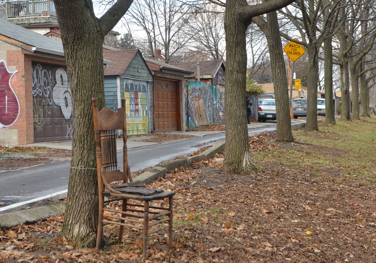
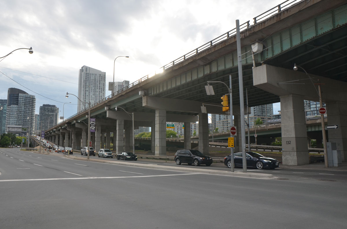
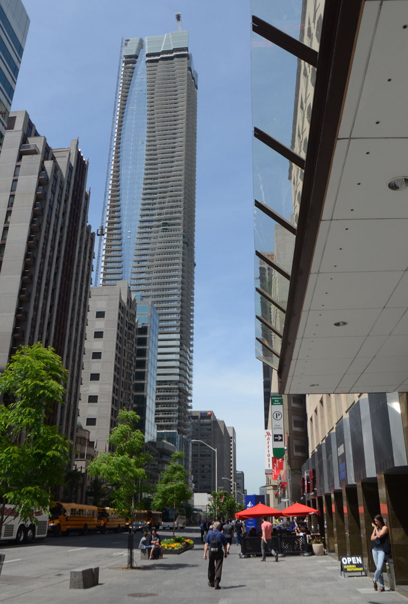
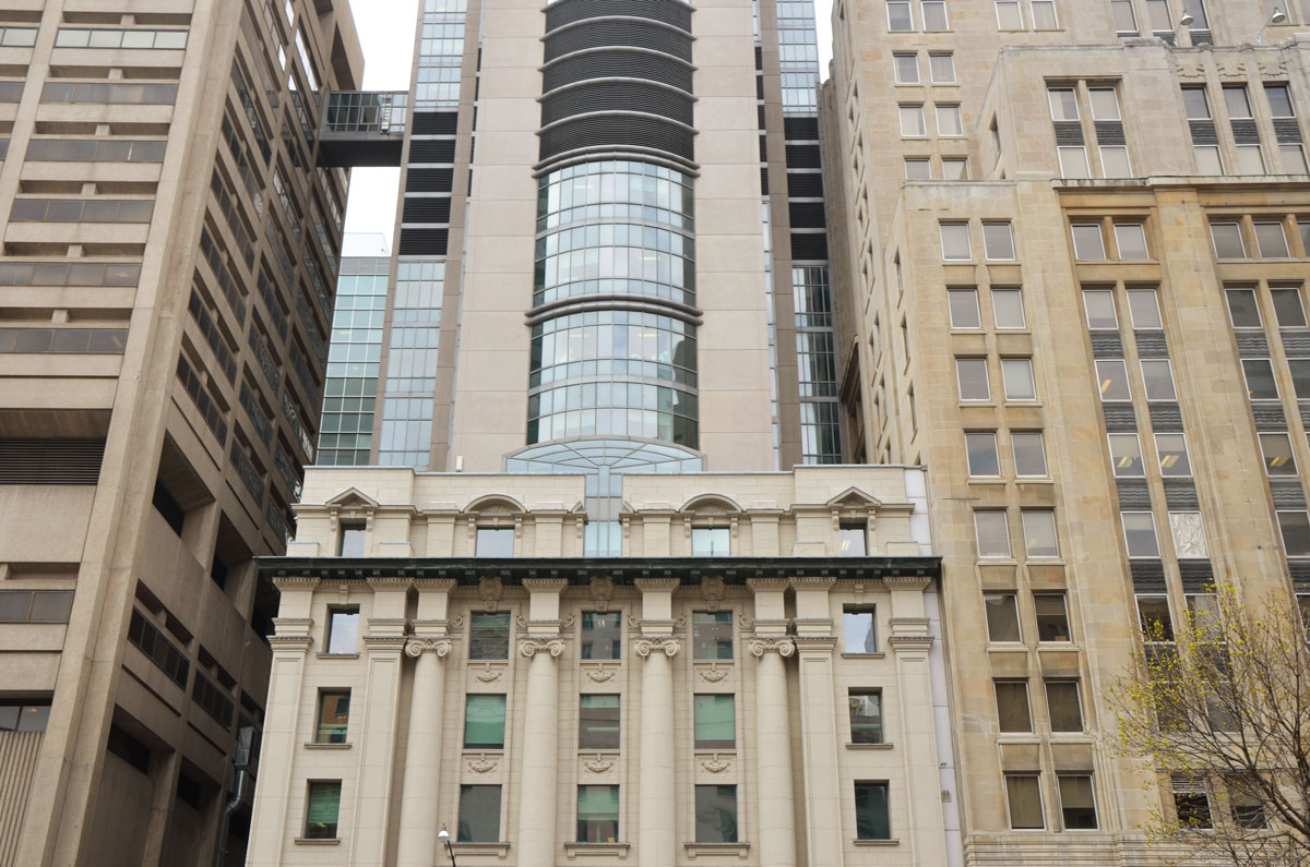
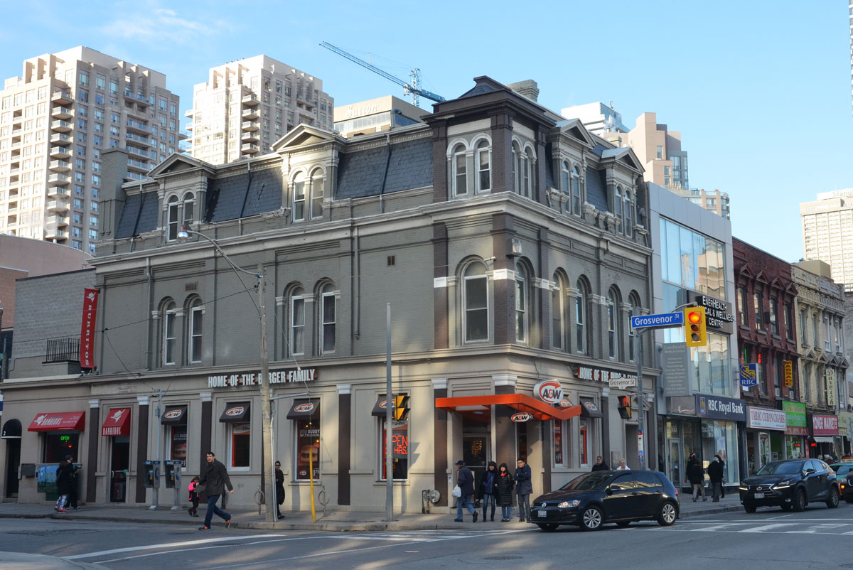
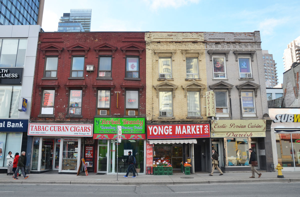
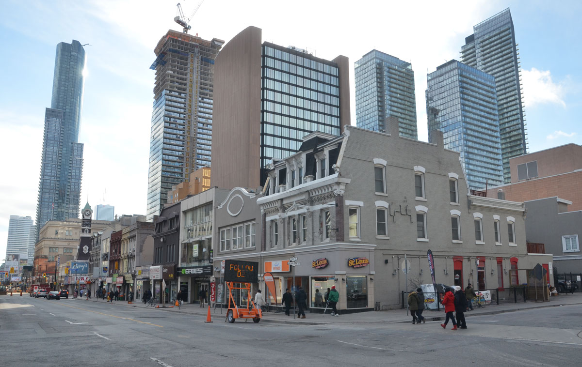
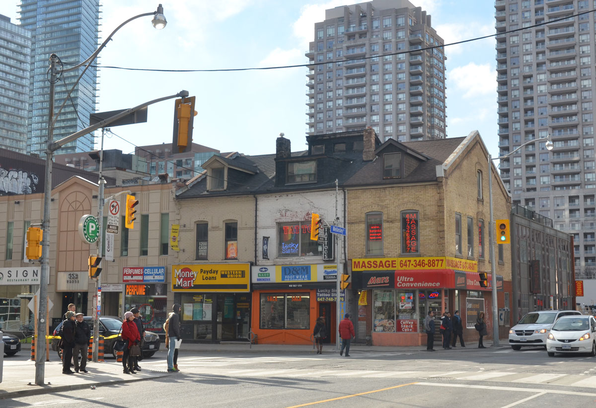
In the end I’m glad I got my momentum back.  I walked streets I’ve walked many times before but I walked it with a long lens in hand.  I started searching for details that I’ve missed before as well as shots that are easier (and sneakier!) with a lens zoomed out to the max.

In no particular order….

below:  The front of Betty’s on King street.  These magnets have been here for a while now although their numbers may have magnified.  In hindsight, I should have gone over and written something like, “Hi my name is Joe and I’m the Prime Minister of Canada”.

store front, front of Bettys bar and restaurant, with grey door. Walls are magnetic and they are covered with kid's letters of the alphabet magnets.

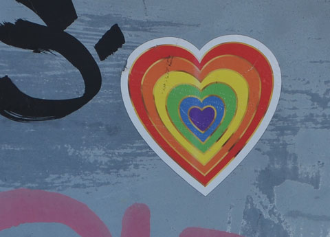
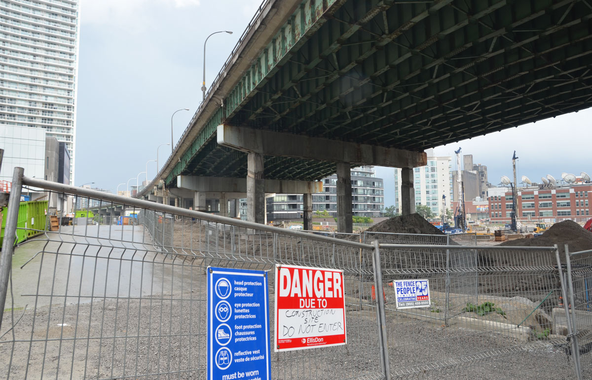
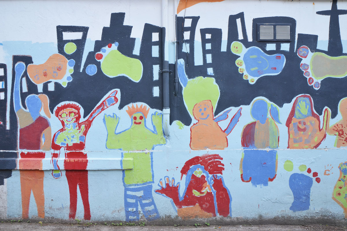
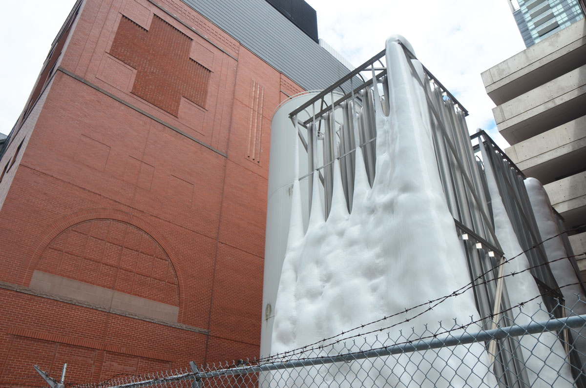
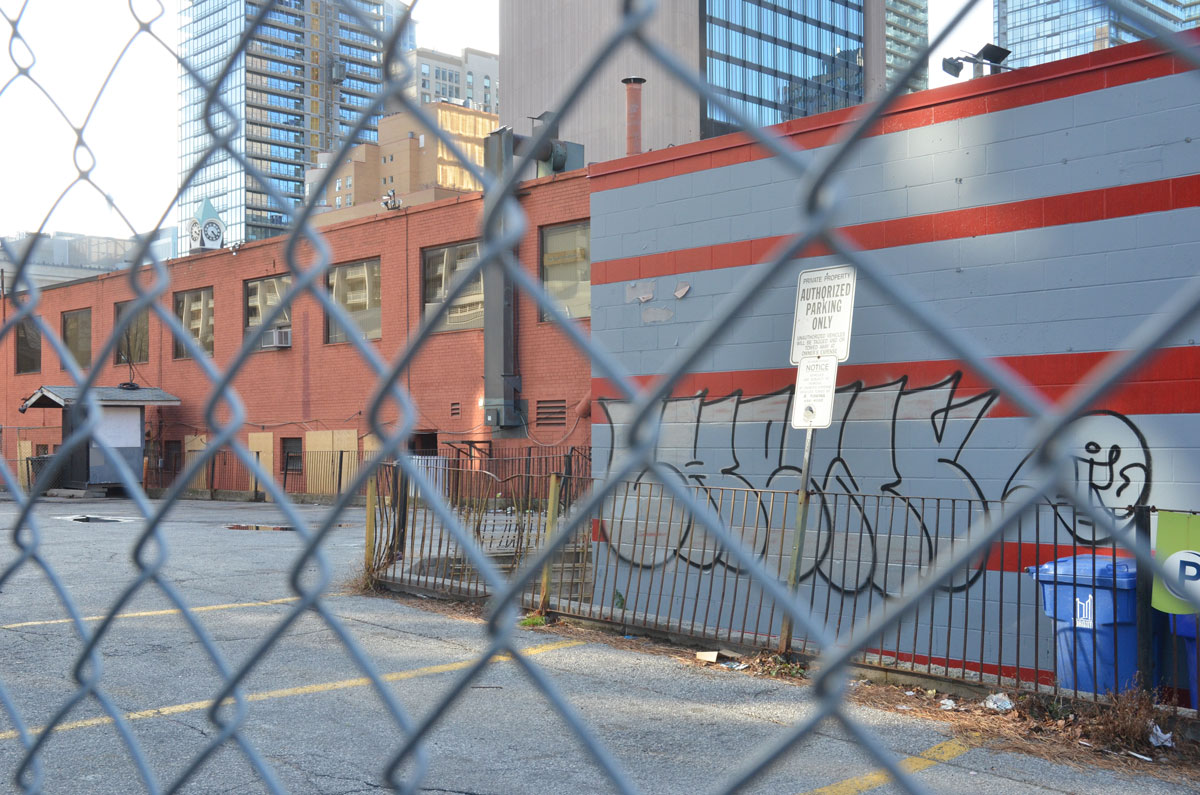
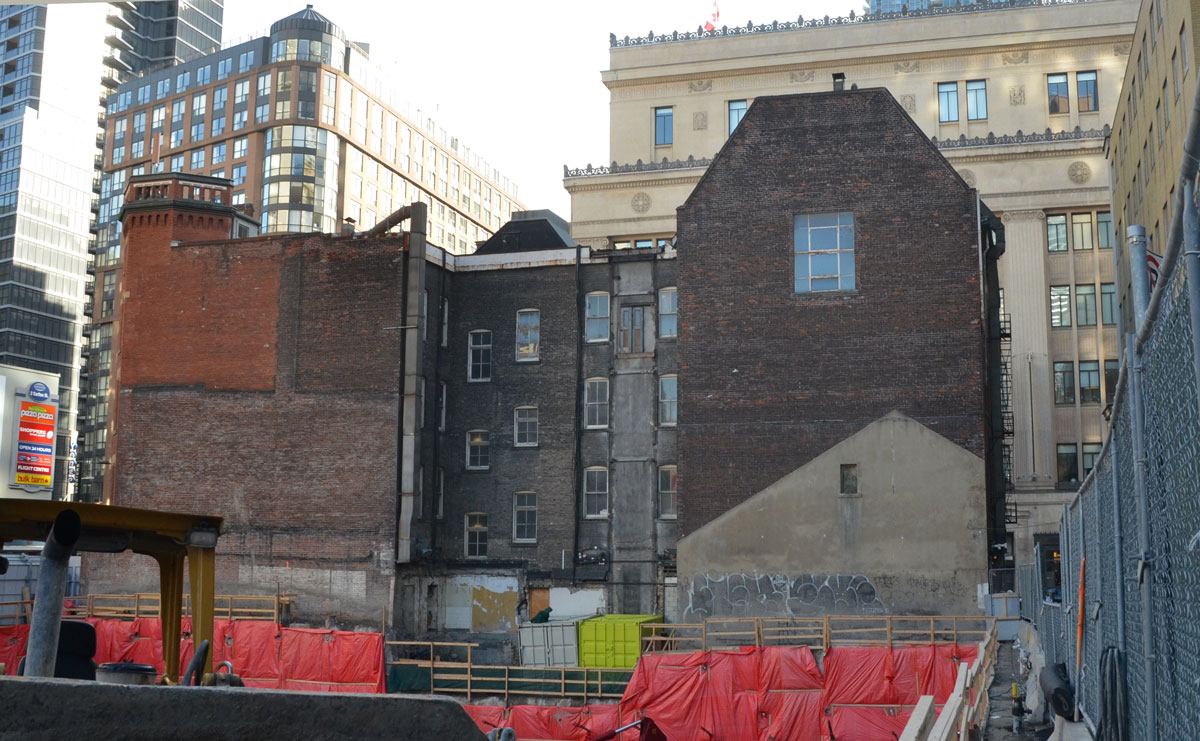
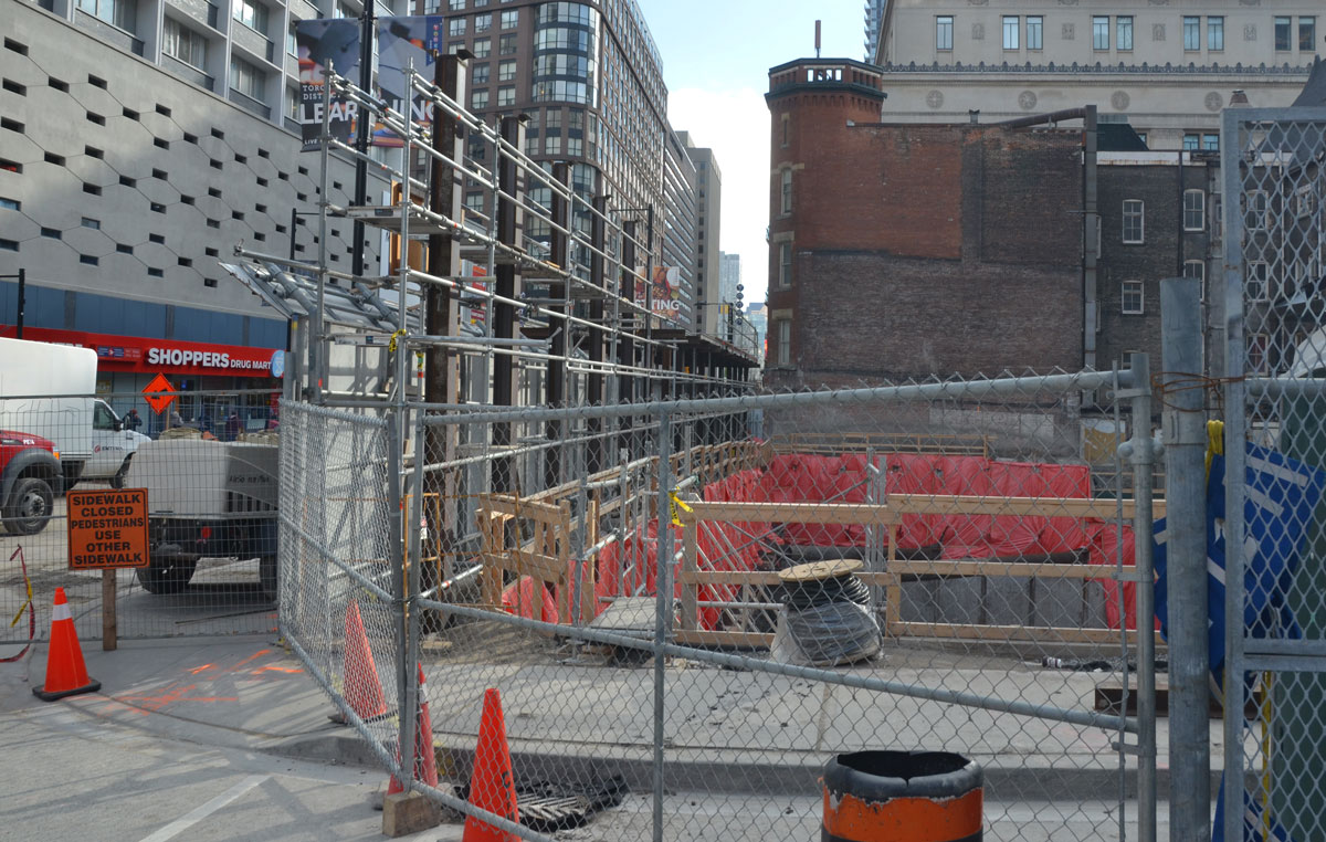
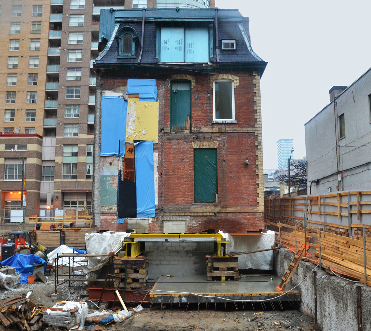
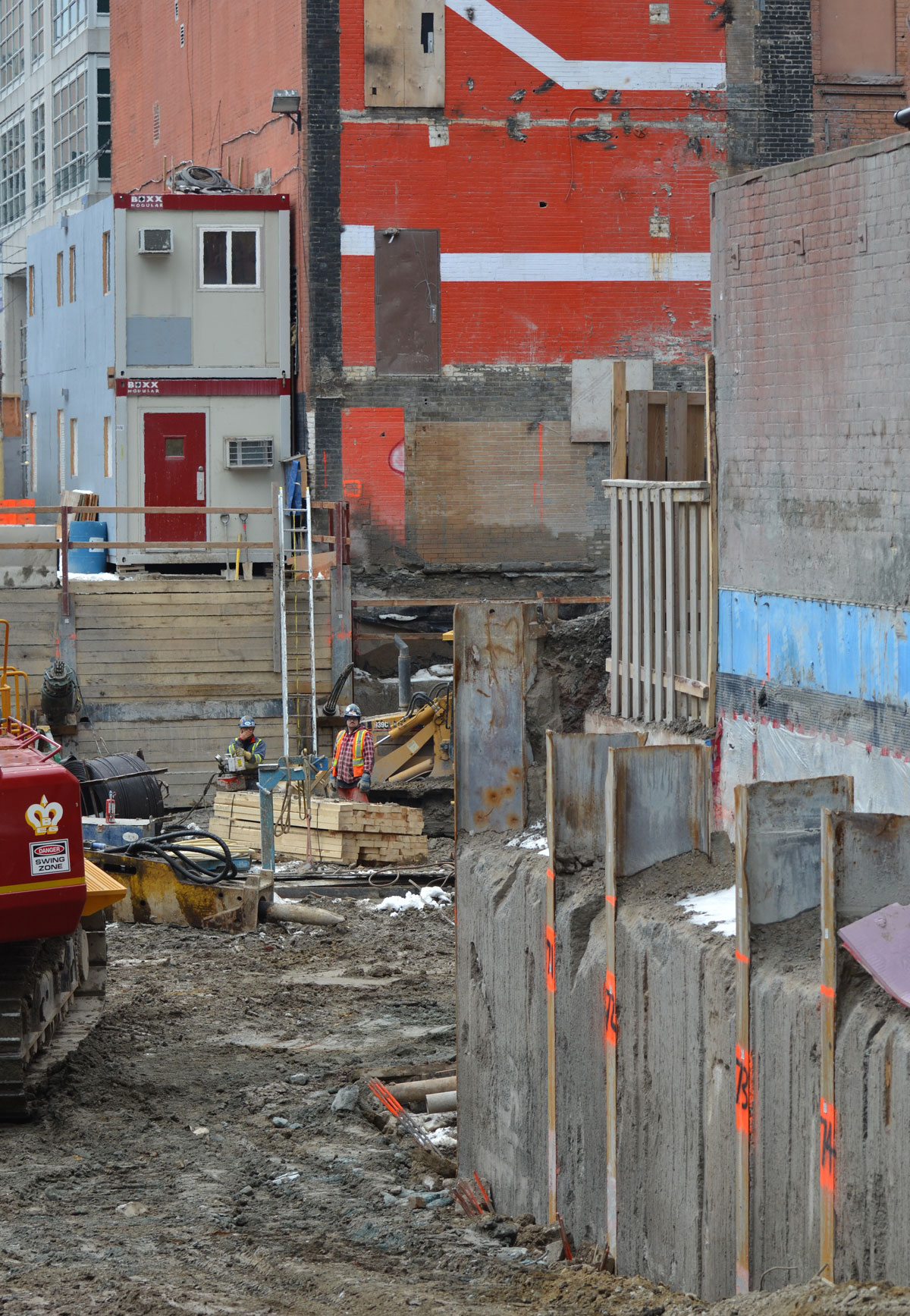
below: The bright colours of this exposed wall caught my eye.  It’s been revealed because of the demolition of a building at Victoria and Lombard and I suspect that it will get covered up again in the near future.

a large construction site at Victoria and Lombard, one wall of a neighbouring building has been exposed that is orange and white

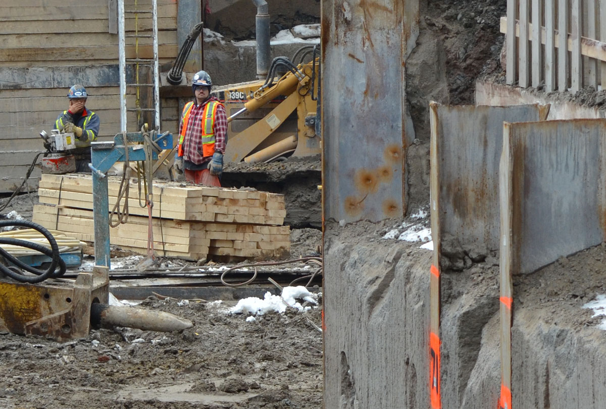
below: This is a closer view of the men in the photo above.  I hadn’t purposely taken their picture but I like the portrait look of the picture.  A kind of Mike Rowe’s ‘Dirty Jobs’ image comes to mind.

two men working on a construction site

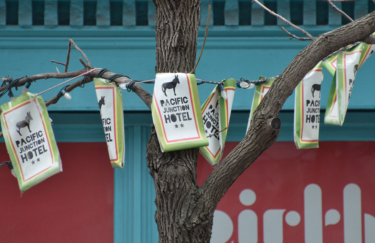
below: Banner for the Pacific Junction Hotel.

banner made of flags for the Pacific Junction Hotel strung in a tree on the sidewalk

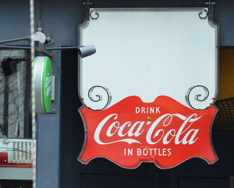
below: Drink Coca-cola

a red and white drink coca cola sign sign hangs in a window of a bar

below: Sitting together in silence.  Black and white.  Alive and not alive.
Both aren’t moving and both don’t see me.

a man sits on a bench in a small park, wintertime, a snowman is at the other end of the bench

below: I have always been intrigued by these vertical windows at St. James Cathedral, especially with the winter trees in front of them.  I’ve taken pictures here before but none have been satisfactory.  This one is certainly not perfect but the sense of scale that the woman provides is a big help.

vertical stained glass windows of St. James cathedral, from the outside in winter, a woman is walking past.

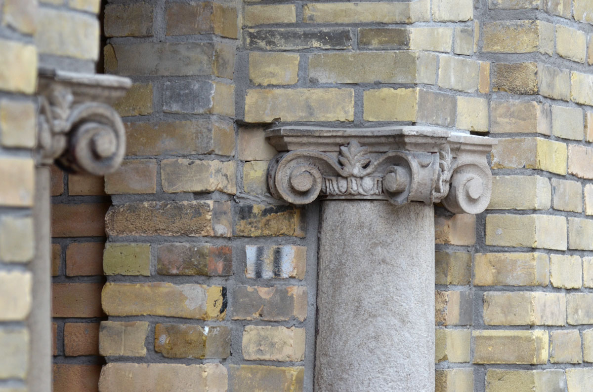
below: These two small ionic-ish columns help support an archway over the door.

a small column with an ionic like capital, embedded in a brick wall. The column looks to be supporting an arch over the doorway

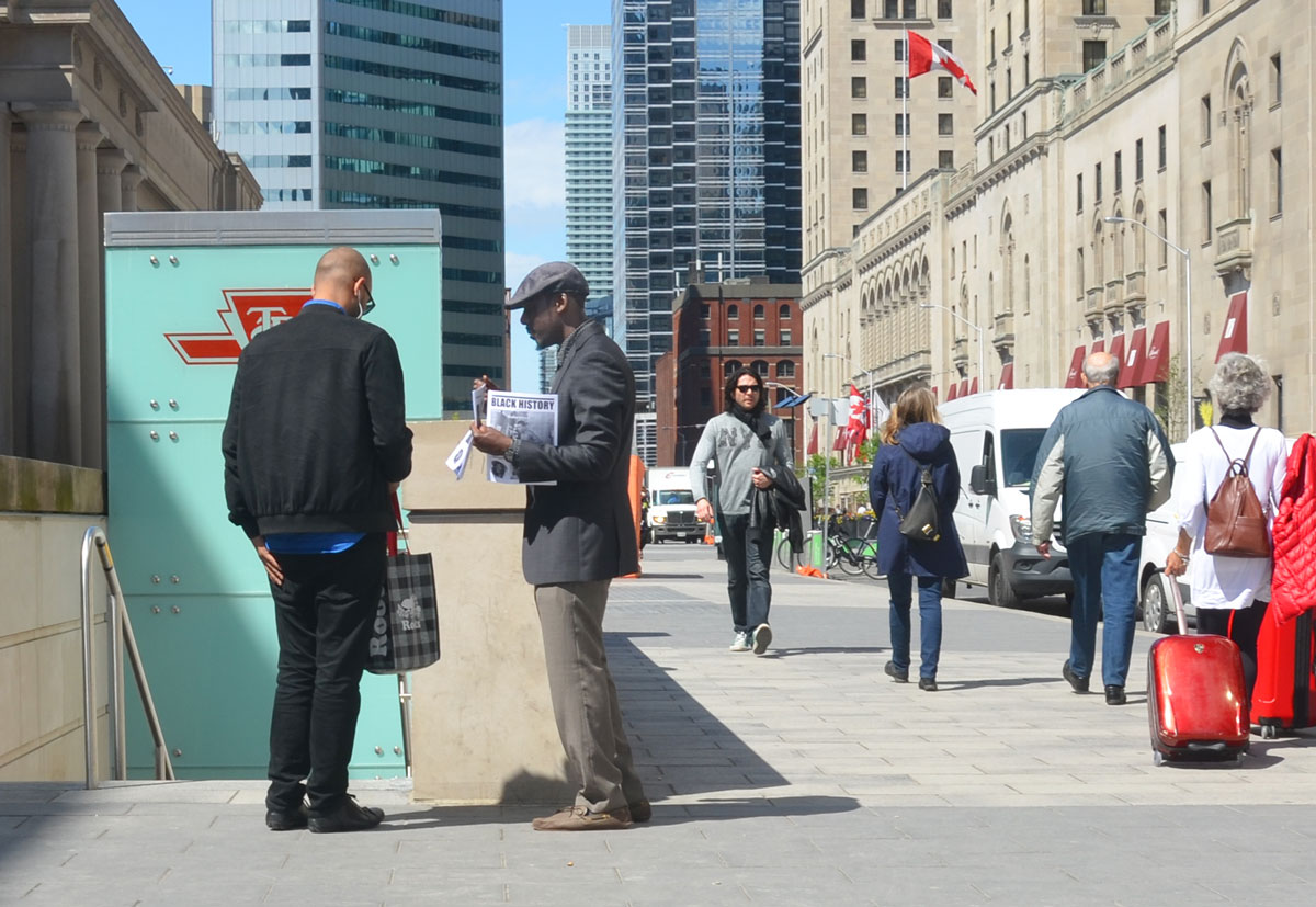
below: A bit of a rant.  At one point did it become acceptable for people to be sleeping on the sidewalks?  How did we learn to walk past?  When someone walks past a person sleeping in the middle of the sidewalk, what thoughts go through their head?  Is there a solution?  Or is so normal now that we don’t consider it a problem?   This man was right in the middle, there was no easy way to avoid him, but avoid him we did.

people walk by on the sidewalk as a homeless man sleeps under blankets on the corner.

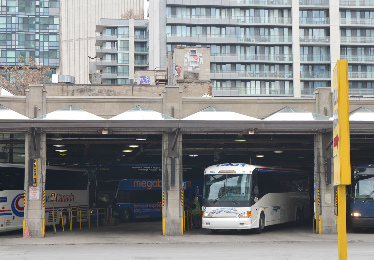
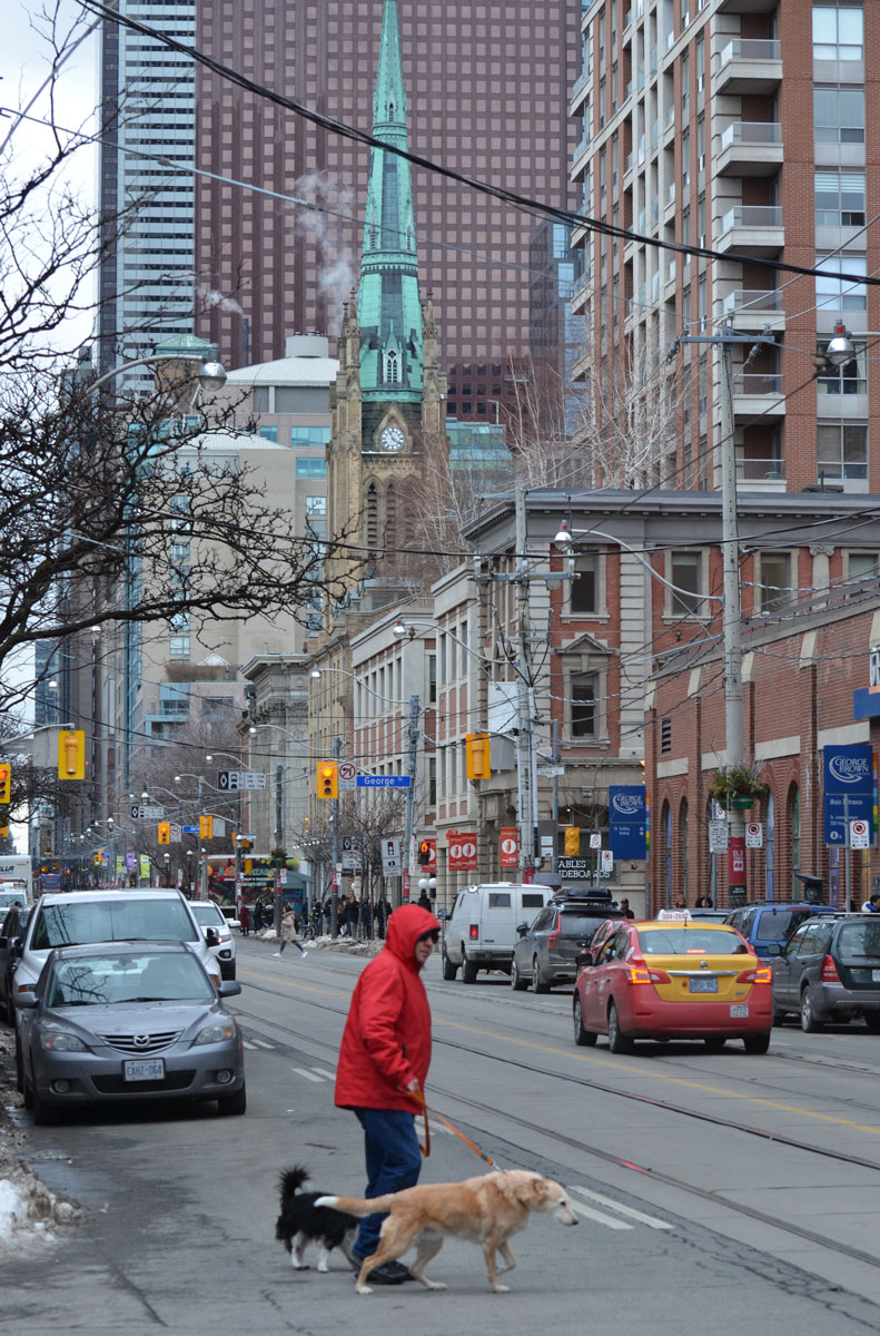
below: Trying to cross King Street.

a man in a red jacket is waking two dogs, waiting to cross King Street, with St. James in the background. traffic, and parked cars too.

below: An exposed support beam, two wood planks on end sandwiched between steel I beams.

on an exterior brick wall, the end of a support beam is visible. the beam consists of a wood beam on end between two steel I beams

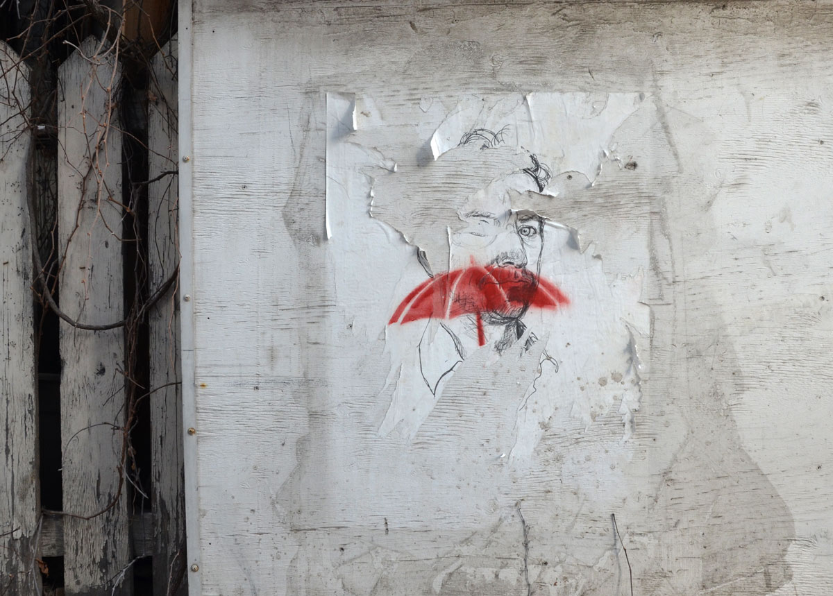
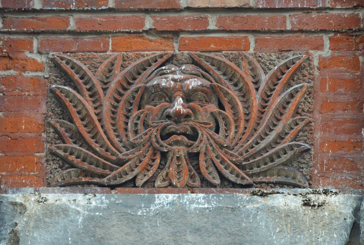
below:  High on a brick wall he suffers in anguish as the pigeons keep pooping on him.

carved stone piece high on a brickwall, exterior of a building, relief sculpture of a man's face with his hair made to look like long leaves that surround his face

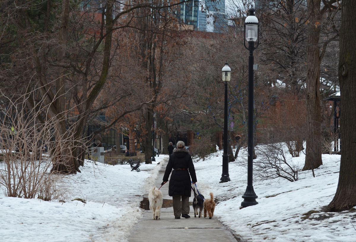
below: A bit of a cliche.  Walking the dogs in the park on a winter day.

a woman walks three dogs on the path through St. James Park on a winter day, snow, no leaves, some buildings in the distance

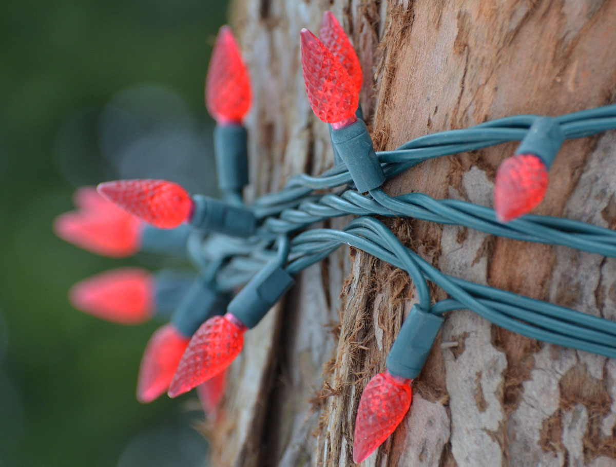
below: The Christmas lights are still wrapped around the trees in St. James Park.

a string of red LED Christmas lights is wrapped around the trunk of a tree

below: Two mis-matched windows side by side.  Old brick, rusty metal.

an old brick building with two windows.

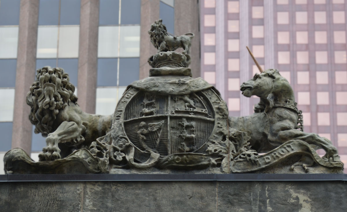
below: Above 10 Toronto Street is this royal coat of arms of the United Kingdom.   The unicorn represents Scotland and in the royal coat of arms for Scotland, the lion and the unicorn are reversed.  You’ll also noticed that the unicorn is chained.  Apparently this is because in legend, the unicorn is a dangerous beast.   I’m not sure what this says about Scotland!  The words on the banner below the lion and the unicorn say “Dieu et Mon Droit” (= God and My Right).  The words around the middle circle say “Honi soit qui mal y pense”.   This is the motto of the Order of the Garter and it translates to ‘shame upon him who thinks evil of it’.

sculpture of a coat off arms above 10 Toronto Street, a lion and unicorn and a motto in Latin.

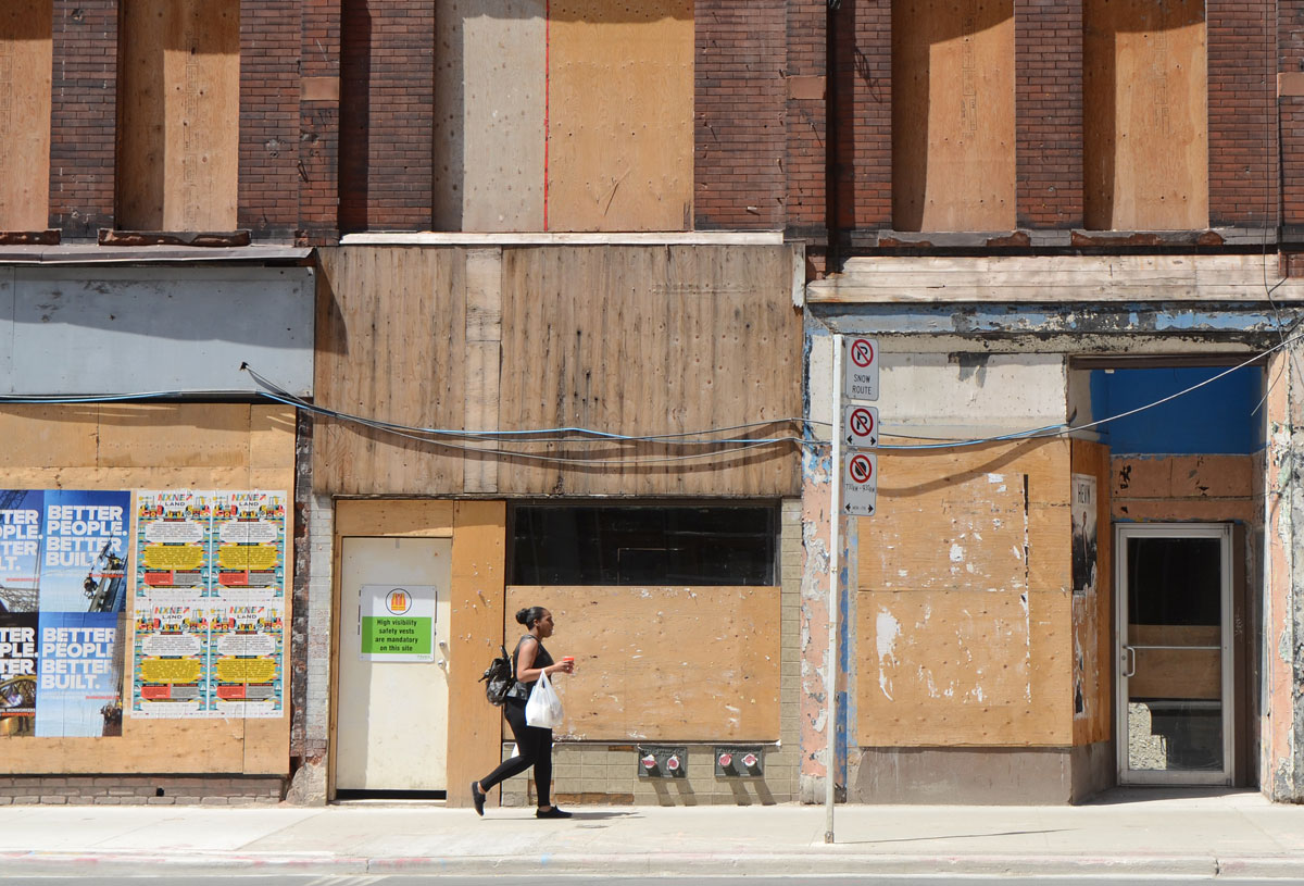
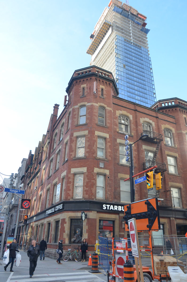
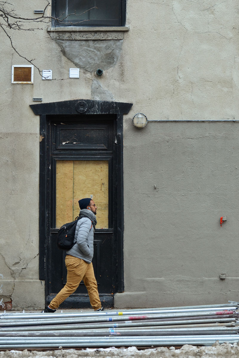
below:  This is the building that used to house Starbucks on King Street near George Brown College.  Many months (more than a year) ago there was a fire in the building and Starbucks closed down.  The windows and doors were boarded up and then nothing happened.   That looks like the makings of scaffolding lying on the sidewalk so maybe some renovation work is about to begin.

a man walks past a boarded up doorway

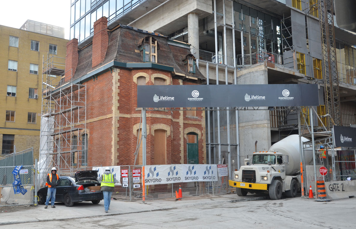
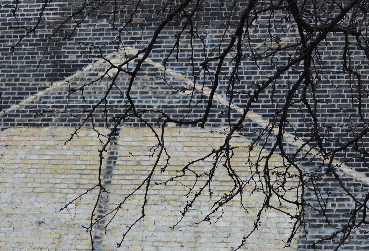
below: A ghost building outline.

The ghost outline of a building, in white, on a black brick wall. Tree branches without leaves hang in front of the wall.

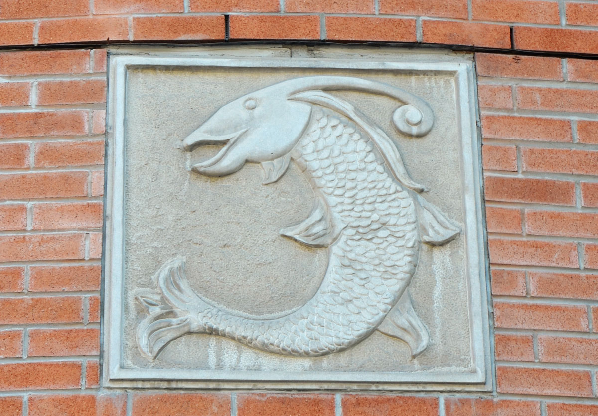
below: An octopus runs up the stairs. Or would it slither?

a blue drawing of an octopus on the second storey exterior wall, beside a metal stair case (fire escape?)

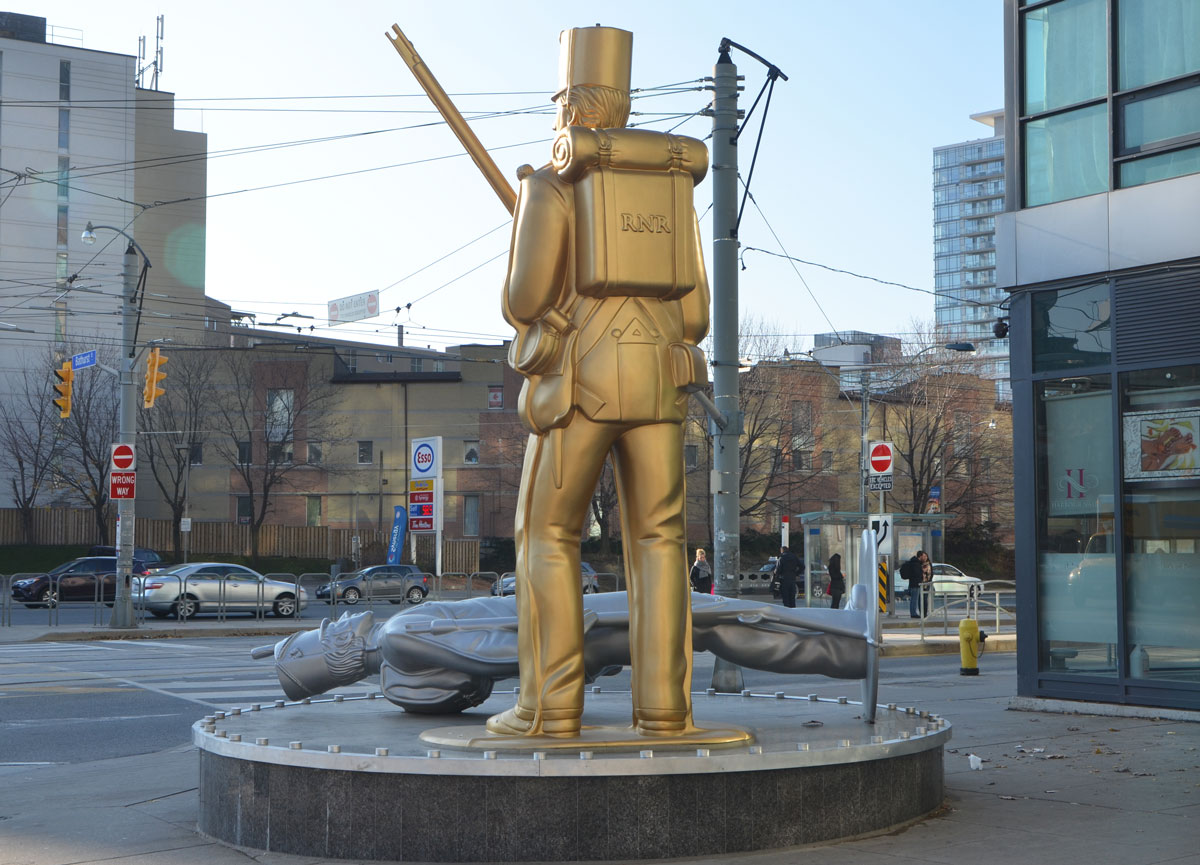
below: Passing by the five faceless naked men who silently and stoically watch over the intersection of Queen and Victoria.  A sculpture “Full Circle” by Peter von Tiesenhausen.

wood sculpture of naked men in a circle with their backs inward, at Queen and Victoria streets, two men walking past the sculpture

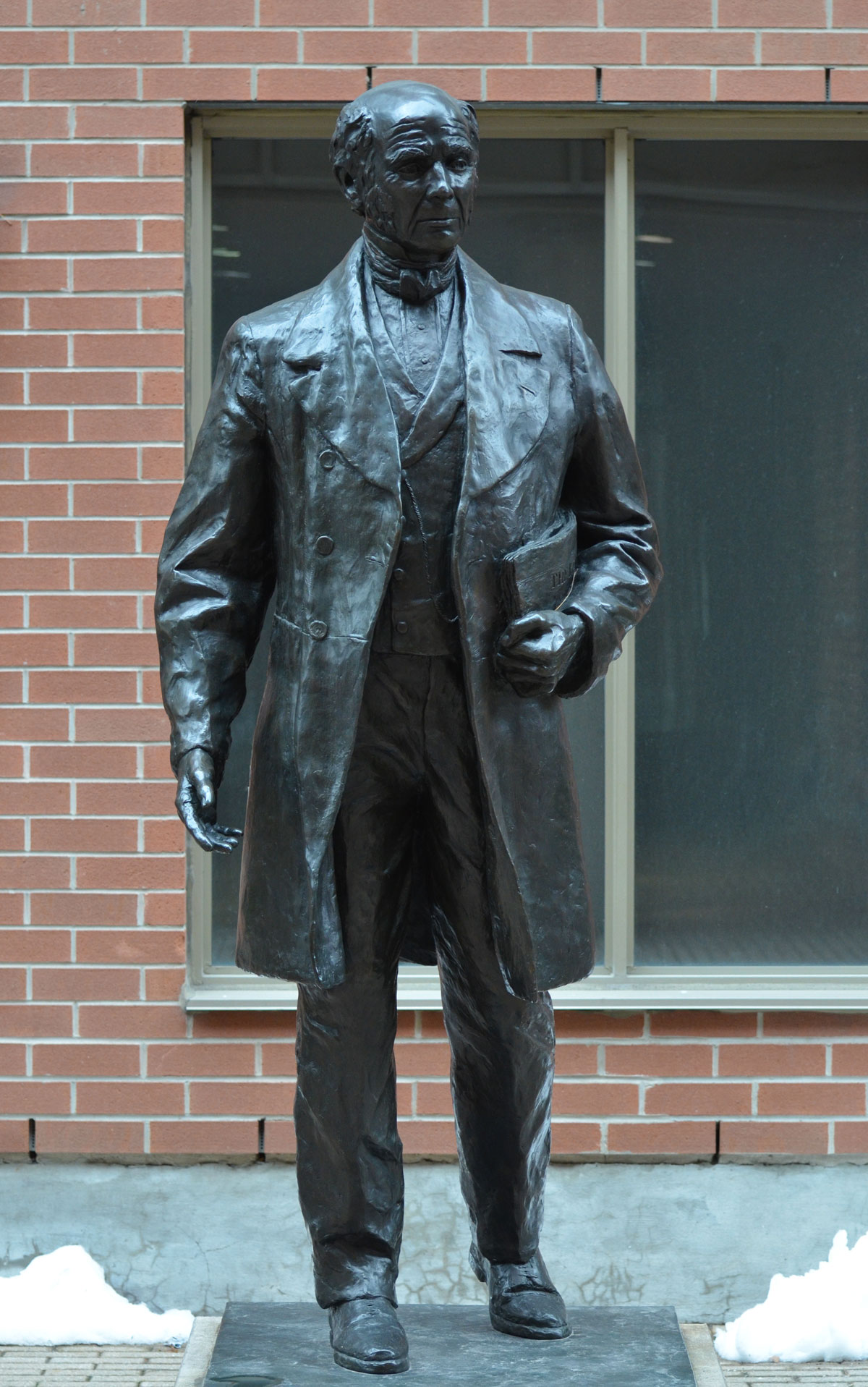
below: I also met James Beaty this morning.  He too stands silently but he is tucked away in a dull and quiet corner so he doesn’t get much to look at.   The original James Beaty was born in Ireland 1798 and came to Canada as young man.   He was a leather merchant, he established the newspaper ‘Toronto Leader’ in 1852,  and in 1867 he became a federal politician.

a black bronze statue of James Beaty, standing with a folded newspaper under his arm, about life sized,

below: Any idea what this might be?  Dancing figure?

small black and white stencil

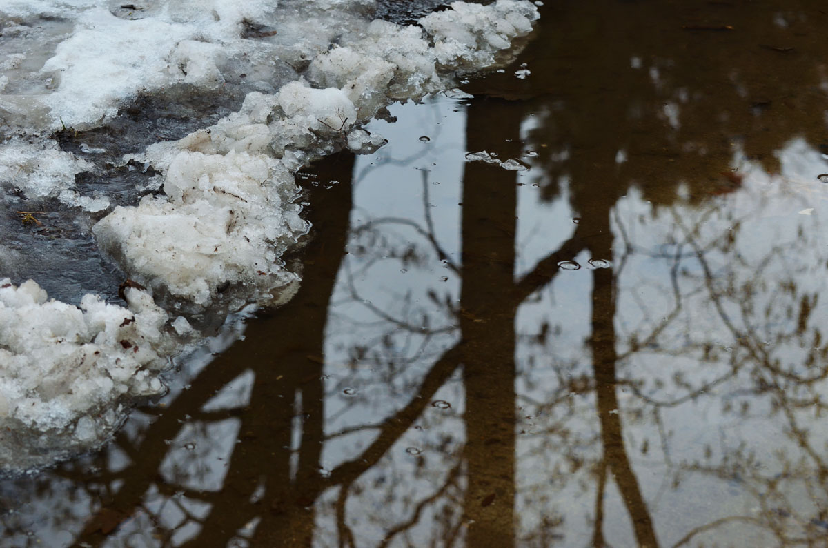
below: It was a puddle jumping, slushy kind of day.  I’m sure that there are lots more of those ahead!

reflections of trees in a puddle on a path that has snow and ice on it was well

below:  There are always more paths to walk and more chances to see what’s around around the next corner and through the gate!

looking down a driveway that passes under a very high square arch to the street beyond. Cars are parked on the street and a pedestrian walks by


Peperonata Lane runs north from Harbord Street.    Most of the garage doors in the alley have been painted.  Some were painted as part of a Wallnoize project in 2013.

a lane running parallel to a park with garages on the other side, a line of large trees by the garages. Most of the garage doors are covered with street art

below: Take a seat… and see what kind of street art there is here.

a wooden chair is tied to a tree, autumn leaves on the ground, a row of garages in the background, a number of large trees,

below: A woman feeds the chickens.

mural on a garage door of a woman feeding some chickens in a yard with colourful laundry hanging out to dry, houses in the background, mural on a garage door.

below: This mural, done in 2009, is one of the older ones in the lane.

blog_mural_simple_houses_garage

below: A deer and a hawk

mural on a garage door, a deer and a hawk

below: Elicser people and a text painting by poise.

street art on a garage and fence by elicser and poise in a lane,

below: Split face on a fence, by fiya

blog_face_gate_halves_split

below: A poser bunny

a poser bunny and tag on a garage door in an alley

below: Multicoloured grumpy cat by shalak and clandestinos.

shalak and clandestinos painting of a colourful cat face and paw with claws, on a garage door and fence in a lane

below: Wrinkled man with fish in hand, by smoky

painting by street artist smoky of a wrinkled old man holding an ugly fish in his hand.

below: A garage door painted by miles.

street artist miles tag and colourful street art on a garage door

garage doors in a lane alleyway that have been painted with street art


From City of Toronto documentation on the naming of Peperonata Lane, November 2012:

“The residents whose properties border on the lane have provided the following background information on the proposed name:”
” …throughout each year, the Galle family, who’ve lived at 441Montrose (the east side) since 1972, includes many Montrose residents in their annual celebration of making the “sugo” or tomato sauce, the roasted peppers and peperonata party, and the spirited soppressata contest, which they bring from their home country of Italy. Everyone learns the old world techniques and celebrates their new life in our Canadian context.
To commemorate how our lives have been enriched by the Galles welcoming and generous spirits, and in keeping with the traditions they’ve taught us and that we’ve now made our own, we propose the lane be named “Peperonata Lane” as a way of celebrating their unsung contribution to our neighbourhood”.

This is another meandering blog post… a post about being out and about on yet another wonderful autumn day, going wherever my feet and eyes take me.

below: The first picture of my day was this intriguing wall made of old wooden doors.  Bathurst Street.

a tall narrow wall about three storeys high made of old white doors.

below: A small elicser mural tucked away at the end of a parking lot.   The man has his back to the viewer but I can’t figure out what’s behind him or what he might be doing.

small mural on a fence, a man's head is back to the viewer

below: The leaves have fallen off the vines to reveal a yellowish creature with his baseball cap askew.

graffiti painting of a yellow animal like creature wearing a blue and yellow baseball cap. The creature is yellow. On a red brick wall, with spots on its back

below: Toronto’s tallest icon framed by a construction crane.

CN Tower in the distance, condo construction in the foreground, with a red crane

below: And on a similar note, a vacant lot cleared and ready for the next stage of its life.

a box beside a fence that has been scrawled over with blue spray paint. Behind it is a fence around a vacant empty lot. There are some small trees growing in front of the fence.

below: No more cranes here (and not many vacant lots either for that matter).  A view showing how much development there has been on the south side of the railway tracks.   Fort York is between the tracks and the condo towers.

a VIA Rail train passes by on one set of many tracks, in the background is Fort York and then a series of new condo buildings.

below: And what’s this? An old blue canoe beached on the tracks?

looking at the scene from a above, a blue canoe has been used to plant plants in. It lies across an old railway track, a chainlink fence separates the canoe from the main railway tracks that still function.

below: Standing guard over Bathurst Street, Fleet street and the Lakeshore, is one larger than life gold replica of a Royal Newfoundland Regiment and his fallen silver American foe. A sculpture by Douglas Copeland entitled “A Monument to the War of 1812”, a nod to nearby Fort York and the history of Toronto.

Douglas Copeland's sculpture of two tin soldiers, a gold one standing with backpack on and rifle in hand, and a silver one lying on its back on the ground, uniforms circa War of 1812, seen from the back, figures are much large than life sized and they are on a corner at an intersection, Bathurst St. and Fleet St.

below: My favorite example of bad grammar still exists!  Off-leash dog area at Coronation Park.

a wood fence around a dog park, in autumn with lots of leaves on the ground, on the fence is a white sign with black letters re the Toronto municipal code 608,

A beautiful day in the park.  A slight November nip was in the air but it was sunny and the sky was a brilliant shade of blue.  Coronation Park is named in honour of the coronation of King George VI who was crowned on 12 May 1937.  At that time nearly 150 trees were planted here.

Apparently, an oak tree was planted to honour the king.  Surrounding it, a ring of silver maples was planted.  This was to symbolize the countries of the British Empire.  I wish I had known that bit of trivia before I walked through the park because now I am curious if these trees are still there.   Some of the trees are quite substantial.

below: Long shadows for the morning sun, low in the sky.

morning in the park, autumn, trees with some leaves still on, many leaves on the ground, wood railing fence, shadows, Lake Ontario, path, Coronation Park.

below: Looking back towards the city center, past the empty docks of the National Yacht Club to the residences on Stadium Road.   A small group of people were making a video in the dog park.

morning in the park, autumn, trees with some leaves still on, many leaves on the ground, wood railing fence, shadows, Lake Ontario, path, Coronation Park. a small group of people in the distance are filming a video

below: This Victory Peace Monument was unveiled on 14 November 1995 to commemorate the 50th anniversary of the end of World War 2 and honour those who died in that war.   It was designed by John McEwen; the bronze pieces resemble the bow of a ship.

Metal partial cylindrical shapes on a concrete circular monument. World War 2 memorial

below: On the inside of one of the bronze pieces is a map of eastern Canada and the Atlantic Ocean.  Each boat on the map represents a ship or U-boat that was sunk during the war.  The Canadian ships are located on the map at “their last known position”.  I hadn’t realized that so many ships were lost so close to North America.

relief map of eastern Canada and the Atlantic Ocean, in bronze on a WW2 memorial. Little ships are shown on the ocean where they were sunk during WW2.

Trees were also planted to represent the four divisions of the Canadian Expeditionary Force (WW1) and its units as well as those who fought in the Fenian Raids of 1866-1870, the Northwest Rebellion of 1885, and the Boer War (1899-1902).  Once upon a time, brass plaques were placed at the foot of each tree to indicate the units the tree stood for.  If any plaques remain, I didn’t see them.

below: Another memorial is close by, a  “Memorial to Lieut. Tommy Hobbs gallant British Canadian soldier in the Great War 1914 – 1918.  Died on active service November 10, 1940.  Beloved and remembered by his comrades.”   Tommy Hobbs was involved in the creation of this park.

a memorial in a park made of a small pile of rocks. The top rock is inscribed, memorial to Tommy Hobbs, died 1940, in Coronation Park

below: A little farther on I noticed another rock, one that was painted red.   The bronze plaque on the rock says that 20 trees have been planted here in commemoration of the G20 Summit held in Toronto in 2010.

a large rock with a bronze plaque on it. The rock has been crudely painted red

below:  A 30 foot tall Inukshuk stands looking out over Lake Ontario.  Approximately 50 tonnes of mountain rose granite was used to create the Inukshuk, which was made by Inuit artist Kellypalik Qimirpik from Cape Dorset, Nunavut.

a tall stone inuksuk on a raised mound of warth

below: Streetcars across the baseball outfield.

Looking across the outfield of a baseball diamond towards a street. A line of mature trees by the street with two red and white TTC streetcars on the street, condo towers behind.

below: A closer look at that brown octagonal structure in the middle of the streetcar loop for the 509 and 511 cars.  Apparently it’s the Queens Wharf lighthouse, one of a pair built in 1861.

a brown structure, the Queens WHarf Lighthouse, sits on a patch of grass beside TTC streetcar tracks in front of a new condo.

The lighthouses marked the entrance to the Toronto Harbour from 1861 until the Western Channel was built in the early 1900’s.   This one stood on Queen’s Wharf which used to be at the foot of Bathurst Street, adjoining Fort York.  The wharf was built by the military; in 1833 it was a pier 42 feet long.    The pier no longer exists; a hundred years ago it was buried under what is now Bathurst Quay.

below:  A picture of an historical map (1886 or 1887) of the area showing Toronto Harbour, Fort York and the railway lands.  Queen’s Wharf is the pier on the left.   At that time, Front Street was the southern most street in this part of the city.   All the present day development south of the train tracks is on reclaimed land.

picture of historical map of part of Toronto Harbour from 1886, showing Fort York, Front St., and Bathurst St., and the railway lands and wharves into Lake Ontario,

below:   Taken from google maps, what the layout of the city looks like now.   As you can see, there have been many changes!

present day map taken from google maps of Coronation Park and Bathurst Quay including Fort York

Lake Ontario in the foreground, trees in Coronation Park in the middle and Toronto skyline in the distance with the CN Tower and a large Canadian flag.
a sticker of a rainbow in a heart shape. A small purple heart is in the center, then a blue heart is drawn around it, moving outwards in rainbow colours.

First I heard a rumour that the Art Gallery of Ontario was going to remove that sculpture from the corner of Dundas & McCaul, you know, the one that everyone climbs on and takes their picture with, the one near the AGO entrance.

Then I read about in a newspaper.

You know, that curvy bulky slippery thing by Henry Moore, the one with a title that’s almost as shapeless as the sculpture, “Large Two Forms” although no one calls it that.   Oh, what do they call it anyhow?

Then I read about it online.

people are walking on the sidewalk, a woman is sitting by a sculpture by Henry Moore, the Art Gallery Of Ontario is beside the sculpture, street and other buildings in the background, street scene,

It’s sat on that corner since 1974.  That’s 42 years.  Longer than the average Torontonian has been alive.
Can you say synonymous? …. as in synonymous with the corner of Dundas and McCaul.

Apparently it’s going to be moved to Grange Park.  That’s the park behind the AGO, the one that is being renovated.

The expression “Rob Peter to Pay Paul” comes to mind.
How about new public art for a renewal of the park?

fence around a construction site, a park that is being renovated

fence around a construction site, a park that is being renovated, the blue wall of the Art Gallery of Ontario is in the background.

But walking the site and looking at the plans made me start to think.  The sculpture is being moved into its own space in the park and as I looked at the drawings and the artist rendition of the future space, it dawned on me that the redesign of Grange Park was possibly (probably?) done specifically to accommodate the sculpture.  The Art Gallery owns Grange Park after all.  Toronto does a lousy job of placement of their public art so maybe I shouldn’t complain about this?

Maybe.

As I tried to take photos of the sculpture where it is, I was reminded of how the streetscape in Toronto gets short shrift.

blog_art_gallery_corner

Henry Moore competes with old poles as well as bus shelters that are designed to maximize Astral Media ads.  At least there isn’t a ghastly trash bin beside the sculpture.  And at least the art is solid enough and strong enough to hold its own.

But this is going to be a problem for any artwork that gets put on that corner.
Oh dear, assuming that something will replace Henry Moore?

Don’t mess it up even more AGO, don’t leave the corner empty.
We have more of a cultural memory than you give us credit for.

The Frederick G. Gardiner Expressway, commonly just called the Gardiner, has been in the news a lot lately.  This 18 km stretch of road between the city and the lake was completed in 1965 after years of planning and building.  At the time that it was built, Toronto’s waterfront was largely industrial and there wasn’t much objection to having a 4 to 6 lane expressway, with many sections elevated, built there.   The railway had begun the process of dividing the city from its waterfront a hundred years previously.

As the city changes and grows, more and more people live in the downtown core.  Industry has moved out and residents have moved in.  For so long the land south of the Gardiner as well as under the Gardiner was neglected, especially from a city planning point of view.  But now, the city is looking differently at that swath of land.  The far east elevated section between the Don Valley Parkway and Leslie Street was demolished in 2001 and there have been calls for the next section (Jarvis to the DVP) to be demolished as well.   There has been some controversy as to whether to demolish it or move it… and if move it, where to? I am not even sure what the plans are at the moment.   On the other hand, the western section of the elevated expressway (Strachan to Spadina) will remain standing.  Work is underway to refurbish the structure – the city doesn’t want any more stories of pieces of concrete dropping onto cars beneath!  Plans are being implemented to use the land under the Gardiner much more efficiently.  To make it work for the public.

The Bentway is the name that has been given to this new park, or public space, beneath the Gardiner Expressway from Strachan 1.4 kilometres east to Spadina. The first phase is due to open Canada Day 2017 and it involves the stretch between Strachan and Bathurst.  Many of you have probably driven on the Gardiner but do any of you know what is under it now?  Let’s take a look.

below: The Gardiner passes over Strachan Avenue which  in turn passes over the railway tracks.

bridge over a street, many orange and black construction cones down the center of the road, some pedestrians on the sidewalk

below:  On Strachan Ave looking west.   Condo development in this area has extended right to the railway line.  The Exhibition GO train station is in the distance.  You can also see the Gardiner to the left of the tracks.  Here the north side of the under part of the expressway is walled in and the enclosed space is used by Exhibition Place.  At this time there is no plan for the Bentway to extend this far; I have used this photo to provide more context as to the location of the park.

railway tracks in the center of the picture, condos on the right. On the left is the elevated Gardiner expressway, but under it is a concrete wall that makes it look more like a concrete building than a road

below: A closer look at the Gardiner on the west side of Strachan Avenue.  Maybe there is potential to expand the park westward? to Exhibition GO station? And by the way, those concrete structures holding up the expressway – those are called ‘bents’ and that is why the park is called what it is.

a dirt road runs alongside the Gardiner Expressway, some condos in the distance

below: This photo was taken as I stood on Garrison Common and looking towards Strachan Avenue.  This will be the western end of the new park. You can see the underside of the Gardiner as it passes over Strachan Ave which in turn is also a bridge.  This bridge once crossed the Grand Trunk Railway tracks that were built in the 1850s.  New entrances to the park are planned that incorporate the present sloped embankment of the bridge.

The elevated Gardiner Expressway passes over Strachan Ave which in turn has a bridge over what used to be a rail line. The bottom part of the bridge is covered with graffiti. The whole area is a construction site at the moment.

below: A quick aside:  It’s a slightly different angle, but here is a photo of the Strachan Avenue bridge from 1959, before the Gardiner was built.  I suspect that there has been upgrades made to the bridge since then.  Photo credit: R.L. Kennedy, found online (also a good source for the history of the Grand Trunk Railway in Toronto).  Garrison Common is to the right.

vintage photo from 1959, GTR tracks pass besidde Garrison Common park and under the bridge at Strachan Ave

Garrison Common is the green space surrounding Fort York.  It will abut (be continuous with?) the new Bentway.  Fort York is a National Historic Site and on its 43 acre site are original buildings from the War of 1812 as well as an 1813 battle site.  Did you know that the Americans beat us here in 1813 and controlled the city of York (as Toronto was known then) for a few days?

below: The new Fort York Visitors Centre is now open. There is still being work done both inside and outside, but it is open to visitors. For so long the fort was hidden away and difficult to get to; it is nice to see it receiving more attention.

entrance to Fort York, under the Gardiner, still a construction site but nearing completion

below: Jake from Park People, one of the groups helping to design the new park, stands under the Gardiner as he talks to a group of us on a tour.    Here, by Fort York, the Gardiner is the equivalent of 5 storeys from ground level, the highest it reaches as it crosses the city.

a man is standing in front of a group of people on a walking tour, he is standing under the Gardiner Expressway where it is 5 storeys above ground level.

below: Standing on the grounds of Fort York.  The Bentway will be beyond the stone wall.  You can get a good idea of the spacing between the bents.  These spaces are being referred to as ‘rooms’ and there are 55 of them between Strachan and Spadina.

from the grounds of Fort York looking south to the Gardiner and the condos built beyond it. Grass field in the foreground.

below: One obstacle is the fact that Fort York Blvd passes under the Gardiner on a diagonal.  Plans are to build a pedestrian/cycle bridge over the street.  Also in the photo, note the TTC bus – Fort York and vicinity are finally on a bus route.  Route 121 runs between the Portlands and Fort York via Union Station.

fort york blvd is in the foreground, a TTC bus and a car are on it, the Gardiner is to the right and a short condo building is in the background along with the CN tower

below: The section under the Gardiner Expressway between Bathurst Street and Fort York Blvd is not city owned. It is owned, and has already been developed, by the Onni Group who built the Garrison at Fort York condominiums on either side of it.  This is the eastern end of phase 1.

evening, low angle sunlight shines under the Gardiner Expressway where it has been developed with paving stones and some large rocks.

below: Northbound traffic on Bathurst passes under the Gardiner.

some traffic on Bathurst street on a rainy day, as the street passes under the Gardiner Expressway, condos on the right, construction hoardings on the left.

Phase 2 of the park’s development involves land between Bathurst and Spadina. This is an area that is undergoing a lot of changes at the moment, i.e. a lot of construction.

below: Immediately south of the Gardiner on the northeast corner of Bathurst and Lakeshore is a construction site.  Demolition of the old 1928 Loblaws warehouse building is now complete.  The facade of the old building was disassembled rather than demolished; after cleaning and refurbishing of the bricks, it will be rebuilt in its original location.  Two condo towers are planned for the space between Loblaws and the Gardiner.  Yes, more condo towers to face the Gardiner and add to the tunnel effect that you get when you drive on the expressway.

construction site in downtown Toronto, Gardiner Expressway runs behind the site, rubble in the foreground, a few remaining remnants of the old Loblaws building that was there, high rises in the background.

below: The development of this site is a collaboration between a number of developers.  I found a photo of one rendition (source) of what the space under the Gardiner will look like here in the future.  Public space including a cafe are part of the plans.  Check back in a couple of years to see what really happens here!

artist's rendering of what a planned development for under the Gardiner would look like, part of a larger condo and retail development.

below:  Standing on Bathurst Street, looking east along what will be Housey Street.  This is just north of where the Loblaws development (above) will be.  As you can see, you can’t walk there yet.

the elevated road, the Gardiner Expressway passes over a construction site on the right, a new street being built on the left.

below: Southeast corner of Bathurst and Fort York Blvd.  This is the section of land just north of Housey Street.  Construction hoardings and cranes – familiar sights in this area.  It also means that taking photos of under the Gardiner here are difficult!

late afternoon, long shadows, yellowish tint to the photo, looking east from Bathurst, south of Front, north of the Gardiner, wood construction hoardings with posters on it, many orange cranes, some condos already built, a woman jogging past, cars on the street.

below: Development north of the Gardiner between Bathurst and Dan Leckie Way.

construction site under the Gardiner, cranes and condos being developed on the left, CN tower in the fog in the distance.

Dan Leckie Way is a north-south road that runs under the Gardiner just east of Bathurst.  It is the western boundary of Canoe Landing Park.  This park is north of the Gardiner and the Lakeshore.

below: ‘Tom Thomson’s Canoe’, by Douglas Coupland sits at the highest point of land in the area; it’s almost at the same level as the Gardiner and is very visible as you drive by.   This park extends down the hill.

The end of a large red canoe, an artwork by Douglas Coupland called 'Tom Thomson's Canoe' sits in a park, high above the surrounding scenery. Looking southwest towards the elevated Gardiner Expressway and the condo developments south of it.

below: Looking the other way from the same vantage point. The street running under the Gardiner here is Dan Leckie Way . Up until this point the Lakeshore is south of the Gardiner.

The elevated Gardiner Expressway with traffic is in the middleground, some trees and parkland in the foreground, and condo developments in the background.

At Dan Leckie Way, the Lakeshore is still south of the Gardiner and the space under the expressway is wide open.   By Spadina, one major block east, the situation changes.   The Lakeshore splits and westbound traffic lanes go north of the Gardiner and eastbound lanes stay south.  Shortly after Spadina, the Lakeshore runs under the Gardiner and there is no room for any further development under the road.

below: Standing on Spadina, just south of the Gardiner and looking west.  Here there is a lot of road to cross for pedestrians on Spadina.  Not only has the Lakeshore split to run on either side of the Gardiner, but there are also ramps between the Gardiner and the Lakeshore.

major road with traffic under an elevated expressway in a city, long ramp from the upper level to the lower. Gardiner Expressway and Lakeshore Blvd in Toronto, at Spadina looking west

below:   Still on Spadina, and still looking west, but now under the Gardiner.  The space under the road is not as high as it was previously.  Its lower and darker and not as inviting.   It will be interesting to see what phase 2 of the Bentway development will look like in this space.  I am not sure when it will to be finished but I will keep an eye on it!

under an elevated section of the Gardiner Expressway, at Spadina.

As for the eastern Gardiner, what does that look like?  Well, that’s a whole other blog post!

 Project: Under Gardiner  On this site you’ll find detailed maps and diagrams of this area as well as information about the plans for the various sections of the space.


Standing on the corner of Yonge & Bloor, looking south….  On one corner, a tower almost finished and on the other corner a tower another just started.  1 Bloor East and 1 Bloor West.

below: 1 Bloor East (7 photos)

part of a glass wall of windows of a tall condo under construction, two men on a balcony, as well as a piece of plastic covering something part way up

below: The beginnings of an overhang at street level, NW corner of the building.

part of a glass wall of windows of a tall condo under construction - reflections in the windows, looking up from the ground floor, the supports of an overhang at the first floor can be seen but the overhang itself is not finished

part of a glass wall of windows of a tall condo under construction - parts of two adjacent buildings

below: The podium level as seen from the SW corner of the building.

part of a glass wall of windows of a tall condo under construction - the edge of the podium levels as viewed from the street, looking up

below: The full height of the building is more easily seen from farther east on Bloor Street.

looking west along Bloor Street towards Yonge, with highrises on the left, and the overhang from the entranceway to the Marriott hotel on the right. people on the sidewalks as well as bright red umbrellas over seating at a patio.

part of a glass wall of windows of a tall condo under construction - curves and diagonal lines as well as the usual rows of windows

below: As seen from across the street, under the protective covering over the sidewalk.

part of a glass wall of windows of a tall condo under construction as seen from under a covered walkway across the street
below: Once upon a time the old Stollerys store stood on the southwest corner.  Today it is a construction site wrapped in hoardings covered by a mural of a forest scene.  I’m not sure what they’re trying to say or who they’re trying to fool.  Oh well, it looks pretty for now.

looking across the Yonge Bloor intersection towards the south west corner where there is a construction site with hoardings covered by a green mural of trees. High rises in the background, a few people on the ocrner waiting to cross the intersection.

below: If you look behind the hoardings, you will see that all the buildings except one have been demolished.   No hole has been dug yet so it’s going to be a while before this tower is completed.  And when it’s completed it will be Toronto’s tallest condo building at 72 storeys.

view of a construction site where one old building remains, a digger is on the site as is a very large orange rubbish bin

Two blocks north, at Yonge & Yorkville, there is another hole in the ground.

below: The doors and windows of the old brick buildings on Yonge Street are boarded up.  These buildings date from the 1860’s.

Looking across the intersection of Yonge and Yorkville streets at a row of old three storey brick stores that now have their doors and windows boarded up.

below: Peek around at the back and you’ll see that the old stores have been demolished but their facades have been saved.  Again, this project is in it’s early stages and again, it’s going to be a tall one.  This time, 58 storeys tall.

construction site, orange fence, the back part of a row of old buildings has been demolished, facades saved, now they are all boarded up.

below: The stores have been stripped of their signs and decorations.  It looks a bit desolate at the moment but it will be interesting to see just what the developers do with the facade.

a woman walks on a sidewalk on Yonge St past old brick buildings with their doors and windows boarded up

below: No one can argue that the old buildings were in good shape.  At least there is an effort being made to preserve the front of the buildings.  Preserving some of our history is important and I think that the old architecture adds visually to the look of the street.

an old wood column decorative piece on the front of an old brick building

As I walk back down Yonge street towards Bloor, a sign catches my eye.  Another development proposal sign – Toronto’s most common sign I think.  This one is for a 64 storey building at Yonge and Cumberland.  Anyone feeling a touch of vertigo at the moment?

development proposal sign on Yonge street


This post is about community involvement and the murals that result.  They aren’t great art and they weren’t meant to be.  They are about the stories we tell about ourselves and our communities.  They brighten our public spaces and enrich our neighbourhoods.

The first is a series of murals painted by Gledhill Public School students. There are murals by the graduating classes of 2008, 2009, 2010 and 2011 in a lane near the school.

Part of a mural in an alley painted by students from Gledhill Public school, graduating class of 2008, black silhouettes under tree branches, hand prints too

Part of a mural in an alley painted by students from Gledhill Public school, graduating class of 2009, black silhouette of the Toronto skyline with big colourful footprints, some roughly drawn people too , an airplane flies overhead

Part of a mural in an alley painted by students from Gledhill Public school, graduating class of 2009, black silhouette of the Toronto skyline with big colourful footprints, some roughly drawn people too

Part of a mural in an alley painted by students from Gledhill Public school, graduating class of 2010. A blue semi-circle

Part of a mural in an alley painted by students from Gledhill Public school, graduating class of 2011. 2011 in large numbers across the bottom with grey silhouettes of people, brightly coloured squares with faces across the top

Part of a mural in an alley painted by students from Gledhill Public school, graduating class of 2011. 2011 in large numbers across the bottom with grey silhouettes of people, brightly coloured squares with faces across the top

Just to the east, Woodbine subway station is undergoing much needed renovations and expansion.  Some of the hoardings around the construction site have been covered with three murals.   They were painted by:  Haley G., Sasha K.S., Francis H., Melika W., Tristan C., Savannah P., Adrina P. and Anna-Lisa A as well as Jim Bravo and Andrenne Finnikin as part of the ‘City on the Move, Young Artists in Transit’ mural project.

Looking across a street to a construction site around which a fence has been erected. There are three murals painted on the hoardings.

The first mural is a juxtaposition of past and present, people playing beside the creek. The creek, trees, and birds are all the same.  There is now a city in the distance and clothing we wear has changed, but we still enjoy the outdoors like our ancestors did.

1910 to 2013, mural of past and present along the creek. Kids playing on either side, the past on the left, the present on the right, bird watching, standing in the grass,

Above ground, a fair, an amusement on a summer day.   Below ground, the subway is being built.

mural depicting people at a fair. A child is licking a giant round lollipop, a girl is holding a doll, a ferris wheel is in the background.

And last, woodpeckers in the trees as well as a poem by George Elliott Clarke who was the Poet Laureate of Toronto 2012-15.  It describes the murals and is transcribed below.

mural painted on TTC construction hoardings, trees and birch trees with no leaves on them, with a couple of woodpeckers

The poem on the last mural:

Seeing Beauty, at Woodbine
 
Citizens, let’s pasture ourselves in parks
And gardens, so skyscrapers mingle with trees,
And we recover Native faith, Settler
Hope, to savour birds’ trills and swoops, fording
Creek and times past, to touch us, where we stand.
 
Once was pleasure in a street fair – ice cream
And lollipop, but also in strolling
Or rolling down to work, shirt-sleeves rolled up,
Dawn light unfolding, That’s what’s visible.
(Underground, a steel vein branches, roots, and throbs.)
 
Torrential leaves stacked up towers, now fallen,
Last Fall, Birds tap into the standing logs
Winter planted.  Spring rain well refreshes
The city.  Now, young artists tap dreams –
Drafting Beauty – to which all say, “Bravo!”
 
by George Elliott Clarke

On Friday morning, my original goal was to find ‘Residents of the Esplanade’, a CONTACT Photography Festival outdoor exhibit at David Crombie Park but it was such a beautiful morning that I didn’t stop there. I found more than just the ‘Residents’.

Forty years ago, May 1976, the site plan for The Esplanade neighbourhood was approved. Since then, it has become home to a very diverse group of people. And it is those people that this installation celebrates on the 40th anniversary of the founding of the neighbourhood.

Crombie Park runs along the south side of The Esplanade between Berkeley street and Lower Jarvis.  The installation consists of a number of small white rectangular pillars with the picture and story of person on either side.

A photo from the CONTACT photography festival, installation called 'Residents of The Esplanade' - story of Mysha from Pakistan

A photo from the CONTACT photography festival, installation called 'Residents of The Esplanade' - photo of Solomon from on top of a basketball hoop

A photo from the CONTACT photography festival, installation called 'Residents of The Esplanade' - photo of Alan working at a desk, tulips and a woman sitting in the park are in the background

People were out enjoying the morning; school kids were playing basketball at recess.

kids playing basketball on an outdoor court. The wall behind the basketball hoop has been painted with a mural of hands making a heart shape with the fingers, by Bruno Smokey and Shalak Attack.

Flowers were blooming.

close up photo of red tulips in full bloom on a sunny day

tulips in a garden in a park, orange and yellow tulips, with some greenery. Grassy area with trees behind, and people walking on a sidewalk in the background.

below: Looking towards Lower Jarvis Street and downtown Toronto.

at the corner of The Esplanade and George Street, looking west towards downtown and St. Lawrence market. Playground on the left with children playing.

below:  One street beyond Lower Jarvis is Market Street.  It dead ends at the railway tracks.  The long structure on the right is a parking garage.

looking west towards the CN Tower, with the railway tracks to the left (but they are elevated and behind maintenance buildings so you can't see the tracks). Parking structure to the right, with city buildings behind it.

below: After a small backtrack up Market Street, I went through Conger Coal Lane to Church Street.  I don’t think I have walked this way before.  The lane was named in commemoration of the Conger Coal Company whose yard and wharf was nearby.   It was one of the many companies that provided Toronto with coal back in the day when coal fueled the city.  It was started in 1870 by Mr. P.D. Conger.   In 1913, Sterling Coal company bought Conger and the name was changed to Conger Lehigh Coal Co.

a downtown Toronto lane, very clean, no graffiti, taller, newer buildings on either side of the lane. CN tower in the distance,

below: A very old photo of the Conger Coal Company dock at the foot of Church Street, back when Church street ended at Lake Ontario

historical picture of the old COnger COal Co wharf at the bottom of Church street.

below: Tucked into a corner on Church street immediately south of Front Street, is an art installation by Paul Raff called ‘Shoreline Commemorative’.  A topography of limestone forms the base of the work.  A glass ball representing the line between sky and water sits on top of a tripod that tries to evoke a land surveyor’s tripod.  The words on the wall say “For 10,000 years this was the location of Lake Ontario’s shoreline.  This brick wall stands where water and land met, with a vista horizon”

Shoreline Commemorative by Paul Raff, an art installation on Church St., south of King, that marks where the shoreline of Lake Ontario used to be. It involves words on a brick wall and a model of the shoreline of Toronto showing the different elevations of the land.

below: Continuing the lake theme, a little fish out of water, jumping over the entrance to a condo.

bas relief sculpture of a fish, square stone on a brick wall above the entrance way to a condo building.

below: From the lake theme to another common theme in the city, construction. Spring is the beginning of construction season and here Berczy Park is being upgraded. In the background a new condo is being built but as we all know condo construction ‘season’ never ends. In fact, the challenge might be to find a place in this city where there isn’t a condo being built.

workmen redoing a park, Berczy Park in Toronto, with a digger and another piece of equipment, cityscape behind with a tall condo building under construction. A red and white crane is on top.

below: I walked past the never ending Front Street construction.  Construction in front of Union station seems to be finished, but this stretch of Front Street just west of the station is still being worked on.   There have been fences here so long that I can’t remember a time when they weren’t here.

Front street constrcution, behind a greenwire fence is a rd truck and piles of construction materials. Between the fence and a stone building is the sidewalk on which some people are walking.

a shirtless man in sitting on a stool at the corner of Front and Union streets. He has four signs (behind, above, in front, and beside him) asking for spare change or for you to buy his novel that is well rated on both Amazon and Goodreads.

A man is selling Black History newspaper to another man in front of the TTC subwayentrance at Union station.


There is no theme to this blog post.  I never really had a purpose in mind as I walked yesterday.  I walked to enjoy the spring day.  I walked wherever my feet took me…  and they took me on a route that wove between Bay Street and University Avenue and from Grenville south to Dundas.

two women dressed up and walking down the street. One is in a puffy black dress, black tights and black shoes. The other woman has long red hair and a polka dot sweater on.

below: “Jimmy Mount Rushmore” mural on the side of Jimmy’s Coffee featuring four famous musical Jimmys: Jimi Hendrix, Jimmy Page, Jimmy Buffet and Jim Morrison.

mural on the side of Jimmys coffee, monochromatic in rust, pictures of what Mount Jimmy Rushmore would like, four famous Jimmys, Jimi Hendrix, Jimmy Page, Jimmy Buffett and Jim Morrison

below: ‘Inner City Gate’ by Kosso Eloul.  1978.  A balancing act of stainless steel boxes on the lawn of the R. Fraser Elliott building (part of the old Toronto General Hospital), Elizabeth Street.

black metal sculpture of three boxes precariously balanced, the upper box is almost horizontal and it is being supported by the other two who are falling down but still balancing

below:  A blight on the sidewalk, so-called information pillars that are really just a sell-out to Astral Media.  They needlessly obstruct the sidewalk and obstruct the view of  cyclists and motorists.  Unfortunately they are part of a 20 year contract that the city has with Astral Media which doesn’t expire until 2027.

cyclists ride by an information pillar that has a large ad jutting out towards the street.

below: Incised into limestone blocks on the Edward Street side of McClelland House (originally the McLean Hunter building) is half of an artwork by Elizabeth Wynn Wood (1903 – 1966) called “Communication”.  The woman is sending a message to a man who is apparently shown on the other side of the building.  Sadly, I missed the man so there is no photograph of him here.  When the work was completed in 1958, the incised lines were inlayed with gold colour.

outline drawing of a woman floating in the sky, incised into limestone facade of a building. She is releasing a bird.

below: Across the street from the ‘floating woman’, 480 University Avenue is getting a facelift.

lower part of building have its facade upgraded to glass panels
below:  This picture shows most of the front of 480 University and you can see the different stages of the recladding process.  At the top of the building, the precast concrete grille that was part of the original 1968 Global House office tower is still in place while new glass panels have already been installed on the lower floors.   It is interesting to watch the metamorphosis of an 18 storey office building into a 55 storey condo tower.   Four levels of underground parking have also been added to the site and a new indoor entrance to St. Patrick subway station is in the works.

Tall office building is having its concrete facade replaced with glass. The upper floors are still concrete, the middle floors are bare and the lower floors have new glass

below: Abstract in blues and greys

very close detail shot of glass and reflections that make diamond shaped abstract in blue and grey

There is a lot of building and redevelopment in the area where I walked.

below: Womens College Hospital is totally new.

a lone man walks by the new Womens College Hospital building with its light grey stone facade, large glass section, and large pink glass section.

below: The corner of College and Bay, looking southeast, is now a wall of glass.

cyclist rides through the intersection of College and Bay streets. A wall of glass condos in the background.

below: The new wing of Sick Kids Hospital dwarfs the older buildings on Elm Street.

view from a parking lot, a row of the back of older two storey brick buildings with some mature trees, then taller modern glass buildings.

below:  The old and the new integrated into one building, Princess Margaret Hospital.

Princess Margaret Hospital, with the older stone building at the bottom, and the new modern addition above and beside it.

below: Even the street is being redone.  The center of Bay Street from Dundas to Elm is torn up because of  TTC streetcar track replacement.

A digger and other equipment working on a torn up section of Bay street.

below: Little quirky details:  First, the cross shapes made of contrasting brick on the back of the Red Cross building.  Second, the workings (or barrier?) of the compressed gas tanks that have been made to look like ice.

part of the addition that was added to the Red Cross building, two cross shaped features in contrasting brick on the upper levels. In front of that building are large compressed gas tanks.

below:  Another piece of public art, ‘Liquid Echo’ by Catherine Widgery, 1999, is in front of 750 Bay Street.  They look like stiff and lifeless frozen metallic fountains… or maybe just 12 pencils 🙂 .   Circular vent shafts for the underground parking have been incorporated into the artwork.

public art installation outside 750 Bay street

below: A  lovebot watches over the people passing through the bus station, unaware that he is there.

large lovebot wheatepaste paste up above the downtown Toronto bus terminal. A white bus is parked in one of the bus bays. Condos in the background.

below: And last, a colourful collection of squares and rectangles. Blue and green.  Red and white.

green and blue glass of a building's facade, with a storefront below. The windows of the store are filled with red and white pillows arranged in a grid.

Sometimes when I walk I find a view or a photo that suggests a theme for the day; something that summarizes the area that I’ve been walking through.  On Saturday, this was the photo, a construction site on Wellesley Street -a massive hole in the ground amongst a growing number of high rise buildings.

red and white danger sign on a makeshift wooden fence that says danger due to open edge. Beyond it is a very large hole for a construction site. A bulldozer is in the hole, downtown Toronto is in the background.

a large number of new high rise buildings just beyond a large hole in the ground where another condo is being built

This piece of property, between Wellesley and Breadalbane streets, had been vacant for a number of years.  It was once owned by the province; back in the 1980s there were plans to build a ballet and opera house there.  Those plans fell through and the land remained vacant while community groups lobbied for a park to be developed there.

When I first walked the area in April 2013, there was a blue fence around the site.

A wood plywood fence painted blue. Someone has painted three large white dollar signs on as well as the word ka-ching.

The blue fence is gone. According to the development proposal sign, two towers are being built here with a combined height of 99 floors.  A nine or ten storey L-shaped podium will run along St. Luke Lane and Wellesley Street to join the towers.    The plan also allows for park land on Breadalbane.  When I checked the website for the development, 11 Wellesley aka Wellesley on the Park, there is only one tower pictured and it doesn’t look like the description on the sign.

Ah, a little light bulb goes on.  The sign describes the developers’ original plan.  A change in the plan doesn’t mean a change in the sign.   So…  this seems to be the future home of one 60 storey condo tower on one third of the land and a 1.6 acre park on the remainder.

two bicycles parked on a sidealk in front of a fence that has a development proposal sign on it. Building site behind that, thena wall of skyscrapers in the background.

My Saturday walk had actually started close to Yonge and College.   I was drawn to the nondescript block of stores that are now boarded up in preparation to be demolished.

A block of two storey stores on Yonge street has been boarded up in preparation for demolition.

I’m wishing that I had taken pictures previously of these stores just to document the history of that part of Yonge Street.  I had many chances to do so, but the building never seemed interesting enough.

a man is walking past a row of boarded up stores that are about to be demolished.

development proposal sign above a large number 501, with an office/retail for lease sign above it.

Whether or not you think that two 58 storey towers with a shared 7 storey podium is an improvement is an entirely different question. It will contain 960 condo units and 5 storeys of above grade parking (because the subway runs underneath) with 320 parking spots.  Lobby access for the buildings will be from Maitland and Alexander Streets on the north and south sides of the property.  Or at least that’s what’s on the sign.   But fool me once, so I checked the  website for the condo (TeaHouse Condos in this case) and once again the information doesn’t match.  According to the website there will be two towers but the north one will be 25 storeys and the south one will be 53 storeys.  Whatever the end result, it will be different from what’s there now!


At least one person had an objection.

development proposal sign on a yellow wall that someone has written enuf on in big pink letters

A walk around the back of the building shows that we aren’t losing much there either.

two stroey building boarded up and ready for demolition, with a parking lot, behind a chain link fence.


The next site that I explored is just to the south where a hole is already in progress on the SW corner of Yonge and Grenville.

A hole in the ground on Yonge Street for construction of a building.

Photo taken from St. Lukes Lane

.

below: This hole has exposed the north wall of the brown brick Oddfellows’ Hall as this view shows.  This is looking south, with College Park in the background (built by the T. Eaton Co. and opened as a 6 storey Eatons store on 30 October 1930).  Behind the chain link fence is St. Luke Lane.

back of a large four storey brick building behind an open hole construction site, taller buildings in the background (College Park)

Now you see it… soon you won’t.  The condo tower here will be 66 storeys high.

open hole at construction site surround by fence, brick building in the background.

Oddfellow’s Hall was built in 1891 and 1892 by architects Norman B. Dick and Frank W. Wickson for the Independent Order of Oddfellows.  It has two octagonal turrets and is a playful mix of Romanesque and Gothic styles.   The building had a 20’ x 46’ long grand hall for IOOF private meetings as well as offices and storefronts.

below: Looking north up Yonge Street at College Street, about 1970.  The Bank of Commerce (later Canadian Imperial Bank of Commerce and now CIBC) was an early tenant of the building.  Also in the picture is the old fire hall tower but more about that later.

old photo from about 1970 looking north up Yonge Street from College Street. Oddfellows Hall is on one corner with main tenant as Canadian Imperial Bank of Commerce. Old fire hall tower is in the distance.

Photo found online, original source was City of Toronto Archives

.

below: Most people will recognize the building as Starbucks.

Oddfellows Hall, a large brick building with two hexagonal turrets, brick, now a Starbucks on the ground floor.

starbucks at the corner of Yonge and College

Back to Grenville Street where there is yet another development.  On the west side of St. Luke Lane is a partially completed condo that has incorporated the facade of what is known as the John Irwin house.  It is one of the oldest surviving residential buildings in the area;  in 1873 it was recorded as being owned by a John Irwin.

An old three storey brick house, the John Irwin house has been restored and incorporated into a new condo development that is in the process of being built, cement mixer in front, men working.

This house wasn’t always in this location though.  It was moved a few metres east along Grenville, from one side of the condo development to the other.  I found a photo that I took in April 2013, just after the house had been moved.  Here you can see the back of the house as well as St. Luke Lane to the right.

back of an old house from the 1870s, the John Irwin House, a three storey brick building, that was moved from one site to another. It is sitting on supports at the edge of a construction site.

Does your head hurt yet?  Because there is more…..
But first, a break.  A few other pictures from the area.

below:  No Parking in St. Luke Lane, twice.

A red sign on a red wall. In yellow letter that are peeling off, the sign says Private Parking Only, mcdonalds.

A light yellowish grey wall with a yellow sign that says no parking. Old sign, looking worse for wear. A piece of flat scrap metal is leaning against the wall
  below:  And a man (Van Gogh? someone else?) with a red umbrella but more remarkably, a white picket fence almost hidden under vines by Wellesley Street.

A drawing of a man on white paper pasted to a concrete wall. A red stenciled umbrella is on top of his face. A white picket fence is beside the wall.

below: Also in St. Luke Lane, a mural commemorating the Highway of Heroes.

A mural commemorating the Highway of Heroes

And back to the program….

So far we have two holes in the ground, a partially finished condo, and a block that has just begun to be demolished.  The last development that I saw in the area was one that is still in the planning stages.  The development proposal sign posted beside Currys Art Supplies (the blue awning) is a clue that changes are imminent at 480-494 Yonge Street.  This building is on the SW corner of Yonge and Grosvenor.   The sign says one 45 storey tower but by now I don’t believe the signs!

development proposal sign at 490 Yonge street

480 Yonge Street is a heritage building as is the old fire hall (1872).   The top corner of 480 Yonge is just visible in the bottom left of this picture.  It is to be incorporated into the new development if it goes ahead.  The fire hall tower is going to be preserved but the building in front of it will be removed.  The sidewalk will also be widened as a result.  That’s the opening act of this story; there may be changes before the final curtain.  The developers applied for a zoning amendment (increased height and density) earlier this year but I do not know the results of that.

old fire hall tower above a newer building, or a newwer facade on an older building, red dump trunk on the street, large new condo being built in the background, Yonge St.

below:  On the NW corner of Yonge and Grosvenor is this building.   I don’t know if there are any plans in the works to redo this stretch of Yonge Street but after seeing all the new developments, I’m starting to get a bit sentimental about the old buildings.  So here is documentation of what remains, starting with  A & W Home of the Burger Family at 496 Yonge.

Three storey older grey building on a downtown corner.

below: between Grosvenor and Breadalbane – Cuban cigars and Persian food

Three three storey buildings in a row, old brick buildings, on Yonge St in downtown toronto, 502, 504 and 506. Yonge Market, Persian restaurant, a Cuban cigar store.

below: SW corner of Yonge & Breadalbane – old and new, short and tall

sw corner of yonge and breadalbane streets showing older stores in the foreground and taller condos in the background.

below: SW corner of Yonge & Wellesley – tattoos, massages, and payday loans.

southwest corner of Yonge and Wellesley, a row of old buildings, now storefronts. A Massage parlor and a tattoo place, a convenience store and a Money Mart. Gass condos in the background.

below: NW corner of Yonge & Wellesley – Not just noodles

not just noodles restaurant on the corner of Yonge and Wellesley as well as more stores going north up Yonge Street.