Archive for the ‘transportation’ Category

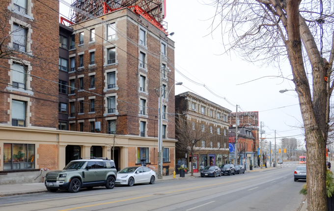
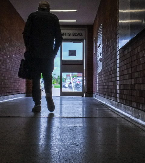
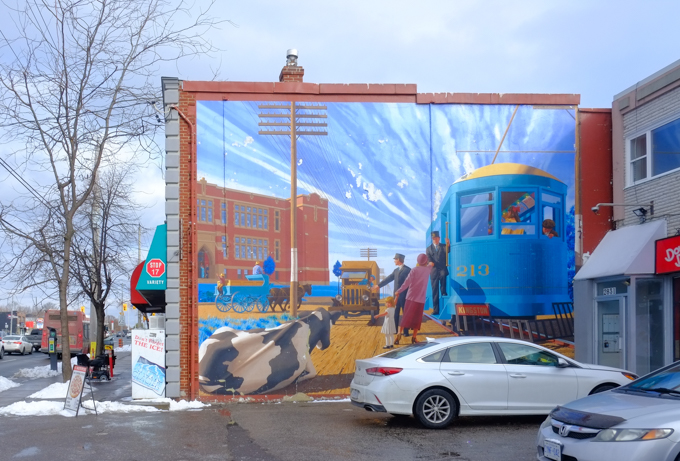
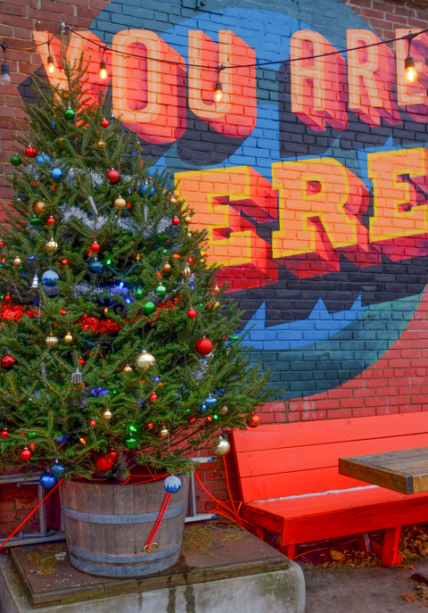
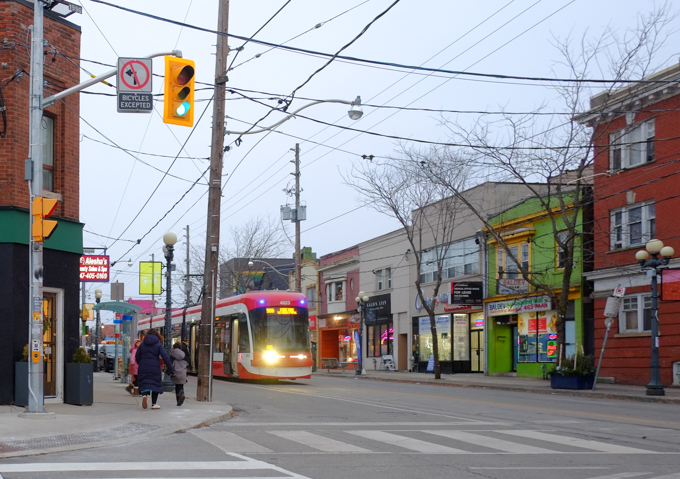
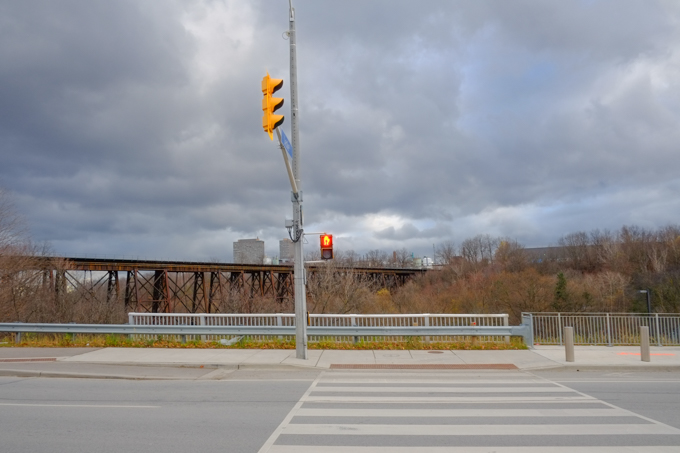
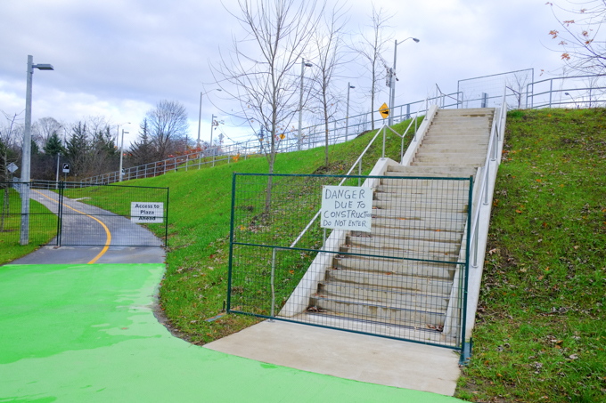
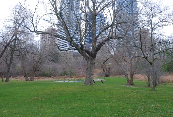
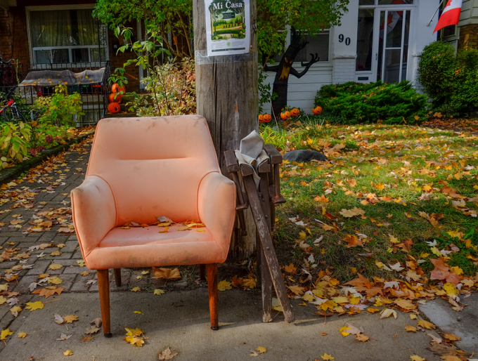
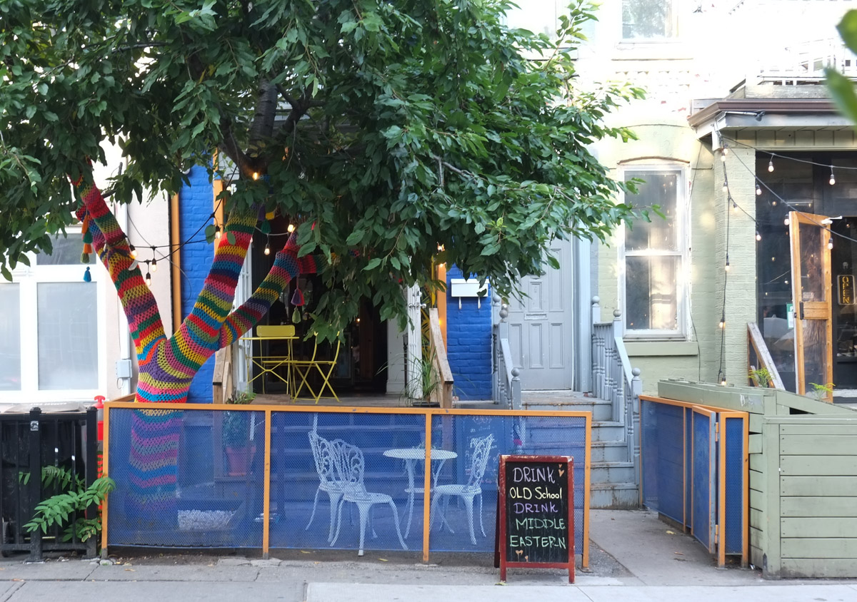
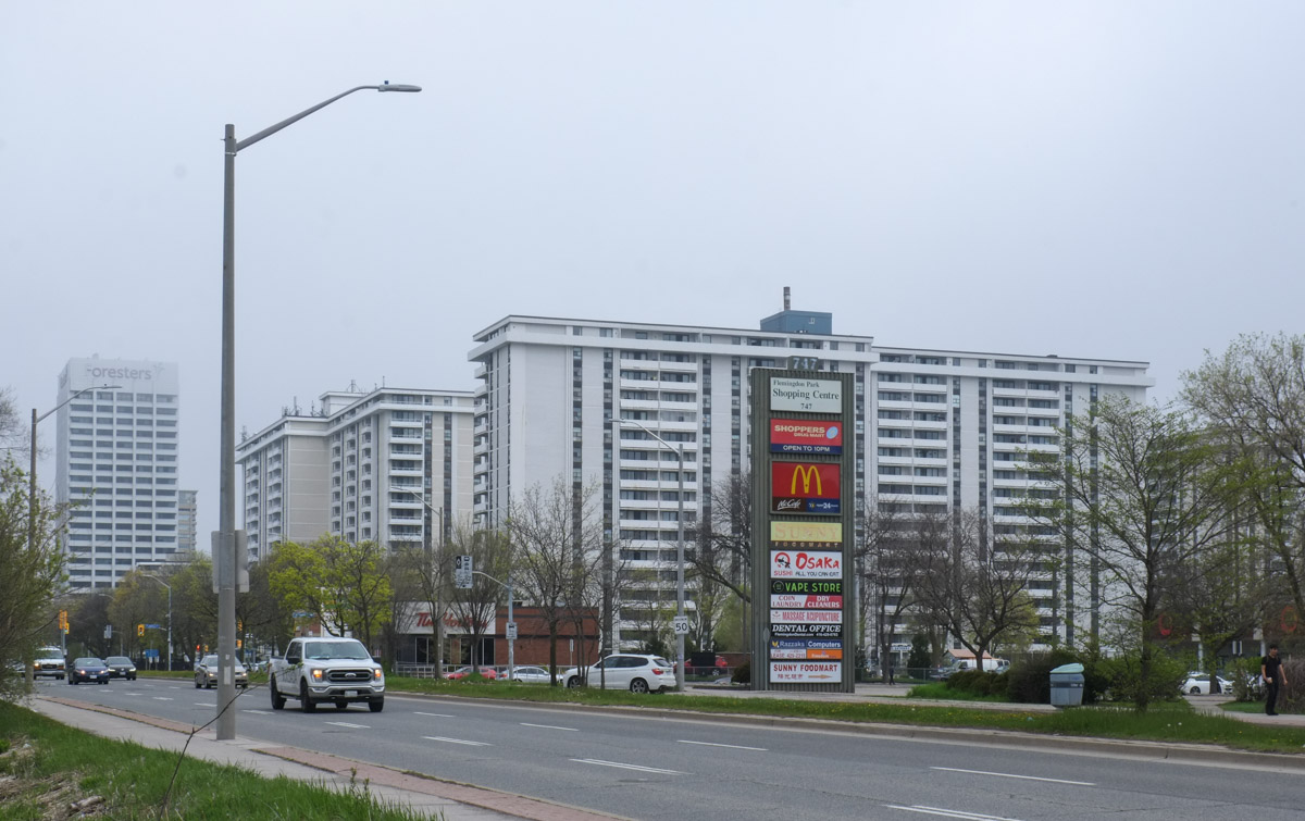
Good morning!  The weather forecast said that there was a chance of drizzly rain and they were right but it wasn’t that much and it didn’t last for long.  Not the best day for sunny blue sky photos of the city, but since when has that held us back?

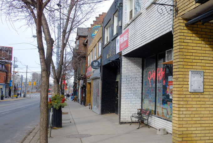
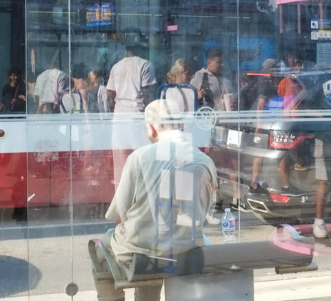
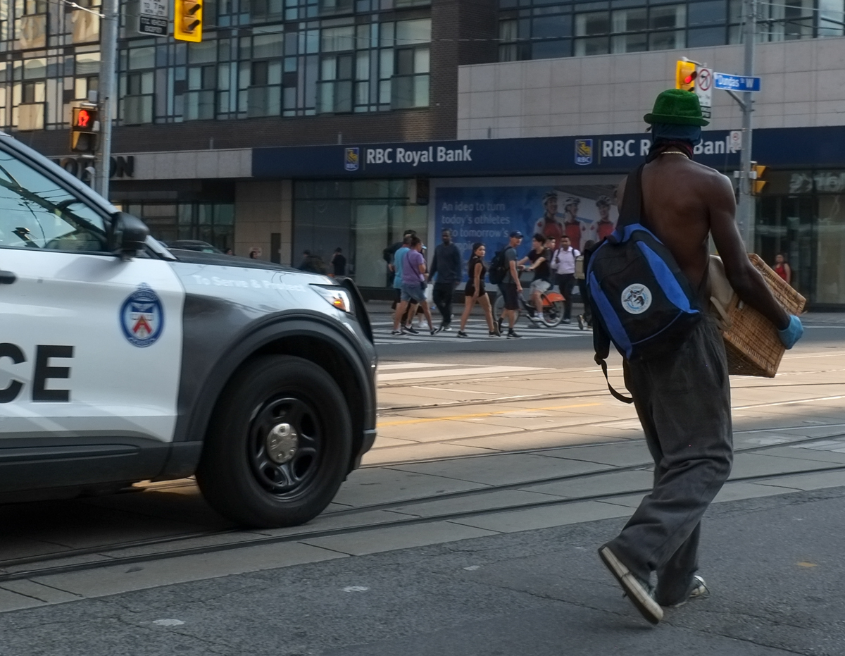
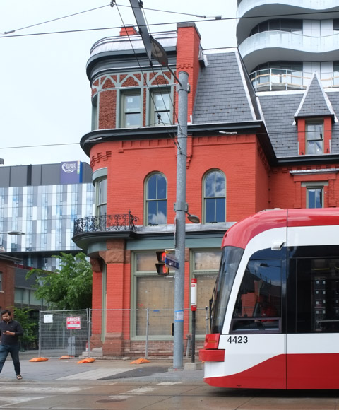
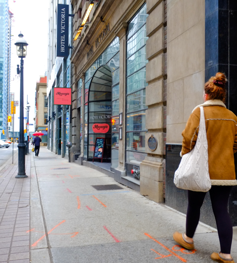
below: You probably don’t recognize where this photo was taken (unless you are familiar with the Victoria Hotel).  This is Yonge Street, just south of King subway station, and it is also where I started walking the other day….

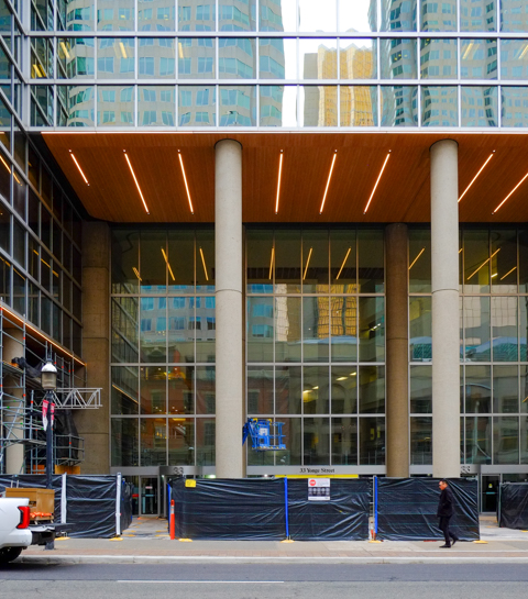
below: Contrasts of old and new at the corner of Yonge and Wellingon.  Architectural trends as well as the material used are a product of their time.

Yonge at Wellington, east side.

below: The old stone entrance with a large circular window over the door and an arch that matches those over the other windows.  There are also little details in the stonework that you just don’t see in modern buildings.

entrance, doorway, to old stone building on Yonge St., arch with round window under arch and over door

below: The more recent development to all glass buildings with oversized (i.e. extra tall) ground floor levels.

entrance to new highrise building on wellington with very high ground floor level

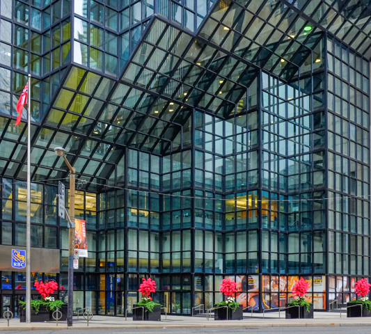
below: But such extensive use of glass is not entirely new. Downtown skyscrapers have been built using steel frames and glass since the 1960s. I think that the TD bank tower was one of the first, if not the first, in 1967. But that’s not this building… this is part of the large RBC complex on Bay Street between Wellington and Front. The bright pink plants along the sidewalk are wonderful!

dark steel and glass building at Bay and Wellington, planters along the sidewalk with bright pink plants in them

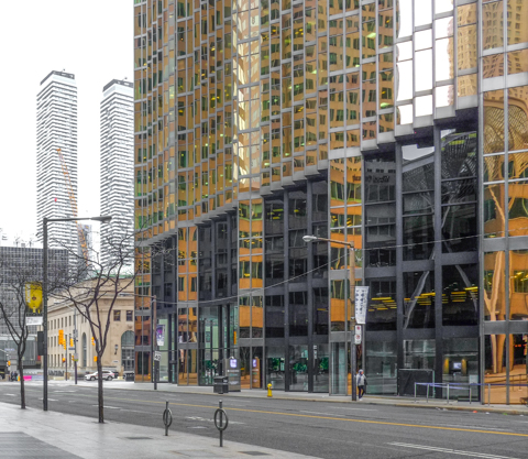
below: The south part of the RBC building is very photogenic! Its gold coloured glass as well as its angles and nooks make for some interesting pictures.  The older stone Union Station is hiding in the bottom left corner.

Bay Street, looking south across from gold glass building, royal bank building, Union station in the backround

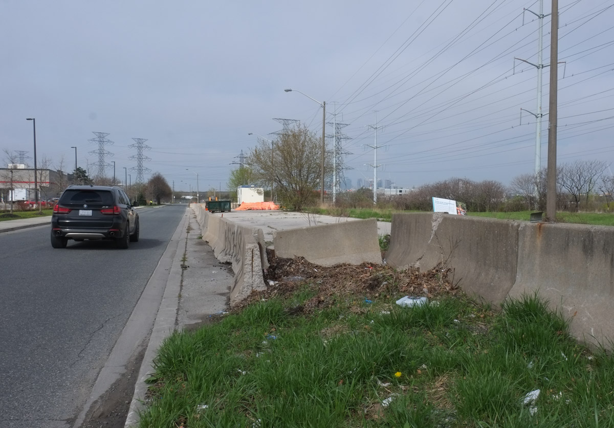
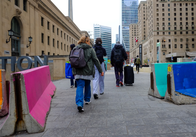
below: A recent addition to the streetscape in front of Union Station are these bland blocks of concrete. Such imagination! So much thought went into their design! Really? That’s what someone thought would be a great addition to Front Street?

Front Street, between Union Station and the Royal York Hotel, new concrete barriers, boring off-white blocks ,

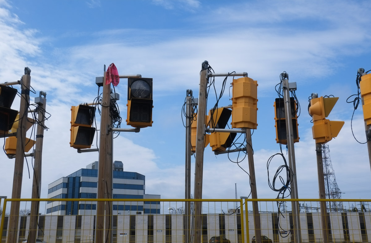
below: There were some complaints about the older ones… the Jersey barriers that were meant to be temporary but then never went away…. in fact, many of them are still here….

people with suitcases walking towards entrance of Union station, along Front Street

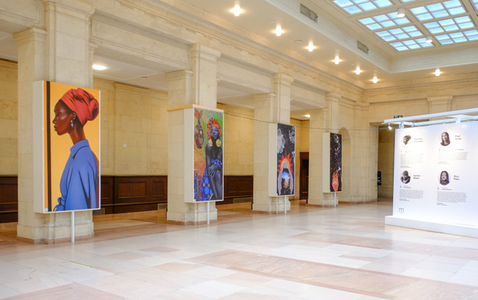
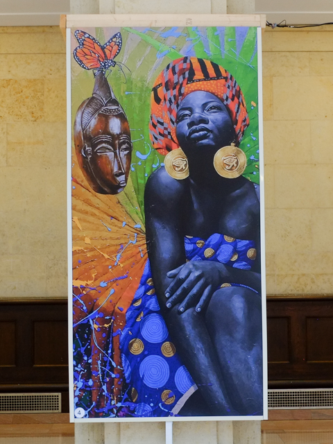
There are 2 art installations in the West Wing at Union Station.  The first is a group exhibit, “A Transit Through Time” featuring six Black artists – Destinie Adélakun, Pixel Heller, Segun Caezar, Heritier Bilaka, Rico Poku and Camille Kiffin.   Each artist is responsible for one panel…

below: The picture in the foreground, the woman with a red head scarf and blue blouse, is the work of Segun Caezar.

pillars in large open hallway at union station, each with a large artwork displayed on them. Transit through time installation

below: “Gelede Queens” by  Destinie Adelakun – people in ornate costumes pose in front of a large fireplace and mirror.  According to UNESCO, “Gelede  is performed by the Yoruba-Nago community that is spread over Benin, Nigeria and Togo. For more than a century, this ceremony has been performed to pay tribute to the primordial mother Iyà Nlà and to the role women play in the process of social organization and development of Yoruba society. “

large vertical picture of people in ornate costumes posing in front of a fireplace and large mirror

below: “Self Knowledge” by Heritier Bilaka

a large picture on display, self knowledge by Heritier Bilaka, a black woman with orange head scarf, and blue dress, sits beside a wood mask

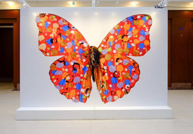
below: This large butterfly, by Jordan Sook, is part of another installation called, “Nothing More, Nothing Less”.   Apparently there are more butterflies around Union Station.  Have you seen any?

a large image of a butterfly, by Jordan Sook,on display at Union Station

below: Ontario Square between Queen’s Quay and the waterfront where a large image from Alex McLeod’s “Liquid, Gold” can still be seen.  I wrote a blog past about this picture and others from this series a year ago, “Liquid, Gold and other matters

a person walks across Ontario Square near the waterfront, condos in the background, square structure is a parking garage entrance, and there is a large photo on display on the side of it

below: This “Carnavale Amulet” basket is made of glass and was created by Laura Donefer.  It is on display at Harbourfront along with several other of her pieces.

carnavale amulet basket, on display behind glass, by Laura Donefer

christmas theme red glass basket by laura Donefer, on display in a gallery

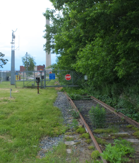
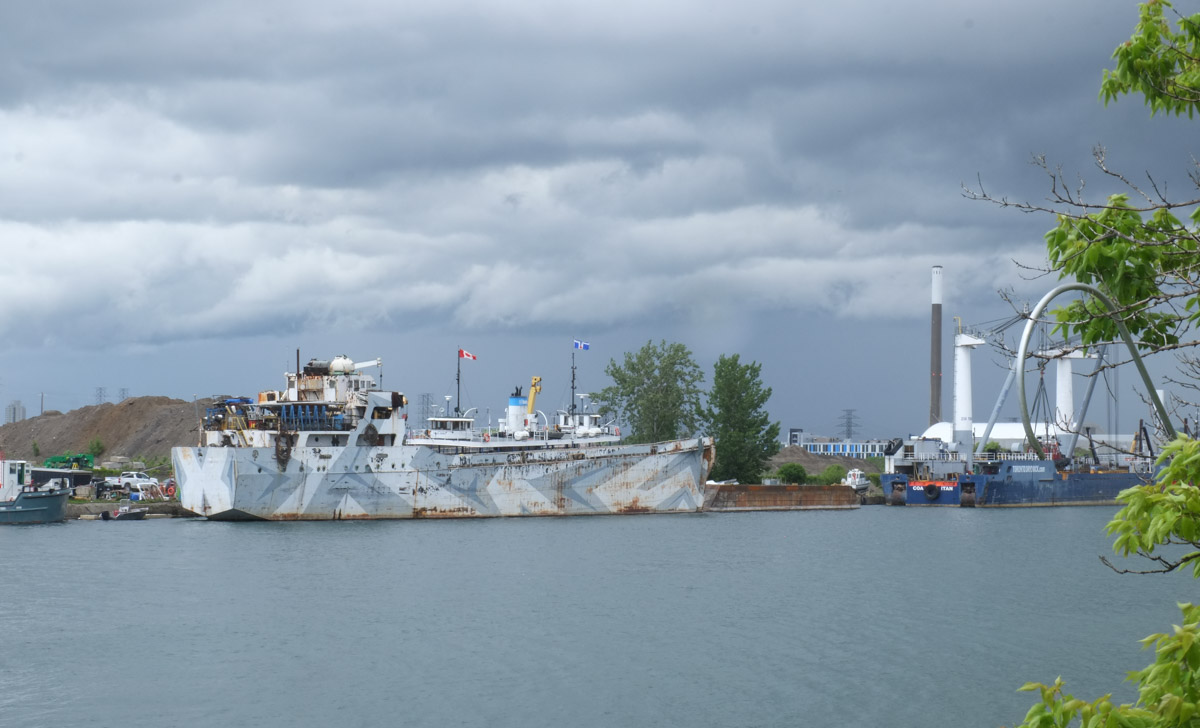
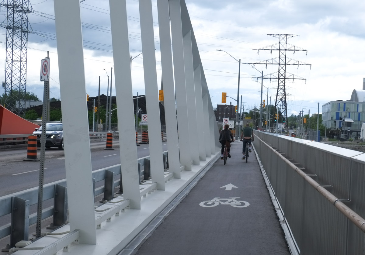
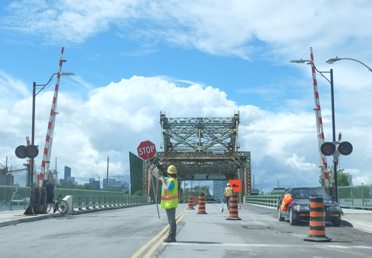
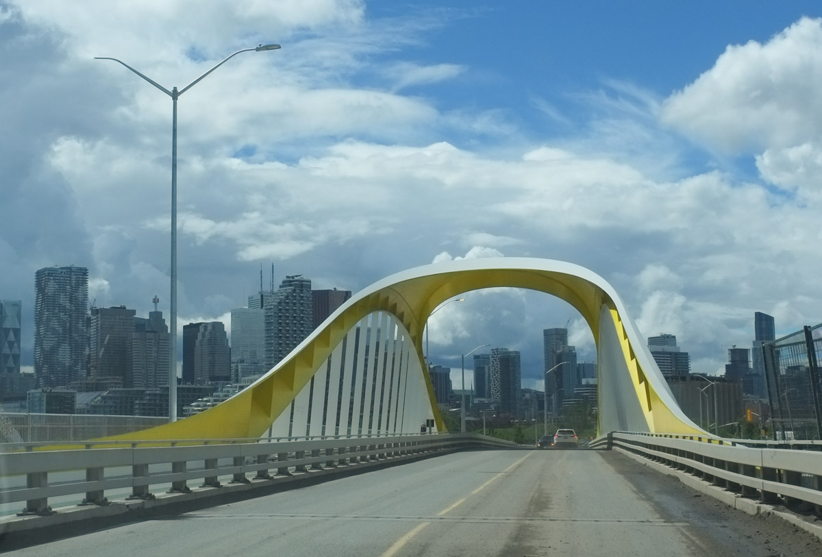
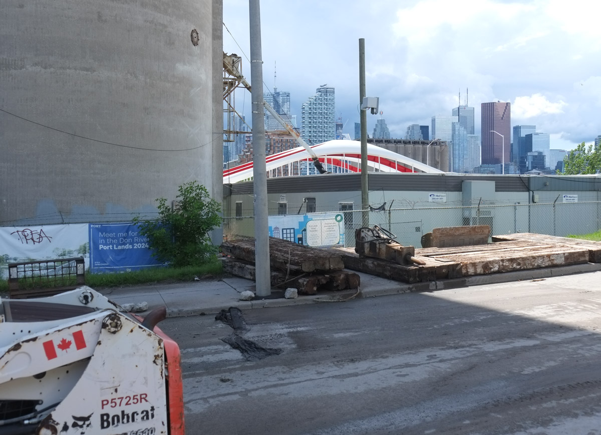
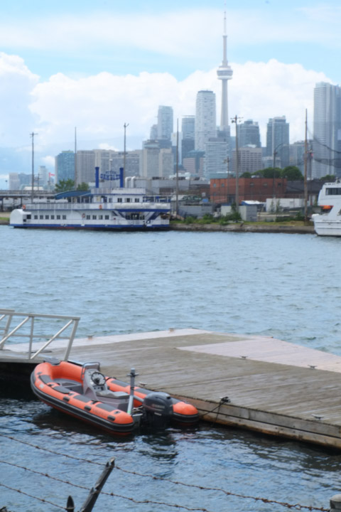
below: A few boats are docked in the harbour.  The bridge over the harbour is no longer just blocked, but is now severed.

Toronto highroses, condos near the water, marina and yacht club in the foreground with a couple of boats, pedestrian bridge over the water has been cut, impassable

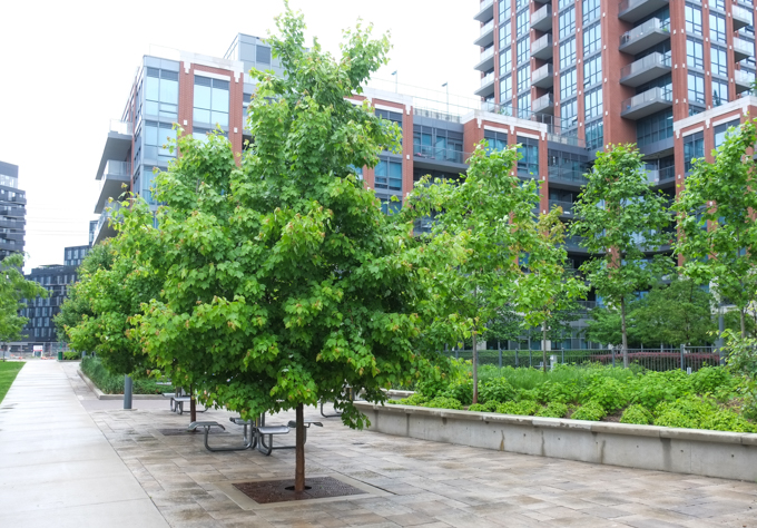
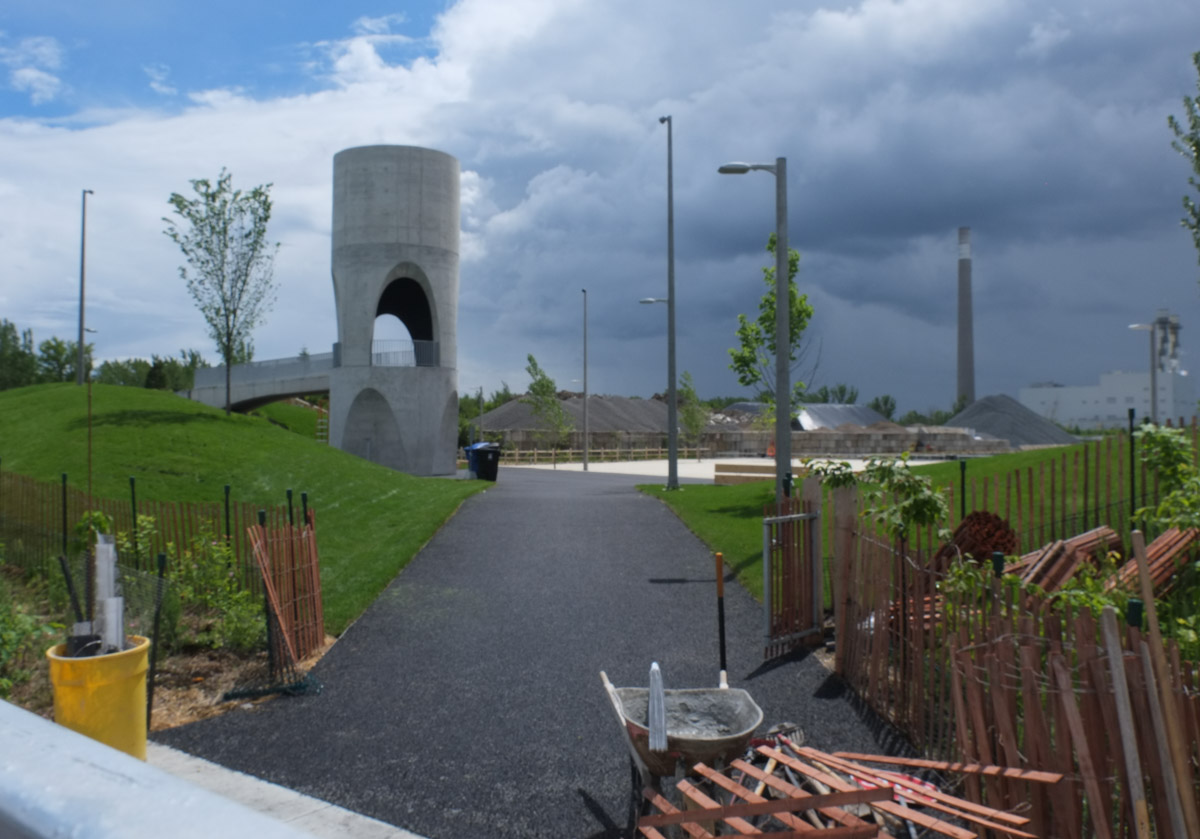
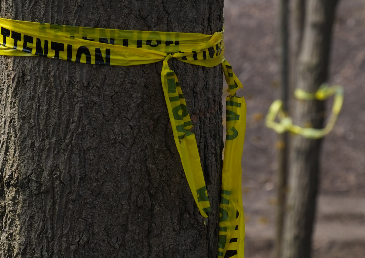
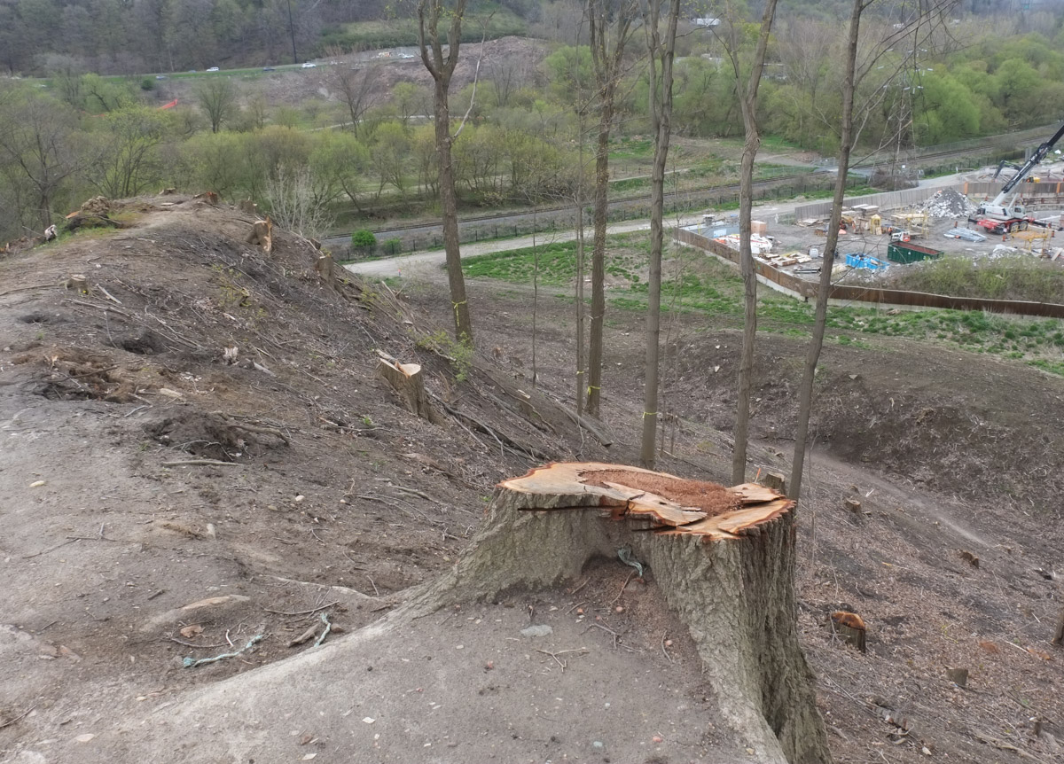
below: Protecting the young trees

CN tower in the background, newly planted trees in green grass covered mounds in the foreground

below: Dead and not alive; dead and dead. Patio season on the waterfront hasn’t begun yet.

a wooden patio structure on the waterfront, with wood roof, hanging from planters are dead plants as well as fake pink flowers

below: On the south wall of the Power Plant Contemporary Art Gallery a very large photograph by June Clark still hangs.  This is left over from last year’s CONTACT Photography Festiva.

large black and white photo by June Clark, exhibited outside, Untitled by from "The Whispering City" series from 1994.

below: Getting ready to clean up the city?!

inside, a cleaning cart with mops and brooms, stands beside a large black and white photo of the skyline of Toronto

man sitting at large table with Tims coffee, large TV in the background

two women sharing photos that they have on their phone, sitting at TIms

below: Still quiet now, but getting ready for summer…. water taxis to take people to Centre Island.

along the waterfront, yellow water taxi for Centre Island, red building for tourist store, downtown skyscrapers

below:  Patriotic red and white, but a very sad Canadian flag.

white lamps overhead on a red building, bedraggled Canadian flag on one of the lamps, a sting of smaller Canadian flags beside

a red and white TTC streetcar on Queens Quay, traveling east past small red building that sells tourist stuff

a woman pushing a stroller stops to wait for two TTC streetcars as they pass byher in opposite directions, queen's quay

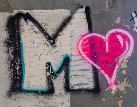
below: Love Park on the southeast corner of York and Harbour is now complete.  This public space was created when the exit ramp from the Gardiner to York Street was removed.   It is difficult to see from ground level photos, but the pond is heart shaped.

two men walking their dogs on a path into love park, large glass building behind, red low wall around the pond in the middle of the park

below: A beaver has made its home in the pond.

sculpture of a beaver on a small rock in the middle of a man made pond in love park, downtown

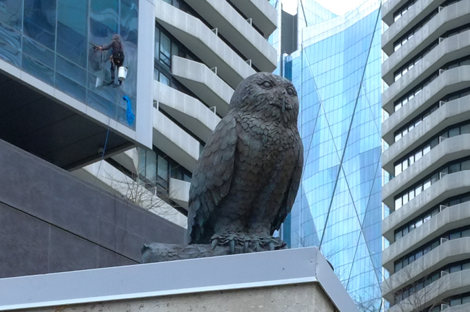
below: There is also an owl that has a great birds eye view of the park.  Someone else has a great view too!

small sculpture of a realistic looking grey owl sits perched on a roof overlooking love park. a window washer works on the building behind the owl

a large tree, no leaves yet, grows in front of a large glass building, lots of reflections of other buildings as well as blue sky

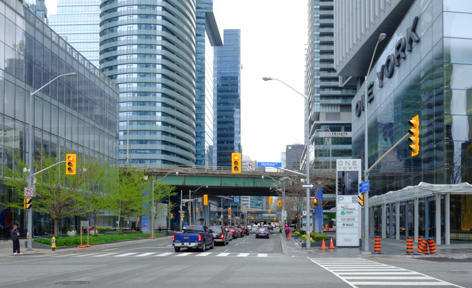
below: Looking north on York from Harbour Street towards the Gardiner Expressway and beyond.  Love Park was behind me to the right when I took this photo.

Looking north on York from Harbour Street, green Gardiner Expressway crosses York

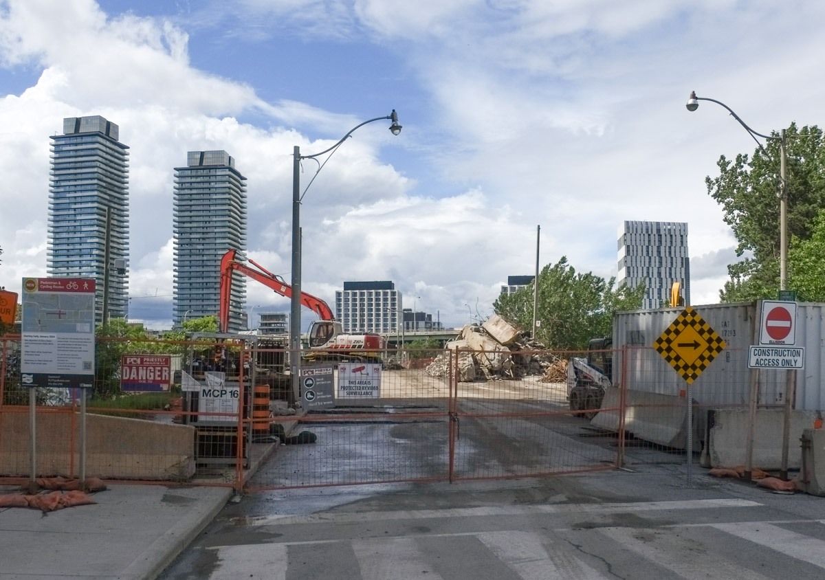
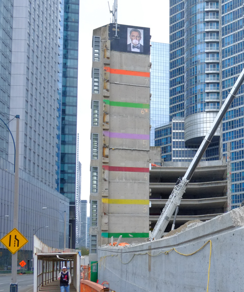
 The old multi level parking garage at Lower Simcoe and the Lakeshore is on its way down.  Demolition is well underway.

below:  Dwarfed by the new condos around it, the stairwell and elevator shaft from the garage stands on its own.  Whose picture is at the top? Someone blowing a giant bubble – must be quite the wad of gum!

demolition of a parking garage

below: The other stairwell.

remains of an elevator shaft

crane with claw at end is demolishing a multi level parking structure. mass of tangled steel parts in the foreground

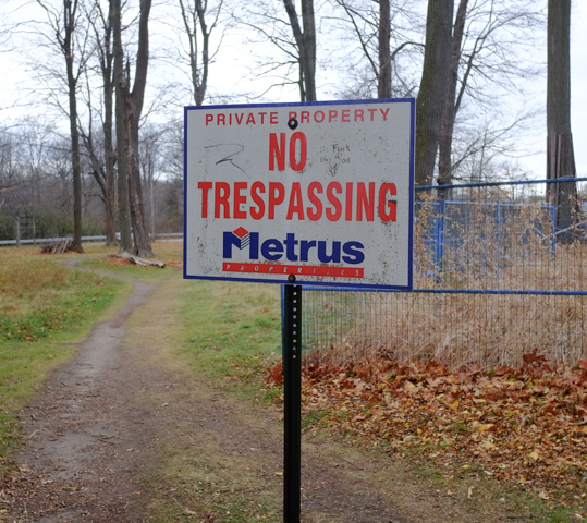
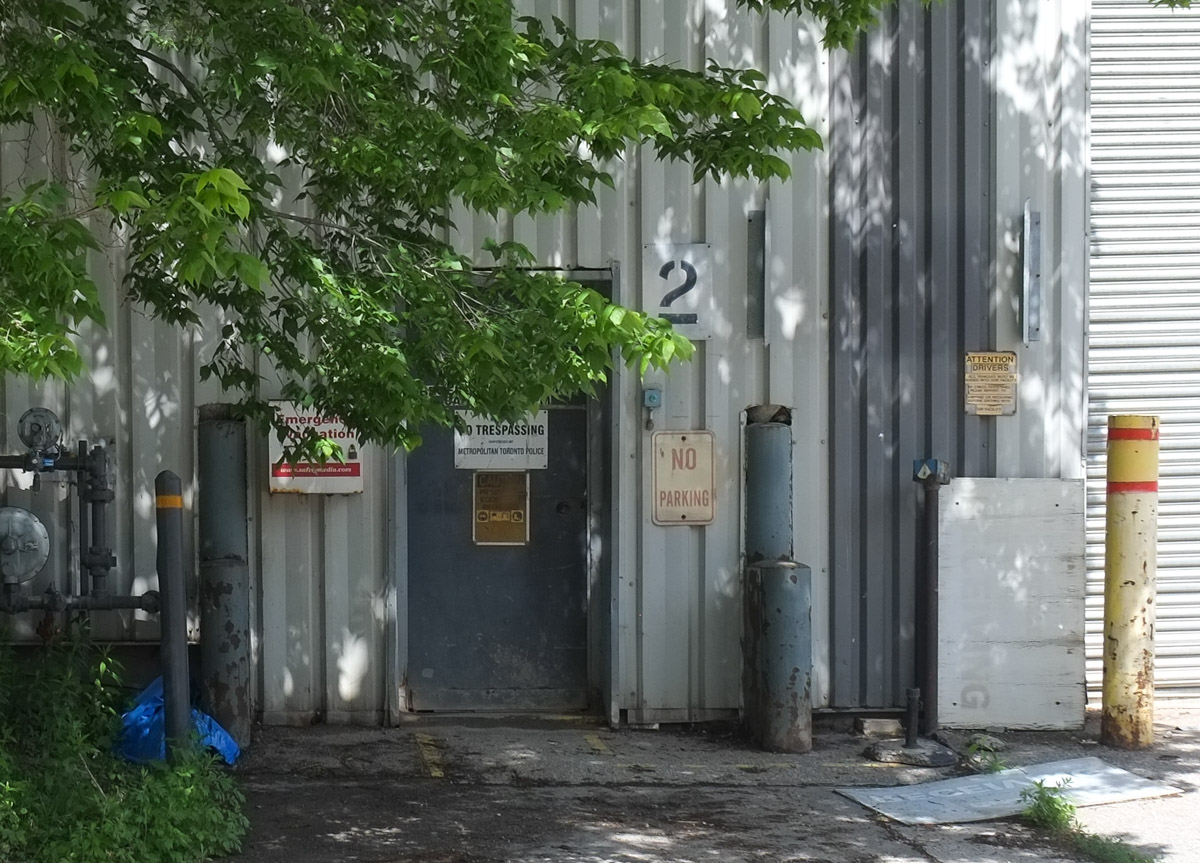
below: “Don’t trespassing”!

red and white danger sign with due to written in as don't trespassing

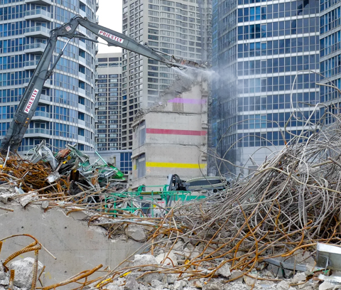
below: The demolition as view from the other side of Lakeshore Blvd.

looking under gardiner to site of demolition of multi level car park

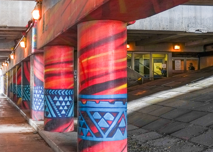
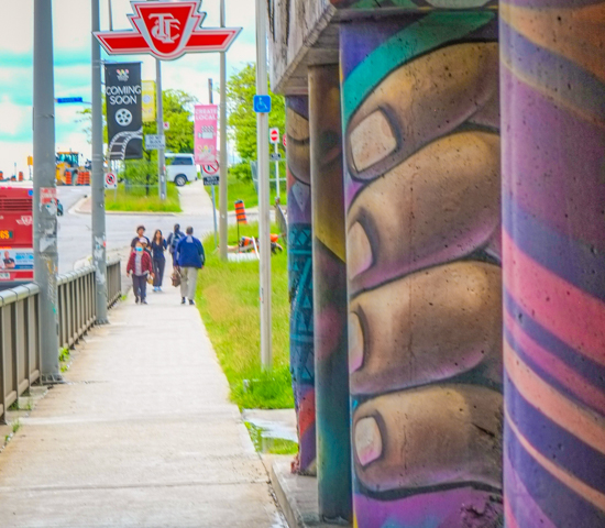
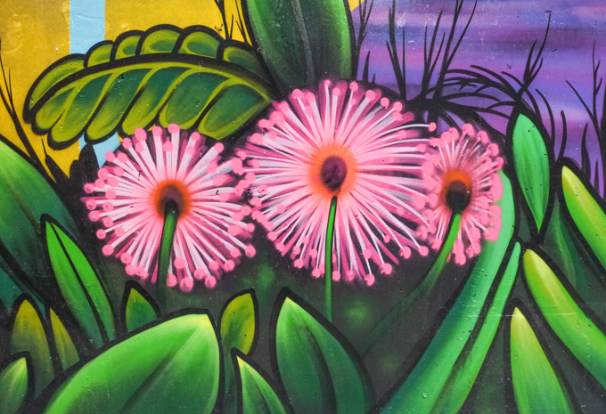
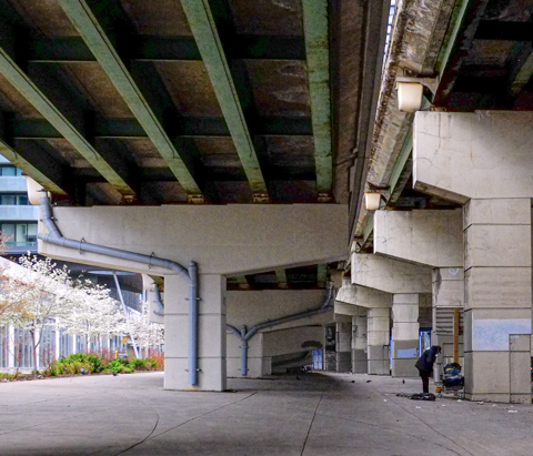
below: A lot of concrete! Under the ramp to the Gardiner

concrete supports, called bents, under the gardiner expressway

on the right, the on ramp to the gardiner expressway from york street, and on the left, a new glass and steel condo building, small tree with spring blossoms beside the path

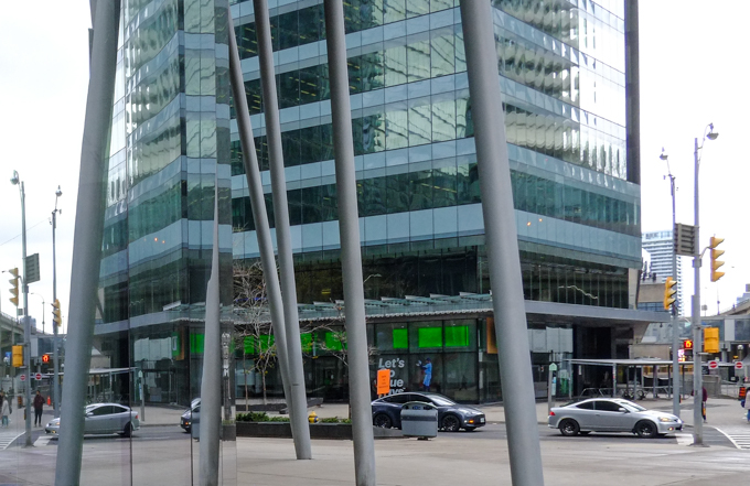
below: The northeast corner of York and Lakeshore

looking past tall stilt like supports for a roof, looking east across york street, just north of lakeshore to a new glass and steel condo building

reflections in the glass of a highrise building

below:

looking north on York Street from Lakeshore towards Bremner.

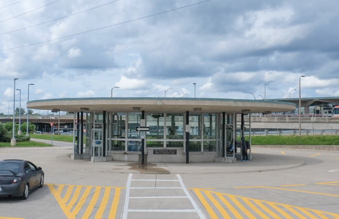
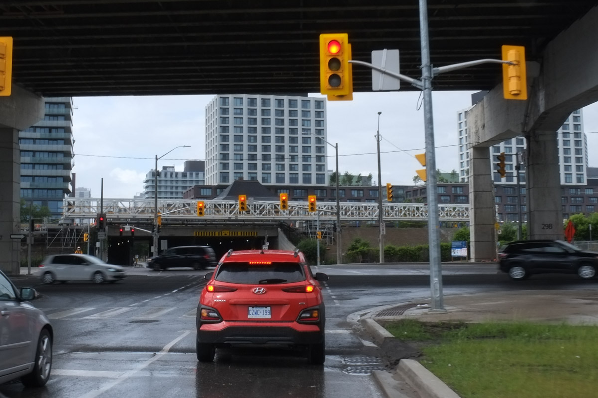
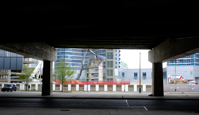
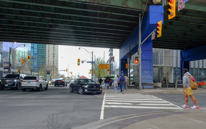
below: York Street at Lakeshore Blvd where the old green Gardiner Expressway travels directly above the Lakeshore

people waiting to cross Lakeshore Blvd., at traffic lights at York St., Gardiner Expressway passes over Lakeshore

below: Just after taking the above photo, there was much noise from the honking of horns, as this black car decided to take a short cut to the ramp by going north in the southbound lane on York Street.

black car going the wrong way on York


sidewalk scene on Lower York St., man sitting on concrete bench, a line of small leafless trees, people walking on sidewalk outside greenish glass building with Longos, Sports Chek, and other stores inside

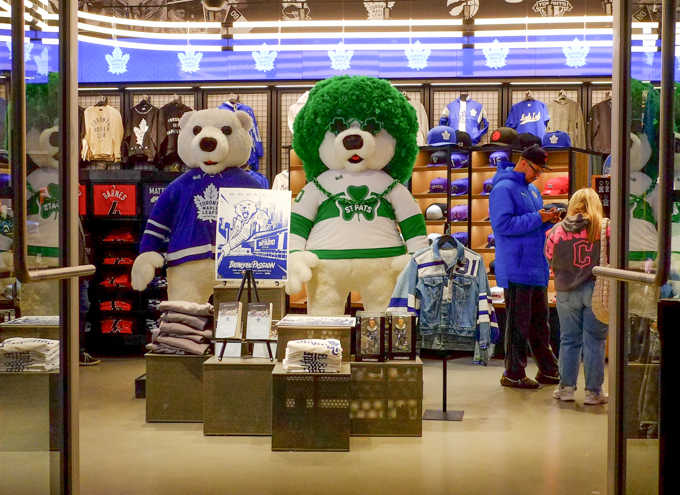
And last, a shout out to the Toronto Maple Leafs as I walk through the Scotiabank Centre back to the subway.   As I write this, the Leafs tied at two games apiece with the Florida Panthers in the second round of the Stanley Cup playoffs.  Go Leafs Go!

below: Carlton in his regular blue and white attire as well as in his St. Pats costume.  Love the curly wig and the clover leaf shaped glasses!  You can catch Carlton in the store at Scotiabank arena (along with a lot of other Toronto team paraphernalia!).

Looking in the door of the MLSE store at Scotiabank arena, and its Toronto Maple Leafs display, Carlton Bear in blue and white as well as in St. Pats white and green sweater, with green curly hair wig and green heart shaped glasses

sign at Union Station, with arrow pointing down towards stairs down to Yonge Line on TTC subway,

… and Roncesvalles and Queensway.

King Street merges with Queen Street twice, once in the east at River Street and once in the west when King turns north and joins Roncesvalles.  At this point Queen becomes the Queensway.

below: Queen streetcar traveling westbound (center of picture) while a King car makes the turn north into the intersection (right side).

intersection of Queen, King, Roncesvalles and Queensway, looking east

If that King car continues north, it travel up Roncesvalles to Dundas West station.

looking north on Roncesvalles from Queen, sidewalk planter decorated with fancy lettering says Roncesvalles village

below: Looking west on the Queensway with all the overhead streetcar wires because….

looking west along Queensway from Roncesvalles, lots of overhead streetcar wires

below: … the TTC Roncesvalles Carhouse is right there.  It is 28 streetcar tracks wide and is used for storage and maintenance of part of the TTC’s streetcar fleet.

Queensway TTC streetcar yard

below:The Queensway also runs parallel to (and within sight of) Lakeshore Blvd, the Gardiner Expressway, and Lake Ontario.

view from pedestrian bridge over lakeshore blvd and gardiner expressway, traffic on the roads, etobicoke and mississauga in the distance, lake ontario

below:  There is access to the waterfront is by a pedestrian bridge.

pedestrian bridge over the lakeshore and gardiner expressway, towards lake ontario, street art and graffiti on the lower concrete parts of the railing, lamp lights along the way, blue sky day, no people

below: Also at this intersection is a memorial to all the Polish citizens who died at the hands of the Soviets during WWII.

monument in a park, large stone with a plaque on it,

Plaque reads: “1940-2000, In Memoriam … Lest we forget… May the tragic deaths of tens of thousands of Polish citizens in Soviet forced-labour camps, political prisons and execution sites, always remind the world that freedom is bought with great sacrifice.
Dedicated to the memory of over one million seven hundred thousand Polish soldiers and civilians arrested in EAstern Poland by the Soviet secret service (NKVD) in 1940-1941, for the only reason that they were Polish citizens and were deported to the far reaches of the Soviet Union (siberia), where many were executed or died of hunger, cold, disease, and exhaustion during World War II.
[words in Polish]”
Alliance of the Polish Eastern Provinces in Toronto, February 10, 2000.

The rest of this post are images of some of the sights along Queen West and in the alleys behind.  Some of them may look like photos that have appeared in prior blog posts….  Many things have changed over the years and yet many things remain the same.

below: North side of Queen West, looking towards Roncesvalles.

queen street west, north side, looking west towards roncesvalles

below: South side of Queen West, looking towards Roncesvalles

brick buildings, low rise apartments, on south side of queen, near roncesvalles

Some of the old architecture remains – Volumes could probably be written about all the old architectural features that can still be seen out Queen West and King West.  Many of which date from when Parkdale was an affluent suburb of Toronto.

three storey house on king street

man standing in front of an older brick apartment building three storey brick buildings on queen west, stores at street level, windows with little turrets on the top floor

below: An old Royal Bank of Canada building (now used for other purposes).

old royal bank of canada building, red brick, with stone dorway, including arch over door

below: An old Second Empire type of building, that is now home to the Easy Restaurant as well as Rosa’s restaurant.

below:Back of the building – King Street side.

back of easy restaurant with black and white mural, old red brick building,

below: The original mural with its yellow convertible once seen on the back of the building is still there, it’s just hidden by a more recently built structure to store garbage bins and other stuff in.

old Easy restaurant mural, now covered over by storage shed for garbage containers

below: If you have passed by this intersection, you may have noticed the yellow motorcycle rider on the King Street side of the building.

yellow painting of a man on a motorcycle, on wall outside Easy Restaurant, King street side

below: Dancing in the window

figurines or sclpture in a store window, thai dancers in traditional costume, head dresses on, gold accessories and highlights

below: A doggie in the window!

neon light art in a store window, a white dog with blue glasses riding on a blue skateboard

below: Ford among the light fixtures.  Who is the dimmest bulb?

inside a store window, light fixtures, shades, and other bits and pieces, along with some campaign literature from Doug Fords recent provincial election

old paint by number paintings of boats, two of them, in frames, on display in a shop window on Queen West

below: An anchor, many stickers, and a red skull and crossbones

a door to a tattoo parlour, part of it is covered with stickers, as well as blue anchor and red skull and cross bones

bright red door with glass panel, number 1635, junk store, vintage store, antiques, all cluttered in windows of the store

signs on a store door, glass door, one says closed, another says parkdale shop local and last, proudly parkdale

collage, graffiti, on a wall on queen west, man's face made up of 6 pieces of paper

below: Potato sack racers in a mural by Jim Bravo.  The sacks all say “Eva’s Fine Deli” on them so perhaps this was once the wall of said deli?  Now it is the Dosa restaurant on Roncesvalles.

mural by Jim Bravo in a lane off Roncesvalles, close to Queen, children in a greenfield, running potato sack race, hopping,

looking west towards roncesvalles in an alley behind queen west on the north side, brick buildings, some street art,

below: Dreamer

alley view, back of building, with door and windows, one mural of a bird with the word dreamer, one abstract blobby street art

below: Birdo paintings that have faded and weathered.  Check out an earlier post if you want to see what they once were like (Animals and Birdo Birds) This post was from March 2015, ten years ago!


birdo street art painting in an alley, bird with blue and white body

birdo street art painting in an alley, koala head, old man with white beard in profile

pink tags on garage in lane

exterior stairs leading to basement level door, door has street art painting of a blond woman's portrait, wearing a red hat

below: Still Alive! It’s always marvelous to encounter Lovebot the Robot in the wild.

a very big lovebot the robot street art, on a black building, white lines, faded red heart, on legs the words still alive are written

concrete steps up a small hill in front of a highrise apartment building, houses in the background

Parkdale mural on mini mart, beside house, with highrise apartments in the background

Parkdale mural on the side of Parkdale mini mart convenience store

below: More alley backyard views…. another house with a rooftop terrace or deck. I have mentioned before in other posts with other alleys, that this type of renovation/expansion has become very common throughout the city.

laneway view, back of houses, one red brick, the other blue cladding, garages, with tagged and graffiti covered garage doors, red truck,

large painting of a rabbit, street art mural, in alley behind queen street west

street art painting on garage door in alley


yellowish vertical cladding, interior wilson subway station, with blue sign with arrow pointing to the left for northbound trains

Wilson subway station, on the University side of  Line 1, opened in 1978 and was the end of the line until Downsview station just to the north opened in 1996.  It is not a thing of beauty.  Concrete.   Austere from the outside.  It’s entrance from under the Allen Expressway is dark, gloomy, and depressing.

below: Northwest entrance to the station, nestled up against the Allen Expressway.

northwest entrance to wilson subway station, right next to the allen expressway

below: Walkway to southwest entrance

southwest entrance to wilson station, sidewalk through grassy area to entrance

That stretch of the subway runs down the median of the Allen Expressway.


below: Although the platform has a roof, it is open at the ends and in the winter it is cold.  There are a few of these pod-like waiting areas, circular glass structures with benches for those wanting a tiny reprieve from the wind.

on the platform of wilson subway station, circular pod-like structures made of glass, with benches, waiting areas

below: Inside the station a concrete wall sculpture by Ted Bieler entitled ‘Canyons’

very textural wall sculpture by artist ted bieler, called canyons, inside wilson subway station

two orange cones beside a phone booth against a concrete wall, interior, wilson subway station

What drew me here in the first place ….  To help brighten up the area, some of the concrete, both inside and out, has been covered with murals by Shalak Attack, Bruno Smoky, and Clandestinos,

below: An owl and a woman’s face at the two south entrances.

owl face, mural, around an entrance to Wilson subway station

clandestinos, or shalak attack, mural of a woman's face with butterflies and flowers, surrounding one of the double doors, entrance to wilson subway station

below: There is a lot of street art along Wilson Avenue but most of it is under the Allen Expressway and is not well lit. Some of it is also looking very dirty.

pillars painted with red and blue designs, under the allen expressway and beside wilson subway station

concrete pillar with street art, large brown fingers, people walking towards subway entrance

below: Pink flowers inside the station

part of a mural, inside wilson station, of bright pink flower


below: Circular “Kiss ‘n Ride” still exists.

round flat building, wilson kiss and ride, where cars can dropoff and pick up passengers

below: Exit at Wilson Heights

silhouette of man walking down hallway at wilson station, light coming through the door at the end of the passage, exit to wilson heights side of the station

below: Northeast side of the station, along with the Allen Expressway

northeast side of wilson subway station

I took most of these pictures back in the summer but I hadn’t taken the time to blog about what I had seen.  When I drove past Wilson again recently, I noticed that the parking lot on the east side (towards Wilson Heights) is now fenced off.  Now it is a snow covered vacant lot.

below: Parking lot before

bike parked outside wilson subway station

below: … and after. You can still park your bikes here, but no more cars.

vacant lot, snow covered, on the east side of wilson subway station

below: There is a City of Toronto development notice sign on the side of Wilson station.  It looks like the city may be serious about affordable housing at this site.  Apparently this has been in the works for a number of years but faced some opposition form those who wanted to keep the parking lot.   Just shy of 1500 units in six buildings are planned on the site along with community space and a public park.  The percent allotted to affordable housing varies from 35 to 48 percent, depending on the source of the information.

To the west of the station, on the north side of Wilson, is the remains of the Downsview Airport lands.

sign on chainlink fence around downsview airport that says airfield, 24 hour surveillance. it is covered with graffiti stickers,

looking through chainlink fence at old airport property, unused road with deteriorating pavement, buildings in the very distance, lots of grass and sky

below: One of the four winners of the ‘XOXO Downsview, Talking Fences’ competition of 2023, is “Aandi wenjibaayan?” which translates to “Where are you from?”  It was suggested by Lakhvir Sandhar.  The other three winners have their words displayed elsewhere on the Downsview property.

vintage photo taken from low flying airplane of bishop-barker airplane limited,

Photo credit: Toronto Public Library online digital image archive

The south side of Wilson is retail and is now Wilson Village.   It is also where you will find Billy Bishop Way named for Canadian pilot.  It is nowhere near Billy Bishop Airport (that’s WAAAAY south, on the island, or the other one in Owen Sound) but is a nod to Downsview’s history as an airfield and its role in airplane manufacturing.

William Avery Bishop was born in Owen Sound in 1894.  He was a Canadian flying ace during WW1.

toronto street sign for billy bishop way in wilson village, on wilson ave

side of home depot store, parking lot, wilson avenue

below: Looking southeast past the old metal fence that surrounds the parking on the northwest side of Wilson station.  Big box retail on the other side of Wilson, and newer midrise to highrise residential development on the other side of the Allen.

standing in parking lot on west side of wilson station, looking southeast towards allen expressway, retail big box stores on west of allen, new residential highrise on the east side

Very close to the planned “affordable housing” but on the south side of Wilson, there is already a new community being built.


There are many older single family homes to the east, in a quiet neighbourhood squeezed in between Wilson and the 401.

I even discovered an old moose hiding in the bushes!  The “Moose in the City” project goes way back to 2000 when 326 life-sized moose sculptures found homes around the city.  Each one was decorated by a local artist.   I am not sure how many still exist but it can’t be more than a fraction of the original.

Other moose: Scarborough moose near Kennedy and 401, moose at St. Clair and Bayview. Any others?

To the east, Wilson is becoming a canyon of midrise buildings, replacing the older residences, often fourplexes and sixplexes.

The development is more intensive as you get closer to the Allen and the subway line…

… on both the north and south side of Wilson

tiles, interior walls of wilson subway station, design of vertical and horizontal lines in pale yellow on rust coloured background

blue and white Scarborough street sign, Kingston Road, in Cliffcrest

Cliffcrest is a neighbourhood in Scarborough that includes a section of Kingston Road between Brimley and Bellamy Roads.  The southern boundary is Lake Ontario including the  eastern portion of the Scarborough Bluffs.

below: At the corner of Kingston Road & St. Clair is one of the Scarborough Heritage Trail murals funded by Mural Routes.   It is “In The Way of Progress” and shows  a Kingston Road radial railway car at Stop 17 with Scarborough High School (later changed name to R.H. King Academy) in the background.  It was painted in 1996 by Phil, Jennifer, and Jamie Richards.

mural on the side of a building by a parking lot on Kingston Road, Scarborough scene, old rail car public transit stopping by old high school, at stop 17, cow lying down near rail car

below: 1922, Kingston Road looking west towards St. Clair with Scarborough High School near the intersection.

Source: City of Toronto Archives, Fonds 1488, series 1230, Item 2064

In 1893 the Toronto and Scarborough Electric Railway, Light and Power Company started running a one car train along Kingston Road.   The tracks went as far east as West Hill.  A couple of years later, this line became part of the Toronto and York Radial Railway (TYRR).  The TYRR had four branches radiating from the city, one to the west, 2 northward, and this one east along Kingston Road.  The stops on the Scarborough route were numbered, starting at Victoria Park Avenue.   Stop 17 was at St. Clair East & Kingston Road.

below: This 1922 photo is actually from a bit farther west, at Victoria Park.  What I wanted to show was how the railway tracks just ran between the road and the sidewalk.  Very simple infrastructure! Not too feasible in a city, but in 1922 this neighbourhood was more rural than urban (and they still got transit!)

1922 photo of Kingston Road, looking west from Victoria Park

Source: City of Toronto Archives, Series 71, item 1607

below:  You can’t see it in this photo but the mural above is on the wall of Stop 17 Variety (by the parking lot on the right).

small tree in front of a store, Stop 17, Variety, on Kingston Road,

below:   From 1973, forty years ago – looking at the southeast corner of Brimley and Kingston Road.  The bus is northbound on Brimley.

black and white photo by Richard Glaze taken in 1973 at the corner of Brimley and Kingston Road, found on Transit Toronto website

Photo Credit: Richard Glaze photo 1973, Transit Toronto website.  If you are interested in anything to do with transit in Toronto, check out their website.  They have an extensive collection of photographs, maps, and documents.  They also feature all the latest news about slow downs, route changes, and service advisories (among other things).

The same motel is still on that corner of Kingston Rd and Brimley.  I don’t have the exact replica photo but this is what the Hav a Nap Motel looks like now.

Hav a Nap motel, sign in front of motel, Brimley and Kingston Road
below: Moving slightly west, photo taken from approximately the corner of Brimley and Kingston Road.

entrance driveway to Hav a Nap motel showing some of the buildings, Brimley and Kingston Road

Once upon a time, Kingston Road was a major east west route in and out of the city.  There were many motels along here.  Their heyday was the 1950s and the bigger, fancier ones are long gone, leaving behind some of the smaller ones.

below: As a shoutout to these motels and their stoy is this sidewalk box decorated with images of old motel signs. The Americana and the Roycroft signs can be seen on this side.

sidewalk box decorated with images of old motel signs, Kingston Rd and Brimley, Americana Motel

below: The Americana Motel still exists in the Cliffcrest neighbourhood (close to Brimley).  The Roycroft is farther east, beyond McCowan.

Americana Motel sign in yard of the motel, red brick buildings,

americana motel on kingston road

below: Henry’s Motel

Henrys Motel on Kingstson Road, newer condo in the background

below: The sign of things to come.. and yes, it’s a condo with retail at street level.

redevelopment notice for property at the corner of Kingston Road and St. Quentin

old building, cafe, on Kingston Road with painting in the covered windows, redevelopment notice on front, snow on ground

Scarborough house on St. Quentin Ave., birch tree in front, snow covered front lawn

below: The north side of Kingston Road, just east of Brimley – it looks like changes are happening here too.

north side of Kingston Road, east of Brimley, long fence or hoardings, with apartment buildings behind.

Brimley Road is also the main access for Bluffers Park at the foot of the Scarborough Bluffs.

yellow traffic sign in a residential neighbourhood that says no access to Beach or Bluffs sat and Sun and Holidays from May 1st to Sept 30th

below: Dairy Queen at Kingston Road and Harewood is closed for the winter

looking across Kingston Road to a Dairy Queen and another storefront that is two 2 storey brick building. sign says Horizon

below: An alley runs behind the south side of Kingston Road

path laneway with snow, behind houses, with wood fences between lane and backyards

a big red handprint painted on a wood fence, as seen in an alley

snow covered lane, back of stores and buildings on Kingston Road, two storey, exterior stairs, porches, balconies, doors, and windows,

jumble of wood, dead leaves, caught between chainlink fence and wood fence

in an alley, many ladders leaning against a tree behind a building

curved porch and front steps in front of a house where some of the rocks are painted bright colours

fake street sign on a wood fence that says beach bum blvd

rowhouses on Kingston Road three storeys high, with trees in front,

renovated and enlarged modern house in between two older brick bungalows

winter street scene in Scarborough, single family homes,

older brick 2 storey home, with garage at side, large snow covered front lawn, large trees beside house, dormer style windows on top floor

below: Mailbox with a porpoise (or two)

in front of a house, a mailbox that looks like a dolphin is holding it up, smaller baby dolphin sits at parent's feet

below: On the side of a Wild Wings restaurant.

mural in brown tones, on side of wild wing restaurant, back to camera, adult male cowboy walking beside younger boy, with cowboy hats and chaps, younger one has a lasso

dark blue cars, in snow, parked at used car lot on Kingston Road, ASD Auto sales

plastic santa claus stands outside a restaurant window, with words printed on window: burgers, souvlaki, steaks, chicken

below: Carusos Fruit Market, Groceries, Hardware & Gift Items

front of Caruos Fruit Market, Groceries, Hardware and Gift Items

Other Scarborough Heritage Mural posts:

1. Heritage Murals – Kingston Road, 2014

  • The Half Way House’ by John Hood, 1990. (Midland & Kingston Road)
  • ‘The Bluffs as Viewed by Elizabeth Simcoe c. 1793’ by Risto Turunen, 1992.

2. Cliffside Murals, 2017:

  • ‘Spooners Garage’ by Phillip Woolf, 1992.
  • ‘H.M. Schooner, Onondaga c. 1793’ by Jeff Jackson 1992.
  • ‘Cliffside Golf Course’ by Dan Sawatzky, 1991.
  • ‘The Half Way House’ by John Hood, 1990. (Midland & Kingston Road) (repeat)
  • ‘The Bluffs as Viewed by Elizabeth Simcoe c. 1793’ by Risto Turunen, 1992.(repeat)

3. Heritage Trail Mural 8, 2014

  • “Building the Addition to the Wesley Methodist Chapel, Highland Creek, Winter” by  John Hood , assisted by Alexandra Hood and Zeb Salmaniw, 1994.1867”

4. Scarborough Bells, 2020

  • scenes from early Scarborough, painted by painted in 2012/2013 by De Anne Lamirande.  Under a railway overpass.

5. Birch Cliff, Kingston Road, 2021

  • On the side of Legion 13 on Kingston Road is this large mural. Painted in memory of Max Silverstein, by John Hood with help from Alexandra Hood and Asif Khan, 1991. Restored in 2010 by Blinc Studios. “Scarborough Rifle Company marching to the Niagara Frontier, June 1, 1866.”
  • “Mitchells General Store” by Phil Irish, 1998.


Another visit to Little India late one afternoon in December.  In December darkness descends early but with darkness come lights.  Some things are hidden but others are revealed.  Shadows shift and details blur. 

below: “Namaste!  Warning, This Store is protected by Karma.  Steal from here and you’ll soon find out why Karma’s a Bitch.”

sign in store window, with picture of buddha, Namaste, Warning,

below: Christmas lights on poles, and greenery with bows – it must be December in the city!

greenery and white bows in a planter along the sidewalk on gerrard, little india, utility pole beside it is wrapped in Christmas lights

sign painted on side of coffee shop, in large capital letters, you are here.  with a decorated christmas tree beside it

seemingly cross eyed santa claus doll in a store window, skinny santa

below: I doubt that it says “Merry Christmas”!  … Nor does it say, “Namaste”.

sticker with arabic writing on it, on a utility pole that is wrapped in christmas lights

below: Love wins, regardless of the season.   A few of the characters on the exterior of a building painted by Al Runt.

two of the many characters painted by Al Runt on the exterior of a building on gerrard east, a sign in the window of the building says love wins

in store, man behind counter, looks out door as photo is being taken of mannequin in the window

portions of saris and other garments in store window, green beaded cloth, bright patterns,

below: A cash register on the counter and shelves crammed full of stuff – mostly household things – mugs, pots & pans, and the like.

looking in the window of a store, cash register on the counter, shelves full of stuff,

below: Looking in gallery windows too

GAS gallery window with large painting on display

north side of Gerrard

below: Baldev Paan – paan, ice cream, soft drinks, and bitcoin.

store in Little India, Baldev Paan, light green painted exterior, many signs in window,

below: Running for the streetcar

streetcar on gerrard,

below: Rana Gems, India Paan, and a restaurant with tacos and mariscos (seafood, en español) as well as a Christmas tree in the window.

2 store fronts on gerrard, India Paan, and  both are two storey older buildings, 
picture taken late afternoon, lights on inside stores

below: Small, smaller, smallest?  or Big, bigger, biggest?  Biggest pencil? Yes!  …..  Karma’s Kitchen is squished in between two larger buildings.

three stores in little india, tall grey building, middle sized blue Neelams store, and short single storey restaurant,

below: More on the south side of Gerrard, Karmas Kitchen again, Sultan Jewellers and, the now empty, Alesha Beauty Salon and Spa.

early evening, three buildings on the north side of Gerrard, Karma Kitchen restaurant,

small metal table on sidewalk outside restaurant, list of food on wall, like lassi, sev puri, panu puri, and gol guppa, evening, street scene

below: Pretty in pink

exterior of restaurant, painted pink

below: Looking through the window

looking through window into restaurant with a large image of a woman in pink on a wall

below: Dancing among the flowers

part of a mural in Little India, two people dancing, woman in purple sari, man in pinkish orange outfit

decorations on a glass door, entrance to a store, lit inside, darker outside, evening

saris hanging up in window of clothing store

mannequins in store window, with sign that says everything must go, also a sign advertising 22k gold

mannequins in a window, evening, yellowish light inside

below: Shiny beaded fringes and reflected lights, playing with windows.

reflections of stores and lights in a window with saris and clothes with shiny beads on fringes, metallic threads,

part of a mural, a woman's portrait on a door, with colourful designs around her, leaves and flowers, stylized

advert posters on exterior wall, faded, both women,

mailbox with white necklace like dangly thing, with fake orange flowers at the end

bicycle parked in front of Lazy Daisy Cafe on Gerrard, bus shelter,

below: Harry’s on the northeast corner of Gerrard and Coxwell

TTC streetcar at Coxwell and Gerrard, in front of Harrys Burgers restaurant

below: Coxwell Variety

coxwell variety store signs, and people on sidewalk

below: Northwest corner of Gerrard and Coxwell

people walking north on coxwell from gerrard

below: Are YOU a Communist?

poster on a pole, Are you a Communist?  Now get organized

sidewalk tree planter painted orange

Happy trails!  and a Merry Christmas….  Joyeux Noël …. Feliz Natal … Feliz Navidad to all!

a couple pushes a stroller past of striped bench  on a sidewalk, in front of stores

… but finding many other things instead.

This is a follow-up to my last post about the Don Mills trail.  Remember that I mentioned that it came to a dead end just north of Eglinton?  I thought that surely someone somewhere in the city government would have looked into options re connecting the Don Mills trail to a street or another multi-use path.  The dead end is just east of Leslie, so off I went to check it out (and I wasn’t going to walk all the way to a dead end just to turn around again) .

Hey look!  There is a vacant lot at approximately where the trail ends.

cracked pavement with weeds growing up in them, vacant lot,

Did I wander back there?  Sadly not….. I didn’t have any lock cutters with me….  This was once a Sony Music building but it was demolished in 2016.  There was no development notice sign at the site (9 acres).

blue metal fence and gate, locked closed, vacant lot beyond the fence

below: This is the Sony Music (or CBS) building, built in 1959.  They don’t make them like this any more – so spread out and only one storey high.   Land must have been much cheaper back then!

older colour photo of sony music building on leslie street (demolished in 2016)

Photo credit: by Bob Krawczyk, found on ACO Toronto website (Architectural Conservancy Ontario)

When I was researching the Sony Music building online, I came across the Phoenix Centre.  That’s the name of the planned private club being developed at the old Wrigleys site next door to the now vacant lot.  If I had realized that when I was out walking, I would have taken more photos.  As it is, this is the best I’ve got:

southwest corner of old Wrigleys building on Leslie street, now OTT, low rise modern building

This building, built 1962, was included in North York’s Modernist Architecture, first published in 1997. In addition, The former Wrigley property has cultural heritage value as it is historically associated with the 1950s planning and development of Don Mills by E. P. Taylor and Don Mills Developments Ltd. (if interested, more info at ACO website).  The Phoenix Centre plan retains most of the office space architecture but completely remakes the factory space.

  There is also talk of a bridge (pedestrian & bikes?) over the CPR tracks to the Crosstown developments.   Makes sense to connect the Don Mills trail, Crosstown, and Leslie Street!

Part of the reason I didn’t take any photos of the old Wrigley building is that I had chose to walk south the day….  just south is a fire station as well as some condos.

on Leslie street, white building that is a fire station, parkland in beside it. to the south are condos, older red brick buildings plus newer glass and steel condos behind

And there is a well worn path that accesses the back of the properties.

large trees in foreground, dead leaves on the ground, autumn, new condos being built in the background, cranes,

This road doesn’t actually lead to those new condo towers.  The CPR railway tracks are in the way.  Those towers are part of the Crosstown development on the old IBM and Celestica property (access from both Eglinton & Don Mills)

long driveway, access road, with new condos under construction in the background

The road didn’t lead to the end of the Don Mills trail either… but it did lead to the back of a parking garage.  No dogs allowed and no trespassing.  No luck here.

path that runs behind beige concrete building (parking garage) with no trespassing sign)

I got a better view of the neighbourhood though….

highrise apartment buildings and condo towers

Black and white on a grey day.

two chairs, one black and one white, in a vacant lot, grassy, one tree,

As I walked back out the path, I noticed this sign.  I took it to mean the property behind the blue fence, not the property the path is on… probably?

no trespassing sign, metrus private property

It stopped munching and stared at me, trying to decide to sit and watch or to run away….  it scampered away before I could get any closer (I don’t pretend to take good pictures of animals but it looked so cute, all puffed up to stay warm).

a grey squirrel sitting on a fallen tree trunk, dead leaves on the ground, a nut or something edible between its two front paws

A very short walk farther south on Leslie brings us to the Inn on the Park site on the northeast corner of Leslie and Eglinton.

below: Inn on the Park as it once was (about 1969)  I have ‘borrowed’ this photo from another website – Jamie Bradburn’s Tales of Toronto.  Follow the link if you are interested in the story of the hotel – it’s an interesting read.  Did you know that in 1962 North York had a ban on cocktail lounges?

below: The site today. It’s now a Toyota/Lexus dealership and home to a few new condos.

old Inn on the Park site, northeast corner of Leslie and Eglinton, now a Toyota and Lexus dealership, also new condo development, still lots of green space in front

new condos being built at inn on the park site

artwork on exterior wall, solid colour shapes inside squares, 3 D, but mostly flat, shades of orange

But there are more changes coming….. (surprised?)…. more glass and steel towers by the looks of it.  The notice also states that parking is planned for 845 cars and 1860 bikes.  Does Doug Ford approve?

blue and white development notice on the corner of leslie and eglinton, with inn on the park site in background, auberge on the park condo development

sidewalk closed sign and barrier, on eglinton, northside, east of leslie

below: A sad sight, Sunnybrook Park LRT station all ready to go but no trains running. One of the Toronto mysteries, when will the Eglinton LRT open?

looking east at Sunnybrook Park LRT station on the Eglinton LRT line, no trains running yet but station is somplete, yellow barriers across the entrance

Standing by the LRT tracks and looking south. Wilket Creek park and the Thorncliffe trestle railway bridge can be seen.  I crossed the road because I had seen stairs down to the park….

looking south from the end of leslie street, across lanes of Eglinton to WIlket creek park and thorncliffe trestle railway bridge

A big new set of stairs!…. But. Not shown – the locked gate that blocked the entrance.   There is still no entry to Wilket Creek/Sunnybrook Park from this side of Eglinton.

long set of stairs downhill from eglinton to a large parking lot at wilket creek park.

looking south from Eglinton towards thorncliffe trestle bridge, wilket creek park, and ravine system,

It’s getting to be crowded….

cars traveling east on eglinton, approaching leslie, many waiting to turn left, new condo developments behind, crosstown, as well as inn on the park site

below: Crossing Eglinton and looking westward

traffic turning left from eglinton onto leslie, looking west on eglinton

New pedestrian and bike paths that provide access to the park from the north side of Eglinton have been built but they too are locked closed.  It’s very frustrating to see this infrastructure built and then left unusable.  The signs says construction danger but there doesn’t seem to be any construction happening…..

new stairs and bike path infrastructure built at leslie and eglinton that are closed, gates and signs

new stairs and bike path infrastructure built at leslie and eglinton that are closed, gates and signs

Just in case I have confused anyone, here is a map of the area that Google maps created.   Near the top left it even says Don Valley Bike Trailhead… which is very wrong.  No trailhead here of any kind as we’ve just learned.  Also it was the Don Mills trail not the Don Valley trail (the latter is somewhere else!)

google map screenshot of leslie and eglinton and vicinity

New benches! Wilket Creek Park is one section of the string of parks that parallel the branches of the Don River in Toronto’s ravine system. I’ll leave you with a few pictures that I took the other day while I was in the area…

new seating area with wood benches beside wilket creek park sign

lots of trees growing on hillside, autumn, dead leaves on the ground and none on the trees, park, railway trestle bridge in the background

path through woods beside a river, autumn, leaves on ground, small trees

view from under thorncliffe trestle railway bridge, metal girders,

last few yellow leaves on a tree, blowing in the wind

west don river as it flows under eglinton avenue

benches and picnic tables in a grassy park with many trees nearby, condos in the background

leaves in a puddle, reflections of tree branches in the water too

graffiti stickers on the back of a sign, one with Mexican flag,

graffiti on the sides of a small concrete pedestrian bridge

graffiti, large capital M with a bright pink heart

Have a seat!   It’s a rather warm autumn this year, isn’t it?

a pale orange, faded, fabric covered armchair sits by the curb on a sidewalk in front of a house, fallen autumn leaves on the ground

below: A Hallowe’en spider caught in a rather thick web. It doesn’t have much to do with Pape subway station although you might feel inclined to put “scary” and “TTC” together.

big black fake spider on white, on a red shrub, front yard

Anyhow back to the main story…. Pape station is where the existing Bloor-Danforth line is going to meet the new Ontario line.

below: Do you remember when Pape station was being renovated? Now the site is a mess again.

pape subway station entrance on pape avenue, with cranes around it, for construction of Ontario Line

Pape station is a short block north of the Greektown section of Danforth.

orange and black traffic cones, and orange construction mesh fencing, outside pape subway station, for ontario line construction

below: Looking south on Pape towards Danforth

looking south on Pape from beside Pape TTC subway station

below: Across the street from the subway station

buildings on Pape across from the TTC subway station

below: See that bright white building in the picture above?  I bet that it’s not white anymore.

truck with red cab is parked beside a white building that is being painted black, person with a paint roller on a very long pole

below: My idea was to walk around the whole site. …

sidewalk in front of A & W, motorcycle parked there, sidewalk ends with orange fence because of construction, utility pole by sidewalk is wrapped in blue with Greektown Danforth written on it, also a blue and white Greektown banner on pole as well as Canadian flag

below: Looking back at the Danforth and Pape intersection, north side.  The white stone Royal Bank building stands on the northwest corner.  Behind it, the steeple and little green dome of Holy Parish church points upward.

Danforth at Pape, north side of the street, bank building on northwest corner, and A & W on the northeast corner

below: Ontario Line construction along the Danforth, northside.  Metrolinx seems to have a lot of property here.

ontario line construction on the danforth near pape

below: Any idea what this is?  What is happening here?

large yellow crane holds up an very large item, ontario line construction

below: I wasn’t the only one taking pictures!

a man on a bicycle has stopped to take a picture of the construction at pape station, on the danforth

below: Eaton Avenue runs parallel to Pape, just to the east.

Eaton Ave at Danforth, looking west, Ontario Line subway construction site

below: Northeast corner of Danforth and Eaton

northeast corner of danforth and eaton avenue, 3 storey brick building, Papa Johns pizza on ground floor, Mr. Pide restaurant (now closed), Black Pot lounge, an empty storefront and an Asian (Korean?) restaurant.

below: Eaton Ave entrance to Pape station lined with plywood hoardings.  This station isn’t that old – the update was completed in 2013.  I think that it is being retained but it is hard to tell from the Metrolinx website.  A brand new entrance is planned for the Danforth as well (and may be very large and very grand, not quite to scale with the present neighbourhood?).

Eaton Ave entrance to Pape subway station, lined by construction hoardings, plywood, Ontario Line subway construction site

below: Houses on Eaton Ave with Metrolinx construction behind them.

single family houses on Eaton Ave with construction cranes behind them, Ontario Line,

2 large orange storage tanks, wires, crane, ontario line construction site

2 large orange storage tanks, wires, crane, ontario line construction site , orange flags on overhead wires

This area has been serviced by the Bloor Danforth line since 1966.  In general, most of the residences are single family houses, often as some form of row housing.  Smaller houses with small yards seems the norm… i.e. a fairly typical East York neighbourhood.

three single family houses on eaton avenue

Muriel Avenue and Selkirk Street, residential neighbourhood near Pape subway station, single family homes and row houses

Exploring on Pape…..

below: Working on Pape, fixing a porch (or just watching)

reconstruction of a front porch

below: Addis Kidan Church, Greek Gospel Church..

Addis Kidan church on Pape Ave., red brick building with small white cross on roof

below: Tzatziki cafe with the painting above the entrance – interior restaurant scene

Tzatziki restaurant cafe on Pape, with painting above entrance

small commercial building on Pape with a TTC bus shelter in front of it

below: Mixed use – once a line of single family homes, now some are businesses.

a line of two storey family houses on Pape Ave., one is now an upholstery business

two storey duplex

Seranos bakery and food store, sign and parking lot,

below: There is also another construction site at Sammon

machinery in a construction site

wires covered with orange plastic, on a pole above a construction site

below: Looking north on Pape Ave from MacPhail.   There is another station under construction at Cosburn, a few more blocks north but that’s for another day. (Updated 22 June 2025 – there is now an Ontario Line – North Pape blog post)

looking northward on Pape

white arrow pointing right and orange pedestrian sign pointing left

I’ll end instead the way I began – with a little bit of Halloween to distract you from the constant noise of construction.

frontyard halloween decorations, zombie on swing with grey teddy bear on her lap

halloween decorations, outdoors, looks like yellow skull and arm bones are rising out of the lawn

This used to be Yonge Dundas Square (photo below) – soon it will be Sankofa Square. Or at least I think that’s what’s happening as there was some controversy over the name change. Although the name Yonge Dundas is very dull and unimaginative, that is what we’ve become accustomed to calling it. Some of us still claim that the Leafs play at the ACC or that the Blue Jays call the SkyDome home – yeah, we can be rather slow!

Whatever its name, that intersection is usually a colourful place on a summer evening.

musician, yonge dundas square, people watching red umbrellas

So that is where I started walking late in the afternoon the other day.  The walk was rather meandering, and did include a quick hop on a streetcar or two.  The weather was perfect and the streets were alive.  It was nice to see so many people out enjoying the evening.  Many (all?) of the curbside patios were busy too.

two men and a women talking and walking together

a man waits by bus shelter on dundas outside of H and M store

women walking, summer evening, two are talking, one is carrying a drink

below: Spiderman sits on a chair waiting for someone to hang out with.

spiderman sits in a chair

man sitting on bench inside bus shelter, people getting on and off streetcar, reflections,

reflections in a window, two levels of interior, with drug store and pharmacy on the lower level

a man sitting on sidewalk in blue t shirt, pan handling, two people on bike waiting for green light to cross Bay street

young man, topless, on skateboard, on street

a topless young man wearing a hat and jeans, and carrying a bag over his shoulder, in middle street, police car passes by, people on sidewalk turn to look because police car has short blast of the siren

below: Garfield is not amused (but he is shiny… or is that why he’s grumpy?)

clothing for sale, on sidewalk, at dundas and spadina, flatbed towtruck on street

two motorcycles parked, a pigeon on the sidewalk, and a couple at a table outside seven lives restaurant in kensington

a young couple on a pink motor scooter

below: On a balcony in Kensington, a war protest or at least a pro-Ukraine and anti-Russian statement.   Lots of sunflowers fill the space and Putin (presumably) is hung in effigy.

on a balcony in Kensington, many sunflowers, both real and fake, plants in blue and yellow pots, an effigy of putin, and a sign that says putin murdered over 200,000 men women and children

below: August is tomato season in Ontario!

boxes and baskets of tomatoes for sale outside of fruit and vegetable market

below:Buddha prays (meditates?)

fabric hanging outside a store, one with buddha, praying

below: A rare species spotted in Kensington – a rainbow tree

patio in front of a restaurant with a blue translucent fence, and a tree with trunk wrapped in stripes of yarn knitted

below: Shadow play on a Kensington graffiti wall.

man on sidewalk in front of graffiti in Kensington

below: Laundry time

man with red bag outside a coin laundry in kensington

below: This young man still watches over College Street (mural by Jarus).

mural on upper storeys, an image of a young man seated on ground, by jarus, above fast food restaurant of gyros, shwarma, poutine, souvlaki, felafal, and fries, and more, with new condo in background, people on sidewalk

below: Lord of the Fries!

sign on sidewalk for hogtown, lord of the fries

people walking on College Street

below: A creative use of a few chairs.

three turquoise plastic chairs in front of a store, written in red paint on chairs is the word open and a red heart

reflections in the window of an uncle tetsu cheesecake store

below: Mural by roam_t.o

mural by roam t o

below: Where danger lurks around the corner, unseen and unexpected!  (mural by Tensoe2 and Nick Sweetman)

mural on the side of a dominos pizza, animal with open mouth and big teeth, looks like it is after the people walking by on the sidewalk

below: Nazare Snack Bar

two stores on Dundas West, Nazare Snack Bar, and a convenience store, evening, people on the sidewalk talking

below: Taking a rest from riding on the broom?! Hallowe’en shopping done early!

mother and daughter sitting on streetcar, mother with shopping bag from halloween store and daughter holding a black witch's broom

below: A sign that claims that Ossington is the coolest neighbourhood. Any opinions?

sign on sidewalk on dundas, at ossington, claiming ossington to be the coolest neighbourhood, streetcar and street life in the background

below: Don’t text me!

don't text me

below: “Freedom is a state of mind” (not just another brick?)

graffiti, in white, on red brick, says freedom is a state of mind

below: Graffiti, text on a poster, by Kleeshay, “All the fun things we did when we were kids never stopped being fun we just stopped doing them”

text, black on white, by kleeshay on a wall at spadina and dundas

below: “We are taught to put emphasis on our differences because it would be too dangerous if we ever realized how much we have in common “

graffiti on a garbage bin, text, black on white, by kleeshay

below: A third Kleeshay poster – “You might forget who you are if you’re surrounded by people who act like you aren’t who you are. “

poster on an exterior wall, lots of text that says

below: Turtle Island, bald eagle

bicycle parked beside a metal utility pole, graffiti on pole, bald eagle with turtle island symbol inside it


below: Locked up; behind bars

black and white small graffiti of a mans face, behind metal bars of a gate

below: “Respect the Space”, an urban collage on a door in Keningston. “Baby’s first pistol” – yikes!
on a white door in Kensington, mailboxes and graffiti, text saying respect this space, stickers,

below: Another collage, sort of – I find it hard to believe that someone actually taped a coffee cup to a pole… but seeing is believing?
bits of old posters on a utility pole, an A and W coffee cup taped to the pole as well

below: Nothing fancy here, but I was fascinated by the old concrete posts that are keeping this fence up. She walked in front of me as I slowed down for a closer look…..

woman walking on sidewalk, walking past a fence made of concrete posts and metal bar, metal gate

below: This final picture is for the person who mentioned that they once thought of collecting images of all the shopping carts they saw abandoned around the city. Ever since reading that comment, I see shopping carts everywhere!!

a house with small frontyard, an old metal shopping cart in the yard

below: What do you see when you walk around Toronto?

view of cn tower from port of toronto, with buoys, on land, in front, as well as a parking lot

Welcome back! Bienvenuti!  A colourful sign to welcome you and visitors to Toronto.  I’m not sure how many visitors get to see this banner!

sign saying welcome to toronto in many different languages

The Port of Toronto has almost become an obscure corner of the city.  It’s certainly not where most tourists arrive in the city!  Nor is it a place where residents venture.

welcome sign in different languages, puddle in front, large green and orange buoys, on land, reflections in the puddle

below: Once there was a ferry between Toronto and Rochester that docked here but it didn’t last long.  Now there are a few cruise ships that stop here.  The building would be almost deserted if Netflix hadn’t taken over some of the space.

building on pier, beside waterfront, with chainlink temporary fence, sign says Toronto Port or Port of Toronto

below:  The fragments of railway track are reminders of the industrial past.

metal fence across old railway tracks on a pier, beside waterfront, Lake Ontario, Port of Toronto

below: There are bits of track scattered all over the Port Lands

fence across old railway tracks with industrial site beyond

below: The Port is much quieter but there is still activity.  These long metal bars that are neatly stacked on shore were probably recently offloaded.

stacks of 40 foot long rebar on the waterfront, port of toronto, recently unloaded from a boat
view through chainlink fence on pier, a yacht is exiting the harbour, toronto skyline in the background

below: Boats in the Ship Channel.  The redevelopment plan for the Port Lands has always included the retention of the Ship Channel.  The sand and salt for Toronto’s roads is delivered here.

ships in the Shipping Channel

below:  At the east end of the Ship Channel, a new park is being developed – Leslie Lookout Park.   The concrete cylindrical structure is a lookout tower so there will be views over a man-made beach (that appears white in the photo).  The beach is larger in real life than it looks like in the photo.

new park being developed

below: Can you see the little sliver of blue water?  That is the Ship Channel.

behind chainlink fence, new park being developed, on shipping channel so water is just visible in the photo

below: Looking south on Munitions Street

munitions street, port lands, construction, all gone but old fire hall and white building film studio

below: Toronto Firehall, Station 30, built in 1928 still stands.  It is a heritage building and if the plans are followed, it will be repurposed.

munitions street, port lands, construction, all gone but old fire hall

entrance to old metal clad building, tree in front, no trespassing sign on door, no parking sign beside door

below: The redevelopment of the Port Lands has involved a lot of infrastructure changes.  Roads have been changed, rivers have been diverted, bike lanes and better sidewalks have been created.  At times it has been confusing to navigate through.

traffic signs, signals, and new construction in Port lands

below: The new Commissioners Street bridge is in, and there is water running under it.  There is now a river on land that was once industrial.   On the north side of the bridge there is a bike lane and a wide sidewalk.

red and white curvy bridge, commissioners street bridge, dark clouds in the sky,

below: The bridge offers new vistas of the city.  Many new trees have been planted.

view northwest from commissioners street bridge, over river and park with many newly planted trees, to downtown toronto skyline

view north from commissioners street bridge, towards Gardiner Expressway, and Lakeshore

below: Lakeshore Blvd crosses the Don River on a very low bridge (like before) while the ramps between the Gardiner and the DVP curve above it.

view north and slightly east from commissioners street bridge, ramp from Gardiner to DVP with Lakeshore crossing river
below: Just be careful because there is no sidewalk on the south side (why not?? for the sake of saving money on 4 extra feet??)

cyclists crossing commissioners street bridge
commissioners street bridge, mostly sky with lots of clouds

below: The same sleek curvy design seen in the previous bridges is repeated here.

red and white curves of the commissioners street bridge

below: Another series of photographs of the work being done here, by Vid Ingelevics and Ryan Walker

large photograph on a billboard in front of large concrete silos, port lands,
below: One photograph is mounted on the roll-up door of one of the ESSROC cement plant silos

large photograph mounted on door of garage on concrete silo

below: Like the previous series of images, most of the photographs are displayed down the center of what remains of Villiers Street,  on top of the remains of the old railway line.

large photo image on display beside street, in front of building with cranes beside it

below: One more photograph on what remains of Villiers Street – and in the background, what remains of the eastern end of the Gardiner Expressway.

construction in port lands, villiers street torn up, photograph on display in center, gardiner expressway in the background

below: Southeast corner of Villiers and Cherry

old bank building with columns, stone, on southeast corner of villiers and cherry

below: One original bridge remains, the one with the long name – Cherry Street Strauss Trunnion Bascule Bridge.

cherry street straus trunnion bascule bridge, with person holding stop sign, construction on the bridge

lifeguarding station at cherry beach, old white wood building, with look out tower and flag pole,

below: The first of the new bridges that was actually operational is the south Cherry Street bridge, the yellow one.

yellow and white cherry street bridge

below: The second new bridge on Cherry Street is now in use.  For months we’ve been able to take pictures of the side of it as we stood on the old Cherry Street bridge. (see The New Cherry Street Bridge from Nov 2020).  Maybe one day in the future there will be a streetcar on the east part of the bridge.    As you can see, the rain came and we bailed.  Better pictures of the bridge will have to wait for a future post!

new cherry street bridge from the south, double bridge, one side for cars, bike, and pedestrians. The other side is for transit but so far there is no transit here

below: The old Cherry Street bridge is gone and the road has been rerouted. The old jog in Cherry at Lakeshore is gone.

rubble and digger removing old cherry street bridge, distillery district condos in the background

rubble and digger removing old cherry street bridge, distillery district condos in the background

below: Misdirection.

green and white sign that says cherry street continues one block north of Lakeshore

below: Trying to see the new bridge from the site of the old bridge but there seems to be a construction site in the way.

new cherry street bridge, red, and white, seen from site of old bridge

below: Continuing north on the now straight Cherry Street.  Any ideas what that white structure is ahead?  It runs parallel to the railway line at track level and crosses Cherry Street just south of the railway underpass.

a red car waits at a red light on Cherry at Lakeshore. The Gardiner Expressway passes overhead. Distillery District and Corktown are straight ahead

We now exit the Port Lands and finish today’s explorations…. with the exception of one quick note…. I noticed that the old Canary Diner on Cherry is now painted a reddish orange colour.  It looks like it is being renovated.   A story for another day!

TTC streetcar, route 504, in front of repainted canary diner on cherry street, old three storey brick building

toronto skyline in the background, with boats docked on piers, rubber dinghy in foreground

hydro transmission towers with the cn tower in the background

… the northern end of the Ontario line that is.  It was a foggy, overcast day when I went searching so I have many grey low contrast pictures with the occasion sunny image when the clouds parted for a few minutes.   As construction progresses there will be lots of opportunities for better photography!  It may be many years yet.

The plans on the Metrolinx website show the Ontario Line ending at the Science Centre station at Eglinton and Don Mills.  From the Science Centre, an elevated line runs south to a Flemingdon Park station near Gateway Blvd and Don Mills Road.  The map suggests that the line runs over or parallel to Don Mills Road.

below: Northeast corner of Don Mills and Gateway Blvd.  Grey on grey I’m afraid.

below: Map, screenshot from Metrolinx website.  Pink sections of the line are elevated and blue sections are underground.

map showing location of Thorncliffe and Flemingdon Metrolinx stations

It is difficult to determine from the map the exact route the line will follow along Don Mills Road.  At the moment, the east side is largely undeveloped between the Science Centre just south of of Eglinton to the school at Overlea.   The west side of Don Mills Road is already home to a number of tall office and residential buildings as well as stores and restaurants.  Whatever the route, traffic on Don Mills is about to get ugly again (having just returned to normal after the Eglinton LRT construction).

below: West side of Don Mills Road, looking north towards Eglinton from hydro right of way.


South of Flemingdon, and before Overlea Blvd, the line swings west and crosses the West Don River.

below: This is the section of land that has been clear cut recently. It is on the northern edge of a Hydro right of way that crosses the city.

clear cut stretch of land, some stumps still there, hydro poles and wire in the background

below: Photo taken from the same place as the one above, but looking more north.  It was a bit foggy but what you are looking at is E.T. Seton Park and the archery range there.  A tiny bit of the Science Centre can be seen near the top right.  The black bridge is the railway bridge just south of Eglinton near the foot of Leslie Street.

Seton Park, ravine, near Science Centre,

below: A spot of colour, spring blossoms on an old and gnarly crab apple tree.

below: More grey concrete.  A wall of  Valley Park Middle School at the northwest corner of Overlea Blvd and Don Mills Road.

When the Ontario line swings west of Don Mills Road, it will run parallel to Overlea Blvd as it crosses the West Don River.

below: This is the plaque on the bridge, the Charles Hiiscott Bridge apparently (does anyone call it that?).  It was named after the mayor of Leaside at the time (1960).  I’m willing to bet that everyone just calls it the Overlea bridge.  Whatever you call it, it’s 62 1/2 feet long and rises 115 feet above the valley floor.

below: Looking north from the bridge over the West Don River and the Seton Park trail.  There is a clear cut hill on near the top left corner of the photo where the Ontario Line will pass.  I have tried to find any drawing or plans that Metrolinx has that might illustrate what this section would look like beyond the fact that it will be elevated.  Some sort of bridge over the Don is needed but the details seem to be up in the air as well.

West Don River as seen from Hiscott, or Overlea, bridge, looking north towards Eglinton, spring, leaves just budding on trees, grass along path is green, some evergreen trees, large new condos n the distance

After crossing the West Don, the tracks will (probably) run behind the buildings on the north side of Overlea.  until Thorncliffe where a station is planned at the intersection of Thorncliffe and Overlea.

below: The Greek Orthodox church has a large presence in this stretch of Overlea.

United Macedonian unknown soldier memorial outside greek orthodox church, along with Canadian and macedonian flags

United Macedonian unknown soldier memorial outside greek orthodox church

truck backed into parking spot in loading bay of yellow brick warehouse type building

large puddle reflects tree that has been pruned to avoid hydro lines,

large puddle reflects a couple of high rise office buildings as well as a low brick warehouse building


back of a light industrial building that is red brick with large sections of coloured trim, parking lot, apartment building on Thorncliffe in the background

below: There is a large community garden there now.

large community garden in Thorncliffe, lots of fences and stakes, early spring so there isn't much growing

below: This is still on the Hydro right of way.

community garden plots on hydro right of way land

below: That’s the back of Costco just peaking into the photo.

car driving on street behind costco, vacant land and hydro right of way on the other side of street

many tall metal hydro poles on right of way

two small orange cones in front of a concrete barrier, large metal hydro poles in the background

below: Road closures and empty buildings.

dead end of street, small building there is no longer open for business, signs for metrolinx construction of Ontario lone

below: A “trash panda” raccoon checks out the old metal bin behind Costco

a raccoon climbs up broken door of a metal bin, shopping cart in foreground,

below: On the west side of Costco there is a row of apple trees now in blossom

a row of apple trees covered in white blossoms along a path beside a concrete building

below: But on the other side of the apple trees is a very large, now vacant, plot of land surrounded by hoardings.  This is Metrolinx.  This is where the Ontario Line turns to join Overlea at Thorncliffe Park.

fencing and hoardings around a vacant lot, with a pile of sand along the far edge

below: Much of Overlea to the west of Thorncliffe is either empty or about to be. The exception is the Salvation Army headquarters at the corner of Overlea and Millwood – the blue and white striped building in this photo.

below: Part of the plan for the neighbourhood is this new Islamic Centre that replaces an older building that will be demolished to make way for the Ontario Line.

new islamic center under construction,

below: A discovery – hiding in the bushes.  This looks like an old fire hydrant.

vintage red fire hydrant, still in use, behind a bush on Overlea

below: It’s actually a “fire main indicator post” made by the McAvity Company.    It marks an underground valve that controls the water supply.   Thomas McAvity started in business in 1834 in St. John New Brunswick; he was followed by most of his 6 sons and together they built a large, thriving company with foundries that produced plumbing parts, among other things.   They started making fire hydrants in 1903 but sold the company in 1960.

closer look at mcavity fire hydrant,

broken sign that had lights, in front of a building with ads for vitamins on the windows

outdoor storage of extra traffic lights, temporary lights used in construction and for road works

yellow construction fence around vacant lot with low rise building in the background

red metal piece that joins the tops of two metal construction fences, ripped corners of hoardings that used to be attached as well

below: Digging holes on one side of the street

two men working beside the road, one in a digger, and one standing by the hole that it is digging

below: And laying orange conduit for future cable on the other side

a man in hard hat and safety vest sits beside a piece of equipment used for laying large conduits for cables under roads, lots of orange conduit piping on the trailer too

below: Sidewalk hieroglyphics, speaking a language most of us don’t understand.

red, orange, and yellow markings on sidewalk, pre construction layouts and routing of underground systems

below: Looking east on Overlea approaching Millwood.  The new Islamic Centre is the building with the turquoise upper level.  Somewhere in here, sometime in the future, an elevated train will run.  At least that’s the plan.

looking east on Overlea towards construction of new islamic center

From Thorncliffe Park station at the intersection of Thorncliffe Park and Overlea Blvd., a train running towards downtown will now need to cross Millwood, the Don River, and the Don Valley Parkway.

below: I had more luck with finding possible ideas for this second bridge.  On a page on the Metrolinx website there is a rendering of the bridge that will cross both the Don River and the Don Valley Parkway (DVP).  This view is from the northwest.  It shows the new bridge running parallel to the Millwood bridge (shown here as the shorter straighter bridge).

screenshot from metrolinx website showing planned bridge over the West Don River and DVP just north of Overlea

A pretty picture.  But what does in mean?  What are the implications?

A hint….

large tree trunks with yellow caution tape tied around them

land recently cleared of vegetation, dirt ruts

below: Another section of Toronto ravine lands cleared of trees. This is immediately west of the Millwood Overlea intersection. The Millwood bridge is in the background.

ridge of land, now cleared of trees, some debris remaining, dirt, Millwood bridge in background

large tree stump in a patch of forest that has just been clear cut

below: The clearing has made the North Toronto Wastewater Treatment facility much more visible. There is a lot of upgrade work going on there too!   Twenty five million dollars worth of upgrades in fact, yes $25,000,000.  (source: Bennett Construction Group)

North Toronto Wastewater Treatment plant, in valley by Don River

below: “The Municipality of Metropolitan Toronto” in stone and embedded in the concrete of the Millwood bridge.   In the center is the “Arms” of the municipality created in 1991.  Because the internet is the source of amazing trivia, this is the description that I found on the Governor General of Canada’s website, “Argent on a chevron Gules between two open books Argent edged Or bound Gules in chief and a caduceus Or fimbriated Gules in base a representation of the Royal Crown Or on a chief Azure a cogwheel winged Or;”   One questions leads to many more, right?  Well, “gules” = red, “fimbriated” = has a narrow border,

Metropolitan toronto symbol in stone, embedded in the concrete of the Millwood bridge

below: Under the Millwood Bridge.  The fence has been repaired so access to the structural underparts is restricted. Back in 2015 it was easy to get underneath – Under the Millwood Bridge.

a photographer stands under the Millwood bridge, on hill beside fence that keeps people off the underside of the bridge, graffiti on concrete and metal parts.

graffiti on lower parts of concrete pillars hoding up the Millwood bridge beside the Don River, spring greenery

graffiti happy face under millwood bridge

simple black drawing of a man in a hat, eyes closed and crying big tears, drawn on a wall with other street art

discarded trash on the ground, broken orange cones, an old hubcap, brown paper, dead leaves, beside a sidewalk