Posts Tagged ‘railway’

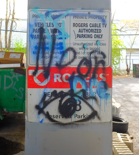
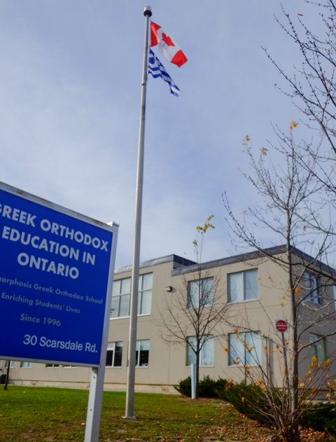
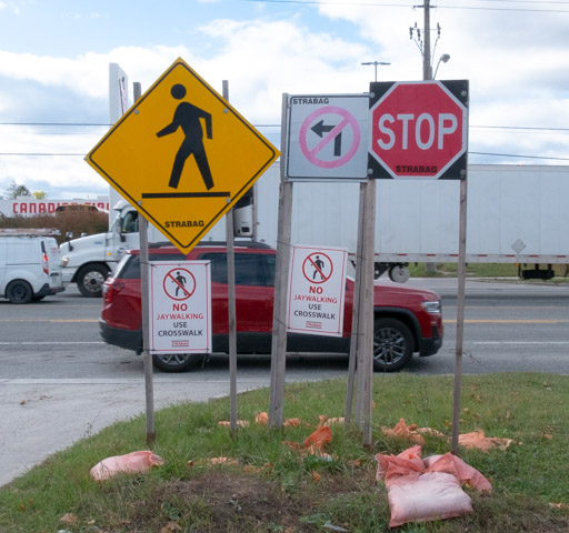
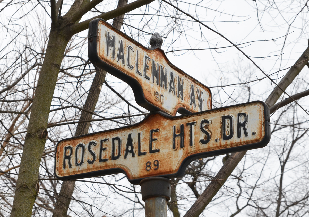
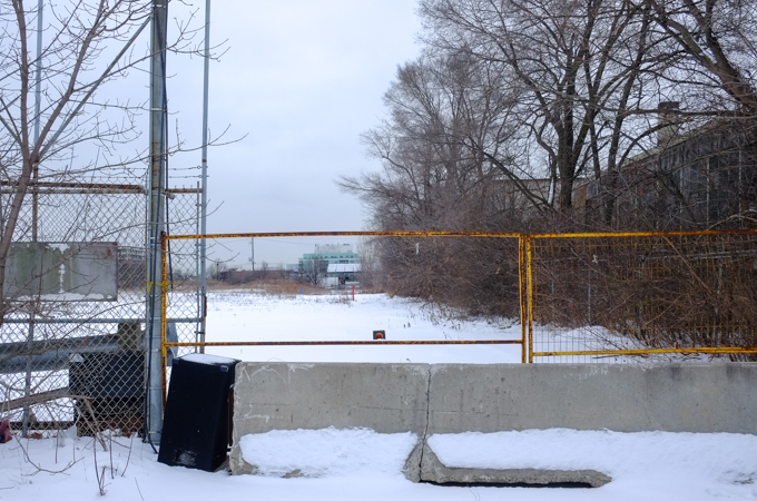
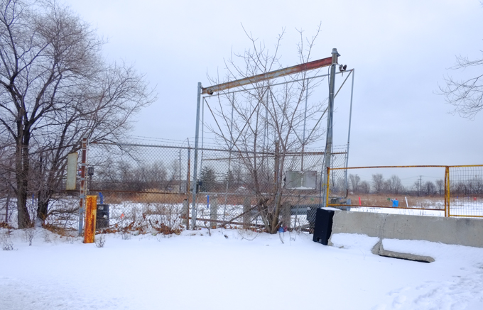
below:  Signs. I always read the signs.  As I approached the fence, I was preparing to read about yet another condo so I was pleasantly surprised to read, “building with Electronic Gaming and Bingo Hall”!   Apparently Dolphin Gaming has submitted a number of applications for developing this site over the past few years and finally, back in November the plan for a lowrise building with plenty of parking was approved.

blue and white city of toronto development notice sign,

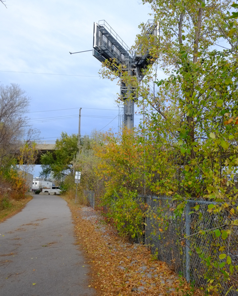
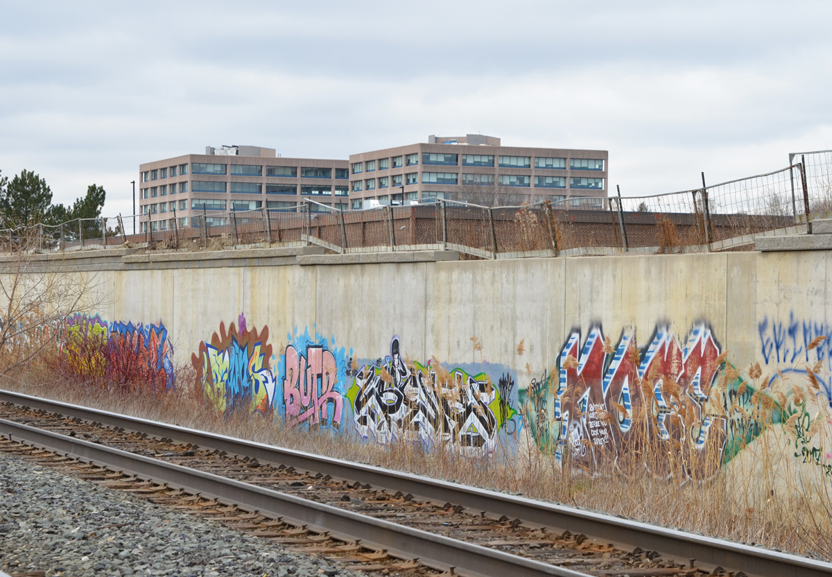
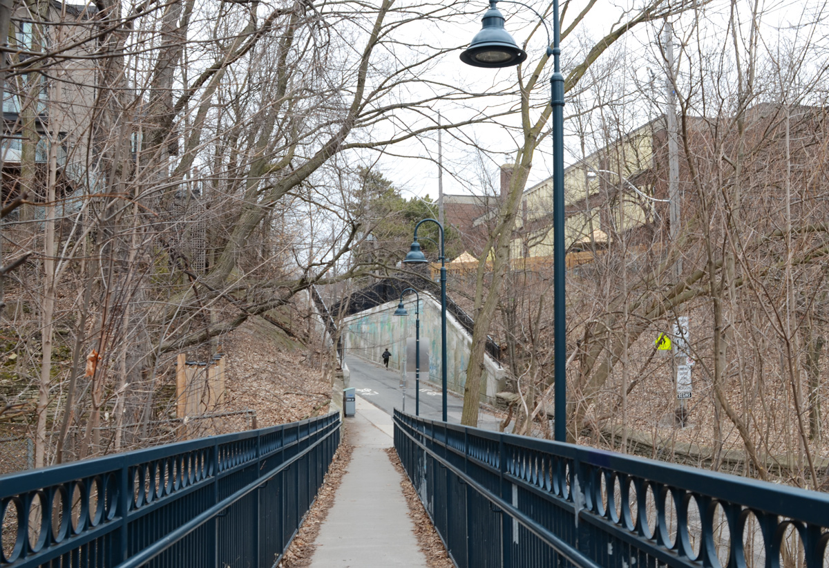
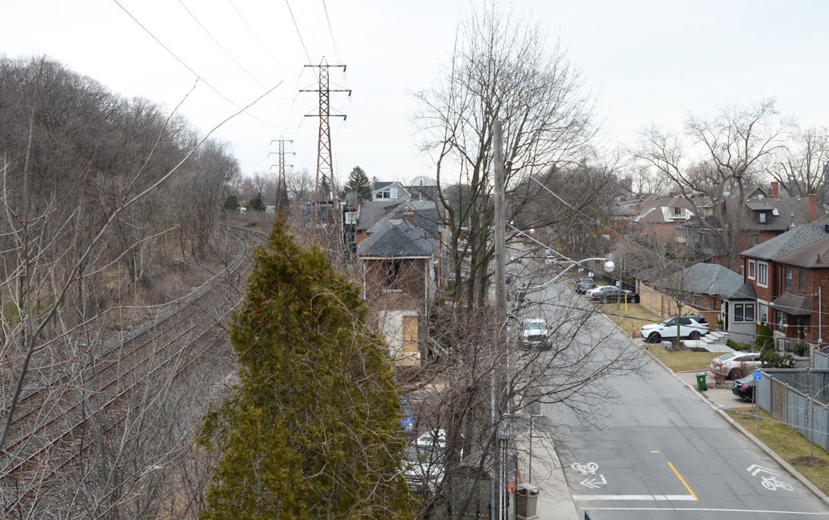
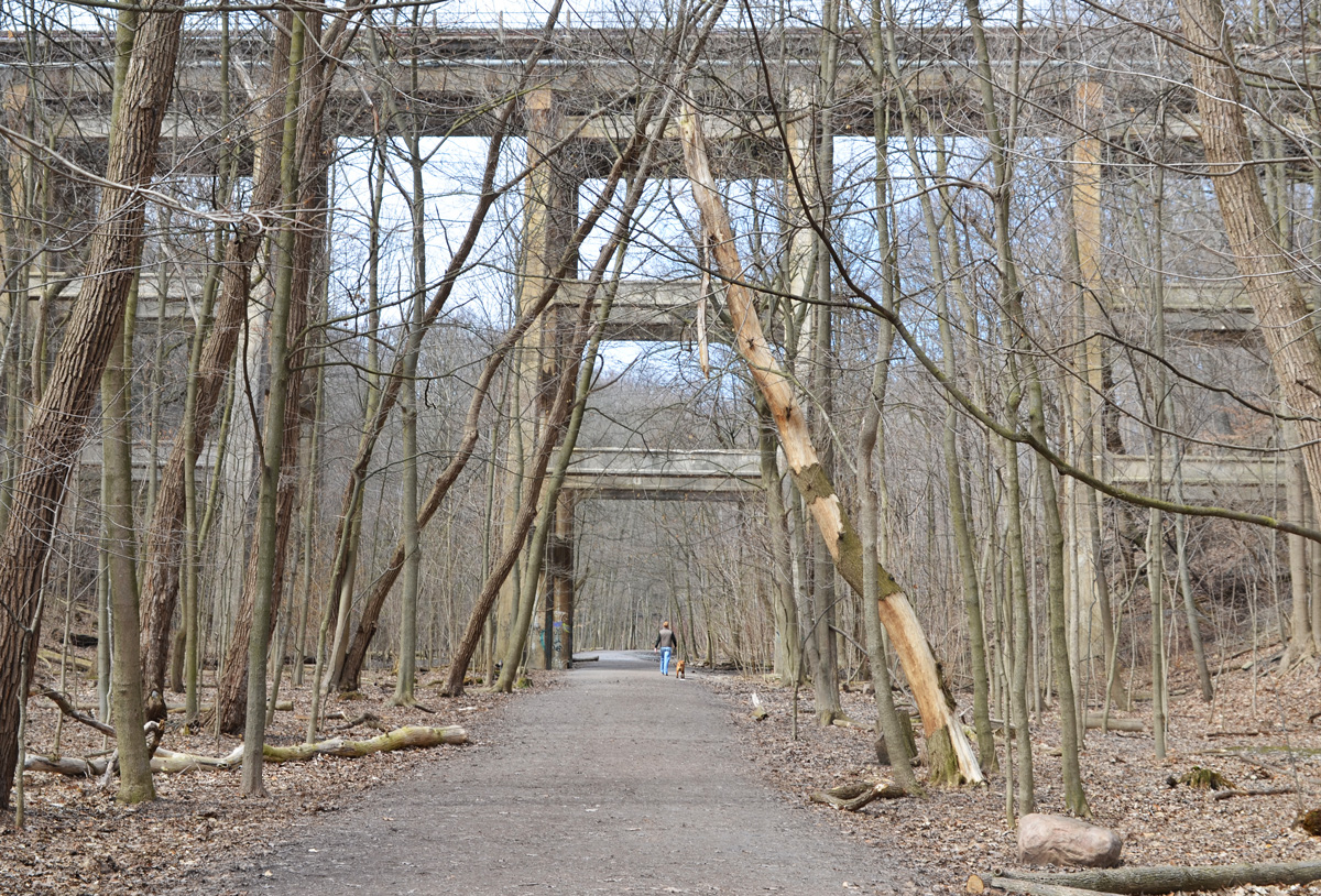
I came across the above sign a few weeks ago when a small group of us explored a rather forlorn section of Scarborough. “Forlorn” can be fun because often it equals interesting photography opportunities.  It was still winter then; back when there was still snow on the ground.

do not enter sign on chainlink gate, in front of light industrial, storage facility

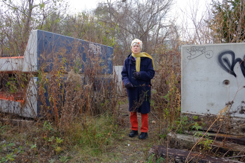
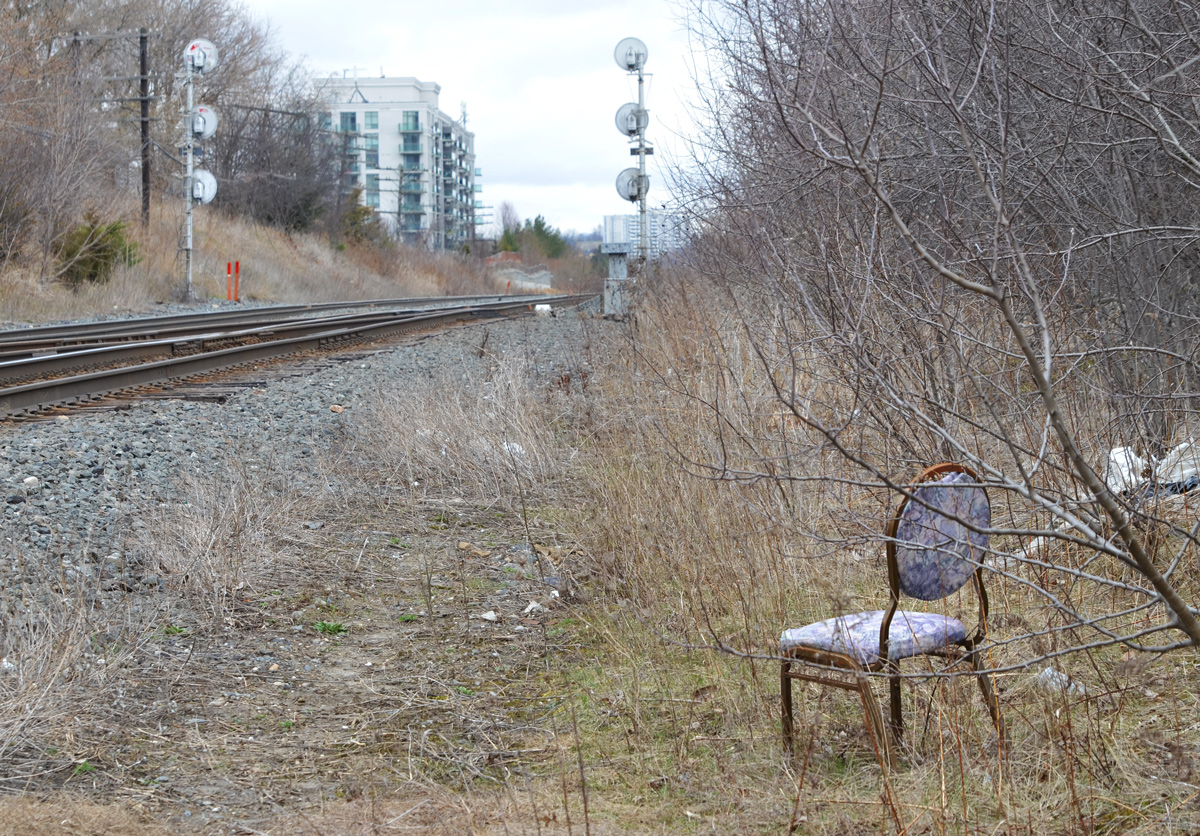
Many people react to seeing a group of people with cameras walking in their neighbourhood.  Some of the natives are friendly and want to talk, even if it’s just a minute or two of small talk.  We can be a chatty group.  A number of times during this walk we were asked if we were looking to buy.  When we asked if what they had was for sale, the answer was frequently, “everything is for sale”.  I can not vouch for how true that is, but in this section of Scarborough it certainly felt possible.
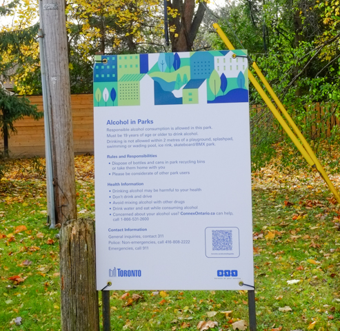
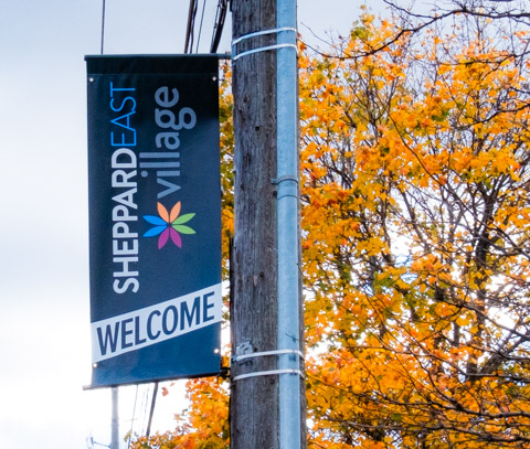
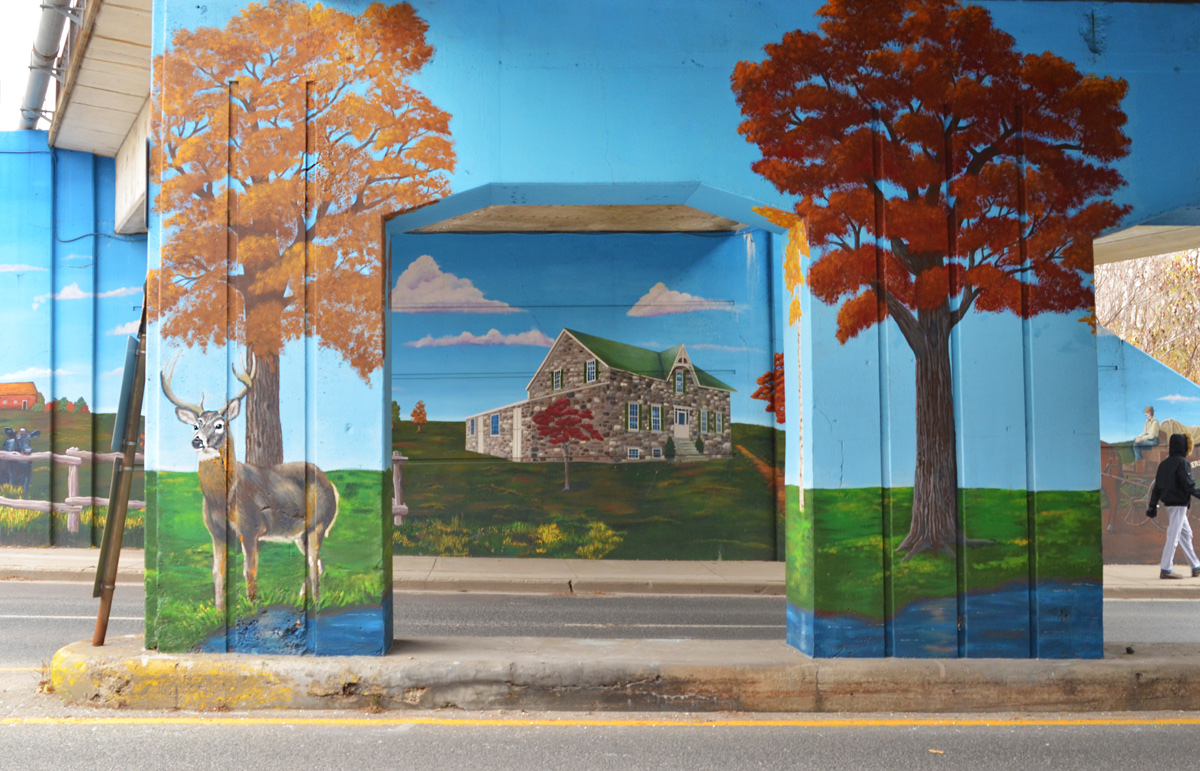
city street signs on a stop sign pole, cleanside road and warden avenue, vacant lot behind

a yellow digger and a full blue dumpster on a snowy vacant lot, behind barbed wire fence

cars and other junk stacked three levels high, outdoors,

small plastic santa claus beside a mail box

large 18 wheeler truck cab, with three mirrors on drivers side

looking between the backs of trucks that are parked close to each other

below: Signs!

below: Oh no!  I can picture the driver jumping out of his Cybertruck already for his shift in a school bus!

Tesla cybertruck parked by Stock school bus office building, small yellow school buses in the background.

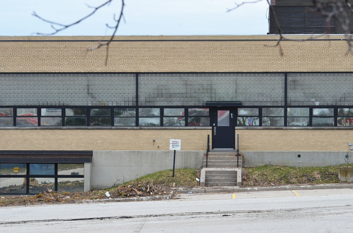
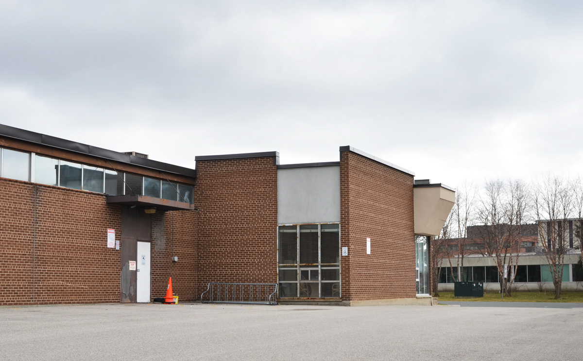
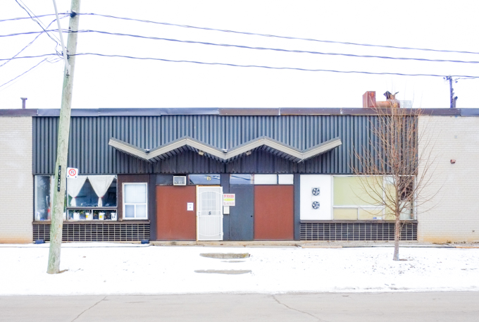
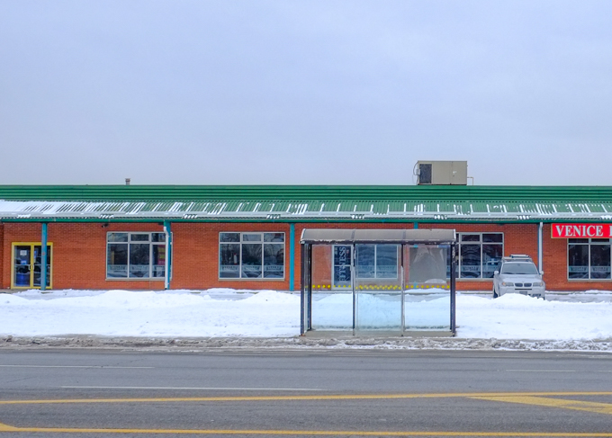
below: Most of the architecture is one storey brick buildings, long and low.  This type of roof over the entrance probably has a name, canopy? awning? – it seems very 1960s or 1970s.

one storey light industrial building in scarborough, with zigzag roof over entrance

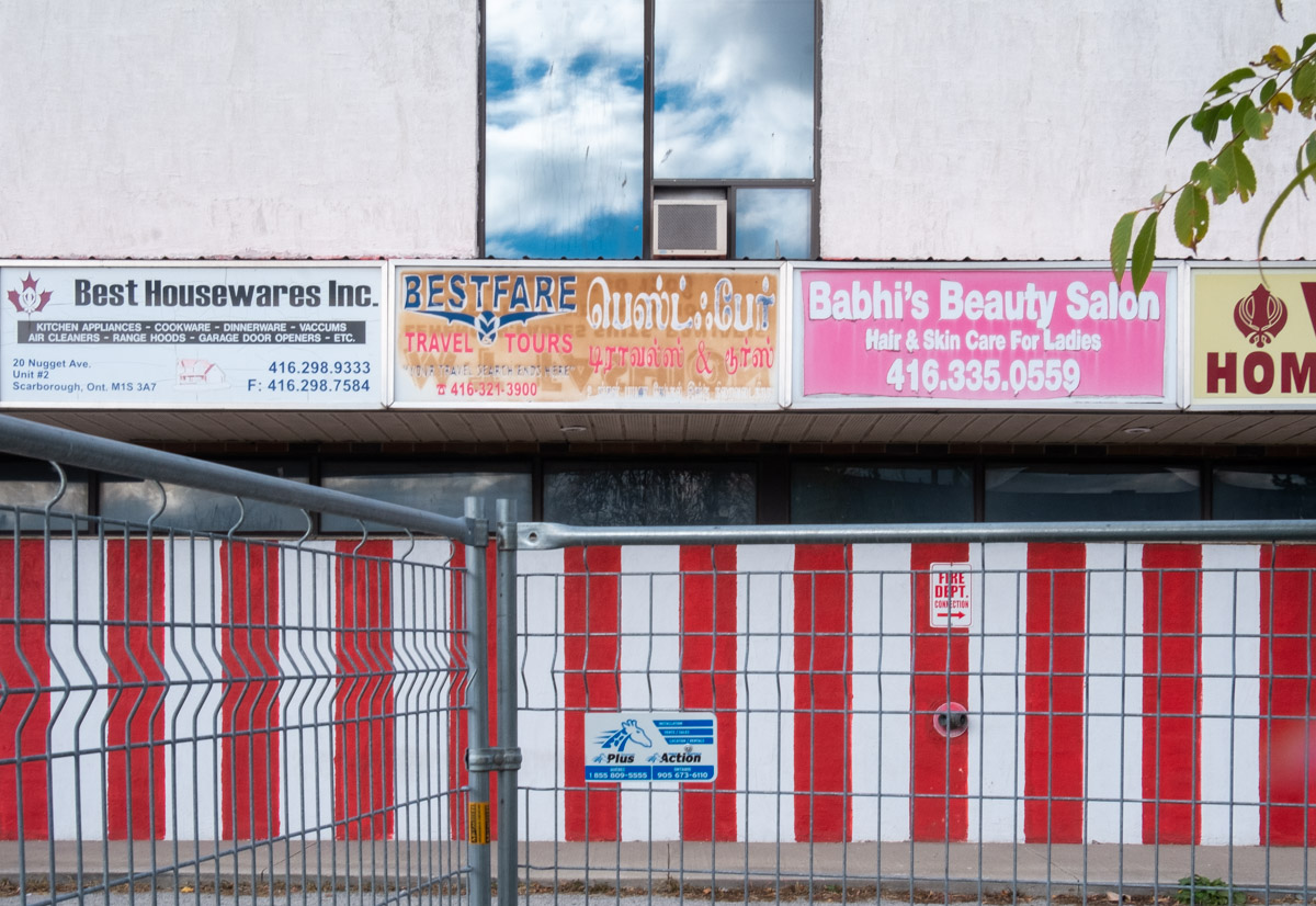
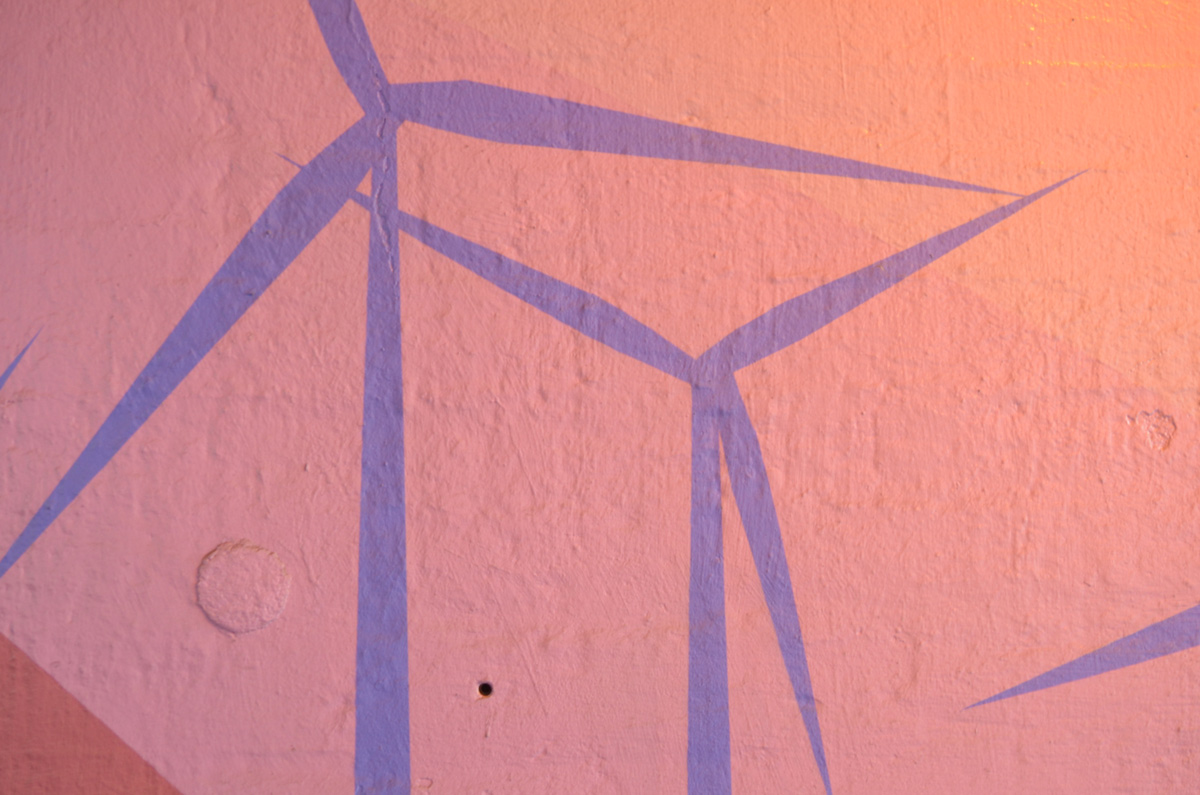
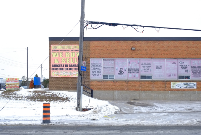
below: Largest in Canada!  Pink windows say: Open to the public…. We can finance your kitchen for a few dollars a week….Big or small, we auction it all…  (and more)

building housing a company that specializes in liquidation, buying and selling of items unsold or unwanted by others

below: Old style bus shelter with no ads.

Warden Ave in Scarborough, bus shelter in front of low rise red brick building with green roof,

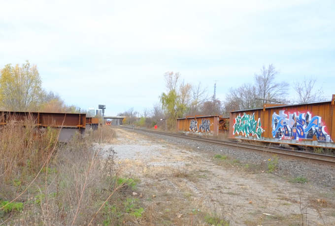
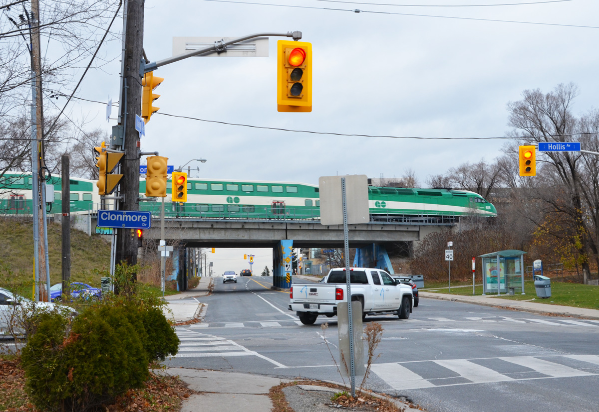
below: Railway tracks cross Warden Avenue at a level crossing

private property, no trespassing sign beside railway tracks in scarborough


hoardings with photos of city buildings with blue sky backgrounds, behind chainlink fence

broken front headlight of a purplish coloured van

old purple van with patchy bodywork

pile of stuff outside a red brick building, including a gatorade vending machine, green plastic chair, two shovels, a metal container, a red plastic gas can, and more

stuff being stored outside behind a gas station including a sign that says hand car wash, yellow dumpster,

gas station in winter

wood chair with old beige cushion sits on a snow covered sidewalk in front of a building under construction

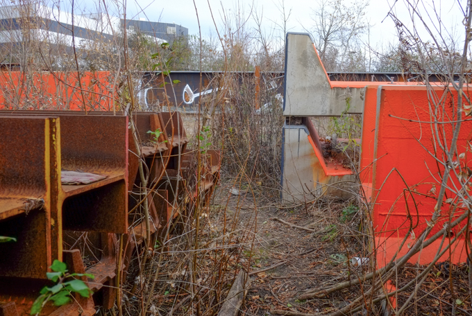
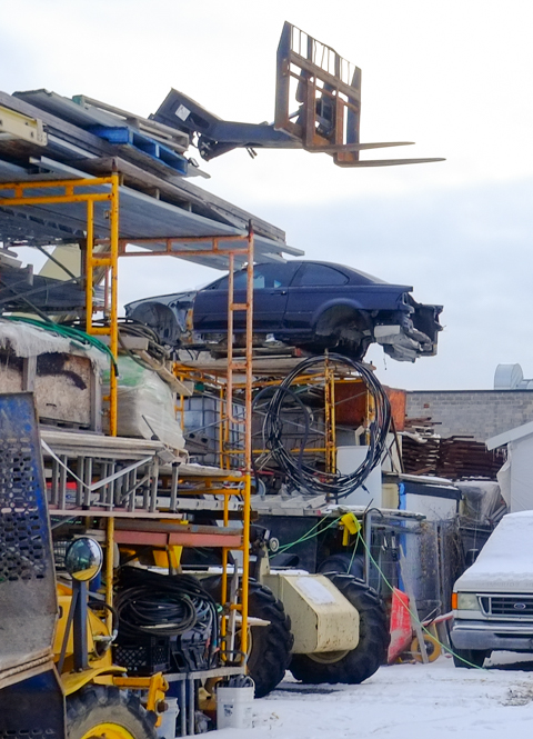
below: A large pile of old used wheel rims
pile of old wheel rims, other piles of scrap metal and metal for recycling

large dump truck entering Triple M Metals site

looking through chainlink fence at large dump truck entering Triple M Metals site

behind chainlink fence, old cars parked bumper to bumper

locked gate, steps leading up to gate, mound of dirt behind gate, winter, snow on ground

rusty barbed wire drooping down across chainlink fence,

signs on the side of a building, one of the signs is partially fallen off

a red brick building with two tall skinny windows is beside and slightly in front of a yellow clad building, picnic tables in the space between the two, snow on ground,

two piles of pallets sitting outside a brick building with graffiti on the walls

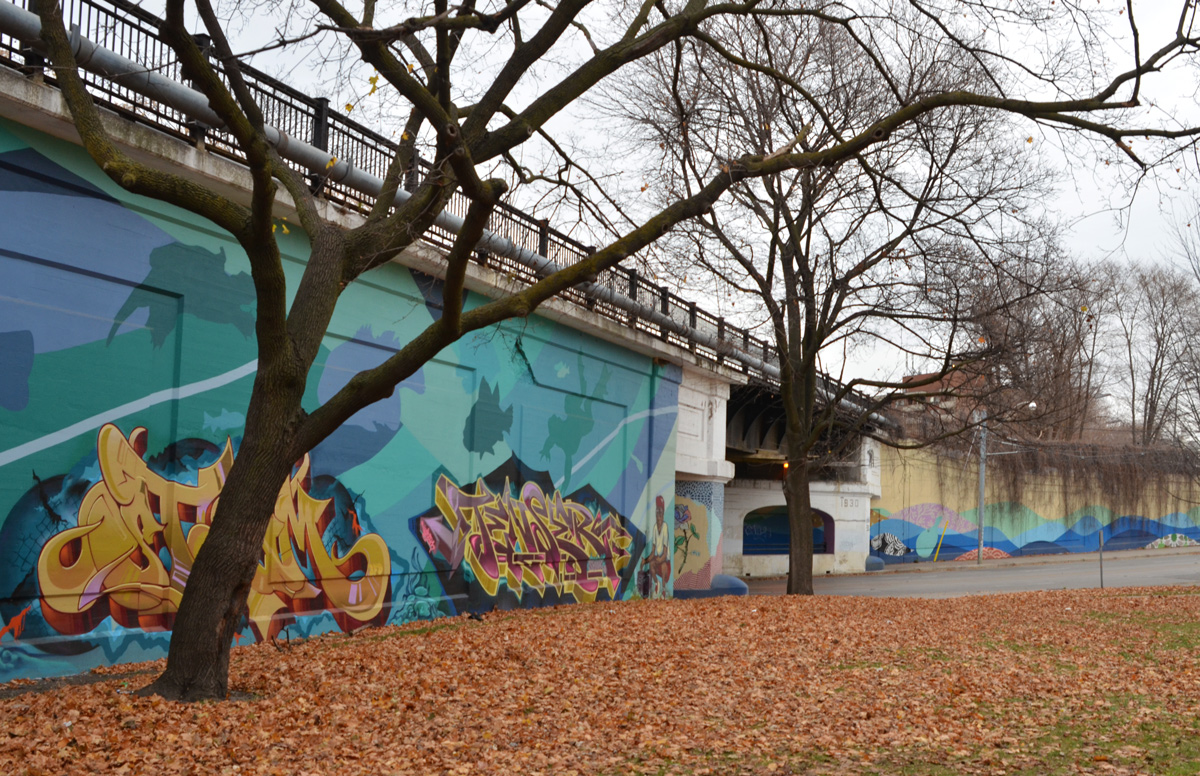
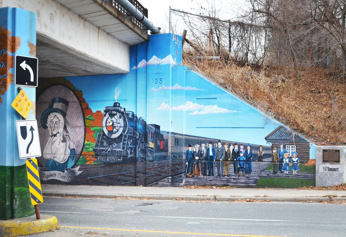
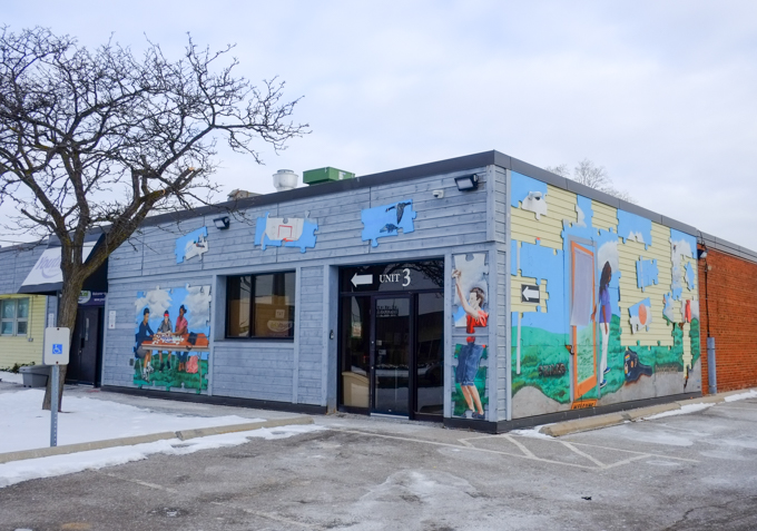
below: “Puzzle” created by Elaine Teguibon, Tara Dorey, Raymond Cho, as well as  youth employment program artists, 2011.  Funded by the City of Toronto.  It covers the front of the Youthlink building .

youth theme murals on low rise building, mural routes

kids playing cards, youth theme murals on low rise building, mural routes

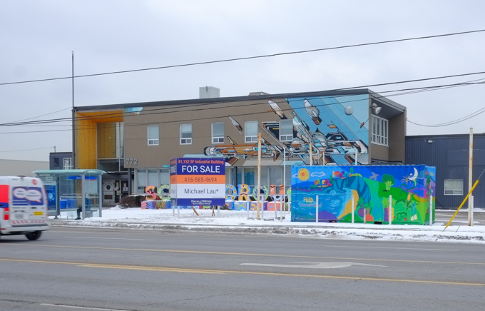
below: It has a couple of Mediah murals and a Scarborough 3D sign, and now its for sale…. (more details at: Scarborough Mediah blog post)

building for sale. mediah murals on two sides, big for sale sign in front, bus stop, painted storage container in front, warden ave in scarborough

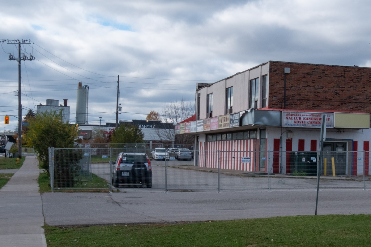
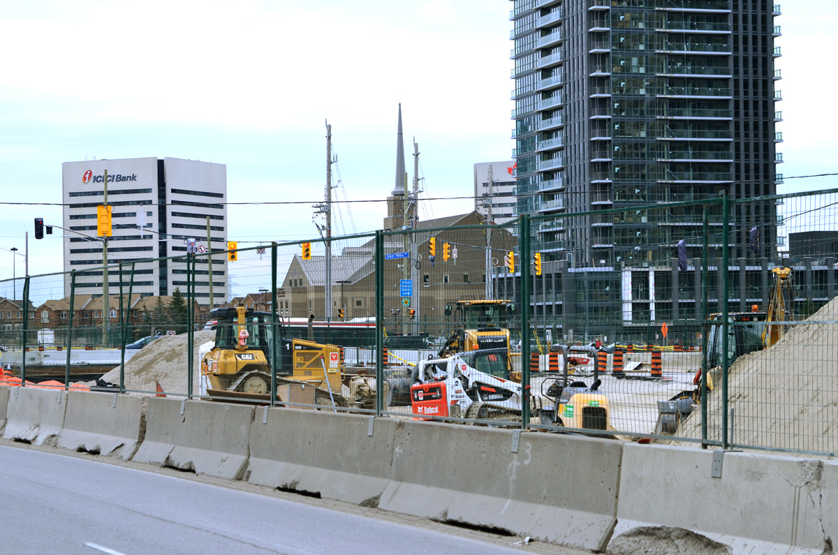
below: More for sale!  All one storey.  This is steps  the new Eglinton LRT (we think!).   It is zoned M4A-225 which is industrial.  Also sneaking into the picture –  You might recognize the large white city of Toronto water tower near the corner of Warden and Eglinton.

large for sale sign beside stores and businesses on warden ave., toronto water tower in the background, snow,

below: Domestic Tank & Equipment with its wall of small panes of window glass.  There must have been hundreds of these types of buildings in Toronto once upon a time.

gates of Domestic Tank and equipment factory, yellowish bricks with large windows made up of hundreds of small panes of window glass

I tried to find some history on this building… instead I learned a lot about “liquid storage solutions since 1952”.  Industrial use tanks are actually quite interesting!

part of wall of windows at Domestic Tank and equipment factory, yellowish bricks with large windows made up of hundreds of small panes of window glass

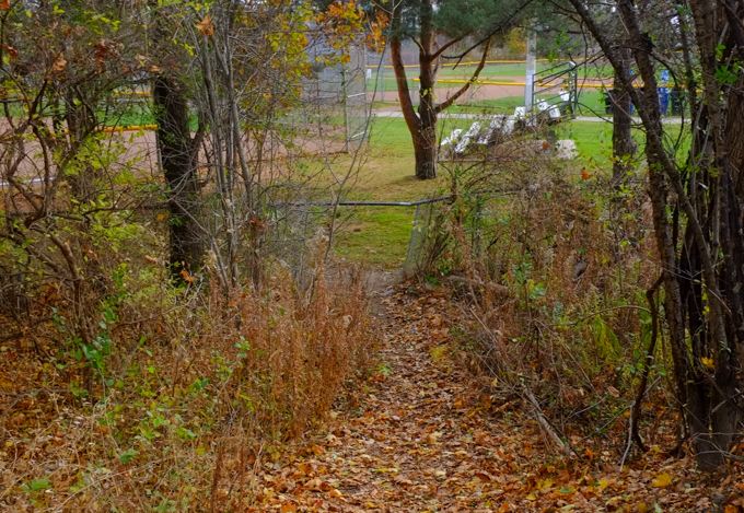
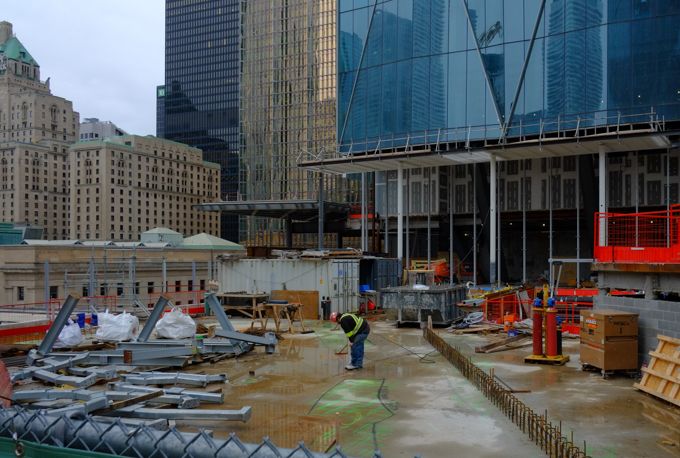
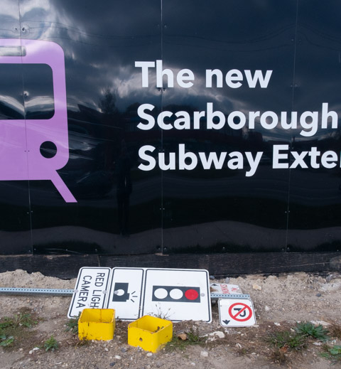
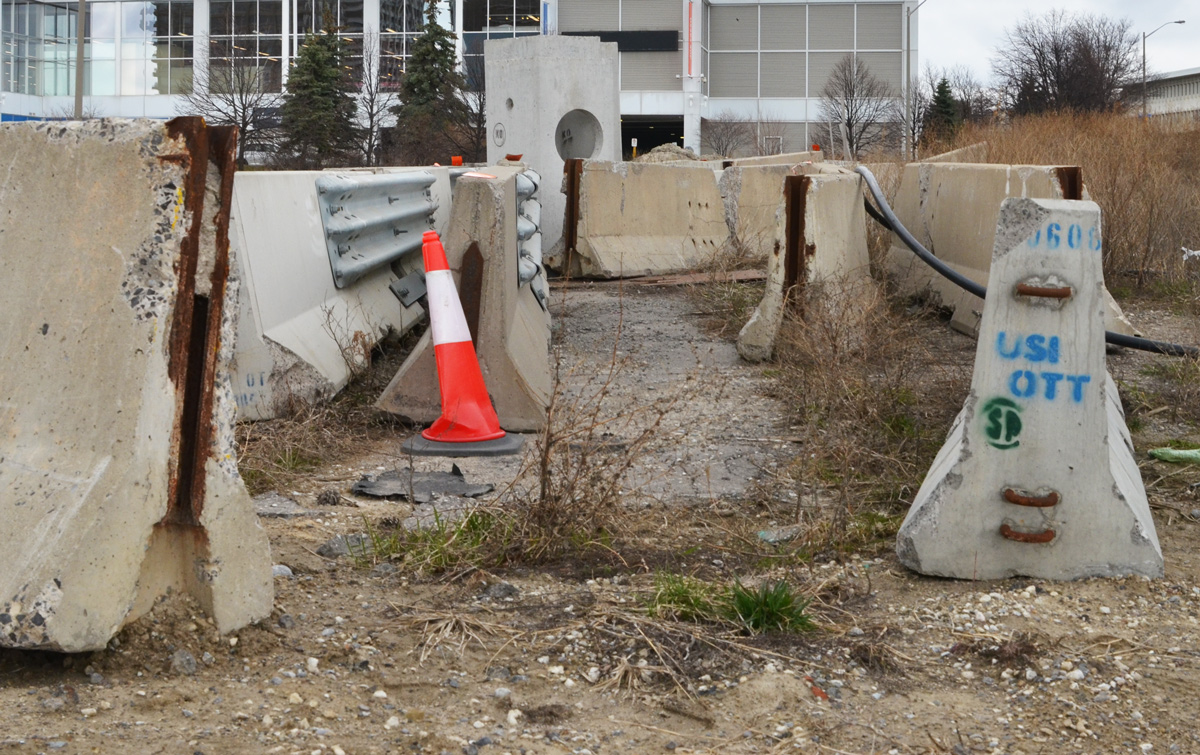
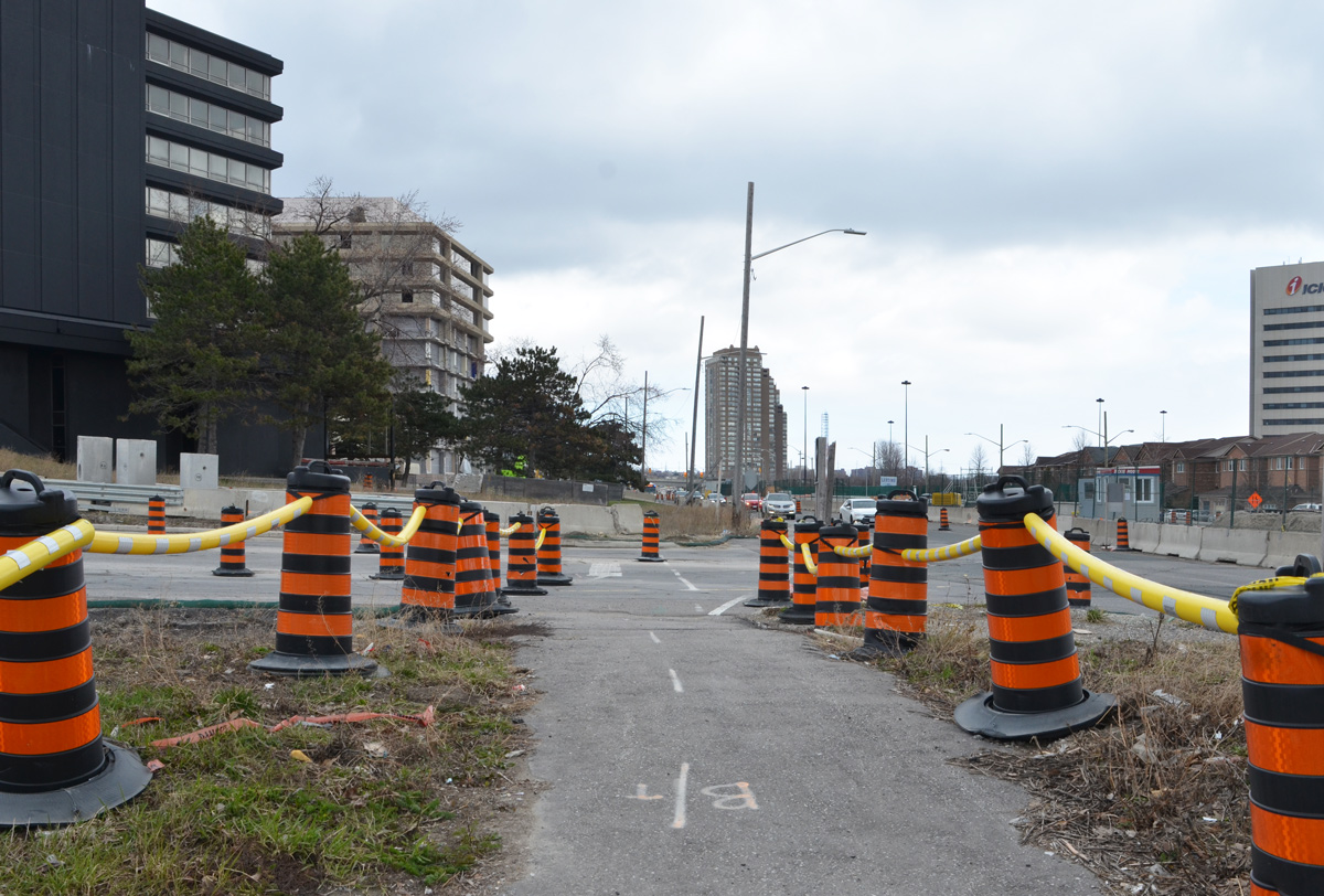
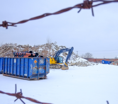
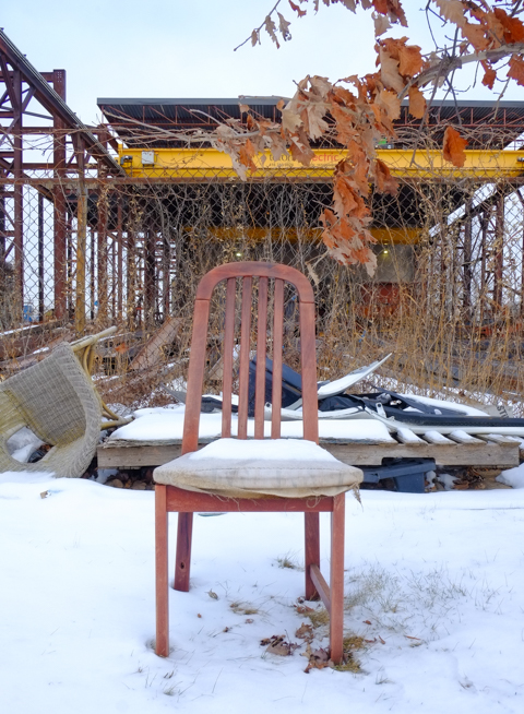
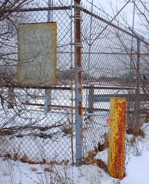
below: Where an Electronic Gambling & Bingo Hall just might go …

vacant lot with concrete barrier blocking entry

old roller gate, open position, driveway now blocked and lot now vacant

old faded and rusty metal sign on chainlink fence

As I was taking the above three photos, I had my back to another very large abandoned site which happens to also be the place where I ended the walk. A large and very empty Rona store occupies a large chunk of prime real estate.  It was made redundant when  Lowes and Rona (both were big box hardware and building supply stores) merged a few years ago.  A second, but very active, Rona store is only a block or so away.

below: It is quite a large piece of property.  Present asking price is just over $50,000,000.

snow covered field in front of empty rona store in scarborough

side view of main entrance to rona store

view of empty loading bays at empty rona store

billboard in empty parking lot of a now empty rona store

below: Although I know that big box stores are big, they look even bigger when they are empty.  There doesn’t seem to be much to them – some beams to make a metal frame, add a few pipes and some wires, and wrap it on all sides.  An engineer or a contractor may disagree, but it looks so simple.

interior, empty Rona store

interior, empty Rona store, looking in through window with reflections of exit door and parking lot

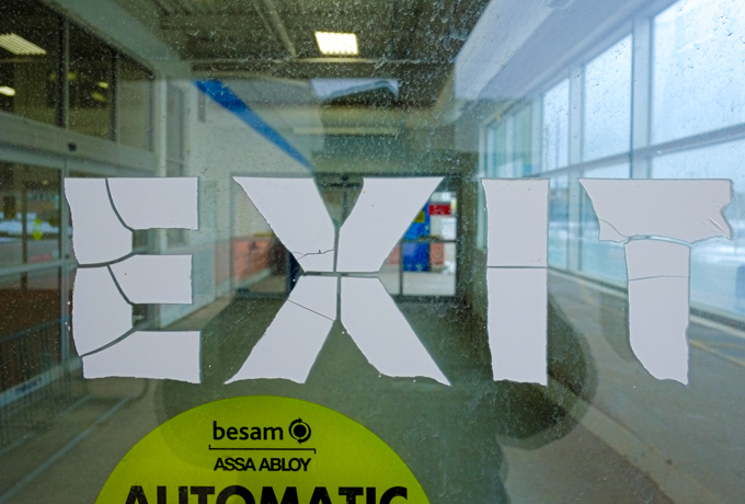
below: Over and out!

exit door from old abandoned rona store

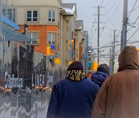
Thanks to the usual Wednesday walking group for letting me join them once again – All bundled up for walking on a winter day!

backs of people walking on sidewalk, past shiny reflective hoardings, with new housing in the background

A circular walk to explore the Don Mills trail south of York Mills Road… but how to get there…. We decided to start by walking south on Scarsdale Road to Bond Avenue.

Scarsdale is a nondescript street in North York with a few churches, private schools, some light industry, offices, and all in all, a lot of lowrise late 20th century architecture.

below: Don Mills Baptist Church looking very un-church like.

below: Unmarked

below: Once at Bond, the buildings are mostly residential.

below:  There is a walk-through to the neighbourhood behind

below: The old railway bridge over Bond is now part of the Don Mills Trail.  Originally it took 6 years to build (1912 to 1918) the bridge – using six 2-foot-thick beams that span the 15-foot-wide opening, spaced to handle the weight of locomotives and heavily loaded railway cars.

Don Mills trail access point at Bond Ave.,

below: Also under the bridge is an entrance to Bond Park.

looking under a bridge to a parking lot in a park

below: Another entrance to Bond Park, this time from the trail via a hole in the fence.

leaf covered path down a small hill to a hole in a chainlink fence, and a park with seating beside a baseball diamond in the background, lots of trees

below: “Responsible alcohol consumption is allowed in this park”….rules and responsibilities are then listed along with health information about alcohol.

notice about alcohol in parks, and all the rules

autumn colours in the weeds and wildflowers beside a fence

below: A few remnants of its former life.  Once upon a time this multi use path was a spur line for the CNR, the Leaside Spur.  One of its functions was to connect the CNR main line (now also used by GO to Oriole station and beyond) to the CPR line near Eglinton.  The CPR tracks are those that cross Eglinton just east of Leslie and then cross the Thorncliffe trestle bridge over Wilket Creek Park.  The path ends just before the CPR tracks – there is no connection any more.

old rusted railway sign, small trees have grown up around it

below: Abandoned and rusting.  CNR stopped using this spur line in 1999.  The city bought the property ten years later.

old piece of metal, remains of railway switch? or some piece of railway equipment, lying on the ground

below: Crab apples and dead leaves litter the path

autumn leaves and little red crab apples cover the ground

below: Storage in bins and barrels, on the other side of the fence.

two old blue barrels, behind a fence, lots of undergrowth and weeds too

below: Left behind

discarded pair of boots, and some clothing, left on metal girders stored beside a railway track
stacks of rusty metal girders beside a railway track

below: The north end of the Don Mills Trail runs beside the live CNR line.  Not much of a view is it?  No trains passed by.  Very quiet.

looking northward up the CNR railway tracks from a hole in the fence by the DOn Mills trail.

old white barrels, behind a fence, weeds and small bushes growing up around them

below: Many, many large satelite dishes (and many small ones too).  I was feeling like a spy as I tried to take pictures through the fence… but I didn’t see any surveillance cameras…

satelite dishes behind a fence

below: Approaching York Mills Road

looking north up don mills trail towards york mills road, where there is a bridge over the railway tracks, a large pair of billboards on a tall pillar, dead leaves beside path, shrubs and weeds along the fence

below: The north end of the trail runs beside the bridge York Mills over the railway tracks (on the right in this picture).  From here there is an access road to Scarsdale on the south side of York Mills, or an exit through to Longos Plaza on the north side.

below: Have a seat!

below: Rogers has a large property on the east side of the CNR tracks and has access to this area.

With thanks to my mother for walking with me – she didn’t hesitate to climb through holes in the fence!  She also doesn’t like this picture, but it’s the better of the two that I took that morning!

Bonus section! Just in case you are interested in what’s on Scarsdale Road….

below: Colonel C.O. Dalton CSO and Colonel H.E. Dalton CSO Armoury

sign in front of building,

below: Greek Orthodox Education in Ontario – Metamorphosis Greek Orthodox School.

flags on flagpole, Canadian and GReek, in front of Greek Orthodox Education building

below: Korean Presbyterian Church

side view of front of Toronto Korean Presbyterian church, large roof over entrance, small white steeple, light grey brick building.


There are so many new buildings in Toronto!  One of them is the new CIBC building at 81 Bay Street which is immediately south of the railway tracks and across the street from Union Station.  It is also adjacent to the new GO Bus station.

below: If you take the elevator to the 4th floor of the new CIBC building,  you can access the new park.   This is the view that greets you. The park extends over the railway tracks – a great use of space!

elevated park over railway tracks that is part of cibc square development,

below:Looking east from the park (on a foggy morning, and with a spot of dirt on the glass fence).   The trees on the right mark the spot where a strip of land separates the railway tracks from the Gardiner Expressway/Lakeshore combination.  Between Yonge and Parliament there are no buildings adjacent to the tracks on the south side.    That tall splotchy looking building is the Sugar Wharf Condos which, as the name suggests, are close to the Redpath Sugar property.

eastward view from cibc park, over railway tracks, tall buildings on either side of the tracks,

below: Looking north across the roof over the railway tracks.  The gold building is another bank building, RBC (Royal Bank of Canada).  On the right, the building that looks like there are diamond shapes in the glass, is a second CIBC tower but on the north side of the railway tracks.

below: Construction continues on the north side.  It too will have a park that extends over the tracks.  The two parks should merge into one once construction is completed.

construction site, park above the railway tracks at part 2 of cibc square, on the north side of the tracks, gold coloured r b c building also in the photo

man working at construction site, park above the railway tracks at part 2 of cibc square, on the north side of the tracks, gold coloured r b c building also in the photo as is Royal York Hotel

CIBC square, park

CIBC square, park, in November

below: Westward

looking west from cibc square, red leaved plants in foreground, CN Tower in background

below: In the center of the park is a large shiny metal leafless tree.   This is “New Amalgam” by Roxy Paine (2022).   It is 72 feet high.

public art, tall tree made of metal, cibc square

public art, tall tree made of metal, cibc square, cn tower in the background

below: Looking over the covered tracks at Union Station and all the ventilation system components on the roof.

looking west from CIBC square, long railway tracks, past covered tracks at Union Station with ventilation systems on the roof, CN Tower,

looking west from CIBC square, long railway tracks, past covered tracks at Union Station, CN Tower, with construction on south side of railway tracks

below: A closer look at the nearby construction at track level (and lower).

union station infrastructure construction

There are also stairs on the exterior of the CIBC building that lead to the elevated park.

looking into a few levels of cibc building, through large windows, from exterior stairs

Bay street side of CIBC office building, west side, lower three levels with tall white pillars

below: Looking south on Bay Street where Scotiabank arena takes up most of the street scene.  That’s the Gardiner Expressway as it crosses Bay.

looking south on Bay street rom CIBC building, Scotiabank arena takes up most of the street scene,

below: Through the window to the interior of CIBC  where Steve Driscoll’s artwork shines brightly.

interior of cibc building on bay street as seen through large window from exterior stairs, glass artwork, little round tables with a couple of people seated at them

below: “A light stolen from the sun” is a collection of 12 digital prints on laminated glass.   they can also be viewed from the 4th floor but access is controlled.   Also, camera use will get you a nice chat with a security guy.  The usual, phones are allowed but even little cameras are a no no.

Steve Driscoll artwork, red and blue, trees, tall, vertical works on glass

below: An outpouring of red poppies is the stunning centerpiece in this Remembrance Day tribute (created by Fresh Floral Creations).

an arrangement of red poppies for Remembrance day in the lobby of an office building,

two women on exterior stairs by CIBC sqaure, downtown toronto

With thanks to Nancy and Merle who went exploring with me that day.

Ready to roll again?!

people walking on sidewalk, past a sign for a sushi restaurant that says lets roll

 The last blog post ended at Dundas West Station where the Giraffe Building sits on the northwest corner of Bloor and Dundas  …. so let’s picked it up from there…..

large billboard on top of two storey building with upper level painted like a giraffe in brown and yellow, bottom level covered with ads and graffiti

If you go north on Dundas from here you’ll find yourself in the Junction.

below:  A quick peak north on Dundas West at Edna (first block north of Bloor).

southwest corner of Edna and Dundas West, standing in front of Mcdonalds at the subway station, a bus, some people walking, a man leaning against a telephone pole.

But not today.  Today we’re heading south on Dundas until it meets up with Roncesvalles.  Then we’ll walk generally north and east until we cross Dundas at Sorauren.  A brief stroll north on Sterling will bring us back to Bloor.   That’s the plan!

man holds a coffee cup as he walks past adverts on side of giraffe building

two people standing beside defaced mural in support of front line workers, dundas west and bloor

below: Crossing Bloor at Dundas

a couple walking together, crossing Bloor, with dollarama store and brick highrise apartment building behind them

man holds a piece of plaid fabric in his outstretched arms as he walks past advertisements on exterior of giraffe building

wood cutouts of people doing things, man holding a ball above his head, painted, mounted on exterior of red brick building, a school,

large painting of a glass half full of milk, on exterior of red building, word full written on the milk, beside Bloor Street fitness, with a large white boxing glove outside

below: Waiting by Jimmys Coffee

looking across Dundas West towards Jimmys Coffee, people waiting to cross with traffic light

below: Walking their bikes

a young man walks his bike on sidewalk past a store, reflections in the window
walking on Roncesvalles, a woman in a maroon skirt, a couple walking together

below: Jac’s Milk on Roncesvalles still has a mural depicting the 504 King streetcar.  The boys at the table were selling eye protectors for watching the solar eclipse (that dates this walk!)

Jac's Milk convenience store on a corner on Roncesvalles, TTC streetcar in mural on the side of the building, a person on a bike in the foreground

a woman walks her dog on the sidewalk, Roncesvalles

below: White Corner Variety

a person on a bike riding north on Roncesvalles, past Whites Corner Variety

below: Outclass reflections

a woman sits on a bench in front of a store window

below: Jogging on Roncesvalles

two women jogging on Roncesvalles at Howard Park

two young asian men working at a fruit and vegetable market, goods on sidewalk, some people passing by, a pile of orange in the foreground

below: Totally gutted

view from alley behind, most of interior of house has been gutted for a renovation

below: Also under renovations is the Hindu Prarthana Samaj Temple, the oldest Hindu temple in Toronto.  Prior to being demolished, this was an old church building dating from 1886.  First it was Ruth Street Presbyterian Mission and then later it became Fern Avenue Church of Christ until the Prarthana Samaj congregation bought the building in 1979.  Soon it will look more like a Hindu temple!

hindu temple being renovated behind hoardings

backyard views, from laneway behind

garages in alley, dark green garage door, bright blue wall,

below: Flowers on the side of a garage in an alley

pinkish peach colour lily painted on a wall in an alley, also a purple rose in the painting


graffiti on a brick wall in an alley, blue eyes with text eyez

sticker of a heavily armed police man with a large gun on a pole in an alley

sign upside down, yellow sign says slow, alley,

below: New infill in an alley

new infill house in an alley

below: With another one under construction nearby.   Construction of these laneway homes was allowed beginning in the summer of 2018.  Since then, their popularity has blossomed.

infill housing being built in an alley, plywood

below: Wilson’s Variety & Grocery on a corner in a residential area.

small convenience store on a corner in a residential area, Wilson's Variety and Grocery says green and yellow sign across the top of the window, black bars on the window, Canada Post mailbox in front of the store,

small narrow house, two storey, large tree in front, gingerbread trim under eaves, very small front yard,

house on Sorauren, white fence in front, red trim on porch and awning over window

backyards, alley view, one with lots of stuff in the yard

below: No payment entertainment and BE BETTER where Sorauren meets Dundas West.

where Sorauren meets Dunda West, a big billbord, an old yellow building, and another building with the words be better written in big white capital letters

below: Same corner, southwest side.  Pink door beside Timmy’s Variety.

southwest corner of Sorauren and Dundas West, building with large white sign and pink features

below: The West Toronto Railpath runs up the east side of the railway tracks.

West Toronto Railpath north from Dundas West,

concrete supports under bridge, Bloor Street over railway tracks, covered with graffiti,

below: You can tell by the sweet chocolatey smell in the air that Nestle is still making chocolate bars and other candy here.

Nestle factory, with large faded ad for Aero chocolate bars

walkway bridge over Sterling Ave at Nestle plant

sign on grey corrugated metal wall that says Nestle, coffee crisp

below: You are greater than everything

orange diamond shape construction sign that has been painted over in yellow and blue, stencil of an open hand holding a flame, text that says you are greater than everything

below: Halfway up Sterling Ave, around the Museum of Contemporary Art (MOCA), there has been a flurry of development activity.

back corner of MOCA, Museum of Contemporary Art, with new construction of a new building beside it, crane on top of new building, sign on the back of MOCA that says over asking under taking

Sterling Ave., new building under construction on right, MOCA on left, museum of contemporary art

below: Development on the north side of MOCA.

looking across a flattened vacant lot. dirt, to a line of new townhouses, as well as older single family homes with large trees in the backyard

looking down the side of a house, to see new townhouses in the background

old used concrete barriers lined up beside each other, being stored in a vacant lot, behind a fence

below: A pair of anser eyes

man in red wool hat taking a picture of anser eyes graffiti on grey wall

below: Land Back, Turtle Island style.

poster on a wood pole, turtle with red sash around middle, words that say land back

below: Catchoo paste-up, catching a hand grenade

small graffiti pasteups by catchoo, two green outstretched hands reaching for a hand grenade

below: One wet fish dripping on Feelings Boi.   The fish is probably the work of Rowan McCulloch.

feelings boi sticker, as well as a sticker with a black and white image of a fish

below: More houses….

older brick two storey single family home with single upper storey window, also a porch across the front of the house, with white metal railing on porch

two storey bay and gable house, painted blue with white trim

two storey bay and gable house, red brick,

chair on a porch with 3 pizza boxes on it, also a bike on the porch

below: A row of bay and gable houses.

row of two and three storey bay and gable houses, large tree in front

houses on Bloor West near Sterling

addition to front of house, extends to sidewalk, large window in front, with reflections, walls are painted in mural with purple sky, blue and red trees, and green grass

below: And that brings us back to Bloor …. Bloor Gift and Smoke Shop across the street from the north end of Sterling Ave

on Bloor West, at Sterling, old red brick building, with Bloor Gift and Smoke Shop

below: Looking west on Bloor from Perth.  The southwest corner remains vacant.  Old concrete steps go nowhere now, and haven’t for many years.  The old tires are a more recent addition to the landscape.  Unfortunately this one of the many sites in the city where development is in limbo.  As early as 2010 there was a 12 storey building proposed on this site (1439 Bloor West plus 80 Perth).  At the moment, there seems to plans in the works for a 14 storey building but the plans seem rather fluid (i.e. they keep changing).

intersection of Bloor and Perth, with vacant lot on southwest corner

below: Back in 2014 or 2015, the concrete walls of this underpass were painted with murals. Now almost all of it is tagged over or scrawled on. It’s a mess.

entrance to toronto railpath beside tracks on Bloor Street, concrete walls covered in graffiti

below: UP Express train stopped at Bloor West station on its way to Pearson Airport.  The UP Express was in the news this past week because Metrolinx decided to change the scheduling such that half the trains no longer stop at the Bloor and Dundas stations.   Cue the now-normal Doug Ford flip flop when there was a lot of very verbal backlash from the commuters that use these stations.  The regular schedule has resumed.

UP Express train in station, reflected in the windows of building on other side of tracks

From here it is a hop, step and a jump back to Dundas West station.

In case you are interested –  Ten years ago, the building that houses MOCA stood alone. Its life as part of Tower Automotive had ended and its new life as a gallery hadn’t yet begun.  Previous posts:

Tower Automotive 2013
Tower Automotive 2014
First visit to the new MOCA 2018

After years of false starts, indecision re routes, and all the other consequences of being City Council’s favorite political football, the new Scarborough subway extension is underway.

on black hoardings around metrolinx site, pink subway symbol, fallen street signs on their side at bottom of hoardings

Once upon a time, the extension was to only go to Scarborough Town Centre and was derided as the “One Stop Subway”.  Now it seems to be three stops from the present Kennedy station with the end point being at McCowan and Sheppard.  In true Metrolinx style, it seems like the last station is going to be called Sheppard East.  Such imagination! … to have three stations called Sheppard!  That seems to be the situation at present…. as for tomorrow’s situation?  Who knows…..

printed on hoardings around metrolinx site, map of scarborough subway extension from Kennedy to Lawrence to Scarborough Centre to McCowan

In case you’ve never been to that intersection, let me show you what’s there…..

below: Looking west on Sheppard approaching McCowan with Metrolinx site on the right hand side.  This construction site is very large and dominates the area.

looking west on Sheppard towards mccowan, metrolinx construction on right side

below: One of the entrance gates to the Metrolinx construction site.  Note all the stacked concrete sections that will form the tunnel walls.

gate across entrance to construction site, red crane inside, also partially curved structures that will form walls of circular subway tunnel

metrolinx site for mccowan station on SHeppard subway extension, red crane,

below:  This blue object is part of the equipment needed to move dirt brought to the surface by the Tunnel Boring Machine that is working underground (There is also a TBM working out in Rexdale on the Crosstown West).

large blue piece of equipment on construction site, made for moving dirt that has been removed from tunnel by tunnel boring machine

It is a very big machine

below: Gate B

Gate B of metrolinx sheppard extension site on mccowan, watch for oncoming traffic sign,

In general, the area south of Sheppard is residential while the area north of Sheppard is industrial or commercial.   Canadian Tire is on the northwest corner.

below: Apartments on Sheppard (south side, east of McCowan)

man walking past low rise apartment building with balconies, green fence beside sidewalk

below:  Because of the angle from which this photo was taken, the exact locations are slightly unclear.  The Medical Clinic is 4651 Sheppard East.  To the west of that is a vacant lot that used to be a gas station and it is on the SE corner of McCowan and Sheppard; it is in the process of being redeveloped.   The apartment building is actually on the SWt corner of McCowan and Sheppard.

apartment building and lowrise plaza with medical clinic, sheppard east

below:  looking east on Sheppard from McCowan

TTC bus shelter beside sidewalk on Sheppard East, hoardings or metrolinx construction site Sheppard East station, are behind the shelter


below: Walking McCowan north of Sheppard is partially impeded by a fence across the sidewalk…. but it is easily bypassed.  Nugget Avenue is just beyond the fence.

chainlink fence across sidewalk at Nugget Ave

below: Looking southeast from McCowan and Nugget where West Highland Creek branches.  The large Metrolinx site fills the triangle formed by McCowan, West Highland Creek, and Sheppard Avenue.  The white apartment building in the distance is on Sheppard Ave.

creeks north of Sheppard

The creek’s concrete bed might make for easy management of the water flow but it makes for an ugly scene – unfriendly to both nature and people.  There are parks north of here on both branches of the creek but here where most of the land use is industrial or commercial, little attention is paid to the esthetics.

dead vines on chainlink fence beside concrete bottom creek

graffiti on concrete sides of west highland creek

below: Dufferin Concrete at Nugget and McCowan

concrete plant in Scarborough

below: Nugget Avenue crosses West Highland Creek.  The plaza at 20 Nugget Ave, with the red and white stripes, was shut down (bought out) by Metrolinx.  Apparently, the two-acre property is needed for an emergency exit and underground tail track for the future Sheppard East Station.

bridge over creek at Nugget Ave

empty two storey plaza, lower level painted with red and white vertical stripes

empty building behind construction fence, red and white vertical stripes on lower level, window on upper level, three signs for businesses, Best Housewares Inc., BestFare travel and tours, and Babhis Beauty Salon

old banners on a chainlink fence advertising boxing week specials, ads for restaurant food,

below: Spotted on a bulletin board at a bus shelter on Nugget (It’s a collection of bible verses).

on public message board at a bus shelter, 4 pieces of 8 1/2 by 11 paper with typing on them, a collection of bible verses

below: Immediately north of Nugget Avenue are train tracks. This is the western edge of the large CPR Toronto Yard.  If you are interested in this yard and some of the trains, I blogged about it previously (Around the marshaling yards – with love and peace).

black tanker cars on railway bridge over McCowan

downward arrow shape painted in yellow and white on blue concrete under a brdge

below: North side of tracks along McCowan

concrete waterway and tunnel for west highland creek as it goes under the railway tracks

a banner for welcome to sheppard east village on a pole, with an autumn tree behind

vertical banner on pole on sheppard east for east sheppard village, picture of three people on banner

traffic signs and warning signs at entrance to construction site on mccowan road

dirt track uphill to the tracks

flock of birds on a wire

In many places in Toronto, railway lines run diagonally through the city’s grid of streets and avenues. Often, they cross the streets near intersections including at Carlaw and Gerrard East. The result is an intersection with two underpasses.

The mural on Gerrard East was updated and added to recently that I remarked on that I noted in a previous post, East on the 506. Kirsten McCrea was the artist.

below: The southeast corner of Gerrard and Carlaw is angled.  In “East on the 506” I described the art on this wall as:  “In the center of the newly painted rectangles are two grey shapes, these are originals. They are part of a 1996 installation by Dereck Revington called ‘Blue Fire’. There is still a plaque that describes these aluminum pieces as “a constellation of five paired aluminum fragments etched with traces of a poem by Robin Blaser and suspended from the entrances to the underpass”.

southeast part of intersection of Carlaw and Gerrard with railway overpass

The overpass on the Carlaw side has now been painted too. The following pictures were taken back in November.

below: Hands beckon and point the way under the railway tracks on the west side of Carlaw, from the north

A large hand mural beckons you forward, under a bridge on Carlaw

below: And from the south

a large realistic hand painted in a mural, part of Bridges in Art project

below: Under the bridge

purple windmills on an orange pink background, part of a Ryan Smeeton mural on Carlaw

Under a railway overpass, looking across the street to arches in concrete supports between road and sidewalk, lights on above sidewalk, mural painted on the far wall including purple windmills on pink and orange background

part of a mural, text graffiti, very three dimensional looking in shades of blue on blue background, representing water

below: A blue octopus in the water

part of a mural, blue background with a darker blue octopus

At the southeast corner of Gerrard and Carlaw there is a small park. The retaining wall of the railway tracks marks one of the boundaries of the park and is continuous with the walls of the underpasses. It too was painted by Ryan Smeeton but with the help of Elicsr, Smug, Tenser, and Steam.

part of a mural, a very large brass faucet is open, water is pouring out, a frog sits on a lily pad

mural on a wall along railway embankment, park in front of wall.  water theme mural, large faucet has water running out of it, a frog, a scuba diver, and some text street art

part of a mural on an outdoor wall, a frog in a blue hoodie sitting on a lily pad, frog has gold chain and medallion around his neck

tree in front of a mural, painting of a person in vintage scuba outfit with old fashioned helmet, yellow suit, weight belt, sitting on a box or a rock at the bottom of the lake, silhouette fish swimming past

park in autumn, wall of railway embankment runs along edge of park, mural on the wall, water theme, with text throw up street art by tenser and steam

part of a mural, a young man in red shorts and red baseball cap, squatting on ground beside a ghetto blaster, there is also part of a text street art piece, as well as a rose on a stem with thorns and a couple of leaves painted on a support pillar for a bridge

A few weeks ago I read a blog post about Agincourt history in Bob Georgiou’s Scenes from a City.   It reminded me that I had once tried to walk that area but I only got discouraged because of weather (grey, damp) and nostalgia.  Sheppard Avenue just east of Kennedy now has this large concrete underpass (Metrolinx/GO trains) which was a shocking change from my childhood memories.  My parents were living here with their parents when then met and my paternal grandparents remained in the neighbourhood until they passed.  One of my great-grandfathers lived on Agincourt Drive in a house that backed onto the railway tracks.

sheppard avenue east just east of kennedy road, with GO train bridge overpass, all concrete, with access road to Go station on the left

This time round, I waited for a sunny day before I tried walking here again.   For the most part, I walked Sheppard Avenue East between Kennedy and Brimley and the photos below are what I saw – what you see there these days.  If you are more interested in the history of the area, then you need to be reading Bob’s blog as mentioned above.

Let’s walk!

a man with a red backpack walks along the sidewalk in front of some small businesses, a condo building in the background

below: The area’s Asian character is very obvious.

Asian store front windows

below: Nutriever?

nutriever label in an ad in a store window, canada flag on the label too

below: West Highland Creek, north of Sheppard

waterway with concrete sides, graffiti on the walls, some water,

pink and white text graffiti on a canal wall

below: Are you in the market for a used truck?

looking across the street to a used truck lot, tall condos in the background

below: If not a truck, how about a car? I passed at least three used car lots.

honest used car sales at the corner of Reidmont and Sheppard

a grey apartment building in the background, a house as auto sales, cars parked in front, used car lot,

Top ten auto, used car sales, white trailer, yellow and black checkered flags

below: The old Agincourt GO station has been demolished and a new one is being built.

2 fences, one on either side of a pedestrian pathway through a construction area at Agincourt GO station

signs on construction fence at Agincourt GO station showing picture of new station

side of a house, orange construction fence, ELlis Don sign, metal railling

below: Bell Canada (It’s a white building)

white Bell Canada building in Scarborough with big round vents on the side

below: In a front yard on a nearby street….. I have many questions.

a small tree, some metal rungs, a bike tied up near top of tree, grey sculpture on the ground

below: Looking east just before Midland Avenue

intersection of Midland and Sheppard East, on Sheppard, looking east,

below: Part of the reason that Sheppard and Midland looks so empty is this vacant site on the southwest corner.  There was once a Lumber King Home Centre here, then it was a flea market and used car lot, but now it’s an empty building on an otherwise vacant 4.7 acres.   A plan for 80 townhouses and a park was filed back in 2015 and seems to have been winding its way through the development process ever since.

chainlink fence around an empty and abandoned store with yellow and white front, large vacant parking lot in front, a security sign is upside down on the fence

old weathered framing around a sign, now empty, in front of a vacant lot

chainlink fence with rusty mailboxes, a lot of garbage has blown up against the fence

below: A quick rest at the intersection where there are actually some people.   I miss interacting with the people that I see as I walk around… and I’m sure that you’ve noticed the lack of people in these blog posts.

corner of Midland and Sheppard East, a Midland bus is northbound, bus shelter with 2 people across the street

 Also, re the TTC – this is Sheppard Avenue, home of the Sheppard subway, or is it LRT now?  As I was researching development at 4181 Sheppard, I discovered that Metrolinx has been applying for easements along Sheppard in preparation for anything that might be built on that street.

two women getting on a Sheppard TTC bus at Midland

below: There is always something to remind us of life’s situation these days, such as this ad that was on a bus shelter.  I liked the hashtag at the end, #PracticeSafe6ix

poster in a bus shelter, Covid-19, how it isn't over yet, practice safe six

below: Knox United Church was built as a Free Presbyterian church in the 1840’s but became Knox United in 1925.   This was when the Presbyterians merged with the Methodists to form the United Church of Canada. (Although not all Presbyterian churches went along with the merger).

side of red brick church with cemetery between church and road, smell steeple, Knox United church

below: Agincourt Baptist Church

blog_agincourt_baptist_church

below: There is a second overpass in the area.   The CPR tracks pass over Sheppard between Midland and Brimley, just west of Canadian Pacific’s Toronto Yard.

looking along Sheppard East from the railway underpass

below: On this overpass is a mural by elicser

mural by elicser on the concrete wall of a C P R overpass in Scarborough

part of an elicser mural, a woman with a red rose in her hair sits on a man's shoulders, a woman in a pink dress is also in the picture

below: Running parallel to the south side of the CPR line and Sheppard Avenue is a large industrial complex belonging to the International Group of Companies.

steel tanks, rail line, industrial area

industrial site with metal tanks, a storefront with Chinese signs in front and to one side

advertising signs along a fence, spa for 15 dollars, a Chinese furniture store, a pink poodle picture

signs along Sheppard Ave East
Chinese halal buffet restaurant with bright red sign,
a small skinny flower store on Sheppard

below: Toronto has 85 BIAs (Business Improvement Areas) including Sheppard East Village which includes Sheppard between Midland and Markham Road.

street signs and banners on utility poles, Sheppard East Village, Fulham Street, Brimley Road,

below: At Glen Watford and Sheppard there is a large new Seniors residence planned.

sign advertising live music and dancing in front of a strip mall that is about to be redeveloped

below: In the meantime, there are empty stores.

Dragon centre, Chinese market, now closed and empty, empty parking lot and two small dead cedar trees

below: North Scarborough Memorial being renovated but the old gate remains.

old gate in front of North Scarborough Memorial centre, now renamed, indoor swimming pool

below: Agincourt Elementary School.  Built in 1915 as a Continuation School, (grades 9 and 10) but used as an elementary school since Agincourt Collegiate was built in 1930.

Agincourt Public school, two storey square brick building built in the early 1900s as a high school

large trees in front of a red brick school, Agincourt Collegiate

residential street in Agincourt, brick houses, Ross Avenue street sign

a house in a residential neighbourhood being renovated

below: (Snow)man down! You’d be tired too if you had to stand outside all winter!

below: Mystery ‘All Way Stop’ in the Walmart parking lot.

a stop sign is leaning against the back of a billboard so that no one can see it from the road

Immediately south of the Danforth , the CNR tracks cross Warden Avenue. A heritage mural was painted there a few years ago.

a white pickup truck makes a turn at an intersection with a GO train going over a bridge in the background

The wall on the west side was painted first. In the centre is a portrait of Elizabeth Simcoe. In August 1793, Elizabeth Simcoe wrote that the bluffs reminded her of the limestone cliffs in Scarborough England. Apparently that led to the bluffs being called Scarborough Highlands. Scarborough village became the settlement near the Scarborough bluffs.

mural by De Anne Lamirande, portrait of Elizabeth Simcoe, in blue dress with white collar, large hat,

To the left of her is a painting of the Scarborough bluffs.

part of mural on side of railway underpass, Scarborough bluffs and Lake Ontario

And to the right, a steam train at the station.

one end of a mural showing a steam train coming into a station where a group of people are waiting

On the east side, a painting of the stone Bell estate house built in 1830 is in the centre. Although it is known today as the Bell estate, the original builders were Richard and John Thornbeck who obtained 100 acres on that site in 1828 (near presentday Warden and St. Clair). In 1861 this 4 bedroom house was occupied by Richard Thornbeck, his wife, six children and his widowed mother.

mural on railway underpass on Warden Ave by De Ann Lamirande, old stone house, Bells estate,

Thornbeck sold the house to William Bell in 1882. It was then home to a line of Bell decendents for over a century. It was Bell’s Scarborough Dairy from 1931 to 1943 when it was purchased by Donlands Dairy.  Part of the property was later owned by Beckers Milk who had a milk processing plant there until 1995.  In 2012 the house was empty and boarded up.

part of a mural, a black and white cow in a farmyard, behind a cedar rail fence, in front of an orange barn

cow, farmyard scene in a mural, beside sidewalk on railway underpass

below: On delivery, with horse and wagon from Mitchells. Arthur Mitchells Grocery store was an early landmark in the community of Birchcliff. It was on the corner of Kingston Road and Birchmount.

a man on a horse drawn carriage making deliveries, part of a mural

The mural was painted in 2012/2013 by De Anne Lamirande with help from Andrew Horne and Emelia Jajus

bronze city of toronto plaque describing the mural on Warden ave

This mural illustrates the Bell estate’s beautiful fieldstone house built in 1830, just east of Warden Avenue which was designated as a historical site in 2011 and still stands today. Established on the property was Bell’s Scarborough Dairy which flourished from 1931 to 1943. The A.H. Mitchell Grocery Store was located on Kingston Road and made deliveries in this area by horse and buggy. The centre columns feature Oak trees, the red Canadian Maple and Birch trees which represent the Oakridge and Birchcliff communities.

[note: Oakridge is north of the tracks while the community of Birchcliff is to the south]

With collaboration from City of Toronto and Mural Routes

bus stop and shelter on Don Mills Road at Wynford, Crosstown construction and high rises in the background

I’ve been keeping an eye on the old IBM building at the corner of Don Mills and Eglinton. It was built in 1951 as IBM’s Canadian manufacturing plant and head office.

It’s been empty for a long time but recently work has begun on the site.

east side of old IBM building at Don Mills and Eglinton, low rise yellow brick, horizontal windows, empty and ready for demolition

The IBM complex sits on 60 acres and the whole site will be redeveloped in the coming months.  The white tower in the background is also on the site, right beside the CPR tracks that mark the northern boundary.

piles of metal from demolition of building

below: A Canada goose struts near one of the entrances to the old IBM building that is being demolished.

solitary Canada goose walking on the grass beside the parking lot for old IBM building, demolition of one of the entrances in the background

an entrance to the IBM building on Don Mills Road being demolished

below: 1954

an old black and white photo of the IBM building on Don Mills Road in 1954

photo credit – taken from ‘Urban Toronto’ online article about this development

below: Apparently the plan is to build a mix of residential and commercial buildings on the site ranging from 3 to 44 storeys.  A new community centre and park are also included in the planned Crosstown Community.

corner of Don Mills and Eglinton during Crosstown construction, IBM building in the background

In terms of construction and development, this intersection is very busy as it is also the location of the future Science Centre LRT station.  It has been a mess for so long that I can’t remember how long it’s been.  There are  signs of progress starting to emerge from the chaos so perhaps there is hope for a 2021 opening of the Crosstown LRT.

below: The new bus bays on the northeast corner are starting to take shape.

west end of the new bus bays at Eglinton and Don Mills, under construction, glass walls and roof

below: More of the NE corner.

vacant lot on Eglinton Ave by Great Canadian Superstore at Don Mills, edge of Crosstown construction site

concrete barriers being stored on a vacant lot, one ornage and white cone too

below: Looking across Eglinton towards the Mormon church and other buildings on the south east corner.

construction on Eglinton at Don Mills, Mormon church in the picture - Church of Latter Day Saints

below: A sign of the times.  Covid-19 dos and don’ts.

signs re covid-19 on a green fence around a construction site

below: New tracks being laid where the LRT comes back to the surface east of Don Mills Road (looking east towards the DVP).  The Science Centre station is underground even though the tracks on both the east and west side are above ground.

construction of the Crosstown l r t, tracks being laid on the above ground portion of the line, near Eglinton.

below: From the NE corner (black building is/was the Ontario Federation of Labour) looking south.  All buildings are on the east side of Don Mills Road.

from the northeast corner of Don Mills and Eglinton looking to the south east corner, Foresters building, another older office building and two newer condos.

below: A sidewalk, temporary, lined with cones, along Eglinton.

line of orange and black traffic cones on both sides of the sidewalk along Eglinton through Crosstown construction zone

There are other buildings being torn down.  The building in the background is 1200 Eglinton Ave East.  It was an office building with a parking structure beside it.   This is the view from Wynford Drive.

two concrete buildings from the 1970s or 1980s, one behind has started to be demolished, a parking lot and large tree between the buildings

The same building a few days later when I went back to check on the demolition’s progress.  The parking structure is now just piles of rubble and more of the exterior walls of the other building are gone.

green machery demolishing a parking structure that is now just piles of rubble, beside another building that is partially demolished

lower levels of a building that has been partially demolished, all the exterior walls have been removed, leaving just the interior walls

below: The large, almost empty, parking lot behind the Bell building on Wynford.

large yellow arrow painted on the surface of a large parking lot, only a few cars

below: With a few exceptions, most of the buildings around Wynford are products of the 1960s and 1970s.

three storey white concrete building with the width of the floors increasing as you go upwards

low one storey building with two large windows with blinds closed, no cars in parking lot

two trees in front of a concrete building with lots of narrow vertical windows

a red brick one storey light industrial building

below: Another empty parking lot.  This picture was taken on a Saturday afternoon which might explain the lack of cars but as I drive around the city I see lots of empty parking lots even during the work week.   A sign of the times.

bent metal pipes as a railing, painted in yellow and black, empty parking lot beyond with a couple a buildings in the background

below: Looking across the Don Valley Parkway

tree silhouette (no leaves) in front of a glass building that is reflecting the blue of the sky

below: CPR tracks behind Wynford.

graffiti, tags, along the concrete embankment beside the CPR tracks, apartment buldings can be seen over the wall

below: Rusty metal spirals, tightly wound, found amongst the gravel along the train tracks.

a pile of rusted spiral pieces of metal formed from drilling into the sides of railway tracks, lying in the gravel beside the tracks

a set of three railway lights at 2042-1 pole, lights are arranged vertically, one on top of the other

edge of parking lot that it empty, with railway tracks behind, a wall with graffiti, and an apartment building in the background

below: Looking east along the tracks just before they cross the DVP.   If you follow the tracks, they lead you to the CPR marshaling yard at McCowan and Sheppard.   So, that’s where I went next…. (scroll down!)

a lone chair sitting in the grass beside the railway tracks, shrubs behind the chair, early spring, no leaves on the shrubs

along the railway tracks, shrubs, and an old wood utility pole with glass knobs

Staying on the side of caution, I haven’t been on the TTC for almost two weeks.  Instead, I have been using this time to venture into areas where it’s easier to drive to including some parts of the city where I rarely (if ever) go.   This is the story of yesterday’s adventure.

below: Two old rusty acorn-style street signs.

street signs, 2 old acorn signs, for Maclennan Ave and Rosedale Heights Drive, rusty

concrete wall between hillside and sidewalk, houses and trees above, street below

a man jogging past concrete wall and elementary school, at bottom of ramp to pedestrian bridge, street lamp above the ramp

below: On the concrete embankment below the elementary school is a very faded mural.

on an old faded mural of white flowers, someone has written in blue, love is love, and also a purple heart has been drawn

below: I doubt this car was a new model the year this mural was painted…. maybe? LOL

old faded mural of a small white car

sidewalk splits, half goes to ramp up to a pedestrian bridge over the railway tracks and half follows the road that curves and goes under the bridge beside the tracks, blue railing

below: Two together, locked beside each other.  Below are the CPR tracks, the same ones that run through the middle of the city from West Toronto, past the Junction and through to the railway yards at McCowan Road in Scarborough.

2 combination locks locked on a chainlink fence on a railway bridge

below: A small sliver of land between the tracks and the street, just big enough for a narrow house.

view from pedestrian railway bridge, Summerhill Ave., with houses, tracks, street, and trees, early spring

very narrow brick house has been gutted and has no windows

houses and yards as seen from a railway bridge

below: Magnolia buds in a front yard.

magnolia buds on a tree in a front yard

below: A very old pine tree in Chorley Park

large old pine tree in chorley park

below: Chorley Park was once the site of the official residence of the Lieutenant-Governor.

large houses in the background, park with large mature trees in the foreground, Chorley Park in Rosedale

below:  It was built in 1915 and was modelled on various chateaux of the Loire Valley in France.  In 1937 it was closed down for financial reasons – during the Great Depression of the 1930s,  the annual costs of heating and electricity were the subject of political debate.   The federal government bought it, using it first as a military hospital and then as RCMP headquarters.  In 1960 the city of Toronto purchased the property, tore down the building, and developed the site as a park.

old black and white picture of a mansion, Chorley Park, stone, long curving driveway, three storeys, many chimneys,

below: From Chorley Park there is a path that winds down the hill to part of the Beltline Trail and the Brick Works park beyond that.

winding path down the hill from Chorley Park to the Beltline trail and Brick works park

below: Part of the path down the hill is being rebuilt.

orange plastic fencing around site where a new path and trail are being made down the side of a hill with lots of trees, early spring, no leaves

Mud Creek as it enters the brick works park and widens to a pond

below: Mud Creek.  It was about here that the word ‘dun’ popped into my head; that was definitely the word of the day…  dull greyish brown colour.   Mud creek, dun views.

old rock wall along the banks of Mud Creek, trees, path,

below: Maybe dun but that doesn’t mean uninteresting.  It won’t be long until there are leaves and then lots gets hidden and houses like this get more of their privacy back!  I’ll gladly stare while I can 🙂  I wonder if anyone uses those stairs?

the back of a house under construction, at the top of a hill on a ravine, trees and dead leaves on the ground, early spring,

below:  Governors Bridge passes over the trail that I share with very few people and about as many dogs as people.

Governors Bridge, where Governors Road passes over the Beltline trail, early spring, no leaves on trees, one person jogging on the trail, path,

below: The street art on the concrete pillars of the bridge look fairly fresh.

part of a bridge, concrete supports with street art on them, a culvert where the creek comes back to the surface, creek, ravine, no leaves on the trees,

Quick diversion to the top of the bridge!

below:  The bridge itself is very plain and the best part of being on it is the view. You can see (barely!) the red brick chimney of Todmorden Mills just below the two taller buildings on the left. That places those buildings at Broadview and Pottery/Mortimer which means that this view is more to the west than to the south.

below: Straight down to the path below. I shot this one blind and was pleasantly surprised to see a bright hat add a bit of life.

2 people walking on path through trees, taken from a bridge high above them

And back down again (you can pretend that I jumped off the bridge)

below: Just a bit farther north the trail passes under the railway tracks.   You might recognize this as a railway bridge as all the Toronto railway bridges over ravines were built in a similar style (and probably all about the same time).

path under a railway bridge, very high, a man walking his dog on the path, lined with trees with no leaves because its early spring

below: The last bridge on the Beltline before it reaches Mt Pleasant cemetery is this one, Cat’s Eye bridge.

below: Unfortunately, that’s where you have to leave the trail for the time being as the path is being refurbished all the way to Moore Ave.

construction, re-doing of path along the Mud Creek

below: The Moore Avenue entrance is blocked for construction – Mud Creek Restoration Project Reach 6,  completion date, summer 2020.

Beltline trail at Moore Ave., blocked by fence because of construction, no entry signs,

And so we leave the path there and make our way back through the neighbourhood to find my car.

three older houses on a street, the one in the middle has been gutted to the other walls, side only, open roof, new beams beinginstalled for a third storey

older houses, three, the one n the middle is white with blue trim and two large trees growing right in front of it

below: Someone wrote this on the pavement on the Cat’s Eye bridge.  I hope they’re wrong!

written in white chalk on greyasphalt are the words no future