A few scenes from the St. Lawrence Market on a busy summer afternoon

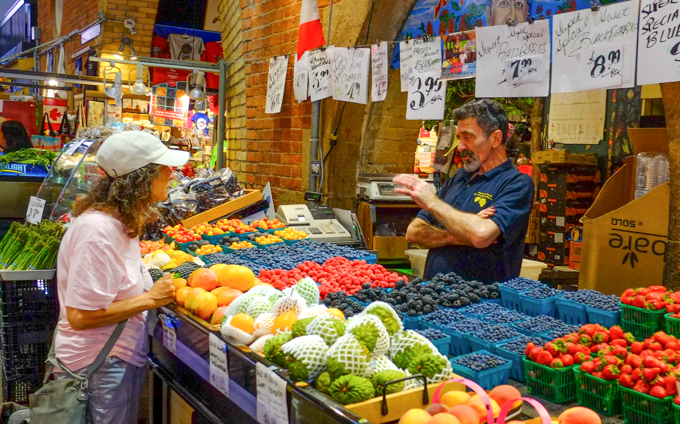

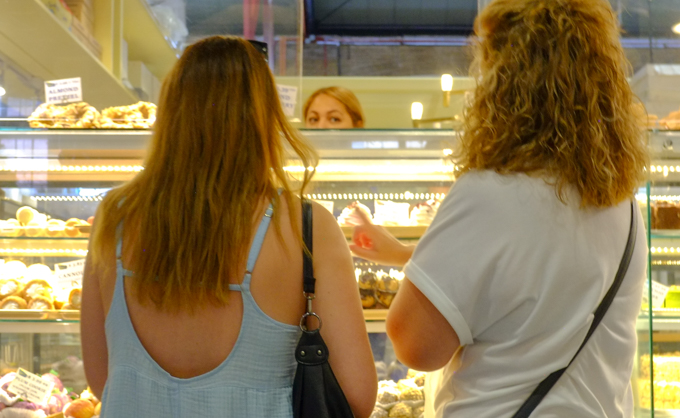


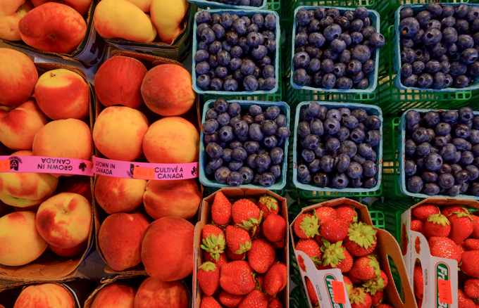
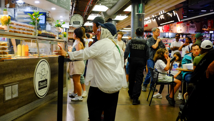

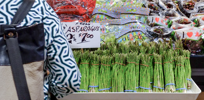


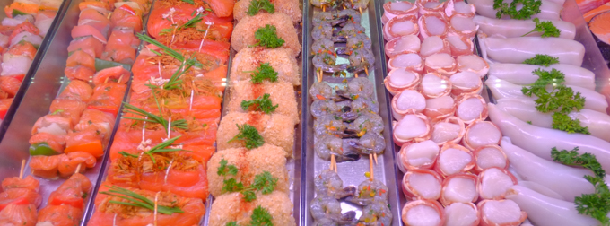


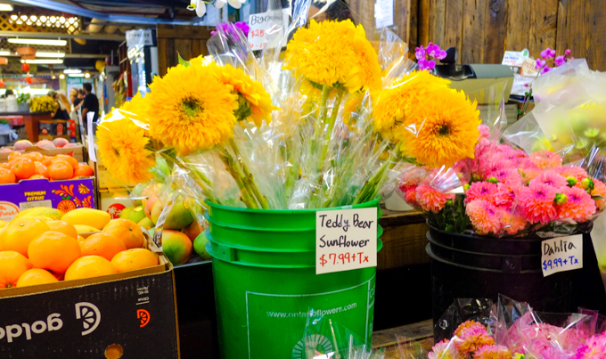

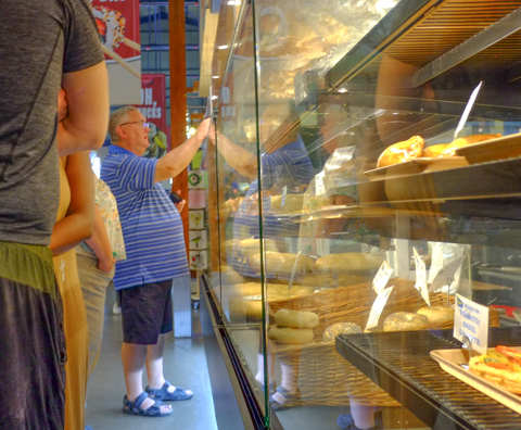
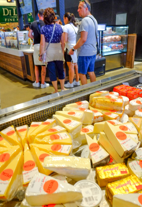

A few scenes from the St. Lawrence Market on a busy summer afternoon

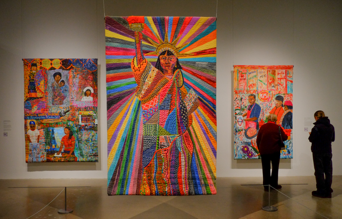
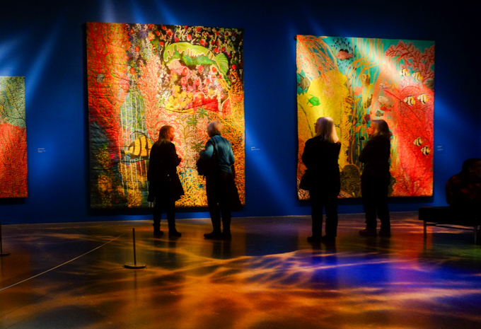
Pacita Abad (1946-2004) was born in the Philippines. During the Marcos regime, she left Manila intending to study law in Spain. Instead, she ended up in the USA.

below: “Old Dhaka” (Bangladesh) 1978, oil on canvas

Many of the artworks that were on display were large-scale hanging trapuntos, a form of quilted painting made of stitched and stuffed canvas.
below: The central piece in this image is “LA Liberty” 1992. Here Abad recasts Lady Liberty as an “International Lady of Color” as opposed to the very white, very European, statue that exists in New York City.
below: “If My Friends Could See Me Now”, An American Dream with all the trappings of a ‘typical’ middle class life.

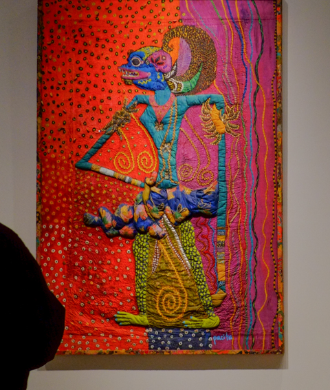
below: “Subali” 1983. Acrylic, oil, gold cotton, batik cloth, sequins, rick rack ribbons on stitched and padded canvas.


below: Many of the fabric pieces had marine themes like this very big octopus in “My Fear of Night Diving” 1985. It is 130 x 170 inches (or 330 x 432 cm).


below: Details, striped braiding sewn on to make the seaweed


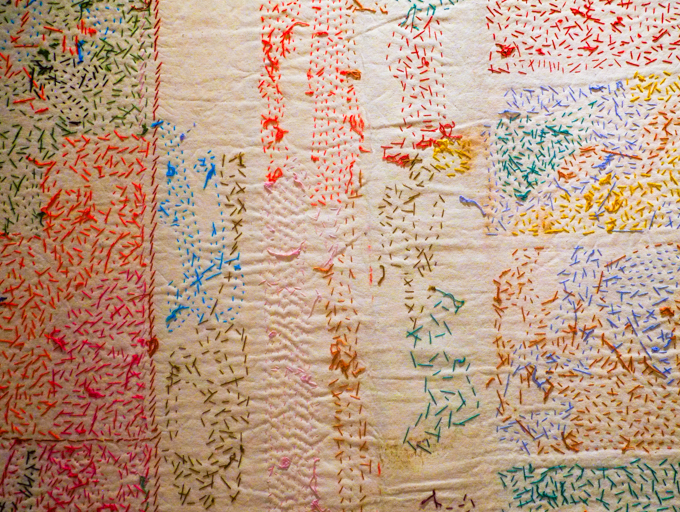
below: Some of the pieces were hung such that the stitches on the back were visible. Also interesting.
Regrettably, this exhibit closes today.
And now for something completely different.. something very yummy!
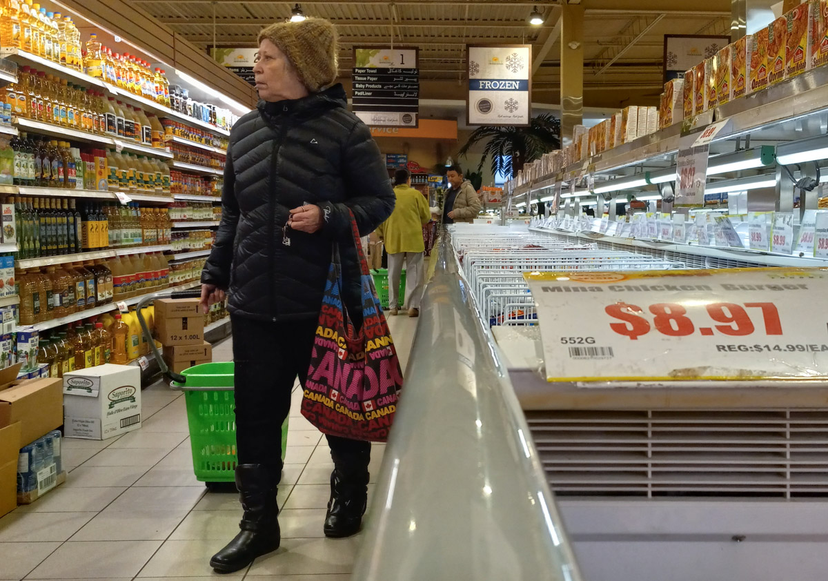
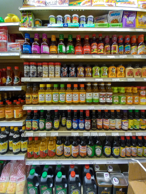
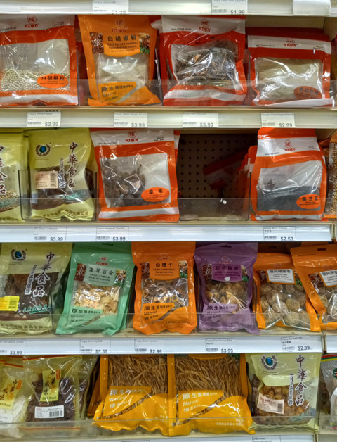
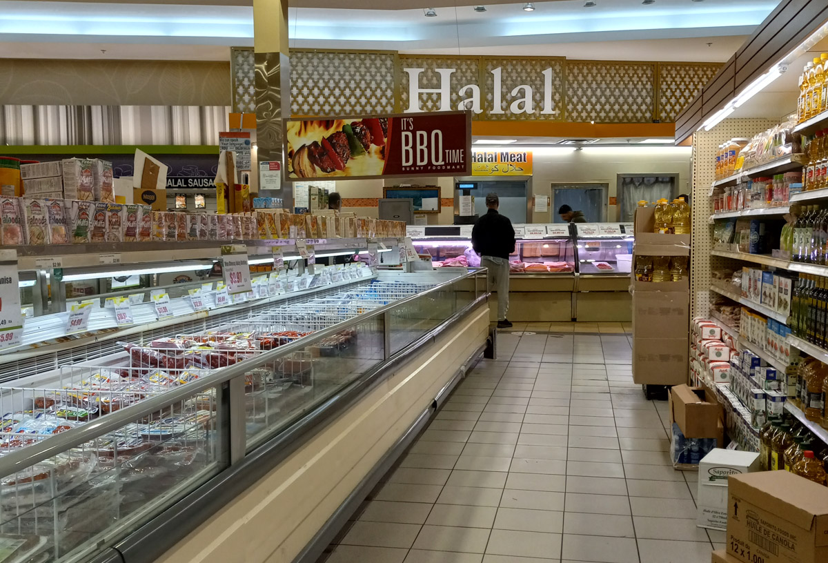
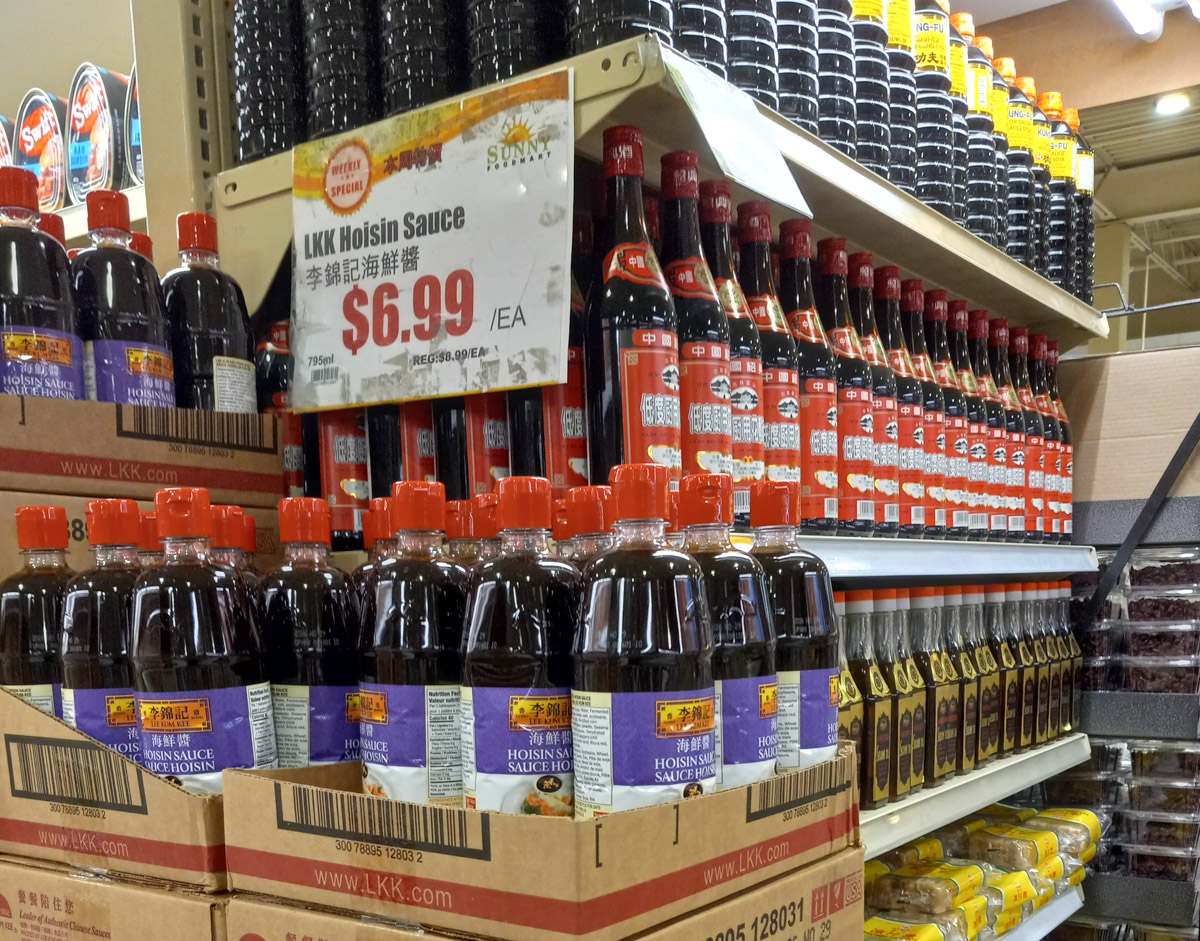
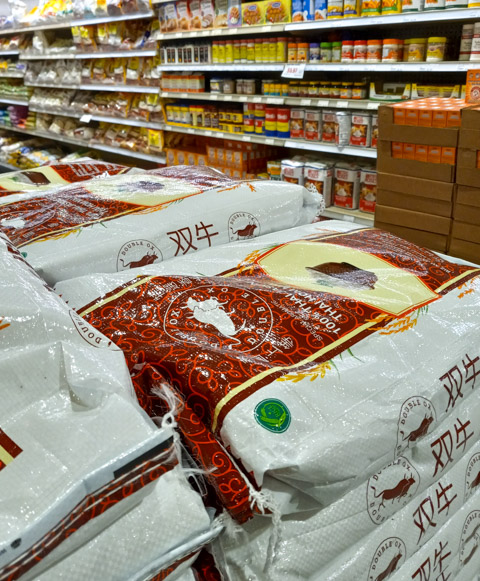
I stopped at Sunny Foodmart on Gateway Blvd because I needed something quick for lunch after a walk. I was amazed at what I saw. I have been in Asian grocery stores before but this was so much more.
below: Obviously she is over-dressed for the hot weather that we’ve had this week! Photos are from a couple of weeks ago 😄
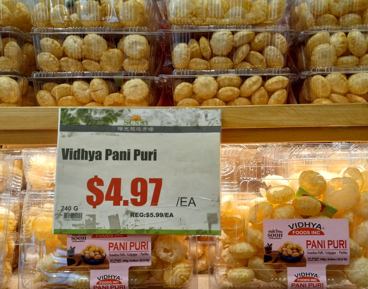
below: Pani Puri originally from India or Pakistan, sort of like samosas but round. Fried dough balls stuffed with good things.
below: Quite a selection! Wasabi, soy sauces, teriyaki sauces, sukiyaki sauces, rice vinegar, oyster sauce, and many labels that I can’t read.
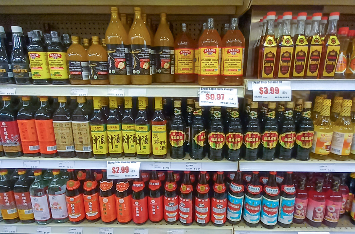
below: More bottles, more sauces. Sesame oil, apple cider vinegar, and cooking wine too.
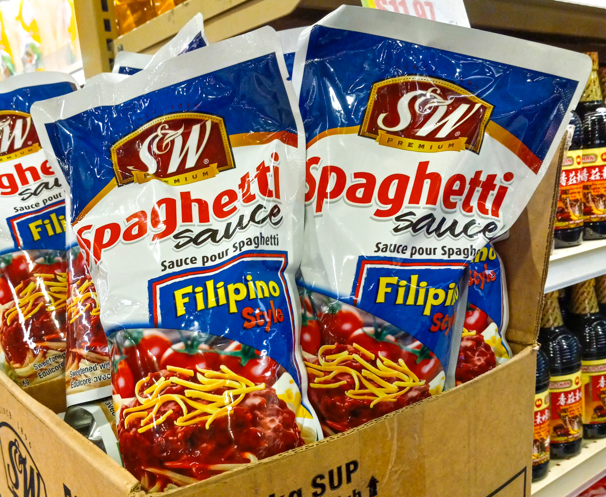
below: Filipino spaghetti sauce – I had no idea that that was a thing! And the packaging is bilingual English/French!
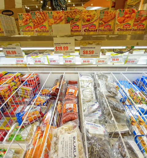
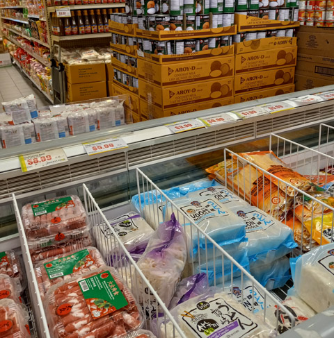
below: Chaat is another new word for me. It’s another food that originated in India and has spread as street food in many south Asian countries. In the freezer below you’ll find sausages, fish balls, Chicharon Bulaklak (pork ruffle fat), smoked herring, and dried danggit (a type of fish from the Philippines, also called rabbitfish or spinefoot fish). In case you’re wondering what ruffle fat is, it’s not actually fat… Chicharon Bulaklak is made with the mesentery (or the connective tissue that joins the internal organs together). It’s salty and crunchy apparently. No, I haven’t tried it!
below: Bags of dried hawthorn, dried orange peel, dried lily bulbs, and longan berries, along with white pepper, cardamom, and aniseed. One of bags is labelled as amomum tsao-ko which is also known as black cardamom.
below: Freezers full of goodies – corn on the cob, scallion flower rolls, assorted dumplings, and golden saba bananas (short stubby bananas from the Philippines).
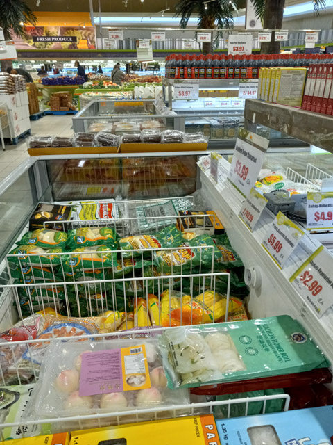
below: More frozen food – udon noodles, lamb rolls, lobster rolls, and bean curd. Boxes of coconut milk are stacked on the other side of the aisle.
below: That’s a lot of hoisin sauce!
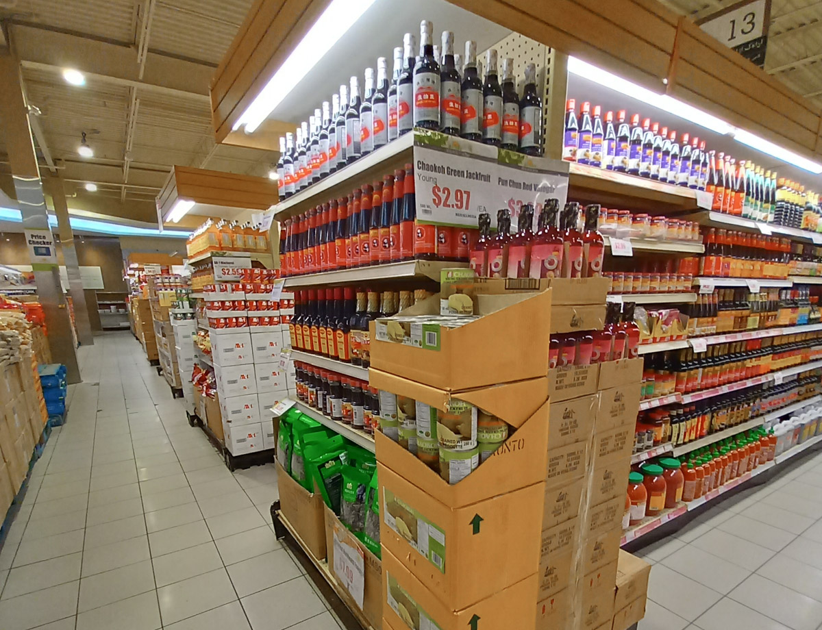
below: Floor to ceiling jars, bottles, and cans including cans of green jackfruit still in the box.
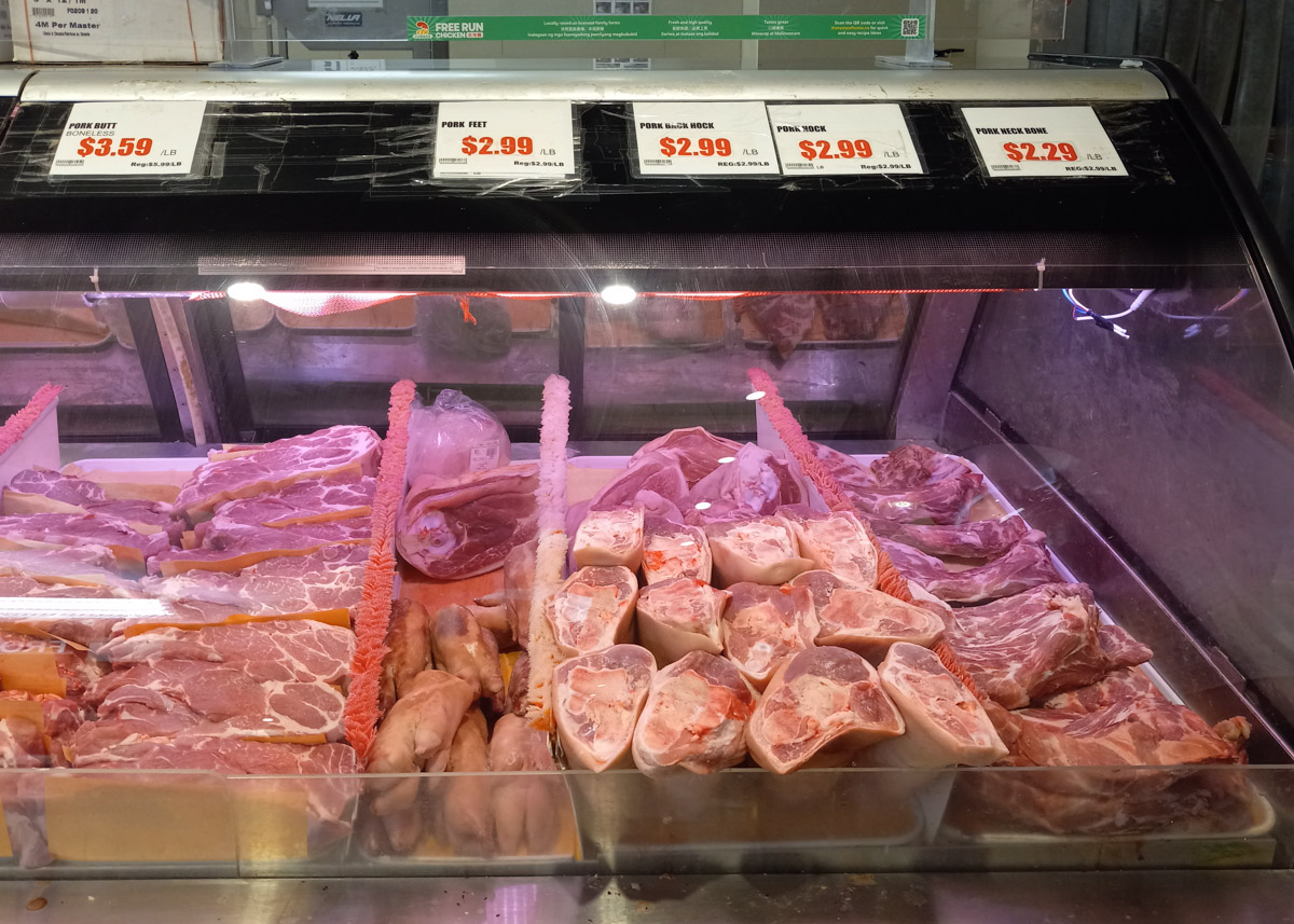
below: Pork pieces, feet and hocks
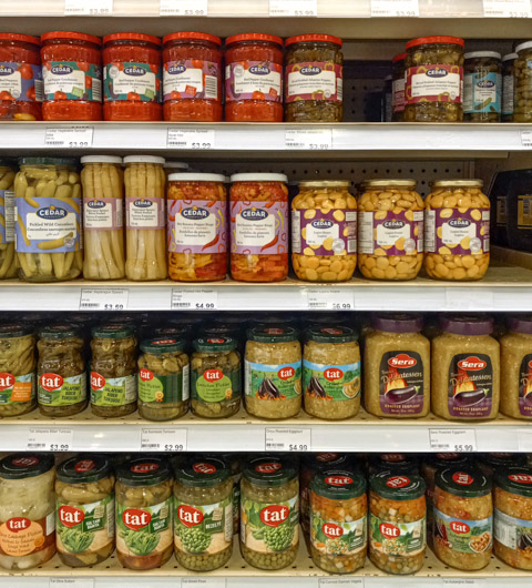
below: Colourful veggie jars. Red peppers, sliced pickled jalapeno peppers, pickled wild cucumbers, white asparagus, peas, pickled white cabbage, and roasted eggplant.
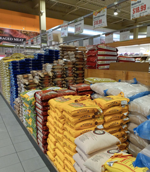
below: There were a couple of aisles of bags of rice stacked in piles on the floor. Thai jasmine rice is pictured here.
below: Marjan rice from the foothills of the Himalayas (Pakistan) as well as Basmati rice.
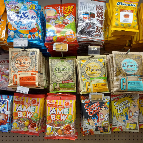
below: No grocery store would be complete without a candy section – orange, mango, peppermint and ginger chewy candies. Lollipops. Ricola in the original herbal formula. And don’t miss the Super Lemon or Super Cola candies!
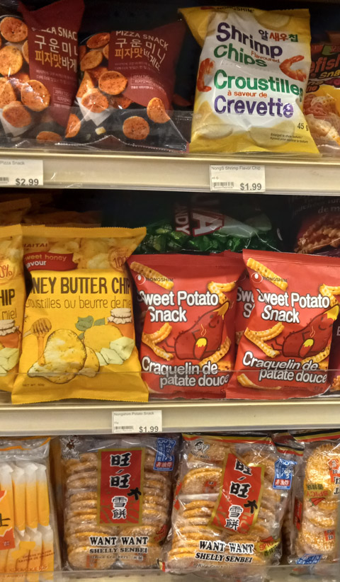
below: Pizza snacks (very Asian!) and shrimp chips. Honey butter chips and sweet potato snacks. On the bottom shelf, want want crackers – part sweet and part salty and totally yummy!
My apologies. All photos were taken with my phone so the quality may be questionable especially after reducing the resolution a little before uploading them. I hope that you still enjoyed the tour!
There has been a lot of talk about Ontario Place in the news lately so I thought that I would take some time to explore that part of the city.
below: My walk started in Liberty Village where I discovered that others are trying to promote walking around and exploring here. If you are interested, Walk Liberty is online. It is a fairly comprehensive guide to the history of the area.

below: Cut into the back of this bench are the words “Is it not the reason we are here”. This bench was designed by Jose Andres Mora was part of the Liberty Village BIA Artist Bench series from 2019. My reason? … Well, I was only passing by because it was a convenient place to have a cup of coffee before walking towards Ontario Place.

below: Comfortable shoes as we keep on walking

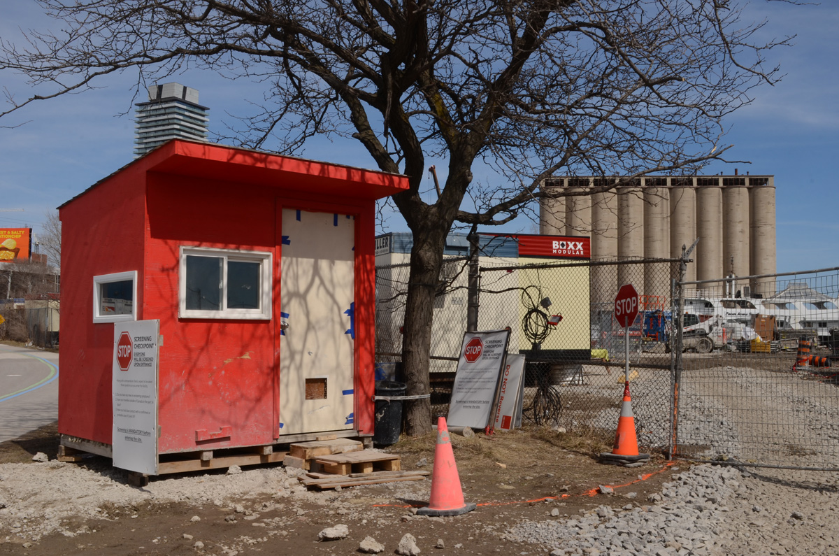
When I reached Atlantic Avenue I discovered that most of the south end of the street was now part of a construction site – both sides of the street have Metrolinx Ontario Line hoardings.

below: The Liberty Trail is closed. This sign was posted by Ontario Transit Group. They are the group who are building some of the infrastructure for the Ontario Line. There are a number of companies included in this group with the two leads being Ferrovial Construction Canada Inc., and VINCI Construction Grands Projects. They were awarded the six billion dollar contract in Nov 2022 and if you want to see a list of what that money should buy us, the information is on an Infrastructure Ontario website (while you’re there, spot the typo!).


below: Looking north on Atlantic Avenue
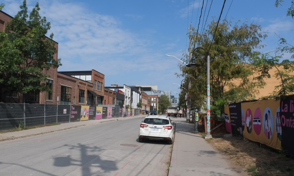
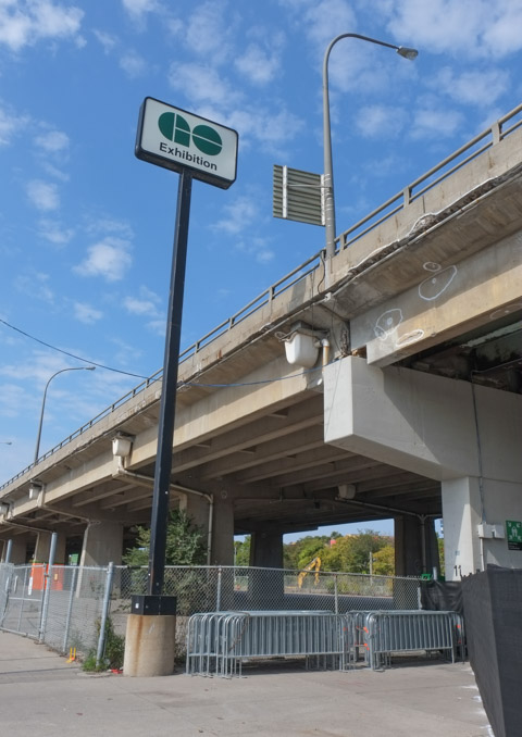
below: The Exhibition GO station is at the south end of Atlantic Ave. The new Ontario line will also have a station here. The ability to transfer between GO and TTC services here will impact a lot of people who commute from the western side of the GTA as they may be able to bypass Union Station.


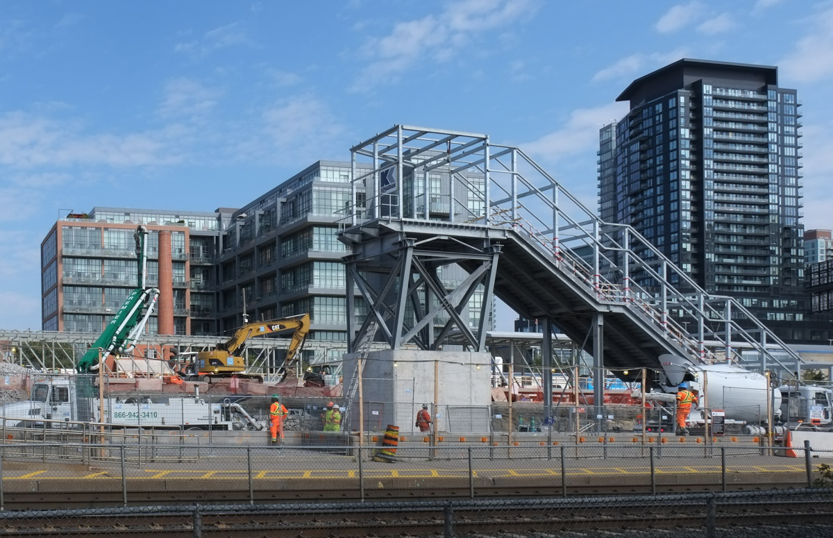
below: From Exhibition station east towards the city centre, north side. A new street that parallels the railway tracks is being built here. If the plans are correct, the new street will connect Strachan Ave in the east with Dufferin St in the west.

below: Construction on the north side of the tracks at Exhibition station where a new concourse area is being built above the tracks
below: Looking eastward from the south side

After walking through the tunnel under the tracks at Exhibition GO station, you emerge under the Gardiner Expressway, right beside the Exhibition grounds. …. And so begins Part 2. A quick note – when Metrolinx describes Exhibition station on the Ontario Line, they usually add “Ontario Place” to it, i.e. it’s Exhibition/Ontario Place station.
The first building that you encounter on the south side is the Horse Palace
below: South entrance of the Horse Palace. Three levels of government contributed to the construction of this building which opened in 1931. It is two storeys high and covers 4 acres. Originally it accommodated 1200 horses. Today it is home to Toronto’s mounted police unit.
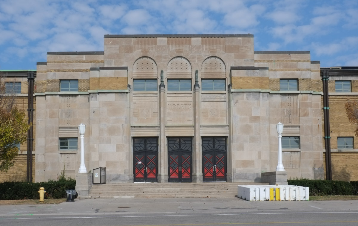
below: Horse in the art deco style, carved in the limestone facade of the Horse Palace.

In August it is busy here as it is the home of the Canadian National Exhibition (CNE) but September is another story! I didn’t see many people as I wandered around. The buildings are locked up tight.
One of the dominant features of the area is BMO field which was built as a large soccer stadium. In 2016 it also became the home of the Toronto Argonauts, the other Toronto football team.

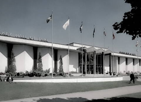
below: Mural above the entrance, gate 6 BMO Field. This mural can be difficult to see from outside because it is behind a window. It confused me at first because why is there a hockey themed picture at BMO field? – they don’t play hockey here. As I was trying to get a closer look at it from outside, a group of men walked past and one of them asked me if I needed help…. here’s the story: Once upon a time the Hockey Hall of Fame was here. When the building was demolished in 2006 to make way for the soccer field, portions of it were retained including the entrance and this mural, “Face Off” by Ronald Satok.

below: The Hockey Hall of Fame building (1961-1993) at the Exhibition. The mural is behind the glass in the entrance way.
below: Also at BMO Field is a Wall of Honour commemorating iconic moments and MLS Honours (e.g. coach of the year, MVP players, etc). Red and white are the colours of Toronto FC (Football Club) whose home is here at BMO stadium. Note: (MLS = Maple Leaf Sports, owners of the Toronto FC )

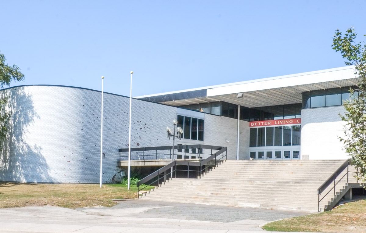
After WW2, the popularity of the CNE was booming and more modern spaces were needed. The Hockey Hall of Fame building was a great success so the Food Building (1954), followed by the Queen Elizabeth Building (1957), and the Better Living Centre (1962) resulted. These buildings still stand. All were very modern buildings for their time.
below: Food Building

below: Queen Elizabeth Building

below: Better Living Centre, symmetry of the side entrances. In the 1960s this building housed exhibits during the CNE that featured different rooms decorated with the latest trends and gadgets… like colour TVs! and other consumer goods.

below: Front entrance with its wide stairs leading to the doors as well as one of its curved walls
below: Artwork on the roof of the Better Living Centre is a three dimensional grid of steel with different coloured plexiglass panels in some of the squares.


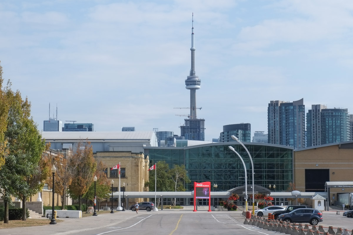
We entered the Exhibition grounds by tunnel and we will leave by bridge over Lakeshore Blvd…. so to Part 3, Ontario Place

below: Looking west from the bridge over Lakeshore Blvd

Ontario Place consists of three different areas, East Island, West Island, and the pods in the middle. When Ontario Place first opened in 1971, the eastern portion was a children’s adventure playground. Today it is Trillium Park. I didn’t go there last week, but if you are interested, I blogged about it on two previous visits (a rainy day from June 2019, and Ontario Place 2.0 from July 2017)
The middle section of the park is where you find the “pods”, the elevated structures with water below, and the marina.

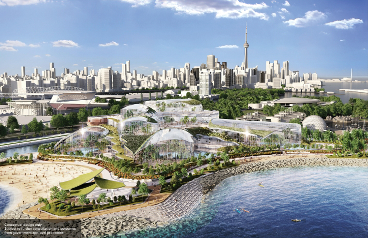
The contentious part at the moment is West Island.
As far as any plan can be trusted, this is from Infrastructure Ontario, dated April 2023. The majority of the West Island becomes covered with a 12 acre waterpark and spa to be built by an Austrian company, Therme. The majority of that is housed in glass buildings.
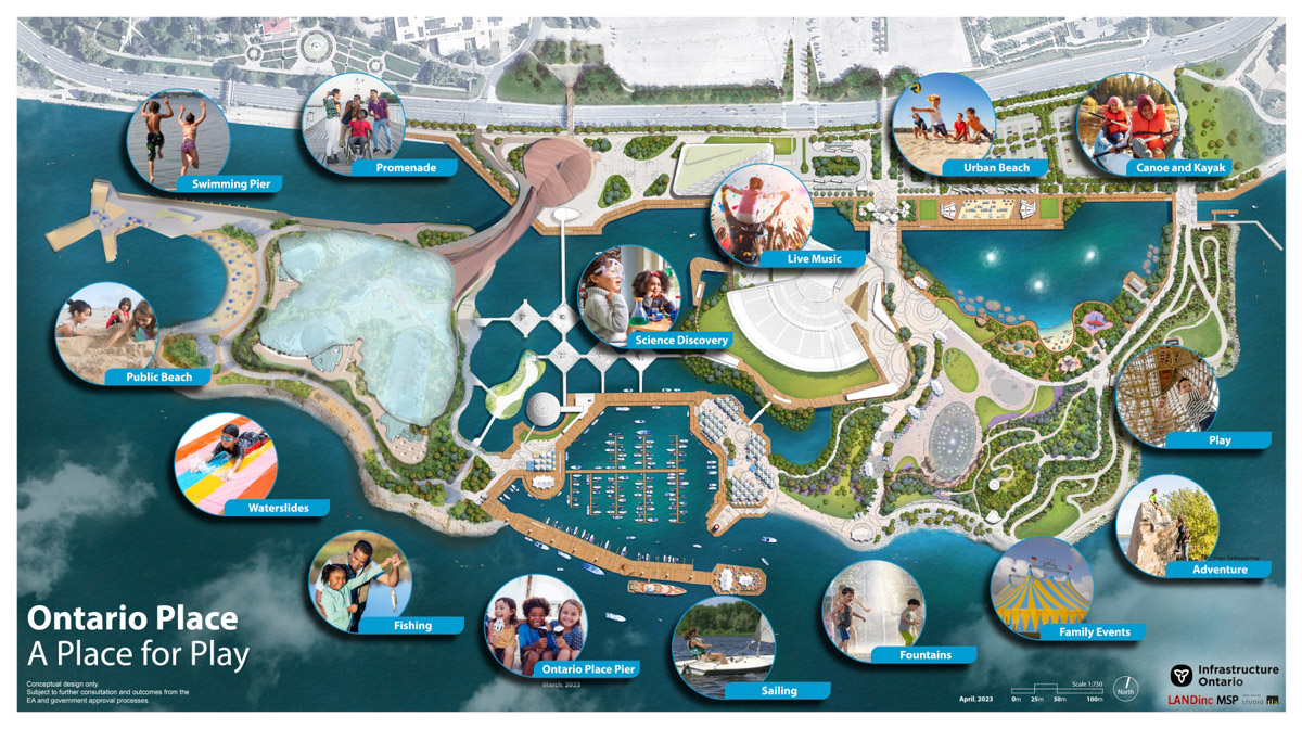
This is a conceptual drawing from Therme’s website. That’s a lot of glass. If you know West Island, you’ll realize that this drawing looks nothing like it. That’s because everything is to be removed, leveled, and a lot of landfill added.
Already gone is a bell, the Goh Ohn Bell. This is the Japanese Canadian Centennial Temple Bell. I took this picture on the 20th of Sept and by the 25th it was gone. Despite a protest on the weekend, it was removed to storage. The Temple Bell was installed in 1977 in a structure designed by Raymond Moriyama (1929 – Sept 2023); it was a gift to the province Japanese Canadians living in Ontario to mark the centennial of Japanese settlement in Canada. Now it is in the way of the Therme spa. Even though the project has not been approved, the provincial government is plowing ahead.


Some say that the West Island is under used now anyhow…..
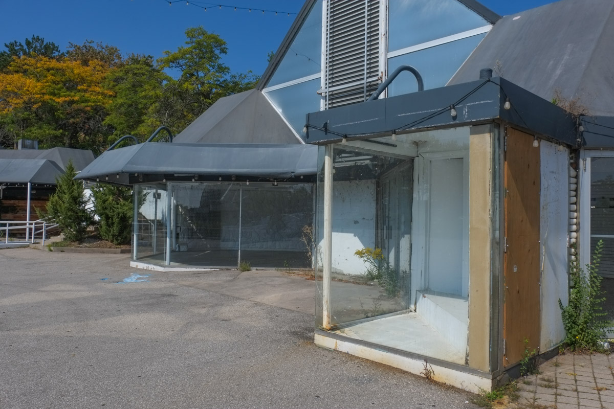
Perhaps. But the biggest reason for that is the neglect (negligence actually) that it’s been subjected to over the years.

Once their were restaurants here but they closed years ago. Their ghosts remain.
below: Pizza anyone?

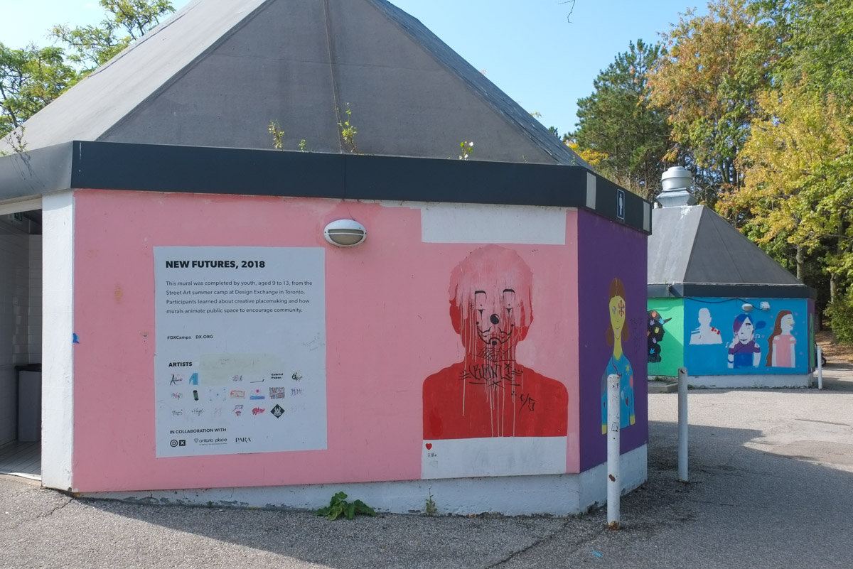
Once there were amusement rides here, those ghosts too still haunt the place.
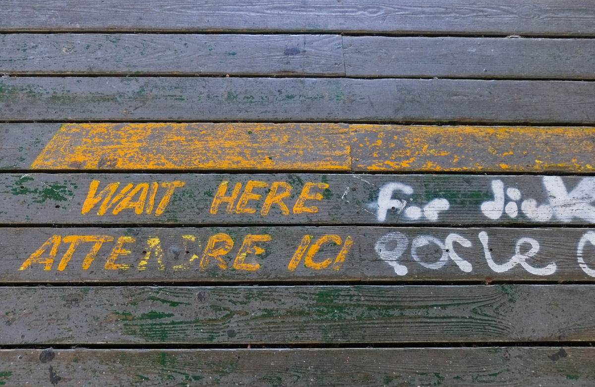
below: Yellow lines to stand behind while you waited your turn for a ride.
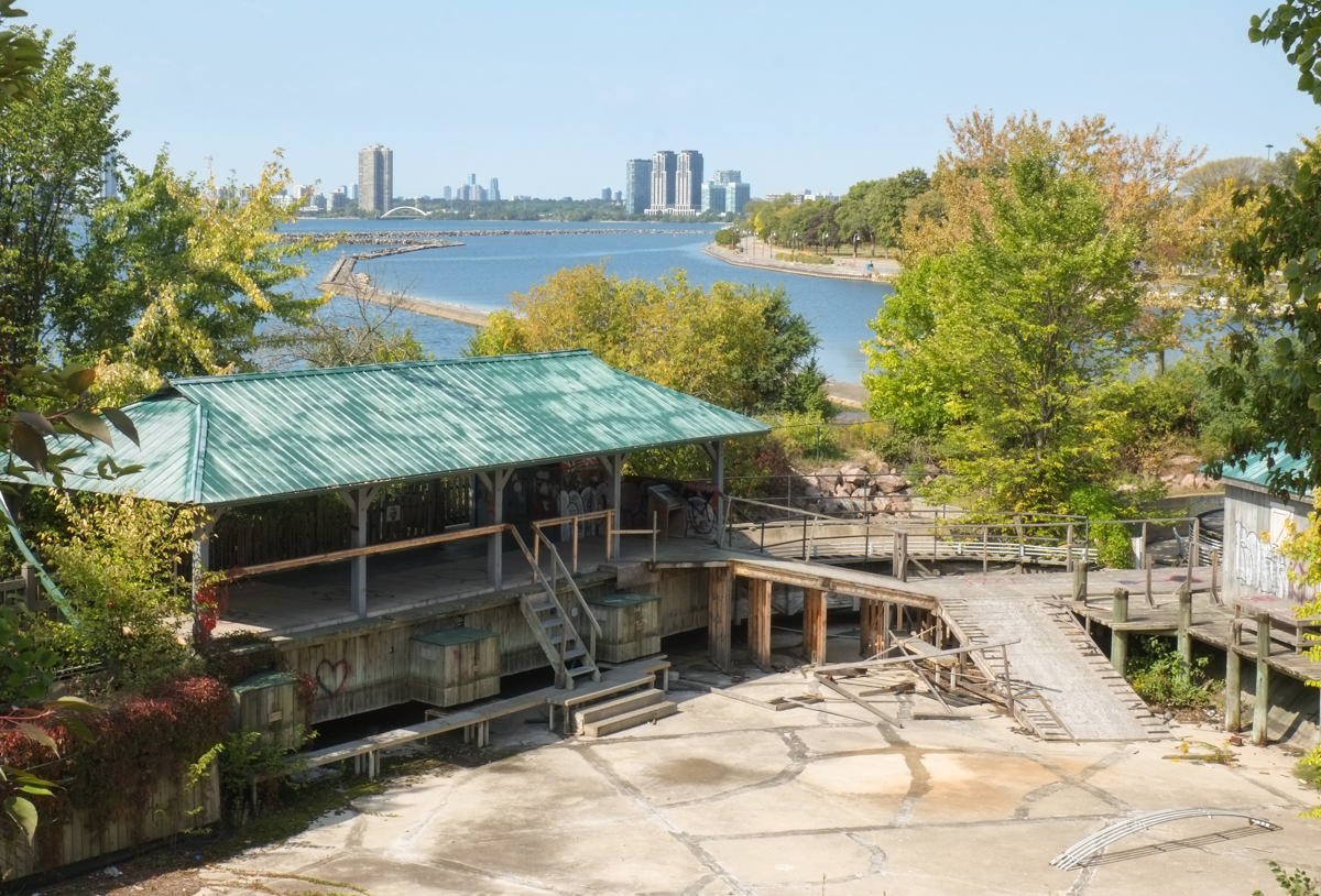
Once upon a time there was some attempt to make something of the place. Then it was abandoned and ignored. In those quiet years the beach and paths were used by those who knew about them. It became a peaceful spot.


Unknowns – there are many because there has been nothing transparent about any of the dealings between Therme and the provincial government. Therme gets a 95 year lease but what are the terms? The provincial government is going to pay for an underground (under the water table!) parking lot for 2000+ cars apparently. They will also be responsible for all those little details that you can’t see – like where does the water go when you flush the toilet? – those little pesky things. Rather than go into more detail here, I highly recommend John Lorinc’s article in Spacing magazine, Below Grade Scandal
Not everyone is happy with the plans…..

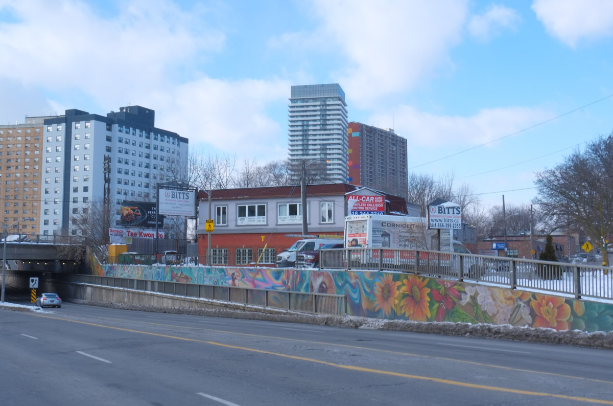
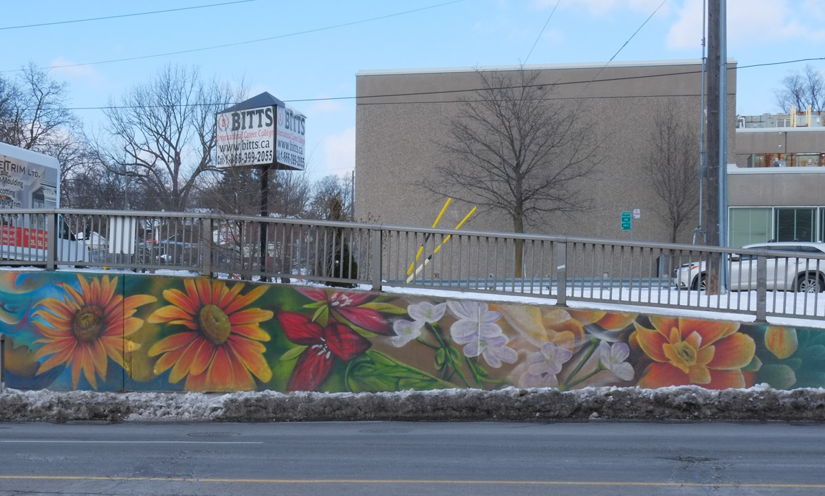
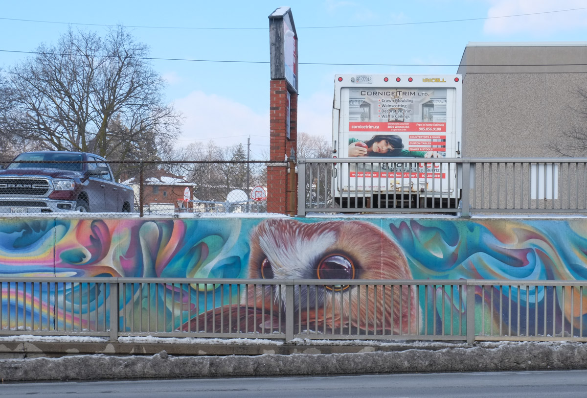
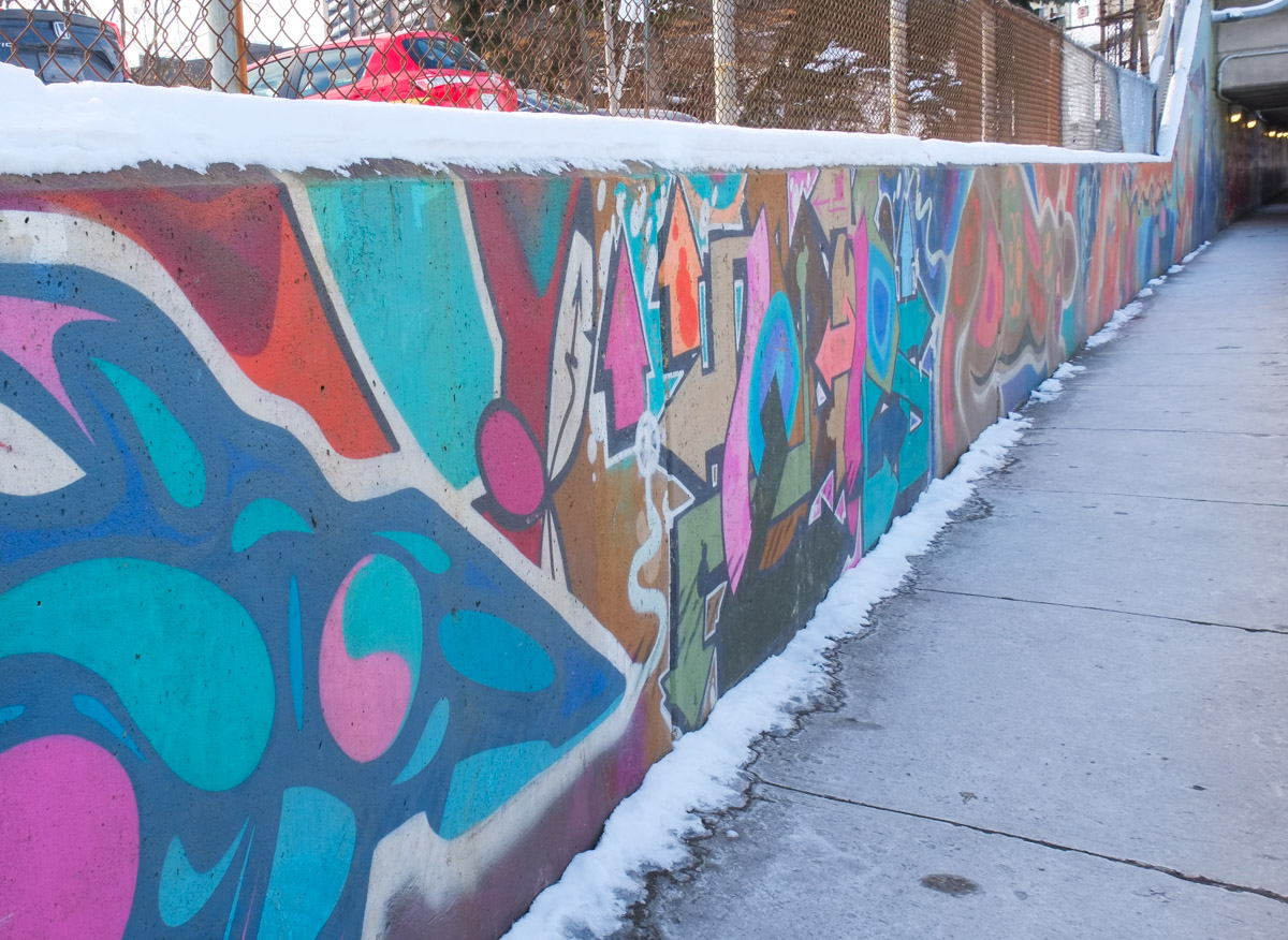
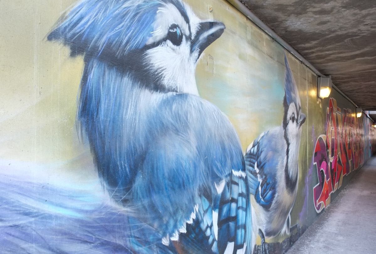
There is a railway bridge over Lawrence Avenue West just to the east of Weston Road (close to Weston UP Station). The walls beside the sidewalk on both sides of the underpass have been painted with street art designs of flowers, birds and animals. The murals are the result of a collaboration between Que Rock and Alex Bacon.


Another Weston mural – Out and About
Another recent Weston blog post – A little piece of Weston
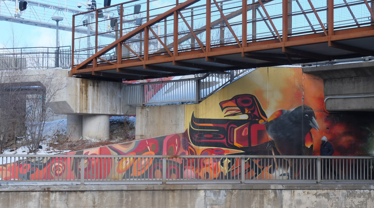
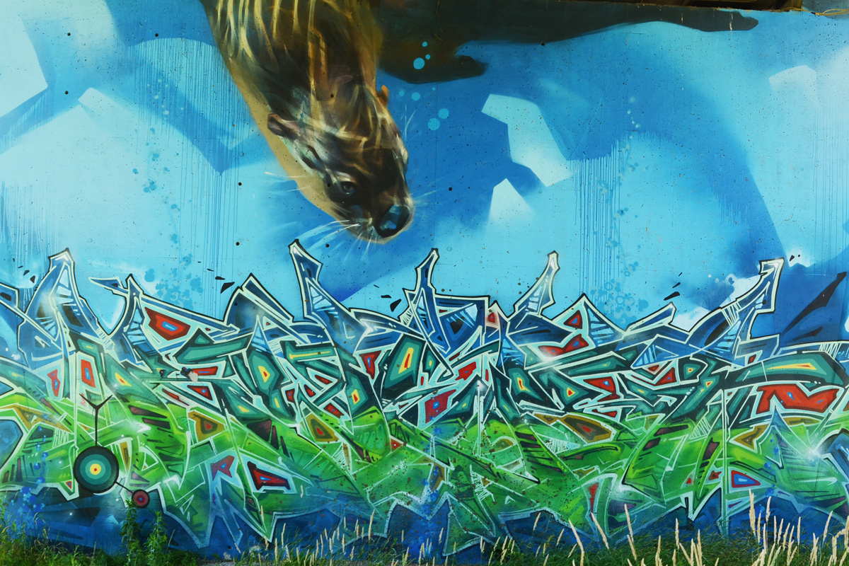
The TTC subway tracks cross above the Humber River at Old Mill station. The concrete pillars that support the subway bridge have been covered with many watery blue First Nations themed murals.

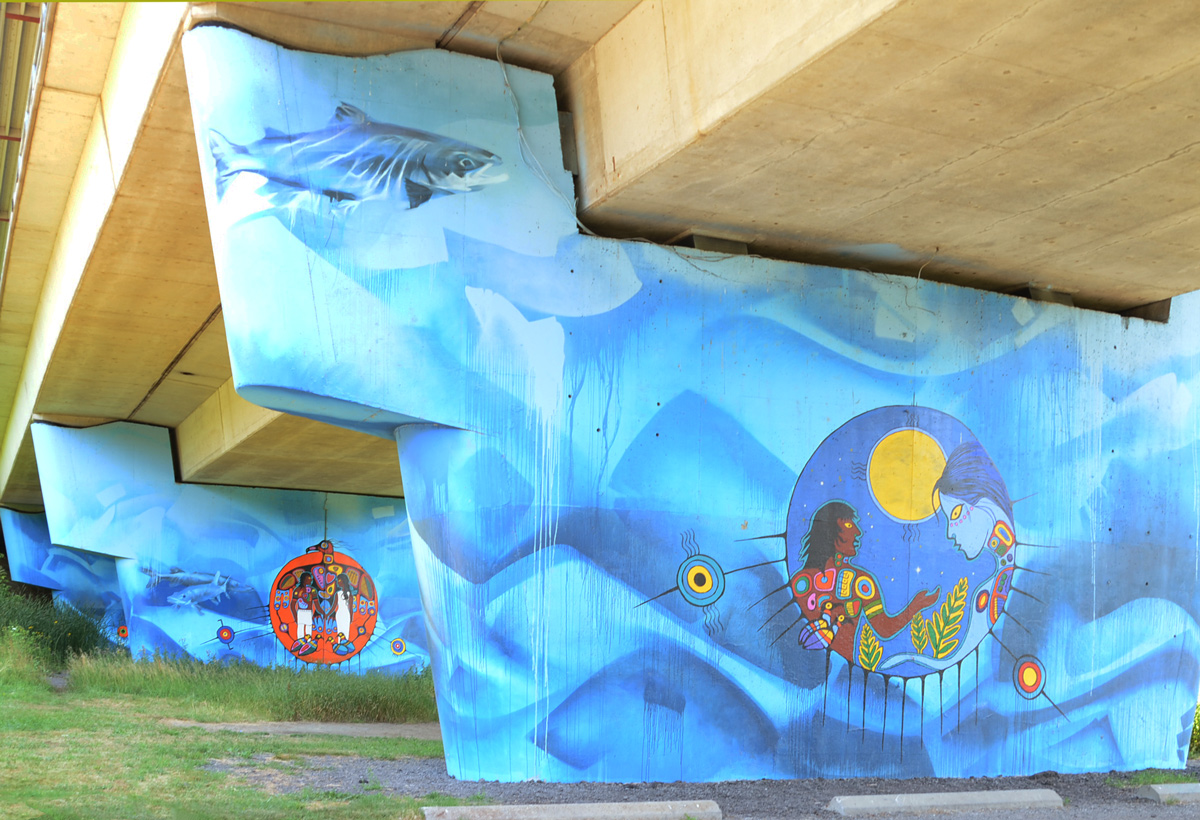
below: The artist, Philip Cote, described the story behind this image on the ArtworxTO website (see link); like all cultures, the Anishinaabe have an origin story. In the beginning there was just Spirit. “And that spirit decided to send signals out into the universe and waited for a response. And when no response happened that spirit called the signals back and said, “As you come back to me, create light in the universe”. And at that moment they had light and dark in the universe. And that is the beginning of the Anishinaabe cosmology. Everything for Anishinaabe is made of light and dark. Everything we look at has a spirit, everything, the ground, the rocks, the sand, the trees, the birds, the plants, everything is… and even our sun and our Mother Earth and the moon, they all have a spirit.”

connecting with thousands of galaxies in the universe
The blues of the water, the Humber River, were painted by Kwest. Water is the Underworld in Ahishinaabe cosmology and the Guardians of this Underworld are the fish. Another artist, Jarus aka (Emmanuel Jarus), painted the fish.
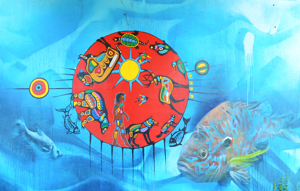
Most of the paintings have a well defined circle. This is the boundary between water and earth, between the spirit world and the physical world. But there are connections between the two worlds – all living things are connected and we are all connected to the Spirit World.


These pictures also appear on another blog, Eyes on the Streets
Let’s follow the fish! 🐟 It’s pointed east along Queen’s Quay and by coincidence that the direction I’m headed too… 😃

The seagull is not amused.


below: Harbour Square Park with “Sundial Folly” at the water’s edge. This art installation is the work of John Fung and Paul Figueiredo. It has recently been cleaned up. The sphere is hollow and there is a walkway that runs through it. An opening at the south side (water side) acts as a sundial.
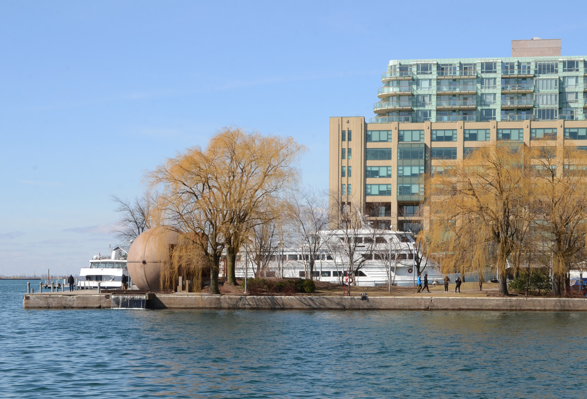
below: Looking east from Harbour Square towards the Westin Hotel tower and the park by the ferry docks.

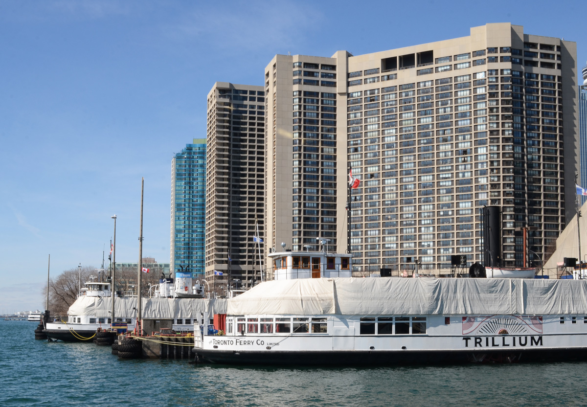
below: Tour boats and ferries still under wraps for the winter months.
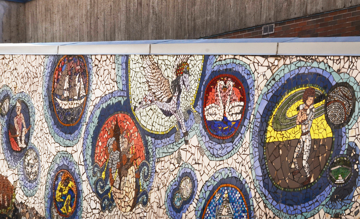
below: “Shore Stories” a mosaic located by the Jack Layton Ferry Terminal. It was made in 2012 by youth from the community under the guidance of AFCY (Arts for Children and Youth, an organization that may or may not still exist).
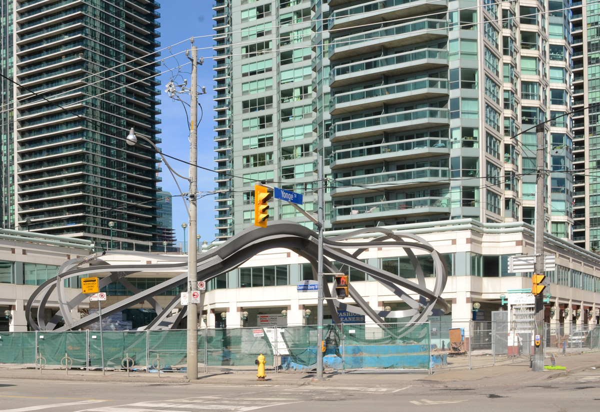
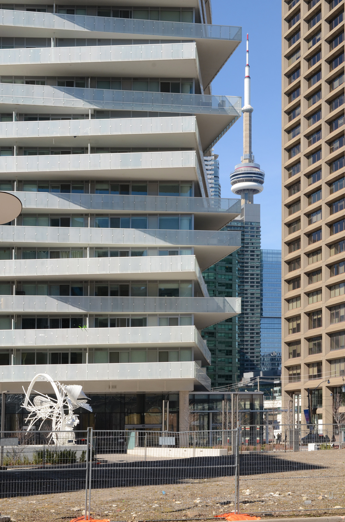
below: The “egg beaters” at 1 Yonge Street are now behind a fence. The installation is actually called “Between the Eyes”, and is by Richard Deacon.
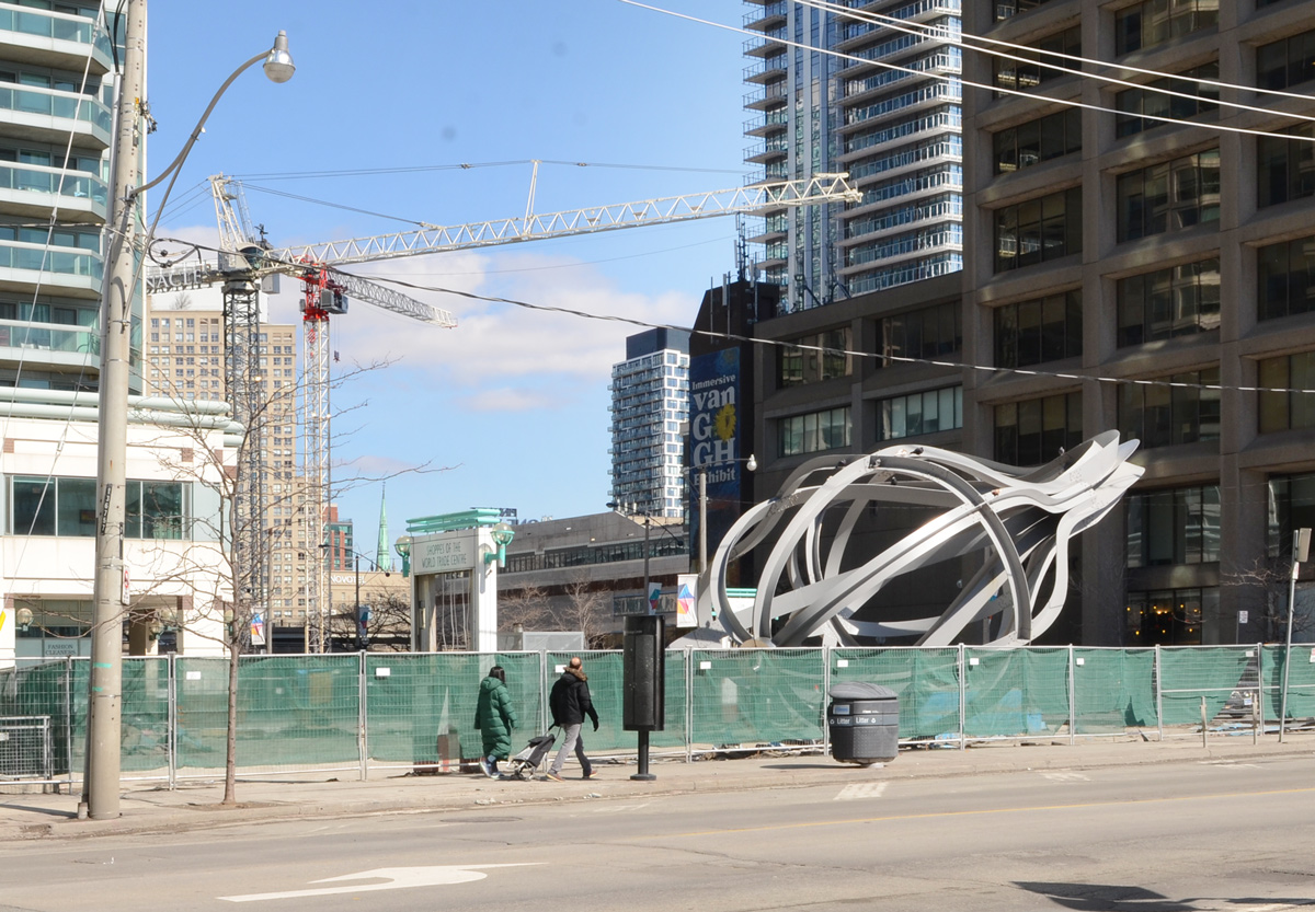
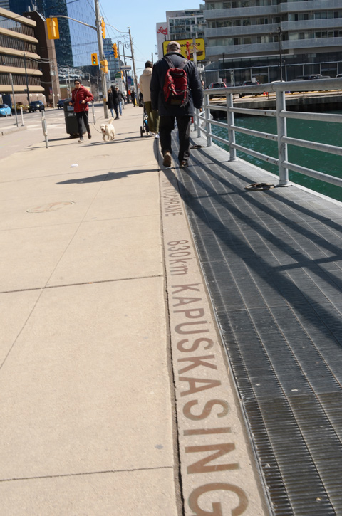
below: It’s 830km to Kapuskasing and even farther to Cochrane, just keep following Yonge Street northwards.


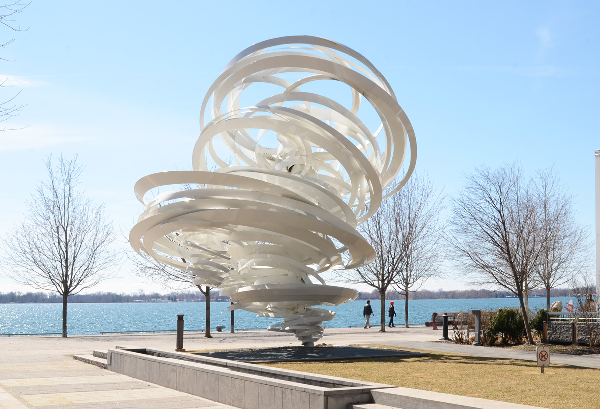
below: “A Series of Whirlpool Field Manoeuvres for Pier 27”. by Alice Aycock
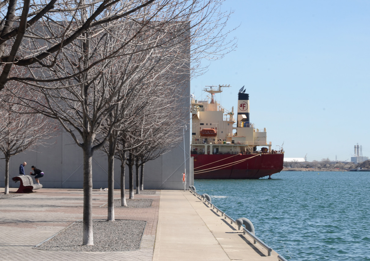
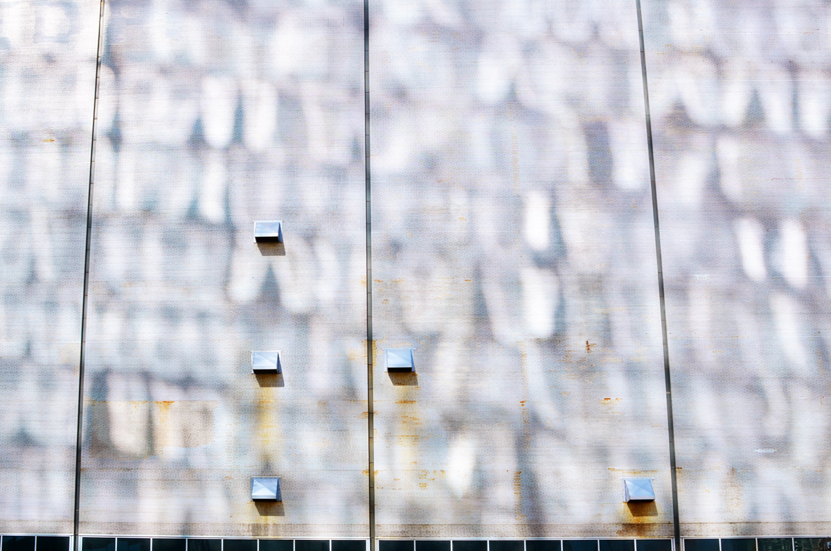
below: The walkway along the waterfront comes to an end where a very high concrete wall separates Redpath Sugar from the public space.
below: Que Rock murals, water theme, “Water Clans (Nbii Dodem)” four panels at Redpath Sugar.


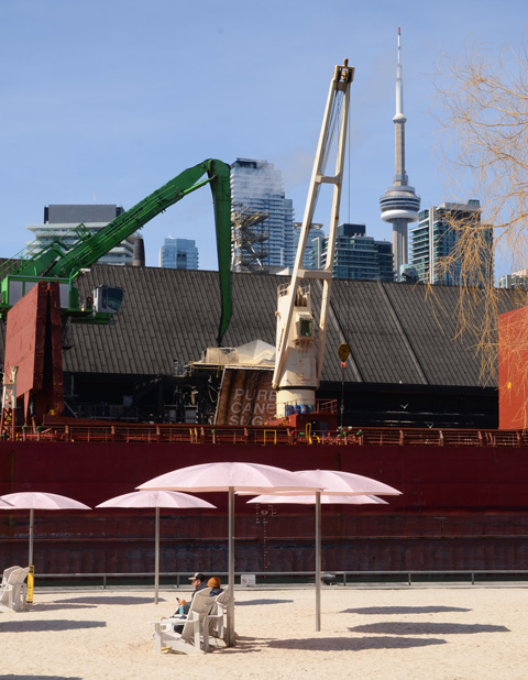
below: Pink umbrellas and sugar filled ships, at Sugar Beach.
below: Queens Quay East at Dockside

below: Sherbourne Commons


below: New construction on Queens Quay East where many parts are being made of wood. A new park, Aitkens Place Park lies between the new building and the waterfront.

below: Vacant lot on the corner of Queens Quay East and Small Street.


below: At the foot of Parliament Street.
below: Anser eyes
below: Sweet and salty at the Distillery

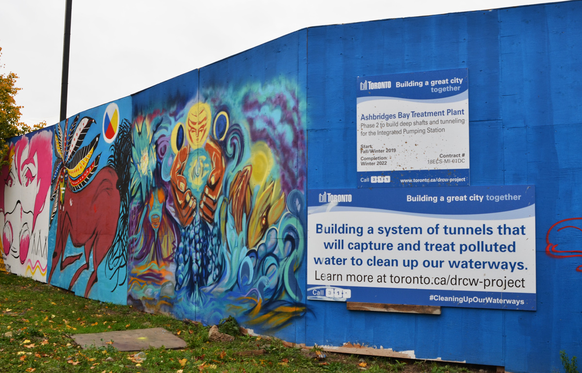
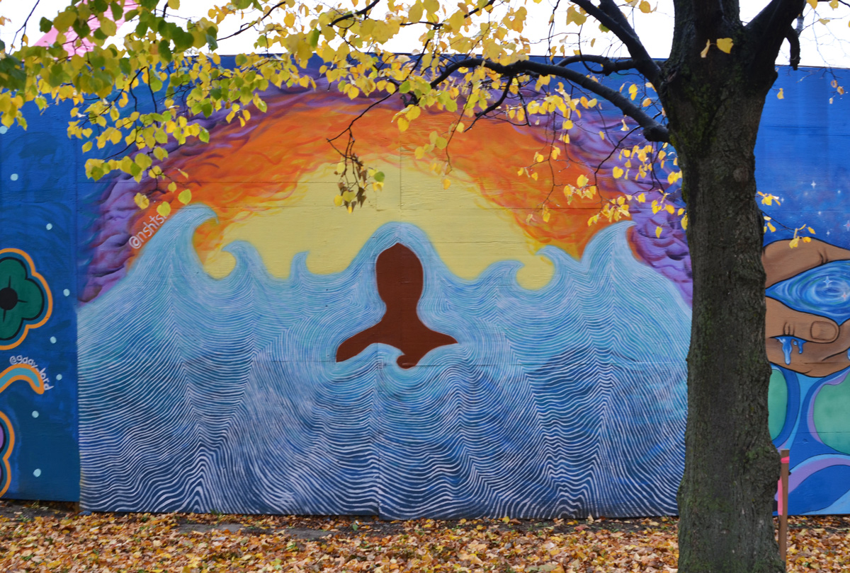
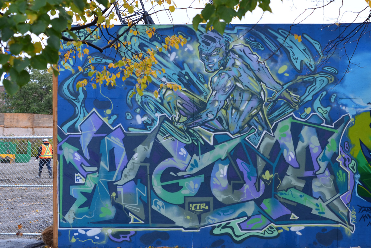
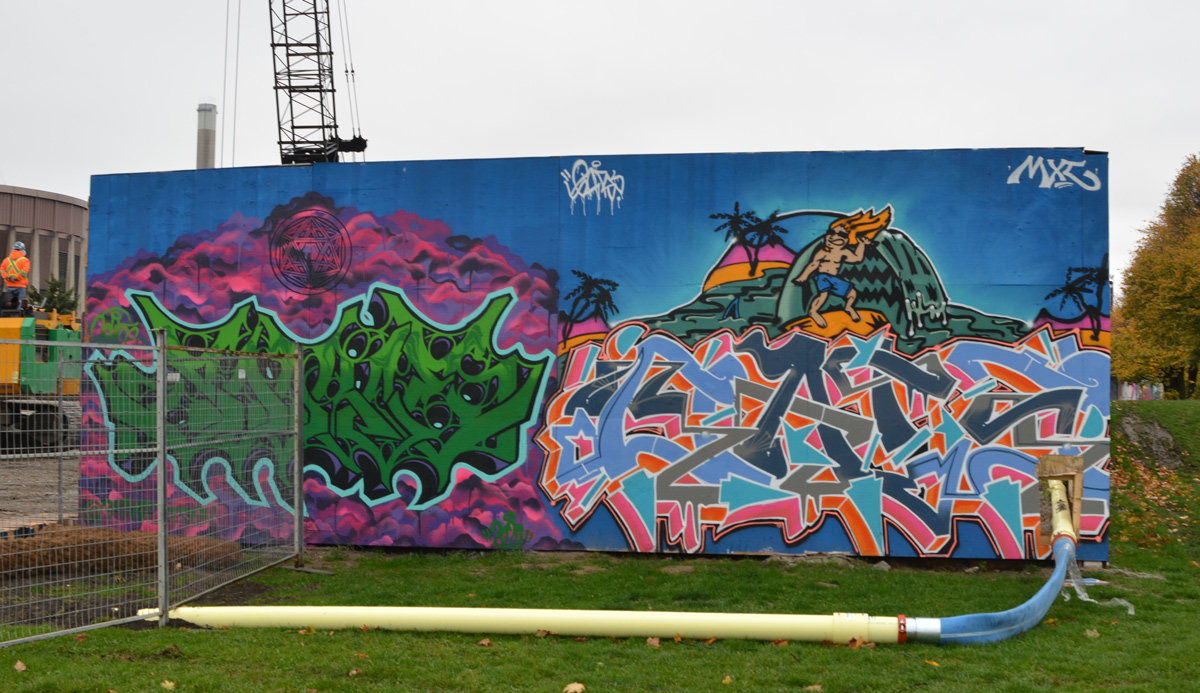
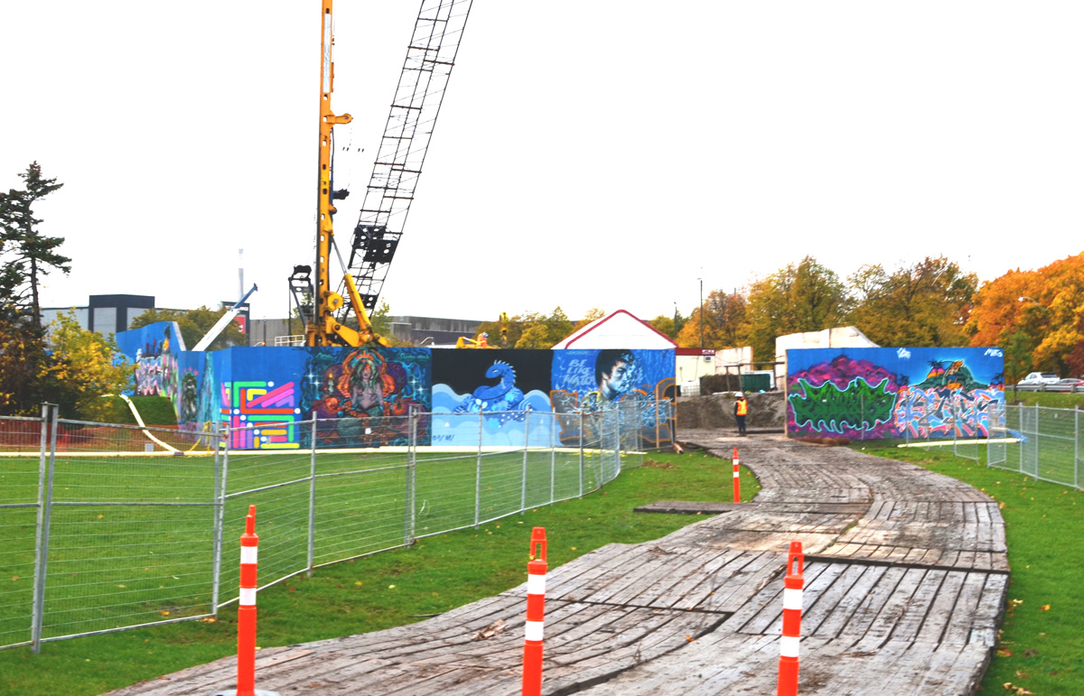
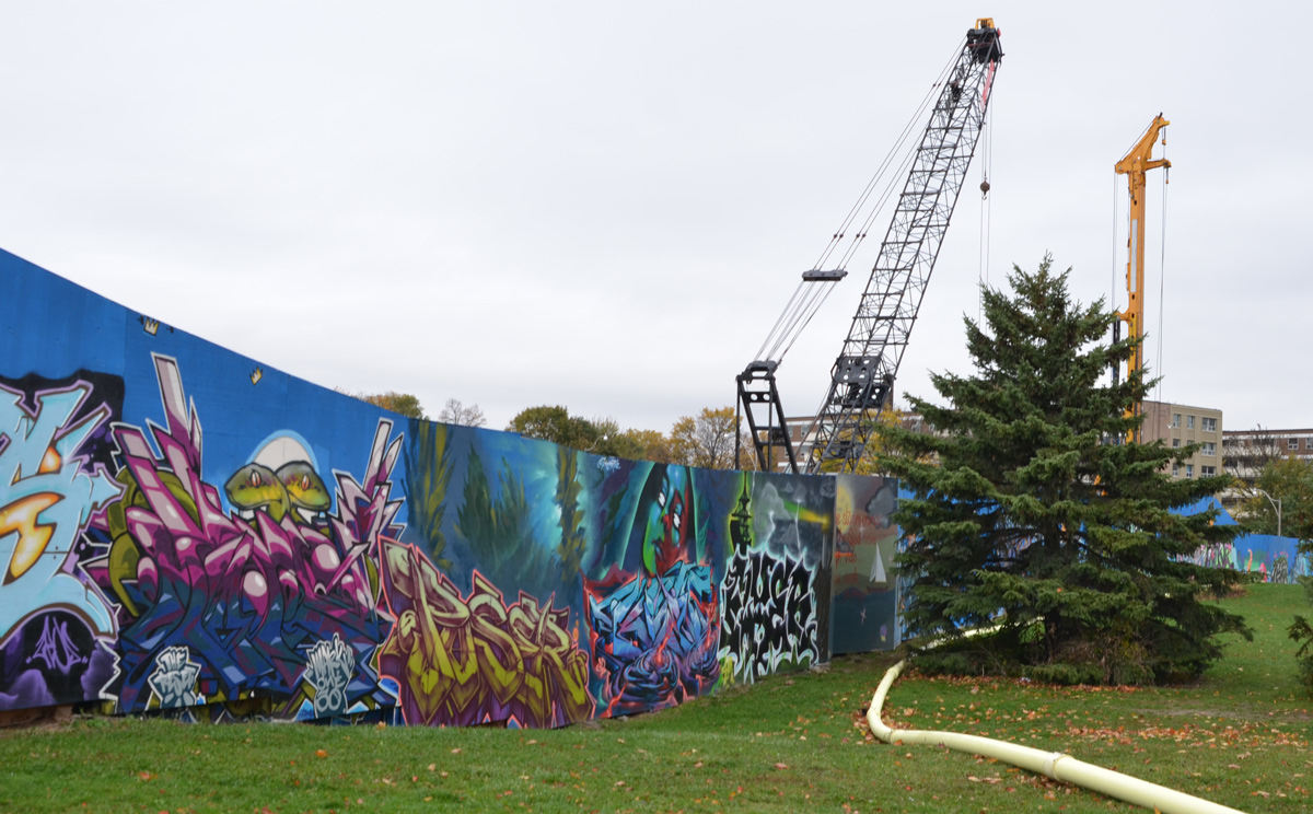
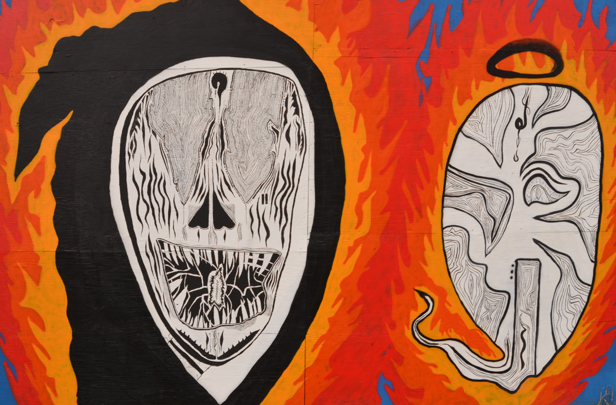
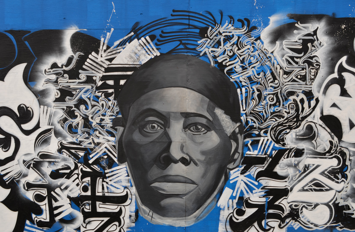
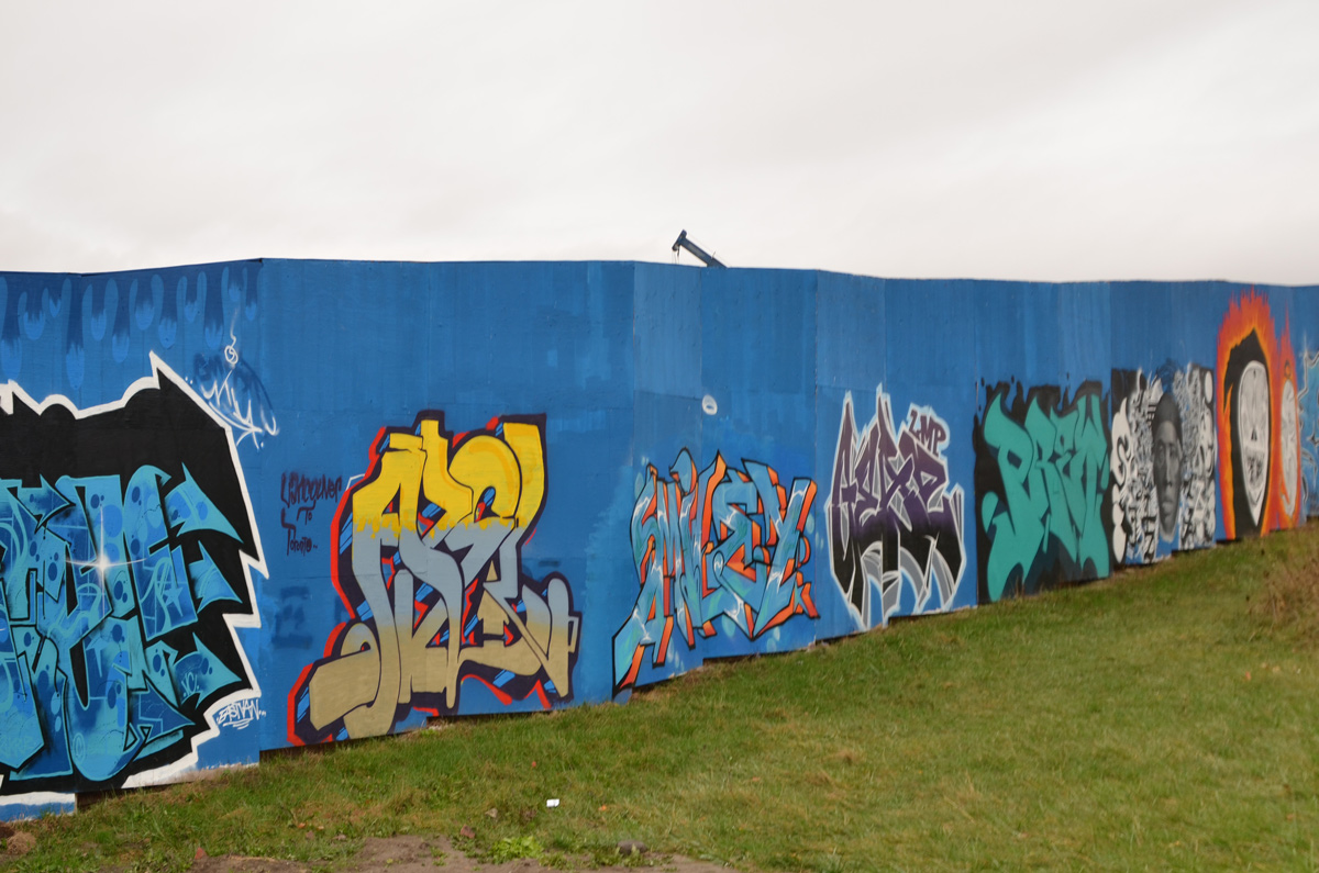
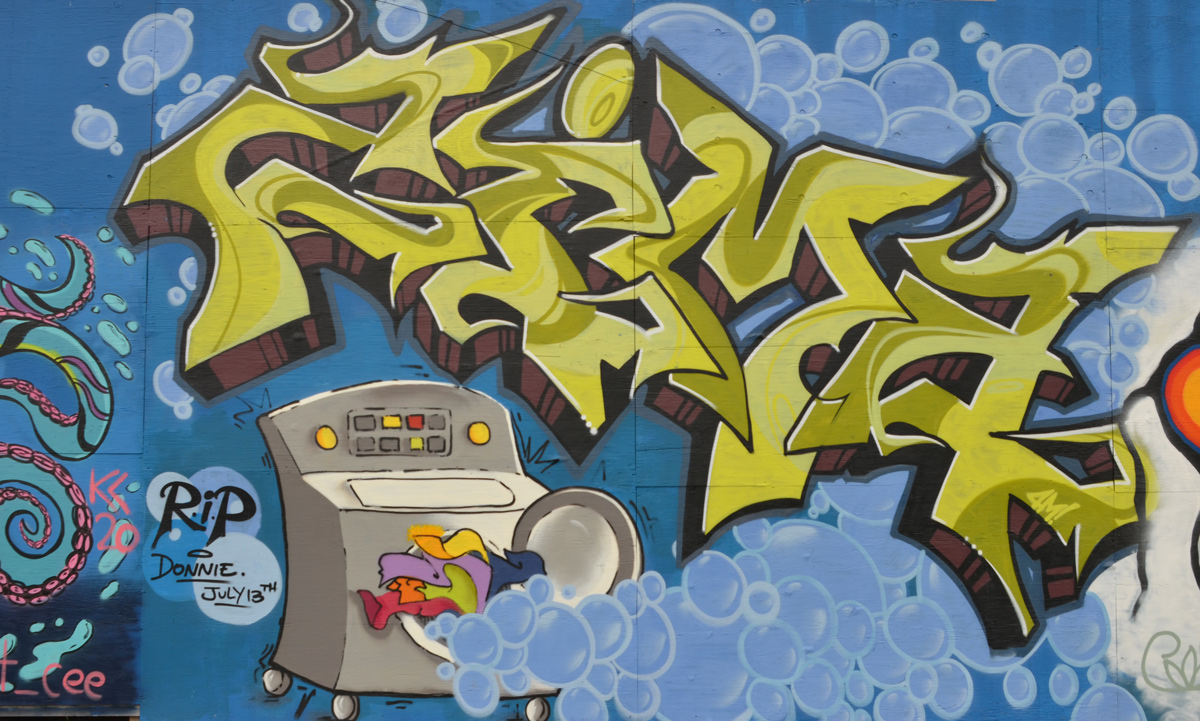
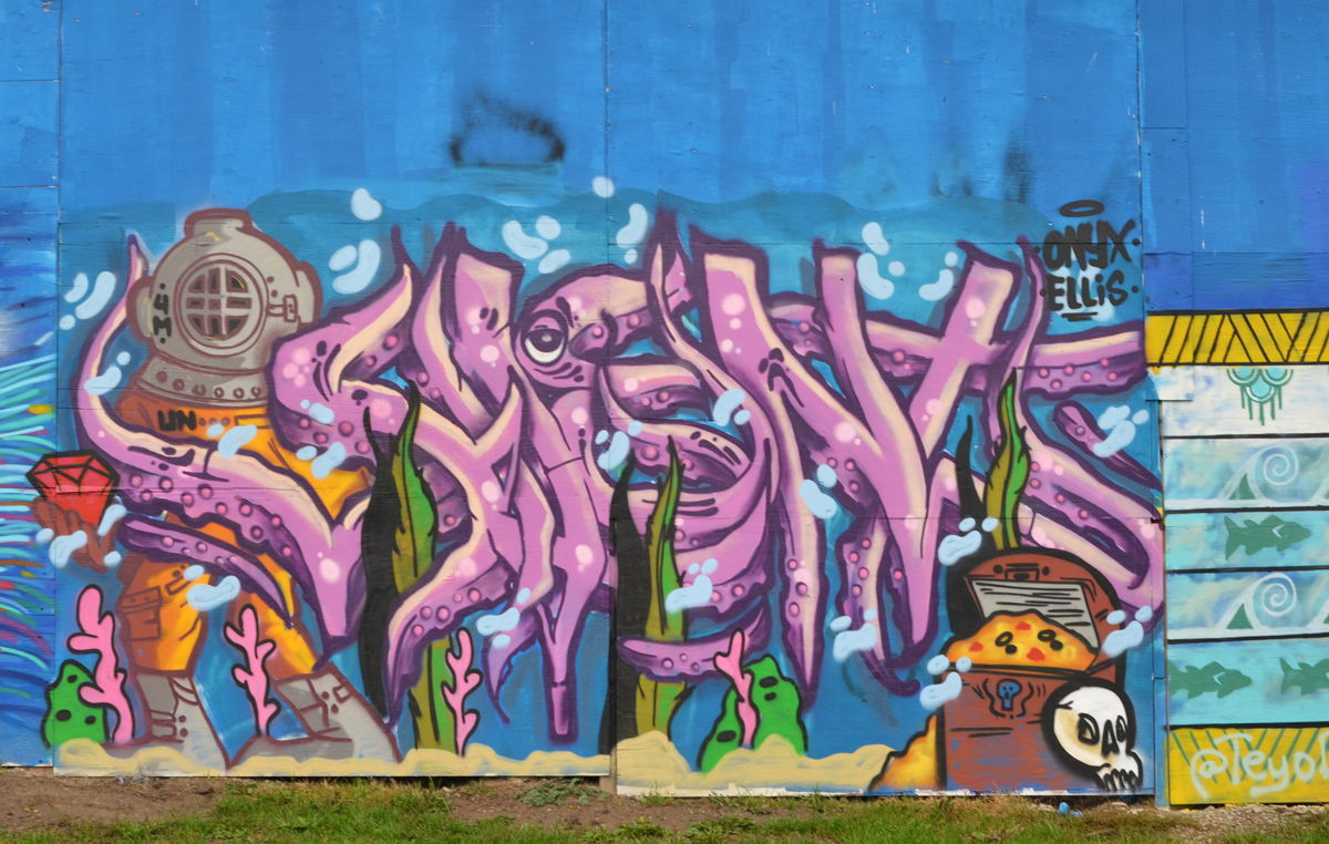
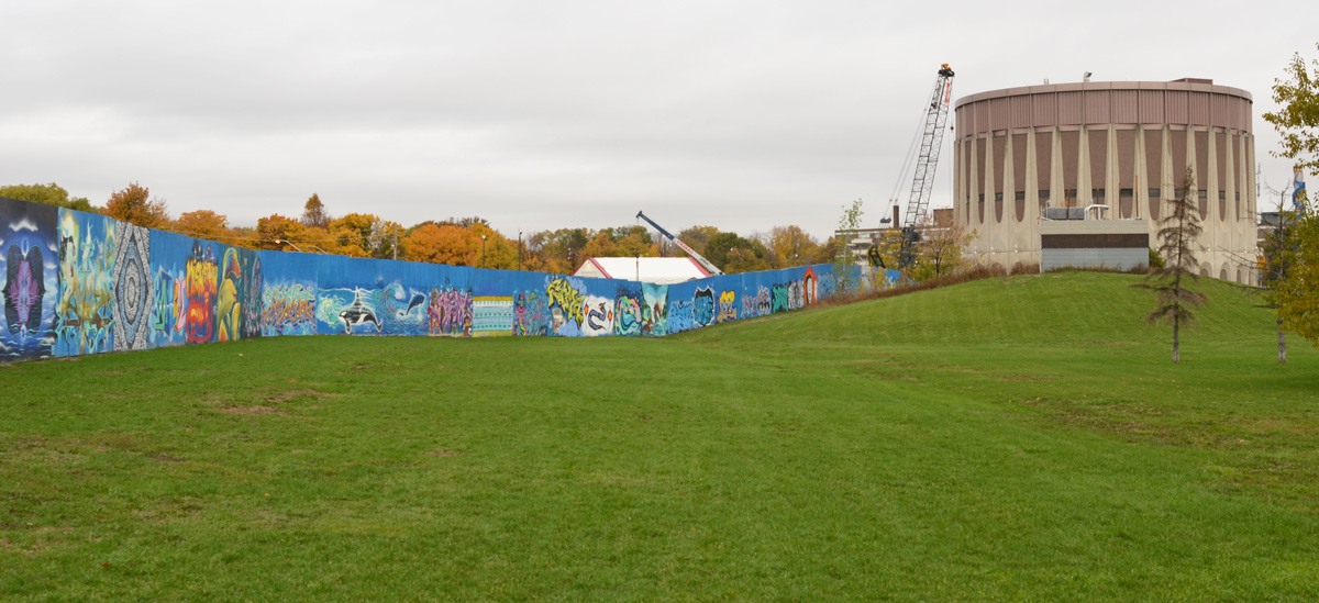
There is a large construction project underway adjacent to the Ashbridges Bay water treatment facility between Lakeshore Blvd and Eastern Ave. The whole site is surrounded by plywood hoardings. In mid-September, Wallnoize 2020 took over the area and painted water themed murals on a large portion of the hoardings. More than ninety artists participated in this project, all coordinated by Cruz1.
Let’s take a walk around the site, starting by walking east on Eastern Avenue towards Coxwell, south across the park, and then back along Lakeshore. I suggest that you’re sitting down since I tried to cover all the murals and it might take a while!
below: Painted by Danielle Hyde

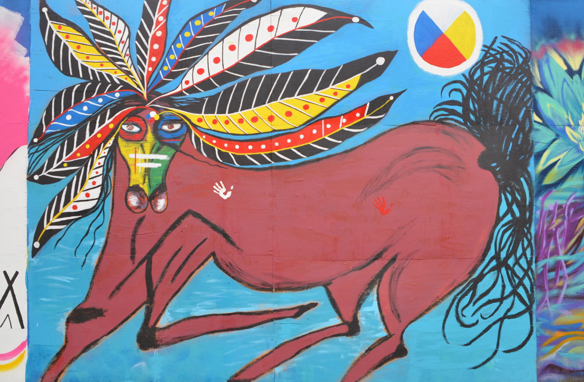
below: Trina Moyan‘s horse has a mane like many brightly coloured feathers. “‘Water Spirit Horse’ – Nehiyaw Mistatim (Plains Cree horse).“
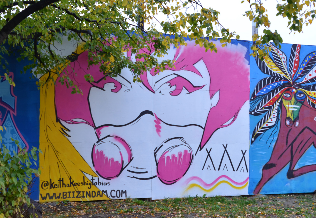
below: Portrait of a street artist in pink and white by Keitha Keeshig Tobias
below: by Siezswift

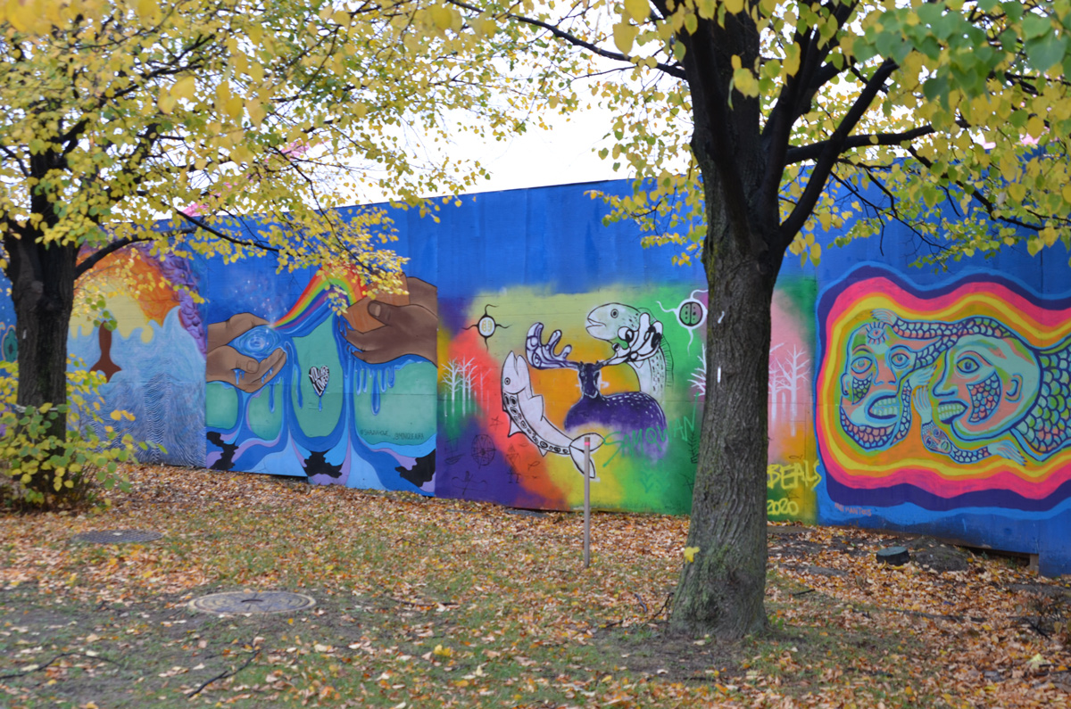
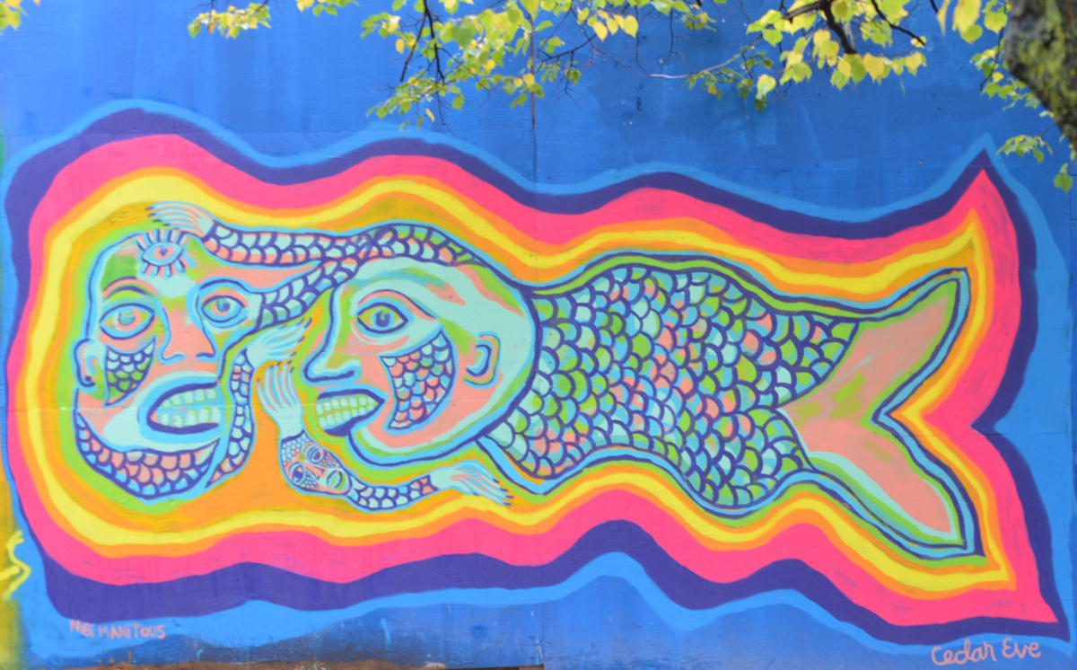
below: ‘Nibi Manitous’ by Cedareve. The water spirits are are shapeshifting between human and animal.


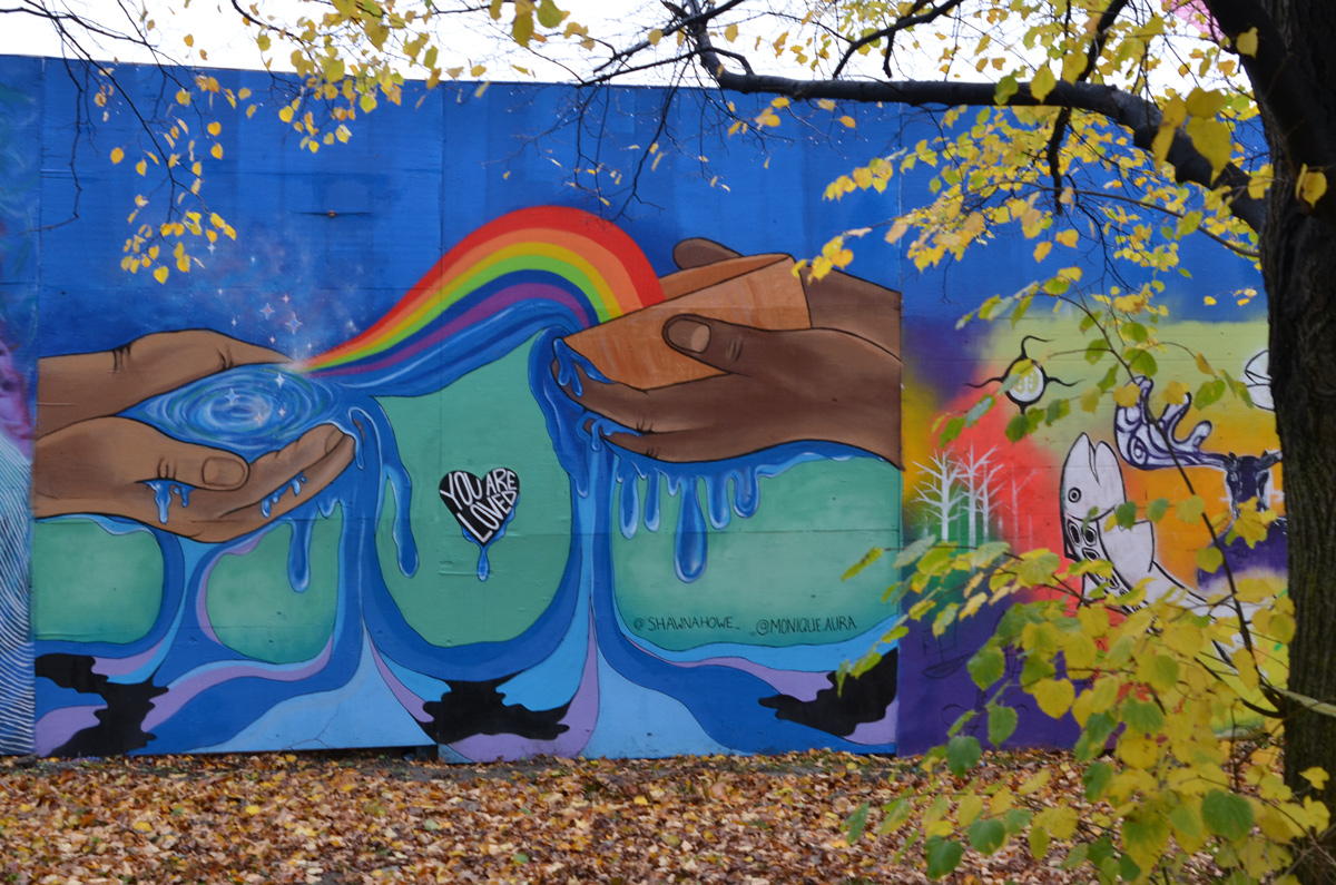
below: “You are Loved” in a heart dripping with water in the center of a mural that is the product of the combined efforts of Shawna Howe and Monique Aura. Rainbows and dancing stars.
below: A head in the water by Shina
below: Bird and flowers by Jennifer, her first solo piece

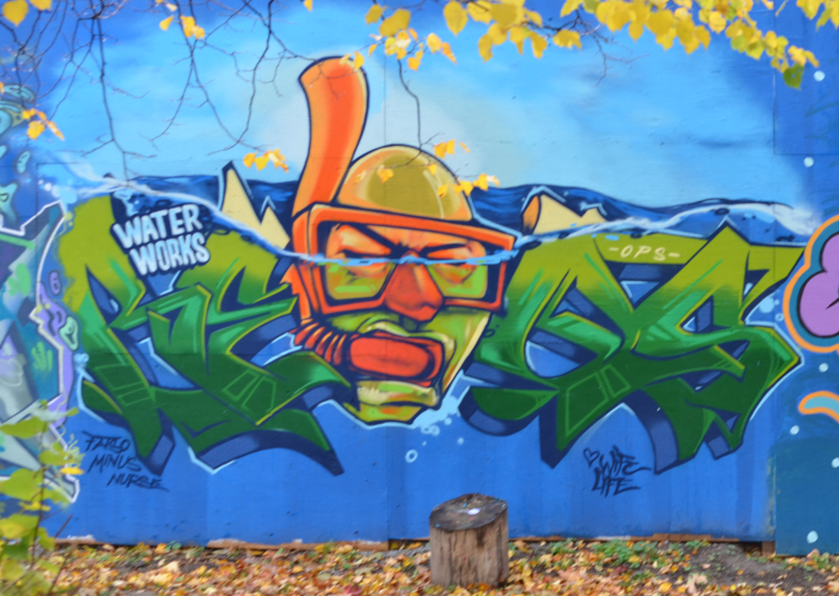
below: This picture of a bald man snorkeling was painted by still_hungry
below: He looks like he’s made of water and he looks like he’s on a skateboard. Painted by 3tr_t
below: Floating away, floating with the fish in a pink bathing suit. Painted by Ghazaleh

below: by Francis Pratt, the poolboy cares apparently

below: Branislav Dordevic‘s mural suggests keeping an eye on the water and ice, warm and cold.

below: Water being poured into three tall clear glasses because we’re all thirsty for clean water, a mural by Julia Antohi

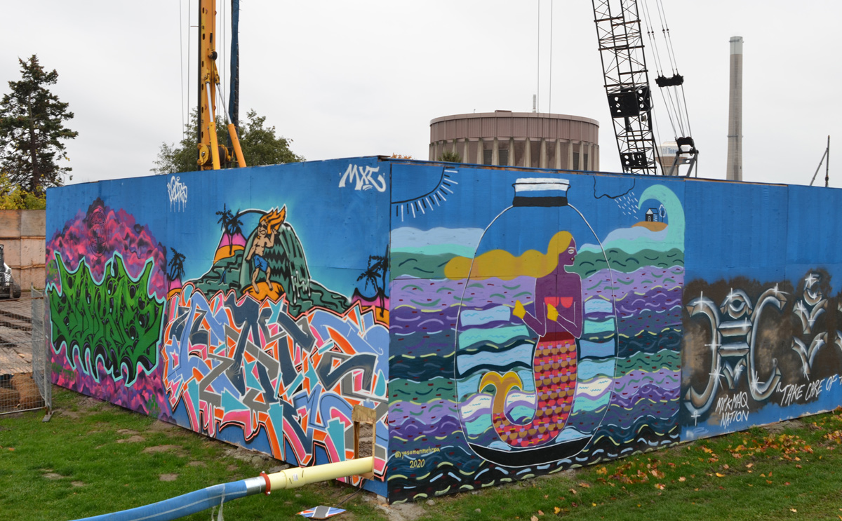
below: A green god with his trident – either Neptune the Roman god of the sea or Poseidon his Greek counterpart, by tongbokes

below: After the green god, is a more somber toned mural with the words, 1752, Mi’kmaq Nation, Take care of the water.

below: A mermaid in a jar by Yasaman Mehrsa. Has she been captured? Is she in a protective bubble? Do mermaids live in glass houses?


below: Surfer dude by broguymanz and a green throw-up on purple by Lukas Byra
below: “Be Like Water” by Adrian Hayles and what could be blue sea serpent, or a blue Chinese dragon, by Avril Wu

below: A mermaid of another sort, with skulls and burning candles, brought to life by Oriah Scott.

below: Bomi (aka bomitosangrantes) painted the lines and white dots that cover this corner

below: It’s not that easy to see, but the grey letters that look like stones in water along a rocky shore were painted by Getso. In the foreground is what looks like a mountain of flowing water (by bareket)

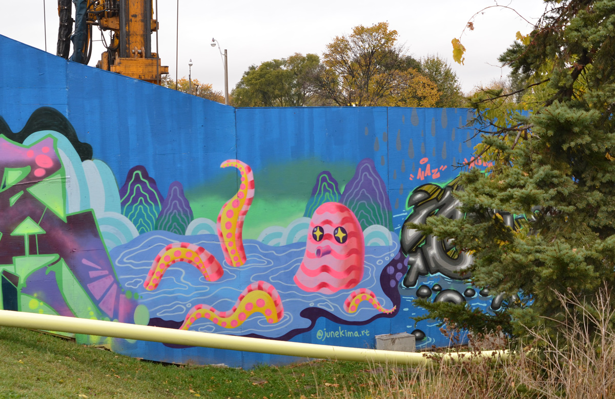
below: This pink striped octopus with stars in its eyes is the work of Jieun June Kim. Did you know that October 8th was World Octopus Day?
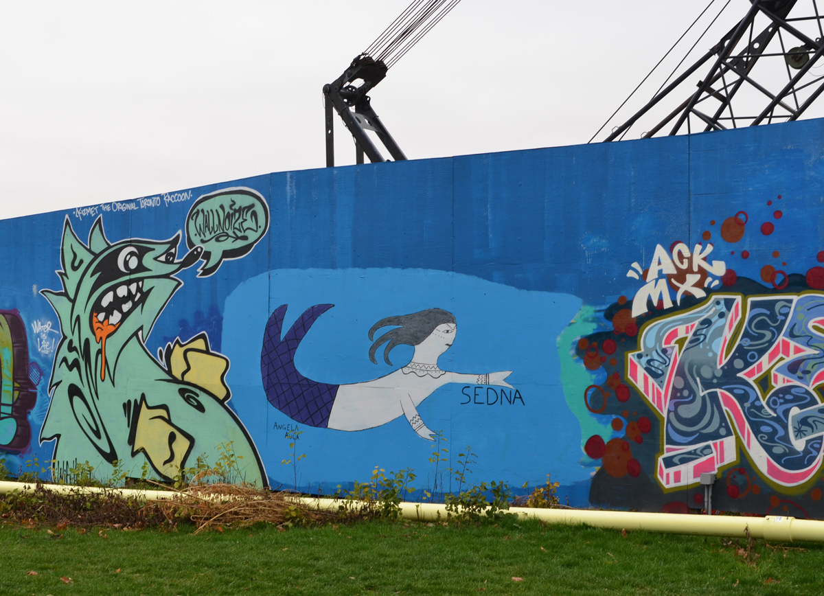
below: Like the words say, Kizmet the original Toronto raccoon, Radcliff is his name. I don’t think he’s going after the cranes even though that’s what it looks like. Swimming away from Radcliff is a Sedna, a curving woman by Angela Aulia.
below: A KERZ throw-up to the left of the BUBZ wildstyle with the tam-wearing duck with a bottle of water on top

below: A “Clew” throw-up by Clewin77
below: Three colourful fish swimming in the waves by Poonam Sharma

below: Blackbird flying along with the moon in different phases is the work of Natalie Very B. On the right, the wildstyle text-based mural was painted by spud1

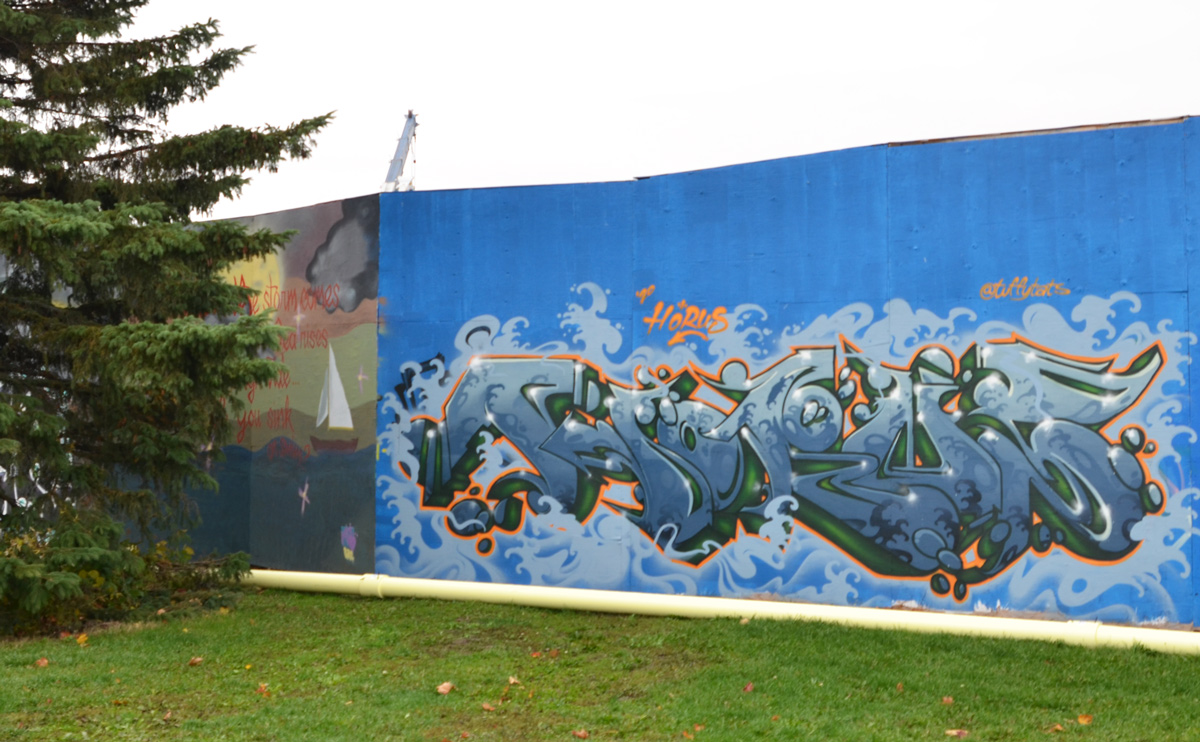
below: A watery wildstyle by Trevor Goodwin (aka Horus)

below: The white eyes are a bit disconcerting – awake? asleep?- but otherwise she’s colourful. Kizmet32 again.

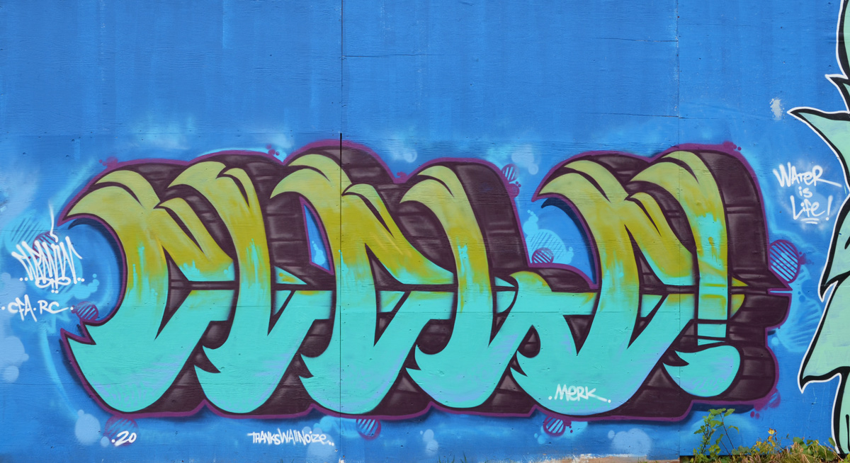
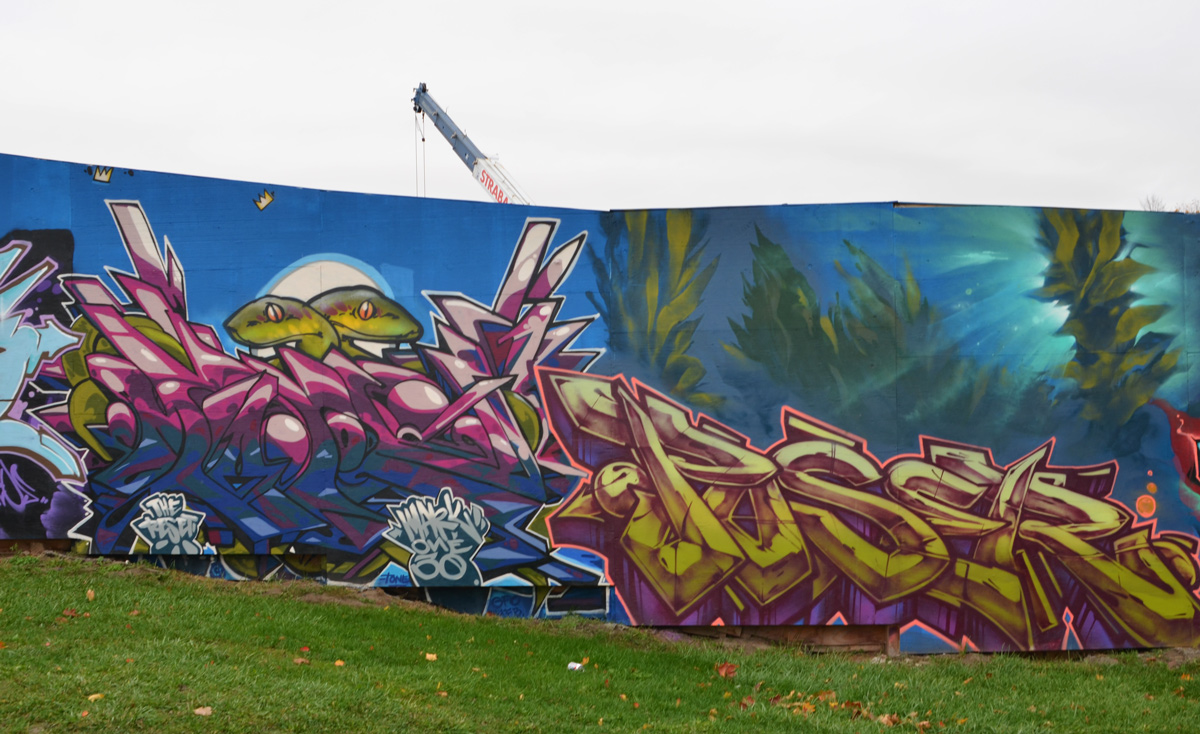
below: Burner on the left and Poser on the right
below: The happy grinning lobster with a fish on each arm is Gentle Giant aka big_doz261. The other mural is by onerzeus

below: A little fish nears the blue head at the end of the CRUZ tag in this Cruz1 mural.


below: by Rusty (aka gutter_crew_guru), If anyone would like to attempt an interpretation, I’d love to hear from you. There’s a lot of detail in the mural that is fascinating yet creepy. Happy Halloween!
below: A collaborative effort between Rowell Soller and @tenneshaskyers
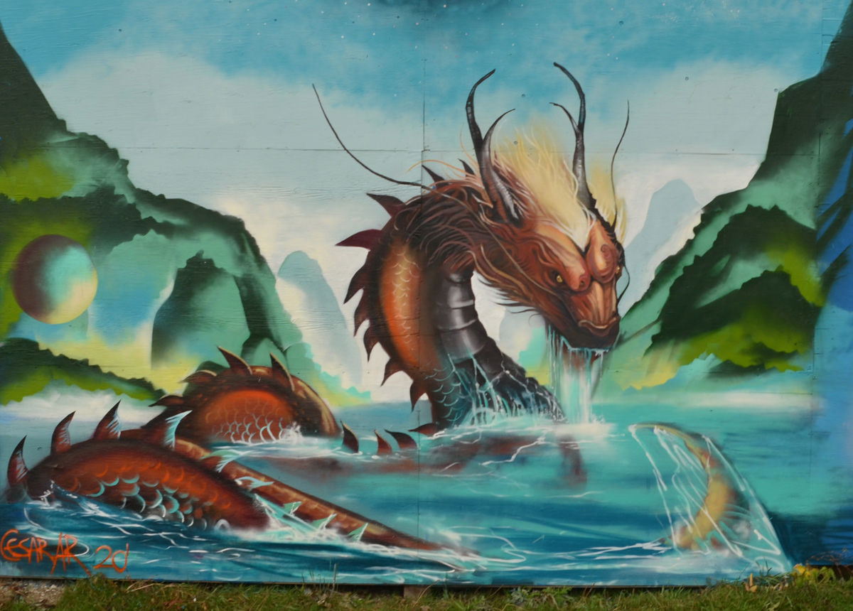
below: A very realistic looking creature in the water painted by Cesar Ar.
below: Mural by Julie Amlin


below: The work of invader.zima
below: Horizontal stripes of fish and water in a basket, or woven onto fabric, by Dakota Brant beside a Octo-Godess-Sea-Witch Lady by Katrina Canendo

below: A vintage scuba diver among the weeds, by silestyle161
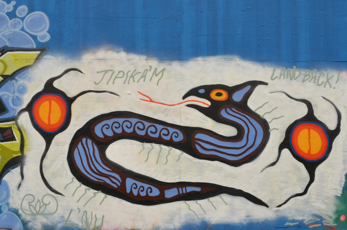
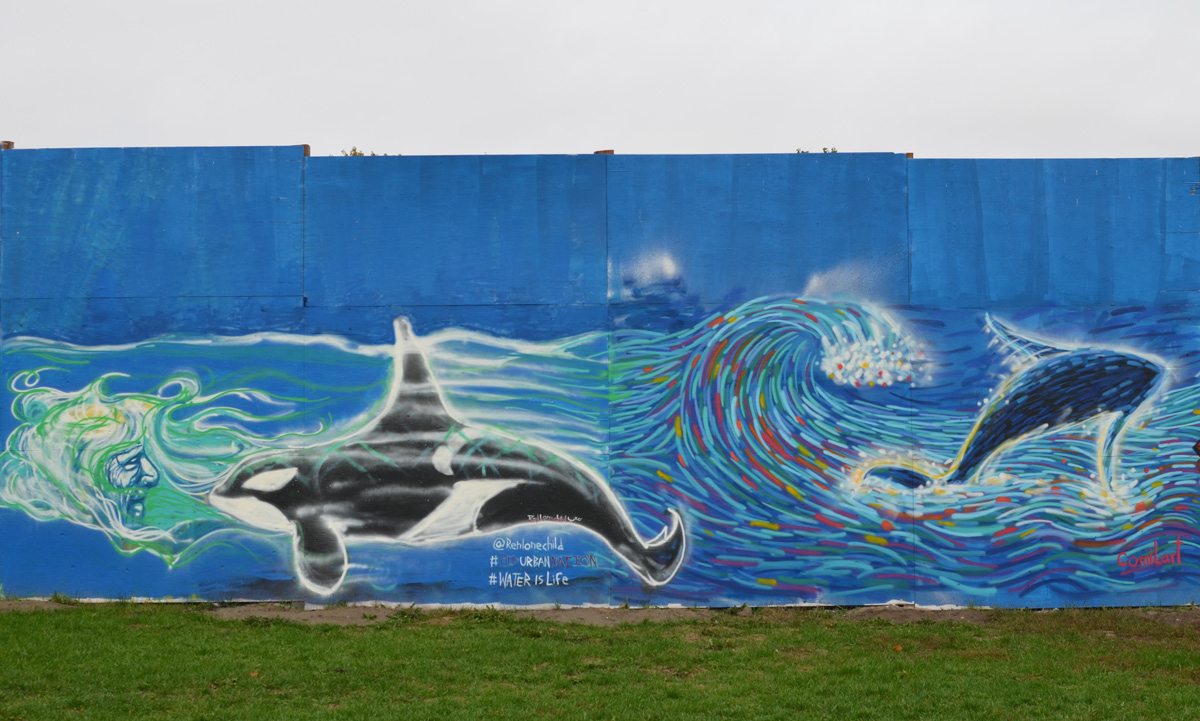
below: Two whales swimming in the ocean, an orca on the left by Ren Lonechild of Red Urban Nation. The whale on the right was painted by Camila Wong and she describes it on instagram as “Inspired from the Great Hokusai artwork, expressive waves with colourful brushstrokes and whale represent overcoming challenges in your life“.
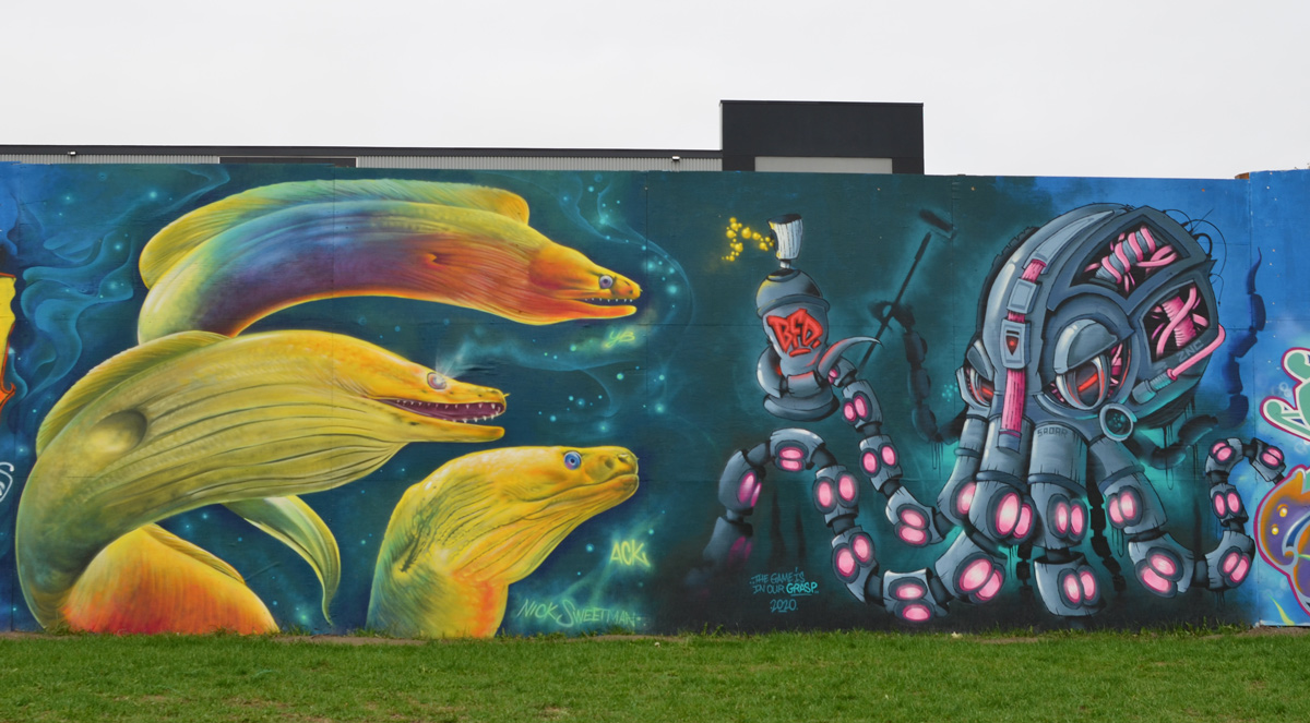
below: Three Nick Sweetman green moray eels looking at SADAR‘s (aka blazeworks) mechanical octopus.
below: Two murals made with text. FATHOM on the left and the creative efforts of RUN (Red Urban Nation) Artist Collective

below: Ashbridges water treatment facility with the wall.
below: Looking in the other direction.

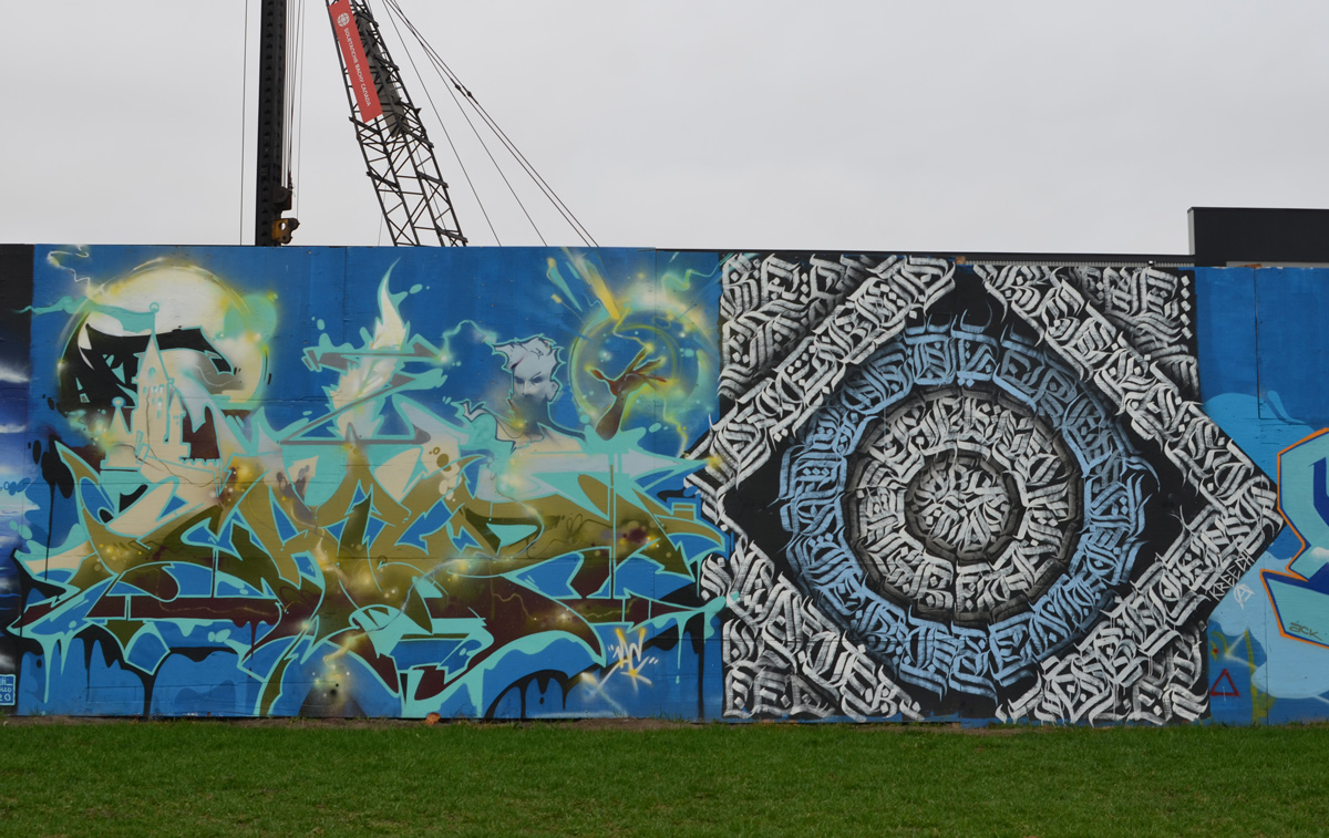
below: Calligraphy by Kreecha (right) and a painting by Art Child (left)
below: Two figures nose to nose with their reflections in the moonlight, by Julii McMillan. The nail polish matches the blues of the water.

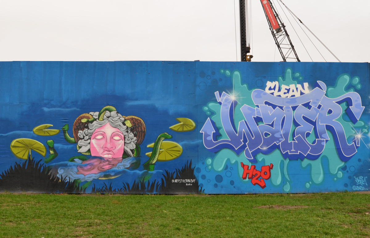
below: Victoria Day painted the very pink woman with grey hair who is surrounded by lily pads and little green dinosaurs? eels? To the right is Clean Water text by SKAM
below: A lovely orange octopus by Spyone beside a man partially submerged in the water, Rise Up by James (aka mistersoy)

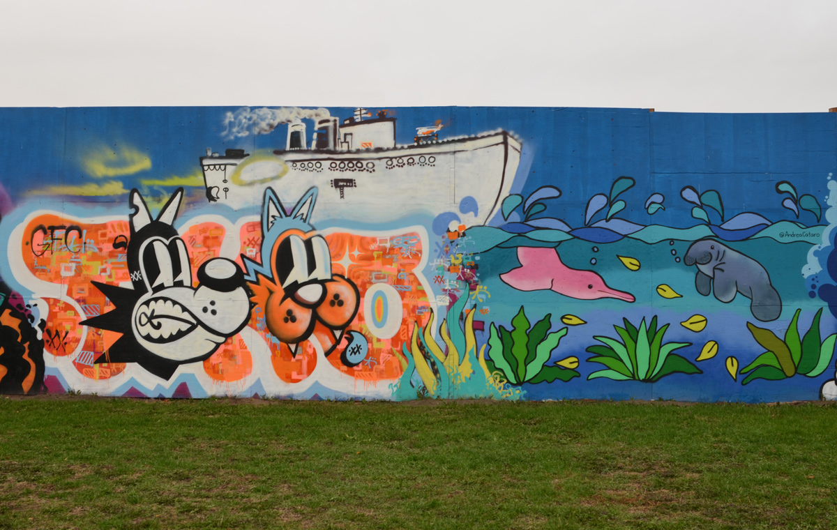
A white boat with many portholes sails past, while on the right, by Andrea Rodriguez (aka Andrea Cataro) a pink dolphin and a grey walrus swimming underwater.
below: Abstract and sort of geometric, in teal and purple, by David Baron
below: A wonderful woman with turquoise dreadlocks in a turquoise sea under a pink octopus wearing a tophat. This mural was painted by Désiré Betty

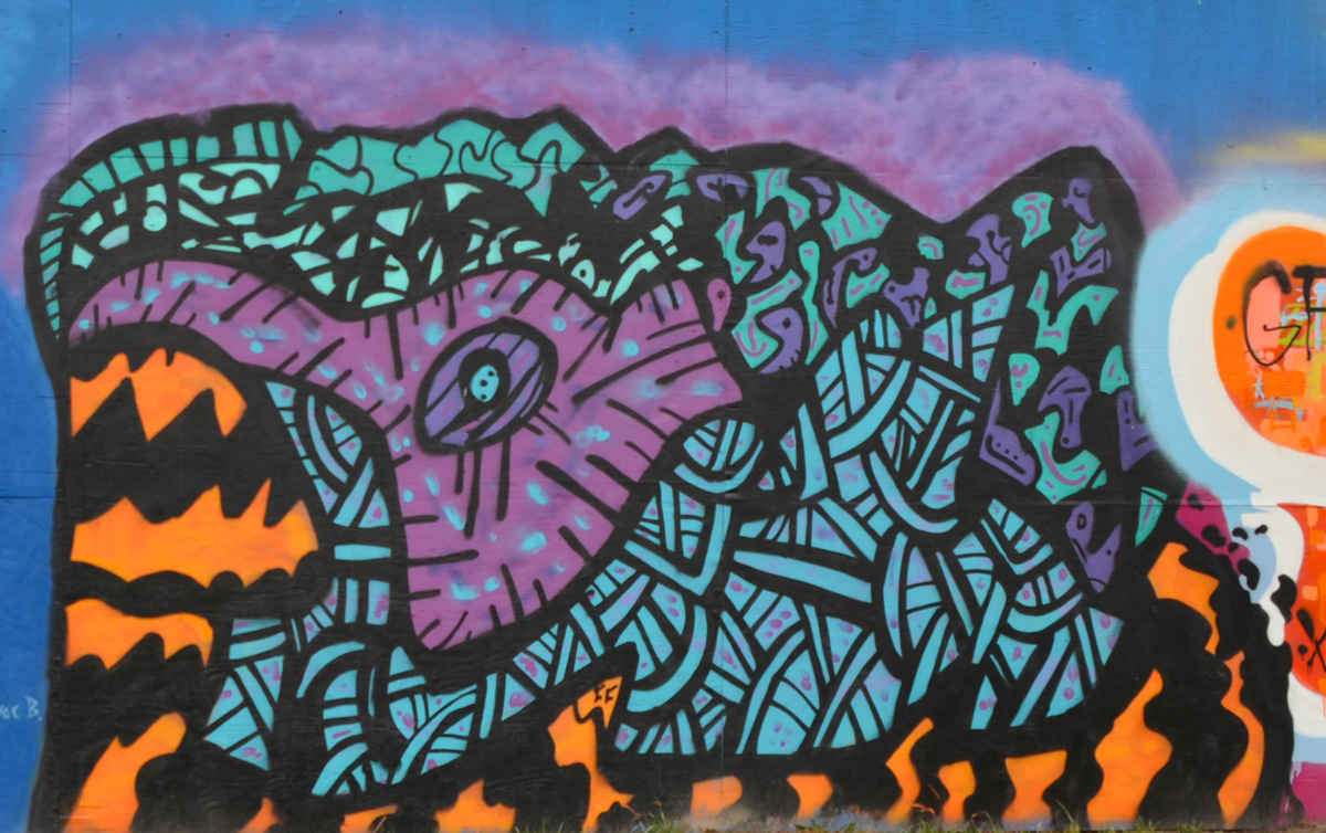
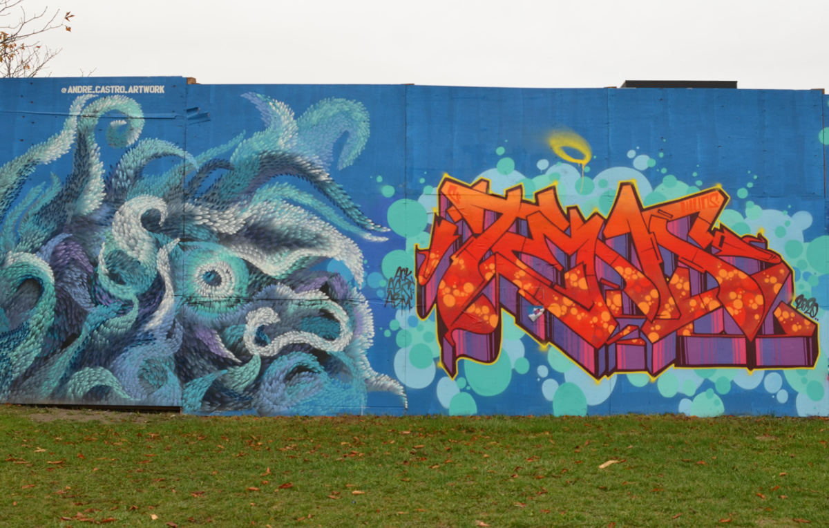
below: A blue, purple, and white sea monster by Andre Castro looks towards red and purple text by mr_tensoe2
below: By dat_dude_stu

below: Something other-worldly by fongkikid

below: By mr. Water


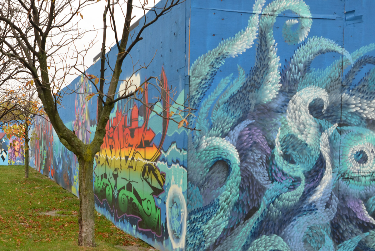
below: Swirls by Flip surround a slightly greenish woman with hair that merge into the waves. The woman’s face was painted by @gosiakomorski One Love – Don’t let hate win.

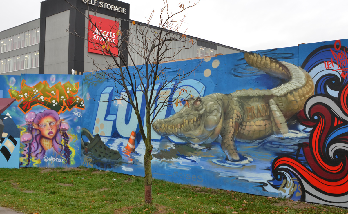
below: Luvs crocodile with crocs floating in the water to the right of a small elfin(?) woman with long pink hair by @monicavcao
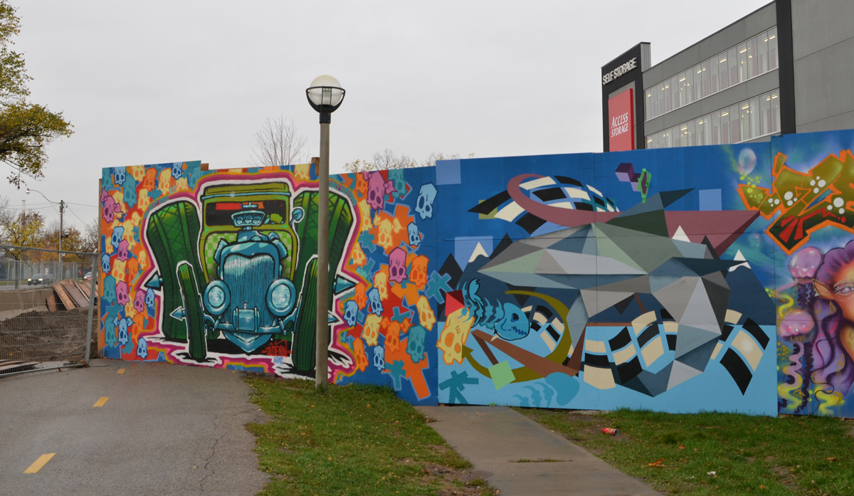
below: At the end of the painted section of the hoardings is this old green car, “little deuce coupe” surrounded by skulls, a dudeman ‘trademark’ of sorts.
Back in the early spring of 2019, I wrote about accessing the East Don path from Moccasin Trail.
below: Last week, the view from the east side of the tunnel under the DVP leading to Moccasin Trail Park.

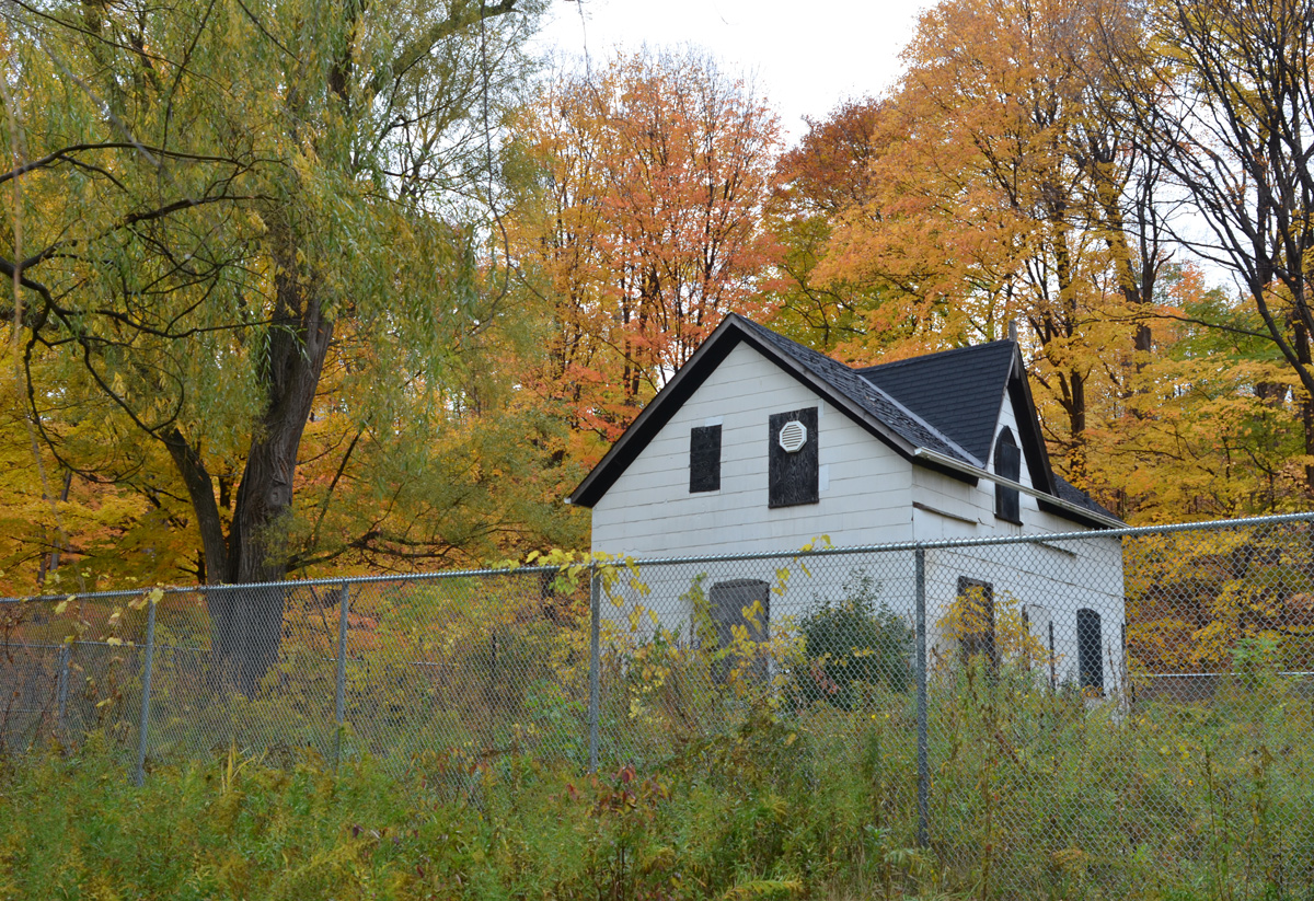
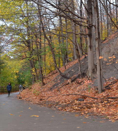
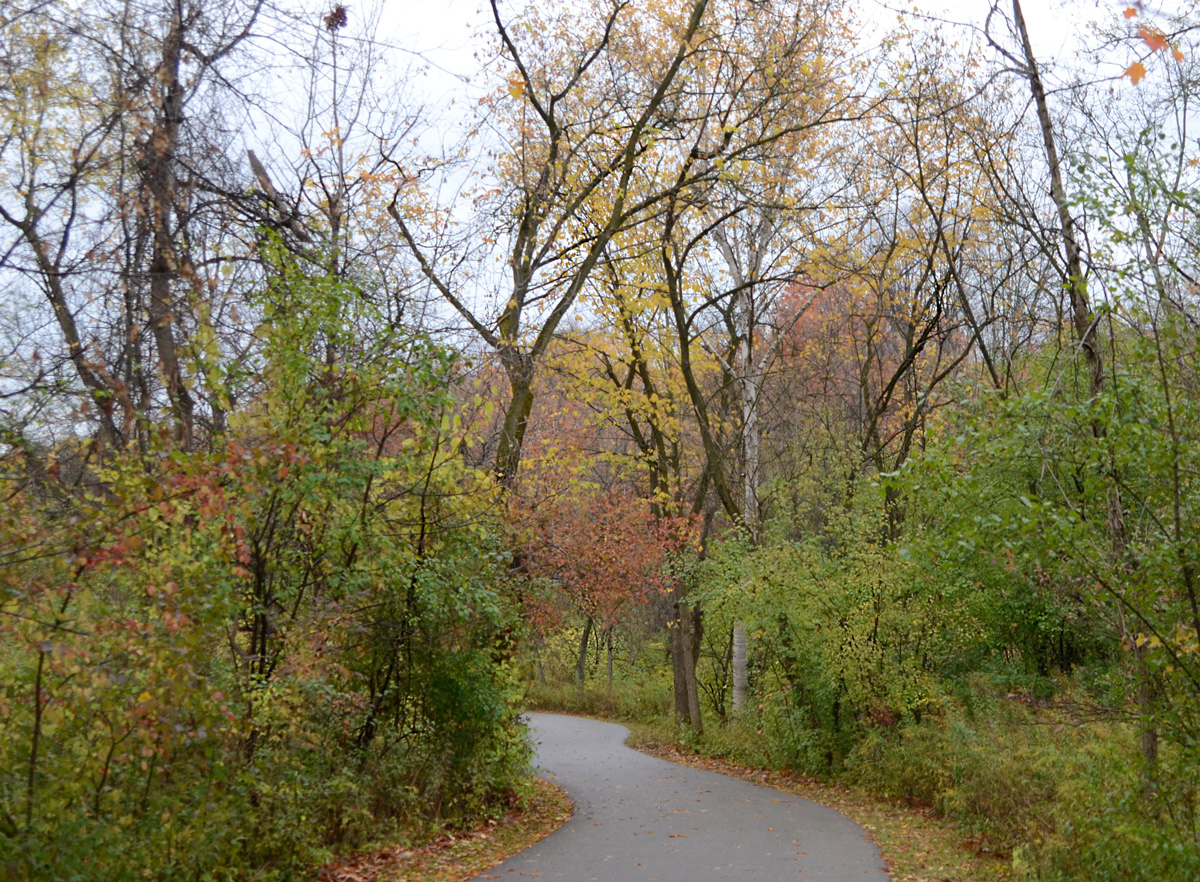
Now, in a different year and a different season, I have explored more of that trail starting at the north end, near Lawrence Avenue and the Don Valley Parkway (DVP). Originally, Lawrence Avenue curved south down the east side of the ravine before it crossed the Don River. The remains of part of that road provide access to the East Don path at Charles Sauriol Conservation Area. Sauriol (1904-1995) was a Canadian naturalist who played a leading role in conserving many natural areas in the province including the Don Valley.
Here, the Alexander Milne family first settled in 1832. Over time, a woolen mill and a sawmill were built, other families moved in, and the village of Milneford Mills was born; it thrived until the early 1900’s. The old woolen mill remained derelict until it was demolished in 1946. Between Hurricane Hazel floods in 1954, and the expropriation of land to make way for the DVP construction, most traces of the village have disappeared.
below: All that remains is one house. It’s been behind chainlink and “under renovation” for MANY years. When I went searching for any kind of story about this house, I discovered a blog post from 2011 about Charles Sauriol Park and the house was fenced in then. Apparently it was covered in graffiti back in 2008/9. I’m not sure that Mr. Sauriol would be impressed.
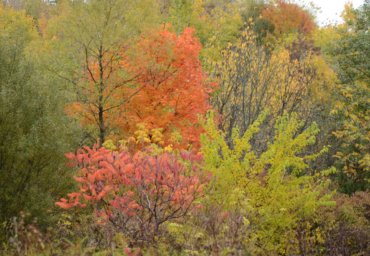
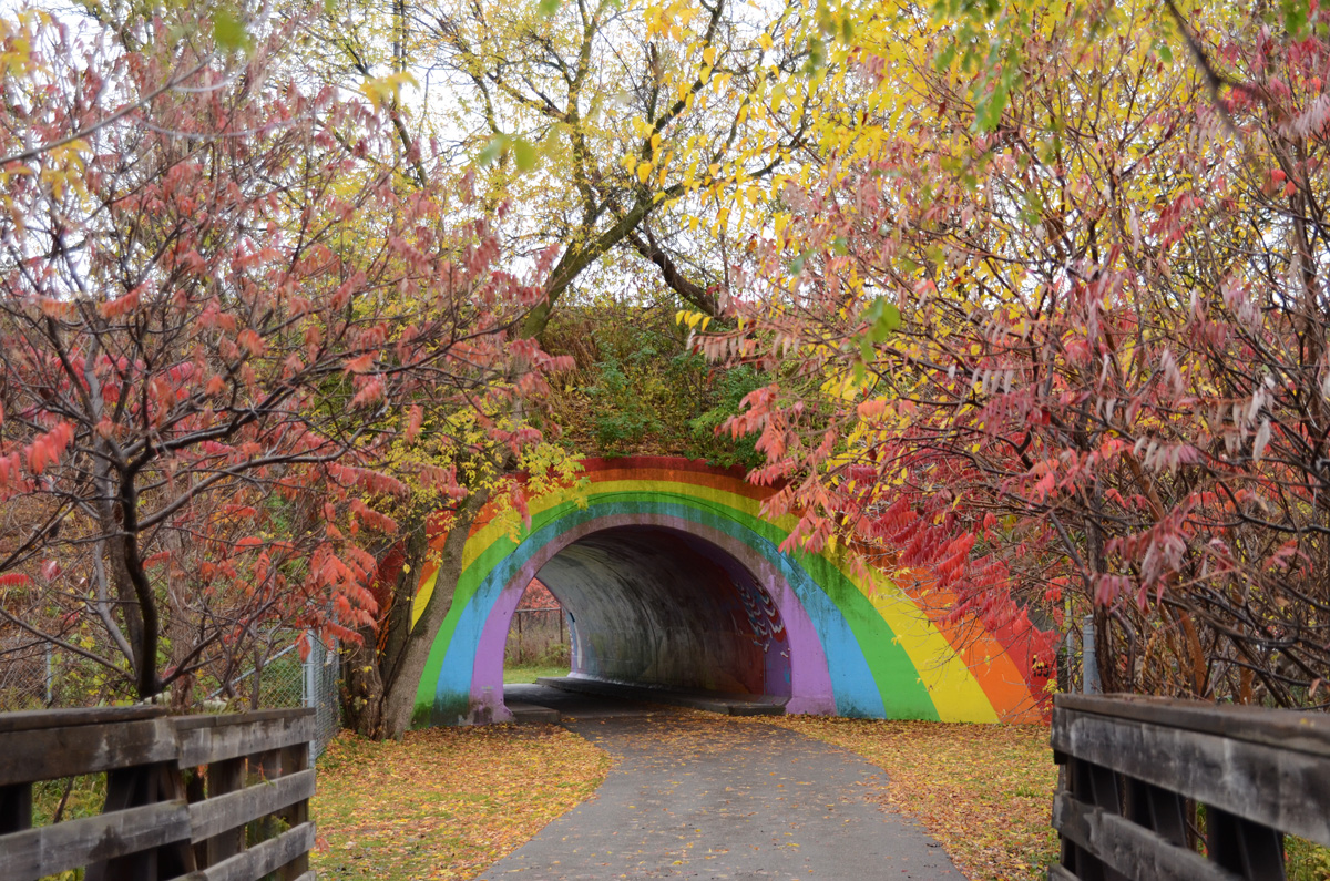
below: The Rainbow Bridge from the north side.
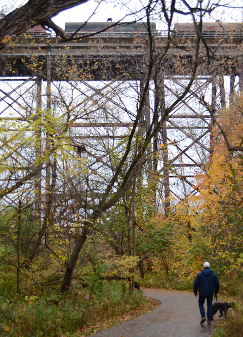
below: The trail passes underneath the Canadian Pacific (CP) tracks.
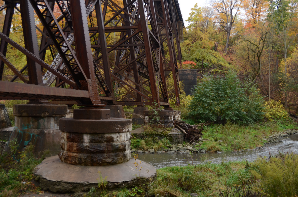
below: Footings for the CP bridge
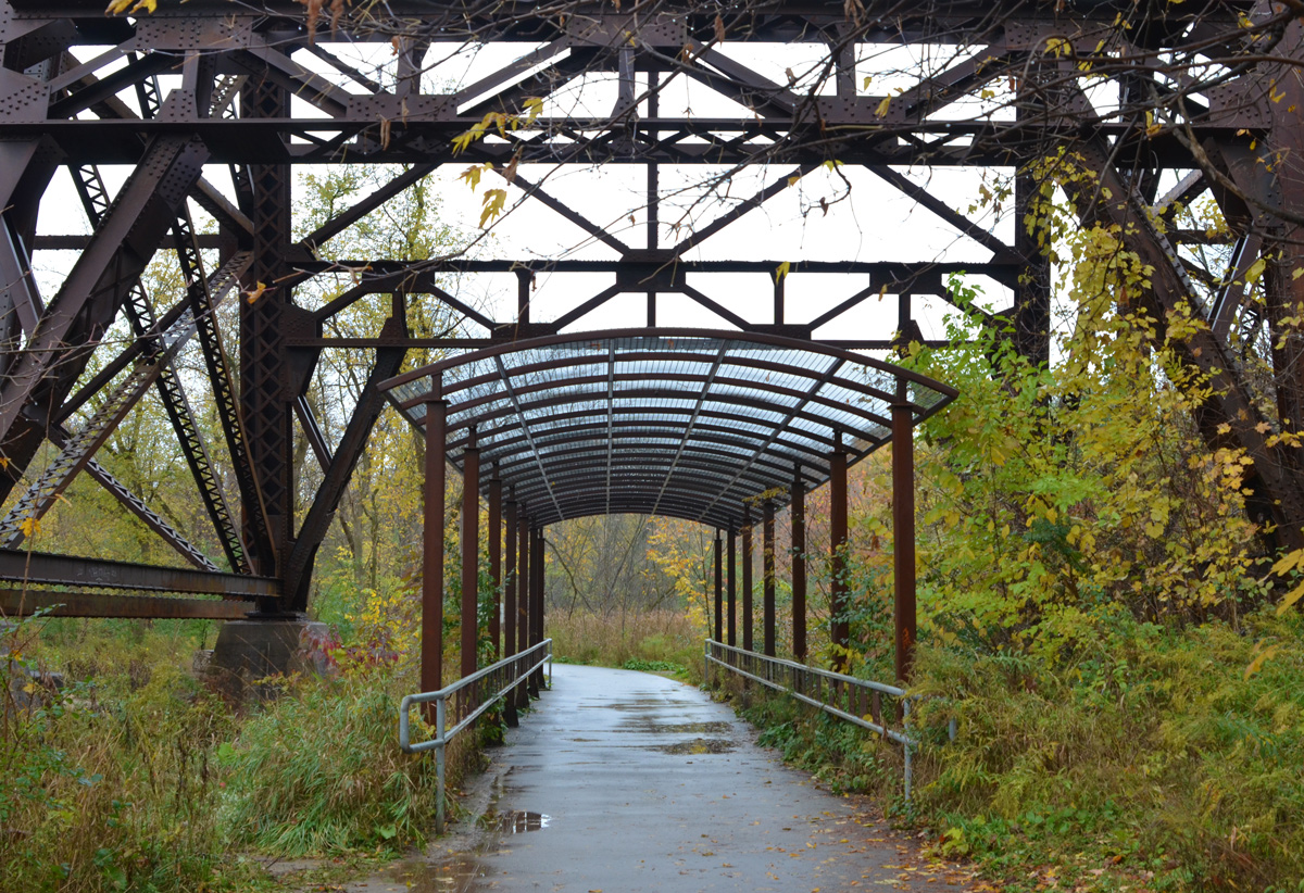
below: As the trail crosses land owned by CP Rail, it is covered by a metal frame canopy. It’s difficult to see in this photo but there is a series of small laser-cut metal artworks between the grey railings. The whole structure is “A Walk in the Woods” and it is the creation of both Robert Sprachman and Arnaud Boutle.


below: Farther down the trail is another railway bridge. This is the same line that goes north to Oriole GO station and beyond. The scaffolding under the bridge is for the construction of another canopy similar to one under the CP bridge (above) as well as an art installation.

below: Part of art installation “High Water Mark” by Robert Sprachman that is almost complete. There are 15 rocks each with a year on them. The height of the rock on a metal pole represents the height of the flood water on the Don River that year (but is not an exact height). There are four rocks in this picture and from left to right are 1926, 1934, 1942, and obscured (the last is behind the wood. Ooops).

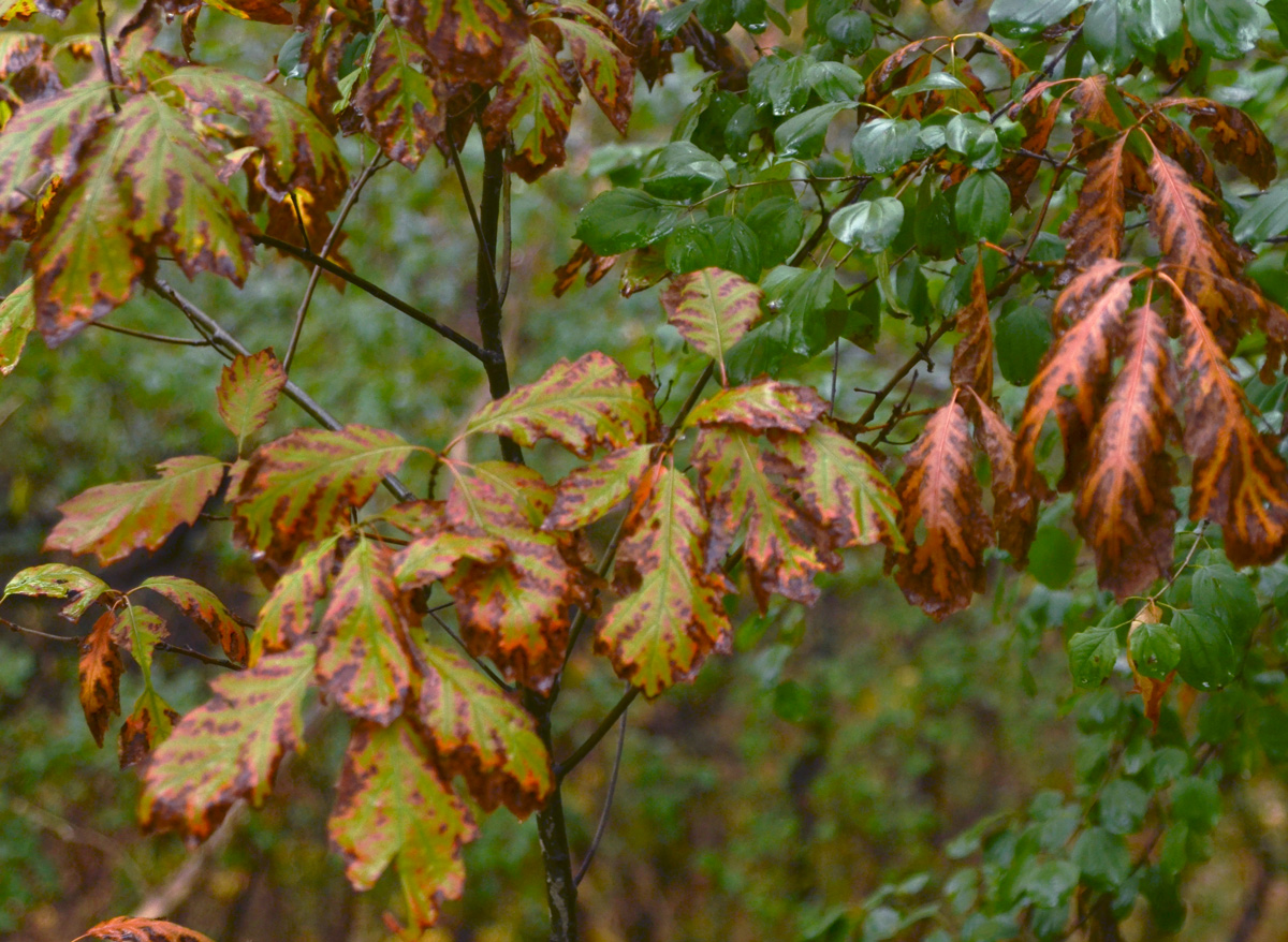
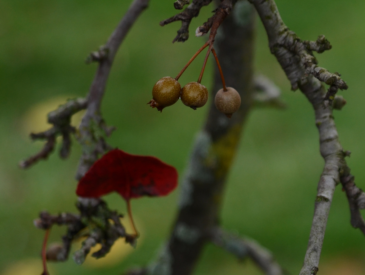
below: Oak leaves
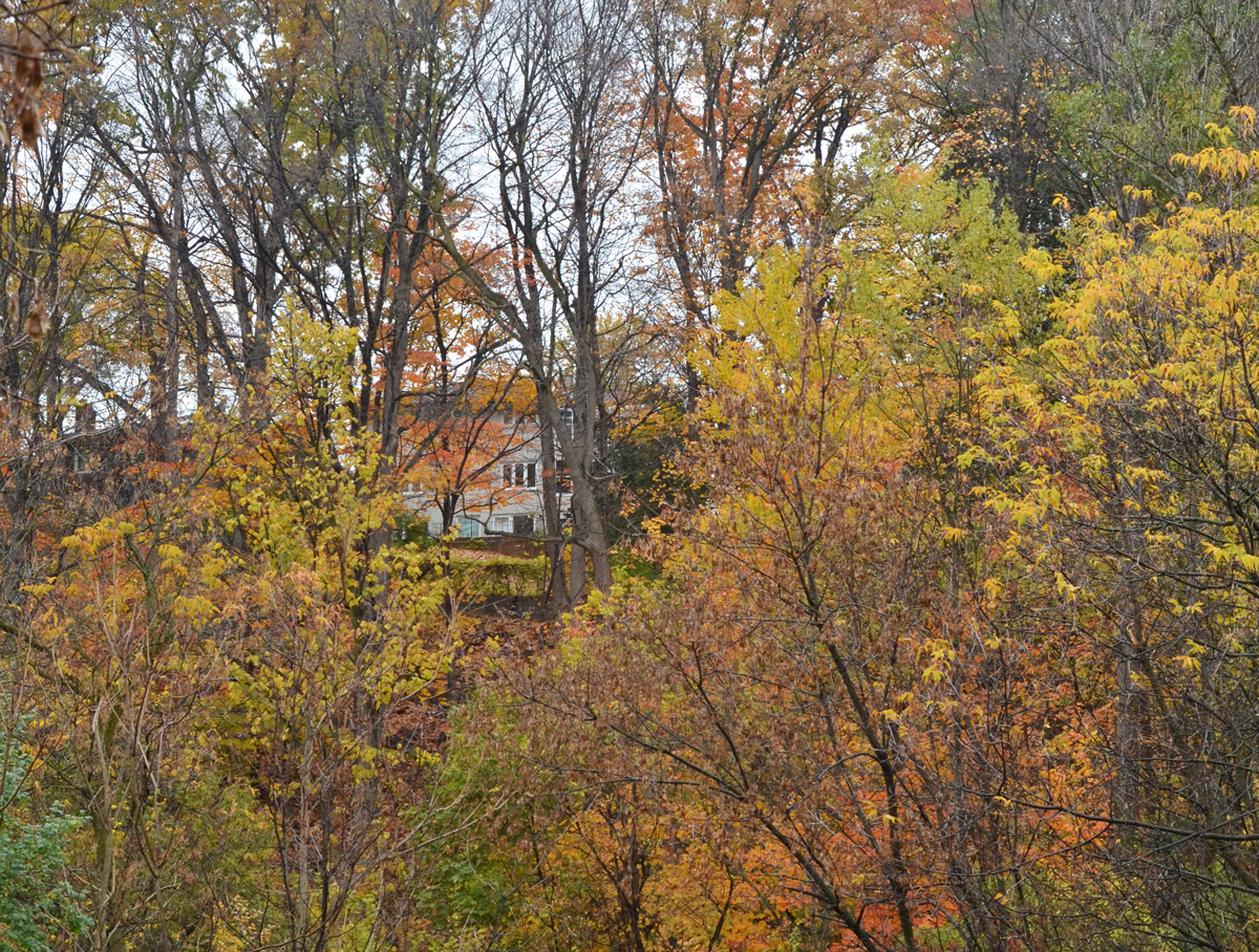
below: Backs of houses overlooking the park
below: A chickadee holding onto a dead flower as it eats the seeds.


below: Fish. Yes there are fish in the Don River, about 21 species apparently. This one, salmon?, although large is unfortunately also dead. Over the past 30 years the Don River has received a lot of TLC which has helped to reduce the level of industrial pollution as well as the amount of litter and trash found along the banks.

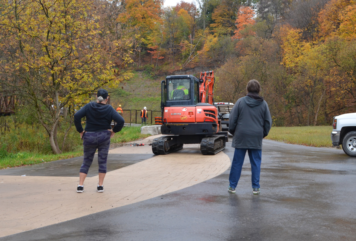
below: We were told “It’s not the best time” when we asked if we could continue on the trail. South of here the trail is a construction zone. Eventually (soon? I may have visited a little too soon?) the path will join with those farther south so that there will be a continuous trail from Lawrence to the lake. In the meantime, this is Wynford. You can exit here, or retrace your steps back to Lawrence. Next time!
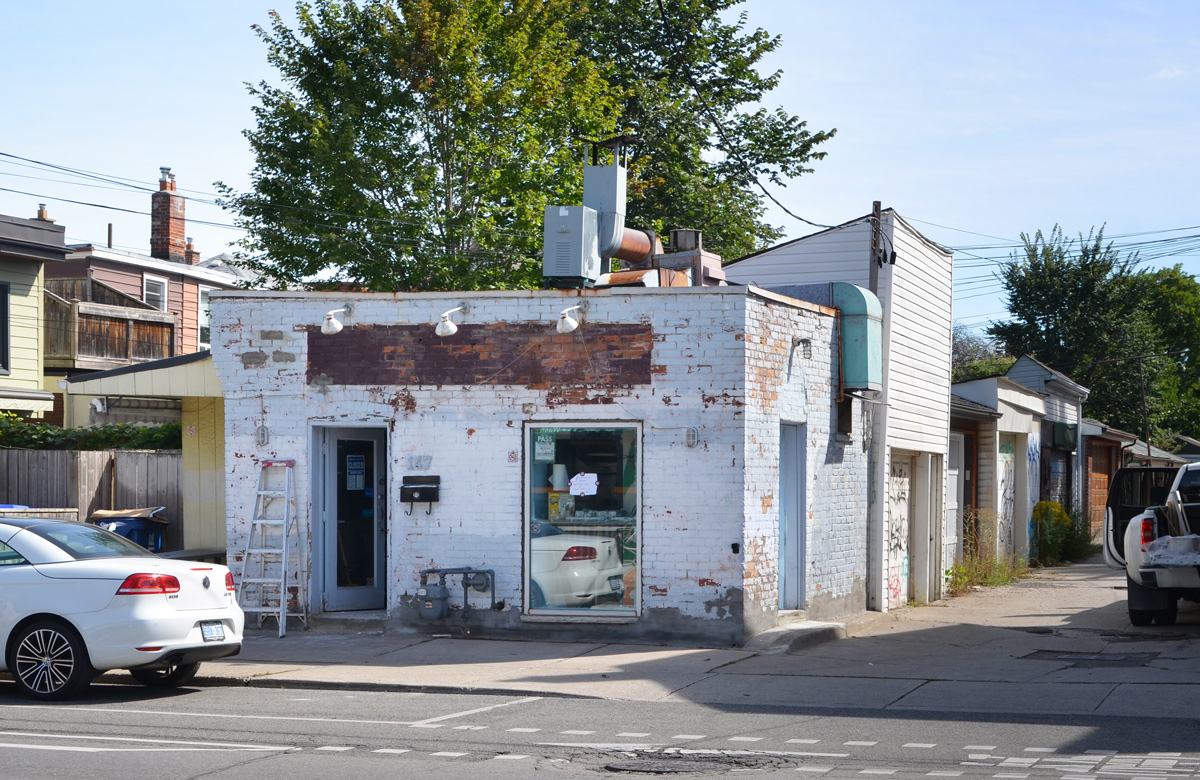
Albert Jackson Lane is a small alley that runs south from Harbord Street.
below: What is happening to Harbord Fish & Chips? (Albert Jackson Lane is on the right).
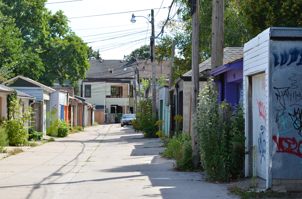
below: Looking down the alley, the first impression is that it is rather nondescript but a few bits of colour suggest that walking down the lane might be worth the effort.
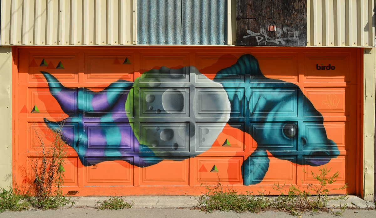
below: A purple and teal fish by birdo, aka Jerry Rugg
below: Part of “Secret Garden” by Emily Kouri

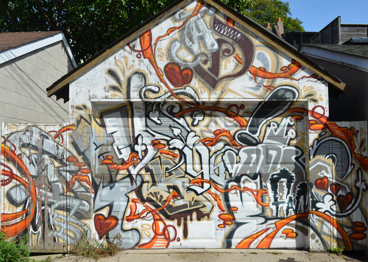
below: An older mural that completely covers the garage and the fence on both sides. I am not sure who the artist is.
below: This character is well known – a poser bunny.

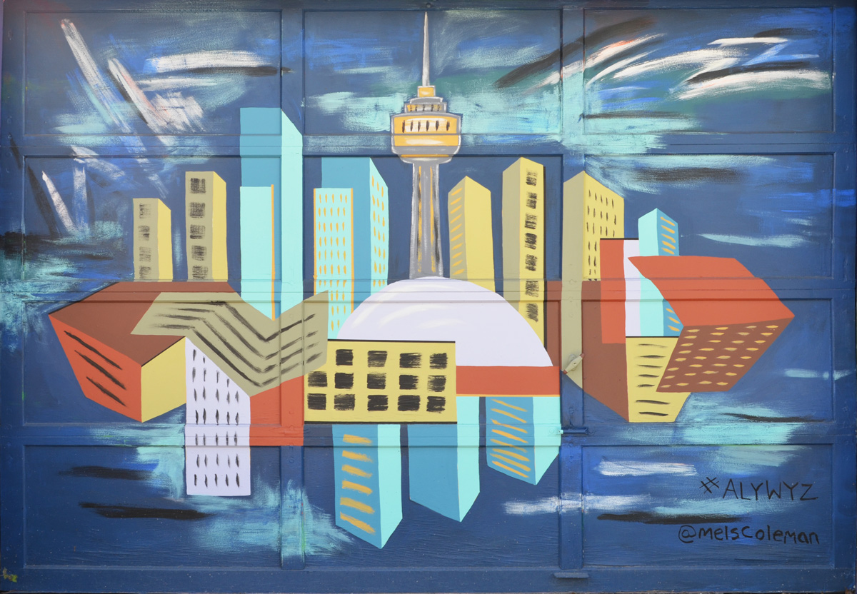
below: The Toronto skyline and its reflection in Lake Ontario in a mural by Mel Coleman.
below: A talking head, a square head on TV. I love the bunny ears on the TV – who has those anymore!

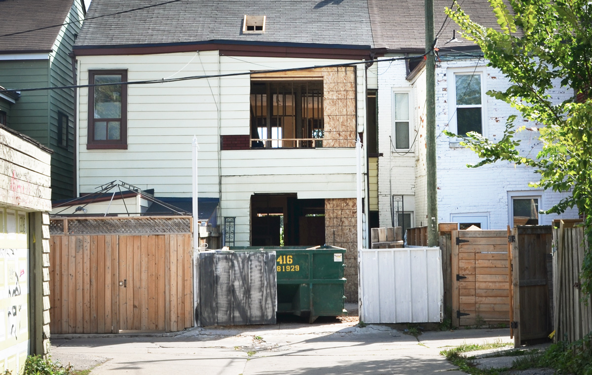
below: At the end of the alley, a house with major renovations in progress.