Posts Tagged ‘construction’

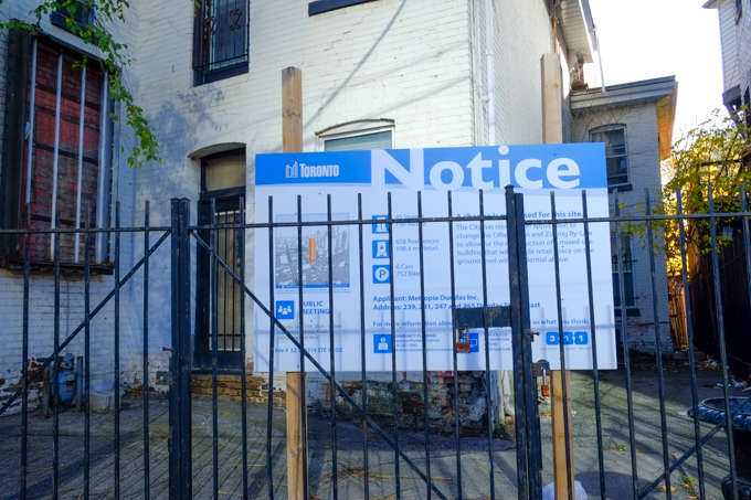
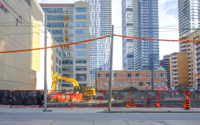
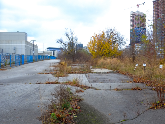
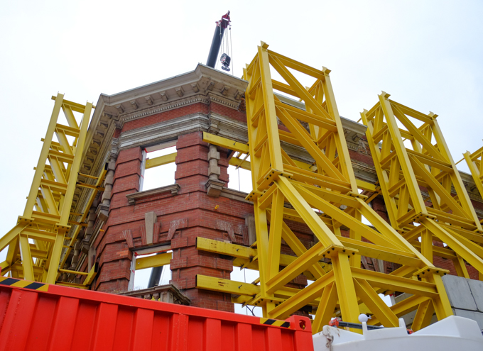
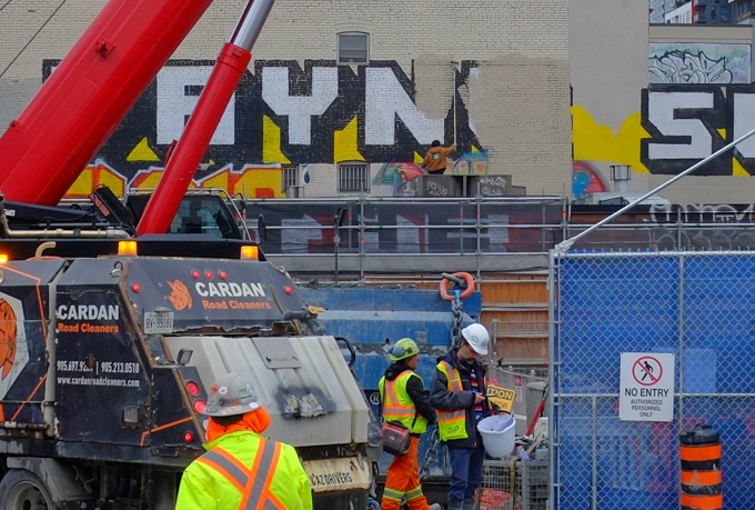
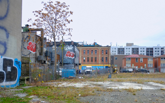
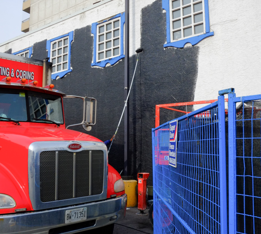
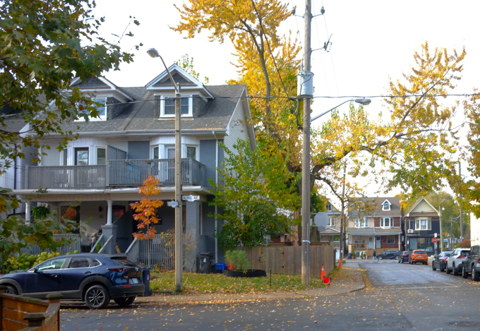
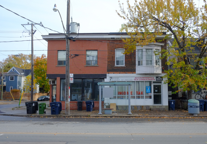
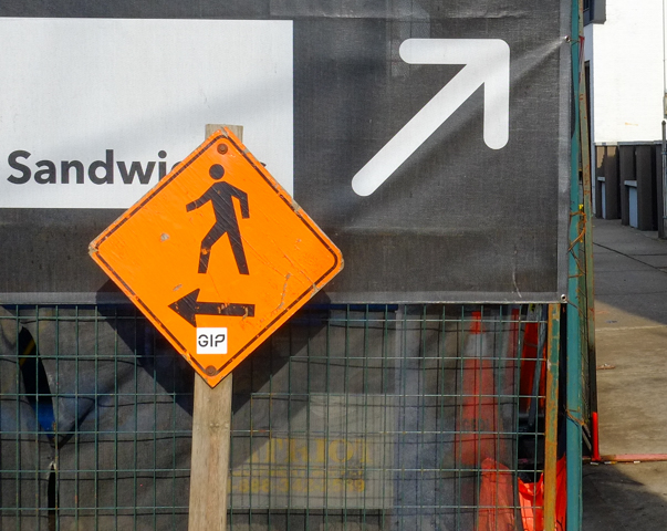
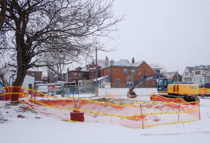
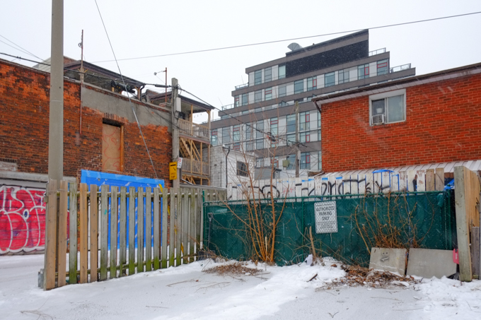
below: View from a lane that runs behind the north side of Dundas West, walking west of Dufferin.   The alley also runs east of Dufferin but that will have to wait for another day.  The large brick building on Dufferin is St. Annes parish hall.  St. Annes church is behind, facing Gladstone Ave.  The vacant lot on left was a parking lot not long ago but now it is now a construction site.

man on bicycle, snow covered alley, vacant lot on left, backs of buildings on right, church at end of alley, St. Annes parish hall, workman arts

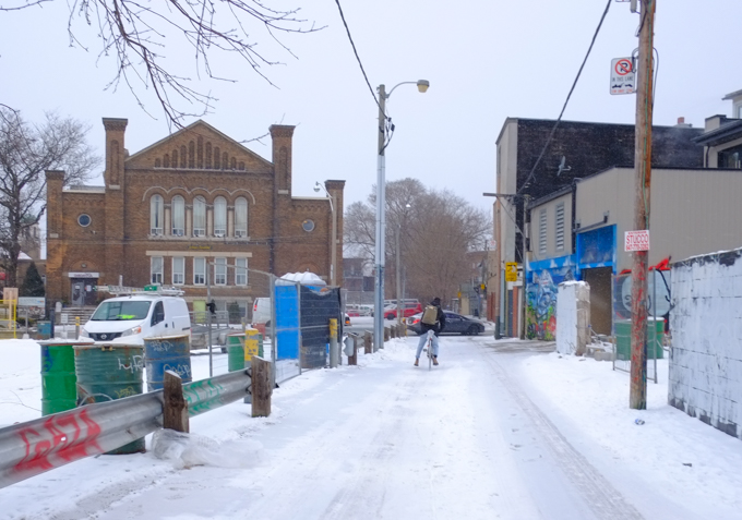
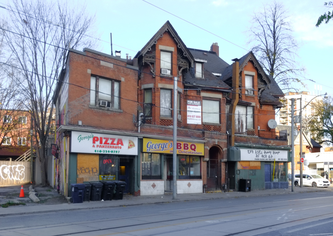
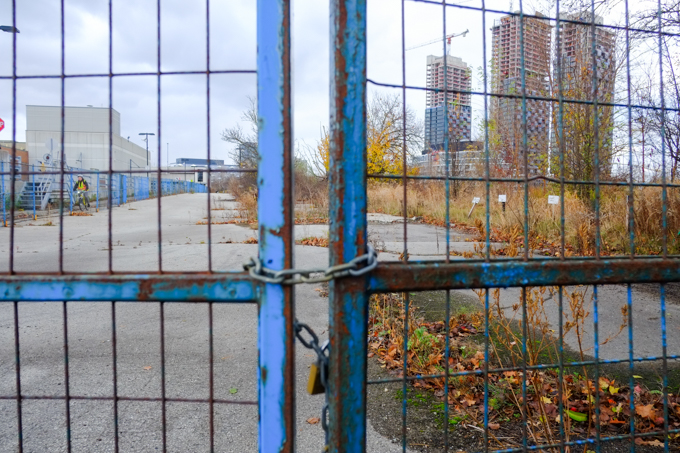
below: It looks like changes are coming on the Dundas West side of the lane as well.  A concrete wall/fence has been partially demolished and there are construction fences behind some of the buildings.  According to the Urban Toronto website, two 8 storey developments have been proposed – one fronting on Dundas and the other on Dufferin, with the alley remaining between them.

partial concrete wall, in an alley, with a row of buildings behind it, construction fence, snow,

below: Behind Dundas West… but not for much longer.

backs of two storey brown brick buildings, metal exterior stairs, doors, snow covered backyards,

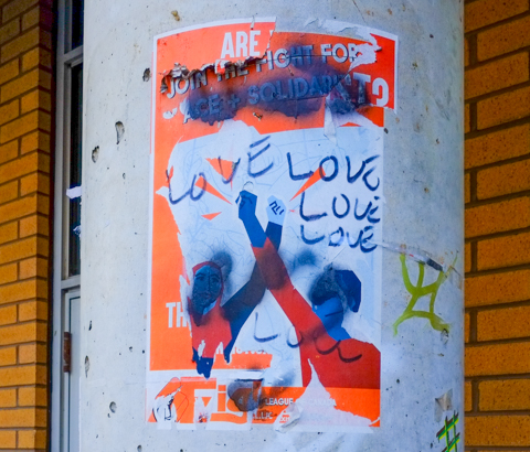
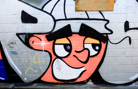
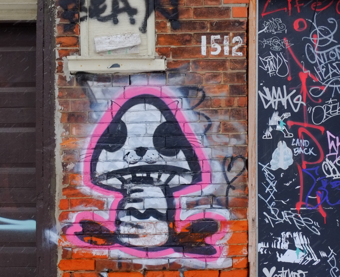
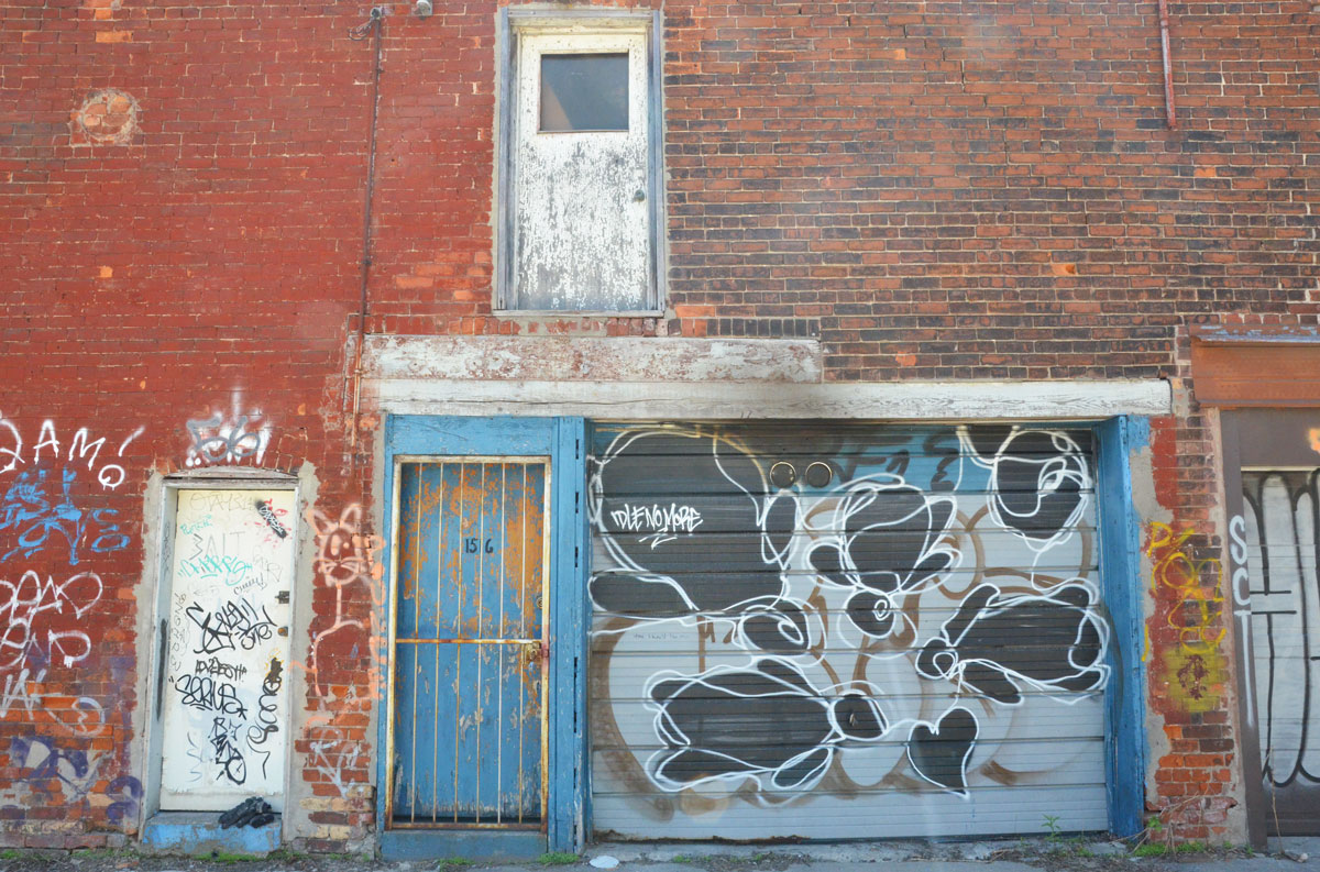
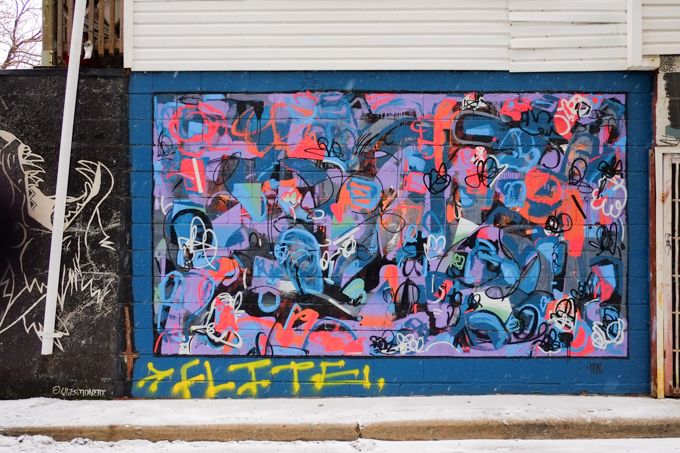
below: Artwork by Cuban artist Supermalo5, aka Fabian Lopez  who always includes a little question mark in his work along with the incorrect equation 2 + 2 = 5

metal construction fence across the backyards of old brown brick buildings on Dundas West

construction site on Dufferin, just north of Dundas

construction site on Dufferin, just north of Dundas

fence around vacant lot, now construction site at lane and Dufferin, also at Boland Lane

alley view, back of old brick building with three doors on upper level, garage doors and single doors on lower covered in street art,

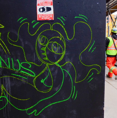
below: Two big round black eyes

behind 1512 Dundas West, a little mushroom shapred creature with two big black eyes, outlined in pink

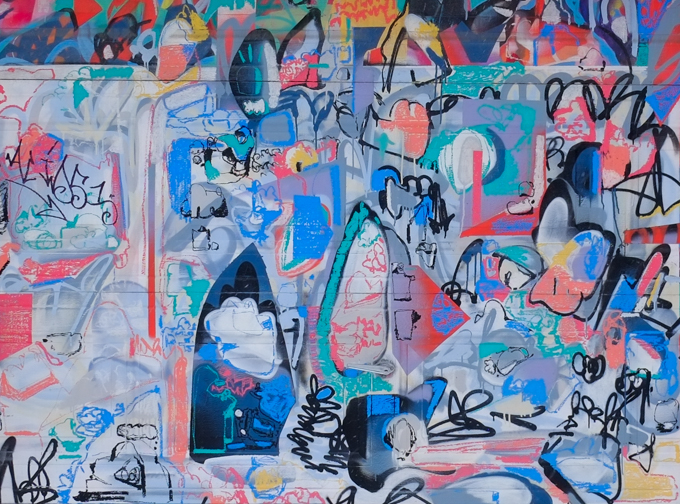
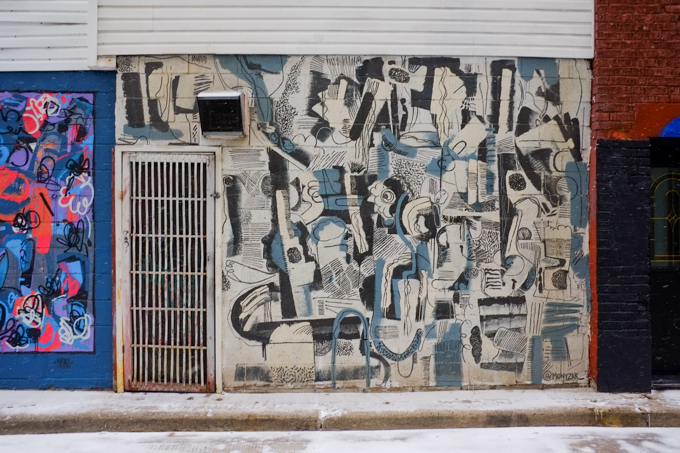
below: Street art painting, abstract, by Mony Zakhour

street art mural by Mony Zakhour in alley behind Dundas West on garage door

close up of part of abstract mural by Mony Zakhour

street art mural by Mony Zakhour in alley behind Dundas West on green and yellow door

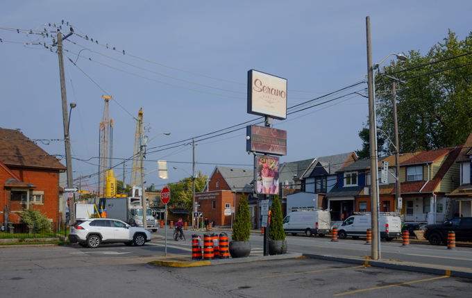
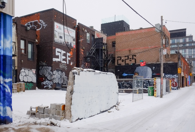
below: Screenshot from Google street view, captured in 2019.  The houses on the left are now gone – you can see the blue and white development notice sign in front of them.  They are now part of the vacant lot/construction site pictured above.  You can also see that the lane here is Boland Lane.  It runs perpendicular to Dundas West.


blue door with faded paint and a metal grille in front of it, beside a garage door with graffiti on it including the words Idle no more. Upper storey has an exterior door that goes nowhere

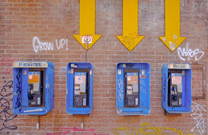
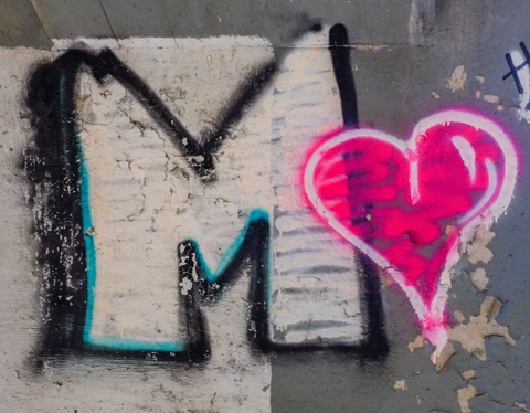
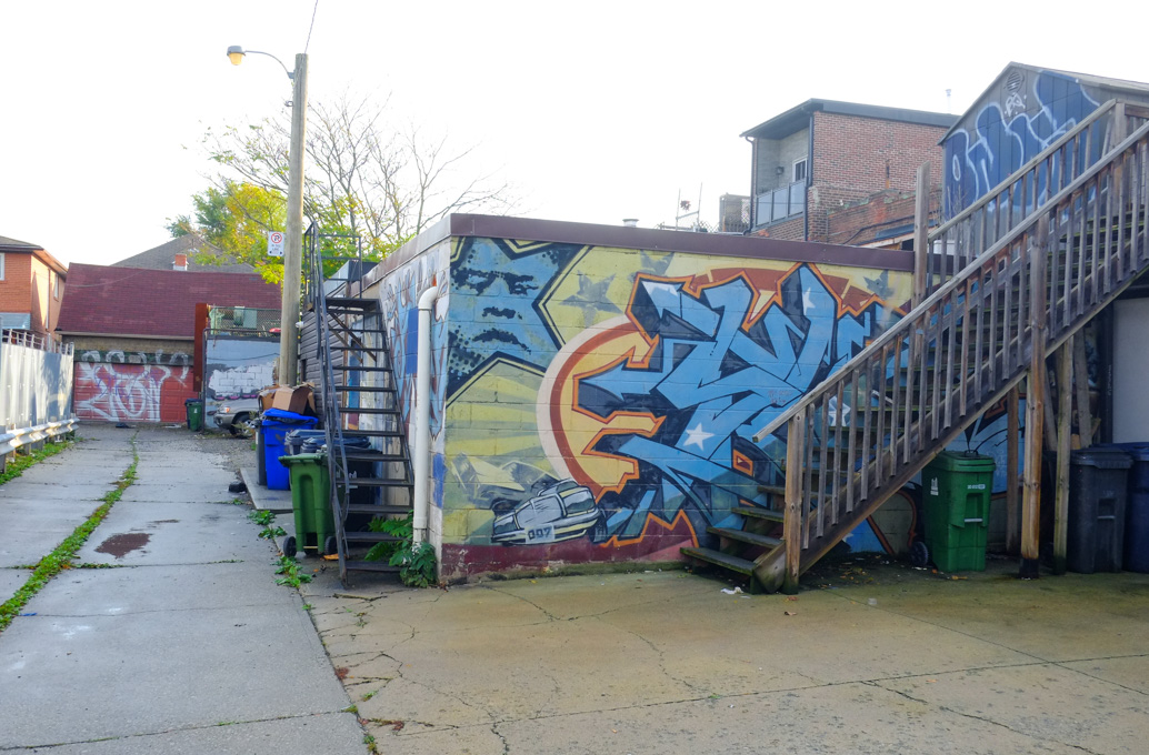
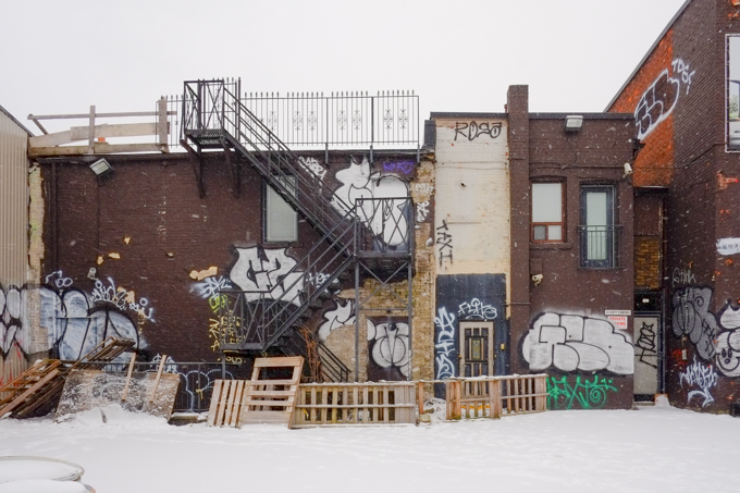
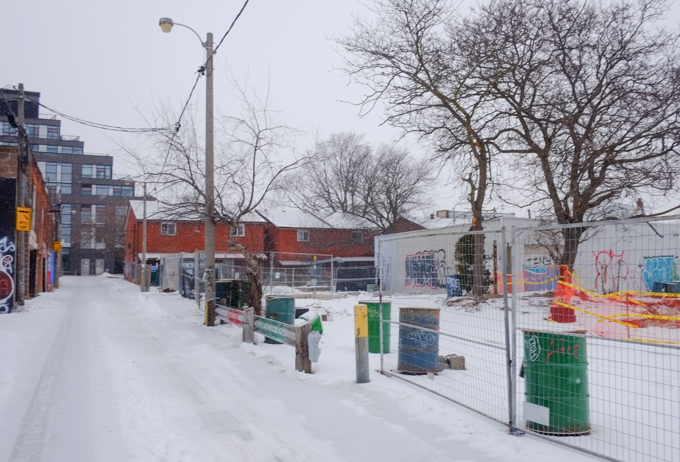
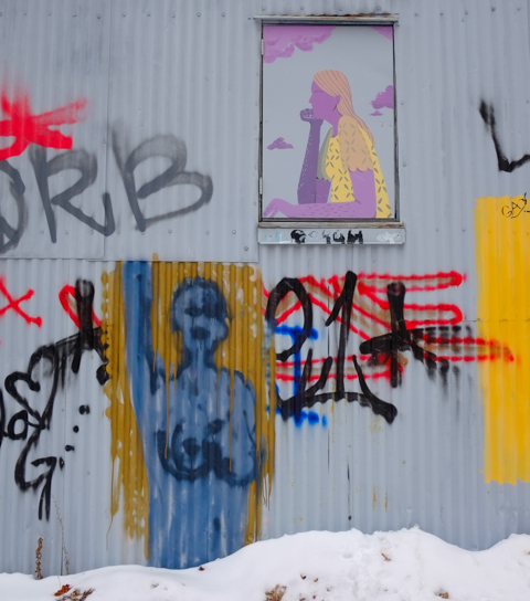
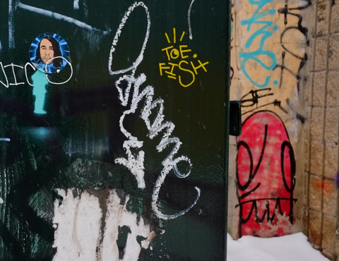
below: A quick look at what else is in Boland Lane

boland lane, looking towards back of dundas west, snow covered graffiti on walls of building on the left

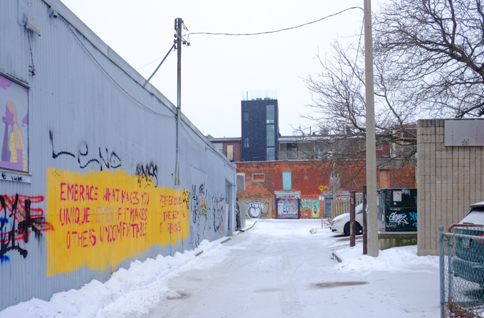
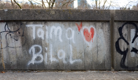
below: “Embrace what makes you unique even if it makes others uncomfortable”

text graffiti that says embrace what makes you unique even if it makes others uncomfortable

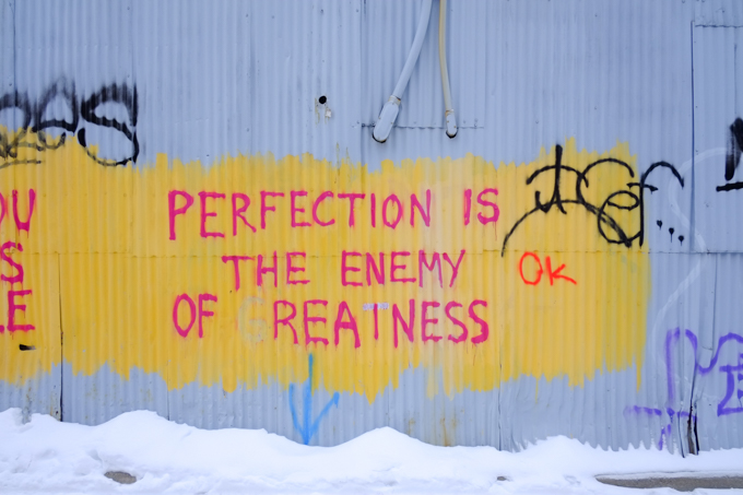
below: “Perfection is the enemy of greatness”

text graffiti that says perfection is the enemy of greatness

graffiti on a grey wall, two images, one a woman in purple with blond hair and yellow t shirt and one more abstract, blue naked woman from waist up

old grey wood door in a grey building, with one rusty step, snow on step, graffiti on door and building

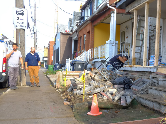
Continuing behind Dundas….

below: Layers, old and new as well as  wood, brick, and glass.

graffiti sticker, man's portrait in blue, on a black wall with red face graffiti behind

below: Rooftop decks and terraces above and street art covered garages below including a flaming hot kitty painted by Christina Mazzulla.

garage in laneway with street art murals on side as well as on garage door.

below:  A trio of grey masked foxes (wolves? dogs?) covering two doors.  This painting goes back to at least 2017 and possibly 2015 and before.

black and white mural on a garage door of at least three wolf-like creatures

below: The lane meets Awde Street, with a teal colored garage door.  Awde is only a block long, and is not the original Awde Street.  Apparently what is now Croatia Street was once Awde (1908) and there is a plaque to prove it.

end of alley, at Awde street, backs of two storey brick single family homes, with garages. snow, some cars,

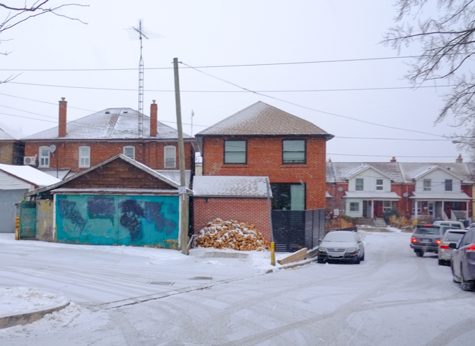
below: That brownish wall in above picture (where there is now a stack of firewood), was once covered with a painting.  This is it in 2015.

garage door with a picture on it titled Casa Nostra, a picture of a man playing a large guitar and a woman standing beside an outdoor table with food on it.

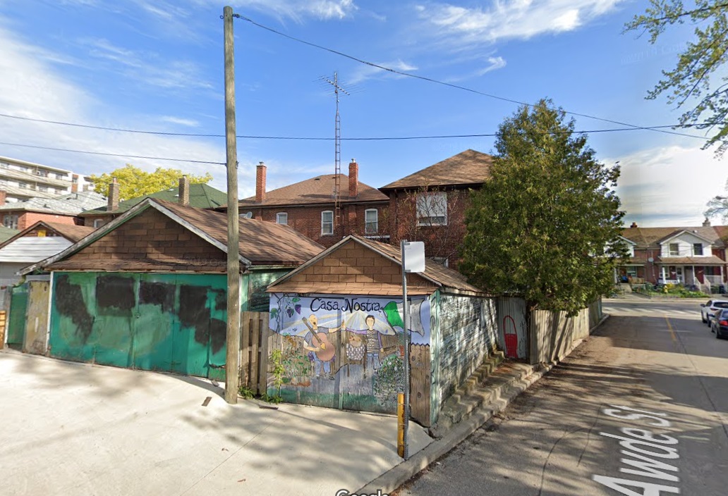
below: Awde Street, streetview from 2019.

At this point, the lane makes a 90 degree turn towards Dundas – and lo and behold, there is even more artwork to see ( also by Mony Zakhour?)

bright mural in alley

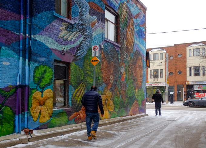
below: On the north side of Dundas West, there is a large mural titled, “Three Sisters” painted by Paula Tikay and Aner Urra.  I discussed it in a blog post from 2019 (Three Sisters, Tikay and Aner)

man in laneway walking past a large mural, Three Sisters,

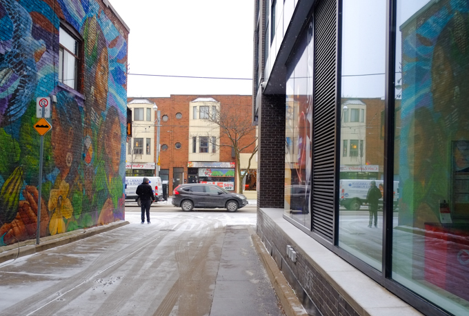
… and that’s the end of the alley!

Small bit of trivia:  I once found my great-great-grandfather, John Marshall, and his family in a Toronto phone book from about 1910 (I can’t remember the exact year).  They were on Gladstone Ave.  When I went to see if I could find the house, I discovered that the number corresponded with a vacant lot (parking lot?) adjacent to St. Annes church.

below: 504 King streetcar on a snowy January afternoon

As you all know, Toronto is being demolished and redeveloped.  Almost every part of the city is affected by the construction of new condo buildings or the upgrading of public transit.  It can be difficult to keep up documenting the changes!  A few weeks ago I posted some pictures from Queen & Spadina where Metrolinx is building a new subway station for the Ontario Line.  The next stop west from there is at King and Bathurst.

Infrastructure Ontario wants to build what they call a Transit-Oriented Community (TOC) at King and Bathurst.  The gist of the plan is that these sites will feature high density development around transit hubs.  Some of the plans for condo and office may still be at the concept level but the new subway station work is well underway.

below: Looking south on Bathurst from King.  On the southwest corner is the Wheatsheaf Tavern  which has been here since 1849.  The exterior of the building hasn’t changed much in 170 years!  It remains untouched by today’s construction.

looking south on Bathurst from King, Wheatsheaf Tavern on the right, vacant lot where most of Banknote Bar was. now a metrolinx construction site

below: The Banknote Bar on the southeast corner is now gone, or at least most of it has been demolished.  The north facade will be incorporated into the new station, the King-Bathurst station (Are they really going to call it that?  So Dull. So Bland.).

southeast corner of Bathurst and King, vacant lot where most of Banknote Bar was. North facade saved and is held up with scaffolding, now a metrolinx construction site

This 4 storey brick building was previously a Bank of Montreal.  It was built in 1901/02 for the Canadian Biscuit Company.   It then had a series of tenants until 1923 when Bank of Montreal moved in.

Previously, a mixed use development rising above the old brick structure had been proposed for the site (prior to Metrolinx).  Cancelled.  At this point there is no other development on this corner.

below: Looking east on King

You can see that the corner (above picture) is now covered by a very big white temporary structure where construction of another station underway. What will be revealed? Plans suggest a mixed office/residential tower above with rebuilding of most portions of the TD bank that was on the corner, as well as the building directly east of it. No car parking spots, bikes only. Concept stage? Or further along?  One day we might find out!

Last, the northeast corner –

below: Clock Tower lofts dominates the corner.  There really are two clocks on the side of the building, both of which are difficult to see.  But that doesn’t matter since they don’t work anyhow.

clock tower lofts and condos on the northwest corner of King and Bathurst, with a clock tower at the corner, clock not working, ugly building

below: 1919 photo of the Clocktower Building.  It was in bad shape in 1980 and was demolished.  The Clock Tower Lofts (above) replaced it.  In 1919 it was home to Otto Higel Piano Company. The church in the background is St. Marys Roman Catholic church at Bathurst and Adelaide.

1919 black and white photo of a brick building on northwest corner of king and bathurst. 4 storeys, with small clock tower on one corner, church in the background

photo credit: City of Toronto Archives, Fonds 1244, Item 3008

The building dates from 1895; it was built for the Toronto Lithographing Company who used it until 1901.  Next, the Newell & Higel Co. Ltd take over the building where they manufacture piano actions, keys and hammers, and organ keys, reeds, and reedboards.  By 1912 they employed 450 people.  They developed a Player Piano that became famous around the world and business boomed.  They expanded the building north to the corner of Adelaide Street West.

By the way, a Player Piano is one that plays itself.  The 1920’s were their heyday but advances in technology, especially the introduction of radios and record players, helped kill the Player Piano.  By the 1930s production ceased.

below: A 1970s view of the northwest corner.

1970s black and white photo of Otto Higel Piano Company, now a furniture factory

photo credit: City of Toronto Archives, Fonds 1526, File 7, Item 5,

below: Looking out the window of the Wheatsheaf Tavern.  How many people have sat here and looked out this window?  What did they think about?

looking out a window at the Wheatsheaf Tavern, looking northeast to corner of King and Bathurst where a large white temporary building encloses metrolinx work on a new Ontario Line subway station

and other little observations along Dundas Street East – a street that has seen intensive redevelopment in the central core.  These changes are slowly moving east with the consequent mixing of old and new.

Once there were large red hearts on the sign, as well as on the building, but they have disappeared.

sign on True Love Cafe, a bright purple building

The True Love Cafe opened at the corner of Dundas East & Sherbourne back in 2004.  The outside was purple and apparently so was the inside.  Before that (since the 1950s), the space was George’s Spaghetti and Jazz Bar.

Once there were messages like, “I love you” on the walls as well as menu items written inside heart shapes, but these too are no more.

gate across entrance to true love cafe, red door, purple building, painted over window,

man on a bike cycles past true love cafe, a purple building with red awning over door

attached to side of purple building, empty frames that once held signs.

graffiti on a pole with two people with arms upraised, lone has written love, love, love, on it in black marker

below: South side of Dundas at Sherbourne.

church on southeast corner of dundas and Sherbourne, Lahore Hakka Chinese restaurant on the south west corner of same intersection

below: Also at Dundas and Sherbourne are the most famous telephone boxes in the city – or at least most photographed

exterior of front of hair salon with pictures of men and women with their hair cut

West of Sherbourne, some of the original large old brick houses still stand. Some converted to commercial uses long ago; some are still residences.

upper level of bay and gable house on Dundas East

front of old convenience store, bars over windows and gate across entrance, faded coca cola sign, green trim, magenta painted bricks,

jumble of items in a store window, metal bars over window, red coca cola boxes, potted plants, reflections of buildings across the street,

old brick houses on Dundas East

old yellow brick house behind a metal fence, green frontyard

part of lower floor of old brick building painted white

part of older white brick house, two storeys, each with one window, small part of house that juts out and is near back of yard

below: (Dundas and Pembroke) Another blue and white development notice – with another very tall condo.  Yet again, all these residences but only 6 car parking spots compared to parking for bikes; Doug Ford screams about closing bike lanes while the city actively discourages car parking.  Great for the developer as car parking costs more money to build than bike spaces.  The sign says 49 storeys, the latest Toronto paperwork on the site says 55 storeys).  The facades of the 4 heritage houses that the condo replaces will be saved.

blue and white city of toronto development notice sign on front yard of a house on dundas east

below: Nearby, another closed restaurant.

looking through window into empty and permanently closed restaurant. some reflections of buildings across the street in the window as well

below: North side of Dundas, just east of George Street.   It’s looked shabby for years but it’s still in one piece.  George’s Pizza, George’s BBQ, and  Piassa Injera and Takeout (Ethiopian).  The sign in the window of the pizza restaurant says “open” but the whole building is for sale.   No price given on the realtors’ website, but its 6000 SF with 3 retail units and 10 residential apartments.  It’s probably a candidate for demolition?

old brick houses on Dundas converted to businesses awhile back, George's Pizza, George's BBQ

below: Looking westward at Dundas and George

looking westward along dundas at george, new condos, one old second empire brick building on the southwest corner, now a King Place BBQ and curry restaurant

below:  King Place BBQ and Curry stands its ground

King Place BBQ and Curry restaurant, painted orange, in an old second empire brick building at Dundas and Dalhousie,

below: The Filmore Hotel still stands at George and Dundas East

filmore hotel at the corner of george and dundas east

dundas street looking east towards george street, old filmore hotel can just be seen behind newer condo development

below: Looking east along Dundas

dundas street east, looking eastward towards george street, new condos on both side of dundas, window reflections on the right hand side

below: Southeast corner of Dundas and Mutual

southeast corner of dundas and mutual

cyclists at the corner of dundas and mutual

below: Dundas and Mutual, northeast corner

two men talking, at the corner of Dundas and Mutual where old building is now behind scaffolding

upper storeys of older building, second empire style, mansour roof, brick, painted yellow, ground floor has addition for a store front, now cannabis store

below: Old City of Toronto Archives photo from 1978 showing the northeast corner of Dundas and Mutual back when the building was pale bluish grey and not yellow; it was home to Denys Barbecue and not a cannabis store.  The Warwick Hotel (built 1910) is long gone.

City Archives 1978 colour photo of northeast corner of Dundas and Mutual, Warwick Hotel,

below: Where the Warwick Hotel once stood is now part vacant lot and part parking lot. This concrete building (partially seen in the photo above too) was built for Sears Canada, completed in 1971.   It features cantilevered blocks to form an upside down ziggurat.   What is a ziggurat?  It is a building where each subsequent floor is smaller than the one below it with the result being a pyramidal shape.

wrought iron fence in front of a large parking lot which is front of a modernist concrete building in upside down triangle shape

below: Reflections at Dundas and Jarvis

reflections in a large window at dundas and jarvis, showing 222 Jarvis, inverted ziggurat building being renovated,

man walking along dundas at jarvis

below: Dundas and Dalhousie

looking east along dundas from dalhousie street, construction traffic cones, tall buildings,

tall condos, new development, downtown

side of an old red brick smaller building in front of a wall of new condo glass and steel with many reflections in the windows

machinery with giant drill, at a construction site

digger in vacant lot at dundas and mutual, old red brick structure with new condos in the background

old smaller red brick building on dundas, with brick taller building behind

below: Church and Dundas – closing in on Yonge Street and TMU

vacant lot at church and dundas, now a construction site

cyclist rides past construction site at Church and Dundas, looking east, with many new condos rising in the background, yellow construction machinery

new building clad with wood tones and dark blue, with orange bollards outside door

below: Birdo mural on Church Street.

birdo mural

below: A squirrel with a nut (or other edible) on the ramp to one of TMU’s buildings on Church Street.   He’s not waving goodbye, but perhaps he’s thinking “Gotta run!”

black squirrel on concrete ramp entrance to glass fronted building, a bright blue building beside it

As this has turned into the first post of January 2025…  Wishing everyone a healthy and prosperous New Year with many walking and/or photographic opportunities!  Have a good one!

…. A short distance but with a lot happening.

An early morning walk with a weak winter sun low in the sky.  Tall buildings that cast shadows, or reflect light.  Patterns of light and shadow.

below: Crossing Yonge from Carlton to College

people crossing intersection of college and yonge, walking westward, towards TTC streetcar that is heading east, in front of College Park, with old red brick building on the north side of college street

below: North on Yonge.  The facade above Shoppers remains.  “….has design value and technological merit as a representative of the 1950s Toronto School of ‘Picturesque Modernism’ in its expressive use of concrete seen in the cantilevered canopy and decorative piercings of the concrete screen for the above-ground parking, in the ‘egg-crate’ elevations designed to reduce solar gain, and in the predominant white aesthetic of glazed white brick and concrete surfaces.” (form City of Toronto report on heritage inclusion)

below: Rising above Yonge and College

tall new condo tower above older red brick building on northwest corner of Yonge and college

below: Looking north, up the canyon that Yonge has become.  The very tall building that is obviously under construction in the distance is at Yonge and Bloor.

looking north on Yonge, from College, towards two very tall condo developments at Yonge and Bloor, shadows because of buildings, blue sky, not much traffic

below:  Empty, boarded up and waiting its turn. Southeast corner of College & Yonge.  I have vague memories of a candy store on this corner although I think that there were a number of businesses that passed through here.

brick building with rounded edge at front, now empty, southeast corner of Yonge and College, construction at street level in front of building

below: The east half of Yonge street in front of College Park is now a construction zone.  An additional entrance on the east side of Yonge along with more elevator service between street and track levels, is being built for College subway station.  Are there any streets in the downtown area that don’t have partial closures for construction?

small construction site on yonge street, taking up space on the street, in front of College Park shops

below: Sunspots, reflected light on the side of College Park

construction equipment

below: More emptiness, more waiting.

metal grille gate covering window of a store or restaurant that is now closed, old doordash sign in the window

below: Granby and McGill are two streets that run parallel to College but don’t actually meet Yonge Street, pedestrians only here

person walking through pedestrian zone between yonge street and sheard street at the end of mcgill

below: Looking back at Yonge Street from the same spot.  When the area was pedestrianized back in the 1980s, the city purchased added the arch.  The arch came from St. Andrews United Church at Bloor and Park Road (not on this site, moved here).  The mural on the wall, right hand side …

old stone arch remains, on yonge street near Sheard and McGill streets

… is The ‘History of Music on Yonge’ mural that covers two large walls on the same building.  This is the south side of that building.   It was painted by Adrian Hayles and features music legends who played in Toronto in the 1950s and 1960s.

History of Music on Yonge mural, south side,

Brown Derby tavern and Steeles tavern part of mural

part of History of Music mural by Adrian Hayles, group of male singers in black shirts, white ties, and black stripe on white suits

On the north side of building, the mural shows Ronnie Hawkins, Glenn Gould, Dianne Brooks, Jackie Shane, Muddy Waters, Shirley Matthews, B.B. King, Gordon Lightfoot, and Oscar Peterson.

history of music on yonge mural by Adrian Hayles, north side, Massey Hall, Gordon Lightfoot, B.B. King, piano player, tall, vertical mural

part of a mural by Adrian Hayles, piano player with multicoloured keyboard

below: Behind Yonge street, between Granby and McGill (Joseph Sheard parkette)

Joseph Sheard park in Toronto, old brick house, with many tall trees, some new condos

new condo towers downtown

below: Looking north up Yonge from Granby

looking north on yonge from granby, just south of college

below: Aura

looking south on yonge by ikea store and fusettes restaurant

below: People on a corner… To the woman in the brown coat – A penny for your thoughts (Does anyone use that expression anymore?)

two women holding bright green coffee cups, talking to each other, man in background crossing the street,

below: The southeast corner of Yonge and Gerrard is still a construction site….

redevelopment of building on southeast corner of yonge and gerrard, old facade being saved

below: …. but now it is on its way up!

redevelopment of building on southeast corner of yonge and gerrard, old facade being saved

below:  On the northeast corner, also Yonge and Gerrard is an older building that is still standing… for now.  An almost obscene 76 storeys with 828 residences.  No car parking; parking for 828 bikes only.   May I recommend the elevator repair business as a career prospect for those who are looking for ideas?  Also, we could have quite the discussion about bikes and bike lanes……

blue and white city of toronto development notice sign


man talking on his phone, walks under covered scaffolding, beside hoardings with painted diagonal stripes in yellow and blue

people walking on sidewalk, approaching covered scaffolding at construction site

looking through scaffolding, to west side of yonge, older 1800s buildings with mansour roofs, H and R block, cotti coffee,

yonge street, motorbike parked outside cotti coffee

below: Looking south on Yonge from Elm

street scene, looking south on yonge from elm, towards yonge dundas square, now called sankofa square

upper levels of buildings on west side of yonge, just north of dundas, includingmcdonalds,

below: The Zanzibar Tavern glows in the morning light

view from Elm street, looking north at Yonge, zanzibar strip club glows in the morning sun, condo redevelopment on the northwest corner of yonge and elm

below: Hoardings around the construction site on the northwest corner of Yonge and Elm

artwork titled Homecomings on the hoardings at construction site, northeast corner of elm and yonge,

below: Orange! Even more construction on Yonge, this time the southwest corner of Yonge and Elm

elm street, south side, looking east, at yonge

below: No more pizzas here.

damaged exterior wall on now abandoned pizza pizza restaurant, orange and yellow ties on point, some missing

below: Looking west on Elm

person walking on sidewalk on elm street, walking west from yonge

below:  A quick stop at the Cong Caphe.  That’s an iced coconut coffee!!

bouquet of flowers on a coffee shop table along with a cinnamon bun and an iced coffee drink


… but finding many other things instead.

This is a follow-up to my last post about the Don Mills trail.  Remember that I mentioned that it came to a dead end just north of Eglinton?  I thought that surely someone somewhere in the city government would have looked into options re connecting the Don Mills trail to a street or another multi-use path.  The dead end is just east of Leslie, so off I went to check it out (and I wasn’t going to walk all the way to a dead end just to turn around again) .

Hey look!  There is a vacant lot at approximately where the trail ends.

cracked pavement with weeds growing up in them, vacant lot,

Did I wander back there?  Sadly not….. I didn’t have any lock cutters with me….  This was once a Sony Music building but it was demolished in 2016.  There was no development notice sign at the site (9 acres).

blue metal fence and gate, locked closed, vacant lot beyond the fence

below: This is the Sony Music (or CBS) building, built in 1959.  They don’t make them like this any more – so spread out and only one storey high.   Land must have been much cheaper back then!

older colour photo of sony music building on leslie street (demolished in 2016)

Photo credit: by Bob Krawczyk, found on ACO Toronto website (Architectural Conservancy Ontario)

When I was researching the Sony Music building online, I came across the Phoenix Centre.  That’s the name of the planned private club being developed at the old Wrigleys site next door to the now vacant lot.  If I had realized that when I was out walking, I would have taken more photos.  As it is, this is the best I’ve got:

southwest corner of old Wrigleys building on Leslie street, now OTT, low rise modern building

This building, built 1962, was included in North York’s Modernist Architecture, first published in 1997. In addition, The former Wrigley property has cultural heritage value as it is historically associated with the 1950s planning and development of Don Mills by E. P. Taylor and Don Mills Developments Ltd. (if interested, more info at ACO website).  The Phoenix Centre plan retains most of the office space architecture but completely remakes the factory space.

  There is also talk of a bridge (pedestrian & bikes?) over the CPR tracks to the Crosstown developments.   Makes sense to connect the Don Mills trail, Crosstown, and Leslie Street!

Part of the reason I didn’t take any photos of the old Wrigley building is that I had chose to walk south the day….  just south is a fire station as well as some condos.

on Leslie street, white building that is a fire station, parkland in beside it. to the south are condos, older red brick buildings plus newer glass and steel condos behind

And there is a well worn path that accesses the back of the properties.

large trees in foreground, dead leaves on the ground, autumn, new condos being built in the background, cranes,

This road doesn’t actually lead to those new condo towers.  The CPR railway tracks are in the way.  Those towers are part of the Crosstown development on the old IBM and Celestica property (access from both Eglinton & Don Mills)

long driveway, access road, with new condos under construction in the background

The road didn’t lead to the end of the Don Mills trail either… but it did lead to the back of a parking garage.  No dogs allowed and no trespassing.  No luck here.

path that runs behind beige concrete building (parking garage) with no trespassing sign)

I got a better view of the neighbourhood though….

highrise apartment buildings and condo towers

Black and white on a grey day.

two chairs, one black and one white, in a vacant lot, grassy, one tree,

As I walked back out the path, I noticed this sign.  I took it to mean the property behind the blue fence, not the property the path is on… probably?

no trespassing sign, metrus private property

It stopped munching and stared at me, trying to decide to sit and watch or to run away….  it scampered away before I could get any closer (I don’t pretend to take good pictures of animals but it looked so cute, all puffed up to stay warm).

a grey squirrel sitting on a fallen tree trunk, dead leaves on the ground, a nut or something edible between its two front paws

A very short walk farther south on Leslie brings us to the Inn on the Park site on the northeast corner of Leslie and Eglinton.

below: Inn on the Park as it once was (about 1969)  I have ‘borrowed’ this photo from another website – Jamie Bradburn’s Tales of Toronto.  Follow the link if you are interested in the story of the hotel – it’s an interesting read.  Did you know that in 1962 North York had a ban on cocktail lounges?

below: The site today. It’s now a Toyota/Lexus dealership and home to a few new condos.

old Inn on the Park site, northeast corner of Leslie and Eglinton, now a Toyota and Lexus dealership, also new condo development, still lots of green space in front

new condos being built at inn on the park site

artwork on exterior wall, solid colour shapes inside squares, 3 D, but mostly flat, shades of orange

But there are more changes coming….. (surprised?)…. more glass and steel towers by the looks of it.  The notice also states that parking is planned for 845 cars and 1860 bikes.  Does Doug Ford approve?

blue and white development notice on the corner of leslie and eglinton, with inn on the park site in background, auberge on the park condo development

sidewalk closed sign and barrier, on eglinton, northside, east of leslie

below: A sad sight, Sunnybrook Park LRT station all ready to go but no trains running. One of the Toronto mysteries, when will the Eglinton LRT open?

looking east at Sunnybrook Park LRT station on the Eglinton LRT line, no trains running yet but station is somplete, yellow barriers across the entrance

Standing by the LRT tracks and looking south. Wilket Creek park and the Thorncliffe trestle railway bridge can be seen.  I crossed the road because I had seen stairs down to the park….

looking south from the end of leslie street, across lanes of Eglinton to WIlket creek park and thorncliffe trestle railway bridge

A big new set of stairs!…. But. Not shown – the locked gate that blocked the entrance.   There is still no entry to Wilket Creek/Sunnybrook Park from this side of Eglinton.

long set of stairs downhill from eglinton to a large parking lot at wilket creek park.

looking south from Eglinton towards thorncliffe trestle bridge, wilket creek park, and ravine system,

It’s getting to be crowded….

cars traveling east on eglinton, approaching leslie, many waiting to turn left, new condo developments behind, crosstown, as well as inn on the park site

below: Crossing Eglinton and looking westward

traffic turning left from eglinton onto leslie, looking west on eglinton

New pedestrian and bike paths that provide access to the park from the north side of Eglinton have been built but they too are locked closed.  It’s very frustrating to see this infrastructure built and then left unusable.  The signs says construction danger but there doesn’t seem to be any construction happening…..

new stairs and bike path infrastructure built at leslie and eglinton that are closed, gates and signs

new stairs and bike path infrastructure built at leslie and eglinton that are closed, gates and signs

Just in case I have confused anyone, here is a map of the area that Google maps created.   Near the top left it even says Don Valley Bike Trailhead… which is very wrong.  No trailhead here of any kind as we’ve just learned.  Also it was the Don Mills trail not the Don Valley trail (the latter is somewhere else!)

google map screenshot of leslie and eglinton and vicinity

New benches! Wilket Creek Park is one section of the string of parks that parallel the branches of the Don River in Toronto’s ravine system. I’ll leave you with a few pictures that I took the other day while I was in the area…

new seating area with wood benches beside wilket creek park sign

lots of trees growing on hillside, autumn, dead leaves on the ground and none on the trees, park, railway trestle bridge in the background

path through woods beside a river, autumn, leaves on ground, small trees

view from under thorncliffe trestle railway bridge, metal girders,

last few yellow leaves on a tree, blowing in the wind

west don river as it flows under eglinton avenue

benches and picnic tables in a grassy park with many trees nearby, condos in the background

leaves in a puddle, reflections of tree branches in the water too

graffiti stickers on the back of a sign, one with Mexican flag,

graffiti on the sides of a small concrete pedestrian bridge

graffiti, large capital M with a bright pink heart

Subtitle: More Ontario Line mess


at corner of Spadina and Richmond, traffic light, with two Spadina street signs on it including old fashion district sign,

below:  Spadina and Richmond…. A giant thimble (by Stephen Cruise) sits on a stack of buttons.  Behind it, a building is shrouded in blue netting.

a couple walks a dog past sculpture at Richmond and Spadina that is a giant thimble on top of a stack of buttons

below:  Blue, blue, my world is blue… walking north on Spadina under blue netting that protects the sidewalk from work being done on the southwest corner of Queen and Spadina.  The whole block between Richmond and Queen is under wraps.  This is a future subway station with the imaginative name of Queen-Spadina.

people walking on sidewalk that is covered with scaffolding and blue netting to protect from a construction site, queen and spadina, ontario line construction

below: Southwest corner of Queen and Spadina

TTC streetcar on Queen, waits at red light at Spadina, people on the corner, tall building behind, pink signs advertising ontario line.

below: A look at what’s happening behind the hoardings….

Metrolinx construction site, hole in the ground, with hoardings, and shored up, some equipment,

below: Mcdonalds on the northwest corner is unaffected by the changes around it.

people waiting for green light, one man has a brown paper bag in his hand, mcdonalds at queen and spadina is in the background

below:  Looking south on Spadina with a good view of the southeast corner of the intersection with Queen West.

looking south on Spadina towards southeast corner of Spadina and Queen, tree, traffic,

below: There is a lot happening in the northeast quadrant, all by Metrolinx.   the yellow framework that protects and stabilizes a facade is becoming a common sight in Toronto.

below: In case you can’t remember what was on that corner, this is a photo taken back when they were laying streetcar tracks in 1912.  Most recently there was a CIBC bank on the corner.

black and white photo from 1912 of brick building on the northeast corner of Queen and Spadina.

Photo taken from WIkipedia Commons, in public domain. Originally from City of Toronto Archives.

below: A couple of the old houses/stores on Queen beside the old brick building seem remarkably unchanged since 1912.   (As a light grey car partially blocks the pedestrian crossing at the intersection).

a white car partially blocks the intersection as it goes southbound on spadina, pedestrians have to go around it while crossing on their green light. northeast corner of queen and spadina in the background

close up of an older brick building that has been gutted, but facade is being retained for redevelopment into metrolinx, ttc, subway station entrance

a woman wearing headphones walks past a construction site, on Spadina, other people on sidewalk crossing at traffic lights

graffiti on black hoardings, line drawing on bright green, picasso style, of a woman

below: The 510 streetcars are not running during this construction.

below:  But because the buses are too wide for the streetcar lanes, the middle of Spadina is very quiet… so I can stand here and take pictures.

standing in streetcar lanes, looking south on spadina, towards queen,

below: It also means that the replacement buses are now running… and competing with cars for a limited space.

a young man in blue winter jacket and baseball cap, walking on sidewalk past an orange sign saying pedestrian detour, and an arrow pointing right

below: Painting over the graffiti

below: Just north of Queen, there is a large vacant lot on Spadina.  So large you can see through to Cameron Street.

below: Cameron House and other houses on Cameron Street and beyond.

two young men on bikes wait at a red light, on Queen West at Spadina

stickers on crossing button at intersection, urban ninja squadron and feelings boi

people waiting on the southwest corner of padina and queen, waiting for their green light, pink hoardings for metrolinx construction behind them

looking out the window of a TTC spadina bus, looking at people waiting at bus stop, tall condos behind them, some reflections

There are so many new buildings in Toronto!  One of them is the new CIBC building at 81 Bay Street which is immediately south of the railway tracks and across the street from Union Station.  It is also adjacent to the new GO Bus station.

below: If you take the elevator to the 4th floor of the new CIBC building,  you can access the new park.   This is the view that greets you. The park extends over the railway tracks – a great use of space!

elevated park over railway tracks that is part of cibc square development,

below:Looking east from the park (on a foggy morning, and with a spot of dirt on the glass fence).   The trees on the right mark the spot where a strip of land separates the railway tracks from the Gardiner Expressway/Lakeshore combination.  Between Yonge and Parliament there are no buildings adjacent to the tracks on the south side.    That tall splotchy looking building is the Sugar Wharf Condos which, as the name suggests, are close to the Redpath Sugar property.

eastward view from cibc park, over railway tracks, tall buildings on either side of the tracks,

below: Looking north across the roof over the railway tracks.  The gold building is another bank building, RBC (Royal Bank of Canada).  On the right, the building that looks like there are diamond shapes in the glass, is a second CIBC tower but on the north side of the railway tracks.

below: Construction continues on the north side.  It too will have a park that extends over the tracks.  The two parks should merge into one once construction is completed.

construction site, park above the railway tracks at part 2 of cibc square, on the north side of the tracks, gold coloured r b c building also in the photo

man working at construction site, park above the railway tracks at part 2 of cibc square, on the north side of the tracks, gold coloured r b c building also in the photo as is Royal York Hotel

CIBC square, park

CIBC square, park, in November

below: Westward

looking west from cibc square, red leaved plants in foreground, CN Tower in background

below: In the center of the park is a large shiny metal leafless tree.   This is “New Amalgam” by Roxy Paine (2022).   It is 72 feet high.

public art, tall tree made of metal, cibc square

public art, tall tree made of metal, cibc square, cn tower in the background

below: Looking over the covered tracks at Union Station and all the ventilation system components on the roof.

looking west from CIBC square, long railway tracks, past covered tracks at Union Station with ventilation systems on the roof, CN Tower,

looking west from CIBC square, long railway tracks, past covered tracks at Union Station, CN Tower, with construction on south side of railway tracks

below: A closer look at the nearby construction at track level (and lower).

union station infrastructure construction

There are also stairs on the exterior of the CIBC building that lead to the elevated park.

looking into a few levels of cibc building, through large windows, from exterior stairs

Bay street side of CIBC office building, west side, lower three levels with tall white pillars

below: Looking south on Bay Street where Scotiabank arena takes up most of the street scene.  That’s the Gardiner Expressway as it crosses Bay.

looking south on Bay street rom CIBC building, Scotiabank arena takes up most of the street scene,

below: Through the window to the interior of CIBC  where Steve Driscoll’s artwork shines brightly.

interior of cibc building on bay street as seen through large window from exterior stairs, glass artwork, little round tables with a couple of people seated at them

below: “A light stolen from the sun” is a collection of 12 digital prints on laminated glass.   they can also be viewed from the 4th floor but access is controlled.   Also, camera use will get you a nice chat with a security guy.  The usual, phones are allowed but even little cameras are a no no.

Steve Driscoll artwork, red and blue, trees, tall, vertical works on glass

below: An outpouring of red poppies is the stunning centerpiece in this Remembrance Day tribute (created by Fresh Floral Creations).

an arrangement of red poppies for Remembrance day in the lobby of an office building,

two women on exterior stairs by CIBC sqaure, downtown toronto

With thanks to Nancy and Merle who went exploring with me that day.

Have a seat!   It’s a rather warm autumn this year, isn’t it?

a pale orange, faded, fabric covered armchair sits by the curb on a sidewalk in front of a house, fallen autumn leaves on the ground

below: A Hallowe’en spider caught in a rather thick web. It doesn’t have much to do with Pape subway station although you might feel inclined to put “scary” and “TTC” together.

big black fake spider on white, on a red shrub, front yard

Anyhow back to the main story…. Pape station is where the existing Bloor-Danforth line is going to meet the new Ontario line.

below: Do you remember when Pape station was being renovated? Now the site is a mess again.

pape subway station entrance on pape avenue, with cranes around it, for construction of Ontario Line

Pape station is a short block north of the Greektown section of Danforth.

orange and black traffic cones, and orange construction mesh fencing, outside pape subway station, for ontario line construction

below: Looking south on Pape towards Danforth

looking south on Pape from beside Pape TTC subway station

below: Across the street from the subway station

buildings on Pape across from the TTC subway station

below: See that bright white building in the picture above?  I bet that it’s not white anymore.

truck with red cab is parked beside a white building that is being painted black, person with a paint roller on a very long pole

below: My idea was to walk around the whole site. …

sidewalk in front of A & W, motorcycle parked there, sidewalk ends with orange fence because of construction, utility pole by sidewalk is wrapped in blue with Greektown Danforth written on it, also a blue and white Greektown banner on pole as well as Canadian flag

below: Looking back at the Danforth and Pape intersection, north side.  The white stone Royal Bank building stands on the northwest corner.  Behind it, the steeple and little green dome of Holy Parish church points upward.

Danforth at Pape, north side of the street, bank building on northwest corner, and A & W on the northeast corner

below: Ontario Line construction along the Danforth, northside.  Metrolinx seems to have a lot of property here.

ontario line construction on the danforth near pape

below: Any idea what this is?  What is happening here?

large yellow crane holds up an very large item, ontario line construction

below: I wasn’t the only one taking pictures!

a man on a bicycle has stopped to take a picture of the construction at pape station, on the danforth

below: Eaton Avenue runs parallel to Pape, just to the east.

Eaton Ave at Danforth, looking west, Ontario Line subway construction site

below: Northeast corner of Danforth and Eaton

northeast corner of danforth and eaton avenue, 3 storey brick building, Papa Johns pizza on ground floor, Mr. Pide restaurant (now closed), Black Pot lounge, an empty storefront and an Asian (Korean?) restaurant.

below: Eaton Ave entrance to Pape station lined with plywood hoardings.  This station isn’t that old – the update was completed in 2013.  I think that it is being retained but it is hard to tell from the Metrolinx website.  A brand new entrance is planned for the Danforth as well (and may be very large and very grand, not quite to scale with the present neighbourhood?).

Eaton Ave entrance to Pape subway station, lined by construction hoardings, plywood, Ontario Line subway construction site

below: Houses on Eaton Ave with Metrolinx construction behind them.

single family houses on Eaton Ave with construction cranes behind them, Ontario Line,

2 large orange storage tanks, wires, crane, ontario line construction site

2 large orange storage tanks, wires, crane, ontario line construction site , orange flags on overhead wires

This area has been serviced by the Bloor Danforth line since 1966.  In general, most of the residences are single family houses, often as some form of row housing.  Smaller houses with small yards seems the norm… i.e. a fairly typical East York neighbourhood.

three single family houses on eaton avenue

Muriel Avenue and Selkirk Street, residential neighbourhood near Pape subway station, single family homes and row houses

Exploring on Pape…..

below: Working on Pape, fixing a porch (or just watching)

reconstruction of a front porch

below: Addis Kidan Church, Greek Gospel Church..

Addis Kidan church on Pape Ave., red brick building with small white cross on roof

below: Tzatziki cafe with the painting above the entrance – interior restaurant scene

Tzatziki restaurant cafe on Pape, with painting above entrance

small commercial building on Pape with a TTC bus shelter in front of it

below: Mixed use – once a line of single family homes, now some are businesses.

a line of two storey family houses on Pape Ave., one is now an upholstery business

two storey duplex

Seranos bakery and food store, sign and parking lot,

below: There is also another construction site at Sammon

machinery in a construction site

wires covered with orange plastic, on a pole above a construction site

below: Looking north on Pape Ave from MacPhail.   There is another station under construction at Cosburn, a few more blocks north but that’s for another day. (Updated 22 June 2025 – there is now an Ontario Line – North Pape blog post)

looking northward on Pape

white arrow pointing right and orange pedestrian sign pointing left

I’ll end instead the way I began – with a little bit of Halloween to distract you from the constant noise of construction.

frontyard halloween decorations, zombie on swing with grey teddy bear on her lap

halloween decorations, outdoors, looks like yellow skull and arm bones are rising out of the lawn

On a warmer than usual late October morning….

hear comes the sun poster in a store window on bloor west

… when the early morning sun played with the autumn leaves in Christie Pits park

trees in autumn foliage, reds, golds, and oranges, in christie pits park

painting on a cement box in christie pits park, black bird head, with text, land back to natives is justice

a man walks by a fruit and vegetable store on bloor street

Of course, late October means Halloween with pumpkins and other spooky things.

display of small pumpkins, outside in sun, at a market, orange with green bumpy bits

below: This guy hasn’t had his coffee yet!

halloween decoration in front of coffee shop, inflatable orange pumpkin with scary face, also two green arms,

As I started putting together this post, I learned that Doug Ford wants to tear up Toronto bike lanes starting with those on Bloor, Yonge, and University Ave   He has named them in his latest wannabe Toronto mayor action, namely Bill 212, Reducing Gridlock, Saving You Time Act, 2024.

stickers and notes on door of bike shop

Ford claims that bike lanes add to the congestion on our streets (and makes his commute to work difficult).  You will note the traffic chaos here this morning! The vans on the far side are (legally) parked.  I suspect that Ford once sat in a traffic jam on Bloor and noticed that cyclists were moving faster than he was.

a female cyclist rides a bike in a bike lane on bloor street, one car is driving past, some other cars are parked across the street

man in plaid shirt riding a bike in bike lane

But I don’t want to get bogged down with politics and the antics of politicians, so I will leave you with a few scenes for Bloor West (approximately) between Christie and Lansdowne.  There is some Halloween, some stores, some construction, some people, some architecture, some of the usual stuff!  Maybe even a few things that will take your mind off politics!

below: Bloorcourt

bloorcourt sidewalk art, heart shapes around the letters, in front of a convenience store, painted by Victor

bloorcourt banner on a utility pole at dovercourt and bloor, with crane in the background, for construction on the northwest corner of that intersection

below: A little bit of history…. small tiles in the doorway of number876

floor, exterior, outside of doorway of store on bloor west, covered with small multi coloured tiles, plus green tiles making the number 876

below: Banjara parking lot payphone with its own Heritage Plaque thanks to the Toronto Sign Reimagination Unit, aka Jode Roberts.

empty small telephone booth with a plaque on top

In the summer of 2015, a coin-operated telephone was installed here, replacing three long-standing Bell payphones.  This payphone served hundreds of residents, offering a vital communication link.  To make a call, users had to insert metal coins through a slot.  However, the phone mysteriously disappeared sometime in the past year. 
The coin-operated payphone was patented by American inventor William Gray in 1891.  Its use peaked around 2005, with nearly half of Canadians reporting regular use and over 150,000 payphones across the country.  By 2015, more than two-thirds of these payphones had been removed. As of 2021, only a few hundred functioning payphones remained in Toronto.   This plaque commemorates the payphones in this parking lot and their gradual disappearance from the urban landscape. 
Heritage Plaque courtesy of the Toronto Sign Reimagination Unit, 2024


a woman sitting on a bench, outside, beside a small store, leaning on grey fence with sign on it saying pizza, as well as an arrow pointing right

looking in a store window, mannequin hand in front of a design on a t shirt that is a raccoon popping its head out of a garbage can, trash panda

chairs stacked in corner of patio, outside, some leaves have fallen on the chairs

below: Bloor and Brock

Pizza Pizza on the southwest corner of Bloor and Brock, also stores on the north side of Bloor,

bloor west, north side, at brock, blue collar bakery, bar neon, old laundromat, man walking past on sidewalk,

below: Part of a mural by Jimmy Chiale

part of a mural by Jimmy chiale, many shapes and colours, abstract, mostly blues, some faces,

man standing outside a door of a store

jumble of signs outside of a store

window of a business on bloor street, massage, neck and shoulder etc., red words on the glass that are starting to peel off, plant in window,

bloody no trespassing banner, as halloween decoration, in a store window display, with reflections of the street

hoardings beside construction site, along with scaffolding and protection that covers the sidewalk

below: Amazing!  He’s a cumin being! Good things!

decorations in a window display, store, paper hearts in different colours, each with one or two words like amazing, good things, , also note saying he's a cumin being.

below: Angel Mary

white statue of angel mary, praying, in a store selling beauty and hair products

below: Very large Italian flag by Vito Vesia Upholstery

large italian flag hanging against exterior wall of a building

envelope sticking out of the top of a rusty mailbox that is mounted on a blue metal gate

below: By Dufferin station

people waiting outside subway station, both women on phones, one standing beside a large suitcase

below: Bloor & Lansdowne

looking west along bloor at Lansdowne, front of TTC bus, people waiting to cross street, discount store on the northwest corner,

below: Scrawl on a TTC bus stop pole.  At first I thought that it was a biblical reference, but when I checked, I found that Daniel 5:5 is “Immediately the fingers of a human hand appeared and wrote on the plaster of the wall of the king’s palace, opposite the lampstand. And the king saw the hand as it wrote”.  I doubt that has anything to do with gullible Christian hippies, right?

graffiti writing on TTC bus stop pole that says Daniel 5.5 gullible Christian hippie

big orange cartoon face, with white cap, mural on a garage in an alley
an alley in bloorcourt, murals on garage, staircases, brick buildngs,

close up of a painting on exterior of garage in an alley, blue star with a man's face in it, front end of car with licence plate 007

mural of lighthouse on a red brick wall, bottom part has been tagged over with a lot of yellow paint

below: “Remember to Love! Go call your mom, say I love you and thanks!”

sticker graffiti on a Canada Post mailbox

graffiti stickers on the back of street signs

With thanks to Bill, Jeff, Paul, and Barry who walked with me that morning – and a shout out to the woman who said, “That’s so cute” when she learned that we were walking together.  Cute?

pedestrians crossing street, man on bicycle waiting for green light, bus stop pole, lowrise brick apartment in background

walking on sidewalk, west on bloor,

The best laid plans….

Tucked away on a dead end suburban street is a little park with a monument in it.  A monument to a couple, Henry Mulholland and Jane Armstrong.

stone pillar about 6 feet high, with plaque, memorial for Henry Mulholland

Dedicated to the memory of Henry Mulholland and his wife Jane Armstrong. Pioneers of this district who emigrated from Ulster in 1806 and took out the original grant of four hundred acres from the crown. He fought in the War of 1812 and later returned to Ireland to induce further emigration. While returning was drowned in the wreck of the Lady of the Lake in the Straits of Belle Isle in 1833. Erected by the eight branches of their descendents, 1937.

The ‘Lady of the Lake’ sailed from Belfast on 8 April 1833.  She was bound for Quebec with 233 passengers aboard – mostly immigrants. On the morning of 11th May, off the coast of Newfoundland, the ship struck an iceberg.  Only a few people survived.

Jane was not with her husband on that trip, instead she was at home with her 10 surviving children, the youngest of whom, Henry Jr. was born in 1829.  Two more children later died of smallpox.

Jane and Henry were married in Co. Monaghan Ireland in 1806 so they must have emigrated as newlyweds.  Their first child, Mary Ann, was born in 1807.

The 400 acres that the couple were granted were Lots 14 and 15, Con 3 in East York (south of what is now Sheppard and east of what is now Leslie).  They built a log house on an island in the East Don River.   Fast forward a number of years, after a number of changes of ownership and many changes in the neighbourhood, Henry and Jane’s great grandson, George Stewart Henry bought the farmhouse and property at Lot 14 Con 3 (for $14,500) to bring it back into the family.

The name George S. Henry may be more familiar to some of you.  There is a high school named after him, and a whole neighbourhood, Henry Farms.

The reason that I found the Mulholland cairn?  It is located close to one of the entrances to the Betty Sutherland Trail, just north of the 401 highway.  A few years ago I walked the south end of this trail (you can read about it here: Paths to ruin and a course, 2021).  Now I wanted to walk the northern section as well.

below: An ominous sign, construction on the trail!

signs at the beginning of the Betty Sutherland Trail

below: It wasn’t long before the trail ended.  There were six signs to warn us.  The end was at the 401 highway.

Rather than retracing our steps, we went down to the river’s edge.

The East Don River flows under the 401

We headed back north instead of south. …Over a piece of the path that had washed out in the August flooding.

below: stag horn sumac

below: pear tree

below: swamp bush sumac

below: North York General Hospital in the background.

below: The East Don River flows diagonally under the Leslie Sheppard intersection.  The black and white highrise in the distance is farther north up Leslie Street.

below: Looking west along Sheppard towards railway bridge

below: Seen just outside of Leslie subway station (at Sheppard).  We didn’t see any wildlife, just a lot of traffic.

Apples on the sidewalk, north side of Sheppard…. Seems to suggest that once upon a time someone lived here and planted apples.

below: Looking east

below: Teasels

below: Chinese Crab Apple tree

Now on the East Don Trail (north of Sheppard) where there is more construction.  Also, a large number of new trees have been planted.

below: Strange artwork outside Canadian Tire, just west of Leslie

Getting back to “Best laid plans”…..   You may have noticed that these aren’t the most recent pictures (wrong season!)….  This post was written back in early September and I thought that I had uploaded it.  Ooops.  Forgot.