Archive for the ‘construction’ Category

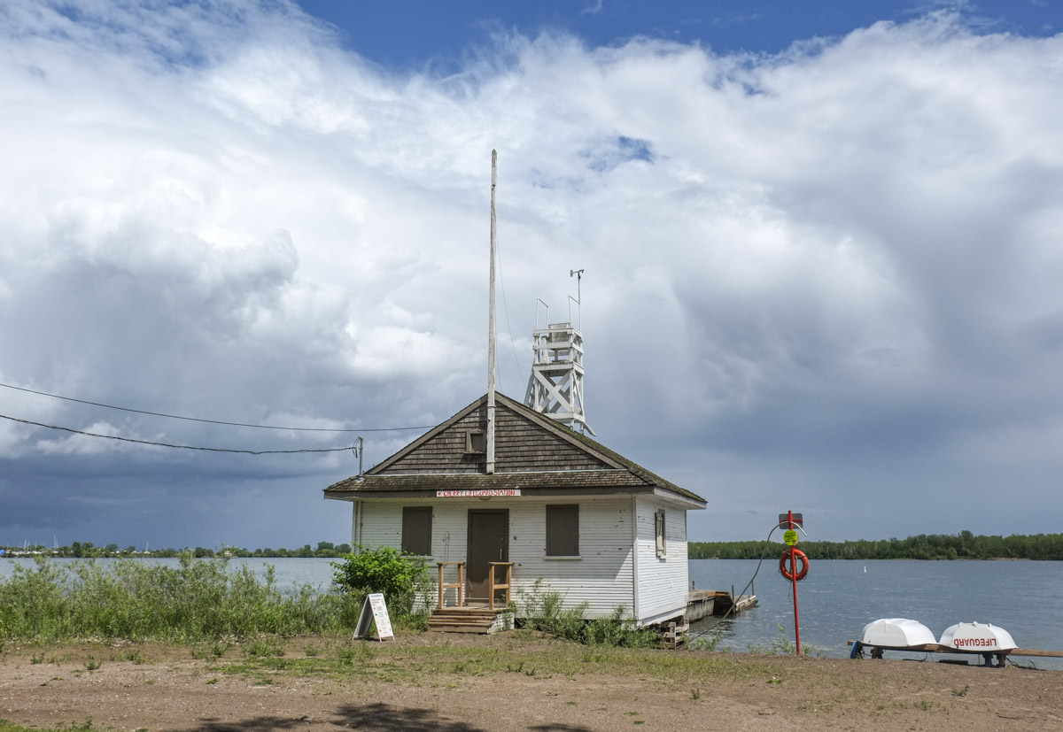
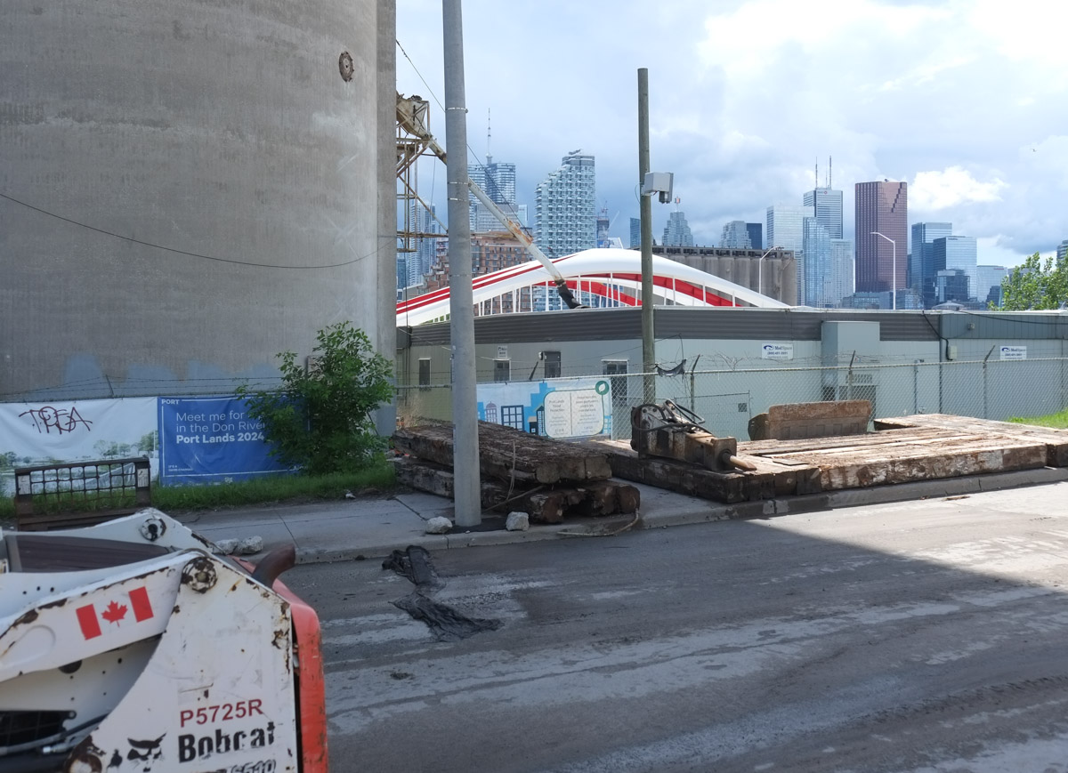
… but finding many other things instead.

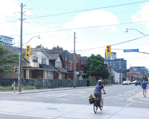
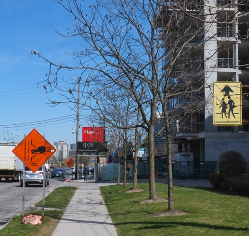
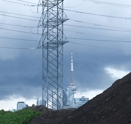
This is a follow-up to my last post about the Don Mills trail.  Remember that I mentioned that it came to a dead end just north of Eglinton?  I thought that surely someone somewhere in the city government would have looked into options re connecting the Don Mills trail to a street or another multi-use path.  The dead end is just east of Leslie, so off I went to check it out (and I wasn’t going to walk all the way to a dead end just to turn around again) .

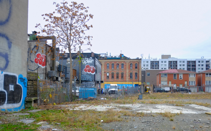
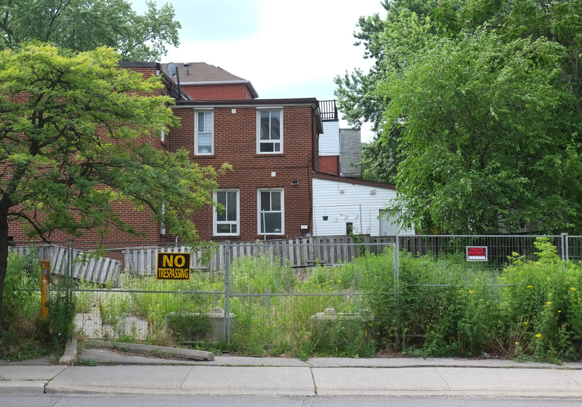
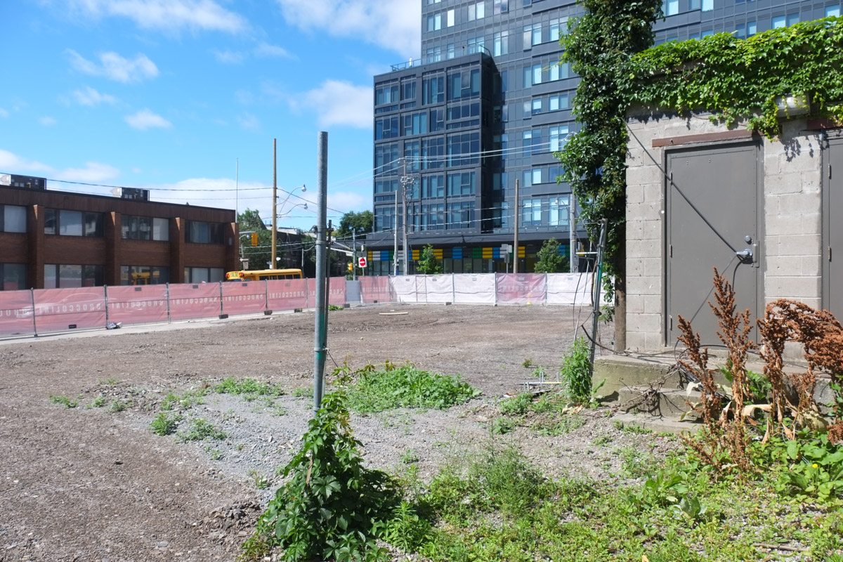
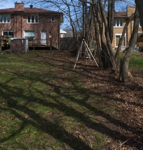
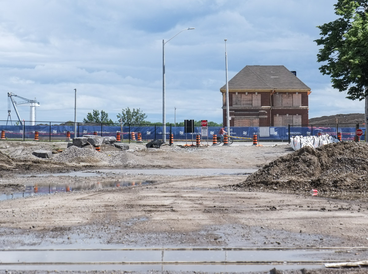
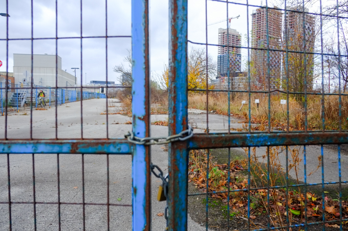
Hey look!  There is a vacant lot at approximately where the trail ends.

cracked pavement with weeds growing up in them, vacant lot,

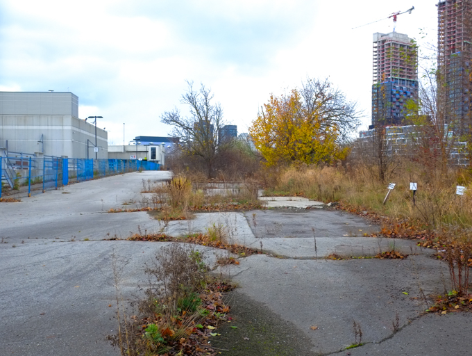
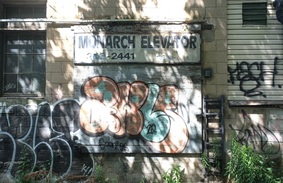
Did I wander back there?  Sadly not….. I didn’t have any lock cutters with me….  This was once a Sony Music building but it was demolished in 2016.  There was no development notice sign at the site (9 acres).

blue metal fence and gate, locked closed, vacant lot beyond the fence

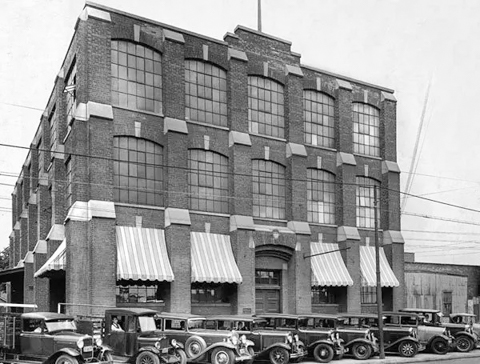
below: This is the Sony Music (or CBS) building, built in 1959.  They don’t make them like this any more – so spread out and only one storey high.   Land must have been much cheaper back then!

older colour photo of sony music building on leslie street (demolished in 2016)

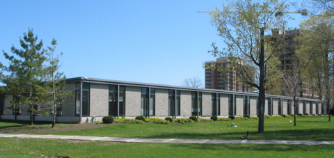
Photo credit: by Bob Krawczyk, found on ACO Toronto website (Architectural Conservancy Ontario)

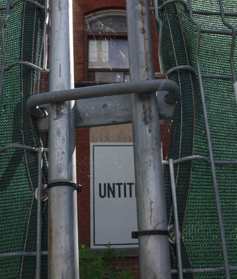
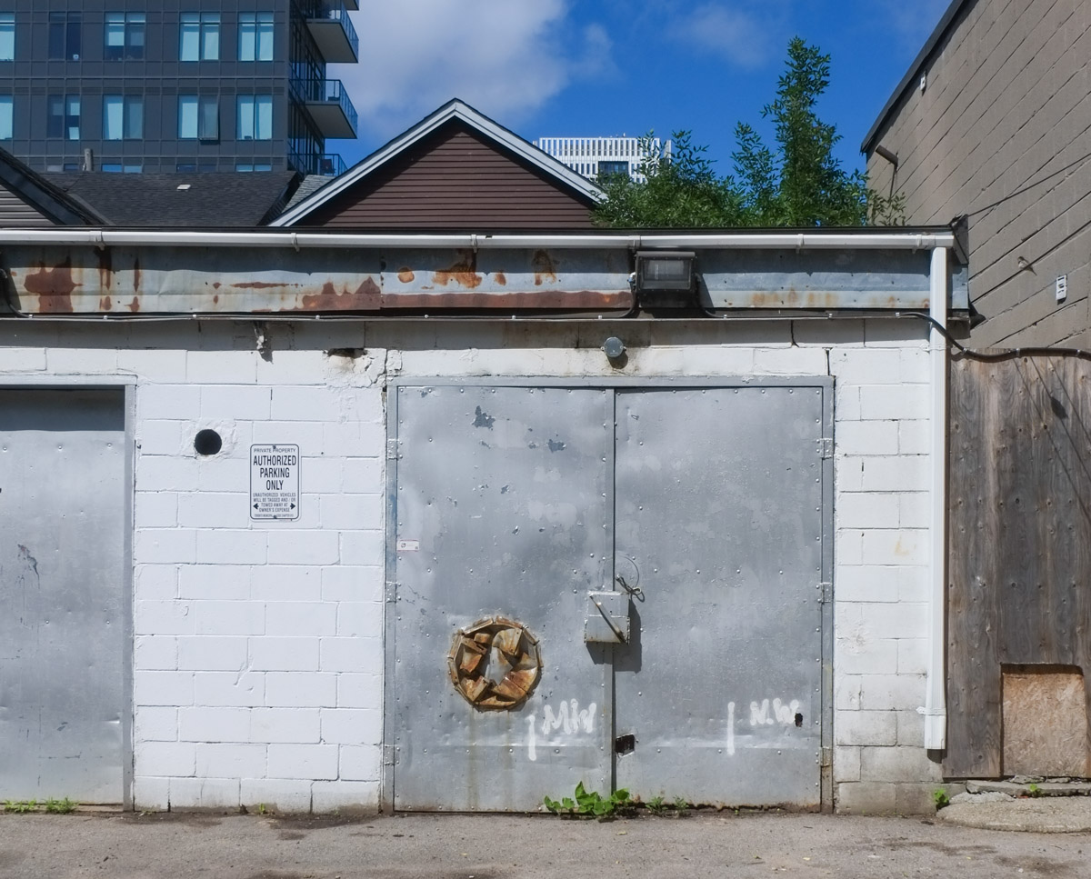
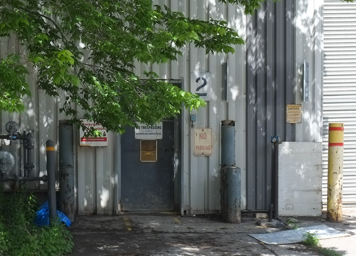
When I was researching the Sony Music building online, I came across the Phoenix Centre.  That’s the name of the planned private club being developed at the old Wrigleys site next door to the now vacant lot.  If I had realized that when I was out walking, I would have taken more photos.  As it is, this is the best I’ve got:

southwest corner of old Wrigleys building on Leslie street, now OTT, low rise modern building

This building, built 1962, was included in North York’s Modernist Architecture, first published in 1997. In addition, The former Wrigley property has cultural heritage value as it is historically associated with the 1950s planning and development of Don Mills by E. P. Taylor and Don Mills Developments Ltd. (if interested, more info at ACO website).  The Phoenix Centre plan retains most of the office space architecture but completely remakes the factory space.

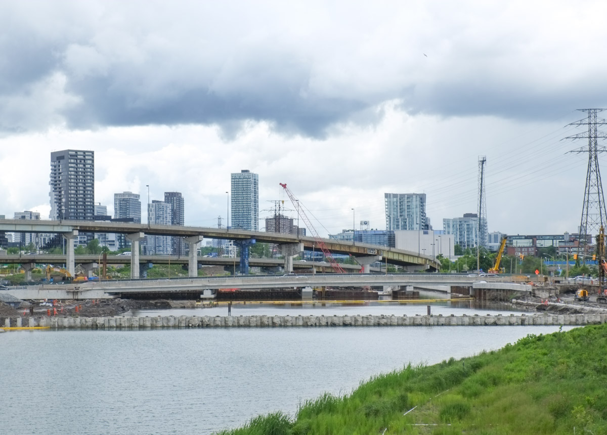
  There is also talk of a bridge (pedestrian & bikes?) over the CPR tracks to the Crosstown developments.   Makes sense to connect the Don Mills trail, Crosstown, and Leslie Street!

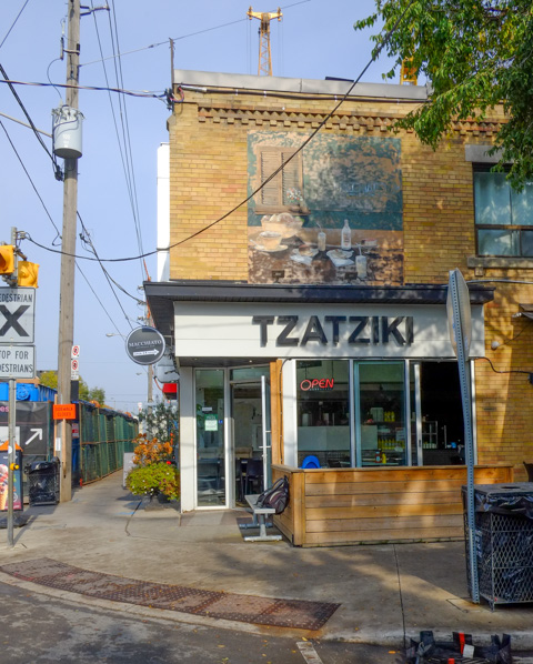
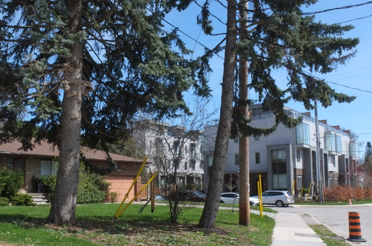
Part of the reason I didn’t take any photos of the old Wrigley building is that I had chose to walk south the day….  just south is a fire station as well as some condos.

on Leslie street, white building that is a fire station, parkland in beside it. to the south are condos, older red brick buildings plus newer glass and steel condos behind

And there is a well worn path that accesses the back of the properties.

large trees in foreground, dead leaves on the ground, autumn, new condos being built in the background, cranes,

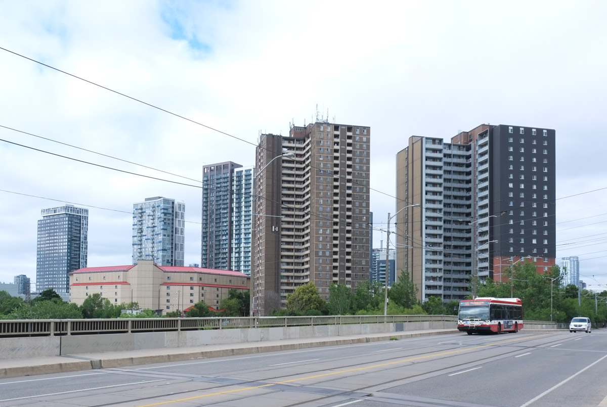
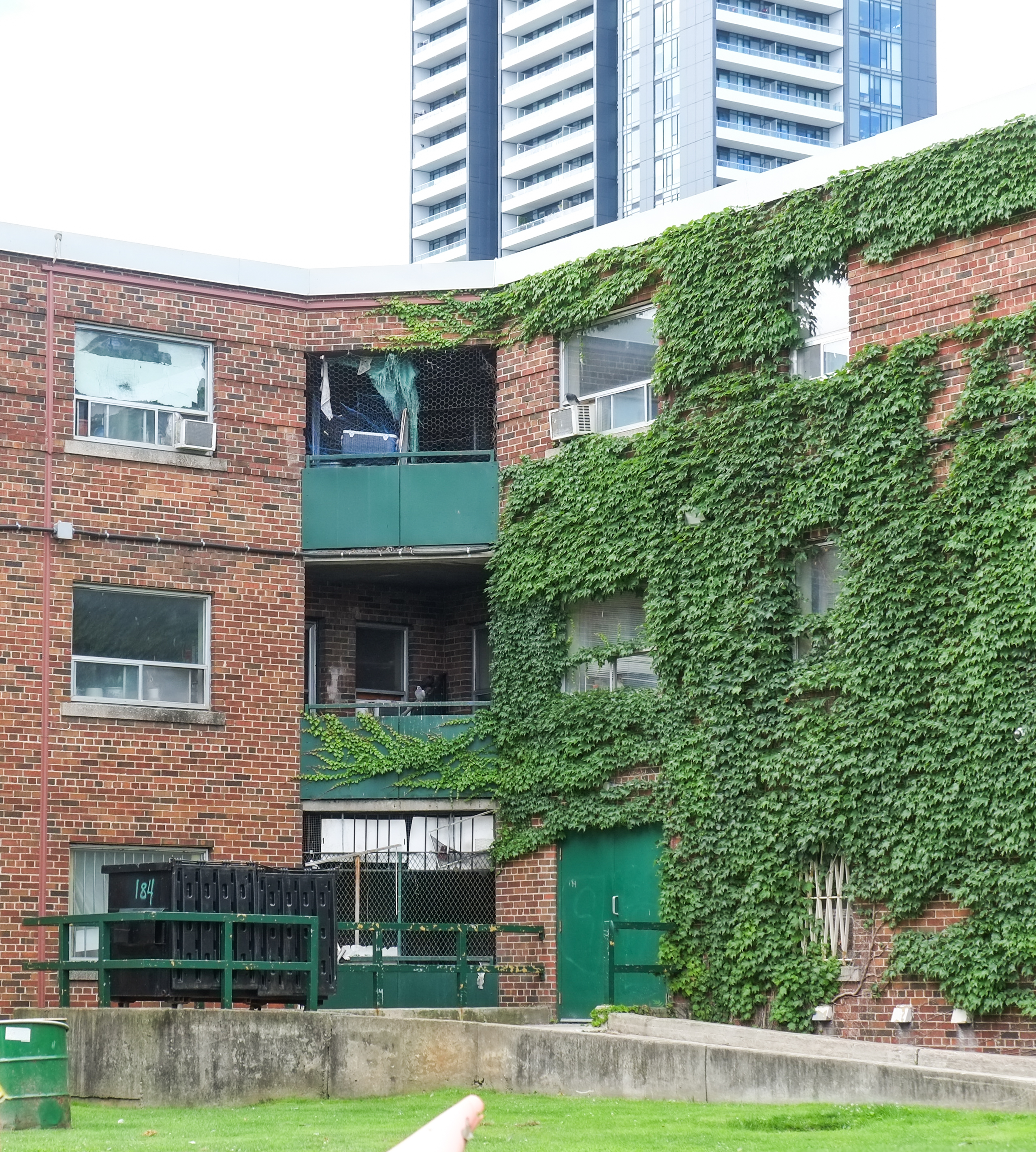
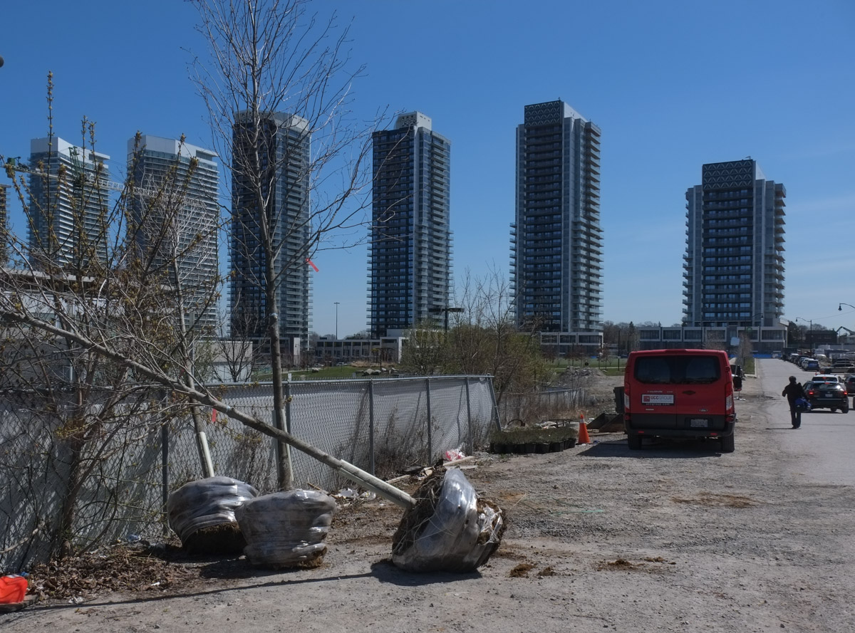
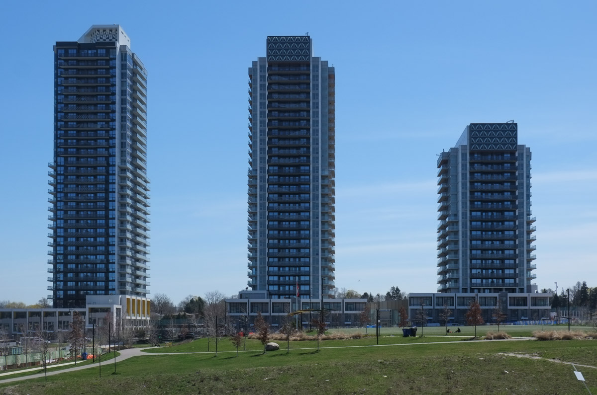
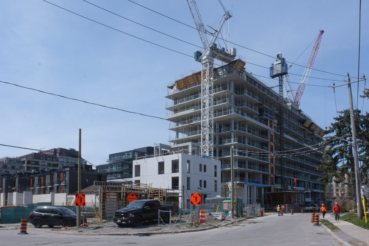
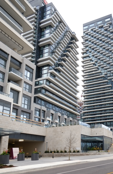
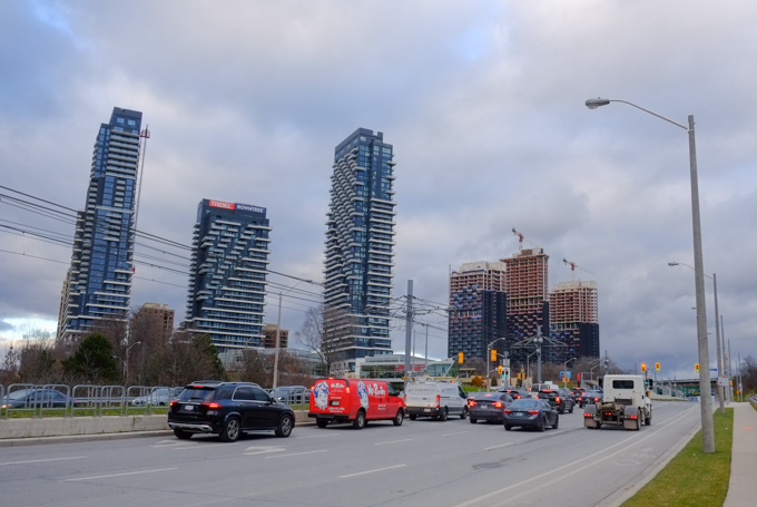
This road doesn’t actually lead to those new condo towers.  The CPR railway tracks are in the way.  Those towers are part of the Crosstown development on the old IBM and Celestica property (access from both Eglinton & Don Mills)

long driveway, access road, with new condos under construction in the background

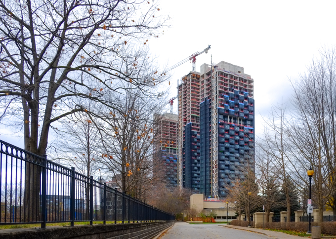
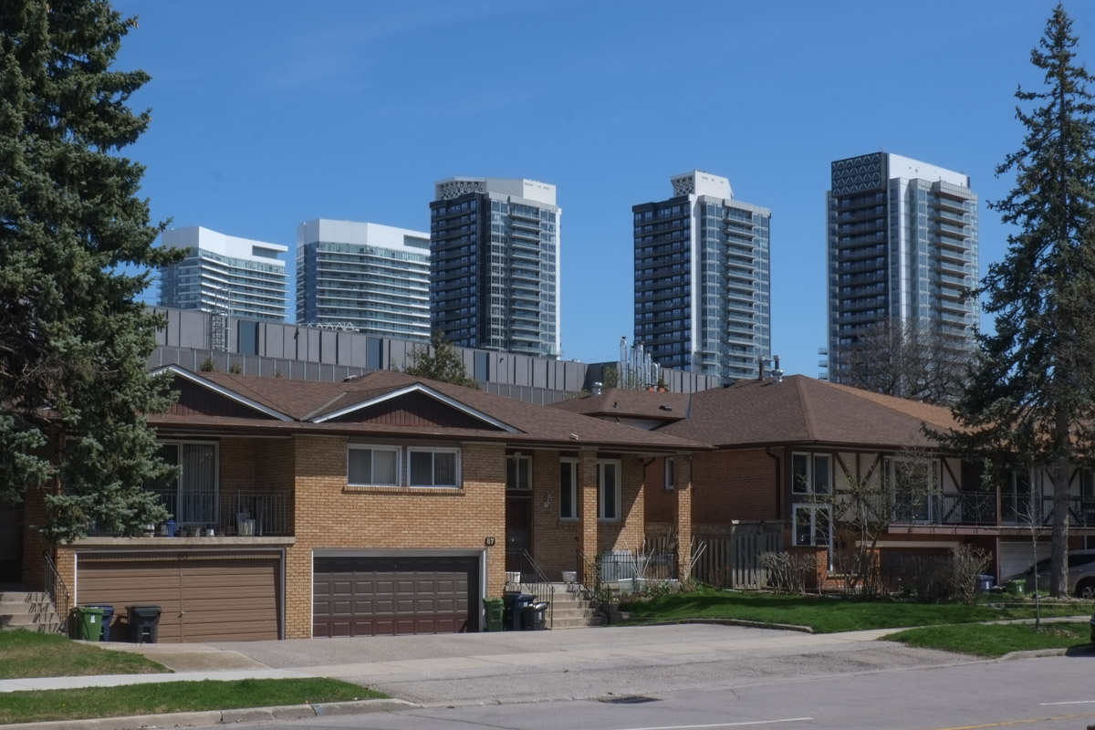
The road didn’t lead to the end of the Don Mills trail either… but it did lead to the back of a parking garage.  No dogs allowed and no trespassing.  No luck here.

path that runs behind beige concrete building (parking garage) with no trespassing sign)

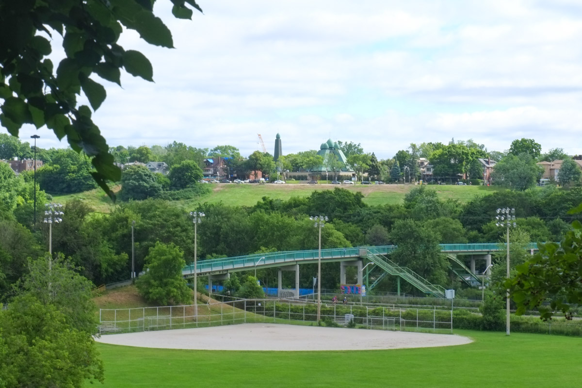
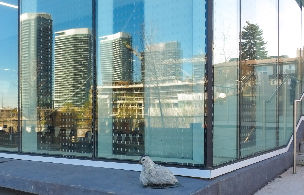
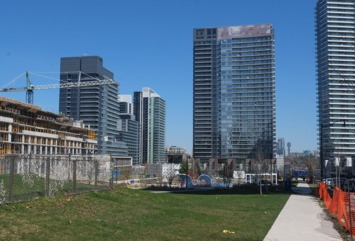
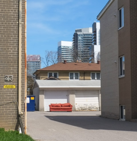
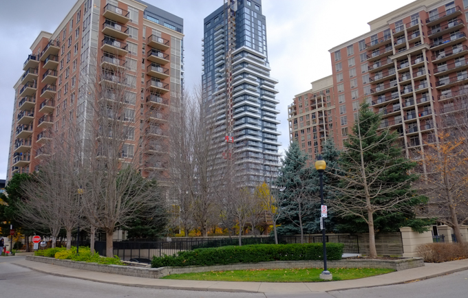
I got a better view of the neighbourhood though….

highrise apartment buildings and condo towers

Black and white on a grey day.

two chairs, one black and one white, in a vacant lot, grassy, one tree,

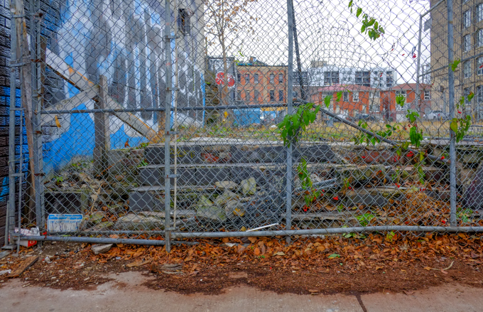
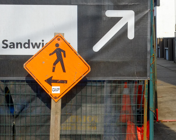
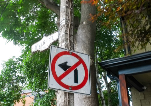
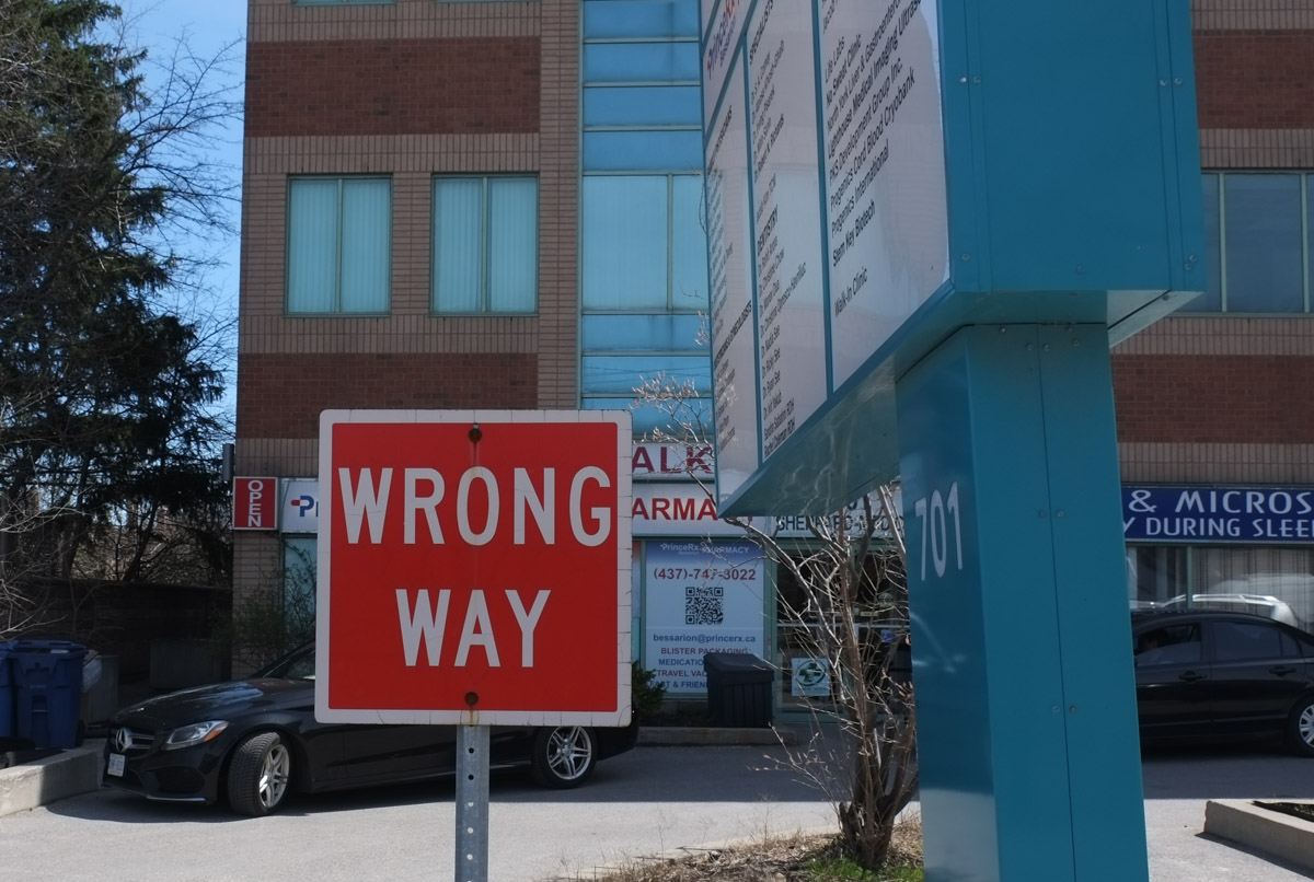
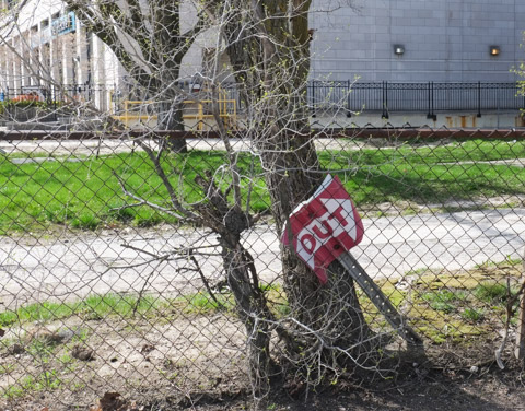
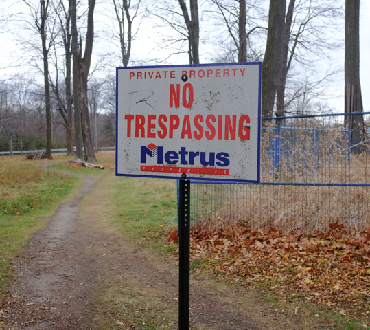
As I walked back out the path, I noticed this sign.  I took it to mean the property behind the blue fence, not the property the path is on… probably?

no trespassing sign, metrus private property

It stopped munching and stared at me, trying to decide to sit and watch or to run away….  it scampered away before I could get any closer (I don’t pretend to take good pictures of animals but it looked so cute, all puffed up to stay warm).

a grey squirrel sitting on a fallen tree trunk, dead leaves on the ground, a nut or something edible between its two front paws

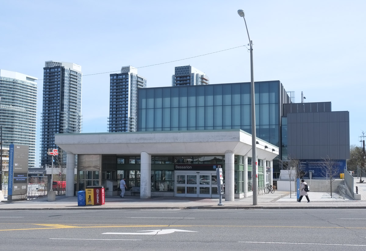
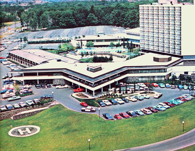
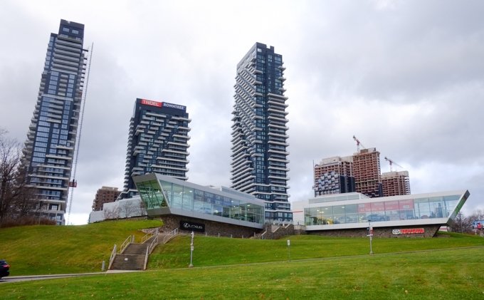
A very short walk farther south on Leslie brings us to the Inn on the Park site on the northeast corner of Leslie and Eglinton.

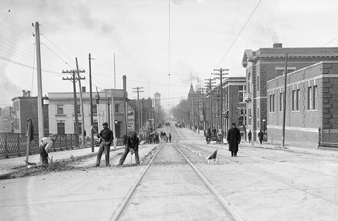
below: Inn on the Park as it once was (about 1969)  I have ‘borrowed’ this photo from another website – Jamie Bradburn’s Tales of Toronto.  Follow the link if you are interested in the story of the hotel – it’s an interesting read.  Did you know that in 1962 North York had a ban on cocktail lounges?

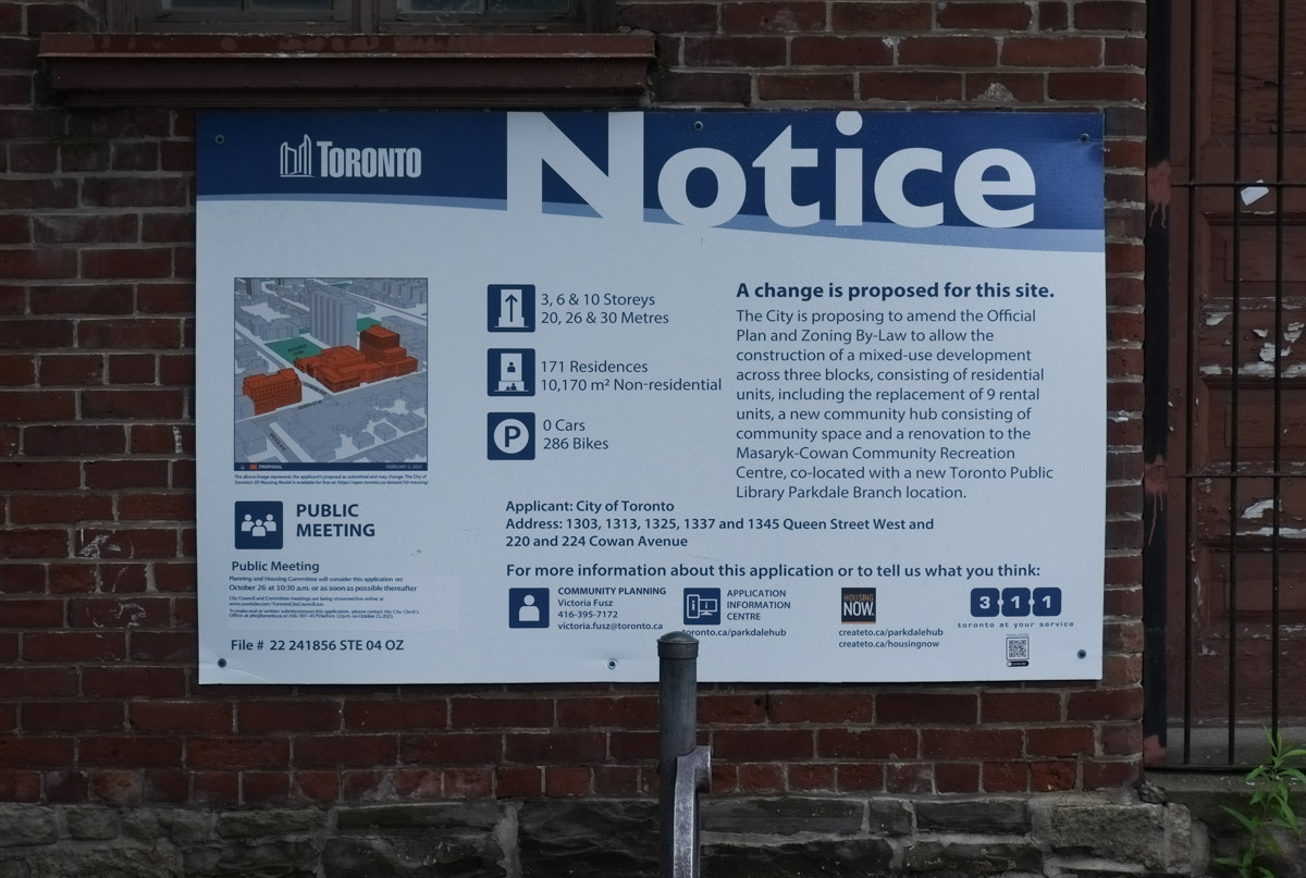
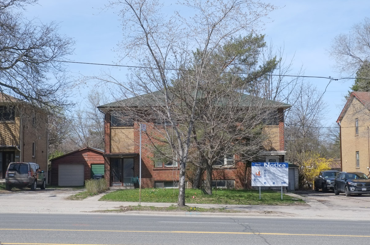
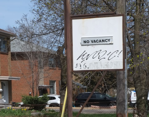
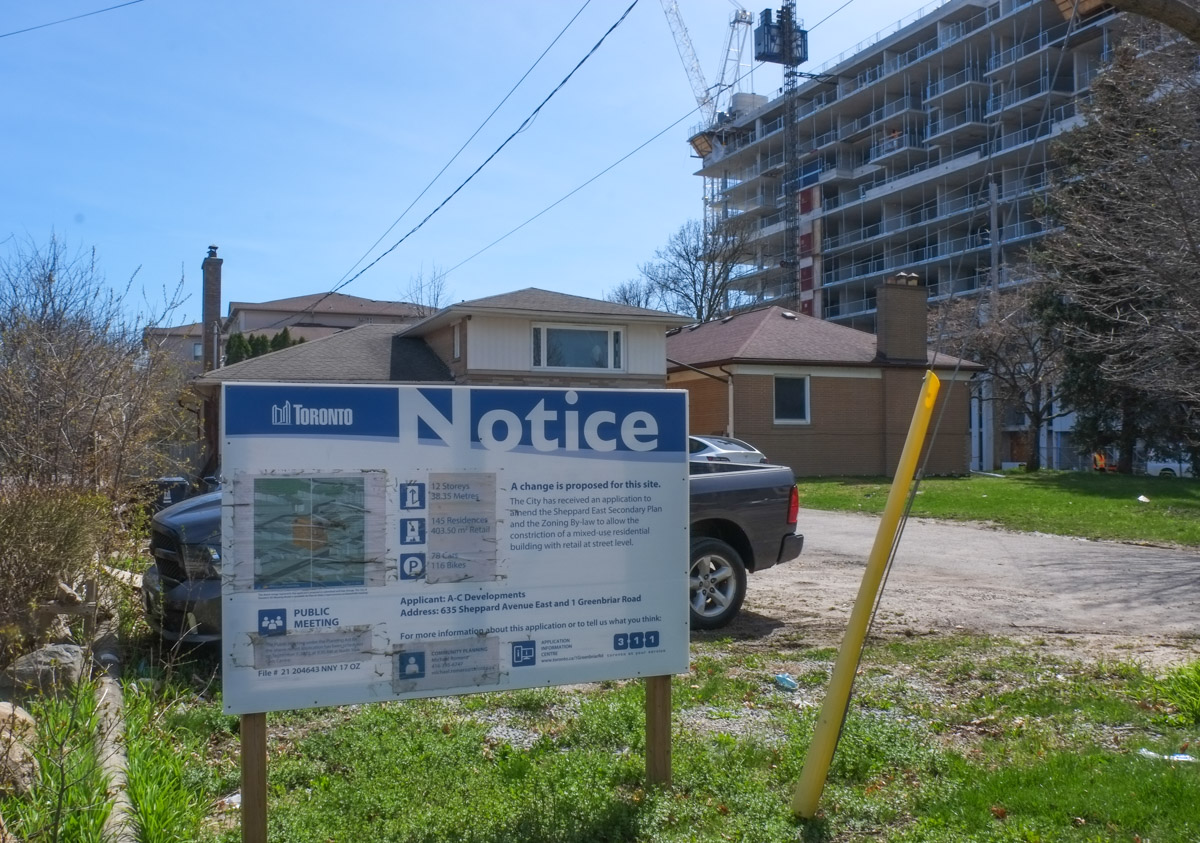
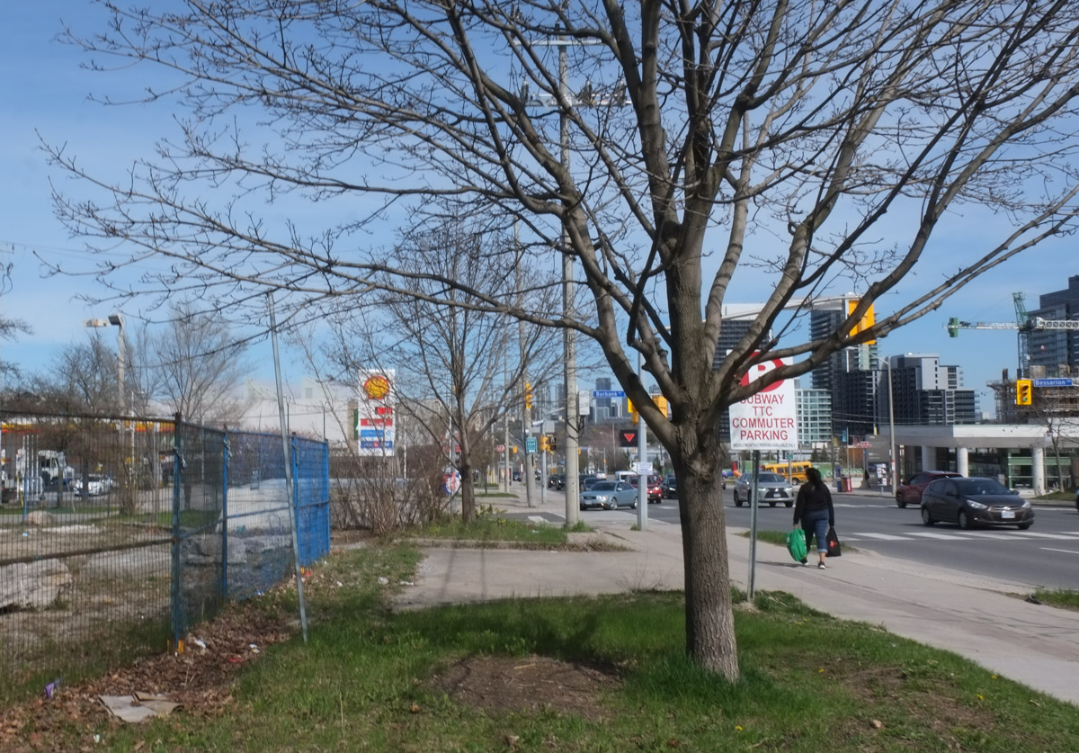
below: The site today. It’s now a Toyota/Lexus dealership and home to a few new condos.

old Inn on the Park site, northeast corner of Leslie and Eglinton, now a Toyota and Lexus dealership, also new condo development, still lots of green space in front

new condos being built at inn on the park site

artwork on exterior wall, solid colour shapes inside squares, 3 D, but mostly flat, shades of orange

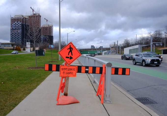
But there are more changes coming….. (surprised?)…. more glass and steel towers by the looks of it.  The notice also states that parking is planned for 845 cars and 1860 bikes.  Does Doug Ford approve?

blue and white development notice on the corner of leslie and eglinton, with inn on the park site in background, auberge on the park condo development

sidewalk closed sign and barrier, on eglinton, northside, east of leslie

below: A sad sight, Sunnybrook Park LRT station all ready to go but no trains running. One of the Toronto mysteries, when will the Eglinton LRT open?

looking east at Sunnybrook Park LRT station on the Eglinton LRT line, no trains running yet but station is somplete, yellow barriers across the entrance

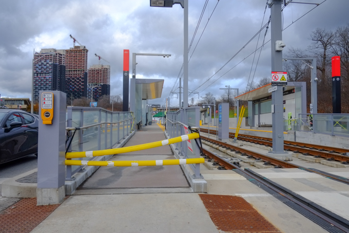
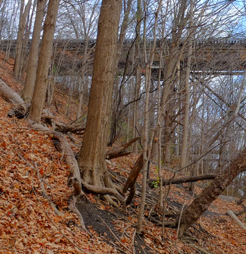
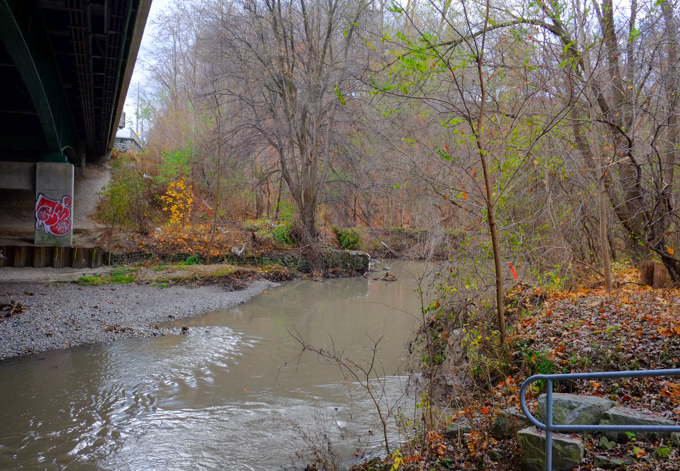
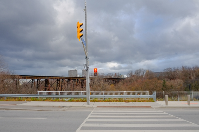
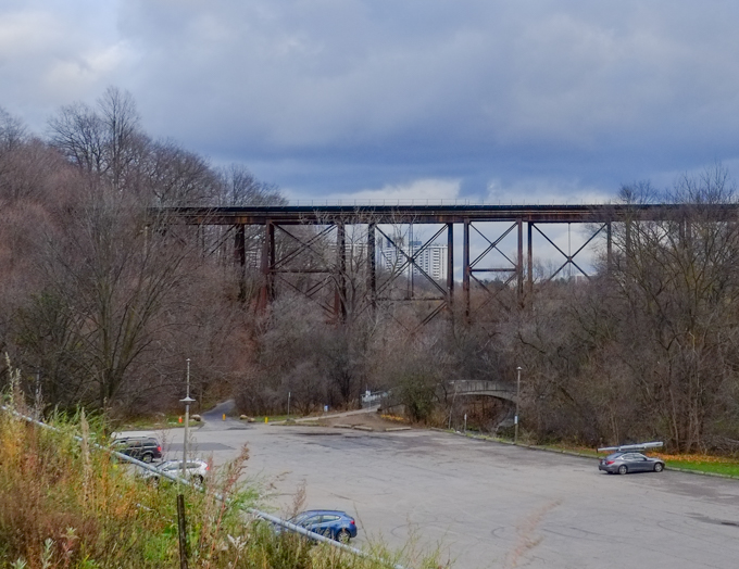
Standing by the LRT tracks and looking south. Wilket Creek park and the Thorncliffe trestle railway bridge can be seen.  I crossed the road because I had seen stairs down to the park….

looking south from the end of leslie street, across lanes of Eglinton to WIlket creek park and thorncliffe trestle railway bridge

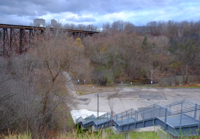
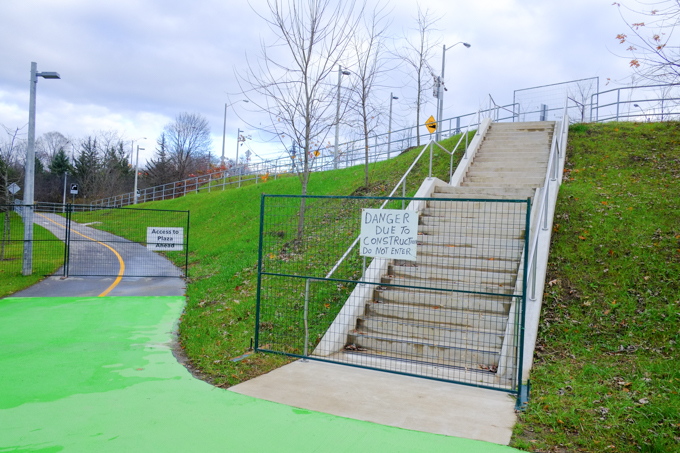
A big new set of stairs!…. But. Not shown – the locked gate that blocked the entrance.   There is still no entry to Wilket Creek/Sunnybrook Park from this side of Eglinton.

long set of stairs downhill from eglinton to a large parking lot at wilket creek park.

looking south from Eglinton towards thorncliffe trestle bridge, wilket creek park, and ravine system,

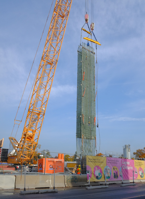
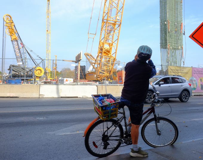
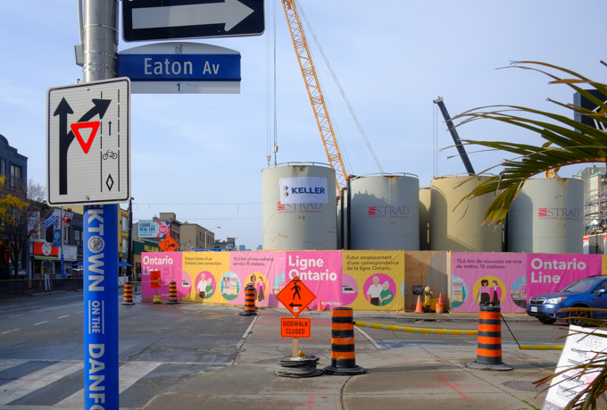
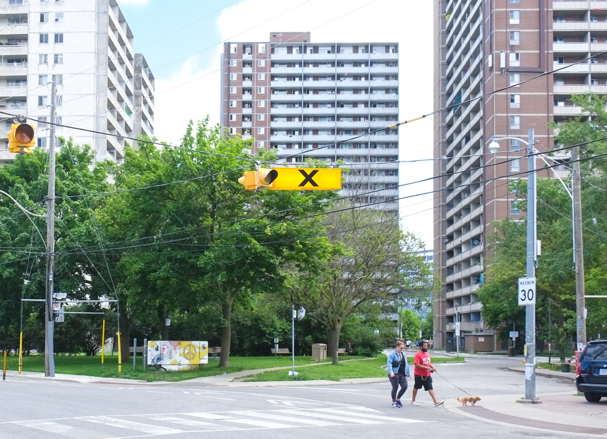
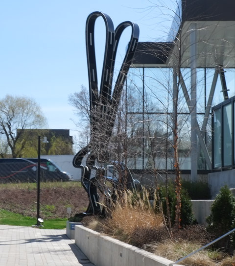
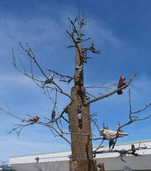
It’s getting to be crowded….

cars traveling east on eglinton, approaching leslie, many waiting to turn left, new condo developments behind, crosstown, as well as inn on the park site

below: Crossing Eglinton and looking westward

traffic turning left from eglinton onto leslie, looking west on eglinton

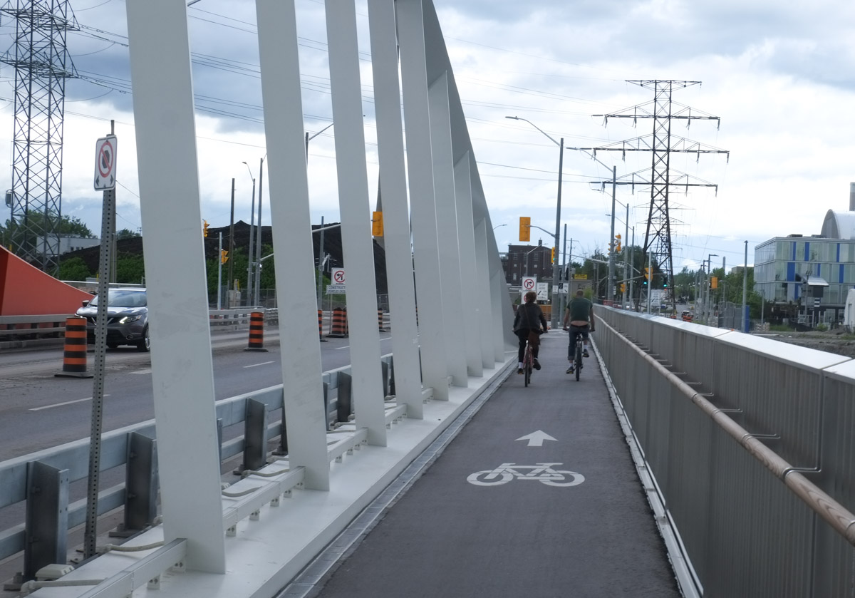
New pedestrian and bike paths that provide access to the park from the north side of Eglinton have been built but they too are locked closed.  It’s very frustrating to see this infrastructure built and then left unusable.  The signs says construction danger but there doesn’t seem to be any construction happening…..

new stairs and bike path infrastructure built at leslie and eglinton that are closed, gates and signs

new stairs and bike path infrastructure built at leslie and eglinton that are closed, gates and signs

Just in case I have confused anyone, here is a map of the area that Google maps created.   Near the top left it even says Don Valley Bike Trailhead… which is very wrong.  No trailhead here of any kind as we’ve just learned.  Also it was the Don Mills trail not the Don Valley trail (the latter is somewhere else!)

google map screenshot of leslie and eglinton and vicinity

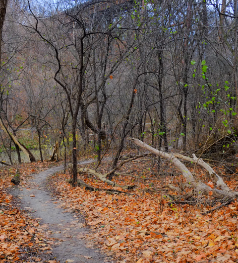
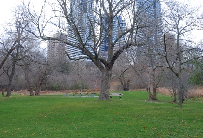
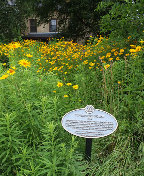
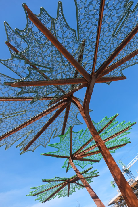
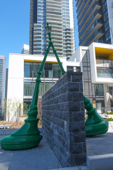
New benches! Wilket Creek Park is one section of the string of parks that parallel the branches of the Don River in Toronto’s ravine system. I’ll leave you with a few pictures that I took the other day while I was in the area…

new seating area with wood benches beside wilket creek park sign

lots of trees growing on hillside, autumn, dead leaves on the ground and none on the trees, park, railway trestle bridge in the background

path through woods beside a river, autumn, leaves on ground, small trees

view from under thorncliffe trestle railway bridge, metal girders,

last few yellow leaves on a tree, blowing in the wind

west don river as it flows under eglinton avenue

benches and picnic tables in a grassy park with many trees nearby, condos in the background

leaves in a puddle, reflections of tree branches in the water too

graffiti stickers on the back of a sign, one with Mexican flag,

graffiti on the sides of a small concrete pedestrian bridge

graffiti, large capital M with a bright pink heart

Subtitle: More Ontario Line mess


at corner of Spadina and Richmond, traffic light, with two Spadina street signs on it including old fashion district sign,

below:  Spadina and Richmond…. A giant thimble (by Stephen Cruise) sits on a stack of buttons.  Behind it, a building is shrouded in blue netting.

a couple walks a dog past sculpture at Richmond and Spadina that is a giant thimble on top of a stack of buttons

below:  Blue, blue, my world is blue… walking north on Spadina under blue netting that protects the sidewalk from work being done on the southwest corner of Queen and Spadina.  The whole block between Richmond and Queen is under wraps.  This is a future subway station with the imaginative name of Queen-Spadina.

people walking on sidewalk that is covered with scaffolding and blue netting to protect from a construction site, queen and spadina, ontario line construction

below: Southwest corner of Queen and Spadina

TTC streetcar on Queen, waits at red light at Spadina, people on the corner, tall building behind, pink signs advertising ontario line.

below: A look at what’s happening behind the hoardings….

Metrolinx construction site, hole in the ground, with hoardings, and shored up, some equipment,

below: Mcdonalds on the northwest corner is unaffected by the changes around it.

people waiting for green light, one man has a brown paper bag in his hand, mcdonalds at queen and spadina is in the background

below:  Looking south on Spadina with a good view of the southeast corner of the intersection with Queen West.

looking south on Spadina towards southeast corner of Spadina and Queen, tree, traffic,

below: There is a lot happening in the northeast quadrant, all by Metrolinx.   the yellow framework that protects and stabilizes a facade is becoming a common sight in Toronto.

below: In case you can’t remember what was on that corner, this is a photo taken back when they were laying streetcar tracks in 1912.  Most recently there was a CIBC bank on the corner.

black and white photo from 1912 of brick building on the northeast corner of Queen and Spadina.

Photo taken from WIkipedia Commons, in public domain. Originally from City of Toronto Archives.

below: A couple of the old houses/stores on Queen beside the old brick building seem remarkably unchanged since 1912.   (As a light grey car partially blocks the pedestrian crossing at the intersection).

a white car partially blocks the intersection as it goes southbound on spadina, pedestrians have to go around it while crossing on their green light. northeast corner of queen and spadina in the background

close up of an older brick building that has been gutted, but facade is being retained for redevelopment into metrolinx, ttc, subway station entrance

a woman wearing headphones walks past a construction site, on Spadina, other people on sidewalk crossing at traffic lights

graffiti on black hoardings, line drawing on bright green, picasso style, of a woman

below: The 510 streetcars are not running during this construction.

below:  But because the buses are too wide for the streetcar lanes, the middle of Spadina is very quiet… so I can stand here and take pictures.

standing in streetcar lanes, looking south on spadina, towards queen,

below: It also means that the replacement buses are now running… and competing with cars for a limited space.

a young man in blue winter jacket and baseball cap, walking on sidewalk past an orange sign saying pedestrian detour, and an arrow pointing right

below: Painting over the graffiti

below: Just north of Queen, there is a large vacant lot on Spadina.  So large you can see through to Cameron Street.

below: Cameron House and other houses on Cameron Street and beyond.

two young men on bikes wait at a red light, on Queen West at Spadina

stickers on crossing button at intersection, urban ninja squadron and feelings boi

people waiting on the southwest corner of padina and queen, waiting for their green light, pink hoardings for metrolinx construction behind them

looking out the window of a TTC spadina bus, looking at people waiting at bus stop, tall condos behind them, some reflections

There are so many new buildings in Toronto!  One of them is the new CIBC building at 81 Bay Street which is immediately south of the railway tracks and across the street from Union Station.  It is also adjacent to the new GO Bus station.

below: If you take the elevator to the 4th floor of the new CIBC building,  you can access the new park.   This is the view that greets you. The park extends over the railway tracks – a great use of space!

elevated park over railway tracks that is part of cibc square development,

below:Looking east from the park (on a foggy morning, and with a spot of dirt on the glass fence).   The trees on the right mark the spot where a strip of land separates the railway tracks from the Gardiner Expressway/Lakeshore combination.  Between Yonge and Parliament there are no buildings adjacent to the tracks on the south side.    That tall splotchy looking building is the Sugar Wharf Condos which, as the name suggests, are close to the Redpath Sugar property.

eastward view from cibc park, over railway tracks, tall buildings on either side of the tracks,

below: Looking north across the roof over the railway tracks.  The gold building is another bank building, RBC (Royal Bank of Canada).  On the right, the building that looks like there are diamond shapes in the glass, is a second CIBC tower but on the north side of the railway tracks.

below: Construction continues on the north side.  It too will have a park that extends over the tracks.  The two parks should merge into one once construction is completed.

construction site, park above the railway tracks at part 2 of cibc square, on the north side of the tracks, gold coloured r b c building also in the photo

man working at construction site, park above the railway tracks at part 2 of cibc square, on the north side of the tracks, gold coloured r b c building also in the photo as is Royal York Hotel

CIBC square, park

CIBC square, park, in November

below: Westward

looking west from cibc square, red leaved plants in foreground, CN Tower in background

below: In the center of the park is a large shiny metal leafless tree.   This is “New Amalgam” by Roxy Paine (2022).   It is 72 feet high.

public art, tall tree made of metal, cibc square

public art, tall tree made of metal, cibc square, cn tower in the background

below: Looking over the covered tracks at Union Station and all the ventilation system components on the roof.

looking west from CIBC square, long railway tracks, past covered tracks at Union Station with ventilation systems on the roof, CN Tower,

looking west from CIBC square, long railway tracks, past covered tracks at Union Station, CN Tower, with construction on south side of railway tracks

below: A closer look at the nearby construction at track level (and lower).

union station infrastructure construction

There are also stairs on the exterior of the CIBC building that lead to the elevated park.

looking into a few levels of cibc building, through large windows, from exterior stairs

Bay street side of CIBC office building, west side, lower three levels with tall white pillars

below: Looking south on Bay Street where Scotiabank arena takes up most of the street scene.  That’s the Gardiner Expressway as it crosses Bay.

looking south on Bay street rom CIBC building, Scotiabank arena takes up most of the street scene,

below: Through the window to the interior of CIBC  where Steve Driscoll’s artwork shines brightly.

interior of cibc building on bay street as seen through large window from exterior stairs, glass artwork, little round tables with a couple of people seated at them

below: “A light stolen from the sun” is a collection of 12 digital prints on laminated glass.   they can also be viewed from the 4th floor but access is controlled.   Also, camera use will get you a nice chat with a security guy.  The usual, phones are allowed but even little cameras are a no no.

Steve Driscoll artwork, red and blue, trees, tall, vertical works on glass

below: An outpouring of red poppies is the stunning centerpiece in this Remembrance Day tribute (created by Fresh Floral Creations).

an arrangement of red poppies for Remembrance day in the lobby of an office building,

two women on exterior stairs by CIBC sqaure, downtown toronto

With thanks to Nancy and Merle who went exploring with me that day.

Have a seat!   It’s a rather warm autumn this year, isn’t it?

a pale orange, faded, fabric covered armchair sits by the curb on a sidewalk in front of a house, fallen autumn leaves on the ground

below: A Hallowe’en spider caught in a rather thick web. It doesn’t have much to do with Pape subway station although you might feel inclined to put “scary” and “TTC” together.

big black fake spider on white, on a red shrub, front yard

Anyhow back to the main story…. Pape station is where the existing Bloor-Danforth line is going to meet the new Ontario line.

below: Do you remember when Pape station was being renovated? Now the site is a mess again.

pape subway station entrance on pape avenue, with cranes around it, for construction of Ontario Line

Pape station is a short block north of the Greektown section of Danforth.

orange and black traffic cones, and orange construction mesh fencing, outside pape subway station, for ontario line construction

below: Looking south on Pape towards Danforth

looking south on Pape from beside Pape TTC subway station

below: Across the street from the subway station

buildings on Pape across from the TTC subway station

below: See that bright white building in the picture above?  I bet that it’s not white anymore.

truck with red cab is parked beside a white building that is being painted black, person with a paint roller on a very long pole

below: My idea was to walk around the whole site. …

sidewalk in front of A & W, motorcycle parked there, sidewalk ends with orange fence because of construction, utility pole by sidewalk is wrapped in blue with Greektown Danforth written on it, also a blue and white Greektown banner on pole as well as Canadian flag

below: Looking back at the Danforth and Pape intersection, north side.  The white stone Royal Bank building stands on the northwest corner.  Behind it, the steeple and little green dome of Holy Parish church points upward.

Danforth at Pape, north side of the street, bank building on northwest corner, and A & W on the northeast corner

below: Ontario Line construction along the Danforth, northside.  Metrolinx seems to have a lot of property here.

ontario line construction on the danforth near pape

below: Any idea what this is?  What is happening here?

large yellow crane holds up an very large item, ontario line construction

below: I wasn’t the only one taking pictures!

a man on a bicycle has stopped to take a picture of the construction at pape station, on the danforth

below: Eaton Avenue runs parallel to Pape, just to the east.

Eaton Ave at Danforth, looking west, Ontario Line subway construction site

below: Northeast corner of Danforth and Eaton

northeast corner of danforth and eaton avenue, 3 storey brick building, Papa Johns pizza on ground floor, Mr. Pide restaurant (now closed), Black Pot lounge, an empty storefront and an Asian (Korean?) restaurant.

below: Eaton Ave entrance to Pape station lined with plywood hoardings.  This station isn’t that old – the update was completed in 2013.  I think that it is being retained but it is hard to tell from the Metrolinx website.  A brand new entrance is planned for the Danforth as well (and may be very large and very grand, not quite to scale with the present neighbourhood?).

Eaton Ave entrance to Pape subway station, lined by construction hoardings, plywood, Ontario Line subway construction site

below: Houses on Eaton Ave with Metrolinx construction behind them.

single family houses on Eaton Ave with construction cranes behind them, Ontario Line,

2 large orange storage tanks, wires, crane, ontario line construction site

2 large orange storage tanks, wires, crane, ontario line construction site , orange flags on overhead wires

This area has been serviced by the Bloor Danforth line since 1966.  In general, most of the residences are single family houses, often as some form of row housing.  Smaller houses with small yards seems the norm… i.e. a fairly typical East York neighbourhood.

three single family houses on eaton avenue

Muriel Avenue and Selkirk Street, residential neighbourhood near Pape subway station, single family homes and row houses

Exploring on Pape…..

below: Working on Pape, fixing a porch (or just watching)

reconstruction of a front porch

below: Addis Kidan Church, Greek Gospel Church..

Addis Kidan church on Pape Ave., red brick building with small white cross on roof

below: Tzatziki cafe with the painting above the entrance – interior restaurant scene

Tzatziki restaurant cafe on Pape, with painting above entrance

small commercial building on Pape with a TTC bus shelter in front of it

below: Mixed use – once a line of single family homes, now some are businesses.

a line of two storey family houses on Pape Ave., one is now an upholstery business

two storey duplex

Seranos bakery and food store, sign and parking lot,

below: There is also another construction site at Sammon

machinery in a construction site

wires covered with orange plastic, on a pole above a construction site

below: Looking north on Pape Ave from MacPhail.   There is another station under construction at Cosburn, a few more blocks north but that’s for another day. (Updated 22 June 2025 – there is now an Ontario Line – North Pape blog post)

looking northward on Pape

white arrow pointing right and orange pedestrian sign pointing left

I’ll end instead the way I began – with a little bit of Halloween to distract you from the constant noise of construction.

frontyard halloween decorations, zombie on swing with grey teddy bear on her lap

halloween decorations, outdoors, looks like yellow skull and arm bones are rising out of the lawn

Nigel smith sign, multi coloured, with text wish you were here

The general plan was to walk River Street.   River Street runs parallel to the Don River (makes sense!) on the west side with the north end of the street just above of Gerrard.   Transit on River Street is limited (is there any?) so I started the walk at Broadview and Gerrard, just to the east of River Street.

below:  At the corner of Broadview and Gerrard is the Roman Coliseum mural that was painted in 2016 as part of ‘Around the World in East Chinatown’.  It was one of seven murals and all of them were featured in a blog post back when they were new (seven new murals, August 2016)

intersection of Broadview and Gerrard, south side, with Boba Boy on one corner and A and W on the other, street car wires overhead, street art on the walls, image of roman coliseum

gerrard, at broadview, southwest side, bus shelter, brick building with street art on it

below: Chinatown East mural by ACK crew, bacon, wunder, tensoe 2, and cruz1, on Gerrard east of Broadview.  Chinatown East is generally Gerrard east of Broadview, but we’re going to walk west today and leave Chinatown for another day.

chinese style gate on gerrard, as entrance to Chinatown East, mural with Chinese theme in the background

below: A long vacant lot on Gerrard.

fence around vacant lot beside a brick house, no trespassing sign on fence

below: Munro Street, south of Gerrard

Munro street, at Gerrard, houses, brick, trees, street scene

below: On the north side is the site of the old Don Jail and its Governor’s House.

many yellow flowers in the garden in front of the Governor's House, with plaque in the garden

Governor’s House,1888, From 1888 until 1968, this was the residence of the Don Jail’s governor (chief administrator).  Until this house was finished, the governor lived in an apartment in the central administration block of the jail.  Designed by architect Mancel Wilmot, this house features a shallow pitched roof with a front-facing gable and double-height bay window that are typical of Toronto’s late 19th century residential architecture.

below: Bridgepoint and the old Don Jail with the red brick steeple of  St. Johns Presbyterian church on Broadview in the distance.  Bridgepoint Health Hospital was built on the site of the old Riverdale Hospital which in turn replaced an older building.  The original House of Refuge was built in 1860.  The Don Jail has been repurposed as part of the hospital complex.

bridgepoint hospital, with old don jail in the background

below: Looking north from the bridge at Gerrard towards the green pedestrian bridge that connects the two sections of Riverdale Park.  Beyond that is the Bloor Viaduct.

view looking north from gerrard street bridge, railway tracks, don river, view to bloor street and beyond

below: Northwest view

very tall hydro electricity transmission tower beside bike path and railway tracks, high rise buildings in the background

below: View from the Gerrard St Bridge (over the Don River and DVP).   Looking southwest.  The tall brown buildings are at River Street.

photo taken while on gerrard street bridge over the Don river, looking southwest towards many highrise apartment buildings

below: Miniature racer, art on a pole by Joseph Lammirato.

miniature black car, toy, mounted on orange board, and attached to utility pole

… and another!  You’ll find lots more on his Instagram page (@joseph.lammirato)

below: Flower Power happiness

sunflower with a happy face, pasteup on canada post mailbox

below: The north end of River Street (north of Gerrard)is showing signs that redevelopment is in the works.

old brick houses with for lease signs in the front yard

old brick two storey houses with front porches on river street, empty, boarded up with plywood waiting for demolition

graffiti tags on plywood used to board up windows and doors on empty old houses

below: If you are driving north on River Street, chances are you are headed down the hill to the Bayview Extension.  The alternative route is a small street that swings left and joins up with Spruce Street.

small houses on Spruce Street, including one that is painted blue, with white gingerbread trim under the eaves, also a modern house in black

below: It also leads to access to Riverdale Park. – there’s that green pedestrian bridge again.  From here you can see Broadview Avenue on the other side of the ravine.

view of Riverdale park with green pedestrian bridge over the DVP and Don River
orange tiger lilies in bloom along a chainlink fence beside a path near River street and spruce street

below: Back to River Street, and let’s head south.

River street street sign, with a no left turn sign under it

below: St. Sava, Serbian Orthodox Church.

St. Sava, Serbian Orthodox Church at Gerrard and River, with tall apartment buildings behind

below: Walking past some of the older Regent Park brick buildings that still remain.   The intersection of Gerrard and River streets marks the northeast corner of the original 1940s and 1950s Regent Park development.

regent park, southwest corner of gerrard and river streets

ivy covered exterior walls of Regent Park apartments,

About 20 years ago, redevelopment of the area began.  The work was divided into five phases.  Phases 1 and 2 have been completed while the third phase is either close to completion or has just been finished.  There is a lot of information online so you should be able to find many more details if you want.  I didn’t feel like going down that rabbit hole!

contrast of old Regent Park residences with newer developments

couple walking a dog on River near Oak street, with three high rises in the background

below: I was surprised at how much variety there was in the housing that I saw.

a row of three storey houses on river street, bay and gable style,

cornwall street row houses, with highrise behind

looking down a private road at a townhouse development

below:  Queen City Vinegar Co. Ltd. factory built in 1908 and converted into lofts (residential) in 2008.

entrance to building, door with stone lintal and decorations

wood railing on a porch, old paint, white, brick house,

blue and white development notice on behind a bent railing on a boarded up building

below: Stalled development (Dare I say arrested development?)  According to the development notice sign, the original file dates from 2017.  Even by Toronto standards that is slow!

red hoardings around vacant construction site

below: Behind the red hoardings is just a vacant lot.  Nothing seems to be happening here.  When I said arrested I was not implying anything criminal…..

vacant lot on river street, buildings already demolished, stalled redevelopment

below: Of course the CN Tower can be seen here too!  This is the view along Shuter Street.

looking west on Shuter street from River street, with cn tower in the distance

cyclist on bike, traveling south on river at dundas, row of houses in the background

below: Dundas, looking west towards River Street with tables in front of Bevy Coffee. The slightly darker brick building was the Adam Beck Box Factory where cigar boxes were once made.  Like the Queen Vinegar Company mentioned above, this building has been converted into lofts (Tannery Lofts, mis-named as this wasn’t a tannery! But it does sound sexier than Box Lofts!).

dundas east approaching river, looking west, bevy coffee shop on the right side, with picnic tables on the sidewalk outside

below: Similar location, but from the parking lot and alley behind – brick building is the Tannery Lofts

back of buildings on river, large condos, lowrise brick old warehouse, back of car dealership on dundas

below: 1930s view of Beck’s cigar box factory

black and white photo from the 1930s of Adam Beck cigar box factory, three storey brick building with cars parked in front

below: Monsters ready to box

mural on large door at back of building on dundas east, blob like monsters in different colours, all wearing white boxing gloves, large white eyes and scowling faces
behind hoardings, boarded up house with graffiti sign by Nigel Smith that says untitled

below: River Variety is no more.

old river variety store, in a ine of rowhouses, boarded up and hoardings in front

below: No more gyros or poutine here.

empty buildings behind green construction fence, boarded up and waiting to be demolished, river street

empty buildings behind green construction fence, boarded up and waiting to be demolished, river street

below: At Mark Street, more old and new

mark street approaching river street, side of red brick house, with new condo in the background

an alley, with lots of greenery from trees and shrubs, back of red building,

below: Every child matters

on a red wood garage wall, in blue spray paint, text that says every child matters, on god

old sign for monarch elevators, in an alley, with lots of shadows, graffiti on wall too

garage in alley, white concrete block with grey metal door

below: West side of River Street, at Queen

River Street, west side at Queen,

below: Old photo from 1914, working on the Queen Street bridge over the Don River, looking westward towards River Street.   The light coloured bank building is still on the southwest corner (see above photo).  The red brick structure on the northwest corner is also still standing, although an additional storey has been added to it.

old black and white photo of men working on the queen street bridge over the don river

photo credit: City of Toronto Archives

below: Looking north on River Street from King.  South from here River becomes Lower River.

view looking north on river street, from king street

below: Part of the mural on the side of Toronto Humane Society (Queen & River) painted by Uber5000

from a mural by uber 5000, an image of a large white and grey dog, tongue hanging out of mouth, happy face,

below: Parked in the bike lane.

blue car parked in the bike lane on river street

Note: River Street is serviced by TTC bus route 121 that runs between Gerrard (just west of Broadview), then down River to Queen before heading west to the Esplanade and Union Station.


Northbound, starting at King…  where this large mural still shines.  Piliriqatigiingniq was painted in 2015 (see link for more info)

part of a mural on a large white wall, a pink animal with blur antlers, also two windows in the wall

below: A yellow parking lot attendant booth, a throwback to an older, less digital age.  Back before machines and parking apps on your phone changed our lives.

old yellow parking lot attendant booth in a parking lot on church street

below: Looking west on Court Street through to Toronto and Victoria Streets (and beyond).  A wide range of sizes and styles all mixed up together.

looking west on Court street from church street, highrises

looking west on Court street from church street, highrises

below: The omnipresent condo construction and ubiquitous summer roadworks can be found here too!

a woman carries two bags full of shopping as she walks on a sidewalk beside a blue construction fence in downtown toronto

below: Lots of glass on the northeast corner of  Church & Lombard –  This section of Lombard is also Gilda Radner Way.

new construction on the northeast corner of church and lombard, also called gilda radner way

below: The view on Lombard, looking east from Church. Lots of midrise buildings.

lombard street ooking east from church, new construction on the northeast corner, row of midrise apartments on the south side

below: Crossing Lombard.  Looking north up Church Street

people crossing street

below: Church & Richmond, northeast corner.

church and richmond, northeast corner, ttc streetcar headed north, wild wings,

below: Church & Richmond again but from a different angle, south side of Richmond with McVeighs Tavern on the southwest corner.

church and richmond, southeast, people on southwest corner, streetcar headed north,

below: Flags flying over the entrance to McVeighs (“since 1962”) – a little bit of Nova Scotia and Newfoundland & Labrador.

below: West on Richmond.

looking east on richmond street from church street

a lane off church street

below: A stretch of Church Street was known for its pawn shops and many still remain.  Here we have Simon’s Pawnbrokers as well as two “exchanges”, Five Star Exchange and Toronto Exchange.

pawn shops on church street

big red pawnbroker sign on a building

below: Balconies old and new.

below: Can you tell where this picture was taken?  A little bit of Toronto love on a mailbox on the corner of Church and ???

graffiti sticker on a Canada Post mailbox, I green heart Tdot

below: Peeking over the mail box above is the yellow of the old Shwarma King on the northeast corner of Queen and Church.  It is now being demolished.

northeast corner of Queen and Church, yellow tower on yellow building now being demolished

scaffolding and hoardings in front of a few buildings on church street, awaiting demolition and redevelopment

below: The side of Metropolitan United Church.

below: The north end of Metropolitan United with St. Michaels Hospital behind it (just south of Shuter).

below: More of the mural as well as St. Michaels Cathedral on the other side of Shuter Street.  The mural is “Paint Your Faith” by Elicser, Chor Boogie, Mediah and Siloette

Church and Shuter, St. Michaels cathedral with St Mikes hospital in the background

below: St. Michaels RC Church in the foreground, looking north along Church St.

below: Many more facades that have been preserved during redevelopment.

older brick buildings whose facades were saved when redeveloped and condos built on top

below:  205 Church Street with its green awning; Its neighbour may be feeling the squeeze, just south of Dundas.

house between two larger buildings

below: Looking east on Dundas

looking south on church street

below: Northeast corner of Church and Dundas.

below: Westward along Dundas towards the Bond Place Hotel and its tall blue mural celebrating health care workers and their dedication during the COVID pandemic  (and since?)

looking west on Dundas from church street as a white bus passes by, Bond Place hotel, with a large vertical mural dedicated to health care workers.

below: mmm

… a little bit of Queen Street West

sticker on the window of a restaurant that says proudly parkdale

no parking sign, and parkdale village street sign for Queen st w, on a pole

parkdale architecture, old bay windows, oval glass,

below: These late-19th and early 20th century commercial buildings along Queen Street West with their display windows are part of the Parkdale Village Heritage District.  The 2022 draft plan for this district describes this row as  Edwardian Classicism style.  The plan is more than 160 pages long but in case you are interested in the history (and politics?) of it, here’s the link: Parkdale HDC plan (a pdf )

row of brick apartments and store fronts at ground level.

below: South side of Queen West, looking west from Jameson

queen street west, south side of street, west of jameson, row of three storey brick buildings, stores,

below:  A broom for $8.99.  $7.99 will buy you a pair of crocs or six tall glasses.  Chili sauce, lights shaped like lotus flowers or Buddha, wicker baskets, espresso makers, mixing bowls, and frying pans also available!

looking in a store window with many items on shelves, boxes of things, shoes, crocs, a broom,

below: Lightning alert! It’s a potato, no, it’s a cloud!  Or maybe a lightning bug!  Small metal street art by Rocky Zenyk

small metal street art by rocky zenyk screwed onto a wood utility pole, blue background, orange cloud and 5 streaks of lightning emanating from the cloud

sign in a restaurant window that says we're all in this together

people walking past an empty store front in parkdale

on a corner, TTC streetcar approaches a stop, with TD bank in background and people waiting for the streetcar

orange lilies growing in a planter on the sidewalk on queen west, street car in the background

a young woman and her phone, waiting in a bus shelter in parkdale

below: Where the aliens hang out on a hot July day!

exterior of small building painted made to look like an ice cream store with big window and awning, aliens are buying and eating ice cream, also an alien dog on a leash

below: Scaffolding in front of the church – Epiphany and St. Mark Anglican church.   The octagonal belfry is being repaired and restored with the help of a 2024 Toronto Heritage Grant.  It is considered to be Gothic Revival style.  The cornerstone laid October 1880 and the first service in the church was held in January 1881.  The gateway was added much later.

Church of the epiphany, St. Marks, with scaffolding over the entrance

below: Hope over the entrance to the community garden at Masaryk Park

community garden in a park, with sign made of wood that says hope, over the entrance

below: Arty metal panels line the south wall of Masaryk-Cowan community center.  Bonar-Parkdale Presbyterian Church is in the background.

metal 2 d sculptural shapes on brick wall, exterior, presbyterian church in the background, highrise on the left

below: Notice for redevelopment of Parkdale Library and Masaryk-Cowan community centre site.

blue and white city of toronto development notice for queen west and cowan, redevelopment of parkdale library and masaryk cowan community centre

part of mural celebrating 136 years of sunnyside beach

below: Queen Fresh Market

Queen Fresh Market on Queen West, with fruits and veggies and plants for sale, displayed on sidewalk

below: A unique building topper – North side of Queen, at Dunn.

Queen West, old buildings in Parkdale

below: $25,000 winning ticket sold here! Hopes and aspirations… and Canada Dry.

window of a convenience store in parkdale, atm machine, coke and sprite ads,

below: More details on brick buildings on Queen West.

three storey red brick buildings in parkdale, on queen street west

below: Standing alone

3 storey red brick building in parkdale, standing on its own, now Daol Korean restaurant on the ground floor

people standing on sidewalk waiting for a green light, older brick apartment building behind them

below: Tiny Cafe

tiny cafe, a small yellow building with a red and white sign, large window in front, beside an alley in parkdale

upper part of a house with a large canadian flag as well as some paintings on display

balcony on a high rise apartment building that has a large Canadian flag

below: Murals and street art in an alley.  Butterflies and monochrome daisies

street art mural in a parkdale alley

below: Emily May Rose mural in an alley – women, we come in many shapes and sizes.

street art mural in a parkdale alley

below: Hello Kirsten on the far left

street art mural in a parkdale alley, hello kirsten

below: A mural painted by Chief Ladybird.  Mother and child finding peace in the city.

street art mural in a parkdale alley, seated woman holding baby, by chief ladybird

street art mural in a parkdale alley

mural on a garage door in an alley, curvy line drawings of women faces and heads

street art mural in a parkdale alley

below: Face in the alley

below: And more faces, Picasso like faces and body parts.

mural on brick wall in laneway, parkdale, round characters, faces mostly, in many colours

below: Muisca

street art mural in a parkdale alley

below: Elicser – so many faces merging into one.

street art mural in a parkdale alley, multiple faces in one, by elicser lliott

below: Monica on the moon – “Over the mountains; Under the stars”

street art mural in a parkdale alley, person on a motorcycle with text over the mountains and under the stars

street art mural in a parkdale alley

graffiti on a door in an alley, shape of a large blue bird in profile

below: A few reminders of Parkdale’s grander past on the quieter side streets – lots of old trees and some houses that remain as they once were.

pale yellow brick parkdale house with picket fence, gravel driveway, large front yard, and old garages in the back

maroon brick house with white gingerbread trim, attached to another brick house, orange colour, and beside a larger white brick house

beige brick house with red front door, between two other houses that re obscured by trees and large shrubs

two storey house behind a metal gate

brick house with curved porch with white trim and white railing

brown metal gate in front of a walkway to the front of a house

below: A little bit of religion and a little bit of social justice at the end.

build social housing poster

man in white clothes, standing on sidewalk, by dollarama store

Were you an Edmonton Oilers fan?  Did you jump on that bandwagon?  On the night of the 7th game of the Stanley Cup playoffs were you glued to the TV?  Or are you wondering what I’m talking about?!

I usually watch hockey games now and again, especially during the playoffs but I found that watching the Edmonton-Florida series was just too stressful.  Instead, these long June evenings are great for walking!  A little bit of Yonge Street, Uptown Yonge, was my stomping grounds the evening of the last game.

banner for uptown yonge on a hydro pole, stores and new condo in the background, says eat up. street sign for st. Clements avenue as well

A few scenes from Yonge between Eglinton and Sherwood, in no particular order…

evening, coffee shop on Yonge street, also poke bar,

below: Old and new. I like the way the evening light catches the architectural details along the rooflines.

roofline, old brick buildings with architectural details in front of a newer high rise residential building

below: Playing peek-a-boo.  The new pushes from behind.

stores on Yonge street, prism hair salon, vape studio, goa hair salon,


below: Seating!

late evening, getting dark outside, looking at store front, cobbler's corner shoe repair,

ceiling art, white and green cubes with lights inside

round exterior wall of part of rio can yonge eglinton centre, short glass tower,

metal grille gate covers glass doors of now empty and closed store on yonge street

below: Northwest corner of Yonge and Eglinton, Yonge- Eglinton Centre with its updated glass facade.

yonge eglinton centre entrance

When the Yonge Eglinton Centre was built in 1968, Eglinton was the last station on the TTC subway line.  The Y-E Centre was a large development, and was the tallest building in the neighbourhood.   There was a shopping centre, a cinema, an office tower, two tall residential towers, most of which still remain.   Eglinton is no longer a gateway to suburbia; it is Midtown.  The Y-E Centre is just another tall building in a sea of them.

side of concrete building from the 1970s, Yonge Eglinton centre

tall concrete building

below: The new entrance to the Eglinton LRT (unopened of course)  with the Canadian Tire headquarters behind.  Southwest corner of Yonge and Eglinton.

southwest corner of Yonge and Eglinton, new entrance to Eglinton LRT (unopened), Canadian Tire head quarters building, 1970s concrete, new condo behind

Lament for the Eglinton LRT.  Metal fences and torn cloth.  In tatters and disarray.   Still not opened.

front glass of eglinton LRT station, behind metal construction fence and torn green cloth

stores on yonge street

sidewalk tunnel under scaffolding to protect from adjacent construction site

restaurant window, night time, sidewalk

Maybe one day I will be able to walk somewhere in this city and not run into another hole in the ground.  Note the usual – facades being saved, single houses that stubbornly remain.

construction hole in the ground

gravel roadway down into construction hole in the ground

Bus stop all tied up in knots.

TTC bus stop on yonge street behind orange and black cones and yellow caution tape

mural on the side of bmo bank on yonge, flowers, male face, female face, child face, dog, and lot lots of flowers

white car parked in front of a mural with flowers with many petals, and a woman's face

artwork on glass above subway entrance at canada square, corner of yonge and eglinton, a woman is carrying a potted plant, a man in green shirt with tattooed arm is looking at her

three plants in flower pots on a shelf in a room with a blue light, on the left is an orchid,

below: With some paparazzi stalker vibes I’m afraid.

… Back home in time for most of the third period…. Sad to see Edmonton lose, but why is there hockey this late in June?

Bessarion subway station has always had the reputation of being one of the least used stations in Toronto.  I haven’t seen any recent numbers, but I suspect that a lot more people are now using the station.   There are a lot of development changes happening in the area so the numbers will only increase in the future.

below: South entrance to Bessarion station

entrance to bessarion ttc subway station on sheppard at bessarion, new high rise condos behind it, street scene

corner of bessarion subway station in the foreground, new community center on the right side, and construction of new condos in the background

below: A Stop sign sits in the middle of one of the entrances to the new development on Sheppard Ave East beside Bessarion subway station.  If you follow the left fork in the road, you will end up in the parking lot of the Canadian Tire store.  This store is all that is left from the original 50 acre site that was home to a Canadian Tire warehouse and distribution centre.  In 2000 Canadian Tire filed a plan to re-develop the whole site, including a new head office tower for the company.  Although the plan was approved, it never came to be.  Instead, most of the land was sold to Concord who is now in the process of redeveloping it.

new development on sheppard ave east

below: Concord has filled this community with a lot of public art including these colourful creations, “Jax” (2021) by Pierre Poussin

brightly coloured public ark in concord park place on sheppard avenue

below: A few maple leaves forming a canopy – “Maple Leaf Trellis” by Demakersvan (aka brothers Joep and Jeroen Verhoeven)

sculpture that looks like a canopy of giant maple leaves

below: Leaping Lamp by Inges Idee (a German artist collective)

leaping lamp, a large green sculpture by ingres idee of a lamp post with two very long legs as it walks over a stone wall

below: There is also a rabbit (title: “Rabbit”),  another artwork by Inges Idee.  It’s made to look like a folded ribbon of highway; it sits next to the 401 highway.

rabbit, a large sculpture by ingres idee, looks like it's made of a road all twisted into the right shape, outside new condo by the 401 highway

rabbit, a large sculpture by ingres idee, looks like it's made of a road all twisted into the right shape, outside new condo by the 401 highway

below: Birds hanging out together between Bessarion station and the new community centre.  They won’t be flying anywhere any time soon!

sculpture that looks like birds on a tree, including an owl looking out of a hole in the tree

close up of part of a sculpture with birds on a tree, showing owl looking out of hole in tree, woodpecker beside the hole

below: A small bird, a continuation of the tree full of birds, sits outside Ethennonnhawahstihnen’ Community Centre (it’s pronounced Etta-nonna wasti-nuh and it means ‘where they had a good, beautiful life”)

reflections in the window of a community centre, with small sculpture of a bird sitting outside the window

below: Real trees ready to plant.

trees with roots wrapped in burlap sitting on the ground, waiting to be planted, a row of condos newly built in the background

below: A line of towers with row houses on the lower level marks the south side. The 401 highway is behind. A new park, also Ethennonnhawahstihnen’, lies in front of the new residences.

below: Water feature in the summer, outdoor skating rink in the winter

concord development on south side of sheppard, on old canadian tire warehouse site, a curved shallow pond with a walkway around it, a small white building beside it, condos and new construction in the background

park in the center of condo development

tall glass and steel condo, one side clad in bright green

below: The view from the southeast corner of the property – the back of IKEA and the 401!

back of ikea on sheppard in north york, 401 highway,

below: At least there have been a lot of trees planted back here and some thought has been put into using the landscaping to mitigate the noise from the 401.  But the fact that thousands of cars and trucks pass her every day can never be downplayed.  I hope that the units are well sound proofed.  Having stood on balconies on other buildings that overlook a major road, I can imagine how noisy it is here too.

newly planted trees along a pathway beside the 401 highway

new condo development with a bright yellow rectangular section around a large window

the words slow down have been spray painted on a concrete barrier in front of a row of new townhouses

below: Looking southeast from Burbank

looking out of ttc bus shelter at burbank and sheppard

below: South side of Sheppard

view on sheppard, looking east near bessarion subway station

wrong way sign by driveway in front of medical building on sheppard

below: The north side of Sheppard Ave looks like this – a row of lowrise apartment buildings from the 1960s or 1970s.

lowrise apartment buildings on north side of sheppard

below: There are 2 major redevelopments proposed along here, 680-688 Sheppard and 690-720 Sheppard. Both involve condo towers.

development notice on front yard of a multiplex residential building on sheppard avenue

crumpled red and white sign says out, pole askew, between fence and tree

sign for apartment building, empty except for no vacancy and a graffiti scrawl

Just west of Bessarion station is Greenbriar Road.  There was a small community of single family homes, duplexes, and small apartment buildings back here.  Almost all of it is gone or on the way out

construction south of sheppard ave

below: A single, lonely, holdout surrounded by newer residences.

one older brick house surrounded by newer and taller residences

A 1970s brick bungalow in the foreground, new townhouses in the background

below: No sign?!

two brick duplexes, semis, or side split houses, with 5 towers of new condos behind

below: Southeast corner of Sheppard and Greenbriar  (12 storeys, 145 residences)

development notice on the frontyard of a house on corner of sheppard and greenbriar

below: There is a development notice sign on the front yard of 25 Greenbriar (23, 25, 27 and 29 to be replaced with 10 storeys, 169 residences).

orange sofa on a driveway in front of a garage between two brick buildings

large grassy backyards of two houses, one has an old swing set in the yard

below: A little farther south on Greenbriar the fences are already up (22-36 Greenbriar, 24 storeys, 351 residences).

house on Greenbriar, empty, with construction fence around it and blue and white development notice beside the fence

bessarion subway station

a woman walks eastward on sheppard near bessarion

Extra note: The northeast corner of the old Canadian Tire acreage, at 1181 Sheppard Ave East, remains undeveloped.  It is the last piece once owned by Canadian Tire.  It is adjacent to the Metrolinx rail corridor, about 100 m from the new Oriole GO station.  [ed note: Prime real estate by the sound of it!].  Two towers will probably get built here, once the heights are finalized.

view of cn tower from port of toronto, with buoys, on land, in front, as well as a parking lot

Welcome back! Bienvenuti!  A colourful sign to welcome you and visitors to Toronto.  I’m not sure how many visitors get to see this banner!

sign saying welcome to toronto in many different languages

The Port of Toronto has almost become an obscure corner of the city.  It’s certainly not where most tourists arrive in the city!  Nor is it a place where residents venture.

welcome sign in different languages, puddle in front, large green and orange buoys, on land, reflections in the puddle

below: Once there was a ferry between Toronto and Rochester that docked here but it didn’t last long.  Now there are a few cruise ships that stop here.  The building would be almost deserted if Netflix hadn’t taken over some of the space.

building on pier, beside waterfront, with chainlink temporary fence, sign says Toronto Port or Port of Toronto

below:  The fragments of railway track are reminders of the industrial past.

metal fence across old railway tracks on a pier, beside waterfront, Lake Ontario, Port of Toronto

below: There are bits of track scattered all over the Port Lands

fence across old railway tracks with industrial site beyond

below: The Port is much quieter but there is still activity.  These long metal bars that are neatly stacked on shore were probably recently offloaded.

stacks of 40 foot long rebar on the waterfront, port of toronto, recently unloaded from a boat
view through chainlink fence on pier, a yacht is exiting the harbour, toronto skyline in the background

below: Boats in the Ship Channel.  The redevelopment plan for the Port Lands has always included the retention of the Ship Channel.  The sand and salt for Toronto’s roads is delivered here.

ships in the Shipping Channel

below:  At the east end of the Ship Channel, a new park is being developed – Leslie Lookout Park.   The concrete cylindrical structure is a lookout tower so there will be views over a man-made beach (that appears white in the photo).  The beach is larger in real life than it looks like in the photo.

new park being developed

below: Can you see the little sliver of blue water?  That is the Ship Channel.

behind chainlink fence, new park being developed, on shipping channel so water is just visible in the photo

below: Looking south on Munitions Street

munitions street, port lands, construction, all gone but old fire hall and white building film studio

below: Toronto Firehall, Station 30, built in 1928 still stands.  It is a heritage building and if the plans are followed, it will be repurposed.

munitions street, port lands, construction, all gone but old fire hall

entrance to old metal clad building, tree in front, no trespassing sign on door, no parking sign beside door

below: The redevelopment of the Port Lands has involved a lot of infrastructure changes.  Roads have been changed, rivers have been diverted, bike lanes and better sidewalks have been created.  At times it has been confusing to navigate through.

traffic signs, signals, and new construction in Port lands

below: The new Commissioners Street bridge is in, and there is water running under it.  There is now a river on land that was once industrial.   On the north side of the bridge there is a bike lane and a wide sidewalk.

red and white curvy bridge, commissioners street bridge, dark clouds in the sky,

below: The bridge offers new vistas of the city.  Many new trees have been planted.

view northwest from commissioners street bridge, over river and park with many newly planted trees, to downtown toronto skyline

view north from commissioners street bridge, towards Gardiner Expressway, and Lakeshore

below: Lakeshore Blvd crosses the Don River on a very low bridge (like before) while the ramps between the Gardiner and the DVP curve above it.

view north and slightly east from commissioners street bridge, ramp from Gardiner to DVP with Lakeshore crossing river
below: Just be careful because there is no sidewalk on the south side (why not?? for the sake of saving money on 4 extra feet??)

cyclists crossing commissioners street bridge
commissioners street bridge, mostly sky with lots of clouds

below: The same sleek curvy design seen in the previous bridges is repeated here.

red and white curves of the commissioners street bridge

below: Another series of photographs of the work being done here, by Vid Ingelevics and Ryan Walker

large photograph on a billboard in front of large concrete silos, port lands,
below: One photograph is mounted on the roll-up door of one of the ESSROC cement plant silos

large photograph mounted on door of garage on concrete silo

below: Like the previous series of images, most of the photographs are displayed down the center of what remains of Villiers Street,  on top of the remains of the old railway line.

large photo image on display beside street, in front of building with cranes beside it

below: One more photograph on what remains of Villiers Street – and in the background, what remains of the eastern end of the Gardiner Expressway.

construction in port lands, villiers street torn up, photograph on display in center, gardiner expressway in the background

below: Southeast corner of Villiers and Cherry

old bank building with columns, stone, on southeast corner of villiers and cherry

below: One original bridge remains, the one with the long name – Cherry Street Strauss Trunnion Bascule Bridge.

cherry street straus trunnion bascule bridge, with person holding stop sign, construction on the bridge

lifeguarding station at cherry beach, old white wood building, with look out tower and flag pole,

below: The first of the new bridges that was actually operational is the south Cherry Street bridge, the yellow one.

yellow and white cherry street bridge

below: The second new bridge on Cherry Street is now in use.  For months we’ve been able to take pictures of the side of it as we stood on the old Cherry Street bridge. (see The New Cherry Street Bridge from Nov 2020).  Maybe one day in the future there will be a streetcar on the east part of the bridge.    As you can see, the rain came and we bailed.  Better pictures of the bridge will have to wait for a future post!

new cherry street bridge from the south, double bridge, one side for cars, bike, and pedestrians. The other side is for transit but so far there is no transit here

below: The old Cherry Street bridge is gone and the road has been rerouted. The old jog in Cherry at Lakeshore is gone.

rubble and digger removing old cherry street bridge, distillery district condos in the background

rubble and digger removing old cherry street bridge, distillery district condos in the background

below: Misdirection.

green and white sign that says cherry street continues one block north of Lakeshore

below: Trying to see the new bridge from the site of the old bridge but there seems to be a construction site in the way.

new cherry street bridge, red, and white, seen from site of old bridge

below: Continuing north on the now straight Cherry Street.  Any ideas what that white structure is ahead?  It runs parallel to the railway line at track level and crosses Cherry Street just south of the railway underpass.

a red car waits at a red light on Cherry at Lakeshore. The Gardiner Expressway passes overhead. Distillery District and Corktown are straight ahead

We now exit the Port Lands and finish today’s explorations…. with the exception of one quick note…. I noticed that the old Canary Diner on Cherry is now painted a reddish orange colour.  It looks like it is being renovated.   A story for another day!

TTC streetcar, route 504, in front of repainted canary diner on cherry street, old three storey brick building

toronto skyline in the background, with boats docked on piers, rubber dinghy in foreground

hydro transmission towers with the cn tower in the background