Archive for the ‘construction’ Category

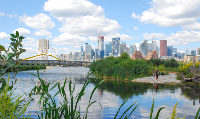
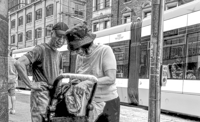
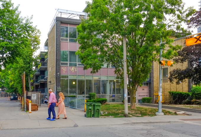
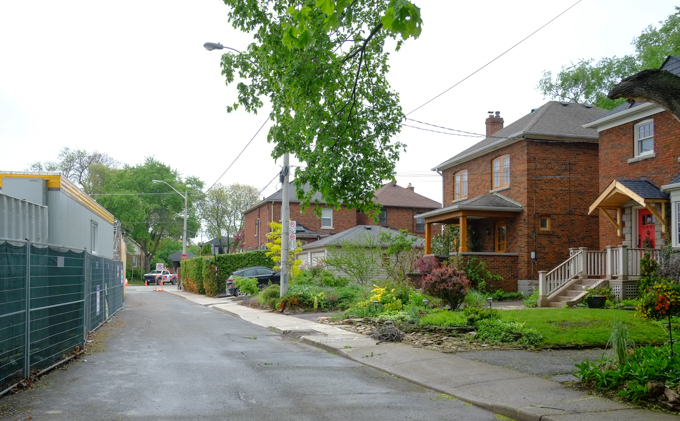
….with a group of friends on a grey November morning.

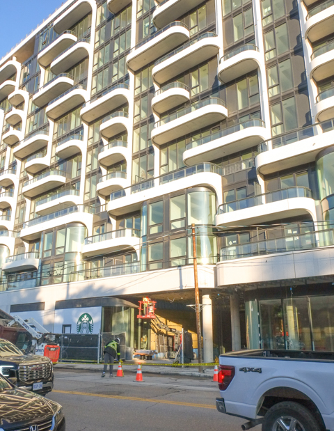
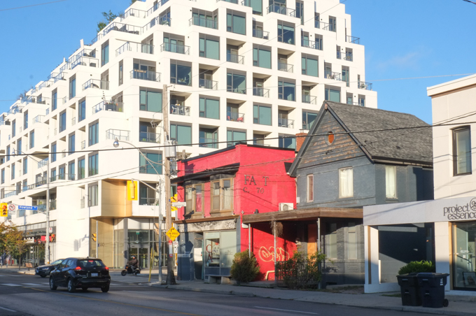
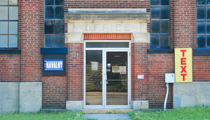
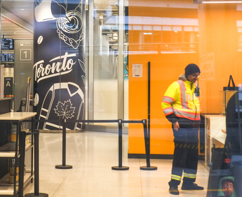
below: From Union Station, there are now plenty of routes to take indoors and we explored some of them (some for at least the second time but there are always changes or points of view that you miss the first time around).

legs and feet of people walking inside

below: Union Station has connected to Scotiabank Arena for a few years now.

large Canadian flag, and many people walking, inside Scotiabank arena foyer area between arena and Union station

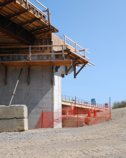
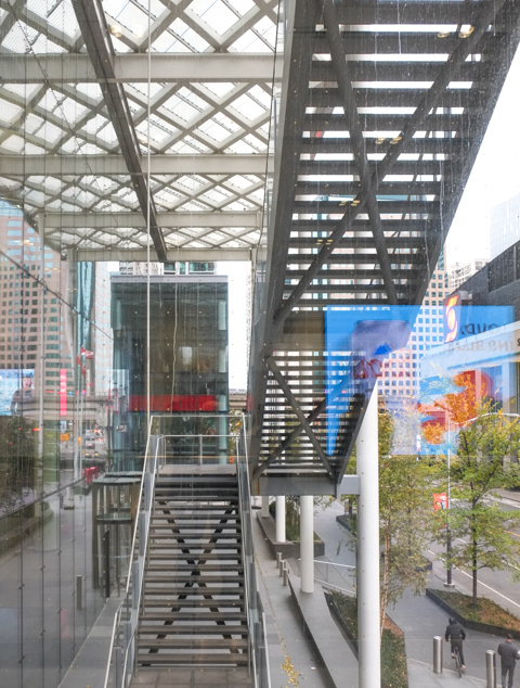
below: And within the last year or two a pedestrian bridge over Bay Street has connected Scotiabank Arena with the new CIBC Square development on the other side of the street.  This picture shows the exterior stairs of that new CIBC building as seen from the south side of that bridge.  That’s a lot of climbing!  So glad for escalators.

exterior stairs on new CIBC building, Bay street

people on escalator inside CIBC building

below:  There is quite a view from the new CIBC Square park area including this one looking mostly southwest to the top of Scotiabank arena.  The architectural details (some sort of overhang?) are on the new CIBC building top of Scotiabank arena, view from CIBC park above tracks, looking southwest across Bay

below: Looking north up Bay past the shiny sparkly gold RBC building to Old City Hall that’s almost hidden behind the newer towers.

from new CIBC park above railway tracks, looking north up Bay street towards old City Hall.

below: You can also see the Royal York hotel on the other side of the railway tracks.

Royal York hotel seen through group of small trees in autumn colours, some leaves gone, at the new CIBC park over the railway tracks

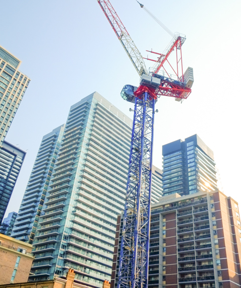
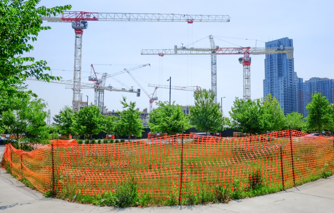
below: Cranes and the CN Tower make for a very downtown Toronto photo.  Again, this is the view from the new CIBC Square.  If you are interested, a year ago I posted more photos from this new park – Above the railway tracks at CIBC Square.

CN Tower in the background, crane and its reflection in a building in the foreground

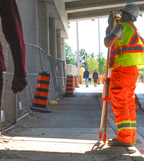
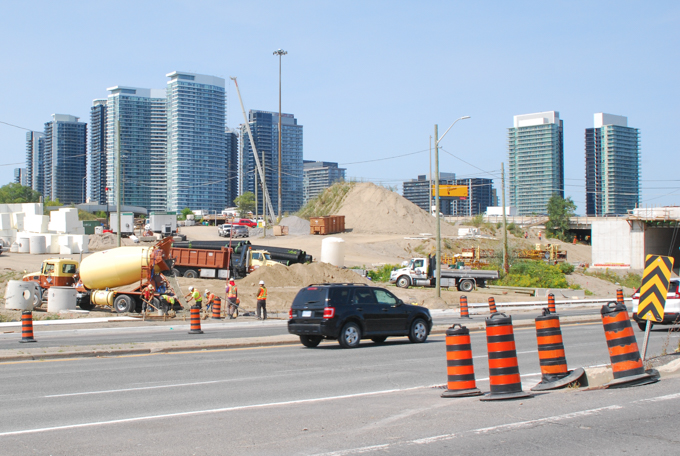
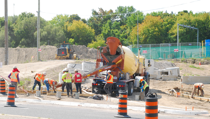
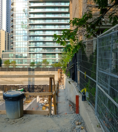
below: Work continues on the Union Station expansion and upgrades on the south side of the station.  This work will provide the infrastructure needed for increased GO train service (more trains, more often).  Comparing this photo to one taken a year ago there don’t seem to be many changes so I hope that most of the work has been inside (or else it’s going to be a very long time before this project is completed).

construction on the south side of union station

below: It is also possible to continue walking indoors through to the new GO Bus Terminal.  This is the glass wall at the south entrance of the terminal on Lakeshore Blvd.

wall of glass at south entrance to new GO bus terminal on Lakeshore Blvd

man wearing yellow and orange high viz jacket waits in line at a Second Cup coffee, Toronto Maple Leafs theme image on wall behind him

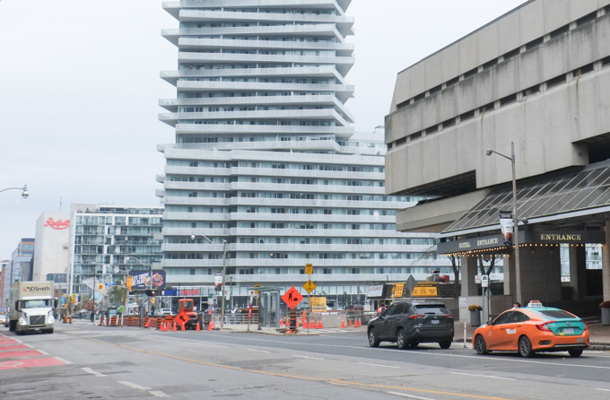
below: This is the view southwest from the corner of Bay and Lakeshore. Just beyond the exit ramp from the Gardiner is the Toronto Harbour Commission Building on Harbour Street – named as such back in the day when this was close to the shore of Lake Ontario.   It was built in the Beaux-Arts style and was completed in 1917.

looking southwest at the intersection of lakeshore and bay, old customs house on Harbour St is there as is the large parking lot beside it , also ramp from the Gardiner.

below: Harbour Commission Building, 1923, just over a hundred years ago.  Photo from the Toronto Public Library, found online in their digital archives. Harbour Street was right on the shore!  Everything that exists toady south of Harbour Street is built on landfill.  That includes most, if not all, of the developments on Queens Quay.

1923 black and white photo of the Toronto Harbour Commission Building, and its reflection in the water of Lake Ontario. From the Toronto Public Library website and was once used by the Toronto Star newspaper


below: A few steps later as we walked down Bay – this photo is now looking northwest back towards Scotiabank Arena and the Gardiner Expressway.   So many new towers!   The Telus building on the right is on York Street and immediately south of the tracks. On the left are twos tall building with an almost round structure on the top (with holes in it) – these are the ICE condo towers at 12 and 14 York.

looking northwest towards scotiabank arena and downtown skyscrapers, from Bay street, just south of the Gardiner

a couple on the sidewalk, walking past a hot dog and sausage vendor in front of the Westin Hotel

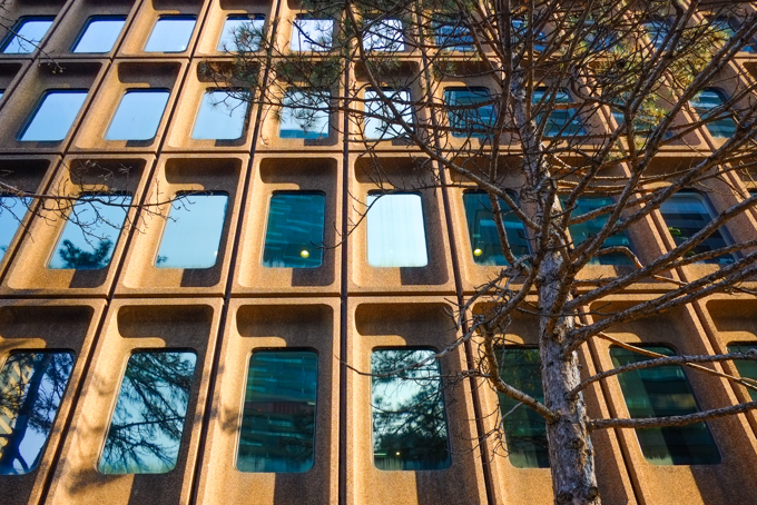
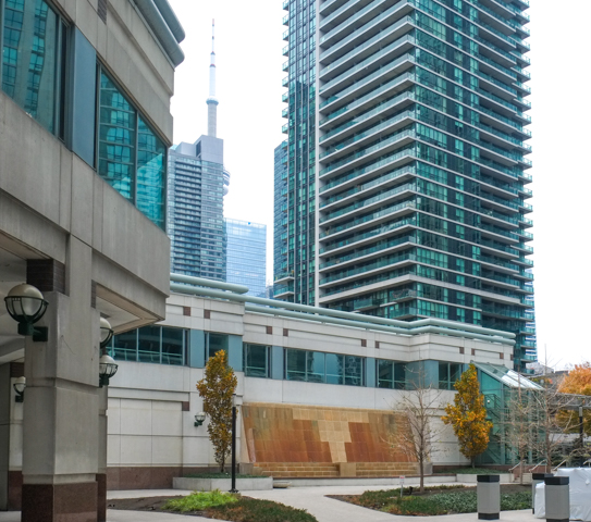
below: On Queens Quay, a contrast between the Brutalist type of architecture of the textured concrete Westin Hotel and the newer glass and steel condo tower beyond it.

looking east on Queens Quay in front of the Westin Hotel

Alexandros fast food Greek style on the waterfront, with construction cones and equipment around it.

below:  Also on Queens Quay (on the north side of Queens Quay between Bay and Yonge) there is a water feature at the horribly named Residences of the World Trade Centre

water feature in brownish colours on the wall of part of the residences of the world trade center at bay and queens quay and yonge

below: The same complex is also home to this mis-shapen peanut thing that is a sculpture, ‘Between The Eyes’, by Richard Deacon.   Also, the brown building on the left is the old Toronto Star building at 1 Yonge Street.  It was to be redeveloped into a condo tower but the market for condos is trash at the moment.  The owner/developer, Pinnacle Group, has announced that they might try to convert the building into a hotel instead.

large metal sculpture that looks like a stretched and twisted peanut, by Richard Deacon at Queens Quay and Yonge,

people walking past a bus shelter on yonge street

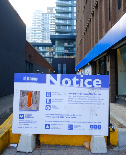
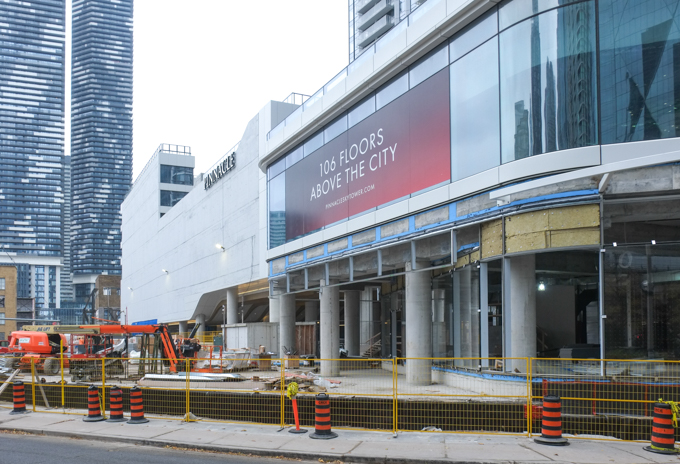
below: Now under construction is Sky Tower at Pinnacle One Yonge (on what was the parking lot behind the Toronto Star building).

new condo tower under construction, pinnacle, large podium at first few floors

below: 106 floors!!  Final height will be 352 metres. May they never have elevator issues.  May the underground garages never have water issues.  The tallest completed building in the city is Aura at Yonge and College at 272m.  A couple of others at Yonge and Bloor are under construction but even once they are finished, this Sky Tower will be the tallest.   Remember that picture of the Royal York Hotel – when it was built in the late 1920s it was the tallest building in the city, and the first one over 100m.

new condo tower under construction, pinnacle, large podium at first few floors with large sign advertising the fact that it is 106 floors high

workman working on exterior ground level finishes in front of Sky Tower condo development

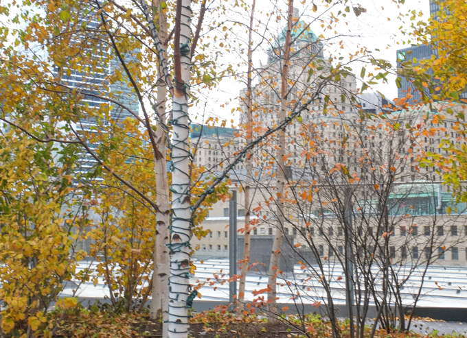
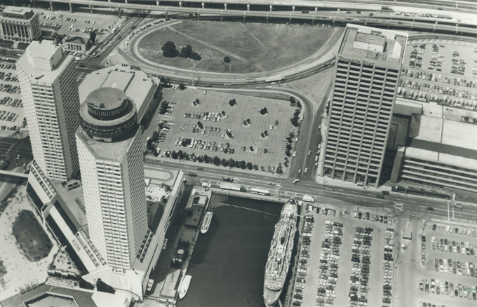
below: When I was looking for older pictures of this area, I found this intriguing photo from 1984.  Not that long ago, right?  The Gardiner Expressway runs across the top and you can see the Toronto Harbour Commission building in the top left corner.   The Westin Hotel is there (the two towers on a triangular base, bottom left).  The rectangular tall building is the Toronto Star building at 1 Yonge.  In other words, this is almost a map of part of our walk.  A couple of things of note – first look how much surface parking there was! And second, what is that circular thing in the middle (and top) of the picture!!!  On closer examination, it’s just an old ramp for the Gardiner and all the wasted space in the center. Harbour Street follows the curve on its south side.  An incredible amount of space is devoted to the car.

1984 black and white aerial photo of westin hotel on queens quay, plus toronto star building at 1 yonge street, waterfront, from Toronto Public Library

below: Walking up the west side of Yonge.  The blue building with all the diamonds and triangles is the back of CIBC Square – we have almost completed a circle.

walking north on the west side of yonge between queens quay and harbour streets

below: More redevelopment and construction to the east of Yonge on Harbour.  Harbour then merges with Lakeshore Blvd.

construction on Harbour street

below: You should recognize the purpose of the exterior bracing on the brick building.  The facade of this 1950s brick LCBO headquarters and warehouse is being saved during its transition to ‘Sugar Wharf’ with new towers, a hotel, a park, and more.   A very familiar story that seems to play in a never ending loop.

construction on Harbour street

below: North on Yonge

tops of buildings on yonge north of the gardiner

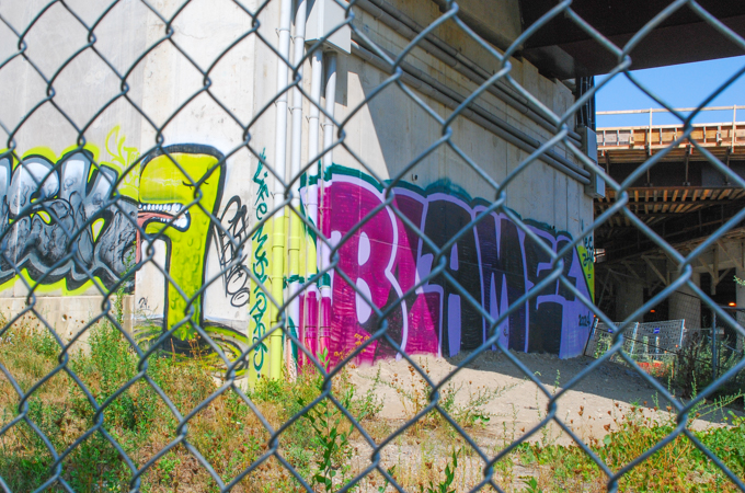
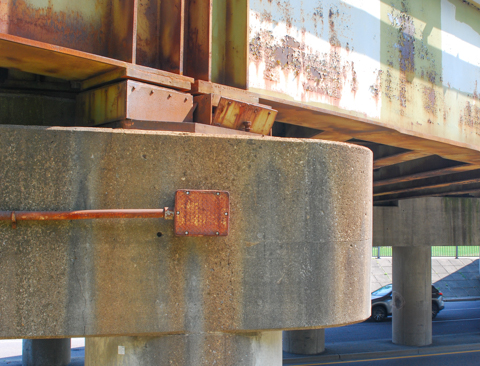
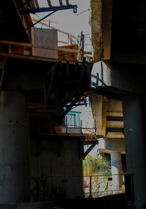
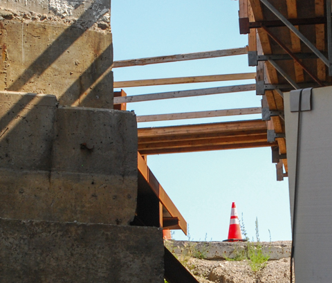
below: Under the Gardiner

man walking a dog under the gardiner expressway

below: Bird in flight but stuck to the concrete –  a paper paste-up on a Gardiner Expressway pillar

man in brown jacket is about to walk under the gardiner expressway, past a concrete pillar with a black and white picture of a bird in flight, street art,

looking north on yonge from under the railway bridge, road repairs construction

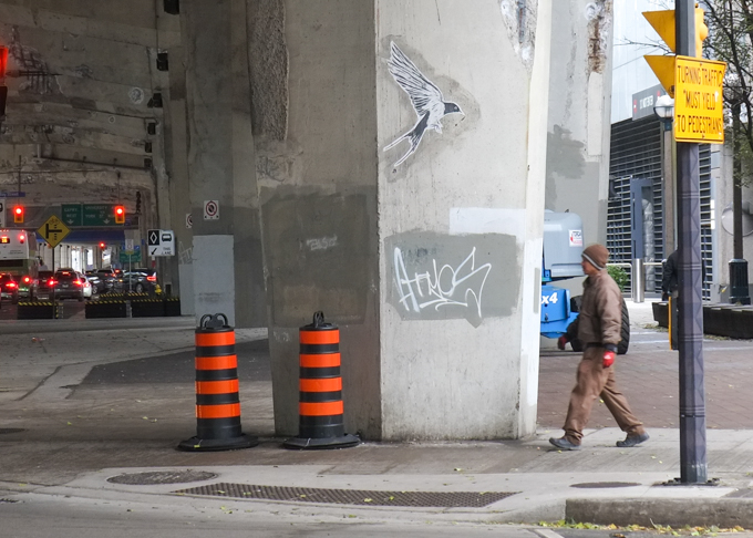
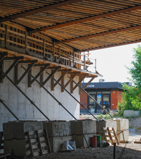
below: I don’t think that this is Finch West.

on yonge street, near The Esplanade, a sign saying sidewalk closed use other side, but it also says Finch West LRT

below: Another bird in flight is ‘Eagle’ by Dean Drever, 2018.  His beak is pointing to another new pedestrian bridge over Yonge Street that hasn’t opened yet.  It is part of the CIBC development and will become part of the PATH system.

relief sculpture of an eagle head and wings in flight on the side of a building on Yonge street

below:  CIBC Square, north side construction.  In the distance is Union Station; we have come close to walking in a circle.  It wasn’t a very big circle but there were many changes and quite a few things happening.   The CIBC Square development includes two towers on the east side of Bay, one on the south side of the tracks and one on the north.  In case you didn’t realize it, the  one acre “park” that they have developed is actually over the railway tracks.  It’s a wonderful use of the space.  I hope that the city sees that it is feasible to create public space this way.  There has been a lot of chatter about how the city should create a park over more of the tracks and I hope that this spurs them on.

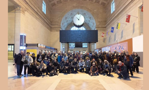
This walk was the 16th Anniversary walk for the Toronto Photowalks group.  It was a rather large group of us that started from Union Station last Saturday morning.

group shot, in great hall at union station

  Toronto Photowalks have walked twice a month since November 2009 with some exceptions during Covid lockdowns and restrictions.  I first walked with them in early February, 2012.  There have been 334 walks and most streets and alleys in the city (and sometimes beyond) have been covered at least once.  Some weeks the group is small while at other times the numbers are a bit overwhelming but all in all, it’s a great group!


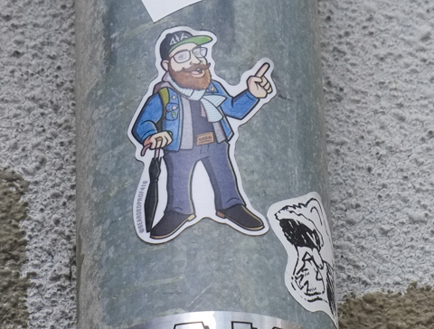
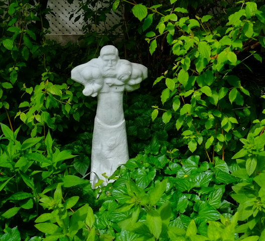
below: I am sure that the Bearded Prof is saying “Thanks for joining us!”

a sticker graffiti slp by bearded prof, of a bearded man in a baseball cap, holding a folded umbrella

Enter if you Dare!

halloween decorations, including hand written sign that says enter if you dare, skeletons, fake cobwebs, yellow caution tape, all behind a little white picket fence


A late October walk on a sunny day – starting at Dupont station which is just north of Bloor on Line 1 (That’s the University side of the Yonge-University Line for those of you who, like me,  haven’t mastered the TTC numbering system yet!).  We walked a few blocks on Dupont before going under the railway tracks to Bridgman, then took a quick turn on Albany to get to Davenport.  A short block later we were on Bathurst.   Vaughan Road veers left off Bathurst just south of Bloor.  We meandered  a bit north of Bloor before walking back to St. Clair West station.

below: A bright and sparkly flower blooms on the southbound platform of Dupont subway station.   This is one of the mosaics designed by James Sutherland in the series “Spadina Summer Under all Seasons” found around the station.

mosaic flower, very large, on the wall at track level, by platform of Dupont subway station

below: More Dupont station flowers to greet subway travelers, this time on the concourse level.


mural picture seen inside dupont subway station, concourse level, on tiles

below: Taking the escalator up inside the dome at street level.

on escalator up to surface level, dupont subway station, looking towards glass dome roof of station entrance

looking through glass doors of dupont station entrance, a woman is coming in, stores across the street

below: There is a Nick Sweetman mural of birds that wraps around the curve of a bench.

mural by Nick Sweetman, above a curved bench at Dupont station, a blue jay, nuthatch, evening grosbeck, and more

below: The curve matches that of the domed entrance to the station on the southeast corner of Dupont and Spadina.

bikes parked outside Dupont subway station, beside glass dome over entrance, beside bench with Nick Sweetman mural

elevator structure at dupont subway station

below: Casa Loma in the distance, on the hill beyond the tracks. This is the view on Spadina north of Dupont.

railway underpass on Spadina, with casa loma on a hill in the background

looking through railway underpass, traffic including school bus is stopped at a red light at dupont

below: Northeast corner of Dupont and Spadina

stores on northeast corner of spadina and dupont, pedestrians people waiting to cross at traffic light, D and D gift shop, country style, and XC Art Restoration, Subway restaurant

below: Big rounded arches, rooftop terraces in the back, and two turrets, all at the corner of St. George Street and Dupont.

large multi unti old brick residence, three storeys, two turrets

below: Looking north on St. George, towards Dupont, 1904.  Working on the street.  The house with the two turrets is already there.  The duplex on Dupont at the top of the street still exists too.

old black and white photo from 1904 of St. George street looking north to Dupont.

below: The duplex (176-178 Dupont) is difficult to see because like so many other older residences on main streets, an addition has been added to the front to facilitate a store or a restaurant.   At the moment,  176 Dupont is a Mexican restaurant, even though the says Pastrami (close enough!).

the first a in pastrami is missing, in a sign above a restaurant.

vines growing on concrete wall that has street art painting on it, side of railway underpass supports

below: Bruno Men’s Hairsylist and his quaint little sign.

Bruno mens hairstylist sign on building on spadina

below: On Dupont, east of Spadina is this mural by Catherine Cachia

mural on the side of a residential building on Dupont, big circular flowers, by Catherine Cachia

below: Cozy and euphoric.

cozy coffee and euphoria stores

below: Bete Suk, Ethiopian Coffee shop

front window of Bete Suk, Ethiopian store and coffee shop on Dupont

below: Northwest corner of Dupont and Spadina, and another domed subway entrance.

bus shelter and dome of dupont subay station entrance on northwest corner of spadina and dupont,

below: Looking west on Dupont

looking west on dupont from in front of dupont subway station, red and white TTC sign.

below: Another, much clearer, example of the transition of houses to businesses by building additions in front, are these two – Krispy Kreme and the faded Modern Laundry & Dry Cleaners.

peaks of original houses can be seen over the top of the boxy additions to the structure to make space for stores, krispy kreme donuts on one side, a dry cleaners on the other

below: West of Dupont, there are still some garages covered in street art.


white car parked beside a garage with a street art on the side of it.

below: This is 390 Dupont Street, part of which is now a coffee shop/vintage clothing store.  I am not sure what the history of the building is but when I tried to research it, I discovered that there is a condo development being proposed for the site.

commercial building, coffee shop on ground level

below: This is the neighbouring property, 388 Dupont.   Two years ago when I walked this stretch, there was a blue and white development notice sign in front of the building (Dupont Street Scenes).   When the application for redevelopment was first filed (2020), it was for an 11 storey building involving 374 to 388 Dupont.  By 2023 the plan had evolved to 12 storeys and now included 390 Dupont as well.  Because the site is adjacent to the CP Railway corridor, a train safety derailment wall along the entire back wall is part of the plan.

old car wash on dupont street

below:  Although there is no posted notice of planning applications for this building, it appears to be empty.  The front door is boarded up and there is a No Trespassing sign in the window.

two storey older brick building, boarded up front door, seems to be empty

below: Two years ago this building was in the early stages of construction.

new condo under construction, balconies are white, with curved ends
below: Another theme that occurs over and over again on the streets of Toronto – the jumble of different eras. Very old brick houses and new glass and steel towers mixed together along with ages in between.   The smaller older structures dwarfed by the newer ones that tower over them.

old grey house, old brick building painted bright red, new condo development, in a line along dupont street

below: The Troy Lovegates mural of 10 faces on Howland & Dupont is still there and still looking vibrant.  If you are interested, there are more images of this mural elsewhere in this blog. 

mural by Troy Lovegates at the corner of Howland and Dupont, 10 faces cover the exterior wall of Fat Pasta restaurant

 below: Running parallel to the railway tracks, and just north of them.

parking lot with tall hydro transmission tower and lines running through it

empty parking lot, with row of condos in the background

below:  The north side of the CP Railway corridor shows signs of its more industrial past.   This building with its curved glass sidelights and other small Art Deco finishes, sits empty.   Previously it was home to a plumbing company but they have moved to new quarters elsewhere in the city.

curved glass sidelights around a metal frame door, brick building, number 316, now empty

 below: Tarragon Village mural by Elicser Elliott

Tarragon Village mural by Elicser Elliott

below: There is also this mural, just around the corner on Albany, “You are not alone”. It was painted by Julia Prajza and Bareket (bkez).  ‘You Are Not Alone Murals’ is a public mural project with over 100 murals completed.  Their goal is to “inspire artists to create murals in their communities–sparking hope, connection, and conversations about mental health.” (quote taken from their website, youarenotalonemurals.com).

mural on the front of a building, wrapped around the front door, in cursive, text says You are not alone

below: An intriguing series of photos in the windows… but I couldn’t get a closer look at them.

private property, no trespassing sign on chain link gate, in front of driveway, beside building with old pictures displayed in boarded up windows

below: A large red heart and an even larger blue spruce tree.

large blue spruce tree growing in the front yard of a house with table and chairs in the front yard, also a bench with a large red heart on it

older house with trees growing in front, front door and enclosed porch have been tagged;

in magenta, stencil graffiti that says you grow girl

below:  The paintings along the concrete wall on the west side of Bathurst have all been defaced.

front end of a white truck in view, driving past a mural painting of an orange car, mural has been tagged in large fat green and white letters

below: Another touch of Art Deco in the neighbourhood

stairs and entrance to an art deco style brick apartment building with curved corners

below: Bathurst Street houses

2 single family homes on Bathurst street

below: Playing in the playground

autumn foilage on tree at edge of playground

below: Store fronts on Bathurst

store fronts on Bathurst

Green Farms store on the corner, Bathurst Street

store fronts on Bathurst, one is empty and for lease, another is knit o matic

below: Looking north up Bathurst where Vaughan Road exits left. Vaughan Road was built in the 1920’s along an older trail that follows a now underground creek.  From here, it runs more or less diagonally north and west to its northern end at Dufferin and Eglinton.

looking north up Bathurst to where Vaughan Road veers left

below: Choice laundry in the old brick building, on Vaughan Road.

Choice coin laundry and dry cleaning, , with a young man sitting outside

below: Also on Vaughan Road, Zoomiez Doggie Daycare and Vaughan Road Pharmacy.

vaughan road pharmacy, brick building on vaughan road, beside newer building with is home to zoomiez doggie daycare

a face has been added to a hydro pole, plastic face parts nailed to the wood

below: We met a couple of strangers.  They weren’t very talkative though so we kept walking….

two life sized skeletons sitting outside with drinks in their hands

vacant lot behind black chain link fence

large apartment building in background, top of a porta potty in the foreground,

hole in the ground for condo construction, crane,

piles of supplies for construction, building materials, behind an old house

below: The gateposts on Strathearn Road mark the entrance to the former village of Forest Hill.  Forest Hill was incorporated as a village in 1923 and then annexed by the City of Toronto in 1967.

two large stone gate posts for a gate in a boulevard between two lanes of traffic

two large trees in front of a single family home, 2 storeys, both trees full of red leaves for autumn

bungalow single family home, white garage door, brickwork is checkerboard light and dark brown,

older stone house with brown wood addition, ivy covers on of the walls, stone chimney, large blue spruce tree growing beside the house

below: There is a metal plaque at each end of the Glen Cedar pedestrian bridge over the Cedarvale Ravine.  This is the one at the south end.  The text is taken from the lyrics of “Anthem”, a song by Leonard Cohen.  The first bridge here was built by Henry Pellatt (the same man responsible for Casa Loma) in 1912. It became a pedestrian bridge when it was modernized in 1989.

brass plaque embedded in the concrete of a bridge railing

Ring the bells that still can ring
Forget your prefect offering.
  There is a crack,
a crack in everything
it’s how the light get’s in
[and yes, the plaque has an apostrophe in gets]

glen cedar pedestrian bridge in late october when the trees were in their autumn foilage

red, range, and yelow oak leaves, autumn colours, from Glen Cedar bridge

below:  Home is where our story begins.

graffiti words on dark grey metal railing of bridge, background is path and trees below the bridge, words say "home is where our story begins"

graffiti, black drawing on white, signed, also words toxic city on drawing

large gnarly old tree beside a two storey brick house

path through a ravine with some sunlight coming down through the large trees that are on both sides of the trail,

below: At Bathurst and St. Clair – Da Best Pilipino Bakery and Deli

on Toronto education workers building, a green sign that says Da Best Pilapino Bakery and Deli

cracked concrete sidewalk, metal drain cover

below: Waiting to cross Bathurst Street

looking east on the north side of St. Clair on Bathurst

below: Looking east on the north side of St. Clair, from Bathurst.  St. Clair West subway station is just a few meters away.

looking east on the north side of St. Clair on Bathurst,, fence around a construction site

below: There was once a gas station on the northeast corner of Bathurst and St. Clair West.  Now it is a vacant lot with a few alien creatures like this one lurking about.

large digger on construction site, with glass and steel condos in the background

passenger in a white truck, window down, elbow out, as it drives around a corner

plastic halloween decorations, a flying orange ghostly creature with a black witch's hat on

below: Happy Hallowe’en pumpkins!  The frog’s not so certain though.

two jack o lantern pumpkins for halloween decorations, on a front porch


With thanks to Nancy who walked with me that day.

Oriole GO station is on the Richmond Hill line.  It is located at Leslie and the 401 highway and for many years the parking lot for the station was under the 401.  With the recent changes to the Leslie/401 interchange, and all the construction that that entails, this parking lot is gone.   Also, the old station building is no longer in use and the platform has been moved slightly north.  A new metal pedestrian bridge has been built over the tracks south of the station to replce an older wood structure – this provides access to the residential area to the south.

sign pointing to GO station, in park,

graffiti on concrete on the side of elevated portion of 401 highway. green space between concrete and chainlink fence and gate

below:  Under the 401 highway

behind chainlink fence, graffiti on concrete pillars holding up the 401 highway

below:  Access to Woodsworth park involves getting over the tracks via a new pedestrian bridge.

looking across tracks at oriole GO station, near new pedestrian bridge over the tracks

below:  Caged!

cage enclosing top level of metal pedestrian bridge

below:  The bridge is high! The top of it is level with the traffic on the ramp between the eastbound 401 and Leslie Street.  This is the view north and slightly west from the bridge.

cars on ramp between eastbound 401 and Leslie Street, highrise glass and steel condos behind, GO train tracks under the ramp, view from pedestrian bridge over the tracks

below:  Another view from the bridge, this time looking northeast

looking northeast from pedestrian bridge over GO tracks at oriole station, looking over the 401 to highrises in the distance

below:  Looking east over all the lanes of the 401, including the new Leslie Street on-ramp on the south side.

highway 401, east from Leslie Street

below:  At track level

track level, platform for oriole GO station, under the 401,

It was very quiet here.  Oriole station is the first stop north of Union but trains only run during rush hours.  There are four trains that run southbound in the morning and five trains for northbound trips in the afternoon.  No trains stop here between 8:35 a.m. and 4:14 p.m.  There don’t seem to be any stats online re the number of people who use this station.

sign for Oriole go station

below:  Old station building in the background that is no longer is use (i.e. there are no washroom facilities here at the moment).

construction of new off-ramp from the 401 eastbound at Leslie Street, with old GO station building in the background

construction of new off-ramp from the 401 eastbound at Leslie Street

below: You may have seen this giant billboard if you have driven past on the 401.  It stands beside the Oriole station platform.  Recently, the platform was under under the 401 and therefore, protected from the rain.  It has been moved slightly north to bring it closer to Leslie subway station (TTC)

massive billboard on large metal support, at the side of GO station tracks, highrise condos in the background, Oriole,

Oriole Go station platform under the 401 highway, with construction

below: All pedestrian access to the old station as well as the parking lot has been closed.

danger do not enter signs, no pedestrians sign, blocking sidewalk passage under bridge at oriole GO station

workmen, construction of new off-ramp from the 401 eastbound at Leslie Street

below: There is another entrance to the station at the north end where the tracks cross Esther Shiner Blvd. [extra note: Esther Shiner was a North York municipal politician who was first elected in 1972.  She served as councilor, as well as a short stint as Deputy Mayor until her death in 1987.]

north end of Oriole GO station platform, with sign pointing to exit at Esther Shiner Blvd

Not everybody walks to IKEA!

IKEA store and flags, on Esther Shiner Blvd, beside GO railway tracks,

looking northwest across railway tracks just north of oriole go station

below: The tracks cross Esther Shiner Blvd, but the sidewalk doesn’t and all pedestrian traffic is routed to the south side.   If you want to transfer to the TTC (Leslie station), there is a walk involved.   It takes about 10 minutes I think.

pigeon sitting on railing overlooking esther shiner blvd, TTC bus in the background, looking east towards Leslie street

esther shiner street, looking west towards ikea, under train tracks,

two signs with arrows, TTC Leslie to the left and GO Oriole to the right

below: Turn left at Old Leslie if you are looking for the TTC subway.  Straight through gets you to Leslie Street (at North York General Hospital, north of the 401 highway and south of Shepard).

Old Leslie Street sign on post along with other signs for TTC and GO,

below: The signs still direct you to the GO station via under the 401….

leslie looking south at 401, construction and Oriole GO station

below: …. but the road is actually closed to traffic.

workman under the 401, by sidewalk, a couple are walking towards him

4 different tall lights,

below: Looking northwest across Leslie, south of the 401 (towards Yonge & Shepard).

leslie street, south of the 401

below: Making sidewalks.

workmen pouring cement for new kerbs and sidewalk, along Leslie street at 401

below: Old and faded, rules and regulations for prevention of the spread of COVID-19

old COVID 19 rules and regulations poster, weathered, on fence at construction site
red lines spray painted onto sidewalk, beside a crack in the cement

concrete support, and part of rusty metal train bridge over Leslie street

light and shadows between portions of highway being constructed and renovated

construction site light and shadows, and small orange cone

construction of new ramp, 401 and Leslie

no entry sign on pole, overgrown with shrub,

brown pigeon sitting on a grey metal round hand rail overlooking city street

below: This lane was recently named for William Hawley, a retired Toronto firefighter and Leslieville resident.

sign for Captain Hawley lane, with new third and fourth floor additions to a building in the background

Captain Hawley lane runs north from Eastern towards Queen St East.  It is west of Leslie Street.  There are a few other little alleys in the vicinity all of which seem to be unnamed.  This blog post shows some of the things seen in these alleys as well as on the major streets around them, Queen, Leslie, and Eastern.

below: Elicser Elliott’s Leslieville mural still looks great at Queen & Jones.

young man crossing Queen Street near Leslieville mural, and beside a TTC streetcar

Leslieville mural

below: “Community” by Candace Bell on Queen East

painting on sidewalk traffic box, in front of store, on Queen Street East

below: Who is the photographer?

a camera is set up on a tripod, on the sidewalk outside a cafe, man sitting on chair nearby, another man sitting too

workman in hard hat and work boots, spray painting a line on the pavement, street,

below: Stores on Queen East.

stores on Queen Street east

below: Northeast corner of Larchmount and Queen East.

intersection of Larchmount and Queen Street East , northeast corner

queen street east, north side

below: Photo taken on a day when gas was $1.43 a litre, albeit full service which you don’t find everywhere these days.

sun gas services station on queen street east

below: An afternoon break on a patio.

woman on patio of duke tavern, red building with mural on the side, white umbrellas,

below: Waiting to get into the Duke, Men’s Entrance

mural, line up of men wanting to enter the duke tavern, men's entrance, plus a boy sitting on the steps outside

mural, line up of men wanting to enter the duke tavern

below: Leslie and Queen East south side,

glass of bus shelter, with Leslie St sign on it, people walking on sidewalk, front of Shish restaurant on Queen Street, construction on southeast corner of Leslie and Queen in the background

below: Construction on the east side of Leslie – one of countless large holes in the ground.

workmen talking, construction site, Leslie street at Memory Lane

below: Houses on Leslie, south of Memory Lane.

houses, Leslie Street and Memory Lane,

below: A house with a bright turquoise front door and another that is now taller and skinnier.

row of houses on leslie street, one has a bright turquoise front door and the one beside it has had a third storey added to it

below: 27 Leslie Street

small blue building at 27 Leslie Street

below:  Non-believers on top – “No Truth to it!” over “Jesus saith unto him…. “.

Note on pole that says, but someone ha written over it, no truth to this

toronto street sign for eastern avenue, on a pole covered with vine and ivy

below: On Eastern, the AMCO gas station is now closed because of a recent fire.

gas station on Eastern ave, scene of a recent fire

men boarding up burned out gas station
AMCO gas station on Eastern ave, scene of a recent fire, with backs of houses beside it

below: “Navalny” and “Text” by Nigel Smith

text street art by Nigel Smith, on old office building, two signs, one says text and the other says Navalny

below: There is still a large vacant lot on the south side of Eastern Avenue (with views towards the Port Lands)

temporary building structures on a large vacant lot
no trespassing sign on fence surrounding a large vacant lot on Eastern Avenue

… and now the laneway scenes …..

below: Starting with the now  ubiquitous laneway garden suite

new infill house development in a lane

low burlap barrier draped across an alley, repairs being made to the concrete and pavement behind the barrier

a large billboard on Eastern avenue, with advert for second cup coffee shop, summer drinks

below: These  houses  with the square-ish shapes at the back are disappearing as more and more home owners renovate and/or expand upwards.  Brick is no longer the cladding of choice (and hasn’t been for a long time).

back of house, alley view, square red brick two storey house, one window, wood fence

alley views, back of two semi detached houses, that share a chimney, one green siding and one one white siding

white camper of RV parked behind house, goldenrod weeds growing by the back door.

back of house, alley view, painted wood fence, lots of trees

vines growing on overhead wires, over a lane, with garages along the sides of the alley

back of house, alley view, wood fence, white sun umbrella, grey cover on barbecue

back of house, alley view, white house, white van parked behind, green wood fence

backyard alley view, back of newly renovated house, expanded, fence down at back, bags of yard waste

backyard alley views, old tire, trash bins, rooftop terrace with umbrella

small red car parked in a lane, line of garages, tall trees,

backyard alley view, overgrown grass and shrubs, hard to see the house, chainlink fence and gate

backyard alley view, lots of stuff, including a shopping cart full of basketballs and soccer balls, chairs, sheets and clothes hanging from a yellow rope clothes line

chainlink fence, old painted wood, rusty metal, latch, gate in an alley

red gate in an alley, with black line drawing on it, locked, latch,

old plywood on a fence, once painted red, now faded to slightly orange red, with dirt splotches and worn areas, texture, pattern, abstract


A new park in the Port Lands has opened.  Biidaasige Park.  Biidaasige translates to “sunlight shining towards us”.

new mouth of the Don River, flowing into Lake Ontario, through Biidaasige Park on toronto eaterfront, toronto city downtown in the background

It is centered around the new mouth of the Don River, with lots of walking and cycling paths that wind along the shores and through the newly planted shrubs, trees, and other native plants.

north end of new yellow bridge in the portlands, over the Don River, with walking trail along the river, Lafarge cement in the background

newly planted trees along path in biidaasige park, with toronto downtown in the background

a mother pushing a stroller walks on path n biidaasige park, toronto skyline and highrises in the background,

There is also a large playground where plenty of adventures await!

two white scottie dogs, scottish terriers, at playground at biidaasige park

kids on a zip line at biidaasige park

How many animals can you spot?

playground structure made of old logs, looks like a beaver dam, with wood sculptures of beavers on top

large wood playground structure in the shape of a raccoon

large wood playground structure in the shape of a raccoon

boy jumping off a large wood carving painted to look like a giant eagle, biidaasige park playground

large white wood play structure in the shape of a snowy owl

large white wood play structure in the shape of a snowy owl, in a playground

cyclists on path, biidaasige park, beside raccoon play structure

group of people using the new grills, barbecues, at biidaasige park

walking and biking path through biidaasige park towards red bridge on commissioners street

Don River flows through wetlands and grssy area, towards new red bridge, port lands

two women on the shore of DOn River

greenery, shrubs and plants in foreground, lafarge cement, yellow bridge in background, biidaasige park, don river

newly planted trees in front of Don River as it goes under new yellow bridge

water lilies in don river, a walking path beside the river

small access area to Don River with walking and cycling path, biidaasige park,
two pale purple chickory flowers poke their heads out from between slats of a wood fence

A black wasp has found a swamp milkweed flower.

a black wasp on top of a pink flower of a swamp milkweed plant

below: The washroom facilities are still temporary (I hope!) but at least they exist….

temporary toilet faciities in a portable building, white, by sidewalk, port lands, by biidaasige park

workmen doing garden work in park at portlands, with lafarge cement silos in the backgroun

… But there is more.  Biidaasige is not the only new park in the area.  Just to the east is the new Leslie Lookout Park that features this 10m tower that references the areas industrial history.  It echos the silos of the past and provides an elevated viewing area.

path leading to Leslie Lookout park, and its repurposed concrete tower

below: The park is at the east end of the Ship Channel

view from tower at leslie lookout park, along ship channel to the west

inside the leslie lookout park tower, looking northwest towards city skyline

sand beach and muskoka chairs at leslie lookout, overlooking ship channel, and next to an industrial site

 at leslie lookout, towards CN Tower and city ckyline, overlooking ship channel,

Both parks are just part of the redevelopment of the Port Lands.  The area has always been industrial, and many industries remain.  Construction continues on other areas

below: Unwin Avenue

Unwin Ave looking east towards the Hearn generating station and its very tall smokestack

below: The old Hearn Generating Station still sits empty.  It was built in the 1950s as a coal powered generating station but it was decommissioned in 1983.   It has been used as a movie set location or as a backdrop for art installations but because of the huge costs involved (especially with cleaning up the interior to present day safety standards) this heritage site is vastly underused.

hearn generating station building, behind fence with vines growing on it

below: But now there is a development notice sign on the fence. Its present owner, Studios of America,  has applied to redevelop the 30 acre site to include condos as well as other mixed uses.

hearn generating station building, with blue and white development notice sign on the fence

hearn generating station building and driveway with gate

sign saying construction zone ends is lying on the ground surround by weeds including yarrow

a dump truck parked beside a large pile of dirt, industrial site behind it

constuction, workmen and equipment, working along the banks of the new mouth of the Don River, as seen from under the yellow bridge

dump truck on street, across intersection from a group of cyclists

a cyclist rides on Commissioners street in the port lands

on a utility pole, two signs, one with arrow pointing right for Don Valley Parkway north, and one toronto city street sign for Villiers street

villiers street scene

abrupt end of the elevated portion of the Gardiner Expressway on the north side of port lands redevelopment activity at the corner of Villiers and Munitions

dump truck on flattened pile of dirt, immediately south of end of the gardiner expressway

port lands redevelopment activity at the corner of Villiers and Munitions

a small orange and white cone covers the top of a pipe coming up from underground, a bulldozer in the background, vacant land, just dirt

red dump truck releasing its load of dirt, adding to dirt on vacant lot in port lands

bulldozer, or front end loader with load of brown soil, heads out gate of construction site towards road, CN TOwer and toronto skyline in the distance

graffiti, bright red heart on a wood pole, with other sctibbles and scrawls on it

graffiti sticker of a poodle head by dogma, beside red arrow pointing to fire extinguisher

black eyed susans, yellow flowers with black centers

a little bit of Church Street, on the run…..

And of course, a lot of in-between too.  A bit of a random walk south from Bloor on Sherbourne, Jarvis, and Church.  A zigzagging walk through four neighbourhoods.

  But first, coffee!  De Mello Coffee on Bloor has mirrors under their counter and it makes for some strange scenes.


inside a coffee shop, de mello coffee, counter has mirror below so that reflections of backs of people sitting are seen from the waist down

below: In the lobby of Postmedia Place on Bloor Street there is this sculpture – three people reading newspapers.

statue, sculpture, in post-media news building lobby, a group of 3 people reading, 2 sharing a bench, and one boy lying on the ground.

below: I found not one, but two, anser faces of unknown vintage in an alley just west of Sherbourne

anser graffiti face drawn in black on a white wall in an alley

graffiti artist anser, blue line drawing of a face on a green garage door

below: Upper Jarvis was neighbourhood number one that day.   The north end of Jarvis Street is at Charles Street; here Jarvis splits into Ted Rogers Way (old Jarvis Street) and Mt. Pleasant.

city of toronto street sign for bloor street east, with header of upper jarvis

below: Looking south along Mt. Pleasant immediately south of Bloor. If you can see the covered pedestrian walkway over the street in this picture, that is where Mt. Pleasant turns slightly left and becomes Jarvis Street.

jarvis street, south of bloor, looking south

below: Ishkozi Park is a small green space on Huntley (actually on the grounds of Rogers Toronto headquarters).  The benches have been recently painted, but the large sculpture in the center has been there a while.  The walking lady in the sculpture may look familiar and you may be thinking to yourself, “Where have I seen her before?”.  The stainless steel sculpture is a giant tree and is titled ‘Red, Orange and Green’ and it was created by artist Michael Snow. …. Have you figured out why she looks familiar? … She was first spotted back in the early 1960s…..

ishkozi park on huntley street, with large metal sculpture, and rainbow painted benches


The neighbourhoods along Sherbourne and south of Bloor are other rapidly changing areas of the city. On the west, many older homes still exist but they are empty and obviously waiting demolition (or inclusion into a large condo development?).

below: Once they were a few family homes, now they are a number of smaller apartments.   Interesting brickwork.

set of 3 rowhouses, red brick, bay and gable, with taller apartment buildings and condos behind them

two older large red brick residences near Bloor and Sherbourne, three storeys each, with large newer glass and steel condo behind

below: Another ubiquitous development notice sign – this time to inform us of a very large two tower development that involves three streets, Huntley, Linden, and Selby.  Portions of some of the older houses would be kept and the towers would be behind them.  I did not do a complete research on the planning application (21 227527 STE 13 OZ) but it seems like city council didn’t like many parts of the initial proposal back in 2021/2022.  I do not know what it’s status is now.

older white two storey house, with development notice sign on the front lawn

older brick residences on a side street near Jarvis and Bloor, with large Rogers headquarters building behind


below: On the east side of Sherbourne, it is Howard Street that is torn up. This is the west side of St. James Town.

workman at a construction site

hoardings around a construction site at Howard & Sherbourne, design by Sarah Klawiter, abstract shapes that look a bit like a city scene, with trees and grass, as drawn by a child

below: A cheeseburger with a sesame seed bun!

bell on the handle bar of a bike, shaped like a cheeseburger with a sesame seed bun

below: Someone’s heart is in heaven, but Lisa and Jerry 4-Ever!

wood park bench with graffiti, words that say my heart is in heaven, also Lisa and Jerry 4 ever

below: Jarvis & Gloucester/Earl northwest corner.  Some black, some white, and lots of grey.

apartment buildings and new highrise glass and steel condos, looking north on Jarvis, west side of the street, at Gloucester

below: Fancy brick work, rounded windows, and a turret!

older brick building with fancy brick work, rounded windows, and a turret

old lamp posts by a brick building

bay windows and stone work above the entrance to the Earl, a low rise apartment building

below: Church Wellesley village, neighbourhood number two.

street sign for Wood st., with header of Church Wellesley village in rainbow stripes, old Maple Leaf Gardens in the background

below: Once upon a time it was Maple Leaf Gardens, home to the Toronto Maple Leafs hockey team (1931-1999). Now it houses a Loblaws grocery store and TMU athletic facilities (Mattamy Athletic Centre). Northwest corner of Church and Carlton

old Maple Leaf Gardens on the northwest corner of Church and Carlton, now part Loblaws store and TMU athletic facilities

Church street side of old Maple Leaf Gardens, art deco brick work

a man sits in a TTC streetcar in downtown Toronto as another streetcar passes it, going in the opposite direction

below: Lots of pink on Maitland Street.

old houses on Maitland street, now stores and businesses, one is painted bright pink with a turquoise door

below: Garden of Lost Boys – dedicated to the memory of friends and neighbours lost to the AIDS epidemic.

small statue in a garden, surrounded by flowers and flowering shrubs
metal circles for locking bikes to, painted in rd, orange, and yellow, in front of a store with a window display that says love sholdn't be bottled up

below: Hot tub macrame!!  Finally, a use for those plant hangers that you (or your mother) might have – that you probably made back in the 1980s.  If you don’t have such a thing, you can find this one in a store on Church Street.

grey plant pot in a macrame holder, with three naked Ken dolls sitting inside it

metal fence in front of store window painted in rainbow colours, reflections in the glass

convenience store, lower level, steps down to it, on church street, with rainbow canadian flag, ad of lott max lottery, ups store ad,

part of a mural by Barbara Hall park, a young person with a long rainbow banner

below (also above): Tribute to Sarah Hegazi, written in 2020.  “To my siblings: I tried to survive and failed, forgive me. To my friends: the experience was harsh & I was too weak to resist it, forgive me. To the world: you were cruel to a great extent, but I forgive.”  Hegazi was an Egyptian writer and LGBTQ activist who was arrested and tortured in Cairo for waving a rainbow banner. She found asylum in Canada in 2018 but died by suicide in Toronto two years later.

mural in Barbara Hall Park, tribute to Sarah Hegazi, large black and white portrait, with text, rainbow painted benches in front, park

below: Patchwork teddy bear graffiti sticker by artsbyabe

graffiti sticker, patchwork teddy bear with a black eye, in the background, a rainbow coloured crosswalk

two men walk past Soy Boys massage on church street
sidewalk traffic box painted in blues and purples with large text that says It's all about drag

below: At the end of the rainbow you will find O’Gradys – in on of the few half houses that exist in the city.

O'Gradys tavern on Church street, with rainbow crosswalk in front of it

man in blue hard hat a construction site on church street

construction site with digger in the middle of an intersection, church street

policeman directing traffic in front of a ttc bus, a man on an electric scooter,

below: On a school wall – a door with rainbow stripes and hearts along with Honesty (Gwekwaadziwin) and Wisdom (Newaakaawin)

doorway of a school with rainbow stripes and hearts, and some words in indigenous language

below: Gerrard Street East and the Garden District,… now we are at number three.

city of toronto steeet sign for Grrard St East, with header that says Garden District

below: … but wait, Gerrard Street East in McGill Granby Village?  The difference of course is that one is on the west side of Church and the other is on the east.  Neighbourhood number four.

city of toronto steeet sign for Grrard St East, with header of McGill Granby Village

below: By the time we get to Queen Street, we are in Old Town Toronto, Historic Queen Street and Neighbourhood number 5.

Old town toronto city street sign for historic queen district, queen street east
top of a TTC streetcar at church and queen

below: The round turret of that yellow building still remains. The green scaffolding keeps the facade stable while new development occurs around it.  Some of you may be old enough to remember it as a Thriftys Sports Shop.   The last business to occupy the space before demolition was Shawarma’s King.

two streetcars going in opposite directions about to pass each other at corner of church and queen, a man on a scooter is also in the intersection
black and white photo of a couple standing on a street corner while a TTC streetcar passes them, both are wearing hats, she is looking for something in her bag and he is watching her

below:  Church street just north of King.  Fenced off and closed to traffic.

beside construction zone, workman waiting for group of people to pass before letting a dump truck pass through gate

person walking a small black dog on sidewalk beside construction zone at king and church

west side of St. James cathedral on Church Street, construction machinery on the street, were pavement has been removed

below: The intersection of Church and King, looking towards the southeast corner.

looking southeast at the corner of king and church streets, workmen on the road, pavement removed, closed to traffic,

below: Still King and Church but a slightly different angle

at king and church, construction fence, on west side of church, looking at southwest corner of the intersection BMO bank

buildings on king street, engel and volkers, old brick buildings, newer glass behind, street torn up for ontario line constrcution

below: … Also King Street

sidewalk patio on king street, with red umbrellas and decorated with lots of flowers including pink petunias

below: Leader Lane runs between King and Wellington. After many years of “discussion” and planning, the part of Leader Lane that is south of Colborne just might get pedestrianized.  This picture show the north half of Leader Lane and yes, that section has just been completely redeveloped around the older white building.

O'Briens tavern, Leader Lane

below: P.J. O’Brien’s has been on the corner of Colborne and Leader Lane since 1966.

front of O'Briens tavern, Leader Lane and Colborne street, an old yellow buolding with blue trim

A quick look back at Front and Sherbourne – this is the northeast corner of that intersection.  A lot of new development here!

northeast corner of Front and Sherbourne streets

Phew! Time for a rest!

workmen sitting and having a rest on the job site

With thanks to all the friends that I walked with that day…. shown here doing what we all do best, play in our favorite photo places (in this case, Leader Lane, side of P.J. O’Briens)

by the large clock on the side of P.J. OBriens on Leader Lane, by their guiness ad,

…. another visit to Yonge and Eglinton

people crossing Eglinton Ave towards entrance to building on southwest corner of Yonge & Eglinton where there are images of people painted on the window

Of course, this is also the location of the Eglinton station on the mysterious Eglinton LRT.  The underground walkways between it and the Yonge – University subway line are complete, as is the entrance on the south side of Eglinton.   The latter is a large building and it will definitely help with the flow of traffic… but it sits idle.

northern new entrance to Eglinton station on LRT line, behind fence, no public access

new entrance to Eglinton station on LRT line, behind fence, no public access, on west side, with old Canada Square development behind

below: All of the old Eglinton station bus bays are long gone.

new Eglinton station Metrolinx entrance for LRT and subway, still closed to the public, with older Canada Square buildings around it

below: Canada Square, home to Canadian Tire head office for more than 50 years, was built in the 1960s and 70s.  It consists of two towers connected by a lower section – it is this middle connecting piece that has the vertical concrete slabs on the exterior. These verticals are on both the Yonge Street side (below) and this motif is repeated on the back of the building (see photo above, behind the new station entrance).   Earlier this year, Canadian Tire announced that they had renewed their lease for another 20 years and that the building was going to be redeveloped/upgraded/modernized in the near future.

a man walks down Yonge St., past vertical concrete slabs on canada square building, light and shadows

below: Northwest corner of Yonge and Eglinton

reflections in the glass on the northwest corner of yonge and Eglinton with Cineplex theatre, Winners store, Pickle barrel restaurant, and Rexall drug store, 2200 Yonge Street

people walking on the west side of Yonge, north of Eglinton

below: The Duke of York pub at Yonge and Roehampton

corner of Roehampton and Yonge, Duke of Kent pub on the corner, along with Chloes Nails, the Stag Shop

below: The old Postal Station K has been incorporated into a new condo development. The older building dates from 1936; it was built on the site of Montgomery’s Tavern (made famous in 1837 when it was the epicenter of William Lyon MacKenzie’s rebellion). It was a big square building but with Art Deco elements around the entrance. Because it was built in 1936, it actually featured (and still does) the Royal Insignia of King Edward VIII whose reign was very short-lived because he abdicated the throne only 11 months after being crowned.

old post office on Yonge street, is now the bottom part of a new condo development

below: North of Montgomery/Broadway more development.  More cranes.

looking north on Yonge street towards Montgomery, old brick and stone building on the corner, many cranes in the background

below:  About 15 years ago, North Toronto Collegiate  (NTCI) was rebuilt on Broadway.  The new school was incorporated into a condo development.  At the north entrance to the school is an artwork by Catherine Widgery’s called “Mindshadows”. It is a 20 foot high stainless steel cube on legs that is covered with numbers, letters, and words. Serene, provoke, laugh, loud, big, spirit, and up are some of the words.

entrance to North Toronto collegiate institute, with public art in front.

below:  View from Broadway of the North Toronto football field and track and some of the condos that surround it.

football field and track, par tof North Toronto Collegiate, surrounded by tall condos and apartment buildings

view west from football field and track, partof North Toronto Collegiate, many tall condos

below: Looking north from Roehampton

looking south from Broadway, football field and track, part of North Toronto Collegiate

below: At the south entrance to NTCI (on Roehampton) is another public art installation.  “What’s your name?” by Ilan Sandler (2011) contains the first names of all the NTCI students since the school opened in 1912.  Each name only appears once – but there are still 2053 different names such as Sven, Connie, Marlee, Janis, Lola, Ephraim, Bryan, and Snezana.

Part of What's your name, an art installation by Ilan Sandler, a list of over 2000 names, in concrete,

The neighbourhood that is north of Eglinton and east of Yonge has been the home of many apartment buildings for at least a few decades.  A growing number of them have been replaced by taller glass and steel condo developments, especially since the city has targeted the area for “… tall buildings and an intense concentration of office, retail, institutional and residential uses…” (quote comes from Yonge Eglinton Secondary Plan, 2018)

exterior staircase beside a building, narrow space between two older brick apartment buildings

older lowrise apartment building

below: Old style (1920s?) 4 storey walk-up apartments.  There was a time when this type of architecture was common and these apartment buildings are (were) scattered around the city.  There aren’t as many as there used to be although some, like this one, has been renovated and kept in good shape…. a testament to their good design.

4 storey brick apartment building

below: Concrete building from the 1970s at 2323 Yonge …

reflections in the windows of a 1970s concrete building, vertical windows with deeply recessed windows

below:  …   but it too has a blue and white development notice on the side of this building.  Fifty eight stories with 40 car parking spots but room for 350 bikes.

blue and white city of toronto development notice sign on yonge street

below: St. Monicas church, an A-frame structure built in 1959, is set well back from the street with a parking lot in front.

st monicas church, A frame building from 1959, and parish hall, with large parking lot in front

below: One of the many stained glass windows inside St. Monica’s church.  This image shows a window that features gold crossed keys which are a symbol associated with St. Peter.  These are the keys to the Gates of Heaven.  The church website describes this window as representing the (Catholic) Sacrament of Reconciliation (the pardoning of confessed sins).

stained glass window in St. Monicas church


below: Redesigned.   From the KPMB website, this is rendering of the proposed new St. Monica’s church.  It has been brought forward closer to the street which also allows for a new condo tower behind.  That’s the plan.

rendering of new redeveloped St. Monicas church on Broadway Ave., as proposed by KPMB, image taken from their website

below: Beside the church is St. Monica’s school.  The original brick building was built in 1916.  A few additions have been added over the years.

st Monicas school, brick building built 1917, with yellow brick addition from the 1960s

reflections of new glass and steel condos in the back window of a small white van or truck

red and black machine parked by hole at construction site

sidewalk closed in front of Akoya, new condo on Broadway, as they finish work on the front entrance and landscaping of the building

narrow walkway with wooden rail, above a large hole in the ground at a construction site

density of residences, highrise condos and apartments around Yonge and Eglinton, glass and steel towers, new developments

density of residences, highrise condos and apartments around Yonge and Eglinton, glass and steel towers, new developments

density of residences, highrise condos and apartments around Yonge and Eglinton, glass and steel towers, new developments

crane used in construction of new tall glass and steel condos, in front of other new high rise buildings near Yonge and Eglinton

below: Changes are also happening to the west of Yonge Street. For instance, this building on Eglinton between Duplex and Henning is coming down.

development notice signs beside a demolition site, partially demolished building, on henning ave,

multi level building in the process of being demolished, exterior walls all gone.

below: Old, new, and in between

Henning Ave., older single family homes with construction of new condos started beside them, crane,

below: Remnants of what used to be.

2 old sets of stairs, side by side, once lead to houses, houses now demolished, stairs now behind construction fence, diggers and other equipment in the background

demolition, debris hanging from ceiling

demolition site

yellow digger, at construction site where a building is being demolished, revealing older interior walls painted in bright colours

below: As I am sure you are aware, I have blogged about Eglinton Avenue before.  Back in 2015 (ten years ago!!) I posted this photo of Eglinton and Duplex.  Both glass buildings are now gone.  The Toronto Hydro Systems building (the short brick one) at the northwest corner of Duplex and Eglinton remains – it is the one with the coloured patches on the wall in the photo above.

looking east along Eglinton Avenue towards Yonge street with Duplex Ave in the foreground. The old Toronto Hydro-Electric building is in the picture, with a newer structure with a glass front beside it. New buildings between Duplex and Yonge on the north side of Eglinton are also in the picture.

below: Same corner, slightly different angle, taken this past week.

looking west along the north side of Eglinton, toronto hydro electric systems brick building on the corner, demolition of other buildings beside it

below: After the glass clad building on the northeast corner of Duplex and Eglinton came down, the backside of the Yonge Eglinton Center was exposed (on the right) as well as another tower (in an area that needs to be explored more!).

concrete tower


young woman with a pink ponytail, pink top, and pink backpack, walks a dog on a leash, crossing street on Yonge, dog is small and white with pink tail and pink ears.

sign that says slow, upside down and leaning against a fence, construction site in the background

below: With thanks to my mother who walked with me that day.

older woman standing in front a fence with two development notice signs

a woman holding a cup of coffee walks on sidewalk, along Eglinton, while a man sits of the steps of a building

defaced TTC bus stops sign on Eglinton, for routes 13, 32, and 61

This walk started from Royal York subway station.  In general, I walked westward first along Bloor Street (to Islington) and then on Dundas West.   The stretch of Bloor West at Royal York is part of The Kingsway neighbourhood.


front of Kingsway cinema on Bloor Street West

blue sign that says welcome to the kingsway, on bloor street west near royal york

two blue chairs beside a metal table, in an open window of a restaurant beside the sidewalk

below: Squares of yarn, some crocheted and some knit, cover a red frame heart similar to others that ShowLoveTO have placed around the city.

crocheted squares or knit squares cover a heart shaped frame, yarn,

below: There are more yarn decorations around the metal frame protecting this tree on Bloor Street West.

yarn squares encircle a pole on bloor street west

below: Also, a little Zen Garden Planter to support the CNIB since June was Deafblind Awareness Month – the planter accessories were provided by The Gardener, a local flower store.

in a sidewalk planter on Bloor West, a little brown miniature pagoda and a sign that says Zen Garden Planter for CNIB donated by The Gardener

below: Bloor West – bike lanes, sidewalk patios, and construction.  Welcome to summer in the city!

construction signs on Bloor Street West, with bike lanes, and sidewalk patios

below: Bloor West glass towers

tall uilding in background seen between two tall closer glass office buildngs

below: One wall of Brentwood Library and the small garden on the north side of the building.

large windows at brentwood Library, some clear, some green, and some blue, trees and a bench in front, some reflections in the glass

below: Old gnarly tree with Kingsway Baptist church in the background

old tree with rough bark on trunk, and large twisty branches, house and church in the background,

below: Just west of Royal York, at Montgomery Road, the subway emerges from underground.

looking west from Montgomery Road towards high rises near Islington, TTC subway tracks in the image as well

small park on Montgomery Road, between two houses, with TTC subway tracks below

The Mimico Creek passes under Bloor between Royal York and Islington.  Tom Riley Park follows the creek on both sides north of Bloor  until it then passes under Islington close to the intersection of Islington & Dundas West.

workmen, up on a crane, city of toronto works department, trimming and pruning trees in a park

a mother and two kids watching a duck on the shores of mimico creek on a summer day, leaves, reflections in the calm water

below: Another angle of the subway at ground level.  Here is looking east as it runs through Tom Riley Park (and if you could see further, you could see where it goes back underground at Montgomery)

pine tree growing in front of opening for entrance to subway, train coming out of tunnel, TTC

below: Islington subway station and bus bays.  A very large parcel of land on the northwest corner of Islington and Bloor is taken up.  Opened May 1968.

buddhist monks and other pedestrians, walking on sidewalk on islington past islington subway station, curved roof of bus bays at station, ttc, highrises in the background

below: A messy corner, at Aberfoyle & Islington (just north of Bloor)

danger due to construction sign at the corner of Aberfoyle ad Islington

long set of stairs up hill to apartment building

below: Just north of Bloor, Islington passes under railway tracks.

looking north on islington, underpass under railway, traffic ign for exit to burnhamthorpe road and dundas street west

below: Islington Towers with a fountain in front. The parts of the fountain that are brown were once blue.  It was designed and constructed by Alfio Bartoletti in the 1960s.

islington towers, apartment building from the late 1960s, with a fountain in the front

below: Across the street from the Islington Towers, a highrise with a more modern design (for better or worse, your decision!).

entrance of new condo tower being built on islington

below: Corner of Cordova and Central Park Blvd with new condo development

corner of Cordova and Central Park Blvd, new ondo being built on the corner, construction fence, and signs, traffic light
woman with gray hair, wearing jeans, walking on sidewalk part vacant lot with fence,
blue and white development notice sign, fallen on ground, behind metal construction fence

In this part of Toronto, Dundas is north of Bloor.

intersection of Dundas West and Cordova and Burnhamthorpe Road, people waiting to cross intersection, with crossing guard

Now you are in Islington village, home to over 20 murals depicting scenes from the history of the neighbourhood.  I documented these back in 2014 in a blog post, Islington Heritage Murals.  The murals are still there and are in good shape.

one of the Islington heritage murals

one of the Islington heritage murals, winter scene, with firetruck, people skating, also painting of a refreshment stand with food and drink for sale

one of the Islington heritage murals

Are cars always getting in the way of public transit?

a white car is parked in front of one of the Islington heritage murals, boy hanging off side of a local train

woman standing in front of one of the Islington heritage murals, children fishing in a creek, with fish and other marine life in the water

below: Not a heritage mural, but painted by Moises Frank for a collaborative project between Arts Etobicoke and the City of Toronto, the Dundas West #NoVacancy project.

mural by moises frank, sleeping person, slightly abstract

below: On the same building as the above mural, is this painting.  Once it was the Chinese Food Gallery, now it is vacant and surrounded by a fence.  A development notice sign on the fence says that a permit for a five storey mixed use building has been applied for.

two storey building, with sign, chinese food gallery, now all boarded up, with mural on the front as well

weeds growing in front of door and building now boarded up, particle board, painted with abstract mural now faded and peeling.

As you walk west on Dundas, you approach the intersections of Dundas, Bloor, and Kipling.   There is a lot of construction,  happening here, mostly condos.

many construction cranes in the background, a fenced off park area in the foreground

below: A park, Dunkip Park, is also being created.  Dun as in Dundas plus kip as in Kipling.


new park being developed, dunkip park, at dundas and kipling

temporary closure sign, falling over, against wood snow fence, by park that is being developed

man crossing street, wide intersection, car approaching as man now has red light

below: A very big hole in the ground.

large hole for construction of condos on kipling

below: Kipling Street bridge over the railway tracks

kipling bridge over railway tracks, looking north

below: Looking east along the railway tracks from on top of the bridge at Kipling (back towards Islington).

looking east along tracks from on top of bridge at kipling

below: Kipling subway station is the west terminus of the TTC Line 2 and was opened in November 1980.  It connected Line 2 of the subway with GO service to the west.  Pictured here is part of the south side showing three of its twenty concrete arches. These are similar to the arches at Islington station, but not identical to them.

rounded roof of Kipling TTC subway station, semi circles, with three newer condo buildings behind

below: North side of Kipling station, back in 1980 when it first opened, north side bus bays

Toronto Public Library, TOronto Star archives, 1980 photo of Kipling subway station, black and white photo

below: Graffiti stickers in the parking lot.  A well-suited duck in a hurry by giacco.ca and a boxy snail by Sketch Nate (aka Nate Galbraith)

two graffiti stickers on a red box in a parking lot, on top is a duck wearing blue clothes and on bottom is a snail with a box on its back
below: Eastbound out of Kipling station. The older Line 2 subway trains still have a window that you can look out.

looking out the front window of a TTC subway train as it leaves Kipling station, traveling east

On a hillside along the Don Valley Parkway (DVP), there is a large construction project underway.  This is where the new Ontario Line subway will go underground after crossing the DVP by bridge.

construction site at north end of Pape, on hill overlooking Don Valley Parkway, workman leaning on fence, new entrance to Ontario Line being built here

From this angle it’s difficult to see the work that has been done on the north side of the DVP but the ground has been cleared for construction of the support pillars for the large bridge that will take the LRT from Don Mills Road to this point at the top of Pape.

looking across the DVP from north of Pape

It has altered the quiet East York neighbourhood at the north end of Pape.

sidewalk closed, cross left, new stop sign, at Minton Ave., make way for Ontario Line construction

top of Pape Ave., now a construction site

houses, red brick, two storey, on one side of the street, hoardings for construction on the other side

Ontario Line construction has also affected Pape Avenue.  Here at Cosburn, a long stretch of what used to be stores and restaurants are now behind plywood hoardings.   The main entrance to the station will be on the northwest corner of Pape and Cosburn.  The final decision on the look of the station is not yet made (according to the Metrolinx website) but at least some of the renderings show that Infrastructure Ontario is involved and maybe the site will include other uses such as housing or offices.

an older woman pushes her shopping under a passageway alonside plywood construction hoardings. Tops of old buildings about to be demolished can be seen on top

Demolition has started but it looks like this project is going to take a while.   The subway is going to run just west of Pape, under these buildings.  Construction will kill (has killed?) street life but traffic shouldn’t be affected as much.  Someone somewhere made that decision.

demolition of an old building, behind green hoardings

woman with a cane and pulling a shopping cart, walks past a construction site with green hoardings

below:  Some of the buildings from the back side, behind the plywood

back of buildings, alley view, empty and waiting for demolition, ontario line work, on pape,


big crane, construction site, apartment buildings in the background

below: There is a large Coca-Cola advert on the side of the building that is about to be demolished.
coca cola ghost sign on the side of a building about to be demolished

utility pole wrapped with pape village sign in red, beside plywood hoardings, mcdonalds in the background

below: Bethany Baptist Church

bethany baptist church on pape ave

looking west on cosburn at pape, construction of new subway station

looking west on cosburn at pape, construction of new subway station, with two red benches in the foreground

three young men sitting outside a coffee shop on pape avenue

payday loans, signs all over building on pape
below: There are little semi circular “ears” at the top of this building.  I doubt that they had a function but along with the 3-D pattern across the top of the building, it adds a little bit of interest to the street scene.

row of brick stores on pape including 1000 variety

below: Cat and dog at Floyd … while the crossing guard takes a break.

intersection of Pape and Flloyd, with cutout images of cat and dog high up on the brick wall of the nearest building, crossing guard is sitting on the bench

mural on the side of El Greco restaurant, a woman drinking a large mug of coffee

street art mural of an ancient Asian warrior

ghost sign on brick wall, auto mechanic ad,

large red vinyl arm chair with old fashioned hair dryer

Back in November 2024, I posted some photos of the changes around Pape station (at Danforth).  I ended that post just north of Danforth with the comment, “There is another station under construction at Cosburn, a few more blocks north but that’s for another day.”  I guess that you could say that now is that day.

below: The top sticker is for the Lemon Bucket Orchestra and on the bottom it’s something about Kirby and Zaku and if you are into such things you might understand the reference.

graffiti stickers on a pole, including one for the Lemon Bucket Orchestra

graffiti stickers, catchoo and trp613

a yellow lovebot sculpture, with a red heart, on the counter at Nadege bakery

A Lovebot!  What a great way to start a day.  These two “live” at Nadege Bakery on Queen West.  The one on the left looks a little like mint ice cream with chocolate chips!  Or else the poor guy has some wickedly strange skin condition.

below: Washing the window makes for more reflections!

man washing inside of window, reflections of other people, cars, and buildings in the same window

below: The Ordinary

two signs above two adjacent stores, one on left says the ordinary, the one on the right says type.

below: And the not so ordinary

a little painting of a black bird with a long neck pecking at someone's brown hair, small painting mounted on a wood utility pole along with traffic signs, no parking

This is a “walk with friends” post.  Last Wednesday I walked with the Wednesday Walking Gang, most of whom I have known and walked with for years. Our “route” took us around the neighbourhoods to the west and south of Trinity Bellwoods Park.  We walked on streets such as Walnut, Stafford, and Shaw.


a woman walks down an alley towards a car parked by a garage

We saw houses, lots of houses…   some new…..

new three storey house on Stanley Terrace which is narrow street with park on the other side of the street

new addition to a house, with black cladding, older part of house is red brick

…  some old …

row houses, brick painted white house on left, then a blue house, and then brown, with a lot of green plants in the front yard.

green house with elaborately decorated front porch

…. and many in a row

a row of houses on Shaw street, mansour roofs, two storey,

… and even one with a pirate flag

front porch of a house, with a pirate flag on display

below: It’s great walking in May when spring gardens are in full bloom.   There were lots of front yards with interesting plants to look at.

an open picket gate by a front yard full of spring greenery as well as a tree with red leaves

below: Purple irises

purple irises in bloom in the front yard of a house

below: White clematis flowers

white clematis flowers growing against a grey wall

green shrub growing in front of a shiny surface wall with black paint graffiti that looks like a face

among many green plants and leaves, a small white statue of an old man, standing with two smaller people, one under each arm.

below: Geraniums in the window.

a brick house with lots of windows, pots of red geraniums are in the window

below: There’s something in the window – and it doesn’t look like flowers!

a cut out of a male body builder in just his skimpy underwear, flexing his muscles in an athletic pose,
hanging on the outside of a building in a lane, a painting of a dog, along with a Christmas wreath

below: Ready for summer?

backyard, semi divided house, patio table and chairs in the backyard along with a grey umbrella that is folded up

backyard space of a three storey brick building, with exterior metal balconies and access stair cases,


worker in yellow vest and hard hat controlling traffic on Shaw street because part of road is closed, rowhouses behind,

below: Utility pole replacement in progress – wow!  are those poles tall!

large flatbed truck carrying new utility poles parked on shaw street, workmen

construction workers standing around outside, by a sign on its side that says come in, we're open

orange do not enter sign on yellow metal fence in front of a red container

below: Three hoppers (funnels?), remnants of an industrial past.

three large metal hoppers, funnel shaped, at the top at roofline of brick building, old, once an industrial use

looking in through open door of mechanic's garage, swivel chair, shelves of tools

below: Queen Street, looking east from Shaw.

people waiting to cross intersection, queen at shaw, looking east on queen, TTC streetcar coming westbound stores, and other people, truck stopped at the red light, painted side of building on northeast corner

below:  Queen West at Walnut Ave where 7-Eleven gas is on the southeast corner (and gas is 135.9/litre).  St. Nicholas Ukrainian Catholic Church is the large red brick building on the north side of Queen West.

7 Eleven gas station on the southeast corner of Queen Street West and Walnut Ave., with St. Nicholas Ukrainian RC Church across the street

below: The north end of Toronto’s Stanley Park (not quite as big as the one in Vancouver!)

a woman with two dogs on leashes, walking across a park

There were two billboards, back to back, near King and Strachan that were part of the CONTACT Photography Festival.  They both had large images from Alanna Field’s “Unveiling” series.

spadina auto service, mechanic, building, with large billboard above with image by Alanna Fields, art, for contact photo festival

image of young black men, by alanna fields, on a billboard

construction site, with billboard above, billboard has image of black man with red background

There were other portraits seen along the way….

below: An orange painting on a white garage door, by doktor karayom.  Here little people seem to be emerging from this poor person’s head.  A little foot in one ear and an exploring hand reaching into the other.  Two cheeky little faces too.  I can’t imagine that that would be comfortable!

orange paint on white garage door, a large face with other smaller heads coming out of it, doktor karayom, in an alley

below: A bit more realistic, but still with a touch of macabre – young person with four hazel eyes painted by Alex Garant.

portrait of a young boy street art mural on the side of a house, boy has four eyes, one set right above the other, also two mouths

below: Normal eyes, blue eyes, on this woman with the long brown hair. Painted by Spud1

street art mural on a garage door in an alley, a portrait of a woman with long brown hair and blue eyes, by spud1

street art mural on a garage in an alley, a portrait of a woman with long brown hair blowing a dandelion, seeds into air, by spud 1

below: There was also the face of a queen, a portrait of Queen Victoria, in a Queen West (no, not Queen Wet!) mural near Trinity Bellwoods Park by Electric Coffin and Denial (aka Daniel Bombardier).

Queen West mural featuring portrait of a queen wearing a crown

below: Four goofy faces in all the wrong colours – great whimsical silliness

urban art painting ona garage door, 4 silly goofy faces in bright wrong colours, green faces, red eyes, or big yellow eyes,

below: There are no human faces here in this Birdo (aka Jerry Rugg) mural but there is an alligator (crocodile?) with red eyes and big teeth as well as a shark lurking at the bottom.

mural by Birdo, aka Jerry Rugg, on a two storey black building, a crocdile or alligator head, and a shark along with the geometric shapes that mark his work

below: Owl in the night sky, a painting by Christina Mazzulla

street art mural of an owl, white face, orange features

below: For many years there has been a white albino squirrel that lives in or near Trinity Bellwoods park.  Here, Ted Hamer has painted it on a Bell box by the sidewalk on Shaw.

painting by Ted Hamer, of the white albino squirrel that is seen at Trinity Bellwoods park, on a metal bell box on the sidewalk


below: Swan

mural of a white swan on pink background by the entrance to a store on Ossington

below: A large snake is coiled up and squeezed into the confines of the fence.

street art painting of a snake with its tongue out, on a fence, with houses and backyards behind

below: Rowell Soller’s work covers the front of this garage.

front of garage in alley covered by street art painting in red, yellow and blacks, by Rowell Soller,

below: Curves by Flips

street art painting by Flips, pink and white swirls and curls, with 5 orange plastic bollards in front of it

below: One could argue that this is actually a bench.

an old dark green wood bench with graffiti on it that says this is a sign. it also has the number 3333 painted on it.

below: Urban Ninja Squadron gets together with Cosmo and away they fly!

sticker graffiti on green metal box, visual noise and urban ninja squadron collaboration with cosmo. t bonez is helping to fly a flying saucer

below: A warning sign – this area is remotely monitored…

a city of toronto street sign for Ossington Ave., by a traffic light also a poster with a picture of Jesus that says warning this area is remotely monitored.

below: Do you have any photos sitting around the house just taking up space?

4 small photos tacked onto a wood utility pole with purple push pins

on a red and white, my name is sticker.. a black drawing of a face with Z shape eyes and triangle nose, lots of teeth in mouth, two ears,

below: Can you see the donuts?

large graffiti slap on cement utility pole, in pink, blue and purple

side of a Canada Post mailbox covered with graffiti stickers as well as small ads

three small graffiti stickers on the side of black mailbox

blue baseball hat in the window of a store, embroidered with the words good vibes only

Thanks everyone!

a group of people walking down an alley with garages on both sides, and taller buildings at the end

children walking past a group of photographers and giving them strange look