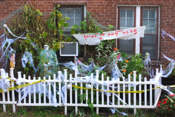
Archive for the ‘transportation’ Category

Enter if you Dare!

halloween decorations, including hand written sign that says enter if you dare, skeletons, fake cobwebs, yellow caution tape, all behind a little white picket fence


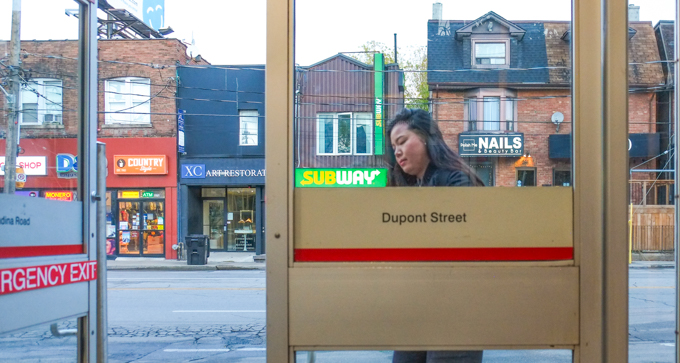
A late October walk on a sunny day – starting at Dupont station which is just north of Bloor on Line 1 (That’s the University side of the Yonge-University Line for those of you who, like me,  haven’t mastered the TTC numbering system yet!).  We walked a few blocks on Dupont before going under the railway tracks to Bridgman, then took a quick turn on Albany to get to Davenport.  A short block later we were on Bathurst.   Vaughan Road veers left off Bathurst just south of Bloor.  We meandered  a bit north of Bloor before walking back to St. Clair West station.

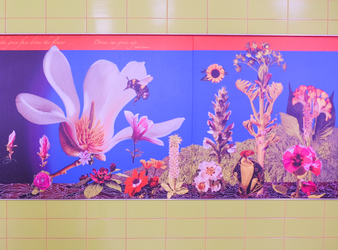
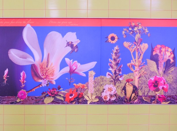
below: A bright and sparkly flower blooms on the southbound platform of Dupont subway station.   This is one of the mosaics designed by James Sutherland in the series “Spadina Summer Under all Seasons” found around the station.

mosaic flower, very large, on the wall at track level, by platform of Dupont subway station

below: More Dupont station flowers to greet subway travelers, this time on the concourse level.


mural picture seen inside dupont subway station, concourse level, on tiles

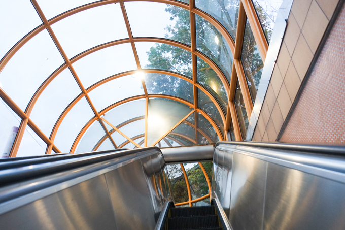
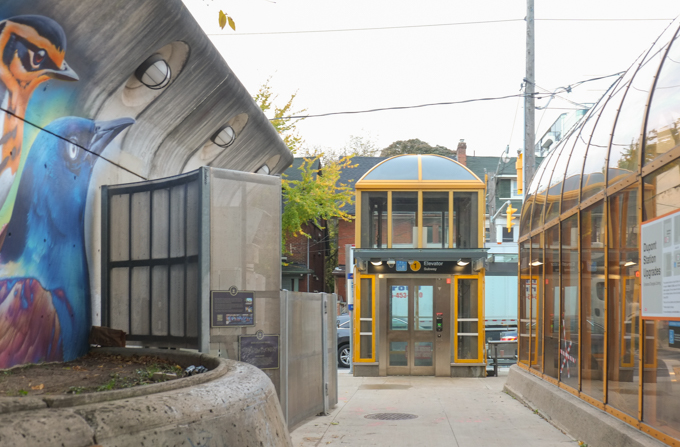
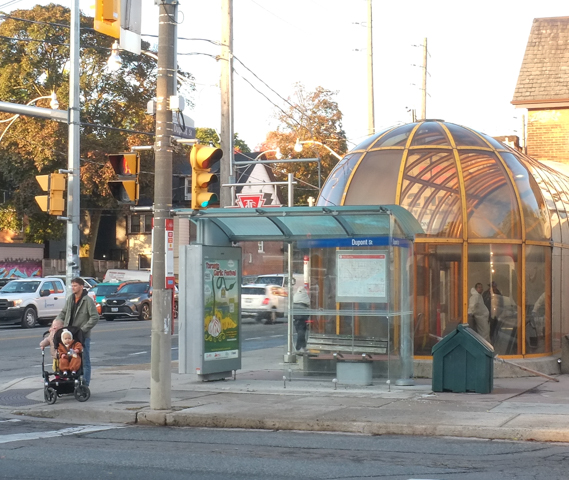
below: Taking the escalator up inside the dome at street level.

on escalator up to surface level, dupont subway station, looking towards glass dome roof of station entrance

looking through glass doors of dupont station entrance, a woman is coming in, stores across the street

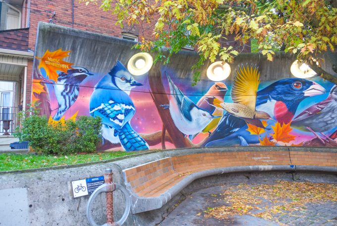
below: There is a Nick Sweetman mural of birds that wraps around the curve of a bench.

mural by Nick Sweetman, above a curved bench at Dupont station, a blue jay, nuthatch, evening grosbeck, and more

below: The curve matches that of the domed entrance to the station on the southeast corner of Dupont and Spadina.

bikes parked outside Dupont subway station, beside glass dome over entrance, beside bench with Nick Sweetman mural

elevator structure at dupont subway station

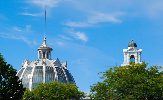
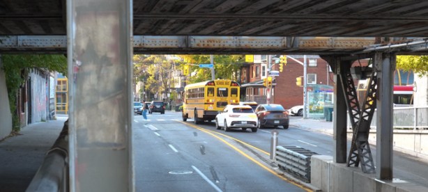
below: Casa Loma in the distance, on the hill beyond the tracks. This is the view on Spadina north of Dupont.

railway underpass on Spadina, with casa loma on a hill in the background

looking through railway underpass, traffic including school bus is stopped at a red light at dupont

below: Northeast corner of Dupont and Spadina

stores on northeast corner of spadina and dupont, pedestrians people waiting to cross at traffic light, D and D gift shop, country style, and XC Art Restoration, Subway restaurant

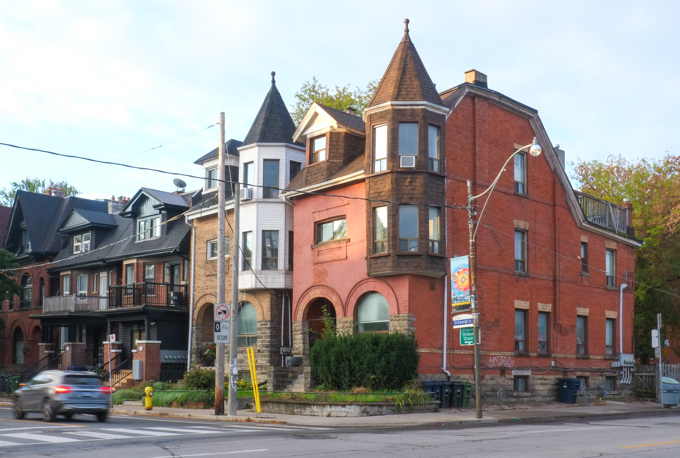
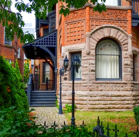
below: Big rounded arches, rooftop terraces in the back, and two turrets, all at the corner of St. George Street and Dupont.

large multi unti old brick residence, three storeys, two turrets

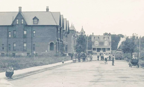
below: Looking north on St. George, towards Dupont, 1904.  Working on the street.  The house with the two turrets is already there.  The duplex on Dupont at the top of the street still exists too.

old black and white photo from 1904 of St. George street looking north to Dupont.

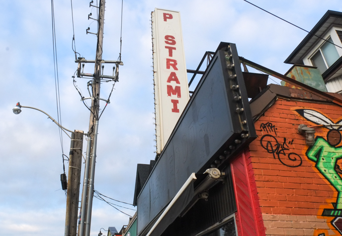
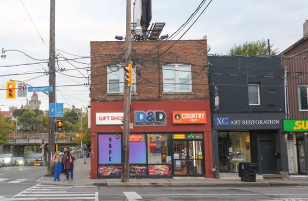
below: The duplex (176-178 Dupont) is difficult to see because like so many other older residences on main streets, an addition has been added to the front to facilitate a store or a restaurant.   At the moment,  176 Dupont is a Mexican restaurant, even though the says Pastrami (close enough!).

the first a in pastrami is missing, in a sign above a restaurant.

vines growing on concrete wall that has street art painting on it, side of railway underpass supports

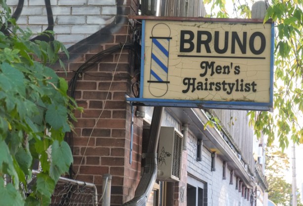
below: Bruno Men’s Hairsylist and his quaint little sign.

Bruno mens hairstylist sign on building on spadina

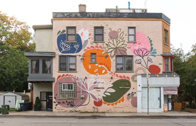
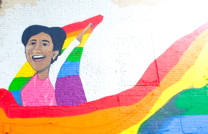
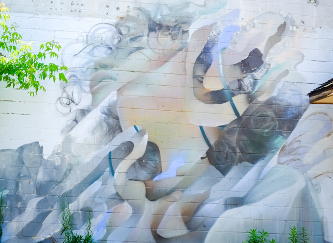
below: On Dupont, east of Spadina is this mural by Catherine Cachia

mural on the side of a residential building on Dupont, big circular flowers, by Catherine Cachia

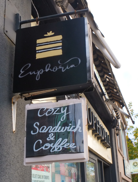
below: Cozy and euphoric.

cozy coffee and euphoria stores

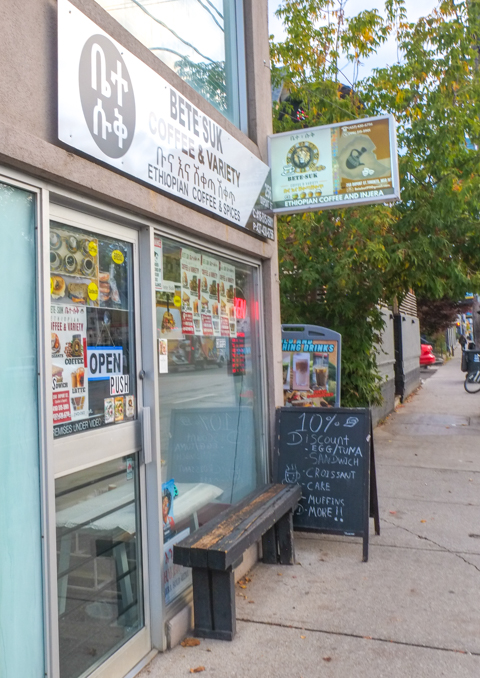
below: Bete Suk, Ethiopian Coffee shop

front window of Bete Suk, Ethiopian store and coffee shop on Dupont

below: Northwest corner of Dupont and Spadina, and another domed subway entrance.

bus shelter and dome of dupont subay station entrance on northwest corner of spadina and dupont,

below: Looking west on Dupont

looking west on dupont from in front of dupont subway station, red and white TTC sign.

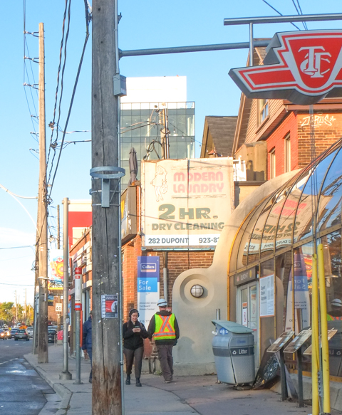
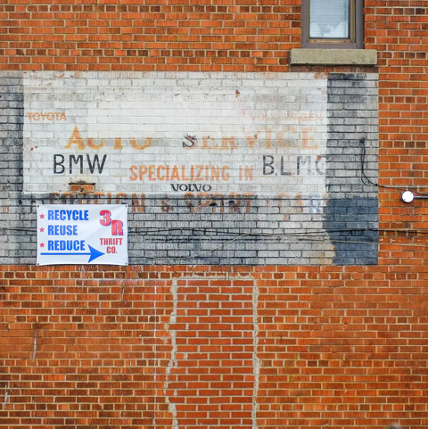
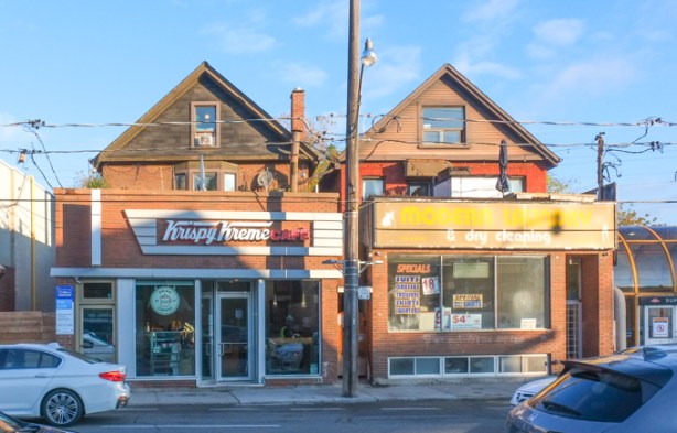
below: Another, much clearer, example of the transition of houses to businesses by building additions in front, are these two – Krispy Kreme and the faded Modern Laundry & Dry Cleaners.

peaks of original houses can be seen over the top of the boxy additions to the structure to make space for stores, krispy kreme donuts on one side, a dry cleaners on the other

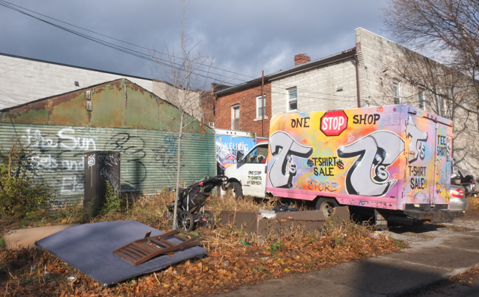
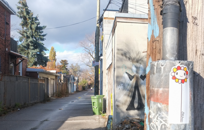
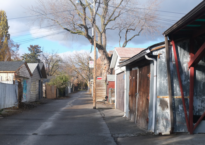
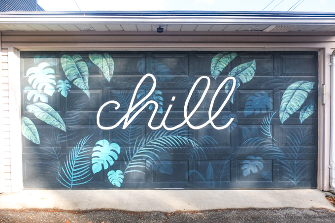
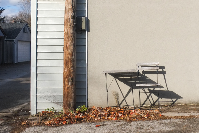
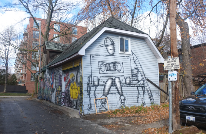
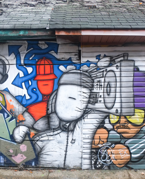
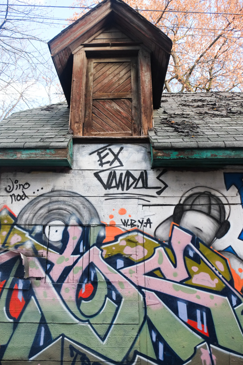
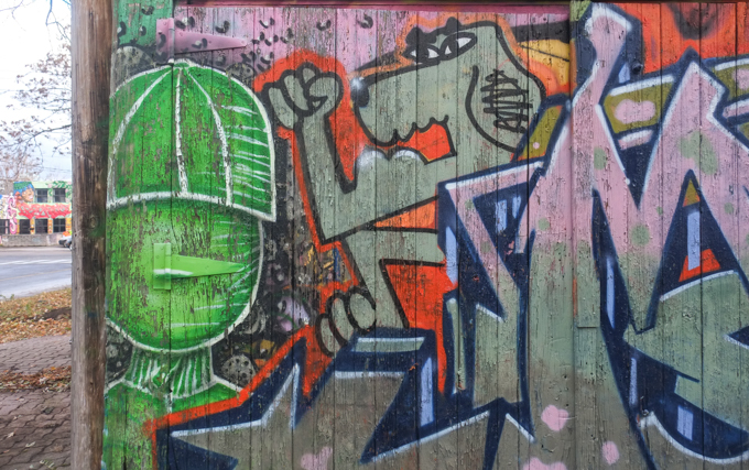
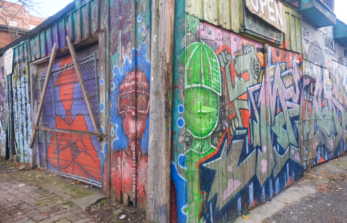
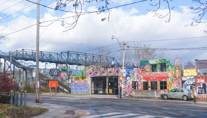
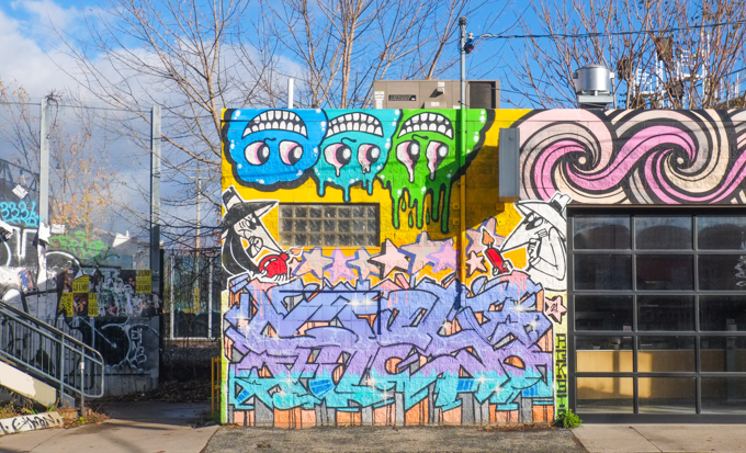
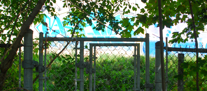
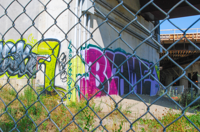
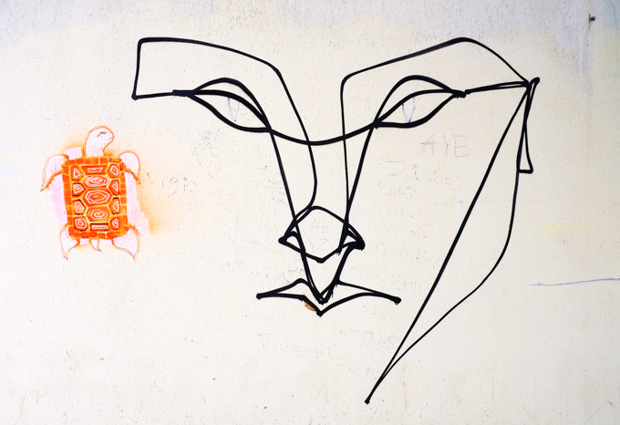
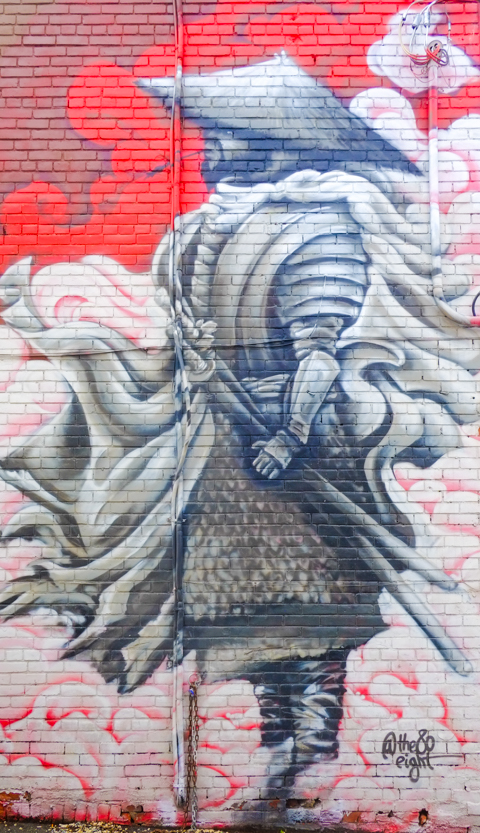
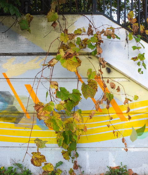
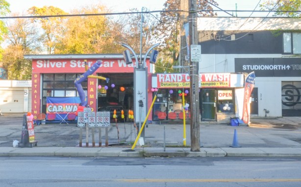
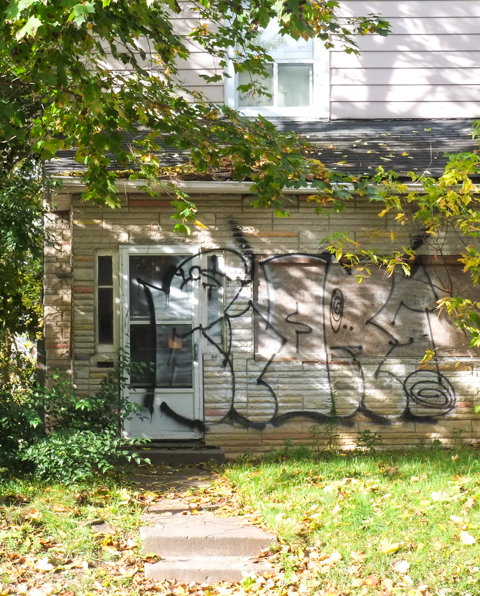
below: West of Dupont, there are still some garages covered in street art.


white car parked beside a garage with a street art on the side of it.

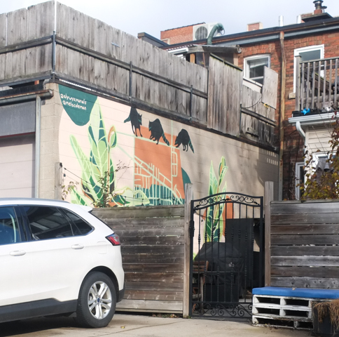
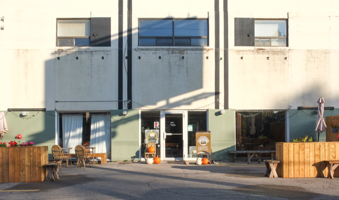
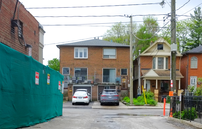
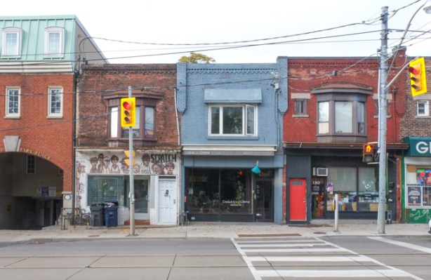
below: This is 390 Dupont Street, part of which is now a coffee shop/vintage clothing store.  I am not sure what the history of the building is but when I tried to research it, I discovered that there is a condo development being proposed for the site.

commercial building, coffee shop on ground level

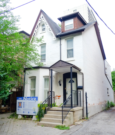
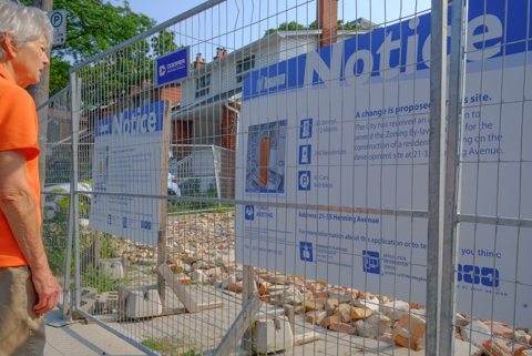
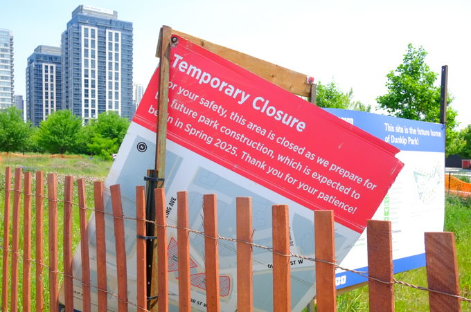
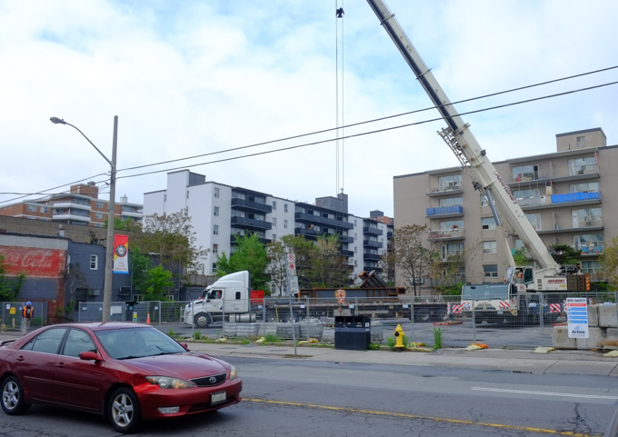
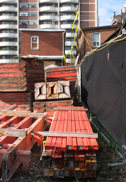
below: This is the neighbouring property, 388 Dupont.   Two years ago when I walked this stretch, there was a blue and white development notice sign in front of the building (Dupont Street Scenes).   When the application for redevelopment was first filed (2020), it was for an 11 storey building involving 374 to 388 Dupont.  By 2023 the plan had evolved to 12 storeys and now included 390 Dupont as well.  Because the site is adjacent to the CP Railway corridor, a train safety derailment wall along the entire back wall is part of the plan.

old car wash on dupont street

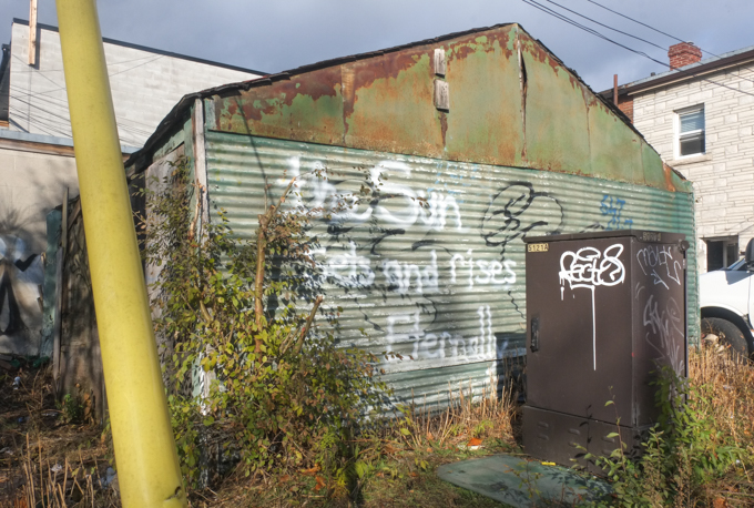
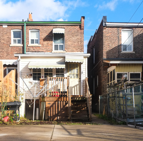
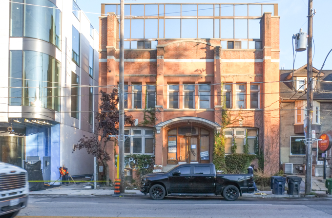
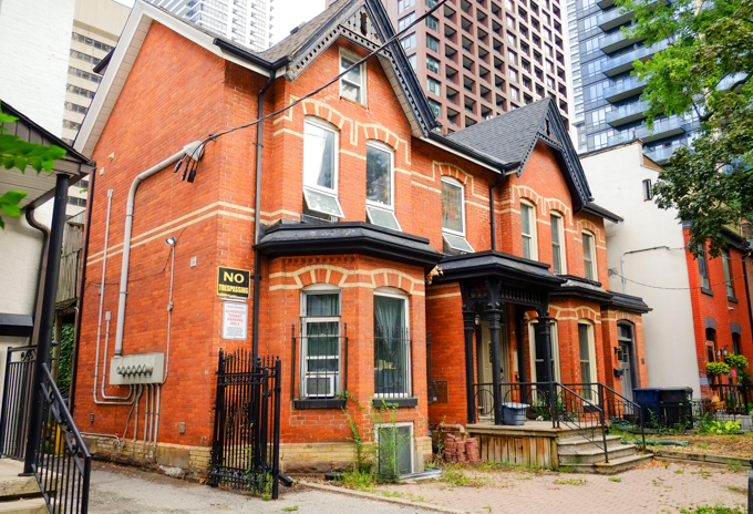
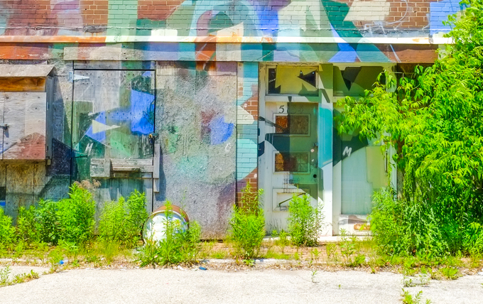
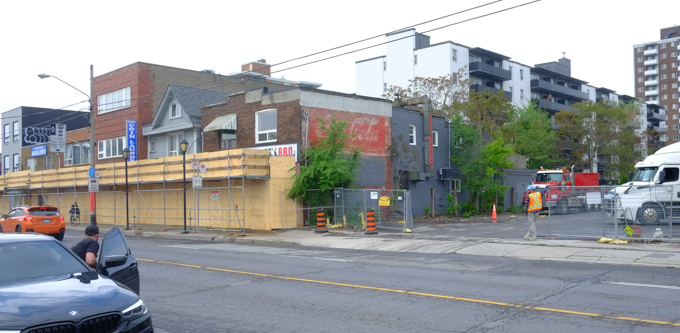
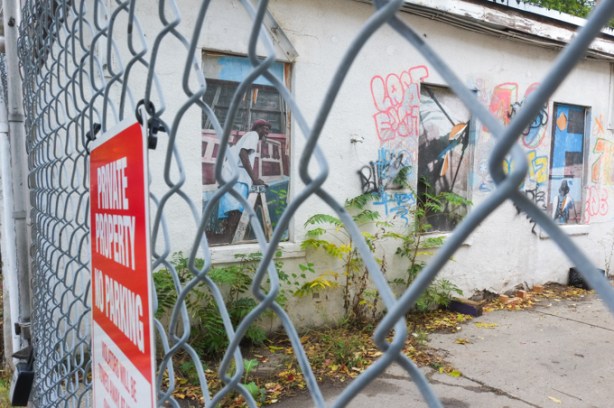
below:  Although there is no posted notice of planning applications for this building, it appears to be empty.  The front door is boarded up and there is a No Trespassing sign in the window.

two storey older brick building, boarded up front door, seems to be empty

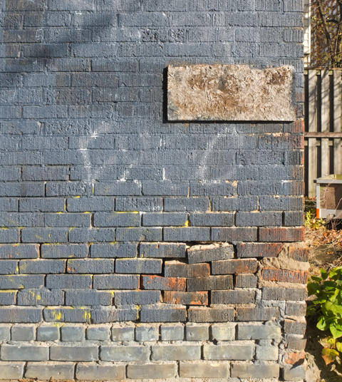
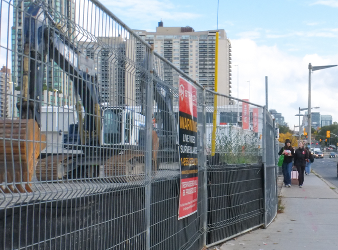
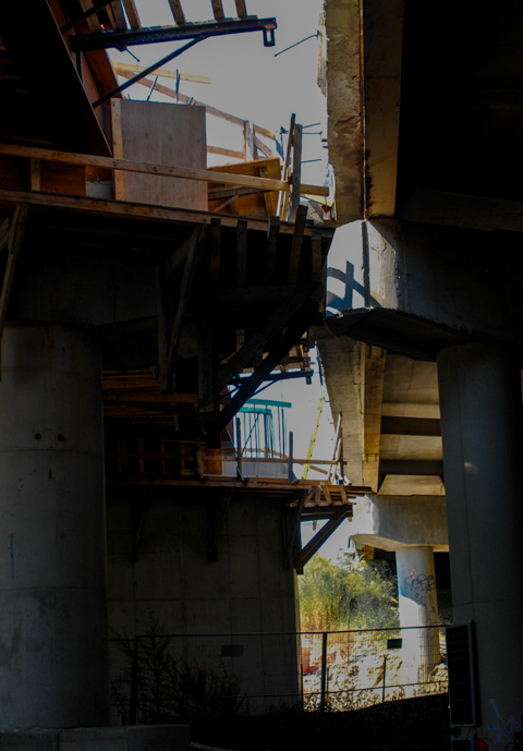
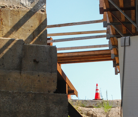
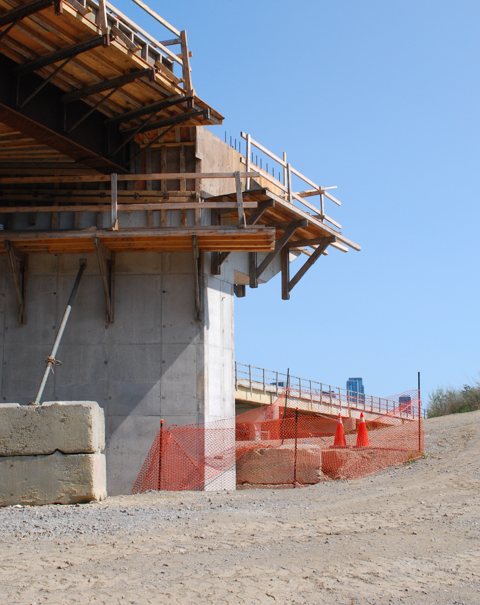
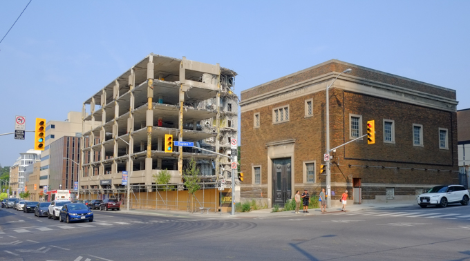
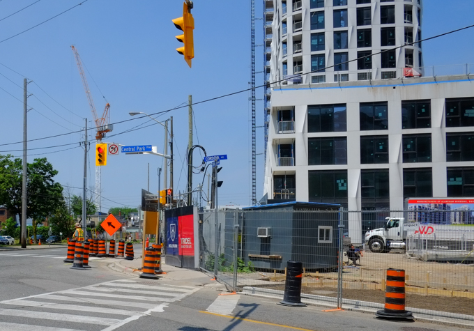
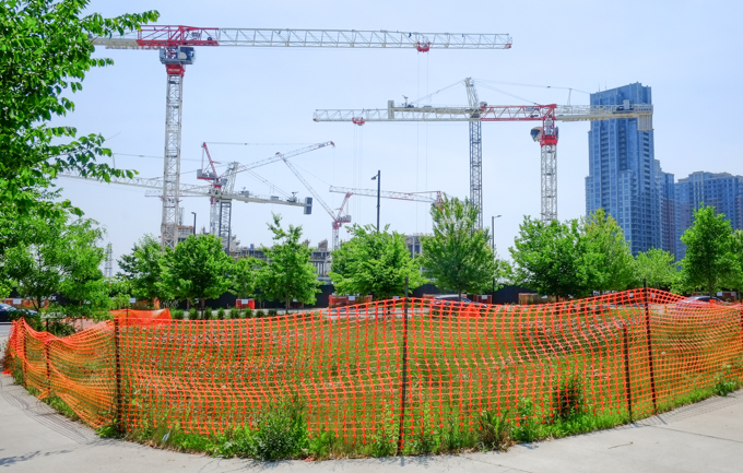
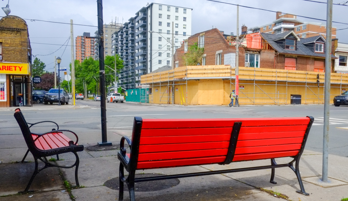
below: Two years ago this building was in the early stages of construction.

new condo under construction, balconies are white, with curved ends
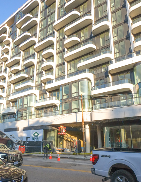
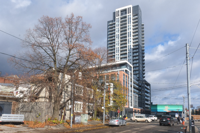
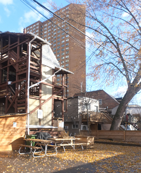
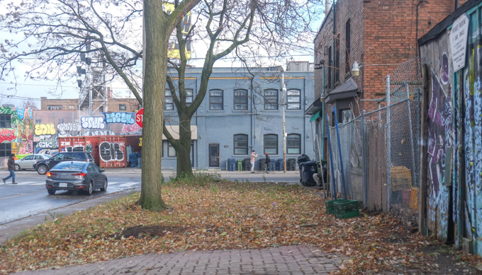
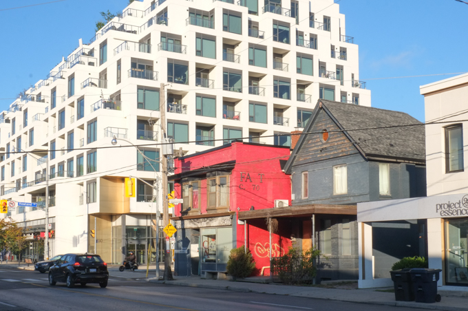
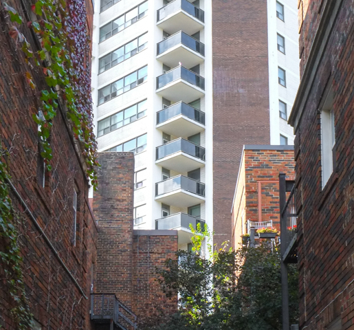
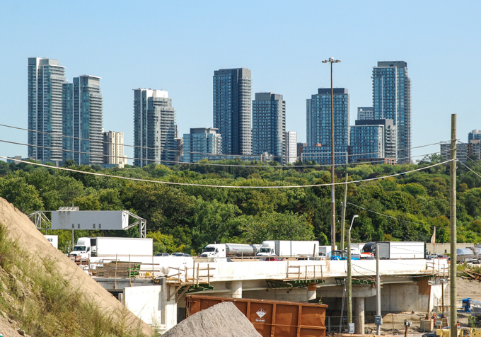
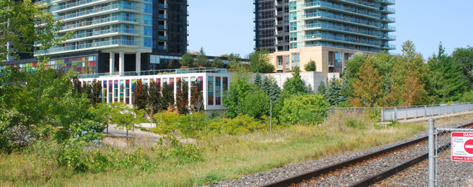
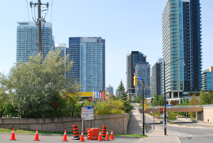
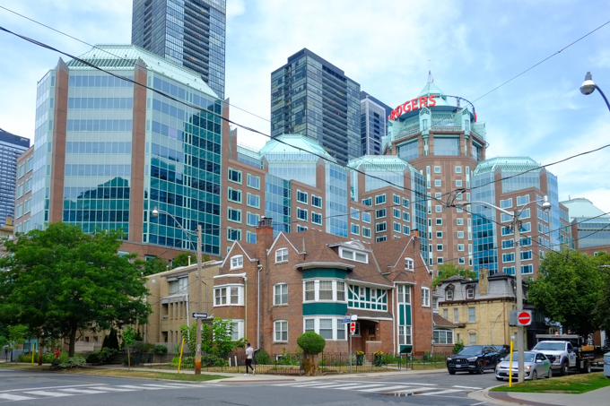
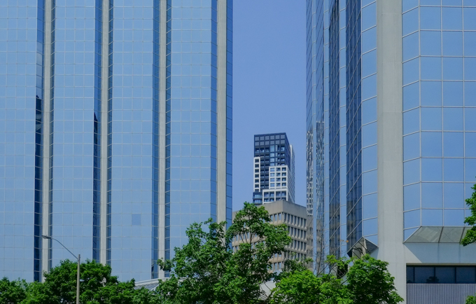
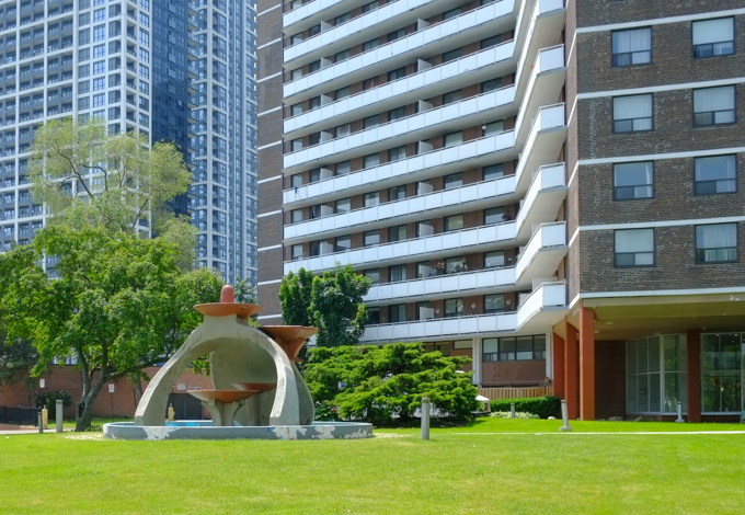
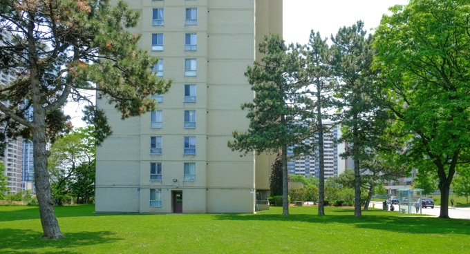
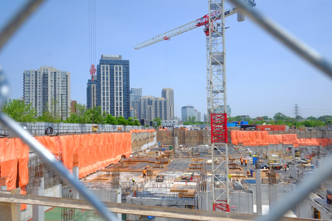
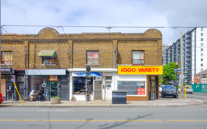
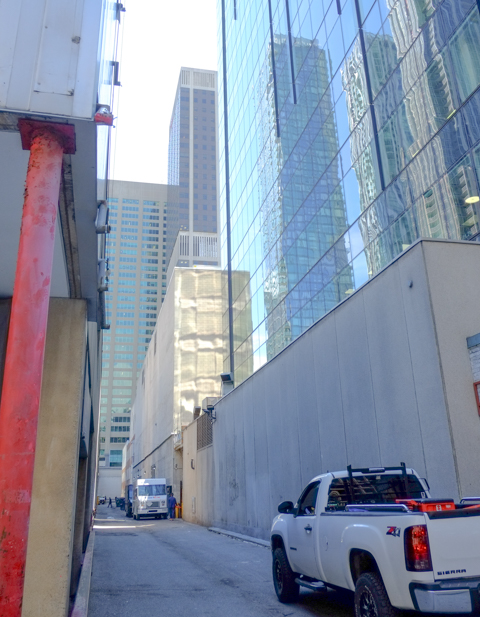
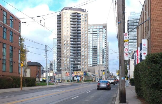
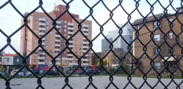
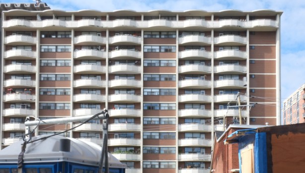
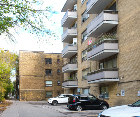
below: Another theme that occurs over and over again on the streets of Toronto – the jumble of different eras. Very old brick houses and new glass and steel towers mixed together along with ages in between.   The smaller older structures dwarfed by the newer ones that tower over them.

old grey house, old brick building painted bright red, new condo development, in a line along dupont street

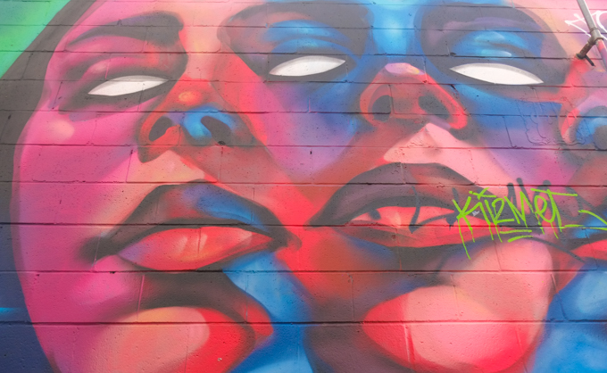
below: The Troy Lovegates mural of 10 faces on Howland & Dupont is still there and still looking vibrant.  If you are interested, there are more images of this mural elsewhere in this blog. 

mural by Troy Lovegates at the corner of Howland and Dupont, 10 faces cover the exterior wall of Fat Pasta restaurant

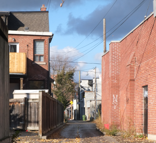
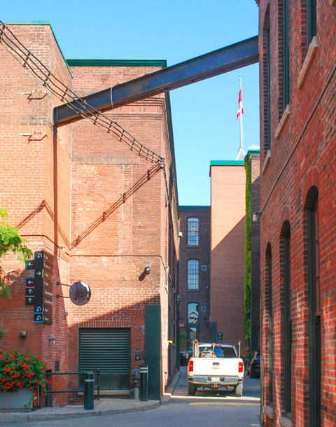
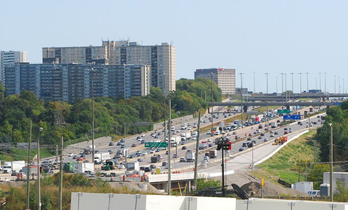
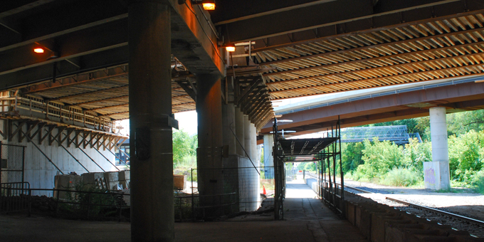
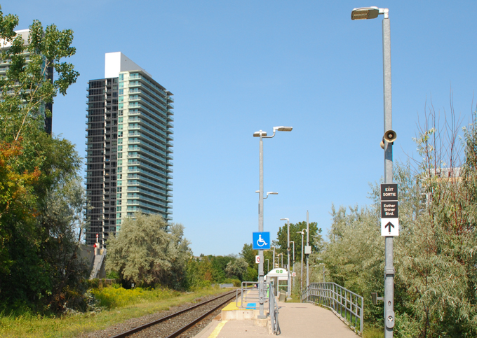
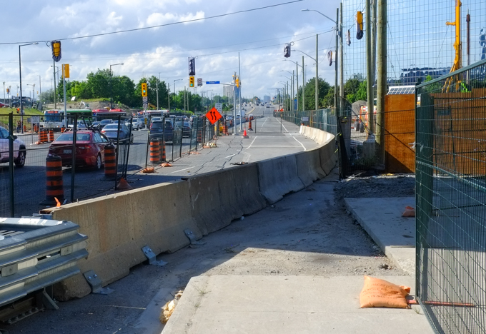
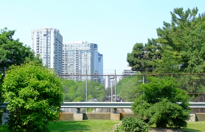
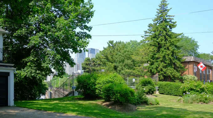
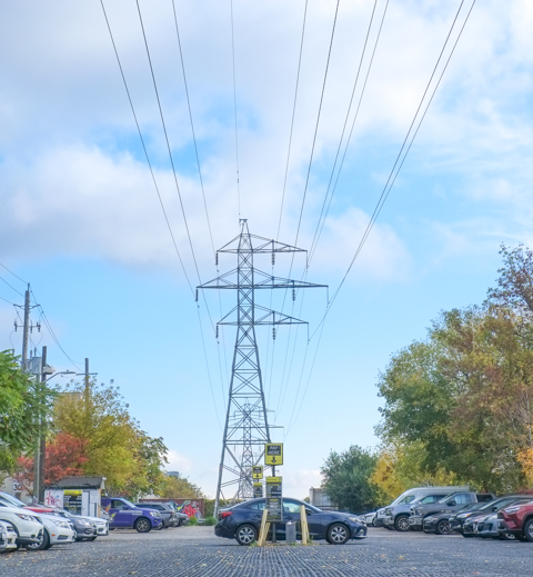
 below: Running parallel to the railway tracks, and just north of them.

parking lot with tall hydro transmission tower and lines running through it

empty parking lot, with row of condos in the background

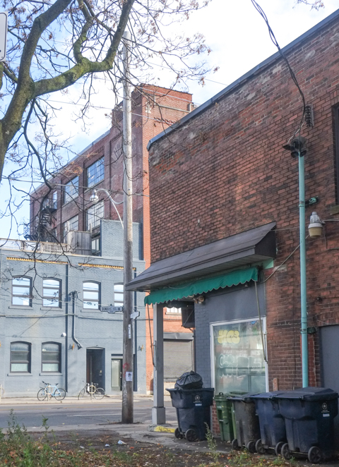
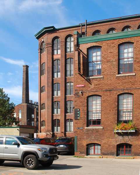
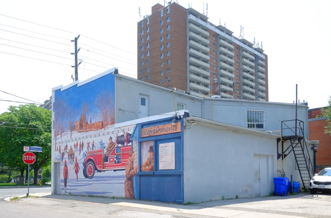
below:  The north side of the CP Railway corridor shows signs of its more industrial past.   This building with its curved glass sidelights and other small Art Deco finishes, sits empty.   Previously it was home to a plumbing company but they have moved to new quarters elsewhere in the city.

curved glass sidelights around a metal frame door, brick building, number 316, now empty

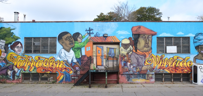
 below: Tarragon Village mural by Elicser Elliott

Tarragon Village mural by Elicser Elliott

below: There is also this mural, just around the corner on Albany, “You are not alone”. It was painted by Julia Prajza and Bareket (bkez).  ‘You Are Not Alone Murals’ is a public mural project with over 100 murals completed.  Their goal is to “inspire artists to create murals in their communities–sparking hope, connection, and conversations about mental health.” (quote taken from their website, youarenotalonemurals.com).

mural on the front of a building, wrapped around the front door, in cursive, text says You are not alone

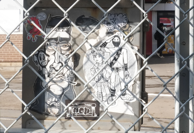
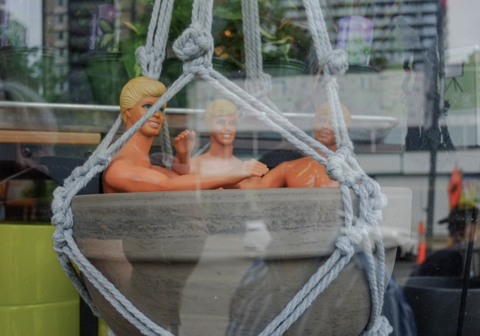
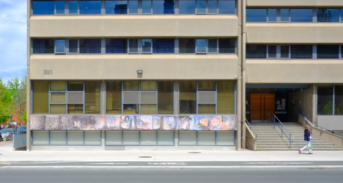
below: An intriguing series of photos in the windows… but I couldn’t get a closer look at them.

private property, no trespassing sign on chain link gate, in front of driveway, beside building with old pictures displayed in boarded up windows

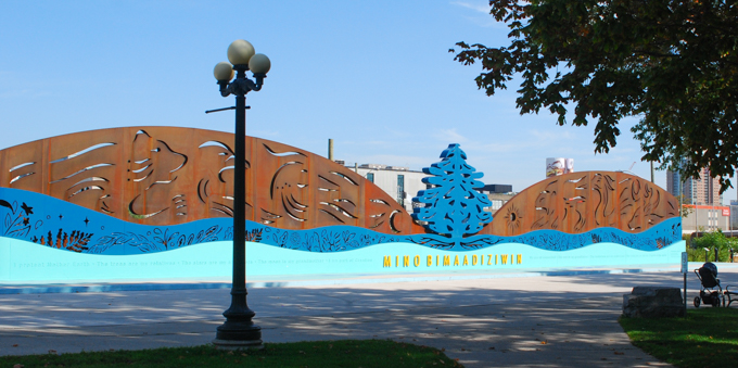
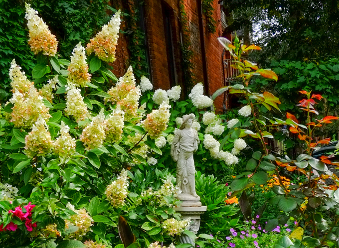
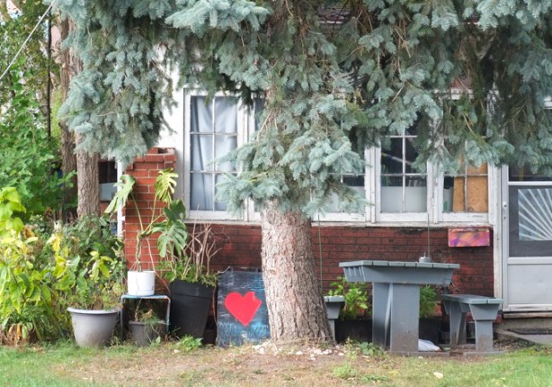
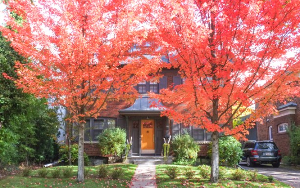
below: A large red heart and an even larger blue spruce tree.

large blue spruce tree growing in the front yard of a house with table and chairs in the front yard, also a bench with a large red heart on it

older house with trees growing in front, front door and enclosed porch have been tagged;

in magenta, stencil graffiti that says you grow girl

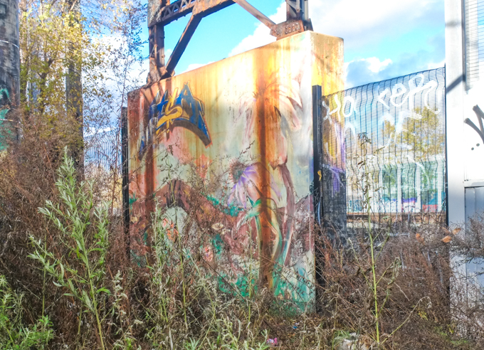
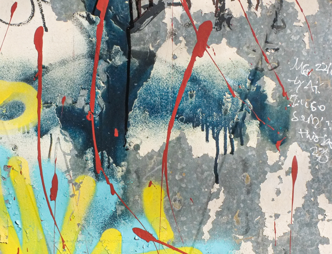
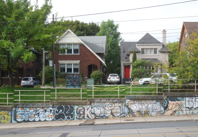
below:  The paintings along the concrete wall on the west side of Bathurst have all been defaced.

front end of a white truck in view, driving past a mural painting of an orange car, mural has been tagged in large fat green and white letters

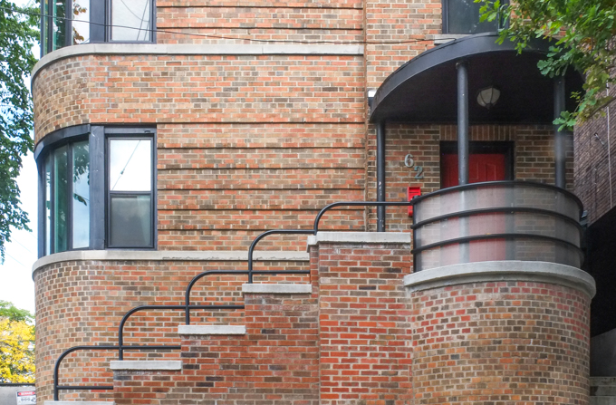
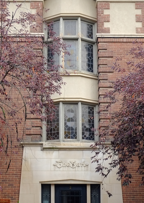
below: Another touch of Art Deco in the neighbourhood

stairs and entrance to an art deco style brick apartment building with curved corners

below: Bathurst Street houses

2 single family homes on Bathurst street

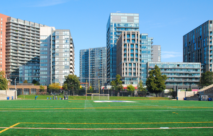
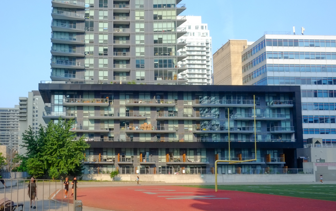
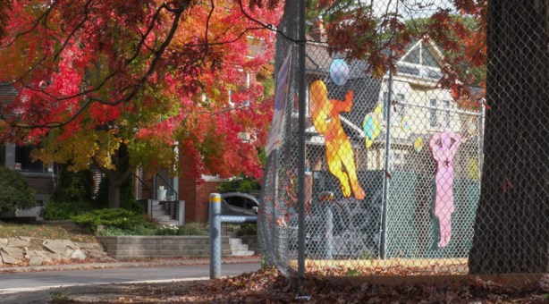
below: Playing in the playground

autumn foilage on tree at edge of playground

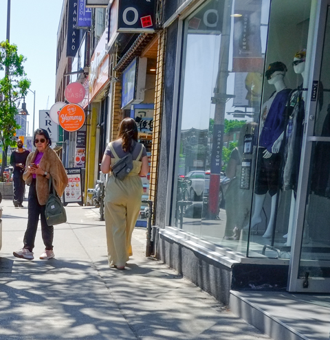
below: Store fronts on Bathurst

store fronts on Bathurst

Green Farms store on the corner, Bathurst Street

store fronts on Bathurst, one is empty and for lease, another is knit o matic

below: Looking north up Bathurst where Vaughan Road exits left. Vaughan Road was built in the 1920’s along an older trail that follows a now underground creek.  From here, it runs more or less diagonally north and west to its northern end at Dufferin and Eglinton.

looking north up Bathurst to where Vaughan Road veers left

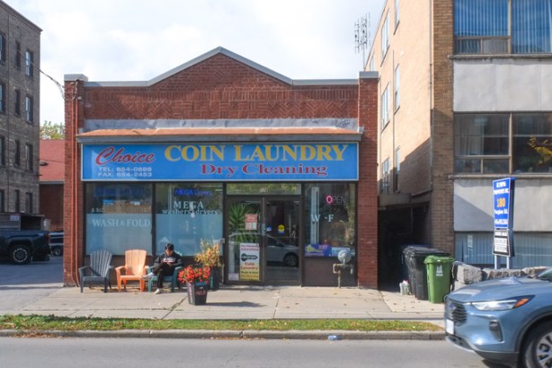
below: Choice laundry in the old brick building, on Vaughan Road.

Choice coin laundry and dry cleaning, , with a young man sitting outside

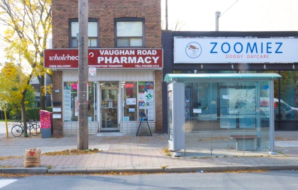
below: Also on Vaughan Road, Zoomiez Doggie Daycare and Vaughan Road Pharmacy.

vaughan road pharmacy, brick building on vaughan road, beside newer building with is home to zoomiez doggie daycare

a face has been added to a hydro pole, plastic face parts nailed to the wood

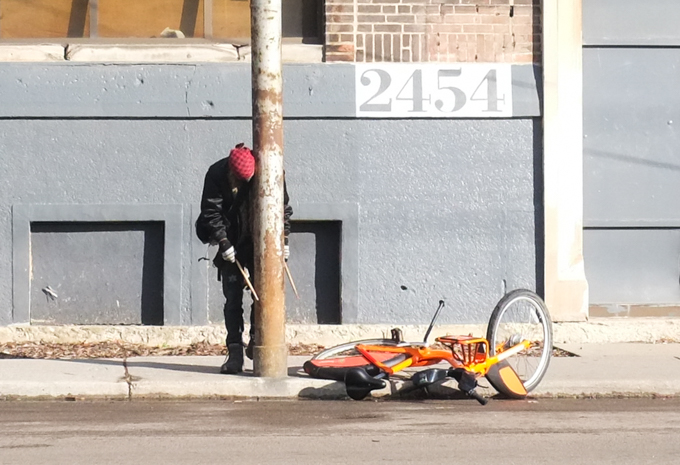
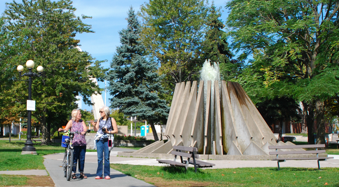
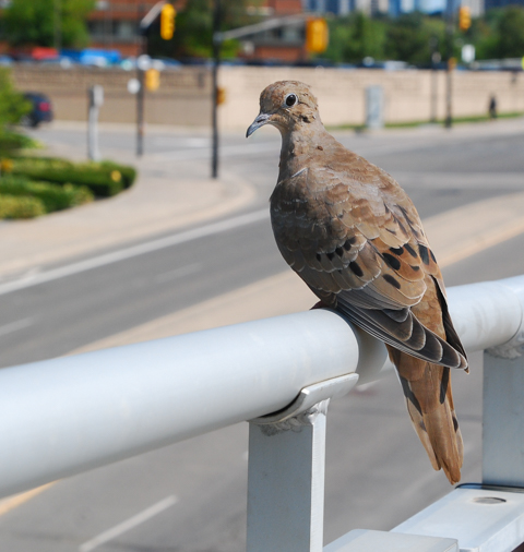
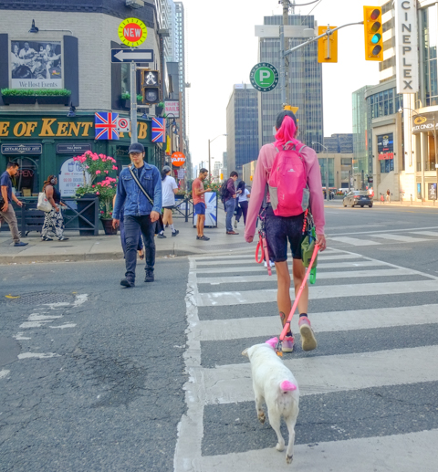
below: We met a couple of strangers.  They weren’t very talkative though so we kept walking….

two life sized skeletons sitting outside with drinks in their hands

vacant lot behind black chain link fence

large apartment building in background, top of a porta potty in the foreground,

hole in the ground for condo construction, crane,

piles of supplies for construction, building materials, behind an old house

below: The gateposts on Strathearn Road mark the entrance to the former village of Forest Hill.  Forest Hill was incorporated as a village in 1923 and then annexed by the City of Toronto in 1967.

two large stone gate posts for a gate in a boulevard between two lanes of traffic

two large trees in front of a single family home, 2 storeys, both trees full of red leaves for autumn

bungalow single family home, white garage door, brickwork is checkerboard light and dark brown,

older stone house with brown wood addition, ivy covers on of the walls, stone chimney, large blue spruce tree growing beside the house

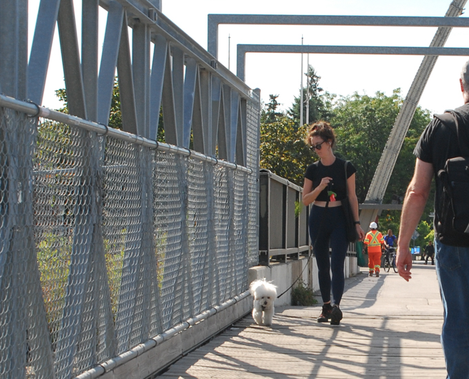
below: There is a metal plaque at each end of the Glen Cedar pedestrian bridge over the Cedarvale Ravine.  This is the one at the south end.  The text is taken from the lyrics of “Anthem”, a song by Leonard Cohen.  The first bridge here was built by Henry Pellatt (the same man responsible for Casa Loma) in 1912. It became a pedestrian bridge when it was modernized in 1989.

brass plaque embedded in the concrete of a bridge railing

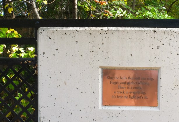
Ring the bells that still can ring
Forget your prefect offering.
  There is a crack,
a crack in everything
it’s how the light get’s in
[and yes, the plaque has an apostrophe in gets]

glen cedar pedestrian bridge in late october when the trees were in their autumn foilage

red, range, and yelow oak leaves, autumn colours, from Glen Cedar bridge

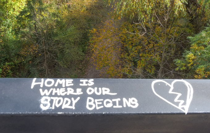
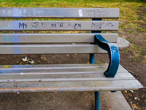
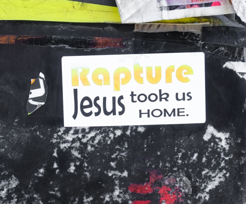
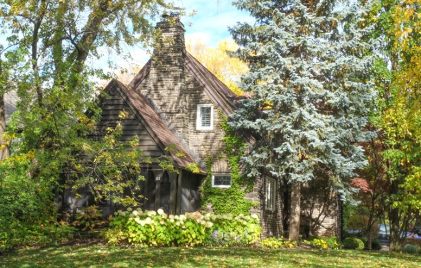
below:  Home is where our story begins.

graffiti words on dark grey metal railing of bridge, background is path and trees below the bridge, words say "home is where our story begins"

graffiti, black drawing on white, signed, also words toxic city on drawing

large gnarly old tree beside a two storey brick house

path through a ravine with some sunlight coming down through the large trees that are on both sides of the trail,

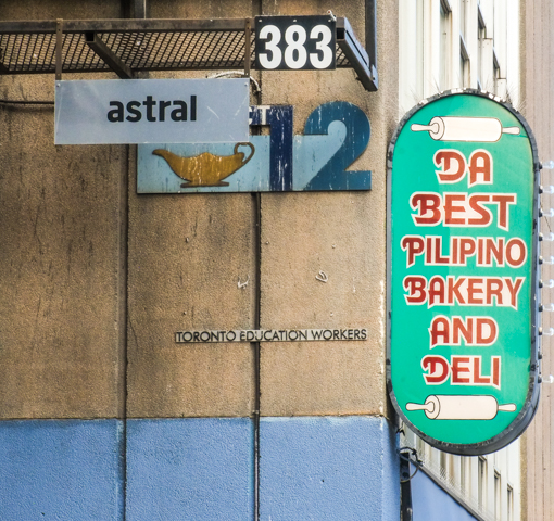
below: At Bathurst and St. Clair – Da Best Pilipino Bakery and Deli

on Toronto education workers building, a green sign that says Da Best Pilapino Bakery and Deli

cracked concrete sidewalk, metal drain cover

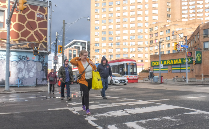
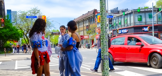
below: Waiting to cross Bathurst Street

looking east on the north side of St. Clair on Bathurst

below: Looking east on the north side of St. Clair, from Bathurst.  St. Clair West subway station is just a few meters away.

looking east on the north side of St. Clair on Bathurst,, fence around a construction site

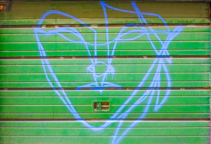
below: There was once a gas station on the northeast corner of Bathurst and St. Clair West.  Now it is a vacant lot with a few alien creatures like this one lurking about.

large digger on construction site, with glass and steel condos in the background

passenger in a white truck, window down, elbow out, as it drives around a corner

plastic halloween decorations, a flying orange ghostly creature with a black witch's hat on

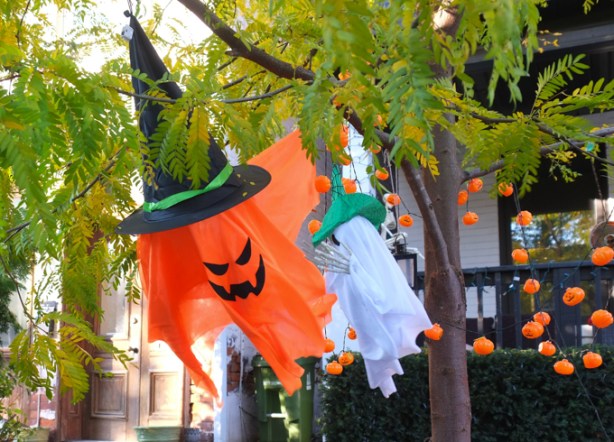
below: Happy Hallowe’en pumpkins!  The frog’s not so certain though.

two jack o lantern pumpkins for halloween decorations, on a front porch


With thanks to Nancy who walked with me that day.

Liberty Village is the neighbourhood that is south of King Street, west of Strachan, and east of Dufferin. It’s southern boundary is a combination of the Gardiner Expressway and the railway tracks (CN, VIA, and GO)

a man holds a cup of coffee as he walks past a road sign with bump symbol, and a utility pole wrapped in red and white liberty village design

below: A temporary park has taken over a corner of the parking lot on Hanna.

artificial grass covering ground in new temporary park in Liberty Village, the word liberty in black on the green grass

below: The sign says Ontario Place straight ahead.

below: Dream Big

large pink mural with black letters that spell dream big

below: Allan Lamport stadium concrete

exterior side walls of Allan Lamport stadium, , concrete, peaks in roof make triangle shadows

below: Looking north from the goalposts in the stadium.

view across the field of Allan Lamport stadium, looking north to wall of condo towers

interior, seating, rows of concrete, sections 22 and 24 of Allan Lamport stadium,

triangular roofline of allan lamport stadium

lights reflected in glass windows, stadium lights on blue sky 

below: Once it was a carpet factory –  The Toronto Carpet Factory was spread over 8 brick buildings on a 4 acre site. It was built between 1899 and 1920.  The company was established by F. Barry Hayes in 1891 and was originally at Jarvis and Esplanade.  At the end of WW1, 1250 people were employed here.  The factory remained in production until 1979, although the number of carpets that were made annually was greatly reduced by the end.

part of old carpet factory, a brick building

part of old carpet factory, exterior,

part of old carpet factory, exterior

part of old carpet factory, exterior

below: Streetcars waiting at Dufferin Loop, Dufferin south of King.

TTC streetcars waiting at Dufferin loop at the bottom of Dufferin street

below: View from the bridge at the south end of Dufferin looking west along the Gardiner Expressway towards Etobicoke and Mississauga.

looking west from bridge over Gardiner Expressway towards Etobicoke and Mississauga

below: Eastern view

bridge over the Gardiner at northwest corner of CNE Grounds

a woman dressed in black walks a small white dog over a metal bridge

below: The arch marks the Dufferin Gate, the west entrance to the Exhibition Grounds.

two men walking across bridge by dufferin gate at the exhibition grounds

Part way between Dufferin and Strachan is Exhibition GO station.  The station has been designed to provide access from both sides of the tracks which in turn offers another walking route south from Liberty Village.    The area north of the tracks is a bit of a mess as the new Ontario Line will terminate at Exhibition and the completion of that project is still a few years away.

below: The pedestrian tunnel under the tracks.

interior, people walking through tunnel, lights, unfocused, fuzzy image

double decker green and white GO train at Exhibition station, wtih workman in orange work uniform waiting to get on train.

below:  Looking north under the Gardiner – Liberty Village provides that background in this image.

construction near railway tracks south of Liberty Village, near Exhibition station, under the Gardiner Expressway

workmen with digger excavator on construction site for ontario line subway

below: More Ontario Line construction as seen from Platform 4 at Exhibition station

ontario line construction site just north of Exhibition station, in liberty village

below: South end of BMO Field, looking east towards downtown and the CN Tower.

on Exhibition grounds, south end of BMO field, looking east towards CN Tower and downtown Toronto

below: BMO Field is home to both the Toronto Argonauts (CFL, football) and the Toronto FC (MLS – Major League Soccer). It has just undergone upgrades (think $$$) to make it ready to host some of the FIFA World Cup soccer/football games in mid 2026.

food building in background, as is CN Tower, entrance to construction site for renovations of BMO Field soccer
red seats that have been removed from BMO stadium, or are awaiting being added. stored outside

below: Some of the lights seen at the Exhibition – with the CN Tower in the distance.

lights and lamp posts at CNE, Exhibition, with CN Tower in the distance

below: rooftops

below:  One of the latest public art addition to the Exhibition Grounds is “Mino Bimaadiziwin”, an Anishinaabemowin phrase that translates to “Good Life”. The mural was developed in partnership with the Mississaugas of the Credit First Nation 50-meter-long artwork honors Indigenous history and culture and was unveiled in October 2024.
The installation is part of a plan to separate Exhibition Place from the Gardiner Expressway.


blue metal sculpture, behind 3 large trees, people walking past in silhouette

art installation at exhibition graounds,

below:  The McGillivray Fountain was designed by Canadian sculptor Gerald Gladstone and donated to Exhibition Place in 1968 by Gordon B. McGillivray in honor of his father, John A. McGillivray.

two women walking past fountain at the CNE

below: The Scadding cabin was originally built in 1794 by John Scadding on land that he owned east of the Don River.  He owned more than 200 acres and his property stretched from Lake Ontario to what is now the Danforth.  The next owner of the property used the cabin as an out-building.  In 1879 it was donated to the York Pioneer and Historical Society who arranged to have it moved close to its present site to celebrate the opening of the Industrial Exhibition (now the CNE).

below: The title printed on this image is “Log Cabins of the York Pioneers,Exhibition Grounds Toronto 1880.  Lithographed and printed at the Exhibition Building, Rolph, Smith & Co. Toronto”.  The cabin on the left is labelled Simcoe 1794 (i.e. the Scadding cabin) and the other is labelled York Pioneers, Lorne 1879.

old black and white photo of a drawing of two cabins, at an exhibition, in 1880

below: Shrine Peace Memorial

angel sculpture at shrine peace memorial

shrine peace memorial on exhibition grounds

below: There is a collection of twenty small sculptures representing Gods, heroes, and monsters of Greek mythology  in what is called the Garden of the Greek Gods.  They were created by Elford Bradley Cox (1914-2003) in the 1960s.

one of the greek gods sculptures at exhibition grounds

below: Hercules is the tallest of the sculptures.

one of the greek gods sculptures at exhibition grounds, back of naked man, with windmill in the background
one of the greek gods sculptures at exhibition grounds, bunch of grapes

Immediately south of the Exhibition Grounds is/was Ontario Place.  This pile of rubble is all that remains of what was on West Island – mostly the decaying amusement/theme park that hasn’t been in operation for years (death by neglect).

pile of rubble, remnants of demolition, on west island, part of Ontario Place, on Lake Ontario, as seen from the Exhibition Grounds

west island of ontario place after having been cleared of everything

below: The round Cinesphere is still there but everything west of it is gone.  Once it was the pride of Ontario – built in response to Montreal’s Expo ’67 – but slowly over the years many of its features have been altered or removed (Children’s Village, the Forum with its free concerts, and more).   Having said that, other sections have been renovated – Trillium Park on the east end for example.  I didn’t get that far on this walk but you can some of it in Ontario Place 2.0 from 2017.

what remains of ontario place

ontario place under renovation, exterior stair with workmen on it ontario place under renovation, digger working behind hoardings

graffiti on a metal railing near Lake Ontario

graffiti on a metal railing near Lake Ontario

two men stand beside street art painting at south liberty trail

Oriole GO station is on the Richmond Hill line.  It is located at Leslie and the 401 highway and for many years the parking lot for the station was under the 401.  With the recent changes to the Leslie/401 interchange, and all the construction that that entails, this parking lot is gone.   Also, the old station building is no longer in use and the platform has been moved slightly north.  A new metal pedestrian bridge has been built over the tracks south of the station to replce an older wood structure – this provides access to the residential area to the south.

sign pointing to GO station, in park,

graffiti on concrete on the side of elevated portion of 401 highway. green space between concrete and chainlink fence and gate

below:  Under the 401 highway

behind chainlink fence, graffiti on concrete pillars holding up the 401 highway

below:  Access to Woodsworth park involves getting over the tracks via a new pedestrian bridge.

looking across tracks at oriole GO station, near new pedestrian bridge over the tracks

below:  Caged!

cage enclosing top level of metal pedestrian bridge

below:  The bridge is high! The top of it is level with the traffic on the ramp between the eastbound 401 and Leslie Street.  This is the view north and slightly west from the bridge.

cars on ramp between eastbound 401 and Leslie Street, highrise glass and steel condos behind, GO train tracks under the ramp, view from pedestrian bridge over the tracks

below:  Another view from the bridge, this time looking northeast

looking northeast from pedestrian bridge over GO tracks at oriole station, looking over the 401 to highrises in the distance

below:  Looking east over all the lanes of the 401, including the new Leslie Street on-ramp on the south side.

highway 401, east from Leslie Street

below:  At track level

track level, platform for oriole GO station, under the 401,

It was very quiet here.  Oriole station is the first stop north of Union but trains only run during rush hours.  There are four trains that run southbound in the morning and five trains for northbound trips in the afternoon.  No trains stop here between 8:35 a.m. and 4:14 p.m.  There don’t seem to be any stats online re the number of people who use this station.

sign for Oriole go station

below:  Old station building in the background that is no longer is use (i.e. there are no washroom facilities here at the moment).

construction of new off-ramp from the 401 eastbound at Leslie Street, with old GO station building in the background

construction of new off-ramp from the 401 eastbound at Leslie Street

below: You may have seen this giant billboard if you have driven past on the 401.  It stands beside the Oriole station platform.  Recently, the platform was under under the 401 and therefore, protected from the rain.  It has been moved slightly north to bring it closer to Leslie subway station (TTC)

massive billboard on large metal support, at the side of GO station tracks, highrise condos in the background, Oriole,

Oriole Go station platform under the 401 highway, with construction

below: All pedestrian access to the old station as well as the parking lot has been closed.

danger do not enter signs, no pedestrians sign, blocking sidewalk passage under bridge at oriole GO station

workmen, construction of new off-ramp from the 401 eastbound at Leslie Street

below: There is another entrance to the station at the north end where the tracks cross Esther Shiner Blvd. [extra note: Esther Shiner was a North York municipal politician who was first elected in 1972.  She served as councilor, as well as a short stint as Deputy Mayor until her death in 1987.]

north end of Oriole GO station platform, with sign pointing to exit at Esther Shiner Blvd

Not everybody walks to IKEA!

IKEA store and flags, on Esther Shiner Blvd, beside GO railway tracks,

looking northwest across railway tracks just north of oriole go station

below: The tracks cross Esther Shiner Blvd, but the sidewalk doesn’t and all pedestrian traffic is routed to the south side.   If you want to transfer to the TTC (Leslie station), there is a walk involved.   It takes about 10 minutes I think.

pigeon sitting on railing overlooking esther shiner blvd, TTC bus in the background, looking east towards Leslie street

esther shiner street, looking west towards ikea, under train tracks,

two signs with arrows, TTC Leslie to the left and GO Oriole to the right

below: Turn left at Old Leslie if you are looking for the TTC subway.  Straight through gets you to Leslie Street (at North York General Hospital, north of the 401 highway and south of Shepard).

Old Leslie Street sign on post along with other signs for TTC and GO,

below: The signs still direct you to the GO station via under the 401….

leslie looking south at 401, construction and Oriole GO station

below: …. but the road is actually closed to traffic.

workman under the 401, by sidewalk, a couple are walking towards him

4 different tall lights,

below: Looking northwest across Leslie, south of the 401 (towards Yonge & Shepard).

leslie street, south of the 401

below: Making sidewalks.

workmen pouring cement for new kerbs and sidewalk, along Leslie street at 401

below: Old and faded, rules and regulations for prevention of the spread of COVID-19

old COVID 19 rules and regulations poster, weathered, on fence at construction site
red lines spray painted onto sidewalk, beside a crack in the cement

concrete support, and part of rusty metal train bridge over Leslie street

light and shadows between portions of highway being constructed and renovated

construction site light and shadows, and small orange cone

construction of new ramp, 401 and Leslie

no entry sign on pole, overgrown with shrub,

brown pigeon sitting on a grey metal round hand rail overlooking city street

a little bit of Church Street, on the run…..

And of course, a lot of in-between too.  A bit of a random walk south from Bloor on Sherbourne, Jarvis, and Church.  A zigzagging walk through four neighbourhoods.

  But first, coffee!  De Mello Coffee on Bloor has mirrors under their counter and it makes for some strange scenes.


inside a coffee shop, de mello coffee, counter has mirror below so that reflections of backs of people sitting are seen from the waist down

below: In the lobby of Postmedia Place on Bloor Street there is this sculpture – three people reading newspapers.

statue, sculpture, in post-media news building lobby, a group of 3 people reading, 2 sharing a bench, and one boy lying on the ground.

below: I found not one, but two, anser faces of unknown vintage in an alley just west of Sherbourne

anser graffiti face drawn in black on a white wall in an alley

graffiti artist anser, blue line drawing of a face on a green garage door

below: Upper Jarvis was neighbourhood number one that day.   The north end of Jarvis Street is at Charles Street; here Jarvis splits into Ted Rogers Way (old Jarvis Street) and Mt. Pleasant.

city of toronto street sign for bloor street east, with header of upper jarvis

below: Looking south along Mt. Pleasant immediately south of Bloor. If you can see the covered pedestrian walkway over the street in this picture, that is where Mt. Pleasant turns slightly left and becomes Jarvis Street.

jarvis street, south of bloor, looking south

below: Ishkozi Park is a small green space on Huntley (actually on the grounds of Rogers Toronto headquarters).  The benches have been recently painted, but the large sculpture in the center has been there a while.  The walking lady in the sculpture may look familiar and you may be thinking to yourself, “Where have I seen her before?”.  The stainless steel sculpture is a giant tree and is titled ‘Red, Orange and Green’ and it was created by artist Michael Snow. …. Have you figured out why she looks familiar? … She was first spotted back in the early 1960s…..

ishkozi park on huntley street, with large metal sculpture, and rainbow painted benches


The neighbourhoods along Sherbourne and south of Bloor are other rapidly changing areas of the city. On the west, many older homes still exist but they are empty and obviously waiting demolition (or inclusion into a large condo development?).

below: Once they were a few family homes, now they are a number of smaller apartments.   Interesting brickwork.

set of 3 rowhouses, red brick, bay and gable, with taller apartment buildings and condos behind them

two older large red brick residences near Bloor and Sherbourne, three storeys each, with large newer glass and steel condo behind

below: Another ubiquitous development notice sign – this time to inform us of a very large two tower development that involves three streets, Huntley, Linden, and Selby.  Portions of some of the older houses would be kept and the towers would be behind them.  I did not do a complete research on the planning application (21 227527 STE 13 OZ) but it seems like city council didn’t like many parts of the initial proposal back in 2021/2022.  I do not know what it’s status is now.

older white two storey house, with development notice sign on the front lawn

older brick residences on a side street near Jarvis and Bloor, with large Rogers headquarters building behind


below: On the east side of Sherbourne, it is Howard Street that is torn up. This is the west side of St. James Town.

workman at a construction site

hoardings around a construction site at Howard & Sherbourne, design by Sarah Klawiter, abstract shapes that look a bit like a city scene, with trees and grass, as drawn by a child

below: A cheeseburger with a sesame seed bun!

bell on the handle bar of a bike, shaped like a cheeseburger with a sesame seed bun

below: Someone’s heart is in heaven, but Lisa and Jerry 4-Ever!

wood park bench with graffiti, words that say my heart is in heaven, also Lisa and Jerry 4 ever

below: Jarvis & Gloucester/Earl northwest corner.  Some black, some white, and lots of grey.

apartment buildings and new highrise glass and steel condos, looking north on Jarvis, west side of the street, at Gloucester

below: Fancy brick work, rounded windows, and a turret!

older brick building with fancy brick work, rounded windows, and a turret

old lamp posts by a brick building

bay windows and stone work above the entrance to the Earl, a low rise apartment building

below: Church Wellesley village, neighbourhood number two.

street sign for Wood st., with header of Church Wellesley village in rainbow stripes, old Maple Leaf Gardens in the background

below: Once upon a time it was Maple Leaf Gardens, home to the Toronto Maple Leafs hockey team (1931-1999). Now it houses a Loblaws grocery store and TMU athletic facilities (Mattamy Athletic Centre). Northwest corner of Church and Carlton

old Maple Leaf Gardens on the northwest corner of Church and Carlton, now part Loblaws store and TMU athletic facilities

Church street side of old Maple Leaf Gardens, art deco brick work

a man sits in a TTC streetcar in downtown Toronto as another streetcar passes it, going in the opposite direction

below: Lots of pink on Maitland Street.

old houses on Maitland street, now stores and businesses, one is painted bright pink with a turquoise door

below: Garden of Lost Boys – dedicated to the memory of friends and neighbours lost to the AIDS epidemic.

small statue in a garden, surrounded by flowers and flowering shrubs
metal circles for locking bikes to, painted in rd, orange, and yellow, in front of a store with a window display that says love sholdn't be bottled up

below: Hot tub macrame!!  Finally, a use for those plant hangers that you (or your mother) might have – that you probably made back in the 1980s.  If you don’t have such a thing, you can find this one in a store on Church Street.

grey plant pot in a macrame holder, with three naked Ken dolls sitting inside it

metal fence in front of store window painted in rainbow colours, reflections in the glass

convenience store, lower level, steps down to it, on church street, with rainbow canadian flag, ad of lott max lottery, ups store ad,

part of a mural by Barbara Hall park, a young person with a long rainbow banner

below (also above): Tribute to Sarah Hegazi, written in 2020.  “To my siblings: I tried to survive and failed, forgive me. To my friends: the experience was harsh & I was too weak to resist it, forgive me. To the world: you were cruel to a great extent, but I forgive.”  Hegazi was an Egyptian writer and LGBTQ activist who was arrested and tortured in Cairo for waving a rainbow banner. She found asylum in Canada in 2018 but died by suicide in Toronto two years later.

mural in Barbara Hall Park, tribute to Sarah Hegazi, large black and white portrait, with text, rainbow painted benches in front, park

below: Patchwork teddy bear graffiti sticker by artsbyabe

graffiti sticker, patchwork teddy bear with a black eye, in the background, a rainbow coloured crosswalk

two men walk past Soy Boys massage on church street
sidewalk traffic box painted in blues and purples with large text that says It's all about drag

below: At the end of the rainbow you will find O’Gradys – in on of the few half houses that exist in the city.

O'Gradys tavern on Church street, with rainbow crosswalk in front of it

man in blue hard hat a construction site on church street

construction site with digger in the middle of an intersection, church street

policeman directing traffic in front of a ttc bus, a man on an electric scooter,

below: On a school wall – a door with rainbow stripes and hearts along with Honesty (Gwekwaadziwin) and Wisdom (Newaakaawin)

doorway of a school with rainbow stripes and hearts, and some words in indigenous language

below: Gerrard Street East and the Garden District,… now we are at number three.

city of toronto steeet sign for Grrard St East, with header that says Garden District

below: … but wait, Gerrard Street East in McGill Granby Village?  The difference of course is that one is on the west side of Church and the other is on the east.  Neighbourhood number four.

city of toronto steeet sign for Grrard St East, with header of McGill Granby Village

below: By the time we get to Queen Street, we are in Old Town Toronto, Historic Queen Street and Neighbourhood number 5.

Old town toronto city street sign for historic queen district, queen street east
top of a TTC streetcar at church and queen

below: The round turret of that yellow building still remains. The green scaffolding keeps the facade stable while new development occurs around it.  Some of you may be old enough to remember it as a Thriftys Sports Shop.   The last business to occupy the space before demolition was Shawarma’s King.

two streetcars going in opposite directions about to pass each other at corner of church and queen, a man on a scooter is also in the intersection
black and white photo of a couple standing on a street corner while a TTC streetcar passes them, both are wearing hats, she is looking for something in her bag and he is watching her

below:  Church street just north of King.  Fenced off and closed to traffic.

beside construction zone, workman waiting for group of people to pass before letting a dump truck pass through gate

person walking a small black dog on sidewalk beside construction zone at king and church

west side of St. James cathedral on Church Street, construction machinery on the street, were pavement has been removed

below: The intersection of Church and King, looking towards the southeast corner.

looking southeast at the corner of king and church streets, workmen on the road, pavement removed, closed to traffic,

below: Still King and Church but a slightly different angle

at king and church, construction fence, on west side of church, looking at southwest corner of the intersection BMO bank

buildings on king street, engel and volkers, old brick buildings, newer glass behind, street torn up for ontario line constrcution

below: … Also King Street

sidewalk patio on king street, with red umbrellas and decorated with lots of flowers including pink petunias

below: Leader Lane runs between King and Wellington. After many years of “discussion” and planning, the part of Leader Lane that is south of Colborne just might get pedestrianized.  This picture show the north half of Leader Lane and yes, that section has just been completely redeveloped around the older white building.

O'Briens tavern, Leader Lane

below: P.J. O’Brien’s has been on the corner of Colborne and Leader Lane since 1966.

front of O'Briens tavern, Leader Lane and Colborne street, an old yellow buolding with blue trim

A quick look back at Front and Sherbourne – this is the northeast corner of that intersection.  A lot of new development here!

northeast corner of Front and Sherbourne streets

Phew! Time for a rest!

workmen sitting and having a rest on the job site

With thanks to all the friends that I walked with that day…. shown here doing what we all do best, play in our favorite photo places (in this case, Leader Lane, side of P.J. O’Briens)

by the large clock on the side of P.J. OBriens on Leader Lane, by their guiness ad,

…. another visit to Yonge and Eglinton

people crossing Eglinton Ave towards entrance to building on southwest corner of Yonge & Eglinton where there are images of people painted on the window

Of course, this is also the location of the Eglinton station on the mysterious Eglinton LRT.  The underground walkways between it and the Yonge – University subway line are complete, as is the entrance on the south side of Eglinton.   The latter is a large building and it will definitely help with the flow of traffic… but it sits idle.

northern new entrance to Eglinton station on LRT line, behind fence, no public access

new entrance to Eglinton station on LRT line, behind fence, no public access, on west side, with old Canada Square development behind

below: All of the old Eglinton station bus bays are long gone.

new Eglinton station Metrolinx entrance for LRT and subway, still closed to the public, with older Canada Square buildings around it

below: Canada Square, home to Canadian Tire head office for more than 50 years, was built in the 1960s and 70s.  It consists of two towers connected by a lower section – it is this middle connecting piece that has the vertical concrete slabs on the exterior. These verticals are on both the Yonge Street side (below) and this motif is repeated on the back of the building (see photo above, behind the new station entrance).   Earlier this year, Canadian Tire announced that they had renewed their lease for another 20 years and that the building was going to be redeveloped/upgraded/modernized in the near future.

a man walks down Yonge St., past vertical concrete slabs on canada square building, light and shadows

below: Northwest corner of Yonge and Eglinton

reflections in the glass on the northwest corner of yonge and Eglinton with Cineplex theatre, Winners store, Pickle barrel restaurant, and Rexall drug store, 2200 Yonge Street

people walking on the west side of Yonge, north of Eglinton

below: The Duke of York pub at Yonge and Roehampton

corner of Roehampton and Yonge, Duke of Kent pub on the corner, along with Chloes Nails, the Stag Shop

below: The old Postal Station K has been incorporated into a new condo development. The older building dates from 1936; it was built on the site of Montgomery’s Tavern (made famous in 1837 when it was the epicenter of William Lyon MacKenzie’s rebellion). It was a big square building but with Art Deco elements around the entrance. Because it was built in 1936, it actually featured (and still does) the Royal Insignia of King Edward VIII whose reign was very short-lived because he abdicated the throne only 11 months after being crowned.

old post office on Yonge street, is now the bottom part of a new condo development

below: North of Montgomery/Broadway more development.  More cranes.

looking north on Yonge street towards Montgomery, old brick and stone building on the corner, many cranes in the background

below:  About 15 years ago, North Toronto Collegiate  (NTCI) was rebuilt on Broadway.  The new school was incorporated into a condo development.  At the north entrance to the school is an artwork by Catherine Widgery’s called “Mindshadows”. It is a 20 foot high stainless steel cube on legs that is covered with numbers, letters, and words. Serene, provoke, laugh, loud, big, spirit, and up are some of the words.

entrance to North Toronto collegiate institute, with public art in front.

below:  View from Broadway of the North Toronto football field and track and some of the condos that surround it.

football field and track, par tof North Toronto Collegiate, surrounded by tall condos and apartment buildings

view west from football field and track, partof North Toronto Collegiate, many tall condos

below: Looking north from Roehampton

looking south from Broadway, football field and track, part of North Toronto Collegiate

below: At the south entrance to NTCI (on Roehampton) is another public art installation.  “What’s your name?” by Ilan Sandler (2011) contains the first names of all the NTCI students since the school opened in 1912.  Each name only appears once – but there are still 2053 different names such as Sven, Connie, Marlee, Janis, Lola, Ephraim, Bryan, and Snezana.

Part of What's your name, an art installation by Ilan Sandler, a list of over 2000 names, in concrete,

The neighbourhood that is north of Eglinton and east of Yonge has been the home of many apartment buildings for at least a few decades.  A growing number of them have been replaced by taller glass and steel condo developments, especially since the city has targeted the area for “… tall buildings and an intense concentration of office, retail, institutional and residential uses…” (quote comes from Yonge Eglinton Secondary Plan, 2018)

exterior staircase beside a building, narrow space between two older brick apartment buildings

older lowrise apartment building

below: Old style (1920s?) 4 storey walk-up apartments.  There was a time when this type of architecture was common and these apartment buildings are (were) scattered around the city.  There aren’t as many as there used to be although some, like this one, has been renovated and kept in good shape…. a testament to their good design.

4 storey brick apartment building

below: Concrete building from the 1970s at 2323 Yonge …

reflections in the windows of a 1970s concrete building, vertical windows with deeply recessed windows

below:  …   but it too has a blue and white development notice on the side of this building.  Fifty eight stories with 40 car parking spots but room for 350 bikes.

blue and white city of toronto development notice sign on yonge street

below: St. Monicas church, an A-frame structure built in 1959, is set well back from the street with a parking lot in front.

st monicas church, A frame building from 1959, and parish hall, with large parking lot in front

below: One of the many stained glass windows inside St. Monica’s church.  This image shows a window that features gold crossed keys which are a symbol associated with St. Peter.  These are the keys to the Gates of Heaven.  The church website describes this window as representing the (Catholic) Sacrament of Reconciliation (the pardoning of confessed sins).

stained glass window in St. Monicas church


below: Redesigned.   From the KPMB website, this is rendering of the proposed new St. Monica’s church.  It has been brought forward closer to the street which also allows for a new condo tower behind.  That’s the plan.

rendering of new redeveloped St. Monicas church on Broadway Ave., as proposed by KPMB, image taken from their website

below: Beside the church is St. Monica’s school.  The original brick building was built in 1916.  A few additions have been added over the years.

st Monicas school, brick building built 1917, with yellow brick addition from the 1960s

reflections of new glass and steel condos in the back window of a small white van or truck

red and black machine parked by hole at construction site

sidewalk closed in front of Akoya, new condo on Broadway, as they finish work on the front entrance and landscaping of the building

narrow walkway with wooden rail, above a large hole in the ground at a construction site

density of residences, highrise condos and apartments around Yonge and Eglinton, glass and steel towers, new developments

density of residences, highrise condos and apartments around Yonge and Eglinton, glass and steel towers, new developments

density of residences, highrise condos and apartments around Yonge and Eglinton, glass and steel towers, new developments

crane used in construction of new tall glass and steel condos, in front of other new high rise buildings near Yonge and Eglinton

below: Changes are also happening to the west of Yonge Street. For instance, this building on Eglinton between Duplex and Henning is coming down.

development notice signs beside a demolition site, partially demolished building, on henning ave,

multi level building in the process of being demolished, exterior walls all gone.

below: Old, new, and in between

Henning Ave., older single family homes with construction of new condos started beside them, crane,

below: Remnants of what used to be.

2 old sets of stairs, side by side, once lead to houses, houses now demolished, stairs now behind construction fence, diggers and other equipment in the background

demolition, debris hanging from ceiling

demolition site

yellow digger, at construction site where a building is being demolished, revealing older interior walls painted in bright colours

below: As I am sure you are aware, I have blogged about Eglinton Avenue before.  Back in 2015 (ten years ago!!) I posted this photo of Eglinton and Duplex.  Both glass buildings are now gone.  The Toronto Hydro Systems building (the short brick one) at the northwest corner of Duplex and Eglinton remains – it is the one with the coloured patches on the wall in the photo above.

looking east along Eglinton Avenue towards Yonge street with Duplex Ave in the foreground. The old Toronto Hydro-Electric building is in the picture, with a newer structure with a glass front beside it. New buildings between Duplex and Yonge on the north side of Eglinton are also in the picture.

below: Same corner, slightly different angle, taken this past week.

looking west along the north side of Eglinton, toronto hydro electric systems brick building on the corner, demolition of other buildings beside it

below: After the glass clad building on the northeast corner of Duplex and Eglinton came down, the backside of the Yonge Eglinton Center was exposed (on the right) as well as another tower (in an area that needs to be explored more!).

concrete tower


young woman with a pink ponytail, pink top, and pink backpack, walks a dog on a leash, crossing street on Yonge, dog is small and white with pink tail and pink ears.

sign that says slow, upside down and leaning against a fence, construction site in the background

below: With thanks to my mother who walked with me that day.

older woman standing in front a fence with two development notice signs

a woman holding a cup of coffee walks on sidewalk, along Eglinton, while a man sits of the steps of a building

defaced TTC bus stops sign on Eglinton, for routes 13, 32, and 61

There is talk about what to do with the Scarborough Rapid Transit (SRT) line that runs from Kennedy station, north to Lawrence and Ellesmere, and then east to Scarborough Town Centre.   The SRT was built in 1985 and then closed in July 2023.  The concrete and glass infrastructure still remains.  The tracks are gone.   A few years ago, I went for a ride on the SRT (blog post is  Are you going to Scarborough? ) but I never checked out the stations themselves.  Since I am not sure how much longer they are going to exist, I thought I’d better take a look before it’s too late.

below:  Lawrence East station nestles under the bridge where Lawrence passes over railway tracks between Kennedy Road and Midland Avenue.

low flat concrete building, Lawrence East station on now defunct SRT line. It is under a bridge, under Lawrence Avenue.

looking in the windows of lawrence east rapid transit station, now empty, reflections of outside as well

below: Although the SRT tracks have been removed, other tracks remain.   These tracks continue on to Agincourt GO station and points farther north.

behind chainlink fence, train station, but with tracks removed.

below: Looking south

chainlink fence, with railway tracks behind, two sets of tracks, the ones in the foreground have been removed

below: Signs for 54A and 954 Lawrence buses

overhead signs for lawrence bus routes at old lawrence east station

below: If you wanted to cross the tracks, this was the fastest way…

stairs for underground passage to cross subway tracks at lawrence east station, round hole with stairs in the middle,

stairs down to underpass under railway tracks at lawrence east srt station, metal doors locked closed,

north side of lawrence east srt station

northwest corner of lawrence east srt station

below:  Permanently closed

poster on door of srt station, picture of old srt subway car, notice that the line is permanently closed.

below: Mike Myers Drive with Lawrence East station in the background.

below: A short distance north of the Lawrence East station is the old Ellesmere station.  It too is under a bridge (under Ellesmere of course!).  It is smaller than the Lawrence East station

south side of Ellesmere station, with tracks now removed, curved glass structure under a bridge,

below:  Ellesmere station also has the circular hole for the stairs leading to an underground passage.  The station looks like a big glass tube.

ellesmere station, east side, with blue railing around circular hole, long glass tube structure in the background that is the station, bridge overhead


looking in window of ellesmere srt station, reflections, sign saying southbound to kennedy

below: Someone is missing their lock.

three toronto bike lock rings, painted red, one with a rusty chain and combination lock still on it.

After Ellesmere station, the SRT turned east, diverging from the other set of tracks.  Midland station was just after the turn – on Midland between Ellesmere and Progress.  Sorry, no pictures (busier street, no parking).  Although the architecture is similar (a glass tube), Midland station is built on top of a bridge, above the road instead of below it.   From Midland the trains went directly east to Scarborough Town Centre.   For most of thee eastern section, the tracks run behind industrial or light industrial land.  I haven’t been able to find out if there is any access or if it is all fenced off.

below: East view of Scarborough Town Centre station with covered walkways from both the federal government building on the left, and the shopping center on the right.

a TTC bus passes by Scarborough Town Centre station with its now abandoned elevated tracks

below: No trains run here anymore, but the station is still used for buses with the elevated rails being used as a roof.

TTC buses loading and unloading at Scarborough Town Centre, seen from above, from the walkway between station and Scarborough Town Centre

people opening doors going into Scarborough Town Centre

below: Pillars supporting the elevated tracks still run through the parking lot of Scarborough Town Centre to McCowan.

pillar P53, and others behind it, SRT tracks at Scarborough Twn centre parking loto

below: McCowan station was the eastern end of the line.

McCowan SRT station, glass, reflections in the glass

below: McCowan station viewed from the east side. The tracks continued a short distance to the SRT yard where trains were housed and serviced.

east side of McCowan Scarborough Rapid Transit station, elevated line for transit

elevated tracks for old scarborough srt, in front of a tall condo building

below: At McCowan, Scarborough Transit Connect is partnered with Metrolinx to build the new Scarborough Extension subway from Kennedy station to a new terminus at Shepherd and McCowan. See a previous blog post, Intersections –  McCowan and Sheppard for some photos from

fence around construction site, Scarborough Transit connect, working on new Scarborough Town Centre station for Scarborough extension of line 1 of TTC subway

below: Traffic on McCowan is impacted by the subway extension construction

looking north on McCowan at Progress, by old McCowan srt station, concrete barrier narrowing the street, construction on the right

below: One more view of the construction at McCowan station

below: And last, I found evidence on a pole in the parking lot at Scarborough Town Centre that indicates that I have missed the Rapture; they left without me. I guess that I am stuck here!

graffiti sticker on a pole that says Rapture Jesus took us home

This walk started from Royal York subway station.  In general, I walked westward first along Bloor Street (to Islington) and then on Dundas West.   The stretch of Bloor West at Royal York is part of The Kingsway neighbourhood.


front of Kingsway cinema on Bloor Street West

blue sign that says welcome to the kingsway, on bloor street west near royal york

two blue chairs beside a metal table, in an open window of a restaurant beside the sidewalk

below: Squares of yarn, some crocheted and some knit, cover a red frame heart similar to others that ShowLoveTO have placed around the city.

crocheted squares or knit squares cover a heart shaped frame, yarn,

below: There are more yarn decorations around the metal frame protecting this tree on Bloor Street West.

yarn squares encircle a pole on bloor street west

below: Also, a little Zen Garden Planter to support the CNIB since June was Deafblind Awareness Month – the planter accessories were provided by The Gardener, a local flower store.

in a sidewalk planter on Bloor West, a little brown miniature pagoda and a sign that says Zen Garden Planter for CNIB donated by The Gardener

below: Bloor West – bike lanes, sidewalk patios, and construction.  Welcome to summer in the city!

construction signs on Bloor Street West, with bike lanes, and sidewalk patios

below: Bloor West glass towers

tall uilding in background seen between two tall closer glass office buildngs

below: One wall of Brentwood Library and the small garden on the north side of the building.

large windows at brentwood Library, some clear, some green, and some blue, trees and a bench in front, some reflections in the glass

below: Old gnarly tree with Kingsway Baptist church in the background

old tree with rough bark on trunk, and large twisty branches, house and church in the background,

below: Just west of Royal York, at Montgomery Road, the subway emerges from underground.

looking west from Montgomery Road towards high rises near Islington, TTC subway tracks in the image as well

small park on Montgomery Road, between two houses, with TTC subway tracks below

The Mimico Creek passes under Bloor between Royal York and Islington.  Tom Riley Park follows the creek on both sides north of Bloor  until it then passes under Islington close to the intersection of Islington & Dundas West.

workmen, up on a crane, city of toronto works department, trimming and pruning trees in a park

a mother and two kids watching a duck on the shores of mimico creek on a summer day, leaves, reflections in the calm water

below: Another angle of the subway at ground level.  Here is looking east as it runs through Tom Riley Park (and if you could see further, you could see where it goes back underground at Montgomery)

pine tree growing in front of opening for entrance to subway, train coming out of tunnel, TTC

below: Islington subway station and bus bays.  A very large parcel of land on the northwest corner of Islington and Bloor is taken up.  Opened May 1968.

buddhist monks and other pedestrians, walking on sidewalk on islington past islington subway station, curved roof of bus bays at station, ttc, highrises in the background

below: A messy corner, at Aberfoyle & Islington (just north of Bloor)

danger due to construction sign at the corner of Aberfoyle ad Islington

long set of stairs up hill to apartment building

below: Just north of Bloor, Islington passes under railway tracks.

looking north on islington, underpass under railway, traffic ign for exit to burnhamthorpe road and dundas street west

below: Islington Towers with a fountain in front. The parts of the fountain that are brown were once blue.  It was designed and constructed by Alfio Bartoletti in the 1960s.

islington towers, apartment building from the late 1960s, with a fountain in the front

below: Across the street from the Islington Towers, a highrise with a more modern design (for better or worse, your decision!).

entrance of new condo tower being built on islington

below: Corner of Cordova and Central Park Blvd with new condo development

corner of Cordova and Central Park Blvd, new ondo being built on the corner, construction fence, and signs, traffic light
woman with gray hair, wearing jeans, walking on sidewalk part vacant lot with fence,
blue and white development notice sign, fallen on ground, behind metal construction fence

In this part of Toronto, Dundas is north of Bloor.

intersection of Dundas West and Cordova and Burnhamthorpe Road, people waiting to cross intersection, with crossing guard

Now you are in Islington village, home to over 20 murals depicting scenes from the history of the neighbourhood.  I documented these back in 2014 in a blog post, Islington Heritage Murals.  The murals are still there and are in good shape.

one of the Islington heritage murals

one of the Islington heritage murals, winter scene, with firetruck, people skating, also painting of a refreshment stand with food and drink for sale

one of the Islington heritage murals

Are cars always getting in the way of public transit?

a white car is parked in front of one of the Islington heritage murals, boy hanging off side of a local train

woman standing in front of one of the Islington heritage murals, children fishing in a creek, with fish and other marine life in the water

below: Not a heritage mural, but painted by Moises Frank for a collaborative project between Arts Etobicoke and the City of Toronto, the Dundas West #NoVacancy project.

mural by moises frank, sleeping person, slightly abstract

below: On the same building as the above mural, is this painting.  Once it was the Chinese Food Gallery, now it is vacant and surrounded by a fence.  A development notice sign on the fence says that a permit for a five storey mixed use building has been applied for.

two storey building, with sign, chinese food gallery, now all boarded up, with mural on the front as well

weeds growing in front of door and building now boarded up, particle board, painted with abstract mural now faded and peeling.

As you walk west on Dundas, you approach the intersections of Dundas, Bloor, and Kipling.   There is a lot of construction,  happening here, mostly condos.

many construction cranes in the background, a fenced off park area in the foreground

below: A park, Dunkip Park, is also being created.  Dun as in Dundas plus kip as in Kipling.


new park being developed, dunkip park, at dundas and kipling

temporary closure sign, falling over, against wood snow fence, by park that is being developed

man crossing street, wide intersection, car approaching as man now has red light

below: A very big hole in the ground.

large hole for construction of condos on kipling

below: Kipling Street bridge over the railway tracks

kipling bridge over railway tracks, looking north

below: Looking east along the railway tracks from on top of the bridge at Kipling (back towards Islington).

looking east along tracks from on top of bridge at kipling

below: Kipling subway station is the west terminus of the TTC Line 2 and was opened in November 1980.  It connected Line 2 of the subway with GO service to the west.  Pictured here is part of the south side showing three of its twenty concrete arches. These are similar to the arches at Islington station, but not identical to them.

rounded roof of Kipling TTC subway station, semi circles, with three newer condo buildings behind

below: North side of Kipling station, back in 1980 when it first opened, north side bus bays

Toronto Public Library, TOronto Star archives, 1980 photo of Kipling subway station, black and white photo

below: Graffiti stickers in the parking lot.  A well-suited duck in a hurry by giacco.ca and a boxy snail by Sketch Nate (aka Nate Galbraith)

two graffiti stickers on a red box in a parking lot, on top is a duck wearing blue clothes and on bottom is a snail with a box on its back
below: Eastbound out of Kipling station. The older Line 2 subway trains still have a window that you can look out.

looking out the front window of a TTC subway train as it leaves Kipling station, traveling east

On a hillside along the Don Valley Parkway (DVP), there is a large construction project underway.  This is where the new Ontario Line subway will go underground after crossing the DVP by bridge.

construction site at north end of Pape, on hill overlooking Don Valley Parkway, workman leaning on fence, new entrance to Ontario Line being built here

From this angle it’s difficult to see the work that has been done on the north side of the DVP but the ground has been cleared for construction of the support pillars for the large bridge that will take the LRT from Don Mills Road to this point at the top of Pape.

looking across the DVP from north of Pape

It has altered the quiet East York neighbourhood at the north end of Pape.

sidewalk closed, cross left, new stop sign, at Minton Ave., make way for Ontario Line construction

top of Pape Ave., now a construction site

houses, red brick, two storey, on one side of the street, hoardings for construction on the other side

Ontario Line construction has also affected Pape Avenue.  Here at Cosburn, a long stretch of what used to be stores and restaurants are now behind plywood hoardings.   The main entrance to the station will be on the northwest corner of Pape and Cosburn.  The final decision on the look of the station is not yet made (according to the Metrolinx website) but at least some of the renderings show that Infrastructure Ontario is involved and maybe the site will include other uses such as housing or offices.

an older woman pushes her shopping under a passageway alonside plywood construction hoardings. Tops of old buildings about to be demolished can be seen on top

Demolition has started but it looks like this project is going to take a while.   The subway is going to run just west of Pape, under these buildings.  Construction will kill (has killed?) street life but traffic shouldn’t be affected as much.  Someone somewhere made that decision.

demolition of an old building, behind green hoardings

woman with a cane and pulling a shopping cart, walks past a construction site with green hoardings

below:  Some of the buildings from the back side, behind the plywood

back of buildings, alley view, empty and waiting for demolition, ontario line work, on pape,


big crane, construction site, apartment buildings in the background

below: There is a large Coca-Cola advert on the side of the building that is about to be demolished.
coca cola ghost sign on the side of a building about to be demolished

utility pole wrapped with pape village sign in red, beside plywood hoardings, mcdonalds in the background

below: Bethany Baptist Church

bethany baptist church on pape ave

looking west on cosburn at pape, construction of new subway station

looking west on cosburn at pape, construction of new subway station, with two red benches in the foreground

three young men sitting outside a coffee shop on pape avenue

payday loans, signs all over building on pape
below: There are little semi circular “ears” at the top of this building.  I doubt that they had a function but along with the 3-D pattern across the top of the building, it adds a little bit of interest to the street scene.

row of brick stores on pape including 1000 variety

below: Cat and dog at Floyd … while the crossing guard takes a break.

intersection of Pape and Flloyd, with cutout images of cat and dog high up on the brick wall of the nearest building, crossing guard is sitting on the bench

mural on the side of El Greco restaurant, a woman drinking a large mug of coffee

street art mural of an ancient Asian warrior

ghost sign on brick wall, auto mechanic ad,

large red vinyl arm chair with old fashioned hair dryer

Back in November 2024, I posted some photos of the changes around Pape station (at Danforth).  I ended that post just north of Danforth with the comment, “There is another station under construction at Cosburn, a few more blocks north but that’s for another day.”  I guess that you could say that now is that day.

below: The top sticker is for the Lemon Bucket Orchestra and on the bottom it’s something about Kirby and Zaku and if you are into such things you might understand the reference.

graffiti stickers on a pole, including one for the Lemon Bucket Orchestra

graffiti stickers, catchoo and trp613

… a walk along Bloor Street on one of the rare warm days in May.

  With respect to the weather, it’s been a crazy May – first cold, then warm, then cold again.  As I write this, my windows are closed and the furnace is on.  These are the coldest days in May since 1967 they say.  I was going to make jokes about Hell freezing over but the Leafs didn’t win.

smaller Bay station entrance, beside The Momo House, with people walking past

One of the Bay station exits is at Cumberland Terrace.

view from Cumberland Ave., into the glass wall of Cumberland Terrace, people sitting at tables for lunch, reflections of tall buildings behind

The lower level of Cumberland Terrace, especially along the north side, sits mostly empty.

empty fast food stalls in the basement level of cumberland terrace, korean food, and falafel places,

the basement level of cumberland terrace, with lots of mirrors and square ceiling lights, but no people, mostly closed

From Cumberland Terrace, I headed to the corner of Bay & Bloor Streets and then westward from there.  This is some of what I saw (and, for a change, I managed to keep the photos in the order that I took them).

looking down an alley downtown, with tall glass and steel buildings

mannequin in a window, with reflections, behind metal bars from scaffolding

young man carrying a ladder, under scaffolding on sidewalk


A woman in a green t shirt and blue shoes sits on a circular bench on Bloor Street, with a laptop, outdoors

Many people crossing Bay street on north side of Bloor. intersection of Bay and Bloor. TD bank on the southwest corner

intersection of Bay and Bloor. building on the northwest corner has cladding removed for renovations, man sitting on corner begging, other people walking by, traffic,

below: Cladding changes at Bay and Bloor.  The older concrete window frames are disappearing.  Does anyone know if this type of recessed window feature has a name?

architecture of windows and cladding, two buildings downtown

people walking past st laurent store, large black off-white coloured building with no windows

woman in beige sweater and orange pants walking abong bloor street

below: People watching from behind glass

2 white mannequins in a window, one in dark glasses and the other in tight fitting cap, looking out a window, with reflections of trees and traffic

bloor street, reflections as well as street scene,

below: From Avenue Road, looking west, where the Art Gallery of Ontario (AGO) dominates the south side of Bloor.

looking west on bloor from avenue road, past the front of the art gallery of ontario, crane in the distance, cement truck on street

below: Renovations now underway on part of the “crystal” structure at the front of the AGO.

in front of the art gallery of ontario where renovations are occurring, hoardings, looking east on bloor

construction and renovations of part of the crystal structure at the entrance to the art gallery of ontario

workmen and equipment, renovations of part of the crystal structure at the entrance to the art gallery of ontario

people walking on the sidewalk, bloor street, in front of the art gallery of ontario

below: Red car….

a bright red car parked on bloor street, in front of new condo building, and a building with a black and white striped awning in the front

below:  … and red maple leaves

sign on brick wall at varsity stadium, arrow pointing right to varsity pavilion, witn lots of red maple leaves on blue background above the sign

below: The OISE building (Ontario Institute for Studies in Education) was controversial when it was built in the late 1960s but it has aged into a good example of classic late modern concrete architecture.   As an extra note – if you are interested in Toronto’s concrete architecture of this period, check out “Concrete Toronto: A Guidebook to Concrete Architecture from the Fifties to the Seventies”, edited by Michael McClelland and Graeme Stewart (many people contributed chapters to the book).

man on electric bike in bike lanes on bloor in front of OISE building

people waiting for traffic lights, before crossing St george, at bloor, by the bata shoe museum, reflections in the window of the building beside them

below: Reflections in the windows of the Bata Shoe Museum at Bloor and St. George.

people crossing bloor at st george, by the bata shoe museum, reflections in the window of the museum

reflections in the window of bata shoe museum on bloor, showing buildng across the street, blue sky, clouds, and people passing by

below: Looking west on Bloor at Huron Street where the old church on the northwest corner is being renovated and expanded.  Bloor Street United church was built in 1880 and was originally a Presbyterian church.  In 1925 it was one of about 70% of the Presbyterian churches that merged with the Methodists to form the United Church of Canada.

looking west on bloor at huron, north side of the street

below:  The Bloor street facade of the church is being retained and updated while maintaining the church itself intact.   A new condo tower is being built on the site, set back from the church building.

conversion of church into condos, northwest corner of bloor and huron

below: Looking east on Bloor Street.  This view also shows the new building to the west of the church that is also part of the same project.

looking east on Bloor street, north side of street, traffic, new construction, church being turned into condos,

below: Tartu College building – another example of concrete architecture; it was designed by Elmar Tampold.  Tartu College is a not for profit student residence and was named after the city Tartu in Estonia.

front, and entrance of, tartu college, a highrose student residence on bloor street, made of concrete in the 1970s

a group of people standing on the corner or Robert and Bloor as a red car turns right beside them

old black and white graffiti stickers on a one way arrow sign

side of a woman in a navy blue sress, god watch, and holding a phone case, as she walks along bloor street,

below: Red dress to symbolize missing and murdered Indigenous women.

red dress hanging in a garden outside a church, as a memorial to missing indigenous women

below: Heart Garden at Trinity St. Pauls church at Bloor and Major.  There are many of these gardens across the country and they are all dedicated to victims of the residential school system.

a woman in a head scarf walks past a small memorial garden, that has a large rock in the middle, heart garden

poetry, on wood, on a wood wall in a garden, heart garden,

Words on the first panel – by Katherena Vermette  An other story this country has an other story one that is not mine or yours but ours


below: Colourful Annex mural by Planta Muisca

shrubs and a tree in front of a mural for the annex in bright colours, houses in blues and reds, by planta muisca

below: Bloor at Bathurst, southwest corner.  This is what replaced Honest Eds – one had character and the other doesn’t and I think you know which one is which.

Mirvish village development on southwest corner of bloor and bathurst, glass and steel with some concrete, standard new condo street level design

a woman sits on a low concrete wall around a planter, on bloor, two cyclists pass by, another woman is pushing a stroller on the sidewalk

below: Markham Street is still closed as it is part of the large construction site on the old Mirvish property.

looking south on Markham street from Bloor. Still a construction site while Mirvish village makeover is underway.

below: Little wavy curled features on the roof

two storey brick building on bloor, market on lower level, language school, CCLCS, on the upper. roofline has two little wave-like curly features

below: From Sammie’s to Jimmy’s, with Real Nails in between.  Square buildings, flat rooflines.

upper levels of a row of three storey brick stores along bloor, the two in the middle are painted yellow.

below: Gold Leaf Fruit Market at Palmerston and Bloor

Gold Leaf Fruit market on the northeast corner of Palmerston and Bloor.

below: Northwest corner of Palmerston and Bloor

northwest corner of palmerston and bloor, 3 storey red brick row of buildings,

four young women standing on a street corner, al with a drink in their hand, with traffic going by and street scene behind them.

looking out the window of a coffee shop, word coffee is in window, but reversed, street scene with stores and traffic.

two women in a coffee shop, one is working at a table by the window, the other is seated at another table

below: Todays Specials

outside a book store, on a table, books for sale, with sign that says Today's Specials, prices as marked

below: Bloor Fruit Market

bloor fruit market, west side, two street art murals on the side of the building, lots of produce for sale outside, red brick building,

man in grey shirt is choosing berries from the bloor fruit market where there are lots of berries in plastic containers, blueberries, strawberries, and black berries,

below: Table for two

on the sidewalk, two small red plastic chairs wth a table between them, a man walking past, street scene in the background, Bloor Street

below: Just a little monkey sunbathing in the window!

little stuffed grey and light purple monkey sitting in the window of a store with 3 mannequin feet behind it.

pedestrians on sidewalk outside clothing store on bloor street, mannequin in the window

signs on the sidewalk for stores along bloor street in koreatown including a restaurant ad for Sapporo premium beer, pictures of plates of food in the restaurant,

below: Koreatown, mailbox

older black mailbox with lid open, on a white wall beside a door on Bloor street, also on the wall, Korean lettering in blue and red

below:  Waiting for the green light.

two cyclists in the Bloor Street bike lane, stopped and waiting for a green light, traffic on the street including a school bus.

woman walking alone on sidewalk with purse over her shoulder and wearing a navy blue sweatshirt that says talentless but connected on the front of it

below: Christie subway station

entrance to Christie subway station, TTC, sidewalk in front, blue bins,

subway stopped at Christie station, one man isgetting off, can be seen through windows, while a woman sits by another window

three men on a subway train, two are standing by the door, looking at their phones. the third is sitting with arms folded and eyes closed

And last, a shout out to Alternity Cafe where my smoothie was a fabulous pale bluish turquoise colour, thanks to the addition of “blue magic”.

fork in salad bowl with avocado dressing, drink beside bowl is a pale turquoise coloured smoothie in a glass

Good morning!  The weather forecast said that there was a chance of drizzly rain and they were right but it wasn’t that much and it didn’t last for long.  Not the best day for sunny blue sky photos of the city, but since when has that held us back?

below: You probably don’t recognize where this photo was taken (unless you are familiar with the Victoria Hotel).  This is Yonge Street, just south of King subway station, and it is also where I started walking the other day….

below: Contrasts of old and new at the corner of Yonge and Wellingon.  Architectural trends as well as the material used are a product of their time.

Yonge at Wellington, east side.

below: The old stone entrance with a large circular window over the door and an arch that matches those over the other windows.  There are also little details in the stonework that you just don’t see in modern buildings.

entrance, doorway, to old stone building on Yonge St., arch with round window under arch and over door

below: The more recent development to all glass buildings with oversized (i.e. extra tall) ground floor levels.

entrance to new highrise building on wellington with very high ground floor level

below: But such extensive use of glass is not entirely new. Downtown skyscrapers have been built using steel frames and glass since the 1960s. I think that the TD bank tower was one of the first, if not the first, in 1967. But that’s not this building… this is part of the large RBC complex on Bay Street between Wellington and Front. The bright pink plants along the sidewalk are wonderful!

dark steel and glass building at Bay and Wellington, planters along the sidewalk with bright pink plants in them

below: The south part of the RBC building is very photogenic! Its gold coloured glass as well as its angles and nooks make for some interesting pictures.  The older stone Union Station is hiding in the bottom left corner.

Bay Street, looking south across from gold glass building, royal bank building, Union station in the backround

below: A recent addition to the streetscape in front of Union Station are these bland blocks of concrete. Such imagination! So much thought went into their design! Really? That’s what someone thought would be a great addition to Front Street?

Front Street, between Union Station and the Royal York Hotel, new concrete barriers, boring off-white blocks ,

below: There were some complaints about the older ones… the Jersey barriers that were meant to be temporary but then never went away…. in fact, many of them are still here….

people with suitcases walking towards entrance of Union station, along Front Street

There are 2 art installations in the West Wing at Union Station.  The first is a group exhibit, “A Transit Through Time” featuring six Black artists – Destinie Adélakun, Pixel Heller, Segun Caezar, Heritier Bilaka, Rico Poku and Camille Kiffin.   Each artist is responsible for one panel…

below: The picture in the foreground, the woman with a red head scarf and blue blouse, is the work of Segun Caezar.

pillars in large open hallway at union station, each with a large artwork displayed on them. Transit through time installation

below: “Gelede Queens” by  Destinie Adelakun – people in ornate costumes pose in front of a large fireplace and mirror.  According to UNESCO, “Gelede  is performed by the Yoruba-Nago community that is spread over Benin, Nigeria and Togo. For more than a century, this ceremony has been performed to pay tribute to the primordial mother Iyà Nlà and to the role women play in the process of social organization and development of Yoruba society. “

large vertical picture of people in ornate costumes posing in front of a fireplace and large mirror

below: “Self Knowledge” by Heritier Bilaka

a large picture on display, self knowledge by Heritier Bilaka, a black woman with orange head scarf, and blue dress, sits beside a wood mask

below: This large butterfly, by Jordan Sook, is part of another installation called, “Nothing More, Nothing Less”.   Apparently there are more butterflies around Union Station.  Have you seen any?

a large image of a butterfly, by Jordan Sook,on display at Union Station

below: Ontario Square between Queen’s Quay and the waterfront where a large image from Alex McLeod’s “Liquid, Gold” can still be seen.  I wrote a blog past about this picture and others from this series a year ago, “Liquid, Gold and other matters

a person walks across Ontario Square near the waterfront, condos in the background, square structure is a parking garage entrance, and there is a large photo on display on the side of it

below: This “Carnavale Amulet” basket is made of glass and was created by Laura Donefer.  It is on display at Harbourfront along with several other of her pieces.

carnavale amulet basket, on display behind glass, by Laura Donefer

christmas theme red glass basket by laura Donefer, on display in a gallery

below: A few boats are docked in the harbour.  The bridge over the harbour is no longer just blocked, but is now severed.

Toronto highroses, condos near the water, marina and yacht club in the foreground with a couple of boats, pedestrian bridge over the water has been cut, impassable

below: Protecting the young trees

CN tower in the background, newly planted trees in green grass covered mounds in the foreground

below: Dead and not alive; dead and dead. Patio season on the waterfront hasn’t begun yet.

a wooden patio structure on the waterfront, with wood roof, hanging from planters are dead plants as well as fake pink flowers

below: On the south wall of the Power Plant Contemporary Art Gallery a very large photograph by June Clark still hangs.  This is left over from last year’s CONTACT Photography Festiva.

large black and white photo by June Clark, exhibited outside, Untitled by from "The Whispering City" series from 1994.

below: Getting ready to clean up the city?!

inside, a cleaning cart with mops and brooms, stands beside a large black and white photo of the skyline of Toronto

man sitting at large table with Tims coffee, large TV in the background

two women sharing photos that they have on their phone, sitting at TIms

below: Still quiet now, but getting ready for summer…. water taxis to take people to Centre Island.

along the waterfront, yellow water taxi for Centre Island, red building for tourist store, downtown skyscrapers

below:  Patriotic red and white, but a very sad Canadian flag.

white lamps overhead on a red building, bedraggled Canadian flag on one of the lamps, a sting of smaller Canadian flags beside

a red and white TTC streetcar on Queens Quay, traveling east past small red building that sells tourist stuff

a woman pushing a stroller stops to wait for two TTC streetcars as they pass byher in opposite directions, queen's quay

below: Love Park on the southeast corner of York and Harbour is now complete.  This public space was created when the exit ramp from the Gardiner to York Street was removed.   It is difficult to see from ground level photos, but the pond is heart shaped.

two men walking their dogs on a path into love park, large glass building behind, red low wall around the pond in the middle of the park

below: A beaver has made its home in the pond.

sculpture of a beaver on a small rock in the middle of a man made pond in love park, downtown

below: There is also an owl that has a great birds eye view of the park.  Someone else has a great view too!

small sculpture of a realistic looking grey owl sits perched on a roof overlooking love park. a window washer works on the building behind the owl

a large tree, no leaves yet, grows in front of a large glass building, lots of reflections of other buildings as well as blue sky

below: Looking north on York from Harbour Street towards the Gardiner Expressway and beyond.  Love Park was behind me to the right when I took this photo.

Looking north on York from Harbour Street, green Gardiner Expressway crosses York

 The old multi level parking garage at Lower Simcoe and the Lakeshore is on its way down.  Demolition is well underway.

below:  Dwarfed by the new condos around it, the stairwell and elevator shaft from the garage stands on its own.  Whose picture is at the top? Someone blowing a giant bubble – must be quite the wad of gum!

demolition of a parking garage

below: The other stairwell.

remains of an elevator shaft

crane with claw at end is demolishing a multi level parking structure. mass of tangled steel parts in the foreground

below: “Don’t trespassing”!

red and white danger sign with due to written in as don't trespassing

below: The demolition as view from the other side of Lakeshore Blvd.

looking under gardiner to site of demolition of multi level car park

below: A lot of concrete! Under the ramp to the Gardiner

concrete supports, called bents, under the gardiner expressway

on the right, the on ramp to the gardiner expressway from york street, and on the left, a new glass and steel condo building, small tree with spring blossoms beside the path

below: The northeast corner of York and Lakeshore

looking past tall stilt like supports for a roof, looking east across york street, just north of lakeshore to a new glass and steel condo building

reflections in the glass of a highrise building

below:

looking north on York Street from Lakeshore towards Bremner.

below: York Street at Lakeshore Blvd where the old green Gardiner Expressway travels directly above the Lakeshore

people waiting to cross Lakeshore Blvd., at traffic lights at York St., Gardiner Expressway passes over Lakeshore

below: Just after taking the above photo, there was much noise from the honking of horns, as this black car decided to take a short cut to the ramp by going north in the southbound lane on York Street.

black car going the wrong way on York


sidewalk scene on Lower York St., man sitting on concrete bench, a line of small leafless trees, people walking on sidewalk outside greenish glass building with Longos, Sports Chek, and other stores inside

And last, a shout out to the Toronto Maple Leafs as I walk through the Scotiabank Centre back to the subway.   As I write this, the Leafs tied at two games apiece with the Florida Panthers in the second round of the Stanley Cup playoffs.  Go Leafs Go!

below: Carlton in his regular blue and white attire as well as in his St. Pats costume.  Love the curly wig and the clover leaf shaped glasses!  You can catch Carlton in the store at Scotiabank arena (along with a lot of other Toronto team paraphernalia!).

Looking in the door of the MLSE store at Scotiabank arena, and its Toronto Maple Leafs display, Carlton Bear in blue and white as well as in St. Pats white and green sweater, with green curly hair wig and green heart shaped glasses

sign at Union Station, with arrow pointing down towards stairs down to Yonge Line on TTC subway,