


It was a rainy commute home for many people last night. Not too miserable though, just enough drizzle to bring out a few umbrellas and create some wonderful reflections to play with.
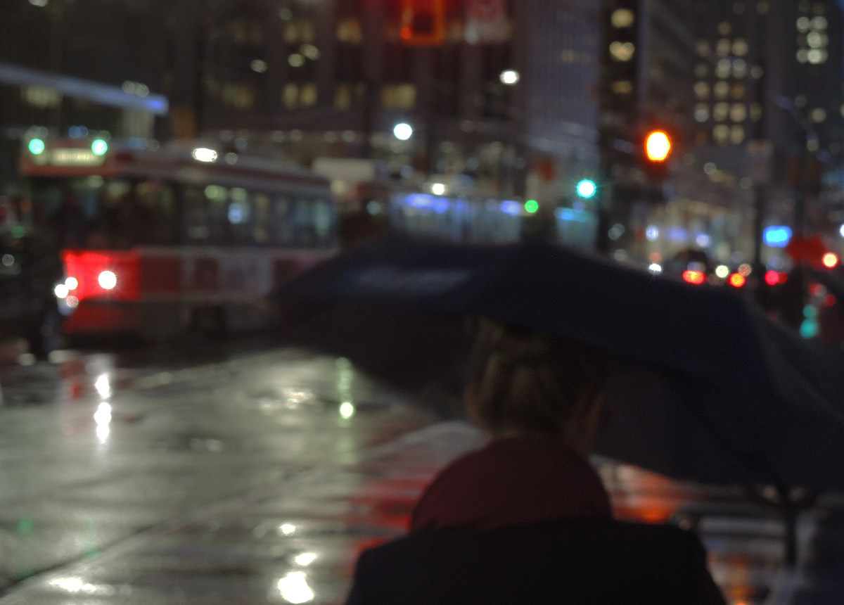
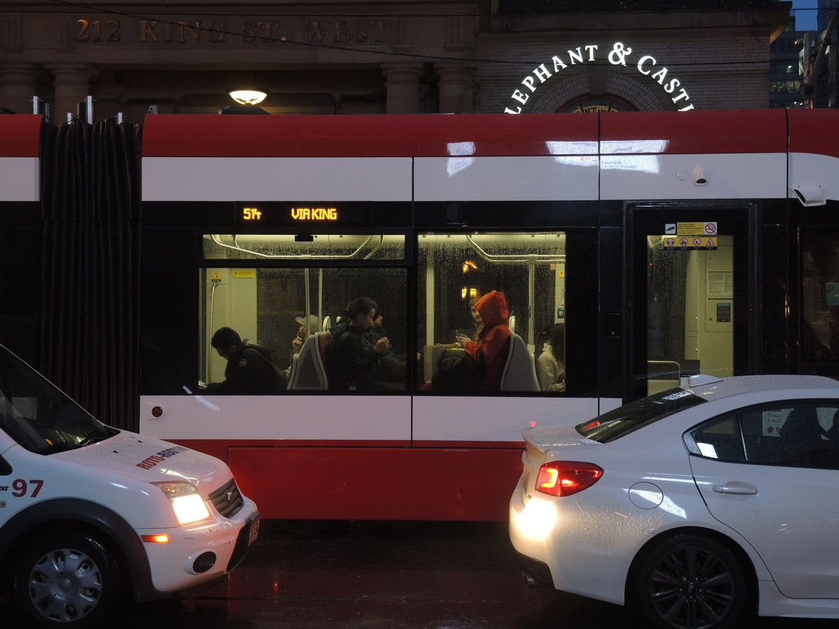
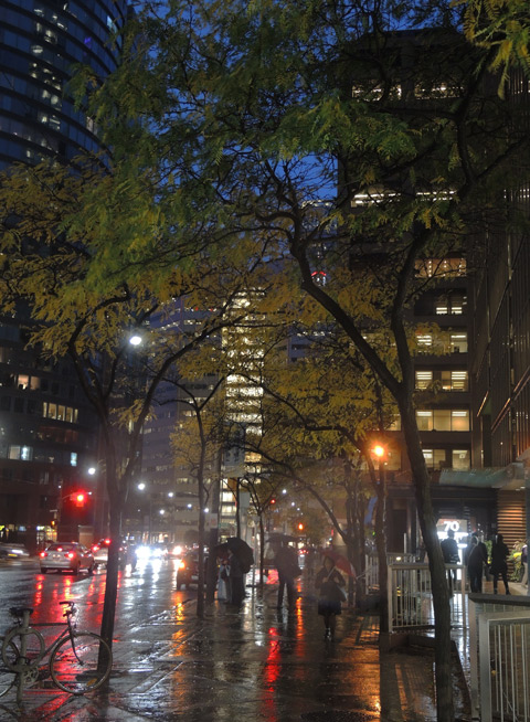
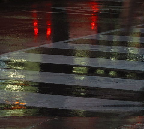
It was a rainy commute home for many people last night. Not too miserable though, just enough drizzle to bring out a few umbrellas and create some wonderful reflections to play with.
There are always options….
and sometimes they are polar opposites.

Also, plans are made for changing.
I was going to go to Brookfield Place to see the World Press Photo exhibit – a good activity for a grey and wet day. Just before I left, the rain stopped so I switched plans and turned the outing into a walk. There was a protest in the afternoon at Queens Park, a march against white supremacy. I knew that I probably missed it (it would have been wet!) but I went in that direction just in case there were still some remnants. But all was quiet and the people were long gone. So I wandered on.
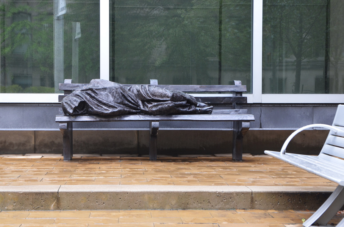
below: In front of St. Regis College, a sculpture called ‘Homeless Jesus’ by Timothy Schmalz. In memory of Joseph and Mary Benninger.
There is a small park at the corner of Bay and Wellesley with trees, water, and sculptures.
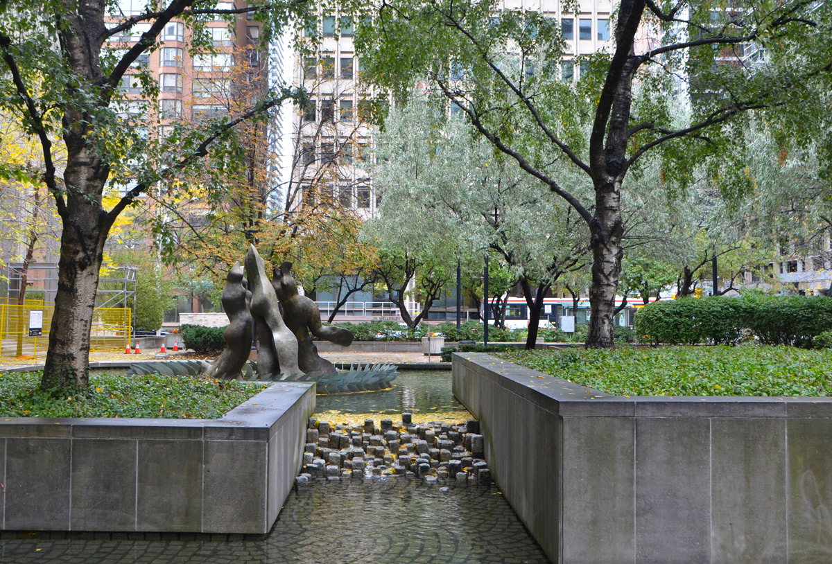
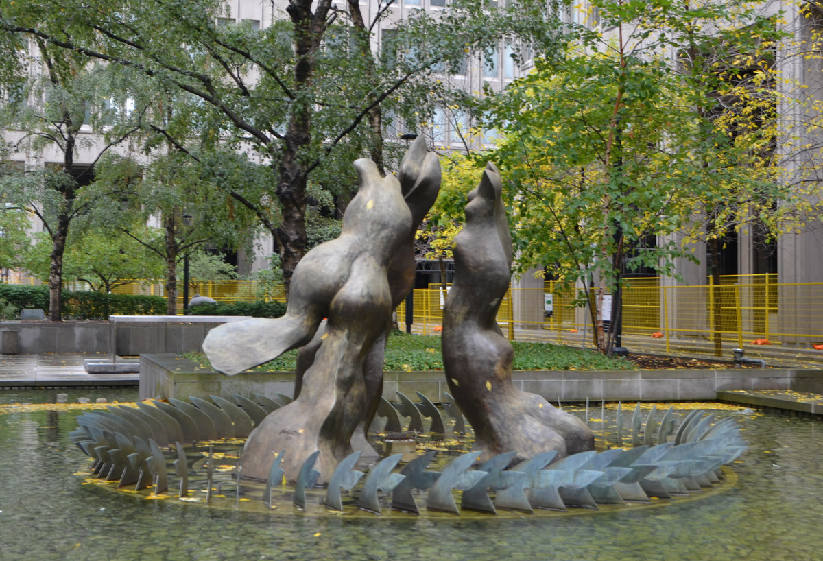
below: ‘The Three Graces’, 1971 by Gerald Gladstone (1929-2005). Part of the Governement of Ontario Art Collection.
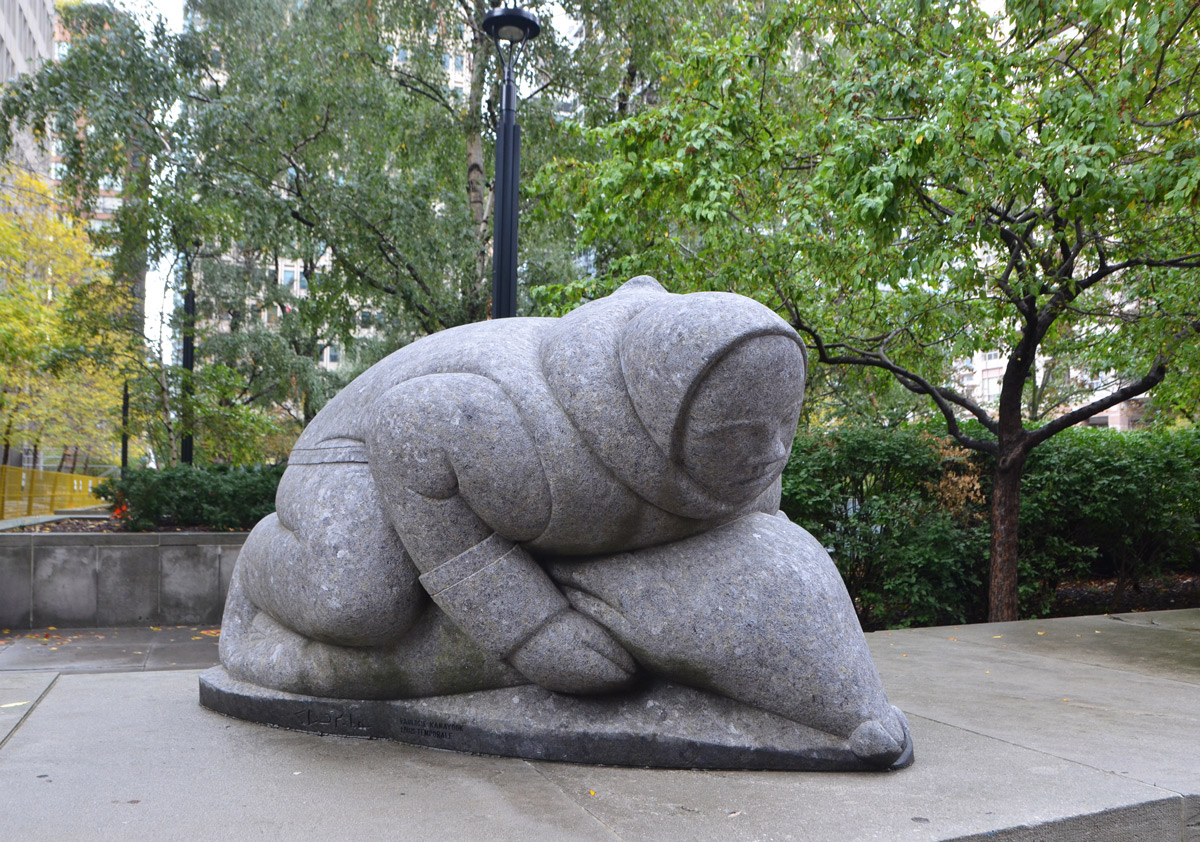
below: ‘Hunter With Seal’ c. 1966-1968. Sculpted in Canadian black granite by Louis Temporale after a soapstone carving by Paulosie Kanayook.
below: Workers in stone – surveyors, men with shovels and picks and wheelbarrows, and a scientist with a microscope. Part of the artwork above the door of the old Stock Exchange Building on Bay street.

below: At one point the sun even came out – shining on the almost blank west wall of Commerce Court North. This 34 storey building was built in 1931 and at the time it was the tallest building in the British Empire and remained so until 1962.

below: When the site was redeveloped in the 1970’s, Commerce Court North was preserved. It is now surrounded by glass and steel high rises.

below: The mama and baby elephants that stand behind Commerce Court are under wraps. I could say something about going into hibernation for the winter but I think that they are in the midst of being renovated.

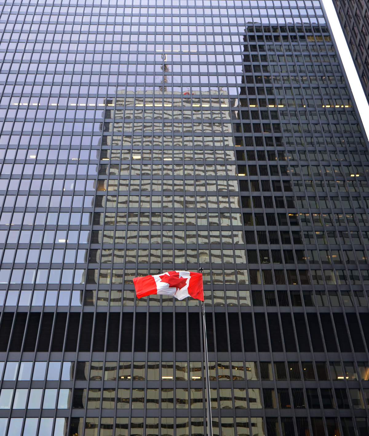
below: Just down the street, one of Toronto’s early skyscrapers is celebrating its 50th anniversary. The black towers of the Toronto-Dominion Centre are icons of the Toronto cityscape. They were designed by architect Ludwig Mies van der Rohe. The 56 storey Toronto Dominion Bank Building was completed in 1967. Two years later the adjacent 46 storey Royal Trust Tower was finished. The buildings are steel structures and are clad with bronze-coloured glass and black painted steel.
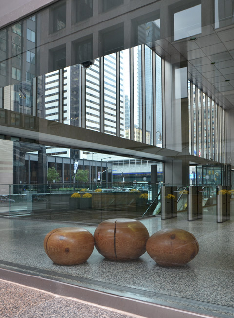
below: Rocks? Large balls of wood? Plastic made to look like something else? They were inside and I was outside so I didn’t get a close up look.
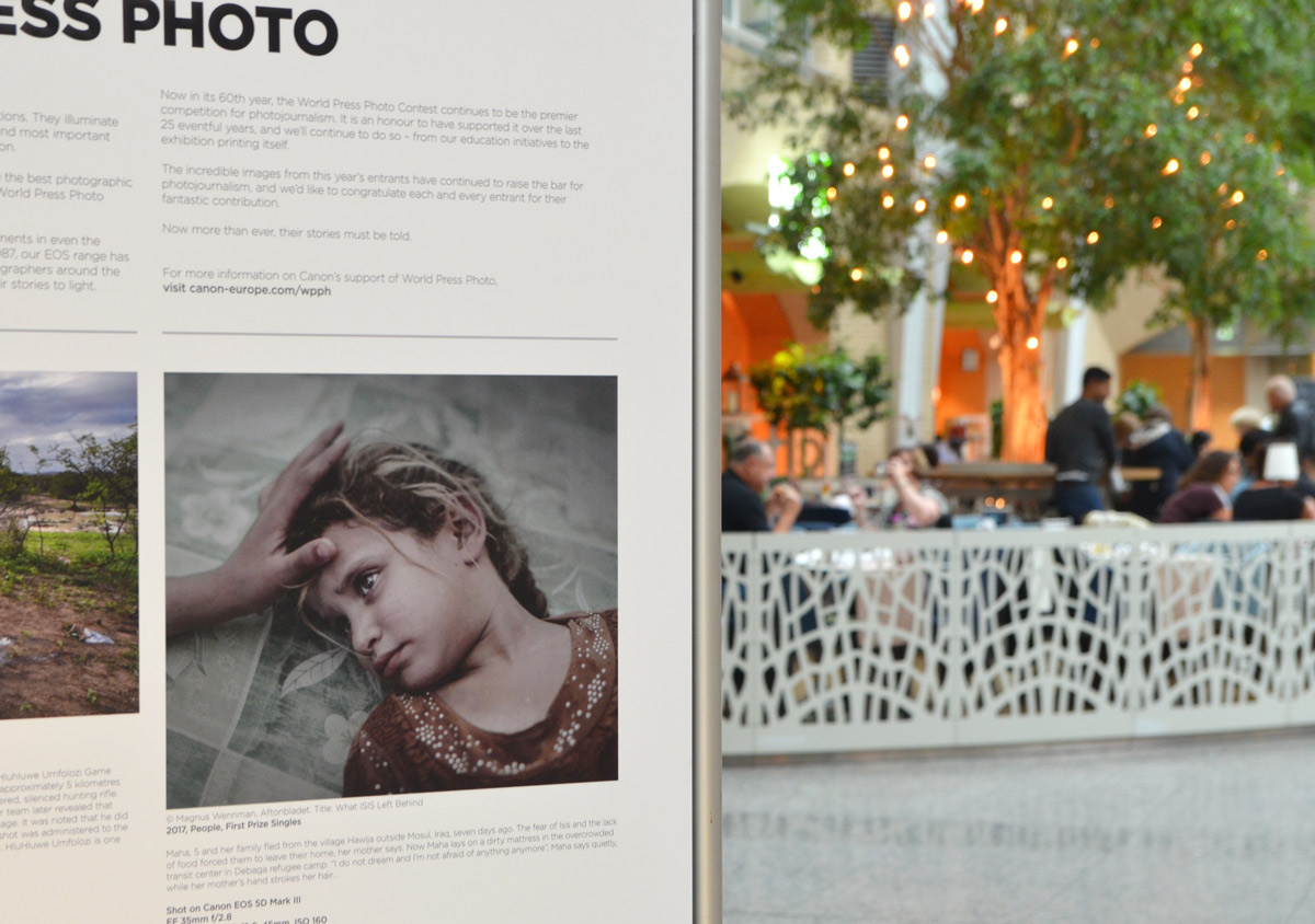
In case you’re wondering, I did get to Brookfield Place.

below: Photo is the winning photo in the people category, ‘What ISIS Left Behind’ by Magnus Wennman. It shows a girl, Maha age 5, at Debaga Refugee Center.
below: Center photo is by Canadian photographer Amber Bracken and it was taken at the Dakota Access Pipeline protest at Lake Oahe at Standing Rock Sioux reservation.

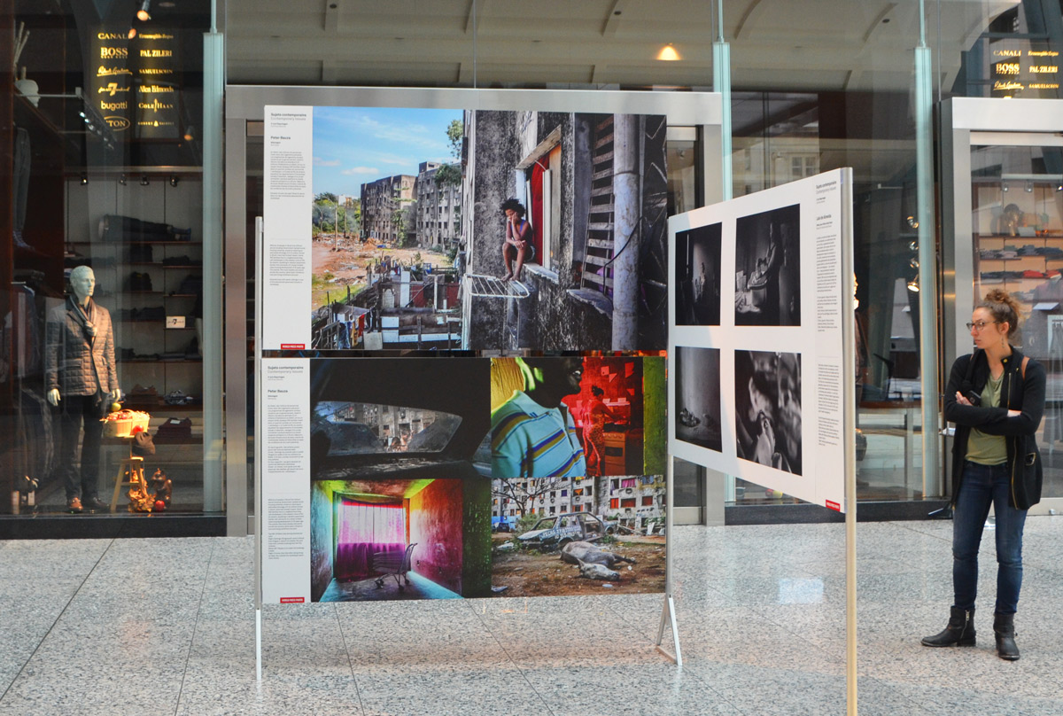
below: Four coloured photos by Peter Bauza. Third prize in the Contemporary Issues category – a series of pictures taken in the Jambalaya neighbourhood in western Rio de Janeiro where people squat in derelict apartment blocks that lack basic infrastructure.
Yesterday I was out near Dundas West and Dufferin to visit an art gallery, the Stephen Bulger Gallery, as they have a showing of photos of the Union Station renovation by Larry Towell. I don’t have any photos from that exhibit, but it is on for another week if you’re interested.
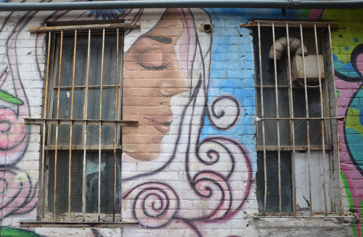
Instead, I have photos from the walk that I took afterwards. I started walking west on Dundas and south on Dufferin, looking for interesting doors, windows, and stores. I wasn’t disappointed. Of course, I was distracted (alleys!) along the way (graffiti!) but I have tried to stick to the architectural shots for this post. Sort of. In no particular order….
below: There was a car parked in front of this building so I cropped off the bottom. The optical illusion covered the whole front of the building. It’s definitely unique!

below: Two people walk past a forest of trees and shrubs.

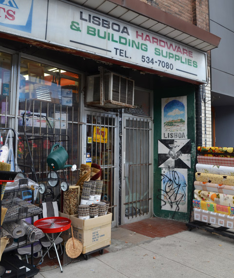
below: Lisboa Hardware and Building Supplies with many household items on display outside – including barbecues, watering cans, and carpets. Old paintings linger on the tile wall.
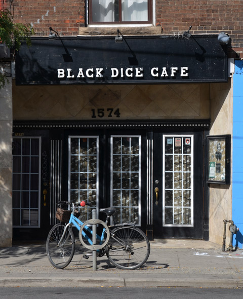
below: A blue bike is parked in front of the french doors of the Black Dice Cafe.
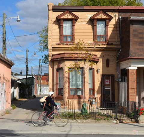
below: A very typical two storey house in this part of Toronto. This was the predominate style of architecture of residential buildings at a certain time – late 1800’s and early 1900’s I think (and maybe longer?). I like the Canadian flag in the window and the new tree in the tiny front yard.
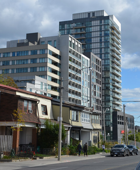
below: On Dufferin Street, an increasingly common scene as glass towers pop up all over the city. The west side of Dufferin Street, just north of Queen.
below: A similar scene on a smaller street nearby.

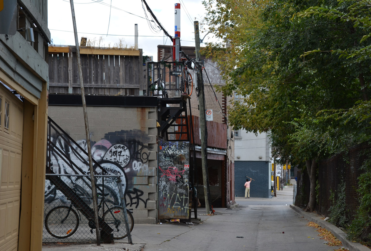
below: Distractions in an alley – this one was a dead end (with the dead end behind me). One of the disadvantages of having your garage in an alley like this is that getting your lawn mower from the garage to the yard involves a bit of a walk. But look at all those doors and windows in buildings that look like they’ve been painted from the same palate.

below: Another alley with a different character. An open door covered with graffiti, balconies above the garages, and what is that? – a TTC pole at the top of the stairs?
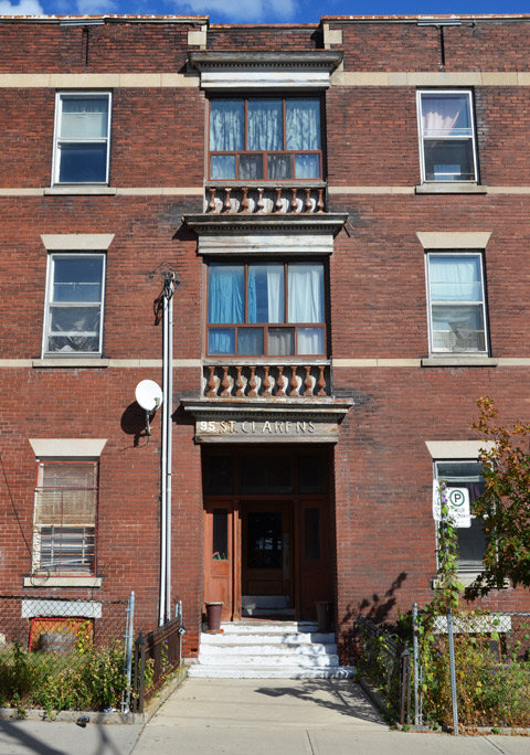
below: The entranceway of an older brick low-rise apartment building on St. Clarens Ave.
below: Another distraction! A crochet bombed pole beside a bright pink wall.

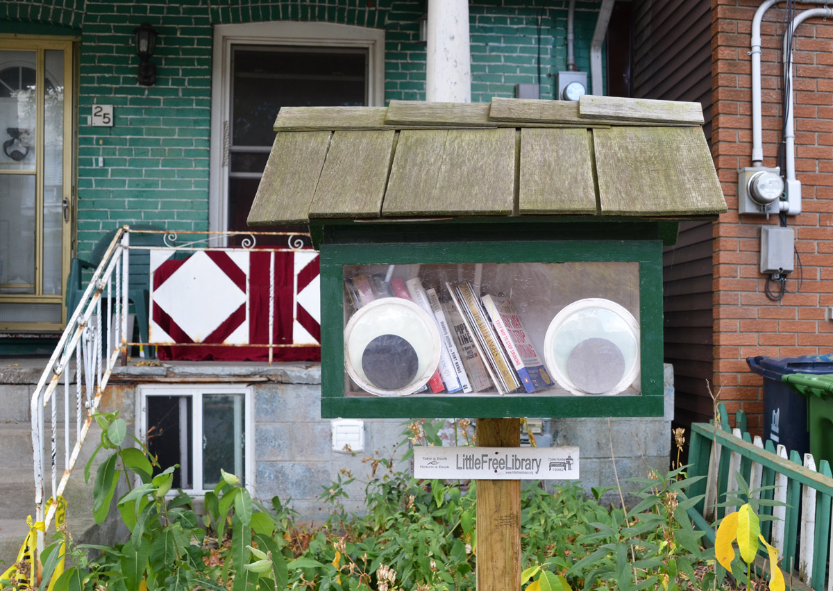
below: I happened upon this cute little free library too – so cute and whimsical with its big eyes keeping watch. There has been some controversy about these in Toronto recently. One owner of little library was ticketed for violating a city bylaw that disallows structures on a person’s property within 3.5 metres of a sidewalk. It was ordered removed within 14 days or a $100 fine would be levied. Yesterday City Hall decided not to pursue this.
below: Nearby was another little free library with a little latched door. It seems that here you can also pick up a pair of shoes along with a book!

below: Did I find Toronto’s smallest house?
below: Somewhere in the jungle is a front door or two! A shared sidewalk to squabble over in the winter – who gets to shovel it.
below: Gates. I’ve never understood the reason for little gates like these. Back in their youth they probably looked quite trim and proper. Now they are sagging and rusted and showing their age; perhaps that’s a reflection of their owners? Not a complaint – a rusted gate has great photographic potential.

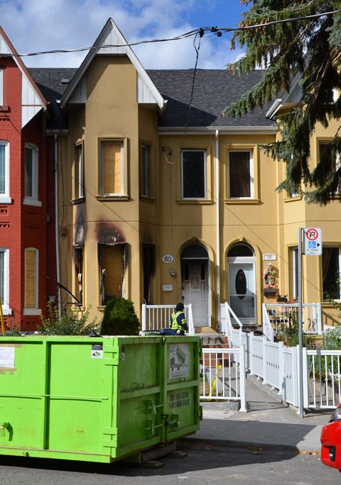
below: Fire damage that is now being repaired. The neighbours seem to have built a thriving shrine (good luck charm?, religious offering? is there a name for these?) beside their front door.
below: We have our share of ugly doors on ugly walls.

below: Have a seat

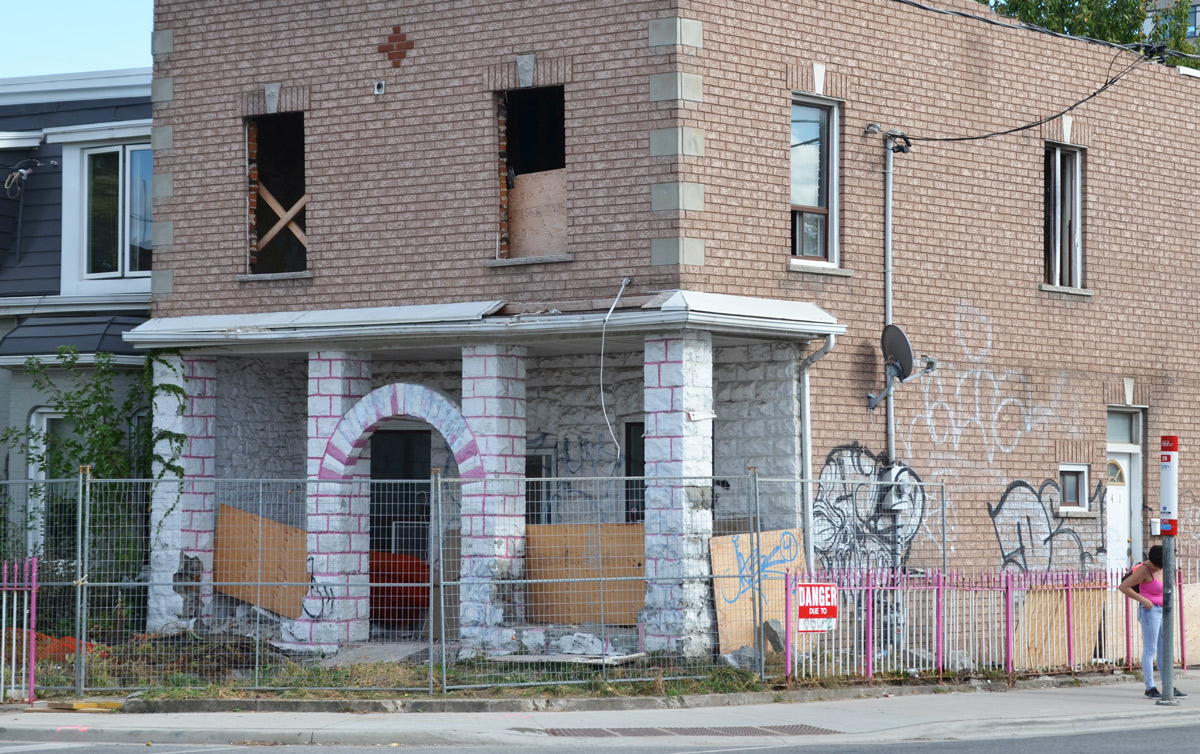
below: On Dufferin Street between Dundas and Queen – Once upon a time this house was totally decorated in pink and white. Some of it remains – the arch in front of the door as well as the fence at the side of the house. Now it is bigger, squarer, and uglier. Even the grominator graffiti on the wall can’t overcome the ‘boringness’ of the renovated structure.
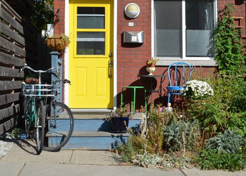
below: I don’t want to end this post on an ugly note, so here’s a cheerful bright yellow door!
The facelift of Berczy Park has been completed and although the park only reopened a short time ago, it has already become a popular spot.
The highlight of the park is the refurbished fountain. Sculptures of dogs big and small spout water into the fountain – or maybe they’re drinking from the fountain? There is one cat that sits quietly on the base of the sculpture seemingly unaware of the canine antics.
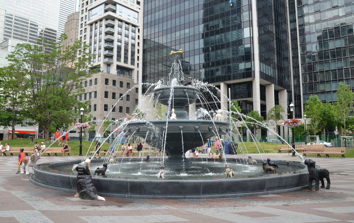
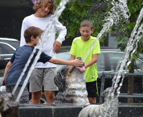

Besides the fountain, there is new landscaping, trees, plants, and benches.

This sculpture was a feature of the original park but it’s been moved to a different location. It is the work of Almuth Lukenhaus-Lackey.

The plaque by this sculpture says “This sculpture was donated by the Electrical Society of Mecklenburg Upper Canada Inc., with the financial assistance of The Consumers’ Gas Company Limited and the The Council of Metropolitan Toronto, in memory of Johan Albrecht Ulrich Moll, better known as William Berczy, born December 10, 1744 in Wallerstein Germany. He was co-founder of York (Toronto) in 1794 when John Graves Simcoe was Lieutenant Governor of Upper Canada. His younger son, Charles Albert Berczy, was the first president of The Consumers’ Gas Company, from 1847 to 1856, and Postmaster of Toronto. His older son, William Bent Berczy was a Member of the Legislative Assembly of Upper Canada and like his father and mother, a gifted painter.”
I only spent a short time at the park on the weekend but I’m sure that I’ll be back!
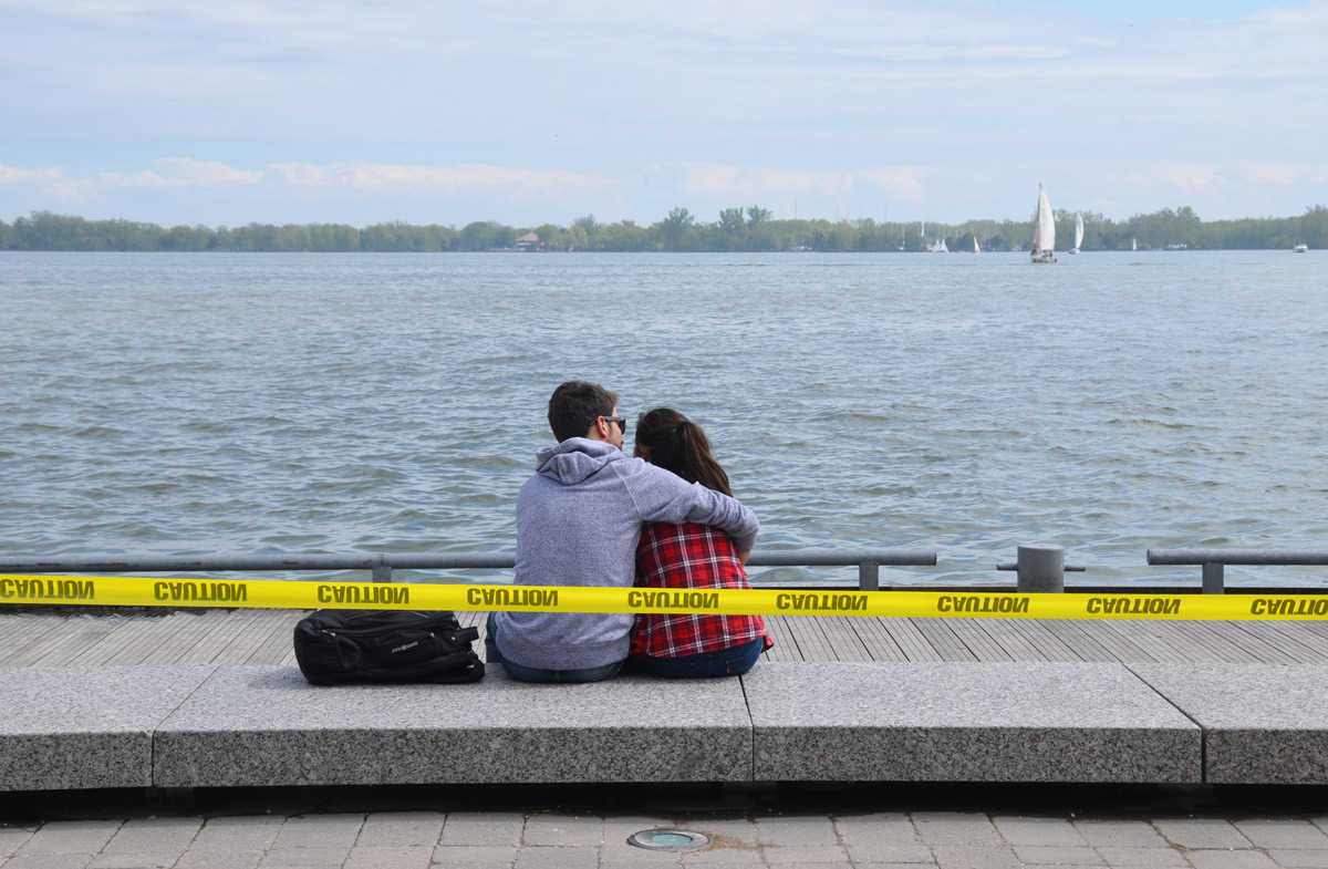
The water levels in Lake Ontario are higher than normal this spring – some beaches are under water and a large percent of the Toronto Islands are flooded. In front of the Power Plant Art Gallery the water level is even with with the concrete walkway… but not high enough to deter people from enjoying the waterfront this past weekend.
It seems appropriate that the artwork on the exterior wall (facing the lake) of the Power Plant features an image of water – white crested waves on a large lake. The piece is “Bound, Hupfield 2017” by Maria Hupfield; it is 19 feet high and 31 feet wide. The central image is a seascape painted by the artist’s mother, Peggy Miller, many years ago. It is being wrapped (unwrapped?) with grey felt-like material.
Is it a treasured artwork that is being readied for storage?
Is it a painful memory that is being covered up to be forgotten?
Is it a family heirloom that is being brought out for someone to admire?


If you are interested in more information about Maria Hupfield, check the CONTACT website.
“Objects contain meanings beyond their materiality, meanings that we bring to them or receive from them. Objects are the result of an action, entail a trace of a human gesture, and trigger reactions and memories. They have the potential to be read collectively or personally. In her artistic practice, Maria Hupfield reveals the interrelational potential triggered by objects between humans or cultural environments.”
Early Saturday morning was cold but beautiful –
brilliant blue overhead with the sun still low in the sky.
below: Striped grass

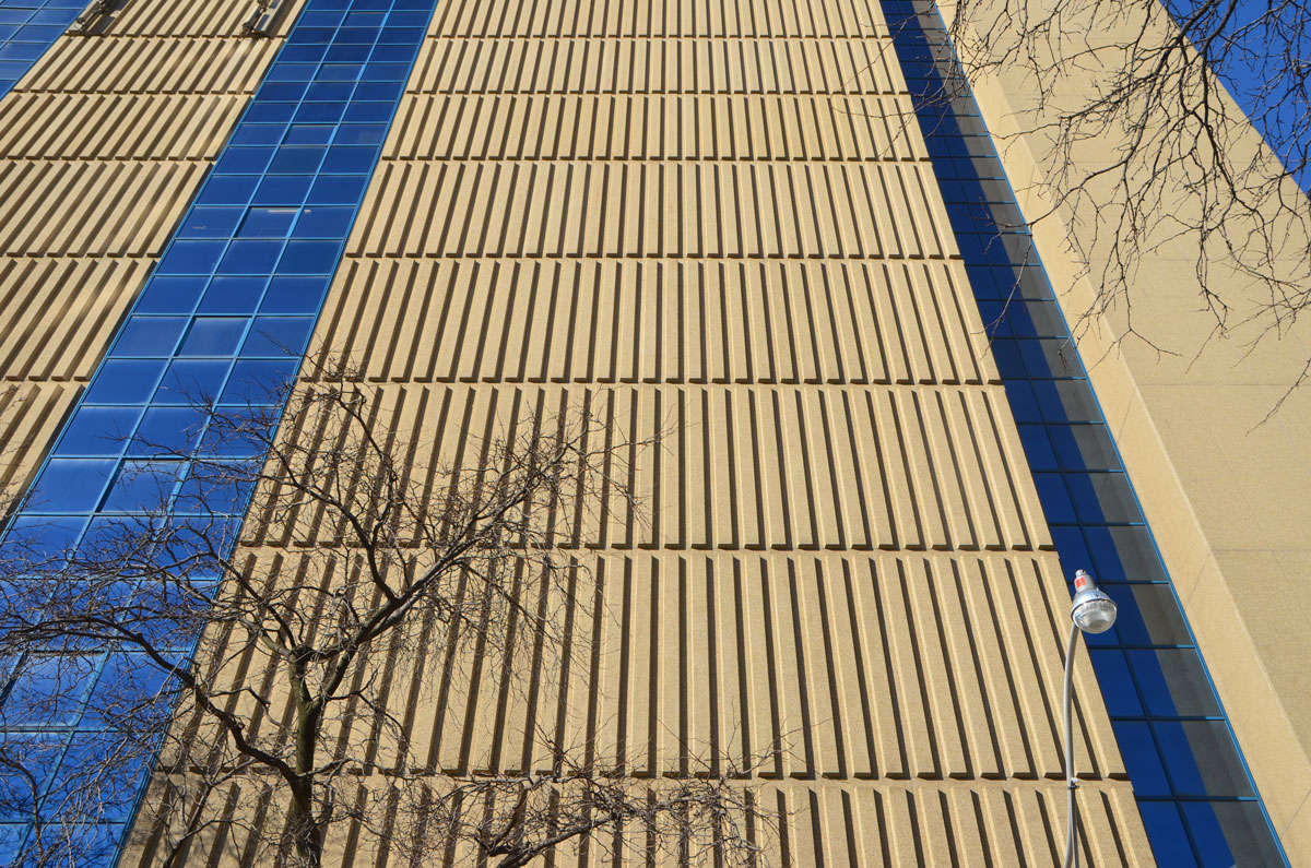
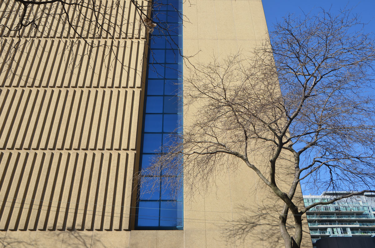
below: This is the Bell building from the Simcoe Street side. The blue glass, vertical lines in the concrete, blue sky and strong tree shapes made for an interesting few minutes while I experimented with different angles and views.
below: The ghostly look of reflected light
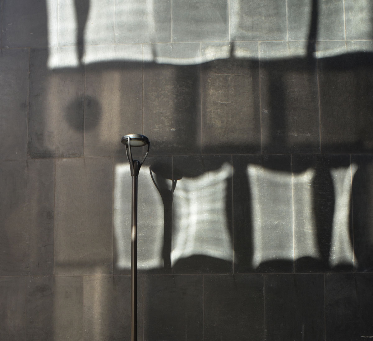
below: A single pole and its shadow, alone on a wall.
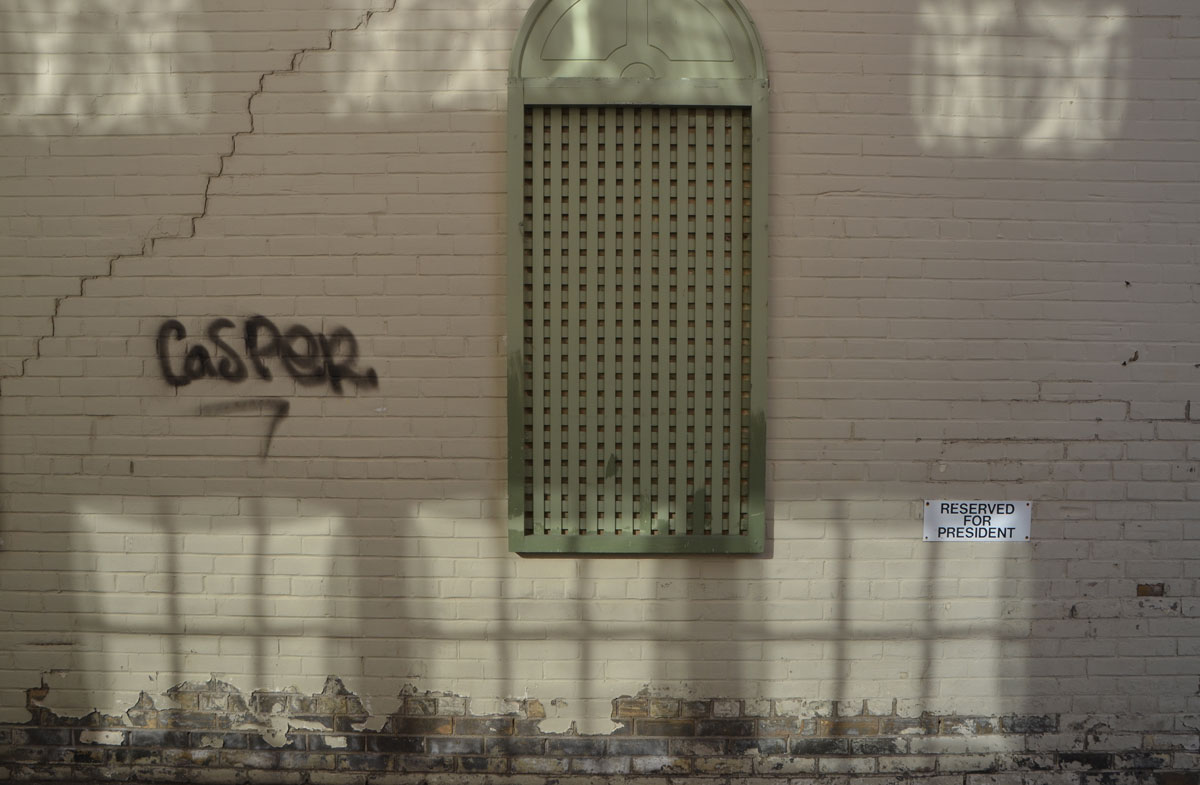
below: Three reflected windows reserved for the president.
below: A half house, a fun find. Once this was a semi-divided house where the shared wall created the peak at the front of the house. With its partner gone, the remaining house looks incomplete.

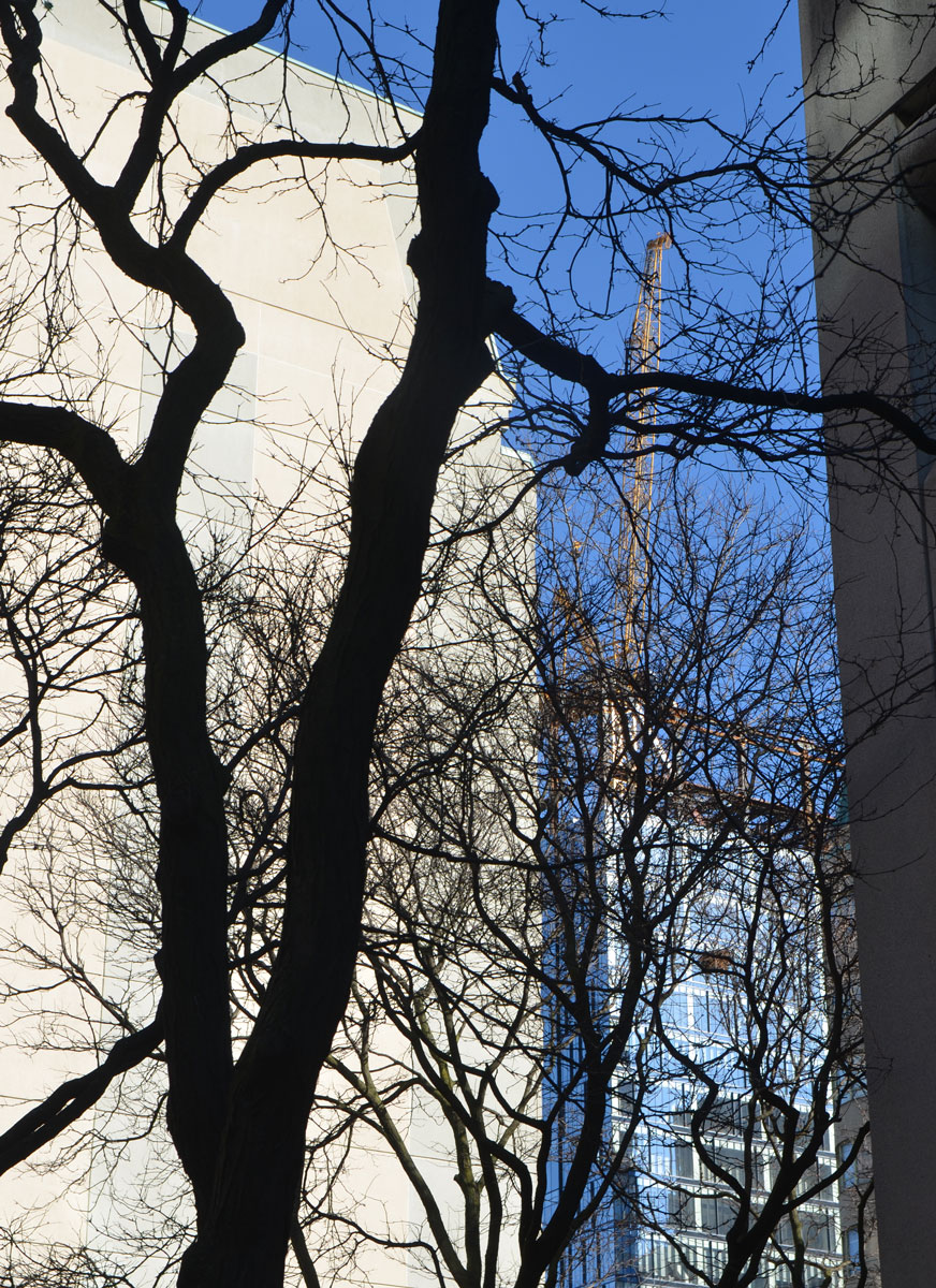
below: A tree in silhouette seems to dance in front of the other buildings.
below: Phantom balconies, mirages on the concrete.

Sculptures by Ken Lum.
I was walking up Bay Street yesterday when I stopped. Out of the corner of my eye I had caught a glimpse of a sculpture that I had never seen before. It is ‘Two Children of Toronto’ by Ken Lum, 2013.
Two children, a boy and a girl, sit opposite each other, some distance between them.

What you can’t see in the above picture is that there are words in bronze mounted on the wall. The words say: “Across time and space, two children of Toronto meet”. The two kids are looking towards each but not each other.

below: Both children are wearing clothes from bygone days.
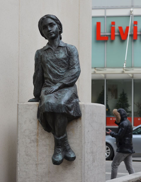
below: But the boy’s clothes are more Chinese looking.

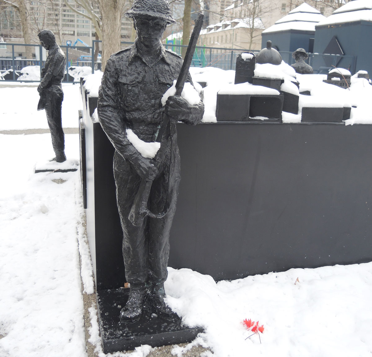
After my walk the other day, I started researching Ken Lum. I discovered that he has another sculpture nearby, and fortuitously, it was one that I took some pictures of back in December. It is “Peace Through Valour” located at the NW corner of City Hall property. Winston Churchill is standing close by.
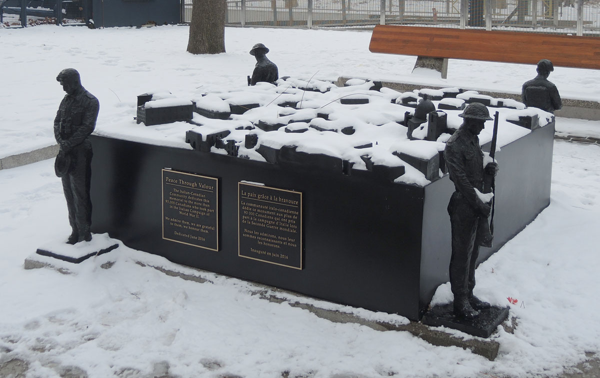
It commemorates the 93,000 Canadians who fought in the Italian campaign of WW2 and was dedicated in June 2016. A Canadian soldier stands vigil at each corner of the memorial. The top of the 7 foot x 7 foot square is a topographical map of Ortona, a town in Italy that was a scene of a battle at Christmas time in 1943. Ortona is on the Adriatic coast and its streets were narrow which made it difficult for Allied forces to liberate the town from Nazi Germany.
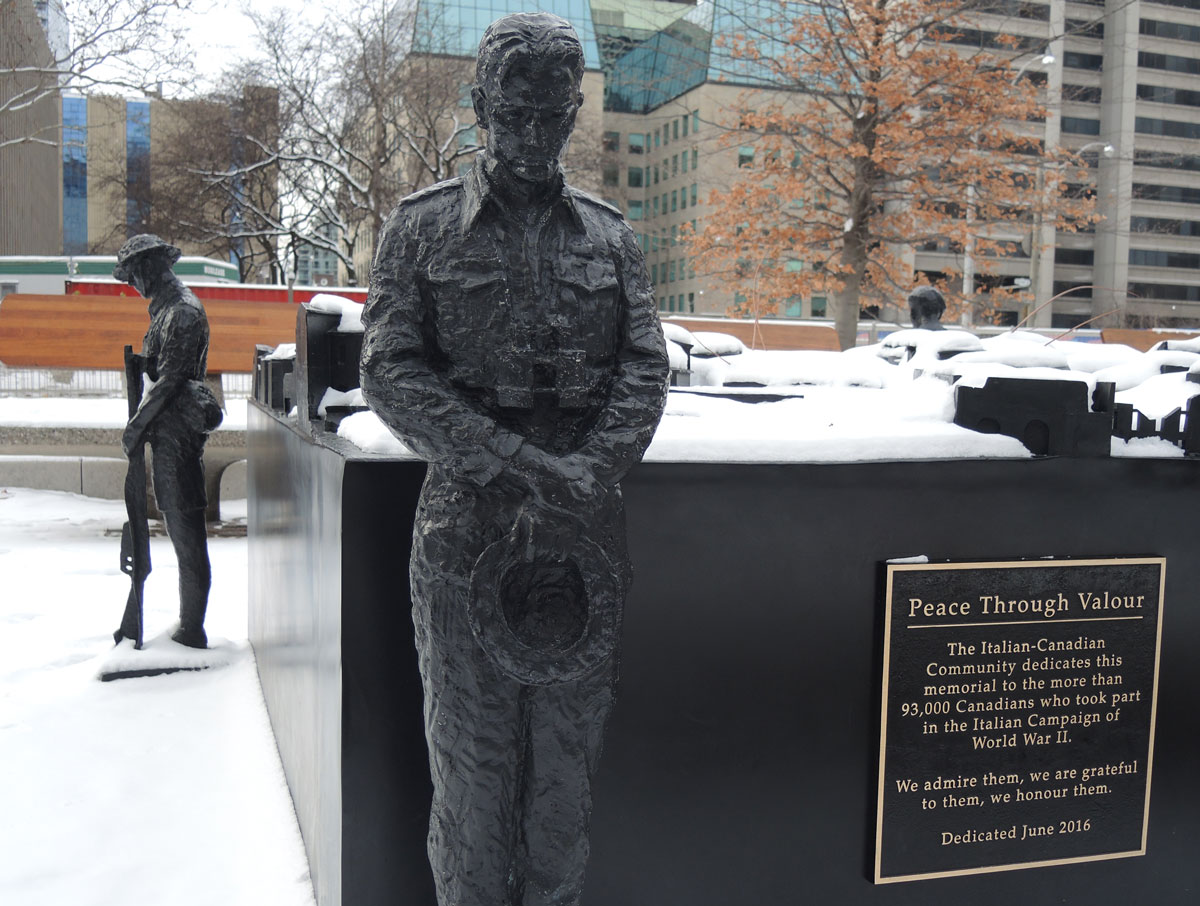
Money for the sculpture was donated by the Italian-Canadian community.
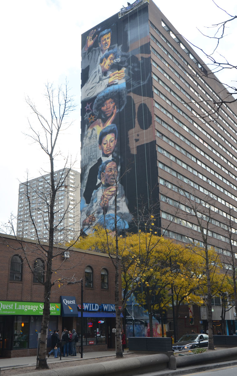
As I was walking down Yonge Street yesterday I happened upon this, faces playing peak-a-boo with passersby on the street. It’s a new 22 storey mural being painted on the north side of 423 Yonge Street. A ‘musical mural’ featuring the faces of musicians from the 1950’s, 1960’s, and 1970’s.

below: From top to bottom: Ronnie Hawkins, Glenn Gould, Diane Brooks, Jackie Shane and Muddy Waters.
below: The bottom of the mural
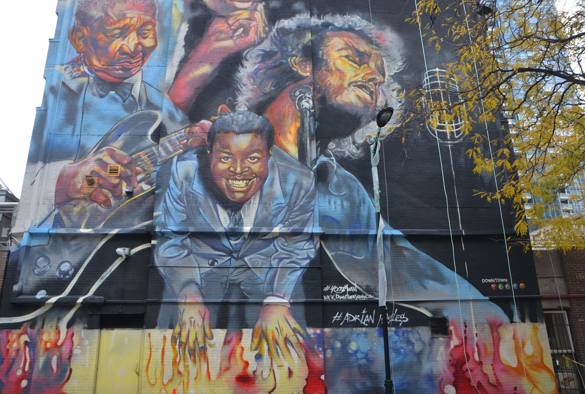
below: Looking up…. Shirley Matthews, B.B. King, Gordon Lightfoot and Oscar Peterson.

#yongemural | #adrianhayles
Well, not really Camden Street, but an alley that runs perpendicular to the street…. If the lane has a name I don’t know what it is. Google maps doesn’t even include it. It’s a very short alley that runs both north and south from Camden street and it doesn’t go anywhere. Both sections were painted with murals 9 or 10 years ago. Amazingly, they have survived.
Let’s start with the south side of Camden Street.
below: Mural Project, “The walls won’t know what hit them”. The mural was painted in 2006 youth from the Harbourfront and Cecil Community Centres as part of the City of Toronto’s Graffiti Transformation Project.
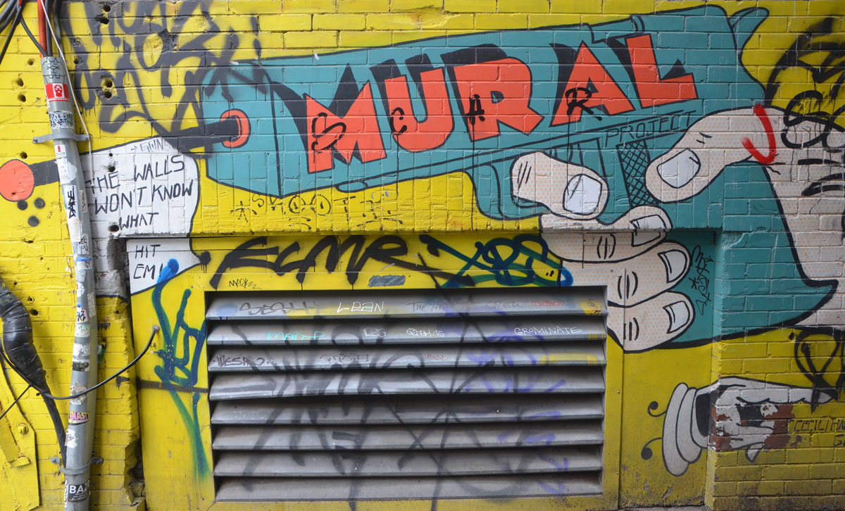
below: The mural is painted in a quasi cartoon style.

below: She’s upset and she’s expressing her hurt and anger with spray paint seems to be the start of the story.

below: My knowledge of slang is limited, and this is 10 years old but this sheezy is cool. It’s probably as simple as “this sure is cool”, i.e. spray painting graffiti is cool.

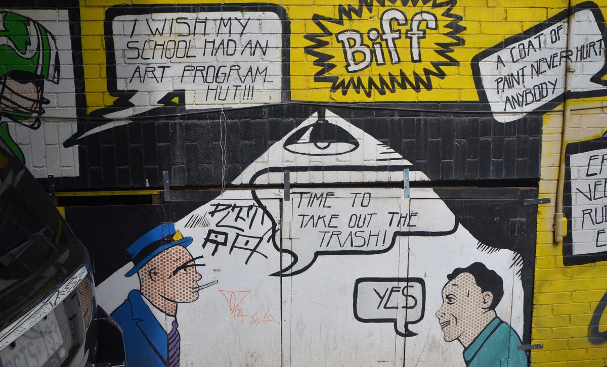
below: Oh no! I always laugh when I hear this expression these days… is there anywhere in Toronto where property values are going down? Okay, okay, so it’s part of the story – she’s complaining that someone has sprayed graffiti somewhere nearby, the vandalism part of the story. The angry young woman or the “sheezy heezy” guy above have been busy in her neighbourhood.

below: As you can see, a couple of things were in the way as I was taking pictures. I am not sure exactly how the plot of the mural progresses from here because I couldn’t see the whole thing. There are gaps in the story line. A few missing pages so to speak.

below: Flesh tones as dots in the face of woman who plays an unknown role in this story – the mystery woman?

below: I suspect that this is the “We’ve got to get rid of the graffiti” part of the story. Is it improper to make comments about Rob Ford and his anti-graffiti program here? I don’t want to insult the mural or the project behind it because I think that the Graffiti Transformation Project is an excellent program.
below: If there was a mural on the other side of the alley, it’s long gone.
A short walk across Camden Street to the other half of the alley….
below: You can see the taller buildings on Richmond Street West but you can’t get there from here.
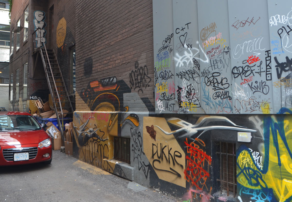
And like most downtown alleys, garbage bins are a dominant feature.

below: At the entrance to the alley. There are words under the window by the sunflowers that say that this painting is also the work of the Harbourfront/Cecil Community Centre’s Graffiti Transformation Project, 2007.

below: A very low window with green arrows

below: And last, I’ll end with a weather comment because we’ve all been talking (complaining?) about it these days – someone’s a bit overdressed for this August weather although it doesn’t seem to bother him. Maybe he knows something we don’t. Or maybe it’s just wishful thinking.

Stay cool!
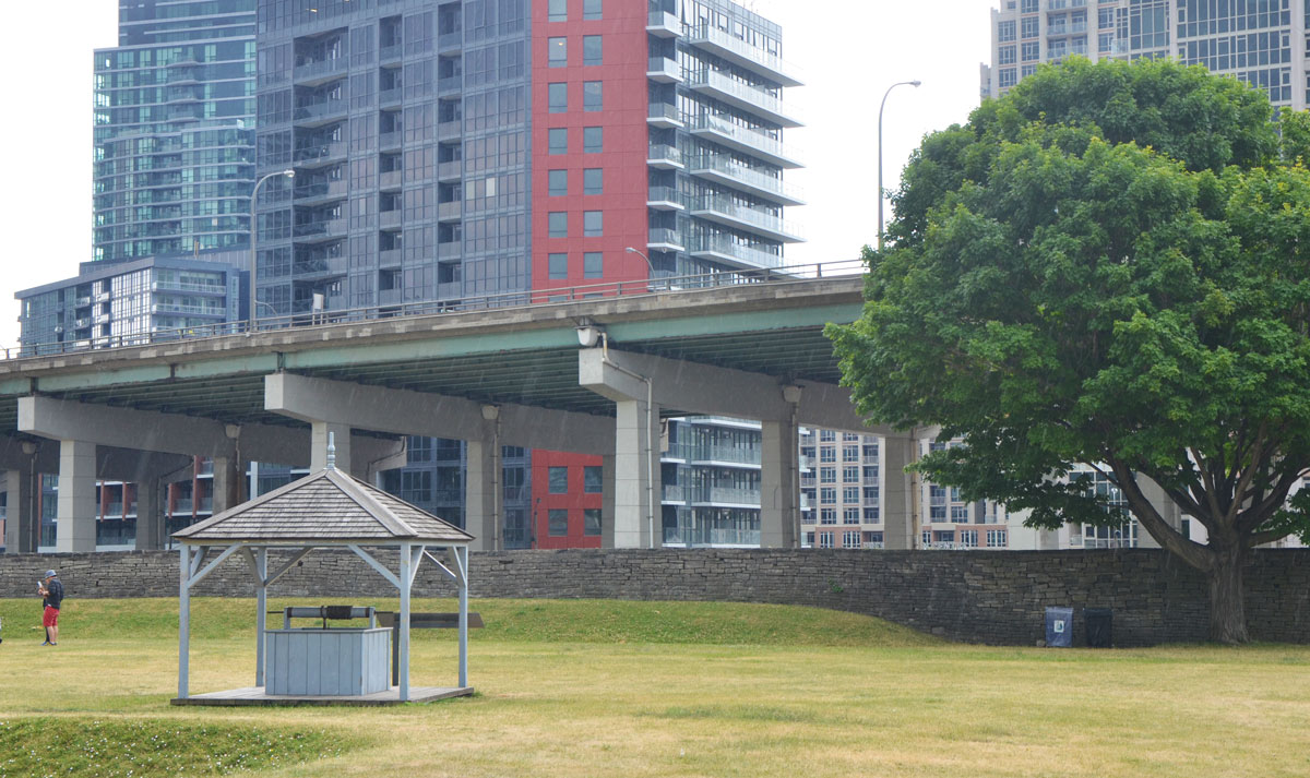
The Frederick G. Gardiner Expressway, commonly just called the Gardiner, has been in the news a lot lately. This 18 km stretch of road between the city and the lake was completed in 1965 after years of planning and building. At the time that it was built, Toronto’s waterfront was largely industrial and there wasn’t much objection to having a 4 to 6 lane expressway, with many sections elevated, built there. The railway had begun the process of dividing the city from its waterfront a hundred years previously.
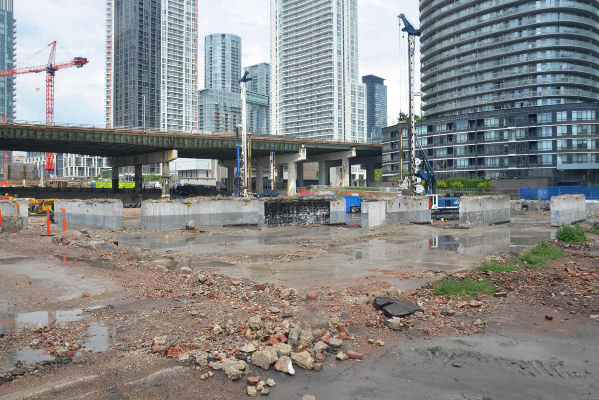
As the city changes and grows, more and more people live in the downtown core. Industry has moved out and residents have moved in. For so long the land south of the Gardiner as well as under the Gardiner was neglected, especially from a city planning point of view. But now, the city is looking differently at that swath of land. The far east elevated section between the Don Valley Parkway and Leslie Street was demolished in 2001 and there have been calls for the next section (Jarvis to the DVP) to be demolished as well. There has been some controversy as to whether to demolish it or move it… and if move it, where to? I am not even sure what the plans are at the moment. On the other hand, the western section of the elevated expressway (Strachan to Spadina) will remain standing. Work is underway to refurbish the structure – the city doesn’t want any more stories of pieces of concrete dropping onto cars beneath! Plans are being implemented to use the land under the Gardiner much more efficiently. To make it work for the public.
The Bentway is the name that has been given to this new park, or public space, beneath the Gardiner Expressway from Strachan 1.4 kilometres east to Spadina. The first phase is due to open Canada Day 2017 and it involves the stretch between Strachan and Bathurst. Many of you have probably driven on the Gardiner but do any of you know what is under it now? Let’s take a look.
below: The Gardiner passes over Strachan Avenue which in turn passes over the railway tracks.

below: On Strachan Ave looking west. Condo development in this area has extended right to the railway line. The Exhibition GO train station is in the distance. You can also see the Gardiner to the left of the tracks. Here the north side of the under part of the expressway is walled in and the enclosed space is used by Exhibition Place. At this time there is no plan for the Bentway to extend this far; I have used this photo to provide more context as to the location of the park.

below: A closer look at the Gardiner on the west side of Strachan Avenue. Maybe there is potential to expand the park westward? to Exhibition GO station? And by the way, those concrete structures holding up the expressway – those are called ‘bents’ and that is why the park is called what it is.

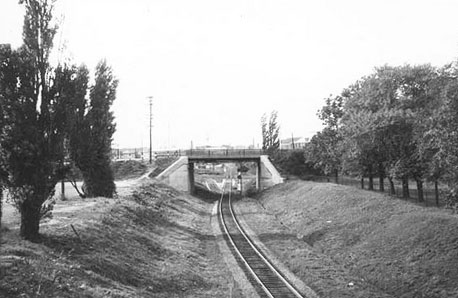
below: This photo was taken as I stood on Garrison Common and looking towards Strachan Avenue. This will be the western end of the new park. You can see the underside of the Gardiner as it passes over Strachan Ave which in turn is also a bridge. This bridge once crossed the Grand Trunk Railway tracks that were built in the 1850s. New entrances to the park are planned that incorporate the present sloped embankment of the bridge.

below: A quick aside: It’s a slightly different angle, but here is a photo of the Strachan Avenue bridge from 1959, before the Gardiner was built. I suspect that there has been upgrades made to the bridge since then. Photo credit: R.L. Kennedy, found online (also a good source for the history of the Grand Trunk Railway in Toronto). Garrison Common is to the right.
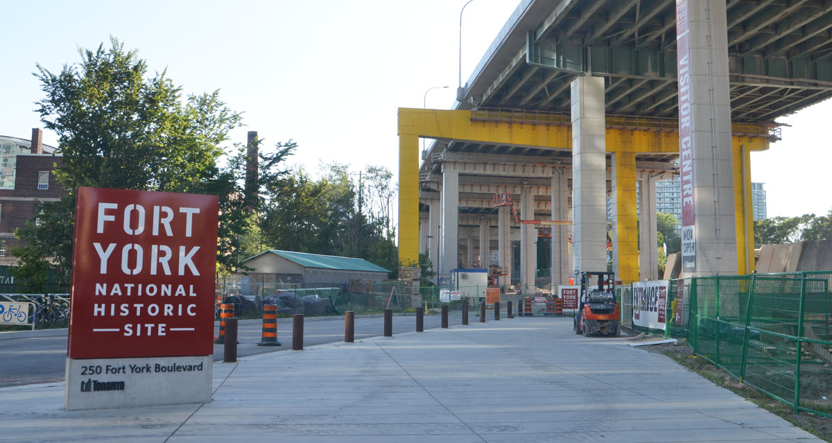
Garrison Common is the green space surrounding Fort York. It will abut (be continuous with?) the new Bentway. Fort York is a National Historic Site and on its 43 acre site are original buildings from the War of 1812 as well as an 1813 battle site. Did you know that the Americans beat us here in 1813 and controlled the city of York (as Toronto was known then) for a few days?
below: The new Fort York Visitors Centre is now open. There is still being work done both inside and outside, but it is open to visitors. For so long the fort was hidden away and difficult to get to; it is nice to see it receiving more attention.
below: Jake from Park People, one of the groups helping to design the new park, stands under the Gardiner as he talks to a group of us on a tour. Here, by Fort York, the Gardiner is the equivalent of 5 storeys from ground level, the highest it reaches as it crosses the city.
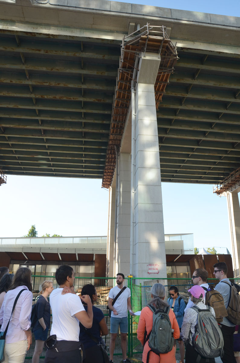
below: Standing on the grounds of Fort York. The Bentway will be beyond the stone wall. You can get a good idea of the spacing between the bents. These spaces are being referred to as ‘rooms’ and there are 55 of them between Strachan and Spadina.
below: One obstacle is the fact that Fort York Blvd passes under the Gardiner on a diagonal. Plans are to build a pedestrian/cycle bridge over the street. Also in the photo, note the TTC bus – Fort York and vicinity are finally on a bus route. Route 121 runs between the Portlands and Fort York via Union Station.

below: The section under the Gardiner Expressway between Bathurst Street and Fort York Blvd is not city owned. It is owned, and has already been developed, by the Onni Group who built the Garrison at Fort York condominiums on either side of it. This is the eastern end of phase 1.

below: Northbound traffic on Bathurst passes under the Gardiner.

Phase 2 of the park’s development involves land between Bathurst and Spadina. This is an area that is undergoing a lot of changes at the moment, i.e. a lot of construction.
below: Immediately south of the Gardiner on the northeast corner of Bathurst and Lakeshore is a construction site. Demolition of the old 1928 Loblaws warehouse building is now complete. The facade of the old building was disassembled rather than demolished; after cleaning and refurbishing of the bricks, it will be rebuilt in its original location. Two condo towers are planned for the space between Loblaws and the Gardiner. Yes, more condo towers to face the Gardiner and add to the tunnel effect that you get when you drive on the expressway.
below: The development of this site is a collaboration between a number of developers. I found a photo of one rendition (source) of what the space under the Gardiner will look like here in the future. Public space including a cafe are part of the plans. Check back in a couple of years to see what really happens here!

below: Standing on Bathurst Street, looking east along what will be Housey Street. This is just north of where the Loblaws development (above) will be. As you can see, you can’t walk there yet.
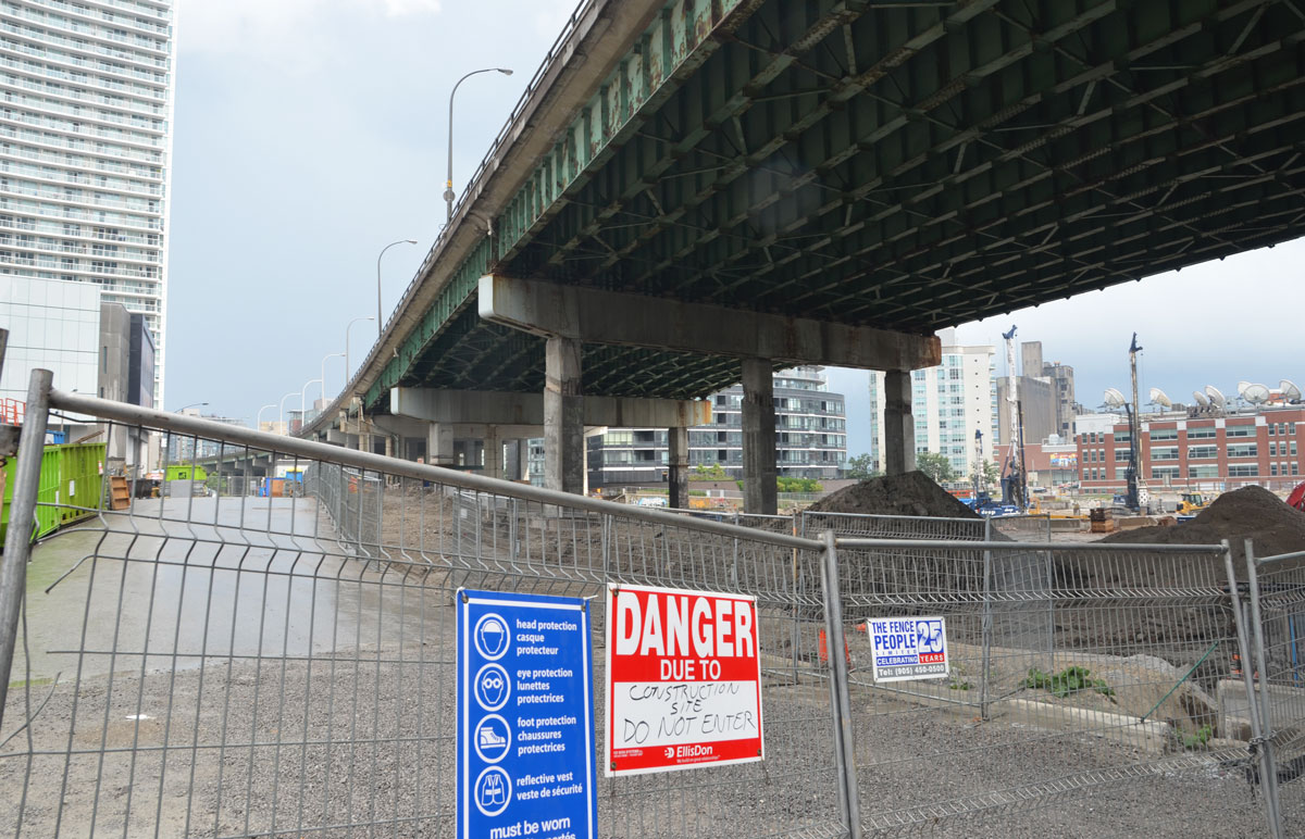
below: Southeast corner of Bathurst and Fort York Blvd. This is the section of land just north of Housey Street. Construction hoardings and cranes – familiar sights in this area. It also means that taking photos of under the Gardiner here are difficult!

below: Development north of the Gardiner between Bathurst and Dan Leckie Way.
Dan Leckie Way is a north-south road that runs under the Gardiner just east of Bathurst. It is the western boundary of Canoe Landing Park. This park is north of the Gardiner and the Lakeshore.
below: ‘Tom Thomson’s Canoe’, by Douglas Coupland sits at the highest point of land in the area; it’s almost at the same level as the Gardiner and is very visible as you drive by. This park extends down the hill.
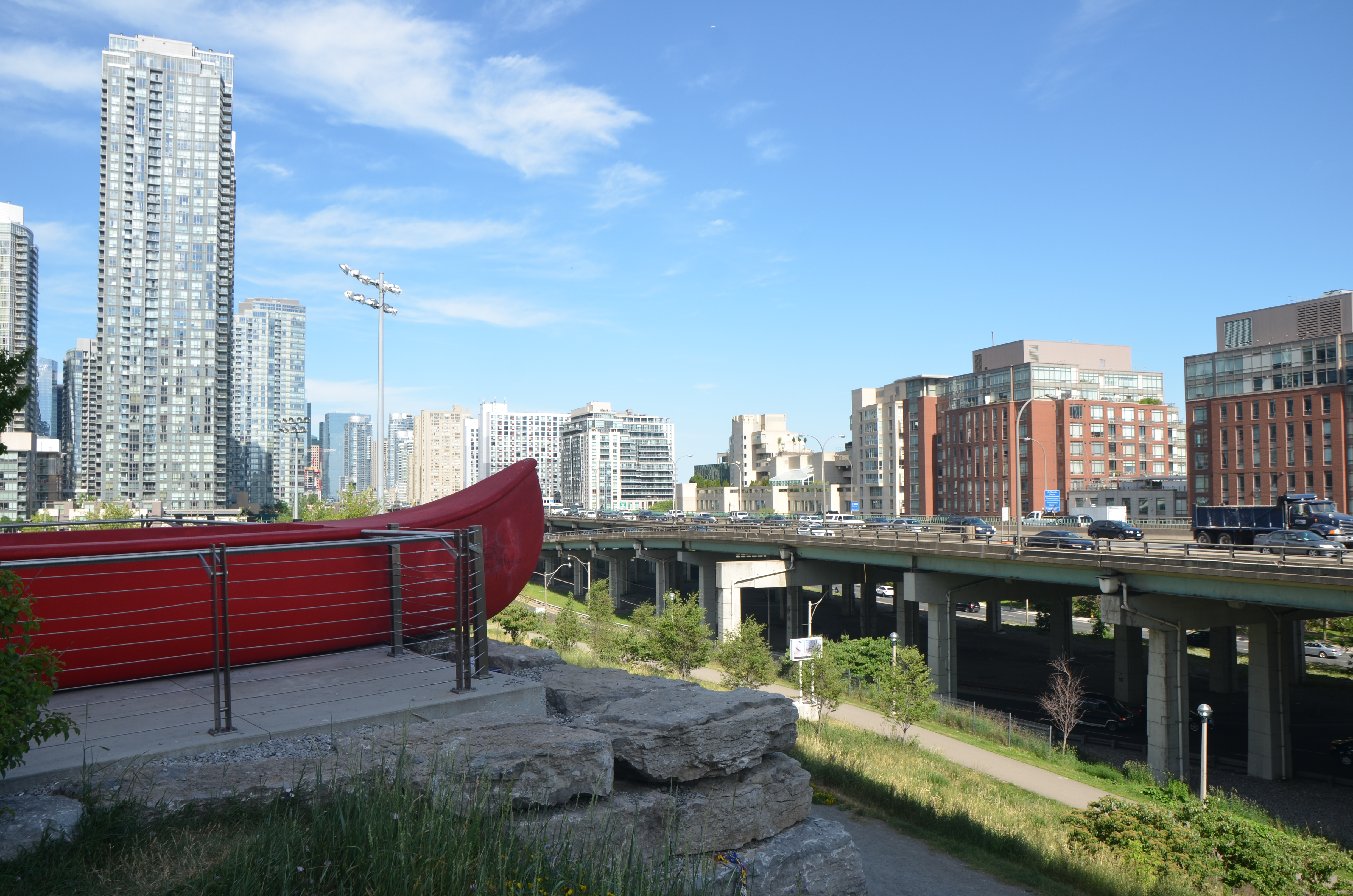
below: Looking the other way from the same vantage point. The street running under the Gardiner here is Dan Leckie Way . Up until this point the Lakeshore is south of the Gardiner.
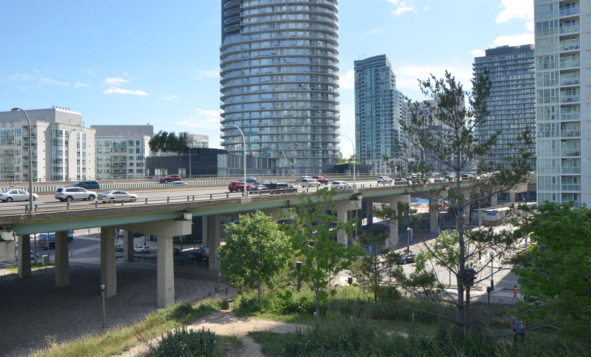
At Dan Leckie Way, the Lakeshore is still south of the Gardiner and the space under the expressway is wide open. By Spadina, one major block east, the situation changes. The Lakeshore splits and westbound traffic lanes go north of the Gardiner and eastbound lanes stay south. Shortly after Spadina, the Lakeshore runs under the Gardiner and there is no room for any further development under the road.
below: Standing on Spadina, just south of the Gardiner and looking west. Here there is a lot of road to cross for pedestrians on Spadina. Not only has the Lakeshore split to run on either side of the Gardiner, but there are also ramps between the Gardiner and the Lakeshore.
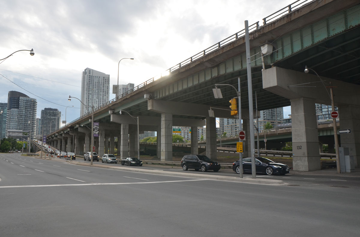
below: Still on Spadina, and still looking west, but now under the Gardiner. The space under the road is not as high as it was previously. Its lower and darker and not as inviting. It will be interesting to see what phase 2 of the Bentway development will look like in this space. I am not sure when it will to be finished but I will keep an eye on it!

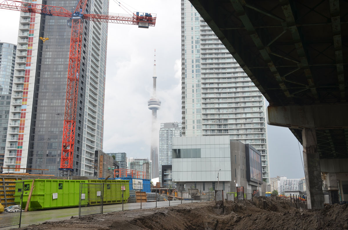
As for the eastern Gardiner, what does that look like? Well, that’s a whole other blog post!
Project: Under Gardiner On this site you’ll find detailed maps and diagrams of this area as well as information about the plans for the various sections of the space.
