


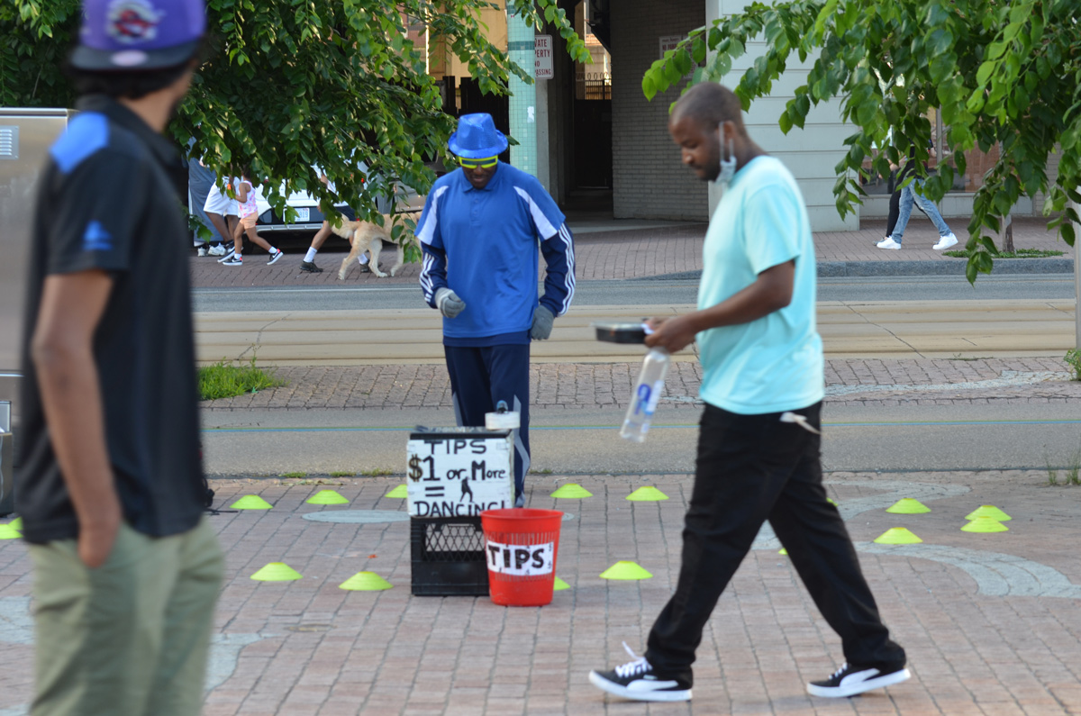
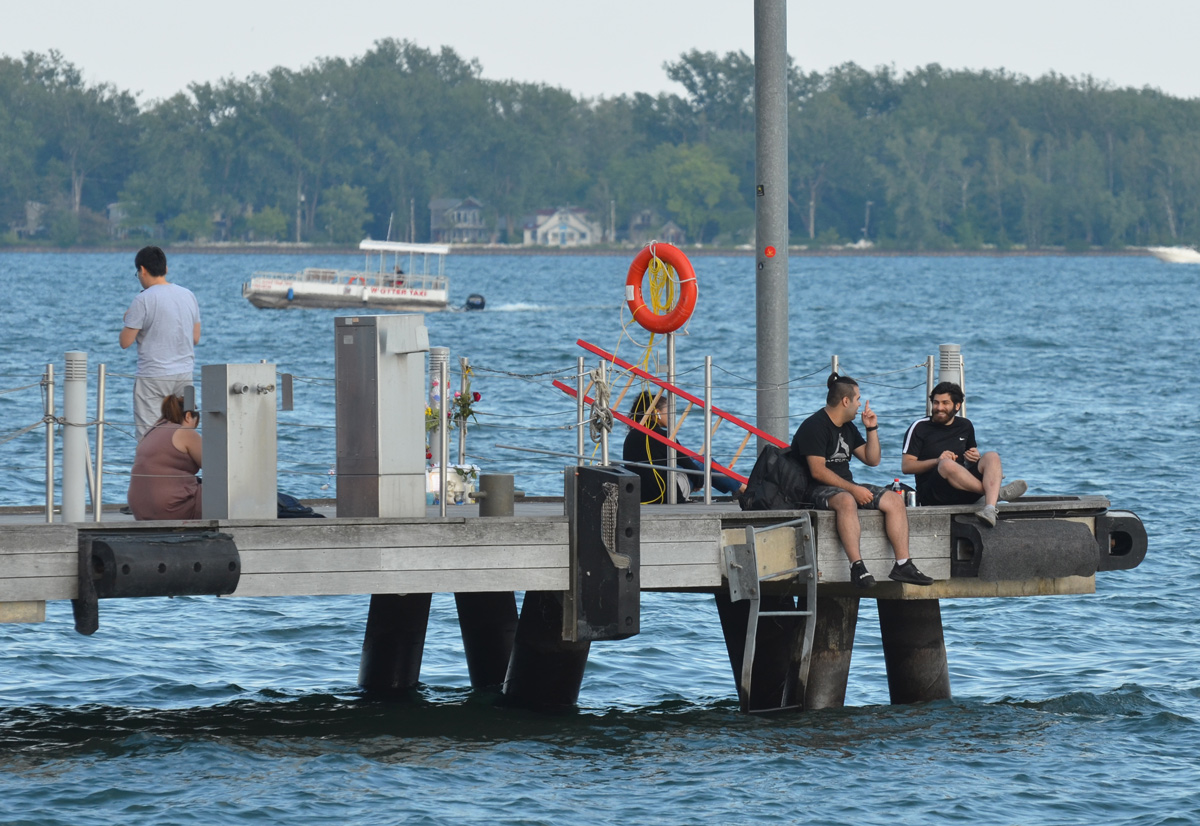
a cooler evening on the waterfront


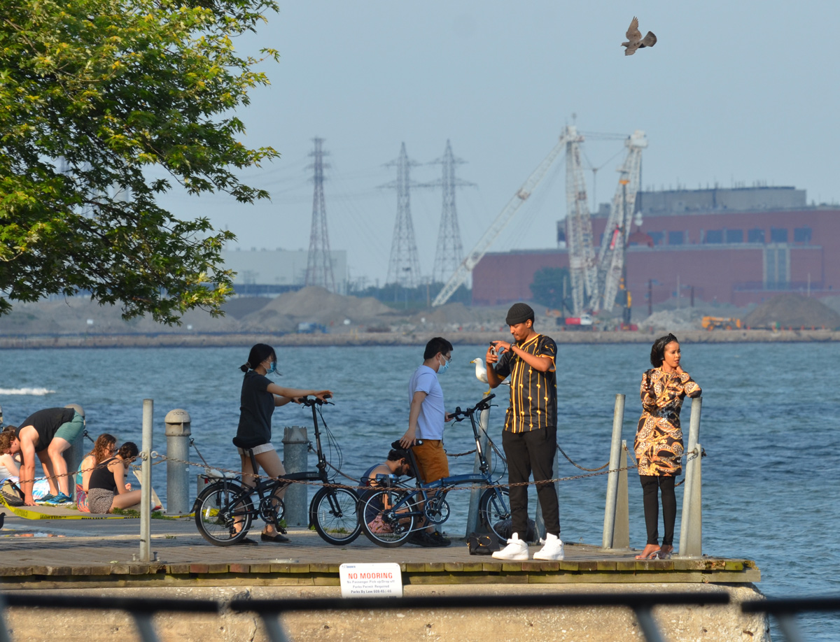
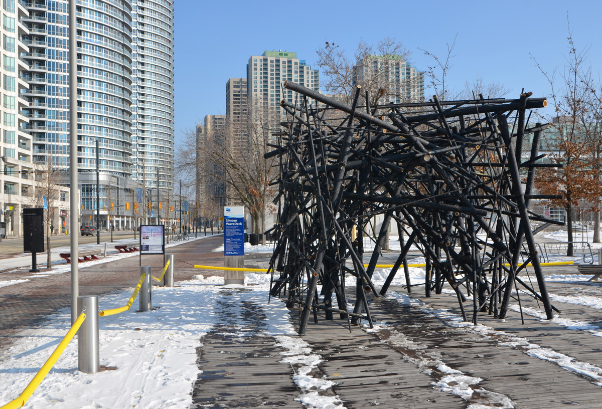
below: Simcoe Wave Deck


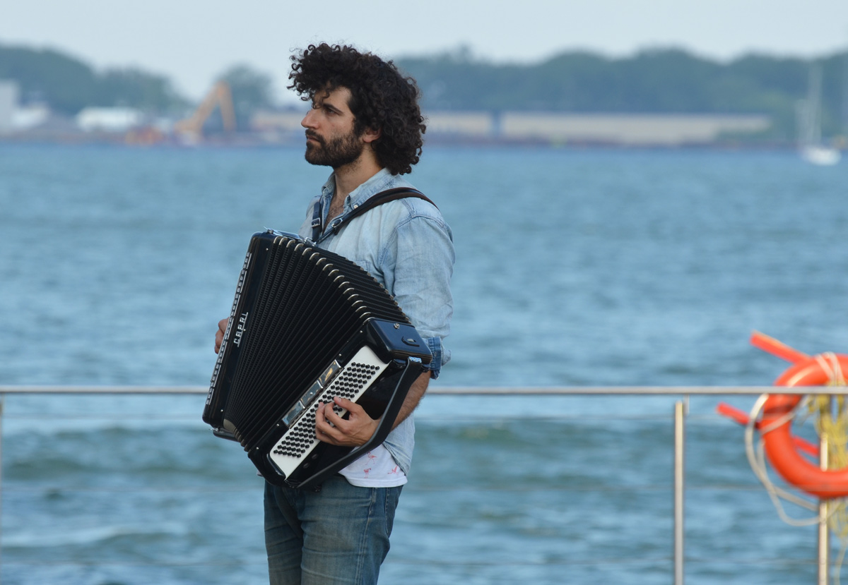
below: Joseph Landau, accordion player
below: Queens Quay traffic – take care! Cyclists (and pedestrians) don’t always see or obey their traffic signals!


below: Simcoe Wave Deck
below: Joseph Landau, accordion player
below: Queens Quay traffic – take care! Cyclists (and pedestrians) don’t always see or obey their traffic signals!
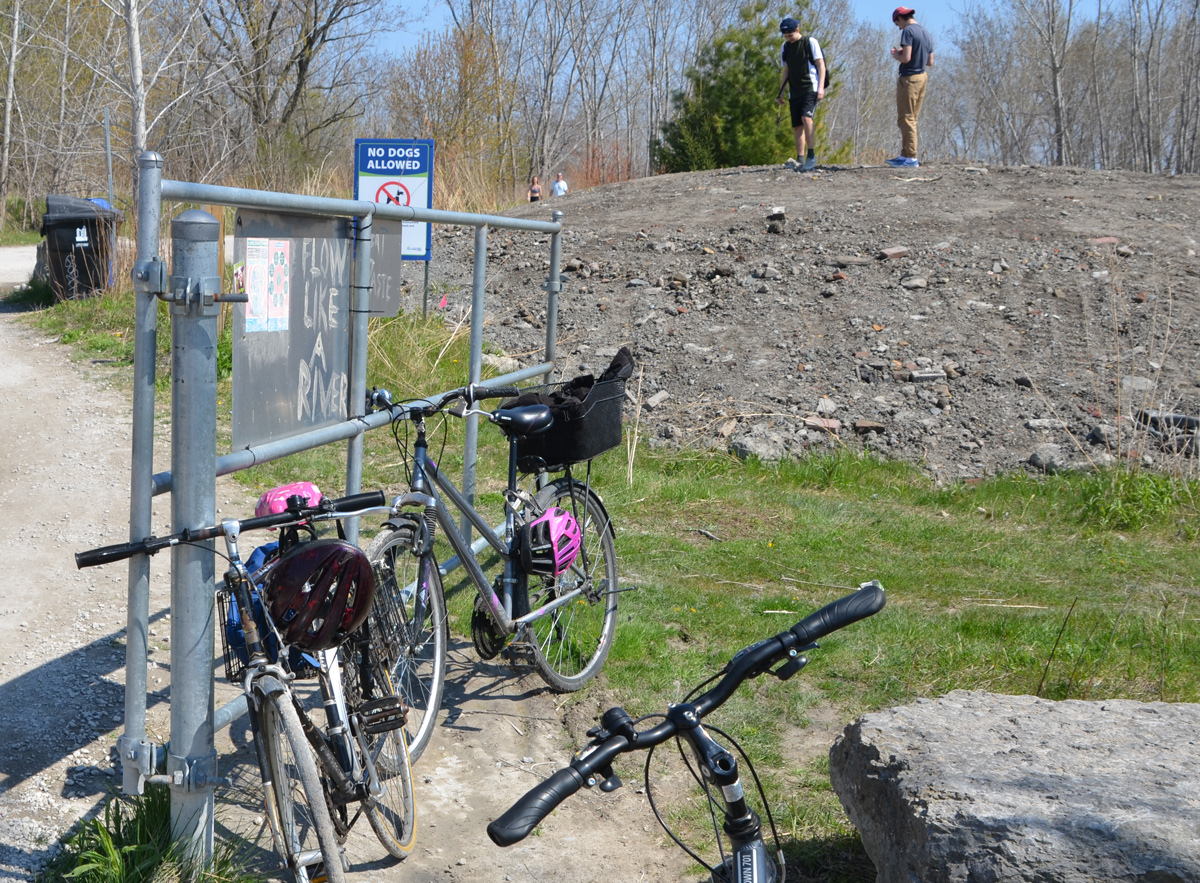
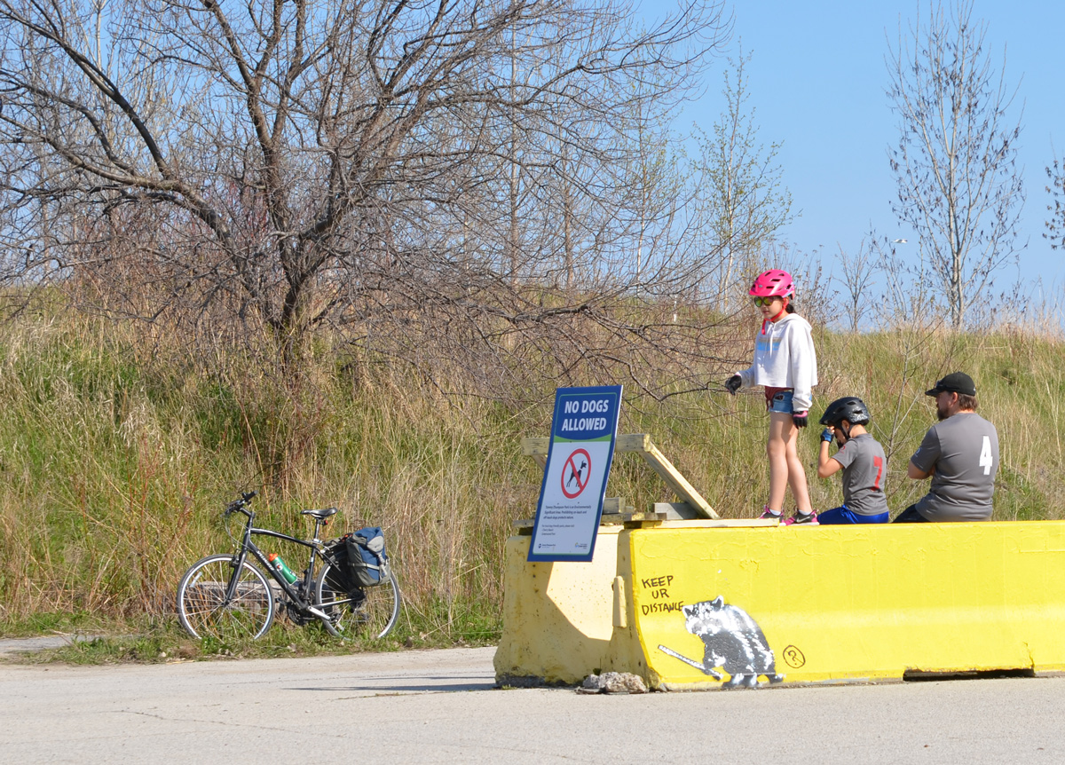
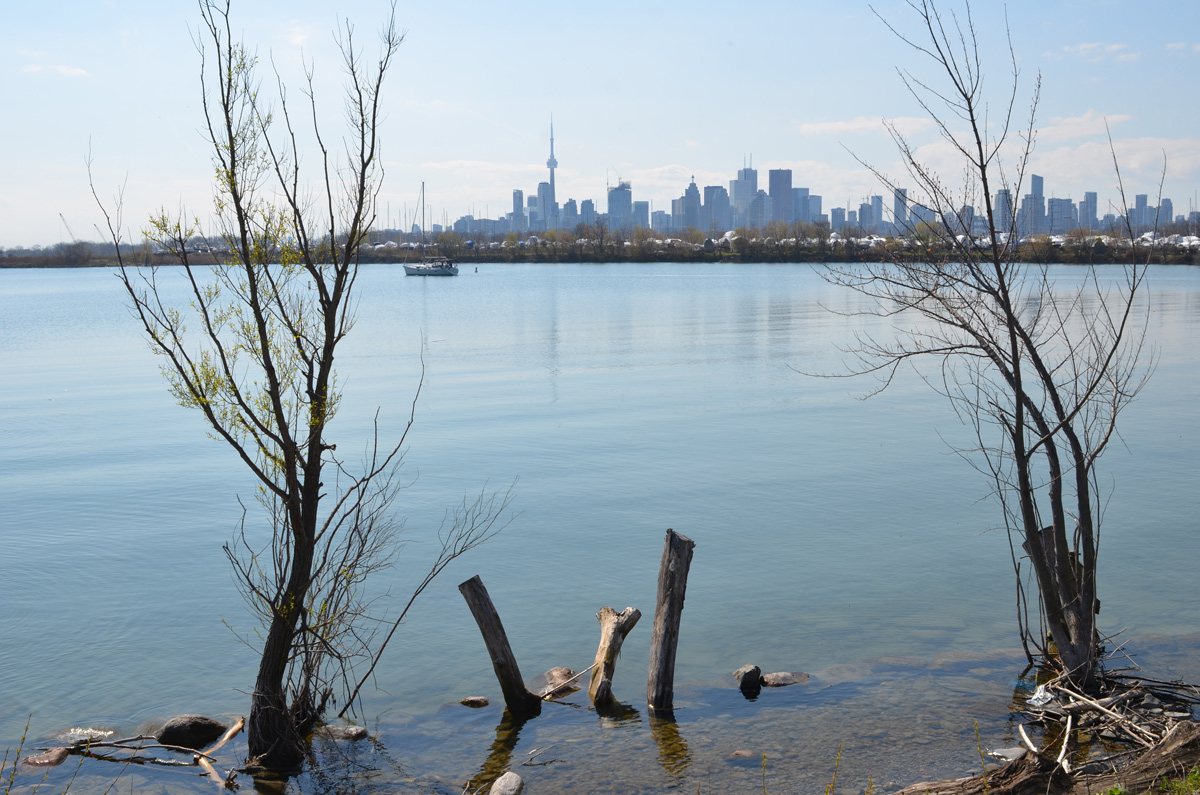
A long weekend in May (Two Four Weekend) + the first sunny warm day in a while + two months of “shelter in place” = people out enjoying Tommy Thompson Park’s trails and waterfront.

below: Flow Like a River
below: Keep ur distance

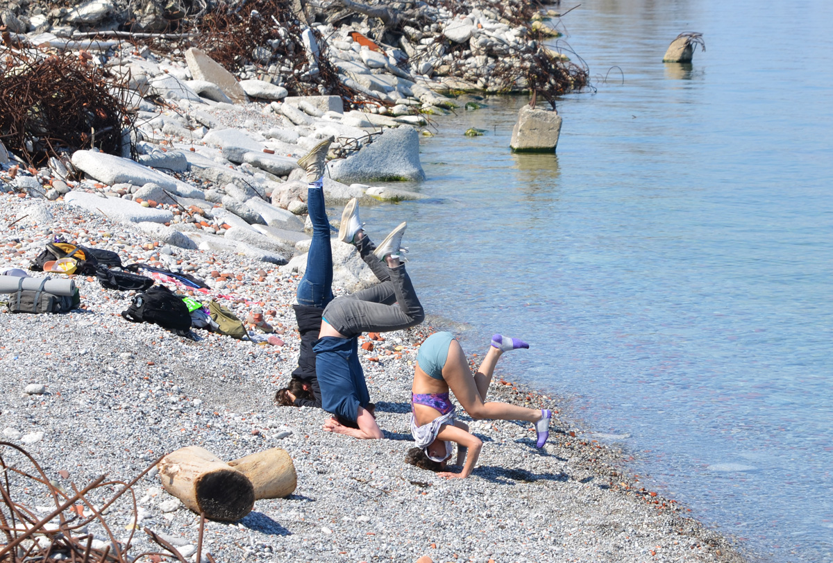
below: Three people, three positions – up tall and straight, flailing legs middle, and collapsing feet at the end. Also notable are the mounds of tangled rebar that dot the shoreline.

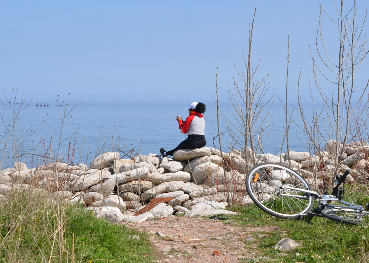
below: She’s sitting on some very rounded rocks that have been shaped by the waves and water. Are they chunks of man-made concrete and not the more solid rocks formed by nature?
The park has come a long way since construction of the Leslie Street Spit started in 1959. In the beginning, it was to be an area for “port related activities”. In the early 1970s, it was decided that Toronto didn’t need an expanded port. Since 1973, the focus has been on developing the area as a park but keeping as much “wilderness” as possible. If you are interested in the history of Tommy Thompson Park, they have an excellent website with aerial pictures that show how the park has grown.

below: Nature slowly takes over, and the piles of rubble and construction waste that were used to help build the foundations of the park become grown over and buried.

below: Late afternoon fishermen on their way in.

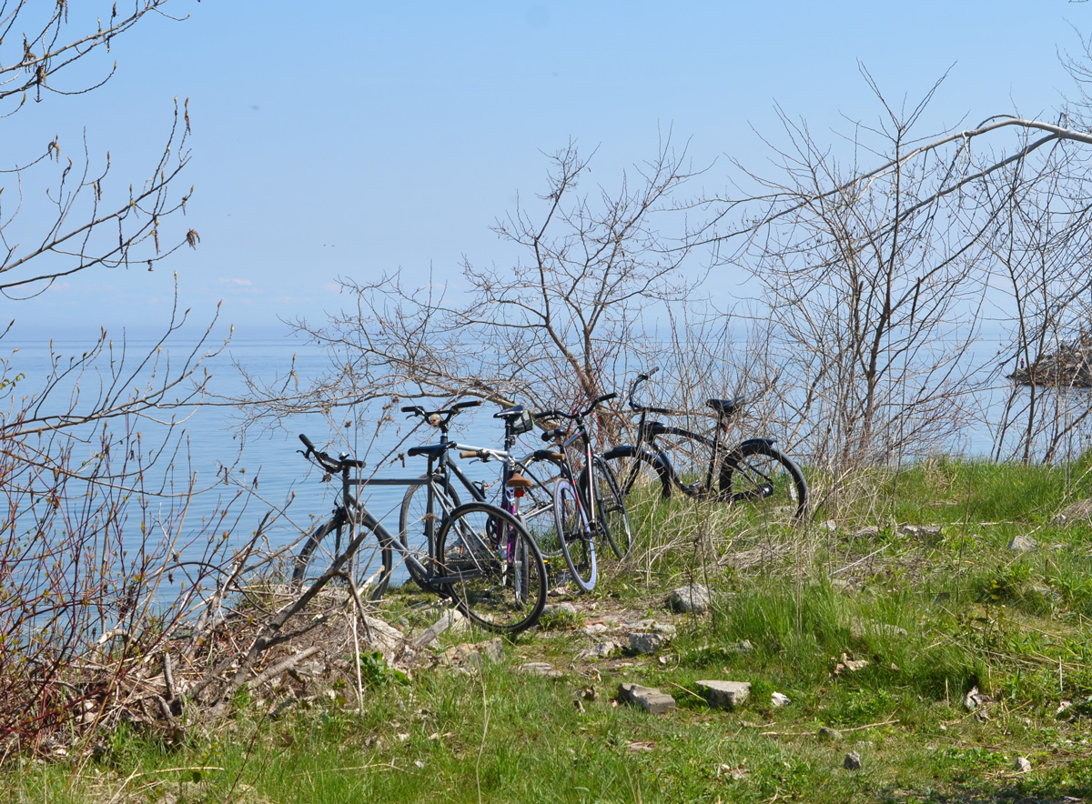
below: If you look closely, you might see that one of the bikes has a bell in the shape of a skull with red eyes.

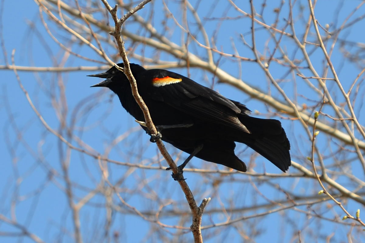
below: There were lots of noisy redwing blackbirds as well as many other kinds of birds – orioles, grosbeaks, goldfinches, robins, warblers, swallows, and sparrows. During spring migration, up to 300 different species can be seen here.


below: Construction on the east side of the park. This is the Ashbridges Bay Treatment Plant Landform Project scheduled to be finished in 2025. Three shore connected breakwaters and a headland/beach system are being constructed.

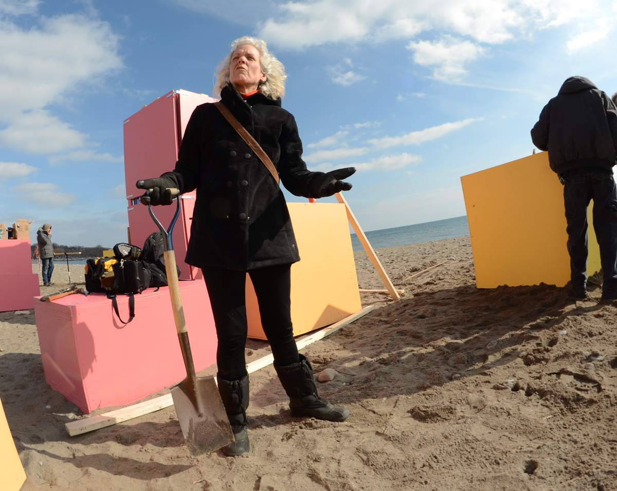
This is the 6th annual Winter Stations art installation event at Woodbine Beach. It was officially opened on Family Day, February17th.
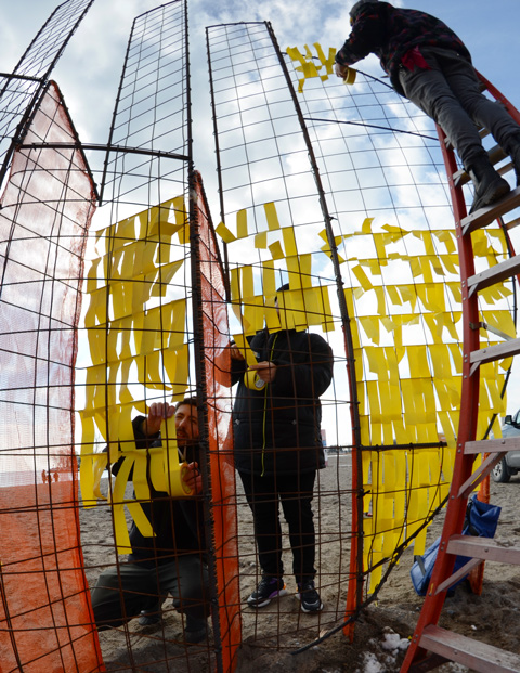
below: Tying yellow ribbons on the yellow metal frame in “Mirage”, designed by Cristina Vega and Pablo Losa Fontangordo. The orange frame is parallel to the lake and the yellow sections are perpendicular. Depending on where you are standing, you see either a red transparent sun setting or a light and bright rising sun laying on the horizon.

below: The end product. There is now graffiti on the boxes

below: and cowbells hung from the underside of boxes in a couple of places.
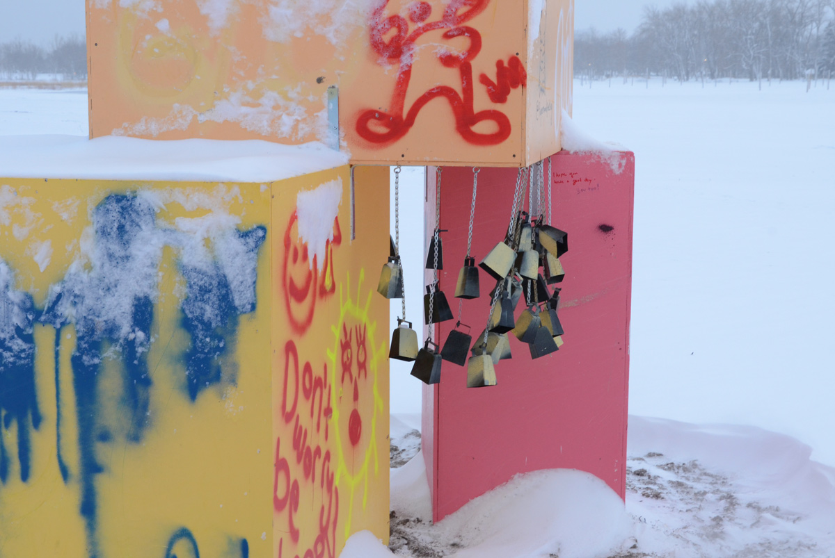


below: When I returned to the beach a few days later, the installation was gone.

Information about the installations can be found at winterstations.com
It’s been a while since I posted here mostly because I’ve been away. But I’m back in Toronto and back to walking. The other day didn’t start as planned! A locked gate stood in my way.

Shortly after, I saw a sign …. I’m not sure that it references locked gates specifically, but at the minimum it’s a reminder to remain flexible.

As anyone Canadian city dweller knows, winter in the city rarely means white snow – the brown slush quickly takes over. Here, at Spadina and Queens Quay, the road has been painted red to alert drivers to the fact that this is a streetcar lane.

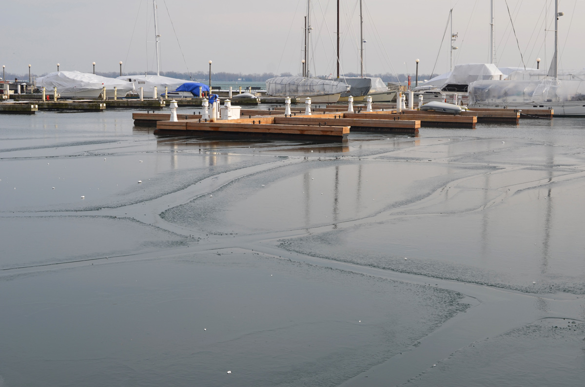
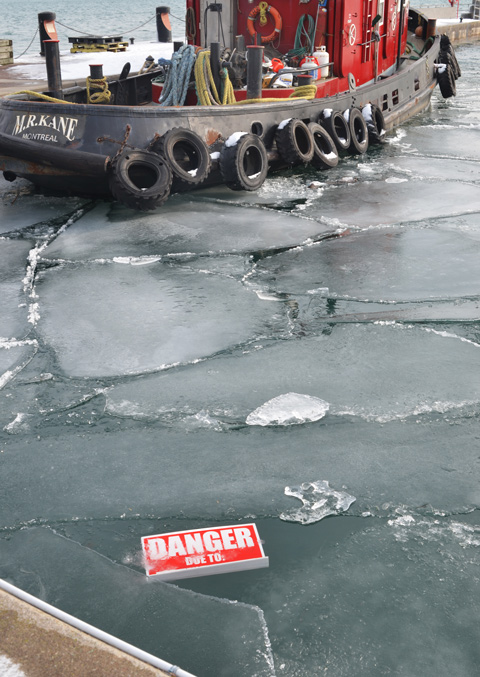
Lake Ontario has only begun to freeze, and only in quiet protected places. The first part of January was warmer than usual. Even as I type this it is raining and all the snow is melting. There probably isn’t much of this ice left this afternoon.
below: A “Danger due to” sign that has blown in from somewhere else but is just as relevant here as it is at any construction site.
below: The Music Garden hibernating for the winter.
below: Kayaks at Harbourfront resting for the winter months.

below: The fire rescue boat was out and about the other afternoon.


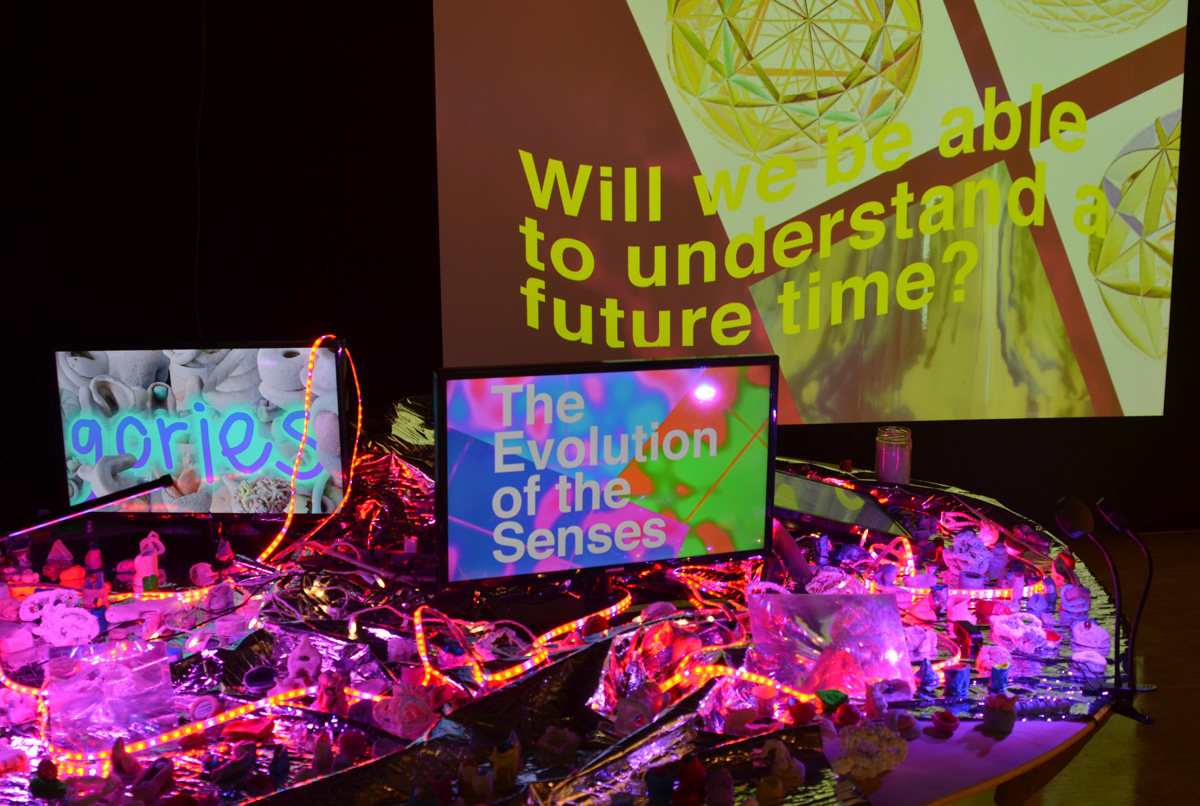
Now on at the Harbourfront Centre is “Future Retrospectives” which is a group exhibition of works by artists and designers who use the past as a lens to look at the future (until 29th March).
below: The coloured shapes with the words, are the work of Hannah Claus. They hang on a clear background so the installation on the wall behind shows through (also the work of Hannah Claus). In fact, the two go together. At first I thought the coloured shapes represented tombstones but in fact they are a replica of the plaque on Hochelaga Rock. This rock commemorates the village and people encountered by Jacques Cartier in 1535; it is on the McGill campus in Montreal. It is also featured in the photos on the far wall. The English words (bottom half) start with “Near here was the…”. More information.

below: Will we be able to understand a future time? Also part of Future Retrospectives.
below: Timeless. Eternity. Waiting for the bus.

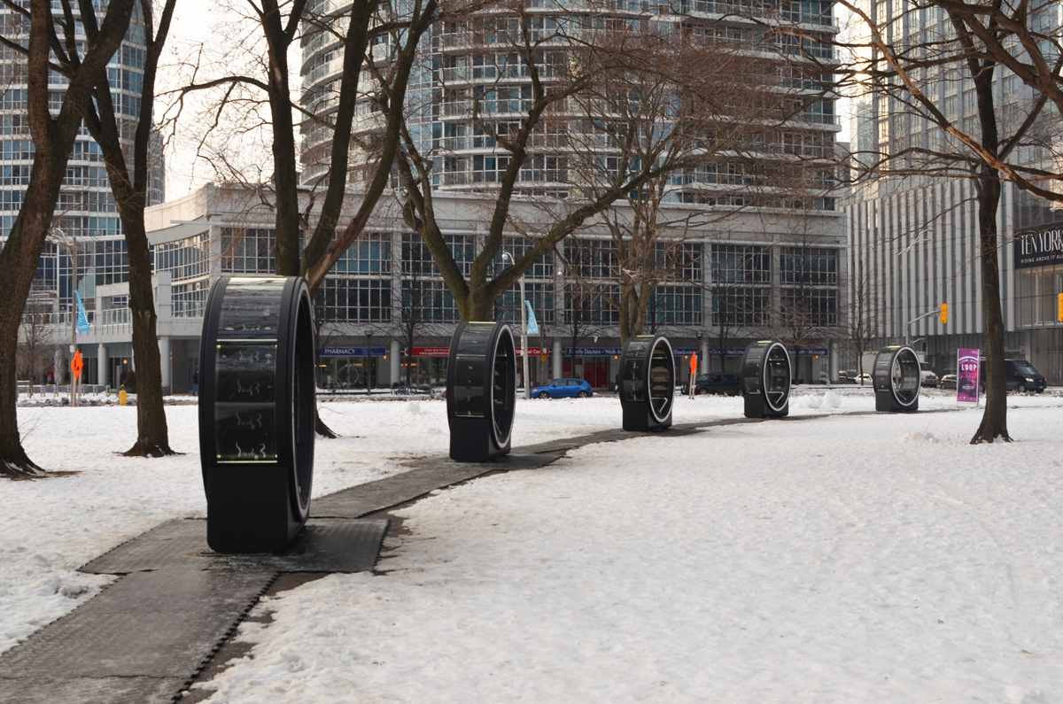
below: This is ‘Loop’ an interactive “Winter Station” public art installation. In past years, there have been 5 or 6 different art installations along Queens Quay as part of the Winter Station project. This year, there is just this one which is located at York Street Park. The circles are large enough for two people to sit face to face. There is a metal bar which can then be moved back and forth between the pair. This movement makes an inner circle spin and activates some lights. It is the creation of Olivier Girouard ; it is scheduled to remain here until the 9th of February.
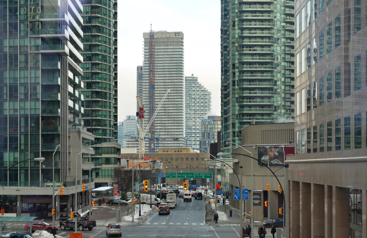
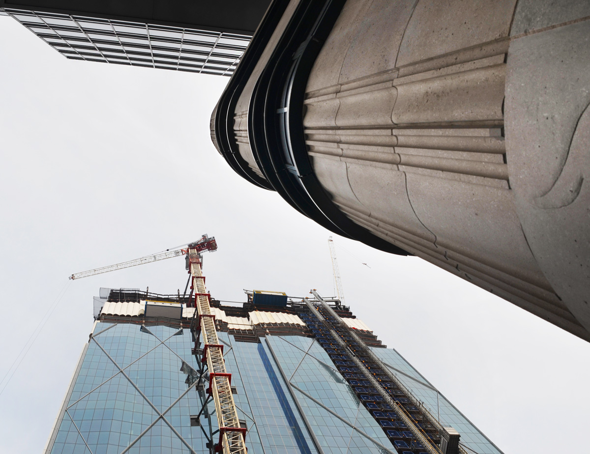
below: Harbour Street, looking east towards Yonge Street from the elevated walkway that runs north from WaterPark Place, over the Lakeshore and under the Gardiner.
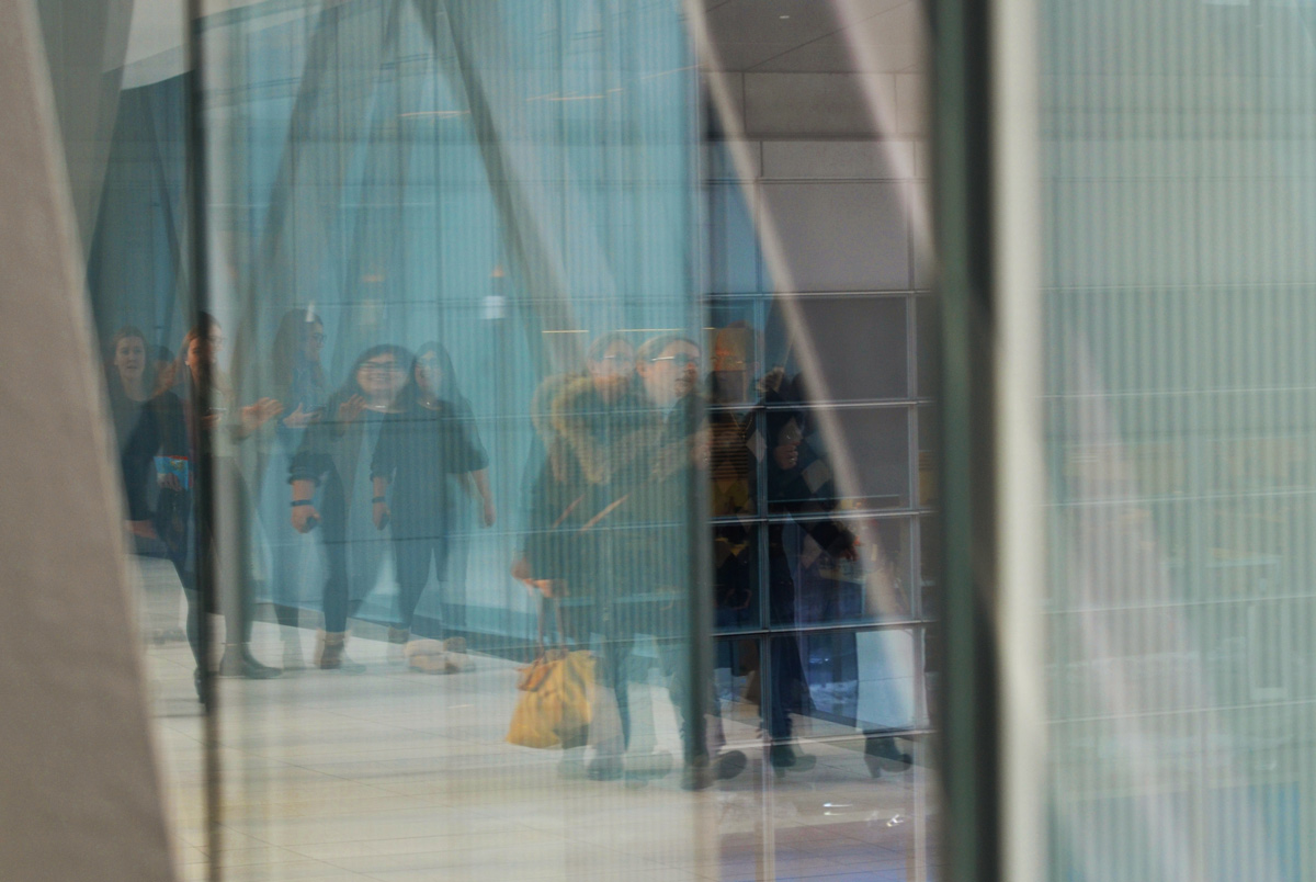
below: Reflections on the walkway.
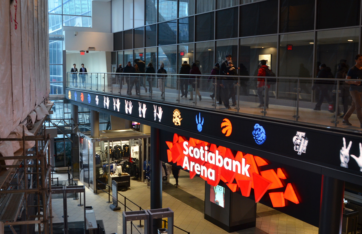
below: After passing under the Gardiner, the walkway wraps around the west side of the second floor of the Scotiabank Arena (originally the ACC).
below: The south entrance to Union Station, from the walkway. This is also a good view of the new glass platform over Union Station (train shed roof?) – this is something that I need to check out in more detail.

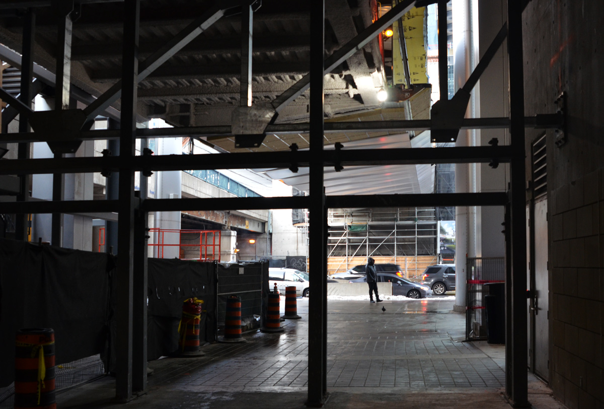
below: Also under renovation is the Bay Street exit of the Scotiabank Arena. A new walkway between it and the building being constructed across the street is almost complete. It is on the same level as, and immediately beside, the railway tracks. This walkway will connect to the new Union Station bus terminal
below: Exit onto Bay Street and look up! Upward. And to the future…. wherever that leads us.
I’d heard that there were some Christmas lights brightening up the sky at Kew Beach. What I didn’t know then was that this is now an annual tradition; it was started by DeClute Real Estate in 2007. Since there was still some daylight left, I started my walk at Woodbine Beach, a bit west of Kew.

below: Small waves crash over the rocks at the shore.

below: Leuty Lifeguard Station closed up for the winter.

below: Ready to run


below: Once I got to the Kew Beach boardwalk I discovered that there are other reminders that it is now December. And what could be more appropriate than some Christmas decorations to add some cheer ? Pine and poinsettias on a bench.

below: Bright red ribbons tied around a small tree.

below: Shiny Christmas ornaments hanging from branches and a wreath on a tree trunk.

below: More signs that Christmas is soon – Some of the trees along the bike path and boardwalk at Kew Beach have been decorated with Christmas lights. As the daylight begins to fade, the Christmas lights become more noticeable.

below: Looking back towards the city as the sun goes down.

below: The mood and atmosphere of the beach changes as it gets dark outside. The light shining on the Muskoka chairs highlights the pink and green colours and almost makes the chairs look translucent.


The lights remain until well into the New Year. More information can be found on the Light Up the Beach website.

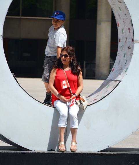
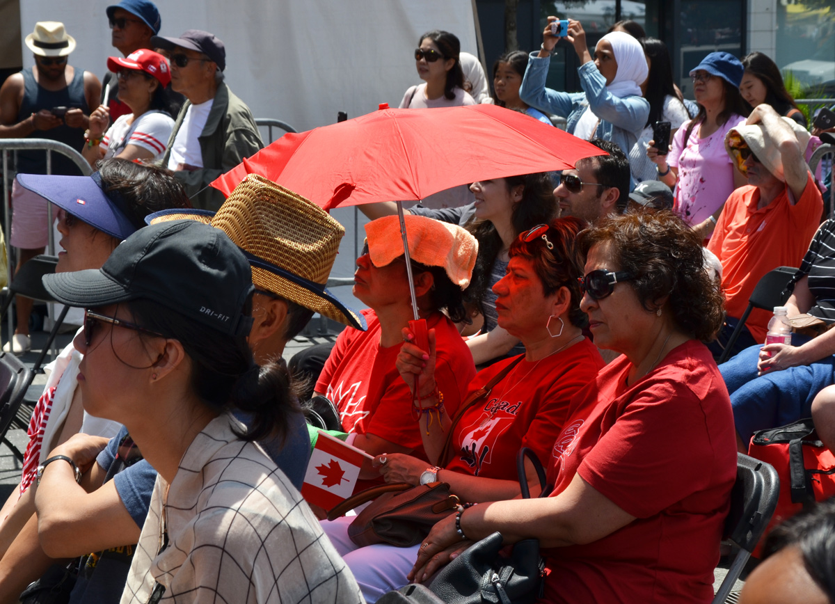
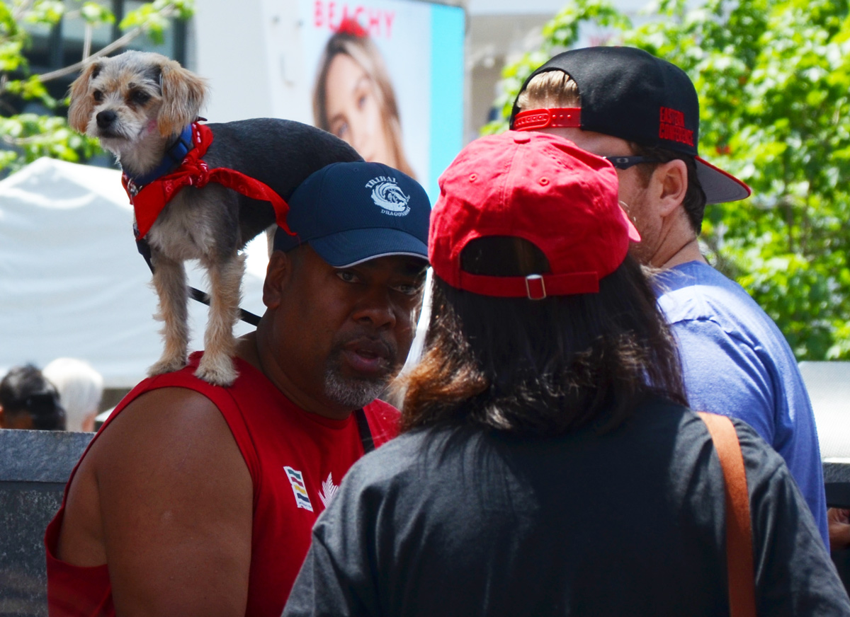
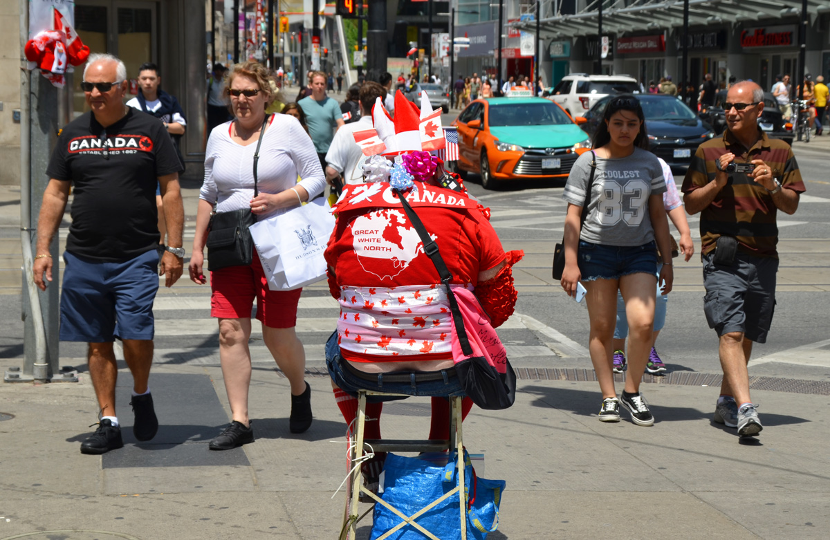
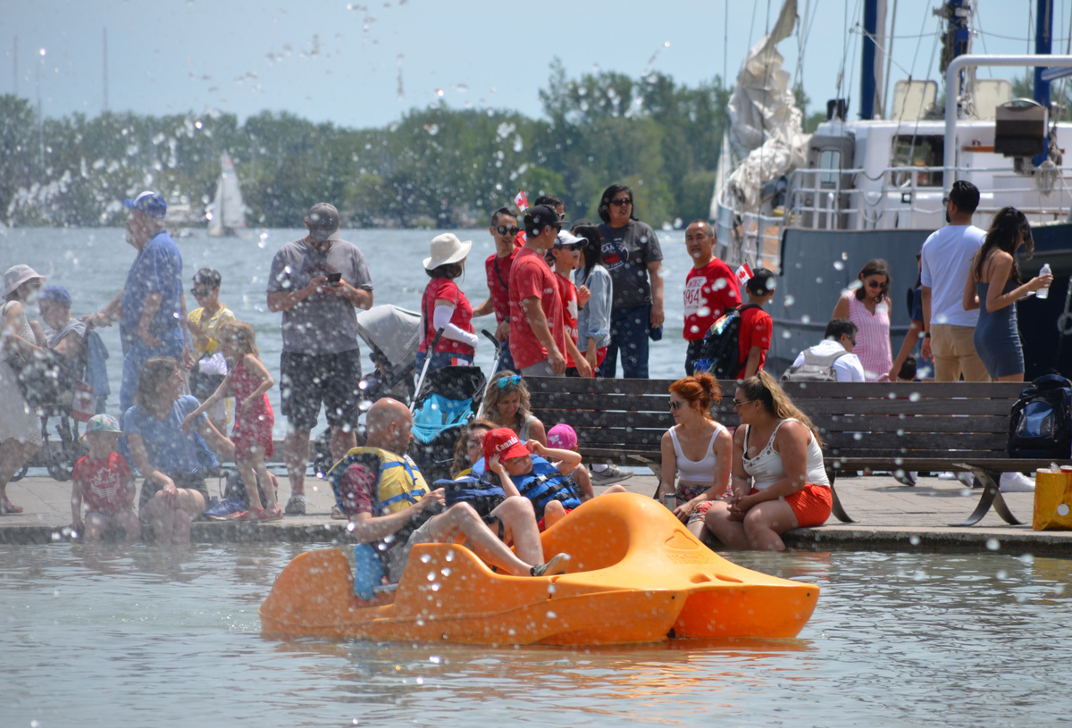
below: Canada Day merchandise for sale at Yonge Dundas Square


below: Great sign! We’re on a picnic because Doug Ford is out to lunch!


below: A Canada flag in a heart, face paint to celebrate the day.


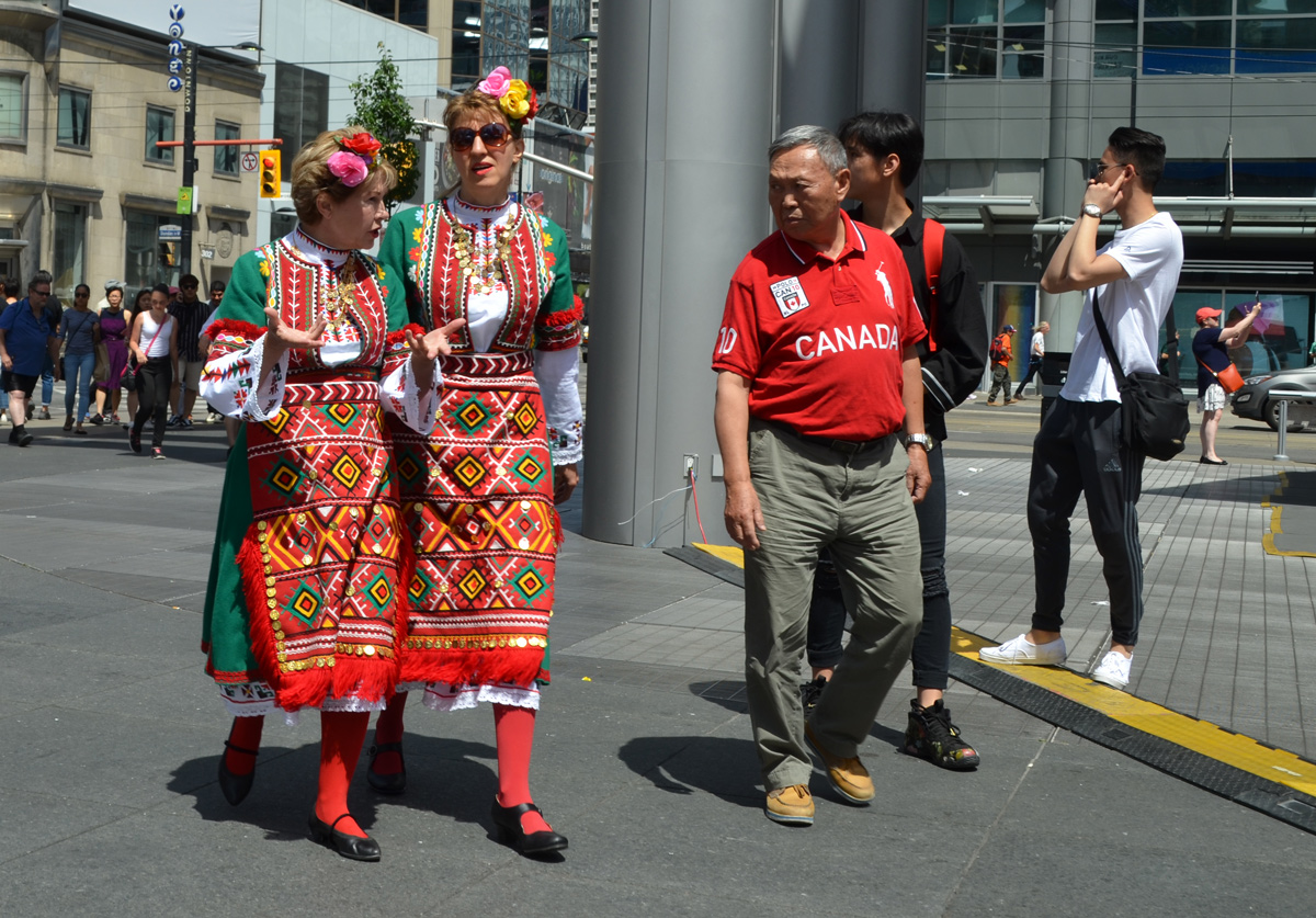
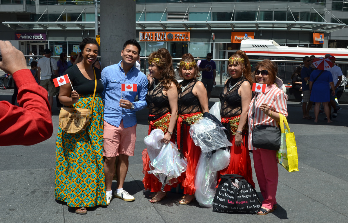
below: Under a red umbrella. There were quite a few performances at Yonge Dundas square, all of which were celebrations by different ethnic groups.

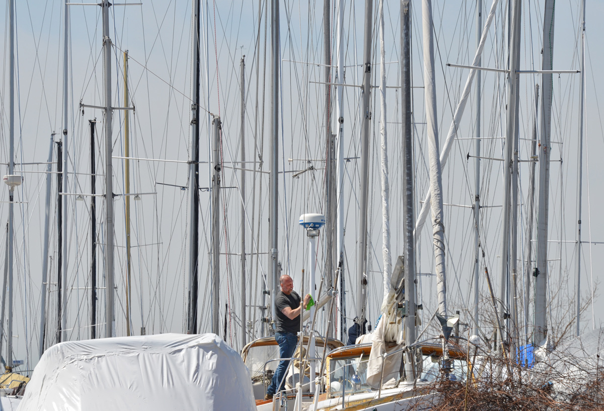
Getting ready for spring. RCYC (Royal Canadian Yacht Club) is nearby.
There are a few changes happening down at the Port Lands.
below: Aerial view of the present configuration of the Keating Channel, Don River, and part of the port lands beside a drawing of the planned changes. Rerouting the Don River will create an island, Villiers Island.
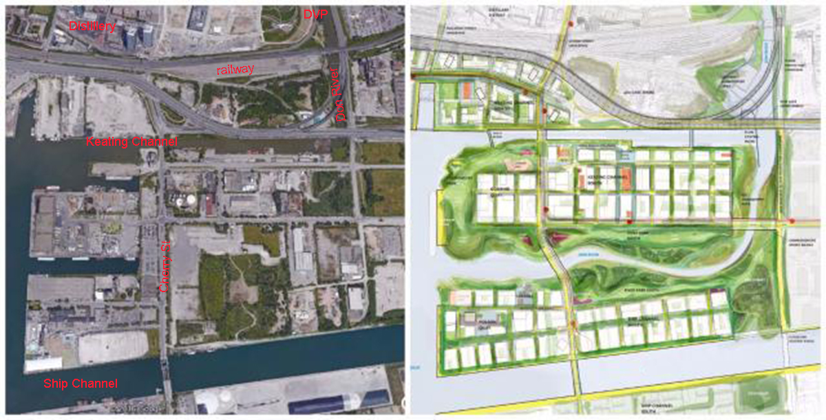
In the 1880s, the lower part of the Don south of the former Winchester St. bridge (just north of Gerrard St) was straightened and the mouth of the river was placed in a channel to create additional harbour space and industrial dock space for boats in what is known as the Port Lands. This project was called the Don Improvement Project. The Don River now empties into the inner harbour through the Keating Channel. Lakeshore Blvd passes over the very south end of the river and because of its height (very low), boats can not enter the Don River. Boats may still enter the Keating Channel by going underneath a lift bridge at Cherry St. The straightening of the Lower Don also allowed for construction of the railway line parallel to it.
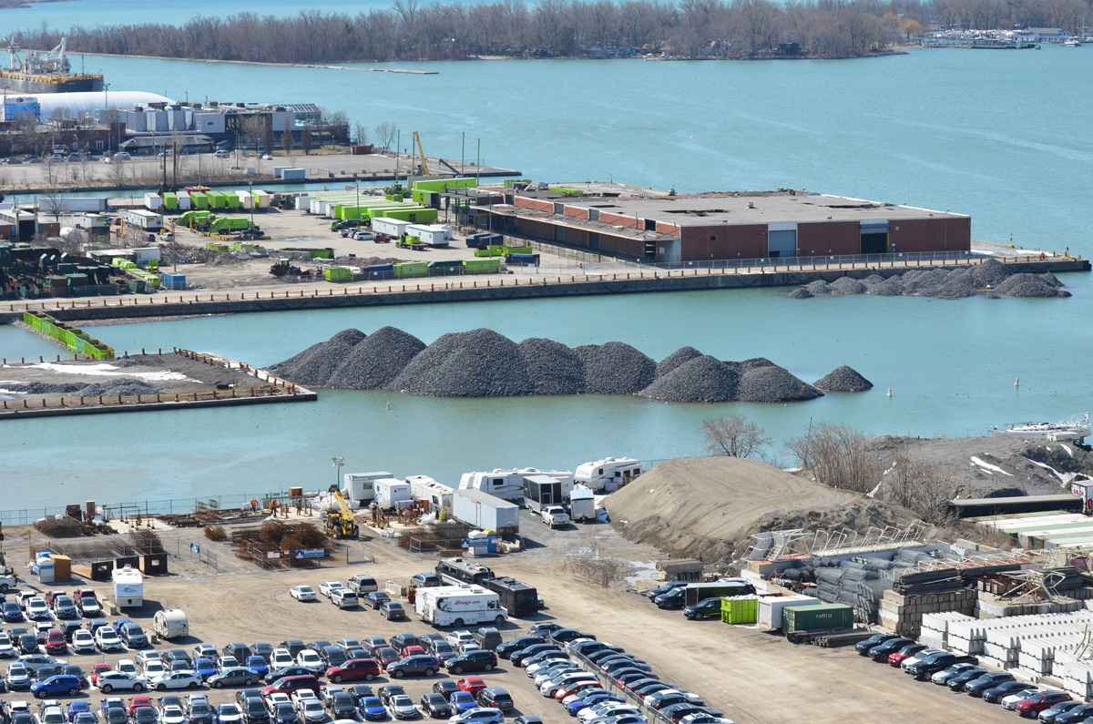
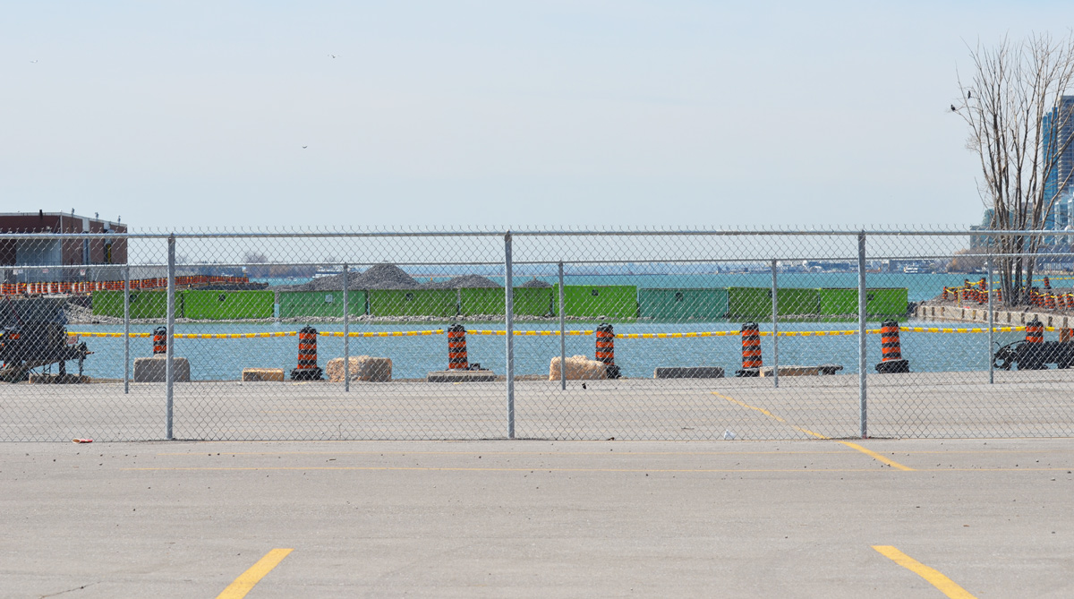
below: The cars are parked on vacant land between Lakeshore Blvd and Lake Ontario/Keating Channel. Mounds of gravel have been dumped off the end of Essroc Quay and beside Keating Channel. You might also have noticed the nine green bins that have been laid across the water (very left side of the photo). They too are full of gravel. These are part of the beginning of the renovations of the port lands. The Keating Channel will remain, but the area south of it is slated to be changed. In the middle is the GFL (garbage collection) transfer station. The low reddish brown building was a recycling facility. It was the site of a fire a few months back and most of the south end sustained substantial damage.
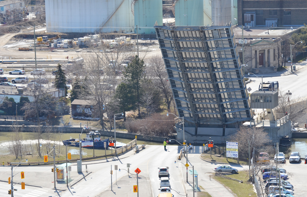
Access to the western portion of the port lands is via the Cherry Street bridge.

below: Here it is being lifted to allow a boat to pass through the Keating Channel. This bridge was built in 1968 and is at least the fourth bridge at this location.
below: In 1900 a wood swing bridge was built with just a single railway track that was operated by the Grand Trunk Railway. There are still remnants of the tracks that serviced the industries located in the area.

below: Two steel drawbridges were subsequently built here, one in 1912 and one in 1932. This is a circa 1915 photo of the lift bridge at Cherry Street.
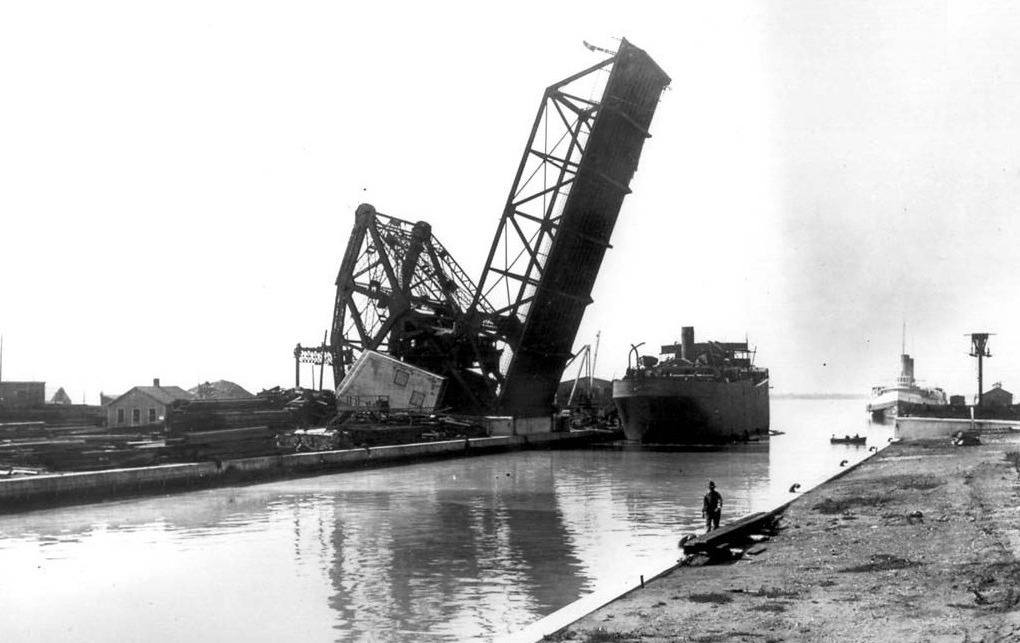
source: Originally from the Toronto Archives but found on Wikipedia
The plans for the redevelopment of this area show that the south end of Cherry Street will be moved to west of its present location – the jog in Cherry where it joins the Lakeshore for a short distance will be eliminated.
below: This is a close up shot of Essroc Quay at approximately the new location of the new Cherry Street bridge. The Keating Channel is in the foreground. This quay, and the water channel behind it, will be turned into wetlands and parkland. Essroc is a landfilled pier and is publicly owned as is Cousins Quay (the one behind it with the GFL transfer station).

below: A new fence too.
below: Looking across Essroc Quay to the Toronto skyline

There are many reasons for rerouting the Don River. The Port Lands are no longer used by many industries, land use has changed. As the city grows and changes, this area has become prime real estate but it is also a flood plain. Before any development can occur, flood control measures need to be taken. The Cherry Street Stormwater and Lakefilling project will stabilize the local shoreline, protect land from flooding, and create a new landmass to begin the re-naturalization of the Don River’s mouth. The river would be re-routed through the middle of the Lower Don Lands between the Keating Channel and the Ship Channel. The area being filled will become part of ‘Promontory Park’, a new major green space across the harbour from Toronto’s skyline.
The project will also allow for a realignment of Cherry Street so that it no longer merges with Lakeshore for a short distance. At the moment, the Cherry street and Lakeshore Blvd intersection is problematic, especially for pedestrians. Once upon a time there wasn’t much reason for people to walk there I guess. Now, if you are on the wrong side (the west side) of Cherry street, you get stranded at Lakeshore.

The Keating Channel isn’t exactly beautiful. Lakeshore Blvd and the Gardiner Expressway run along the north shore of the channel. There has been discussion & debate about the fate of these roads but so far nothing has changed. Will they demolish this section of the elevated Gardiner? Or won’t they? (Probably not).
below: The very south end of the Don River at the moment. Not much to get excited about is it? It looks like there is work being done under the bridge? (something’s happening there but I don’t know what). Hopefully it will look better in a few years.

The Ship Channel is south of the proposed changes described above.
below: Piles of salt on the south side of Ship Channel. These arrive by ship. The old Hearn Generating Station is in the background.


And south of it all, Cherry Beach.

More info on the Cherry Street Stormwater and Lakefilling project
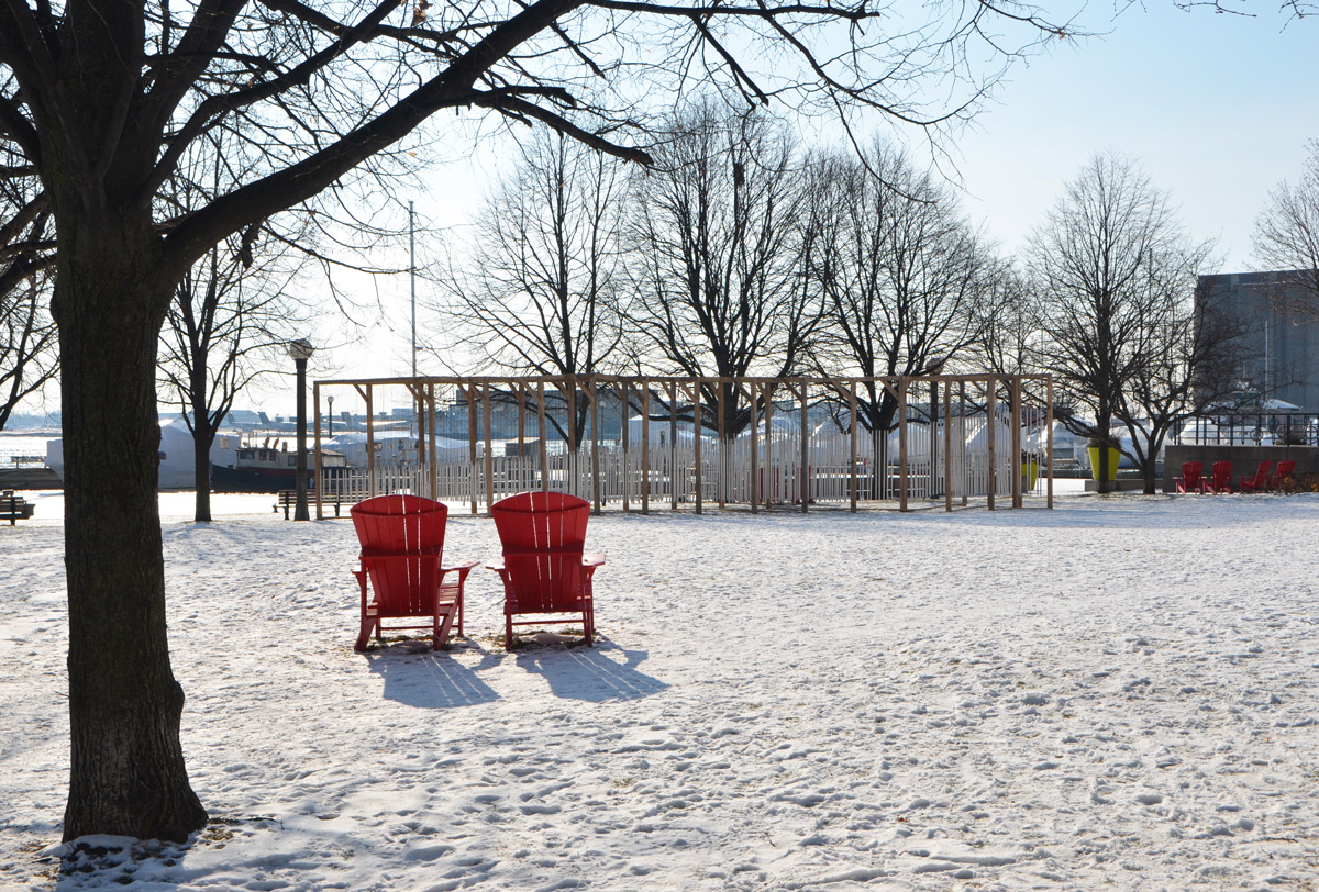
Ice Breakers returned to the Toronto waterfront once again last month. In mid-January five interactive art installations were built along Queens Quay West between the Harbourfront Centre in the east and the Music Garden in the west.
below: Appropriate for a space called the Music Garden, is a large structure supporting many wind chimes. This is “Ensemble” by Joao Araujo Sousa and Joana Correia Silva of Portugal.

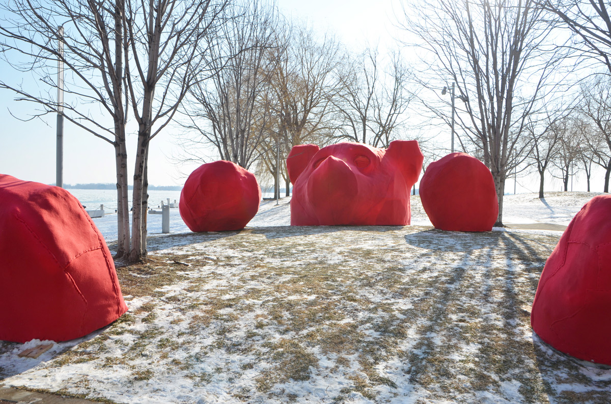
There are two installations in H2O Park.
below: On the west side of the park is “Winter Fanfare” by Thena Tak of Vancouver. It is made from painted layers of wood. After I had walked past this installation I happened to look back to see a group of boys using these wood forms as protection as they had a snow ball fight.

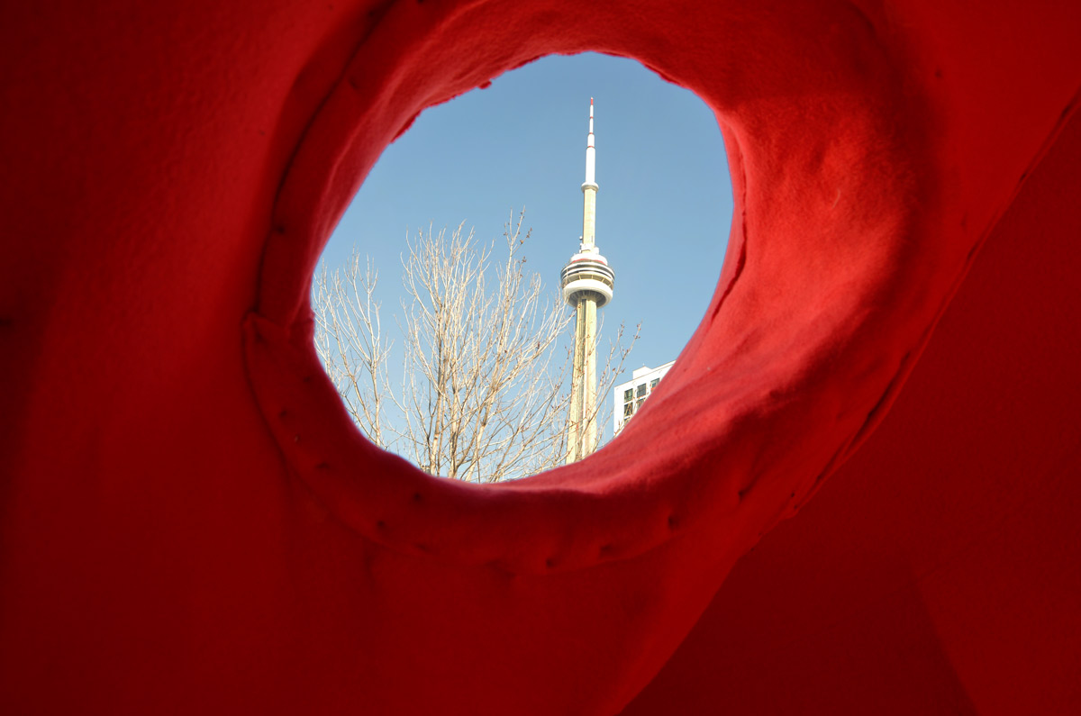
below: Also in H2O park is “Through the Eyes of the Bear”. This giant bear, or rather parts of a bear, is the creation of Tanya Goertzen of Calgary.
below: The large head of the bear is open at the back. With a little crouching you can go inside and look out through the bear’s eyes. It’s got a great view of the CN Tower!
below: Close to the Simcoe Wave Deck (at the bottom of Simcoe Street) is a structure called “Black Bamboo” that you can walk through. It was designed by Bennet Marburger and Ji Zhang of China.
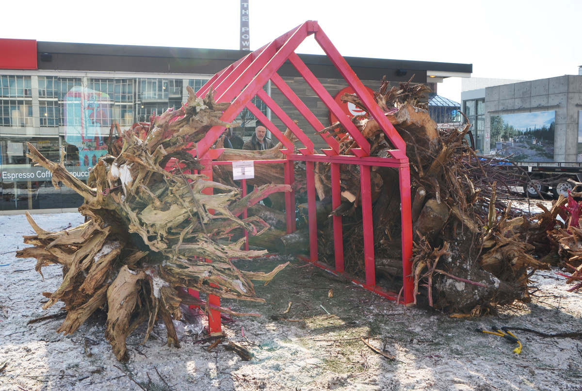
below: Last is “Root Cabin”, a small hut constructed from large tree roots. The day that I walked past these Ice Breakers was early on when they weren’t quite complete. The roots were being arranged, like a puzzle being put together. The pink frame was being used as a guide and the plan was to remove it once the roots were in place. This installation was designed by Liz Wreford and Peter Sampson from Winnipeg.
For more information, Ice Breakers
These installations remain until the 25th of February.
Maybe you thought that the duck was a waste of money or maybe you thought the duck was a fantastic idea. Maybe you didn’t like the duck because it wasn’t Canadian enough for a Canada Day celebration (the Canaduck!) or maybe you didn’t care about such things. It certainly generated a lot of discussion even before it arrived – who hasn’t heard about the duck? Who didn’t have an opinion about the duck? It spawned the hashtag #whattheduck, a play on WTF.
The noise has now all died down. The 150th birthday party is over.
I don’t think that I am alone in thinking that the duck was the star of the Redpath Waterfront Festival and that the festival organizers have no regrets about spending the money on the duck.
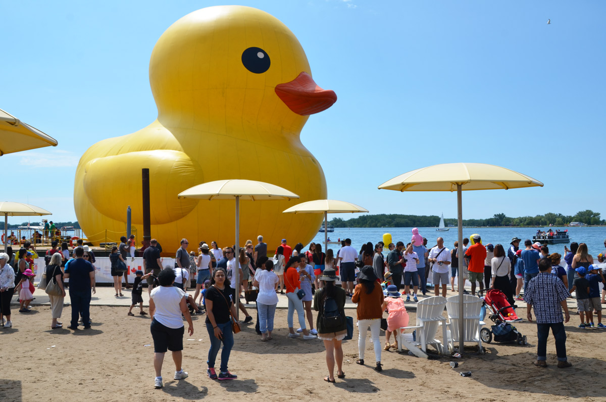
below: The yellow duck was moored by HTO beach (that’s the one with the yellow umbrellas) for the duration of the July 1st long weekend. It smiled through rain and shine.

below: It was a popular duck and it attracted about a million people. People of all ages. It was about 6 storeys tall so even if you couldn’t get close to it, you could still get a good view.

below: Millions of photos were taken with (and of) the duck. It was a willing subject and it stayed still – it was good at holding a pose. The trick was to get a selfie that didn’t have lots of other people in it! He was a bit grubby – maybe too big for a bathtub? – but no one cared.

below: Not everyone was excited to see the duck!

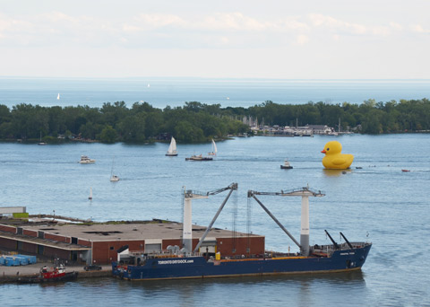
below: One last look at the duck. On Monday evening the duck was towed across Toronto Harbour to the Port Lands where it was deflated and readied to be sent to Owen Sound for the next port of call on its Ontario tour.
The water levels in Lake Ontario are higher than normal this spring – some beaches are under water and a large percent of the Toronto Islands are flooded. In front of the Power Plant Art Gallery the water level is even with with the concrete walkway… but not high enough to deter people from enjoying the waterfront this past weekend.
It seems appropriate that the artwork on the exterior wall (facing the lake) of the Power Plant features an image of water – white crested waves on a large lake. The piece is “Bound, Hupfield 2017” by Maria Hupfield; it is 19 feet high and 31 feet wide. The central image is a seascape painted by the artist’s mother, Peggy Miller, many years ago. It is being wrapped (unwrapped?) with grey felt-like material.
Is it a treasured artwork that is being readied for storage?
Is it a painful memory that is being covered up to be forgotten?
Is it a family heirloom that is being brought out for someone to admire?


If you are interested in more information about Maria Hupfield, check the CONTACT website.
“Objects contain meanings beyond their materiality, meanings that we bring to them or receive from them. Objects are the result of an action, entail a trace of a human gesture, and trigger reactions and memories. They have the potential to be read collectively or personally. In her artistic practice, Maria Hupfield reveals the interrelational potential triggered by objects between humans or cultural environments.”
