Posts Tagged ‘housing’

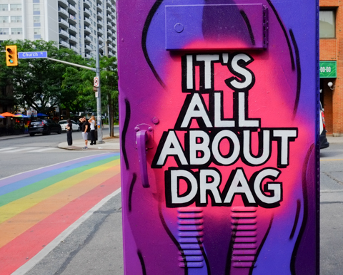
a little bit of Church Street, on the run…..

And of course, a lot of in-between too.  A bit of a random walk south from Bloor on Sherbourne, Jarvis, and Church.  A zigzagging walk through four neighbourhoods.

  But first, coffee!  De Mello Coffee on Bloor has mirrors under their counter and it makes for some strange scenes.


inside a coffee shop, de mello coffee, counter has mirror below so that reflections of backs of people sitting are seen from the waist down

below: In the lobby of Postmedia Place on Bloor Street there is this sculpture – three people reading newspapers.

statue, sculpture, in post-media news building lobby, a group of 3 people reading, 2 sharing a bench, and one boy lying on the ground.

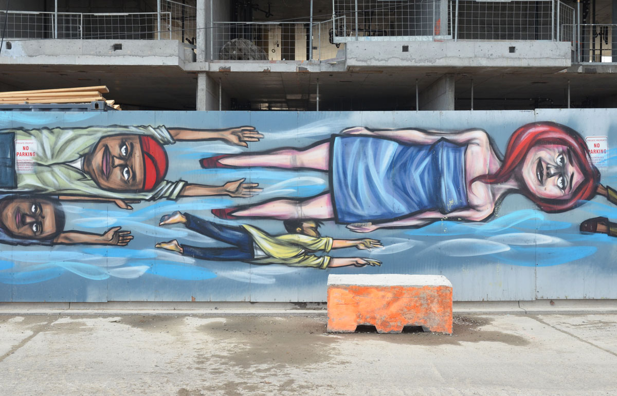
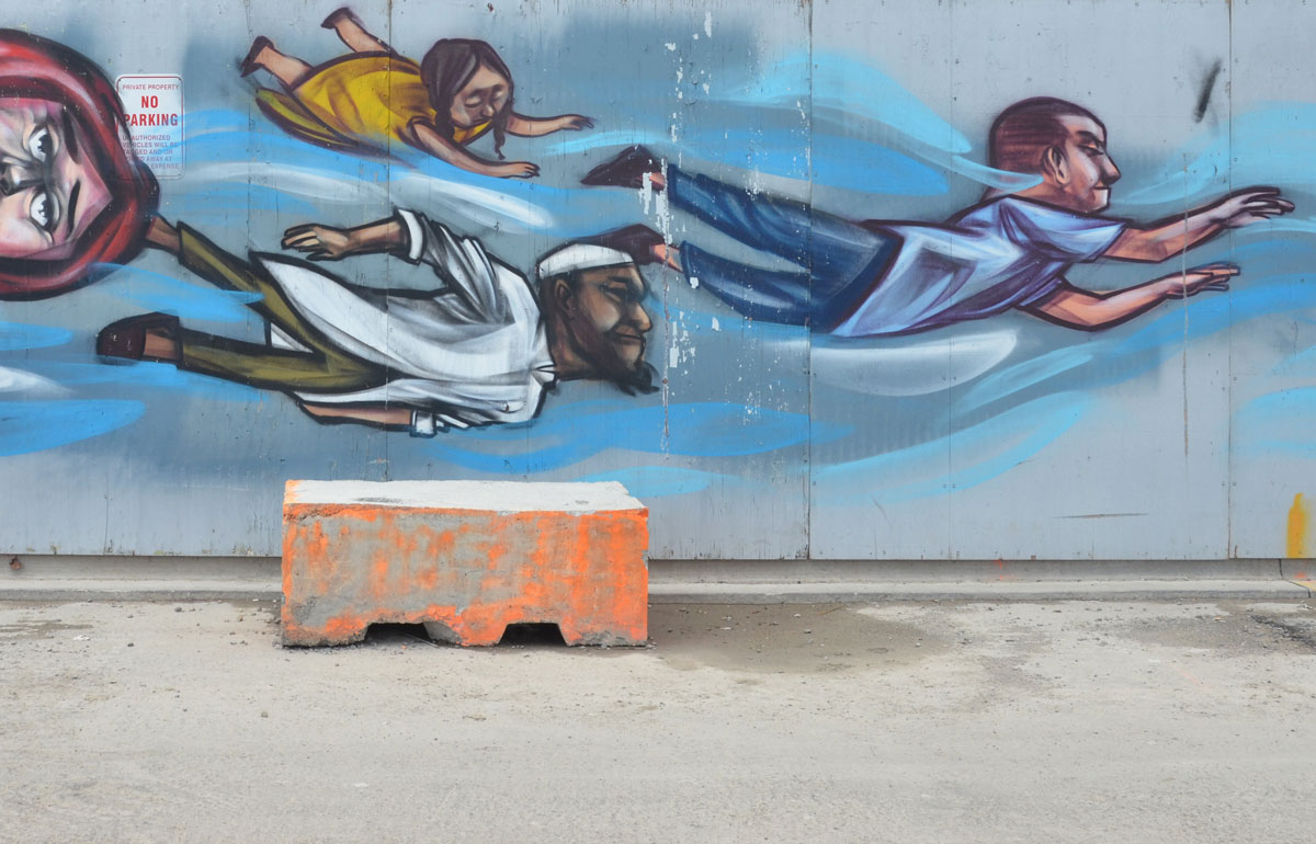
below: I found not one, but two, anser faces of unknown vintage in an alley just west of Sherbourne

anser graffiti face drawn in black on a white wall in an alley

graffiti artist anser, blue line drawing of a face on a green garage door

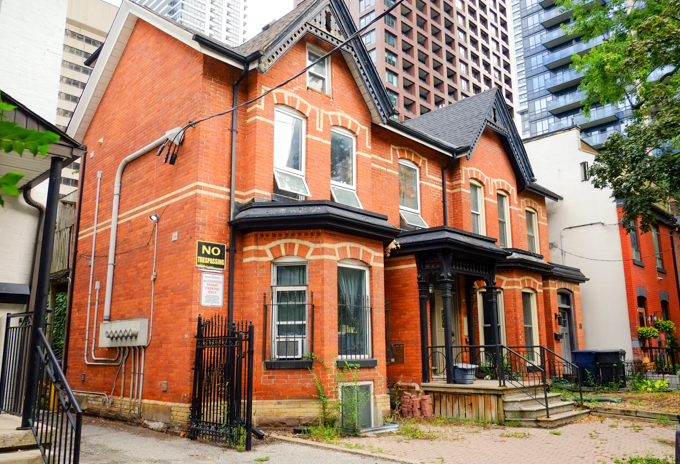
below: Upper Jarvis was neighbourhood number one that day.   The north end of Jarvis Street is at Charles Street; here Jarvis splits into Ted Rogers Way (old Jarvis Street) and Mt. Pleasant.

city of toronto street sign for bloor street east, with header of upper jarvis

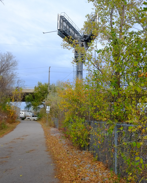
below: Looking south along Mt. Pleasant immediately south of Bloor. If you can see the covered pedestrian walkway over the street in this picture, that is where Mt. Pleasant turns slightly left and becomes Jarvis Street.

jarvis street, south of bloor, looking south

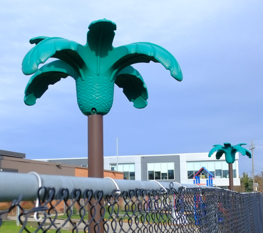
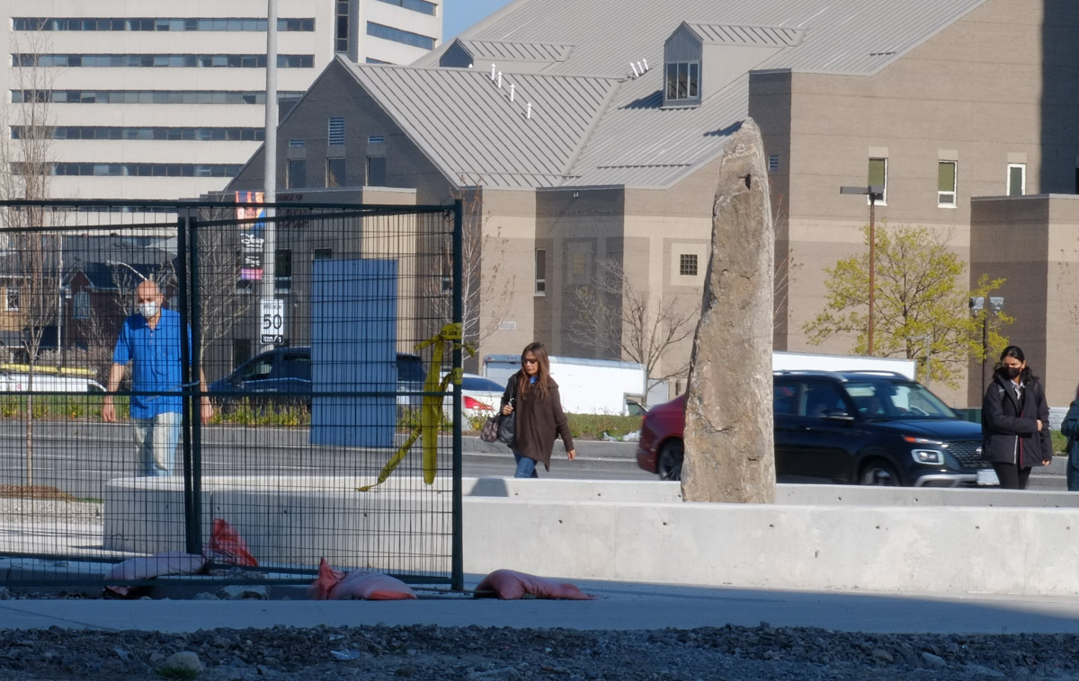
below: Ishkozi Park is a small green space on Huntley (actually on the grounds of Rogers Toronto headquarters).  The benches have been recently painted, but the large sculpture in the center has been there a while.  The walking lady in the sculpture may look familiar and you may be thinking to yourself, “Where have I seen her before?”.  The stainless steel sculpture is a giant tree and is titled ‘Red, Orange and Green’ and it was created by artist Michael Snow. …. Have you figured out why she looks familiar? … She was first spotted back in the early 1960s…..

ishkozi park on huntley street, with large metal sculpture, and rainbow painted benches


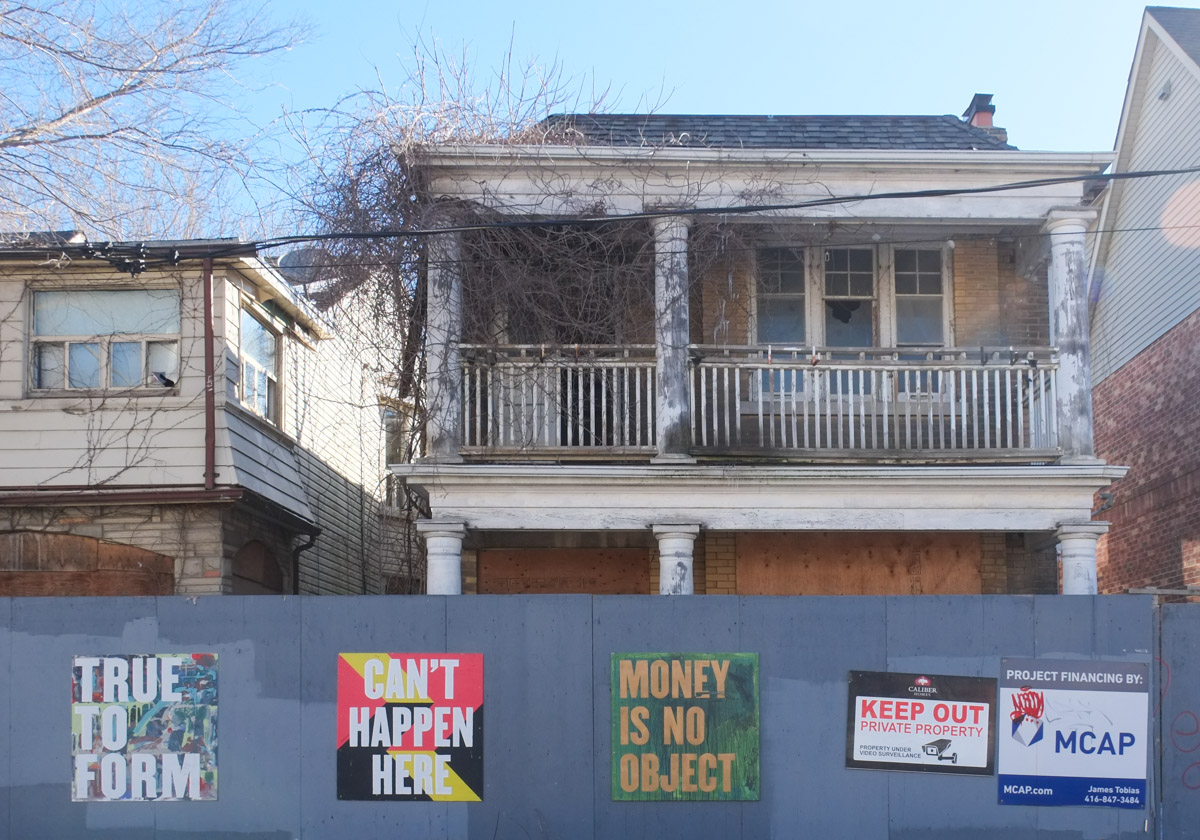
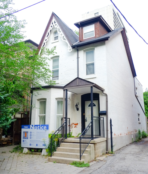
The neighbourhoods along Sherbourne and south of Bloor are other rapidly changing areas of the city. On the west, many older homes still exist but they are empty and obviously waiting demolition (or inclusion into a large condo development?).

below: Once they were a few family homes, now they are a number of smaller apartments.   Interesting brickwork.

set of 3 rowhouses, red brick, bay and gable, with taller apartment buildings and condos behind them

two older large red brick residences near Bloor and Sherbourne, three storeys each, with large newer glass and steel condo behind

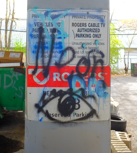
below: Another ubiquitous development notice sign – this time to inform us of a very large two tower development that involves three streets, Huntley, Linden, and Selby.  Portions of some of the older houses would be kept and the towers would be behind them.  I did not do a complete research on the planning application (21 227527 STE 13 OZ) but it seems like city council didn’t like many parts of the initial proposal back in 2021/2022.  I do not know what it’s status is now.

older white two storey house, with development notice sign on the front lawn

older brick residences on a side street near Jarvis and Bloor, with large Rogers headquarters building behind


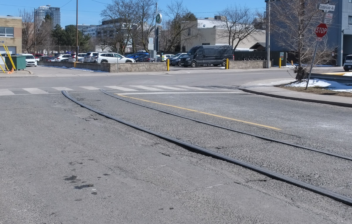
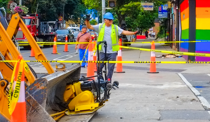
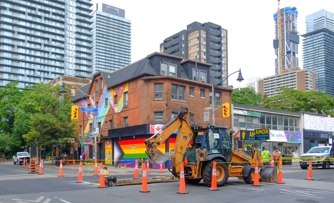
below: On the east side of Sherbourne, it is Howard Street that is torn up. This is the west side of St. James Town.

workman at a construction site

hoardings around a construction site at Howard & Sherbourne, design by Sarah Klawiter, abstract shapes that look a bit like a city scene, with trees and grass, as drawn by a child

below: A cheeseburger with a sesame seed bun!

bell on the handle bar of a bike, shaped like a cheeseburger with a sesame seed bun

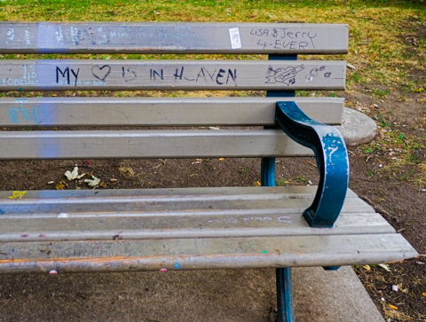
below: Someone’s heart is in heaven, but Lisa and Jerry 4-Ever!

wood park bench with graffiti, words that say my heart is in heaven, also Lisa and Jerry 4 ever

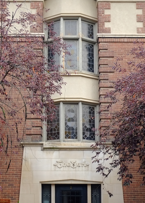
below: Jarvis & Gloucester/Earl northwest corner.  Some black, some white, and lots of grey.

apartment buildings and new highrise glass and steel condos, looking north on Jarvis, west side of the street, at Gloucester

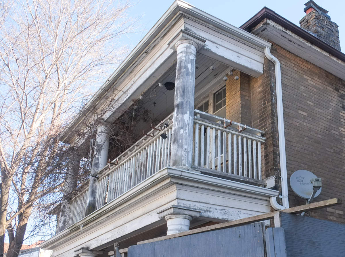
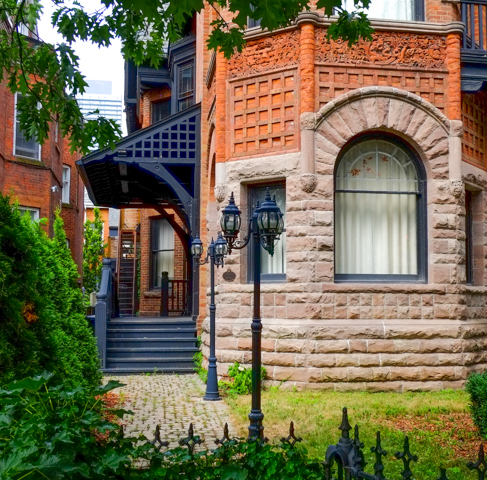
below: Fancy brick work, rounded windows, and a turret!

older brick building with fancy brick work, rounded windows, and a turret

old lamp posts by a brick building

bay windows and stone work above the entrance to the Earl, a low rise apartment building

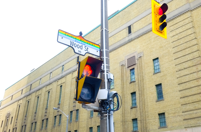
below: Church Wellesley village, neighbourhood number two.

street sign for Wood st., with header of Church Wellesley village in rainbow stripes, old Maple Leaf Gardens in the background

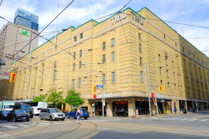
below: Once upon a time it was Maple Leaf Gardens, home to the Toronto Maple Leafs hockey team (1931-1999). Now it houses a Loblaws grocery store and TMU athletic facilities (Mattamy Athletic Centre). Northwest corner of Church and Carlton

old Maple Leaf Gardens on the northwest corner of Church and Carlton, now part Loblaws store and TMU athletic facilities

Church street side of old Maple Leaf Gardens, art deco brick work

a man sits in a TTC streetcar in downtown Toronto as another streetcar passes it, going in the opposite direction

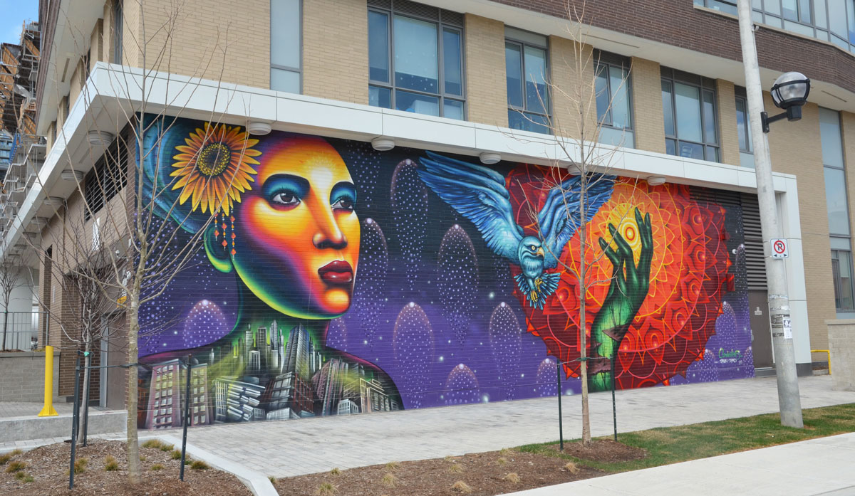
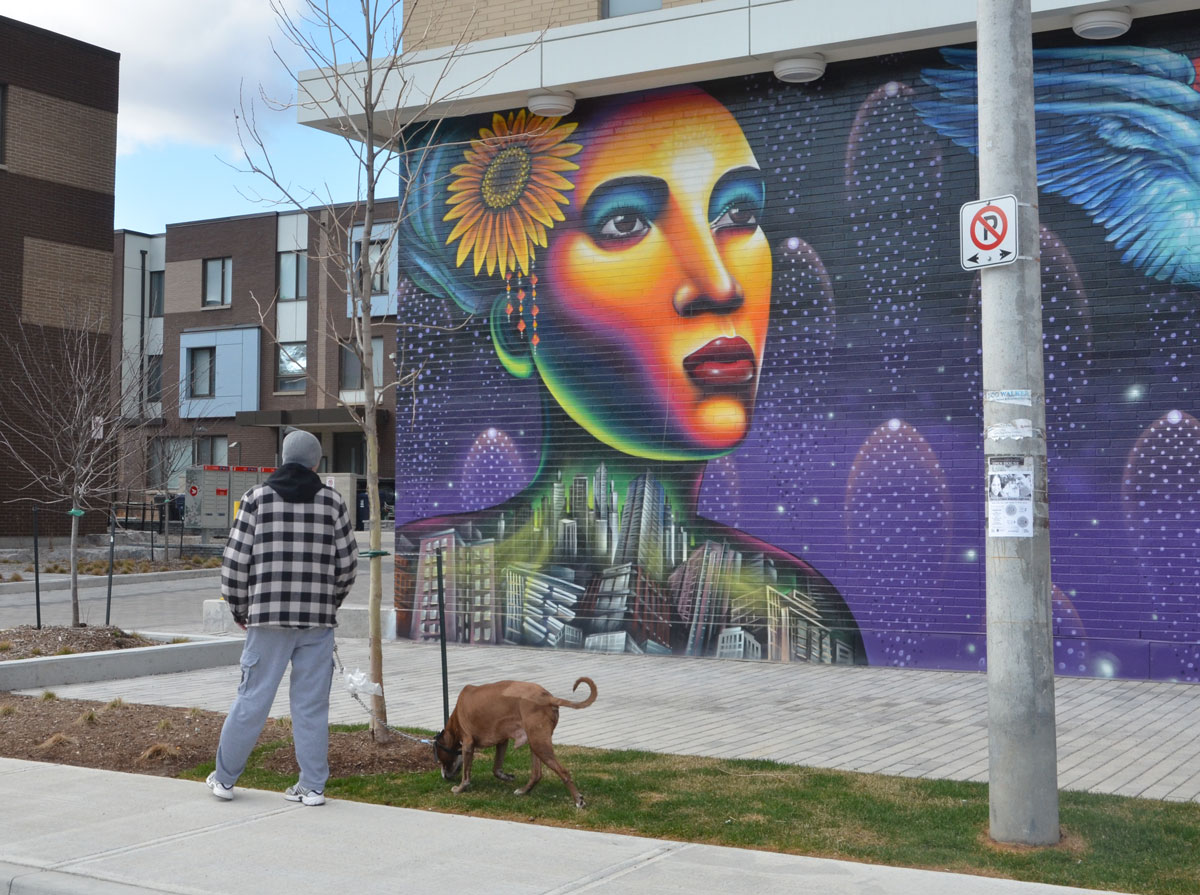
below: Lots of pink on Maitland Street.

old houses on Maitland street, now stores and businesses, one is painted bright pink with a turquoise door

below: Garden of Lost Boys – dedicated to the memory of friends and neighbours lost to the AIDS epidemic.

small statue in a garden, surrounded by flowers and flowering shrubs
metal circles for locking bikes to, painted in rd, orange, and yellow, in front of a store with a window display that says love sholdn't be bottled up

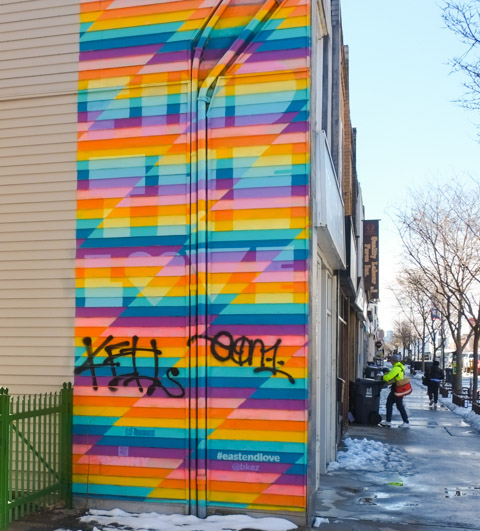
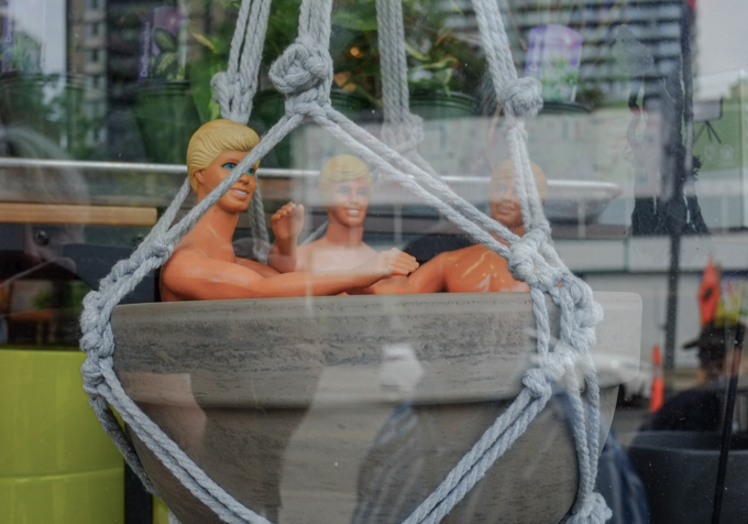
below: Hot tub macrame!!  Finally, a use for those plant hangers that you (or your mother) might have – that you probably made back in the 1980s.  If you don’t have such a thing, you can find this one in a store on Church Street.

grey plant pot in a macrame holder, with three naked Ken dolls sitting inside it

metal fence in front of store window painted in rainbow colours, reflections in the glass

convenience store, lower level, steps down to it, on church street, with rainbow canadian flag, ad of lott max lottery, ups store ad,

part of a mural by Barbara Hall park, a young person with a long rainbow banner

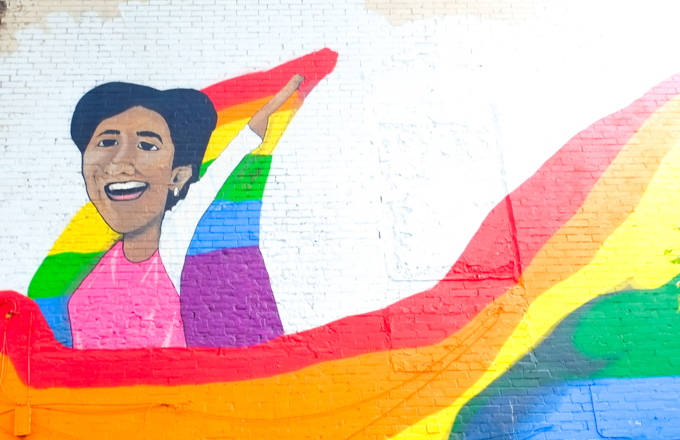
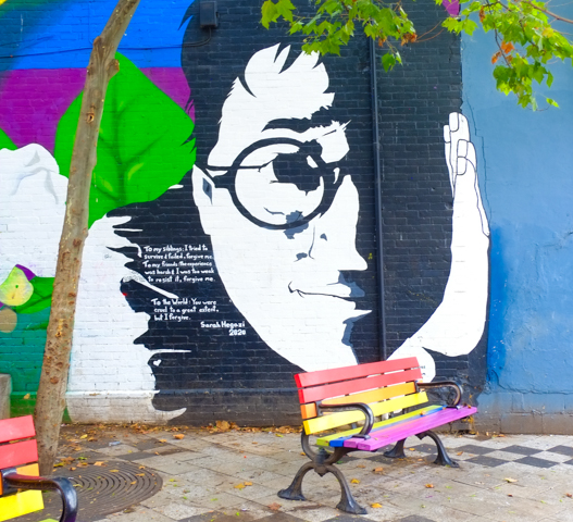
below (also above): Tribute to Sarah Hegazi, written in 2020.  “To my siblings: I tried to survive and failed, forgive me. To my friends: the experience was harsh & I was too weak to resist it, forgive me. To the world: you were cruel to a great extent, but I forgive.”  Hegazi was an Egyptian writer and LGBTQ activist who was arrested and tortured in Cairo for waving a rainbow banner. She found asylum in Canada in 2018 but died by suicide in Toronto two years later.

mural in Barbara Hall Park, tribute to Sarah Hegazi, large black and white portrait, with text, rainbow painted benches in front, park

below: Patchwork teddy bear graffiti sticker by artsbyabe

graffiti sticker, patchwork teddy bear with a black eye, in the background, a rainbow coloured crosswalk

two men walk past Soy Boys massage on church street
sidewalk traffic box painted in blues and purples with large text that says It's all about drag

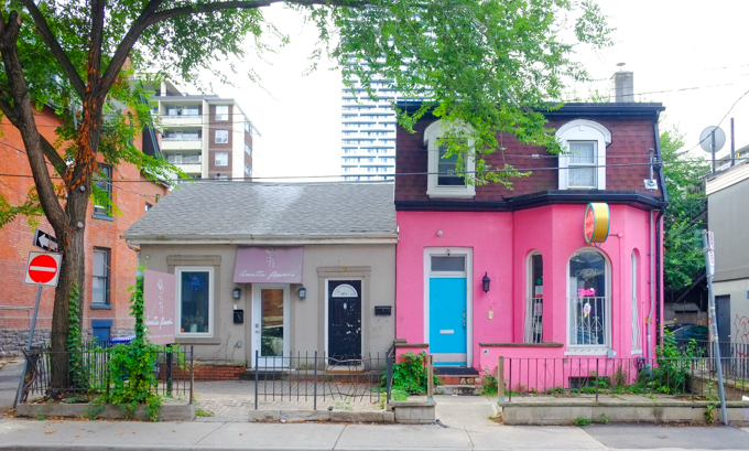
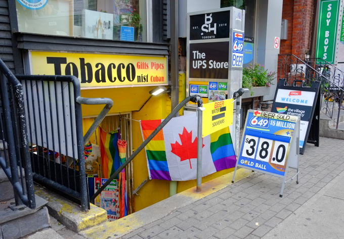
below: At the end of the rainbow you will find O’Gradys – in on of the few half houses that exist in the city.

O'Gradys tavern on Church street, with rainbow crosswalk in front of it

man in blue hard hat a construction site on church street

construction site with digger in the middle of an intersection, church street

policeman directing traffic in front of a ttc bus, a man on an electric scooter,

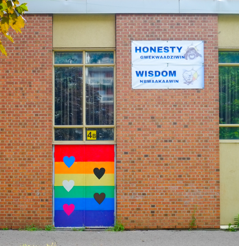
below: On a school wall – a door with rainbow stripes and hearts along with Honesty (Gwekwaadziwin) and Wisdom (Newaakaawin)

doorway of a school with rainbow stripes and hearts, and some words in indigenous language

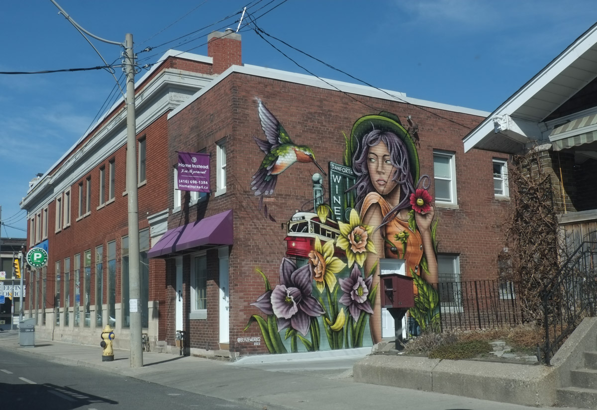
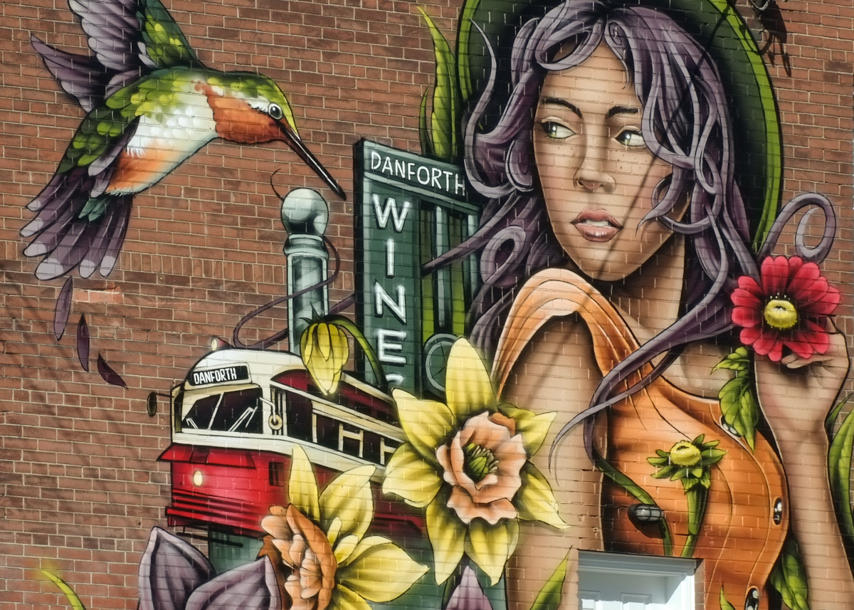
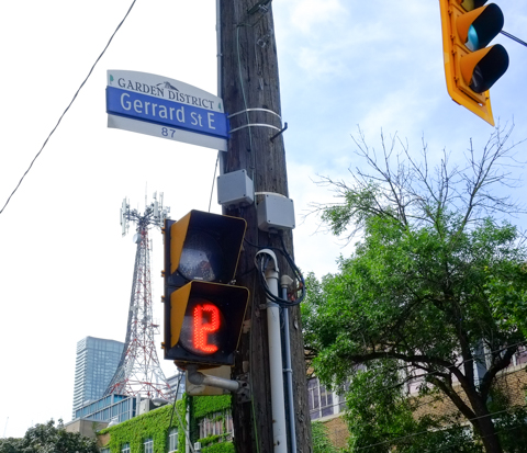
below: Gerrard Street East and the Garden District,… now we are at number three.

city of toronto steeet sign for Grrard St East, with header that says Garden District

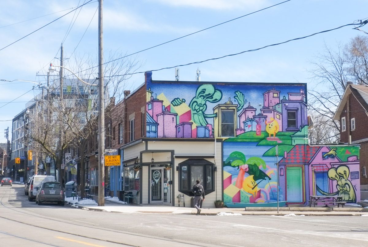
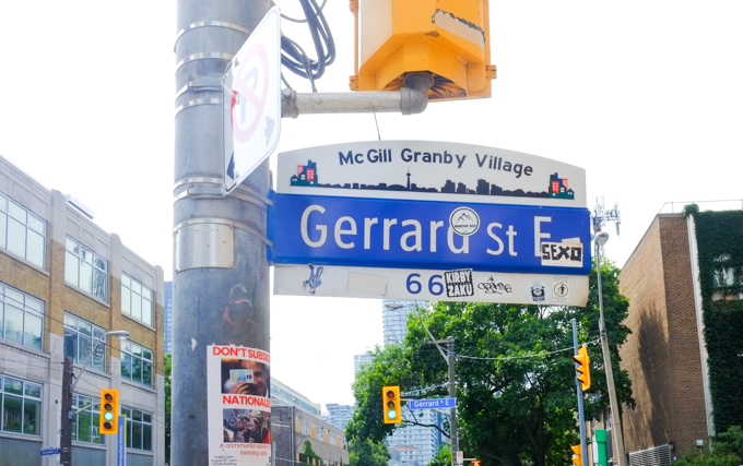
below: … but wait, Gerrard Street East in McGill Granby Village?  The difference of course is that one is on the west side of Church and the other is on the east.  Neighbourhood number four.

city of toronto steeet sign for Grrard St East, with header of McGill Granby Village

below: By the time we get to Queen Street, we are in Old Town Toronto, Historic Queen Street and Neighbourhood number 5.

Old town toronto city street sign for historic queen district, queen street east
top of a TTC streetcar at church and queen

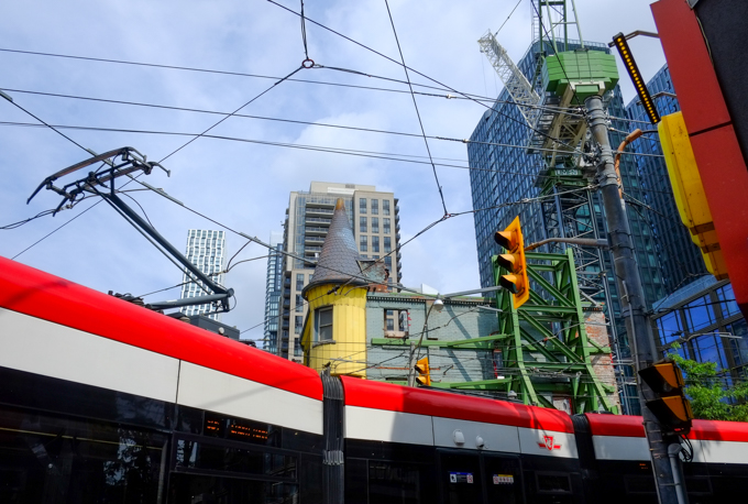
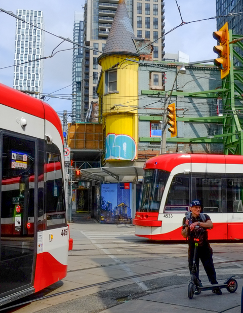
below: The round turret of that yellow building still remains. The green scaffolding keeps the facade stable while new development occurs around it.  Some of you may be old enough to remember it as a Thriftys Sports Shop.   The last business to occupy the space before demolition was Shawarma’s King.

two streetcars going in opposite directions about to pass each other at corner of church and queen, a man on a scooter is also in the intersection
black and white photo of a couple standing on a street corner while a TTC streetcar passes them, both are wearing hats, she is looking for something in her bag and he is watching her

below:  Church street just north of King.  Fenced off and closed to traffic.

beside construction zone, workman waiting for group of people to pass before letting a dump truck pass through gate

person walking a small black dog on sidewalk beside construction zone at king and church

west side of St. James cathedral on Church Street, construction machinery on the street, were pavement has been removed

below: The intersection of Church and King, looking towards the southeast corner.

looking southeast at the corner of king and church streets, workmen on the road, pavement removed, closed to traffic,

below: Still King and Church but a slightly different angle

at king and church, construction fence, on west side of church, looking at southwest corner of the intersection BMO bank

buildings on king street, engel and volkers, old brick buildings, newer glass behind, street torn up for ontario line constrcution

below: … Also King Street

sidewalk patio on king street, with red umbrellas and decorated with lots of flowers including pink petunias

below: Leader Lane runs between King and Wellington. After many years of “discussion” and planning, the part of Leader Lane that is south of Colborne just might get pedestrianized.  This picture show the north half of Leader Lane and yes, that section has just been completely redeveloped around the older white building.

O'Briens tavern, Leader Lane

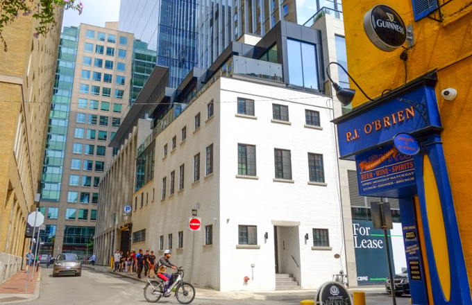
below: P.J. O’Brien’s has been on the corner of Colborne and Leader Lane since 1966.

front of O'Briens tavern, Leader Lane and Colborne street, an old yellow buolding with blue trim

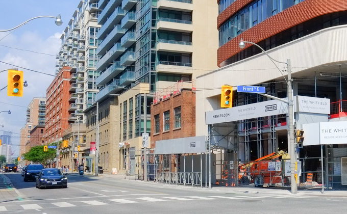
A quick look back at Front and Sherbourne – this is the northeast corner of that intersection.  A lot of new development here!

northeast corner of Front and Sherbourne streets

Phew! Time for a rest!

workmen sitting and having a rest on the job site

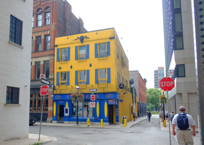
With thanks to all the friends that I walked with that day…. shown here doing what we all do best, play in our favorite photo places (in this case, Leader Lane, side of P.J. O’Briens)

by the large clock on the side of P.J. OBriens on Leader Lane, by their guiness ad,

A circular walk to explore the Don Mills trail south of York Mills Road… but how to get there…. We decided to start by walking south on Scarsdale Road to Bond Avenue.

Scarsdale is a nondescript street in North York with a few churches, private schools, some light industry, offices, and all in all, a lot of lowrise late 20th century architecture.

below: Don Mills Baptist Church looking very un-church like.

below: Unmarked

below: Once at Bond, the buildings are mostly residential.

below:  There is a walk-through to the neighbourhood behind

below: The old railway bridge over Bond is now part of the Don Mills Trail.  Originally it took 6 years to build (1912 to 1918) the bridge – using six 2-foot-thick beams that span the 15-foot-wide opening, spaced to handle the weight of locomotives and heavily loaded railway cars.

Don Mills trail access point at Bond Ave.,

below: Also under the bridge is an entrance to Bond Park.

looking under a bridge to a parking lot in a park

below: Another entrance to Bond Park, this time from the trail via a hole in the fence.

leaf covered path down a small hill to a hole in a chainlink fence, and a park with seating beside a baseball diamond in the background, lots of trees

below: “Responsible alcohol consumption is allowed in this park”….rules and responsibilities are then listed along with health information about alcohol.

notice about alcohol in parks, and all the rules

autumn colours in the weeds and wildflowers beside a fence

below: A few remnants of its former life.  Once upon a time this multi use path was a spur line for the CNR, the Leaside Spur.  One of its functions was to connect the CNR main line (now also used by GO to Oriole station and beyond) to the CPR line near Eglinton.  The CPR tracks are those that cross Eglinton just east of Leslie and then cross the Thorncliffe trestle bridge over Wilket Creek Park.  The path ends just before the CPR tracks – there is no connection any more.

old rusted railway sign, small trees have grown up around it

below: Abandoned and rusting.  CNR stopped using this spur line in 1999.  The city bought the property ten years later.

old piece of metal, remains of railway switch? or some piece of railway equipment, lying on the ground

below: Crab apples and dead leaves litter the path

autumn leaves and little red crab apples cover the ground

below: Storage in bins and barrels, on the other side of the fence.

two old blue barrels, behind a fence, lots of undergrowth and weeds too

below: Left behind

discarded pair of boots, and some clothing, left on metal girders stored beside a railway track
stacks of rusty metal girders beside a railway track

below: The north end of the Don Mills Trail runs beside the live CNR line.  Not much of a view is it?  No trains passed by.  Very quiet.

looking northward up the CNR railway tracks from a hole in the fence by the DOn Mills trail.

old white barrels, behind a fence, weeds and small bushes growing up around them

below: Many, many large satelite dishes (and many small ones too).  I was feeling like a spy as I tried to take pictures through the fence… but I didn’t see any surveillance cameras…

satelite dishes behind a fence

below: Approaching York Mills Road

looking north up don mills trail towards york mills road, where there is a bridge over the railway tracks, a large pair of billboards on a tall pillar, dead leaves beside path, shrubs and weeds along the fence

below: The north end of the trail runs beside the bridge York Mills over the railway tracks (on the right in this picture).  From here there is an access road to Scarsdale on the south side of York Mills, or an exit through to Longos Plaza on the north side.

below: Have a seat!

below: Rogers has a large property on the east side of the CNR tracks and has access to this area.

With thanks to my mother for walking with me – she didn’t hesitate to climb through holes in the fence!  She also doesn’t like this picture, but it’s the better of the two that I took that morning!

Bonus section! Just in case you are interested in what’s on Scarsdale Road….

below: Colonel C.O. Dalton CSO and Colonel H.E. Dalton CSO Armoury

sign in front of building,

below: Greek Orthodox Education in Ontario – Metamorphosis Greek Orthodox School.

flags on flagpole, Canadian and GReek, in front of Greek Orthodox Education building

below: Korean Presbyterian Church

side view of front of Toronto Korean Presbyterian church, large roof over entrance, small white steeple, light grey brick building.


or thereabouts…

below: Starting point, Woodbine and Danforth

below: Small Mediah painting in the doorway, Danforth

small street art mural by mediah in the entrance to a store, people on the sidewalk, Danforth

below: Another Mediah mural, on the railway underpass on Woodbine just south of Danforth

mural by mediah, geometric shapes and colours, on an underpass

below: And again, in an alley south of Gerrard.

below: East End Love

tall narrow mural beside sidewalk on the Danforth, East End Love

below: “Humming on Woodbine”  – A hummingird and a young woman with daffodils in yellow and purple, a mural by Blazeworks at Woodbine and Danforth.

mural painted by Blazeworks in 2023, called humming on woodbine

below: Closer-up version  –  an old streetcar (when did they stop running on Danforth?  The TTC operated streetcars on Danforth from 1923 until the subway opened in the 1960s.)

below: Two storey brick stores with square facades in front.  Rows like this can be found all over the city although in many places they are being replaced. This row has probably been here for a hundred years; this section of Danforth was developed between 1910 and 1930.  The streetcar provided a commuter route and facilitated growth to the east.  The opening of the Prince Edward Viaduct (Bloor Viaduct) over the Don River in 1918 made access to downtown and the rest of the city even easier.

row of two story brick stores on danforth

below: Some stores have added features such as this little peaked facade at the front and the fancy brick work around the windows.

two storey brick store front on danforth, with small peak in roof on on side

below: Window reflections

reflections in a window of a store on Danforth, cars and stores across the street can be seen.

below: Tims stands alone

two story building with a Tim Hortons, pale pink building, no buildings on either side of it, a woman in a pink coat walks past

below: Ghost sign on Danforth, Burnett Brothers Butchers, The House of Quality.  That would be Alfred and Horace Burnett.

ghost sign for Burnett Brothers Butchers of high quality, on old brick building on the Danforth

below: Remnants of streetcar tracks can also be found on Strathmore Blvd (behind Woodbine station) that abruptly end at Cedarvale

old streetcar tracks in a street, Strathmore Blvd., that come to an end.

below:  Drink Coca-Cola – an iconic red disc. As for the rest of the sign, the font and the style of sign is still seen in many places in Toronto.

old store, now a gallery, with red round drink coca cola sign, also old sign saying confectionery

below: Soaking up the sun in front of Atop Appliances

two people in a bus shelter, one standing, one sitting, in front of store called Atop Appliances which is an old grey building with a black shingle roof

below: Spring blossoms, pretty even if they aren’t real!

mural on the side of Value village, spring scene with blossom tree and green grass, bike share bikes in a row in front of the mural

below: A line of stars

painted along the side of a red brick building, beside driveway, two stripes, a narrow white stripe on top and a wider blue stripe below.  On the blue, are eight pale orange stars

below: And stars on fences in an alley

2 large stars as decorations, on old fence in an alley, crooked fence, car parked in alley, dead leaves on the ground, mossy roof on garage next door

below: Aren’t doors fascinating?  Final Notice and 2nd Final Notice.  If a door is a title to the story that lies within, what is the story that would unfold here?

old black door, with yellow spray paint, three times, that says final notice, mailbox beside the door, number 2138, crooked concrete step

below: Many little pots in a sun-filled window, looks like an attempt to jump start spring planting.

row of old store fronts on gerrard, some now home, one has large window with greenish curtains, also a lot of little pots in the sunlight, perhaps growing seeds for spring planting

below: My favorite kind of Canada Geese.  They are quiet and don’t leave little messes behind.

front yard with decorations - in the shape of canada geese with red scarves around their necks

below: Lakeside campfire at sunset on a garage door

painting on a garage door, campfire on a granite outcropping beside a lake with pine trees around it, at sunset, sky in reds, oranges, and purples

below:  Poser bunnies in a mural on Gerrard

poser bunny mural on the side of a two storey structure on gerrard street

below:  I saw a lot of these posters that day – How to fold a fitted sheet.  Once upon a time such posters had a phone number written on little flaps that you could tear off.  Now we have the dreaded QR code.  Apparently there is now something called “quishing” which is QR code phishing (I am not calling this poster fake, I am just ranting about QR codes in general – like how annoying they are on menus because now everyone has to get their phones out).

poster on wood utility pole with the title How to fold a fitted sheet

below: Secret Park  …. sshhhhh  I can’t tell you where it is.

below: Empowerment by the wading pool (this is not the Secret Park!)

below: Toronto Chinese Mennonite Church (formerly Rogers Presbyterian Church), Woodbine

front of brick building, toronto chinese mennonite church

below: Crossing the street, towards Grant African Methodist Episcopal Church, Gerrard St.

woman crossing stret with a dog on a leash dog has a purple coat on, in front of old brick church, grant african

below: Plaque of Dedication for Grant Church

Plaque outside Grant Church

Plaque of Dedication commemorating the relocation of Grant African Methodist Episcopal Church from 23 Soho Street to 2029 Gerrard Street, November 17th, 1991. 
  Grant Church Journey
In 1833 in Toronto, worship began in each other’s homes.  The meetings were held on a site on Chestnut Street.  Later, a church was built on Richmond Street.  In 1856 we moved to a hall at Queen and McCaul Streets.  In 1912 we celebrated the grand opening at University and Elm Streets, and moved to 23 Soho Street in 1929.

grant african methodist episcopal church, brick building, on gerrard,

below: St. Francis National Evangelical Spiritual Baptist Faith, Archdiocese of Canada.

below: Semis on a slope

semi divided houses in a row on gerrard, two stories, with front porches,

below: A newer three storey residential building. I wonder how many units it has? Three at least?

new three story residence beside an older house

below: Layers

car parked in a driveway beside an older house, with a taller glass and brick condo building behind

semi houses, large trees between sidewalk and street

below: Pink house with a lot of stairs to the front door, Woodbine

below: Housing on the hill

below: A bus shelter, unfortunately it seems to be acting as housing as well.

below: May Peace Prevail on Earth in two languages (and more on the back)

4 sided pole about 8 feet high, with words written on it, may peace, also written in another language (different alphabet too)

Back in January I blogged about some graffiti that looked like signs, i.e. they just had text on them (The word about town). A couple of the signs that we had seen were hidden behind shrubs and weeds that started to overgrow the site.  The other day I was passing by the old houses where those signs were posted and noticed that someone had cleaned the site up.

Also, the artist responsible for these signs is Nigel Smith.

blue plywood hoardings with signs on them, large house behind the hoardings with balcony on upper level

graffiti signs by Nigel Smith, with words that say Hiding in plain sight

graffiti signs by Nigel Smith, with words that say true to form

hoardings with signs on them, blue painted plywood, snow on roof of abandoned house,

graffiti signs by Nigel Smith, with words that say money is no object

graffiti signs by Nigel Smith, with words that say can't happen here

view above the hoardings, abandoned house, upper level, old white balcony, brick house, satelite dish, brick chimney,

graffiti signs by Nigel Smith, with words that say blood in the water

The “graffiti” signs look as legitimate as the owner/developer’s signs.

sign that says keep out private property under video surveillance has had orange spray paint sprayed on it

Four houses on Woodbine plus a house on Buller to be demolished to make way for a 4 storey building with 67 units.  Shock – didn’t Doug Ford just say that 4 storeys makes a Tower!  A hated tower that nobody wants?  Does he have any idea how many 4 storey residential units there are in this city?  And how many more are in the process of being developed?

city of toronto notice of development in front of a row of empty houses with blue hoardings in front, sidewalk, a couple of trees,

Right across the street from this site are quite a few buildings (residential) that are 4 storeys high. This is only a small part – they have been there for years now.

row of four storey residential buildings on woodbine avenue


Ontario Science centre from the south

Rumours swirling that is…. because the Ontario Science Centre has been in the news lately.  Doug Ford (and the Provincial PC’s) have said that they are going to move it from its Don Mills and Eglinton location to Ontario Place down by the Exhibition Grounds.  What then becomes of the Science Centre LRT station?  It hasn’t even opened yet and its already obsolete?  And needs a new name?  …..that’s assuming that the Eglinton Crosstown LRT ever gets done.  But hush, no one is talking about that, that’s a secret……

below: Behind fences, the new Science Centre LRT station and transit hub remains unfinished.  It is a very quiet construction site.  Not a soul to be seen.

metal construction fence in front of the science centre lrt station that is being built at Don Mills and Eglinton,

One of the arguments for moving the Science Centre is to open up the land for housing.  Let’s ring some bells and say ‘housing’.   Who can oppose housing, right?

below: This is southeast corner of Don Mills and Eglinton where a development notice stands.  Apparently two towers are planned for this location – 26 and 48 storeys high. (The Science Centre is on the west side of Don Mills Road).

In fact, on the east side of Don Mills Road, south of Eglinton (i.e. across the street from the Science Centre), there are two other properties with development notice signs.

brick townhouse row with a blue and white development notice in front, Don Mills Road, St. Dennis Drive

Four new towers, as infill, have been proposed for these sites.

brick highrise apartment building on Don Mills Road with development notice sign in front of it

AND

What is now the upper parking lot for the Science Centre is already on the books as new housing.  This is at the southwest corner of Don Mills and Eglinton.   The sign may have been flattened but that doesn’t make the plan disappear!

blue and white development notice sign lying on the ground in the shade under some trees, trash around it

below: Blocked sidewalk on the south side of Eglinton, upper parking lot is on the left side in the picture

orange signs on sidewalk saying sidewalk closed ahead

below: View looking south from the upper parking lot towards the Science Centre

view from upper parking lot of science centre which is empty, past line of tall evergreens, to lower parking lot and buildings

green exit sign with an arrow pointing to the right on which someone has written there's no, sign now says there's no exit

AND (Yes, there’s more)

There is a 60 acre development on the northwest corner of Don Mills and Eglinton (the old IBM/Celestica site) that is in the midst of being transformed into the Crosstown neighbourhood.

new construction at Aspenridge crosstown development

below:  This is a picture that I found (and have blatantly swiped from) on an Urban Toronto web page – It shows the development and infill at Flemingdon Park  among the existing structures. The planned buildings are slightly transparent – perhaps 14 of them?? (and that doesn’t include all of Crosstown)  The Science Centre is bottom centre.

image taken from urban toronto site showing development at Don Mills an Eglinton

So which developer whispered sweet nothings in Doug Ford’s ear?

Who thought that moving the Science Centre was a good idea?

Who owns the land now? Did you know that 81 acres of the land that the Science Centre is on is owned by the TRCA?  That’s the Toronto Regional Conservation Authority.  The rest of the land (a tiny sliver along Eglinton & Don Mills) is owned by the city of Toronto.  TRCA  and the City of Toronto jointly leased the property to the Ontario Science Centre for a 99-year term, expiring on June 30, 2064.

The TRCA owns the land because of the terrain – steep slopes, ravines, and waterways – i.e. not land suitable for housing.  Doug Ford’s announcement came as a surprise to the TRCA – but does that surprise anyone?

below: Another image that I found online that describes the area better than any words that I could write.  This is a map of the area showing who owns what.  Source: TRCA website

map of Don Mills and Eglinton showing ownership of the land by TRCA and city of toronto

BUT

What else is happening here?

The new subway/LRT line, the Ontario Line, Doug Ford’s favorite line, is also being built here.  It is the transit line that runs south from the Science Centre to close to the lakeshore before turning west through downtown (Queen Street closed for 4 years for construction!!) and ending at Ontario Place.

Work has already started in the ravine south of the Science Centre where there will be stops for both Flemingdon Park and Thorncliffe Park.  The whole north section of the Ontario Line will be elevated.  Between the Science Centre and Flemingdon stations it will run above the street and sidewalk (Don Mills Rd).  At some point between Flemingdon and Thorncliffe Park there will have to be a bridge over the West Don River.

pink sign on construction fence in park that is for Ontario line, transit construction

signs around a construction site, ravine erosion mitigation work, as well as drilling for new subway line

below: Where the Science Centre meets the West Don Trail

two men walk across the grass where the West Don Trail meets the Science Centre south entrance, spring, green grass, some buds on trees

Some other photos from the area

science centre exterior

view from entrance of science centre, curved outdoor stairs, apartment building in background

below: The Science Centre has interesting trash bins on its grounds.  Maybe they could teach the city a thing or two?

trash bin, metal, with colourful picture on the side

Ontario Science Centre banner on a pole on Don Mills Road with traffic and larger buildings in the background

below: West side of Don Mills Road

west side of Don Mills Road at Eglinton, new glass covered building on north side is partially completed, new science centre station entrance behind metal fence on south side

below: The southwest entrance to the Science Centre station from another angle

new entrance to Science Centre LRT station at Eglinton and Don Mills

below: Looking west on Eglinton towards Don Mills

looking east on Eglinton Ave towards Don Mills Road and new science centre station on the south side

below: Walking home after school

a small group of boys walking along the grass beside Eglinton Ave on the east side of Don Mills

It was four years ago that demolition of the old IBM buildings began.  On the surface it doesn’t look like much is happening.

fence, dirt, and weeds in front of crosstown redevelopment

construction site, steel girders slightly rusted upright into the ground, some water puddles, sand and dirt, start of a new street

construction site

Crosstown neighbourhood construction site

people waiting for traffic light to turn green at corner of Don Mills and Eglinton, two young women and an Asian woman with a black and white umbrella

Out of Service.  Nothing happening here.

sign that says out of service

Sorry, but I have a few more questions and comments about this thing I encountered at Don Mills & Eglinton ….

What is this?  A phallic rock in a concrete circle …. or Doug Ford giving the city the finger?  To those who design and build public art (if that’s what it is)…. that concrete circle is just a large garbage can.  It will collect trash.  It will fill with rain water.  It will be an unsightly mess.  It’s too low for a bench and it blocks the sidewalk.  There’s no sign and no explanation.  I can’t find anything about it online either.

a rock pillar stands upright, in the center of a concrete circle

Sackville Street, just south of Dundas, is right in the midst of the Regent Park renewal project.  It is also the site of two murals.  First, there is bright and colourful mural which is painted on the side of a new apartment building.

mural painted by Shalak Attack and Bruno Smoky in Regent park Toronto, showing a brightly coloured woman;s face, with a flower in her hair and her body (from the shoulders up) made of buildings in a jumble as well as a blue owl (large bird) in flight, passing in front of the sun that is represented by circles of orange and red radiating out from the bright yellow center. A green hand is reaching up towards the sun

A man with a dog an a leash is walking by a mural of a brightly coloured woman;s face, with a flower in her hair and her body (from the shoulders up) made of buildings in a jumble. Painted by Shalak Attack in Regent Park

close up of a mural by Shalak Attack and Bruno Smoky of a blue owl (large bird) in flight, passing in front of the sun that is represented by circles of orange and red radiating out from the bright yellow center. A green hand is reaching up towards the sun

The other mural is a painting by elicser on hoardings around a building under construction.

a long mural by elicser painted on hoardings around a building under construction. People flying past in the mural

below: With the ubiquitous Timmie’s cup on the ground.

the end of a mural, a man is sideways, arm above his head, painted on a mural, a large orange concrete block is in front of the wall, an empty Tim Hortons cup (Timmies cup) is on the ground.
part of a mural of flying people by elicser, a woman in a light purple dress and head scarf as well s a boy in beige Tshirt and blue shorts

Two people painted flying sideways on a mural, a brown man with no shirt on and a much smaller person below him with a yellow T-shirt. An orange concrete block is on the sidewalk in front of the mural along with an orange and white traffic cone

people flying sideways on a mural by elicser, including a girl in a pink dress

people flying sideways on a mural by elicser, including a woman in a blue dress and a man with a red hat.

flying people mural by elicser

the words Regent Park are written in pink paint on a light blue background, painted on wooden hoardings around a construction site.