Posts Tagged ‘construction’

In downtown Toronto there is a large waterfall mural painted on a brick wall  – because of the bricks, the painting looks a bit more like water pouring over a dam.  Still nice; still nature.

mural by b c johnson, a waterfall

Another waterfall – a longer drop of water, this time on a door.  All the murals here were painted by B. C. Johnson.  There are five or six of them on different buildings, some waterfalls, and some landscapes.

in cottage lane, a mural of a waterfall, with greenery beside it, electrical boxes on the green, with wires, and graffiti on the boxes ,

below: Here a  heron stands on a fallen tree beside the water.  A birch trees is also on the shore.  A waterfall is on the other side of the lake.

mural in cottage lane by b c johnson, a heron stands on a fallen log on a rock on shoreline, birch tree nearby, water, and a waterfall in the background

below: This building is overgrown with ivy which adds a nice touch to the scene. The door becomes a very thick tree trunk perched on a rock above the water.

on a wall by a black door, overgrown with ivy, door looks like tree trunk, also mural in cottage lane by b c johnson, a heron stands on a fallen log on a rock on shoreline, birch tree nearby, water, and a waterfall in the background

below: Surprisingly, there is no puddle at the bottom of the steps (insert big smiling emoji here).

porch at back of building, in alley, on building with lots of ivy growing on it, mural of a waterfall

porch at back of building, in alley, on building with lots of ivy growing on it, with another building across the alley with murals of waterfalls and landscapes

below: A real tree once grew here.  I don’t think that it was a beaver that cut it down.

old hollow tree trunk in lane, in front of a landscape mural and wall overgrown with ivy

boarded up window or door, exterior view, from cottage lane, now covered with part of a mural of a landscape by b c johnson

below: Where do you find Cottage Lane?  South of Bloor, west of Yonge, then follow the signs… and the road less traveled.

St. Marys street, restaurants and signs, canadian flag, street sign of cottage lane

I was not sure why it was named Cottage Lane since, to me, there isn’t much that is cottage-y here.  The answer – there are 10 rowhouses on St. Nicholas Street that were built in 1883 and although the architectural style is ‘bay and gable’, they are referred to as the cottages of St. Nicholas Street.  As you may have guesses, St. Nicholas Street backs onto this lane.

below: Looking north towards Bloor.   Buildings that face Yonge Street are on the right and those on St. Nicholas Street are on the left.

cottage lane, looking north towards bloor and new condos, back of buildings,

back of buildings in cottage lane, balconies, green trash bins, tall condos in the background,

cottage lane

purple bike with white seat cover, parked in an alley beside a small sumac tree and an old window with metal bars on it

back of buildings in cottage lane, balconies, exterior stairs, pink wall, green trash bins, car parked, brick buildings,

back of store, commercial building, alley view, door, heating and air conditioning vents, graffiti on wall, blue trash bins

graffiti on a red brick wall, a bright white ghost with red eyes and smiling mouth, yellow pipes and white plastic exhaust pipes from building

exterior brick wall, painted bright red, with many black wires in a bundle crossing it,, white graffiti happy face, other blue graffiti text lil

graffiti on red brick wall, respect dollar sign, free dollars, 2014

square street sign covered with graffiti ticker, all o them are black with gold lettering

Back in 2021, I posted some pictures from Sandown Lane (Cliffside, near Midland and Kingston Road) where there are many more paintings by B. C. Johnson.

Were you an Edmonton Oilers fan?  Did you jump on that bandwagon?  On the night of the 7th game of the Stanley Cup playoffs were you glued to the TV?  Or are you wondering what I’m talking about?!

I usually watch hockey games now and again, especially during the playoffs but I found that watching the Edmonton-Florida series was just too stressful.  Instead, these long June evenings are great for walking!  A little bit of Yonge Street, Uptown Yonge, was my stomping grounds the evening of the last game.

banner for uptown yonge on a hydro pole, stores and new condo in the background, says eat up. street sign for st. Clements avenue as well

A few scenes from Yonge between Eglinton and Sherwood, in no particular order…

evening, coffee shop on Yonge street, also poke bar,

below: Old and new. I like the way the evening light catches the architectural details along the rooflines.

roofline, old brick buildings with architectural details in front of a newer high rise residential building

below: Playing peek-a-boo.  The new pushes from behind.

stores on Yonge street, prism hair salon, vape studio, goa hair salon,


below: Seating!

late evening, getting dark outside, looking at store front, cobbler's corner shoe repair,

ceiling art, white and green cubes with lights inside

round exterior wall of part of rio can yonge eglinton centre, short glass tower,

metal grille gate covers glass doors of now empty and closed store on yonge street

below: Northwest corner of Yonge and Eglinton, Yonge- Eglinton Centre with its updated glass facade.

yonge eglinton centre entrance

When the Yonge Eglinton Centre was built in 1968, Eglinton was the last station on the TTC subway line.  The Y-E Centre was a large development, and was the tallest building in the neighbourhood.   There was a shopping centre, a cinema, an office tower, two tall residential towers, most of which still remain.   Eglinton is no longer a gateway to suburbia; it is Midtown.  The Y-E Centre is just another tall building in a sea of them.

side of concrete building from the 1970s, Yonge Eglinton centre

tall concrete building

below: The new entrance to the Eglinton LRT (unopened of course)  with the Canadian Tire headquarters behind.  Southwest corner of Yonge and Eglinton.

southwest corner of Yonge and Eglinton, new entrance to Eglinton LRT (unopened), Canadian Tire head quarters building, 1970s concrete, new condo behind

Lament for the Eglinton LRT.  Metal fences and torn cloth.  In tatters and disarray.   Still not opened.

front glass of eglinton LRT station, behind metal construction fence and torn green cloth

stores on yonge street

sidewalk tunnel under scaffolding to protect from adjacent construction site

restaurant window, night time, sidewalk

Maybe one day I will be able to walk somewhere in this city and not run into another hole in the ground.  Note the usual – facades being saved, single houses that stubbornly remain.

construction hole in the ground

gravel roadway down into construction hole in the ground

Bus stop all tied up in knots.

TTC bus stop on yonge street behind orange and black cones and yellow caution tape

mural on the side of bmo bank on yonge, flowers, male face, female face, child face, dog, and lot lots of flowers

white car parked in front of a mural with flowers with many petals, and a woman's face

artwork on glass above subway entrance at canada square, corner of yonge and eglinton, a woman is carrying a potted plant, a man in green shirt with tattooed arm is looking at her

three plants in flower pots on a shelf in a room with a blue light, on the left is an orchid,

below: With some paparazzi stalker vibes I’m afraid.

… Back home in time for most of the third period…. Sad to see Edmonton lose, but why is there hockey this late in June?

Bessarion subway station has always had the reputation of being one of the least used stations in Toronto.  I haven’t seen any recent numbers, but I suspect that a lot more people are now using the station.   There are a lot of development changes happening in the area so the numbers will only increase in the future.

below: South entrance to Bessarion station

entrance to bessarion ttc subway station on sheppard at bessarion, new high rise condos behind it, street scene

corner of bessarion subway station in the foreground, new community center on the right side, and construction of new condos in the background

below: A Stop sign sits in the middle of one of the entrances to the new development on Sheppard Ave East beside Bessarion subway station.  If you follow the left fork in the road, you will end up in the parking lot of the Canadian Tire store.  This store is all that is left from the original 50 acre site that was home to a Canadian Tire warehouse and distribution centre.  In 2000 Canadian Tire filed a plan to re-develop the whole site, including a new head office tower for the company.  Although the plan was approved, it never came to be.  Instead, most of the land was sold to Concord who is now in the process of redeveloping it.

new development on sheppard ave east

below: Concord has filled this community with a lot of public art including these colourful creations, “Jax” (2021) by Pierre Poussin

brightly coloured public ark in concord park place on sheppard avenue

below: A few maple leaves forming a canopy – “Maple Leaf Trellis” by Demakersvan (aka brothers Joep and Jeroen Verhoeven)

sculpture that looks like a canopy of giant maple leaves

below: Leaping Lamp by Inges Idee (a German artist collective)

leaping lamp, a large green sculpture by ingres idee of a lamp post with two very long legs as it walks over a stone wall

below: There is also a rabbit (title: “Rabbit”),  another artwork by Inges Idee.  It’s made to look like a folded ribbon of highway; it sits next to the 401 highway.

rabbit, a large sculpture by ingres idee, looks like it's made of a road all twisted into the right shape, outside new condo by the 401 highway

rabbit, a large sculpture by ingres idee, looks like it's made of a road all twisted into the right shape, outside new condo by the 401 highway

below: Birds hanging out together between Bessarion station and the new community centre.  They won’t be flying anywhere any time soon!

sculpture that looks like birds on a tree, including an owl looking out of a hole in the tree

close up of part of a sculpture with birds on a tree, showing owl looking out of hole in tree, woodpecker beside the hole

below: A small bird, a continuation of the tree full of birds, sits outside Ethennonnhawahstihnen’ Community Centre (it’s pronounced Etta-nonna wasti-nuh and it means ‘where they had a good, beautiful life”)

reflections in the window of a community centre, with small sculpture of a bird sitting outside the window

below: Real trees ready to plant.

trees with roots wrapped in burlap sitting on the ground, waiting to be planted, a row of condos newly built in the background

below: A line of towers with row houses on the lower level marks the south side. The 401 highway is behind. A new park, also Ethennonnhawahstihnen’, lies in front of the new residences.

below: Water feature in the summer, outdoor skating rink in the winter

concord development on south side of sheppard, on old canadian tire warehouse site, a curved shallow pond with a walkway around it, a small white building beside it, condos and new construction in the background

park in the center of condo development

tall glass and steel condo, one side clad in bright green

below: The view from the southeast corner of the property – the back of IKEA and the 401!

back of ikea on sheppard in north york, 401 highway,

below: At least there have been a lot of trees planted back here and some thought has been put into using the landscaping to mitigate the noise from the 401.  But the fact that thousands of cars and trucks pass her every day can never be downplayed.  I hope that the units are well sound proofed.  Having stood on balconies on other buildings that overlook a major road, I can imagine how noisy it is here too.

newly planted trees along a pathway beside the 401 highway

new condo development with a bright yellow rectangular section around a large window

the words slow down have been spray painted on a concrete barrier in front of a row of new townhouses

below: Looking southeast from Burbank

looking out of ttc bus shelter at burbank and sheppard

below: South side of Sheppard

view on sheppard, looking east near bessarion subway station

wrong way sign by driveway in front of medical building on sheppard

below: The north side of Sheppard Ave looks like this – a row of lowrise apartment buildings from the 1960s or 1970s.

lowrise apartment buildings on north side of sheppard

below: There are 2 major redevelopments proposed along here, 680-688 Sheppard and 690-720 Sheppard. Both involve condo towers.

development notice on front yard of a multiplex residential building on sheppard avenue

crumpled red and white sign says out, pole askew, between fence and tree

sign for apartment building, empty except for no vacancy and a graffiti scrawl

Just west of Bessarion station is Greenbriar Road.  There was a small community of single family homes, duplexes, and small apartment buildings back here.  Almost all of it is gone or on the way out

construction south of sheppard ave

below: A single, lonely, holdout surrounded by newer residences.

one older brick house surrounded by newer and taller residences

A 1970s brick bungalow in the foreground, new townhouses in the background

below: No sign?!

two brick duplexes, semis, or side split houses, with 5 towers of new condos behind

below: Southeast corner of Sheppard and Greenbriar  (12 storeys, 145 residences)

development notice on the frontyard of a house on corner of sheppard and greenbriar

below: There is a development notice sign on the front yard of 25 Greenbriar (23, 25, 27 and 29 to be replaced with 10 storeys, 169 residences).

orange sofa on a driveway in front of a garage between two brick buildings

large grassy backyards of two houses, one has an old swing set in the yard

below: A little farther south on Greenbriar the fences are already up (22-36 Greenbriar, 24 storeys, 351 residences).

house on Greenbriar, empty, with construction fence around it and blue and white development notice beside the fence

bessarion subway station

a woman walks eastward on sheppard near bessarion

Extra note: The northeast corner of the old Canadian Tire acreage, at 1181 Sheppard Ave East, remains undeveloped.  It is the last piece once owned by Canadian Tire.  It is adjacent to the Metrolinx rail corridor, about 100 m from the new Oriole GO station.  [ed note: Prime real estate by the sound of it!].  Two towers will probably get built here, once the heights are finalized.

view of cn tower from port of toronto, with buoys, on land, in front, as well as a parking lot

Welcome back! Bienvenuti!  A colourful sign to welcome you and visitors to Toronto.  I’m not sure how many visitors get to see this banner!

sign saying welcome to toronto in many different languages

The Port of Toronto has almost become an obscure corner of the city.  It’s certainly not where most tourists arrive in the city!  Nor is it a place where residents venture.

welcome sign in different languages, puddle in front, large green and orange buoys, on land, reflections in the puddle

below: Once there was a ferry between Toronto and Rochester that docked here but it didn’t last long.  Now there are a few cruise ships that stop here.  The building would be almost deserted if Netflix hadn’t taken over some of the space.

building on pier, beside waterfront, with chainlink temporary fence, sign says Toronto Port or Port of Toronto

below:  The fragments of railway track are reminders of the industrial past.

metal fence across old railway tracks on a pier, beside waterfront, Lake Ontario, Port of Toronto

below: There are bits of track scattered all over the Port Lands

fence across old railway tracks with industrial site beyond

below: The Port is much quieter but there is still activity.  These long metal bars that are neatly stacked on shore were probably recently offloaded.

stacks of 40 foot long rebar on the waterfront, port of toronto, recently unloaded from a boat
view through chainlink fence on pier, a yacht is exiting the harbour, toronto skyline in the background

below: Boats in the Ship Channel.  The redevelopment plan for the Port Lands has always included the retention of the Ship Channel.  The sand and salt for Toronto’s roads is delivered here.

ships in the Shipping Channel

below:  At the east end of the Ship Channel, a new park is being developed – Leslie Lookout Park.   The concrete cylindrical structure is a lookout tower so there will be views over a man-made beach (that appears white in the photo).  The beach is larger in real life than it looks like in the photo.

new park being developed

below: Can you see the little sliver of blue water?  That is the Ship Channel.

behind chainlink fence, new park being developed, on shipping channel so water is just visible in the photo

below: Looking south on Munitions Street

munitions street, port lands, construction, all gone but old fire hall and white building film studio

below: Toronto Firehall, Station 30, built in 1928 still stands.  It is a heritage building and if the plans are followed, it will be repurposed.

munitions street, port lands, construction, all gone but old fire hall

entrance to old metal clad building, tree in front, no trespassing sign on door, no parking sign beside door

below: The redevelopment of the Port Lands has involved a lot of infrastructure changes.  Roads have been changed, rivers have been diverted, bike lanes and better sidewalks have been created.  At times it has been confusing to navigate through.

traffic signs, signals, and new construction in Port lands

below: The new Commissioners Street bridge is in, and there is water running under it.  There is now a river on land that was once industrial.   On the north side of the bridge there is a bike lane and a wide sidewalk.

red and white curvy bridge, commissioners street bridge, dark clouds in the sky,

below: The bridge offers new vistas of the city.  Many new trees have been planted.

view northwest from commissioners street bridge, over river and park with many newly planted trees, to downtown toronto skyline

view north from commissioners street bridge, towards Gardiner Expressway, and Lakeshore

below: Lakeshore Blvd crosses the Don River on a very low bridge (like before) while the ramps between the Gardiner and the DVP curve above it.

view north and slightly east from commissioners street bridge, ramp from Gardiner to DVP with Lakeshore crossing river
below: Just be careful because there is no sidewalk on the south side (why not?? for the sake of saving money on 4 extra feet??)

cyclists crossing commissioners street bridge
commissioners street bridge, mostly sky with lots of clouds

below: The same sleek curvy design seen in the previous bridges is repeated here.

red and white curves of the commissioners street bridge

below: Another series of photographs of the work being done here, by Vid Ingelevics and Ryan Walker

large photograph on a billboard in front of large concrete silos, port lands,
below: One photograph is mounted on the roll-up door of one of the ESSROC cement plant silos

large photograph mounted on door of garage on concrete silo

below: Like the previous series of images, most of the photographs are displayed down the center of what remains of Villiers Street,  on top of the remains of the old railway line.

large photo image on display beside street, in front of building with cranes beside it

below: One more photograph on what remains of Villiers Street – and in the background, what remains of the eastern end of the Gardiner Expressway.

construction in port lands, villiers street torn up, photograph on display in center, gardiner expressway in the background

below: Southeast corner of Villiers and Cherry

old bank building with columns, stone, on southeast corner of villiers and cherry

below: One original bridge remains, the one with the long name – Cherry Street Strauss Trunnion Bascule Bridge.

cherry street straus trunnion bascule bridge, with person holding stop sign, construction on the bridge

lifeguarding station at cherry beach, old white wood building, with look out tower and flag pole,

below: The first of the new bridges that was actually operational is the south Cherry Street bridge, the yellow one.

yellow and white cherry street bridge

below: The second new bridge on Cherry Street is now in use.  For months we’ve been able to take pictures of the side of it as we stood on the old Cherry Street bridge. (see The New Cherry Street Bridge from Nov 2020).  Maybe one day in the future there will be a streetcar on the east part of the bridge.    As you can see, the rain came and we bailed.  Better pictures of the bridge will have to wait for a future post!

new cherry street bridge from the south, double bridge, one side for cars, bike, and pedestrians. The other side is for transit but so far there is no transit here

below: The old Cherry Street bridge is gone and the road has been rerouted. The old jog in Cherry at Lakeshore is gone.

rubble and digger removing old cherry street bridge, distillery district condos in the background

rubble and digger removing old cherry street bridge, distillery district condos in the background

below: Misdirection.

green and white sign that says cherry street continues one block north of Lakeshore

below: Trying to see the new bridge from the site of the old bridge but there seems to be a construction site in the way.

new cherry street bridge, red, and white, seen from site of old bridge

below: Continuing north on the now straight Cherry Street.  Any ideas what that white structure is ahead?  It runs parallel to the railway line at track level and crosses Cherry Street just south of the railway underpass.

a red car waits at a red light on Cherry at Lakeshore. The Gardiner Expressway passes overhead. Distillery District and Corktown are straight ahead

We now exit the Port Lands and finish today’s explorations…. with the exception of one quick note…. I noticed that the old Canary Diner on Cherry is now painted a reddish orange colour.  It looks like it is being renovated.   A story for another day!

TTC streetcar, route 504, in front of repainted canary diner on cherry street, old three storey brick building

toronto skyline in the background, with boats docked on piers, rubber dinghy in foreground

hydro transmission towers with the cn tower in the background

below: Medallion embedded in the sidewalk outside Bathurst subway station entrance showing the way –   South to Bloor and west to Bathurst is first on list for today. … Or maybe round and round in circles?

brass circular medallion embedded in the sidewalk in front of Bathurst subway station, four points of the compass with labels, E to subway, S to Bloor, W to Bathurst and N to Dupont

below:  Looking south on Bathurst towards Bloor.  The southwest corner of Bloor and Bathurst is now a solid block of condos.

looking south on Bathurst towards Bloor, west side of the street

below: Same collection of buildings but from a slightly different angle.  Giant concrete pillars in front of ground level glass wall.  Argh.  Unoriginal Toronto architecture.

southwest corner of Bloor and Bathurst, tall glass and steel condo buildings

below:  Working at heights.  It looks like road access from Bathurst towards Markham Street. More concrete pillars!

below:  Alternative Thinking and its neighbour directly to the south remained the holdouts and are now completely surrounded by new development.

two older structures now surrounded by new condo buildings, older ones were three storey brick stores with apartments above from the 1880s. Alternative Thinking store

below: Around the corner on Bloor near Markham. The sidewalk in this stretch has been widened with benches and planters added.

bloor street, sidewalk in front of new condos, blue construction fence still up, new benches and planters on the sidewalk
below: Honest Eds is long gone.

behind blue construction fence, machinery, two tall condo being built with laneway between them

below:  Work continues on the re-making of Markham Street.

workmen on construction site on Markham street

below:  Ed’s Mercantile Store & Studio.  Vintage and Handmade Goods – it’s not exactly Honest Ed’s but it was at least worth a smile and a chuckle (and a photo!)

Ed's Mercantile store window on Bloor, vintage and old stuff,

below: Stop.  Stop building.

stop sign at Palmeston Blvd, with the word building scratched into it, stop building

below: From Palmerston, the new condos rise up behind.

roofline of older houses on Palmerston with new condos in the background

large red brick old house on Palmerston with large new condo in the background

below: Spring!  Lilacs in abundance in front of an old brick house with fabulous balcony space.

older brick house, 3 storeys, with 2 balconies and a porch, all with white wood railings, large pink lilac in front, with yellow tulips and greenery in front garden

below: One block south of Bloor is Lennox

Lennox street scene, trees, old red brick building, condos behind

 chairs, one on either side of a brown door, red brick building

below:  There is a lane that runs north from Lennox that ends behind the stores on Bloor.   The old buildings are dwarfed by the newer condos.

looking down an alley, with backs of old buildings on Bloor immediately adjacent to tall new condo

below: Same alley, new infill housing

infill housing in a laneway, two storey house with mostly windows on upper level

below: This isn’t the exact view from that lovely infill house, but it’s close.

wall with street art, construction site on the other side of the wall

below: Still in the alley trying to get a good view of what’s happening on the site…   Some of the old houses on Markham have been kept (or at least their facades).

Markham street, old mirvish village, redevelopment, small house among the highrises

looking down an alley, tree and greenery along fence on right, street art covered wall on left, car parked in front of a garage at the end

below: Bloor Street from Markham Street west to just beyond Christie is part of the Koreatown BIA which suggests a preponderance of Korean businesses.

Koreatown banner on lamp post, condos behind

below: Businesses like Seoul Hot Dog, Mummy Korean Restaurant, and Mapo Korean BBQ.

stores on Bloor

three young Korean woman walking on Bloor

older Korean woman shopping in corner store

four little characters with drinks, on the window of a korean cafe

pictures of dishes displayed outside, under window of korean restaurant, also green sign advertising in korean lettering, for acupuncture and herbs

below: Korean Village Restaurant

Korean Village Restaurant with mural on upper level,

below: Imagine Your Korea mural (in 2 photos)

Imagine Your Korea mural in Koreatown, with bike share bikes in front, mostly empty

korea mural on corner of bloor

below: A green dragon breathes fire outside Chung Chun Rice Hot Dog in a mural by Allan Render, John Norbrega, and Stacey Kinder (Blinc Studios), 2019.

outside wall of chung chun rice hot dog restaurant, a mural with a large green fire breathing dragon

part of a larger mural, people running outside shops on sidewalk, running away from green monster

below: But in typical Toronto style, many other ethnic groups are represented here – Ave Maria Latin Cafe

Latin Cafe on Bloor with round yellow sign,

below: Pour Boys keeping an eye on Bloor.

pour boys muralon building across the street from Bloor Fruits store, selling veggies and fruits on the sidewalk

below: … Tibetan Paper Store… and more.

objects in the window of the Tibetan Paper Shop, little dolls, incense, bowls, bracelets,

below: “If you are reading this, Iran is not free”

mural that says if you are reading this, Iran is not free

tattered pink heart with a face cut out of it, stapled to a wood utility pole that has hundreds of staples on it

googly eyes have been glued onto yellow box with push button for crossing the street


old mural on side of white brick building, text, abstract, kizmet32,

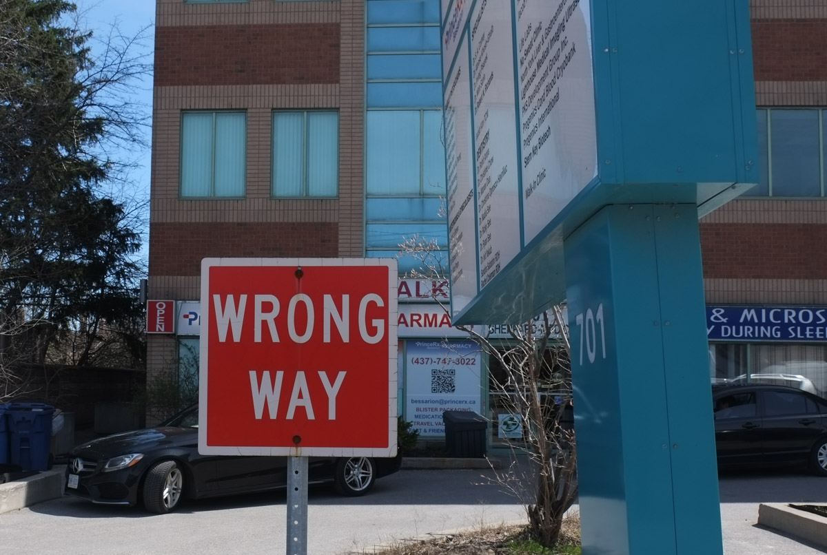
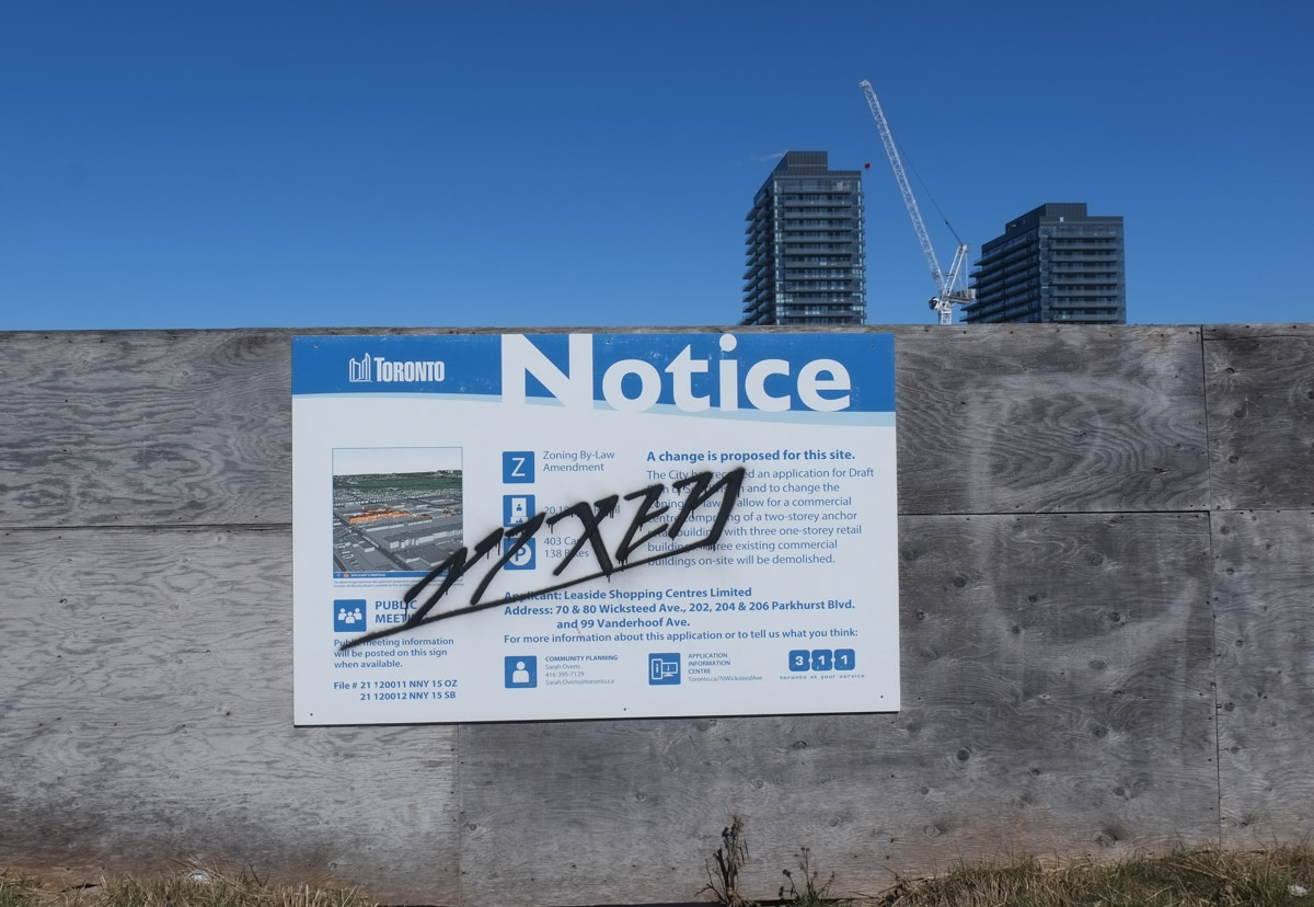
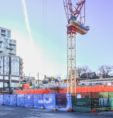
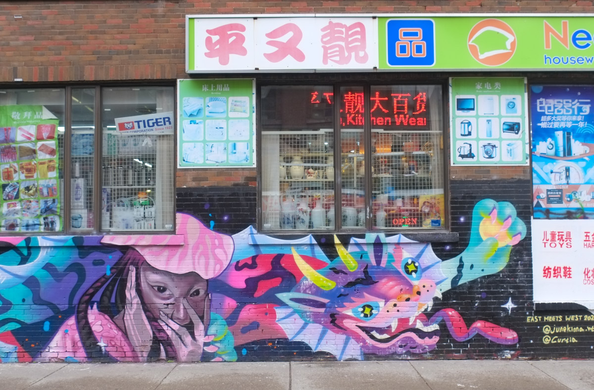
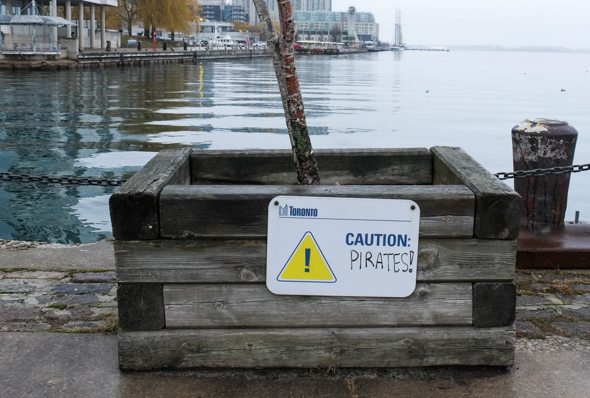
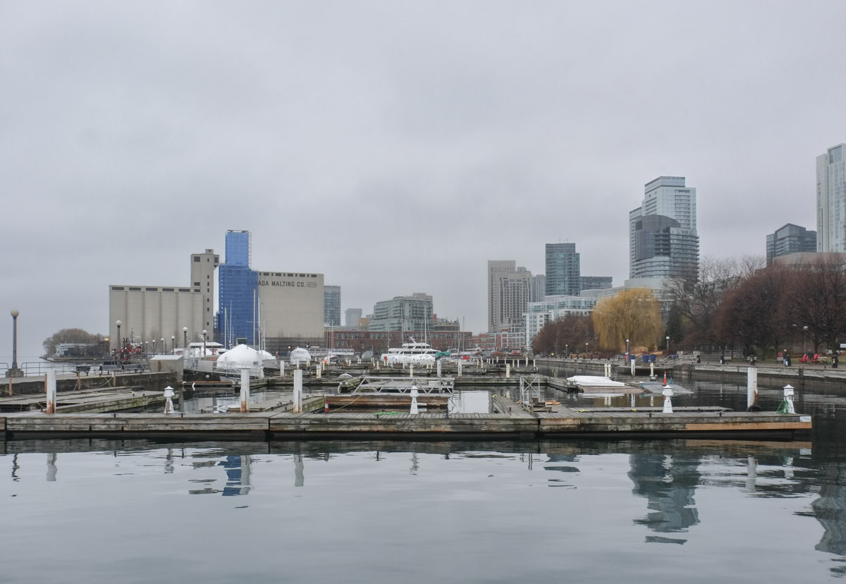
… the northern end of the Ontario line that is.  It was a foggy, overcast day when I went searching so I have many grey low contrast pictures with the occasion sunny image when the clouds parted for a few minutes.   As construction progresses there will be lots of opportunities for better photography!  It may be many years yet.

The plans on the Metrolinx website show the Ontario Line ending at the Science Centre station at Eglinton and Don Mills.  From the Science Centre, an elevated line runs south to a Flemingdon Park station near Gateway Blvd and Don Mills Road.  The map suggests that the line runs over or parallel to Don Mills Road.

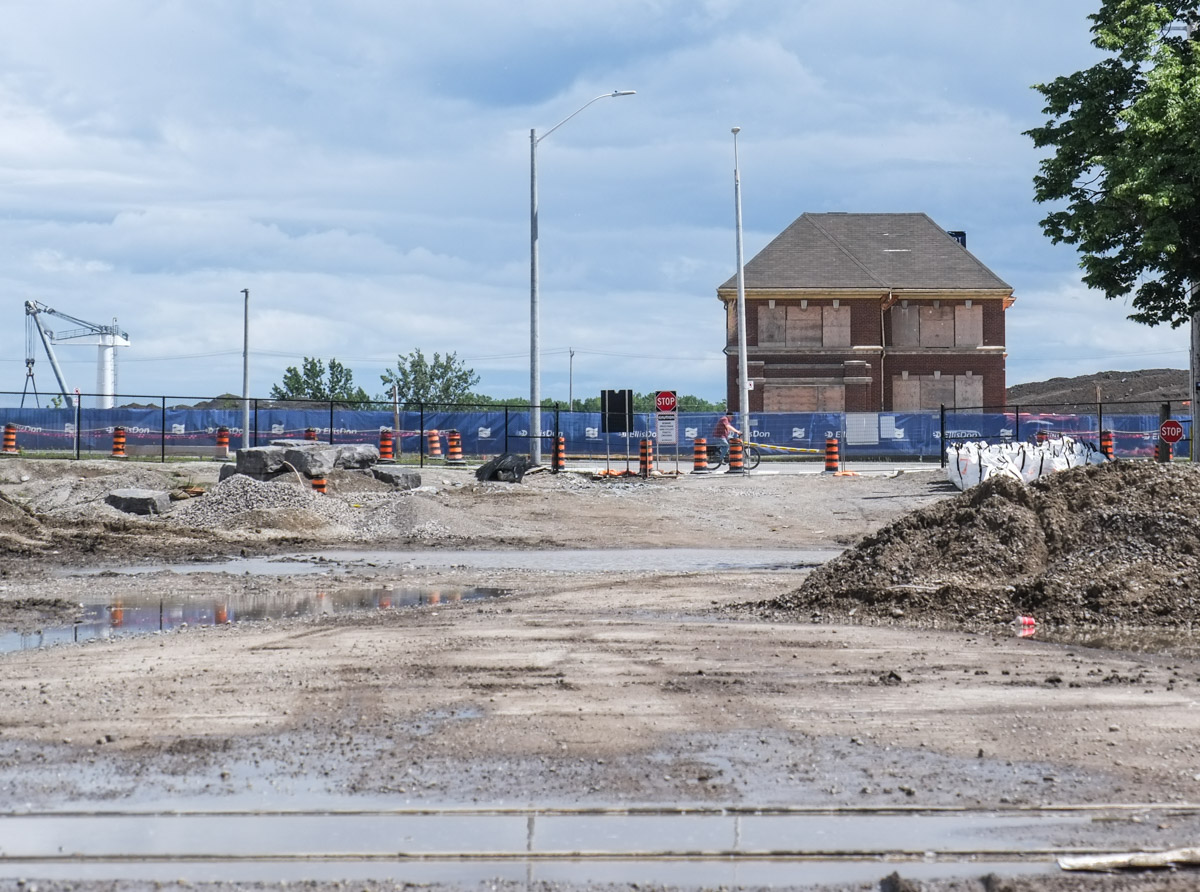
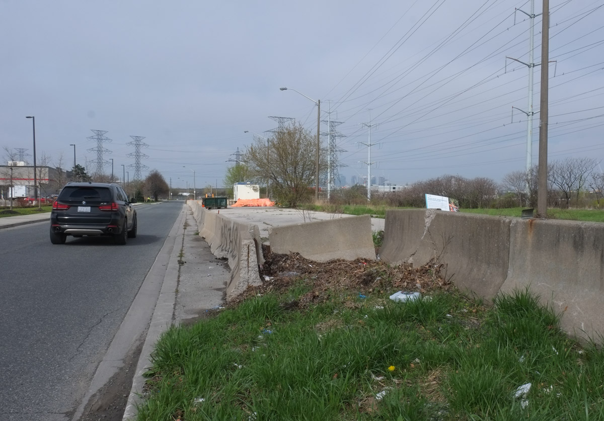
below: Northeast corner of Don Mills and Gateway Blvd.  Grey on grey I’m afraid.

below: Map, screenshot from Metrolinx website.  Pink sections of the line are elevated and blue sections are underground.

map showing location of Thorncliffe and Flemingdon Metrolinx stations

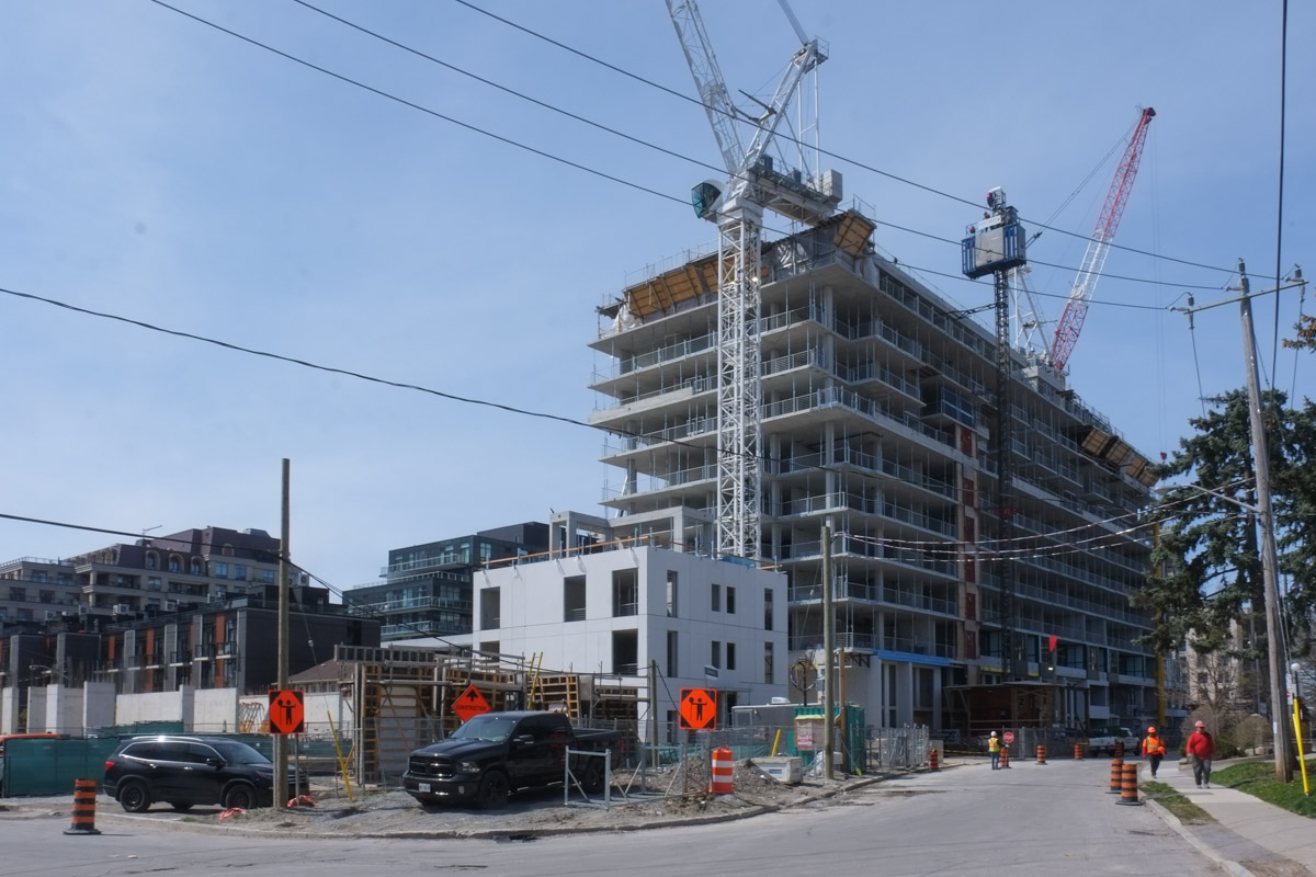
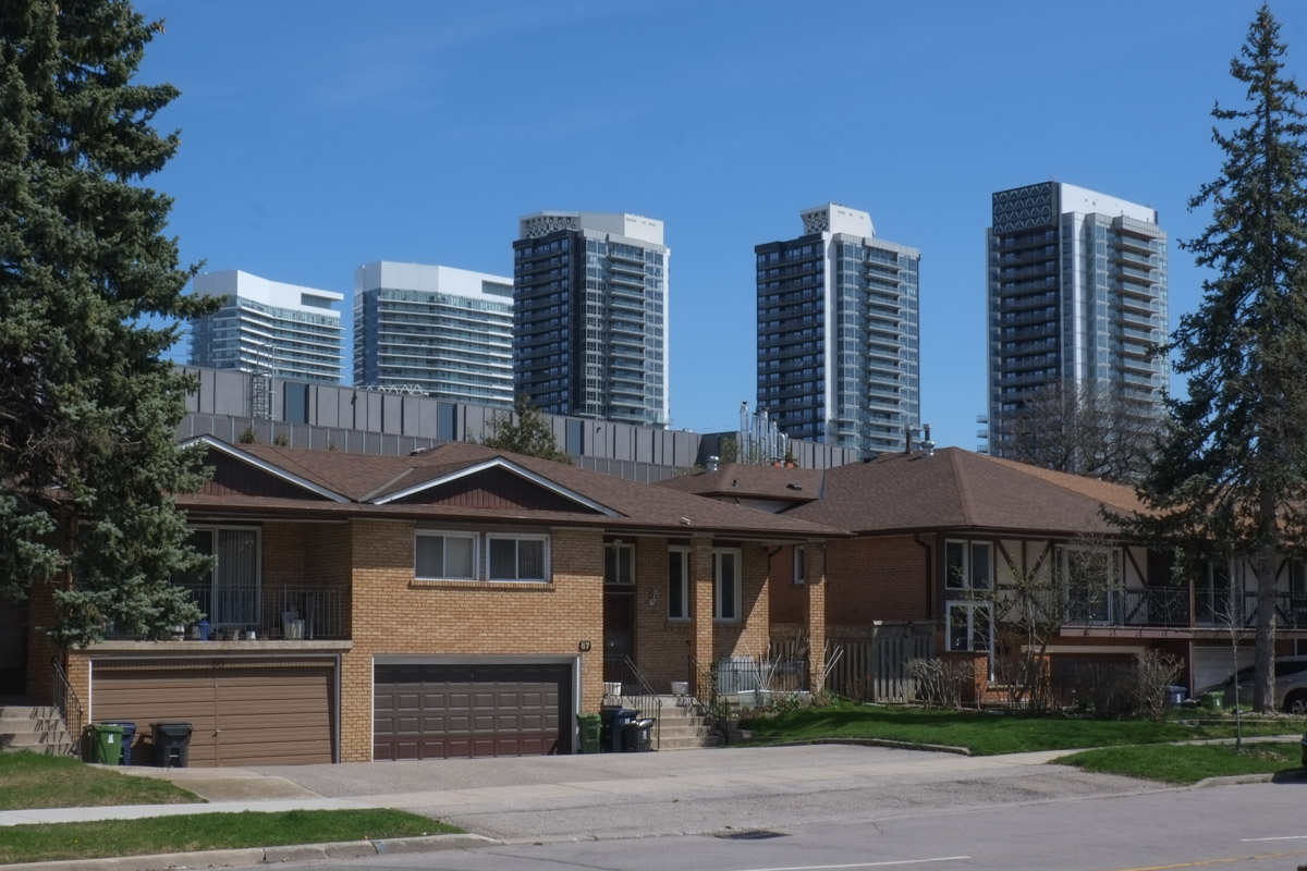
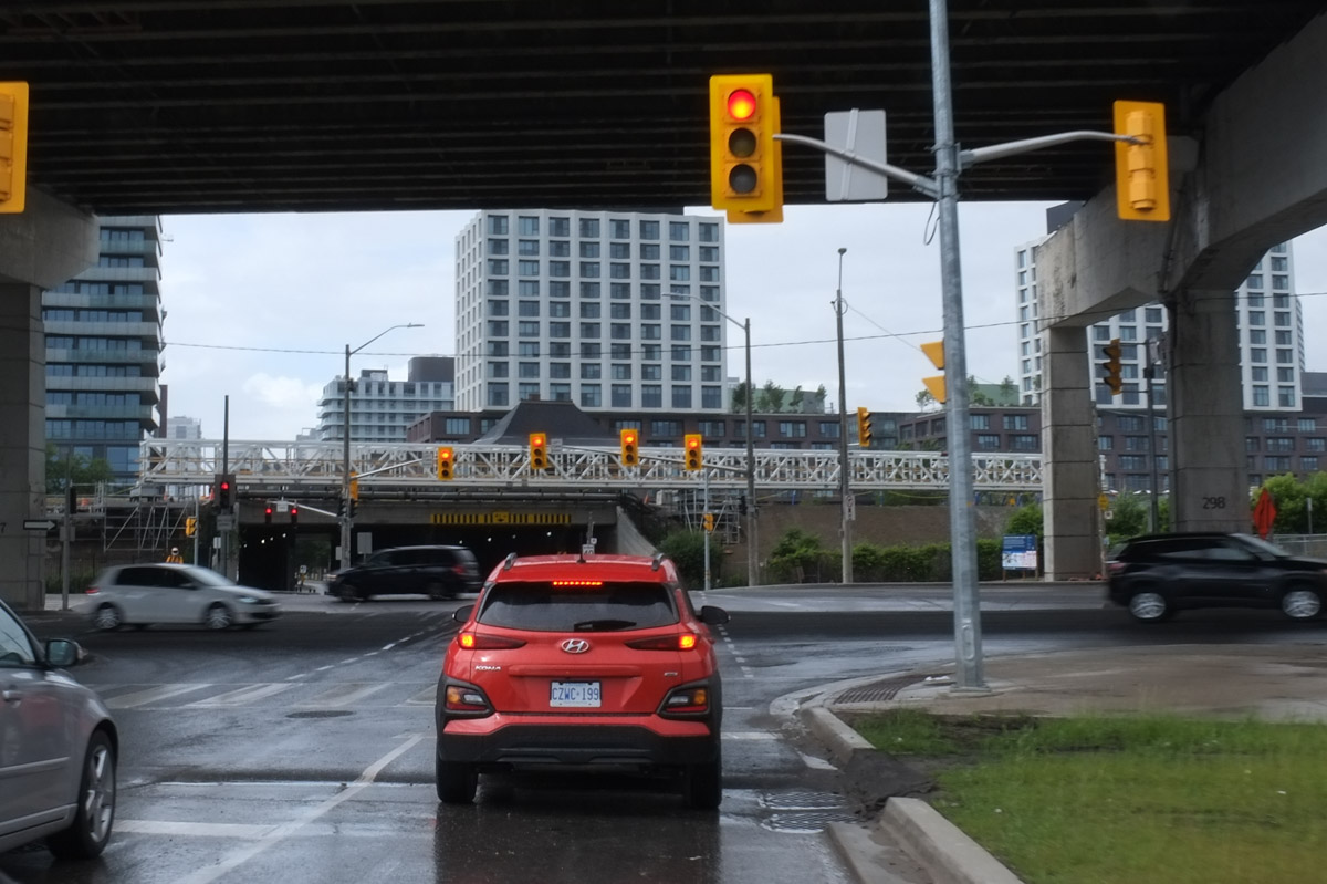
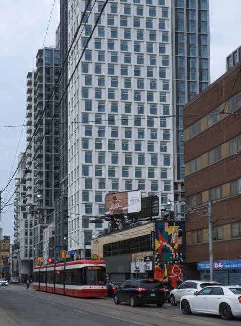
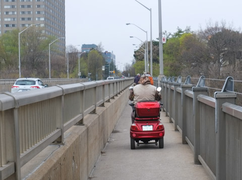
It is difficult to determine from the map the exact route the line will follow along Don Mills Road.  At the moment, the east side is largely undeveloped between the Science Centre just south of of Eglinton to the school at Overlea.   The west side of Don Mills Road is already home to a number of tall office and residential buildings as well as stores and restaurants.  Whatever the route, traffic on Don Mills is about to get ugly again (having just returned to normal after the Eglinton LRT construction).

below: West side of Don Mills Road, looking north towards Eglinton from hydro right of way.


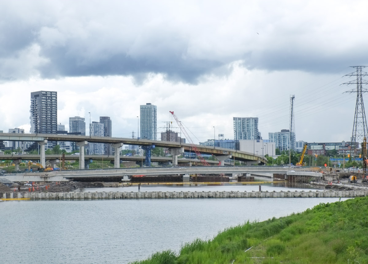
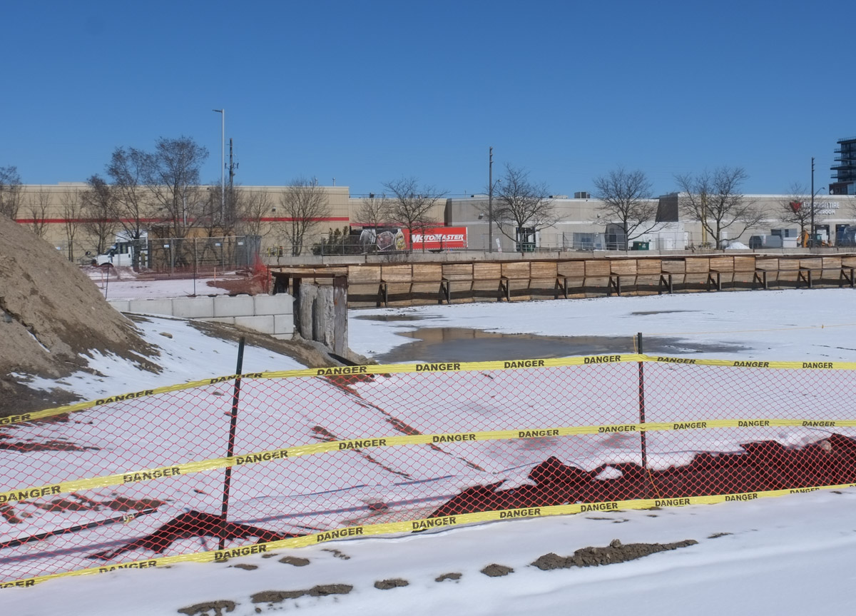
South of Flemingdon, and before Overlea Blvd, the line swings west and crosses the West Don River.

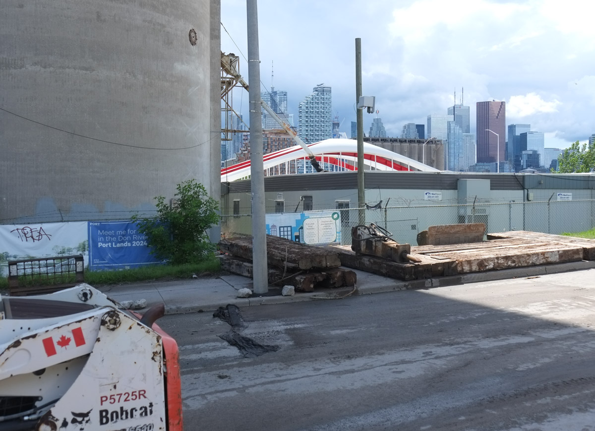
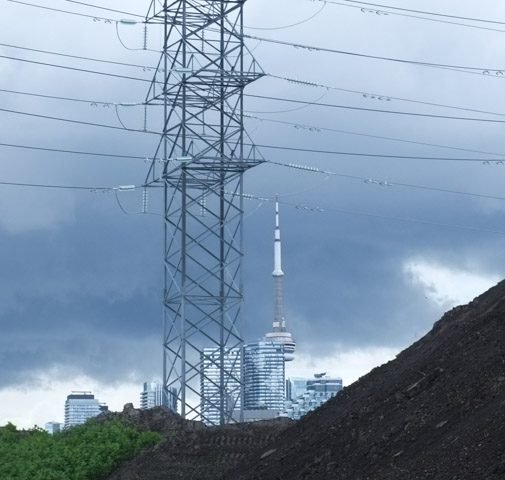
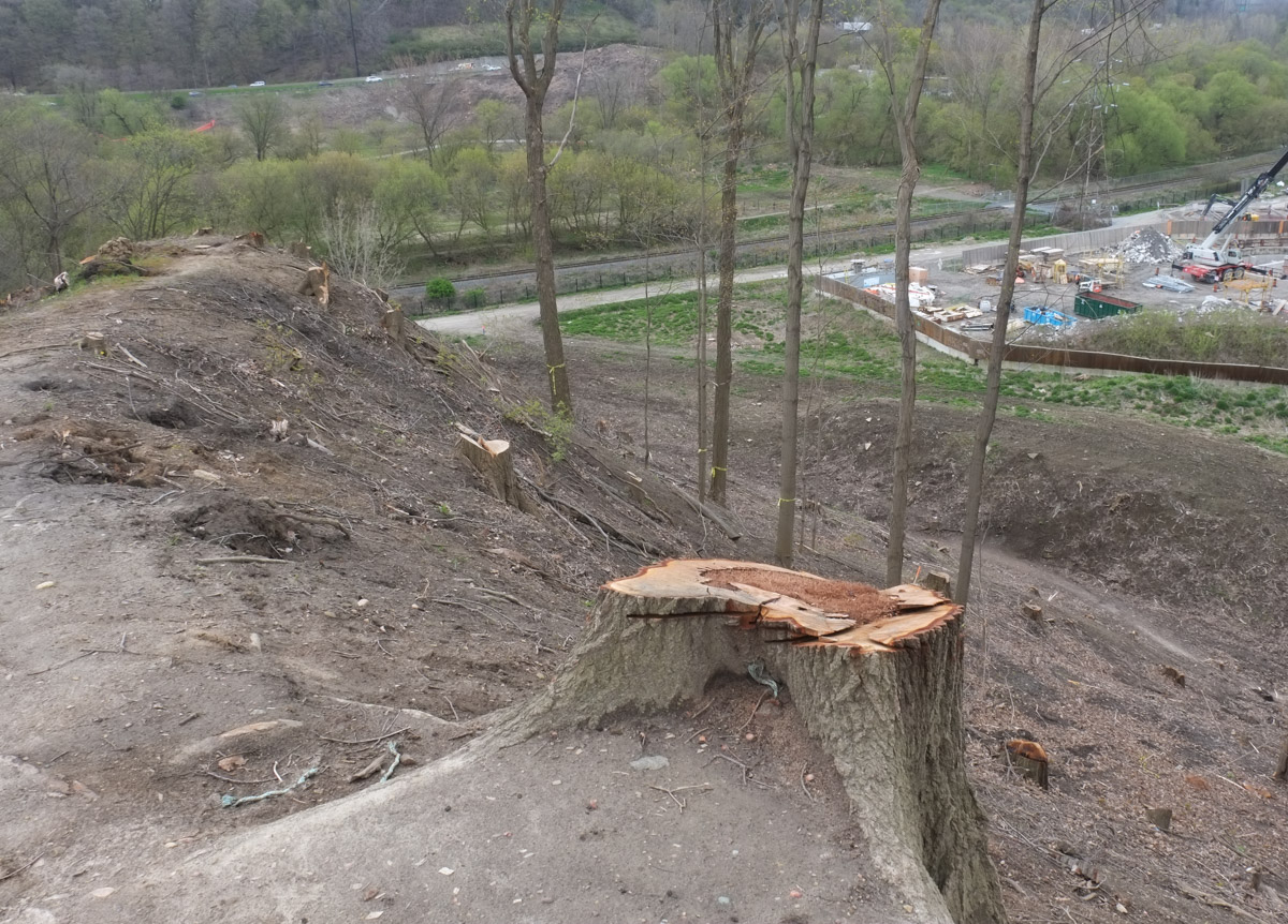
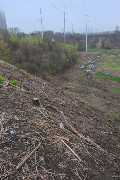
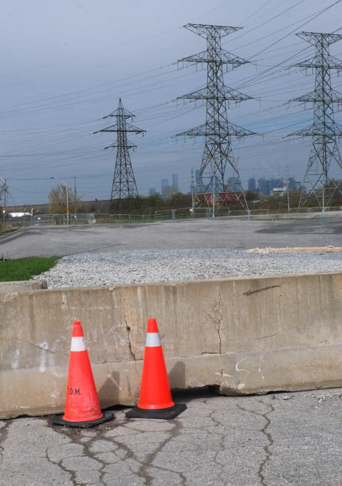
below: This is the section of land that has been clear cut recently. It is on the northern edge of a Hydro right of way that crosses the city.

clear cut stretch of land, some stumps still there, hydro poles and wire in the background

below: Photo taken from the same place as the one above, but looking more north.  It was a bit foggy but what you are looking at is E.T. Seton Park and the archery range there.  A tiny bit of the Science Centre can be seen near the top right.  The black bridge is the railway bridge just south of Eglinton near the foot of Leslie Street.

Seton Park, ravine, near Science Centre,

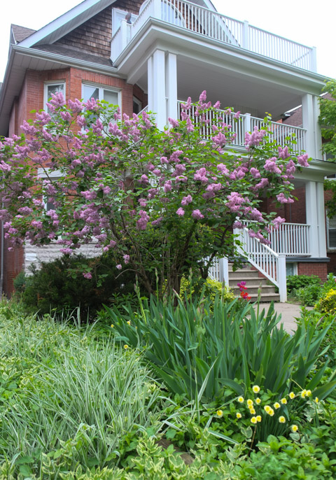
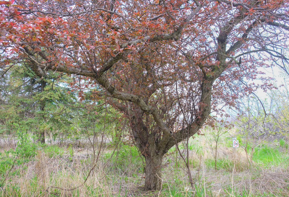
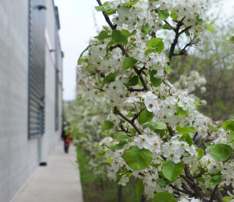
below: A spot of colour, spring blossoms on an old and gnarly crab apple tree.

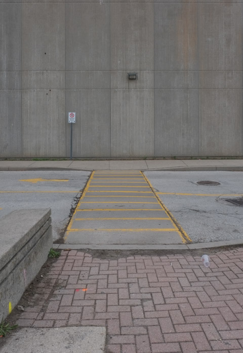
below: More grey concrete.  A wall of  Valley Park Middle School at the northwest corner of Overlea Blvd and Don Mills Road.

When the Ontario line swings west of Don Mills Road, it will run parallel to Overlea Blvd as it crosses the West Don River.

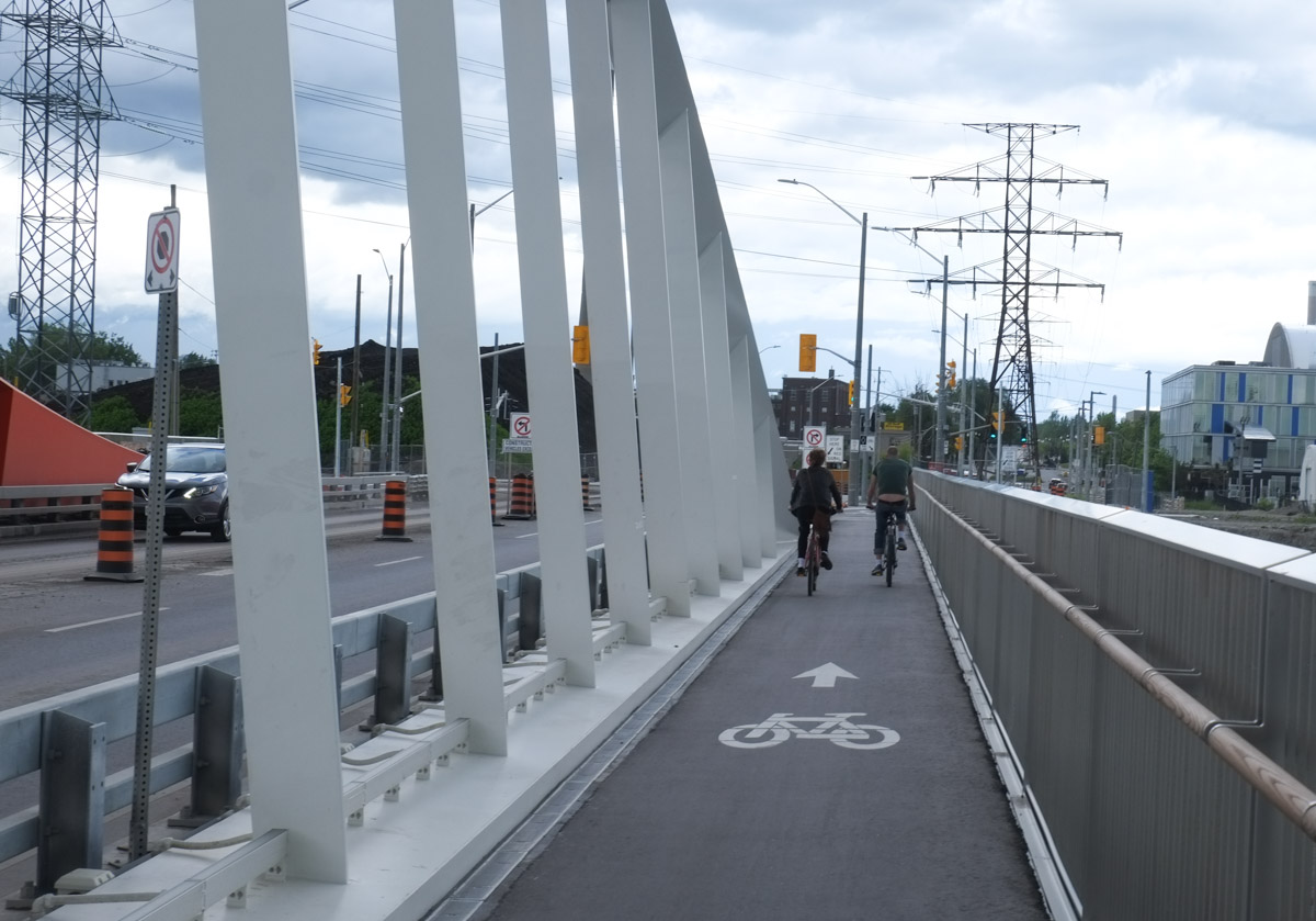
below: This is the plaque on the bridge, the Charles Hiiscott Bridge apparently (does anyone call it that?).  It was named after the mayor of Leaside at the time (1960).  I’m willing to bet that everyone just calls it the Overlea bridge.  Whatever you call it, it’s 62 1/2 feet long and rises 115 feet above the valley floor.

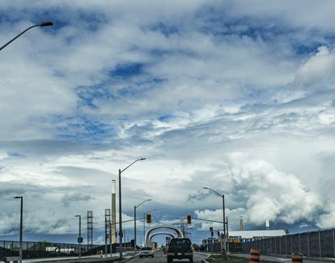
below: Looking north from the bridge over the West Don River and the Seton Park trail.  There is a clear cut hill on near the top left corner of the photo where the Ontario Line will pass.  I have tried to find any drawing or plans that Metrolinx has that might illustrate what this section would look like beyond the fact that it will be elevated.  Some sort of bridge over the Don is needed but the details seem to be up in the air as well.

West Don River as seen from Hiscott, or Overlea, bridge, looking north towards Eglinton, spring, leaves just budding on trees, grass along path is green, some evergreen trees, large new condos n the distance

After crossing the West Don, the tracks will (probably) run behind the buildings on the north side of Overlea.  until Thorncliffe where a station is planned at the intersection of Thorncliffe and Overlea.

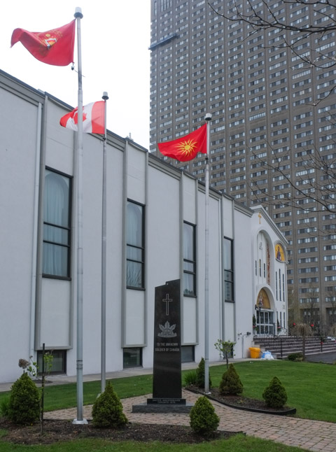
below: The Greek Orthodox church has a large presence in this stretch of Overlea.

United Macedonian unknown soldier memorial outside greek orthodox church, along with Canadian and macedonian flags

United Macedonian unknown soldier memorial outside greek orthodox church

truck backed into parking spot in loading bay of yellow brick warehouse type building

large puddle reflects tree that has been pruned to avoid hydro lines,

large puddle reflects a couple of high rise office buildings as well as a low brick warehouse building


back of a light industrial building that is red brick with large sections of coloured trim, parking lot, apartment building on Thorncliffe in the background

below: There is a large community garden there now.

large community garden in Thorncliffe, lots of fences and stakes, early spring so there isn't much growing

below: This is still on the Hydro right of way.

community garden plots on hydro right of way land

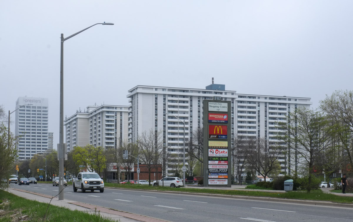
below: That’s the back of Costco just peaking into the photo.

car driving on street behind costco, vacant land and hydro right of way on the other side of street

many tall metal hydro poles on right of way

two small orange cones in front of a concrete barrier, large metal hydro poles in the background

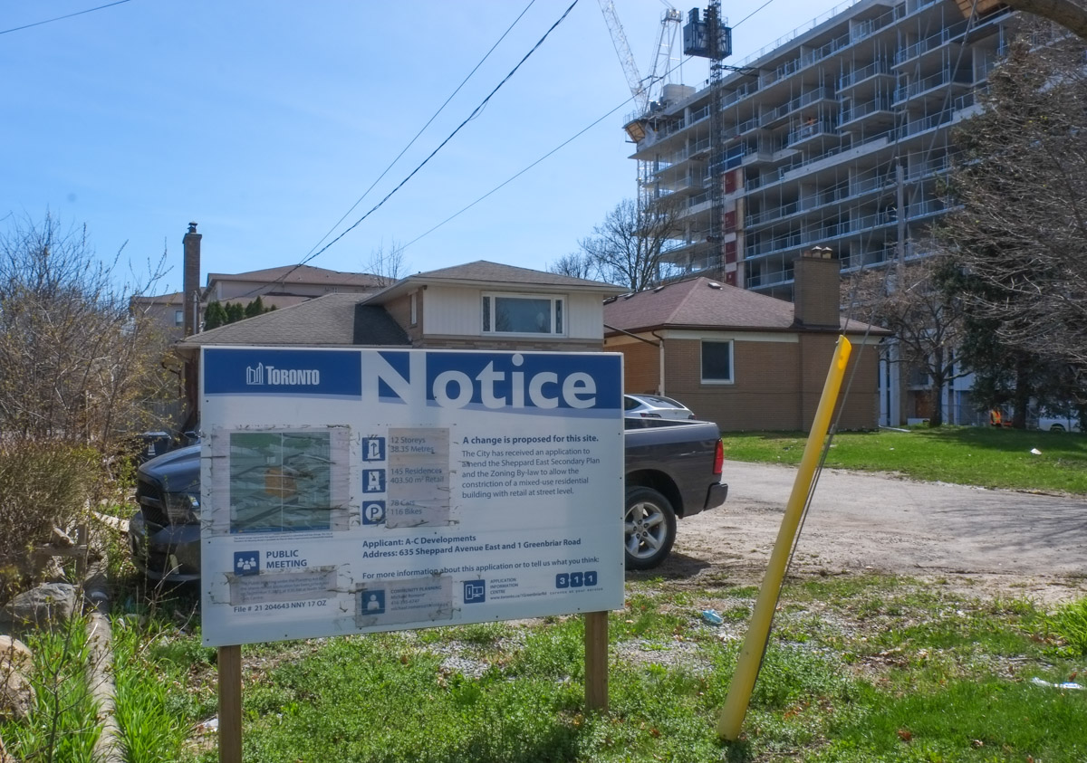
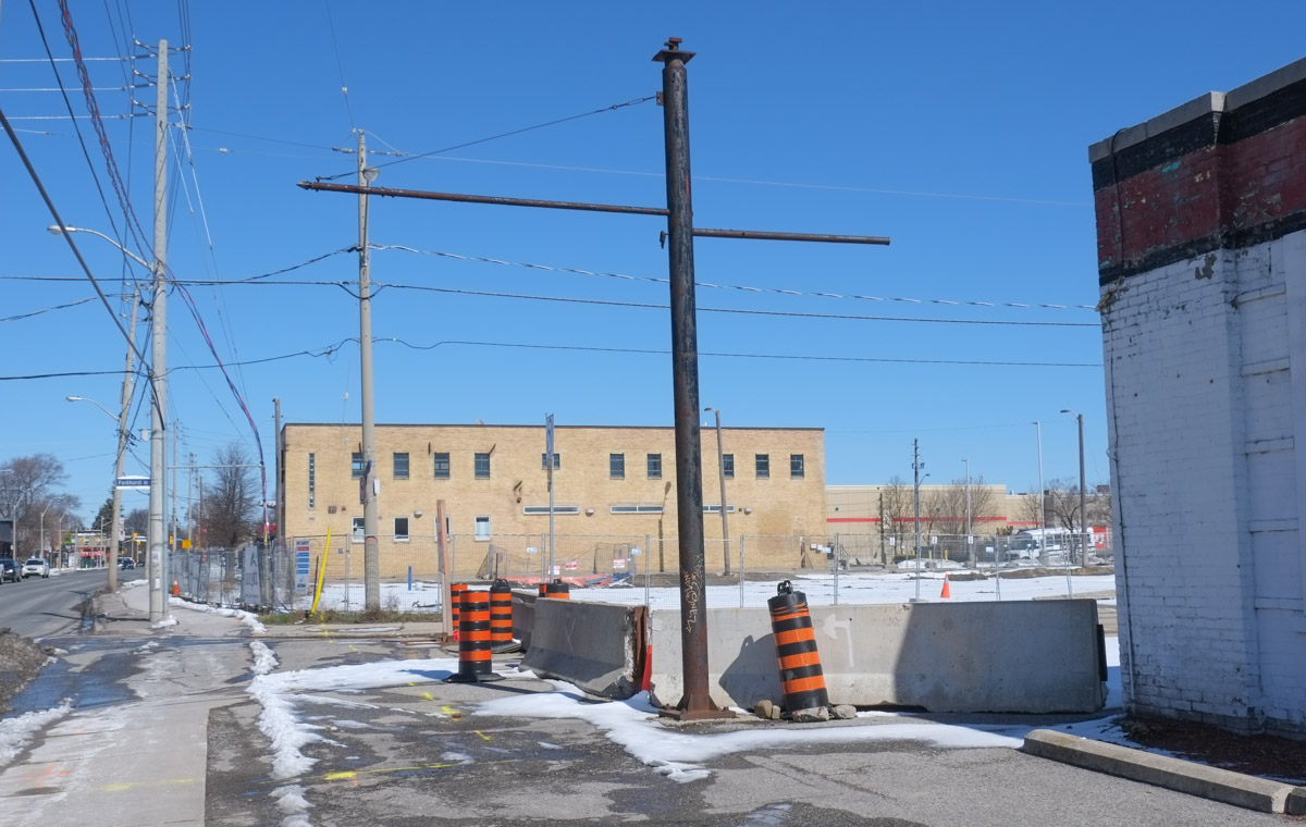
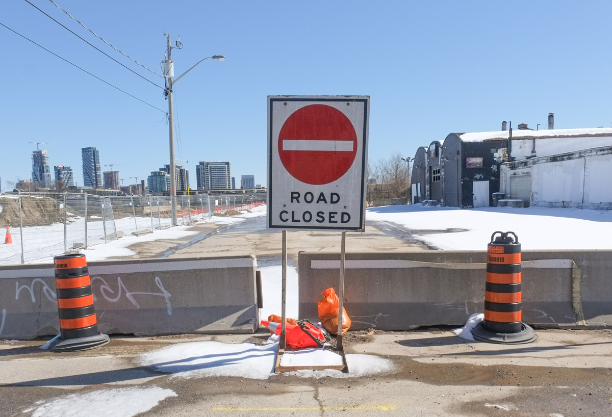
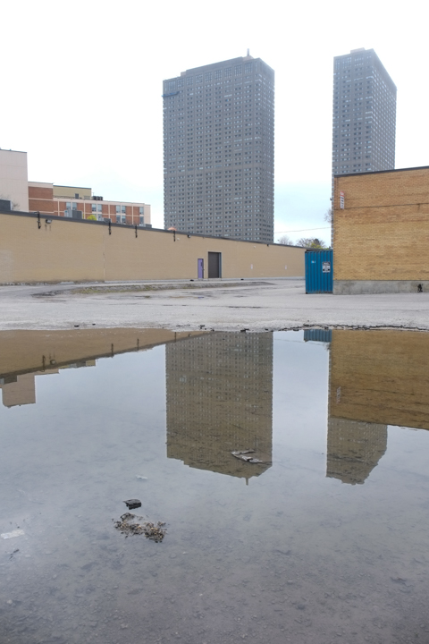
below: Road closures and empty buildings.

dead end of street, small building there is no longer open for business, signs for metrolinx construction of Ontario lone

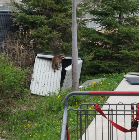
below: A “trash panda” raccoon checks out the old metal bin behind Costco

a raccoon climbs up broken door of a metal bin, shopping cart in foreground,

below: On the west side of Costco there is a row of apple trees now in blossom

a row of apple trees covered in white blossoms along a path beside a concrete building

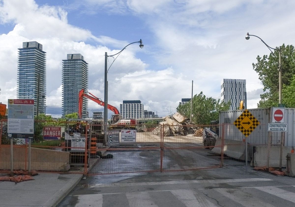
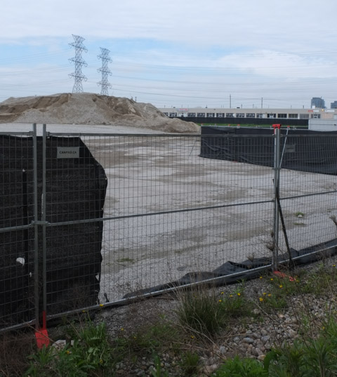
below: But on the other side of the apple trees is a very large, now vacant, plot of land surrounded by hoardings.  This is Metrolinx.  This is where the Ontario Line turns to join Overlea at Thorncliffe Park.

fencing and hoardings around a vacant lot, with a pile of sand along the far edge

below: Much of Overlea to the west of Thorncliffe is either empty or about to be. The exception is the Salvation Army headquarters at the corner of Overlea and Millwood – the blue and white striped building in this photo.

below: Part of the plan for the neighbourhood is this new Islamic Centre that replaces an older building that will be demolished to make way for the Ontario Line.

new islamic center under construction,

below: A discovery – hiding in the bushes.  This looks like an old fire hydrant.

vintage red fire hydrant, still in use, behind a bush on Overlea

below: It’s actually a “fire main indicator post” made by the McAvity Company.    It marks an underground valve that controls the water supply.   Thomas McAvity started in business in 1834 in St. John New Brunswick; he was followed by most of his 6 sons and together they built a large, thriving company with foundries that produced plumbing parts, among other things.   They started making fire hydrants in 1903 but sold the company in 1960.

closer look at mcavity fire hydrant,

broken sign that had lights, in front of a building with ads for vitamins on the windows

outdoor storage of extra traffic lights, temporary lights used in construction and for road works

yellow construction fence around vacant lot with low rise building in the background

red metal piece that joins the tops of two metal construction fences, ripped corners of hoardings that used to be attached as well

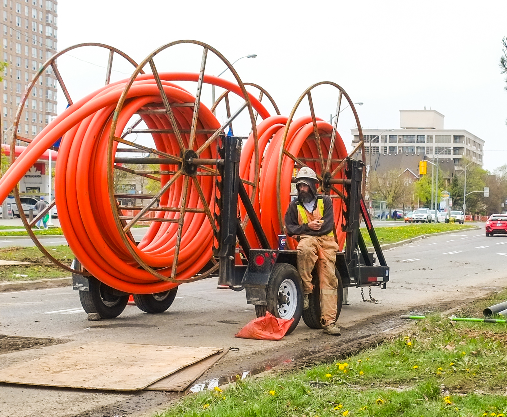
below: Digging holes on one side of the street

two men working beside the road, one in a digger, and one standing by the hole that it is digging

below: And laying orange conduit for future cable on the other side

a man in hard hat and safety vest sits beside a piece of equipment used for laying large conduits for cables under roads, lots of orange conduit piping on the trailer too

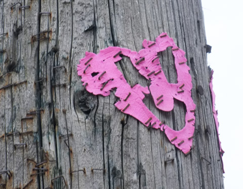
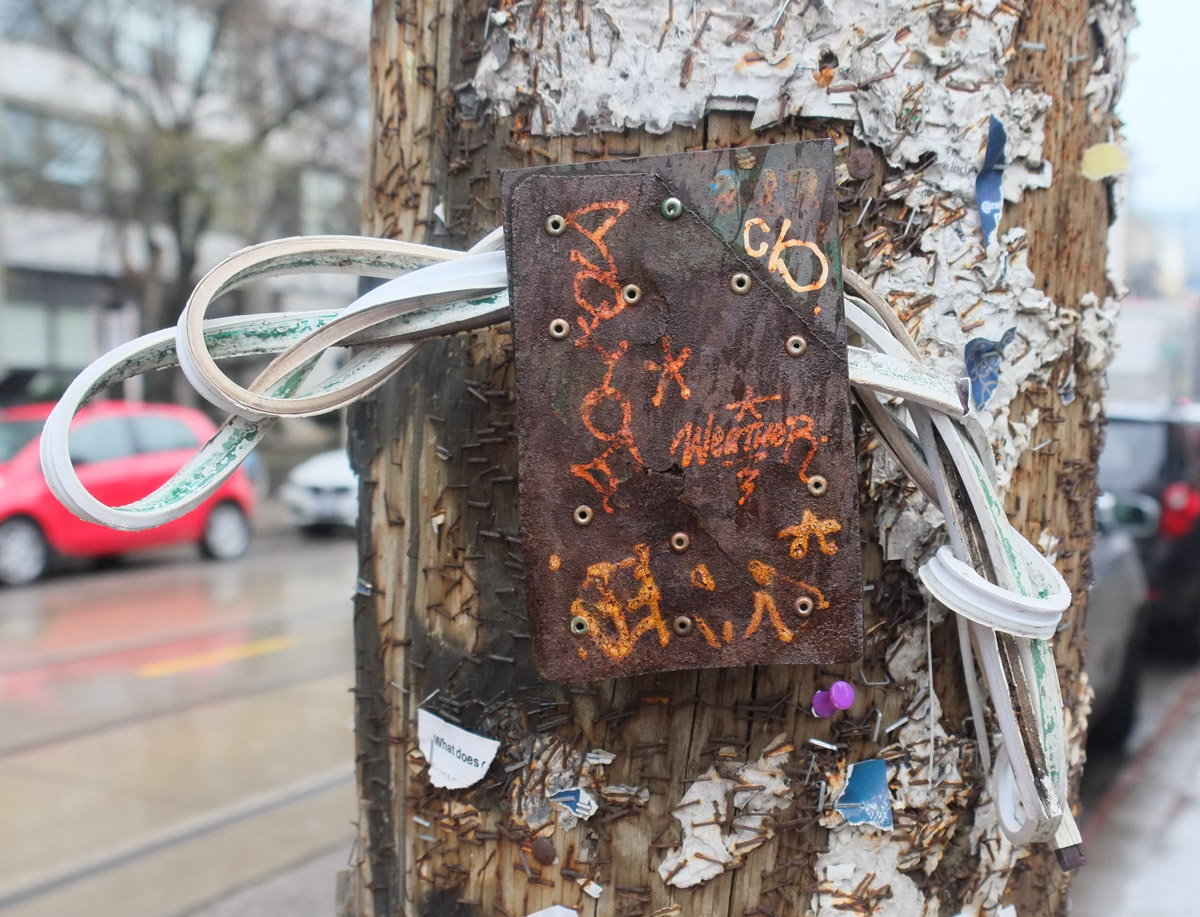
below: Sidewalk hieroglyphics, speaking a language most of us don’t understand.

red, orange, and yellow markings on sidewalk, pre construction layouts and routing of underground systems

below: Looking east on Overlea approaching Millwood.  The new Islamic Centre is the building with the turquoise upper level.  Somewhere in here, sometime in the future, an elevated train will run.  At least that’s the plan.

looking east on Overlea towards construction of new islamic center

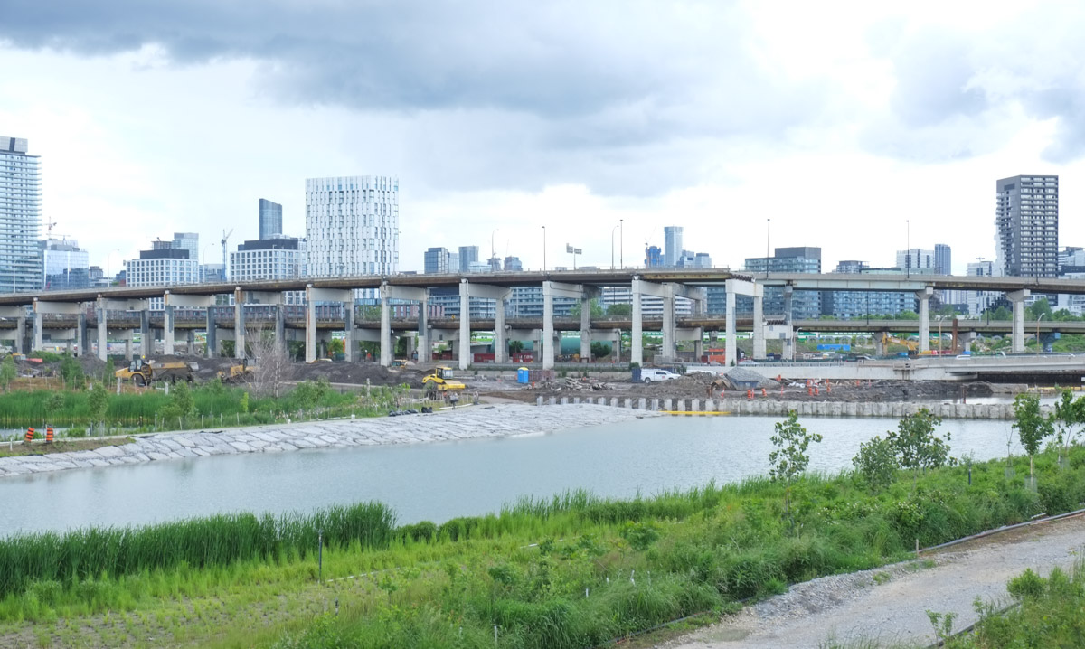
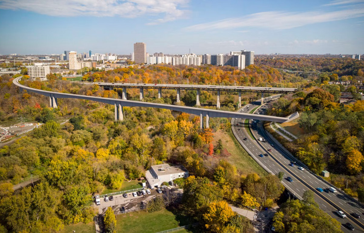
From Thorncliffe Park station at the intersection of Thorncliffe Park and Overlea Blvd., a train running towards downtown will now need to cross Millwood, the Don River, and the Don Valley Parkway.

below: I had more luck with finding possible ideas for this second bridge.  On a page on the Metrolinx website there is a rendering of the bridge that will cross both the Don River and the Don Valley Parkway (DVP).  This view is from the northwest.  It shows the new bridge running parallel to the Millwood bridge (shown here as the shorter straighter bridge).

screenshot from metrolinx website showing planned bridge over the West Don River and DVP just north of Overlea

A pretty picture.  But what does in mean?  What are the implications?

A hint….

large tree trunks with yellow caution tape tied around them

land recently cleared of vegetation, dirt ruts

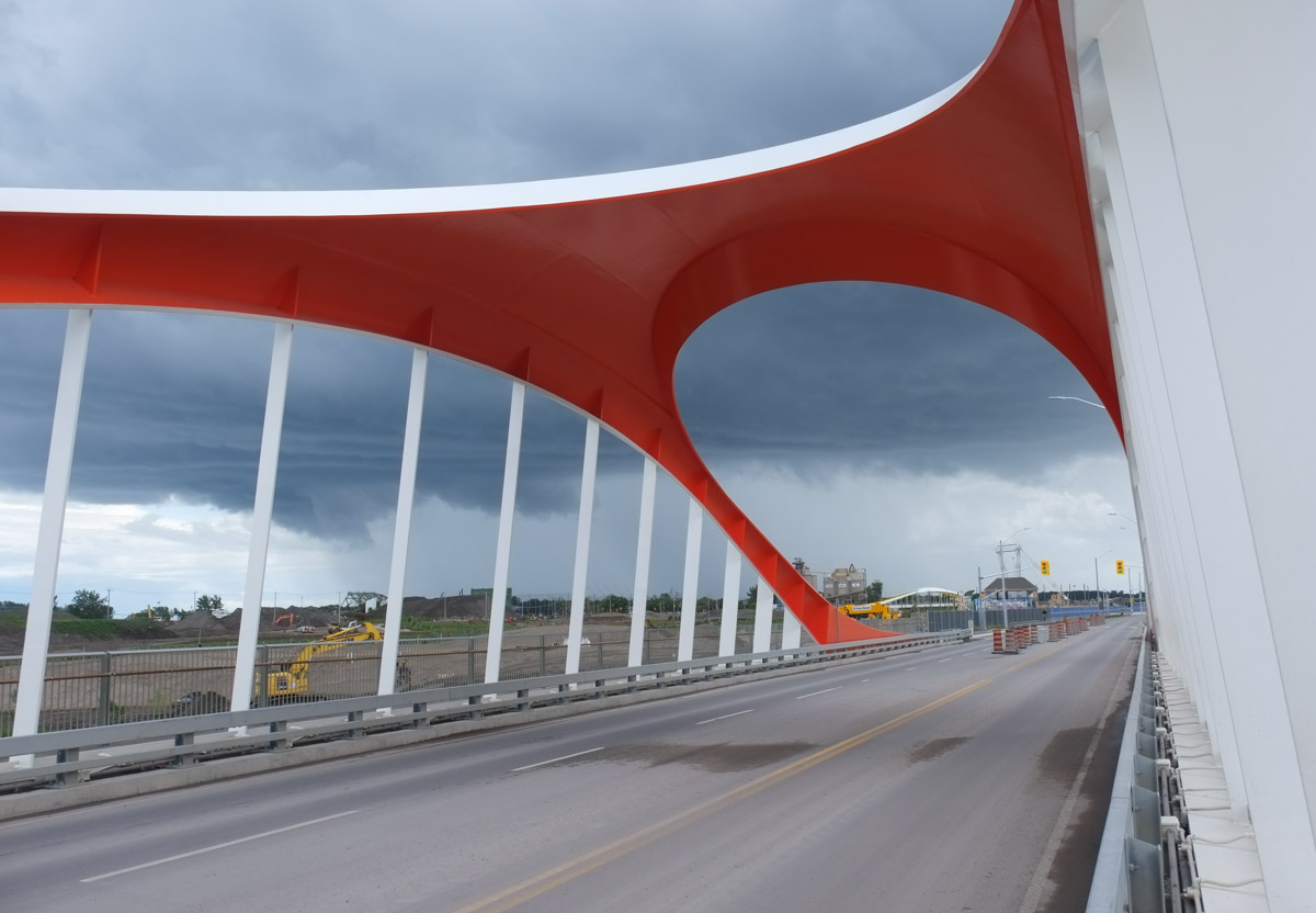
below: Another section of Toronto ravine lands cleared of trees. This is immediately west of the Millwood Overlea intersection. The Millwood bridge is in the background.

ridge of land, now cleared of trees, some debris remaining, dirt, Millwood bridge in background

large tree stump in a patch of forest that has just been clear cut

below: The clearing has made the North Toronto Wastewater Treatment facility much more visible. There is a lot of upgrade work going on there too!   Twenty five million dollars worth of upgrades in fact, yes $25,000,000.  (source: Bennett Construction Group)

North Toronto Wastewater Treatment plant, in valley by Don River

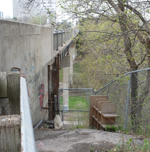
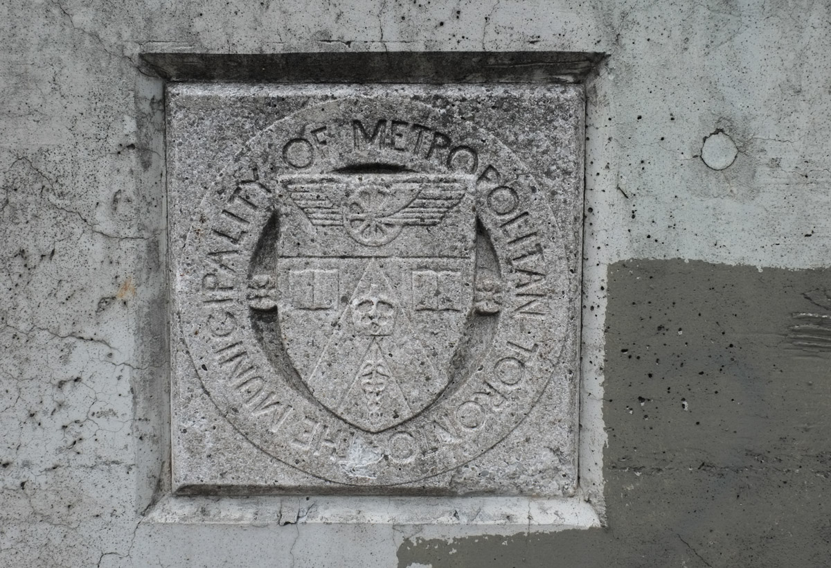
below: “The Municipality of Metropolitan Toronto” in stone and embedded in the concrete of the Millwood bridge.   In the center is the “Arms” of the municipality created in 1991.  Because the internet is the source of amazing trivia, this is the description that I found on the Governor General of Canada’s website, “Argent on a chevron Gules between two open books Argent edged Or bound Gules in chief and a caduceus Or fimbriated Gules in base a representation of the Royal Crown Or on a chief Azure a cogwheel winged Or;”   One questions leads to many more, right?  Well, “gules” = red, “fimbriated” = has a narrow border,

Metropolitan toronto symbol in stone, embedded in the concrete of the Millwood bridge

below: Under the Millwood Bridge.  The fence has been repaired so access to the structural underparts is restricted. Back in 2015 it was easy to get underneath – Under the Millwood Bridge.

a photographer stands under the Millwood bridge, on hill beside fence that keeps people off the underside of the bridge, graffiti on concrete and metal parts.

graffiti on lower parts of concrete pillars hoding up the Millwood bridge beside the Don River, spring greenery

graffiti happy face under millwood bridge

simple black drawing of a man in a hat, eyes closed and crying big tears, drawn on a wall with other street art

discarded trash on the ground, broken orange cones, an old hubcap, brown paper, dead leaves, beside a sidewalk

These photos were taken on one of those rare days when there was snow on the ground, i.e. not within the past couple of weeks.   As usual, I am a bit behind but I thought that I should finish this page before posting snowy pictures is too weird.  Anyhow, let’s head to Leaside and walk up Laird Drive …

below: Condo building on the west side of Laird.  Like many neighbourhoods in Toronto, it’s an area in flux, full of changes.

Laird at Commercial, condo development on the left with a large crane, traffic lights, cars, 2 street signs for Commercial Road, Leaside

below: More facades, more condos.  This might be a new word for you but this is facadism; the facade of an old building gets incorporated into a new development.  It has become the most common form of heritage preservation in Toronto.  In 1921 this building was home to the Canadian branch of Durant Motors Inc.  They made cars.

blue metal container in front of an old brick building with decorative stone entrance, empty, facade being kept in making of new condo rising above it

below:  This is an example of the cars produced by Durant Motors.  With thanks to Wikipedia, this is a 1923 Durant touring car.

1923 Durant Motors touring car, image from wikipedia, red car,

1923 Durant A-22 touring car 9th Annual Saturday Night Cruise-In, June 28, 2014, Hastings, Minnesota, photo by Greg Gjerdingen


below: The lion and crown on the lintel over the window (once a door) is the crest of the Imperial Bank of Canada for whom this structure was built in 1941.   No facadism here.  The whole building is now a restaurant/pub.  When I was researching to find out if this building has heritage status (it doesn’t), I discovered that this bank was robbed by the Boyd Gang in 1951.  It was the biggest bank robbery in Toronto at the time.  Edwin Alonzo Boyd and his various gangs committed eleven bank robberies between 1949 and 1952.   He even escaped from Kingston Penitentiary in 1951 before getting caught again in 1952.

red brick building with a stone decorated door frame, a lion in a medallion

below: Olde Yorke fishe and chipe restaurante at the corner of Laird and Lea.    This too is a heritage site for its cultural value.  It was historically known as Osmond’s Restaurant and was constructed as a red brick building as early as 1923.  John Osmond owned the property and it was his family’s home as well as a restaurant. In fact, it has always been a restaurant.  It was known as CNR Restaurant in 1926 because of it’s association with the Leaside railway station.   It was also used as a lunch room or cafeteria for the workers in the local factories and industries.

Old Yorke fish and chip restaurant on Laird, old house,

below: A sign of the times, a cannabis shop.

two adjacent buildings on laird, on the left, an older two storey house, now nuleef cannabis and on the right, square building, painted yellow, a music school

looking north on laird, billboard on right, construction sign

below: Sales office for The Leaside Residences, open by appointment only.  Not just luxury condos, but luxury boutique condos.  Apparently there will be two buildings of 8 storeys each and they will include studios to some 3 bedroom townhouses.  Studios start at $600,000.

low rise building, one story, sales office for new condo development, leaside residences

below: Large shopping area on east side of Laird, just south of Wicksteed.   A big parking lot surround by big box stores.

shopping complex on laird, parking lot, big box stores, in winter,

condo construction with red crane reflected in a large window in a building across the street from it

below: Another vacant lot, Laird and Parkhurst, just south of Eglinton.

lowrise yellow brick building across a vacant lot covered with snow

snow covered vacant lot behind a metal construction fence, yellow brick building in the background

no entry, road closed sign in front of concrete barrier, empty road behind it

below: Closed to traffic but there was nothing to stop me from walking down that road.  Looking north to the back of Canadian Tire that is on Eglinton.  The back of the hoardings along Vanderhoof can also be seen.  Under that snow is a hole full of water.

yellow danger tape on metal poles, making temporary fence in front of hole in ground that is full of water, top frozen and covered with a layer of snow., back of a Canadian Tire store in the background

below: Still looking north but a more east.

looking across vacant lot towards new condo development

below: Laird and Eglinton and a sad sight (or site, your choice) – an unopened Laird subway station on the southwest corner.

on Laird, looking west to intersection with Eglinton, Laird subway station there, new and not open yet, line of stores on north side of Eglinton

below: The original plan was to walk Laird but we’re so easily called away and Eglinton beckoned.   Looking west…

looking west on Eglinton, from near Brentcliffe,

below: Four storey apartment buildings on the north side of Eglinton.

housing on north side of eglinton Ave

below: Lots of this type of residential buildings on Eglinton.  Walking east.

a man walks his dog on sidewalk, on south side of eglinton, row of lowrise buildings, residences, on the north side

below: Just east of Laird is Brentcliffe where there is now a large new development on the southwest corner.

Eglinton Ave, looking east from Brentcliffe, snowy, people have just got off a bus, sign saying open house for the new condo building on the corner, high rises in the background at Don Mills

below: From the back (taken on Brentcliffe)

two identical condo towers side by side, reddish lower parts (about 8 stores, and glass above), construction site out the back with fences and trailers, sign says gate 2

below: There is a skyway between two buildings in this development which seems to be called Upper East Village.  From their website –  An 1160 sq foot, 2 bedroom apt on the 9th floor is available for $1.4 million.  Also available, a 1750 sq ft., 2+1 bedroom on the 18th floor, for a mere $2.5 million;  It’s a corner suite if that helps.

orange and black traffic cones sit on a road that passes under a pedestrian bridge between two condo buildings, words on bridge say Upper East Village, snow on the ground

below: The view from Brentcliffe, looking northeast back towards Eglinton.  Those new buildings are probably the ones being built at Don Mills and Eglinton (where IBM once stood).

on Brentcliffe Ave., looking northeast over a vacant lot with a fence around it, to houses on Vanderhoof, and highrises on Eglinton

below: More on Brentcliffe

abandoned grocery store cart beside a TTC bus stop pole adjacent to white building with blue boarded over window

below: A patchwork of worn plywood make the hoardings along the south side of this redevelopment site on Wicksteed.  (Wicksteed runs parallel to Eglinton)

long wall of worn plywood hoardings, grass beside it, along Wicksteed, looking west towards Laird

below: One of thousands of these blue and white signs that can be seen around the city.  The surprise here is that the proposal is for a commercial development – a shopping complex for SmartCentres REIT.   The plan dates from 2021 but the hoardings pre-date that.  This site has a long history that goes back to at least 2011 but I haven’t tried to figure it all out!  Rumour says that part of the issue is that previous commercial developments on the other side of Wicksteed turned out to be so ugly AND it was thought to be a Walmart that was going to be built.

blue and white toronto development notice sign, posted on plywood hoardings, large new condo in the background

part of a wall made of weathered pieces of plywood, wood some bits of white and red paper stapled to it, a faint white arrow pointing right

fence with lock and chain, vacant lot seen through the gap in the gate,

empty metal shopping cart lying on its side on the other side of a chain kink fence with a large hole in it, ground covered with snow

below: Wicksteed approaching Laird with an older white structure, a remnant of Leaside’s past.  Back in the day, the Leaside Aerodrome was nearby.  It was built in 1917 to train Commonwealth pilots for the last days of WW1.

on Wicksteed, just east of Laird, an old corrugated metal building with rounded roof, large garage door, chainlink fence beside it and a large tree

facade of white metal metal building with large garage door in center, and roofline of three curves, rusted portions,

below: Not the type of building that you would usually associate with an auto shop.  Also, remember the very first picture in this post?  It included a street sign for Commercial Road.  Well, this building is nearby, but on Industrial Road.

auto shop on industrial road in leaside

This part of Leaside used to have much more light industry than it has today. There are still industries there today but they are closer to the train tracks that cut through the area – running northeast from the from the south end of Laird (where it meets Millwood).

below: For instance, I saw this interesting piece of equipment. I am not sure what this large machine does but the sign on the fence says Coco Paving.

large machinery in yard of Coco Paving Co., behind fence, with snow,

The area may also be impacted in the near future by Metrolinx and the Ontario Line. Somewhere in the Leaside, Wicksteed area is going to be the new home of a large maintenance and storage facility. Has an actual site been selected? A story to look into….

I will leave with one last photo – it’s not a complete summary of what Laird is, but it’s a start.  It’s the view from the Home Depot parking lot looking west towards the construction of new condos on Laird.

machinery for rent in parking lot of a home depot store, parking lot behind it, condo construction with cranes in the background


below: I’d heard that the old Coach Terminal was no longer in use (since mid 2021) but I hadn’t heard anything about its present status.  Now I know: Empty.  Abandoned.

old Toronto coach station, now empty with metal fence blocking entrances

below: Apparently the land is owned by the city. There is talk of redevelopment that includes affordable housing, office space, etc. I am not sure where the plans are at (does anyone?) at the moment.

old Toronto coach station, now empty with metal fence blocking entrances, Elizabeth street view, newer high rises in the background

below: Concrete.  Just a concrete wall…  But an interesting use of concrete.

decorative concrete wall, with vertical geometric designs

below: The sign says “weather” and the weather this day is miserable.  Wet. Grey. Luckily I had a rainy day plan….

plastic coated wire bundled up and inserted between brass plaque and wood pole, lots of staples and bits of old paper in pole, artwork scratched onto the brass, including the word weather

I was meeting friends at Starbucks at Sick Kids.

a woman enters through the large glass doors of Sick Kids newer building on east side of Elizabeth street

below: This is when I learned that Sick Kids Hospital is in two buildings that are across Elizabeth Street from each other.  Only one has a Starbucks!

Elizabeth street, bench on sidewalk, bridge over the street connecting two sick kids hospital buildings

below: Inside the bridge with its zigzagging light

interior of pedestrian bridge, glass walls, a zigzag shaped light in the ceiling, white floor,

below: A white goose

a white goose (not real) on a ledge by a fake orange door on a wall between real windows

below: One side of the atrium, 8 storeys high, in the older building on the west side of Elizabeth

large multi storey atrium of Sick kids hospital, with elevator and stairs and window to rooms on the sides

below: On the east side of Elizabeth Street is the new Sick Kids’ Patient Support Centre – we didn’t venture too far past the main entrance and bridge to the other building, but there was a lot to see just in this space!

coloured lights, glass walls, stairs, atrium of Sick kids

interior at Sick Kids, glass walls, painted murals on interior walls, chairs, coloured lights

blue stair case, hanging public art beside it,

a security guard sits in a chair by a door, a large mobile, or hanging public art installation with hundreds of metal bits floating in the space,

below: Swirly squiggly LED lights turn an ordinary ceiling into something more.

squiggly LED ceiling lights at Sick kids

below: Gerrard Street entrance to Toronto General Hospital (TGH)

Gerrard street entrance to Toronto General Hospital

below: Part of a conference room door.

fractal like design on door to conference room in hospital

below: There aren’t as many photos from TGH for a couple of reasons. First, regrettably (in hindsight) we didn’t explore much of it and second, although hospitals are generally public spaces they are also places where people expect privacy. So you’ll have to settle for some empty chairs and artwork in a waiting area. I suspect that a wander around all of TGH would provide ample material for its own blog post, just not today.

artwork on wood paneled wall and above three blue chairs

below: After TGH we entered MaRS – they call themselves “North America’s largest urban innovation hub”.  A modern building that incorporated part of an older stone structure that was built in 1913 as the original home of Toronto General Hospital.   Ooops, it’s not a building, it’s a “Discovery District”.

interior of mars tower, large escalator

below: 1923 view of Toronto General Hospital with College Street in the immediate foreground and University Avenue on the right.  There weren’t many tall buildings 100 years ago!

1923 colour postcard of Toronto General Hospital, a brick building on College Street

photo credit: Photo found on Wikimedia Commons, image is in the public domain.

As it turns out, MaRS doesn’t like cameras.  It was the only building that morning where security approached us.  Apparently you can take all the photos you want if you use your phone but cameras are not allowed.  Snuck in a few before we got told off.

interior of mars building

a man sits at a wood table, in front of a room with red sofas and chairs, with a glass wall between them

inside atrium of MaRS discovery district, large multi storey space with glass ceiling

below: Here’s the tunnel leading to Queens Park subway station.   Brightly lit but with the minimum of planning and imagination.

people walking through an all white tunnel connecting to the subway, well lit,

below: Back at ground level it’s a bit more interesting.

glass wall and large doors, university avenue entrance to mars building,

below: In front of MaRS is a sculpture of two men talking.

outside mars building on college street, two people are talking, also two bronze statues, buildings on college street

below: Dr. James Till (left) and Dr. Ernest McCulloch (right) having a discussion in the rain (with an onlooker).  There are lots of seats available so if you are passing by you can join the conversation.   The two men were involved in stem cell research at the Ontario Cancer Institute and at Princess Margaret Hospital in the 1960s.  They were pioneers in the field.

Doctors Till and McCulloch, bronze statues

below: Dr. McCulloch needed some help keeping dry!

statue of a man, bronze, holding a real red umbrella

below: Pardon the raindrop – across College Street from MaRS is (the first phase of?) the new Schwartz Reisman Innovation Campus (part of the University of Toronto).

below:  When I saw it, my first reaction was, “This looks familiar” … i.e. the recessed glass withing the window frame is reminiscent some concrete buildings used back in the 1960s such as the Clarke Institute just down the street (built in 1964).  There is also a similar “modernist” building from the same era at Yonge & Roehampton (just north of Eglinton).  I thought that it was interesting to see an older architectural “detail” show up in a modern building.  It’s a nice change.

closer look at cladding features, Schwartz Reisman building, new building on College St

below: Walking on University Ave… which is a mess on the southbound side between College and Queen Street West because of infrastructure upgrades.  Apparently the water mains here were 150 years old.

people walking in the rain on University ave where there is construction, yellow fence, Queens park building is in the background

below: Campbell Family Building, part of the front facade and doorway.  This building was constructed in 1935 for the Hydro Electric Power Commission of Ontario (later Ontario Hydro).  In the 1990s it became part of Princess Margaret Hospital.  Audrey Campbell was the daughter of Roy Thomson and it is her family that the building was named for (because of donations obviously).

front door of Campbell Family Building, an old stone building with large decorative glass rectangle above the door, but behind yellow construction fence because of work being done on University Avenue

below: Across the street from Princess Margaret Hospital, part of TGH.

Toronto General Hospital on University Ave., Robert McEwen Atrium, glass,

below: South on University Ave

looking south along the west side of university avenuse, from princess margaret hospital, on a rainy april day

below: Digging up the street in front of Mt Sinai Hospital

workman standing on sidewalk watching red digger dig up the street in front of him

a person stands under a small porch, beside stone columns, with Canadian flag behind

below: In a small space between two buildings on University Ave are a few small sculptures.  The building on the left is Mount Sinai Hospital where there is now an art gallery. The building on the right is Princess Margaret Hospital.

bronze sculpture outside, human like figure walking upright, greenish tinges

below:   This is a small part of the interior of the Hennick Family Wellness Gallery at Mount Sinai Hospital. All of the pieces are the work of Sorel Etrog (1933-2014, Canadian).

red sculpture in a gallery, human like shape made of two large screws

There is a plaque in Mt. Sinai that tells the story of The Ezras Noshem Society (Ladies Aid in Yiddish) led by four Jewish women who started raising money in 1913 for a new hospital. By 1922 they had raised $12,000 and in 1923 the Hebrew Maternity and Convalescent Hospital was opened at 100 Yorkville. They seem to be known only as Mrs. Cohn, Mrs. Miller, Mrs. Spiegel, and Mrs. Adler (and others).  They also opened a Jewish Old Folks’ Home in 1917.
Contrast that to the “Hall of Chairs” – a hallway with the portraits of all the past “Chairs” of the hospital, all men.

below: Large mural on the side of the parking garage behind Mount Sinai Hospital

large colourful abstract mural on the side of parking garage behind Mount Sinai Hospital

below: Love Locks

large heart shape grid of metal wires with some filled with locks, in artwork called heart locks, on wall of parking garage

It would have been nice to get a break in the weather but the rain just kept coming.

a group of people huddled together in a bus shelter on dundas, a cyclist going past them, other people on the sidewalk

a man runs along dundas, on the street, cars there too

So a warm, dry place with coffee – with a shout out to Carbonic Coffee on Baldwin as well as thanks to Jeff, Paul and Perry who walked with me today.

taking pictures of cups of flat white coffee in a coffee shop

three people walking in the rain, on dundas street, one man has a black and white striped umbrella with a red border

A short walk between two subway stations….

below: Westbound subway enters Keele station.

black and white photo of a TTC subway headed to Kipling, enters Keele station at section of track that is above ground, buildings in the background

below: A view to the east of Keele subway station where the tracks are elevated and there is a large parking lot underneath (free parking on the weekend!).

elevated subway tracks on east side of keele station, with parking lot below and pedestrian entrance, highrises in the background

below: Some of the buildings that formed the north wall of the parking lot beside Keele station are no longer all there.  Only one of the buildings remains.

street art on the back of a brick building, parking lot in front

below: The demolished buildings were covered with street art including a mural featuring King Midas.  Where he used to be there is now a tall crane above and a large hole below.  Increasing density at transit stops is a good idea but this is yet another square box in glass and steel with bland and nondescript street level “appeal”.  I am not sure if it is the developers or the city planning office that is responsible for the lack of imagination and/or variety at street level; that requires more research and another blog post.

large crane and orange barriers along the edge of a construction site on bloor near keele station

below: When buildings come down, others are revealed.  Angles briefly open up.  Obviously (now) LMP, JETR, TEMPO and friends were here.

large tags on outside of building revealed when building beside was demolished

below: Running behind the south side of Bloor is this alley There has been street art here for years.

graffiti and street art in an alley behind Bloor near Keele subway station

below: Some of that street art, like this Uber5000 painting, remain intact.  Lucky yellow birds!  It’s also nice to see an old Lovebot (upper left corner).

uber 5000 mural with three yellow birdies sitting around a red table. One is reading a newspaper

below: Others haven’t fared so well – A waving hand and the top of a red cap are all that remain of this Elicser Elliott piece.  I doubt that the fat white letters are an improvement but that’s the way it goes.

old mural by elicser mostly tagged over by giant white fat letters, only the very top of original can be seen 0 a red cap and a hand.

below: An urban night scene.  King Kong once stood over it.

part of a mural, night scene, city, highrises with lights on, in black and white

below: Someone has hung this little framed picture on an exterior wall.  I think that it is an image of a flower or plant of some sort.

small framed picture surrounded by graffiti on an exterior wall in a lane

below: Another Uber5000 work with a yellow birdie in a red cap.

uber 5000 mural in an alley, a yellow bird in a red cap, a man with square red framed glasses

below: A Buddha prays among the lotus flowers and leaves.

mural in back of building, with window above it, stairs in front of it, buddha, lotus flowers and lotus leaves

murals on two sides of a building in an alley,

below: Another mural that has been left untouched is Movie Art Decor featuring Alfred Hitchcock directing ‘Psycho’ along with Marilyn Monroe and a topless Bruce Lee.

movie art decor mural in black and white with Alfred Hitchcock and Bruce Lee

a white swan painted on a sidewalk box

below: It looks a bit like a big white shark is coming after us.

text throw up tag street art

below: Stop!

a hand with open palm in a mural beside a small sign that says parking reserved

below: Remembering 1995.

text graffiti scrawled on wall, says remember 1995, of course not

below: Sunny backyard spaces

single storey extension on the back of a building in an alley, with street art painted on the side,

below: More backyard spaces.

small steps up grassy hill at the back of a building, alley view

below: Looking west towards Keele Station – alley, subway tracks, and a few highrises.

an alley behind bloor, looking west towards keele subway station

below: Waiting at Dundas West Station

a man in a red jacket sits on a bench at Dundas West station, waiting between two TTC streetcars

Dundas West station is at Dundas and Bloor.  Also on this corner is the Giraffe Building.   Many years ago (2007?) this property was bought by a developer who wanted to build the Giraffe Condos, a 27 storey project.  To promote the condo development, the typical two storey stores that were there became the Giraffe building that we have now.  But the city rejected that proposal saying that the structure was too high and the site seems to have been in limbo ever since.  It has changed hands a number of times.

along Dundas West, east side of giraffe building,

  In 2018 the site, along with one or two adjacent properties was purchased by a partnership between two companies, Trinity & Timbercreek.  Lo and behold, a 27 storey condo with 354 units was proposed and this time accepted.   Back to square one?    But that isn’t the end of the story… In January the site was back on the market.   It looks like not much is going to change for a while yet.

below: Northwest corner of Dundas and Bloor with a streetcar covered in a lipstick advertisement.

northwest corner of Dundas and Bloor, people crossing with green light, TTC streetcar covered in ad for lipstick, giraffe building,

below: Graffiti break dancer behind the Giraffe building

red on white painting of a break dancer, graffiti

below: Sarah has claimed the cat in the doorway.  Cool hat.

cat cartoon character, with purple hat over its eyes, white trench coat, mural in a doorway in an alley

below: A green laser beam from a fiery eye?  A burning tall skinny structure (like the CN Tower)?

external metal staircase outside building beside a mural on the other wall, an eye, with red flames on the top, a green laser-like beam coming out of the eye

below: That’s a strange way to open a door.

doorway mural, male character, in green clothing
below: A miserable little impish guy with an oversized green tongue.

If you are interested in the street art in the alley above,  there is a blog post from 2015 titled ‘old friends’ that shows more pictures (from 9 years ago!).  You can get a better idea of what has changed and what hasn’t.  King Midas is there too.

Spadina has many faces –  It starts at Eglinton as Spadina Road where it runs south through Forest Hill.  It’s journey southward then continues through a number of different parts of the city including a spot where there is a block missing at Casa Loma.  Pedestrians can use the Baldwin Stairs but traffic has to detour around the castle.   At Bloor it changes to Spadina Avenue and widens to allow streetcar access down the middle of the road.   Here, it is also the western edge of the University of Toronto.

Just north of College Street,  Spadina becomes Spadina Crescent as it forms a circle around what is now the Daniels Faculty of Architecture building.   South of College Street to Dundas  the neighbourhood is somewhat eclectic with a mix of Kensington Market and Chinatown.

three people waiting for a green light before crossing spadina, a woman in a long yellow and grey plaid coat and a couple talking to each other

on a pole at an intresection, a yellow button for crossing signal plus lots of papers, posters and graffiti, a cyclist goes north on spadina in the background

people buying fruit and vegetables from a market, on the sidewalk,

chinese food store on spadina, with some items on display on the sidewalk

2 asian women on sidewalk, talking together, one has a clear plastic bag with 2 cauliflowers in it.

below: Celtuce and asparagus for sale.  Celtuce was new to me – I’ve never seen it before.  It is also called also called stem lettuce, celery lettuce, asparagus lettuce, or Chinese lettuce.  Unlike other lettuces, it is the stem that is eaten (although the leaves are also edible).

box of celtuce for sale at a fruit and vegetable market in chinatown, also a box of asparagus tied in bundles,

below: Collaborative mural under the window, the work of June Kim and Curtia Wright. East meets West, painted back in October.

mural with tigers and women face, under window on chinatown store

part of mural with tigers and women face, under window on chinatown store

a woman walks along spadina, pulling a shopping bag on rollers, walking past a store with displays on the sidewalk

head mannequin of a young boy, wearing a fur hat, in the window of a store

window display of asian chinese store in chinatown on spadina, metal grille in window as well, tea cups, silver piggybank, porcelain figurines,

below: Holy Chinatown window Batman!

window display, chinese and asian new year items, lots of red, plus one batman toy in blue

below: A Canada Post mailbox decorated originally with an image of the Year of the Rat (from Lunar New Year calendar) stamp issued in 2020.

side of a canada post mailbox with chinese characeters, one male and one female, on the side, also stickers and graffiti slaps on it

below: Waiting for the streetcar

a young man is waiting for ttc streetcar on spadina, standing in front of an advertisement featuring the large face of a woman

a large yellow school bus turns right onto spadina from queen street, two men are standing by the street car tracks

below: Looking eastward along Queen Street West with a web of streetcar wires overhead and many tracks underfoot.   The new Ontario Line subway will cross here with a new Queen-Spadina station being planned.   Between Sherbourne (Moss Park) and Spadina the Ontario Line will be under Queen Street.  West of here the tracks will swing south to a station at King and Bathurst.

looking east along queen street from spadina, people crossing the street, ttc wires above and tracks at street level

below: Another eastward looking view, this time from a bit farther south at Adelaide, a street that has become canyon-like as it makes it way through the older brick buildings in foreground and then the taller glass buildings as it gets closer to Yonge Street and the downtown core.

people crossing Adelaide Street at Spadina, looking eastward along Adelaide with Yonge street in the distance, large tall buildings on both sides of adelaide

below: And a little bit more south again… the CN Tower rises into the fog as it peeks out between two glass condo buildings at King and Spadina.  South of King is the new development “The Well” that opened recently.  I have blogged about it previously (Well, Well, Well, 27 Nov 2023)

CN tower peaks through between two highrise glass condo buildings, above where two people are repainting a billboard

Spadina is also a major access point to Lakeshore Blvd and the Gardiner Expressway.  This section of the road is rather barren if you are on foot (unless you are a concrete aficionado LOL)

below: Another eastward view – Both Lakeshore Blvd westbound (but not eastbound!) and the Gardiner Expressway are elevated and they run parallel as they cross over Spadina.

ramp to the gardiner expressway, plus upper levels of the gardiner, looking east from spadina

below: Standing on the northwest corner of Spadina and Queens Quay.  This is where Spadina ends – at the waterfront with some of the docks and parks that have been redeveloped in recent years.

a couple stands on the northwest corner of spadina and queens quay

below: Looking north up Spadina from Queens Quay.

view from queens quay looking north up spadina, with gardiner crossing over, lots of ttc streetcar wires overhead

below: Look!  Continue walking towards the waterfront but be careful crossing the bike lanes of the Martin Goodman Trail!

on the street, paved with bricks, the word look has been painted in blue on white background,

below: Spadina Wave Deck

Spadina Wave Deck on Queens Quay, where the sidewalk arches up over the water, glass condos rise up in the background

below: The Omni Coastal, a tug boat, is docked at Spadina Quay.

a boat tied up at a dock, with city street scene behind

thick grey rope wrapped around a metal post

below: Pulling back a little farther… the CN Tower is still hiding in the fog.

toronto waterfront at spadina quay, omni coastal tug boat is docked, condos on the waterfront, CN tower obscured by fog, grey cloudy day

below: Ahoy matey!

caution sign on a wood tree planter that someone has written the word pirates on, so sign now says caution, pirates!
below:   It’s a much quieter scene in the winter when fewer boats are here.  In the background, the Canada Malting Company silos still stand strong.

view of Toronto waterfront, looking west from Spadina Quay, towards large Canada Malting Co silos, boats in the foreground, but not many because it's winter, some wrapped in white, foggy grey day

lamp post, black with downward curved top, in music garden, with condos behind,

below: Looking for the signs of spring and finding the beginnings of tulips and daffodils in the Music Garden

small daffodils and tulips starting to grow in a garden in front of a large willow tree

small wood bird house with a blue roof hanging from the branch of a tree

below:  Some useful information: “Bathrooms, Where can they be found?”  Number one on the list is Billy Bishop Airport and I can attest to the fact that yes, they have bathrooms (check in the ferry terminal building).

sign on sidewalk on waterfront re information on where to find a bathroom in the area

below: Another red tugboat in the fog – this one is the Radium Yellowknife.

red fire boat docked at Toronto waterfront, on a foggy day

below: The silos have been under wraps as they have been renovated.

scaffolding and blue tarps around the curved ends of the canada malting co silos

below: Built on reclaimed land in the early 1900s, the silos have been empty since 1987 and  had fallen into disrepair.   Although they are now missing a couple of letters, the silos are in much better shape.  I am not sure if there is any use planned for the structures but the site is being turned into a park, Bathurst Quay Common.

below: If you walk past the silos, you come to Ireland Park with its memorial to those who fled the Irish famine in the 1840s.   The park also has seven sculptures cast in bronze by Rowan Gillespie of Dublin Ireland. The installation is called ‘Arrival’.  These figures match an earlier installation on the Customs House Quay in Dublin, ‘Famine’ (1997).  A third installation in Tasmania Australia completes the trilogy.

In Ireland Park statue of man, very thin, ragged clothes, upraised arms, representing Irish immigrants to Toronto during Irish famine in 1847

head and shoulders of a cast bronze statue of an Irish immigrant at Ireland Park on Toronto waterfront, part of a memorial to Irish immigrants to Canada during the famine years in the 1840s

below: Along the exterior walls of the silos, a few signs have been posted that tell the story of Irish immigration to Canada.  This is one of those signs.

sign half in English and half in French that tells the story of the ship called The City of Toronto that brought irish immigrants to Canada in 1847.

Arrival of the City of Toronto – When the steamer City of Toronto dropped anchor at Rees’s Wharf on Sunday, 6 June 1847, City officials had no way of knowing the boat was a harbinger of the chaotic and overwhelming migration season to come.  The City carried 700 people.  More than half of the adults on board were “indigent” migrants from Ireland, all traveling at the expense of the government. 
Given reports of ongoing distress and hunger in Ireland, the volume of immigrants was expected to be high that year, but Toronto was still unprepared for the tidal wave of Irish Famine immigrants now cresting its shores.  Toronto, with its population of 20,000 would eventually receive 38,000 immigrants in 1847. 
Steamships arrived filled to capacity with passengers exhausted and sick from their weeks-long journey.  Many of those who had been deemed healthy by doctors at Grosse Ile were beginning to show signs of typhus.  
The logistics of receiving, triaging, housing, treating and transporting (or burying) this wave of newcomers fell to a group of municipal and provincial officials, who had to make do with rudimentary medical and settlement infrastructure and resources.

black and white photograph of a woman sitting at the back of a streetcar, looking through the window