Archive for the ‘nature’ Category

Almost 200 hundred years ago plans were made for a new park in a very new city.

old painting of Clarence Park in Toronto in winter, trees around a small fountain, a line of houses at the top of the picture

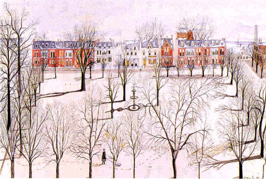
Colorized print, Clarence Park with houses on north side and a fountain in the middle.  Image found on a Heritage Assessment document for the park, no credit given there.

The park, named Clarence Park for the Duke of Clarence, was part of a planned community conceived of in the 1830s that included a church, a market, and building lots for houses.  The land that it was on was part of a military reserve (i.e. it belonged to the British).   In 1860 ownership of the land, already developed as a park, was transferred to the city by means of a  Crown grant containing a restrictive covenant to maintain it as a public square.

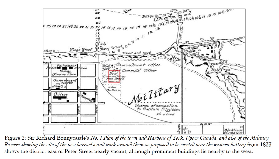
below: A map of the area circa 1833.  Lake Ontario to the south is at the top of the map.  Fort York, on the right was actually on the waterfront at the time.  On the left are some of the original streets – Peter St. and John St. being two of them that are still with us today.  The red square on the map is the location of the present day Clarence Park.

1833 map of Fort York and some streets in Toronto at the Lake Ontario waterfront

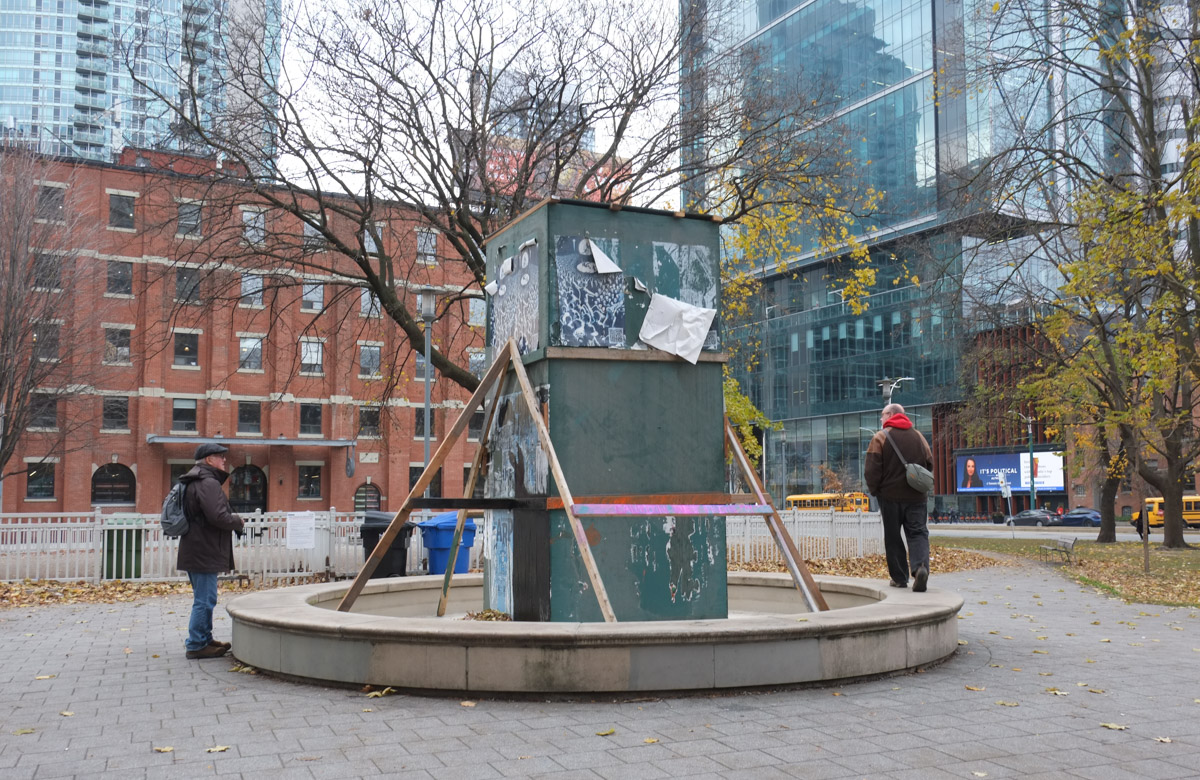
below: Clarence Park fountain these days.  I have mentioned before that I think that Toronto does a horrible job with fountains but this one probably wins an award for worst maintenance job ever.  And you say it’s been this way for at least four years?  Is the original fountain (see the painting at top) hiding under here?

boxed sculpture in dry fountain in clarence park

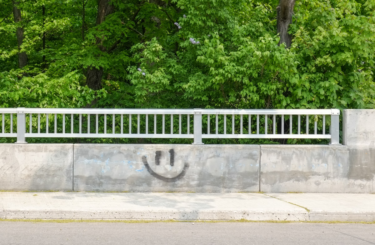
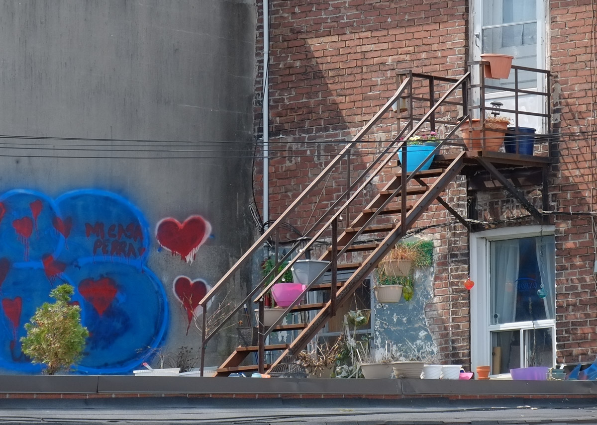
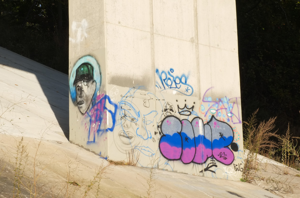
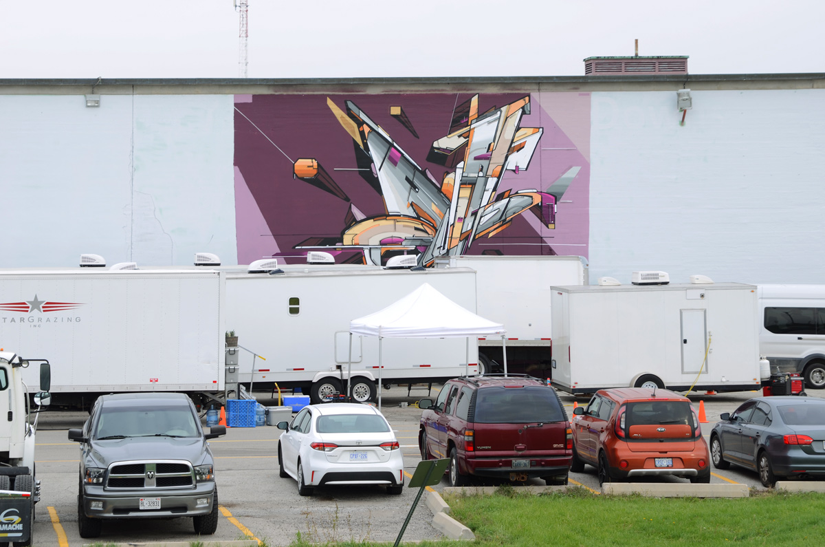
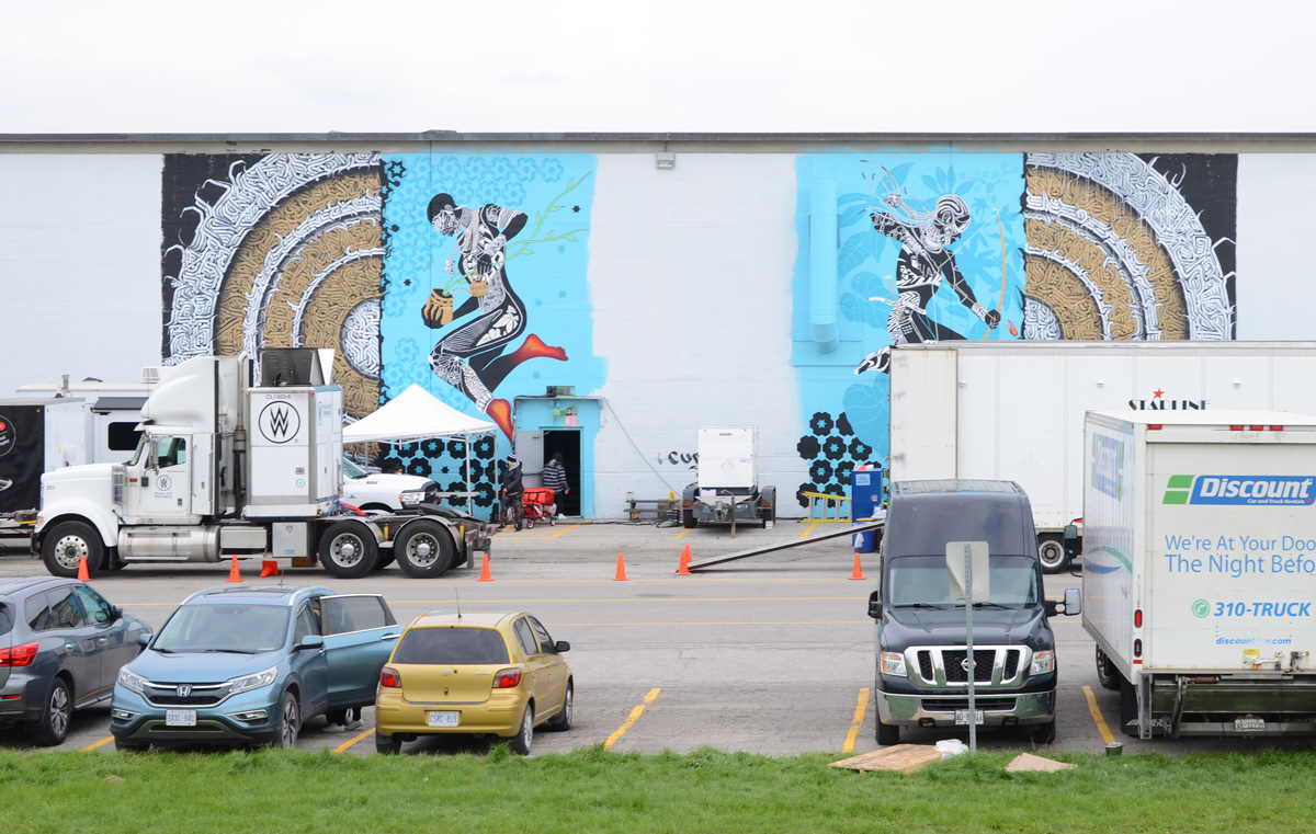
below: So nice of the city to provide more canvas space for graffiti.  Public art at its finest!

paper paste ups on plywood on boxed sculpture in clarence park

close up of paper paste ups on plywood covering sculpture in the middle of a dry fountain in clarence park

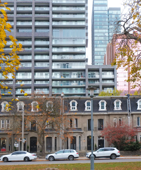
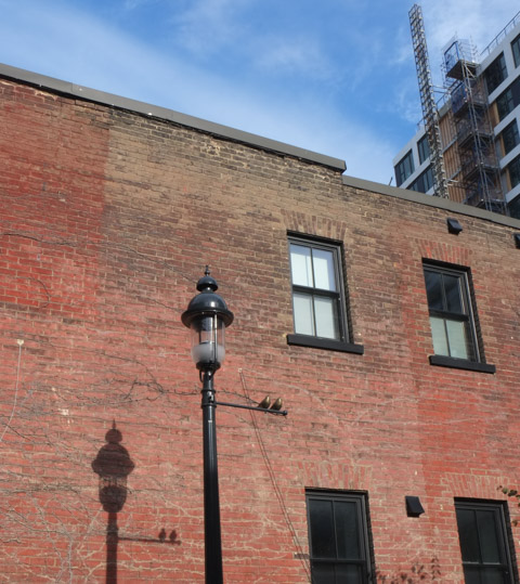
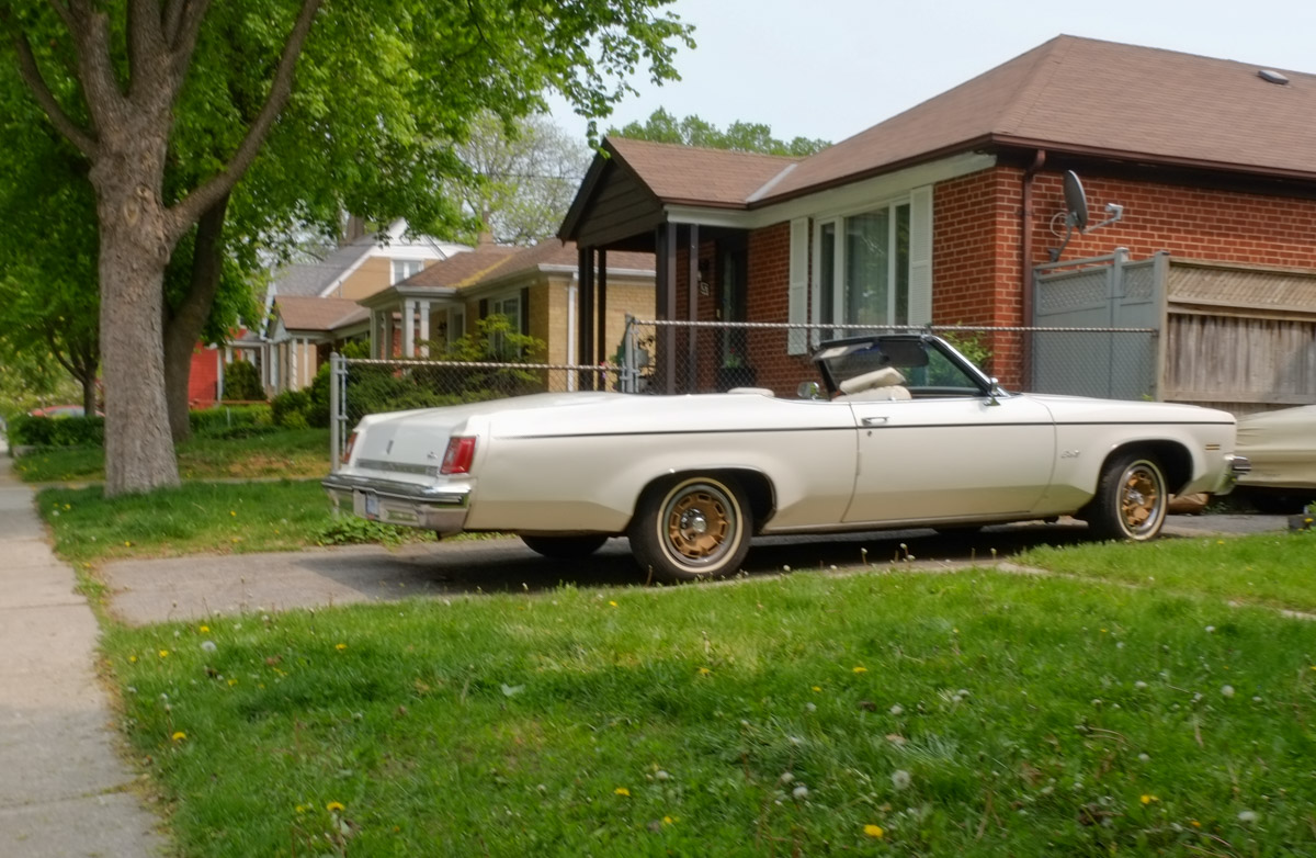
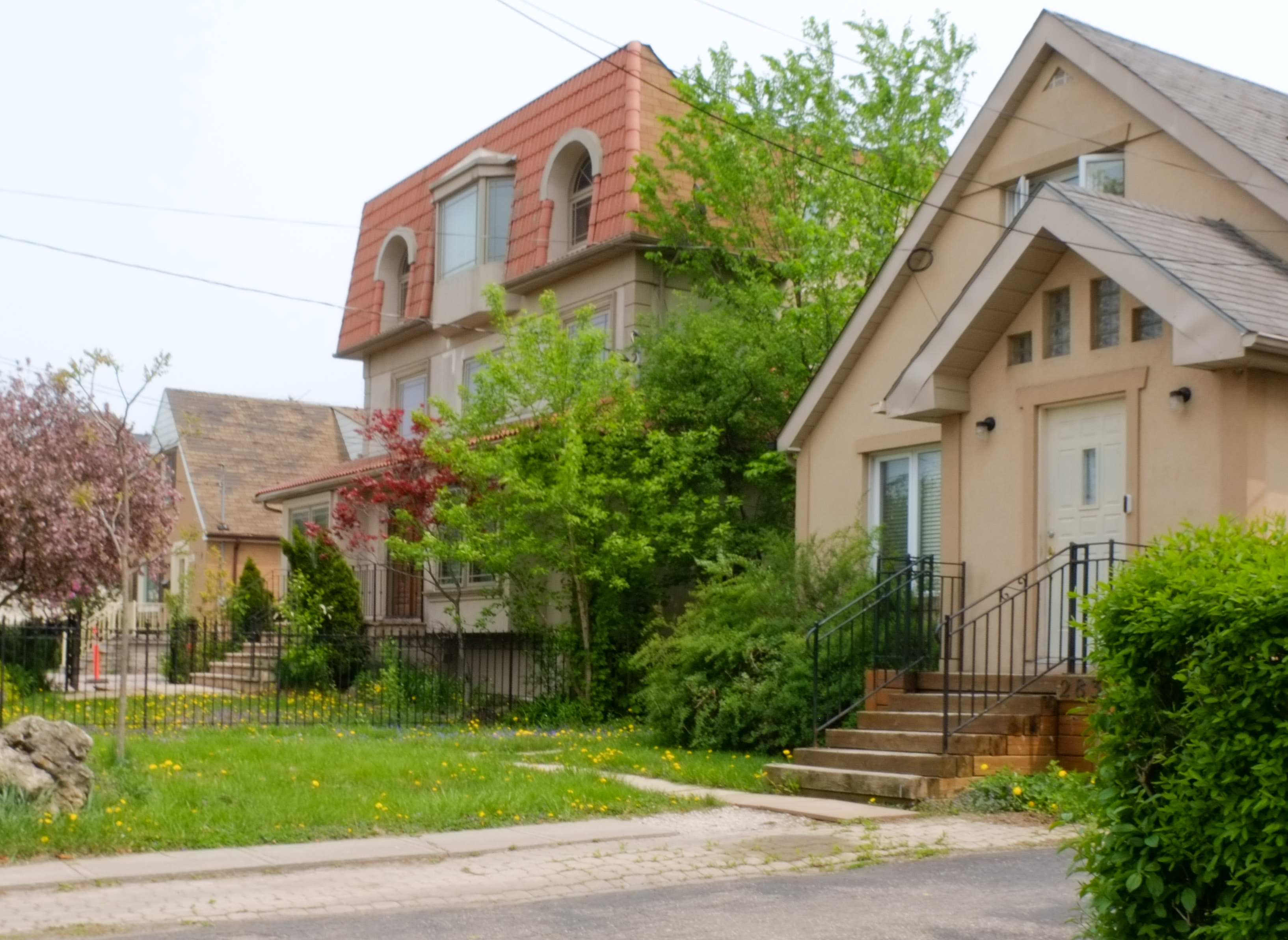
below: Not that long ago, this type of picture was not that common in the city. Now, this layered look is everywhere. The houses of Clarence Square, north side, built 1879 – 1885.

row houses on clarence square with glass condos behind

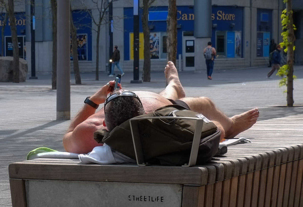
below: Part of the homeless encampment of Clarence Square.  Since this picture was taken (mid-November) some of the other encampments in the city have been cleared, specifically Kensington and St. Stephens church on College Street.  Yes, we have a housing problem.  No, we haven’t got any solutions, or at least none that we can agree on or are prepared to pay for.  Are tents in parks a good idea?  Probably not.  But they are there because it’s an “easy” solution that costs the city nothing.

homeless encampment in clarence park

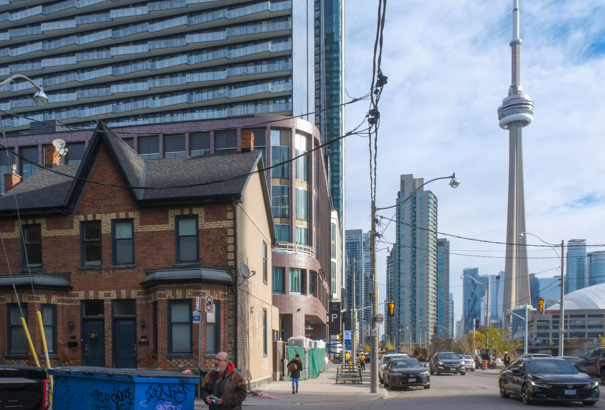
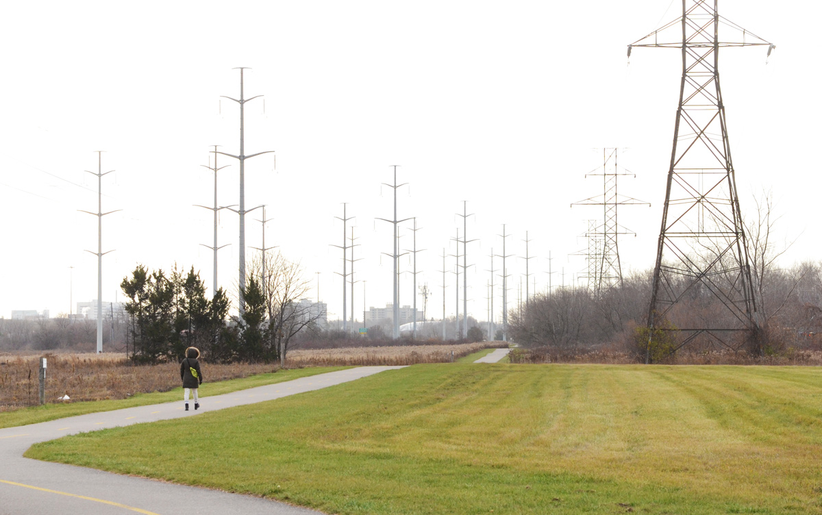
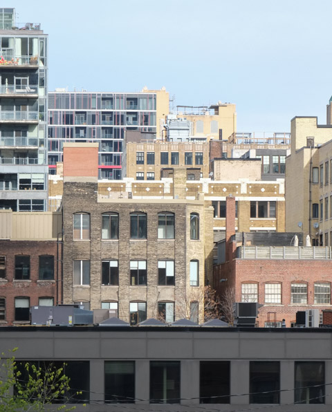
below: Does anyone recognize this view?  There are a view clues that suggest this is just another view of Clarence Park. But when did those towers appear?  Turn around and someone alters the landscape while you’re not looking, playing tricks with your memory.

cluster of tall condo towers behind a park

below: Now turn 180 degrees, and the view changes…. sort of.  The new LCBO on Spadina that replaces the one at King & Spadina (that building is still standing and still vacant by the way).  Also, across the street is The Well that I blogged about previously.

LCBO store in brick building on corner, on Spadina, across street from new steel and glass development, the well, and other condos in the distance

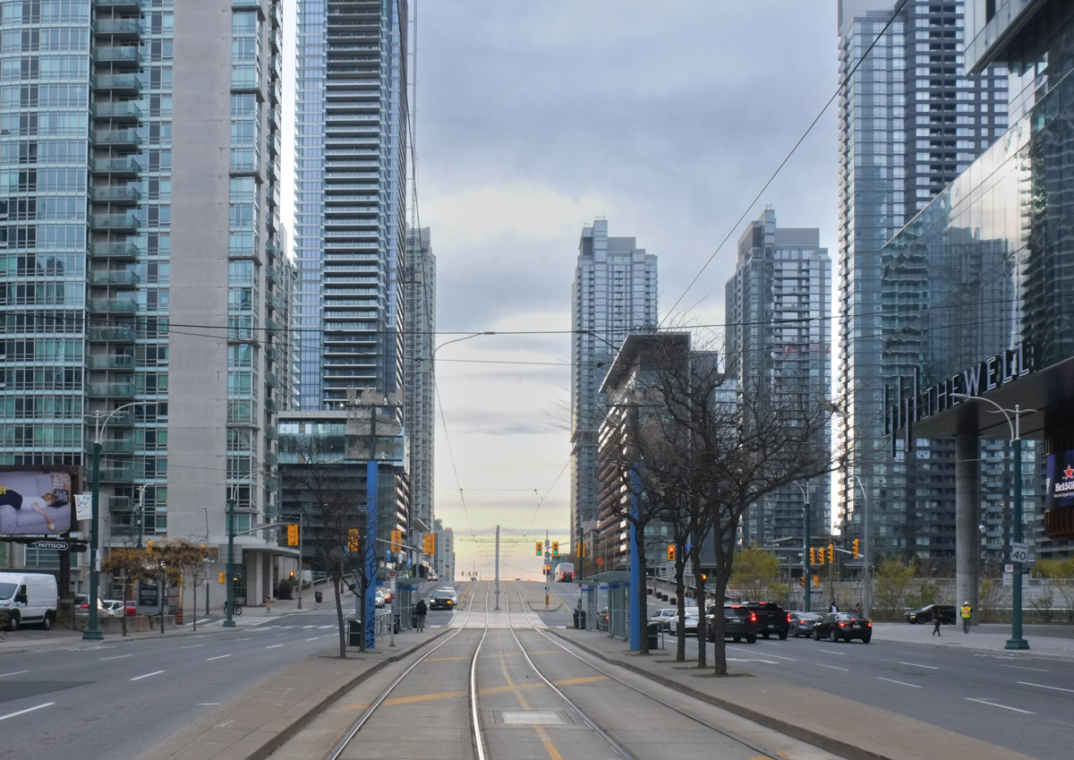
below: Looking south on Spadina at Front Street – I love the way that Spadina seems to disappear into the distance.  Into the great beyond.

standing on streetcar tracks TTC and looking south on Spadina, at Front street, with glass tower condos on both sides

people waiting at streetcar stop at spadina and front in toronto,

below: If you walk through The Well, at one point this is the view to the north with an interesting jumble of roof lines, window styles, and brick patterns.

layers of midrise buildings, mostly brick, some with balconies, downtown toronto, north of wellington, west of spadina

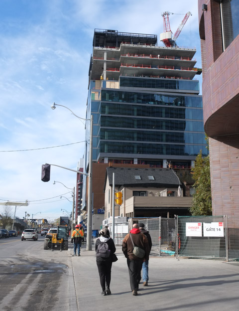
below: Front St., putting the finishing touches on the sidewalk outside The Well development.

workmen in hi viz jackets laying concrete blocks to make sidewalk along Front Street in downtown Toronto, CN Tower in the background

below: Front Street, walking west towards Bathurst.

three people walking along sidewalk on front street towards portland street and bathurst street in toronto

below: “Dance all night till you can’t feel your legs”

back corner of white car, red light, stickers, rooster, mask, dakkar, and words that say dance all night until you can't feel your legs

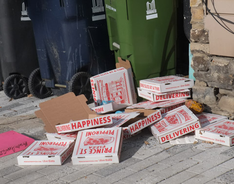
below: So many possible captions!  Tossing happiness aside … Empty promises of happiness…

a pile of empty pizza boxes on the sidewalk beside some city of toronto rubbish bins and recycling bins

below: In the midst of all the new development along Front Street and the railway corridor, Draper Street remains.  It is one block of old houses, many of them heritage row houses.

old blue wood door on brick house, stone step, welcome mat with keith herrig image on it

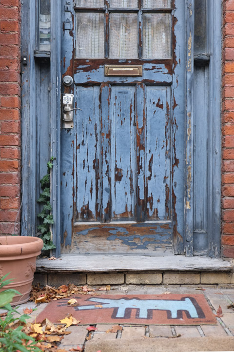
below: Draper Street houses – a smaller version of the houses seen on Clarence Street (see above).  They are of a similar vintage with almost identical rooflines and window shapes.  The Empire Style.

empire style row houses from the 1880s, black mansour roof, with new condos behind

City of Toronto historic plaque for Draper Street

“DRAPER STREET – Draper Street’s Empire-style cottages were built in 1881 and 1882,  while its larger homes were constructed between 1886 and 1889.  The street – a Designated Heritage Conservation District – is unusual because its residential character survived the overall industrialization of the King-Spadina neighbourhood in the twentieth century.  Draper Street has been a haven for people of many backgrounds, such as Lincoln Alexander, who was born here in 1922 to West Indian parents, and who served as Lieutenant-Governor of Ontario from 1985-1991.  The name of the street honours William Henry Draper (1801-1877), a pre-Confederation lawyer and Conservative politician, who was the virtual “Prime Minister” of the United Province of Canada from 1844 to 1847.  He subsequently became a judge, eventually being appointed Chief Justice of post-Confederation Ontario in 1869. “


shadow of old light pole on brick wall of house, new condo being built behind, draper street

The new condos at The Well loom over a new park (2021), Draper Park.  It’s small, the equivalent of two housing lots; numbers 19 and 21 once stood here.  The original owner of 19 Draper Street (1881) was George Hickey, a railway manager.  It was demolished in 1942 and was replaced by a small factory owned by Farrell Plastics.  At that time, a factory would not be out of place as the area was more industrialized.  The building was destroyed by fire in 1969.

below: Draper and Front, looking east

intersection of draper and front streets, looking eastward

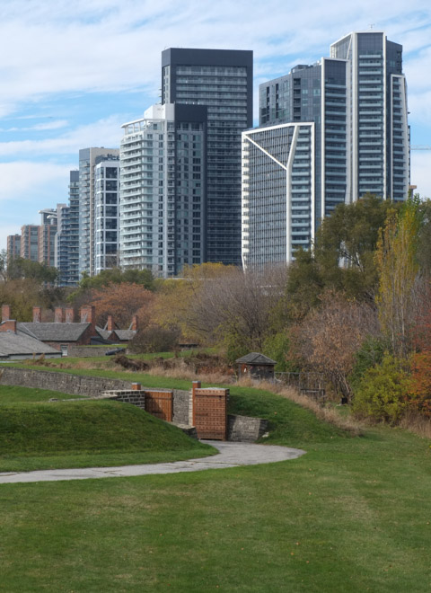
Since I mentioned the fact that this land was once owned by the British military, and the fact that Fort York was once “in the middle of nowhere”, I’d like to add a couple more photos that show much development has occurred in the area.

below: New development along Front Street.  The bridge is at Bathurst.  Draper Street is just outside the photo on the righthand side.  All the railway corridor and the lands to the south were not there in 1833 when Sir. Richard Bonnycastle drew his map – but that’s a whole other story for another day!

looking northeast across the railway corridor to Front Street and the new development along it at Bathurst St., Bathurst bridge over the tracks, and new condos in the distance

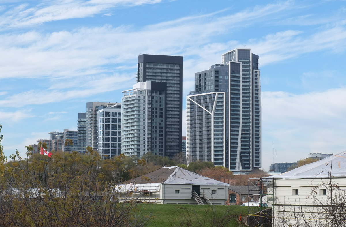
below: View from Bathurst – the white buildings here are part of Fort York while the new condos are just beyond, closer to Strachan Ave.

buildings at fort york in the foreground, new condo high rise buildings in the background, looking northwest from Bathurst and Front

buildings at fort york in the foreground, new condo high rise buildings in the background, looking northwest from Bathurst and Front


The north end of Senlac Road is at Finch Avenue. It runs south through the middle of York Cemetery and the Lansing neighbourhood towards Sheppard Ave.   .

an old wood bench on a patch of grass in front of shrubs and trees

below:  Addington Greenspace (or Addington Greenbelt) is a small park on the west side of Senlac, or rather it is an access point to the city’s ravine system.  In this photo, the trail back up the hill to the street ends by a bus stop.

looking uphill along a path through the woods and ravine, Addington, to a TTC bus stop pole at the top of the trail

below: The greenspace follows a creek and passes under Addington Street before it meanders southwestward towards the Don River close  to Sheppard and Bathurst.

concrete wall on bridge, has a black happy face spray painted on it

below: Protest signs on lawns.  Back in May City Council tried passing a new bylaw that would limit what signs you put on your lawn and how many.  There were more than 30 amendments to the Toronto Municipal Code Chapter 693 (Signs).  Most of them were adopted on the 14th of June except (if I am reading it correctly) for all amendments concerning “advocacy signs”.   The council agenda item history is online.  If you check it out and find that I am wrong, please let me know!

sign beside sidewalk that says stop privitization of public hospitals

below: Although the main part of Senlac ends at Sheppard, there is a small two block section south of Sheppard slightly to the west.

utility poles and hydro wires, street signs for senlac and sheppard avenue

below: Beware of the zombies!!

no parking signs, one says zombies on duty


low rise brick building

below: Most of the area is residential – 1950s and 60s suburbia.

old white convertible with top down parked in driveway in front of a house

side view of a house, wood fence in front of it, roofline is barn shaped

lots of plants growing in blue and grey pots in front of the porch and beside stairs of a house

pink lilac bush in full bloom, by a wood fence

2 storey brick house on sheppard aveune, beside a vacant lot

old red car in driveway of a house

below: Like all older neighbourhoods in Toronto, many smaller houses are being upsized.

renovation and enlargement of a house, smaller older house beside

2 houses on a residential street

…. or torn down and redeveloped totally.

blue and white city of toronto development notice

below: An empty house.  As I was taking these pictures, a woman passing by remarked that they had been empty for seven years.  I hadn’t meant for this walk to turn into yet another redevelopment story but even here there are blue white signs along with boarded up buildings.

front porch and front door of old brick house now empty

below: This development dates from 2016.  It proposes townhouses along Sheppard but 5 multistorey (11-25 storeys) buildings behind.  Part of the reason for the delay is that the project also involves tearing down existing rental accommodation.  In June 2022 the City Planning Division recommended that City Council approve the Rental Housing Demolition application that accompanies this development.  It is 14 pages long but if you are interested in what happens when developers want to tear down rental units, click on this City of Toronto link

blue and white development notice in front yard of a house

below: Hiding behind a massive shrub, both a house and a development notice

a large green shrub obscures a house that is awaiting demolition

boarded up doors and window of an empty brick house, wood porch has rotted away

old brick bungalow with boarded up windows and door

small brick house with boarded up windows

below: This bungalow is actually on Sheppard West.  The proposal here is not for a condo, but for a 38 room hotel (in 6 storeys).

small brick bungalow with development notice in the front yard

below: Also Sheppard West.

black metal construction fence around a building site

mm

… with touches of pinks and other colours.  Spring time!

Here are a few photos of spring in the city that I collected as I walked in the past few weeks.

CN tower behind spring buds and new growth on trees

below: Spring time … when all the bugs and insects come out!

a large stuffed caterpillar on a deck of a house

below: As do the trees….  including this massive pink magnolia in full bloom.

a large pink magnolia tree in a front yard

a house with a large white blossom tree in the front yard

below: Flowers on a grave

York cemetery, tombstones in foreground, tall buildings of North York in the background

Ryerson university, Balzacs coffee, yellow umbrellas outside on spring day, people sitting outside, some people walking past

a man sits on a red bench on Pape Ave., East York

Pinehills cemetery, stones in the oreground, blossom trees in spring in the middle, and apartment building with blue features in the background

two houses on a street, with condo in background, spring, double car garages, white brick, black roofs, large tree in front

front yard, black metal trellis, blossom trees, one yellow tulip, fake stone front of house, stone walkway, brown wood fence, single white door for front door

a man wearing only shorts lies on a bench

back staircase of a brick building, upper apartment, with blue and pink planters on the stairs

metal box on sidewalk, bell box, painted with a monarch butterfly in a field of pale purple daisies

lots of dandelions in the grass by a sidewalk in front of a wall with street art on it, apartment building behind.

pussy willow in the foreground, tall buildings in the background

big old willow tree in spring in front of two houses

house with pale pink siding on upper floor, spring

Welcome to Osgoode subway station.

young woman in short coat, boots, and a reddish handbag stands on the osgoode subway station platform

It’s not the busiest station on the University Line but changes are in the works.  It is going to become one of the transfer stations with the new Ontario Line.  This line will cross downtown underground with stations at: Corktown, Moss Park, Queen, Osgoode, Queen/Spadina, and King/Bathurst.

Osgoode subway platform

When the University Line was built in 1966, Osgoode station was yellow with greenish accents.

section of wall at osgoode subway station, original yellow tiles have been revealed when part of new white cladding was removed

Like other University Line station, it is nondescript and built with the minimum of fuss.

escalator from platform level at osgoode ttc subway station, yellow and green tiles on the walls

One could say the bare minimum

tunnel to an exit at Osgoode station, green tiles on walls, grey institutional flooring, overhead lights, exit sign at the end of the tunnel

One of the only extras that have been added to the station recently is direct access to the  Four Seasons Centre on the southeast corner.

stairs connecting osgoode subway station with Four Seasons centre

The other three corners of the University and Queen West intersection have stairwells on the sidewalks that connect to Osgoode station.   But…. I didn’t really mean to dwell on the station itself….

below: Canada Trust building on University Avenue
Canada Trust building on the west side of University Ave., just north of Queen, people crossing University Ave at the intersection, rainy day

I came here to document the intersection as it is now, pre-Ontario Line construction (and years of disruption!)

below: Looking north up University Avenue from Queen, east side of University (including the present subway entrance on the sidewalk – close to where the pedestrians are in the photo).

looking north up University Avenue, east side, from Queen, Osgoode law school with green grass and trees in front, surrounded by black wrought iron fence

Behind the black wrought iron fence is the former Osgoode Law School (for which the subway is named).  There is public access to the grounds and it is an oasis of green and shade in the summer time.  Green ribbons have been tied around the large trees.

trees in a park, late autumn, early winter, green ribbons are tied around the large trees

… and at least one tree has been tagged as an historic tree.

a large tree trunk with a gold ribbon and green tag on it. Tag says historic tree

Metrolinx wants to build another subway entrance here.  Apparently a third-party independent review of alternative station designs is in the process but hasn’t been completed yet.  Metrolinx decided that in the meantime they’d cut down the trees on the 5th of December (this coming week) anyhow.    If you want to see one of the ideas for the plan, there are artist’s renderings on their website:   The Ontario Line – Neighbourhood Updates – Downtown – Osgoode Station.  As usual, what is pictured now is never guaranteed to be the end product!

The Law Society of Ontario is the custodian of this greenspace and they have formally objected to Metrolinx trying to short-circuit the process.

green space in front of Osgoode Hall, trees, grass, tall buildings in the background (looking south)

Yet another location to keep an eye on!


october scene, leaves on trees in different shadesof greens, yellows, and oranges, with blue water of highland creek, as well as reflections of leaves in the water

Colonel Danforth Park is located where Kingston Road and Old Kingston Road pass over the Highland Creek in Scarborough.

people walking by highland creek in october with lots of red leaves on the trees

This past weekend we had some amazing warm and sunny days – great days to spend some time meandering through a park, especially this year when the autumn colours seem so much brighter and plentiful than in past years.  Is it just my imagination or have the colours have also lingered longer?

large deciduous trees with lots of orange and red leaves, october

The north part of the park merges with the grounds of U of T Scarborough campus.

bright orange and red leaves on mid si

people at univerity of toronto scarborough campus tennis courts on lower playing fields, october, trees in bright autumn colours

large group of autumn trees, with lots of leaves on the ground

birch trees in autumn, lots of blue sky too

late afternoon sun low in sky, long shadows, light through tree trunks, with lots of october leaves on the ground

october afternoon in the woods, large mature trees with lots of colourful leaves

afternoon sunlight shining through forest

three tall straight pine trees beside a path

a path through the woods in October, different coloured leaves on the trees, leaves fallen on the path

trees in the woods at Colonel Danforth park, one is dead, the others have colourful leaves, october scene

below:  Seed pods of ‘dog-strangling vine’ (or swallowwort) starting to burst.  This plant is an invasive species.  It is quite pretty at this time of year as the seeds are released and the leaves of the plant turn a silvery colour.  Unfortunately, it is a fast growing vine that quickly climbs other plants such as this young sumac tree.  It will kill that plant.

dog strangling vine growing on young sumac or sumach with red leaves

the remains of a very old tree, a broken stump, very large, beside another tree

below: A wasp nest high up in a tree

large globe shaped wasp nest up in a tree

big fat pine cones growing on a pine tree

large reddish hued pine tree with gnarled trunk in the foreground, benches in the park in the background

below:  Ooops!  “Off roading” taken a bit too far.

a small plastic toy ride on truck stuck on the rocks in a creek

below: Under Kingston Road

three faces, graffiti on concrete supports for a bridge. each face has black hair, one has glasses and their skin is various shades of brown

 graffiti on bridge concrete support

tall concrete supports holding up bridge, Kingston Road, over Highland creek and Colonel Danforth park

***

historical society plaque for Highland Creek Mills

“Highland Creek Mills
The early settlers of Scarborough used the waters of Highland Creek to provide power for their many saw and grist mills in this valley. The first mill in the township was built here in 1804 by William Cornell who hauled his mill stone from Kingston on his sled. In 1847 William Hellewell built the first of his four mills on this site. Downstream there were saw mills operated by Jordan Post, Stephen Closson, and others. …”


There have been discussions recently about the lack of washroom facilities in Toronto parks especially once the city deems summer to be over. There were no facilities that I saw on my walk but I was thankful for the porta-potty that was provided. Not the best but I have seen worse!

…at the Forks of the Don

If you’ve driven on the Don Valley Parkway you’ve probably seen them, the big grey structures that look like teeth.  They are just south of Don Mills Road, on both sides of the DVP.  Over the years, the trees and shrubs have been growing around them so they don’t stand out as much as they did when they were first installed in 1998.

below: On the west side of the Parkway

an old and rusted city street sign, maximum 30 km/h begins, with elevated wetlands sculptures behind

The structures were designed by Noel Harding (1945-2016) and are constructed out of recycled polystyrene and acrylic. Financing was provided by a group from the Canadian Plastics Industry Association.

large concrete containers, planters, on a small hill with small trees, winter,

Their purpose is to help purify polluted water from the Don River watershed.

below: On the west side, the third planter stands alone, looking a bit like the back end of an elephant.

large grey planter for wetlands water purification, looks like the back end of an elephant, with four stumpy legs

large container on right with spout to concrete planter on the left, in the background, seen between the two concrete planters, an old cement bridge and a highrise apartment in the distance

below: The three concrete structures form a line on the east side of the DVP.

looking across traffic on the Don Valley Parkway to the other set of elevated wetlands sculptures

They can be accessed by following the trail that goes under the highway and follows Taylor Massey Creek.  If you follow this route, you end up walking generally east and you can walk for miles through the ravine system that runs under O’Connor Drive, through Taylor Creek Park and on to Warden Woods Park.

roadway curves to the right and passes under the Don Valley Parkway, traffic crossing over the bridge, winter time, snow on the ground, Forks of the Don where Taylor Massey Creek joins the Don River

Forks of the Don – where rivers come together, trails go in all directions, and even the railway passes through.

below: Stairs up to Don Mills Road and Gateway Blvd,

stairs leading up, to an apartment building, trees, winter

below: Or take the ramp that passes under Don Mills Road beside the tracks.

blue sign on a concrete pillar that says Don Mills Road, beside a metal ramp walkway under a bridge, Lower Don Trail

below: Looking southbound towards Union Station.

vehicle on train tracks approaching an underpass, where Don Mills Road crosses the tracks

below: From here the tracks follow the Don Valley east and then north.  They pass under Don Mills Road once more, just south of York Mills Road, before heading to Oriole GO station.

looking through gaps in a chainlink fence, a railway vehicle on the tracks below, looking eastward from Don Mills Road, apartment buildings in the background

below: This part of the Lower Don Trail really is a nexus, or hub, in the ravine path system.  Trails also lead northwest to the Science Center and Wilket Creek Park.

three people walking across a snow covered park towards highrise buildings

below: Choose kindness

colorful sticker on metal railing, lots of one eyed faces with big teeth on the back of a van with words choose kindness

heart painted on metal rail, graffiti, left side is red and right side is blue

a car drives over an old semi circular concrete bridge over the Don River, Gateway Blvd apartment building in the background

road bridge, concrete, above a river with a parth beside the river. Rusted metal railings on both sides of the path, green metal beams under the bridge, winter, sone snow, no leaves on the trees, Lower Don Trail, under Don Mills Road

below: “Passage”, an art installation by Labspace Studio under the Don Mills Bridge – part of the PanAm Path project.

public art under a bridge, halves of red canoes appear to come out of the wall, 8 of them in a line

below: Southward on the Lower Don Trail where you can walk all the way to Lake Ontario.

lower don trail, looking south, with DVP on one side and trees on the other, apartment building in the background.

below: If you are interested, this is a map of the PanAm Path, one of the projects from when the PanAm games were hosted here in Toronto in 2015.  The Forks of the Don is in the center by the pink X.  Something to consider exploring in the spring!?

city of Toronto map of the PanAm Path that crosses the city.

*****
plaque describing the elevated wetlands sculptures

“The elevated wetlands are functional sculptures, symbols of the integration of the plastics industry, art and environmental stewardship. The sculptures were developed through a partnership between the City of Toronto, the Canadian Plastics Industry Association, and artist Noel Harding.”

“The sculptures draw attention to the importance of wetlands as an ecosystem. A solar powered pump lifts water from the Don River into a series of raised “planters” where native wetland plants and trees naturally remove pollutants from the water. Recycled plastics are used as soil substitute to promote vegetative growth. From the smallest container, water is emptied into a natural land based wetland, and flows back in to the Don River. The surrounding area has been naturalized through volunteer tree plantings to create a natural buffer between the sculptures and the Don Valley Parkway. “


mural, blue letters on yellow, XOXO Downsview

below: Ulysses Curtis mural by Danilo Deluxo McCallum.  Curtis (1926-2013) played for the Toronto Argonauts football team in the 1950s.  He was considered to be the first black player on the team.

mural, black man with helmet and shoulder harness straps

The Downsview area and airplanes have been linked since the late 1920s when land here was being used for airfields—Barker Field, the Canadian Express Airport and the Toronto Flying Club.  In 1929 de Havilland Aircraft of Canada purchased 70 acres of farmland along Sheppard Avenue West.  In the mid-1950s de Havilland moved its operations to newly constructed modern facilities to the southeast.  De Havilland Canada was sold to Boeing in 1988 and then to Bombardier in 1992.

below: Bombardier facility and GO tracks on the east side of the park.   Downsview Park station at the north end of the park connects the GO system with the TTC’s Line 1.

Bombardier facility beside GO tracks in Downsview

In 2017, the Sesquicentennial Trail was developed on part of the site.  Sesquicentennial means 150 years, as in Canada was 150 years old in 2017.

below: The North Plaza of the trail features a semi-circular wall of rusted steel with cutout silhouettes of real historical photographs showing various people, buildings, and airplanes that was designed by John Dickson.

rusted metal art installation with sections of wall with cutout pictures, airplane windsock in front

part of an art installation, rusted metal with cut out pictures, cut out words that say danger low flying aircraft stop until clear

two pictures cutout of rusted metal

Small models of four of the aircraft built by DeHaviland ‘fly’ over the trail – the DH.60 Gipsy Moth, the Dash 8, the DHC-6 Twin Otter, and the Mosquito.   They cover years of both DeHaviland and aircraft history from the bi-winged Moth in the mid-1920’s to the turboprop Dash8. The later was developed in the early 1980s and is still in production today.

plaque describing 4 of the types of aircraft once produced in Downsview, DH.60 Gipsy Moth, the Dash 8, the DHC-6 Twin Otter, and the Mosquito

two model airplanes on pillars, look like they are flying above a pond, park, and new apartments under construction

below: High overhead, a DHC-Beaver, a bush plane developed in 1947 here at Downsview.

large metal flat silhouette of beaver airplane on tall metal poles as public art in a park

Grounded! But still great for child’s play.

playground at Downsview Park, yellow wood airplane on ground with pretend control tower

Hundreds, and probably thousands, of trees have been planted on the site.

two red muskoka chairs near the top of a hill, overlooking the trees in the valley below

below: Tulip tree

autumn colours on a tulip tree

below: Other areas have been set aside for native grasses and wildflowers such as milkweed, purple coneflower, and wild lupine.

plaque at donswview park describing tallgrass prairie and three of the plants that grow there

below: There is a large hill in the park and this is the view to the southwest from there.

Downsview view from hill in the park, looking southwest over a path, some apartment buildings, and rest of Toronto skyline

below: At the top of the hill stands an installation of blue flags along with two of the many red muskoka chairs scattered around the park.   This is “Wind Rose” by Future Simple Studio. This picture doesn’t show it very well but at the northwest corner, two of the flags are not blue – one is black and the other white (black for west and white for north).  These two flags, “The Turtle and the Traveller,” were designed by Mi’kmaq artists Chris and Greg Mitchell.   They are best seen when the wind is blowing!

blue flags hanging from poles, art installation at Downsview Park

maple leaves in autumn

small bird feeder on a tree, with a blue roof with red flower painted on the roof

Downsview has also been associated with the military.  In 1937, the Royal Canadian Air Forces expropriated portions of the site to establish the RCAF Station Downsview.  The site once had two residential areas with barracks – one for the enlisted soldiers and their families and another for the commissioned officers and their families.  Over the years the base expanded to include the original de Havilland lands.  In the 1960s, the military expropriated the lands adjacent to the Downsview Airport and closed 2.5 miles of Sheppard Avenue between Dufferin and Keele Streets.  That is why Sheppard Avenue swings north around what is now Downsview Park.

two small bird houses hanging against a tree, white round one with red conical shaped roof

In 1996 CFB Toronto officially closed.  Parc Downsview Park Inc. was established in 1999 to build and operate Downsview Park but administrative control over the land wasn’t transferred to the Park until 2006.

very red crimson maple leaves in fall

below: ArtworxTO Hub North with a mural by Mediah.  At the time, the site was being used by a film crew.

mediah mural at arthub at Downsview park

below: Another mural on the exterior of the ArtworxTO Hub building.  This one was painted by Kreecha.

mural at arthub at Downsview park

stickers on the back of a dark coloured car, robots shooting at stick figures, The Empire Doesn't Care about your stick figure family

below: The southwestern end of the Meadoway is at Thomson Memorial Park – it exits the park at McCowan just north of Lawrence and runs 16 km through Scarborough.  The goal is form one continuous linear urban park from downtown to the Rouge River.

large trees in autumn, lots of yellow and gold leaves on the trees and on the ground

below: The steeple of St. Andrews Bendale Church is just visible through the trees.  This church is adjacent to Thomson Memorial Park

steeple of St. Andrews Bendale shows through the trees at Thomason Memorial Park

below:   Springfield Farm House is also at McCowan and Lawrence.   It is the oldest brick house in Scarborough, built in 1840 by James Thomson.

springfield farm house near McCowan and Lawrence in Scarborough, built by Andrew Thomson

people on path

below: The Meadoway follows the Gatineau Corridor, a swath of land under hydro transmission lines.

a man pushes a child in a stroller along a path, the meadoway

below: Large sections are in the process of being “naturalized”, i.e. meadow restoration is underway.

meadoway sign

yellow headed bird on weeds

below: from left to right – New England Aster, Little Blue Stem, Common Milkweed, Switch Grass, Cup Plant, Bergamot, Big Blue Stem and False Sunflower.

close up of meadow restoration information sign showing which plants are growing there

wildflowers and other naturalized plants growing under hydro lines

meadoway in autumn, hydro lines and towers, a badminton net, path, bike path, grass,

people walking on a path through a park

a man walks along a path, through the Meadoway with autumn trees with yellow and gold colour leaves falling to the ground

rusty metal supports for transmission wires, with yellow autumn tree in the background

yellow sign warning cyclists that there is downhill section ahead

below: The Meadoway as it crosses Bellamy Road

meadoway crosses Bellamy Road

schoolyard under transmission lines

below: school access

gap in chainlink fence under hydro transmission lines, with path leading to a school

combination lock on a chainlink fence

below: Daventry Garden plots with highrises on Markham Road in the background.

autumn community garden in foreground, highrises in the background, on the meadoway
orange plastic fences around garden plots after the growing season is over, dead remains of vegetable gardens

string and wire make a fence around a community garden plot

community garden in the meadoway with back of houses in the background

There is a large gap from Scarborough Golf Club Road to Conlins (just east of Morningside). The Gatineau Corridor transmission lines cross the Highland Creek and the 401 where there is no path beneath the wires. The city has tried to make continuous bike routes and now Conlins, which runs north-south has bike lanes and crosses the 401.

bike path direction signs, route 79 to Rouge River Drive and route 26 to Gatineau Corridor

The northeast end of the Meadoway is still a bit bleak but at least the potential is there…. being November doesn’t help!

below: The Meadoway crosses diagonally through the intersection of Sheppard Ave East and Dean Park (just west of Meadowvale).

Meadoway path approaches the intersection of Sheppard Ave East and Dean Park with its hydro wires and towers

below: Looking southwest from near Sheppard and Dean Park

a woman walks on the path through the meadoway with transmission towers and hydro lines, November,

The trail ends shortly after at Meadowvale Road which is just beyond the Sheppard Transformer Station.

hydro transmission lines leading to Sheppard Transformer Station

below: Spindleberry tree (Euonymus europaeus)

spindle tree berries and autumn leaves

Development of the Meadoway is led by the Toronto and Region Conservation Authority with help from the city, Hydro One, the Weston Family Foundation, and the Toronto and Region Conservation Foundation.

For more information – Meadoway website
Some of these photos were taken in 2020.


Wilket Creek forms one of the many ravines in the city. The northern part has been buried; it surfaces just south of York Mills Road and flows south until it joins the West Don just north of Eglinton. Edwards Gardens is part of the park system along the creek and that is where I met a friend the other day.  It was her part of town and she was my guide for the day.  The magnolia trees were at peak bloom and the fragrance of their blossoms filled the air.

below: Magnolia

A white magnolia in full bloom in front of a house with chimney

below: Three magnolia buds ready to open up.
Three magenta magnolia buds ready to open up, grey fuzzy bottom part of the bud included

below: Other trees and shrubs were also laden with blossoms
Pink blossoms on a tree, spring

A man takes a picture of his wife and daughter in front of a tree full of pink blossoms at Edwards Gardens

below: Volunteers working in the Teaching Garden, preparing the beds for planting.
A woman with grey hair and a blue baseball cap is hoeing weeds out of a garden, orange yellow wheelbarrow beside her, Edwards Garden

below: Some of the different types of trees that grow here – three different bark colours.
Three different kinds of trees, with 3 different coloured trunks, including a birch tree

below: A willow tree by Wilket Creek
large tree on a grassy field beside a creek lined with rocks, early spring, willow leaves are just beginning to show, a pale green colour

below: Dawn Redwood tree (aka Metasequoia tree)
large dawn redwood tree, also called metasequoia, no leaves, very early spring

below: Parts of the gardens were closed for repairs to the banks of the creek and the path alongside it.
construction machinery on a path beside Wilket Creek, Edwards Gardens

Walking the ravine north from Edwards Gardens is impossible – unfortunately, that stretch of the ravine  is not open to the public.  A gap in the system. We rejoined the creek at Windfields Park.

Windfields Park

paved path, curves as it goes downhill, bench at the bottom of the hill, grass beside the path, trees on both sides, Windfields Park

A person in a red jacket sits on a fallen log in a forest beside a teepee shape structure made from tree branches, leaves are just beginning to open, late April

below: A rock stuck in a hard place, where rocks usually aren’t found.
A large granite boulder entangled in the roots of tree that has fallen over

below: Yellow wildflowers, Lesser Celandine which is apparently an invasive species.
A large patch of low yellow flowers and greenery in front of a tree that has fallen down, tree trunks in the background

below: A tennis ball in the wild.

orange tennis ball stuck in the V of a tree, between two branches, in a forest

below: Two birch trees, probably Silver Birch because of the brown bark of the younger tree that will soon shed to reveal the white bark below.

Two birch trees in a forest, one is younger and has just started shedding it's brownish bark, the other is older and had white bark

below: Yellow trout lily. The flashy red parts hang downwards so they are hidden close to the forest floor. The flowers are difficult to spot but the mottled green and brown leaves give them away.
wildflower on the ground in forest, a yellow trout lily
below: Bloodroot flowers
wildflower on forest floor, white bloodroot flower and leaves

With thanks to Iskuhi for walking with me and teaching me the names of some trees and wildflowers. … and for some playing with sunlight and shadows (because that’s what photographers do!).

A person holding a bloodroot plant in one hand and a camera phone in the other, trying to get a picture showing texture of veins in the leaf

As you probably know, Toronto is full of creeks, ravines, and trails. Most of the creeks are tributaries of the Humber, Don, or Rouge River. This week’s adventure was along the Don River starting at the south end of the Betty Sutherland Trail. The north part of this trail begins at Leslie and Sheppard, just behind North York General Hospital (where parking is difficult).  Even though early April is still brown and grey, there is always something to see.

below: Don River

Don River in early spring

below: Pussy willows – One of the first signs of spring

pussy willows in spring

below: As I walked along the trail, I encountered this guy. He started getting agitated as I got close to the the river, but there was a photo that I was after…..

a male mallard duck standing on the bank of a creek with back to photographer but turning head to look behind

below: I had spotted colours through the browns and greys of the trees… graffiti covered ruins on the other side of the river.

colorful graffiti on an old stone structure whose roof has collapsed, as seen from across a creek, with trees in the way, no leaves because April, too early in the spring

Of course I found my way across the river to explore them in more detail!

below: When I went looking online for information about this structure, I came across a blog post in Scenes from a City from 2013. It’s hard to see, but some of the graffiti remains unchanged 8 years later.

below: And right behind me I discovered a tunnel entrance built into the hillside

below: It was very dark inside so the quality of these photos is questionable, but I thought that the old rusty control boxes looked fascinating. How long have they been here?

The Betty Sutherland trail ends at Duncan Mill Road. I was trying to get as far south as possible, so rather than go up to street level, I went under Duncan Mill Road where my map showed that there was more green space.

below: Wishes were written on pieces of paper, folded, and tied to a tree with pink yarn.

pieces of white paper tied to small branches of a small tree with pink yarn

below: The tangled roots of a dead tree lie beside the Don River just south of Duncan Mill Road.

a large piece of driftwood from the roots of a large tree in the foreground with a river, trees, and an apartment building in the background

below: Blue and yellow rocks

many small stones painted blue and some painted yellow, on the ground, with weeds starting to grow up among them

below: It wouldn’t be a walk without a (or several!) used mask lying around but this one is cuter than most.

a pink covid mask lies on the ground, on top of dead leaves.  The mask has a picture of a peach on it.

below: Oh Oh

below: Bracket, or shelf, fungi on a dead tree trunk

below: Playing fields alongside Moatfield

Green space, playing field, beside a road with office buildings on it

below: Looking east towards Graydon Hall

playing field with soccer goal, apartment buildings of Graydon Hall in the background.

below: Now we are off the beaten track. That’s Don Mills Road with some graffiti on a pillar that beckons me forward. A few trees have been planted here but maintenance may be sporadic.

below: under the bridge
close up of a discarded can of spray paint lying on the ground.  Graffiti under a bridge is in the background but out of focus.

under a bridge over the Don River with graffiti on the concrete, metal girders overhead, water in the river

below: There was no problem getting under the bridge, but around the corner was an unexpected surprise – This appears to be the end of the line. Yes, it was green space but my map didn’t warn me that it was private! I didn’t have golf clubs with me so I wasn’t sure if I could sneak or bluff my way through – plus my car was behind me so it wasn’t worth the trouble to try.

sign saying private property no trespassing at the edge of a golf course, Donalda Golf course

blog_betty_sutherland_trail

“Betty Sutherland served thirteen years as an elected representative on North York Council until her retirement from politics in 1985. From 1979 to 1985, Mrs. Sutherland was a member of Metropolitan Toronto Council and the Metropolitan Toronto and Region Conservation Authority. Devoted to the improvement of recreational opportunities for citizens and visitors, Mrs. Sutherland was Chairman of Metropolitan Toronto Parks, Recreation, and Property Committee from 1982 to 1985 and a member of the Authority’s Don Valley Advisory Board from 1981 to 1984. The naming of this trail is a symbol of the significant contribution she made to Metropolitan Toronto’s regional parks.