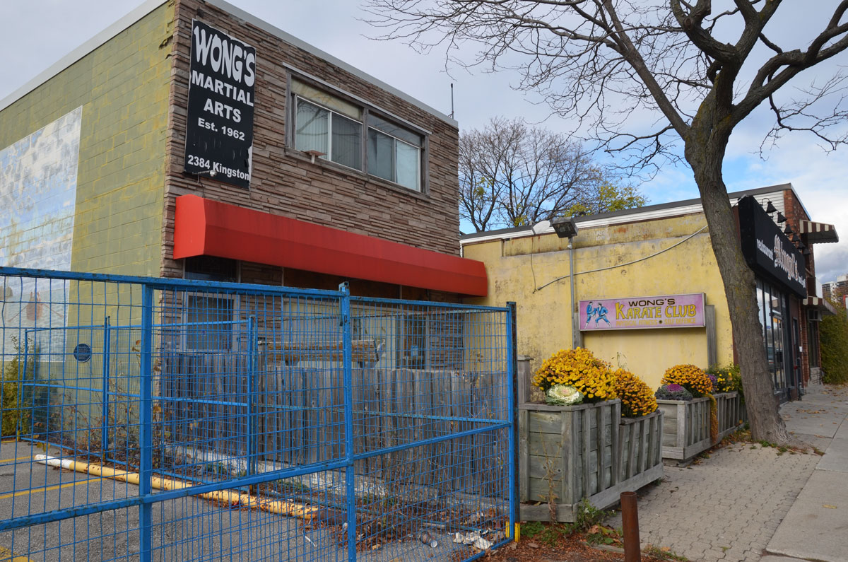
Along Dundas St. West between Islington and Kipling there are a series of more than twenty murals that depict scenes from the history of the area.
In 1793, Simcoe’s Queen’s Rangers cut a route through the forest for Dundas Street. It was meant to serve both as a military route in case of war with the U.S. and as a route to increase settlement in the area. Settlement of what became the village of Islington began a few years later with the arrival of the Johnston family in 1808.
The first mural was a picture of the Methodist church painted on plywood. It no longer exists.
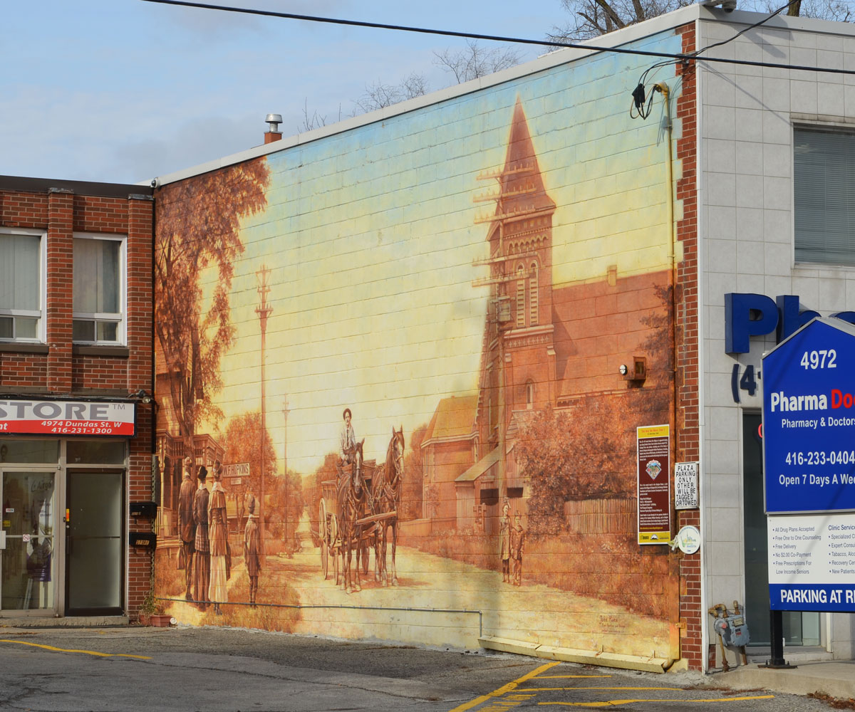
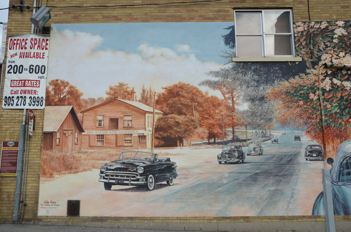
mural 2 – The Way We Were, part 1 by John Kuna, 2005.
Looking east along Dundas St. towards Cordova Ave in 1912. It includes Hopkins store and the Methodist church.


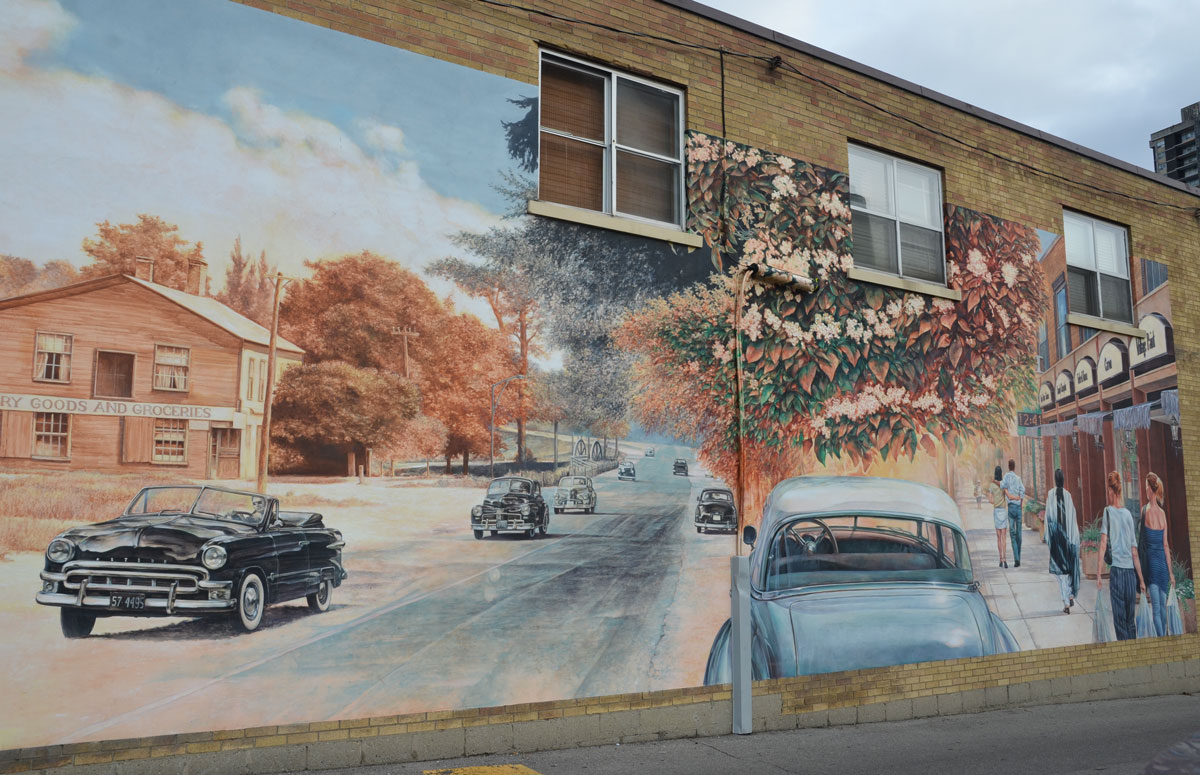
mural 3 – They Way We Were part 2, 1912, by John Kuna, 2006.
Because of the car that was parked next to it, I don’t have a good photo of the whole mural.


mural 4 – Timeline: Islington Then and Now, by John Kuna, 2006.
Showing Dunn’s store (NE corner of Dundas & Burnhamthorpe Cres) as well as the flowering catalpa trees that used to line the street (on the right in the picture)


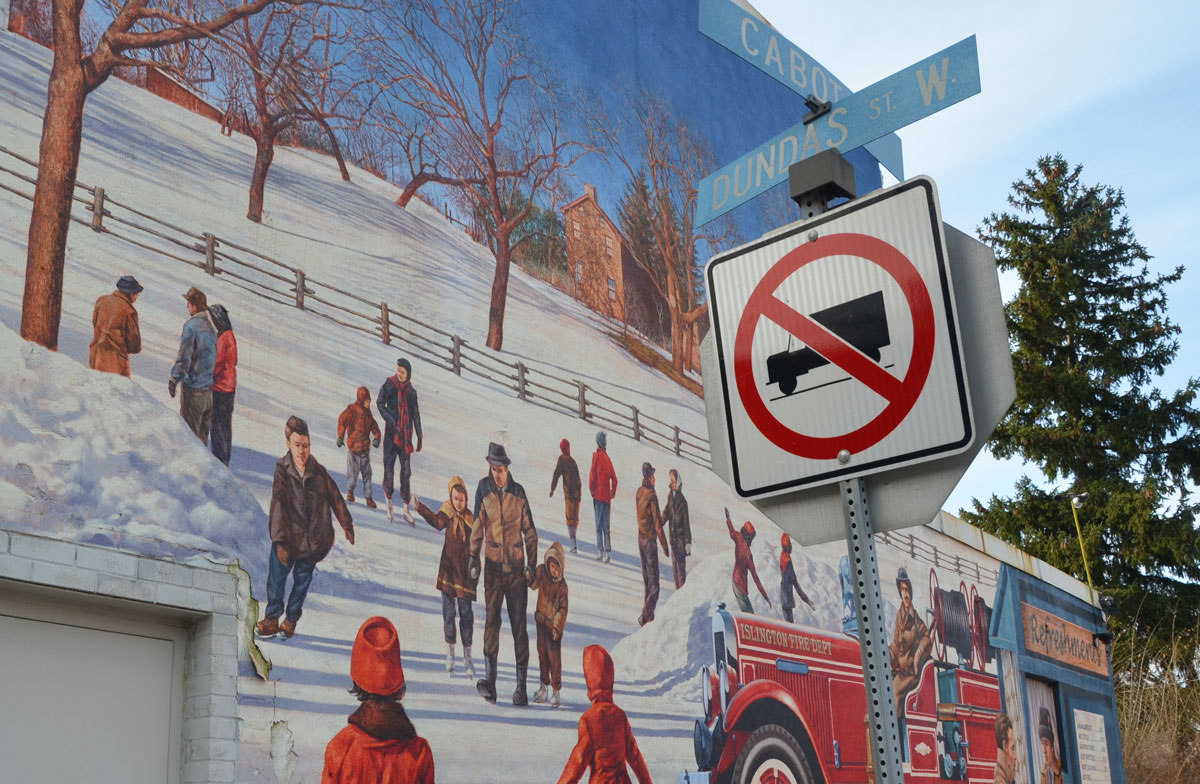
mural 5 — Honouring Islington’s Volunteer Fire Brigade, by John Kuna, 2007.
Islington had its first motorized fire truck in 1931. In the 1940s and 1950s the volunteer firefighters would use water from the Mimico creek to flood part of Central Park, on the west side of the creek, to create a skating rink.


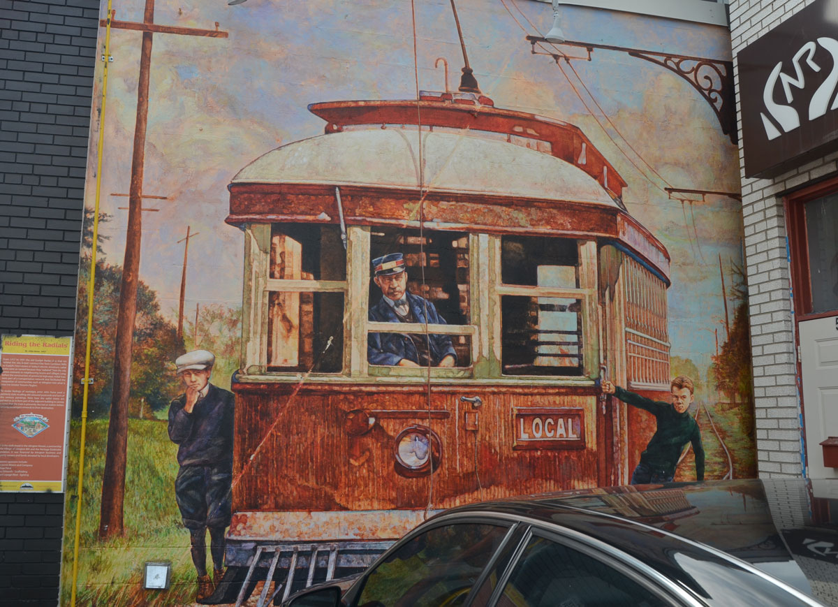
mural 6 – Riding the Radials, by John Kuna, 2007.
From 1917 to 1931 the old Guelph Radial Line (or Toronto Suburban Railway) ran close by this site. It was an electric rail line between Toronto and Guelph.

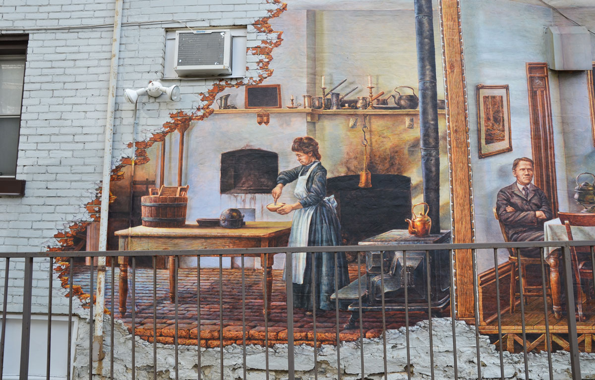
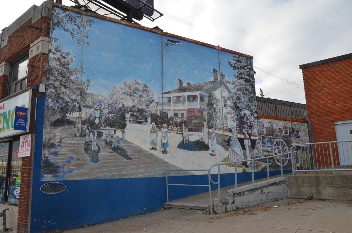
mural 7 – Briarly, Gone but not Forgotten, by John Kune, 2007.
Briarly, also known as Gunn House was built in 1840s. From 1870 to 1985 it was owned by the Montgomery family and their descendents.


mural 9 – Harold G. Shipp’s Firt High Flier, by John Kuna, 2008.
The story behind this mural: “In 1944 Harold Shipp convinced a Lancaster bomber pilot who ferried supplies from Toronto to England during the war, to fly over the school’s football field and drop hundreds of leaflets, a few of which could be traded for tickets to the school dance. Unfortunately, a rogue wind scattered the leaflets across the Chinese market gardens near Montgomery’s Inn. In the ensuing mayhem, excited football fans frantic to secure a winning ticket, stormed the field and trampled the carefully tended cabbages”


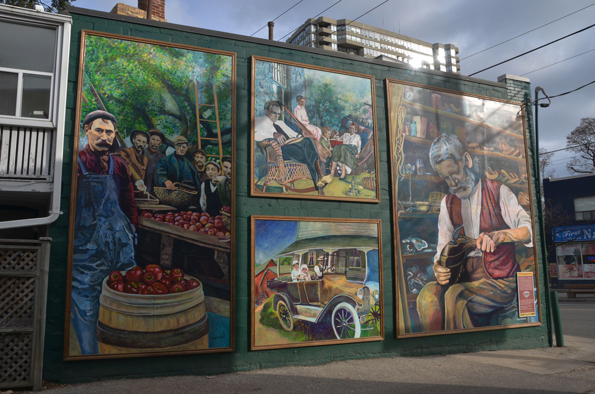
mural 10 – Portraits from our Past by Sarah Collard, 2008.
Inspired by pictures taken in the early 1900’s. “These include: Apple Packers at Bigham family orchards, Rathburn and Martingrove ~1917; Sunday Afternoon, a scene showing the family of famous Islington photographer Walter Moorhouse on their veranda at 34 MacPherson Ave. (now Aberfoyle); Islington’s First Car, a 1917 Chevrolet owned by the Appleby family; and the Village Shoemaker, Mr. Nelson in the 20th century.”

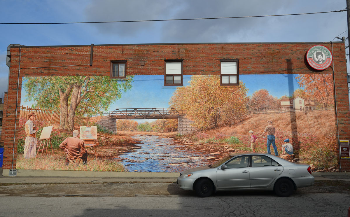
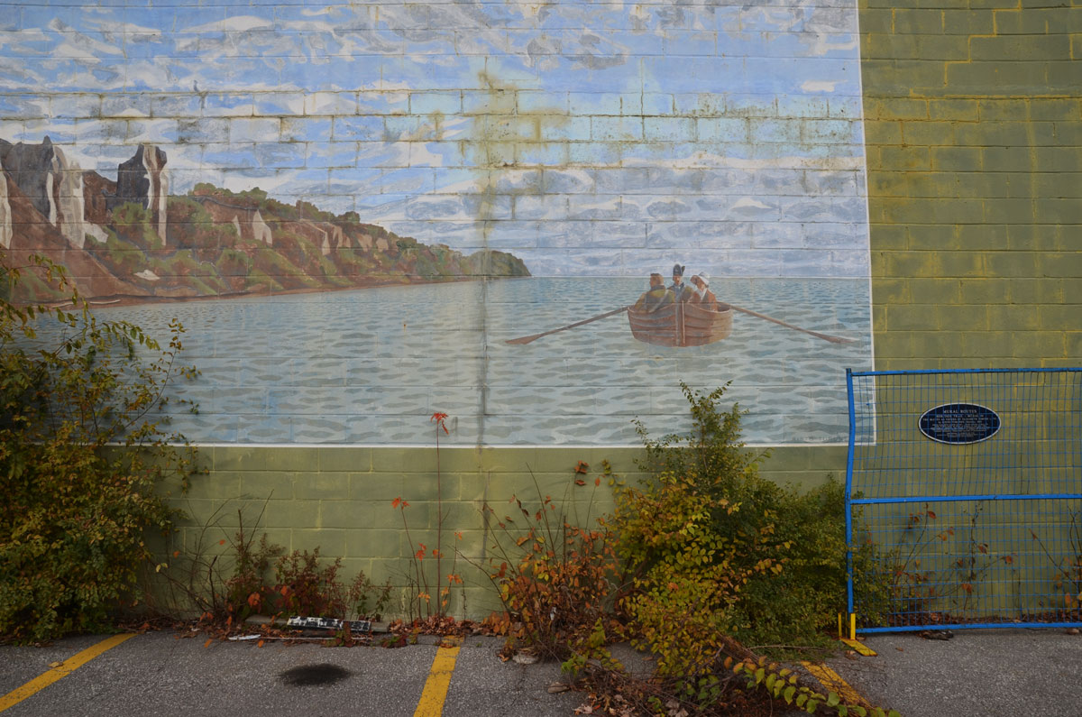
mural 11 – Mimico Creek in Fall, ca 1920, by John Kuna, 2008.
Looking north towards the Dundas Street bridge.

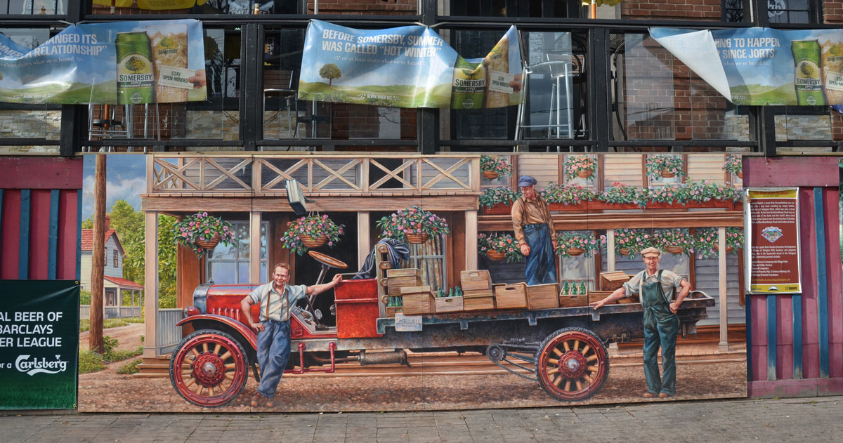
Gordon’s Dairy, by John Kuna, 2008.

mural 13 – The Old Swimming Hole by June Kuna, 2009.
Swimmers at the mill pond.


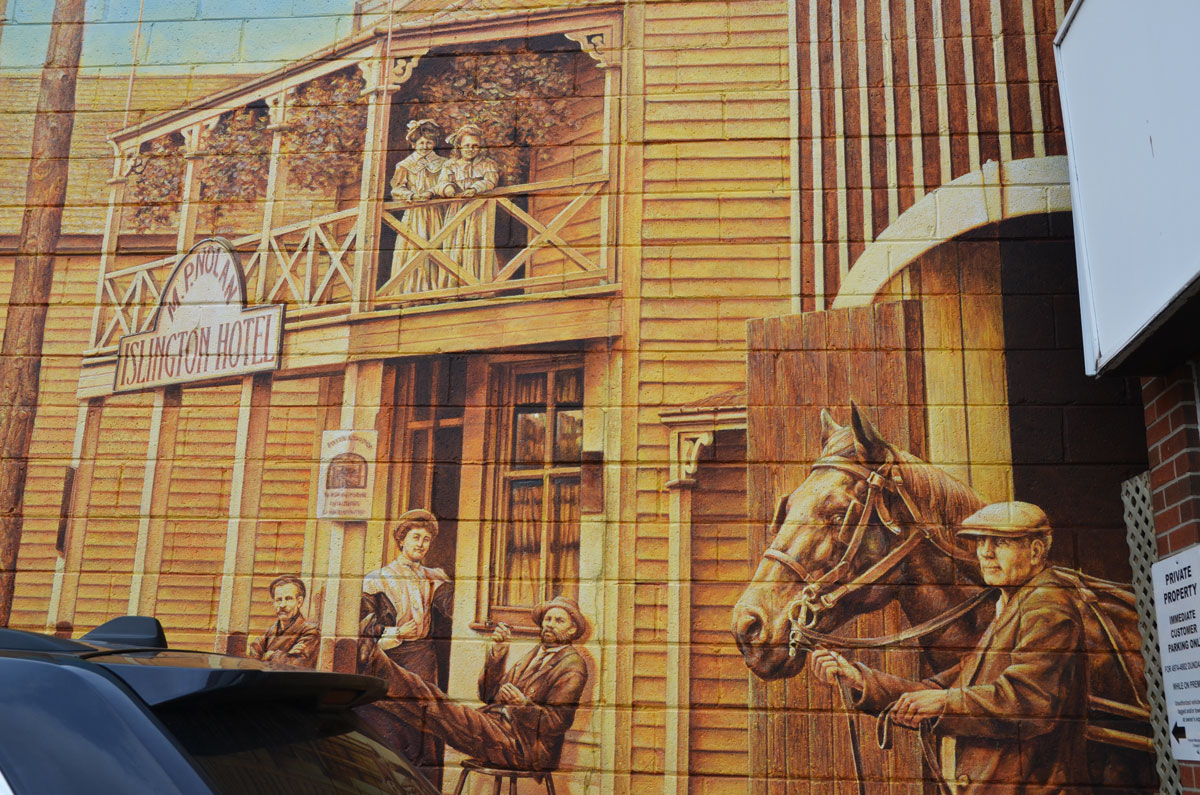
mural 14 – The Pub with no Beer, by June Kuna, 2009.
A scene from the Prohibition Era in the late 1920’s. Men collecting empty pop bottles from outside the Islington Hotel.


mural 15, Faith of Our Fathers, part 2, by John Kuna

mural 16 – The Manse Committee by John Kuna 2010


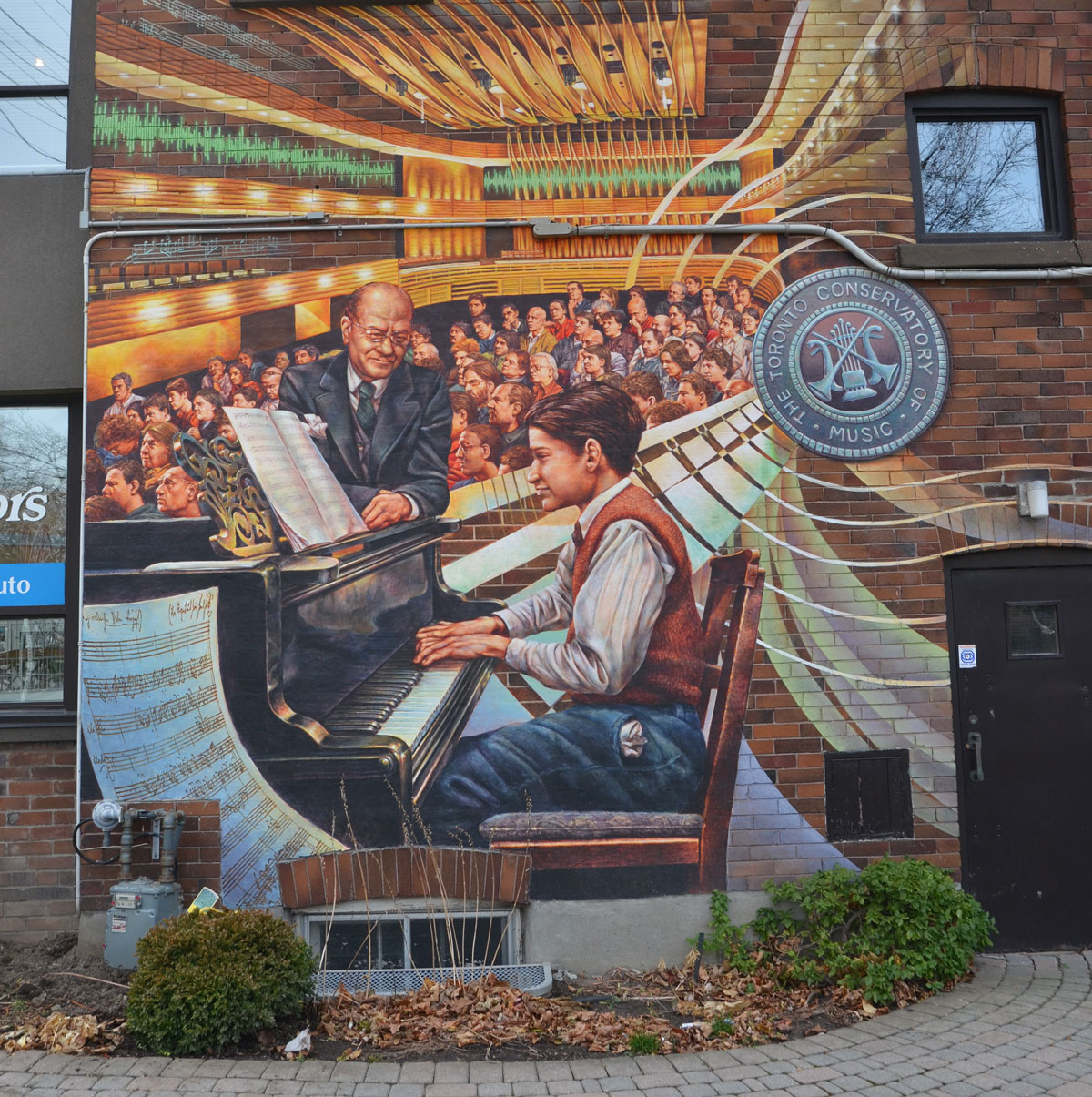
The Prodigy, by John Kuna, 2011
A satellite branch of the Royal Conservatory of Music was located in this building from the 1950s through the 1980s.

mural 19 – Aftermath by John Kuna, 2011.
After Hurricane Hazel on 15 Oct 1854, most of Islington Golf Course and the low lying areas around Mimico Creek were flooded.

mural 20 – Ontario Gothic, by John Kuna, 2011

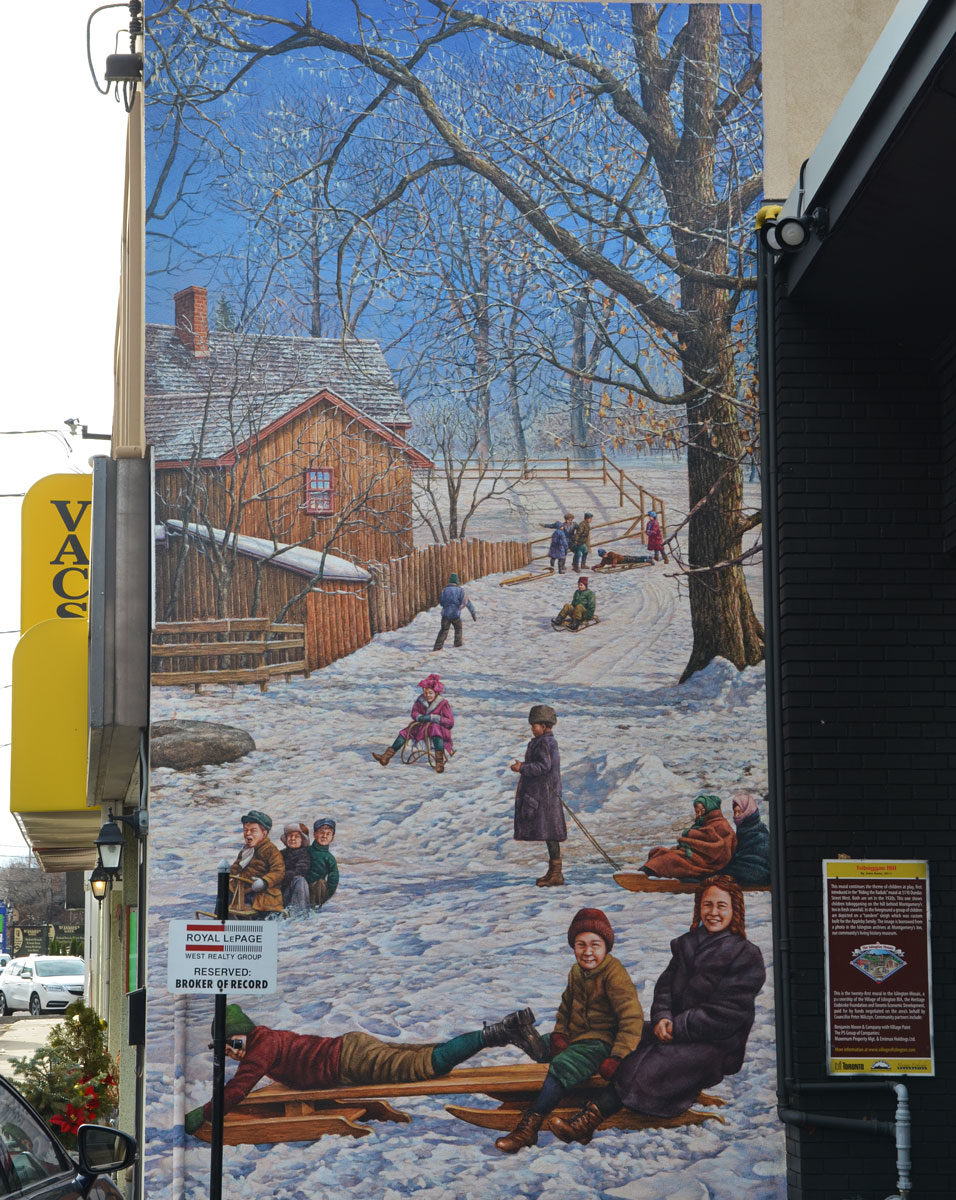
mural 21 – Toboggan Hill, by John Kuna, 2011


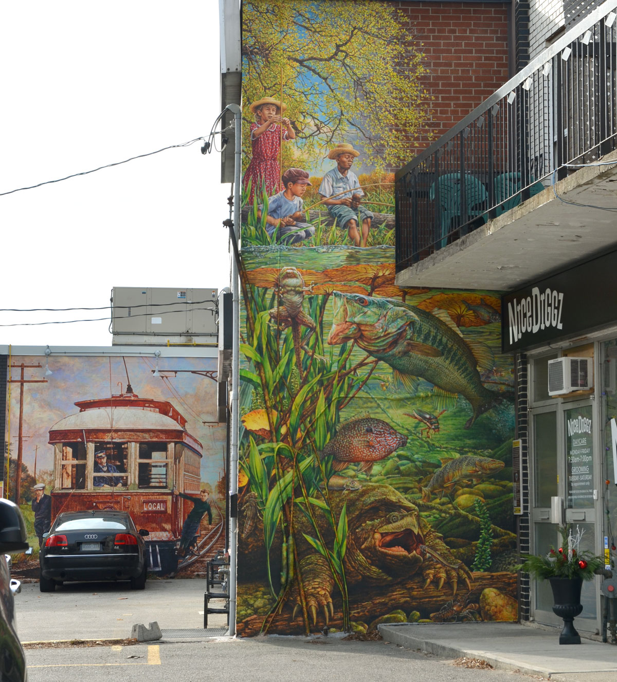
Fishing in Mimico Creek, by John Kuna, 2012,
with Riding the Radials seen in the background.

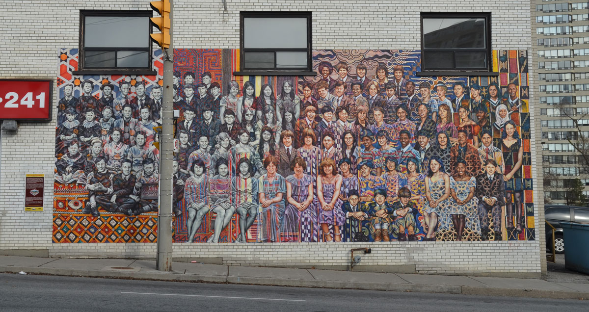
The Faces of Islington, by John Kuna, 2013


the mural with no sign

more information – village of Islington murals website