Archive for the ‘history’ Category

Corktown Common

One of Toronto’s newest parks

In one corner of the park there is a plaque that commemorates the William Davies Company, once the owners of the land and buildings in this part of the city.

blog_plaque

“From 1874 to 1927, this site was home to the William Davies Company, reputed to be the largest pork packing plant in the British Empire. Established in 1857 by William Davies (1831-1921), the company made its fortune preparing and exporting cured sides of pork to England. Later, its products were sold through William Davies Company shops, one of Canada’s first store chains. In its buildings here, the innovative company controlled the entire process from slaughter to shipment. Processing nearly 500,000 hogs annually by 1900, the company contributed to the city’s nickname “Hogtown”.
In 1892, Joseph Flavelle (1858-1939) became a partner and managing director of the company. Under Flavelle, the business flourished until the 1920’s when it was hurt by falling markets. The William Davies Company merged with three other packing firms to create Canada Packers, which continued to operate from this site until 1932. The last of the company’s buildings here were demolished in the 1990’s.”

.

An old coloured map of the area now called the West Don Lands.   This illustration also appeared in a blogTO post about the William Davies Company. http://www.blogto.com/city/2013/10/how_toronto_got_the_nickname_hogtown/

An old illustrated map of the area now called the West Don Lands. The red letters are as follows:
A – Gooderham & Worts, now the Distillery District
B – William Davies Company, now Corktown Common
C – CNR tracks
D – the Don River
A version of this illustration also appeared in a blogTO post about the William Davies Company.

.

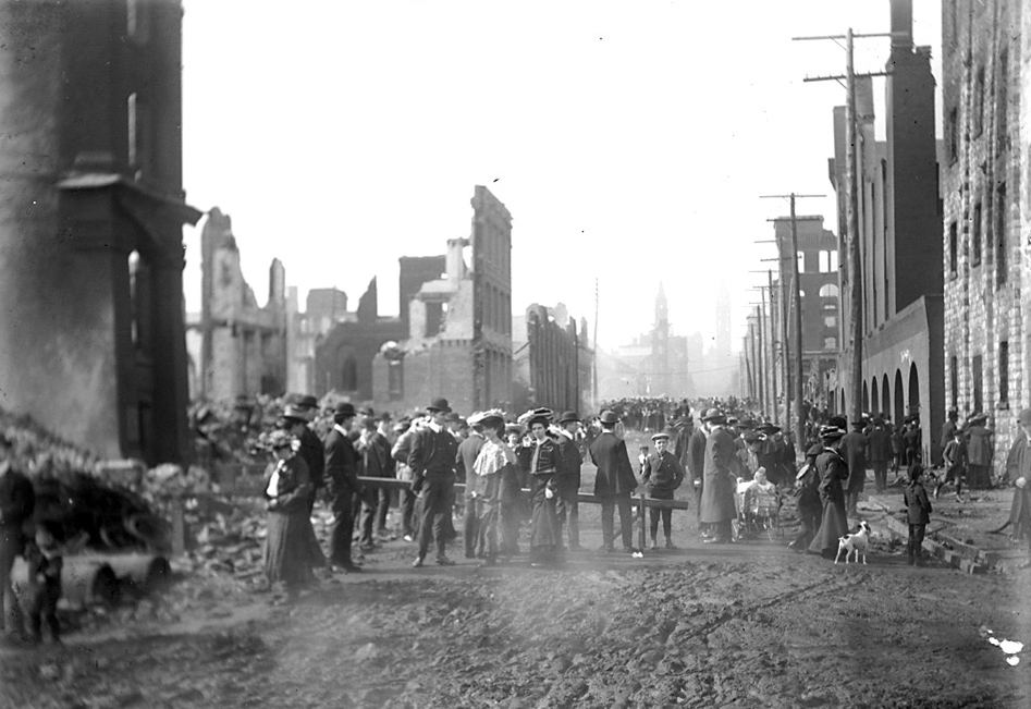
The last remains of the pork processing business disappeared long ago. After remaining vacant for a number of years, the site was developed into a park as part of the West Don Lands rebuilding.


small trees and other greenery , with a path and bench in the middle, in the foreground and the Toronto skyline is in the background.

The park is starting to look a lot greener as the plants and trees grow. This photo was taken from on top of one of the man made hills in the park. August 2014

.

A black, grey, white and orange butterfly on a pink flower

There are now lots of butterflies….

.

A bee and a butterfly on a tall upright light purple flower.

… and bees

.

a metal and wood structure

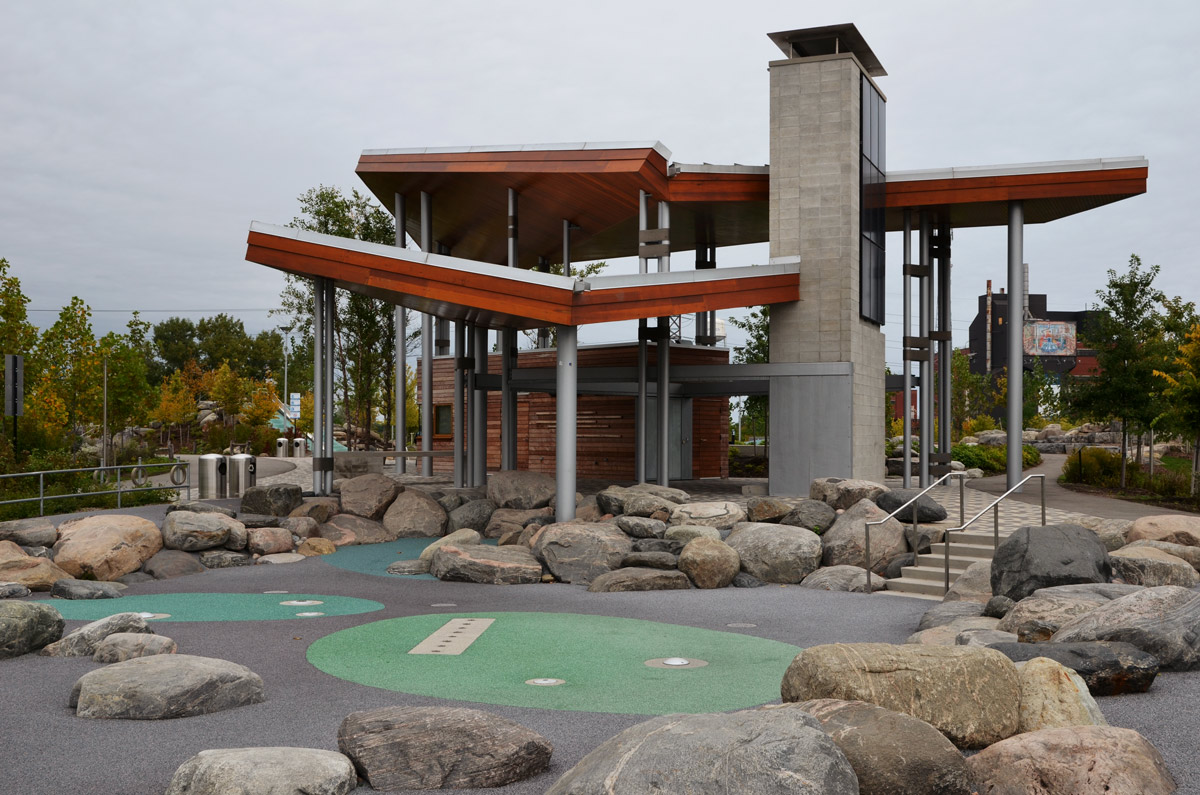
A pavilion made of steel and wood sits atop a small hill in the middle of the play area. The pavilion was designed by by Maryann Thompson Architects of Boston The blue and green ovals are where there are fountains for warm weather water play.

.

a woman is sitting on a bench, looking at her phone.  Behind her there are a number of buildings under construction

Looking west, and slightly north, from the pavilion towards the downtown area.  West Don Lands redevelopment in the immediate background.  Autumn 2013 (the building under construction is now almost complete – see above)

.

Part of a large red metal sculpture is in the foreground, looking past it you can see the pavillaion on top of a small hill that is part of Corktown Common park

Looking northeast through the wood and red metal sculpture,  ‘No Shoes’, by Mark di Suvero.  May 2014

.

Newly planted trees surroounded by grass.

The trees are starting to grow. They don’t look like much at the moment but give them time!

.

raspberries, not quite ripe, on a raspberry canes

There is even a large raspberry bush but by the looks of it, only the birds and insects have found it!

.

A map, screenshot from google maps, of West Don Lands and vicinity.

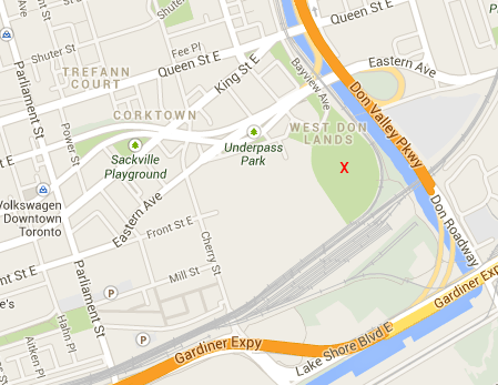
A map of the area today. The red X marks the spot of the new park.

When the park opened in 2013, urbantoronto.ca had an article about it.  You can read  about it  here

Some wonderful aerial views of the area can be seen in another wordpress blog

******

Jennifer Kateryna Kobal’s’kyj

I became curious about this story when I encountered two different memorial plaques for this girl in two different churches on the same day.   Jennifer Kateryna, 24 Aug 1989 to 2 April 1996.  She would have been just a couple of months older than my daughter.

memorial plaque on a wall

In 1997 her maternal grandfather erected a plaque in her memory in Metropolitan United church.

.

memorial plaque on a wall

There is another plaque, this one at St. James Cathedral, erected by her mother, maternal grandfather and aunt in 1998.

The death of a child is never a happy event, but Jennifer’s story is one of the sadder ones as she was murdered by her father as she tried to protect her grandmother from him. Sadder still is the fact that she had been living with her grandmother as part of the settlement in a custody dispute.

Polson Street Park, where the Don River meets Lake Ontario, was officially changed to Jennifer Kateryna Kobal’s’kyj Park in 1998. This park is at the end of Polson Pier, overlooking Toronto Harbour.

——————

On the 19th of April, 1904, a large section of downtown Toronto burned for nine hours.

street map of downtown Toronto showing the buildings that were affected by the fire of 1904.

Map showing the area of Toronto affected by the fire of 1904. Bay Street from the Esplanade to Miranda Street (just south of King Street) was the hardest hit.  At the time, this was called the Wholesale District of the city.

.

Historical photo of Bay street after the 1904 fire in Toronto.  There are people on the street.  The street is all mud.  There are many burned out buildings on both sides of the streets.  Brick facing of two to four storey buildings is all that remains.

Aftermath, Bay street, April 1904.

In part, because the fire started in the evening, there were no fatalities. As a result of the fire, 5000 people were left without a job.   In 1904, the population of Toronto was about 200,000 so the loss of employment on this scale had an impact on the city.

a very bright and colourful mural on the back of a brick building,  It shows, in reds, yellows ans oranges the burning of a couple of brick buildings, with flames coming out of the windows.

Mural painted on the back of the building on the northwest corner of College St. and Croft St.  (398 College St.), commemorating the fire of 1904.

Demolition of the ruins left by the fire took many weeks.  On the 4th of May, John Croft died while using dynomite to bring down the remains of the W.J. Gage building on Front Street.  His was the only known death associated with the fire.  What is now Croft Street was renamed in his honour.

The east side of 398 College St., at the south end of Croft St., is painted with a mural as a memorial to John Croft.

corner of a building showing parts of two murals.  On the back wall is the mural depicting the fire itself.  On the side wall is a memorial to John Croft.

northeast corner of the building

.
1904

blog_croft1

Burned out brick buildings.  All that remains is part of the front facade of these two to six storey buildings.

Burned out buildings, April 1904

The images of the fire’s aftermath are available online.   The originals are kept at the City of Toronto Archives, located on Spadina Road., just north of Dupont Street.

.

St. Andrews  Bendale, Presbyterian church and cemetery, are located in a quiet corner of Scarborough, east of McCowan Avenue and north of Lawrence Avenue.  The property backs onto Thomson Memorial Park which in turn follows the West Highland Creek.

The acre of land for the church was donated by David Thomson and the original wood church was built here in 1818.  It was the first Presbyterian church built in what is now Toronto.   David Thomson had arrived in the area from Scotland in 1796 at which time he was granted 400 acres of land.  David was soon followed by his brothers Andrew Thomson and Archibald Thomson who settled nearby.  The area became known as the Thomson Settlement.

A large memorial in a cemetery.  The memorial consists of three tombstones that have been attached to a large concrete structure that looks like a tombstone

Thomson burial plot.   The inscription across the top reads “1796 – To their honor who redeemed this township from the wilderness – 1921”    
The three plaques (stones) are for David Thomson, Mary Thomson and Hellen Thomson.On the left: “In Memory of David Thomas of Westerkirk Dumfries-shire Scotland who was the First Settler in Scarborough where his was the first land cleared.  He had arrived in Upper Canada in 1796 and died on the 22nd  June 1834, aged ?, leaving his wife, eleven children and 53 grandchildren.”
Center: “In Memory of Mary Thomson, Mother of Scarborough, who died the 8th of Nov 18–? aged 80 years….”
On the right is the stone for Hellen Thomson. It is very worn and is difficult to read.

.

Robert Rae and Agnes Hamilton "natives of Lesmahago Scotland who came to Scarboro in 1832.  Three weeks after their arrival, in his 29th year, he was killed by a falling tree :: his wife survived him 46 years, dying in 1878 - in her (86?)th year."

Robert Rae and his wife Agnes Hamilton
“natives of Lesmahago Scotland who came to Scarboro in 1832. Three weeks after their arrival, in his 29th year, he was killed by a falling tree :: his wife survived him 46 years, dying in 1878 – in her (86?)th year.”To the left of the Rae/Hamilton memorial is a smaller tombstone for Margaret Rae (d. 1860), wife of Amos Thomson.

To the right of the Rae/Hamilton memorial is a tombstone for James McCowan and Margaret Porteous. This couple also came from Lesmahago Lanarkshire Scotland and they too were one of the pioneering families of Scarborough.

There are a large number of other old Scarborough families represented in this cemetery – Gibson, Muir, Young and Stobo to name a few.

A view of St. Andrews Bendale showing a number of tombstones both old and new

four old tombstones in a cemetery

.