Posts Tagged ‘West Highland Creek’

After years of false starts, indecision re routes, and all the other consequences of being City Council’s favorite political football, the new Scarborough subway extension is underway.

on black hoardings around metrolinx site, pink subway symbol, fallen street signs on their side at bottom of hoardings

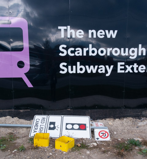
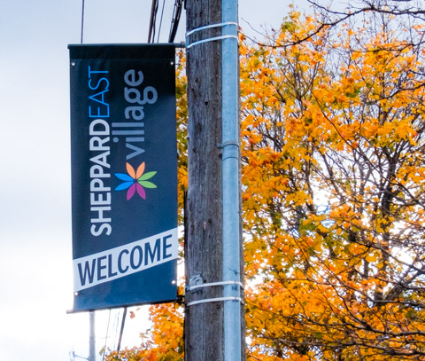
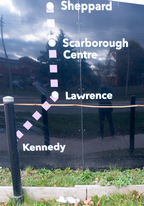
Once upon a time, the extension was to only go to Scarborough Town Centre and was derided as the “One Stop Subway”.  Now it seems to be three stops from the present Kennedy station with the end point being at McCowan and Sheppard.  In true Metrolinx style, it seems like the last station is going to be called Sheppard East.  Such imagination! … to have three stations called Sheppard!  That seems to be the situation at present…. as for tomorrow’s situation?  Who knows…..

printed on hoardings around metrolinx site, map of scarborough subway extension from Kennedy to Lawrence to Scarborough Centre to McCowan

In case you’ve never been to that intersection, let me show you what’s there…..

below: Looking west on Sheppard approaching McCowan with Metrolinx site on the right hand side.  This construction site is very large and dominates the area.

looking west on Sheppard towards mccowan, metrolinx construction on right side

below: One of the entrance gates to the Metrolinx construction site.  Note all the stacked concrete sections that will form the tunnel walls.

gate across entrance to construction site, red crane inside, also partially curved structures that will form walls of circular subway tunnel

metrolinx site for mccowan station on SHeppard subway extension, red crane,

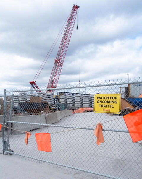
below:  This blue object is part of the equipment needed to move dirt brought to the surface by the Tunnel Boring Machine that is working underground (There is also a TBM working out in Rexdale on the Crosstown West).

large blue piece of equipment on construction site, made for moving dirt that has been removed from tunnel by tunnel boring machine

It is a very big machine

below: Gate B

Gate B of metrolinx sheppard extension site on mccowan, watch for oncoming traffic sign,

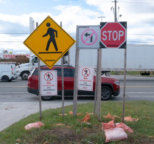
In general, the area south of Sheppard is residential while the area north of Sheppard is industrial or commercial.   Canadian Tire is on the northwest corner.

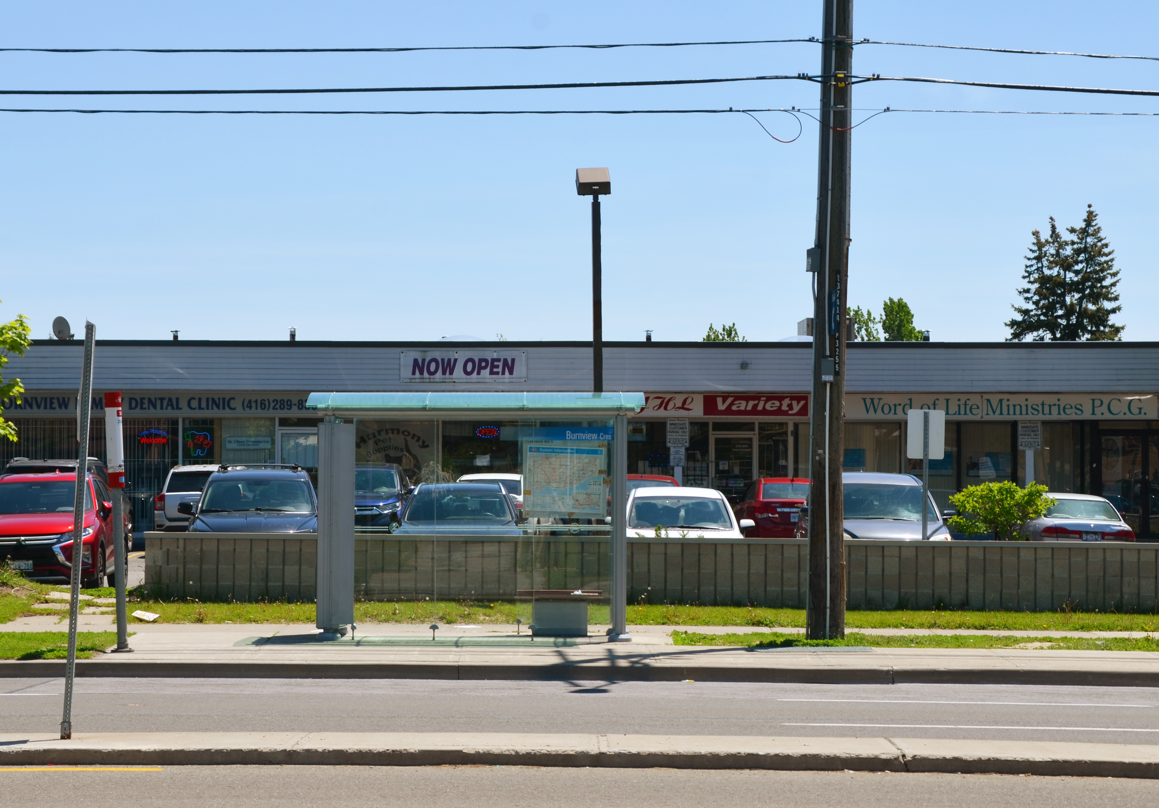
below: Apartments on Sheppard (south side, east of McCowan)

man walking past low rise apartment building with balconies, green fence beside sidewalk

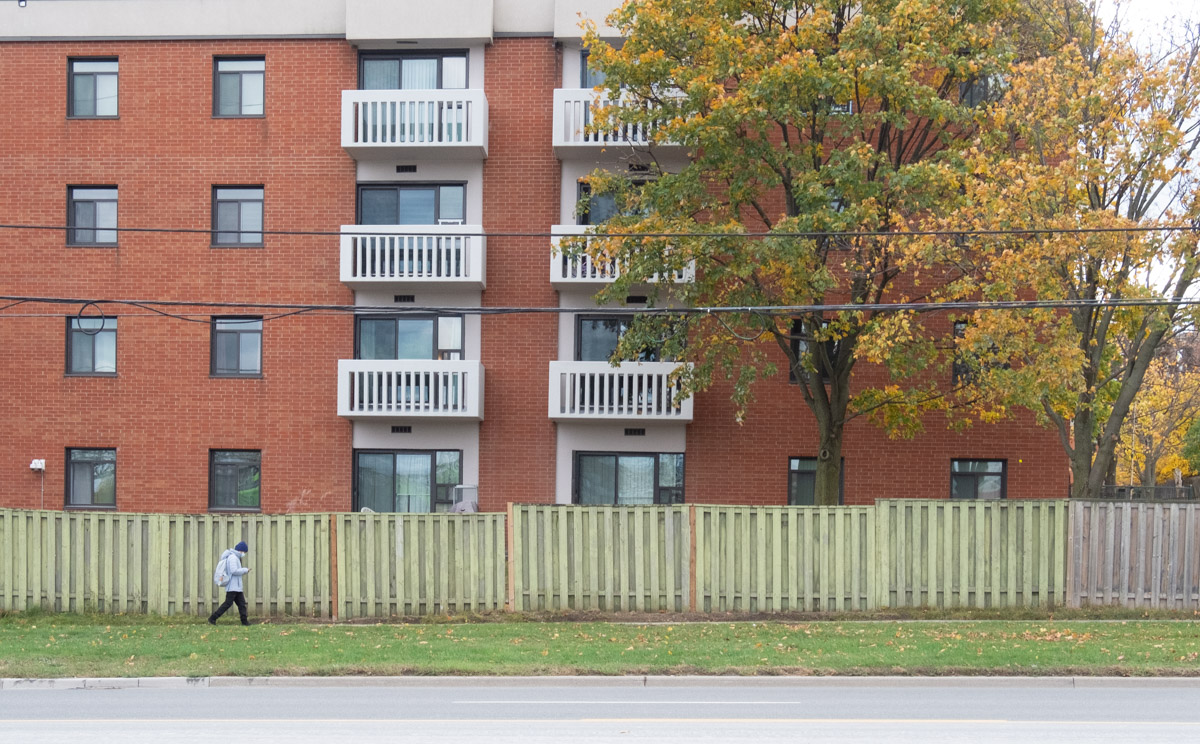
below:  Because of the angle from which this photo was taken, the exact locations are slightly unclear.  The Medical Clinic is 4651 Sheppard East.  To the west of that is a vacant lot that used to be a gas station and it is on the SE corner of McCowan and Sheppard; it is in the process of being redeveloped.   The apartment building is actually on the SWt corner of McCowan and Sheppard.

apartment building and lowrise plaza with medical clinic, sheppard east

below:  looking east on Sheppard from McCowan

TTC bus shelter beside sidewalk on Sheppard East, hoardings or metrolinx construction site Sheppard East station, are behind the shelter


below: Walking McCowan north of Sheppard is partially impeded by a fence across the sidewalk…. but it is easily bypassed.  Nugget Avenue is just beyond the fence.

chainlink fence across sidewalk at Nugget Ave

below: Looking southeast from McCowan and Nugget where West Highland Creek branches.  The large Metrolinx site fills the triangle formed by McCowan, West Highland Creek, and Sheppard Avenue.  The white apartment building in the distance is on Sheppard Ave.

creeks north of Sheppard

The creek’s concrete bed might make for easy management of the water flow but it makes for an ugly scene – unfriendly to both nature and people.  There are parks north of here on both branches of the creek but here where most of the land use is industrial or commercial, little attention is paid to the esthetics.

dead vines on chainlink fence beside concrete bottom creek

graffiti on concrete sides of west highland creek

below: Dufferin Concrete at Nugget and McCowan

concrete plant in Scarborough

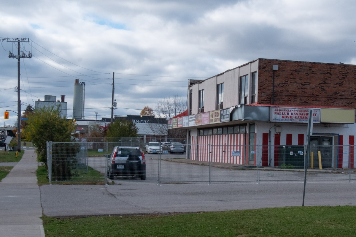
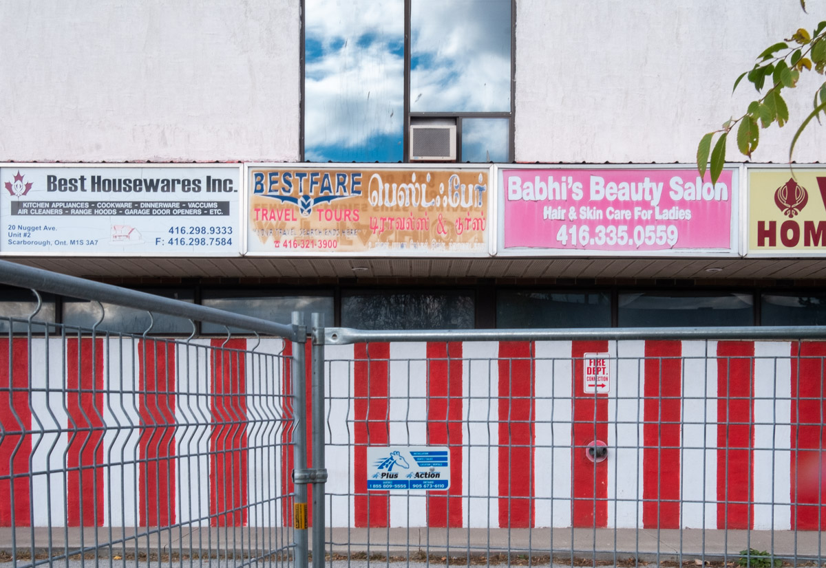
below: Nugget Avenue crosses West Highland Creek.  The plaza at 20 Nugget Ave, with the red and white stripes, was shut down (bought out) by Metrolinx.  Apparently, the two-acre property is needed for an emergency exit and underground tail track for the future Sheppard East Station.

bridge over creek at Nugget Ave

empty two storey plaza, lower level painted with red and white vertical stripes

empty building behind construction fence, red and white vertical stripes on lower level, window on upper level, three signs for businesses, Best Housewares Inc., BestFare travel and tours, and Babhis Beauty Salon

old banners on a chainlink fence advertising boxing week specials, ads for restaurant food,

below: Spotted on a bulletin board at a bus shelter on Nugget (It’s a collection of bible verses).

on public message board at a bus shelter, 4 pieces of 8 1/2 by 11 paper with typing on them, a collection of bible verses

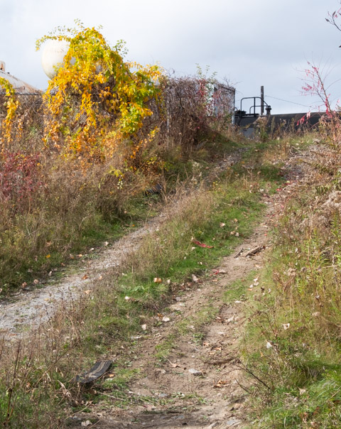
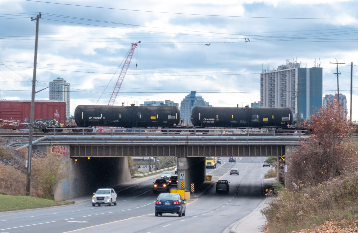
below: Immediately north of Nugget Avenue are train tracks. This is the western edge of the large CPR Toronto Yard.  If you are interested in this yard and some of the trains, I blogged about it previously (Around the marshaling yards – with love and peace).

black tanker cars on railway bridge over McCowan

downward arrow shape painted in yellow and white on blue concrete under a brdge

below: North side of tracks along McCowan

concrete waterway and tunnel for west highland creek as it goes under the railway tracks

a banner for welcome to sheppard east village on a pole, with an autumn tree behind

vertical banner on pole on sheppard east for east sheppard village, picture of three people on banner

traffic signs and warning signs at entrance to construction site on mccowan road

dirt track uphill to the tracks

flock of birds on a wire


paved path through a park, grass on both sides, on the pavement is a large white arrow, hand drawn with white spray paint

I went east this afternoon, out to the boondocks. Whenever I think of the word ‘boondock’, I hear it sung to music. Billy Joe Royal sang the song ‘Down in the Boondocks” in 1965 (You can find it on youtube).   Boondock is one of the few words that English has borrowed from Tagalog where bundok = mountain.  Yo-yo is another.   I don’t mean to be derogatory but when you’re battling Toronto traffic, Bellamy and Lawrence seems like a long, long way.

I drove but as I subsequently walked along Lawrence Ave., I wondered about buses and public transit and all the talk about a subway to Scarborough.   The Sheppard East LRT will service Scarborough to the north of here but has it even been started yet?    For now there is the Lawrence West station on the Scarborough RT but there is also talk of replacing the Scarborough RT line – that plan is still on the Metrolinx website but does anyone know what’s really happening?

looking across the street to a bus shelter that is in front of a strip mall with cars parked in front of the stores

two large utility poles side by side beside a sidewalk and a bus shelter. Two people waiting for a bus

Perhaps you’ve been asking yourself, why Bellamy and Lawrence?  Recently I had heard about Taber Hill Park and a rock that sits on top of a hill.

a large rock wits on a stone and concrete platform on the top of a grassy hill, Taber Hill memorial

The plaque reads: “TABER HILL site of an ancient Indian ossuary of the Iroquois Nation, burials were made about 1250 A.D. This ossuary was uncovered when farm lands were developed into residential properties in 1956. This common grave contains the remains of approximately 472 persons. Dedicated as a historical site by the Township of Scarborough October 21, 1961.

below: You can even see the CN Tower from the top of the hill.

view from the top of a hill, street, houses, trees, and the CN Tower in the far distance

After Taber Hill I walked to Bendale Park which is just a bit west of Bellamy.

One of the first things that I saw in Bendale Park was a mural by elicser. It is on the walls of the bridge where Lawrence Avenue passes over the West Highland Creek. The mural is beside the path under the bridge. A better angle for a photo of the whole mural would have been from the other side of the creek but I couldn’t find any access – and I wasn’t about to take off my shoes and go wading!  Instead, here are four pictures of parts of the mural.

part of an elicser mural beside West Highland Creek, under Lawrence Ave., a man in a white t-shirt sitting beside a tree

part of an elicser mural beside West Highland Creek, under Lawrence Ave., an older man in a red shirt with a white beard and moustache, beside him is a girl reading (in the mural)

part of an elicser mural beside West Highland Creek, under Lawrence Ave., a young couple, she has a pink flower in her hair

part of an elicser mural beside West Highland Creek, under Lawrence Ave., a couple, she has long braids

Bendale Park merges with Thomson Memorial Park.  Immediately north of these parks is St. Andrews Bendale Presbyterian church (that I have mentioned in a previous blog post – see link).  This is one of the first areas of Scarborough to be settled; the original St. Andrews Church was built in 1818.

below: Lilac bush in bloom. Lilacs are not native to Canada and they don’t grow in the wild. If you see a lilac bush in places like this, or along the road, chances are someone once had a home here and they planted the lilac.

lilac bush

below: Another pink flower found in abundance in the ravines at this time of year is this one, Dame’s Rocket, or Hesperis matronalis.    There is also a white variety

pink wild flowers

small word path through long grass and between large leafy trees

below: Passing through here is the Gatineau Corridor which is a bike trail ….

bike trail direction signs, Gatineau Corridor, right turn to McCowan Ave and left turn to Brimley Rd

well, actually it is a hydro corridor which runs diagonally through the city from Leaside in the west to  Meadowvale and beyond in the east.  In the late 1920’s the Great Gatineau Power Station was built in Leaside as a transformer station to enable the city to use electricity generated in Quebec and delivered via this corridor to provide power to the city.  There is still a hydro substation at Millwood and Overlea (in Leaside)

This corridor is being turned into a park called the Meadoway.   Sections of the park and bike trail are finished including this part between Brimley and McCowan.  When it’s finished, this linear park will be 16 km long and will connect the Lower Don Trail to trails in Rouge Park at the city’s eastern boundary.

three very tall hydro poles with many electrical wires, in a park, man walking on path near them

below: Reflections in the West Highland Creek

reflections of green leaves and blue sky in water

below: I saw quite a few red wing blackbirds, especially around the bulrushes and reeds in the wetter places in the park.

a red wing blackbird sits on a branch

below: The last time I walked I saw a McLaren (next blog post), today it was these flashy bright gold things!

a red van parked beside a silver coloured car with bright gold coloured wheel rims

below: More car stuff, but this time it’s my car as I was driving home.

view out the passenger window of a car, of a large flatbed truck loaded with lumber, in the side mirror of the car is the reflection of a TTC bus

signoutside St. Rose de Lima Roman Catholic Church advertising Vietnamese Mass on Sunday afternoons

… but I’ll be back. There is a lot more to this part of the city that I want to explore, including this mosque just east of Midland Avenue.

a mosque

***


On the back of the rock on Taber Hill is another plaque which reads:

IROQUOIS PRAYER
O Great Spirit whose voice I hear in the winds and whose breath gives life to all the world, Hear me.
I am a man before you, one of your many children. I am small and weak. I need your strength and wisdom. Let me walk in beauty and make my eyes ever behold the red and purple sunsets. Make my hands respect the things you have made, my ears sharp to hear your voice. Make me wise so that I may know the things that you have hidden in every leaf and rock. I seek strength O Creator, not to be superior to my brothers but to be able to fight my creators enemies myself. Make me ever ready to come to you with clean hands and straight eye so that when life fades as the setting sunset my spirit may come to you without shame.
credit: White Cloud, Approved by Iroquois Council 2-2-60.


St. Andrews  Bendale, Presbyterian church and cemetery, are located in a quiet corner of Scarborough, east of McCowan Avenue and north of Lawrence Avenue.  The property backs onto Thomson Memorial Park which in turn follows the West Highland Creek.

The acre of land for the church was donated by David Thomson and the original wood church was built here in 1818.  It was the first Presbyterian church built in what is now Toronto.   David Thomson had arrived in the area from Scotland in 1796 at which time he was granted 400 acres of land.  David was soon followed by his brothers Andrew Thomson and Archibald Thomson who settled nearby.  The area became known as the Thomson Settlement.

A large memorial in a cemetery.  The memorial consists of three tombstones that have been attached to a large concrete structure that looks like a tombstone

Thomson burial plot.   The inscription across the top reads “1796 – To their honor who redeemed this township from the wilderness – 1921”    
The three plaques (stones) are for David Thomson, Mary Thomson and Hellen Thomson.On the left: “In Memory of David Thomas of Westerkirk Dumfries-shire Scotland who was the First Settler in Scarborough where his was the first land cleared.  He had arrived in Upper Canada in 1796 and died on the 22nd  June 1834, aged ?, leaving his wife, eleven children and 53 grandchildren.”
Center: “In Memory of Mary Thomson, Mother of Scarborough, who died the 8th of Nov 18–? aged 80 years….”
On the right is the stone for Hellen Thomson. It is very worn and is difficult to read.

.

Robert Rae and Agnes Hamilton "natives of Lesmahago Scotland who came to Scarboro in 1832.  Three weeks after their arrival, in his 29th year, he was killed by a falling tree :: his wife survived him 46 years, dying in 1878 - in her (86?)th year."

Robert Rae and his wife Agnes Hamilton
“natives of Lesmahago Scotland who came to Scarboro in 1832. Three weeks after their arrival, in his 29th year, he was killed by a falling tree :: his wife survived him 46 years, dying in 1878 – in her (86?)th year.”To the left of the Rae/Hamilton memorial is a smaller tombstone for Margaret Rae (d. 1860), wife of Amos Thomson.

To the right of the Rae/Hamilton memorial is a tombstone for James McCowan and Margaret Porteous. This couple also came from Lesmahago Lanarkshire Scotland and they too were one of the pioneering families of Scarborough.

There are a large number of other old Scarborough families represented in this cemetery – Gibson, Muir, Young and Stobo to name a few.

A view of St. Andrews Bendale showing a number of tombstones both old and new

four old tombstones in a cemetery

.