


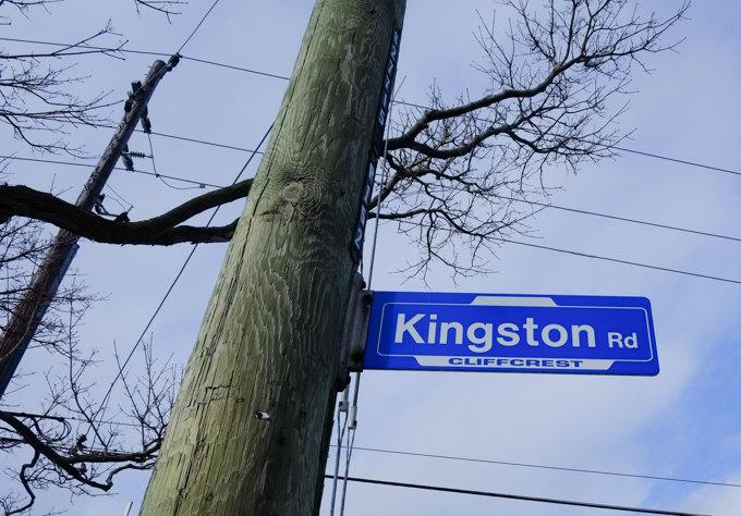
Cliffcrest is a neighbourhood in Scarborough that includes a section of Kingston Road between Brimley and Bellamy Roads. The southern boundary is Lake Ontario including the eastern portion of the Scarborough Bluffs.
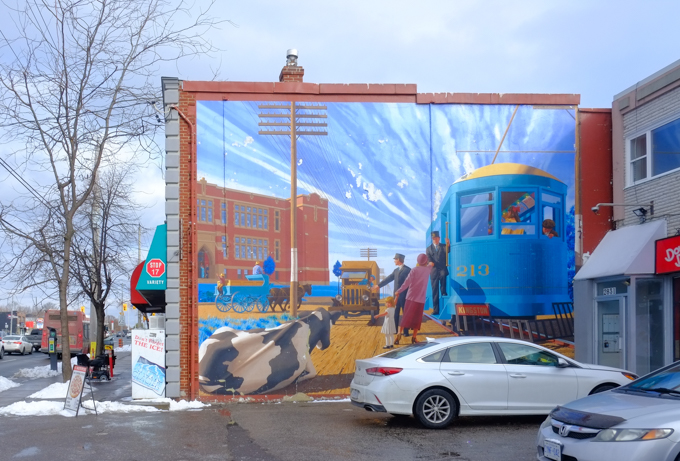
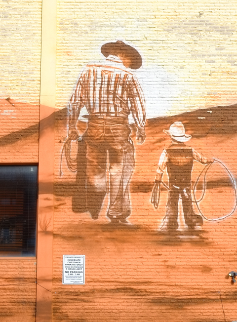
below: At the corner of Kingston Road & St. Clair is one of the Scarborough Heritage Trail murals funded by Mural Routes. It is “In The Way of Progress” and shows a Kingston Road radial railway car at Stop 17 with Scarborough High School (later changed name to R.H. King Academy) in the background. It was painted in 1996 by Phil, Jennifer, and Jamie Richards.
below: 1922, Kingston Road looking west towards St. Clair with Scarborough High School near the intersection.
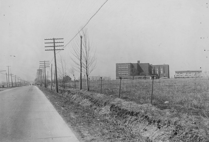
Source: City of Toronto Archives, Fonds 1488, series 1230, Item 2064
In 1893 the Toronto and Scarborough Electric Railway, Light and Power Company started running a one car train along Kingston Road. The tracks went as far east as West Hill. A couple of years later, this line became part of the Toronto and York Radial Railway (TYRR). The TYRR had four branches radiating from the city, one to the west, 2 northward, and this one east along Kingston Road. The stops on the Scarborough route were numbered, starting at Victoria Park Avenue. Stop 17 was at St. Clair East & Kingston Road.
below: This 1922 photo is actually from a bit farther west, at Victoria Park. What I wanted to show was how the railway tracks just ran between the road and the sidewalk. Very simple infrastructure! Not too feasible in a city, but in 1922 this neighbourhood was more rural than urban (and they still got transit!)
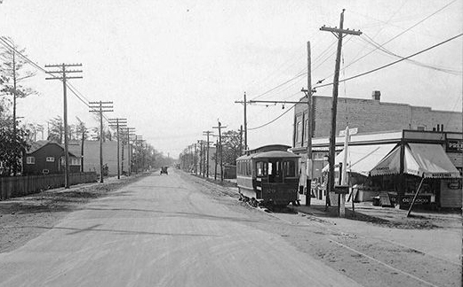
Source: City of Toronto Archives, Series 71, item 1607
below: You can’t see it in this photo but the mural above is on the wall of Stop 17 Variety (by the parking lot on the right).

below: From 1973, forty years ago – looking at the southeast corner of Brimley and Kingston Road. The bus is northbound on Brimley.
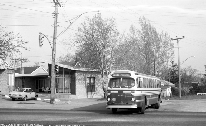
Photo Credit: Richard Glaze photo 1973, Transit Toronto website. If you are interested in anything to do with transit in Toronto, check out their website. They have an extensive collection of photographs, maps, and documents. They also feature all the latest news about slow downs, route changes, and service advisories (among other things).
The same motel is still on that corner of Kingston Rd and Brimley. I don’t have the exact replica photo but this is what the Hav a Nap Motel looks like now.

below: Moving slightly west, photo taken from approximately the corner of Brimley and Kingston Road.

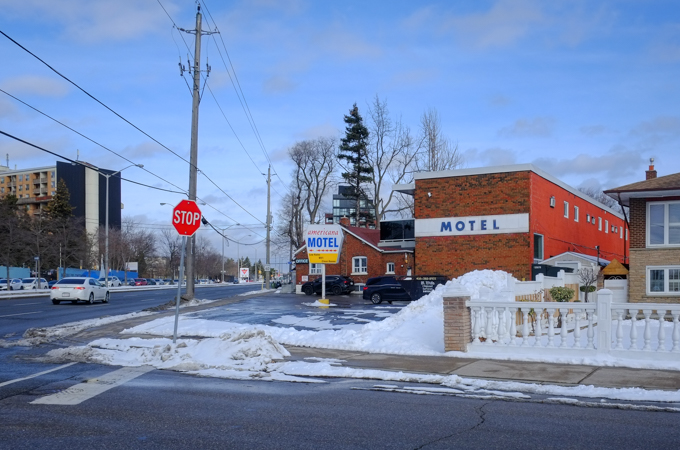
Once upon a time, Kingston Road was a major east west route in and out of the city. There were many motels along here. Their heyday was the 1950s and the bigger, fancier ones are long gone, leaving behind some of the smaller ones.
below: As a shoutout to these motels and their stoy is this sidewalk box decorated with images of old motel signs. The Americana and the Roycroft signs can be seen on this side.
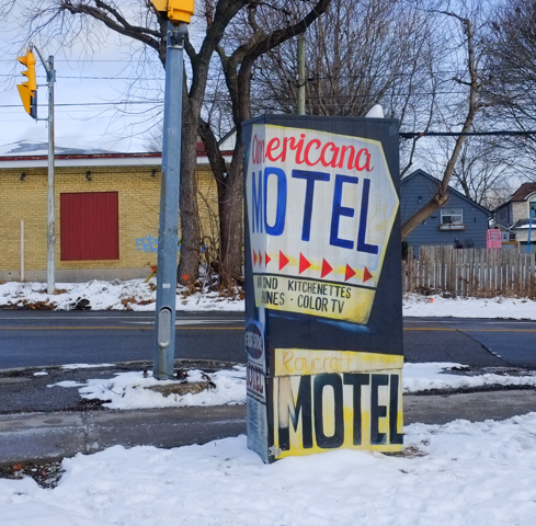
below: The Americana Motel still exists in the Cliffcrest neighbourhood (close to Brimley). The Roycroft is farther east, beyond McCowan.

below: Henry’s Motel

below: The sign of things to come.. and yes, it’s a condo with retail at street level.


below: The north side of Kingston Road, just east of Brimley – it looks like changes are happening here too.
Brimley Road is also the main access for Bluffers Park at the foot of the Scarborough Bluffs.

below: Dairy Queen at Kingston Road and Harewood is closed for the winter
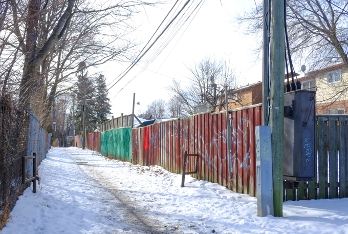
below: An alley runs behind the south side of Kingston Road


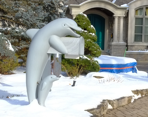
below: Mailbox with a porpoise (or two)
below: On the side of a Wild Wings restaurant.

below: Carusos Fruit Market, Groceries, Hardware & Gift Items

Other Scarborough Heritage Mural posts:
1. Heritage Murals – Kingston Road, 2014
- The Half Way House’ by John Hood, 1990. (Midland & Kingston Road)
- ‘The Bluffs as Viewed by Elizabeth Simcoe c. 1793’ by Risto Turunen, 1992.
- ‘Spooners Garage’ by Phillip Woolf, 1992.
- ‘H.M. Schooner, Onondaga c. 1793’ by Jeff Jackson 1992.
- ‘Cliffside Golf Course’ by Dan Sawatzky, 1991.
- ‘The Half Way House’ by John Hood, 1990. (Midland & Kingston Road) (repeat)
- ‘The Bluffs as Viewed by Elizabeth Simcoe c. 1793’ by Risto Turunen, 1992.(repeat)
3. Heritage Trail Mural 8, 2014
- “Building the Addition to the Wesley Methodist Chapel, Highland Creek, Winter” by John Hood , assisted by Alexandra Hood and Zeb Salmaniw, 1994.1867”
4. Scarborough Bells, 2020
- scenes from early Scarborough, painted by painted in 2012/2013 by De Anne Lamirande. Under a railway overpass.
5. Birch Cliff, Kingston Road, 2021
- On the side of Legion 13 on Kingston Road is this large mural. Painted in memory of Max Silverstein, by John Hood with help from Alexandra Hood and Asif Khan, 1991. Restored in 2010 by Blinc Studios. “Scarborough Rifle Company marching to the Niagara Frontier, June 1, 1866.”
- “Mitchells General Store” by Phil Irish, 1998.
