


Election day – Monday 19th October

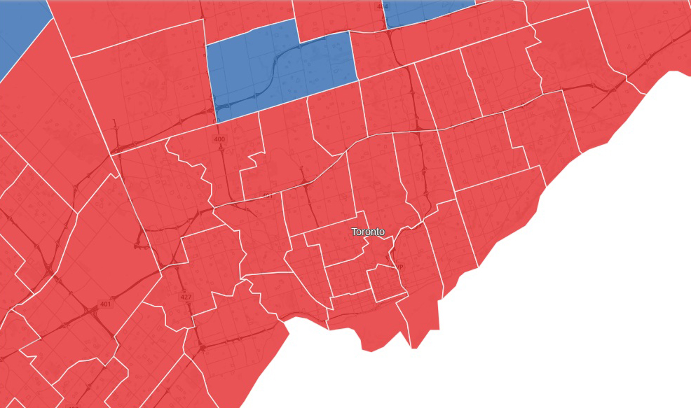
I was going to post the election results in Toronto ridings but this picture (screenshot from the Toronto Star website) says it all much more concisely. Red = Liberal and blue = Conservative. The blue riding top center is Thornhill. The other two that are only partly in the picture are Milton in the west and Markham-Stouffville in the east.
I’ve taken a screenshot of the map showing the voter turnout in the Toronto and area ridings, again from the Toronto Star. The darker the purple, the higher the turnout. The colours in the screenshot didn’t always match the colours on the website, so I added the numbers (the percent turnout for each riding). As you can see, turnout varied between 59% and 76%; as a percentage, more people voted in city center ridings than in suburban ridings.

